b.sc. geography - periyar university
TRANSCRIPT
1
PERIYAR UNIVERSITY
SALEM-636 011
B.Sc - GEOGRAPHY SYLLABUS
UNDER CHOICE BASED CREDIT SYSTEM (CBCS)
(STUDENTS ADMITTED FROM THE ACADEMIC YEAR -
2008-2009 ONWARDS)

2
Eligibility for Admission
A Candidate who has passed higher secondary
examination in Geography, Maths, Science and other Arts
Subjects under higher secondary board of Examinatins, Tamil
Nadu or as per the norms set by the Government of Tamil
Nadu or an Examination accepted as equivalent by the
Syndicate subject to such conditions as may be prescribed
thereto are permitted to appear and qualify for the B.Sc
Geography degree Examination of this university after a
course of study of three academic years.

3
B.Sc-GEOGRAPHY
SEMESTER-I
Course-I CLIMATOLOGY
Code-
Unit-I: Weather and Climate- Definition-Atmosphere-Structure and
Composition Insolation –Heat Balance of the Atmosphere-
Distribution of Temperature.
Unit-II: Atmospheric Pressure-Vertical and Horizontal distribution-pressure
Belts-Winds:- Planetary, Seasonal and Local Winds.
Unit-III: Atmospheric Moisture-Condensation –Classification of Clouds
–Forms of Precipitation –Types of Rainfall-Monsoon: Origin and
its importance.
Unit-IV: Air masses: Properties and Classification–Formation of the Fronts-
Types of Fronts-Cyclones: Tropical and Temperate cyclones-Anti-
cyclones.
Unit-V:Classification of climates-Basis of classification-Koppen
Climatic classification-Distribution of world climates.
Reference Books:
1. An Introduction to climatology----- Trewartha.
2. Climatology ------Austin Miller
3. Climatology ------------- D.S.Lal.
4. Physical Geography ------------ Strahler and Strahler.
5. Physical Geography ----------- Philip Lake.
6. Physical Geography ----------Savindra Singh.
7. Physical Geography -------Majid Hussain.
-------------

4
Semester-II
Course-II- OCEANOGRAPHY CODE-
UNIT-I: Oceanography: Definition-Formation and Distribution of
Oceans and Continents- Tetrahedral Theory- Surface Configuration
of the Ocean Floor- Hypsometric Curve.
UNIT-II: Types of Lands Forms at the Ocean Bottom- Submarine Relief
Features of Atlantic, Pacific and Indian Ocean.
UNIT-III: Characteristics of Ocean Waters- Temperature- Vertical and
Horizontal Distribution–Salinity- Factors Controlling the
Salinity of the Atlantic, Pacific and Indian Ocean.
UNIT-IV: Ocean Circulations- Ocean Currents found in Atlantic, Pacific
and Indian Oceans- Waves and Tides.
UNIT-V: Deposits of the Ocean floor- Types of Marine Deposits and their
Distribution-Coral Reefs- Types of Coral Reefs- Darwin’s
Theory of Coral Formation-Ocean as Resources Reserve.
Reference Books:
1. Sharma .R.C and Vatal- Oceanography for Geographers.
2. Jerald’s-An Introduction to General Oceanography.
3. King.K.L- Oceanography.
4. Carter –Oceanography.
--------------------

5
Semester-II
Practical –Core Course-I-Maps and Scales
Paper code-
UNIT-I: Scales-Types of Scales: Construction of Linear, Comparative and
Diagonal Scales-Conversion of Scales.
UNIT-II: Measurement of Distances and Areas-Enlargement and
Reduction – Combination of Maps- Directions and Bearings-
Conversion – Methods of Finding Truth North- Map settings.
UNIT-III: Representation of Relief Features- Interpolation of contours-
Contour diagrams with cross sections.
UNIT-IV: Representation of climatic data- Temperature, Rainfall and
wind data- Drawing of simple and polygraphs.
UNIT-V: Climatic Graphs-Climographs, Hythergraphs,Ergograph, Wind
Rose Diagrams.
REFERENCE BOOKS:
1. Monkouse and Wilkinson- Maps and Diagrams.
2. Gopal Singh-Elements of Practical Geography.
3. Misra. R.P and Ramesh-Fundamentals of Cartography.
4. Austin miller-The Skin of the earth.
----------------------

6
SEMESTER-III
Course-III—GEOMORPHOLOGY
Code:
UNIT-I Basics of Geomorphology: Meaning-Earth plates-Continental
Drift Theory-Isostacy-Earth Movements: Earthquakes and
Volcanoes.
UNIT-II Denudational Process-Rocks: Formation and Types-Folds and
faults: –types-Weathering types-MassWasting-Denudational activities-
Aggredation and Degradation.
UNIT-III Denudational activities of river: Drainge Patterns-Fluvial Cycle-
Davis Concept-Erosional and Depositional Features.
UNIT-IV Denutational activities of Glaciers and Waves: Types of Glaciers
and Waves-Erosional and Depositional Landform Features.
UNIT-V Denudational activities Underground Water and Wind: Erosional
and Depositional Features.
REFERENCE BOOKS:-
1. Worcester- A Text of Geomorphology.
2. Wool ridge and Morgan .R.S- An outlines of Geomorphology.
3. Thornbury.W.D. Principles of Geomorphology.
4. Strahler.A.N. and Strahler.A.N- Physical Geography.
6. Savindra Singh-Geomorphology.
7. Savindra Singh- Physical Geography.
--------------

7
SEMESTER-IV
Course-IV- GEOGRAPHY OF TAMILNADU
Code-
Unit-I: General Aspects: Location: Physiographic Units-Climate and
Seasons-Rainfall variation and distribution. Soil types and
Distribution-Forest Types and Distribution.
Unit-II: Agriculture: Importance of Agriculture –Distribution of the
following crops. a) Paddy b) Cotton c) Sugar cane d) Tea e) Coffee.
Unit-III: Economic Base: Minerals: Distribution and production of:
a) Iron b) Bauxite c) Limestone.
b) Power Resources: - a) Coal b) Natural Gas and Petroleum.
c) Industries: a) Cotton b) Sugar c) Cement d) Automobiles.
Unit-IV: Population: Growth and Distribution:- Rural and Urban
Population-Density of Population-Literacy rate-Birth and Death Rate.
Unit-V: Transportation: Types and Distribution - Road, Railways and Air
ways-Important Ports.
REFERENCE BOOKS:-
1.Indian Geographical Soceity-This is Tami Nadu .
2. Kumarasmy.K-Geography of Tamil Nadu.
3. Ramesh.A and Tiwari.P.S-Basic Resource Atlas of Tamil Nadu.
---------------------
8
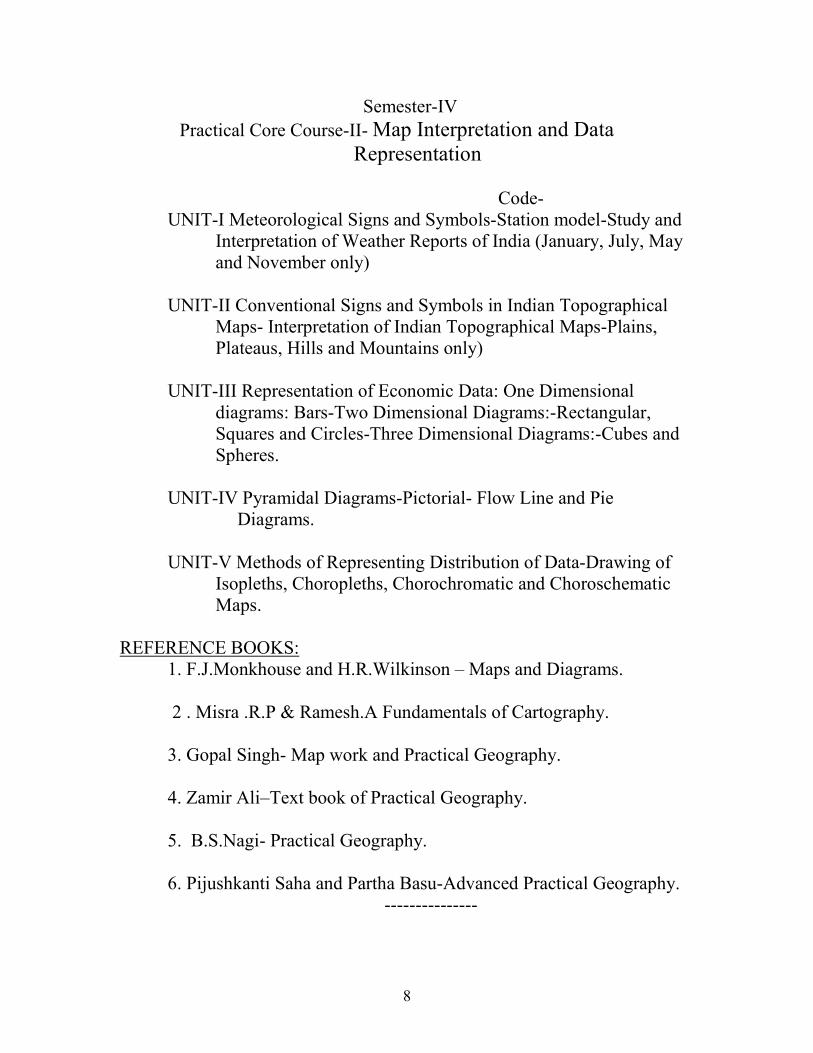
Semester-IV
Practical Core Course-II- Map Interpretation and Data
Representation
Code-
UNIT-I Meteorological Signs and Symbols-Station model-Study and
Interpretation of Weather Reports of India (January, July, May
and November only)
UNIT-II Conventional Signs and Symbols in Indian Topographical
Maps- Interpretation of Indian Topographical Maps-Plains,
Plateaus, Hills and Mountains only)
UNIT-III Representation of Economic Data: One Dimensional
diagrams: Bars-Two Dimensional Diagrams:-Rectangular,
Squares and Circles-Three Dimensional Diagrams:-Cubes and
Spheres.
UNIT-IV Pyramidal Diagrams-Pictorial- Flow Line and Pie
Diagrams.
UNIT-V Methods of Representing Distribution of Data-Drawing of
Isopleths, Choropleths, Chorochromatic and Choroschematic
Maps.
REFERENCE BOOKS:
1. F.J.Monkhouse and H.R.Wilkinson – Maps and Diagrams.
2 . Misra .R.P & Ramesh.A Fundamentals of Cartography.
3. Gopal Singh- Map work and Practical Geography.
4. Zamir Ali–Text book of Practical Geography.
5. B.S.Nagi- Practical Geography.
6. Pijushkanti Saha and Partha Basu-Advanced Practical Geography.
---------------

9
SEMESTER-V
COURSE- V–HUMAN GEOGRAPHY Code-
UNIT-I Basics: Scope and Content of Human Geography-Interrelationship
between Man and Environment- Concepts –Determinism and
Possibilism- Neo-Determinism and Probablism.
UNIT-II Human Habitats-Meaning and types-Mode of life in Equatorial
regions, Tropical Deserts, Temperate Grass lands and Tundra region..
UNIT-III Race - Major Races:-Caucasoid, Mongoloid and Negroid-
Distribution –Racial Conflicts and Racial Prejudice.
UNIT-IV Religion: Distribution of world religion:Hinduism, Christianity,
Islam, Buddhism and Judaism .
UNIT-V Languages: Major world Languages and their distribution-
Geographical factors –Significances.
REFERENCE BOOKS:
1. Majid Husian-Human Geography.
2. G.T.Trewarta-Geography of Population.
3. Goh Chenleong and Gilan C.Morgan - Economic and Human
Geography.
-----------------

10
Semester-V COURSE-VI-GEOGRAPHY OF POPULATION AND SETTLEMENTS
Code-
Unit-I Population: As a Resource and Constraints to Development-Factors
influencing the Distribution and Density, Factors affecting growth of
population of the world-Problems of over population and under
population.
Unit-II Migration-Historic and Contemporary Migrations-Types of Human
Migration-National, International, Voluntary and Forced Migration-
Causes and Consequences of Migration.
Unit-III Settlements: Definition, Site and Situation of Rural settlements,
Factors influencing Settlement Patterns, Classification of Settlements:
Rural and Urban.
Unit-IV Structure of Towns: Theories relating to the morphology of town.
a)Concentric Zone Theory
b)Circle and Sector theory and
c)Multiple Nuclei Theory
Unit-V Urban and Urbanization: Meaning-Classification of Towns and
Cities, Site and Situation and Functions-Urban hierarchy and
Hinterland-Patterns of Urbanisation in India.
Reference Books:
1. G.T.Trewartha-Geography of Population.
2. Clerk- Geography and Population.
3. J.H.Johnson-Principles of Demography.
4. Cole & King- Urban Geography.
5. Mayor and Kohn- Urban Geography.
6. R.L.Singh-Geography of Settlements.
-----------------

11
SEMESTER-VI
COURSE-VII- AGRICULTURAL GEOGRAPHY
Code:
UNIT-I Meaning –Scope and Content of Agricultural geography-
Approaches.
UNIT-II Factors Influencing Argriculture: Physical, Cultural, Social and
Economic Aspects. Origin and Diffusion of Crops.
UNIT-III Agricultural Systems-Whittlissey’s classification-Agricultural
Regions of the World.
UNIT-IV Spatial Crop Analysis: Cropping Indices: Intensity, Crop
Concentration, Crop Diversification, Agricultural Productivity,
and Crop Combination.
UNIT-V Spatial Methods in Agriculture: Agricultural Location- Theory and
its Modification-Population and Food Supply-Markets.
REFERENCE BOOKS:
1. Majid Husian-Agricultural Geography.
2. W.M.Morgan and R.J.C.Muntan – Agrcultural Geography.
3. A.Ahamed- Agricultural Geography.
-----------------

12
Semester-VI
COURSE –VIII– GEOGRAPHY OF RESOURCES
Code-
UNIT-I Resources: Meaning -Nature and Significance in resources-
Classification and types – Need for Conservation and Sustainable
Development.
UNIT-II Water Resources-Importance –Classification-Continent wise
Distribution and Utilization of water resources-Problems and Issues.
UNIT-III Biotic Resources-Major Forest types and Distribution –Live stock-
Fisheries-Major fishing grounds of the world.
UNIT-IV Mineral Resources-Classification and Distribution of major
Minerals: Iron and copper –Energy Resources-Coal, Petroleum,
Hydro Electric and Atomic power-Major industrial Zones of the
world.
UNIT-V Transportation and Trade –Different Modes of Transport- Trade-
Types, Factors affecting Trade-Muti lateral and Bilateral- Agreements
of trade –WTO-GATT.
REFERENCE BOOKS:-
1. John.W.Alexander-Economic Geography.
2. Gohcheng Leong and Morgan-Economic and Human Geography.
3.Von Royan and Bergsten- Fundamentals of Economic Geography.
4. R.S.Thoman -Geography of Economic Activities.
----------------

13
-
SEMESTER-VI
COURSE-IX – QUANTITATIVE METHODS IN GEOGRAPHY
Code:
UNIT-I Data Base:Classification of Data-Physical, Climatic, Economic
Population, Industrial, Agricultural, Trade and Transport.-Sources of
Data- Primary and Secondary–Geographical Sampling Methods.Point,
Line and Area Sampling- Quantitative Revolution in Geography.
UNIT-II Processing of Data-Histogram-Frequency Polygon- Frequency
Curve Measures of Central Tendency- Mean, Median and Mode.
UNIT-III Correlation Techniques-Spearman’s Rank Correlation and Karl
Pearson Co-efficient of Correlation-Geographical Aplications.
UNIT-IV Regression Analysis-Types- Uses and Applications in Geography.
UNIT-V Hypothesis Testing-Methods-Uses of computers in Data Analysis-
T-Test and F-test results and its Interpretations.
REFERENCE BOOKS:-
1. F.J.Monkhouse and H.R.Wilkinson – Maps and Diagrams.
2. Hammed and Magullah- Quantitative Techniques in Geography.
3. Gregory S. Longmans- Statistical Methods and the Geographers.
4. M. Yeates - An Introduction to Quantitative Analysis in Human
Geography.
---------

14
Semester-VI
Practical Core Course- III -Projections and Surveying
Code-
UNIT-I Projections: Construction of Equi-distant and Equal area,
Cylindrical, Poly-conic and Zenithal Projections –Properties and uses.
UNIT-II Chain Survey-Triangulation-Open and Closed Traverse.
UNIT-III Prismatic Compass-Open and Closed Traverse-Recalculation of
Bearings and Included Angles.
UNIT-IV Plane Table Survey-Open and Closed Traverse-Correction of
Closing Error-Bowditch Method-Finding of Resection points –a)Trial
and Error Method b) Tracing Paper Method (three points only).
UNIT-V Survey with Indian Clinometer and Abney level -Accessible and
Inaccessible Methods- Dumpy Level-Collimation method, Calculation
of Heights.
REFERENCE BOOKS
1. Singh.R.l- Elements of Practical Geography.
2. Monk house and Wilkinson- Maps and Diagrams.
3. Singh.R.L. -Map Work and Practical Geography.
4. Misra, R.P & Ramesh.A- Fundamentals of Cartography.
5. Kelley and George-Map projections.
-----------------
15
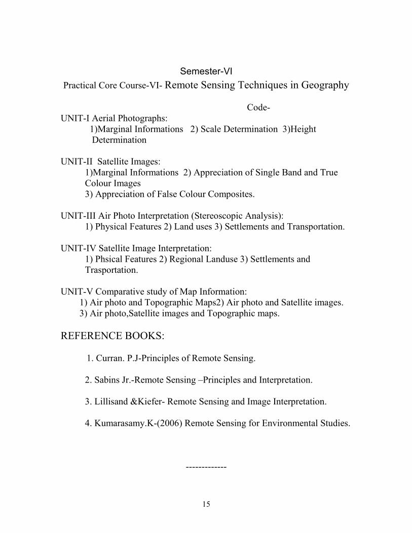
Semester-VI
Practical Core Course-VI- Remote Sensing Techniques in Geography
Code-
UNIT-I Aerial Photographs:
1)Marginal Informations 2) Scale Determination 3)Height
Determination
UNIT-II Satellite Images:
1)Marginal Informations 2) Appreciation of Single Band and True
Colour Images
3) Appreciation of False Colour Composites.
UNIT-III Air Photo Interpretation (Stereoscopic Analysis):
1) Physical Features 2) Land uses 3) Settlements and Transportation.
UNIT-IV Satellite Image Interpretation:
1) Phsical Features 2) Regional Landuse 3) Settlements and
Trasportation.
UNIT-V Comparative study of Map Information:
1) Air photo and Topographic Maps2) Air photo and Satellite images.
3) Air photo,Satellite images and Topographic maps.
REFERENCE BOOKS:
1. Curran. P.J-Principles of Remote Sensing.
2. Sabins Jr.-Remote Sensing –Principles and Interpretation.
3. Lillisand &Kiefer- Remote Sensing and Image Interpretation.
4. Kumarasamy.K-(2006) Remote Sensing for Environmental Studies.
-------------

16
SEMESTER-V
ELECTIVE COURSE-I- BIO GEOGRAPHY
Code-
UNIT-I Bio-Geography: Definition, Scope and Significance -Basic
Ecological Principles-Bio-Energy Cycle in the Terrestial Eco system -
Tropic Levels and Food Chain.
UNIT-II Evolution of Life on Earth:Origin of Fauna and Flora-Plants and
Animal evolution throughout the Geological Times-Distribution of
plant life on the earth-concepts of Biome, Ecotone and Community.
UNIT-III Bio-Diversity:Problems of Extinction of plant and animal life-
Habitat decay and need for Conservation- Process of Desertification
and its Consequences - Industrial Effluents and their effects on fresh
Water Biology.
UNIT-IV World Biomes: Major Biomes-Tropical Forest-Tropical
Grasslands-Temperate Grassland and Tropical Deserts.
UNIT-V Ecological and Environmental Managements: Study of
Ecological regions of Himalayas and the Western Ghats-Conservation
and Management-Major Global Environmental Problems-
International Co-operation.
REFERENCE BOOKS:-
1. Savindra Singh- Environmental Geography.
2. Robinson-H.Biogeography.
3. Nigel Pears- Basic Biogeography.
4. Newbegin.I. - Plant and Animal Geography.
------------

17
Semester-V
Elective Course-II-Remote Sensing and GIS
Code-
UNIT-I Basics of Remote Sensing: Defination-scope and content-
Development of Aerial and Stallite remote sensing-International and
National Remote Sensing Centres-Uses.
UNIT-II Remote Sensing Systems: Electromagnetic Radiation-EMR
regions-Energy interaction in the atmosphere-Atmospheric windows-
energy interaction with earth surface features- Spectral reflection
curve –Platforms-Types of remote sensing.
UNIT-III Aerial Remote Sensing: Aerial cameras-Films and Filters-Types
of photos-Flight Planning-Elements of Photo interpretations.
UNIT-IV Satellite Remote Sensing: Types of Satellites-Orbital elements-
Resolutions: Spatial, Spectral, Temporal and Radiometric –LAND-
SAT-IRS SPOT and INSAT Satellite series.
UNIT-V Geographical Information Systems (GIS) Meaning- Developments-
Raster and Vector data-Data integration –Global positioning
System (GPS)-Advantages and Limitations of GIS and GPS.
REFERENCE BOOKS:
1. Curran. P.J- Principles of Remote Sensing.
2. Ashbins. J-Remote sensing –Principles and Interpretation.
3. Lillisand and Kiefer- Remote Sensing and Image Interpretation.
----------

18
SEMESTER-VI
Elective Course -III –GEOGRAPHY OF INDIA
Code:
UNIT-I General Aspects: Location and Extent -Major Physiographic
divisions-Drainage-Climate-Soils- Natural vegetation- Muti-purpose
projects-DVC.
UNIT-II Agriculture-Importance -Distribution and production of major
crops-Paddy, Wheat, Sugarcane, Tea, Cotton-Problems of Indian
agriculture-Green Revolution.
UNIT-III Minerals and Power: Minerals Resources:- Iron, Manganese,
Bauxite- Minerals and their distribution-Power Resources and Hydal
Power, Coal, Petroleum, and Atomic power.
UNIT-IV Industries: - Distribution of Major Industries-Cotton Textile, Iron
and Steel, Chemicals and Automobile- Major Industrial Regions.
UNIT-V Transport and Trade: Land, Water and Air – Foreign trade of India.
REFERENCE BOOKS:-
1. T.C sharma and O.Coutinho-Economic and commercial Geography of
India.
2. Mamoria- Economic and Commercial Geography of India.
3. Gopal Singh – Geography of India.
4. R.N.Dubey and B.S Negi- Economic and Commercial Geography of
India.
5. R.C.Tiwari-Geography of India.
6. Govt. of India Publications- Year Book. R
***********

19
Semester-II
Skill Based Courses-I
PHYSICAL GEOGRAPHY FOR COMPETITIVE EXAMINATIONS
Code-
UNIT-I General Geography: Nations and Capitals, Geographical locations
-Latitude, longitude and Time Zone, Solar System and Planets.
UNIT-II Landforms: Major relief features,Earth’s External and Internal
forces and Agents of Denudation-Features formed by them, Normal
Cycle of Erosion.
UNIT-III Climatology: Atmosphere, Insolation – Temperature, Pressure –
Wind – Humidity – Forms of Condensation and Precipitation – Types
and Distribution of rainfall – Airmass – front, cyclones –Classification
of Climate: Koppen’s classifications.
UNIT-IV Oceanography: Land and Sea distribution – Bottom topography
of Oceans – Temperature, Salinity, Currents, Tides, Coral reefs,
Ocean Deposits and Resources.
UNIT-V Biogeography: Elements of biogeography – Environment, habitat,
Plant and animal-Distribution Groupings-Distribution of forests and
major Communities.
Reference Books:
1. Dayal.P- A Text book of Geomorphology.
2. Lal, D.S- Climatology.
3. Robinson, H- Biogeography.
4. Strahler. A.H. and Strahler.A.N. - Modern Physical Geography.
5. Thornbury.W.D- Principles of Geomorphology.
6. Worcester. P.G- A Textbook of Geomorphology.
----------------

20
Semester-III-
Skill Based Course –II-GEOGRAPHY OF TRAVEL AND TOURISM
Code-
UNIT-I-Tourism: Scope and Content-Geographical components of
Tourism-Factors affecting the growth of Tourism-Trypes of Tourism-
Religious Tourism –Recreational Tourism-Pleasure Tourism-Sporting
Tourism.
UNIT-II- Tourism in India-Development-Tourism Departments-
Corporations-Tourist Facilities and Services in India-Transport-
Accommodation-Catering –Hospitality-Entertainment in Promoting
Tourism.
UNIT-III-Tours and accommodation-Tours-Regional-National and
International levels-Role of hotels Motels, Star hotels-Choultries and
Guest houses in Development of Tourism.
UNIT-IV-Tourism and Travel Agencies-Functions –Tourism as a Trade –
Role of Trade Fairs and Festivals-National and International Sports
and Games as Promoters-Tourism in Tamil Nadu –Impact on
Economy.
UNIT-V-Major Tourist Centres of India-Agra and jaipur-Tourist locations:
–Hill stations-Picnic Spots in South India: Geographical study of
Undagamandalam, Kodaikanal, Yercaud, Bangalore and Mysore as
Tourist locations.
REFERENCE BOOKS:-
1. Ratan Deep Singh- Tourism Today.
2. Bhatia-Tourism Development.
3. S.N.Singh-Geography of Tourism.
4. Manoj Doa- India: A Tourist Paradise.
--------------------

21
Semester-V
Skill Based Courses-III- Fundamentals of Map Reading
Code-
UNIT-I General: Latitudes and Longitudes-Greenwich Meridian Time- IST-
Calculation of Time and Time zones-Location of Places-International
Date Line.
UNIT-II Graticule: Radius of the reduced earth-Spacing of the parallels and
Meridians-Grid and Grid Reference System-Grid North and True
North.
UNIT-III Weather map-Synoptic Chart-Station model-Beaufort scale for
Wind Velocity-Seasonal Interpretation-Cross Section of Cyclone-
Track of Cyclone.
UNIT-IV Map Reading Instruments-Types of Map: Small, Medium and
Large Scale Maps-Cadastral maps-Magnetic compass-Weather
Reading and Recording Instruments-Pantograph-GPS-Uses.
UNIT-V Map Organizations in India-History of Land Survey in India-
Survey of India-NATMO-ISRO Institutes-Survey and Land Records.
REFERENCE BOOKS:
1. Ramesh.A-Fundamentals of Cartography.
2. R.L.Singh-Practical Geographty.
3. Gopal Singh-Practical Geography.
4. Web Sites: NATA-survey of India-Land Records, Govt.of Tamil Nadu.
5. Pijushkanti Saha and Partha Basu-Advanced Practical Geography.
-----------

22
Semester-V
Skill Based Course-IV-CARTOGRAPHY
Code-
1.UNIT-I Cartography – Nature, Scope and Content of Cartography Arts and
Science of Cartography-CArtography as system of communication-
Maps – Classification and their uses- Growth, development and
modern trends in Cartography.
2.UNIT-II Map Drawing and Measuring Techniques. Map Setting –The
Earth and System of Co-ordinates – Base map – Compilation and
Generalization – Symbolization – Types of Cartographic Symbols –
Point, Line and Area- Uses – Qualitative and Quantitative data
and generalization.
3.UNIT-III Mapping the relief features, elevation, contours, Hypsometric
curves, Slopes, Shading and combined systems. The representation of
Physical features – Hydrography – Coastline surface – characteristics
– Composition, ice and vegetation etc. The Representation of artificial
features with Point, Line and area symbols- International boundaries
and boundaries in rivers –Representation of place names –
Standardization of Place names.
4.UNIT-IV Map Design and Layout – General design problems – Principles
of Cartographic design and design of map symbols – Format-
Lettering – Lettering Methods, types and characteristic and use of
mapspositioning of letters – Geographical names.
5.UNIT-V Map Reproduction – Process of Map Productions:Photographic
systems – Multiple Reproduction Processes- Computer application in
Cartography – Computer mapping- Remote Sensing and Cartography
Use of air Photographs and Satellite images in Cartography.
REFERENCE BOOKS:
1. Misra R.P. and A.P. Ramesh – Fundamentals of Cartography.
2. Robinson-Elements of Cartography.
3. Keats J.S – Cartographic Design and Production.
4. Raiz -Principles of Cartography.
---------------------
23
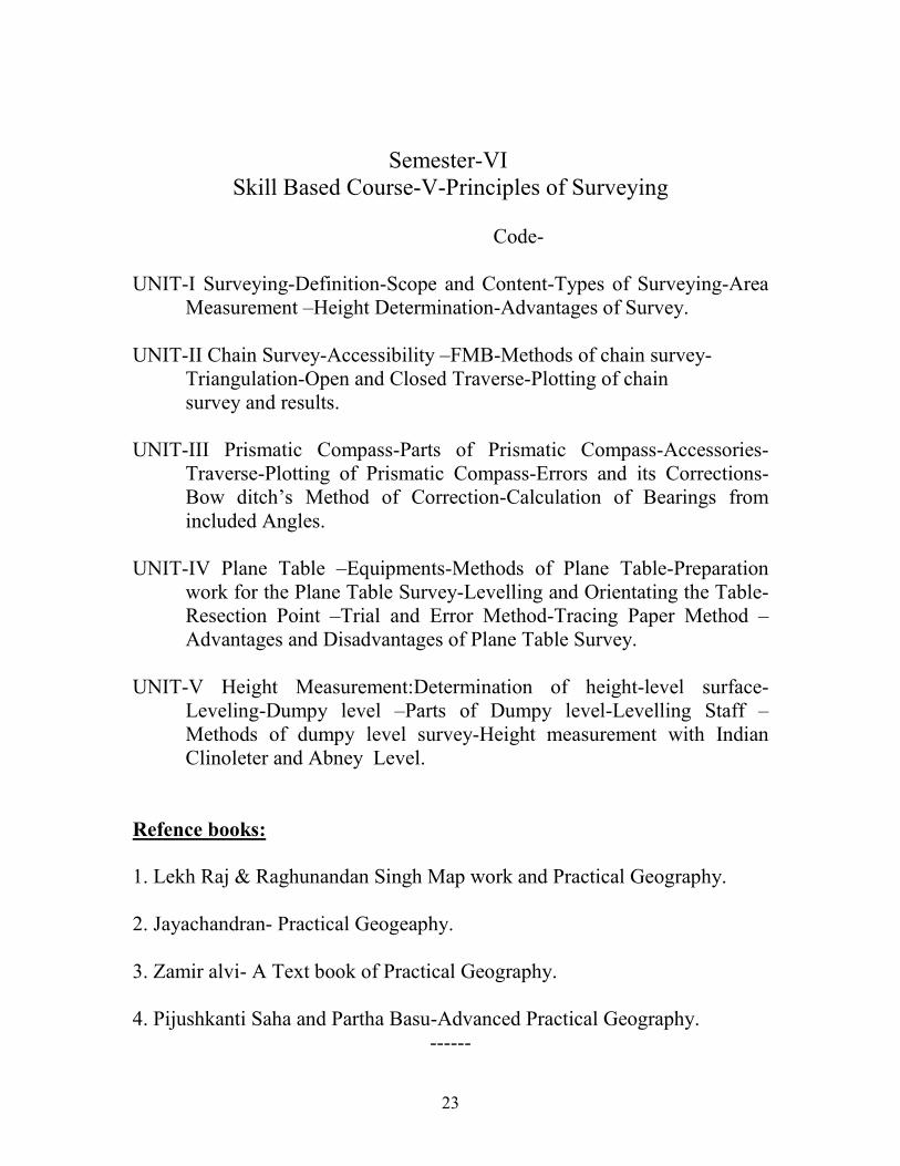
Semester-VI
Skill Based Course-V-Principles of Surveying
Code-
UNIT-I Surveying-Definition-Scope and Content-Types of Surveying-Area
Measurement –Height Determination-Advantages of Survey.
UNIT-II Chain Survey-Accessibility –FMB-Methods of chain survey-
Triangulation-Open and Closed Traverse-Plotting of chain
survey and results.
UNIT-III Prismatic Compass-Parts of Prismatic Compass-Accessories-
Traverse-Plotting of Prismatic Compass-Errors and its Corrections-
Bow ditch’s Method of Correction-Calculation of Bearings from
included Angles.
UNIT-IV Plane Table –Equipments-Methods of Plane Table-Preparation
work for the Plane Table Survey-Levelling and Orientating the Table-
Resection Point –Trial and Error Method-Tracing Paper Method –
Advantages and Disadvantages of Plane Table Survey.
UNIT-V Height Measurement:Determination of height-level surface-
Leveling-Dumpy level –Parts of Dumpy level-Levelling Staff –
Methods of dumpy level survey-Height measurement with Indian
Clinoleter and Abney Level.
Refence books:
1. Lekh Raj & Raghunandan Singh Map work and Practical Geography.
2. Jayachandran- Practical Geogeaphy.
3. Zamir alvi- A Text book of Practical Geography.
4. Pijushkanti Saha and Partha Basu-Advanced Practical Geography.
------

24
Semester-VI Skill Based-Course-VI
SOCIAL GEOGRAPHY FOR COMPETITIVE EXAMINATIONS
Code-
UNIT-I Population–World Population distribution–factors affecting
Population-Growth of Population-Theories: Malthus, Optimum,
Demographic Trassition-Migration-Settlement: Rural and Urban –Site
and Situation-Classification-Urbanisation-Regional Studies – Concept
–Types: Formal, Functional, Natural, Agricultural, Industrial and
Cultural Regions of the world.
UNIT-II Cartography: Primary and Secondary source of data, Air photo
and satellite Images, Maps: Compilation, Generalization-Mapping of
Socio Economic data-Distribution maps.
UNIT-III Environmental Studies: Man and Environment relationships-
Determinism-Possibilism-Ecosystem- Natural of Hazards-Impact of
population – Pollution – Conservation.
UNIT-IV Resources of the World: Resource types –Agriculture:
Distribution and Production of Paddy, Wheat, Tea and Coffee-Forest
types –Distribution-Fisheries-Minerals: Iron ore-Power Resources:
Coal-Petroleum, Thermal, Hydro, Nuclear- Industries: Cotton
Textiles, Iron and Steel, Ship building,- Transport and Trade.
UNIT-V Geography of India: Location, Relief, Climate, Soil, Population,
Urbanisation – Tamil Nadu – Relief-Climate-Crops-Minerals-
Industries-Population and urbanization.
REFERENCE BOOKS:
1. Dayal, P., (1990) A Text book of Geomorphology.
2. Lal, D.S., (1996) Climatology.
3. Robinson, H. (1978) Biogeography.
4. Strahler.A.H. and Strahler.A.N. (2001) Modern Physical
Geography.
5. Thornbury.W.D., (1954) Principles of Geomorphology.
6. Worcester, P.G., (1948) A Textbook of Geomorphology.
----------------
25
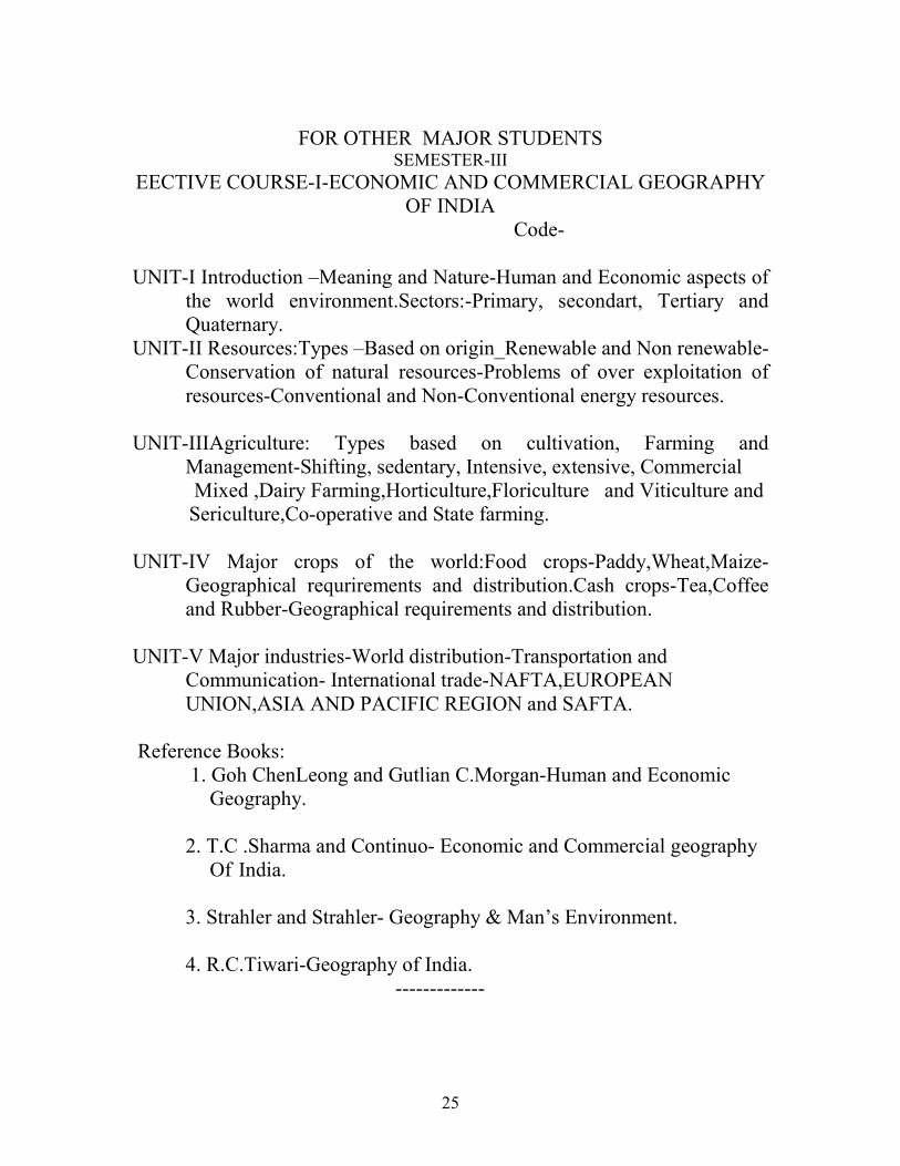
FOR OTHER MAJOR STUDENTS SEMESTER-III
EECTIVE COURSE-I-ECONOMIC AND COMMERCIAL GEOGRAPHY
OF INDIA
Code-
UNIT-I Introduction –Meaning and Nature-Human and Economic aspects of
the world environment.Sectors:-Primary, secondart, Tertiary and
Quaternary.
UNIT-II Resources:Types –Based on origin_Renewable and Non renewable-
Conservation of natural resources-Problems of over exploitation of
resources-Conventional and Non-Conventional energy resources.
UNIT-IIIAgriculture: Types based on cultivation, Farming and
Management-Shifting, sedentary, Intensive, extensive, Commercial
Mixed ,Dairy Farming,Horticulture,Floriculture and Viticulture and
Sericulture,Co-operative and State farming.
UNIT-IV Major crops of the world:Food crops-Paddy,Wheat,Maize-
Geographical requrirements and distribution.Cash crops-Tea,Coffee
and Rubber-Geographical requirements and distribution.
UNIT-V Major industries-World distribution-Transportation and
Communication- International trade-NAFTA,EUROPEAN
UNION,ASIA AND PACIFIC REGION and SAFTA.
Reference Books:
1. Goh ChenLeong and Gutlian C.Morgan-Human and Economic
Geography.
2. T.C .Sharma and Continuo- Economic and Commercial geography
Of India.
3. Strahler and Strahler- Geography & Man’s Environment.
4. R.C.Tiwari-Geography of India.
-------------

26
SEMESTER-IV
ELECTIVE-II-PHYSICAL GEOGRAPHY FOR COMPETITIVE
EXAMINATIONS
Code-
UNIT-I General Geography: Nations and Capitals, Geographical locations
-Latitude, Longitude and Time Zone, Solar System and Planets.
UNIT-II Landforms: Major relief features,Earth’s External and Internal
forces and Agents of Denudation-Features formed by them, Normal
Cycle of Erosion.
UNIT-III Climatology: Atmosphere, Insolation – Temperature, Pressure –
Wind – Humidity – Forms of Condensation and Precipitation – Types
and distribution of rainfall – Airmass – front, cyclones – classification
of Climate: Koppen’s classifications.
UNIT-IV Oceanography: Land and Sea distribution – Bottom topography
of Oceans – Temperature, Salinity, Currents, Tides, Coral reefs,
Ocean Deposits and Resources.
UNIT-V Biogeography: Elements of biogeography – Environment, habitat,
Plant and animal-Distribution Groupings-Distribution of forests and
major Communities.
Reference Books:
1. Dayal.P- A Text book of Geomorphology.
2. Lal, D.S., (1996) Climatology.
3. Robinson, H. (1978) Biogeography.
4. Strahler. A.H., and Strahler.A.N., (2001) Modern Physical
Geography.
5. Thornbury.W.D., (1954) Principles of Geomorphology.
6. Worcester, P.G., (1948) A Textbook of Geomorphology.
----------------
27
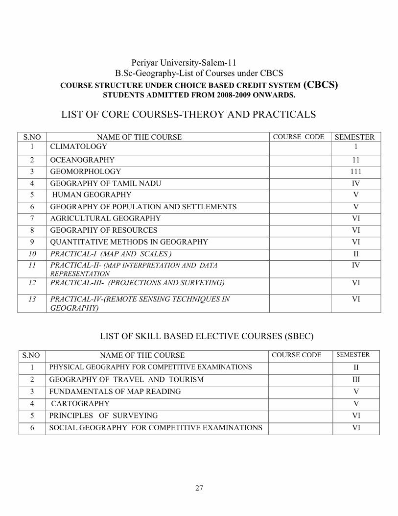
Periyar University-Salem-11
B.Sc-Geography-List of Courses under CBCS
COURSE STRUCTURE UNDER CHOICE BASED CREDIT SYSTEM (CBCS) STUDENTS ADMITTED FROM 2008-2009 ONWARDS.
LIST OF CORE COURSES-THEROY AND PRACTICALS
S.NO NAME OF THE COURSE COURSE CODE SEMESTER
1 CLIMATOLOGY 1
2 OCEANOGRAPHY 11
3 GEOMORPHOLOGY 111
4 GEOGRAPHY OF TAMIL NADU IV
5 HUMAN GEOGRAPHY V
6 GEOGRAPHY OF POPULATION AND SETTLEMENTS V
7 AGRICULTURAL GEOGRAPHY VI
8 GEOGRAPHY OF RESOURCES VI
9 QUANTITATIVE METHODS IN GEOGRAPHY VI
10 PRACTICAL-I (MAP AND SCALES ) II
11 PRACTICAL-II- (MAP INTERPRETATION AND DATA REPRESENTATION
IV
12 PRACTICAL-III- (PROJECTIONS AND SURVEYING) VI
13 PRACTICAL-IV-(REMOTE SENSING TECHNIQUES IN
GEOGRAPHY)
VI
LIST OF SKILL BASED ELECTIVE COURSES (SBEC)
S.NO NAME OF THE COURSE COURSE CODE SEMESTER
1 PHYSICAL GEOGRAPHY FOR COMPETITIVE EXAMINATIONS II
2 GEOGRAPHY OF TRAVEL AND TOURISM III
3 FUNDAMENTALS OF MAP READING V
4 CARTOGRAPHY V
5 PRINCIPLES OF SURVEYING VI
6 SOCIAL GEOGRAPHY FOR COMPETITIVE EXAMINATIONS VI

28
LIST OF ELECTIVE COURSES (EC)
LIST OF NON-MAJOR ELECTIVE COURSES (NMEC)
S.NO NAME OF THE COURSE COURSE CODE SEMESTER
1 ECONOMIC AND COMMERCIAL GEOGRAPHY III
2 PHYSICAL GEOGRAPHY FOR COMPETITIVE EXAMINATIONS IV
COMMON COURSES
S.NO NAME OF THE COURSE COURSE CODE SEMESTER
1 VALUE BASED EDUCATION 1
2 EXTENSION ACTIVITIES V1
COMPULSORY COURSE
S.NO NAME OF THE COURSE COURSE CODE SEMESTER
1 ENVIRONMENTAL STUDIES 1I
S.NO NAME OF THE COURSE COURSE CODE SEMESTER
1 BIO-GEOGRAPHY V
2 REMOTE SENNSING AND GIS VI
3 GEOGRAPHY OF INDIA VI

29
B.Sc–GEOGRAPHY –COURSE STRUCTURE UNDER CBCS PATTERN
(For the candidate admitted from the Academic year 2008- 2009 onwards)
SEMESTER-I
SEMESTER-II
PART
TITLE OF THE COURSE
Course
Instr.Hour
s/Week
Credit
s
Exam
Hours
MARKS
TOTAL
CIA EXTE
1 LANGUAGE COURSE TAMIL-I 1 6 3 3 25 75 100
II LANGUAGE COURSE- ENGLISH-I 1 6 3 3 25 75 100
III
CORE—CLIMATOLOGY-I 1 5 5 3 25 75 100
CORE-PRACTICALS-(MAPS AND
SCALES)-I * *
- 3 - - - - -
ALLIED –APPLIED STATISTICS -I
1
4
3
3
25
75
100
ALLIED- PRACTICALS-I * * - 4 - - - - -
IV VALUE BASED EDUCATION
(Common Course) 1 2 2 3 25 75 100
TOTAL 5 30 16 15 125 375 500
PART
TITLE OF THE COURSE
COURSE
INSTU
OURS/ WEEK
CREDIT
S
EXAM
HOUR
MARKS
TOTAL
CIA
EXTE
I
LANGUAGE COURSE TAMIL-II 1 6 3 3 25 75 100
II
LANGUAGE COURSE- ENGLISH-II 1 6 3 3 25 75 100
III
CORE-OCEANOGRAPHY-II 1
5 5 3 25 75 100
CORE- PRACTICAL-(Maps and Scales)-I
1
3
3
3
25
75
100
ALLIED – APPLIED STATISTICS-II 1
4 4 3 25 75 100
ALLIED -PRACTICAL -I 1 3
3 3 25 75 100
PHYSICAL GEOGRAPHY FOR
COMPETITIVE EXAMINATIONS -SBEC-I
1 2 2 3 25 75 100
IV
ENVIRONMENTAL STUDIES
1
1
2
3
25
75
100
TOTAL 8
30 25 24 200 600 800

30
SEMESTER-III
PART
TITLE OF THE COURSE
COUR
SE
INSTU
OURS/ WEEK
CREDI
TS
EXAM
HOUR
MARKS
TOTAL CIA EXTE
I
LANGUAGE COURSE TAMIL-III 1 6 3 3 25 75 100
II
LANGUAGE COURSE-ENGLISH-III 1 6 3 3 25 75 100
III
CORE- GEOMORPHOLOGY-III 1 5 5 3 25 75 100
CORE- PRACTICAL-II (MAP INTERPRET-
ATION AND DATA REPRESENTATION) -II*
-
2
-
-
-
-
-
ALLIED BOTANY-I 1 4 3 3 25 75 100
ALLIED PRACTICAL ** - 3 - - - - -
IV
GEOGRAPHY OF TRAVEL AND TOURISM-SBEC-
II
1 2 2 3 25 75 100
NMEC-I 1 2 2 3 25 75 100
TOTAL 6 30 18 18 150 450 600
SEMESTER-IV
PART
TITLE OF THE COURSE
COURSE
INSTU
HOURS/ WEEK
CREDITS
EXAM HOUR
MARKS
TOTAL CIA EXTE
I
LANGUAGE COURSE TAMIL-IV 1 6 3 3 25 75 100
II
LANGUAGE COURSE-EINGLISH-IV 1 6 3 3 25 75 100
III
CORE-GEOGRAPH OF TAMIL NADU-
IV
1 5 5 3 25 75 100
CORE- PRACTICAL-II (MAP
INTERPRETTION AND DATA
REPRESENTATION))—II
1
2
4
3
25
75
100
ALLIED BOTANY-II 1 5 4 3 25 75 100
ALLIED PRACTICAL-II 1 4 3 3 25 75 100
IV NMEC-II 1 2 2 3 25 75 100
TOTAL 7 30 24 21 175 525 700

31
SEMESTER-V
PART
TITLE OF THE COURSE
COURSE
INSTU
HOURS/ WEEK
CREDITS
EXAM
HOUR
MARKS
TOTAL CIA
EXTE
III
CORE- HUMAN GEOGRAPHY-V
1 4 4 3 25 75 100
CORE-GEOGRAPHY OF POPULATION
AND SETTLEMENTS-VI
1 4 4 3 25 75 100
CORE-BIO-GEOGRAPHY-EC-I 1 4 4 3 25 75 100
REMOTE SENSING AND GIS-EC-II 1
-
4
-4
-3
-25
-75
100-
CORE-PRACTICAL-( PROJECTIONS AND
SURVEYING)-IV**
-
3
-
-
-
-
-
CORE-PRACTICAL-REMOTE SENSING
TECHNIQUES IN GEOGRAPHY)-IV**
- 3
IV
FUNDAMENTALS OF MAP READING-
SBEC-III
1 4 4 3 25 75 100
CARTOGRAPHY-SBEC-IV
1
4
4
3
25
75
100
TOTAL 6 30 24 18 150 450 600

32
SEMESTER-VI
** Examinations only at the even semesters
* Extension Activities –One Course and One Credit = 139+1= 140 Credits
Part
TITLE OF THE COURSE
COURSE
INSTU
HOURS/ WEEK
CREDITS
EXAM HOUR
MARKS
TOTAL CIA EXTE
III
CORE-AGRICULTURAL GEOGRAPHY 1 4 4 3 25 75 100
CORE-GEOGRAPHY OF RESOURCES 1 4 4 3 25 75 100
CORE-QUANTITATIVE METHODS IN
GEOGRAPHY
1 4 4 3 25 75 100
CORE-GEOGRAPHY OF INDIA- EC-III
1
4
4
3
25
75
100
CORE- PRACTICAL (PROJECTIONS AND
SURVEYING)- III
1
3
4
3
25
75
100
CORE- PRACTICAL- (REMOTE SENSING
TECHNIQUES IN GEOGRAPHY- IV
1
3
4
3
25
75
100
IV
PRINCIPALS OF SURVEYING – SBEC-V
1
4
4
3
25
75
100
SOCIAL GEOGRAPHY FOR COMPET- ITVE
EXAMINATIONS- SBEC-VI
1
4
4
3
25
75
100
EXTENSION ACTIVITIES
1
-
-
-
-
-
-
TOTAL
8
30
32
24
200
600
800
OVER ALL TOTAL 41 180 140 * 1000 3000 4000
33
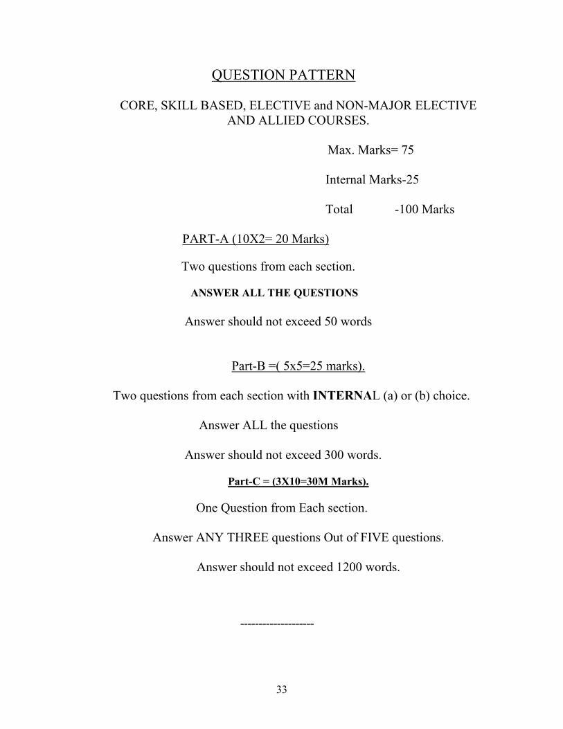
QUESTION PATTERN
CORE, SKILL BASED, ELECTIVE and NON-MAJOR ELECTIVE
AND ALLIED COURSES.
Max. Marks= 75
Internal Marks-25
Total -100 Marks
PART-A (10X2= 20 Marks)
Two questions from each section.
ANSWER ALL THE QUESTIONS
Answer should not exceed 50 words
Part-B =( 5x5=25 marks).
Two questions from each section with INTERNAL (a) or (b) choice.
Answer ALL the questions
Answer should not exceed 300 words.
Part-C = (3X10=30M Marks).
One Question from Each section.
Answer ANY THREE questions Out of FIVE questions.
Answer should not exceed 1200 words.
--------------------

34
QUESTION PATTERN
MAJOR CORSE PRACTICALS
For Record Submission- 10
For Internal 15
----------
Total Marks 25 Marks
-------------
For University Examination --- 75 Marks
One Question from Each Section
Each question carries 15 Marks (5x15= 75 Marks)
-------------

35
Allied –Geography for HISTORT Major B.A(First Year)_ Semester-I
Allied course-I-Geography of India
UNIT-I India: Location-Physiographic units and its significances-Climate-
Rainfall Variation and Distribution-Climatic Regions-Soil: Types and
Distribution-Erosion and Conservation-Natural Vegetations-Forest
distribution and its Products-Water Resources-River Irrigation: Types-
Distribution-Multipurpose Projects-DVC.
UNIT-II Agriculture-Importance of Agriculture-Distribution and Production
of the following crops; a)Paddy b)Wheat c)Cotton d)Jute e)Tea
f)coffee -Problems of Agriculture-Green revolution.
UNIT-III Mineral Resources-distribution, Production and Trade of the
following Minerals: Iron, Manganese, Mica and bauxite-Power
resources: Coal, Petrolem and natural Gas-Atomic minerals-Power
Distribution and Production.
UNIT-IV Industries: Locational factors-Major Industries: Iron and Steel,
Steel, Shipbuilding, Chemicals, Paper, Cement and sugarcane
Industries.
UNIT-V Human Resources: Population; Growth and Distribution-Rural and
Urban Population-Migration; Types-Causes and Consequences.
Reference Books:-
1. T.C Sharma and O.Coutinho-Economic and commercial Geography of
India.
2. Mamoria- Economic and Commercial Geography of India.
3. Gopal Singh – Geography of India.
4. R.N Dubey and B.S Negi- Economic and Commercial Geography of
India.
5. Govt. of India Publications- Year Book, Ministry of Information and
Broadcasting Division, New Delhi.
6. R.C.Tiwari-Geography of India.
-----------
36
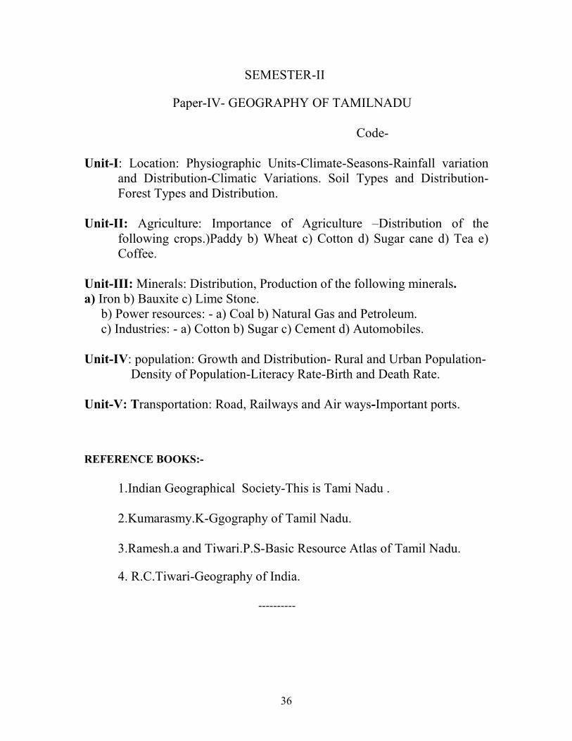
SEMESTER-II
Paper-IV- GEOGRAPHY OF TAMILNADU
Code-
Unit-I: Location: Physiographic Units-Climate-Seasons-Rainfall variation
and Distribution-Climatic Variations. Soil Types and Distribution-
Forest Types and Distribution.
Unit-II: Agriculture: Importance of Agriculture –Distribution of the
following crops.)Paddy b) Wheat c) Cotton d) Sugar cane d) Tea e)
Coffee.
Unit-III: Minerals: Distribution, Production of the following minerals.
a) Iron b) Bauxite c) Lime Stone.
b) Power resources: - a) Coal b) Natural Gas and Petroleum.
c) Industries: - a) Cotton b) Sugar c) Cement d) Automobiles.
Unit-IV: population: Growth and Distribution- Rural and Urban Population-
Density of Population-Literacy Rate-Birth and Death Rate.
Unit-V: Transportation: Road, Railways and Air ways-Important ports.
REFERENCE BOOKS:-
1.Indian Geographical Society-This is Tami Nadu .
2.Kumarasmy.K-Ggography of Tamil Nadu.
3.Ramesh.a and Tiwari.P.S-Basic Resource Atlas of Tamil Nadu.
4. R.C.Tiwari-Geography of India.
----------

37