brabson p&r 5 year planrev6c
TRANSCRIPT
City of Delafield
Park and Recreation 5-year plan 2020 – 2024 Page 55
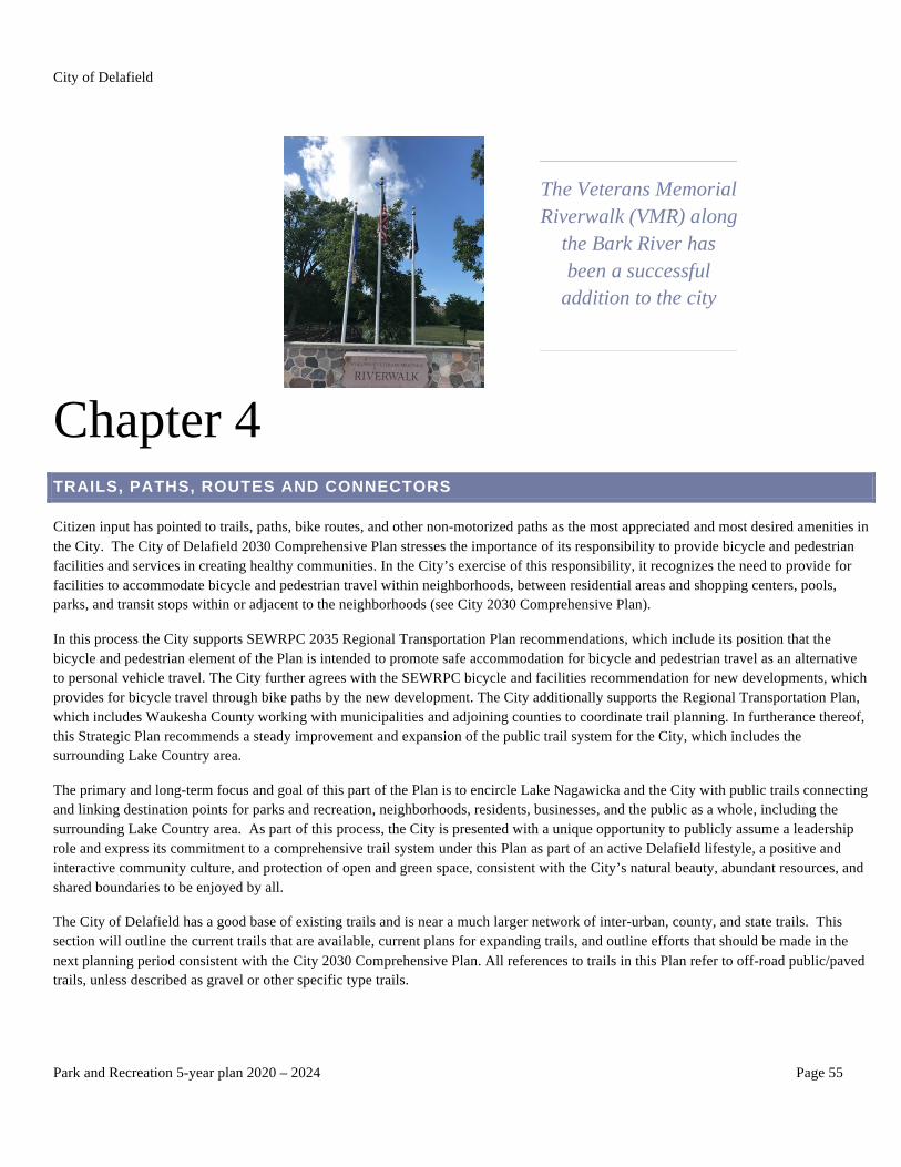
The Veterans Memorial Riverwalk (VMR) along
the Bark River has been a successful
addition to the city
Chapter 4 TRAILS, PATHS, ROUTES AND CONNECTORS
Citizen input has pointed to trails, paths, bike routes, and other non-motorized paths as the most appreciated and most desired amenities in the City. The City of Delafield 2030 Comprehensive Plan stresses the importance of its responsibility to provide bicycle and pedestrian facilities and services in creating healthy communities. In the City’s exercise of this responsibility, it recognizes the need to provide for facilities to accommodate bicycle and pedestrian travel within neighborhoods, between residential areas and shopping centers, pools, parks, and transit stops within or adjacent to the neighborhoods (see City 2030 Comprehensive Plan).
In this process the City supports SEWRPC 2035 Regional Transportation Plan recommendations, which include its position that the bicycle and pedestrian element of the Plan is intended to promote safe accommodation for bicycle and pedestrian travel as an alternative to personal vehicle travel. The City further agrees with the SEWRPC bicycle and facilities recommendation for new developments, which provides for bicycle travel through bike paths by the new development. The City additionally supports the Regional Transportation Plan, which includes Waukesha County working with municipalities and adjoining counties to coordinate trail planning. In furtherance thereof, this Strategic Plan recommends a steady improvement and expansion of the public trail system for the City, which includes the surrounding Lake Country area.
The primary and long-term focus and goal of this part of the Plan is to encircle Lake Nagawicka and the City with public trails connecting and linking destination points for parks and recreation, neighborhoods, residents, businesses, and the public as a whole, including the surrounding Lake Country area. As part of this process, the City is presented with a unique opportunity to publicly assume a leadership role and express its commitment to a comprehensive trail system under this Plan as part of an active Delafield lifestyle, a positive and interactive community culture, and protection of open and green space, consistent with the City’s natural beauty, abundant resources, and shared boundaries to be enjoyed by all.
The City of Delafield has a good base of existing trails and is near a much larger network of inter-urban, county, and state trails. This section will outline the current trails that are available, current plans for expanding trails, and outline efforts that should be made in the next planning period consistent with the City 2030 Comprehensive Plan. All references to trails in this Plan refer to off-road public/paved trails, unless described as gravel or other specific type trails.
City of Delafield
Park and Recreation 5-year plan 2020 – 2024 Page 56
PRIORITIES AND PLANNING AREAS
Trails and paths are planned in an integrated and comprehensive fashion. The priorities for adopting plans for trails and paths are:
1. Provide a safe method for citizens to walk, talk, bike, hike, run, and travel in and around Delafield. Wherever possible, motorized and non-motorized activities should be separated, recognized, and respected by one another
2. Provide connections between destinations. Trails should link people and neighborhoods to destinations, and destinations to destinations
3. Provide enjoyment, relaxation, and recreation that is fun, healthy, and interesting 4. Expand public access and usage 5. Complement and preserve existing neighborhood character and culture 6. Include water-based trails for boating, kayaking, paddle boarding, and canoeing in planning 7. This Plan provides the means by which City residents can move forward as a community to keep Delafield’s trails open,
accessible, and useable to the public in linking our parks and recreation areas to destination points for all to enjoy
The planning areas are divided into several areas of focus. Each area is discussed, and recommendations made. The planning areas are:
1. Historic Downtown 2. NE Quadrant of the City 3. West Side of the City 4. NW Quadrant of the City 5. South of I-94 6. Bark River and Lake Nagawicka 7. Connections
OVERVIEW AND TRAIL PLANNING CONCEPTS
The Master Plan for public trails, paths, routes and connections has multiple purposes. The individual areas of planning combine to form the overall master trail plan for the City of Delafield. The maps included in this section are a generalized outline of the location of trails. They are not official planning maps and are provided for illustration purposes only. The orange and red lines represent existing and proposed trails. The blue/purple line is the approximate path of the VMR/Ice Age hiking trail, and the Lake Country Recreation Trail. Connect to Google Maps [Click Here] for an unofficial interactive map.
o Develop a connecting hiking and biking trail to encircle the Delafield area; fourteen connectors are identified for development, including, but not limited to, the following:
§ Extend trail on Nagawicka Road north to Vettelson Road
§ New east/west trail on Vettelson Road to Lakeland Drive (HWY C)
§ New east/west trail on ATC right-of-way between Lakeland Drive and Sawyer Road
§ Facilitate agreement with the Village of Oconomowoc Lake to create and develop new north/south paved trail
on Sawyer Road to Nashotah Road linked to ATC right-of-way
§ Facilitate agreement with the Village of Summit to create and develop new east/west paved trail on Nashotah
Road between Sawyer Road intersection and Mission Road
§ Facilitate agreement with the Village of Nashotah to create and develop a new east/west paved trail on
Nashotah Road between Lakeland Drive and Mission Road
§ New east/west trail on Mission Drive between Mission Road and HWY C
§ New north/south trail on Mission Road past Nashotah House to Valley/Oakwood Drive

City of Delafield
Park and Recreation 5-year plan 2020 – 2024 Page 57
§ Connector trail along Oakwood Drive between HWY C (Genesee Street) and Mill Road
§ New north/south trail on eastside of Mill Road linking Oakwood Drive on the north with Lake Country
Recreation Trail on the south at West Main Street/ Delafield Road
§ Facilitate agreement with Waukesha County, Village of Summit, and any utility party in interest for a
connector of Lake Country Recreation Trail between Mill Road in Delafield and Lower Nemahbin Lake boat
launch (south) in the Village of Summit
§ New east/west trail on Oakwood Road between Nagawicka Road and HWY 83
§ New south/north trail on the west side of HWY 83 between Golf Road and HWY 16. This trail passes Naga-
Waukee County Park and Oakwood Community Park on the west side of HWY 83
§ Extend south/north trail on HWY C/Oakwood Drive intersection north to Copperfield Drive
o Obtain Bicycle Friendly City designation for Delafield
City of Delafield
Park and Recreation 5-year plan 2020 – 2024 Page 58
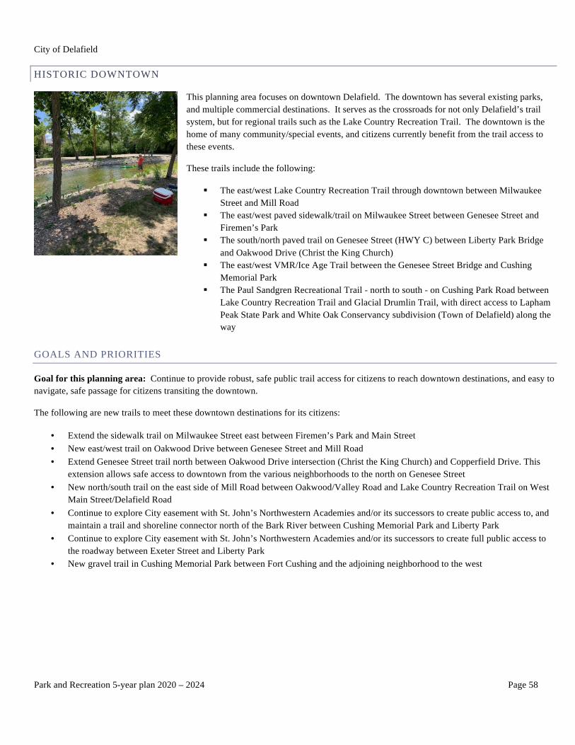
HISTORIC DOWNTOWN
This planning area focuses on downtown Delafield. The downtown has several existing parks, and multiple commercial destinations. It serves as the crossroads for not only Delafield’s trail system, but for regional trails such as the Lake Country Recreation Trail. The downtown is the home of many community/special events, and citizens currently benefit from the trail access to these events.
These trails include the following:
§ The east/west Lake Country Recreation Trail through downtown between Milwaukee Street and Mill Road
§ The east/west paved sidewalk/trail on Milwaukee Street between Genesee Street and Firemen’s Park
§ The south/north paved trail on Genesee Street (HWY C) between Liberty Park Bridge and Oakwood Drive (Christ the King Church)
§ The east/west VMR/Ice Age Trail between the Genesee Street Bridge and Cushing Memorial Park
§ The Paul Sandgren Recreational Trail - north to south - on Cushing Park Road between Lake Country Recreation Trail and Glacial Drumlin Trail, with direct access to Lapham Peak State Park and White Oak Conservancy subdivision (Town of Delafield) along the way
GOALS AND PRIORITIES
Goal for this planning area: Continue to provide robust, safe public trail access for citizens to reach downtown destinations, and easy to navigate, safe passage for citizens transiting the downtown.
The following are new trails to meet these downtown destinations for its citizens:
• Extend the sidewalk trail on Milwaukee Street east between Firemen’s Park and Main Street • New east/west trail on Oakwood Drive between Genesee Street and Mill Road • Extend Genesee Street trail north between Oakwood Drive intersection (Christ the King Church) and Copperfield Drive. This
extension allows safe access to downtown from the various neighborhoods to the north on Genesee Street • New north/south trail on the east side of Mill Road between Oakwood/Valley Road and Lake Country Recreation Trail on West
Main Street/Delafield Road • Continue to explore City easement with St. John’s Northwestern Academies and/or its successors to create public access to, and
maintain a trail and shoreline connector north of the Bark River between Cushing Memorial Park and Liberty Park • Continue to explore City easement with St. John’s Northwestern Academies and/or its successors to create full public access to
the roadway between Exeter Street and Liberty Park • New gravel trail in Cushing Memorial Park between Fort Cushing and the adjoining neighborhood to the west

City of Delafield
Park and Recreation 5-year plan 2020 – 2024 Page 59
City of Delafield
Park and Recreation 5-year plan 2020 – 2024 Page 60
NE QUADRANT OF THE CITY
This planning area focuses on the NE Quadrant of the City. A trail system is largely not developed in this area yet, so the goals and priorities should be used as a guide as this area of the City is developed.
The Lois Jensen Nature Preserve has a network of walking/hiking trails along Vettelson Road. The trail system is connected to Lake Country School on the east side, and the Village of Nashotah Dickten Park on the west side. The trails are used heavily by the school as a nature center to support academic activity. In the winter, the park is also used by ice fisherman for access to Lake Nagawicka. Two parking areas have been added in recent years to provide better access to the nature preserve. The nature preserve is represented in blue on the map, page 61.
To the east of Lois Jensen Nature Preserve on the south side of Vettelson Road is Nagawicka Road (north-south) where University Lake School is located (in brown on the map, page 61).
Nagawicka Road contains a paved hiking/biking path between the Water Leaf subdivision on the north and the southern section of Nagawicka Road/Oakwood Road (in blue and yellow on maps, page. 61). This path connects Oakwood Community Park to University Lake School and Lake Country School to further improve neighborhood connectivity.
The area further to the east of Nagawicka Road is primarily farmland. University Lake School is at the north end of the planning area, and Oakwood Community Park is at the south end (in blue on the map, page. 63). The Bark River bisects the farmland, and the County has designated a conservancy zone on either side of it. The City park planning map (see map on page 61) shows a 4-acre park to be developed within the area of the Bark River Conservancy near HWY 83. Trail planning for this area should take each of these destinations into consideration
With any new development, developers will be encouraged to incorporate multi-use public paths into their designs (See City 2030 Comprehensive Plan).
GOALS AND PRIORITIES
Goal for this planning area: Provide off road, multi-use trails connecting the destinations in this Quadrant that ultimately connect to other trails in Delafield.
• Since most of the area is farmland, and yet to be developed, make sure that the intent of the City is communicated to potential developers. The goal of trails in this area is to connect the following destinations:
o Oakwood Community Park o HWY 83 o Proposed City park near the Bark River and HWY 83 (by Wee Know School) o Bark River green space o Vettelson Road o University Lake School o Lake Country School o Lois Jensen Nature Preserve o Dickten Park in Nashotah
• Create a nature path along the Bark River, extending the nature path that already exists in the Ice Age Wetland of Hartland. This path should extend from Hartland to the Bark River entrance to Lake Nagawicka
o This plan for a future path is documented in Waukesha County’s trail planning • Coordinate with the Village of Nashotah to connect trails from Lois Jensen, through Dickten Park and downtown Nashotah to the
City of Delafield NW Quadrant (along Vettelson Road, connecting Nagawicka Road to HWY C) • New east/west hiking/biking trail connecting Vettelson Road between Nagawicka Road and Lakeland Drive
City of Delafield
Park and Recreation 5-year plan 2020 – 2024 Page 61
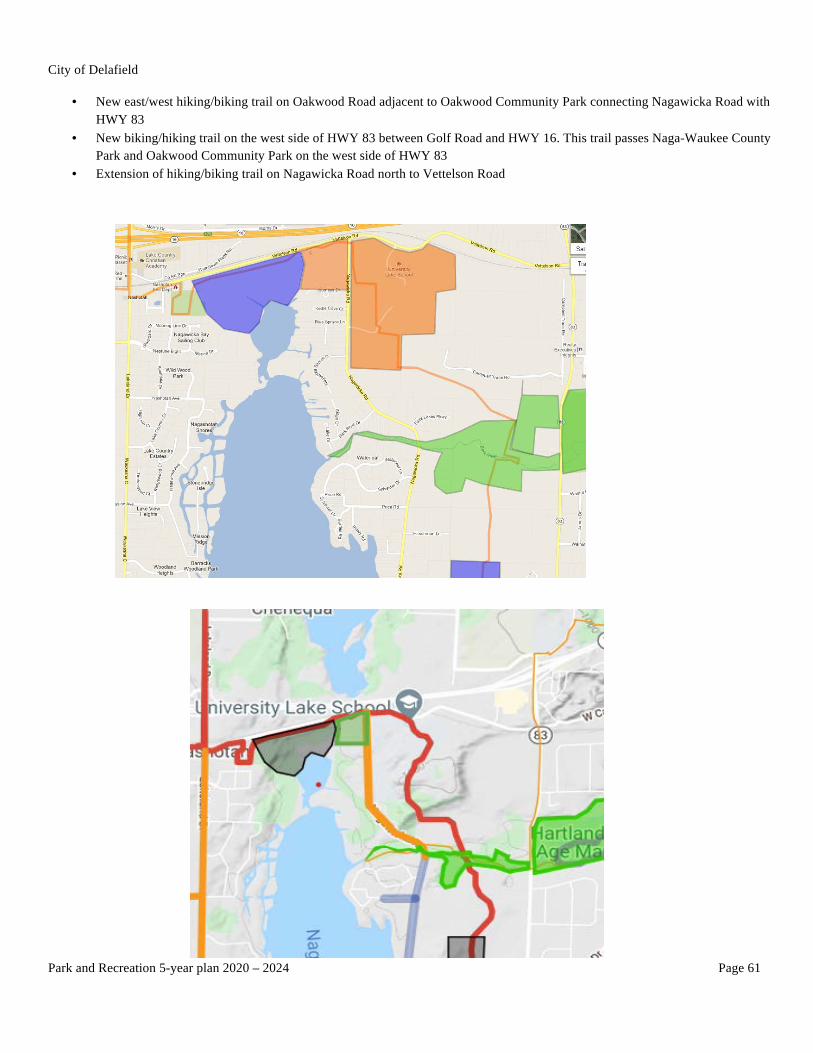
• New east/west hiking/biking trail on Oakwood Road adjacent to Oakwood Community Park connecting Nagawicka Road with HWY 83
• New biking/hiking trail on the west side of HWY 83 between Golf Road and HWY 16. This trail passes Naga-Waukee County Park and Oakwood Community Park on the west side of HWY 83
• Extension of hiking/biking trail on Nagawicka Road north to Vettelson Road

City of Delafield
Park and Recreation 5-year plan 2020 – 2024 Page 62
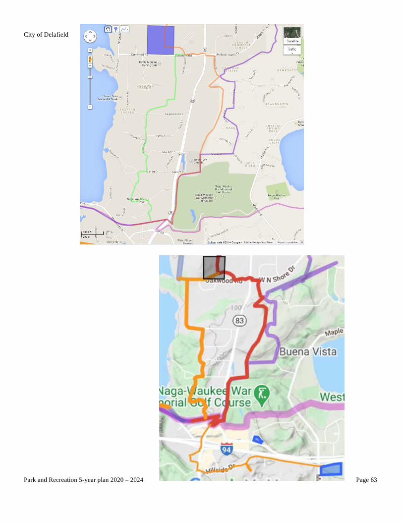
EAST SIDE OF THE CITY
The dominant destinations on the east side of Delafield are Naga-Waukee County Park, which provides hiking, biking, camping, swimming, boating, and fishing activities, and the commercial shopping areas on HWY 83 and Golf Road. Other destinations are Oakwood Community Park to the north and Lake Country Recreation Trail from downtown Delafield to the east. Also, along this Trail, is the Naga-Waukee Ice Arena, which provides various ice skating activities and instruction for the public. The connection from downtown to Naga-Waukee Ice Arena, Naga-Waukee County Park, and the commercial area is provided by the Lake Country Recreation Trail.
The Ice Age Trail also passes through this area and makes use of city and county trails.
The neighborhood to the north of Naga-Waukee County Park is well developed, with no open land that can be used for an off-road park. Bicycle signage to the next biking trail should be considered. The area does have a horse trail running through it, but there is not a desire by the neighbors or the Commission to mix bi-directional traffic made up of horses, walkers, and bikers. The Commission will continue to seek out alternatives to connect trails through this area, including bicycle signage.
There is, however, the possibility of creating a trail path along the eastern border of the City and Town of Delafield along an undeveloped tract of land (orange on the map, page 63). This trail could then be leveraged for the City trail, and as an off-road path for the Ice Age Trail.
The City also believes that a new east/west trail be established on Oakwood Road between Nagawicka Road and HWY 83 connecting the downtown, Lake Country Recreation Trail, Nagawicka Road Trail, and other neighborhoods surrounding Oakwood Community Park (green on the map, page 63).
The City further believes a path on the west side of HWY 83 will be valuable. That path should extend south/north between Golf Road and HWY 16, passing Naga-Waukee Park and Oakwood Community Park along the way. The path would be partially on and partially off road (green on map, page 63).
GOALS AND PRIORITIES
Goal for this planning area: Connect key destinations with off road trails.
• Continue support and use of the hiking, biking, camping, swimming, boating, and fishing activities in Naga-Waukee County Park
• Extend the biking and hiking path along the entire length of Nagawicka Road, incorporating the existing Water Leaf Path, to Vettelson Road
• New east/west trail on Oakwood Road between Nagawicka Road and HWY 83 adjacent to Oakwood Community Park • New north/south trail on HWY 83 between Golf Road and HWY 16. This trail passes Naga-Waukee Park and Oakwood
Community Park on the west side of HWY 83 • Explore the possibility of connecting Naga-Waukee County Park (and the Lake Country Recreation Trail) to Oakwood
Community Park by an off-road path on the Eastern border of the City of Delafield, and the Town of Delafield. o Utilize this same path for the Ice Age Trail o This trail would support any commercial or residential development that occurs in the parcel between HWY 83 and the
border of the City • With any new development, developers will be encouraged to incorporate multi-use public biking/hiking trails into their designs
(see City 2030 Comprehensive Plan) • Preserve at this time the neighborhood horse trails for their intended purpose
City of Delafield
Park and Recreation 5-year plan 2020 – 2024 Page 63

City of Delafield
Park and Recreation 5-year plan 2020 – 2024 Page 64
NW QUADRANT OF THE CITY
The NW Quadrant of the City is mostly undeveloped farmland, so plans for trails should be viewed as conceptual and for planning purposes. At the south end, this planning area starts with Cushing Memorial Park, and at the north end, this planning area ends with a route through an undeveloped area that will eventually be a residential neighborhood. It is envisioned that the trails will connect through the Village of Nashotah, the Village of Oconomowoc Lake, and the Village of Summit. This journey will be linked by the ATC right-of-way, the Knoff-Binkowski parcels, the Glen Parc subdivision, Nashotah Road, Vettelson Road, and Mission Road at the north end. They eventually connect all the way around Lake Nagawicka through the City to Oakwood Community Park and Lake Country Recreation Trail on the southeast end and between Mission Road and West Main Street on the southwest end.
This Quadrant represents the farthest north and west portions of the City. It is rural in character and space but essential to encircling the City by public trails. As a result, any new development in this Quadrant area requires consideration to be given to a paved public biking/hiking trail connecting and linking the City and its trail system as a whole with other trails and recreational destinations (see City 2030 Comprehensive Plan).
Important destinations in this planning area include, but are not limited to:
• Nashotah House • Bostrom Memorial Park • St. Joan of Arc Church and School • A proposed City Park near Nashotah Road and Mission Road • St. John’s Northwestern Academies (and/or its successors) • Christ the King Church • Cushing Memorial Park • Knoff-Binkowski parcels • Nashotah Park (Waukesha County/HWY C) • Valley Road subdivision • Copperfield Estates subdivision
GOALS AND PRIORITIES
Goal for this planning area: Connect important destinations and establish a clear intent for future developers of current farmland.
• Add a paved east/west public mixed-use biking, hiking, and running path along Oakwood Drive between HWY C and Mill Road • Provide road surface signage for an on-road bike path between Cushing Memorial Park and Bostrom Memorial Park through the
Valley Road subdivision • Install directional signs at entrances of each park directing cyclists to the path • Provide a biking/hiking path within the boundaries of Cushing Memorial Park • Continue to explore a primarily off-road path to connect Cushing Memorial Park and Bostrom Memorial Park through St. John’s
Northwestern Academies and/or its successors. As the St. John’s Northwestern Academies and/or its successors develops additional facilities and plans, make sure that the City’s desire and interest in public hiking/biking trails is made known and considered (see City 2030 Comprehensive Plan)
• Create new paved public hiking/biking trails on the north side and/or south side of Nashotah Road between Glen Parc subdivision and Mission Road
• Connect north/south trail on Mission Road between Nashotah Road and Oakwood/Valley Drive • Create new east/west paved public trail on Mission Drive between Mission Road and HWY C • Create new east/west paved public trail along the ATC right-of-way next to the railroad tracks between Lakeland Drive and Sawyer
Road
City of Delafield
Park and Recreation 5-year plan 2020 – 2024 Page 65
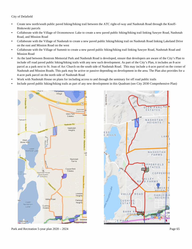
• Create new north/south public paved hiking/biking trail between the ATC right-of-way and Nashotah Road through the Knoff-Binkowski parcels
• Collaborate with the Village of Oconomowoc Lake to create a new paved public hiking/biking trail linking Sawyer Road, Nashotah Road, and Mission Road
• Collaborate with the Village of Nashotah to create a new paved public hiking/biking trail on Nashotah Road linking Lakeland Drive on the east and Mission Road on the west
• Collaborate with the Village of Summit to create a new paved public hiking/biking trail linking Sawyer Road, Nashotah Road and Mission Road
• As the land between Bostrom Memorial Park and Nashotah Road is developed, ensure that developers are aware of the City’s Plan to include off road paved public hiking/biking trails with any new such development. As part of the City’s Plan, it includes an 8-acre parcel as a park next to St. Joan of Arc Church on the south side of Nashotah Road. This may include a 4-acre parcel on the corner of Nashotah and Mission Roads. This park may be active or passive depending on development in the area. The Plan also provides for a 4-acre park parcel on the north side of Nashotah Road
• Work with Nashotah House on plans for including access to and through the seminary for off road public trails • Include paved public hiking/biking trails as part of any new development in this Quadrant (see City 2030 Comprehensive Plan)

City of Delafield
Park and Recreation 5-year plan 2020 – 2024 Page 66
WEST QUADRANT OF THE CITY
The West Quadrant of the City represents the gateway to hiking/biking/running trails linking the City of Delafield to its western Lake Country communities, including, but not limited to, the Village of Summit, the City of Oconomowoc, and the Village of Dousman. Its principal connector trail is the Lake Country Recreation Trail (Waukesha County) traveling east to west along West Main Street crossing Mill Road in the City and then reconnecting on Delafield Road in the Village of Summit at the Lower Nemahbin Lake launch (south). However, currently, there is a disconnect of approximately one half-mile roadway area on Delafield Road running between Mill Road in the City of Delafield and Lower Nemahbin Lake launch in the Village of Summit. This disconnect interrupts the continuation of the Lake Country Recreation Trail between the City of Delafield and the Village of Summit. It needs to be corrected and connected. As such, it would require a collaboration of the City, the Village of Summit, Washington County, and any utility party of interest to make this connection happen.
From the Lower Nemabhin Lake launch (south), the Lake Country Recreation Trail continues its trek into other popular biking/hiking/running destinations, such as Waterville Road and the Ice Age Trail in the Village of Summit, Sawyer Road and Pabst Farms in the City of Oconomowoc, downtown Oconomowoc, and the Glacial Drumlin Trail in the Village of Dousman.
The West Quadrant also represents an entryway to significant access to the Bark River, Upper and Lower Lake Nemahbin, and Upper and Lower Nashotah Lakes. These waterways further connect and are linked together for the benefit of the surrounding Lake Country areas, including, but not limited to, the City of Delafield, the Village of Summit, the City of Oconomowoc, and the Village of Dousman.
The other most western part of this City Quadrant involves the south to north direction of Mill Road, crossing the Mill Road Bridge, the Bark River, and Mill Pond to Oakwood/Valley Drive on the north.
GOALS AND PRIORITIES
Goals for this planning area:
• Collaborate with the Village of Summit, Waukesha County, and any potential utility party in interest to create and establish a new paved connector trail involving Lake Country Recreation Trail for hiking/biking/running on the south side of West Main Street/Delafield Road between Mill Road in the City of Delafield and the Lower Nemahbin Lake launch (south) in the Village of Summit
• Create a new paved public north/south trail on the east side of Mill Road between West Main Street (Lake Country Recreation Trail) on the south and Oakwood Drive on the north

City of Delafield
Park and Recreation 5-year plan 2020 – 2024 Page 67
SOUTH OF I-94
The Paul Sandgren Recreational Trail on Cushing Park Road connects the Lake Country Recreation Trail to the Glacial Drumlin Trail, with direct access to Lapham Peak State Park and White Oak Conservancy subdivision (Town of Delafield) along the way. While no data has been documented, anyone who drives Cushing Park Road on a regular basis can tell you that the Trail is used extensively for hiking, biking, walking, running, etc. It is used at all times of day, evening, and night.
GOALS AND PRIORITIES
Goal for this planning area: The City should continue to work with Lapham Peak State Park staff on strategic planning. The parking lot on the Recreation Trail is an access point to the park, which has become so popular that the 4-car city parking that is provided is often not adequate.
With the recent addition of the adjoining biking/hiking trail on Abitz Road and the new White Oak Conservancy subdivision in the Town of Delafield leading to the Glacial Drumlin Trail, the Paul Sandgren Recreational Trail has become even more popular. With the DNR, the City should explore additional parking opportunities in the interest of safety, access to the park, and also continuing to draw visitors to the area.
City of Delafield
Park and Recreation 5-year plan 2020 – 2024 Page 68
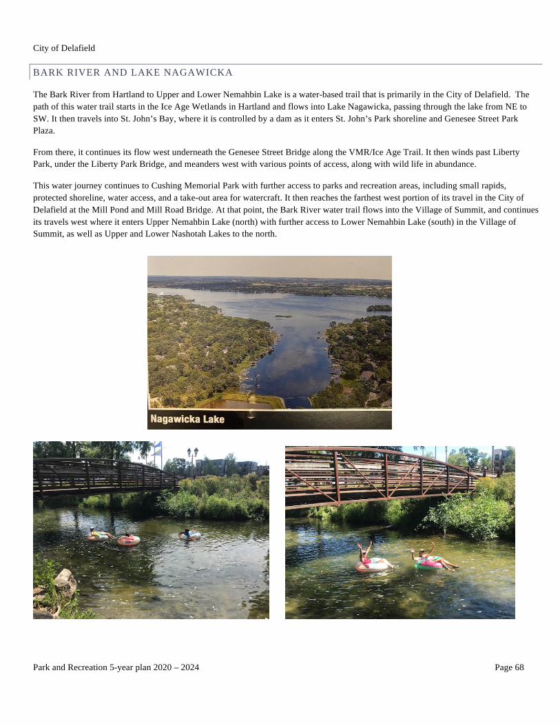
BARK RIVER AND LAKE NAGAWICKA
The Bark River from Hartland to Upper and Lower Nemahbin Lake is a water-based trail that is primarily in the City of Delafield. The path of this water trail starts in the Ice Age Wetlands in Hartland and flows into Lake Nagawicka, passing through the lake from NE to SW. It then travels into St. John’s Bay, where it is controlled by a dam as it enters St. John’s Park shoreline and Genesee Street Park Plaza.
From there, it continues its flow west underneath the Genesee Street Bridge along the VMR/Ice Age Trail. It then winds past Liberty Park, under the Liberty Park Bridge, and meanders west with various points of access, along with wild life in abundance.
This water journey continues to Cushing Memorial Park with further access to parks and recreation areas, including small rapids, protected shoreline, water access, and a take-out area for watercraft. It then reaches the farthest west portion of its travel in the City of Delafield at the Mill Pond and Mill Road Bridge. At that point, the Bark River water trail flows into the Village of Summit, and continues its travels west where it enters Upper Nemahbin Lake (north) with further access to Lower Nemahbin Lake (south) in the Village of Summit, as well as Upper and Lower Nashotah Lakes to the north.

City of Delafield
Park and Recreation 5-year plan 2020 – 2024 Page 69
Ice Age Wetlands to Lake Nagawicka
City of Delafield
Park and Recreation 5-year plan 2020 – 2024 Page 70
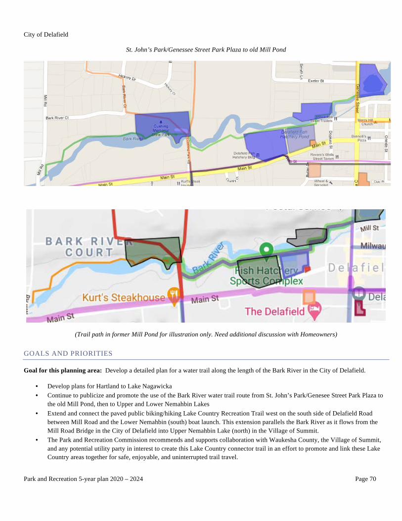
St. John’s Park/Genessee Street Park Plaza to old Mill Pond
(Trail path in former Mill Pond for illustration only. Need additional discussion with Homeowners)
GOALS AND PRIORITIES
Goal for this planning area: Develop a detailed plan for a water trail along the length of the Bark River in the City of Delafield.
• Develop plans for Hartland to Lake Nagawicka • Continue to publicize and promote the use of the Bark River water trail route from St. John’s Park/Genesee Street Park Plaza to
the old Mill Pond, then to Upper and Lower Nemahbin Lakes • Extend and connect the paved public biking/hiking Lake Country Recreation Trail west on the south side of Delafield Road
between Mill Road and the Lower Nemahbin (south) boat launch. This extension parallels the Bark River as it flows from the Mill Road Bridge in the City of Delafield into Upper Nemahbin Lake (north) in the Village of Summit.
• The Park and Recreation Commission recommends and supports collaboration with Waukesha County, the Village of Summit, and any potential utility party in interest to create this Lake Country connector trail in an effort to promote and link these Lake Country areas together for safe, enjoyable, and uninterrupted trail travel.
City of Delafield
Park and Recreation 5-year plan 2020 – 2024 Page 71
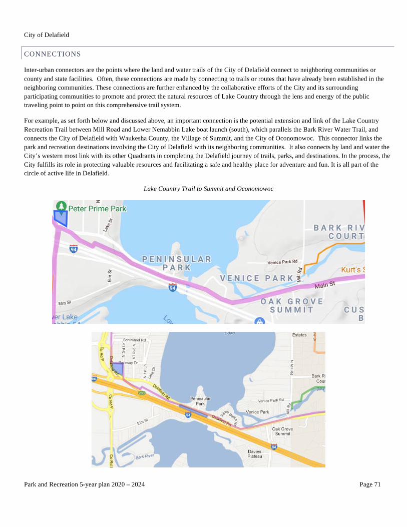
CONNECTIONS
Inter-urban connectors are the points where the land and water trails of the City of Delafield connect to neighboring communities or county and state facilities. Often, these connections are made by connecting to trails or routes that have already been established in the neighboring communities. These connections are further enhanced by the collaborative efforts of the City and its surrounding participating communities to promote and protect the natural resources of Lake Country through the lens and energy of the public traveling point to point on this comprehensive trail system.
For example, as set forth below and discussed above, an important connection is the potential extension and link of the Lake Country Recreation Trail between Mill Road and Lower Nemabbin Lake boat launch (south), which parallels the Bark River Water Trail, and connects the City of Delafield with Waukesha County, the Village of Summit, and the City of Oconomowoc. This connector links the park and recreation destinations involving the City of Delafield with its neighboring communities. It also connects by land and water the City’s western most link with its other Quadrants in completing the Delafield journey of trails, parks, and destinations. In the process, the City fulfills its role in protecting valuable resources and facilitating a safe and healthy place for adventure and fun. It is all part of the circle of active life in Delafield.
Lake Country Trail to Summit and Oconomowoc

City of Delafield
Park and Recreation 5-year plan 2020 – 2024 Page 72
Existing neighboring trails or routes:
Delafield has many existing trails and routes to build on.
• Lake Country Recreation Trail • Glacial Drumlin State Trail • Paul Sandgren Recreational Trail • Lapham Peak State Park • VMR/Ice Age Trail • Bark River Trail • Cushing Memorial Park Trail • Liberty Park Trails • Milwaukee Street Path • Firemen’s Park Path • HWY C North Trail to Oakwood Drive • Naga-Waukee County Park • Nagawicka Road Trail • Town of Delafield bike routes • Nashotah Park (Waukesha County) • Dickten-Masch Park • Lois Jensen Park Trail
Future neighboring trails or routes:
Delafield has many future trails and routes to consider, including, but not limited to, the following:
• Extension of Lake Country Recreation Trail between West Main Street in Delafield and Lower Nemahbin Lake launch (south) in the Village of Summit
• Continuation of HWY C Trail north to Copperfield Drive • Continuation of Nagawicka Road Trail to Vettelson Road • Trail on Oakwood Road between Nagawicka Road and HWY 83 • Trail on HWY 83 between Golf Road and HWY 16 • Vettelson Road Trail between Nagawicka Road and Lakeland Drive (HWY C) • East/west Trail on ATC right-of-way between Lakeland Drive and Sawyer Road • North/south Trail on Sawyer Road to Nashotah Road • Nashotah Road Trail between Sawyer Road and Mission Road • Nashotah Road Trail between Mission Road in Delafield and Glen Parc subdivision in the Village of Nashotah • Nashotah Road Trail between HWY C and Mission Road • North/south Trail connecting ATC right-of-way to Nashotah Road in the City of Delafield • North/south Trail connecting Lakeland Drive, Sawyer Road, and Nashotah Road involving Knoff-Binkowski parcels • Mission Road Trail between Nashotah Road and Oakwood/Valley Drive • Mission Drive Trail between Mission Road and HWY C • Oakwood Drive Trail between Mill Road and HWY C • Mill Road Trail between Oakwood Drive and West Main Street • Gravel Trail in Cushing Memorial Park to residential neighborhood • Easement on Bark River north trail and shoreline between Liberty Park and Cushing Memorial Park • Easement on roadway between Exeter Street and Liberty Park
City of Delafield
Park and Recreation 5-year plan 2020 – 2024 Page 73
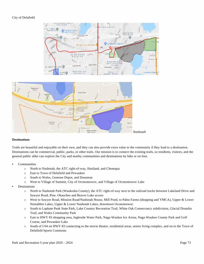
Nashotah
Destinations
Trails are beautiful and enjoyable on their own, and they can also provide extra value to the community if they lead to a destination. Destinations can be commercial, public, parks, or other trails. Our mission is to connect the existing trails, so residents, visitors, and the general public alike can explore the City and nearby communities and destinations by bike or on foot.
• Communities o North to Nashotah, the ATC right-of-way, Hartland, and Chenequa o East to Town of Delafield and Pewaukee o South to Wales, Genesee Depot, and Dousman o West to Village of Summit, City of Oconomowoc, and Village of Oconomowoc Lake
• Destinations o North to Nashotah Park (Waukesha County), the ATC right-of-way next to the railroad tracks between Lakeland Drive and
Sawyer Road, Pine, Okauchee and Beaver Lake access o West to Sawyer Road, Mission Road/Nashotah House, Mill Pond, to Pabst Farms (shopping and YMCA), Upper & Lower
Nemahbin Lakes, Upper & Lower Nashotah Lakes, downtown Oconomowoc o South to Lapham Peak State Park, Lake Country Recreation Trail, White Oak Conservancy subdivision, Glacial Drumlin
Trail, and Wales Community Park o East to HWY 83 shopping area, Ingleside Water Park, Naga-Waukee Ice Arena, Naga-Waukee County Park and Golf
Course, and Pewaukee Lake o South of I-94 on HWY 83 connecting to the movie theatre, residential areas, senior living complex, and on to the Town of
Delafield Sports Commons