bank and channel modifications river habitat...
TRANSCRIPT

Bank and Channel Modifications
River Habitat Survey

Preparatory Work
• Get an idea of the site
beforehand:
• Resources
– Maps
– Geographical Information
Systems
– Google Earth
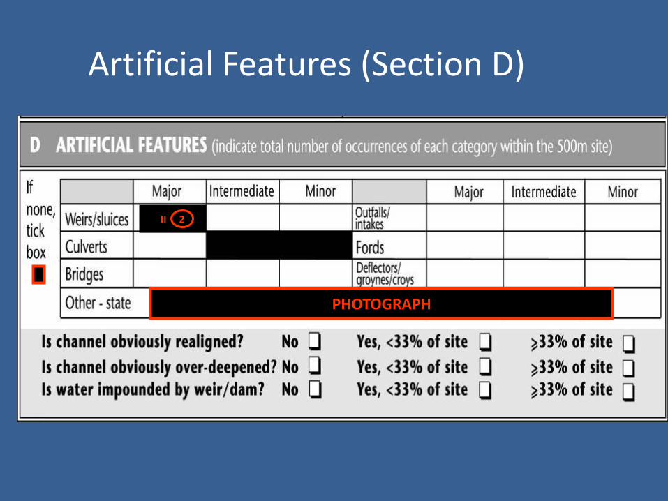
Artificial Features (Section D)
II 2
PHOTOGRAPH

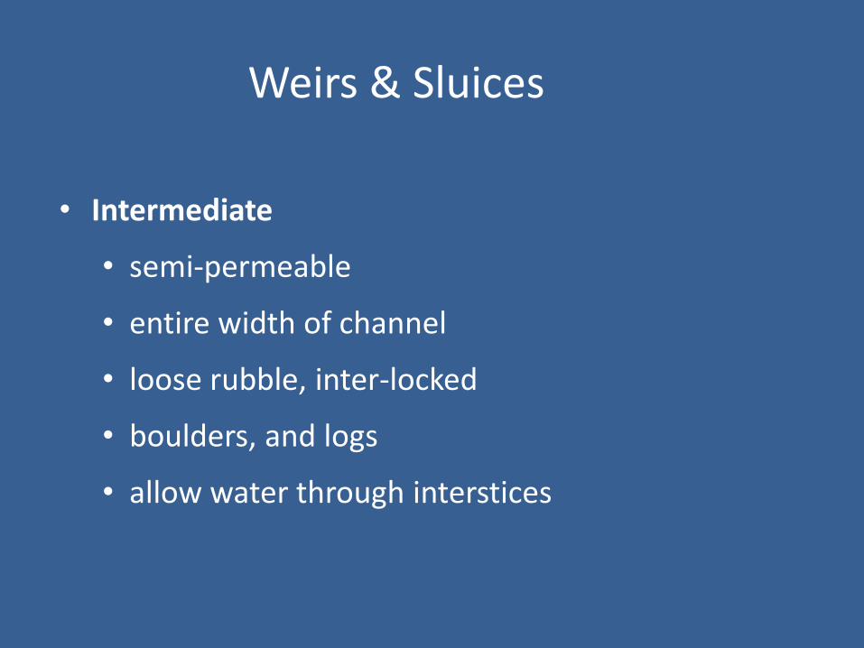
Weirs & Sluices
• Photograph all weirs or sluices
• Major: - permanent
- water-tight
- extend entire width of channel

Major Weir
Weirs & Sluices
• Intermediate
• semi-permeable
• entire width of channel
• loose rubble, inter-locked
• boulders, and logs
• allow water through interstices

Intermediate weir

Weirs & Sluices
• Minor
• Permeable
• temporary structures
• stones, cobbles, pebbles (kiddies weirs)

Culverts
• Arched, enclosed pipe structure
• Channel modification -CV
• Record land use
• Often Artificial Substrate
• NV or NK for other entries unless visible

Bridges
• Major• In-channel support (any width)
OR– wide bridges >25m bank length
• Intermediate • No in-channel support• Abutments 10 - 25m of bank length
• ~Banks often RS / RI around bridges

Major Bridge

Bridges
• Minor - No in-channel supports
- Bank abutments <10m bank length
- Any bridge, irrespective of width, with no abutments on bank e.g. viaducts

Outfalls/Intakes
• Discharge points
• Abstraction points
• Classify by size
• Include aprons, wing-walls & bank
protection in assessment of size
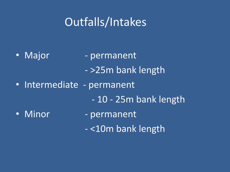
Outfalls/Intakes
• Major - permanent
- >25m bank length
• Intermediate - permanent
- 10 - 25m bank length
• Minor - permanent
- <10m bank length
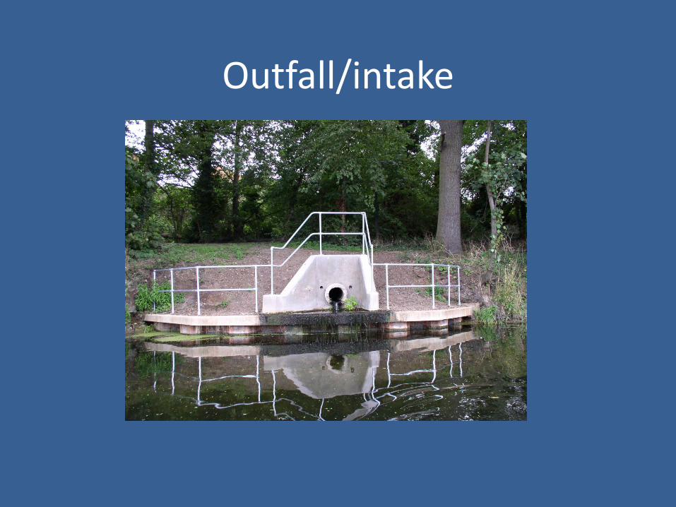
Outfall/intake
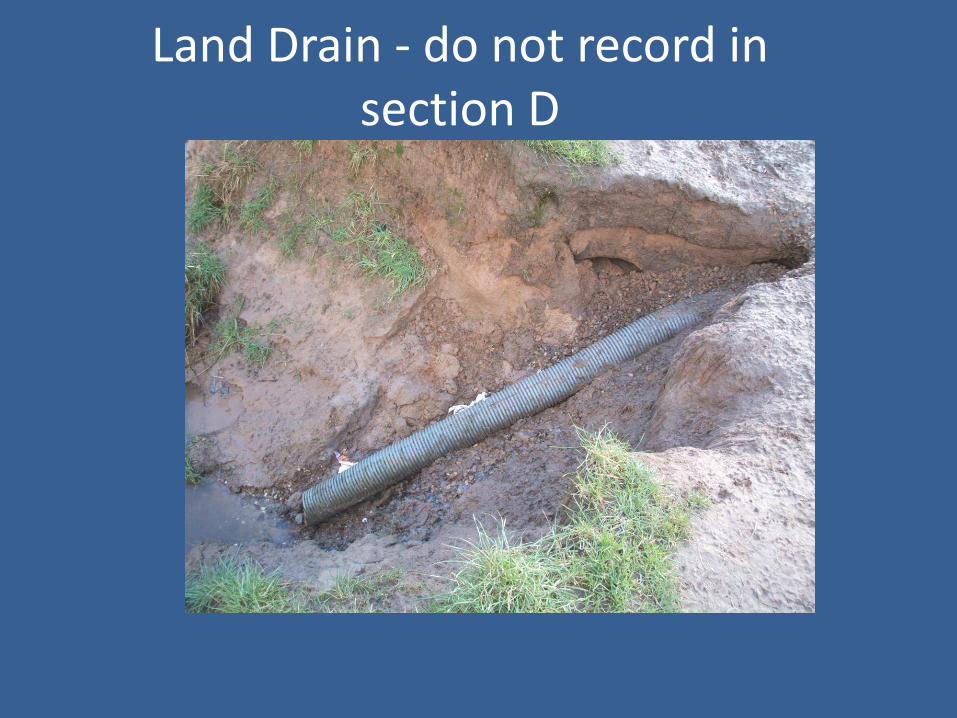
Land Drain - do not record in section D
Fords
• Permanent crossing for vehicles/machinery• Major - Bed is artificial
- Banks can be artificial or natural- Ponding upstream
• Intermediate - Banks artificial material- Channel substrate natural- Slight upstream ponding
• Minor - No artificial bed/bank

Deflectors/Groynes/Croys
• Artificial
• Part-way across channel
• Deflect currents from eroding banks
• Create in-stream habitat diversity, so often used in river enhancement schemes

Deflectors/Groynes/Croys
• Major - Extends >20% channel width
- Includes collapsed weirs
• Intermediate - Extends 10 - 20% channel width
• Minor - Extends <10% channel width

Bank Modification

Principal Bank Modifications recorded by RHS
• RESECTIONED (RS)
• REINFORCED (RI)
• POACHED
• ARTIFICIAL BERM
• EMBANKED

Indicators of Bank Resectioning
• Uniform bank profile
• No trees/uniform age trees
• Intensive land use (eg IG, TL, SU, PG)
• Channel resectioning (see channel modifications)
TIP: Look for RS and RI around bridges, weirs, sluices etc.

Resectioned
Old bank resectioning
• Some reaches may have been resectionedlong ago but are now naturalising
• Record RS on RHS form only where uniform banks remain
• Do not record RS where river processes have reintroduced a more natural bank form

Resectioned & Reinforced banks?
RI WHOLE BANK ONLY

Reinforced
• Whole or part of bank artificially strengthened
• Concrete CC
• Sheet Piling SP
• Wood Piling WP
• Gabions GA
• Brick or Laid Stone BR
• Rip-rap RR
• Tipped Debris TD (IF FOR BANK PROTECTION)

WOOD PILING RI
RIP RAP RI
SHEET PILINGRI WHOLE BANK
BRICK/LAID STONE RI
RS BANKS & CHANNEL,RIP RAP RI, EMBANKMENT
WEIRS

Poached
• Banks trampled/puddled by livestock
• Inc. HEAVILY trampled by humans
• Predominantly bare due to poaching = PC(B)

Artificial Berm
• Bank excavated laterally below bank top, OR Artificial ledges created to reduce low-flow channel width in over-widened channels
Embankments
• Artificial raising of banks
• Little ‘hills’ running along banktop
• If it is resectioned, record RS too
• DO NOT INCLUDE SET-BACKEMBANKMENTS IN SPOT-CHECK

Channel Modifications

Channel Modifications
• Confined to alterations to the bed
• Culvert CV
• Resectioned RS
• Reinforced RI
• Dam/weir/sluice DA
• Fords FO

Indicators of channel resectioning
• Channel
• Overdeepened
• Straightened
• Over-widened
• Uniform/low energy flow types
• Intensive surrounding land-use
• Uniform aged/no bankside trees
• Bank resectioning
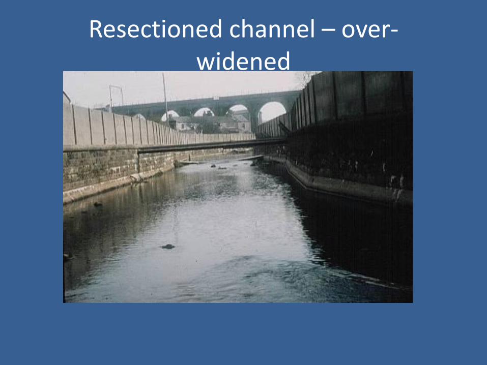
Resectioned channel – over-widened

Resectioned channel - realigned

Old channel resectioning
• Resectioned channels may persist longer than resectioned banks
• Where river processes have re-instated more natural channel dimensions or meanders, do not record RS channel

Reinforced channel & banksResectioned channel

Recording Modifications: Spot-check
RS/RI/PC
NKRS/RI* RI EM/RS
* You can only record RS/RI if only part of the bank is reinforced.

RS RS RS RS RS RS RS RSEMRI
E

REMEMBER…….
• Map work before going into the field
• Evidence in field
• Photograph all major and intermediateartificial structures
• Be consistent
• Logical checks
• NK - “Not Known”• investigate before submitting forms.