bangladesh water asian development development board bank
TRANSCRIPT

Bangladesh Water Development Board
Asian Development Bank
Consultant’s Report
Irrigation Management Improvement of
Ganges-Kobadak Irrigation Project
FEASIBILITY STUDY REPORT SR-3 Land Use and Agriculture
September 2017
Prepared by Project Management and Design Consultant
Mott MacDonald Ltd (UK) in association with: Euroconsult Mott MacDonald (Netherlands)
Northwest Hydraulic Consultants (Canada)
SODEV Consultant Ltd (Bangladesh)
Mott MacDonald, Demeter House, Station Road, Cambridge CB1 2RS, United Kingdom
T +44 (0)1223 463500 F +44 (0)1223 461007 W www.mottmac.com

Irrigation Management Improvement Project
(ADB Loan No. 3135-BAN)
Project Management and Design Consultant’s Report
Improvement of Irrigation Management of Ganges-Kobadak Irrigation Project
FEASIBILITY STUDY REPORT
SR-3 Land Use and Agriculture
Issue and revision record
Revision Date Originator Checker Approver Description
A 19th May
2016 Frank van Berkom
Nick Lockett / Alan K Clark
Nick Lockett 1st draft report
B 2nd October
2017 Alan K Clark Alan K Clark Lolu A Akindiji
• Executive summary included
• Inclusion of information on agricultural mechanisation
• Firming up and clearer definition of agriculture support program, components, activities, and costs
• Map of Rabi area supplied with canal water included in report
• Mistakes corrected
• New cover and formatting
Information class: Standard
This document issued for the party which commissioned it
and for specific purpose connected with the above-
captioned project only. It should not be relied upon by any
party or used for any other purpose.
We accept no responsibility for the consequence of this document being relied upon by any other party, or being used for any other purpose, or containing any error or omission which is due to an error or omission in data supplied to us by other parties. This document contains confidential information and
proprietary intellectual property. It should not be shown to other
parties without consent from us and from the party which
commissioned it.

Irrigation Management Improvement Project
(ADB Loan No. 3135-BAN)
Project Management and Design Consultant’s Report
Improvement of Irrigation Management of Ganges-Kobadak Irrigation Project
FEASIBILITY STUDY REPORT
SR-3 Land Use and Agriculture
Key Data
Name of Project: Irrigation Management Improvement Project (IMIP)
Implementing Parties: Government of Bangladesh (GoB)
Bangladesh Water Development Board (BWDB)
Contractor: Mott MacDonald Ltd UK in association with:
Euroconsult Mott MacDonald, Netherlands
Northwest Hydraulic Consultants, Canada
SODEV Consultant Int. Ltd, Bangladesh
Contracting Authority: PD, IMIP, BWDB, Dhaka
Start/ End Date: 1st March 2015 to 28th February 2020
Beneficiaries: Farmers of GKIP
Scheme/Location Ganges-Kobadak Irrigation Project (GKIP) in Kushtia, Jhenaidah, Magura and
Chuadanga Districts
Distribution List of this Report
Recipient Copies Format
PD, IMIP, BWDB, Dhaka 3
1
Printed Copy
Electronic
ADB in Bangladesh 1
1
Printed Copy
Electronic

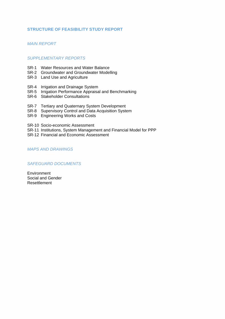
STRUCTURE OF FEASIBILITY STUDY REPORT
MAIN REPORT SUPPLEMENTARY REPORTS SR-1 Water Resources and Water Balance SR-2 Groundwater and Groundwater Modelling SR-3 Land Use and Agriculture SR-4 Irrigation and Drainage System SR-5 Irrigation Performance Appraisal and Benchmarking SR-6 Stakeholder Consultations SR-7 Tertiary and Quaternary System Development SR-8 Supervisory Control and Data Acquisition System SR-9 Engineering Works and Costs SR-10 Socio-economic Assessment SR-11 Institutions, System Management and Financial Model for PPP SR-12 Financial and Economic Assessment MAPS AND DRAWINGS SAFEGUARD DOCUMENTS Environment Social and Gender Resettlement


GKIP SR - 3 Land Use Agriculture (5).docx i 30-Nov-17
SR 3: LAND USE AND AGRICULTURE
I. EXECUTIVE SUMMARY 1
II. PROJECT DESCRIPTION 5
A. Project Objectives IMIP 5 B. Description Ganges Kobadak Irrigation Scheme 5 C. Climate 8 D. Agro-Ecological Conditions and Soil Physiography 9
III. AGRICULTURE AND LAND USE 11
A. Land Ownership 11 B. Land Use Index 12 C. Land Use 12 D. Land Type 15 E. Land Suitability 16
V. AGRICULTURAL PRODUCTION, EXTENSION AND INPUT SERVICES AND MECHANISATION 21
A. Introduction 21 B. Crop Seasons 22 C. Farming Systems and Land Ownership 23 D. Cropping and Cropping Patterns in GKIP Area 24 E. Crops grown and prospects 28
1. Yields 28 2. Food crops 28 3. Non-food Crops 33
F. Water Management 34 1. Sources of Irrigation Water 34 2. Flood Protection 37 3. Drainage 37
G. Crop Budget 37 H. Extension Services 40
1. Introduction 40 2. BWDB Extension Division 40 3. Department of Agricultural Extension 41 4. Agriculture Research Institutes 41 5. NGOs 42 6. Private Companies 42 7. Credit Availability and Costs 42
I. Mechanization 43
VI. CONSTRAINTS TO AGRICULTURAL PRODUCTION 45
A. Introduction 45 B. Water Management Constraints 45
1. Irrigation Supply 45 2. Groundwater 46 3. On-farm Irrigation Practices 46
C. Land and Soil Fertility 47 D. Seed Quality and Supply 48 E. Pests and Diseases 49 F. Marketing Facilities and Organisation 50
1. Organisation 50 2. Marketing System by Crop 50
G. Quality and Certification 51
VII. AGRICULTURAL SUPPORT PLAN 53
A. Introduction 53 B. Training and Advisory Services for Farmers 53
1. Modality of Support 53 2. Capacity Development and Training 54

GKIP SR - 3 Land Use Agriculture (5).Docx ii 30-Nov-17
3. On-site/ WMO Office Training 56 4. Cost Estimate for Training, Extension and Advisory Services 57
C. Support for WMO Institutions 58 1. WMO Offices 58 2. WMO Capacity Development 59 3. WMO Offices and Capacity Development Costs 60
D. Seed and Planting Material 60 E. Land Improvements, Demonstrations, Precision Farming and IT 61
1. Land Improvements and Irrigation Application 61 2. On-Farm Drainage 63 3. Cultivation Practices 63 4. Mechanisation 64 5. Information Technology and Precision Farming 64 6. Costs to Support Land Improvements, Demonstrations, IT and Precision Farming 66
F. Innovation Funds and Micro-Credit 67 G. Agriculture Support Plan Costs 68
VIII. REFERENCES 69
ANNEXES ANNEX A: SAMPLE AREAS ANNEX B: FERTILISER COMPANIES ANNEX C: SEED COMPANIES ANNEX D: PESTICIDE COMPANIES

GKIP SR - 3 Land Use Agriculture (5).docx iii 30-Nov-17
LIST OF FIGURES Figure II-1: Monthly and Annual Rainfall ................................................................................................. 8 Figure II-2: Temperatures in Jessore ...................................................................................................... 8 Figure II-3: Temperatures in Faridpur ..................................................................................................... 8 Figure III-1: Typical Cropping Pattern by Land Category ..................................................................... 15 Figure V-1: Growth of Pumps and Tractors in Bangladesh .................................................................. 44 Figure VI-1: On-farm irrigation practices ............................................................................................... 47 Figure VII-1: Imagery of T8-S11K showing Basins, & photos of Hydrant & Furrow ............................. 62
LIST OF TABLES Table III-1: Land Ownership .................................................................................................................. 11 Table III-2: Number of Households*) by Land Ownership and Land Tenure ......................................... 11 Table III-3: Land use within the GKIP area .......................................................................................... 12 Table III-4: Cropping by Upazila ........................................................................................................... 13 Table III-5: Land Type and Flood Depth ............................................................................................... 15 Table III-6: Land Types, Soils and Clay Content .................................................................................. 16 Table III-7: Crop Suitability Maps .......................................................................................................... 18 Table V-1: Structural Change during the Sixth Plan (% of GDP) .......................................................... 21 Table V-2: Crop seasons ...................................................................................................................... 22 Table V-3: Landownership and farm size ............................................................................................. 23 Table V-4: Crops grown in 2012-2013, grouped by cropping pattern ................................................... 24 Table V-5: Current cropping pattern in GKIP Area .............................................................................. 26 Table V-6: Current cropping pattern in GKIP Area, visualised ............................................................. 27 Table V-7: Yields and Yield Potential .................................................................................................... 28 Table V-8: Cereal production, present and potential ............................................................................ 30 Table V-9: Cereal production, present and potential, 35% Boro option ............................................... 30 Table V-10: Rice production, present and potential, 35% Boro option, limited potential yield ............. 31 Table V-11: Other food crops production, present and potential .......................................................... 33 Table V-12: Other food crops production, present and potential: low rice scenario ............................. 33 Table V-13: Non-food crops production, present and future ................................................................. 33 Table V-14: Groundwater Irrigation by STW ......................................................................................... 35 Table V-15: Groundwater Irrigation by DTW ......................................................................................... 35 Table V-16: Surface Water Irrigation – BWDB ...................................................................................... 36 Table V-17: Crop Budgets – raw data ................................................................................................... 38 Table V-18: Technical Staff Position of BWDB Extension Division ...................................................... 40 Table VI-1: Cost of Ground Water Irrigation (commercial rates) .......................................................... 46 Table VI-2: Approximate nutrient removal ............................................................................................ 48 Table VI-3: Seed production BADC ...................................................................................................... 49 Table VII-1: Training, Extension and Advisory Services for Farmers ................................................... 57 Table VII-2: WMO Offices ..................................................................................................................... 59 Table VII-3: WMO Offices and Capacity Development ......................................................................... 60 Table VII-4: Seed and Planting Material Improvement Programme Costs ........................................... 61 Table VII-5: Comparative Assessment of Drones ................................................................................. 65 Table VII-6: Drone Cost 66 Table VII-7: Precision Farming and Efficient On-Farm Water Management ........................................ 66 Table VII-8: Agriculture Support Plan Costs ......................................................................................... 68

GKIP SR - 3 Land Use Agriculture (5).Docx iv 30-Nov-17
LIST OF MAPS Map II-1: Location of command area ...................................................................................................... 6 Map II-2: BWDB O&M Divisions and general layout of irrigation system ............................................... 7 Map II-3: Agro Ecological Zones of Bangladesh ................................................................................... 10 Map III-1: Cropping Pattern in and Around Command Area ................................................................. 14 Map III-2: Soil Association Map ............................................................................................................ 17 Map III-3: Aus 18 Map III-4: Jute Capsilarum (Kharif I) ..................................................................................................... 18 Map III-5: Aman 18 Map III-6: Onion / Garlic (Kharif II) ........................................................................................................ 18 Map III-7: Boro 18 Map III-8: Wheat (Rabi) 18 Map III-9: Potatoes (Rabi) ..................................................................................................................... 19 Map III-10: Jute Olitorius (Kharif-I) ........................................................................................................ 19 Map III-11: Chili (Rabi) 19 Map III-12: Chili (Kharif) 19 Map III-13: Mustard (Rabi) .................................................................................................................... 19 Map III-14: Sugarcane (year round) ...................................................................................................... 19 Map V-1: Supply of Surface Canal Water, Rabi 2013-2014 ................................................................. 39

GKIP SR - 3 Land Use Agriculture (5).docx v 30-Nov-17
ABBREVIATIONS
ADB Asian Development Bank
ATC Agricultural Technical Committee
ATCC Agricultural Technical Coordination Committees
BARC Bangladesh Agricultural Research Council
BARI Bangladesh Agriculture Research Institute
BBS Bangladesh Bureau of Statistics
BCIC Bangladesh Chemical Industries Corporation
BDT Bangladesh Taka
BINA Bangladesh Institute of Nuclear Agriculture
BJRI Bangladesh Jute Research Institute
BSRI Bangladesh Sugarcane Research Institute
BWDB Bangladesh Water Development Board
BRRI Bangladesh Rice Research Institute
CA Command Area
CWR Crop Water Requirements
DEPC District Extension Planning Committee
DTW Deep Tube Well
GKIP Ganges Kobadak Irrigation Project
GOB Government of Bangladesh
HVC High Value Crop
HYV High Yield Variety
IMIP Irrigation Management Improvement Project
ISC Irrigation Service Charge
LEISA Low Externa Input Sustainable Agriculture
LLP Low Lift Pump
MFLW More Food Less Water: Technical Study commissioned by ADB
MIP Muhuri Irrigation Project
MWh Megawatt hour
O&M Operation and Maintenance
OFWM On-farm Water Management
NARS National Agricultural Research System
PPP Public-Private Partnership
SAAO Sub-Assistant Agricultural Officer
SRDI Soil Resources Development Institute
STW Shallow Tube Well
UAO Upazila Agricultural Officer
UAECC Upazila Agricultural Extension Coordination Committee
TCA Total (Gross) Cultivated Area
WMA Water Management Association
WMG Water Management Group
WMO Water Management Organisation


GKIP SR - 3 LAND USE AGRICULTURE (5).DOCX - 1 - 30-Nov-17
I. EXECUTIVE SUMMARY
1. The Irrigation Management Improvement Project (IMIP) will support the Government of Bangladesh in her efforts to sustain high (4.5%) agricultural growth by: (i) supporting farmers achieve crop productivity gains, (ii) rehabilitating and modernizing irrigation engineering infrastructure; and (iii) establishing an effective management team. This Supplementary Report described land use and agriculture in the Ganges Kobodak Irrigation Project, and gives a costed Agricultural Support Plan1.
2. Agriculture will be made more productive through: (i) crop diversification, (ii) more intensive land use and cropping intensity, (iii) more efficient use of inputs, as well as more efficient/ effective irrigation, (iv) more efficient use of agro-chemicals, fertilisers, pesticides and fungicides, also (v) more green methods like integrated pest management (IPM), pheromone traps, and green manure, (vi) reduced post-harvest losses, (vii) increased value (value added) to the farmers, and (viii) price stability.
Agriculture and Land Use 3. The GKIP extends over 197,500 ha, of which 142,560 ha is cultivable area, the rest being urban and homestead area. A brief description of the GKIP is given in Chapter II.
4. Farming is dominated by smallholders who farm mostly small (< 1.0 ha) holdings. About 40% of farmers are functionally landless (<0.2 ha).
5. About 69 - 85% of the GKIP area comprises medium-high and high-land where triple cropping or higher is possible, with double cropping possible for most of the remainder. Overall, a cropping intensity of about 280% is achievable, up from about 247% (or 254% cultivation intensity) at present. Major crops by season are as follows: (i) Kharif I (April - July): Jute and Aus rice, (ii) Kharif II (July - November): Aman rice, (iii) Rabi (December – March/April): Boro, Wheat, Maize, Tobacco, Vegetables, Lentils & Oilseeds, Spices, and (iv) Perennial crops: Sugarcane, Various fruit trees including banana.
6. Soils comprise mostly silt loam – silty clay loam, with the higher land having a higher loam content and a lower clay content compared to the lower land. They are suited to a large range of crops, but require good water management, with irrigation in the dry months and drainage in the wetter months, as well as fertilisation to achieve good yields. Land ownership, land use, land types and land suitability for a range of crops are presented in Chapter III.
Agriculture Production, Extension and Input Services and Mechanisation 7. Due to heavy rainfall, water logging and high temperatures, crop choice is limited, in Kharif particularly in the Kharif-II, when by far the major crop is T-Aman, though improved drainage might allow other crops to be grown. A wider range of crops can be grown in Rabi.
8. Small farm households cultivate 58% of the net cropped area, the medium farm households 36%, and the large farm 6%. Most farmers are owner-operators. Large landowners rent out land to tenants/ share croppers for cultivation. Usually the land owner and the share cropper share production equally, after deducting about 1/3 for inputs, giving a “three way split”. Leasing out land in kind (chukti) or in cash (pattani) is also practised in the area. The cash rate depends on the crop. For banana plantation the 2015 rate was reported to be about Tk 37,500/ha (Tk 15,000 per acre). For tobacco (for contract farmers) Tk 60,000/ha (Tk 24,000 per acre) was reported (PMDC field surveys).
1 This report is based on information from: (i) primary sources such as field visits, four sample study areas and
findings from 30 FGDs/ PRAs, and (ii) secondary sources such as Bangladesh Bureau of Statistics (BBS), Bangladesh Water Development Board (BWDB), Department of Agricultural Extension (DAE), Bangladesh Agricultural Development Corporation (BADC) and related organizations. Data and findings of the More Food Less Water study report (2014, ADB) have been used in this report.

GKIP SR - 3 LAND USE AGRICULTURE (5).DOCX - 2 - 30-Nov-17
9. The GKIP is a mature agricultural area, and yields are generally higher compared to the rest of Bangladesh, but remain quite low by international standards. The yield gap compared to those in research institutes (in Bangladesh) is about 30-60%.
10. The GKIP was originally designed for supplementary irrigation of Kharif-I (Aus) and Kharif-II (Aman) crops and did not provide water in the Rabi dry season. To meet the needs of Rabi crops, about 64,000 STWs, and later 63 DTWs, were sunk and groundwater pumped. Since 2012, surface canal water has been supplied to partially meet Rabi water requirements.
11. Monthly water balance, expressed as mm over the GKIP area of 197,500 ha, found that:
i. During the “dry” season (November to April) rainfall is about 70-200 mm, much less than crop evapotranspiration, about 500 mm. Pumped surface water was about 80 mm prior to 2012, and about 200 mm after 2012. Pumping of groundwater has declined from about 300 mm in 2008/09 to about 210 mm in 2012/13, presumably as a result of increased surface water supply.
ii. During the “wet” season (May to October), rainfall varied from about 800 mm (2010) to
about 1700 mm (2011), and is usually far more than evapotranspiration which is about 650 mm. In addition, pumped surface water supplies about 300-350 mm. A proportion, about 250 mm, of the surplus supply recharges the water table. The balance which varies from about 200 mm to 1200 mm depending on the year, results in season flooding or leaves the project area as surface (drainage) runoff.
12. The water balance indicates that, post 2012, groundwater and surface water contributed about 210 mm and 200 mm over the GKIP area respectively. However, canal water is supplied to parts of the canal command area, while groundwater is pumped all over the area, and particularly in the 47,000 ha not commanded by the canal system.
13. In Rabi 2013/14, about 24,970 ha was irrigated with canal water. The volume pumped totalled 438 Mm3, equivalent to 1750 mm over this area, and indicating a water use efficiency of just 23%. In Kharif-I 2014, about 46,471 ha, half the command area of 95,600 ha, was irrigated with canal water. Currently, it is clear that farmers remain heavily dependent on pumped groundwater, though with the project this dependency will be reduced.
14. Government agencies providing extension services include the BWDB Extension Division and the Department of Agriculture Extension, DAE, under the Ministry of Water Resources and Ministry of Agriculture, respectively. The former is primarily concerned with institutional aspects of water management, i.e. the founding of the WMOs and irrigation fee collection, while the latter are concerned with agricultural extension, on-farm irrigation, advice and training. The arrangements are laid out in a MOU between BWDB and DAE (1994).
15. There are acute shortages of technical manpower, transports and logistic support in the BWDB Extension Office. For example, 77 Extension Officers, were supposed to be necessary but only 26 are at present appointed. Meanwhile, the DAE has withdrawn largely from the GKIP area, and covers only 10% of it, due to its own staffing shortages. Perhaps not surprisingly, farmers interviewed indicated that they had never received any extension support from the DAE, and very little from the BWDB Extension Office.
16. The Agriculture Research Institutes, ARIs, in Bangladesh include the following: Bangladesh Agriculture Research Institute, Bangladesh Rice Research Institute, Bangladesh Jute Research Institute, Bangladesh Sugarcane Research Institute, Soil Resources Development Institute, and the Bangladesh Institute of Nuclear Agriculture. The ARIs have regional stations and substations to undertake studies focusing on farmers problems and to develop appropriate farming systems. They also provide (on-farm) training to farmers.
17. There are large numbers of NGOs involved in agricultural development and extension, as well as in micro-credit lending. Banks are also increasingly involved, providing micro-finance and credit through networks of Agents.
18. Private companies are involved in selling agricultural inputs. Initially their business operation was limited to agro-chemicals, such as pesticides and fertilizers. Subsequently, private companies expanded their scope to sale of seeds, particularly for high value crops such as

GKIP SR - 3 LAND USE AGRICULTURE (5).DOCX - 3 - 30-Nov-17
vegetables, and farm machinery. The pesticide, fertilizer and seed companies carryout extension work and motivational campaigns, demonstrating results that may be obtained by use of their inputs.
19. Farmers make use of credit to purchase inputs, fertilisers, chemicals for pest and disease control, and for quality seeds. Credit is obtained from family members, landlords, traders, NGO’s and banks, and product market combinations (BAT). Smaller and landless farmers have difficulty obtaining formal loans.
20. Most farmers either own or have access to pumps and two-wheel tractors, and many have access to threshers. Use and access to other different machines such as reapers, seeders and four-wheel tractors is much lower.
21. Cropping, land tenure, extension and input services and mechanisation are presented in Chapter V.
Constraints to Agriculture Production 22. Constraints to agricultural crop production in the GKIP area include poor water management, insufficient or untimely irrigation, and high cost of pumping groundwater, and flooding/ deeper and prolonged water logging due to heavier than expected rainfall and/ or poor drainage. Other constraints are related to: (i) land and soils (permeability and fertility), (ii) seed supply (insufficient HYV/ hybrid seed, re-use of own seed) and poor seed quality (adulterated seeds), (iii) farm operations (sub-optimal OFWM, poor crop choice / crop diversification, poor input application), (iv) lack of mechanisation, (v) cropping patterns (choice base on last year’s price), (vi) marketing, (vii) credit, and (viii) lack of knowledge/ farm practices (insufficient support from the extension services). Details are given in Chapter VI.
Agriculture Support Plan 23. Modernisation of the irrigation system engineering works and management arrangements, will provide canal water more or less on demand to farmers, and needs to be supported by an effective Agriculture Support Plan to increase productivity. The ASP is detailed in Chapter VII, and recognises that:
i. Farmers and rural entrepreneurs are innovators, and with the rapid penetration of mobile phones, are just beginning to access information on technologies, markets and prices, more than ever before. However, they remain risk adverse while tenure/ land leasing arrangements limit on-farm and crop investment.
ii. Information is key, and for farmers to take full advantage of irrigation and drainage modernisation, improved access to knowledge and information on modern technologies and guidance on how to commercialize their output is required.
iii. The “market”, including supermarkets and commercial crop processors, will increasingly
establish food quality and safety standards, and are a key driver. Demand and prices will affect cropping patterns and production decisions.
24. The activities and interventions of the Agriculture Support Plan are grouped into five components:
i. Training, Extension and Advisory Services for Farmers, including for marketing and quality.
ii. Support for WMO institutions, including construction of office buildings/ stores, enabling them to coordinate activities, and provide points of contact between farmers and the “market”.
iii. Seed and Planting Material.
iv. Land improvements and Precision Farming including Mechanisation and efficient On-farm
Water Management.

GKIP SR - 3 LAND USE AGRICULTURE (5).DOCX - 4 - 30-Nov-17
v. Innovation funds.
25. Together these components will boost crop yields and quality, reduce crop losses, support crop diversification and a modest increase in cropping intensity, improve water (and energy) use efficiencies as well as more effective and environmentally sustainable use of chemicals, and reduce transaction costs.
26. The total cost of the Agriculture Support Plan is Tk 726.7 million, US$ 9.1 million. The bulk of this cost will be incurred over the first 1-3 years of the seven year Project.
Agriculture Support Plan Costs
Staff Units Quantity Rate
Tk/ unit
Cost, Tk
million Cost, US$
1 Training, Extension and Advisory Services for Farmers, including marketing and quality
1.1 Remuneration & Transport Costs for
Extension Agents 16.80 210,000
1.2 Support for Soil Testing and Health Card No 1,000 3,000 3.00 37,500
1.3 Support for Farmer – Trader Meetings No 7 x 20 20,000 2.80 35,000
1.4 Residential Training Courses 176.30 2,203,750
1.5 Training of Farmers at WMO offices No 7 x 4 x 200 1,000 5.60 70,000
Subtotals 204.50 2,556,250
2 Support for WMO institutions, including construction of office buildings/ stores
2.1
Construction of WMO Offices, complete with furnishings, facilities & equipment
No 160 1,750,000 280.00 3,500,000
Repair of Existing Buildings sum - 20.00 250,000
2.2 Institutional Support Agents, motorbikes
and running cost 16.80 210,000
2.3 ToT courses for institutional support
agents No 2 x 80 240,000 38.40 480,000
2.4 Training of Farmers at WMO offices No 7 x 4 x 200 1,000 5.60 70,000
Subtotals 360.80 4,510,000
3 Seed and Planting Material
3.1 Bulk purchase of quality seed Sum 10.00 125,000
3.2 Contract growers programme Sum 10.00 125,000
3.3 Training in seed selection and use No 7 x 200 20,000 28.00 350,000
Subtotals 48.00 600,000
4 Land Improvements and Precision Farming including Mechanisation, IT and Efficient On-farm Management
4.1 Demonstrations, hose, basin and furrow
irrigation ha 5,000 2,000 10.00 125,000
4.2 Pilot drip systems ha 50 125,000 6.25 78,125
4.3 On-Farm Drainage ha 15,000 3,200 48.00 600,000
4.4 Demonstrations of SRI, AWD and
growing crops under plastic ha 2,000 3,000 6.00 75,000
4.5 Support for mechanisation sum 10.00 125,000
4.6 Information Technology and Precision
Farming including
13.12 164,000
Subtotals 93.37 1,167,125
5 Innovation funds 20.00 250,000
Totals 726.67 9,083,375