auto tour - aaa
TRANSCRIPT

-1-
AUTO TOUR AAA Washington Travel Services
Columbia Basin – South Vantage, Moses Lake & the Tri-Cities
The south-central portion of Washington State is often dismissed as little more than a haven for agriculture, sagebrush and nuclear waste. A more thorough exploration of the area yields a plethora of sightseeing gems, historical landscapes and fun activities.
Clockwise from top left: Tri-Cities Cable Bridge (photo © Wikipedia); Wild Horse Monument overlooking
the Columbia River east of Vantage; one of Moses Lake’s ubiquitous water towers
The South Columbia Basin Auto Tour can be driven in a number of different ways:
• Starting in Vantage, the loop trip covers 231 miles as written, and takes 5 hours, 15 minutes to drive without stops.
• Travelers from Western Washington may find this tour works best as a scenic drive en route to Walla Walla or Pendleton. The Vantage-Moses Lake-Tri-Cities one-way segment clocks in at 163 miles and four hours without stops.
• Drivers from Eastern Washington heading to the Columbia Gorge or the Oregon Coast may want to side-trip to Potholes on their way down. The trip from Moses Lake to the Tri-Cities on this route runs 120 miles and 3½ hours without stops.

-2-

-3-
1. Vantage to Moses Lake (via I-90) Our auto tour begins at Interstate 90’s exit at VANTAGE (pop. 70, el. 663), a place best known to drivers for its junction with Highway 26 leading to Washington State University. The location has been home to a major bridge across the Columbia River since 1927 – the current version has been in place since 1962.
During the Great Depression, workers from the Civilian Conversation Corps building a separate highway to Ellensburg excavated a rare field of fossilized trees, today preserved as GINGKO PETRIFIED FOREST STATE PARK (Discover
Pass required, see page 5). The park’s historical core is located two miles west of town along Old Vantage Highway – a forest containing some of the only samples of petrified gingko tree yet found on the planet. An interpretative trail loops past three dozen separate specimens – keep an eye out for rattlesnakes along the dustier crags here. Closer to town and along the river’s edge, an interpretative center and picnicking tables are available in a separate unit of the park.
After the completion of Wanapum Dam in 1963, the townsite was moved upriver to its present spot. The creation of a four-mile lake behind the dam inundated hundreds of ancestral cave carvings (known as petroglyphs) belonging to the native Wanapum people. Nearly five dozen of these drawings were cut out of the basalt prior to being flooded out and are on display outside the state park’s interpretive center.
Leaving Vantage, let’s hop on the interstate and cross the Columbia – consider that water from the river’s source at Columbia Lake in eastern British Columbia has already traveled nearly 950 miles to reach this spot, and still has another 300 miles or so to go until the Pacific Ocean.
The pavement begins to ascend a five-mile grade along which two scenic viewpoints are posted. Westbound travelers get a lovely vista of the Wanapum dam and lake, while those headed eastbound can stop at Exit 139 to grab an up-close view of the Wild Horses Monument, known formally as Grandfather Cuts Loose The Ponies. Created by Spokane artist David Govedare in 1989 to honor the state’s centennial, the monument is a set of mustang silhouettes crafted from tempered steel perched on a bluff overlooking the parking area, daring adventurous visitors to scramble 150 feet up a rocky trail to score the grandest view of the Columbia around. Watch your step on the way down!
Eastbound I-90 continues climbing for another couple miles, then levels out into one of the most prolific agricultural areas in the country – Grant County. Prior to the 1930s the entire Columbia Plateau was sagebrush country, a natural semi-desert receiving less than ten inches of annual precipitation. Once the Columbia’s power was harnessed upriver for hydroelectric purposes, the government’s attention turned to converting over a million acres of land to crop production by building the country’s largest network of irrigation canals known as the Columbia Basin Project. The county’s farmers have a unique angle to attract interest – signs face the busiest highways indicating what’s growing where. For the next 20 miles, keep an eye out for Sweet Corn (for humans), Field Corn (for livestock), Alfalfa and Potatoes – the county is the most-productive spuds producer in the U.S. – take that, Idaho!
The area’s major attraction comes up at Exit 143, THE GORGE
AMPHITHEATER – one of America’s premier outdoor music venues, located six miles north of I-90 along Silica Road. Since opening as a simple stage adjacent to a local winery in 1985, The Gorge has grown to become the mecca for major concerts and festivals in the Pacific Northwest. Its natural setting – a panoramic vista of the Columbia set against 900-foot-tall, polychromatic basalt cliffs – is unmatched worldwide and comfortably seats 20,000 concertgoers, most of whom sit on a terraced lawn and spend the night at nearby campgrounds. Bob Dylan was the first big act to appear in 1988 and many famous names have played the venue over the years: Sting, Sheryl Crow, Pearl Jam, Aerosmith, The Dave Matthews Band and Paul Simon.
The Gorge Amphitheater (courtesy Wikimedia)
Entrance is not permitted on non-performance days, so the view from Silica Road isn’t worth a diversion from the highway. However, the winery that launched The Gorge into international consciousness, Champs de Brionne, lives on as the Cave B Estate Winery, located next-door to the amphitheater’s south side. The dramatic canyon scenery is easier to view from the tasting room (open daily year-round). Orchards lap up the abundant sunshine, and the estate features both yurts and cabins, as well as an inn with a full-service spa and restaurant. Don’t be surprised if you get buzzed by an F-15 fighter from Spokane’s Fairchild Air Force Base zooming overhead – they’re frequent visitors!

-4-
Interstate 90 rolls on for another six miles of the Columbia Plateau until travelers are welcomed to the town of GEORGE
(pop. 600, el. 1,227 ft.) by a large sign promoting agricultural “inFARMation” on the radio. Clearly not lacking for humor, the town got its pun-inducing name in 1957 by local pharmacist and town founder Charlie Brown – good grief! The exit at George is a key junction point for those heading to north-central Washington – State Route 281 darts north to Quincy and on to Wenatchee, while Highway 283 runs northeast toward Ephrata and (later) Grand Coulee Dam. For information on any of those cities and sights, consult the North Columbia Basin Auto Tour. While being mesmerized by crop names in the fences along the highway, keep a sharp eye out for dust devils – tornadoes in miniature – on especially hot days. Twenty miles east of George, evergreen trees on the horizon indicate a change in the landscape.
MOSES LAKE (pop. 20,366, el. 1,070 ft.) is the largest city on I-90 between the Seattle metro area and Spokane and the center of services for a 50-mile radius. Its eponymous lake has three freshwater tendrils that form a combined length of over 18 miles and was named after the Native American leader who negotiated with the government after whites settled the area in the early 1880s. For most east-west drivers, Moses Lake begins and ends at the large truck stop teeming with gas stations and fast-food joints at the east end of town at Exit 179.
Moses Lake, viewed from Neppel Park downtown
However, the city has a number of parks that provide a welcome respite from white-line fever. Blue Heron Park, off Exit 175 on the lake’s west shore, is a day-use area featuring a large picnicking ground, a free boat launch and a short disc golf course. The next exit (176) is signed as the Business Route of I-90 along Broadway Avenue and charts a course for the downtown 2½ miles away. At Ash Street, pull in to the lakeside alley to arrive at Neppel Park. Walking trails lead to scenic views along the shore. A third, more kid-friendly option is the city’s Surf n’ Slide Water Park. Located two blocks east of Broadway on Cedar Street and open from Memorial Day to Labor Day, the park is home to a surfing simulator, two waterslides and a lazy river.
Four miles north of downtown along SR-17 (and beyond our touring route) is Grant County International Airport, one of the largest in the country in terms of area. Originally built as Larson Air Force Base at the beginning of World War II, the airport serves as a test flight destination for new Boeing aircraft as well as training for prospective airline pilots – there is no scheduled passenger service from Moses Lake. Adjacent to the airport on the old base grounds is Big Bend Community College, which serves 5,000 students. Follow Broadway Avenue to its junction with Pioneer Way, the return route to I-90. Museum buffs will want to stop at the Moses Lake Museum and Art Center (turn right at 5th Avenue). The route passes by that hallmark of small-town America, the water tower, on its way back to the truck stop zone.
2. Moses Lake to Pasco (via Potholes) Rather than re-joining the Interstate, our tour turns south along SR-17. Fields of crops of all stripes dominate this stretch of blacktop. Passengers will tend to notice differences in irrigation strategies from farm to farm – some use concentric circles, others go for a grid pattern. After 10 miles and just a half-mile short of the quiet community of WARDEN (pop. 2,605, el. 1,302 ft.), our route turns west on State Route 262 following signs for the Potholes Reservoir. Farmland yields to sagebrush as the road climbs uphill, then the rolling landscape shifts to barren, dusty hills. A number of public fishing and hunting areas are available along dirt and gravel paths parallel to the highway (Discover pass required, see below). After several miles, the road descends and reveals a body of water that roils like a large sea on windy days. This is the Potholes Reservoir, a storage lake that collects irrigation water used by farms north of it to re-distribute to acreage located south of the reservoir. The highway crosses O’Sullivan Dam, an impressive three-mile-long earthen structure that impounds the water. Though it appears endless in places, the reservoir is merely eight miles across at its widest point.

-5-
Potholes is named after a series of depressions in the earth’s crust (also known geologically as kettle lakes) scattered in all directions from the park. The dips were created by massive glacial flooding at the end of the last Ice Age but were bone-dry until the 1950s. Once the dam was put into place, the area’s water table rose enough to create miniature ponds, washes and shallow lakes that look like pock marks on the landscape. The Potholes recreational area at the west end of O’Sullivan Dam includes a small golf course and several RV resorts. One mile further down the road is POTHOLES STATE PARK (Discover pass required, see below), one of Washington’s most popular spots for camping in the summertime. The park occupies over a mile of the reservoir’s shoreline and is a favorite of anglers as well as the jet-ski/water-ski crowd. Camping facilities here include primitive and normal tent sites, RV sites and cabins for larger groups.
Return to the highway and retrace your route past the RV resorts and gas station, then after one mile turn right on H Road SE. This county byway chugs up a steep slope and provides passengers with a birds-eye view of the reservoir before barreling back into orchard country. Another 4½ miles pass until the junction with McManamon Road. Hang a left here and after a couple miles, signs announce the entrance to the Columbia National Wildlife Refuge. This is one of several reserves in Central Washington that protect and manage wildlife habitats for terrestrial species, flyways for migratory birds as well as some epic landscapes.
Directly across from the first sign for the refuge is a small parking area at a breathtaking scenic overlook of the Drumheller Channels. This spot is one of the prime examples of the Channeled Scablands and a series of interpretative signs tell their story. Nearly 20,000 years ago at the end of the last Ice Age, a large glacial lake as deep as 2,000 feet formed behind an ice dam in western Montana. When the ice gave way, a torrent of water eroded soil in Idaho, Washington and Oregon and carved the basalt in a manner not unlike fingernails scraping gouges into a chalkboard. This damming and flooding process repeated over and over again throughout the next 2,000 years or so, creating a network of braided channels across hundreds of square miles.
Drumheller Channels National Natural Landmark
For deeper exploration of the refuge, there is a single stretch of paved road six miles further down McManamon Road – all other roads inside the refuge are dirt or gravel. An interpretative trail circulates Morgan Lake on the refuge’s east side. Wildlife lovers flock here in late March for the Sandhill Crane Festival, which heralds the arrival of the refuge’s most high-profile avian visitors. Our auto tour presses on through sagebrush and shrub-steppe until farms and orchards appear again approaching the agricultural center of OTHELLO (pop. 7,364, el. 1,060 ft.). Like many ag communities in the southeastern part of the state, the town features a Hispanic majority. Large crop-processing plants form a two-mile line along the road into town from the
Note: As of July 2011, a Washington Discover Pass is required for admission to day-use areas of state parks, as well as areas administered by the state Department of Fish & Wildlife and the Department of Natural Resources.
The fee is $10 per car for a one-day pass, or $30 for an annual pass. Purchase the pass from any State Parks regional office or at the park itself when staff is available. Beginning in Fall 2011, Discover Passes can be purchased as part of vehicle license renewals. Click www.discoverpass.wa.gov for details on other methods of purchase, including over 600 locations where hunting and fishing licenses are sold (transaction fees apply). A $99 fine can be levied against drivers of street-legal vehicles caught without a Pass.
Overnight campers in state parks need not purchase the Discover Pass for the nights they’re camping.
-6-
north. Continue south to reach the downtown core, and at the corner of Broadway and Main, art enthusiasts can check out the Old Hotel Art Gallery, a former boarding house for railroad folk dating back to 1912. Turn onto Main Street and head uphill. To your left a couple blocks over is Lions Park, centered at 9th and Pine Streets, which has a swimming pool, ballfields and extensive areas for picnicking. It’s also home to the Sun Faire, the town’s Fourth of July celebration featuring fireworks and a demolition derby, as well as Fiesta Amistad, a community celebration of Hispanic culture held in August. Adams County has its yearly fair in August as well – the Fairgrounds are located south of town along Highway 26. Main Street rolls out of downtown Othello and slips past the modern symbol of a large small town – the big-box retailer store. After two miles, we re-join State Route 17 southbound and settle in for 20 miles of highway that glides by farm country. As SR-17 descends to the junction with US Highway 395, the hamlet of MESA (pop. 489, el. 689 ft.) emerges on the side of a hill.
Turn onto southbound US-395 as it begins its run to the Tri-Cities. Paralleling the highway is the old Northern Pacific Railroad linking Pasco with Spokane still used by BNSF and Amtrak in the present day. If you blink more than a couple times, you may miss ELTOPIA (pop. 200, el. 646 ft.), a former railroad junction now little more than a cattle auction house to be sped past.
Kids of all ages eager for a break from the drive should stop at the County Mercantile store seven miles down the road for a carousel ride, a train ride and more kiddie fun during the summer. Grownups can get their fun at one of Washington’s oldest vintners, Preston Premium Wines, three miles further south on Highway 395 – the first vineyards were planted here in 1972. As US-395 descends into a braided maze of highways at the edge of the populated area, look up for a second! A line of space-age windmills appear atop the ridgeline of the Horse Heaven Hills across the river, making the Nine Canyon Wind Project seem a futuristic scene straight out of science-fiction. Those drivers continuing to Walla Walla along US-12 will get a much closer view of the state’s most prolific wind farm.
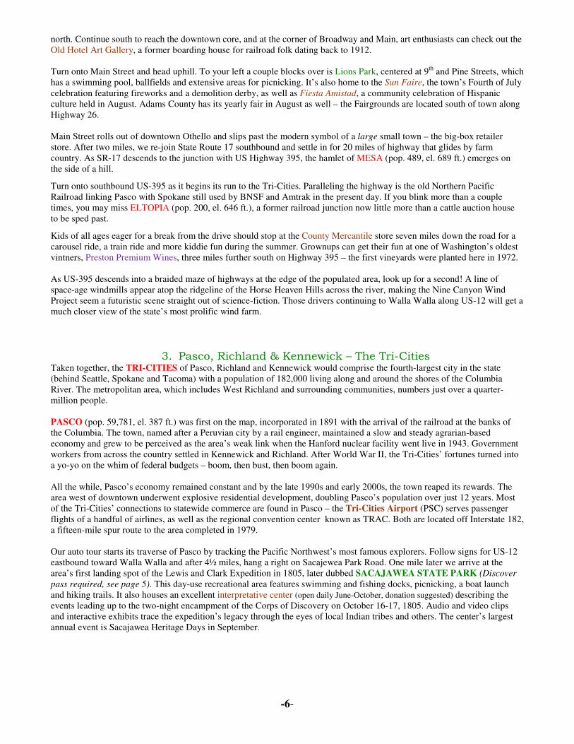
3. Pasco, Richland & Kennewick – The Tri-Cities Taken together, the TRI-CITIES of Pasco, Richland and Kennewick would comprise the fourth-largest city in the state (behind Seattle, Spokane and Tacoma) with a population of 182,000 living along and around the shores of the Columbia River. The metropolitan area, which includes West Richland and surrounding communities, numbers just over a quarter-million people.
PASCO (pop. 59,781, el. 387 ft.) was first on the map, incorporated in 1891 with the arrival of the railroad at the banks of the Columbia. The town, named after a Peruvian city by a rail engineer, maintained a slow and steady agrarian-based economy and grew to be perceived as the area’s weak link when the Hanford nuclear facility went live in 1943. Government workers from across the country settled in Kennewick and Richland. After World War II, the Tri-Cities’ fortunes turned into a yo-yo on the whim of federal budgets – boom, then bust, then boom again. All the while, Pasco’s economy remained constant and by the late 1990s and early 2000s, the town reaped its rewards. The area west of downtown underwent explosive residential development, doubling Pasco’s population over just 12 years. Most of the Tri-Cities’ connections to statewide commerce are found in Pasco – the Tri-Cities Airport (PSC) serves passenger flights of a handful of airlines, as well as the regional convention center known as TRAC. Both are located off Interstate 182, a fifteen-mile spur route to the area completed in 1979. Our auto tour starts its traverse of Pasco by tracking the Pacific Northwest’s most famous explorers. Follow signs for US-12 eastbound toward Walla Walla and after 4½ miles, hang a right on Sacajewea Park Road. One mile later we arrive at the area’s first landing spot of the Lewis and Clark Expedition in 1805, later dubbed SACAJAWEA STATE PARK (Discover
pass required, see page 5). This day-use recreational area features swimming and fishing docks, picnicking, a boat launch and hiking trails. It also houses an excellent interpretative center (open daily June-October, donation suggested) describing the events leading up to the two-night encampment of the Corps of Discovery on October 16-17, 1805. Audio and video clips and interactive exhibits trace the expedition’s legacy through the eyes of local Indian tribes and others. The center’s largest annual event is Sacajawea Heritage Days in September.

-7-
Retrace your route back to the railroad tracks and turn left uphill onto Road 40. This access road ends at East A Street – hang a left here to veer towards Pasco’s old town core.
A quick zig right on Oregon Avenue and another zag left onto Lewis Street puts you smack in the middle of Pasco’s Hispanic heritage – colorful restaurants, grocers and other everyday shops line the road. One block north to your right along Tacoma Street is the Amtrak station, served by the nightly Empire Builder line between Portland and Spokane. Also found here is the Washington State Railroad Historical Society Museum (open May-
December) featuring photos, indoor exhibits and a locomotive outdoors that’s older than the state itself!
A quick detour off Lewis Street onto Fourth Avenue yields the obligatory Franklin County Museum (open Tue-Fri year-round) and the seat of county government - the Franklin County Courthouse (pictured at left), a National Historic Landmark dating back to 1912.
Follow Lewis Street to Tenth Avenue and turn left towards the river. Shortly you’ll reach the de facto symbol of the Tri-Cities, the Ed Hendler Intercity Bridge, known around here as the CABLE BRIDGE. Connecting Pasco and Kennewick, this structure was completed in 1978 and is illuminated with white lights every night.

-8-
Settlers began claiming land on the bank opposite Pasco in 1884 and the railroad eventually bridged the Columbia. As Hanford grew during the war and after, KENNEWICK (pop. 73,917, el. 407 ft.) assumed the role of affluent suburb. Its five miles of river frontage eschews businesses or private homes in favor of large parks and trails designed for livability. As a result, Kennewick is home to more residents and tourist hotspots than either of the other two Tri-Cities. Just off the end of the Cable Bridge, follow Columbia Drive around to the right. After a mile through Kennewick’s Auto Row, follow signs through a pair of wide roundabouts to State Route 240 westbound. A few hundred yards up the road, take the exit for the crown jewel of Tri-Cities public spaces, COLUMBIA PARK. Flanking over four miles of shoreline and covering 400 acres, the park literally has something for everyone to enjoy!
The road descends toward the river, site of the Columbia Cup Hydroplane Races and 60,000 race fans on the last weekend of July each year. Visitors are greeted by the Miss Tri-Cities unlimited hydroplane from 1955 (pictured above left,
refurbished for display in the late 90’s). Up ahead adjacent to the water is the Tri-Cities Regional Veterans’ Memorial – a circle of obelisks honoring the area’s war dead. Those folks who make a left at the roundabout gain access to Columbia Park Golf Course (18-hole executive layout, public), a disc golf course and soccer fields. Instead, follow Columbia Park Trail eastward past several acres of shaded and sunny grass field – ahead on the right are the two main attractions for kids: the Family Fishing Pond and the Playground of Dreams (pictured above right). Meanwhile, the river’s edge is ringed by the Sacagawea Heritage Trail, a 23-mile bicycling and jogging loop connecting the marina upriver with the state park in Pasco. The trail is lined with benches and is fabulous for evening strolls.
Follow Columbia Park Trail (the road) back around to Columbia Drive and hang a right … yes, you’ve been on this road before! At the double roundabouts follow signs for US-395 southbound. As the road bends keep an eye out for the leafy enclave on your left, the Tri-City Country Club. The highway climbs uphill past restaurants and motels.
Continue to 10th Avenue and hang a right to enter the leafy Southridge neighborhood. One of Kennewick’s top sights is located smack in the middle of this quiet residential area – the Demonstration Garden at Highlands Grange City Park (left on Union to 16th Avenue). Showcasing 25 separate gardens over a quarter-mile-long trail, this is one of Washington’s top public botanical reserves. A true community collaboration relying solely on volunteer efforts from master gardeners, service clubs and others, the garden was completed in 2003 after four years and 40,000 man-hours of labor. Highlights include rose gardens, a kids’ garden, a Japanese display and a vegetable garden that sends its entire bounty to local food banks. Return to 10th Avenue and continue west for two miles, then turn right at Columbia Center Boulevard to enter the economic engine of Kennewick. The familiar colors of fast-food and retail appear again, with several chain hotels lining either side of the drive. On the way toward the river at Grandridge Boulevard is the Toyota Center, an arena seating 7,500 fans for concerts and the Western Hockey League’s Tri-City Americans.
Two shopping centers sit opposite one another further downhill. Columbia Center is the Tri-Cities’ flagship mall on the west side of its namesake road, featuring JCPenney, Sears and Macy’s. Across the street is The Colonnade, home to the local AAA Service Center at 6501 West Grandridge Boulevard – open weekdays to provide helpful advice for road trips, insurance, reservation services for hotel stays and car rentals and a Travel Store. Follow Columbia Center Boulevard to the on-ramp for Highway 240 westbound – four miles later the freeway diverges and the pavement converts into George Washington Way, the entrance to RICHLAND (pop. 48,058, el. 384 ft.). Founded on the north bank of the Yakima River delta in 1910, the town began life as a quiet agricultural community of 300. Everything changed in the fall of 1943 when the U.S. dispatched thousands of scientists and engineers to a remote section of desert with an area half the size of Rhode Island: the HANFORD NUCLEAR RESERVATION. Richland was razed and reborn as the ultimate company town – a master-planned city centered on the secret research and development of nuclear fission energy. The town swelled overnight to a population reaching 25,000 by war’s end. Nearly all expenses and supplies were provided by the government, with workers accommodated either in barracks or row after row of standard-issue houses.
Today, many of Richland’s workers are involved with Hanford’s on-site environmental cleanup efforts or work on continuing experiments at the Pacific Northwest National Laboratory, one of the country’s preeminent research facilities.

-9-
Follow “G-Way”, the local name for the main drag honoring America’s first president, into the downtown core. The first road on your right leads to Columbia Point Golf Course, an 18-hole parkland tract owned by the city, and Columbia Point Marina Park, a public boat launch and one of the best spots to put in to the Columbia. G-Way plods north and a couple streets up keep an eye out for a brown bus on your right, resting in the parking lot of the Columbia River Exhibition of History, Science & Technology (or CHERST Museum). During WWII, the government operated a fleet of over 900 of these buses, more than the entire city of Chicago!
Behind CHERST along the river is Howard Amon Park, an excellent spot for vista views on the Columbia. The public dock here is the jumping-off point for jet-boat and kayak trips into the Hanford Reach National Monument, the last remaining non-tidal, free-flowing stretch of the Columbia in the U.S. Established in 2000 as a haven for wildlife, the Reach (which features few roads) showcases the environmentally rehabilitated section of land along the Columbia. Deer, coyotes, bald eagles, great blue herons and even some porcupines call this area home.
4. Return Route to Vantage (via WA-240 & WA-243) Back in Richland, hang a left off G-Way to the city’s other main drag, Jadwin Avenue, which winds through town until we re-join Highway 240. On its way into rural Benton County, our tour route bypasses WEST RICHLAND (pop. 11,181, el. 413 ft.), formed in 1955 by a faction of Richland residents who moved north to take possession of land not owned by the federal government. The one highlight in this mostly residential area is Horn Rapids County Park, home to a campground, trails and one of the Northwest’s few model airplane launch sites.
The next 35 miles of the highway run northwestward along the west border of the Hanford reservation. Twenty-five of those miles are pristine views of desert grassland set against the stark, dominant visage of Rattlesnake Mountain, a massive rock towering nearly 3,000 feet above the valley floor. The land west of the highway, part of Hanford Reach National Monument, protects the state’s largest remaining tract of shrub-steppe habitat. Finally the road gradually ascends and reaches the main gate of Hanford at the junction with Highway 24 - be sure to continue straight on 240 at this point following signs toward Othello.
After a small climb at the low point of Umtanum Ridge, the crossroads of hydroelectric power appears in a maze of steel towers and wire. The Vernita Bridge and its attendant rest area signal a return to the Columbia – this is a popular access point for boaters heading into the Hanford Reach. Cross the bridge and turn left to follow Highway 243 northbound. Nine miles up the road is the first of Grant County’s two power-generation plants, Priest Rapids Dam. Completed in 1959, this structure churns out over 950,000 kilowatts of electricity for the county – note that other than picnic tables, no visitor facilities are present. Three miles further on is DESERT AIRE (pop. 1,200, el. 560 ft.), a golf resort community opened in the late 1970s located in one of the state’s driest spots. Tony summer homes line this placid stretch of the Columbia behind the dam known as Priest Rapids Lake. Another five miles click by on a jibe away from the river before bypassing MATTAWA (pop. 2,700, el. 768), the hub of local orchard and vineyard country. As the center of services for the large migrant-worker community, the town swells to nearly double its size during peak picking and packing season in the summer. The road dives down to the shore and follows the Columbia through Sentinel Gap, a grand, rock-bound path the river has carved through the east-west ridge of Saddle Mountain (pictured at right).
Just north of the gap, our tour skirts a pair of dusty towns: SCHWANA (pop. 150, el. 535 ft.), located at the base of Saddle Mountain, and BEVERLY (pop. 200, el. 548 ft.), a mile north. Further ahead is WANAPUM DAM, the larger of Grant County’s restraints of the Columbia. This massive edifice spans over 8,000 feet across and generates over 4 million megawatt-hours of electricity per year. An excellent interpretative center, the Wanapum Dam Heritage Center, traces the history of the local Native American tribe displaced from the nearby area.

-10-
Back on the road, follows signs and the steep climb to a commanding overlook of the dam (pictured below). Once that short break is complete, proceed north to the junction with Highway 26 and follow signs back to Interstate 90, completing our Auto Tour.
__________________________________________________________________
Photos by Tony Mayer unless otherwise indicated, Maps drawn by John King Updated 12/2/2011 tm
Be sure to pick up the latest edition of the AAA Washington TourBook at your local office!
Redesigned for 2012, the TourBook contains
updated information on
• Attraction Pricing & Hours of Operation
• Exclusive Diamond Ratings for AAA-Approved Lodging & Restaurants
Best of all, TourBooks are FREE for members!
Download AAA Apps for Android & iPhone Discounts, Roadside Assistance & TripTik Maps Available – Click www.aaawa.com to Download