arid region geomorphology... what causes the erosion and deposition? - wind, water, and gravity arid...
TRANSCRIPT

Arid region geomorphology...What causes the erosion and deposition?
- Wind, Water, and Gravity
Arid region geomorphology...What causes the erosion and deposition?
- Wind, Water, and Gravity

Badlands topography with terracesBadlands topography with terraces

Types of streams in Arid and semi-Arid locales
Exotic streams- begin in areas that are not arid and flow into the desert.
Ex. Nile River, Colorado River, Okavango River
Local streams (Arroyos) - begin in the arid region, and often end there as well.
There are many streams of this type…
Types of streams in Arid and semi-Arid locales
Exotic streams- begin in areas that are not arid and flow into the desert.
Ex. Nile River, Colorado River, Okavango River
Local streams (Arroyos) - begin in the arid region, and often end there as well.
There are many streams of this type…

A dry stream channel (arroyo)Note the scale of the bouldersA dry stream channel (arroyo)Note the scale of the boulders

Nile River-
An exotic stream
Nile River-
An exotic stream
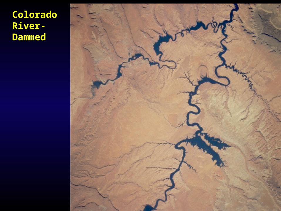
Colorado River-Dammed

Alluvial fans & Bajadas in Death Valley Graben
Alluvial fans & Bajadas in Death Valley Graben

Playa lake,
Owens Valley,
CA


Sand Dunes in Colorado Great Sand Dunes National Monument
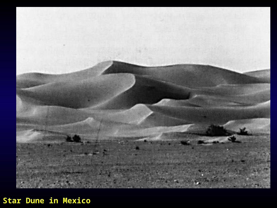
Star Dune in Mexico

Star Dune

Linear Dunes
With an exotic stream
windwind
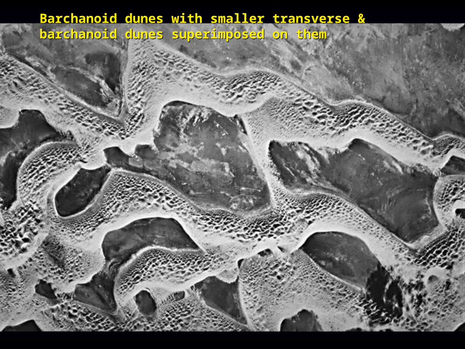
Barchanoid dunes with smaller transverse & barchanoid dunes superimposed on themBarchanoid dunes with smaller transverse & barchanoid dunes superimposed on them

Transverse dunes in Namibia- oblique aerial view
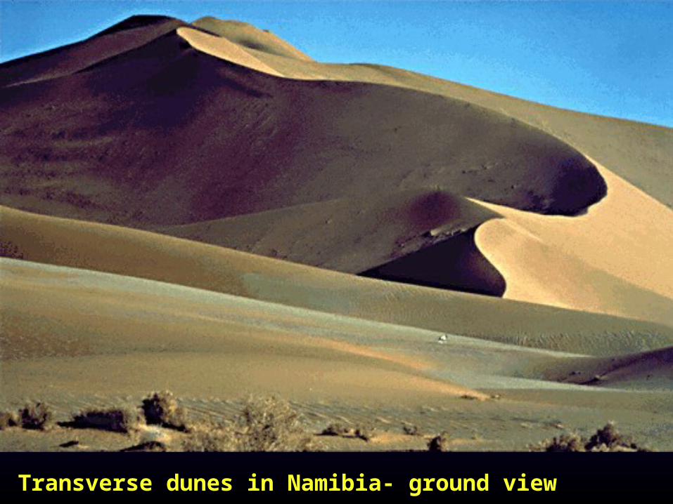
Transverse dunes in Namibia- ground view


Barchan dunesBarchan dunes
Wind directionWind direction
Slip faceSlip face
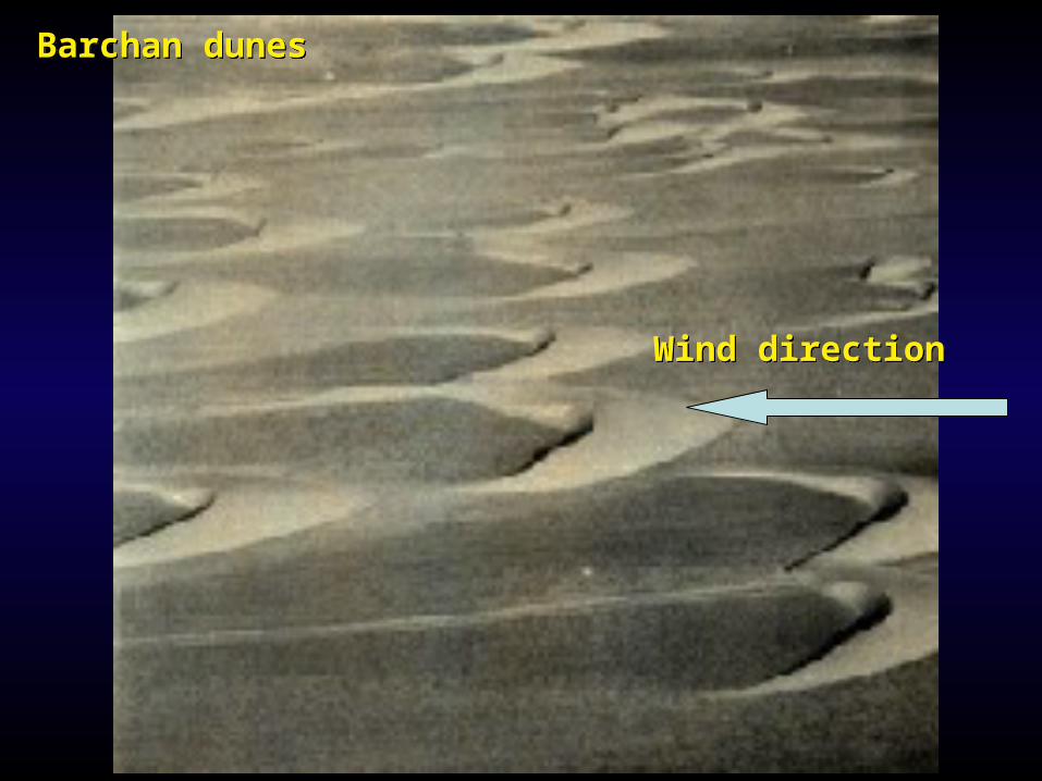
Barchan dunesBarchan dunes
Wind directionWind direction

Parabolic dunes -on a topo mapParabolic dunes -on a topo map
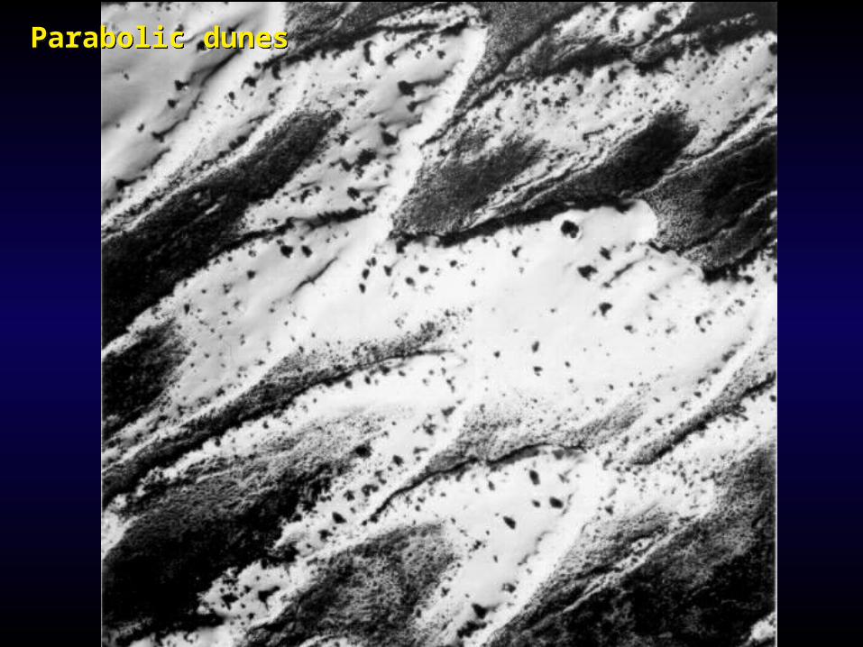
Parabolic dunesParabolic dunes


Erosional landforms vs. Depositional landformsErosional forms include...
Pediment - bedrock ramp that leads up to the mountain front
Plateau- large flat undeformed area that is topographically higher than the
surrounding region
Mesa- Smaller than the plateau, but basically the same feature
Buttes- smaller than the Mesa, but basically the same feature
Spires (a.k.a. Hoodoos)- smaller than the buttes
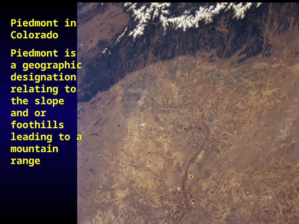
Piedmont in Colorado
Piedmont is a geographic designation relating to the slope and or foothills leading to a mountain range
Piedmont in Colorado
Piedmont is a geographic designation relating to the slope and or foothills leading to a mountain range
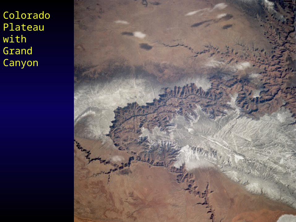
Colorado Plateau with Grand Canyon

A Mesa

Buttes and Spires in Monument Valley, UtahButtes and Spires in Monument Valley, Utah

Spires, Hoodoos, goblins...Spires, Hoodoos, goblins...

Yardangs on Mars

Yardang

Boulders (foreground) collected from desert pavement (background)Boulders (foreground) collected from desert pavement (background)

Desert Pavement and Desert Varnish
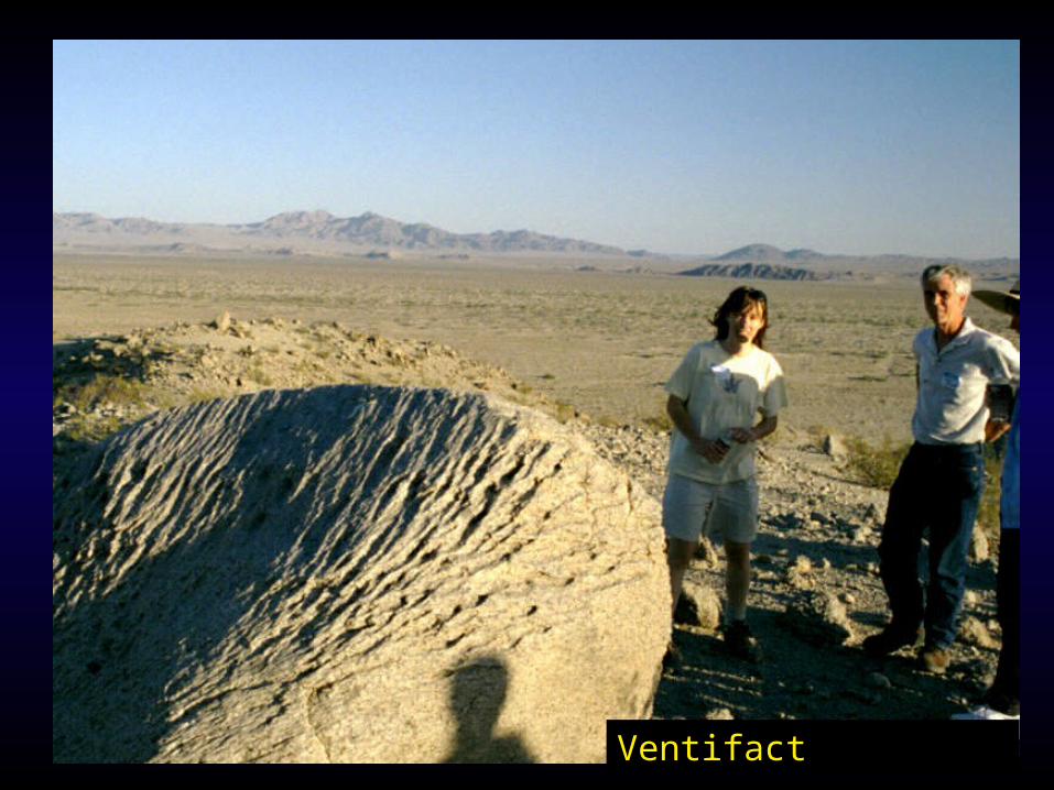
Ventifact
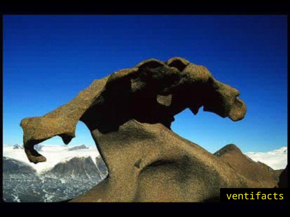
ventifacts
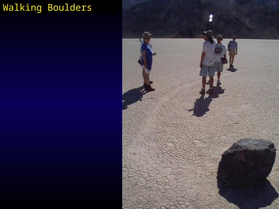
Walking Boulders

