arcp final · pdf filearcp final report project reference ... (bohol and palawan province),...
TRANSCRIPT

ARCP Final Report
Project Reference Number: ARCP2015-10CMY(B&ES)-
Liang
Coastal forest management in the face of global change based on case studies in Japan, Myanmar and the Philippines
The following collaborators worked on this project:
1. Liang Luohui, United Nations University Institute for the Advanced Study of Sustainability(UNU-IAS), [email protected]
2. Leni D. Camacho, University of the Philippines Los Baňos (UPLB), the Philippines, [email protected]
3. Antonio Perez Carandang, UPLB 4. Dixon T. Geñava, UPLB, [email protected] 5. Thaung Naing Oo, Forest Research Institute (FRI), Ministry of
Environmental Conservation and Forestry, Myanmar, [email protected]
6. Chaw Chaw Sein, FRI, [email protected] 7. Yuei Nakama, University of the Ryukyus, Japan,
[email protected] 8. Bixia Chen, University of the Ryukyus, [email protected]
ryukyu.ac.jp 9. Kazuhiko Takeuchi, UNU-IAS, [email protected] 10. Evonne Yiu, UNU-IAS, [email protected] 11. Akira Nagata, UNU-IAS, [email protected] 12. Krishna Gopal Saxena, Jawaharlal Nehru University, India,

Copyright © 2015 Asia-Pacific Network for Global Change Research
APN seeks to maximise discoverability and use of its knowledge and information. All publications
are made available through its online repository “APN E-Lib” (www.apn-gcr.org/resources/).
Unless otherwise indicated, APN publications may be copied, downloaded and printed for private
study, research and teaching purposes, or for use in non-commercial products or services.
Appropriate acknowledgement of APN as the source and copyright holder must be given, while
APN’s endorsement of users’ views, products or services must not be implied in any way. For
reuse requests: http://www.apn-gcr.org/?p=10807

1
Table of Content
Table of Content ................................................................................................................... 1
Project Overview ................................................................................................................... 2
1. Introduction ................................................................................................................. 5
2. Methodology ............................................................................................................... 8
3. Results & Discussion ................................................................................................ 25
4. Conclusions .............................................................................................................. 67
5. Future Directions ...................................................................................................... 72
6. References ............................................................................................................... 73
7. Appendix ................................................................................................................... 75

2
Project Overview
Project Duration : 2 years
Funding Awarded : US$ 40,000 for Year 1; US$ 40,000 for Year 2
Key organisations
involved
: 1. United Nations University, Japan (Liang Luohui, Kazuhiko Takeuchi, Evonne Yiu and Akira Nagata)
2. University of the Philippines Los Baños, the Philippines (Leni D. Camacho, Antonio P. Carandang, Dixon T. Gevaña, Sofronio C. Camacho, and Lorena L. Sabino)
3. Forest Research institute, Myanmar (Thaung Naing Oo, Chaw Chaw Sein, Billi Nay Win, Aung Soe and Htike San Soe )
4. University of the Ryukyus, Japan (Nakama Yuei and Chen Bixia)
5. Jawaharlal Nehru University (K.G. Saxena)
Project Summary
Coastal forests, such as mangroves, beach forests and plantations, should be included as
part of the integrated approach to mitigate tsunami induced disasters and climate change
impacts in the coasts. Nevertheless, there is little understanding how the natural sub-system
and the human sub-system interact and can be better integrated to adapt to climate change
impact, in particular, from a cross-country comparative perspective. The project examined
policy impact on coastal forest management and community-based forest management,
including local knowledge to recommend best practices of coastal forest management,
integration with human settlement planning and facilities to strengthen community resilience
to climate change impacts. It also assessed potential benefits of coastal forests in adaptation
to and mitigation of climate change in addition to local livelihoods in food, medicines,
construction and spiritual needs. The comparative perspective addressed how different
countries and local communities facing a common challenge manage coastal forests and
harness the regulating service of forests in adapting to climate change impacts under similar
bio-physical conditions, but different socio-economic contexts. The project conducted policy
reviews and case studies research in vulnerable coastal communities of three countries,
namely the Philippines (Bohol and Palawan Province), Myanmar (Ayeyawady Delta) and
Japan (Okinawa), assessed the effectiveness of bottom-up approaches, extracted lessons
and identified needs of relevant policies for coastal forest management. The results of three
country studies are compared and synthesized as a solid basis for policy recommendations
and developing a wider network of coastal forest management beyond participating countries.
Keywords:
Coastal, forest, mangrove, disaster, mitigation
Project outputs and outcomes
Year I
Project inception workshop held in Okinawa, Japan, 14-17 Sept 2014 to launch the
project, refine the methodology, select three case study sites (one each in Japan,
Myanmar and Philippines), and discuss communications plan for reaching out multi-

3
stakeholders, and visit the Okinawa study site.
Community-based assessment of coastal forest management conducted through
collection and review of secondary data, ground survey, semi-structure interview
(PRA) and questionnaire
UNU research mission to Myanmar jointly organised with the UNU-OJCB programme
on 9-13 Feb 2015 and Japan on 21-24 Aug 2015 carried out to support consolidation
of project results and capacity development.
Year II
Policy dialogues/consultations with multi-stakeholders held to evaluate barriers for up-
scaling good practices, effectiveness of coastal forest policies and programs, and
discuss policy implications of the project findings
UNU research mission to Japan on 20-28 Feb 2016 and Philippines jointly organised
with UNU-OJCB programme on 13-18 Apr 2016 to support consolidation of project
results and capacity development.
Project synthesis workshop held in Bohol, Philippines, 27 May-1 June 2016 to review
project findings and discuss policy implications and plan forward.
Follow-up workshop jointly organised with UNU-OJCB programme in Myanmar, 17-22
Dec 2016 to discuss policy recommendations and review follow-up initiative, and
support capacity development.
Project outcomes:
Best practices of coastal forest management, integrating with planning of human
settlement and facilities and agriculture and other local livelihoods identified.
Approaches to up-scaling best practices and improving effectiveness of coastal forest
management policy recommended
A regional research network on coastal forest management expanded to include the
Indian team
Research capacity of young scientists enhanced through on-job training programme.
Publishing of journal articles related to the project findings and outcomes contributed
to academic and policy discussions on coastal forest managements and climate
change mitigation
Key facts/figures
- In the study area of Myanmar: identification of 18 mangrove tree species, their mean
diameter at breast height, mean height and mean productivity for each tree species in
the secondary forest of. Excoecaria agallocha was found having the highest proportion.
Soil carbon in natural forest was found nearly two times higher than those of plantation.
- In the study area of Okinawa, Japan: 11914 individual trees of Fukugi (Garcinia
subelliptica), aged from 100 years old to 317 years old, were counted, and their heights
measured in 10 communities and 1121 houses..
- In the Philippines: 8 policy consultations/meetings with various stakeholders were held.
- Seven presentations sharing project results were made at three international
conferences.
- Two training courses, one each on “Participatory Agroforestry for Rural Development
in the Face of Climate Change”, and “Management of Coastal Forest for
Environmental Conservation, Food Security and Climate Change Mitigation” were

4
already organised in the Philippines and India, respectively to make full use of the
project findings.
- Expanded research network beyond three participating countries (Philippines,
Myanmar and Japan) to include India
Potential for further work
Apart from ongoing efforts to engage in policy debate around coastal forests, the project teams
have started to make full use of project findings for capacity building and networking. The
project teams in the Philippines and India submitted two training proposals to the UNU
Programme “On-the-Job Research Capacity Building Programme for Food Security and
Environmental Conservation in Developing Countries (OJCB)”, funded by the Ministry of
Agriculture, Forestry and Fisheries of Japan and received positive approval. The two training
proposals made full use of the project expertise and results for training of young scientists,
including those involved in the project implementation. As a result, the Year II work programme
of the project was extended to include the additional follow-up workshop in Myanmar on 17-
22 Dec 2016 with generous support of OJCB to summarize project findings and discuss the
full proposal on the follow-up research.
The project team also submitted to APN a summary proposal on a new project focusing on
sustainable mangrove rehabilitation to follow up and received a favourable review. While
mangrove planting has been promoted to restore vital ecosystem services most of such efforts
were largely monoculture plantation and were not effective in restoring the wide range of vital
ecosystem services. The proposed follow-up research will review past experiences of
mangrove planting and identify best practices for sustainable rehabilitation to integrate global
and local benefits, taking case studies in the Philippines and Myanmar where both countries
has suffered serious damages caused by typhoons and cyclones in recent years. Synthesising
findings from in-depth case studies of community-based mangrove rehabilitation efforts of
both countries, the project aims to make policy recommendations to further improve mangrove
rehabilitation strategies. The final output will contain technical final reports, sustainable
mangrove rehabilitation guidelines and policy briefs that will be conveyed to policy-makers
and relevant mangrove stakeholders beyond the Philippines and Myanmar. Following the APN
favourable review of the summary proposal, the full research proposal has already been
submitted to APN for consideration.
Publications
1. Chen, B., Nakama, Y., & Zhang, Y. (2017). Traditional village tree landscapes: tourists’
attitudes and preferences for conservation, Tourism Management, 59, 1-11. (online
first)
2. Chen, B., Nakama, Y., & Urayama, T. (2016). Dimensions and management of remnant
Garcinia subelliptica tree belts surrounding homesteads- a case study from two villages
on the Sakishima Islands, Okinawa Prefecture, Japan. Journal of the Japanese Society of
Coastal Forest, 15 (2), 29-36.
3. Chen, B. (2016). The state of conservation and management of old Garcinia Subelliptica
trees: a case study in Aguni Island, Okinawa Prefecture, Journal of the Japanese Society
of Coastal Forest , 15 (1), 1-6.
4. Chen, B. (2015). Function of traditional forests for disaster prevention-a landscape design
perspective. In: Toward New Island Studies: Okinawa as an Academic Node Connecting

5
Japan, East Asia, and the Oceania. International Institute for Okinawan Studies (IIOS),
University of the Ryukyus (pp.67-70) (in Japanese)
5. Chen, B., and Nakama, Y. (2015). Residents’ Preference and Willingness to Conserve
Homestead Woodlands: Coastal Villages in Okinawa Prefecture, Japan. Urban Forestry
& Urban Greening, 14(4), 919-931.
6. Nakama, Y., Kurima, G. & Chen B. (2017). A Study of Sacred Site Landscape
Conservation- Fukugi (Garcinia subelliptica) Tree Cutting and Pruning Issues in Uchima-
udun, Nishihara Town , The Science Bulletin of the Faculty of Agriculture, University of the
Ryukyus, 61, 1-18. (in Japanese)
7. Sein, C. C., Oo, T. N., Win, B. N., & Chen, B. (2015). Assessing different land use
pattern and livelihood of the local people in the mangrove area (Case study in Pyapon
Township). Global Journal of Wood Science, Forestry and Wildlife. 3 (2), pp. 052-058
Pull quote
“Unlike a single protective function of seawall, forests protect local communities from floods,
tides and storms, but also provide a wide range of vital ecosystem services for global and
local communities. Recognising multiple values of coastal forests, local communities have
long conserved and planted forests around their houses and villages. Coastal forest policy
making must take into account local concern and indigenous practices beyond global concern
and scientific knowledge. Regional cooperation on research and capacity building could
hasten the process of replication and further improvement of the known good practices. “
By Liang Luohui, the project leader, United Nations University
Acknowledgments
This research project was made possible through the ARCP Programme of the Asia-Pacific
Network for Global Change Research (APN). The project team also appreciated the co-
funding of the UNU Programme “On-the-Job Research Capacity Building Programme for Food
Security and Environmental Conservation in Developing Countries (OJCB)”, the United
Nations University (UNU), the University of the Philippines Los Baños (UPLB), the Forest
Research institute (FRI), the University of the Ryukyus, the Jawaharlal Nehru University (JNU),
and the assistance of local communities and authorities in study sites of the Philippines,
Myanmar, Japan and India.
1. Introduction
Coasts are home to a high proportion of world populations, particularly in Asia. Coasts are
suffering the adverse effects of hazards related to climate and sea level, and the impact of
climate change is exacerbated by increasing human-induced pressures. The tsunami induced
disasters following the earthquake of magnitude 9.0 in Japan on 11 March 2011 warned the
world of the limits and inadequacy of the conventional scope of coastal infrastructure (such as
cement seawalls) in prevention of natural disasters. Coastal forests, such as mangroves,
beach forests and plantations, should be included as part of the integrated approach to
mitigate tsunami induced disasters and climate change impacts in the coasts. Nevertheless,
there is little understanding how the natural sub-system and the human sub-system interact
and can be better integrated to adapt to climate change impact, in particular, from a cross-
country comparative perspective.

6
The proposed research aims to improve the understanding of interaction between the forest
ecosystems, agriculture and human settlement on the landscape and develop integrated
approaches to harnessing forest regulating services in the planning of human settlement and
agriculture, and combining benefits of forests in adaptation to and mitigation of climate change
in coastal areas. Specifically, the project objectives are as follows:
To identify best practices of coastal forest management, integrating with planning of
human settlement and facilities and agriculture and other local livelihoods
To evaluate barriers for up-scaling best practices, and effectiveness of coastal forest
management policy through a bottom-up process.
To recommend integrated approaches to harnessing forest regulating services in the
planning of human settlement, agriculture and local livelihoods in coastal areas.
To establish a long-term research network on coastal forest management and enhance
research capacity of developing countries through networking and learning from each
other.
The project examined policy impact on coastal forest management and community-based
forest management, including local knowledge to recommend best practices of coastal forest
management, integration with human settlement planning and facilities to strengthen
community resilience to climate change impacts. It also assessed potential benefits of coastal
forests in adaptation to and mitigation of climate change in addition to local livelihoods in food,
medicines, construction and spiritual needs. The comparative perspective will address how
different countries and local communities facing a common challenge manage coastal forests
and harness the regulating service of forests in adapting to climate change impacts under
similar bio-physical conditions, but different socio-economic contexts.
The project conducted policy reviews and case studies in vulnerable coastal communities of
three countries, namely the Philippines (Bohol and Palawan Province), Myanmar (Ayeyawady
Delta) and Japan (Okinawa), assessed the effectiveness of bottom-up approaches, extracted
lessons and identified needs of relevant policies for coastal forest management. Three study
sites in the Philippines, Myanmar and Japan and Myanmar often suffer from typhoons or
cyclones. The project was also networked with an associated case study in Sundarban, India
on the Bay of Bengal, also vulnerable to tropical cyclones. The different situations of coastal
forests in the Philippines, Myanmar and Japan are further introduced in the following sections.
1.1 The Philippines
At its natural state, mangroves provide many benefits to mankind. Its strict protection and
conservation would ensure the sustainability of these benefits. Considerable benefits are also
expected from the development of new mangrove plantations.
Despite the numerous laws in place, the country's mangrove resources continue to decline.
A century before, the country had an estimated 400,000 ha of mangrove forests. Today, only
around 154,000 ha remain. This area continues to shrink due to ever-increasing population
pressure. Efforts to reclaim and rehabilitate degraded mangrove areas has been started some
30 years ago. However, mangrove restoration efforts pale in comparison with the magnitude
of the tasks at hand.
The government provides many incentives to Community-Based Forest Management (CBFM)
participants in its uplands sites such as security of tenure and exemption from forest charges

7
for planted forest crops. However, mangrove CBFM participants and other forest developers
cannot avail of these because of prohibitions of RA 7161.
In view of the above premises, there is an urgent need to harmonize mangrove policies and
institutions to truly push for an effective management and development of mangrove areas in
the country. Mangrove areas continue to shrink due to population pressure. There is also a
need to put more incentives to mangrove developers to develop more areas and gain direct
economic benefits from their toils as well as strictly protect the remaining mangrove areas.
1.2 Myanmar
Myanmar has a total coast line of about 2,000 km in length and a continental shelve of nearly
270,000 km2. There are three coastal regions in Myanmar, namely Rakhine, Ayeyarwady and
Tanintharyi where mangroves are common. Mangroves were found with the coverage of
7,850 km2 (785,000 ha) of which 3,200 km2 (320,000 ha) were designated as reserved forests
in 1920s. At the beginning of 1990s, the extent of mangroves was reported to be about 85,533
hectares which was reportedly decreased by approximately 50% in 2002.
The Ayeyarwady delta as a whole covers an area of 33,670 km2 (3,367,000 ha) having a large
network of creeks, streams, and rivers. The tidal action in the delta together with various other
conditions creates an ideal ecological condition for mangrove vegetation. Mangroves support
local livelihoods as well as protect local communities from storms and floods. In the past, the
extent of mangrove forests in the Ayeyarwady delta was reported to be about 2,500 km2
(250,000 ha). Reduction of mangrove forests in the Ayeyarwady Delta was taking place at a
rapid pace as a result of different factors among which are over encroachment of agricultural
expansion, and extraction of fuelwood. The rapid loss of mangroves put local people and their
livelihoods at a high risk of cyclones in the coastal areas.
The tropical cyclone ‘Nargis’ severely damaged the lower parts of Myanmar, mainly Yangon
and Ayeyarwady Division in May 2008 claiming many lives and causing enormous destruction
to villages, plantations and forests including food supplies. Many inhabitants lost their means
of livelihood. It was the worst natural disaster in the history of Myanmar. Therefore,
rehabilitation by community-based forest management has already been conducted by forest
department and NGOs with the participation of local people since 2009 after the Nargis.
1.3 Japan
In traditional coastal villages of Okinawa Islands, a traditional landscape integrated with
planted trees is functional to protect the communities from natural disasters, such as typhoons,
tsunamis and salty tides and etc. Traditional planted forest belts of “ho:go”, which literally
means “embracing protection” and usefully refers to a configuration of ideal Feng Shui
landscape, was designed and established about 300 years ago. Forest belts were planted to
circle all the houses, and even surround whole villages or several neighboring villages to
protect the coastal communities in Okinawa. Such forest belts were cultivated in the early part
of the 17th century by all households in the village under common management, and tree
cutting was prohibited. Among these preserved forests, native tree species also regenerated
inside the woods alongside planted species of Fukugi (Garcinia subelliptica) tree, and a rich
biodiversity of herbaceous vegetation could be found. These woodlands were converted to
protection forests or communal land during the Meiji Period (1868-1912). Unfortunately, the
majority of the forests were destroyed through conversion to roads, residential areas or

8
cropland during the rapid urbanization and rural development after WWII. Thus, it is urgent to
identify the appropriate conservation strategy under the transformed socio-economic
conditions in the face of climate change.
2. Methodology
2.1. Study sites
In order to compare lessons and experiences across Asia, the project selected two clusters of coastal communities, one each from the Philippines (Bohol and Palawan Province) and Japan (Okinawa) vulnerable to typhoons in the northwest Pacific, and one cluster of coastal communities from Myanmar (Ayeyawady Delta) vulnerable to tropical cyclones in the North Indian Ocean as study sites. The project was also enriched with an associated case study in Sundarban, India on the Bay of Bengal,also vulnerable to tropical cyclones in the North Indian Ocean . 2.1.1 The Philippines. The case study research in the Philippines was conducted in two sites in the Philippines by the University of the Philippines Los Baños team led by Professor Leni D. Camacho. The Island of Banacon was chosen as the main site of case study (Figure 1). This Island is located in Bohol Province representing a case of a very vulnerable community with respect to strong waves and storm surges. A big mangrove plantation in its vicinity apparently saves it from destructive forces of these natural phenomena. Another site of the study is in Palawan (Figure 2) which has good natural mangrove stands. 2.1.1.1 Bohol The Province of Bohol is located at the central part of the Philippines i.e. 556.16 nautical miles from Manila (Figure 3). It is the 10th largest island in the country with a total area of 394,816.2 ha. Recent census revealed that this province is inhabited by around 1,230,110 individuals with an annual growth rate of 2.92% (PPDO, 2008).

9
Figure 1. Map of Banacon Island, Bohol, Philippines Agriculture is the predominant livelihood of the province (Table 1). Agricultural land comprised nearly half of the total land area of 169,678.4 ha. On the other hand, fishing serves as second major livelihood particularly of the 30 coastal municipalities. People regard the marine protection programs such as “bantay-dagat” (protect the sea) and mangrove reforestation essential efforts that sustain the vigorous condition of their sea for fish yield. Conservation therefore of 15,320 ha mangrove (Figure 2) became the banner program for conservation of the local government and DENR in the area.
Table 1. Landuse of Bohol Province.
Landuse Area (ha)
Agriculture 169678.4
Upland Forest 41145.56
Mangrove (tree) 10597.62
Mangrove (palm) 4722.412
Beach 202.992
Fishpond 1137.767
Open/grassland 158007.8
Mining 1007.767

10
Unclassified 1744.035
Built-up areas 6571.811
Total 394816.2
Figure 2. Map showing mangrove forest of Bohol
Among the mangrove areas, Banacon Island (Figure 3 and 4) in the municipality of Getafe is
the most popular and well-documented site. It is a protected seascape covering an area of
1,775 ha. The Banacon mangrove project received several environmental awards including
the “Likas Yaman Award” of the Department of Environment and Natural Resources (DENR)
in 1981, and the “Outstanding Tree Farmer Award from the Philippines” by the FAO in 1991.
Further, it is also renowned as largest man-made mangrove in Southeast Asia.

11
Figure 3. Location map of Banacon Island, Bohol
Figure 4. General view of Banacon Island (a. mangrove plantations mainly composed of bakawans or Rhizophora sp; b. local community)
Banacon mangrove is generally a plantation forest comprising mainly of Rhizophora stylosa
locally known as “bakawan bato”. This species is adaptive to high saline sandy loam to sandy
corraline substrates. It is also resilient to frequent tidal surges compared with other Rhizophora
species. Various ages of plantation are currently being managed in the area (Figure 5).
Furthermore, sparse mixed or natural stands that are dominated by Avicennia sp. and
Sonneratia spp. are also frequent in the island.
a b

12
Figure 5. General view of R. stylosa plantations based on age (a. 15 years or P-15; b. 20 years or P-20; c. 40 years or P-40), and natural stand or P-N (d.)
2.1.1.2 Palawan
Palawan is the largest province and fifth largest island of the Philippines. It is located at the western part of the archipelago lying between South China Sea and the Sulu Sea. It has a total area of 14382.98 km2 (Figure 6). Agriculture is the primary form of local livelihood in the province while mining and logging used to be second in the economy. Based on the recent census, the population is around 682,152 with a density of 46.6 persons per km2.
a b
c d

13
Figure 6. Map of Palawan, Philippines
Endowed with rich natural forest resources, Palawan serves as an abode for more than 200
species of fauna and more than 1,672 species of flora (Novellino, 2008). Serious forest
conservation is not the major focus of the local government and various organizations such
as the Palawan Council for Sustainable Development. Vast old growth forest can be found
along ultramafic mountain ranges and mangrove areas. Mangroves constitute around 3.8%
(54,604.7 ha) of the total land area of the province (Table 2 and Figure 7).
Table 2. Land use of Palawan.
Landuse Area (ha)
Agriculture 186847.7 Upland forest 671092.8 Mangrove 54604.7 Open land/grassland 356730.9 Marshland 43082.3 Shrubland 120561.7

14
Fishpond and inland water 2283.1 Built-up areas 3094.9 TOTAL 1438298
Figure 7. Map showing mangrove forest of Palawan
Mangrove stands in Puerto Princessa City in Palawan were considered in the study.
Mangrove forest in this area is roughly around 4,425.9 ha by which large old growth stands
can be found in Barangay1 Kamuning (Figure 8). Bakauan babae (R. mucronata) is the most
common tree species in these sites. In terms of age, most of the trees are at least 60 years
old, while others are believed to be living for a century already.
1 Barangay generally pertains to village, which is the smallest political unit of the Philippines.

15
Figure 8. General view of the old growth mangrove forest of Barangay Kamuning, Palawan 2.1.2 Myanmar
The study area in Myanmar is located in the Pyapon District, Pyapon Township which is
situated in Ayeyarwady Delta, with an area of approximately 5517.42 km2. The study site is
situated in the Pyindaye reserve forest, and three nearby villages, namely War Kone, Padauk
PinSeik and Kanyin Kon villages were also selected as the study areas (Figure 9).
Myanmar has a total coast line of about 2,000 km in length and a continental shelve of nearly
270,000 km2. There are three coastal regions in Myanmar, namely Rakhine, Ayeyarwady and
Tanintharyi where mangroves are common. Mangroves were found with the coverage of
7,850 km2 (785,000 ha) of which 3,200 km2 (320,000 ha) were designated as reserved forests
in 1920s. At the beginning of 1990s, the extent of mangroves was reported to be about 85,533
hectares which was reportedly decreased by approximately 50% in 2002.
The Ayeyarwady delta as a whole covers an area of 33,670 km2 (3,367,000 ha) having a large
network of creeks, streams, and rivers. The tidal action in the delta together with various other
conditions creates an ideal ecological condition for mangrove vegetation. In the past, the
extent of mangrove forests in the Ayeyarwady delta was reported to be about 2,500 km2
(250,000 ha). Reduction of mangrove forests in the Ayeyarwady Delta was taking place at a
rapid pace as a result of different factors among which are over encroachment of agricultural
expansion and extraction of fuelwood and charcoal and (Webb, et al, 2008).
The tropical cyclone ‘Nargis’ severely hit the lower parts of Myanmar, mainly Yangon and
Ayeyarwady Division in May 2008 claiming many lives and causing enormous destruction to
villages, plantations and forests including food supplies. Many inhabitants lost their means of
livelihood. It was the worst natural disaster in the history of Myanmar. Therefore, rehabilitation
by community-based forest management has already been conducted by forest department
and NGO with the participation of local people since 2009 after Nargis.
a b

16
Figure 9. Study area of Myanmar site
The study area is located in the Pyapon District which is situated in Ayeyarwady Delta, with
an area of approximately 5517.42 km2. The study site is situated in the Pyindaye reserve forest,
and three nearby villages, namely War Kon, Padauk PinSeik and Kanyin Kon villages were
also selected as the study areas. Around 29 mangrove species are found in the Pyindaye
reserve forest. The most dominant species are Heriteriera fomes and Excoecaria agallocha.
There are seven common tree species found in Pyindaye reserve forest area (Heritiera fomes,
Sonneratia caseolaris, Excoecaria agallocha, Bruguiera gymnorhiza, Avicennia officinalis,
Ceriops decandra. and Sonneratia apetala).
In the Pyindaye reserve forest, different types of land uses are found. The majorities of the
land uses are agriculture, aquaculture and mangroves. Others are salt pan, shrimp farming,
mangrove plantations, and community forestry. In Pyindaye reserve forest, the population is
about 100,000. And the number of households is about 160,000. The main livelihood activities

17
are agriculture, fuel-wood collection, fishery, salt pan, shrimp farming and laboring. The major
drivers; human settlement in that reserve forests around 1960, over production of firewood
and charcoal production for local use and to carter to the energy needs of Yangon city,
conversion of mangrove forest to agricultural land (paddy field) starting from 1970 and
conversion of degraded land to aquaculture account for the deforestation in the study area.
Population pressure is the most important driver of deforestation in the area. Human
settlement around 1960s forming villages in the reserve forest caused a large deforestation
by the formation of agricultural land and aqua farms in the area. Conversion of mangrove
forest to paddy field turned a large area of pristine natural forests to agricultural land around
1970. Over production of firewood and charcoal making also accelerated the rate of
deforestation. To satisfy the energy needs of the Yangon city, mangrove forests in
Ayeyarwady region were exploited for charcoal making and fuel wood production. As a result,
mangrove forest in Ayeyarwady region decrease 84% over a thirty-year period.
2.1.3 Japan
The study site in Japan is located in Tarama island of Okinawa prefecture, Japan’s
southwestern most prefecture, at lat. 24~28° North and long. 123~132° East. Okinawa
prefecture consists of 49 inhabited and 110 uninhabited islands. The islands are scattered
over an area 1,000 km from east to west and 400 km from north to south. Okinawa is the only
prefecture that is located in the subtropical climate zone, endowed with rich rare species.
Although many species of animals that once lived on the Asian Continent have become extinct,
these species have survived and evolved on the subtropical islands of Okinawa. Many rare
species such as the Iriomote wildcat (Prionailurus bengalensis iriomotensis), Yambaru Kuina
(Gallirallus okinawae), and Yambaru Noguchigera (Sapheopipo noguchii), are only seen in
Okinawa.
The climate of Okinawa is influenced by the latitude, the surrounding ocean, the monsoon, the
Black Current, and typhoons. In the long term, annual average temperature of the Okinawa
area is, has been rising at a rate of 1.08 ℃ per 100 years (Okinawa Meteorological
Observatory 2015). Present evidence suggests that elevated sea temperature is one among
the leading factors responsible for large-scale coral reef bleaching, as a result, threats the
coastal ecological environment.
Extreme high temperature have increased, while, extreme low temperature have decreased
in the past 100 years. During the period of 1931-2013, the number of hot days (daily minimum
temperature over 25℃) has increased at a rate of about 5.19 days every 10 years.
Okinawa has a long typhoon season, extending from June to November. The number of
typhoon formed and moved through Okinawa Prefecture was showed in Figure 10, with an
average of 25.6 and 7.4, respectively. The year of 2004 recorded the most active typhoon
year in Okinawa with a total number of 15 typhoons moving through Okinawa Prefecture.

18
Figure 10. The number of typhoon formed and moved through Okinawa Prefecture.
Note: the thin line is annual average, and, the thick line is an average of every 5 years
Data source: Okinawa Meteorological Observatory (2015)
Traditional village landscape in Okinawa was established about 300 years ago, featuring
multilayer of forest belts to protect settlements from strong typhoons and seasonal winds.
Ho:go is one essential word for a Feng Shui village in Ryukyu Islands. The literal meaning of
Ho:go is to embrace and protect by forest planting in order to retain the living energy. Ho:go
also refers to a forest belt that encircles a house, a village, several neighboring villages, or the
coastline, and is called House Ho:go (habitat-embracing forest), Village Ho:go, District Ho:go,
and Coastline Ho:go, respectively. However, such Feng Shui village landscapes have
disappeared rapidly since World War II because of the changing life styles.
In this part, Tarama Island was selected as survey site since it has the only currently existing
Village Ho:go in Okinawa (Figure 11). According to the old document, the Village Ho:go in
Tarama Island was planted in 1742. Around 1800m long forest belt of Village Ho:go were
planted to curve along the front of the village and to be connected with the forested mountain
in the back to shape a greening circle with a radius of about 400m.
Frequency Typhoons that formed
Typhoons that moved through Okinawa
Year

19
Figure 11. Village houses (at the center of the photo) clustered in the northern part of
Tarama Island. (1) Bummja: the center of village (2) The back hill covered with thick forest,
where several Utaki (sacred spots) were located. (3) Jaejama to: midai (4) Tukapana (5)
Village Ho:go curving in the front. (6)-(8): sacred sites
2.1.4 Sundarban, India
The associate study site in Sundarban is located in the southern part of West Bengal state of
India in the expansive river delta on the Bay of Bengal. The village landscapes can be
classified into the ones (i) mangrove belt forming the village boundary facing river front and
(ii) the ones without such a belt, more vulnerable to the damage of cyclones. All villages have
an earthen embankment to protect from floods. Village livelihoods consist of food crop
cultivation (paddy in main field and vegetables on raised plot boundaries), betel leaf gardens,
tree-crop mixed home gardens, fish ponds (natural fish production), aquaculture (crab and
fish), natural mangrove forests, mangrove plantations and deep sea fishing.

20
Figure 12 Indian part of Sundarban region, encircled on forest map prepared by Forest
Survey of India (2011)
All villages have a drainage system allowing outflow of water from the settlement to the river
and also from river to the settlement. For some activities, like cultivation of some fish or for
conversion of shrimp larvae (which suffer mass mortality if not sold out within a day) to
juveniles (which suffer less mortality), river water is used. However, for paddy it is the rainwater
which is accumulated in bunded fields or underground water drawn borewells is used for
irrigation. However, during the high tide and rainy season, some inflow of river water is
common in fields with low bunds. This provides advantage of catching easily the fish
transported by river water but disadvantage of increase in salinity stress to rice crop.
The coastal forests are classified into (i) reserve and protected forests, (ii) community forests
and (iii) roadside/riverside/seaside plantations. Mangroves (Avicennia spp) are planted
towards river front, Casuarina equisetifolia, Tamarix gallica and Accacia nilotica on 2-3 m high

21
earthen bunds bordering river and Accacia auriculformis, Cassia fistula, Eucalyptus hybrid
and Phoenis dactylofera on roadside; natural forests are dominated by Heritiera forms,
Excocaeria agallocha, Avicennia alba, A. officinalis, A. marina, Bruguiera parviflora , Ceriops
tagal and Nypa fruiticans.
2.2 Study components and methods
The research was an interactive process of community-based assessment and policy analysis.
The community-based assessment of forest management at three study sites vulnerable to
typhoons/tropical cyclones was carried out so as to identify good practices of coastal forest
management and their integration with planning of human settlement and facilities, and local
agriculture and gaps to strengthen community resilience to climate change impacts. The
project selected three case study areas of the Philippines (Bohol Province), Myanmar
(Ayeyawady Delta) and Japan (Okinawa) as all three countries that face the common
challenges of dealing with typhoon and tropical storms. Yet all three countries are at different
levels of social and economic development, different climates and cultures, which could
provide a variety of experiences, traditional knowledge and best practices for sharing.
The community-based studies combined ground survey of coastal forest resources and their
dynamics, semi-structure interview and questionnaire. A cultural landscape/seascape
approach was taken to analyse land-/resource-use linked differentiation of ecosystems in
interaction of coastal forests, resource utilization/regeneration mechanism, people’s
perceptions about climate change/sustainability/policy interventions. The field study
comprised three activities: (1) biophysical survey and analysis through interviews,
participatory field mapping, interpretation of satellite imagery and geographic information
system (2) socio-economic survey through interviews and focused group discussions to
elucidate community based practices and people’s perceptions about interventions and
problems; (3) identification of good land/resource use practices synergizing multiple benefits
from coastal cultural landscapes/seascapes.
On the basis of the community-based assessments, the policy analysis proceeded through a
bottom-up process approach to evaluate effectiveness, lessons, gaps of existing policies in
supporting community-based forest management, coastal reforestation as well as to identify
barriers for up-scaling of good practices and mainstreaming of regulating service of coastal
forests in human settlement planning, and to feed into the process of local forest management
and human settlement planning. The extensive knowledge and expertise of participating
teams in the forest management in the region were built on to minimize project costs and
duration. The collaboration amongst developed and developing nations resulted in the
common understanding and coordinated strategies towards coastal forest management. The
comparative perspective analysed how different countries and local communities facing a
common challenge manage coastal forests under similar bio-physical conditions, but different
socio-economic contexts so that regional difference can be taken into account in policy
recommendations.
Specifically, the policy analysis reviewed existing policies in community-based forest
management and identify gaps for effective coastal forest management vis-à-vis the findings
from the community level study; identify barriers for mainstreaming coastal forests in human
settlement planning and recommend solutions; exchange lessons learnt from effective policies

22
of other countries, and share knowledge and experience with the experts. A number of national
stakeholders’ consultations and three international workshops (one each in Okinawa, Japan
on 15 – 17 Sept 2014; in Bohol, Philippines on 28-30 May 2016, and in Pyapon, Myanmar
on 17- 22 Dec, 2016), involving officials, community leaders and policy researchers, were
organised to synthesis results and experiences between the community level study and policy
analysis under different socio-economic contexts, as well as encouraging dialogue and
fostering cooperation amongst the stakeholders to fit the research findings into their policy
making processes, including forest management plan, human settlement plan and land use
regulations.
Capacity building has been an important part of the project implementation and the long-term
research on coastal forests. Several young researchers in Myanmar, Philippines and India
took part in the UNU Programme “On-the-Job Research Capacity Building for Food Security
and Environmental Conservation in Developing Countries (OJCB)” held at University of the
Philippines Los Baños, the Philippines in 2016 and at Jawaharlal Nehru University, India in
2015 and 2016. The field work of the OJCB was conducted at the study sites in Myanmar,
Philippines and India for young researchers to appreciate experiences of coastal forest
management across Asia.
Considering difference in data availability, socio-economic contexts and research fouces
among three countries, the site-specific methodologies taken by each country teams are
further clarified as follows:
2.2.1 The Philippines
Secondary data gathering on policies, statistics, and current management situation in the
country were done. Primary data gathering was done to study in details the case of Banacon
Island as compared with the case of Kamuning, Palawan. Community-based assessment
carried out key informant interviews, focus group discussion and mangrove mapping. Policy
analysis and local management practices were done in the light of the following criteria:
Environmental soundness
Socio-economic feasibility
Social acceptability
Administrative practicality
Climate change sensitivity
After the study, the team provided policy recommendations particularly focusing on the
weaknesses of current policies in addressing issues related to:
a. Mainstreaming coastal forests in human settlement planning, and to feed into the
process of local forest management and human settlement planning;
b. Maximizing policy benefits in the context of socio-economic development in the
coastal areas;
c. Dealing with coastal hazards in the context of climate change; and
d. Building local capacity through networking and sharing of expertise

23
Finally, a wider assessment on the benefits of mangrove forest development and management
beyond the Philippine’s case was done looking at cross- country and inter-country experiences
in view current and future hazards from extreme climate and geologic events.
2.2.2 Myanmar
The research proceeded with the community-based assessment component in Year 1 and the
policy analysis component in Year 2. The community-based assessment conducted inventory
and monitoring of forest resources, GIS analysis and semi structure survey.
2.2.2.1 Inventory of forest resources
Ten 50 m × 50 m plots were chosen randomly in the local community plantation and three 50
m x 50 m plots of the natural forests in Wakon, Padauk PinSeik and Kanyin Kon villages in
the the Ayeyarwady Delta. Diameter at breast height (DBH) and height of all trees in these
plots were measured and recorded. A spacing of 1.8 m x 1.8 m was generally adopted in the
rehabilitation program in the delta.
The aboveground biomass was estimated as follows:
Measurement of felled trees
Four sample trees were felled at 0.3 m above the ground. All the boughs, twigs and leaves
were cleared off the felled trunk. The height of the felled tree was measured before the trunk
was being cut into logs for the convenience of weighing. Each log was weighed and noted in
the field note. Boughs, twigs and leaves including saw dust were weighed and noted.
Collection of samples for dry weight estimate
The samples of the trunk, bark, boughs, twigs and leaves were collected in separate paper
bags for drying and weighing. Leaf sample of 10 kg, branch sample of 50 kg, 2 cm disks to
represent trunks were collected.
Drying samples
After felling, the trunk, branches and leaves of each sample tree were separated and weighed.
Small samples were then extracted from each separated organ, weighed, dried for 96 hours
(leaves, 48 hours) at 80°C, and re-weighed in order to determine their fresh to dry weight
ratios. The biomass of each organ was calculated from the fresh weight and fresh to dry weight
ratio thus obtained.
Estimation of total dry weight of each sample tree
Total dry weight (TDW) of each organ of each sample tree was calculated from its total fresh
weight (TFW), the fresh weight of its organ sample (SFW) and its dry weight (SDW) (JIFPRO
&JOPP, 2004). The carbon content of tree biomass was estimated by using the carbon content
default value of 0.5 as proposed by the IPCC (1996).
Estimation of soil Organic Carbon (SOC) started with collection of soil samples from all three
plantation sites (War Kon, Kanyin Kon and Padauk Pin Seik). Five points were selected
randomly in each plantation site. Then, soil samples were systematically collected from five
depths, 0-10 cm, 10-20 cm, 20-30 cm, 30-40 cm and 40-50 cm. Samples for soil bulk density
were also taken from each depth by dipping an improvised metal canister into each of the
designated soil depths. Soil test was taken in the soil laboratory of the FRI, Yezin, Myanmar.

24
2.2.2.2 GIS analysis
GIS analysis was carried out in each village using the digital data of Landsat 7 satellite imagery
for land use mapping for the year 2014. Before the pre-processing and classification of satellite
imagery began, an extensive field survey was performed throughout the study area using
Global Positioning System (GPS) equipment. This survey was performed in order to obtain
accurate locational point data for each land use included in the classification. The satellite data
was enhanced before classification using histogram equalization to improve the image quality
and to achieve better classification accuracy. The whole process is guided by ground
observations and local knowledge. The land use maps produced at year 2014, at a scale of
1:100000 include eight classes, depending on the characteristics and objectives of the study
site.
2.2.2.3 Semi structure interview Survey, questionnaires with local people
Simple random sampling with sampling intensity of 50% in War Kon village which have total
of 95 households, 25% in Kanyin Kon village which have 198 households and 50% in Padauk
PinSeik which has 49 households was carried out in order to focus the impacts of coastal
forest loss and impact on fisheries; human settlement management issues such as vulnerable
zones to natural disturbances and institutional factors such as land regulations and ownership;
traditional coastal management knowledge, social, economic and environmental impacts to
local people.
2.2.2.4 Policy consultation
The consultation was focused on how coastal forests are managed and conserved for
sustainable use and climate change adaptation on three levels over questionnaire surveys:
(a) stakeholder discussion, (b) dialogue with village head and (c) questions to staff from forest
department who is practically managing and conserving coastal forests (See Appendix1 for
questions used). And finally it recommends the appropriate policy to manage coastal forests
for the livelihood improvement of local people and adaptation to climate change.
2.2.3 Japan
The Okinawa case study was conducted around four research objectives. Combined
approaches of field survey and in-depth interview were applied to achieve the objectives and
individual tasks undertaken.
(1) Measure and record the distribution and location of huge trees in the coastal village;
document in detail the demographical and socioeconomic background and transformation of
coastal village.
Task 1.1: Using various sources of statistical data, residential maps and literature review,
develop a basic information sheet of land use transformation of village settlement.
Task 1.2: Conducting field survey, develop a database of the huge tree inventory and tree
distribution map.
Task 1.3: Interview local community to provide in-depth understanding of the background of
land use change. Evaluate the impact of land use and other socio-economic changes on
coastal forest management.

25
(2) Document in detail the information of the influence of coastal forest on farming and
coastal fishing, and how coastal forests function to protect from typhoons, storm tide and
tsunami.
Task 2.1: Using the snowball approach, identify the key informants and conduct interviews
with key informants to clarify the ecological, social, cultural values of coastal forests,
Specifically, the function of forest to the natural disasters, in particular in the face of climate
change.
Task 2.2: Interview the key respondents identified at Task 2.1 to understand the challenges
to the coastal forest management and potential risks to the natural disasters.
(3) Identify stakeholders of coastal forest conservation, and the good practice and
challenges to coastal forest conservation.
Task 3.1: Identify stakeholders involved with coastal forest conservation, administrative
people, community leaders, NPO, local community, and key persons who live in the urban
away from their village home and highly concern about their home town’s issue and have
certain power inside the village.
Task 3.2: Use community-based participatory method to conduct semi-structured interviews
and observational approach to understand stakeholders’ specific interests in forest
management. Understand the area’s principal problems and aspirations for coastal forest
conservation.
Task 3.3: Conduct questionnaire survey to assess the perception of local people on the
management and conservation of the coastal forest.
Task 3.4: Conduct questionnaire survey to assess the perception of tourists on coastal forest
landscape management and conservation.
(4) Assess the current coastal forest policy and propose community-based self-regulated
conservation strategies through effective extension and outreach programming to house
owners, NPOs, policymakers, and other stakeholders.
Task 4.1: Use the database developed in Objectives 1-3, analyses strong and weak points of
current local coastal management policy. In combination with the results of literature studies
and field surveys, propose the policy implication for sustainable coastal forest management.
Task 4.2: Organize and conduct workshop with local community, and NPO and policy
makers to report the research findings for review.
3. Results & Discussion
Adaptive management of coastal forests The community-based assessment of coastal forests found out that local peoples in all three
study sites have long made efforts to establish man-made forests and conserve natural forests
around houses and villages to protect them from windstorm. Extensive mangroves are
conserved and planted in the windward side of the coastal villages in the study sites of
Myanmar (Figure 12) and Philippines to mitigate impacts of the strong southwest monsoon.
Many villages maintain man-made and natural mangrove belts at their boundaries facing river
and sea front in the study sites of the Ayeyarwardy delta in Myanmar and the Indian region of
Sundarban on the Bay of Bengal. The forest belts are planted and conserved at the village
boundary over centuries in the study site of Okinawa islands, Japan (see Figure 11). In
addition to the protection forest belts around the village, densely forested home gardens of

26
trees (coconut, bamboo, betel nut, mahogany, etc) forming canopy, and various
annual/perennial/seasonal crops under the tree canopy are traditionally established around
individual houses to protect individual houses from strong storms and provide shade in the
study sites of Myanmar and India. The forest strips of the Fukugi trees Garcinia subelleptica
resistant to windstorm are planted around houses in Okinawa to protect individual houses from
windstorms and provide shade. As a traditional best practice, protection forests are conserved
and planted on both village and family levels to reduce risk of windstorm damage in all study
sites.
Figure 12 Different Land Use Pattern in the study site of Myanmar, noting expansive
mangroves on the south of the study villages
The man-made mangrove forests play very important roles in local livelihoods, such as fishing,
collection of fuelwood, honey and thatching materials in the cases of Myanmar, the Philippines
and India in addition to their protecting villages from strong wind and storms. Sustainable use
of forests is critical for coastal communities in Myanmar, the Philippines and India. Coastal
communities manage nipa palm for thatching materials and fruits in tidal zone, and cultivate
coconut in home garden on the higher ground beyond high tide in Ayeyarwardy delta of
Myanmar. Most home gardens are attached with fish and crab ponds so as to support cash
income and subsistence needs. Ongoing efforts of mangrove rehabilitation contribute to both
local livelihoods as well as coastal protection. On the contrary, the man-made forest belts in
Okinawa are mainly created for protection of houses and farms from strong winds and for
cultural values of Fengshui that recognise a closed landscape as auspicious. Nowadays, these
forest belts have become attractions for tourism development.
Apart from embracing regulating services of forests, local communities take into account risk
of flooding and windstorm into their traditional architecture. Building houses on the stilts above

27
ground and water is a traditional way by coastal communities in both the Philippines and
Myanmar sites to reduce risk of flooding damage to their houses in low-lying areas. The
material of the stilts has recently been changed from the traditional wood structure to the
concrete ones for stronger resistance to flooding and windstorm. On the contrary, a traditional
house in Okinawa is often built in the man-made depression below the ground level so that
the house is lowered inside the depression to minimize risk of windstorm (see Figure 13).
Nevertheless, raised houses on stilts in the Ayeyarwardy delta of Myanmar and the Bohol
Island of the Philippines is not a feature of Indian region of Sundarban. Here, in almost
settlements, houses are either far away from the river/sea front (beyond high tide) or by the
side of an earthen embankment (opposite side of embankment facing river) lined by bricks
and augmented or not by belts/strips of forest plantations. The embankment is high enough to
protect from tides and floods but has succumbed to damage to extreme events. Sometime,
biological and physical methods are integrated to reduce risks of flooding (see Figure 14).
Mangroves (Avicennia spp.: air-drop) are maintained towards river front, and Casuarina,
Tamarix gallica and Accacia are planted on embankment as in the study site of India. Along
the coasts of Okinawa concrete seawall and structures are widely built to mitigate coast
erosion. In the past, monastery may have served as cyclone shelters as their stilts are much
taller than those of ordinary houses in the study site of Myanmar (See Figure 15). Cyclone
shelters of concrete structure on the tall stilts are now established in school. Therefore, local
communities in study sites integrate both forests and physical structures in protection of their
houses and farms.
Figure 13 Traditional house architectures are surrounded by forest strips in study sites of
Myanmar and Japan

28
Figure 24 Forest belt and embankment are often integrated to reduce risk of flooding in the
associate study site of Indian Sundarbans.
Figure 35 Monastery and school raised on the tall stilts could serve as cyclone shelter to
cope with risk of floods in the study site of Myanmar
Traditional coastal communities evolved livelihood systems that met their subsistence needs
by utilizing resources in the sea/river and mangrove forests at sea-land interface regenerating
exclusively by natural processes, husbanding a crops/livestock in land and culturing fish in
inland ponds and provided protection from tide, storm surges and flood. Such systems are
evident in all countries but with changes induced by economic globalization, changing socio-
political conditions, technological advancements and global environmental changes; a
land/resource use or landscape architecture considered “best” earlier may not the best one at
present or in future because of changing scenarios. Thus, expansion of urbanization,
industrialization, advanced technologies and outmigration after second world war resulted in
loss and degradation of plantations along coast line and Garcinia subelleptica groves
established centuries ago around dwellings leading to decline in carbon stocks and
biodiversity and increase in dependence on expensive engineering methods of protection of
dwellings from wind, cool temperatures. Though mere restoration of such a traditional forest

29
cover may be quite significant from the point of biodiversity conservation and climate change
mitigation, it requires policies, financial support and proactive role of local government even
in a developed country like Japan.
In a developing country like Philippines, Tagbanua people utilized only dead trees for charcoal
and fuelwood for a belief that healthy mangroves were necessary for sustaining fish production
at a time when mangroves occupied large tracts, were freely accessible, population pressure
was low and huge quantities of dead wood were available because of natural mortality as was
the case in November 2013 when Palwan and nearby islands were ravaged by Typhoon
Haiyan, a category 5 storm. Exclusive dependence on dead trees was a “best practice” in
the subsistence economy when natural forests were extensive but may not at present when
natural intact forests have almost vanished, resource endowments have dramatically declined,
plantations in private land or leased community forest land is a prospective source of income
and a growing rather than a mature forest has higher potential of carbon sequestration and a
landscape mosaic of forest at different stages of development is likely to harbour higher
biodiversity than monotonous -homogeneous landscapes. Thus, access of land to people by
leasing degraded forest land to them since introduction of Community Forestry programme
and mobilization of funds from private companies to people for plantation since 1990s is a
good practice but the outcomes can be further improved by developing silvicultural methods
enabling simultaneous enhancement of multiple functions of plantations, demonstrating them
and enhancing local capacity for adoption.
Homegardens in Ayeyarwady delta of Myanmar and Sundarbans of India exemplify the
potential of indigenous knowledge in establishing a land use as species rich, productive and
rich in regulating services as natural forests but in the absence of salinity and water stagnation.
This traditional land use synergizing local livelihood concerns with global biodiversity
conservation and climate change mitigation concerns however has been stagnant or declining
in the absence of policies promoting supplementation of indigenous knowledge with scientific
knowledge and encouraging indigenous innovations. In spite of widespread occurrence of
homegardens in Ayeyarwady and Sundarban delta regions, cultivation of Piper betel (betel
leaf) is an example of indigenous innovation confined to only some homegardens. Betel
cultivation has enhanced both social bonding (linkages within farming community) and
bridging (linkages between farmers, traders and consumers in far off places) enabling high
profit of margin from this perishable crop and maintenance of a highly productive system by
recycling local resources. Deposition of nutrient sediment removed from fish ponds in betel
garden and irrigation of the crop by the water flushed out from these ponds maintains high
production of betel with local inputs along with maintenance of high fish production. The
locations of the gardens and ponds are selected such that water flows to the garden by
gravitational force. Enterprising nature of betel leaf production and trade exposed the farmers
to new resource management practices elsewhere. Since last 2-3 decades, they started
cultivating Sesbania rostrata to serve the twin purposes of reducing salinity and nutrient
enrichment in crop fields.
People do understand degradation of natural forests due to overgrazing by livestock and
intensive pruning for fuelwood collection, susceptibility of grazed/trampled/pruned trees to
pests and pathogens and increased incidences of encroachments of degraded forests, and
direct loss of dense forests from conversion to shrimp farms and paddy fields. The local
knowledge could however not advance in respect of accelerated restoration of degraded lands
and sustainable resource use intensification in intact forests.

30
The system of Regeneration Improvement Felling developed in Myanmar favouring economic
species over weedy growth developed for government forests is a good practice of coupling
of concerns for income/material benefits among local people and the global concerns for
biodiversity conservation and enhancement of regulating service. Such systems assume
importance in extensively degraded regions in view of two times higher carbon stocks and
plant species diversity in natural forests than monospecific plantations currently promoted.
In situations like Sundarbans deforestation/forest degradation was not so rampant, bonafide
residents enjoyed rights of free subsistence uses of forest resources even after the land was
taken over by the government the 1950s and deforestation/forest degradation was avoided by
designing interventions that favoured income from honey requiring a healthy forested
landscapes. Government authorities (i) organized groups for local people for honey collection
from state forests, (ii) reduced the risks from high profile tiger by allowing collection only in
groups and (iii) securing income to farmers by procuring the products and then marketing it at
no costs to farmers. Nonetheless, attention has not been paid to many traditional good
traditional practices from the point of their enhancement and replication: (i) integrated
management of a highly heterogeneous landscape comprising paddy fields, fish ponds,
homegardens, betel gardens and mangroves (ii) lunar cycle of collection of fish, crabs and
shrimp larvae, (iii) creation of temporary ponds on river bank to collect dead wood/debris from
mangrove forests in tidal flows, a labour intensive but ecologically efficient way of meeting
fuel needs. Coexisting with these good practices are unsound practices like burning fecal
pellets of goat, dung of cattle (in the form of cake) and coconut shells ; the resource can be
better used as manure.
Challenge for adaptive management Forests are widely harnessed to enhance local livelihoods and resilience to natural hazards in
coastal areas. In mangrove areas, local people believe that reforestation will help improve the
marine habitat hence fish catch. They also regard that the presence of thick mangrove cover
provides them shelterbelt against the impact of storm surge. Owing to continuous planting
activity of the local community, mangrove cover in the study site of the Philippines has
improved as seen in the expansion of dense mature and intermediate plantations (Figure 16
and Table 3). Nevertheless, it is necessary to revisit national policies that totally ban mangrove
cutting since they work in conflict with lower-level policies that allow limited harvesting for local
communities with tenure instruments and discourage local communities in mangrove planting
and conservation. The interest of local stakeholders whose livelihoods depend mainly on
mangroves should be taken into consideration. Mangrove management plans should consider
re-zoning coastal areas that will be intended for setting aside the lots for wood utilization, the
carbon offset, tourism, and strict protection of biodiversity. The current mangrove planting
does not give high regards on biodiversity since plantations are purely monoculture while
afforestation areas are encroaching healthy seagrass beds where diverse marine organisms
depend.
One of the major causes of mangrove depletion in the Ayeyawady Delta, Myanmar is change
of mangrove areas to other land use systems. It is urgent to formulate a proper land use
planning in the delta. To date, a suitable land use policy has yet to be promulgated. This made
a big concern among the villagers in terms of sustainability of community plantation for long

31
term, 30 year land tenure right is permitted in Community Forestry Instruction (CFI) though.
Forestry, agriculture and fishery sectors are highly competitive in land use. Many controversial
issues still linger in implementation of CF in the delta. Therefore, a clear land-use plan and
management system should be developed with the collaboration of multi stakeholders who
are involving in the socioeconomic development programs for the people living in the
Ayeyawady Delta of Myanmar.
Land use ordinance is not adequate to regulate cutting of old Fukugi trees in Okinawa. The
current stipulations regarding total or partial cutting are vague. Private ownership of woodlands
is considered the major limitation to restrict old trees cutting. Local residents and local officials
are not fully aware of multiple values of Fukugi tree strips in windbreak, shading and cultural
values. Without any scientific research, the collapse of stone fences side by side of Fukugi
trees was attributed to the old tree root growth, and the old Fukugi trees are susceptible to
typhoon damage.
3.1. The Philippines
3.1.1. Policy review on mangroves The country’s mangrove resources continue to decline despite numerous laws protecting it. A
century before, the country had an estimated 400,000 has of mangrove forests. At present,
only around 154,000 ha remain.
A policy review has been conducted basically looking at the policy situation of mangroves in
the Philippines.
Majority of the mangrove studies in the Philippines have dealt on restoration and rehabilitation
of mangrove areas, productivity assessment of mangrove forests, economic value of
mangrove goods, and assessment of key ecological services such as carbon sequestration.
The critical discussions as far as the management of dwindling mangrove cover is concern
are: 1) need to revert aquaculture ponds to mangrove forests; 2) conscious rehabilitation of
mangrove areas by taking into consideration site-species suitability of reforestation species;
3) improvement of tenure system by allowing harvesting in plantations established by local
communities; 4) proper economic valuation of mangrove goods and services for better
appreciation of mangrove ecosystems; and 5) capacitating local stakeholders to become
better managers of coastal resources. Indeed, policies are needed to address such issues
and thereby pursue sustainable mangrove management.
Apparently, several research gaps were also raised in the papers reviewed. One is the need
to further assess the ecological impacts of small-scale cutting the biodiversity and health of
natural mangroves. Such assessment will capture the appropriate stand management
techniques in order to sustain healthy mangrove cover. Secondly, there are limited studies
concerning the profitability and marketability of mangrove goods and services hence many of
these resources are undervalued. Third, impacts of tenure system on local communities needs
a further look upon the realization that many disturbed mangrove sites are situated in areas
where local rights are not properly in place. Lastly, there were not much studies on the drivers
of mangrove deforestation. Ridge-to-reef assessments are needed to capture the likely
impacts of upland forest activities on mangroves and other coastal ecosystems.

32
There are some constraints which inhibit the communities, private individuals and even the
government in promoting the development of the mangroves. Specifically important is
Republic Act No. 7161 which is an Act amending Sections 70, 71 and 72 of PD 705 (The
Revised Forestry Code of the Philippines). Section 4 of this Act provides the cutting ban for
all mangrove species specifically for firewood purposes. This provision has been strictly
interpreted to mean prohibition of cutting of all mangrove timber species for all purposes, even
in mangrove plantations established with the use of private funds. This discourages the
planting of mangroves through private and community initiatives because the planters would
have no right to harvest what they planted. The government provides many incentives to
Community-Based Forest Management (CBFM) participants in its uplands sites such as
security of tenure and exemption from forest charges for planted forest crops. However,
mangrove CBFM participants and other forest developers cannot avail of these. Because of
prohibitions of RA 7161. Likewise, more mangrove areas have been included in the system of
Protected Areas in the Philippines through RA 7586 (Integrated Protected Area System ACT,
1992). This is another Law that effectively outlawed the cutting of mangroves in the country.
The various studies conducted underscored the need to revisit national policies that totally
ban mangrove cutting since they work in conflict with lower-level policies that allow limited
harvesting for local communities with tenure instruments. This should take into consideration
the interest of local stakeholders whose livelihoods depend mainly on mangroves, hence
focusing on how social, economic and environmental benefits of mangrove can be harmonized.
Further, there is a need to come up with policies or guidelines for suitable and sustainable
mangrove rehabilitation strategies in order to revive the essential functions of mangrove
forests.
3.1.2. Policy consultation on community-based mangrove management This section summarizes the results of consultations with various mangrove stakeholders and
managers on the impacts and implications of mangroves policies as far pursuing sustainable
and equitable conservation and use of mangrove resources is concern. It also captured the
varying perspectives on the proposed law in the Philippine Congress entitled National
Mangrove Conservation and Rehabilitation Act of 2010. Below are the highlights of the policy
consultation meetings:
The results of policy consultations are summarized in Annex 2. There were varying
perspectives and concerns on the current and proposed mangrove policies on community-
based mangrove management that transpired. These can be summarized into the following:
1. While the proposed bill generally aims to establish mangrove reservations, it is
important to take note that many of our mangrove sites today are already under CBFM
program through which local communities (represented by POs) have access and
utilization rights over the mangrove trees they planted (according to EO 263 and DAO
1998-10). Totally depriving them of their already limited utilization rights will surely
forgo the opportunities to further bolster their commitment and participation in the
protection and conservation of our remaining mangrove forests. While it is understood
that there is a current law that totally prohibits mangrove cutting (through RA 7161), it
is however impossible to undo CBFM.

33
2. Recognizing that passing this bill (National Mangrove Conservation and Rehabilitation
Act of 2010.) at its current form may create serious tenurial management rights
overlaps, hence a question on how will the designation of mangrove reservation areas
complement those that are already under CBFM program? Will CBFM sites be
exempted from this proposed bill? where raised.
3. 'Preservation' or 'Conservation'? The concept of 'mangrove preservation' is not clearly
defined in the bill, although the tone on how it was drafted is to pursue ecological
development through strict protection and rehabilitation. In Section 2, ‘sustainable
development of the mangrove forests' was mentioned as its major goal. Unfortunately,
this cannot be fully achieved through strict protection and rehabilitation efforts
alone. There must be mechanisms/provisions for creating economic benefits
(especially non-wood goods and services) and thereafter fair / equitable distribution of
these benefits among stakeholders. Perhaps, ‘conservation’ is a more appropriate
term as this implies conscious management of mangrove resources, by taking into
consideration the requisite of meeting people’s basic needs, forest protection and
production, as well as careful rehabilitation/restoration through site-species suitability
matching that will favor biodiversity and sustain other ecosystem services.
Overall, there are foreseen and unforeseen issues if the proposed National Mangrove
Conservation and Rehabilitation Act of 2010 will be passed as its current form. Participants of
the policy consultations recognized that local communities will be negatively affected by the
‘strictly no cutting’ policy(s)’ hence they have indicated the need to: 1) conduct in-depth
reviews of the existing policies coupled with case studies; 2) organize a national mangrove
policy forum that will help stage discussion on how the needs and interests of mangrove
stewards and governing institutions can be best harmonized into policy(s).
3.1.3 Case Study on Vulnerable Coastal Communities
3.1.3.1 Bohol Case Study 1. Background Information Banacon Island was selected as a case for this study. It is one of the small islands in northern
Bohol which covers about 660 ha. Lying between 10º 03’ 30” to 10º 15’ 30” N latitude and 124º
03’ 30 –124º 14’ 30” E longitude, it forms part of the Sulu Sulawesi Seascape and showcases
the largest man-managed mangrove plantation in Asia. Historical records show that the island
was used to be devoid of forest in the early 1950s. With this dire economic condition and
insufficient source of fuelwood and pole to repair their houses, boats and pens, the local
community was then compelled to plant mangroves. This reforestation initiative began in 1957
when a local resident named Mr. Eugenio Paden developed an effective way of raising
Rhizophora stylosa plantations along sand bars and idle mudflats (Melana et al. nd). At
present, mangroves of Banacon Island amassed to about 500 ha, covering almost the entire
island. The plantations are divided into blocks, which is also the basis of identifying ownership.
Their success story has been well-recognized such that they were given the “Likas Yaman
Award” of the DENR in 1981 for their exemplary performance in coastal reforestation. In 1991,
they also received the prestigious “Outstanding Tree Farmer Award” from the Food and

34
Agriculture Organization (FAO).
As of 2003, there were 260 households, distributed among 7 sitios. The average income is
PHP2,500/month/family. Being an island-barangay, the main source of livelihood is fishing
using mostly motorized and non-motorized bancas. The fishing methods most commonly used
are crab net/pot, drift gill net, fish pot, and fish corral. The use of beach seine and baby trawl
is illegal, as provided by Presidential Decree 704 (Fisheries Code) and Republic Act 8550.
Banacon abounds in marine resources such as different varieties of crabs, shrimps, shells,
and fish, as well as mangrove resources. It was declared a wilderness area by virtue of
Presidential Proclamation No. 2151 dated December 20, 1981, and a marine sanctuary in
2004.
Sari-sari stores (vending stores) and restaurants are the main business establishments on the
island. The people mostly depend on rainwater for their water supply, but usually get potable
or drinking water from the nearby barangay of Jandayan Island, and purified water from stores.
Communication facilities include television, transistor radio, and cellphones. Power is
provided through generator sets. For recreation, the barangay has a basketball court and a
children’s playground. The elementary school on the island has two (2) buildings, six (6)
classrooms and six (6) teachers. A total of 244 pupils were enrolled in 2004. The major
religions are Roman Catholic and Born-Again Christians. The health needs of the community
are served mainly by a Barangay Health Center, which has health workers and a midwife.
Seizing the opportunity to bolster local efforts, the government (through the Department of
Environment and Natural Resources or DENR) has installed Community-based Forest
Management Program Agreement (CBFMA) in 2004. CBFMA is a stewardship agreement
between the DENR and local community (represented by their People’s Organization known
as Banacon Fisherfolks and Mangrove Planters Association or BAFMAPA) that aims to
empower local communities in managing state-owned mangroves. This tenure program has
bestowed BAFMAPA with rights to utilize mangrove plantations for domestic and non-
commercial purposes. Further, CBFMA provides financial and technical support for livelihood
development that will promote forest protection and responsible utilization of mangrove
resources.
Notwithstanding these progressive paces, the major problems confronting the community in
Banacon Island are illegal fishing that has resulted in low fish catch; illegal drugs; potable
drinking water; and unemployment. Illegal cutting also emerged as a subtle problem today.
Few local residents have started cutting trees and sell them in the nearby towns of Bohol. The
limited progress of CBFMA in creating alternative livelihoods (eg. ecotourism enterprise) has
also contributed to continuous severing of the half century old plantations. By law, commercial
utilization of all mangrove trees is strictly prohibited by the virtue of Republic Act 7586 also
known as the National Integrated Protected Areas System Act (NIPAS of 1992) and Republic
Act 7161 or Act of Incorporating Certain Sections of the National Revenue Code of 1977.

35
2. Survey Results a. On the Sustainability of Mangrove Management
Criterion 1: Enabling condition for the sustainable management of mangrove Forest The enabling conditions for SFM to materialize can be summarized into existence of policies,
plans, and programs that will impose regulations on mangrove management and use; securing
tenure rights; and improving capacities of the officers and members of the People’s
Organization in – BAFMAPA, to manage their mangrove plantations. In terms of policies, the
existence of two major laws, namely, Republic Act 7161 or Act of Incorporating Certain
Sections of the National Revenue Code in 1991, and Republic Act 7586 or National Integrated
Protected Areas System Act (NIPAS) of 1992 was regarded by the DENR as an important
platform for crafting its department-level policies (i.e., Department Administrative Order or
DAO) to strengthen regulations on mangrove cutting. Some of these specific policies
include:
DAO 76 (1987): Establishment of buffer zones, 50 m fronting seas and oceans, and
20 m along riverbanks; Fishpond Lease Agreement (FLA) ponds required to plant 50
m mangrove strip;
DAO 34 (1987): Guidelines on Environmental Clearance Certificate (applied to
fishponds);
DAO 123 (1989): Award of 25-year Community Forestry Management Agreement for
small scale mangrove use, Rhizophora and Nypa plantation, and aquasilviculture;
DAO 15 (1990): Policies on communal forest plantations; tenure through Mangrove
Stewardship Contracts; revert abandoned ponds to forest; ban cutting of trees in FLA
areas; prohibit conversion of thickly vegetative areas;
DAO 3 (1991): Policies and guidelines for mangrove stewardship agreement; and
DAO 10 (1998): Guidelines on the establishment and management of Community-
based Forest Management (CBFM) Project within mangrove areas.
In terms of tenure security, the Executive Order 263 or Community-based Forest management
as the National Strategy to Ensure the Sustainable Development of the Country’s Forestlands
and Providing Mechanisms for Its Implementation and DAO 10 (1998) or Guidelines on the
Establishment and management of CBFM Projects with Mangrove Areas have provided the
opportunities for BAFMAPA to gain legal access, management, and utilization rights (to some
extent, that is, for domestic or subsistence purpose) over mangrove forests.
BAFMAPA also formed its own policies regarding mangrove management. Basically, these
policies reflect their roles and responsibilities as CBFMA participants such as participation in
PO meetings, mangrove planting and forest protection, and participating in trainings and
seminars. Moreover, they are also deputized by the DENR to apprehend perpetrators of illegal
cutting in the area. So far, there has been only one case of illegal cutting and selling in the
island that was brought to criminal court.
In terms of SFM plans, BAFMAPA still awaits for DENR’s approval of their Community
Resource Management Framework (CRMF). This framework (expressed in a form of plan or

36
document) stipulates their harvesting and replanting plans. The approval process however
takes a very long time since it was submitted to DENR in 2011 for review and approval. This
problem is being reflected by the divided views of DENR officials on policies that ban cutting
in all mangrove forests (RA 7586 and 7161) vis-à-vis policy that allows harvesting (DAO 10 in
1998). According to Camacho et al. (2011) and Yao (2001), there is not much hope for
BAFMAPA to have its CRMF to be approved soon since there is no move to revise RA 7161
that could put an exemption on planted mangroves. But once it is approved, Banacon Island
will be the first in the history of CBFMA that will have its commercial mangrove utilization.
Both DENR and BAFMAPA regarded capacity building as important mechanism to equip local
community with technical forestry skills (e.g., inventory, forest patrol, silviculture, reforestation
planning, etc.) in mangrove management. However, DENR lack regular fund for this kind of
skills upgrading hence they relied on other institutions such as international aid agencies (e.g.,
US Agency for International Development or USAID and World bank) for
collaboration.Training local community members was deemed advantageous to compensate
the shortage in the technical workforce that will assist BAFMAPA in its forest management
work. Currently, there are only two DENR foresters who are in-charge of five protected areas
in northern Bohol, of which Banacon Island belongs.
Criterion 2: Extent and condition Based on the landuse change analysis conducted by Gevana et. al. (2015), mangrove cover
in Banacon Island has improved as seen in the expansion of dense mature and intermediate
plantations which can be owed to continuous planting activity of the local community (Figure
16 and Table 3). On the average, the area covered by dense plantations has increased from
147 to 285 ha after a decade. Zoning of mangrove stands was also done for better protected
area management. As per DENR description, the protective zone includes natural mangroves,
seagrass meadows, and reef banks while the productive or multiple-use zone covers
mangrove plantations and seaweed farms (Yao 2001).

37
Figure 16. Forest landuse change in Banacon Island, Philippines
between 1993 and 2004 (Gevana et al. 2015)
Table 3. Forest landuse distribution in Banacon Island, Philippines 1993 and 2004 (Gevana
et al. 2015).
Landuse Area (ha) Y1993 Y2004
Dense mature stand 80.0 113.0 Dense intermediate 66.5 172.0 Sparse mangrove area 393.2 173.9 Coastal sand 56.7 203.4 Sea 952.0 886.2 Total 1548.5 1548.5
Criterion 3: Ecosystem health Deforestation in Banacon Island was mainly anthropogenic. Findings in Gevana et al (2015)
showed that the cutting for poles and fuelwood were the major causes of cover loss. By
estimate, there was at least 120 trees month-1 being harvested in dense mature stand for
seaweed poles, house construction posts, and fuelwood. This contributes to 1.6 ha yr-1
denudation in the area.
In dense intermediate stands, fuelwood harvesting contributed to about 156 trees yr-1 loss or
3 ha yr-1 deforestation rate. Young trees are also being cut for seaweed fences with a rate of
200 trees household-1 yr-1. Despite its significance, mangrove planting has exceeded the area

38
loss with a net change of 7.5 ha yr-1. Thus with more cover being added, larger carbon stocks
are stored; and habitat and population of marine organisms are likewise improved.
Criterion 4: Forest production Despite that mangrove plantations are continuously expanding and commercial thinning
opportunities (i.e., thinning and selling trees for poles and fuelwood) suggest beneficial
opportunities for the local community today, the absence of utilization rights (through CRMF)
however prevents BAFMAPA to realize the economic benefits from mangrove wood.
Furthermore, there has been limited effort in the part of BAFMAPA and DENR to conduct
inventory on their stands thus making it difficult for them to plan out the harvesting and
replanting targets in the future. With these limitations, it is therefore timely for DENR to seek
feasible options to effectively manage mangroves and create rewards for local community for
their toils in tending them. As this study proposed, a carbon offset project could be good
option since their mangrove has the capacity to store 435 tC ha-1 (Gevana 2014). Forest
production plans should therefore consider re-zoning the areas that will be intended for the
carbon offset project; and setting aside the lots for wood utilization, tourism, and strict
protection as well.
Criterion 5: Biological diversity Apparently, the current mangrove planting in the island does not give high regards on
biodiversity since plantations are purely monoculture while afforestation areas are
encroaching healthy seagrass beds where diverse marine organisms depend. Reiterating the
need to designate productive and protective zones, the DENR and BAFMAPA should
strategize their afforestation and reforestation target by diversifying the species in
rehabilitating natural mangrove stands or protected zone and restricting monoculture
plantations over logged-over plantation gaps. While there is now an increasing interest from
private agencies to fund plantation projects in the area, it is also important to properly allocate
plantation development areas on suitable sites to avoid habitat degradation.
Criterion 6: Coastal resource protection Coastal resources protection is a shared responsibility of the DENR, Bureau of Fisheries and
Aquatic Resources (DA-BFAR), local government units (from provincial to barangay), and
BAFMAPA. This mandate largely includes sea patrolling and apprehending illegal fishing and
mangrove cutting activities in marine protected areas. Some of the major policies on coastal
management include RA 7586 which declared Banacon Island as a marine protected area;
RA 7160 or the Local Government Code which decentralized some management roles of DA-
BFAR and DENR to local government units; and RA 8550 or The Fisheries Code which
provides a framework for the development, management, and conservation of the country’s
coastal fisheries (Congress of the Philippines n.d.). The latter also reaffirms the mandate of
municipal and city governments over municipal waters and their important roles in enforcing
fishery laws and managing coastal resources.
Began in 1998, the Coastal Resource Management Project (CRMP) was implemented by the
DENR and DA-BFAR through the help of USAID. This project provided technical assistance
and training to local government units, coastal communities, and non-government
organizations in Bohol in terms of coastal planning and management.

39
Criterion 7: Social, cultural and economic aspect CBFMA appears to be the only mechanism promoting equitable access to mangrove goods
and services among BAFMAPA members and the local community. This tenure regime
provides them rights to own and manage the mangroves they planted and continuously enjoy
the benefits therein (e.g., income from fish, crab and shrimp catches, healthy seaweed farms,
and wood for domestic subsistence). Moreover, CBFMA was regarded essential in sustaining
their planting tradition of which they are really proud of.
Mangrove planting also provides few and occasional income benefits to local community. For
instance, the current mangrove planting project funded by the Kanepackage Philippines Inc.
(KPG) which started in late 2011 gives PhP 0.50 for every propagule planted in the field. This
project targeted 200 ha of R. stylosa plantations by 2014. By estimate, the local community
earns USD 465 ha-1 from this project.
b. Awareness on Climate Variability and Climate Change The occurrence of two recent strong storm events, Typhoon Haiayan (2013) and Seniang
(2014) causing major disasters in lives and properties of the local community was underscored
as a major evidence of climate change. Coastal communities are exposed to the risk of storm
surge and coastal erosion hence the local community believe that keeping a good mangrove
cover is vital to counter impacts.
1. On the average, from the range of 1-5 with 5 as the highest and 0 as totally not aware, the
rate of awareness of key informants with the term climate variability was 3.57 while for
members and non-member respondents were 3.76 and 3.41, respectively. The climate
variability events that had been experienced by the community according to the respondents
include: El Niño; La Niña; too much heat during summer; unpredictable weather condition;
long rainy days/heavy rains; abnormal high tide, sea water going inside houses not like before;
occurrence of more often typhoon, earthquake. Almost all of the respondents learned this term
through the mass media and some from friends, family, school, and through personal
observation.
2. The rate of awareness of key informants on the term climate extreme was 3.56 while for
member and non-member respondents were 3.69 and 2.76, respectively. The climate
extreme events that had been experienced according to most of the respondents include the
following: prolonged/continuous rain (3-7days); La Niña; drought/ long dry season; very cold
condition at night; extreme heat/ hotter/warmer condition during summer; much stronger
typhoon/ earthquake; and, unpredictable weather condition. All other respondents don’t know,
not familiar or even said have not experienced any. The sources of information of the
respondents were mostly from the mass media. Some came from local officials, friends, family,
school, DENR, NGO and personal experiences.
3. The rate of awareness of the key informant respondents on climate change/ global
warming was 3.65 while those of the member and non-member respondents were 3.31 and
3.10, respectively. As indicated by most of the respondents, most of the climate change events
they experienced were: sudden change of weather condition/ unpredictable weather

40
condition; prolonged rain/ unpredictable rain; too much heat/ hot weather; colder nights; more
typhoons/ extreme weather condition/ strong storm; not normal high tide causing inundation
of some areas; and, long drought. The other respondents don’t know, not familiar or have no
answer. The sources of information of all the respondents were mostly from the mass media
and some from school, friends, local officials, NGO, and DENR.
4. The rate of awareness of the key informant respondents on greenhouse effect was 3.19
while those of the member and non-member respondents were 1.34 and 1.21, respectively.
Most of the respondents from the key informants, members and non-members were not able
to identify, don’t know or have no idea of the process involved on greenhouse effect. However,
31%, 28% and 28% of the KI, member and non-member respondents, respectively described
the process involved as: carbon dioxide within ozone layer bounced back to earth which cause
high temperature; open fire/”kaingin” burning result to high CFC, trapped and bounced back
to earth causing hot temperature; carbon dioxide produced from CFC; too much carbon
dioxide in the air results to high temperature. The source of information according to the
respondents was mostly from the mass media. Other sources were from friends and local
officials. Some of the respondents were not able to give answers to the sources of information
related to greenhouse effect.
5. Evidential effects of climate change in your area. Seventy five percent of the key
informants, almost all of the member respondents and all of the respondents identified one or
more of the following as evidential effects of climate change in their community: too much
heat/ very warm condition during summer; sudden heavy rain and thunderstorm/ unpredictable
rain; too much cold at night; sea water rises/ abnormal high tide; unpredictable weather
condition; storms/typhoons more often and stronger; decrease in fish catch; and, heavier/
prolonged/ continuous rain/ greater volume of water; Twenty- percent of the key informants
and three percent of the member respondents and none of the non-member respondents have
no idea or don’t know of any.
6. Reasons for climate change/ global warming. Thirteen percent of the key informants,
sixty nine percent of the member respondents and 86 % of the non-member respondents
identified one or more of the following as reasons for climate change: illegal activities like
burning of garbage and plastic/ open fire; improper waste disposal/ throwing of garbage
anywhere; deforestation/ massive cutting of mangroves/ illegal cutting of trees; pollution;
illegal fishing; industrialization/ smoke from factories; temperature imbalance due to decrease
forest area; not enough trees; destruction of ozone layer; overpopulation; carelessness and
hard-headedness of people; increased in motor vehicle use; too much use of CFC and plastic;
and, use of body spray and spray net. The remaining respondents don’t know of any reasons
why there is climate change.
7. Mitigation measures to address climate change. Sixty-nine percent of the key informants,
100% of member respondents and 97% of non-member respondents associate one or more
of the following as mitigation measures to address climate change: reforestation/ massive tree
planting/ plant trees; solid waste management/ proper waste disposal/segregation; strict law
enforcement/ implementation of environmental protection laws; IEC/ educate people on
climate change; sustainable development and full support to clean and green projects; stop
burning/ adapt RA 9003/ no burning of plastics and garbage; stop illegal fishing; no cutting;
forest protection and conservation; control factories and proper compliance of policies related

41
to industries; population control; and, minimize use of products that contain CFC. Thirty-one
percent of the KI respondents and three percent of the non-member respondents said, there
are no mitigating measures or simply don’t know.
8. Adaptation measures to address climate change. The key-informants (81%), PO
member respondents (97%) and non-member respondents (93%) identified one or more of
the following as adaptation measures to address climate change: plant plenty of trees/tree
planting program; IEC/proper orientation about climate change; involvement in clean and
green projects; prepare for unpredictable weather condition; proper waste disposal and
segregation; no burning of garbage; use of electric fan rather than an air-conditioning unit; and,
building of stronger houses/shelter, among others. Nineteen percent of the key informants and
three percent of the PO member respondents and seven percent of the non-member
respondents said there are none or don’t know of any adaptation measures to address climate
change.
9. Policies and programs on climate mitigation and adaptation. Most of the key informants
(63%), P0 members (86%) and non-member respondents (72%) identified one or more
policies and programs on climate mitigation and adaptation. These are as follows: mangrove
tree planting program; clean and green project; no to illegal fishing; no cutting of mangroves;
disaster preparedness program; no to illegal fishing; and other specific policies and regulations
stated in various laws such as EO 26, RA 7586, Ra 7161, RA 9147, and NIPAS Act. The
remaining respondents have no answer or don’t know of any policies or programs on climate
mitigation and adaptation.
10. Implementers of the policies and programs. Almost all of the respondents listed one or
more of the following as major actors implementing policies and programs on climate
mitigation and adaptation: government; DENR; community; LGU; barangay officials/ Barangay
LGU; PO-BAFMAPA/ PO officials and members; private sector (KANEPACKAGE); students;
Department of Agriculture, Bureau of Fisheries and Aquatic Resources, and Department of
Education.
3.1.3.2 Palawan Case Study 1. Background Information Barangay Kamuning is one of the four project sites of the STAGBAK-Mangrove Rehabilitation
Subproject funded by the Japan Bank for International Cooperation and implemented in Puerto
Princesa City, from 2001 to 2003. STAGBAK represents the four subprojects sites in the
barangays of Sta Lourdes, Tagburos, Bacungan, and Kamuning, all in Puerto Princesa City.
Brgy. Kamuning is 65 km from the city proper and is accessible by land transportation. In 2003,
the barangay population was 1,341 composed of 705 males and 636 females. Available
facilities in the barangay include a
chapel, daycare center, health center, and postal services. Water in the barangay is sourced
from pumps, deep and open wells. Electricity is provided by the Palawan Electric Cooperative
(PALECO). The main economic activities include fishing and farming.

42
The Mangrove Rehabilitation Project in Brgy. Kamuning started on June 29, 2000 with the
awarding of contract to the Kamuning Coastal Residents Development Association, Inc.
(KCRDAI) to start Comprehensive Site Development (CSD) in connection with STAGBAK-
Mangrove Rehabilitatin Subproject. Under the tree plantation component, 1,010.81 hectares
were planted while 715.84 ha were subjected to enrichment planting. The species planted
were bakauan babae, bakauan bato, and bakauan lalaki.
KCRDAI, a SEC registered non-stock and non-profit organization started out with 178
members in 2000. But as of 2003, membership has decreased to 90. It is the policy of KCRDAI
that if a member incurs three absences in the general assembly, he/she can be expelled. Most
members participated in the project activities which included livelihood, training, mangrove
reforestation, and enrichment planting. The PO members were divided into working groups to
facilitate the accomplishment of assigned tasks.
2. Survey Results a. Sustainable Mangrove Management
Criterion 1: Enabling condition for the sustainable management of mangrove Forest National policies that discourages mangrove cutting was regarded as a key facilitating factor
in the conservation of old growth stands in Kamuning, Palawan. Furthermore, the creation of
a multi-sectoral agency called the Palawan Council for Sustainable Development (PCSD) in
1992 was instrumental in effectuating mangrove-related regulations. This agency is
composed of various governmental and non-governmental organization whose aim is to put
forward natural resource conservation in the whole province. One of PCSD’s landmark
policies that are related to mangrove is the Administrative Order No. 11, series of 2006 (Rules
and Regulations Governing the Conservation and Protection of Mangrove Areas) which
stipulates the strict regulatory access and use of mangrove areas in terms of aquaculture and
tanbark production (for textile dyeing). Furthermore, mangrove reforestation is one of the
major projects of this agency aside from continuous forest protection activities.
The presence of a local People’s Organization known as Kamuning Coastal Residence
Development Association, Inc. (KCRDAI) was also viewed helpful in ensuring the protection
of old growth stands. Members of this organization are regarded of coastal vanguards. They
report illegal activities (illegal cutting, occupancy and fishing) to DENR and PCSD, and
cooperate in mangrove planting activities particularly during the celebration of Love Affair with
Nature and Pistang Kagueban, which is an annual environmental festivity of the Puerto
Princesa City.
With high regards to the value of natural mangroves, the local community particularly the major
tribe of Tagbanua avoids cutting trees, and instead they only harvest dead trees to meet their
domestic need for charcoal and fuelwood. They believe that keeping the mangroves green will
give them more fish to harvest.

43
Criterion 2: Extent and condition
Mangrove cover was found increasing from around 39,131.6 ha in 1993 to 49,107.1 ha in 2004
(Figure 17). The respondents had attributed this increase from the continuous reforestation
and forest protection activities in both coastal and landward forestlands. However, a
considerable decrease of about 8,500 ha was observed between the period of 2004 and 2015.
The respondents indicated that the largest portion of deforestation was due to the recent
devastation brought by Typhoon Haiyan, a category 5 storm that ravaged Palawan and nearby
islands in November of 2013.
In terms of other landuses, agriculture and built-up areas were also found to have slightly
increased through time. Portions by which these landuses have occupied are forestlands that
are open and eventually converted to production areas.
Figure 17. Landuse change in Kamuning, Palawan based on 1992, 2004 and 2015 data.
Table 4. Landuse distribution in Kamuning, Palawan based on 1992, 2004 and 2015.
Landuse Area (ha)
Y1992 Y2004 Y2015
Agriculture 15635.9 8520.7 13525.1
Builtup 1433.9 1085.3 2692.8
Forest 39131.6 49107.1 40597.9
Water 33074.1 31195.8 33068.2
Open 724.6 91.2 26.0
Criterion 3: Ecosystem health
The lush and verdant mangrove cover of Kamuning depicts its stability to provide local
communities with various ecosystem services particularly in terms of fisheries. According to
Carandang et al. (2012), mangrove forest of Kamuning has a direct use value of USD 580
million per year, of which fisheries accounts to 87%.

44
Another indicator of a good mangrove health is the absence of major pest and diseases such
as barnacles and blight. The respondents associated the clean coastal water and diversified
species composition as the main contributing factors to ecosystem stability.
Criterion 4: Forest production Kamuning mangroves contains an aboveground tree biomass of around 652 t ha-1, a value
that is equal to 293 t ha-1 of carbon stock (AKECOP 2011). Donato et al. (2011) believed that
mangrove soil has thrice the amount stock with that of the aboveground pool. This therefore
provide huge economic opportunity to create incentives for the local community in conserving
these stands, through a carbon offset project such as REDD.
Criterion 5: Biological diversity In terms of vegetation, few tree species dominate the mangrove stand. These are Rhizophora
mucronata, Rhizophora apiculate, Ceriops tagal and Sonneratia alba. Healthy mangrove
habitats are home to the endemic wildlife such as the Palawan monitor lizard (Varanus
palawanensis), salt-water crocodile (Crocodylus porosus), Philippine long-tailed macaque
(Macaca fascicularis philippensis), crested serpent eagle (Spilornis cheela), among others.
The respondents believe that wildlife population have started to decrease through time due to
the increase in built-up areas which somehow disturb the nesting sites of these wildlife.
In order to protect the remaining wildlife, the local government has established the Palawan
Wildlife Rescue Center. This agency is tasked to apprehend illegal wildlife trades, and
conducts captive breeding for endemic wildlife species.
Criterion 6: Coastal resource protection The local community recognized the need for continuous reforestation to help rebuild the
coastal areas that were eroded during the event of Typhoon Haiyan. They believe that
revegetating those damaged site will help improve the marine habitat hence fish catch. They
also regard that the presence of thick mangrove cover provides them shelterbelt against the
impact of storm surge.
Criterion 7: Social, cultural and economic aspect Fisheries is the major livelihood. These include fishing, mollusc catching, fishpond production,
and shrimp farming. Nipa (Nypa fruiticans) thatching is also a major cottage-based industry
for some of the local residents. All of these are just some of the direct benefits that members
of KCRDAI enjoys being the participants of CBFM.
The cultural minority of Tagbanua represents the large portion of KCRDAI membership.
Through CBFM, members enjoy access, utilization and management rights over the upland
and coastal forest resources that were devolved to them for sustainable management. They
regard CBFM as an important platform that will further elevate their level of ownership from
that of being limited stewards (since CBFM tenure is only good for 25 years, and renewable
for another term) to that of exclusive and perpetual owners of upland and coastal forests. This
is through the Certificate of Ancestral Domain Claim (CADC) program of the government.

45
However, there is a need for more thorough discussions and consultations regarding this move
since there are also non-Tagbanuas who are important stakeholders of the coastal resources.
Results of the interview revealed various perceptions on the socio-economic and cultural
aspects of community-based mangrove management. These were:
1. Local livelihoods that utilize mangrove resources. Fifty percent of the key informants
and 86% of the non-member respondents said there are local livelihoods that utilize mangrove
resources. These are charcoal making using dead and fallen tree; fishing; gathering of crabs,
shrimps and shells; making of nipa shingles in some areas; gathering of “tamilok”, and,
collection of propagules and bakawan barks (dried as tanbarks).
2. Markets for mangrove products. The markets for mangrove products as indicated by 60%
of the key informants and 71% of the non-member respondents are the community/ local
buyers and quality products are transported and sold in Puerto Princesa City proper.
3. Policies and programs that help promote traditional knowledge systems. According
to 53% of the key informants and 71 % of the non-member respondents, there are no policies
and programs that help promote traditional knowledge systems. The remaining others said
there are but, did not specify the policies.
4. Conflict resolution mechanisms. As indicated by 87% of the key informants and 86% of
the non-member respondents, there are no existing mechanisms to resolve conflicts within
the community, and with the government as far as mangrove management is concern. But
according to the remaining respondents, there are some mechanisms that could be resolved
through meetings/ barangay assembly and consultations.
5. Major threats to the sustainability of livelihood sources. Sixty seven percent of the key
informants enumerated one or more of the following as major threats to sustainability of
livelihood sources: illegal fishing, lack of funds/ assistance, cutting of mangroves since there’s
no support coming, increase in population, the government policy itself, and intruders who
illegally cut mangroves or collect other mangrove resources. Twenty nine percent of the non-
member respondents identified either increase in population and cutting of mangrove as major
threats. The other respondents said there are no threats or don’t know or have no answer.
6. Effects of increase in population on livelihood. One or more of the following were
identified each by the various respondents as major threats on livelihood with the increase in
population: many will engage in charcoal making; lead to competition in source of livelihood;
increase in violators of laws/policies; there will be road access; and there will be more people,
more needs and more pressure on mangrove resources.
b. Awareness on Climate Change The occurrence of strong storms, prolonged drought, and extremely warm daily temperatures
were enumerated as major climate change evidences observed in the study site. Respondents
have various levels of awareness and perceptions of these issue.

46
1. On the average, from 1-5 with 5 as the highest and 0 as totally not aware, the rate of
awareness of key informants with the term climate variability was 3.07 while for non-member
respondents, 3.57. The climate variability events that had been experienced by the community
according to the KI respondents include: El Niño/ drought; unpredictable weather condition,
extreme heat during summer causing heat stroke/ people getting sick easily; and, potable
water getting scarce. The non-member respondents identified one or more of the following as
climate variability events that the community had experienced: drought/El Niño, extreme heat
during summer, and unpredictable weather condition. The KI respondents learned this term
through the mass media and local officials and some from friends, family, school, and through
personal observation. Information sources of the non-member respondents are mostly the
media, and also from friends and local officials.
2. The rate of awareness of key informants on the term climate extreme (prolonged drought,
torrential rain, prolonged rain) was 2.93 while for non-member respondents was 2.86. The
climate extreme events that had been experienced according to most of the KI respondents
include the following: drought, unpredictable weather condition, extreme heat, and high
incidence of floods causing death and loss to properties. More than half (57%) of the non-
member respondents climate identified El Niño and unpredictable weather condition as the
climate extreme events experienced by the community. All other respondents don’t know, not
familiar or even said have not experienced any. The sources of information of the respondents
were mostly from the mass media, local officials, friends, and NGO.
3. The rate of awareness of the key informant respondents on climate change/ global
warming was 3.2 while that of the non-member respondents was 2.0. As indicated by the key
informants, most of the climate change events they experienced were: El Niño and drought;
unpredictable weather condition; extreme heat and hotter summer; air pollution caused by
smoke belching vehicles and burning of plastics; and, low tide and high tide which are
unpredictable sometimes. Almost half of the non-member respondents identified drought and
extreme heat during summer as the climate change events they have experienced. The other
non-member respondents don’t know, not familiar or have no answer. The source of
information of key informants was mostly from the mass media and school, some from friends,
local officials, NGO, and personal observation. The source of the non-member respondents
was mostly from the mass media and sometimes from friends.
4. The rate of awareness of the key informant respondents on greenhouse effect was 1.6
while that of the non-member respondents was 0.14. The respondents both from the key
informants and non-members were not able to identify the process involved in greenhouse
effect. However, one key informant described it as, the ozone layer is covered causing
extreme heat and temperature is not good since high. The source of information according to
the key informants was mostly from the mass media. Other sources were from friends, local
officials and school. The sources of some of the non-member respondents were from the local
officials and NGO.
5. Significance of knowing climate change- According to 60 % of the key informants and
29% of the non-member respondents, the significance of climate change is to make them
aware and be prepared to react or cope with climate change. Also, twenty percent of the key
informants (20%) said, in order to be able to take care of the environment and come up with
measures to prevent flood and drought. The last 20% of the key informants and 71% of the

47
non-member respondents have no answer or don’t have any understanding at all of what
climate change is all about.
6. Evidential effects of climate change in your area- Eighty percent of the key informants
identified one or more of the following as evidential effects of climate change in their
community: drought; unpredictable weather condition; extreme temperature and hotter
summer; always visited by typhoon; and another important effect is that people become aware.
Twenty percent of the key informants said there are no evidential effects or don’t know of any.
Almost half of the non-member respondents (43%) identified unpredictable weather condition,
drought, and plants get damaged as evidential effects of climate change. Fifty- seven percent
of the non-member respondents said there are no evidential effects or don’t know.
7. Reasons for climate change/ global warming- Sixty-seven percent of the key informants
identified one or more of the following as reasons for climate change: denudation of forests/
cutting of trees; industrialization; burning of plastics; man’s abusing the environment;
population growth; and, overuse of resources. Accordingly, with all of these, man is considered
the root cause. More than half of the non-member respondents (57%) identified man’s abusing
the environment and cutting of trees as their reasons for climate change. The remaining
respondents from both the key informants and non-member don’t know of any reasons why
there is climate change.
8. Mitigation measures to address climate change- Seventy-three percent of the key
informants associate one or more of the following as mitigation measures to address climate
change: planting more trees as identified by most of the respondents; followed by no burning;
and obeying the policies and rules of local government that pertain to the environment.
Twenty-seven percent of the KI respondents said, there are no mitigating measures or simply
don’t know. Fifty-seven percent of the non-member respondents identified one or more of the
following mitigating measures: planting more trees, obeying the policies and rules of local
government pertaining to the environment; proper garbage disposal; and, use of organic
fertilizers and pesticides. Forty- three percent of the non-member respondents said, there are
none or don’t know of any mitigating measures.
9. Adaptation measures to address climate change- The key-informants (53%) identified
one or more of the following as adaptation measures to address climate change: plant trees;
plant short rotation varieties; participate in barangay activities related to the environment; and
proper information campaign. Likewise, 71 percent of the non-member respondents identified
water segregation/proper waste disposal; planting short rotation crops and proper information
campaign as adaptation measures to address climate change. Forty-seven percent of the key
informants and 29 percent of the non-member respondents said there are none or don’t know
of any adaptation measures to address climate change.
10. Policies and programs on climate mitigation and adaptation- Most of the key
informants (67%) and non-member respondents (86%) believed that there are no policies and
programs on climate mitigation and adaptation or don’t know of any. However, thirty-three
percent of the key informants indicated one or more specific policies such as the following: no
burning of plastic and garbage; wastes/ garbage segregation; recycling; and planting of trees.
Also, fourteen percent of the non-member respondents indicated the policy on garbage/waste
segregation.

48
11. Implementers of the policies and programs – Most of the key informants (73%) listed
one or more of the following as major actors implementing policies and programs on climate
mitigation and adaptation: barangay/ government officials (as identified by most); followed by
community; LGU; DENR; and, by all. Seventy-one percent of the non-members listed
barangay/ government officials; LGU; and community as implementers of these policies and
programs. Twenty-seven percent of the key informants and twenty-nine percent of the non-
member respondents don’t know of any implementers of policies and programs on climate
mitigation and adaptation.
3. 2 Myanmar 3.2.1 Relationship between villagers and coastal/mangrove forests
The villagers’ daily life in the study area totally depends on the mangrove forest for extraction
of fuel wood, catching fish, crab, shrimp, or shells and processing mangrove products for their
daily commodities or for market. Even farmers get part of their earnings by fishing or catching
fish or prawn, which may account for a major part of their income. Human life in the area is
closely linked with the mangroves or mangrove based products.
3.2.1.1 Livelihood activities of Mangrove in Myanmar
Due to increase of population, overexploitation of forest products for the energy consumption
and extension of agricultural and aquaculture lands for food security are the key characters of
human impacts on the mangrove forests of Myanmar. The Myanmar coastal mangroves are
some of the most degraded or destroyed mangrove systems in the Indo-Pacific region. The
mangroves have also been overexploited from forestry, agriculture, aquaculture, and
development projects. Mangrove forests are subject to severe degradation because there is
no clear-cut land-use system. Forestlands have been converted to agriculture and other
development activities. If the situation between 1977 and 1986 is maintained, it is estimated
that all the mangrove forests will disappear in fifty years (World wildlife, 2001).
One of the objectives of mangrove management in all the regions in Myanmar is biofuel
production for domestic and industrial uses. Among the three areas, AYWD Delta is more
important as the supplier of biofuels; for in addition to the needs of Ayeyarwady Division,
Rangoon’s firewood and charcoal requirements, which about 70,000 hoppus tons per year,
have also to be supplied from Ayeyarwady Delta (Saw Han, 1992). Projection of woodfuel
local consumption and export of the AYWD Delta for 2005 are 4.71 and 1.0 (million ADT). The
production is 0.59 million ADT. Therefore, the deficit is estimated to be 4.82 million ADT (Gill,
1992). Rakhine and Tanintharyi mangrove areas are also not an exception in terms of the
woodfuel deficit.
Philosophy of self sufficiency in paddy cultivation caused the conversion of the mangrove
forests to paddy field without considering feasibility of sustainable landuse. It is heard that
even Nipa plantations have been forcedly converted to the paddy fields in line with the
philosophy. Moreover, many big companies have recently occupied the mangrove areas for
the establishment of shrimp farms, especially Rakhine and Tanintharyi areas. Semi-natural
shrimp farming that cause the denudation of mangroves with a great extent has been recently
popular in the Delta.

49
3.2.1.2 Non Timber Forest Products
Most non-timber forest products from mangrove forests in the study area have less demand
from local communities compared to the wood products. However, some non-timber forest
products are collected and utilized for both domestic and commercial purposes. Compared to
other non-timber forest products, Nipa thatches are produced widely throughout the study area.
Especially, a commercial production of Nipa thatch is common in Ayeyarwaddy Delta.
Because of large-scale production, the Nipa thatch and phoenix poles are currently the only
two forest products in the study area, levied for revenue by FD. Other non timber forest
products are rather small-scale production and more concentrated to domestic uses.
3.2.1.3 Current Situation of Agricultural Resource Use in the Study Area
According to an agro-ecological zone designated by the land-use division of the Myanmar
Agriculture Service, the study area is categorized as the agro-ecological zone “R3S1” (“R3”
indicates annual rainfall of above 100 inches (2,540mm) and with two continuous months of
dry summer, and “S1” indicates soil of Fluvisols/Gleysols). The agro-ecological zone is
normally regarded as poor drainage, low pH, and high salinity areas that are not always
favorable for agriculture. However, agriculture is predominant land use in the study area, the
dominant agricultural production is monsoon paddy, coconuts, and Nipa palms. Other than
these three products, some legume species, oil plants, betel nuts and betel leaves, and
bananas are found. Vegetables, fruits, and flowers do not appear in the table because of the
small cultivation area and yield, mostly being cultivated in home gardens. Such production is
supplemental activities that support marginal villagers’ income and nutrition.
3.2.2 Conservation and Management of Coastal/Mangrove in the Study Area There are four approaches for conservation and management of coastal/ mangrove forests in
the study area. They are as follow:
a. Public Forestry
- Roadside planting
- Coastal belt planting
- Riverbank protection planting
- Planting in communal land
b. Private forestry
- Planting in reserved forest land permitted by Forest Department
c. Community forestry
- Planting in reserved forest land permitted by Forest Department
d. Agro-forestry
- Cash crop planting in home garden traditionally owned by local people
- Planting in farm boundary area
- Silvo-fishery
a. Public Forestry
This approach mostly addresses to the public land that is available for planting trees. Under
this approach, planting of roadside, coastal belt, river bank and communal land etc., is entitled.
Mostly, this approach focuses on reduction of disaster risk rather than supporting livelihood.

50
Tree species in particular will be grown for the purposes of wind and wave resistance, amenity
and protection of pollution along the motor road. Maintenance, particularly protection from
uncontrolled grazing, has to be prioritized to be successful.
Roadside Planting
Roadside planting aims at sustainability of road, which can be used as an evacuation purpose
when natural disaster takes place in the delta. Basically, tree species that can resist to wind
and wave are planned to grow along the road. In addition, amenity is also included in the
selection of species. Native species must be considered in priority of species selection. Exotic
species are needed to choose if it is adaptable to site condition. Patching will be made along
the old road where trees planted still remain. For new road, planting is conducted with suitable
spacing and planting techniques. As uncontrolled grazing is widespread in the delta, care must
be given intensively. Fencing for individual tree, raising people awareness, law enforcement
and collaboration with Forest Department and local authorities are essential for maintenance
of plantation.
Costal belt planting
By planting of trees along the coastal belt could play a protective role from the destruction of
wind and wave caused by storm or Tsunami. As vegetation is sparse or absent along the coast
of the delta, vulnerability for natural disaster is found to be quite high. Sand beaches which
are narrow and long occupy along the delta. As some parts of the beaches closed to inland
side are usually higher than neighboring areas, local dwellers usually cultivate paddy in that
areas in rainy season. Some part of beach close to the sea is mostly unstable due to coastal
erosion and sedimentation. Seasonal fishermen occupy this part for settlement so that they
can easy to access their boats for works.
From the legal aspect, these lands in most areas are included in reserved forests. Local people
have however invaded for many years for the purpose of livelihood. In fact, forests should be
totally protected in these areas for the purpose of disaster risk reduction. As line agencies
concern, it is not clear how to cope this situation for reforestation activities that will be done
along the coast in post Nargis.
At present, organizations involved in reforestation organize the villagers living along the coast
to participate in the reforestation program, with providing any form of subsidies and raising
awareness on impact of disaster as well. As an incentive, land user right and subsidies for
establishment of plantation can persuade them to take part in the activity. Technically speaking,
site factors are so poor that selection of species should be carefully undertaken for the
reforestation. Tree Species that will have to be grown on the beach are non-mangrove species
because the land is free from tidal inundation. Mangroves can be successfully replanted in the
only place where tidal inundation is pretty frequent.
Species in particular which are resistant to desiccation and adaptable for infertile soil must be
chosen for planting in Coastal belt. A. auriculiformis, Melaleuca leucadendron, E.
camadulensis, Streblus asper, Calophyllum inophyllum, Casuarina equisetifolia and
Pongamia pinnata were suitable in coastal belt planting. Nargis cyclone proved that these
species have not only resistance but also resilience to wind compared to other species, which
were planted in the past.

51
River bank protection planting
A lot of efforts have been made in river bank protection planting in the delta. Field observation
shows that planting for this purpose was not substantially successful in endeavor due to some
constraints. It is assumed to be lack of integration on engineering and forestry aspects in the
course of implementation, especially big river banks like Ayeyarwady, Pyanmalot, Ywe,
Bogalay and Pyapon rivers. Along the small creeks, however, it was found to have visible
impact of planting. If structures of engineering that can reduce the speed of river or tidal current
are done, the cost would be higher than normal planting activities. But, this must be done for
successful planting activities for the purpose of disaster risk reduction. .
Planting in communal land
This approach is used for the land that belongs to community such as monastery, church,
school compound etc. Purposes of planting are to support to some extent need of wood and
a protective role of disaster for the community members in case. Usually, availability of land
may be limited for villages in this approach. It is intended to grow the following species that
are suitable for multiple uses. Non-mangrove and mangrove species are chosen depending
on site conditions. As non-mangrove species, Acacia auriculiformis, Eucalyptus camadulensis
and Melaleuca Leucodandron are examples of exotic species. As for indigenous species,
Albizzia procera (Sit or Thit phyu), Albizzia lebbek (Kokko) and Dipterocarpus species meet
the objective of planting in communal land.
Mostly, spacing to be used for this planting is 6 feet by 6 feet. Closer spacing has to be used
to accommodate the site factors, if necessary. Management of plantation has to be done in a
collective manner, and benefit sharing has to be decided how much individual contributes to
the plantation establishment and maintenance.
b. Private forestry
As Forest Department has allowed Myanmar citizens to involve in private forestry, some of
the citizens are participating in conservation and reforestation activities in the delta. By means
of supporting technical know-how, distribution of seed and seedlings to these people, it could
assist recovery of forests in the delta in post Nargis.
Planting on the land permitted by Forest Department
Forest Department is now promoting private forestry sector across the country, including the
delta. Some people have been given permission to establish mangrove plantations in the
reserved forest areas. As private forestry is just an initiative in the delta, it needs several inputs
like technical backstopping, seed and seedlings, management of forest plantation and market
opportunities etc. Forest Department only is not able to manage the whole process of private
forestry.
Mangrove species share higher percentage in planting. As mangrove plantations are usually
aimed at supply of fuelwood, 6 ft by 6 ft are put in spacing. More narrow spacing are used in
plantation, depending on site factors and character of species to be grown. If slow growing
mangrove species like Ceriops decandra (Madama) and Heritiera fomes (Kanazo) are
intended to plant, spacing should be narrow to get straight pole and to get soil cover in short
period.

52
c. Community Forestry Community Forestry program in which land use certificates are issued to communities is used
in Myanmar. Under the CF program, it can be generally said that two models are being widely
used in Myanmar. One is that all the FUG members carry out entire activities of forestry at a
communal land through collective action. It means that the land where forest plantations are
established belongs to community, and activities are manipulated by management committee
elected by all members. Benefit sharing is dependent upon extent of inputs contributed by
individual members. Inputs basically imply financial, material and labor contributions to
conservation and reforestation activities of CF.
A model in which land belongs to individual members, but all the issues related to CF are
handled by management committee elected by all FUG members is being used in some parts
of Myanmar. This model has been successful in a certain extent among communities of the
delta. In terms of benefit sharing, 80% of net profit from communal plantation goes to individual
members as they contributed. 10% out of total income is set aside for forestry works and the
remaining 10% is spent for the community development affairs. This is benefit sharing
example of ongoing project of FREDA/ACTMANG in Ama-Sub Township, Pyapon Township.
The model has been initiated since the project started in 1999.
Theoretically, the former (village model) is likely to be realistic in terms of the nature of
community works. However, it is not easy to implement on ground in order to get achievement
because intensive monitoring and recording system are highly required for individual
contribution and benefit sharing. Experiences show that it works well during the project funded
by outsiders, but many challenges remain after project. Capacity building is very crucial in the
former model. This model could be fundamentally implemented in some areas where social
capital is naturally rich. It would be difficult to conduct in the delta where social cohesiveness
is rather weak, especially in reserved forests due to immigration from other areas.
The latter functions well on ground because the FUG members have individual user right on
forest resources extracted from the land which has been transferred for 30 years. Monitoring
for individual contribution and benefit sharing are not complicated in this system. Labor works
for record of inputs can be reduced, to great extent. Many people in the delta have encroached
into reserved forest land for years due to socio-economic circumstances. Most of the reserved
forest areas have been covered with paddy fields, settlement areas, salt pan, shrimp farms
and other land uses. When CF is planned to establish in reserved forests, it is necessary to
organize these people to participate in CF.
According to past experience, some of them engaged in CF, with contribution of the land they
have. If additional land is available nearby their village, land allocation for the landless who
want to grow trees can be done with the permission of FD. Generally, size of land allocated
for the landless in the CF program of the delta depends on numbers of population of each
household. For example, up to 5 acres of land is distributed to a family having 5 people as an
average. If a family has more than 10 people, 15 acres are allotted as a maximum. The size
of FUG in the delta varies 20 to 80 households in general. Experiences show that the optimum
size is about 40 households.
Management committee-MC comprising of 5 members is responsible for activities of nursery,
plantation and natural forests. Management committee is a focal point with FD and other

53
related organizations such as NGOs and local authorities. Capacity of MC is essential for FUG
to hold the achievement. MC has to monitor the activities done by FUG members so as to
accommodate the works committed in management plan. Now, trees grown by some FUGs
have been harvested by thinning operation. FD has issued a permit for selling fuelwood, pole
and post extracted from their community plantation. After thinning operation, FUG members
replanted seedlings again where coppice shoot did not re-sprout well. Generally, rotation of
fuelwood plantation is set 10 years under the CF program.
Although CF is successful in some part of the delta, many constraints still remain in its
implementation, especially maintenance of plantation and extraction of forest products. Illegal
cutting is one of the great disturbances in maintenance of plantation. It is found that some
FUGs' members also did not follow the regulations that they agreed in management plan.
Monitoring and Evaluation of Forest Department was found to be weak in general. It seems to
heavily rely on individual. It is therefore indicated that awareness on CF is highly decisive for
all parties concern.
Reserved forest land permitted by FD
Myanmar Forest Department issued Community Forestry Instruction-CFI in 1995 to
encourage rural people to participate in conservation and reforestation of forests. Forest
Department transfers 30 year land tenure right to villagers who will involve in Forest User
Group-FUG that is formed in line with CFI. The land tenure right is a great incentive for the
villagers to engage in Community Forestry-CF. In other words, CF is a threshold of
empowerment for the rural people. In the delta, reserved forest lands are mostly transferred
to the FUGs for conservation and reforestation.
Therefore, in this strategy if land is available for CF in some villages, which is located inside
or around reserved forests, organizations concern should encourage the villagers who are
interested in establishment of community forest plantation. Forest Department can assist to
draw forest management plan which is a prerequisite for transferring of land to FUGs. The
management plan is a corner stone in implementation of CF. It is like a contract between
Community and Forest Department that guides what FUG a member has to do and what
Forestry staff have to assist the activities accordingly. Forest Department can take an action
on FUG's members who do not follow the works that they have already committed in the plan.
Extension of land tenure right is basically dependent on performance of each FUG and its
desire that extends 30 years further.
CF is not a short term mission, but a long term, with full of challenges. No matter how it is
challengeable, it is the only way for the rural poor to hold tenure right on forest and land
resources. As environment is a cross cutting issue, collective action is highly significant in
order to sustain natural resources and to maintain the quality of environment.
d. Agro-Forestry
In the delta, there are many homestead gardens in which Coconut, Betel nut, Mango, Gauva
etc. have been traditionally grown as a source of income. Most of the gardens were severely
destroyed during the cyclone Nargis. This caused profound impact on livelihood of local people.
If organizations concern could supply for seedling of cash crops together with agro-forestry
techniques, it would be very supportive for the income generation of the local people.

54
Agricultural land, especially paddy fields occupy most of the area of the delta. If agencies
concern could organize farmers to participate in farm boundary planting, it would be very
helpful for livelihood as well as disaster risk reduction.
Extension of shrimp and fish ponds has been common in the delta. Especially extensive
shrimp farming has gradually increased in the lower part of the delta. In the upper part of the
delta, fish ponds occupy in a small scale in earnings. It is essential to organize the shrimp
farmers to involve in the reforestation in order to maintain the balance of ecosystem for the
long run.
Homestead garden
Approximately, 50-60 percent of families in the delta are engaged in agriculture (PONJA,
2008). In every village of fresh water zone in the delta, traditionally established homestead
gardens can be found, and they support to some extent of livelihood of local people after
paddy cultivation. Sand ridge areas in the saline water zone are also favorable for home
garden. It is saline water zone where vegetables can be grown only in rainy season in the
delta.
In home garden, coconut, betel nut and banana are mostly planted as cash crops, followed by
bamboo, guava, lime, mango, jackfruit, pepper and other vegetables. Almost all the gardens
were destroyed during the cyclone Nargis. It is necessary to substitute the gaps in gardens
with suitable multipurpose tree species for restoring livelihood of inhabitants. Spacing is
dependent upon the species that are intended to replant. For instance, 20 ft by 20 ft spacing
is normally applied for coconut.
Farm Boundary Planting
As most of the areas in the delta are paddy fields, if agencies concern could organize farmers
to grow trees along their farm boundary, it would be very obliging for farmers in terms of food,
timber, fodder and so on. Extension work for awareness is highly important in this activity.
Tree species that can disturb paddy yield should not be chosen. For instance, P. pinnata that
extends many horizontal roots causes a disturbance on growth of paddy. Farmers' needs and
technical feasibility must be taken into account for farm boundary planting. According to the
nature of ecological zones, species selection should be done.
Generally, land between river and outer embankment of paddy field is available for farm
boundary planting. As an average, width of the land is about 30 feet (10 meters). These places
are targeted to conduct the planting. It could be difficult to motivate the farmers to plant trees
along the inner boundaries because they have anxiety that trees would disturb yield of crops.
It should be noticed that ownership is also crucial for sustainable utilization of these plantations.
Nitrogen fixing species such as Sesbania grandiflora (L) Poir. (Paukpan byu), S. bispinosa
(Jacq.) Fawceet & Rendle (Nyan) and Leucaena glauca Benth. (Bawzagaing) must be
encouraged because most of the soil is deficient in Nitrogen content. For the farmers who
need fodder for their cattle, L. glauca, Gliricidia sepium (Jacp.) Walp. (Thinbaw Ngusat) and
Albizzia lebbek Benth. (Kokko) can be chosen. These species, to a certain extent, can reduce
the wind speed so that transpiration rate of crops could be decreased. As transpiration rate
drops, yield of crop could increase. Space between one tree to another depends on character
of species, site factor and purpose of plantation.

55
Planting around shrimp and fish ponds
Planting mangroves or non-mangroves around shrimp and fish ponds is important because
extension of aquaculture has been very speedy recently. Silvo-fishery practice integrating
planting trees and raising shrimp or fish is one of the ways to balance economic gain and
stability of ecosystem. This practice is not so familiar with the local people in the delta. Clear
cutting of mangrove forests for extensive shrimp farm caused loss of biodiversity and land
degradation in the delta.
Suitable species, spacing and planting techniques may depend on site factors of particular
place where planting is conducted. Rhizophoraceae, Aviceniaceae and Sonneratiaceae
species are suitable for the saline water areas. In fresh water areas, Sesbania spp:, and
Moringa oleifera Lam. (Drum stick) are usually grown on the raised beds of the fish ponds.
Generally, the space between one to another tree is 9 ft by 9 ft. Other perennial species are
also grown with trees.
Conservation approach for remaining natural forests
Clear cutting for establishment of plantation should not be encouraged in order to maintain the
mangrove ecosystem. Regeneration Improvement Felling-RIF and Enrichment planting are
being currently practiced in the delta as a sivicultural treatment for degraded forests. Under
RIF operation, removal of unhealthy trees, climber cutting, cleaning and coppicing are
undertaken to improve the quality of forests. Enrichment planting with suitable species is made
in gaps where natural regeneration is lack. Then, these treated forests are placed under fully
protection until certain period. Strong and healthy mother trees are conserved to produce
seeds and propagules, some of which can be applied in reforestation. Due to population
pressure, timber demand is getting higher and higher in the delta. Therefore, illegal cutting
take place in the forests which are conserved for multipurpose.
All the above management and conservation activities are intended for adaptation to climate
change as well as for sustainable utilization of coastal/mangrove forests in the delta.
3. 2. 3 Land Use Conflict One of the major causes of mangrove depletion in the Ayeyawady Delta is change of
mangrove areas to other land use systems. The most important issue is to have a proper land
use planning in the delta. To date, a suitable land use policy has yet to be promulgated. This
made a big concern among the villagers in terms of sustainability of community plantation for
long term, 30 year land tenure right is permitted in CFI though. Forestry, agriculture and fishery
sectors are highly competitive in land use. Many controversial issues still linger in
implementation of CF in the delta. Therefore, a clear land-use plan and management system
should be developed with the collaboration of multi stakeholders who are involving in the
socioeconomic development programs for the people living in the Ayeyawady Delta of
Myanmar.
3.2.4 Major Vulnerabilities to Climate Change
Mangroves, salt marshes and salt flats are particularly vulnerable to sea level rise. Increases
in sea level should lead to an increase in the area of mangroves, and migration of mangroves,
salt marsh and salt flats upslope. This scenario is likely in areas of the GBR with high tidal
ranges, where rainfall is predicted to increase and where there are no barriers to landward

56
migration. Expansion of mangroves may be further enhanced with elevated CO2, nutrient
enrichment and warmer winter temperatures at southern latitudes. Reductions in area of
mangroves, salt marsh and salt flats will occur in response to sea level rise if the soil surface
elevation of the wetlands cannot keep pace with rising sea level.
This is most likely to occur in areas with low tidal ranges, where rainfall is reduced, where
sediment inputs are not sufficient to contribute to the maintenance of surface elevation and
where groundwater depletion leads to subsidence of sediments. Additionally high
temperatures, low humidity and more severe storms could also lead to reduced productivity,
subsidence and erosion. The presence of human created barriers to landward migration of
wetlands will have a significant negative impact on intertidal wetland cover.
3.2.5 Disaster Risk Management
1. Community-based disaster preparedness and enhancing risk awareness
There is an opportunity to use community-based organizations to enhance disaster
preparedness at the village level, including through the formation of village disaster
preparedness committees and of specialized disaster management teams on various aspects
of disaster preparedness (search and rescue, first aid, evacuation, etc.); community-based
risk assessment, including mapping of past disasters and their impacts; and identification of
priority interventions at the community level. These actions are not necessarily reduce future
disaster risks but can enhance community preparedness to respond to disasters and minimize
the loss of lives and livelihoods.
2. Strengthening local level elements of early warning systems:
Cyclone Nargis has exposed weaknesses in early warning systems. Under the leadership of
the government, and in cooperation with regional and international agencies, an end-to-end
review of the early warning systems is currently underway. Strengthening of early warning
systems are required a comprehensive effort. The efforts to generate improved forecasts and
warning need to be matched with effective communication systems, public awareness and
social infrastructure at the community level so that the warnings can be acted on.
3. Introducing disaster risk reduction in reconstruction and recovery efforts
The rebuilding of permanent shelters is an opportunity to “build back better,” including through
the use of locally appropriate construction technologies, training of building artisans, and
manuals on construction technologies. There is a need to initiate the process of setting design
and safety guidelines for the housing sector, as well as for settlement planning, infrastructure,
health and education facilities, water and sanitation, and livelihoods.
In the short and medium term, a comprehensive multi-hazard risk assessment should be
carried out, to guide the reconstruction process as well as future development. This could be
accompanied by an assessment of the existing early warning system to clarify roles and

57
responsibilities, and a strengthening of institutional and legislative arrangements for disaster
risk management systems, including strengthening local level disaster preparedness and
response systems to increase capacity to manage risks. Fostering national public-private
partnerships would contribute to a holistic approach towards DRR, and the creation and
strengthening of national integrated disaster risk reduction mechanisms. Finally, exploring the
development of micro-insurance mechanisms could serve to guard against natural hazards
for small farmers as well as small and micro enterprises, while the construction of multi-
purpose evacuation shelters would provide physical safety.
3.3 Japan
In the survey site of Tarama Island, the only currently existing Village Ho:go in Okinawa, about
seven species were found in the upper story in the surveyed plots inside ho:go. Around 62%
of the upstorey stand trees are Fukugi trees, followed by Calophyllum inophyllum (see Figure
18 left). About 46 species of grass and seedlings were found in the undergrowth of all surveyed
plots in the front forest belt. According to the local informants, village houses were only built
on the area inside the village Ho:go. On the aerial photo, we can see that settlements are
clustered in the northern part of the island, close to the foot of the hills in the north (Figure 11).
Figure 18 (Left) Planted forest belt in the front of the village to protect the houses from
strong typhoons in Tarama Island
(Right) The only remaining house with traditional coral reef stone fence in Tarama Island,
which tells us the original premise vision. Soon after WWII, local people broken the coral
reef stone fence into small pieces and used them to mix with cement to build houses.

58
3.3.1 Distribution and location of huge trees in the coastal village
In this part, our primary research focus concerns the actual structure, management, and
regeneration of house-embracing Garcinia subelliptica trees. We chose to survey several
best preserved villages in Okinawa, Tonaki Island, Hateruma Island, Aguni Island, Bise
and Imadomari hamlets in Mainland Okinawa, and Karimata hamlet in Miyako Island.
We reproduced the actual distribution and sizes of house-embracing G. subelliptica trees
by HO CAD software.
We found tree lines were much thicker in the borderline of the village, in particular, those
either facing the coast or standing in the north. In contrast, there was usually one tree
line inside the village. The surveyed G. subelliptica trees on Tonaki Island were much
smaller than those in Bise Village. More demand of G. Subelliptica trees for timber use
in this small isolated island and better maintenance might be assumed to be the reasons
for the difference in tree height between the two surveyed villages. Thus, proper
maintenance in terms of cutting and cleaning are necessary to preserve house-
embracing G. subelliptica tree lines in a traditional village.
Fukugi tree distribution by tree age is shown in Figure 19. In Bise, majority of the village
house has homestead woods. We can also see a tendency for huge trees older than 200
yrs. to be clustered around

Final Report: ARCP2015-10CMY(B&ES)-Liang 59
Figure 19 (Left) Planted forest belt (shown as the green lines) to protect the houses from trong
typhoons in Bise village, Motobu Town, the north of Okinawa Island.
Legend for Figure 16
House having trees older than 250 yrs.
House having trees older than 200 yrs.
House having trees older than 150 yrs.
House having trees older than100 yrs.
Table 5. The Number of remaining huge Fukugi trees in the selected villages
(right) Distribution of old house-embracing Fukugi trees older than 100 yrs. inside Bise village.
Survey site
Number of Remnant Fukugi Trees Estimated age of Biggest tree
Mean Tree Height (cm)
Max TH (cm)
Survey house numbers
Total ≧ 300 yrs
250~299 yrs
200~249 yrs
150~199 yrs
100~149 yrs
Okinawa Island
Bise 1,075 1 17 89 360 609 300 994 99 Imadomari 964 0 2 9 111 842 268 842 155

60 ARCP2015-10CMY(B&ES)-Liang
Tonaki Island 1,293 0 15 85 307 886 294 900 165
Aguni Island
East & West
2,561 0 16 82 486 1,977 296 723 1,300 333
Hama 500 0 3 6 55 436 281 713 1,308 85
Tarama Island
Shiokawa 1,089 0 1 8 157 923 257 1,010 1,610 124 Nakasuji 1,592 0 1 17 240 1334 262 1030 160
Village ho:go
458 0 1 14 107 336 297 1,031 1,170
Taketomi Town
Hateruma 1,796 0 3 52 463 1,278 266 720 1,770 -
Miyako Island
Karimata 586 1 1 27 123 434 317 640 1,200 -
Note: the estimated tree age was calculated using the formula [Age (year) = DBH (cm)/2 9 8]
that was developed by Hirata (2006).
Important sites in the hamlet, e.g., ashagi, hasagi or haisho. The Hasagi, also called kami-
ashagi, is a small building in a sacred place, where guardian deities were summoned in order
to hold ceremonies and rituals.
We have measured all house-embracing Fukugi trees older than 100 yrs, with a DBH bigger
than 25cm in two selected hamlets in Mainland Okinawa, and another six hamlets in three
isolated small island. It was found that Yae (combined with current East and West hamlets in
Aguni Island) had the highest number of large trees, totaling about 2,500, while Hama, also in
Aguni Island, had the fewest, totaling about 500 trees (Table 1). And the other hamlets had
about 1,000 Fukugi trees older than 100 yrs old.
3.3.2 Residents’ attitude toward the management and conservation of homestead
woodlands
Fukugi (Garcinia subelliptica Merr.) homestead woodlands spread through the Ryukyu Islands,
the southernmost part of Japan. Homestead woodlands have played a key role in protecting
settlements from strong winds, as well as providing timber, green manure, and other services.
However, with rapid urbanization and economic and societal change, homestead woodlands
in Japan have largely vanished.
The primary purpose of this part was to assess residents’ perceptions of the functions and
management of homestead woodlands. The secondary purpose was to evaluate residents’
willingness to conserve homestead woodlands using the contingent valuation method (CVM).
A survey was conducted in four hamlets with the best-preserved Fukugi homestead
woodlands, Bise village, Imadomari, Tonaki Island and Aguni Island in Okinawa Prefecture.
The overwhelming majority of respondents (91%) favored the conservation of homestead
woodlands. Residents highly valued the amelioration of the microclimate by homestead
woodlands such as serving as windbreaks (85.6%) and cooling the air in summer (60.9%). In
contrast, the contribution to biodiversity was only modestly (16.8%) valued. An OLS model
revealed that residents of small islands valued Fukugi trees highly for their function of

Final Report: ARCP2015-10CMY(B&ES)-Liang 61
protection from typhoons. Fukugi homestead woodlands were considered as private goods by
the residents as well as by local authorities. Approximately half of the respondents felt that
homeowners and/or a local authority such as the hamlet community should be responsible for
their conservation. Estimated mean and median WTP values were JPY 1,451 (approximately
USD14)/household and JPY 1,000/household, respectively. The low CV value by the residents
and perception of woodlands as private property suggests a relatively low concern for
conservation. A BLR model suggested that respondents with better education and higher
income were more concerned about conservation. It is suggested that fostering environmental
education and awareness will contribute to better conservation of their homestead woodlands.
This research result provides information to local policy makers for coastal settlement
landscape planning and conservation strategies.
3.3.3 Alternative utilization as tourist attractiveness as a means of conservation
strategy: a survey on tourists’ Attitudes and Preference
In this part, a tourist perception towards to the traditional coastal forest and homestead
woodlands was surveyed to provide information to policy makers for conservation strategy.
Bise village was selected as a case study in this part.
Traditional village forest landscape amenities, as tourist attractiveness, which provides the
tourists with integrative experience of local culture, history and specific nature were studied
under this objective. It is found the tourists not only highly appreciated the scenery and
naturalness of traditional village forest, but also stated dissatisfaction with tourist facilities of
the parking lot and restroom. Payment card was used for WTP elicitation format, while OLS
and the Cameron and Huppert (1989) models were applied for parametric analysis of data.
The average willingness to pay per person was JPY 418.6 (equivalent to about USD 4) and
an aggregate annual WTP was JPY 70.49 million (equivalent to about USD 704.9 thousand).
It was found that the respondents who were younger than 40 years old, had received
education above high school, and travelling with the family were likely to pay more for the tree
landscape conservation fund. This study suggests that request for a “donation” or “entrance
ticket” can be applied in order to collect conservation funds for the natural resources. However,
taking consideration of the low values attached by the tourists regarding the tourist facility and
information board setting, tourist facility should be greatly improved when request collecting
financing conservation funds from the tourists.
It is found that the visitors from local residence value the tree landscape lower than the
respondents from outside Okinawa Prefecture. This result suggests that the traditional
property, local culture and local traditions by the local people, may attribute to the low
awareness of the value of the local resources.

62 ARCP2015-10CMY(B&ES)-Liang
Figure 20. A traditional red tilted roof wooden house surrounded by tree lines in Bise
Figure 21. Tourists riding on a cattle cart to appreciate the green landscape created by the
tree lines planted along the houses.
3.3.4 Assess the current coastal forest policy and propose community-based self-
regulated conservation strategies
Interviews have been conducted in the selected survey sites regarding the traditional
knowledge and current challenges of homestead woodland conservation. In particular, in
depth interviews with the influential persons and the village heads were conducted regarding

Final Report: ARCP2015-10CMY(B&ES)-Liang 63
a conservation strategy. Their concerns and difficult points will be analyzed, summarized and
finally brought to the prefectural official staff for their advice.
3.3.4.1 No adequate landscape conservation regulations: a case of Tonaki Island
In this part, Tonaki Island was selected to illustrate the landscape conservation regulations at
the village level. In terms of landscape conservation activities, only Tonaki Island has issued
a village regulation to determine regarding tree pruning/cutting, and the surrounding houses.
In Article 6 of the Tonaki village regulations, it is established that when carrying out “the cutting
down of trees” (regarding mainly embracing Fukugi trees), people had to have permission
from the village education committee beforehand. However, in the second item of Article 6,
regarding the cutting down of embracing Fukugi forests, it is mentioned that no permission is
required under such situations as follows.
① Decayed or damaged trees, dangerous trees, or trees with diseases and insect pests
may be cut down ②Trees may be cut down for the use of one’s own house or to let other trees grow.
In Article 6 of the Tonaki preservation regulations, no stipulations regarding total or partial
cutting are legal control cannot be applied and the regulations turn out to be vague specified.
For this reason, one point clearly understood by the requirements mentioned above is that the
cut-down that do not need permission granted depends upon totally the decision of embracing
Fukugi forests owner.
3.3.4.2 Low residents’ conservation awareness: a case of Aguni Island and Hateruma
Island
Trees, in particular old trees, are sensitive to the environment and subject to irreversible
damages. On the islands of Okinawa, tens of thousands of trees have been planted to provide
humans a safer and more productive environment, but many have vanished due to rapid
urbanization. In addition to natural hazards, e.g., typhoons, human activities have largely
degraded tree habitat and health. Life style changes and population loss in the rural areas are
among the major reasons contributing to decrease in the number of Fukugi trees. Private
ownership of woodlands is considered the major limitation to restrict old trees cutting. Trees
are chopped, pruned, and maintained at low heights within private properties at the owners’
will and responsibility.
The conservation and maintenance of old-growth trees within the homestead depends on both
natural and human factors. Exposure to typhoons and monsoon winds are among the most
important natural factors that contribute to tree damage. However, human factors are also
important for tree cutting or conservation.
Management measures are urgently needed to protect the remnant trees from threats. The
local government agrees that they should have played a more important role in tree
management and conservation, but also recognizes that this is difficult, as most trees are in
private properties. The lessons learnt from Aguni Island’s experience should alert scientists
about the low awareness of the residents and local administrative staff toward these small and

64 ARCP2015-10CMY(B&ES)-Liang
fragmented woodlands, which have much higher ecological significance than their tangible
economic values.
According to the local people in Hateru Island, many Fukugi trees were cut down to improve
transportation infrastructure and by the owner of the homestead. Trees attacked by termites
can be seen here and there. It was said that damage caused by past construction work and
typhoons had fatally injured the old trees. These damaged trees develop hollows areas in their
stems and are very vulnerable to future typhoons.
3.3.4.3 Neglected by local administrative staff: a case of historic site tree cutting
Uchima-udun (total area: 5,162 m2) is a national historic site located in Kadekaru, Nishihara
Town, Okinawa Prefecture, in Japan. The former Lord of Uchima, Kanamaru, is believed to
have lived in Kadekaru for 16 years in the mid-15th century before he became king of the
Ryukyu Kingdom, Sho En. With its stone fence and old fukugi (Garcinia subelliptica) tree lines
surrounding (Figure 22), the old residence represents unique historic landscape on the Ryukyu
Islands. Today, it also serves as a place of worship for local people. We conducted a
vegetation survey in 2013 and measured all the trees with a height of one meter or more on
the property and tallied a total number of 180. Some of these trees were estimated to be more
than 300 years old, and the majority were likely planted in the late 1830s. As it is pointed out
by botanists, vegetation of this type—namely, that blends with artificial forests and a prototype
of broad-leaved secondary evergreen forests—possesses an academic significance of
lowland forest in the urban area. Uchima-udun’s valuable fukugi trees were cut and pruned in
May 2015 under reasoning that typhoons and exposing tree roots had caused the stone fences
to collapse. It was said that nearby residents had also complained about potential risks from
typhoon-damaged trees (Figure 23).
However, the tree cutting project moved forward without any scientific evidence proving that
the collapsed fences influenced by tree root growth or made the trees more susceptible to
typhoon damage. Uchima-udun’s luxuriant forest landscape will disappear if the tree cutting
and pruning plan is completed. Many valuable old trees inside the Agarie (the south part of
Uchima-udun) and a coalesced female and male tree at the south entrance were pruned and
all of their leaves or branches chopped. Inadequate conservation laws are a significant reason
for the ease with which the cutting and pruning old, historically significant trees occurs. The
Act on Protection of Cultural Properties and The Landscape Act already exist to protect historic
and cultural landscapes. However, a “historic landscape conservation ordinance”, complete
with penal provisions, is needed in each community to effectively protect landscapes at the
local level. Such a local conservation ordinance does not exist in Japan. Tourism is a major
industry in Okinawa Prefecture. Uchima-udun’s historic landscape is a valuable tourism
resource, as well as an important sacred space. Therefore, landscape conservation ordinance
at the community level in Okinawa is urgently required.

Final Report: ARCP2015-10CMY(B&ES)-Liang 65
Figure 22 Fukugi tree lines along the entrance to the sacred site designated as the national
cultural property
Figure 23 Fukugi trees were pruned to control their growth for the purpose to protect the
stone fence surrounding the sacred site

66 ARCP2015-10CMY(B&ES)-Liang
3.3.5 Outreach activities to raise awareness of coastal forest conservation
We have worked closely with local government and communities to disseminate our research
findings in order to raise local’s awareness of coastal forest protection. University students
have been sent to the hamlets to learn with the local knowledge of coastal village conservation.
Study tours were organized to visit two villages in Mainland Okinawa, Bise and Imadomari
(see Figures 24, 25).
Figure 24 A group discussion was organized for university students to learn about the
challenges of coastal forest management and conservation with the hamlet head and a
knowledgeable person in Bise village
Figure 25 University students attended a study tour guided by the local in Imadomari village
Our project team members have given public speech to the locals to explain our research
findings (Figure 26). Speech topics include the actual distribution of old Fukugi trees, the
functions of Fukugi trees to protect from natural disasters, and threats of vanishing Fukugi
trees. A workshop was held with the locals in Aguni Island under the support from Education
Committee of the village.
Policymakers in the local level need to be aware of the significance of homestead woodlands
and also vanishing trend of greening in the village. Village heads and influential persons were

Final Report: ARCP2015-10CMY(B&ES)-Liang 67
interviewed and invited to develop a coastal forest conservation strategy. Finally, the interview
results will be brought to the prefectural government officials to raise their awareness.
Figure 23 Public speech to the village people
4. Conclusions
Coastal landscapes are undergoing a variety changes. With enormous variation in
environmental and socio-economic conditions and interactions between forest, farming,
aquaculture and sea/river systems, forest management need to be addressed as an integral
component of cultural landscape/seascape rather than as an sectoral and independent activity
of forestry. A comprehensive land use planning with site-appropriate land use ordinance is
critical to harmonize different land uses for conservation, forestry, agriculture and human
settlements at landscape level. Further, forest conservation and restoration should be
integrated for strengthening multiple services of forests at a regional scale. Participatory
forestry is a good approach but, apart from empowering people by leasing land and granting
funds, there is a need of mobilizing people to apply and enhance indigenous knowledge on
green infrastructure, such as Ho:go forests to harness protective functions of forests around
houses and villages combined with the present approach of following top-down approach on
early warning, cyclone shelter system and improved housing. Early, high and secured income
from any occupation remains the top priority of people in poor countries. There is a need of
setting out long term participatory research harmonizing this local concern with global concern
for enhancing conserving biodiversity and regulating and supporting functions of coastal
ecosystems.
Apart from participatory research in a given area, regional cooperation may hasten the
process of replication and further improvement of the known good practices. Context-based
approaches to coastal forest management vary from country to country.
4.1 Philippines
Mangrove was generally perceived to be a valuable resource in both sites. In terms of SFM
criteria & indicator, current mangrove forest is ‘sustainably being managed’ in view of forest

68 ARCP2015-10CMY(B&ES)-Liang
cover, carbon stock capacity, and livelihood benefits. However, policy improvements are
needed to strengthen / clarify tenure rights over timber and land access. Carbon offset project
is a promising incentive-based conservation strategy since policies are bend towards strict
forest protection rather than timber utilization.
In view of policies, there are foreseen and unforeseen issues if the no harvesting policy of
mangroves for wood will still be enforced. The greatest impact will be on the poor coastal
communities whose survival also largely dependent on access to various mangrove resources
for subsistence particularly wood (intended for house construction, fuelwood, seaweed
farming, among others). This study therefore recommends the: 1) conduct in-depth reviews
of the existing policies coupled with case studies on the impacts of no cutting policy over
mangroves; 2) organizing a national mangrove policy forum that will help stage discussions
on how the needs and interests of mangrove stewards and governing institutions can be best
harmonized into policy(s), plans and programs.
Some points for policy improvement include:
• Provision for a commercial timber cutting exemption on monoculture mangrove
plantations in Banacon Island to help local community sustainably manage their
plantations.
• Pursue ancestral domain tenure titling in Kamuning, Palawan since members
belong to Tagbanua tribe. This will give the community an ‘exclusive’ right and
responsibility to conserve mangroves according to their tradition.
• Ecologically conscious mangrove rehabilitation (through careful site-species
suitability matching)
• Align proposed policies and programs to capture the climate change adaptation
and mitigation aspects of mangrove rehabilitation.
4.2 Myanmar
It is essential for governments and people to understand that mangroves are a valuable social
and economic resource. It is a fact of human nature that we tend to preserve and protect
resources that are of economic importance; aesthetics is historically not high on the list of
reasons why we conserve resources. Global climate change is one of the greatest challenges
that humans will face in this century. The present rate of global warming threatens the survival
of entire ecosystems. Among the most at-risk ecosystems are mangroves, which are
especially vulnerable to sea-level rise, but the good news is that not all coastlines with
mangrove forests are projected to experience a rise in relative sea level. In contrast, mangrove
ecosystems with ample sediment supplies and/or room to move inland are likely to survive
projected rates of sea-level rise. Mangrove species have demonstrated different tolerances to
changes in sea level, salinity, and storms. If mangrove forests are not seen as a fundamental
economic and ecological resource to be treasured, they will continue to be exploited at current
rates until at least 2025. Hence, holistic approach covering economic, social, technical,

Final Report: ARCP2015-10CMY(B&ES)-Liang 69
environmental and institutional aspects should be applied in order for sustainable utilization of
mangrove forests in the delta.
4.2.1 Policy Recommendations
a. Strengthening of Institutional/ Organizational Developments for CF & Coastal
Forest Management
Issues
Though there are movements for amendment of the Forest Law and CFI,
- Still concrete and practical strategies/ approaches/ plans on how to proceed
CF and coastal management have not been fully developed yet.
- Up to now, there are not enough institutional / organizational arrangements
as well as budget allocation in FD to practically implement CF and coastal
management.
- There are various interpretations and understandings toward CF and CFI
within FD (not fully clear consensus within FD yet. Also concrete and
standardized procedures have yet to be established.)
Lessons Learned
Currently, there are many CF, and coastal conservation related projects on-going and
scheduled in Myanmar. These projects are more of field level activities at various locations
in Myanmar.
However, for better CF/ coastal forest managements, it is also important to emphasize
upstream level strengthening, such as
- Policy, institutional and organizational arrangements/ development,
- Capacity development
Recommendations
Currently, MONREC is in the process for establishing a CF section and Mangrove Division.
If CF and coastal management continue to be one of key areas for forest management,
following activities shall be strengthened.
- National (Regional) level CF SOP (Standardized Operational Procedures )
development
- SOP for CF Section
- Preparation of practical CF implementation plans
- SOP for Mangrove Division
- Preparation of practical mangrove/ coastal forest implementation plans
- Sufficient organizational / budgetary arrangements for new organizations
b. Strengthening Linkages between Livelihood Improvement /Capacity
Development Activities and CF
Issues
Though, livelihood improvement and capacity development are included in most of past
and existing CF implementation:

70 ARCP2015-10CMY(B&ES)-Liang
- CF activities based on current Community Forestry Instruction (CFI) are
heavily dedicated to forestry aspect and less emphasis and linkages with
livelihood improvement as well as community’s capacity development.
- For FD officers, there are still tendency that their obligation with CF is to
provide first year seedlings and technical guidance as per indicated in CFI.
Lessons Learned
For ensuring sustainability of CFUGs and CF activities:
- Require identifying methods, procedures, and basic information to
strengthen linkages between CF and livelihood improvement activities
- Require livelihood / capacity development related activities to be covered
in relevant instructions, operational procedures and etc.
- Strengthening Linkages between Livelihood Improvement /Capacity
Development Activities and CF
Recommendations:
For ensuring sustainability of CFUGs and CF activities:
- Baseline information collection for linkages between CF and livelihood
- Action research to examine possible linkages between livelihood and CF
- Pilot planning and implementation based on the above.
- Amendment of CFI, and preparation of operational procedures including
management and support for livelihood activities.
c. Strengthening Land Use Planning/ Zoning for Better Forest (CF) Management
Issues
Currently,
- There is no comprehensive land use planning yet. Existing land use
delineation tends to be more of independent among each authority and less
coordination.
- There are various land uses even inside forest areas, especially in the delta
area. However, there is no practical and systematic zoning/ delineation
reflecting the actual land use conditions yet.
Lessons Learned
To contribute to better forest management as well as interdisciplinary and multi-sector land
use management:
- Requires re-clarifications of status and roles of forest areas reflecting the
actual ground conditions.
- Requires to redefine positions and roles of CF in forest management.
- Shall consider resettlement issues, zoning, and exclusion of forest areas
based on necessity.
Recommendations
- To contribute to better forest management as well as interdisciplinary and
multi-sector land use management.
- Reflecting issues and lessons learned into upcoming land use policy and
land use plans establishments.
- Formulation of standards and criteria for delineation of forest management
areas and other land use areas inside and surrounding forest areas.

Final Report: ARCP2015-10CMY(B&ES)-Liang 71
4.2.2 Establish Greenbelts and Buffer Zones
Mangrove greenbelts can provide significant coastal protection from erosion and should be
established along erosion-prone coastlines and riverbanks and in areas which experience
significant damage from typhoons, tidal surges, cyclones, and geomorphic erosion (Macintosh
and Ashton 2004). Greenbelts should be a minimum of 100 m, but preferably up to 500 m or
1 km (advocated in Mekong Delta which is subject to typhoons) at the open coast and 30-50
m along riverbanks and lagoons, and >10 m on islands, creeks, and channels (Macintosh and
Ashton 2002; Macintosh and Ashton 2004).
It is also important to establish buffer zones bordering the seaward and landward margins of
protected mangrove areas to provide a transition between human settlements with intensively
used lands and waters and the protected area. The landward zones are more critical for
mangroves in areas experiencing sea-level rise to enable landward expansion. The seaward
zones are more critical for mangroves in areas where land is prograding to enable seaward
expansion. To proactively plan for landward migration in areas where mangroves have the
potential to expand, the adjacent land gradients should be used to determine how wide a
buffer is necessary to accommodate the mangrove migration for different sea-level rise
projections. The land-use practices surrounding buffer-zones should be “biodiversity-friendly”
wherever possible (such as pesticide-free farming, sustainable forestry, and well-drained
roadways and bridges) (Barber et al. 2004).
4.2.3 Develop Adaptive Management Strategies
Climate changes such as sea temperature rise, sea-level rise, precipitation or salinity changes,
and the frequency and intensity of storms will affect mangrove species distributions. If
mangrove conservation strategies are to be successful in protecting species and habitats, they
will need to adapt to the changing climate conditions. The ability to predict the location of future
habitat sites, and build these potential sites into protected area design and adaptation, will be
a crucial element of long-term planning to ensure sustainable protected areas in the face of
global change. Flexible strategies and boundaries should be established and tracked to allow
for adaptive management.
4.3 Japan
The traditional homestead woodland landscape established approximately 300 years ago was
common on the islands in Okinawa Prefecture. In coastal villages of Okinawa Islands, planted
trees is functional to protect the communities from natural disasters, such as typhoons,
tsunamis and salty tides and etc. The ecological functions of protecting houses from strong
winds and the aesthetics of the homestead woodland landscape were widely appreciated by
residents.
Similar to the lessons from the other areas that the dynamic of old growth trees can be related
to the biotic factors including diseases and abiotic factors such as air pollution the existence
of these huge remnant trees on Okinawa islands also depends on natural and human factors.

72 ARCP2015-10CMY(B&ES)-Liang
Exposure to typhoons and monsoonal winds are among the most important factors for the
resident’s remaining tree belts at their homestead. However, human factors are also important
for tree cutting or conservation. The residents’ awareness on tree conservation determines
whether the trees were preserved or felled. Older generations generally have higher
conservation awareness with regard to Fukugi trees, while younger generations are much less
aware. These old growth trees have been managed and maintained by the villagers; however,
the current conservation scheme has placed these old trees to face the threats of being clear-
cut or abandoned with the socio-demographic transformation in the future.
Unfortunately, conservation of homestead woodlands is not indicated in any of current local
policy scheme in Japan. Moreover, a landscape ordinance is still not taken into consideration
by the village leaders. Inadequate conservation laws are a significant reason for the ease with
which the cutting and pruning old, historically significant trees occurs. In Japan, the Act on
Protection of Cultural Properties and the Landscape Act already exist to protect historic and
cultural landscapes. However, a “historic landscape conservation ordinance”, complete with
penal provisions, is needed in each community to effectively protect landscapes at the local
level. Such a local conservation ordinance does not exist in Japan.
A new conservation network that includes the local government, urban residents, and
volunteer groups is called for to conserve these old trees. Increasing environmental
awareness through education programs directed at village inhabitants might be the most
effective way to protect old trees and conserve the landscape.
Tourism is a major industry in Okinawa Prefecture. Historic landscape is a valuable tourism
resource, as well as an important sacred space. Therefore, landscape conservation ordinance
at the community level in Okinawa is urgently required.
5. Future Directions
Following the recommendations of the project synthesis workshop held in the Philippines on
27 May to 1 June, 2016, the project team submitted to APN a summary proposal on a new
project focusing on mangrove rehabilitation to follow up this project and received a favourable
review for submission of the full proposal. In addition, the project team submitted two training
proposals to the UNU On-the-Job Research Capacity Building Programme for Food Security
and Environmental Conservation in Developing Countries (OJCB), funded by the Ministry of
Agriculture, Forestry and Fisheries of Japan and received positive approval. The two training
proposals made full use of the project expertise and results for training of young scientists who
involved in the project implementation. As a result, the Year II work programme of the project
expanded to include an international training and follow-up workshop in Myanmar on 17-22
December 2016 with generous support of OJCB to summarize project findings and discuss
the full proposal on the follow-up research for potential funding.
Mangrove forests in coastal areas provide a wide range of vital ecosystem services for global
and local communities, such as climate change mitigation (through high carbon sequestration),
climate change adaptation (through protection from floods, tides and storms), biodiversity
conservation, and local livelihoods (through community fishery, aquaculture and forest
products). However, overharvesting and land use change have resulted in widespread
degradation of mangrove forests, leading to loss and reduction of the above vital ecosystem

Final Report: ARCP2015-10CMY(B&ES)-Liang 73
services. While mangrove planting has been promoted to restore vital ecosystem services
most of such efforts were largely monoculture plantation and were not effective in restoring
the wide range of vital ecosystem services. Building on the project findings and relevant
studies, the proposed follow-up research will review past experiences of mangrove planting
and identify best practices for sustainable rehabilitation to integrate global and local benefits,
taking case studies in the Philippines and Myanmar where both countries has suffered serious
damages caused by typhoons and cyclones in recent years. Synthesising findings from in-
depth case studies of community-based mangrove rehabilitation efforts of both countries, the
project aims to make policy recommendations to further improve mangrove rehabilitation
strategies. The final output will contain technical final reports, sustainable mangrove
rehabilitation guidelines and policy briefs that will be conveyed to policy-makers and relevant
mangrove stakeholders beyond the Philippines and Myanmar. Following the APN favourable
review of the summary proposal, the full research proposal has already been submitted to
APN for potential support.
6. References
1. ASEAN-Korea Environmental Cooperation Project (AKECOP), Philippines, Annual
Reports (2008, 2011). UPLB College of Forestry & Natural Resources, College,
Laguna, Philippines.
2. Barbier EB, Koch EW, Silliman BR, Hacker SD, Wolanski E, Primavera J, Granek EF,
Polasky S, Aswani S, Cramer LA, Stoms DM, Kennedy CJ, Bael D, Kappel CV, Perillo
GME, Reed DJ,, 2008: Coastal ecosystem–based management with nonlinear
ecological functions and values, Science 319 (2008) 321-323.
3. Boyd, Robynne, 2011: Blue Carbon: An oceanic opportunity to fight climate change;
mangroves, salt marshes and seagrasses soak up to five times more carbon than
tropical forests, making their conservation critical. Scientific American. March 10, 2011.
4. Camacho, L.D., Carandang, A.P., Camacho, S.C., Combalicer, E.A., Rebugio, L.L.,
Youn, Y.C., 2011. Tree Biomass and Carbon Stock of a Community-Managed
Mangrove Forest in Bohol, Philippines. Forest Science & Technology. 7:4, 161-167.
5. Donato D, Kauffman J, Kurnianto S, Stidham M, Murdiyarso D. 2011. Mangroves
among the most carbon-rich forests in the tropics. Nature Geoscience 4: 293-297.
6. D.T. Gevaña, L.D. Camacho, A.P. Carandang, S.C. Camacho, S.Im. 2015. Landuse
Characterization and Change Detection of a Small Mangrove Area in Banacon Island,
Bohol, Philippines using Maximum Likelihood Classification Method. Forest Science &
Technology. (In Press) Published by Taylor & Francis. Pages 118-125.
7. Erwin, Kevin ,2009: Wetlands and global climate change: the role of wetland
restoration in a changing world Wetlands Ecol Manage (2009) 17:71–84.
8. Field, C.D. 1995: Impacts of expected climate change on mangroves. Hydrobiologia
295(1-3):75-81.
9. Gill, A.M., Tomlinson, P.B., 1992: Aerial roots: an array of forms and functions. In:
Torrey, J.G., Clarkson, D.T., (Eds.), The Development and Function of Roots. 3. Cabot
Symposium Academic Press, London.
10. Granek EF, Ruttenberg BI. 2007. Protective capacity of mangroves during tropical
storms: a case study from “Wilma” and “Gamma” in Belize. Mar Ecol Prog Ser.
343:101–105.

74 ARCP2015-10CMY(B&ES)-Liang
11. Hashim Roslan, Babak Kamali, Noraini Mohd Tamin, and Rozainah Zakaria,2010: An
integrated approach to coastal rehabilitation: Mangrove restoration in Sungai Haji
Dorani, Malaysia. Estuarine, Coastal and Shelf Science, Volume 86, Issue 1, Jan. 2010.
12. Macintosh, D.J. and E.C. Ashton. 2002: A review of mangrove biodiversity
conservation and management. Denmark: Centre for Tropical Ecosystems Research.
13. Macintosh, D.J. and E.C. Ashton. 2004: Principles for a code of conduct for the
management and sustainable use of mangrove ecosystems. Washington (DC): The
World Bank.
14. Post-Nargis Joint Assessment Taskforce (PONJA), 2008. Post-Nargis Assessment.
Tripartite Core Group: Yangon.
15. Primavera J.H. and J. M. A. Esteban, 2008: A review of mangrove rehabilitation in the
Philippines: successes, failures and future prospects. Wetlands Ecology Management
May 2008.
16. Webb, E. L., Jachowski, N.R.A., Phelps,J. Friess, D. A., Than, M. M., Ziegler, A. D.
(2014). Deforestation in the Ayeyarwady Delta and the conservation implications of an
internationally engaged Myanmar. Global Environmental Change, 24, 321–333

Final Report: ARCP2015-10CMY(B&ES)-Liang 75
7. Appendix
Appendix 1 Conferences/Symposia/Workshops
Appendix 1.1 Inception Workshop, Japan, 15-17 Sept 2014
APN Project on Coastal Forest Management in the Face of Global Change Based on
Case Studies in Japan, Myanmar and the Philippines
Inception Workshop:
“Coastal forest management in the face of global change”
Nishihara (Okinawa), Japan
15-17 September 2014
Background:
Forests are recognized for reduction of coastal hazards. However, there is little understanding
how the forests and the human settlement interact and can be better integrated to adapt to
climate change impact, in particular, from a cross-country comparative perspective. With
support of Asia Pacific Network for Global Change Research (APN), Institute for the Advanced
Study of Sustainability (UNU-IAS), University of the Philippines Los Baños (UPLB), Forest
Research institute (FRI) and University of the Ryukyus are launching an joint research initiative
on “Coastal forest management in the face of global change”. The research initiative will
examine community-based forest management, including local knowledge in vulnerable
communities to identify best practices and their integration with planning of human settlement
and facilities to strengthen community resilience to climate change impacts as well as evaluate
effectiveness and needs of policy interventions through a bottom-up process. The project will
assess potential benefits of coastal forests in adaptation to and mitigation of climate change.
Three project sites, one each in the Philippines, Myanmar and Japan, suffer frequent typhoons
or tropical cyclones. The comparative perspective will explore how different countries and local
communities manage coastal forests to cope with coastal hazards under similar bio-physical
conditions, but different socio-economic contexts and draw on their experiences for
developing context-based solutions.
As part of the above joint research initiative, the University of the Ryukyus and the UNU
Institute for the Advanced Study of Sustainability are jointly organizing this inception workshop
in Okinawa, on 15 – 17 September 2014 to bring together experts from UNU, Japan,
Philippines and Myanmar to kick off the research initiative. The workshop will also provide an
opportunity to exchange experience with other countries in Asia.
Objectives:

76 ARCP2015-10CMY(B&ES)-Liang
The main objectives of the workshop are:
Review the project goals and expected outcome.
Review and confirm project sites, and visit the project site in Japan
Finalize the project methodology and work plan.
Workshop programme and agenda:
Sunday, 14 Sept 2014: Arrival of participants
After arrival Check in guesthouse in University of the Ryukyus
Monday, 15 Sept 2014: Field trip
8:30–10:30 hrs Group Travel to Imadomari of Nakijin Village
10:30-12:00 hrs Field walk observing remnant Village Hogo: (Planned forest to
surround the whole village)
Group meeting with village group and local officials
12:00-12:15 hrs Move from Imadomari to Bise Village
12:20-13:30 hrs Lunch at Bise Misaki Restaurant
13:30-15:00 Field walk observing village landscape, land use and protection
forests
15:00 – 16:00 hrs Meet with village group and local officials to discuss
problems, ideas and history of coastal forest management
16:00 -18:00 Return to Nishihara
18:30 - 21:00 Welcome Reception
Tuesday, 16 Sept 2014: University of the Ryukyus
9:00–9:10 hrs
Welcome remarks
Tomiko Hokama, Vice President (University of the Ryukyus)
Kazuhiko Takeuchi (UNU)
9 :10–9:30 hrs Overview of the project: goals and outcomes
Luohui Liang
Discussion
9:30–10:10 hrs
Coastal forest management in Japan (Satoshi Akahori, Forestry
Agency Japan)
Coastal forest management in Okinawa (Yuei Nakama, UoR)
10:10–10:50 hrs Session I: Selection of project sites
Bixia Chen (UoR)
Leni D. Camacho (UPLB)
Zaw Win Myint (FRI)
Discussion
10:50-12:00 hrs Session II: Proposed methodology at each site
Yuei Nakama (UoR)
Antonio P. Carandang (UPLB)

Final Report: ARCP2015-10CMY(B&ES)-Liang 77
Chaw Chaw Sein (FRI)
Discussion
12:00–12:20 hrs Coffee/tea break
12:20–13:00 hrs Session III: Methodology framework/guidelines
Field assessment (Kazuhiko Takeuchi, UNU)
Discussion
13:00–14:00 hrs Lunch
14:00-14:20 hrs Session III: Methodology framework/guidelines (continued)
Policy analysis (Akira Nagata, UNU)
Discussion
14:20–15:50 hrs Session IV: Proposed work plan at each site
Yuei Nakama (UoR)
Leni D. Camacho (UPLB)
Zaw Win Myint (FRI)
Discussion
15:50–16:10 hrs Coffee/tea break
16:10–17:20 hrs Session V: Project work plan
Introduction (Luohui Liang, UNU)
Discussion
18:00–19:00 hrs Working Dinner
Wednesday, 17 September 2014: University of the Ryukyus
9:00–10:30 hrs Session VI: Project budget and contract
Introduction (Evonne Yiu, UNU)
Discussion
10:30–10:45 hrs Coffee/tea break
10:45–11:40 hrs International Experience
Coastal forest management in India (K.G. Saxena, JNU)
Mangrove forest management by local community in Indonesia (Iin Ichwandi, Bogor Agricultural University, Indonesia)
Restoration Practice on the Costal Vegetation of Kimen Islands (Fujun Pan, Chinese Culture University)
11:40–12:30 hrs Wrap-up and closing
12:30–13:30 hrs Lunch
13:30–14:00 hrs Courtesy visit to President of UoR
14:30–17:30 hrs Optional Study Tour
18:00–20:0 hrs Working Dinner
Thursday, 18 September 2014: Departure of participants

78 ARCP2015-10CMY(B&ES)-Liang
Participants list
UNU :
Prof. Kazuhiko Takeuchi
Senior Vice-Rector, United Nations University
53-70, Jingumae 5-chome, Shibuya-ku,
Tokyo 150-8925, Japan
Tel. +81-3-5467-1212, +81-3-5467-1237 (Direct)
Fax +81-3-3406-7347
Mr. Luohui Liang
Programme Coordinator
United Nations University
Institute for the Advanced Study of Sustainability (UNU-IAS)
53-70 Jingumae 5-chome, Shibuya-ku,
Tokyo 150-8925 Japan
Email: [email protected]
Mr. Akira Nagata
Senior Programme Coordinator
United Nations University
Institute for the Advanced Study of Sustainability (UNU-IAS)
5-53-70 Jingumae, Shibuya-ku, Tokyo 150-8925
Tel: +81-3-5467-1242
Fax:+81-3-3406-7347
E-mail: [email protected]
Ms. Evonne Yiu
Research Associate
United Nations University
Institute for the Advanced Study of Sustainability (UNU-IAS)
5-53-70 Jingumae, Shibuya-ku, Tokyo 150-8925 Japan
Tel: +81-3-5467-1334
Fax:+81-3-3406-7347
E-mail: [email protected]
Japan :
Prof. Yuei Nakama
Department of Subtropical Agro-Production Sciences
Faculty of Agriculture, University of the Ryukyus
1 Senbaru,Nishihara, Okinawa, 903-0213, Japan
Email: [email protected]
Tel & Fax: +81-98-895-8777
Final Report: ARCP2015-10CMY(B&ES)-Liang 79
Dr. Bixia Chen
Assistant Professor
Department of Subtropical Agro-Production Sciences
Faculty of Agriculture, University of the Ryukyu
1 Senbaru,Nishihara,Okinawa, 903-0213, Japan
Email: [email protected]
Tel & Fax: +81-98-895-8773
Mr. Koichiro Takano
GIAHS Advisor to Sado City
Email:[email protected]
Mr. Satoshi Akahori
Director, Forest Multiple Use and Conservation Division, Forest Agency
Email: [email protected]
Prof. Masashi Konoshima
University of the Ryukyus
Email:[email protected]
Ms Aya Ikeda
University of the Ryukyus
Email:[email protected]
Ms Sumire Nagahara
University of the Ryukyus
Email:[email protected]
Bam NH Razafindrabe
University of the Ryukyus
Email:[email protected]
Ms. Fumiko Nakada
University of the Ryukyus
Email:[email protected]
Mr. Eiji Nakada
Dr. Shimako Takahashi
Email: [email protected]
Dr. Genji Kurima
Email:[email protected]
Prof. Minoru Okada
Senshu University
Email:[email protected]

80 ARCP2015-10CMY(B&ES)-Liang
Philippines :
Leni D. Camacho, PhD
Professor and Chair
Department of Social Forestry & Forest Governance
College of Forestry and Natural Resources
University of the Philippines Los Baños
College, Laguna 4031 PHILIPPINES
Telefax No. 63(49)536-3493
Mobile Phone No. 63(917)530-0096
Email : [email protected]
Dr. Antonio P. Carandang
Associate Professor and Director
Forestry Development Center
UPLB College of Forestry & Natural Resources
College, Laguna 4031 Philippines
Telephone No.: 6349-536-3097
Email: [email protected]
Myanmar :
Mr. Zaw Win Myint
Director
Forest Research Institute
Forest Department
Ministry of Environmental Conservation and Forestry
Nay Pyi Taw, Myanmar
Tel: +95 - 67 - 416524
Fax: +95 - 67 - 416523
Email: [email protected]
Email: [email protected]
Dr Chaw Chaw Sein
Staff Officer
Forest Research Institute
Forest Department
Ministry of Environmental Conservation and Forestry
Tel: +95 - 67 - 416524
Fax: +95 - 67 - 416523
Email: [email protected]
India:
K.G. Saxena, Professor
School of Environmental Sciences
Jawaharlal Nehru University
New Delhi 110067

Final Report: ARCP2015-10CMY(B&ES)-Liang 81
Tel: +91-11- 26704305 (O)
Fax: +91-11- 26172438, 26169962 (O)
Email: [email protected]; [email protected]
Indonesia:
Prof. Iin Ichwandi
Bogor Agricultural University, Indonesia
Email: [email protected]
Taiwan:
Prof. Fujun Pan
College of Environmental Design, Taiwan Culture University

82 ARCP2015-10CMY(B&ES)-Liang
Appendix 1.2 Synthesis Workshop, Philippines, 27 May-1 June 2016
APN Project on Coastal Forest Management in the Face of Global Change Based on
Case Studies in Japan, Myanmar and the Philippines
Synthesis Workshop:
“Coastal forest management in the face of global change”
Bohol, Philippines
27 May - June 1 2016
Objectives:
As part of the joint research initiative on “Coastal forest management in the face of
global change”, UPLB and UNU-IAS are jointly organizing the synthesis workshop in
Bohol, Philippines on 28 – 30 May 2016 to review and summarize the research findings
and draft policy recommendations based on studies in Japan, Philippines and
Myanmar since the research started in 2014, and as well as provide a good opportunity
to visit the study site in Bohol.
Programme
Friday, 27 May 2016: Arrival of participants in Manila
Arrival Check in at D' Circle Hotel, Manila
Saturday, 28 May 2016: Flight to Tagbilaran, Bohol, visit to Tarsier Sanctuary,
Loboc Man-Made forest, Chocolate Hills and Talibon, Bohol
9:20–10:35 hrs Group Air Travel to Tagbilaran, Bohol
10:35-11:00 hrs Move to Loay River (along mangroves)
11:00-11:30 hrs Lunch at Loay River Cruise by boat
11:30-13:30 hrs Move to Tarsier Sanctuary (tarsier is the smallest known primate)
13:30-14:00 hrs Field Study At Tarsier Sanctuary
14:00-14:30 hrs Move to Loboc Man-Made Forest
14:30-15:00 hrs Field Study At Loboc Man-Made Forest
15:00-16:00 hrs Move to Bohol Chocolate Hills
16:00-17:00 hrs Field Study At Chocolate Hills
17:00-18:00 hrs Move to Talibon, Bohol
18:00 hrs Hotel Check Inn (AM Bayside Pension House) and Dinner at
Vidasto Restaurant, Bohol

Final Report: ARCP2015-10CMY(B&ES)-Liang 83
Sunday, 29 May 2016: Field Visit to Banacon Island Mangroves, Getafe, Bohol
07:00-07:30 hrs
Breakfast at Vidasto Restaurant, Talibon
07:30-08:30 hrs Move to Getafe, Bohol Port
08:30-09:15 hrs Move to Banacon Island/Mangrove Site by Boat
09:15-14:00 hrs Site Visit At Banacon Island/mangrove site/Meeting with the
People’s Organization and Local Leaders (Lunch with the People)
14 :00-14:45 hrs Back to Getafe Port by Boat
14:45-17:40 hrs
Move to Tagbilaran City
17:40-18:00 hrs Move to Restaurant for Dinner
18:00-19:00 hrs Dinner at Golden Cowrie Restaurant, Tagbilaran City
19:00-19:30 hrs Move to Panglao Island
19:30 hrs Hotel Check in at Alona Kew White Beach Resort, Panglao Island
Monday, 30 May 2016: Workshop at Alona Kew White Beach Resort Function Room
8:30–8:45 hrs Welcome remarks
Leni Camacho (UPLB)
Kazuhiko Takeuchi (UNU)
8:45–9:00 hrs Overview of the workshop
Luohui Liang Discussion
9:00–10:30 hrs Session I: Philippines (UPLB)
Summary of Project Findings
Policy Recommendations
10:30-11:00 hrs Coffee Break
11:00–12:30 hrs Session II: Japan (UoR)
Summary of Project Findings
Policy Recommendations
12:30–13:30 hrs Lunch Buffet at the Restaurant near the Function Hall
13:30–15:00 hrs Session III: Myanmar (FRI)
Summary of Project Findings
Policy Recommendations
15:00–15:30 hrs Session IV: International networking
Coast forest ecology and management in India (Prof. Saxena, JNU)
15:30–15:45 hrs Coffee break
15:45–17:00 hrs Discussion
17:00-17:30 hrs Closing
18:00–20:0 hrs Dinner (Buffet at the Restaurant near the Beach)

84 ARCP2015-10CMY(B&ES)-Liang
Tuesday, 31 May 2016: Departure of participants from Bohol (Flight From
Tagbilaran to Manila: 11:15 hrs for Prof. Saxena, and, 16:10 hrs for other
participants); Check In at D’ Circle Hotel, Manila
06:30-07:30 hrs Breakfast at the Hotel
7:30-11:00 hrs Field Study of Panglao Island
11:00-11:30 hrs Hotel Check-Out/Flight also of Prof. Saxena back to Manila
11:30-11:50 hrs Move to ICM Mall, Tagbilaran for Lunch at Prawn Farm Restaurant
(located within the Mall)
11:50-13:30 hrs Lunch at Prawn Farm Restaurant
13:30-13:50 hrs Move to Tagbilaran Airport
13:50-14:10 hrs Airport Check In
16:10-17:25 hrs Flight back to Manila
17:25-18:00 hrs Move to D’Circle Hotel/Check-in
18:00 hrs Dinner at a restaurant near the hotel
Wednesday, 1 June 2016: Hotel Check Out/Departure of participants from Manila
List of Workshop Participants
UNU :
Prof. Kazuhiko Takeuchi
Senior Vice-Rector, United Nations University
53-70, Jingumae 5-chome, Shibuya-ku,
Tokyo 150-8925, Japan
Tel. +81-3-5467-1212, +81-3-5467-1237 (Direct)
Fax +81-3-3406-7347
Mr. Luohui Liang
Programme Coordinator
United Nations University
Institute for the Advanced Study of Sustainability (UNU-IAS)
53-70 Jingumae 5-chome, Shibuya-ku,
Tokyo 150-8925 Japan
Email: [email protected]
Mr. Akira Nagata
Senior Programme Coordinator
United Nations University
Institute for the Advanced Study of Sustainability (UNU-IAS)
5-53-70 Jingumae, Shibuya-ku, Tokyo 150-8925
Tel: +81-3-5467-1242
Fax:+81-3-3406-7347
E-mail: [email protected]

Final Report: ARCP2015-10CMY(B&ES)-Liang 85
Ms. Evonne Yiu
Research Associate
United Nations University
Institute for the Advanced Study of Sustainability (UNU-IAS)
5-53-70 Jingumae, Shibuya-ku, Tokyo 150-8925 Japan
Tel: +81-3-5467-1334
Fax:+81-3-3406-7347
E-mail: [email protected]
Japan :
Prof. Yuei Nakama
Department of Subtropical Agro-Production Sciences
Faculty of Agriculture, University of the Ryukyus
1 Senbaru,Nishihara, Okinawa, 903-0213, Japan
Email: [email protected]
Tel & Fax: +81-98-895-8777
Dr. Bixia Chen
Assistant Professor
Department of Subtropical Agro-Production Sciences
Faculty of Agriculture, University of the Ryukyu
1 Senbaru,Nishihara,Okinawa, 903-0213, Japan
Email: [email protected]
Tel & Fax: +81-98-895-8773
Philippines :
Leni D. Camacho, PhD
Professor
Department of Social Forestry & Forest Governance
College of Forestry and Natural Resources
University of the Philippines Los Baños
College, Laguna 4031 PHILIPPINES
Telefax No. 63(49)536-3493
Mobile Phone No. 63(917)530-0096
Email : [email protected]
Dr. Dixon T. Gevana
Assistant Professor,
Dept of Social Forestry and Forest Governance
College of Forestry and Natural Resources
University of the Philippines Los Baños
College, Laguna 4031 Philippines
Email: [email protected]
Mobile Phone No.: 63 9152376143

86 ARCP2015-10CMY(B&ES)-Liang
For. Sofronio C. Camacho
Forestry Development Center
College of Forestry and Natural Resources
University of the Philippines Los Baños
College, Laguna 4031 Philippines
Email : [email protected]
Mobile Phone : 63 9178076782
Myanmar :
Dr. Thaung Naing Oo
Director
Forest Research Institute
Yezin, Nay Pyi Taw
Myanmar
Tel: +95 - 67 – 416524
Fax: +95 - 67 - 416523
Email: [email protected]
Email: [email protected]
Dr Chaw Chaw Sein
Staff Officer
Forest Research Institute
Forest Department
Ministry of Environmental Conservation and Forestry
Tel: +95 - 67 - 416524
Fax: +95 - 67 - 416523
Email: [email protected]
India:
K.G. Saxena, Professor
School of Environmental Sciences
Jawaharlal Nehru University
New Delhi 110067
Tel: +91-11- 26704305 (O)
Fax: +91-11- 26172438, 26169962 (O)
Email: [email protected]; [email protected]

Final Report: ARCP2015-10CMY(B&ES)-Liang 87
Appendix 1.3 Follow-up Workshop, Myanmar, 17-22 Dec 2016
APN Project on Coastal Forest Management in the Face of Global Change Based on
Case Studies in Japan, Myanmar and the Philippines
Follow-up Workshop:
“Coastal forest management in the face of global change”
Pyapon, Myanmar
17- 22 Dec 1 2016
Background and Objectives
Following the recommendations of the project synthesis workshop held in the Philippines on
27 May to 1 June, 2016, the project team submitted to APN a summary proposal on a new
project to follow up and received a favorable review for submission of the full proposal. In
addition, the project team submitted two training proposals to the UNU On-the-Job Research
Capacity Building Programme for Food Security and Environmental Conservation in
Developing Countries (OJCB), funded by the Ministry of Agriculture, Forestry and Fisheries
of Japan, and received approval of support. The two training proposals have made full use
of the project expertise and results for training of yound scientists. As a result, the Year II
work programme of the project has extended to include an international training workshop
in Myanmar on 17-22 December 2016 with generous support of OJCB .
As part of the joint research on “Coastal forest management in the face of global change”
and the OJCB programme, FRI and UNU-IAS are jointly organizing the follow-up workshop
in Pyapon, Myanmar on 18 – 21 Dec 2016 to summarize the Year II research findings,
conduct the OJCB follow-up training of young researchers, discuss the follow-up project
proposal and visit the study site in the Ayeyarwady Delta, Myanmar.
Programme
Saturday, 17 Dec 2016: Arrival of participants in Yangon
Arrival Check in at Tawwin Garden Hotel, Yangon
Sunday, 18 Dec 2016: Meeting Room, Yangon, Forest Department
07:00-7: 30 hrs Breakfast at the Hotel
7:30-12:00 hrs Visiting around Yangon
12:30–13:30 hrs Lunch
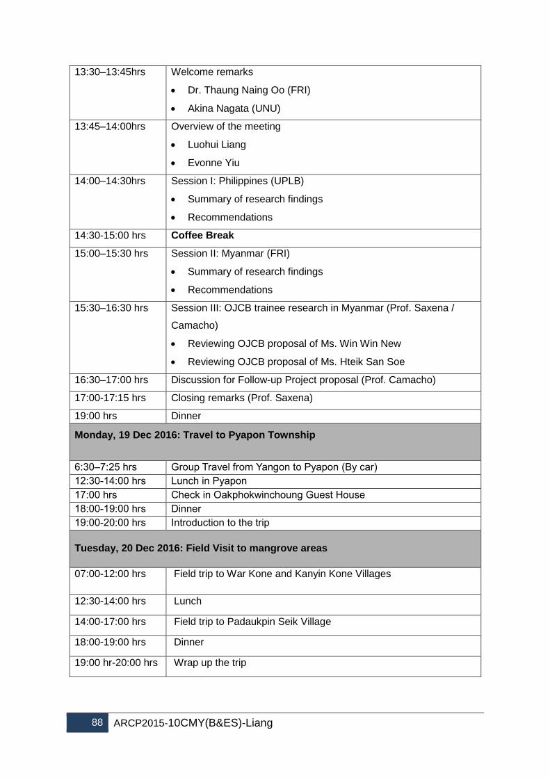
88 ARCP2015-10CMY(B&ES)-Liang
13:30–13:45hrs Welcome remarks
Dr. Thaung Naing Oo (FRI)
Akina Nagata (UNU)
13:45–14:00hrs Overview of the meeting
Luohui Liang
Evonne Yiu
14:00–14:30hrs Session I: Philippines (UPLB)
Summary of research findings
Recommendations
14:30-15:00 hrs Coffee Break
15:00–15:30 hrs Session II: Myanmar (FRI)
Summary of research findings
Recommendations
15:30–16:30 hrs Session III: OJCB trainee research in Myanmar (Prof. Saxena /
Camacho)
Reviewing OJCB proposal of Ms. Win Win New
Reviewing OJCB proposal of Ms. Hteik San Soe
16:30–17:00 hrs Discussion for Follow-up Project proposal (Prof. Camacho)
17:00-17:15 hrs Closing remarks (Prof. Saxena)
19:00 hrs Dinner
Monday, 19 Dec 2016: Travel to Pyapon Township
6:30–7:25 hrs Group Travel from Yangon to Pyapon (By car)
12:30-14:00 hrs Lunch in Pyapon
17:00 hrs Check in Oakphokwinchoung Guest House
18:00-19:00 hrs Dinner
19:00-20:00 hrs Introduction to the trip
Tuesday, 20 Dec 2016: Field Visit to mangrove areas
07:00-12:00 hrs
Field trip to War Kone and Kanyin Kone Villages
12:30-14:00 hrs Lunch
14:00-17:00 hrs Field trip to Padaukpin Seik Village
18:00-19:00 hrs Dinner
19:00 hr-20:00 hrs Wrap up the trip

Final Report: ARCP2015-10CMY(B&ES)-Liang 89
Wednesday, 21 Dec 2016: Back to Yangon(By Car)
6:00–7:00 hrs Breakfast
7:30 hrs Check out Oakphokwinchoung Guest House
12:30-14:00 hrs Lunch in Pyapon
17:00 hrs Check in at Tawwin Garden Hotel, Yangon
19:00-20:00hrs Dinner in Yangon
Thursday, 22 Dec 2016: Departure of participants from Yangon
List of participants:
Myanmar
Dr. Thaung Naing Oo
Director
Forest Research Institute
Yezin, Nay Pyi Taw
Myanmar
Tel: +95 - 67 – 416524
Fax: +95 - 67 - 416523
Email: [email protected]
Email: [email protected]
Dr Chaw Chaw Sein
Staff Officer
Forest Research Institute
Forest Department
Ministry of Environmental Conservation and Forestry
Tel: +95 - 67 - 416524
Fax: +95 - 67 - 416523
Email: [email protected]
Ms Hteik San Soe
Range Officer
Forest Research Institute
Yezin, Naypyitaw
Email: [email protected]
Ms Win Win New
Range Officer
Forest Research Institute
Yezin, Naypyitaw
Email: [email protected]

90 ARCP2015-10CMY(B&ES)-Liang
UNU :
Mr. Akira Nagata
Senior Programme Coordinator
United Nations University
Institute for the Advanced Study of Sustainability (UNU-IAS)
5-53-70 Jingumae, Shibuya-ku, Tokyo 150-8925
Tel: +81-3-5467-1242
Fax:+81-3-3406-7347
E-mail: [email protected]
Mr. Luohui Liang
Programme Coordinator
United Nations University
Institute for the Advanced Study of Sustainability (UNU-IAS)
53-70 Jingumae 5-chome, Shibuya-ku,
Tokyo 150-8925 Japan
Email: [email protected]
Ms. Evonne Yiu
Research Associate
United Nations University
Institute for the Advanced Study of Sustainability (UNU-IAS)
5-53-70 Jingumae, Shibuya-ku, Tokyo 150-8925 Japan
Tel: +81-3-5467-1334
Fax:+81-3-3406-7347
E-mail: [email protected]
Philippines :
Leni D. Camacho, PhD
Professor
Department of Social Forestry & Forest Governance
College of Forestry and Natural Resources
University of the Philippines Los Baños
College, Laguna 4031 PHILIPPINES
Telefax No. 63(49)536-3493
Mobile Phone No. 63(917)530-0096
Email : [email protected]
India:
K.G. Saxena, Professor
School of Environmental Sciences
Jawaharlal Nehru University
New Delhi 110067
Tel: +91-11- 26704305 (O)/Fax: +91-11- 26172438, 26169962 (O)
Email: [email protected]; [email protected]

Final Report: ARCP2015-10CMY(B&ES)-Liang 91
Appendix 2 Funding sources outside the APN
Fund outside the APN In-Kind
(US$) Cash (US$) Details of support Organizations
Project coordination, synthesis and
research missions, and support of OJCB United Nations University 4,000 7,500
Field assessment, policy analysis,
synthesis workshop organization University of the Philippines 1,000
Field assessment, policy analysis and
consultations in Myanmar
Forest Research Institute,
Myanmar 1,000
Field assessment, policy analysis and
consultations in Japan University of the Ryukyu, Japan 4,000
Associate study in India and supporting
the project workshops in Japan and
Philippines Jawaharlal Nehru University 1,000 1,500
Total 11,000 9,000

92 ARCP2015-10CMY(B&ES)-Liang
Appendix 3 List of Young Scientists
Ms Hteik San Soe
Range Officer
Forest Research Institute
Yezin, Naypyitaw, Myanmar
Email: [email protected]
She involved in inventory of forest resources and social survey of the project. She was
also supported by OJCB to take part in the OJCB programme on Participatory Agroforestry
For Rural Development in the Face of Climate Change” in Philippines on 2 Nov to 27 Nov
2016. Working with the project, she has developed a research proposal on agroforestry
practice for local livelihood in Delta Region, Ayeyarwady Division.
Ms Win Win New
Range Officer
Forest Research Institute
Yezin, Naypyitaw, Myanmar
Phone: +95-931496525; 67416524; 67416523
Email: [email protected]
She involved in inventory of forest resources and social survey of the project. She was
supported by OJCB to take part in the OJCB Programme on “Management of Coastal Forest
for Environmental Conservation, Food Security and Climate Change Mitigation” in India on
1 Oct to 22 Nov, 2016. Working with the project, she has developed a research proposal on
“assessing the potential of agroforestry in forest conservation and climate change mitigation
and adaptation in the Ayeyarwady delta, Myanmar”.
Dr. Lorena Sabino
University Researcher,
Dept of Social Forestry & Forest Governance, CFNR
University of the Philippines Los Baños
College, Laguna 4031 PHILIPPINES
Email address: [email protected]
She involved as a Project Staff of the APN Project (Philippines). She is a young researcher
in the department. She was involved in the APN project’s research works and policy

Final Report: ARCP2015-10CMY(B&ES)-Liang 93
consultations from various sectors where she learned a lot in terms of the current
mangrove situation in the country as well as the existing policies, policy recommendations,
etc. as a result of the project. She is involved in drafting an article for the project for
submission to international journal.

94 ARCP2015-10CMY(B&ES)-Liang
Appendix 4 Glossary of Terms
acronyms and abbreviations
Definition
ADT air dried metric tonnes
AYWD Ayeyarwady
BAFMAPA Banacon Fisherfolks and Mangrove Planters Association
CADC Certificate of Ancestral Domain Claim
CBFM Community-Based Forest Management
CBFMA Community-based Forest Management Program Agreement
CF Community Forestry
CFC Chloro-fluoron-carbon
CFI Community Forestry Instruction
CRMF Community Resource Management Framework
CRMP Coastal Resource Management Project
CSD Comprehensive Site Development (CSD)
CVM contingent valuation method
DA-BFAR Department of Agriculture, Bureau of Fisheries and Aquatic Resources
DAO Department Administrative Order
DENR Department of Environment and Natural Resources
FAO Food and Agriculture Organization
FLA Fishpond Lease Agreement
FUG Forest User Group
FD Forest Department, Myanmar
FREDA/ACTMANG Forest Resource Environment Development and Conservation Association/Action for Mangrove Reforestation
FRI Forest Research Institute, Myanmar
Ho:go One essential word for a Feng Shui village in Ryukyu Islands. The literal meaning of Ho:go is to embrace and protect by forest planting in order to retain the living energy.
IAS Institute for the Advanced Study of Sustainability
KCRDAI Kamuning Coastal Residents Development Association, Inc.
KI key informants
KPG Kanepackage Philippines Inc.
NGOs Non-governmental organizations
NIPAS National Integrated Protected Areas System Act
OJCB On-the-Job Research Capacity Building Programme for Food Security and Environmental Conservation in Developing Countries (OJCB), funded by the Ministry of Agriculture, Forestry and Fisheries of Japan.
PCSD Palawan Council for Sustainable Development
POs People’s Organizations
R3S1 “R3” indicates annual rainfall of above 100 inches (2,540mm) and with two continuous months of dry summer, and “S1” indicates soil of Fluvisols/Gleysols
RIF Regeneration Improvement Felling
SOC soil Organic Carbon
SOP Standardized Operational Procedures
SFM Sustainable Forest Management
STAGBAK Mangrove Rehabilitation Subproject funded by the Japan Bank for International Cooperation and implemented in Puerto Princesa City

Final Report: ARCP2015-10CMY(B&ES)-Liang 95
TDW Total dry weight
TFW total fresh weight
UNU United Nations University
UoR University of the Ryukyu
UPLB University of the Philippines Los Baños
USAID US Agency for International Development

96 ARCP2015-10CMY(B&ES)-Liang
Appendix 5. Philippines
Appendix 5.1 Results of policy consultation meeting with various stakeholders and
institutions in The Philippines
Based on Republic Act 7161 known as the “Revised Forestry Code of the Philippine” – Increasing the forest charges on Timber and other forest products. In this code, section 71 stated that commercial cutting in all mangrove species is not allowed. This code is contrary to DAO 10 of 1998 under Community Based Forest management (CBFM) that there is a component of cutting. In short, some sections of the policies in Community Based Forest Management (CBFM) are contradictory to RA 7161. The challenge is we cannot undo the CBFM on the ground particularly in production areas. Many mangrove areas are under CBFM and PO’s project sites are both CBFM. Mangrove policy is more on the protection/preservation rather than on the production and utilization, but when people are consulted, they want to harvest it for their subsistence. Communities want a provision for production or utilization in the bill since areas are CBFM. In 17th Congress-Senate bill 1308 of 2016 (new proposed bill) in which the tone of this bill is strengthening the no mangrove cutting which is strictly more on preservation, conservation, reforestation, afforestation and sustainable development of mangrove forest which more on the ecological. In short, the new proposed bill is more on the protection and rehabilitation, although sustainability was mentioned but the real context of sustainability is not yet clear. The challenge is what would be the impact of this new bill on CBFM communities and applicability of bill in the current CBFM areas. Proposal
To pilot Banacon site for sustainable management of mangrove though thinning and pruning in monoculture plantation. With this, amendments of including the thinning and pruning as part of silvicultural treatment, provided that capacity building and strict monitoring, compliance and accountability
With this, policy consultations were conducted in the following agencies:
Local Mangrove Communities in Bohol (March 22, 2016); Palawan (April 15, 2016) Forestry Development Center (FDC) - August 09, 2016 Biodiversity Management Bureau (BMB), July 26, 2016 Ecosystem Research and Development Bureau (ERDB) - August 22, 2016 NGO’s for Fisheries Reform (NFR) - October 21, 2016 Forest Management Bureau (FMB) - Policy section office and interviewed Ms. Edna
Nuestro and staff - October 21, 2016 Forest Management Bureau (FMB) - Office of the Director, interviewed Director
Ricardo Calderon - October 21, 2016 Bureau of Fisheries and Aquatic Resources (BFAR) - Melanie Guerra (OIC, Fisheries
Policies and Economic Division)

Final Report: ARCP2015-10CMY(B&ES)-Liang 97
Appendix 5. 2. Table 1. Summary of insights / perspectives on the implications of
current and proposed policy (s) on community-based mangrove management.
Agency/Institution Point of view Suggestions
1. Forestry
Development Center (FDC)
There is a need to assess the level of mangrove protected and production purposes. So, mangrove zoning should be done
There is a need to look at the National Inventory of mangrove – how successful are the PO’s
Determination of basic data such as: - Present condition of the mangrove - Total hectares of mangrove - Depleted area - PO actively doing rehabilitation and
utilizations - Present policy and sections on
mangrove - Status of logging - Benefits of mangrove - Reasons for protection - Any existing silvicultural treatments
of mangrove species– such as pruning, thinning as one way of alternative livelihood sources?
- Review of related literatures such as protected functions, livelihood and ecotourism opportunities, ecosystem services, economic values, income, food, livelihood,
Apprehensions: Once you allow the community to do
thinning, that is the opportunity for cutting.
If amendments in mangrove forest code under CBFM to include utilization of timber, how different will it be in protected areas?
In refining the bill, there should be a successful a model of sustainable forest management that will serve as a pilot site.
- Conduct a policy forum, regional consultation
- Invite all sectors concerns and speakers from different sectors to give point of view, experiences and related policies
- Expected output of the workshop: A bill amending section 3 RA 6171
2. Ecosystem Research and Development Bureau (ERDB)
Sustainable thinning use should be considered, given that monitoring is in place. Considering the opportunity losses if thinning is not done.
There is a need to do leveling off from the ground
They don’t want to encourage afforestation unless to revive the mangrove areas
Some LGUs allowed the POs to do thinning
To come up a policy paper and studies to support particularly on thinning for the policy paper
To conduct national policy forum inviting different

98 ARCP2015-10CMY(B&ES)-Liang
To have national mangrove committee or national council to monitor the mangrove.
Determine the use and alternative non-wood livelihood benefits
Policy gaps regarding Nipa
Secure profiles and maps on mangroves
stakeholders. ERDB will help in conducting a forum, provided that basic data about mangrove should support it.
ERDB plans on Policy forum 2nd international mangrove congress to be held next year 2017 sponsored by ERDB.
3. NGO’s for Fisheries Reform (NFR)
Total log ban is not ideal. There is need for thinning
Production and utilization should be considered since the people in the communities also need poles for housing
No charcoal for commercial purposes
POs target wants to plant since it is their source of livelihood
There is a need of clear guidelines in physical reversion between BFAR and DENR. BFAR Converted areas to aquasilviculture just to keep the FLA holder areas
Sustainable development concept in mangrove areas should focus on ecotourism and non-wood benefits such as collection of shellfish.
Regular monitoring system should be well implemented.
Advocating with Multispecies and not on monoculture since forest is not just a trees it is about biodiversity.
4. Forest
Management Bureau (FMB)
1. Key points from Ms.Edna Nuestro (Policy section)
If planted by the communities or production forest harvesting should be allowed as sustainable forest.
We cannot encourage farmers to plant if they are not allowed to harvest or do thinning. Thinning is just part of silviculture system treatment and thus is a way of improving the trees.
CBFM serves as a window for communities to access for consumption not in commercial purposes. CRMF should be included.
Inventory on planted trees through GEOTAG should be done to improve tracking system.
Conduct mangrove survey nationawide as data base for the mangrove areas using modern technologies

Final Report: ARCP2015-10CMY(B&ES)-Liang 99
Forest landuse planning as focus activities for 2017-2018
Lack of clear guidelines and files should be secured.
2. Key Points from Director Ricardo Calderon
We should allow harvesting as long as mangrove trees are planted by the communities.
Planted mangrove as of 2016 planted should not be harvested and be treated as natural, however, mangrove to be planted by 2017 onwards allowed for utilization and sustainable use.
Established mangrove plantations should be registered and manage it well
Pilot site in Caranglan, Pantabangan, Nueva Ecija: Doing charcoal in legal way.. Charcoal bricketting as a business model. There is a hub and market.
Thinning is just part of silvicultural treatment or sanitation cutting even pruning particularly in urban areas.
Preserve the natural mangrove stands. But encourage investment in mangrove plantation and allow to harvest.
Newly planted that could be harvest even for fuel wood etc.
Conduct policy forum and invite Senators
5. Bureau of Fisheries and Aquatic Resources (BFAR)
Points for consideration:
Surface issues when it comes to rehabilitations on degraded or abandoned fishponds.
More on the statics and status and cases on aquasilviculture
Key points from Ms. Melanie Guerra
Talks about 5 Year Development Plan on Aquasilviture (2012-2017) on mangrove rehabilitation
Communities Fisherfolks can start planting of mangrove trees with incentive of 1.50 per mangrove propagule once planted. Pag tumubo makakuha ng additional some of a total P 8.50
Community organizer in partnership with 63 SUCs and LGUs. Specific intervention with the SUCs is to manage the lying
Currently, intensifying program for aquasilvi culture

100 ARCP2015-10CMY(B&ES)-Liang
in of hatchery of crabs and this will serve as aquasilvi culture.
BFAR also provide fencing materials (wooden bamboo sticks) just to prohibit the cutting of mangrove para hindi na mag cut ng mangrove.
Statistics on FLAs will be acquired thought the Fisheries Regulatory and Quarantine Division (FRQB). In terms of abandoned, unproductive and underutilized fishponds. Contact: Atty. Annie Veto or Ms. Mary Ann Gonzales
- National Aqua Brackish Technology Center based in Pagbilao (Dr. Romeo Dietha). Technologies adopted are based on their recommendations/guidelines. They would normally recommend that whatever species growing in the areas will be the same species in the areas to be rehabilitated.
No harvesting in mangrove forests, would be good for them. It gives them livelihood benefits (non wood) particularly, the gleaners.

Final Report: ARCP2015-10CMY(B&ES)-Liang 101
Appendix 5.3. List of conferences attended sharing APN project results: Local GEVANA D, CAMACHO L, CAMACHO S, IM S. 2017. Carbon sequestration of mangroves, Paper presented during the symposium on mangroves for climate adaptive and resilient communities held at Waterfront Cebu City Hotel, Lahug, Cebu City, Philippines last December 19 to 20, 2016 International Camacho L, GEVAÑA d, CAMACHO s. 2017. Economic Valuation for Sustainable Mangrove Ecosystems Management in the Philippines. International Conference on Sustainable Mangrove Ecosystems 2017. Bali, Indonesia. 18-21 April 2017. (Oral Presentation) GEVAÑA D, PULHIN J, PULHIN F. 2017. Community-based Mangrove Management in the Philippines: Experiences and Challenges of Forest Governance in the Context of Climate Change. International Conference on Sustainable Mangrove Ecosystems 2017. Bali, Indonesia. 18-21 April 2017. (Oral Presentation) SOFRONIO C, GEVAÑA D, CAMACHO L. 2017. Potential Costs and Benefits of Carbon Sequestration in Mangrove Forest in Bohol, Philippines. International Conference on Sustainable Mangrove Ecosystems 2017. Bali, Indonesia. 18-21 April 2017. (Poster Presentation) GEVAÑA D, CAMACHO L, CAMACHO S, IM S. 2017. Stand Density Management and Blue Carbon Stock Potential of Rhizophora stylosa Plantation in Bohol, Philippines. International Conference on Sustainable Mangrove Ecosystems 2017. Bali, Indonesia. 18-21 April 2017. (Poster Presentation) GEVAÑA D, CAMACHO L, CAMACHO S, IM S. 2016. Reconciling the Environment and Economic Potentials of Community-managed mangroves for timber and blue carbon stocks: The Case of Bohol, Philippines. International Conference on Sustainable Forest Development in View of Climate Change (SFDCC2016). Kuala Lumpur, Malaysia. 8-11 August 2016. (Oral Presentation)

102 ARCP2015-10CMY(B&ES)-Liang
APPENDIX 5.4. PHOTO DOCUMENTATION OF THE STUDY SITES AND POLICY CONSULTATION MEETINGS IN THE PHILIPPINES 4A. Survey Community at Banacon Island, Bohol

Final Report: ARCP2015-10CMY(B&ES)-Liang 103
Mangroves in Banacon Island

104 ARCP2015-10CMY(B&ES)-Liang
The Team during the survey activities in the community and visit to the study site

Final Report: ARCP2015-10CMY(B&ES)-Liang 105

106 ARCP2015-10CMY(B&ES)-Liang
Appendix 4b. Survey Community at Barangay Kamuning, Puerto Princesa City, Palawan Mangroves in Barangay Kamuning, Puerto Princesa City, Palawan

Final Report: ARCP2015-10CMY(B&ES)-Liang 107
The Team during the survey activities in the community and visit to the study site

108 ARCP2015-10CMY(B&ES)-Liang

Final Report: ARCP2015-10CMY(B&ES)-Liang 109

110 ARCP2015-10CMY(B&ES)-Liang

Final Report: ARCP2015-10CMY(B&ES)-Liang 111
3C. Policy Consultation Meetings
Local Community, BAFMAPA, Banacon, Bohol

112 ARCP2015-10CMY(B&ES)-Liang
DENR-CENRO, Talibon, Bohol

Final Report: ARCP2015-10CMY(B&ES)-Liang 113

114 ARCP2015-10CMY(B&ES)-Liang
Local community in Puerto Princesa, Palawan

Final Report: ARCP2015-10CMY(B&ES)-Liang 115
Forestry Development Center (FDC) - August 09, 2016

116 ARCP2015-10CMY(B&ES)-Liang

Final Report: ARCP2015-10CMY(B&ES)-Liang 117
Ecosystem Research and Development Bureau (ERDB) - August 22, 2016
Biodiversity Management Bureau (BMB)

118 ARCP2015-10CMY(B&ES)-Liang

Final Report: ARCP2015-10CMY(B&ES)-Liang 119
NGO’s for Fisheries Reform (NFR) - October 21, 2016
Forest Management Bureau (FMB) - Policy section office and interviewed Ms. Edna Nuestro and staff - October 21, 2016

120 ARCP2015-10CMY(B&ES)-Liang
Forest Management Bureau (FMB) - Office of the Director, interviewed Director Ricardo Calderon - October 21, 2016

Final Report: ARCP2015-10CMY(B&ES)-Liang 121
Bureau of Fisheries and Aquatic Resources (BFAR) - Melanie Guerra (OIC, Fisheries Policies and Economic Division)

122 ARCP2015-10CMY(B&ES)-Liang
Appendix 6. Myanmar
Appendix 6.1. Questions and Topics of Research for Stakeholder Discussion
in Myanmar
- Who own the coastal forests in the study areas? Who is conserving the coastal
forests for sustainability? Who has the main responsibility to manage the coastal
forests? Do you also get the support and help from government organizations and
others?
- Do you also participate in the establishment of plantations by forest department?
- Do you also have CF plantations and how do you organize CF and how do you
share the benefits?
- Do you also have home garden or agroforestry or agro-silvo-pastro around your
village or near your home? And if yes, how much?
- Is there any land use conflict whenever you establish coastal plantations?
- How do you share the benefit from coastal forest plantations?
- Do you also face climate change effects?( eg- increase in temperature, decrease in
biodiversity, climate change, how do you feel currently?)
- How will you adapt if you face climate change effect like Nargis in future?( Will you
move to more safety area or will you stay in here or will you conserve the forests)
- Do you think that coastal could survive/ protect for climate change like Nargis? Do
coastal forests prove others services?
- How do you prepare to survive the climate change like Nargis?
- Do you prepare individually or with the arrangement of all members of the village?
- Is there any adaptation activities to climate change from Forest Department or NGos
or other governmental organizations?
- How do you prepare and protect the climate change activities?
Dialogue with head of the village
- Who own the coastal forests in the study areas? Who is conserving the coastal
forests for sustainability? Who has the main responsibility to manage the coastal
forests? Do you also get the support and help from government organizations and
others?
- Do you also participate in the establishment of plantations by forest department?
- Do you also have CF plantations and how do you organize CF and how do you
share the benefits?

Final Report: ARCP2015-10CMY(B&ES)-Liang 123
- Is there any land use conflict whenever you establish coastal plantations?
- How do you share the benefit from coastal forest plantations?
- Do you also face climate change effects?( eg- increase in temperature, decrease in
biodiversity, climate change, how do you feel currently?)
- How will you adapt if you face climate change effect like Nargis in future?( Will you
move to more safety area or will you stay in here or will you conserve the forests)
- Do you think that coastal could survive/ protect for climate change like Nargis? Do
coastal forests provide others services?
- How do you prepare to survive the climate change like Nargis?
- Do you prepare individually or with the arrangement of all members of the village?
- Is there any adaptation activities to climate change from Forest Department or NGos
or other governmental organizations?
- How do you prepare and protect the climate change activities?
Questions for Government Staff
- How do you conserve and manage coastal forests?
- Do you also have social problems for the conservation of coastal forests ( eg-
encroachment in reserved forest).
- Is there enough finance and staffs for conservation of coastal forests?
- Which kind of benefits do local people get from coast forest plantations?
- Do you think that coastal forests could survive/ protect for climate change like
Nargis? Do coastal forests provide others services?
- How do you prepare to survive the climate change like Nargis?
- Is there any adaptation activity to climate change cooperation with NGos or other
governmental organizations?
- How do you prepare and protect the climate change activities?

124 ARCP2015-10CMY(B&ES)-Liang
APPENDIX 6.2. PHOTO DOCUMENTATION OF THE STUDY SITES AND POLICY CONSULTATION MEETINGS IN MYANMAR
Stakeholders discussion in Wah Kone Village

Final Report: ARCP2015-10CMY(B&ES)-Liang 125
Stakeholders discussion in Padauk Pin Seik Village

126 ARCP2015-10CMY(B&ES)-Liang
Dialogue with village head in Padauk Pin Seik Village
Planting around shrimp and fish ponds

Final Report: ARCP2015-10CMY(B&ES)-Liang 127
Nursery for private plantation

128 ARCP2015-10CMY(B&ES)-Liang
Agroforestry
Community Forest Plantation

Final Report: ARCP2015-10CMY(B&ES)-Liang 129
Homegarden

130 ARCP2015-10CMY(B&ES)-Liang
Cyclone Shelter