appendix b, page 1 dakubetede (or11-40) wilderness ... · wilderness characteristics inventory...
TRANSCRIPT

Appendix B, Page 1
DAKUBETEDE (OR11-40)
WILDERNESS CHARACTERISTICS INVENTORY
APPENDIX B – INVENTORY AREA EVALUATION
Evaluation of Current Conditions:
1) Document and review any existing BLM wilderness characteristics inventory findings on file
regarding the presence or absence of individual wilderness characteristics, using Form 1,
below.
2) Consider relevant information regarding current conditions available in the office. Identify and
describe any changes to the existing inventory information. Use interdisciplinary team
knowledge, aerial photographs, field observations, maps, etc. and document the findings on
Form 2, below. Document current conditions regarding wilderness characteristics, as opposed
to potential future conditions.
Conduct field reviews as necessary to verify information and to ascertain current conditions.
Reach conclusions on current conditions including boundaries, size of areas and presence or
absence of wilderness characteristics. Fully explain the basis for each conclusion on Form 2,
including any critical differences between BLM and citizen information.
Document the findings regarding current conditions for each inventoried area. Describe how
the present conditions are similar to, or have changed from, the conditions documented in the
original wilderness characteristics inventory. Document the findings on Form 2 for each
inventory area. Cite to or attach data considered, including photographs, maps, GIS layers, field
trip notes, project files, etc.

Appendix B, Page 2
DAKUBETEDE (OR11-40)
FORM 1
Documentation of BLM Wilderness Characteristics Inventory Findings from Previous Inventory
on Record
1. Is there existing BLM wilderness characteristics inventory information on all or part of
this area?
No ☐ (Go to Form 2) Yes ☒ (If yes, and if more than one area is within the area, list
the unique identifiers for those areas.):
a) Inventory Source: 2006 WOPR
b) Inventory Area Unique Identifier(s): OR11-40
c) Map Name(s)/Number(s): Dakubetede_WCI_20130521.pdf
d) BLM District(s)/Field Office(s): Medford/Ashland
2. BLM Inventory Findings on Record:
Existing inventory information regarding wilderness characteristics (if more than one BLM
inventory area is associated with the area, list each area and answer each question individually for
each inventory area):
Inventory Source: 2006 WOPR
Unique Identifier
Sufficient Size?
Yes/No
(acres)
Naturalness?
Yes/No
Outstanding
Solitude?
Yes/No
Outstanding
Primitive &
Unconfined
Recreation?
Yes/No
Supplemental
Values?
Yes/No
OR11-40 Y N N N

Appendix B, Page 3
DAKUBETEDE (OR11-40)
FORM 2
Current Conditions: Presence or Absence of Wilderness Characteristics
Area Unique Identifier OR11-40 (DAKUBETEDE) Acreage 5,099
(If the inventory area consists of subunits, list the acreage of each and evaluate each separately).
In completing steps (1)-(5), use additional space as necessary.
1) Is the area of sufficient size? (If the area meets one of the exceptions to the size criterion, check
“Yes” and describe the exception in the space provided below),
Yes ☒ No ☐
Note: If “No” is checked the area does not have wilderness characteristics; check “NA” for the
remaining questions below.
Description (describe the boundaries of the area--wilderness inventory roads, property lines, etc.):
Field inspections, review of the area using Google Earth, and review of BLM road and timber records
brought changes to the original inventory unit boundary. Route analyses were conducted on several
roads. Unit boundary was edited to match land line inventory, topography where appropriate, and
exclude roads with 20 ft buffer.
2) Does the area appear to be natural?
Yes ☒ No ☐ N/A ☐
Note: If “No” is checked the area does not have wilderness characteristics; check “NA” for the
remaining questions below.
Description (include land ownership, location, topography, vegetation, and summary of major human
uses/activities):
The DAKUBETDE WCI unit consists of several areas of large blocks of contiguous public lands
within the Applegate watershed. The area is steep and rugged. Vegetation varies from dense mature
mixed conifers and hardwood stands to open grass and shrublands. Major human uses/activities
include hiking, mountain biking and equestrian use.
3) Does the area (or the remainder of the area if a portion has been excluded due to unnaturalness and
the remainder is of sufficient size) have outstanding opportunities for solitude?
Yes ☒ No ☐ N/A ☐
Description (describe the area’s outstanding opportunities for solitude):
Topographic and vegetative features provide ample screening from roads, private lands, and
management activities on surrounding lands.
4) Does the area (or the remainder of the area if a portion has been excluded due to unnaturalness and
the remainder is of sufficient size) have outstanding opportunities for primitive and unconfined
recreation?
Yes ☒ No ☐ N/A ☐

Appendix B, Page 4
DAKUBETEDE (OR11-40)
Note: If “No” is checked for both 3 and 4 the area does not have wilderness characteristics; check
“NA” for question 5.
Description (describe the area’s outstanding opportunities for primitive and unconfined recreation):
Topographic and vegetative features provide ample screening from roads, private lands, and
management activities on surrounding lands. The Sterling Mine Ditch Trail traverses East/West
through the area. The area’s proximity to settled areas of the Applegate Valley provides opportunities
to many who seek primitive and unconfined recreational experiences close to home.
(5) Does the area have supplemental values (ecological, geological, or other features of scientific,
educational, scenic or historical value)?
Yes ☒ No ☐ N/A ☐
Description: STERLING MINE DITCH ACEC

DAKUBETEDE (OR11-40)Appendix B, Page 5
Summary of Analysis
Area Unique Identifier: OR11-40 (DAKUBETEDE)SummaryResults of analysis:(Note: explain the inventory findings for the entirety of the inventory unit. When wildernesscharacteristics have been identified in an area that is smaller than the size of the total inventory unit,explain why certain portions of the inventory unit are not included within the lands with wildernesscharacteristics (e.g. the inventory found that certain parts lacked naturalness).
1. Does the area meet any of the size requirements? Yes NoD
2. Does the area appear to be natural? Yes No D N/AD
3. Does the area offer outstanding opportunities for solitude or a primitive and unconfined type of
recreation? Yes 13 No D N/A D
4. Does the area have supplemental values? Yes IS No D N/A D
Check one:
IS The area, or a portion of the area, has wilderness characteristics and is identified as lands with
wilderness characteristics.
D The area does not have wilderness characteristics.
Prepared by (team members):NameJeanne Klein
Dennis Byrd
Levi Dean
Kristi Mastrofini
TitleDistrict Sup Outdoor Recreation Planner
Ashland RA Outdoor Recreation Planner
Recreation Technician
Natural Resource Specialist
Date2/12/13
2/12/13
2/12/13
4/13
istrict or Field Manager):
Title Date
This form documents information that constitutes an inventory finding on wilderness characteristics. It does notrepresent a formal land use allocation or a final agency decision subject to administrative remedies under either 43 CFRparts 4 or 1610.5-3.

"/
"/
"/
"/
"/
"/
"/
"/
"/
"/
"/
"/
"/
"/ "/
"/
"/
"/
"/
"/"/
"/
D4
D9
D8D7
D6
D5
D3
D2
D1
D22
D21D20D19
D18D17
D16D15
D13
D14
D12D11
D10
39 -2-8.0 38-2-2 4.0
39-2-9.0
38-2-26.0
39-1-1 8.0
39-1-1 8.1
39-2-28.0
39-2-12.2
39-2-
12.0
39-2-17.0
39-2-
25.0
39-2-3.2
39-2-15.0
39-1-19.0
39-1-1 7.0
39-1-17.2
39-2-1.0
39-1-17.3
39-2-11.039-1-28.2
39-1-
30.0
39-1-
18
.2
3 9-2-2.0
39-2-15.1
39-2-
4.0
39-2-27.1
39
-1-29.0
39-2-
7.0
39-2-4.2
39-1-19.1
39-2-1 7.0
39-
2-28.0
39-2-12.0
39-2-28.0
39-1-1 7.3
L ittle ApplegateRoad
Anderson Creek Road
Sterlin
g Cree
k Rd
Dakubetede5099 Acres
07
18
19
11
15
21
16
1009
14 13
22 2423
12
20
17
08
30
08
17
20
25262728
04 0603 02 0105
29 29
05
30 00
3500
40002500
4500
2000
5000
3 500
35
00
450 0
3500
4500
3 00 0
39-2-3.1
39-2-17.1
39-1-
28.2
39-2-1.139-2-12.1
38-2-31.0
38-2-31.0
39-2-25.1
39-1-31.0
39-1-
20.0
39-1-
20.0
39-1-20.0
39-1-
20.0
39-1-
20.0
39-1-20.0
39-1-
19.2
39-1-19.2
39-2-5.3 39-2-3.0
39-1-29.1
39-2-
34.1
Yale Creek R
oad
No warranty is made by the Bureau of Land Management as to the accuracy,reliability, or completeness of these data for individual or aggregate usewith other data. Original data were compiled from various sources and maybe updated without notification.
0 1 20.5Miles
MXD: W:\ArcMap\WCI_BND_EDITS_20130415.mxd AMP
Wilderness Characteristics Inventory - Dakubetede (OR11-40) 2013/04/15
"/ Photo_Points_Dakubetede
Major HighwayHWY_CLASS
Interstate HighwayUS HighwayState HighwayWCI Units 2013
RoadOwnerDesg
Bureau of Land ManagementCounty routeForest ServiceOther state routeMunicipal route (urban, residential, etc.)Private road (no symbol)Not KnownSection
OwnershipPROPERTY STATUS
Bureau of Land ManagementU.S. Forest ServiceBureau of ReclamationCorps of EngineersNational Park ServiceU.S. Fish and Wildlife ServiceLocal GovernmentStatePrivate Individual or Company®

DAKUBETEDE (OR11-40) ROUTE ANALYSIS
WILDERNESS CHARACTERISTICS INVENTORY
APPENDIX C – ROUTE ANALYSIS1 (Factors to consider when determining whether a route is a road
2 for wilderness characteristics inventory
purposes.)
Wilderness Characteristics Inventory Area Unique Identifier: DAKUBETEDE
Route or Route Segment3 Name and/or Identifier: 39-2-27
(Include Transportation Plan Identifier, if known, and include route number supplied by citizen
information, when available.)
I. LOCATION: Refer to attached map DAKUBETEDE_Rt_analysis_20121221.pdf and BLM
corporate data (GIS). List photo point references (where applicable) or reference attached photo
log: Frame # 34-38; D19-23
Describe: BLM Road 39-2-27 is a natural surface road that spurs off of a private road that begins on
Little Applegate Road in section 22 outside of proposed DAKUBETEDE WCI unit. The road is
blocked by a gate and private signs at the beginning of the road and has not been used lately, as there
are small trees and shrubs growing in the road.
II. ROUTE CONTEXT
1 This form documents information that constitutes an inventory finding on wilderness characteristics. It does not
represent a formal land use allocation or a final agency decision subject to administrative remedies under either 43 CFR parts 4 or 1610.5-3. 2 Road: An access route which has been improved and maintained by mechanical means to insure relatively regular
and continuous use. A way maintained solely by the passage of vehicles does not constitute a road. a. Improved and maintained – Actions taken physically by people to keep the road open to vehicle traffic.
“Improved” does not necessarily mean formal construction. “Maintained” does not necessarily mean annual maintenance.
b. Mechanical means – Use of hand or power machinery or tools. c. Relatively regular and continuous use – Vehicular use that has occurred and will continue to occur on a
relatively regular basis. Examples are: access roads for equipment to maintain a stock water tank or other established water sources, access roads to maintained recreation sites or facilities, or access roads to mining claims.
3 If a portion of a route is found to meet the wilderness inventory road criteria (see Part III) and the remainder
does not meet these criteria (e.g., a cherrystem road with a primitive route continuing beyond a certain point), identify each segment and explain the rationale for the separate findings under pertinent criteria.

DAKUBETEDE (OR11-40) ROUTE ANALYSIS
A. Current Purpose4 (if any) of Route: (Examples: Rangeland/Livestock Improvements (stock
tank, developed spring, reservoir, fence, corral), Inholdings (ranch, farmhouse), Mine Site,
Concentrated Use Site (camp site), Recreation, Utilities (transmission line, telephone,
pipeline), Administrative (project maintenance, communication site, vegetation treatment)).
Describe: Private access to private lands and administrative access in past to BLM lands
B. Right-of-Way (ROW):
1. Is there a ROW associated with this route?
Yes ☐ No ☐ Unknown ☒
2. If yes, what is the stated purpose of the ROW?
3. Is the ROW still being used for this purpose?
Yes ☐ No ☐ Unknown or N/A ☒
Explain:
III. WILDERNESS INVENTORY ROAD CRITERIA
A. Evidence of construction or improvement using mechanical means:
Yes ☒ (if either A.1 or A.2 is checked “yes” below) No ☐ (if both A.1 and A.2 are
checked “no” below)
1. Construction: (Is there evidence that the route or route segment was originally
constructed using mechanical means?) Yes ☒ No ☐
Examples: Paved☐ Bladed☐ Graveled☐ Roadside Berms☐ Cut/Fill☒ Other☐
Describe: Obvious road bed.
2. Improvements: (Is there evidence of improvements using mechanical means to facilitate
access?) Yes ☐ No ☒ If “yes”: by Hand Tools ☐ by Machine ☐
Examples: Culverts☐ Hardened Stream Crossings☐ Bridges☐ Drainage☐ Barriers☐ Other
☐
Describe: Road has small trees growing in the center of it
4 The purpose of a route is not a deciding factor in determining whether a route is a road for wilderness
characteristics inventory purposes. The purpose of a route does provide context for factors on which such a determination may be based, particularly the question of whether maintenance of the route ensures relatively regular and continuous use. The purpose also helps to determine whether maintenance that may so far have been unnecessary to ensure such use would be approved by BLM when the need arises.

DAKUBETEDE (OR11-40) ROUTE ANALYSIS
B. Maintenance: (Is there evidence of maintenance that would ensure relatively regular and
continuous use?):
Yes ☐ (if either B.1 or B.2 is checked “yes” below) No ☒ (if both B.1 and B.2 are checked
“no” below)
1. Is there Evidence or Documentation of Maintenance using hand tools or machinery?
Yes ☐ No ☒ If “yes”: by Hand Tools ☐ by Machine ☐
Explain: Road is overgrown, with small trees and brush growing in the middle of it.
2. If the route or route segment is in good5 condition, but there is no evidence of
maintenance, would mechanical maintenance with hand tools or machines be approved
by BLM to meet the purpose(s) of the route in the event this route became impassable?
Yes ☐ No ☒
Explain: Road is not currently being used but has been in the past to access BLM lands for fuels
treatments.
C. Relatively regular and continuous use: (Does the route or route segment ensure relatively
regular and continuous use?) Yes ☐ No ☒
Describe evidence (e.g., direct, vehicles or vehicle tracks observed, or indirect, evidence of use
associated with purpose of the route such as maintenance of facility that route accesses) and
other rationale for whether use has occurred and will continue to occur on a relatively regular
basis (i.e., regular and continuous use relative to the purpose(s) of the route):6
IV. CONCLUSION:
Does the route or route segment7 meet the definition of a wilderness inventory road (i.e., are items
III.A and III.B and III.C all checked yes)?
Yes ☐ = Wilderness Inventory Road No ☒ = Not a road for wilderness inventory purposes
Explanation8:
5 Good condition would be a condition that ensures regular and continuous use relative to the purposes of the
route. Consider whether the route can be clearly followed in the field over its entire course and whether all or any portion of the route contains any impediments to travel. 6 Include estimate of travel rates for the stated purposes, e.g., trips/day or week or month or season or year or
even multiple years in some facility maintenance cases. 7 If part of the route meets the wilderness inventory road definition and the remainder does not, describe the
segment meeting the definition and any remaining portion not meeting the definition and why. 8 Describe and explain rationale for any discrepancies with citizen proposals.

DAKUBETEDE (OR11-40) ROUTE ANALYSIS
The road has not been used in several years, as it is overgrown with grass, shrubs and small trees.
The beginning of the road on private land is more open, but once it enters BLM, it is overgrown.
Evaluator(s) Date
Jeanne Klein 5/23/13
Robyn Wicks 5/23/13

DAKUBETEDE (OR11-40) ROUTE ANALYSIS
WILDERNESS CHARACTERISTICS INVENTORY
APPENDIX C – ROUTE ANALYSIS1 (Factors to consider when determining whether a route is a road
2 for wilderness characteristics inventory
purposes.)
Wilderness Characteristics Inventory Area Unique Identifier: DAKUBETEDE
Route or Route Segment3 Name and/or Identifier: 39-2-15.1
(Include Transportation Plan Identifier, if known, and include route number supplied by citizen
information, when available.)
I. LOCATION: Refer to attached map DAKUBETEDE_Rt_analysis_20121221.pdf and BLM
corporate data (GIS). List photo point references (where applicable) or reference attached photo
log: Frame # 13,14,15; Photo pt. 6
Describe: BLM Road 39-1-18.2 is a natural surface road that spurs northwest from road 39-2-8
outside of proposed DAKUBETEDE WCI unit boundary in section 15. The road is no longer in use,
because it has been decommissioned with tank traps.
II. ROUTE CONTEXT
1 This form documents information that constitutes an inventory finding on wilderness characteristics. It does not
represent a formal land use allocation or a final agency decision subject to administrative remedies under either 43 CFR parts 4 or 1610.5-3. 2 Road: An access route which has been improved and maintained by mechanical means to insure relatively regular
and continuous use. A way maintained solely by the passage of vehicles does not constitute a road. a. Improved and maintained – Actions taken physically by people to keep the road open to vehicle traffic.
“Improved” does not necessarily mean formal construction. “Maintained” does not necessarily mean annual maintenance.
b. Mechanical means – Use of hand or power machinery or tools. c. Relatively regular and continuous use – Vehicular use that has occurred and will continue to occur on a
relatively regular basis. Examples are: access roads for equipment to maintain a stock water tank or other established water sources, access roads to maintained recreation sites or facilities, or access roads to mining claims.
3 If a portion of a route is found to meet the wilderness inventory road criteria (see Part III) and the remainder
does not meet these criteria (e.g., a cherrystem road with a primitive route continuing beyond a certain point), identify each segment and explain the rationale for the separate findings under pertinent criteria.

DAKUBETEDE (OR11-40) ROUTE ANALYSIS
A. Current Purpose4 (if any) of Route: (Examples: Rangeland/Livestock Improvements (stock
tank, developed spring, reservoir, fence, corral), Inholdings (ranch, farmhouse), Mine Site,
Concentrated Use Site (camp site), Recreation, Utilities (transmission line, telephone,
pipeline), Administrative (project maintenance, communication site, vegetation treatment)).
Describe: Provides scenic non-motorized opportunities for recreation, hunting, and administrative
purposes.
B. Right-of-Way (ROW):
1. Is there a ROW associated with this route?
Yes ☐ No ☒ Unknown ☐
2. If yes, what is the stated purpose of the ROW?
3. Is the ROW still being used for this purpose?
Yes ☐ No ☒ Unknown or N/A ☐
Explain: Road has been decommissioned
III. WILDERNESS INVENTORY ROAD CRITERIA
A. Evidence of construction or improvement using mechanical means:
Yes ☐ (if either A.1 or A.2 is checked “yes” below) No ☒ (if both A.1 and A.2 are
checked “no” below)
1. Construction: (Is there evidence that the route or route segment was originally
constructed using mechanical means?) Yes ☒ No ☐
Examples: Paved☐ Bladed☐ Graveled☐ Roadside Berms☐ Cut/Fill☒ Other☐
Describe: Road has been decommissioned with tank traps. Obvious road cut, see photo frame 13.
2. Improvements: (Is there evidence of improvements using mechanical means to facilitate
access?) Yes ☐ No ☒ If “yes”: by Hand Tools ☐ by Machine ☐
Examples: Culverts☐ Hardened Stream Crossings☐ Bridges☐ Drainage☐ Barriers☐ Other
☐
4 The purpose of a route is not a deciding factor in determining whether a route is a road for wilderness
characteristics inventory purposes. The purpose of a route does provide context for factors on which such a determination may be based, particularly the question of whether maintenance of the route ensures relatively regular and continuous use. The purpose also helps to determine whether maintenance that may so far have been unnecessary to ensure such use would be approved by BLM when the need arises.

DAKUBETEDE (OR11-40) ROUTE ANALYSIS
Describe: Road has been decommissioned with tank traps.
B. Maintenance: (Is there evidence of maintenance that would ensure relatively regular and
continuous use?):
Yes ☐ (if either B.1 or B.2 is checked “yes” below) No ☒ (if both B.1 and B.2 are checked
“no” below)
1. Is there Evidence or Documentation of Maintenance using hand tools or machinery?
Yes ☐ No ☒ If “yes”: by Hand Tools ☐ by Machine ☐
Explain: Road has been decommissioned
2. If the route or route segment is in good5 condition, but there is no evidence of
maintenance, would mechanical maintenance with hand tools or machines be approved
by BLM to meet the purpose(s) of the route in the event this route became impassable?
Yes ☐ No ☒
Explain: Road has been decommissioned
C. Relatively regular and continuous use: (Does the route or route segment ensure relatively
regular and continuous use?) Yes ☐ No ☒
Describe evidence (e.g., direct, vehicles or vehicle tracks observed, or indirect, evidence of use
associated with purpose of the route such as maintenance of facility that route accesses) and
other rationale for whether use has occurred and will continue to occur on a relatively regular
basis (i.e., regular and continuous use relative to the purpose(s) of the route):6
IV. CONCLUSION:
Does the route or route segment7 meet the definition of a wilderness inventory road (i.e., are items
III.A and III.B and III.C all checked yes)?
Yes ☐ = Wilderness Inventory Road No ☒ = Not a road for wilderness inventory purposes
Explanation8:
5 Good condition would be a condition that ensures regular and continuous use relative to the purposes of the
route. Consider whether the route can be clearly followed in the field over its entire course and whether all or any portion of the route contains any impediments to travel. 6 Include estimate of travel rates for the stated purposes, e.g., trips/day or week or month or season or year or
even multiple years in some facility maintenance cases. 7 If part of the route meets the wilderness inventory road definition and the remainder does not, describe the
segment meeting the definition and any remaining portion not meeting the definition and why. 8 Describe and explain rationale for any discrepancies with citizen proposals.

DAKUBETEDE (OR11-40) ROUTE ANALYSIS
The road is no longer in use, because it has been decommissioned with tank traps. No evidence of
vehicle use.
Evaluator(s) Date
Levi Dean 1/10/13
Amanda Noel 1/10/13

DAKUBETEDE (OR11-40) ROUTE ANALYSIS
WILDERNESS CHARACTERISTICS INVENTORY
APPENDIX C – ROUTE ANALYSIS1 (Factors to consider when determining whether a route is a road
2 for wilderness characteristics inventory
purposes.)
Wilderness Characteristics Inventory Area Unique Identifier: DAKUBETEDE
Route or Route Segment3 Name and/or Identifier: 39-2-11
(Include Transportation Plan Identifier, if known, and include route number supplied by citizen
information, when available.)
I. LOCATION: Refer to attached map DAKUBETEDE_Rt_analysis_20121221.pdf and BLM
corporate data (GIS). List photo point references (where applicable) or reference attached photo
log: Frame # 21-28; Photo pt. 6
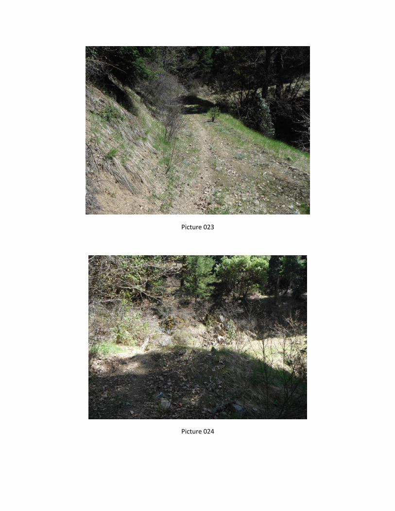
Describe: BLM Road 39-2-11is a natural surface road that spurs southwest from road 39-2-8 within
the DAKUBETEDE WCI unit boundary in section 111. The road is no longer in use, because it has
been decommissioned with tank traps.
II. ROUTE CONTEXT
1 This form documents information that constitutes an inventory finding on wilderness characteristics. It does not
represent a formal land use allocation or a final agency decision subject to administrative remedies under either 43 CFR parts 4 or 1610.5-3. 2 Road: An access route which has been improved and maintained by mechanical means to insure relatively regular
and continuous use. A way maintained solely by the passage of vehicles does not constitute a road. a. Improved and maintained – Actions taken physically by people to keep the road open to vehicle traffic.
“Improved” does not necessarily mean formal construction. “Maintained” does not necessarily mean annual maintenance.
b. Mechanical means – Use of hand or power machinery or tools. c. Relatively regular and continuous use – Vehicular use that has occurred and will continue to occur on a
relatively regular basis. Examples are: access roads for equipment to maintain a stock water tank or other established water sources, access roads to maintained recreation sites or facilities, or access roads to mining claims.
3 If a portion of a route is found to meet the wilderness inventory road criteria (see Part III) and the remainder
does not meet these criteria (e.g., a cherrystem road with a primitive route continuing beyond a certain point), identify each segment and explain the rationale for the separate findings under pertinent criteria.

DAKUBETEDE (OR11-40) ROUTE ANALYSIS
A. Current Purpose4 (if any) of Route: (Examples: Rangeland/Livestock Improvements (stock
tank, developed spring, reservoir, fence, corral), Inholdings (ranch, farmhouse), Mine Site,
Concentrated Use Site (camp site), Recreation, Utilities (transmission line, telephone,
pipeline), Administrative (project maintenance, communication site, vegetation treatment)).
Describe: Currently being used by motorcycles as a single track trail.
B. Right-of-Way (ROW):
1. Is there a ROW associated with this route?
Yes ☐ No ☒ Unknown ☐
2. If yes, what is the stated purpose of the ROW?
3. Is the ROW still being used for this purpose?
Yes ☐ No ☒ Unknown or N/A ☐
Explain: Road has been decommissioned
III. WILDERNESS INVENTORY ROAD CRITERIA
A. Evidence of construction or improvement using mechanical means:
Yes ☐ (if either A.1 or A.2 is checked “yes” below) No ☒ (if both A.1 and A.2 are
checked “no” below)
1. Construction: (Is there evidence that the route or route segment was originally
constructed using mechanical means?) Yes ☒ No ☐
Examples: Paved☐ Bladed☐ Graveled☐ Roadside Berms☐ Cut/Fill☒ Other☐
Describe: Road has been decommissioned with tank traps. Obvious road cut, see photo frame 13.
2. Improvements: (Is there evidence of improvements using mechanical means to facilitate
access?) Yes ☐ No ☒ If “yes”: by Hand Tools ☐ by Machine ☐
Examples: Culverts☐ Hardened Stream Crossings☐ Bridges☐ Drainage☐ Barriers☐ Other
☐
Describe: Road has been decommissioned with tank traps and has been rehabilitated.
4 The purpose of a route is not a deciding factor in determining whether a route is a road for wilderness
characteristics inventory purposes. The purpose of a route does provide context for factors on which such a determination may be based, particularly the question of whether maintenance of the route ensures relatively regular and continuous use. The purpose also helps to determine whether maintenance that may so far have been unnecessary to ensure such use would be approved by BLM when the need arises.

DAKUBETEDE (OR11-40) ROUTE ANALYSIS
B. Maintenance: (Is there evidence of maintenance that would ensure relatively regular and
continuous use?):
Yes ☐ (if either B.1 or B.2 is checked “yes” below) No ☒ (if both B.1 and B.2 are checked
“no” below)
1. Is there Evidence or Documentation of Maintenance using hand tools or machinery?
Yes ☐ No ☒ If “yes”: by Hand Tools ☐ by Machine ☐
Explain: Road has been decommissioned
2. If the route or route segment is in good5 condition, but there is no evidence of
maintenance, would mechanical maintenance with hand tools or machines be approved
by BLM to meet the purpose(s) of the route in the event this route became impassable?
Yes ☐ No ☒
Explain: Road has been decommissioned
C. Relatively regular and continuous use: (Does the route or route segment ensure relatively
regular and continuous use?) Yes ☐ No ☒
Describe evidence (e.g., direct, vehicles or vehicle tracks observed, or indirect, evidence of use
associated with purpose of the route such as maintenance of facility that route accesses) and
other rationale for whether use has occurred and will continue to occur on a relatively regular
basis (i.e., regular and continuous use relative to the purpose(s) of the route):6
IV. CONCLUSION:
Does the route or route segment7 meet the definition of a wilderness inventory road (i.e., are items
III.A and III.B and III.C all checked yes)?
Yes ☐ = Wilderness Inventory Road No ☒ = Not a road for wilderness inventory purposes
Explanation8:
5 Good condition would be a condition that ensures regular and continuous use relative to the purposes of the
route. Consider whether the route can be clearly followed in the field over its entire course and whether all or any portion of the route contains any impediments to travel. 6 Include estimate of travel rates for the stated purposes, e.g., trips/day or week or month or season or year or
even multiple years in some facility maintenance cases. 7 If part of the route meets the wilderness inventory road definition and the remainder does not, describe the
segment meeting the definition and any remaining portion not meeting the definition and why. 8 Describe and explain rationale for any discrepancies with citizen proposals.

DAKUBETEDE (OR11-40) ROUTE ANALYSIS
The road is no longer in use, because it has been decommissioned with tank traps. No evidence of
vehicle use.
Evaluator(s) Date
Jeanne Klein 4/23/13

DAKUBETEDE (OR11-40) ROUTE ANALYSIS
WILDERNESS CHARACTERISTICS INVENTORY
APPENDIX C – ROUTE ANALYSIS1 (Factors to consider when determining whether a route is a road
2 for wilderness characteristics inventory
purposes.)
Wilderness Characteristics Inventory Area Unique Identifier: DAKUBETEDE (OR11-40)
Route or Route Segment3 Name and/or Identifier: 39-1-19
(Include Transportation Plan Identifier, if known, and include route number supplied by citizen
information, when available.)
I. LOCATION: Refer to attached map DAKUBETEDE_Rt_analysis_20121221.pdf and BLM
corporate data (GIS). List photo point references (where applicable) or reference attached photo
log: Frame # 2,3,4; Photo pt. 2
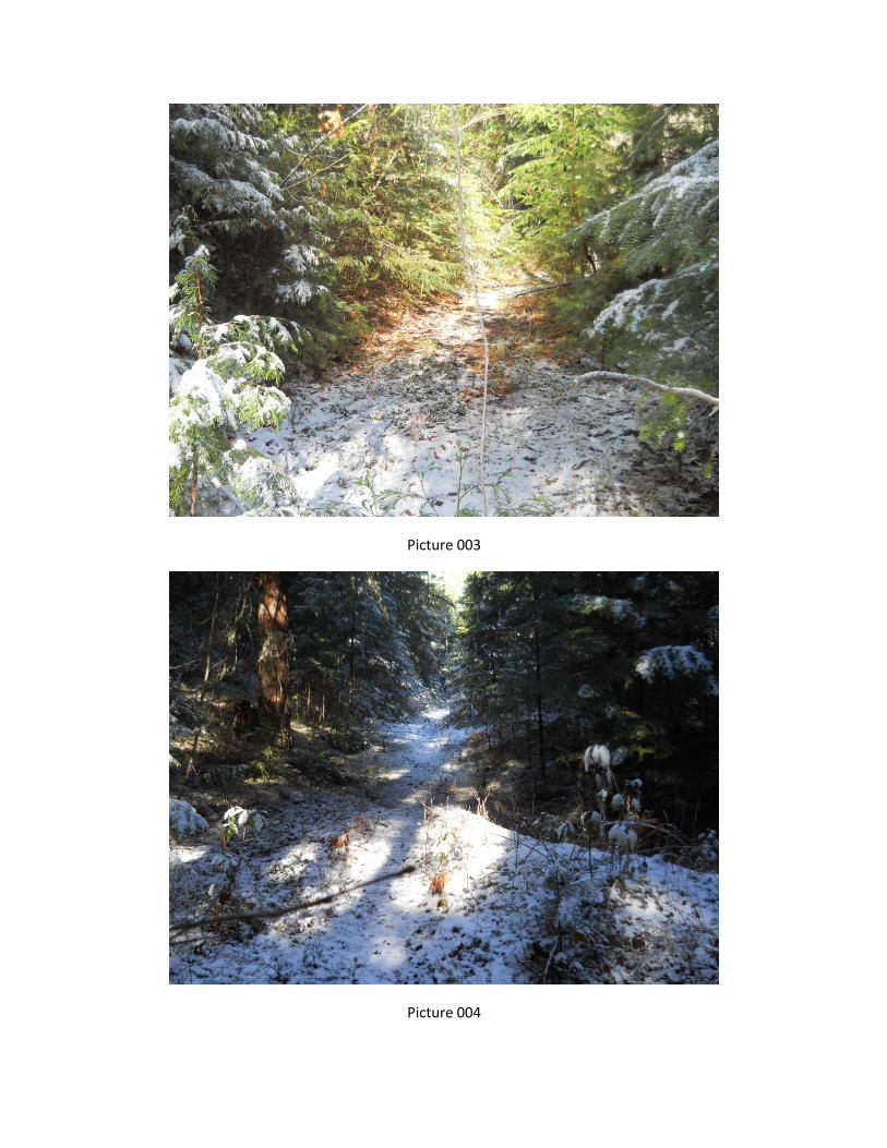
Describe: BLM Road 39-1-19 is a decommissioned natural surface road that spurs off of Anderson
Creek Road into the eastern portion of the DAKUBETEDE WCI unit. 39-1-19 extends .48 miles up
an unnamed tributary to Rush Creek, located northeast of Goat Cabin Ridge. The road is no longer in
use, because it has been decommissioned with tank traps and water bars. There is evidence of rehab
efforts.
II. ROUTE CONTEXT
1 This form documents information that constitutes an inventory finding on wilderness characteristics. It does not
represent a formal land use allocation or a final agency decision subject to administrative remedies under either 43 CFR parts 4 or 1610.5-3. 2 Road: An access route which has been improved and maintained by mechanical means to insure relatively regular
and continuous use. A way maintained solely by the passage of vehicles does not constitute a road. a. Improved and maintained – Actions taken physically by people to keep the road open to vehicle traffic.
“Improved” does not necessarily mean formal construction. “Maintained” does not necessarily mean annual maintenance.
b. Mechanical means – Use of hand or power machinery or tools. c. Relatively regular and continuous use – Vehicular use that has occurred and will continue to occur on a
relatively regular basis. Examples are: access roads for equipment to maintain a stock water tank or other established water sources, access roads to maintained recreation sites or facilities, or access roads to mining claims.
3 If a portion of a route is found to meet the wilderness inventory road criteria (see Part III) and the remainder
does not meet these criteria (e.g., a cherry stem road with a primitive route continuing beyond a certain point), identify each segment and explain the rationale for the separate findings under pertinent criteria.

DAKUBETEDE (OR11-40) ROUTE ANALYSIS
A. Current Purpose4 (if any) of Route: (Examples: Rangeland/Livestock Improvements (stock
tank, developed spring, reservoir, fence, corral), Inholdings (ranch, farmhouse), Mine Site,
Concentrated Use Site (camp site), Recreation, Utilities (transmission line, telephone,
pipeline), Administrative (project maintenance, communication site, vegetation treatment)).
Describe: Provides scenic non-motorized opportunities for recreation, hunting, and administrative
purposes.
B. Right-of-Way (ROW):
1. Is there a ROW associated with this route?
Yes ☐ No ☒ Unknown ☐
2. If yes, what is the stated purpose of the ROW?
3. Is the ROW still being used for this purpose?
Yes ☐ No ☒ Unknown or N/A ☐
Explain: Decommissioned and impassible
III. WILDERNESS INVENTORY ROAD CRITERIA
A. Evidence of construction or improvement using mechanical means:
Yes ☐ (if either A.1 or A.2 is checked “yes” below) No ☒ (if both A.1 and A.2 are
checked “no” below)
1. Construction: (Is there evidence that the route or route segment was originally
constructed using mechanical means?) Yes ☐ No ☒
Examples: Paved☐ Bladed☐ Graveled☐ Roadside Berms☐ Cut/Fill☐ Other☐
Describe: Decommissioned and impassible
2. Improvements: (Is there evidence of improvements using mechanical means to facilitate
access?) Yes ☐ No ☒ If “yes”: by Hand Tools ☐ by Machine ☐
Examples: Culverts☐ Hardened Stream Crossings☐ Bridges☐ Drainage☐ Barriers☐ Other
☐
Describe: Decommissioned and impassible
4 The purpose of a route is not a deciding factor in determining whether a route is a road for wilderness
characteristics inventory purposes. The purpose of a route does provide context for factors on which such a determination may be based, particularly the question of whether maintenance of the route ensures relatively regular and continuous use. The purpose also helps to determine whether maintenance that may so far have been unnecessary to ensure such use would be approved by BLM when the need arises.
DAKUBETEDE (OR11-40) ROUTE ANALYSIS
B. Maintenance: (Is there evidence of maintenance that would ensure relatively regular and
continuous use?):
Yes ☐ (if either B.1 or B.2 is checked “yes” below) No ☒ (if both B.1 and B.2 are checked
“no” below)
1. Is there Evidence or Documentation of Maintenance using hand tools or machinery?
Yes ☐ No ☒ If “yes”: by Hand Tools ☐ by Machine ☐
Explain: Decommissioned and impassible
2. If the route or route segment is in good5 condition, but there is no evidence of
maintenance, would mechanical maintenance with hand tools or machines be approved
by BLM to meet the purpose(s) of the route in the event this route became impassable?
Yes ☐ No ☒
Explain: Decommissioned and impassible
C. Relatively regular and continuous use: (Does the route or route segment ensure relatively
regular and continuous use?) Yes ☐ No ☒
Describe evidence (e.g., direct, vehicles or vehicle tracks observed, or indirect, evidence of use
associated with purpose of the route such as maintenance of facility that route accesses) and
other rationale for whether use has occurred and will continue to occur on a relatively regular
basis (i.e., regular and continuous use relative to the purpose(s) of the route):6
IV. CONCLUSION:
Does the route or route segment7 meet the definition of a wilderness inventory road (i.e., are items
III.A and III.B and III.C all checked yes)?
Yes ☐ = Wilderness Inventory Road No ☒ = Not a road for wilderness inventory purposes
Explanation8:
The road is no longer in use, because it has been decommissioned with tank traps and water bars.
There is evidence of rehab efforts.
5 Good condition would be a condition that ensures regular and continuous use relative to the purposes of the
route. Consider whether the route can be clearly followed in the field over its entire course and whether all or any portion of the route contains any impediments to travel. 6 Include estimate of travel rates for the stated purposes, e.g., trips/day or week or month or season or year or
even multiple years in some facility maintenance cases. 7 If part of the route meets the wilderness inventory road definition and the remainder does not, describe the
segment meeting the definition and any remaining portion not meeting the definition and why. 8 Describe and explain rationale for any discrepancies with citizen proposals.

DAKUBETEDE (OR11-40) ROUTE ANALYSIS
Evaluator(s) Date
Levi Dean 1/10/13
Amanda Noel 1/10/13

DAKUBETEDE (OR11-40) ROUTE ANALYSIS
WILDERNESS CHARACTERISTICS INVENTORY
APPENDIX C – ROUTE ANALYSIS1 (Factors to consider when determining whether a route is a road
2 for wilderness characteristics inventory
purposes.)
Wilderness Characteristics Inventory Area Unique Identifier: DAKUBETEDE (OR11-40)
Route or Route Segment3 Name and/or Identifier: 39-1-18.2
(Include Transportation Plan Identifier, if known, and include route number supplied by citizen
information, when available.)
I. LOCATION: Refer to attached map Dakubetede_Rt_analysis_20121221.pdf and BLM
corporate data (GIS). List photo point references (where applicable) or reference attached photo
log: Frame # 6,7,9,10; Photo pt. 4
Describe: BLM Road 39-1-18.2 is a natural surface road that spurs south from Anderson Butte Road
(38-2-24) into the eastern portion of the DAKUBETEDE WCI unit. 39-1-18.2 extends .46 miles
along the uppermost portion of Goat Cabin Ridge.
II. ROUTE CONTEXT
A. Current Purpose4 (if any) of Route: (Examples: Rangeland/Livestock Improvements (stock
tank, developed spring, reservoir, fence, corral), Inholdings (ranch, farmhouse), Mine Site,
Concentrated Use Site (camp site), Recreation, Utilities (transmission line, telephone,
pipeline), Administrative (project maintenance, communication site, vegetation treatment)).
Describe: Provides scenic opportunities for recreation, hunting, and administrative purposes.
1 This form documents information that constitutes an inventory finding on wilderness characteristics. It does not
represent a formal land use allocation or a final agency decision subject to administrative remedies under either 43 CFR parts 4 or 1610.5-3. 2 Road: An access route which has been improved and maintained by mechanical means to insure relatively regular
and continuous use. A way maintained solely by the passage of vehicles does not constitute a road. a. Improved and maintained – Actions taken physically by people to keep the road open to vehicle traffic.
“Improved” does not necessarily mean formal construction. “Maintained” does not necessarily mean annual maintenance.
b. Mechanical means – Use of hand or power machinery or tools. c. Relatively regular and continuous use – Vehicular use that has occurred and will continue to occur on a
relatively regular basis. Examples are: access roads for equipment to maintain a stock water tank or other established water sources, access roads to maintained recreation sites or facilities, or access roads to mining claims.
3 If a portion of a route is found to meet the wilderness inventory road criteria (see Part III) and the remainder
does not meet these criteria (e.g., a cherrystem road with a primitive route continuing beyond a certain point), identify each segment and explain the rationale for the separate findings under pertinent criteria. 4 The purpose of a route is not a deciding factor in determining whether a route is a road for wilderness
characteristics inventory purposes. The purpose of a route does provide context for factors on which such a determination may be based, particularly the question of whether maintenance of the route ensures relatively regular and continuous use. The purpose also helps to determine whether maintenance that may so far have been unnecessary to ensure such use would be approved by BLM when the need arises.

DAKUBETEDE (OR11-40) ROUTE ANALYSIS
B. Right-of-Way (ROW):
1. Is there a ROW associated with this route?
Yes ☐ No ☒ Unknown ☐
2. If yes, what is the stated purpose of the ROW?
3. Is the ROW still being used for this purpose?
Yes ☐ No ☒ Unknown or N/A ☐
Explain: User created spur.
III. WILDERNESS INVENTORY ROAD CRITERIA
A. Evidence of construction or improvement using mechanical means:
Yes ☐ (if either A.1 or A.2 is checked “yes” below) No ☒ (if both A.1 and A.2 are
checked “no” below)
1. Construction: (Is there evidence that the route or route segment was originally
constructed using mechanical means?) Yes ☐ No ☒
Examples: Paved☐ Bladed☐ Graveled☐ Roadside Berms☐ Cut/Fill☐ Other☐
Describe: User created spur.
2. Improvements: (Is there evidence of improvements using mechanical means to facilitate
access?) Yes ☐ No ☒ If “yes”: by Hand Tools ☐ by Machine ☐
Examples: Culverts☐ Hardened Stream Crossings☐ Bridges☐ Drainage☐ Barriers☐ Other
☐
Describe: User created spur.
B. Maintenance: (Is there evidence of maintenance that would ensure relatively regular and
continuous use?):
Yes ☐ (if either B.1 or B.2 is checked “yes” below) No ☒ (if both B.1 and B.2 are checked
“no” below)
1. Is there Evidence or Documentation of Maintenance using hand tools or machinery?
Yes ☐ No ☒ If “yes”: by Hand Tools ☐ by Machine ☐

DAKUBETEDE (OR11-40) ROUTE ANALYSIS
Explain: User created spur.
2. If the route or route segment is in good5 condition, but there is no evidence of
maintenance, would mechanical maintenance with hand tools or machines be approved
by BLM to meet the purpose(s) of the route in the event this route became impassable?
Yes ☐ No ☒
Explain: User created spur.
C. Relatively regular and continuous use: (Does the route or route segment ensure relatively
regular and continuous use?) Yes ☒ No ☐
Describe evidence (e.g., direct, vehicles or vehicle tracks observed, or indirect, evidence of use
associated with purpose of the route such as maintenance of facility that route accesses) and
other rationale for whether use has occurred and will continue to occur on a relatively regular
basis (i.e., regular and continuous use relative to the purpose(s) of the route):6
Road dead ends at a view point. Vehicle tracks were observed.
IV. CONCLUSION:
Does the route or route segment7 meet the definition of a wilderness inventory road (i.e., are items
III.A and III.B and III.C all checked yes)?
Yes ☐ = Wilderness Inventory Road No ☒ = Not a road for wilderness inventory purposes
Explanation8:
Evaluator(s) Date
Levi Dean 1/10/13
Amanda Noel 1/10/13
5 Good condition would be a condition that ensures regular and continuous use relative to the purposes of the
route. Consider whether the route can be clearly followed in the field over its entire course and whether all or any portion of the route contains any impediments to travel. 6 Include estimate of travel rates for the stated purposes, e.g., trips/day or week or month or season or year or
even multiple years in some facility maintenance cases. 7 If part of the route meets the wilderness inventory road definition and the remainder does not, describe the
segment meeting the definition and any remaining portion not meeting the definition and why. 8 Describe and explain rationale for any discrepancies with citizen proposals.

DAKUBETEDE (OR11-40) ROUTE ANALYSIS

Appendix D, Page 1
WILDERNESS CHARACTERISTICS INVENTORY
APPENDIX D – PHOTO LOG
Photographer(s): Levi Dean/Kristi Mastrofini/Jeanne Klein
Inventory Area Unique Identifier: Dakubetede (OR11-40)
(*) Photo Point #s correspond to GPS locations shown in shapefile named Dakubetede_Photo_Pts.shp located in
Dakubetede project folder. Attribute item in shapefile is “ident”.
Date Frame # Camera
Direction Description
GPS/UTM
Location
Town-
ship Range Sec.
Photo
Point #
(*)
1/2/13 1 NE Sec 15 of meadow perceived to
be timber sale
42°9’45”N
122°55’55”W
T39S R1W 22 D1
1/2/13 2,3,4 NW Decommissioned road 39-1-19 42°9’60”N
122°51’49”W
T39S R1E 19 D2
1/2/13 5 S Sec 18,19,24 (left to right) 42°10’17”N
122°51’25”W
T39S R1E 18 D3
1/2/13 6,7,10 S 39-1-18.2 42°10’40”N
122°52’32”W
T39S R1E 18 D4
1/2/13 8,9 SW Taken from junction of 39-1-18.2
Frame 8 is looking into Sec 13
42°10’40”N
122°52’32”W
T39S R1E 18 D4
1/2/13 11 NE Taken from S border into Sec 15,
14
42°9’17”N
122°55’43.5”W
T39S R1W 27 D5
1/2/13 12 SE Taken from 39-2-15.1
Looking into sec 15 and 22
42°10’41”N
122°55’48”W
T39S R1W 15 D6
1/2/13 13,14,15 NW 39-2-15.1 42°10’41”N
122°55’48”W
T39S R1W 15 D6
4/23/13 16,17 W Along 39-1-17 Rd 42°10’33.37”N
122°51’51”W
T39S R1W 17 D7
4/23/13 18 SW Along 39-1-17 Rd 42°10’25.48”N
122°50’59.02”W
T39S R1W 17 D8
4/23/13 19 W Along Little Applegate Road 42°09’16.89”N
122°52’55.29”W
T39S R2W 23 D9
4/23/13 20 NW Along 39-2-8 rd 42°10’53.27”N
122°54”53.73”W
T39S R2W 15 D10
4/23/13 21-28 SW Along 39-2-11 rd 42°11’53.64”N
122°54’15.75”W
T39S R2W 11 D11
4/23/13 29 NW Along 39-2-8 rd-looking at grassy
ridge
42°11’59.88”N
122°54’26.19”W
T39S R2W 11 D12
4/23/13 30,31 SW Ridgeline Along 39-2-8 rd 42°12’14.69”N
122°54’37.21”W
T39S R2W 2 D13
4/23/13 32 SW Quarry 42°12’29.20”N
122°54’23.41”W
T39S R2W 2 D14
05/20/13 33 Photo of plantation on boundary
(but outside) of original proposal
122°57'45.581"W
42°10'42.496"N
T39S R2W 17 D15
05/20/13 34 Sterling Wolf timber sale units
(inside original boundary)
122°57'55.263"W
42°10'47.034"N
T39S R2W 17 D16

Appendix D, Page 2
05/20/13 35 Sterling Wolf timber sale units
(inside original boundary)
122°57'58.931"W
42°10'30.228"N
T39S R2W 17 D17
05/20/13 36 Fuels treatments (inside original
boundary)
122°58'10.341"W
42°10'20.573"N
T39S R2W 17 D18
37
5/23/13 39 NE Road 39-2-27 42° 09’26.8”N
122° 56’07.9”W
T39S R2W 21 D19
5/23/13 40 SW Road 39-2-27 42° 09’18.7”N
122° 56’07.9”W
T39S R2W 21 D20
5/23/13 41 E Road 39-2-27 42° 09’36.3”N
122° 56’05.8”W
T39S R2W 21 D21
5/23/13 42 N Road 39-2-27 at start of BLM
land
42° 09’33.6”N
122° 56’03.5”W
T39S R2W 21 D22
5/23/13 43 N Beginning of road on private land,
turns into BLM Road 39-2-27
42° 09’20”N
122° 56’58.4”W
T39S R2W 21 D23

Picture 001
Picture 002
Picture 003
Picture 004

Picture 005
Picture 006

Picture 007
Picture 008
Picture 009
Picture 010

Picture 011
Picture 012

Picture 013

Picture 014

Picture 015
Picture 016

Picture 017
Picture 018

Picture 019
Picture 020

Picture 021
Picture 022
Picture 023
Picture 024

Picture 025
Picture 026

Picture 027
Picture 028
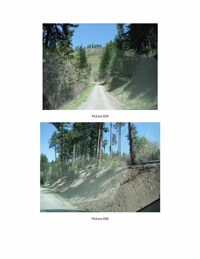
Picture 029
Picture 030

Picture 031
Picture 032

Picture 033
Picture 034

Picture 035
Picture 036


Picture 037
Picture 038

Picture 039
Picture 040

Picture 041