ap human geography ptolemy’s first world map, c. ad 150
TRANSCRIPT
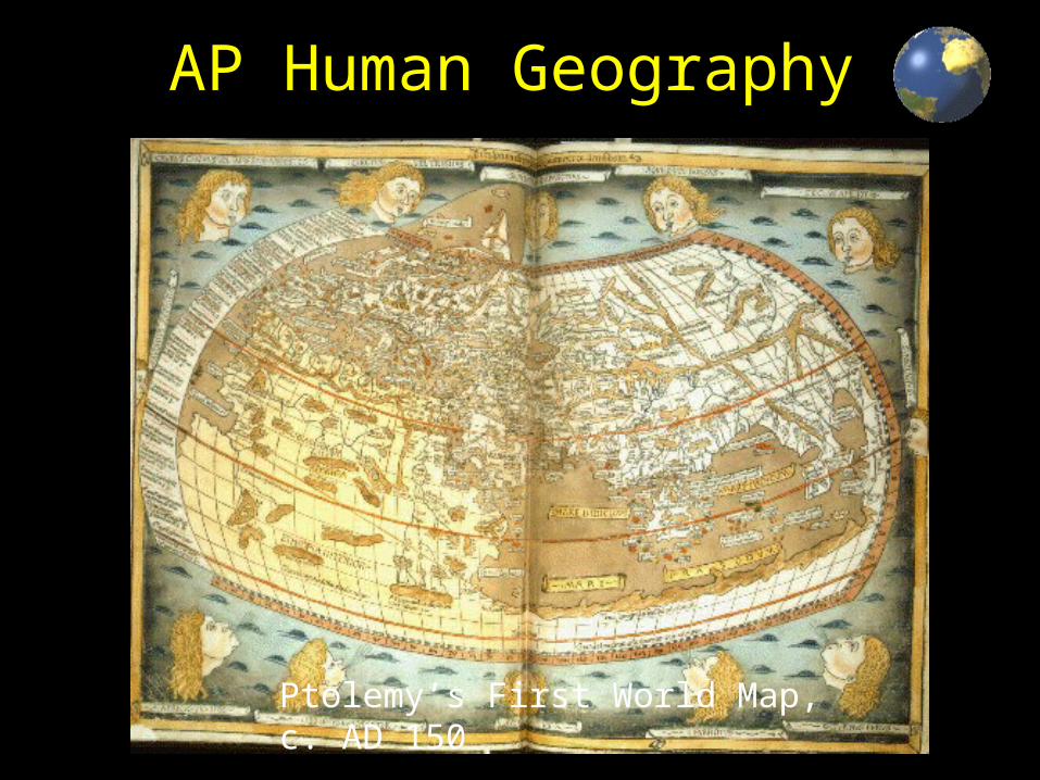
AP Human Geography
Ptolemy’s First World Map, c. AD 150

What is Geography?Geography is a representation of the whole known world together with the phenomena which are contained therein.
Ptolemy, Geographia 2nd Century A.D.
Geography is the science of place. Its vision is grand, its view panoramic. It sweeps the surface of the Earth, charting the physical, organic and cultural terrain, their areal differentiation, and their ecological dynamics with humankind. Its foremost tool is the map.
Leonard Krishtalka, Carnegie Museum of Natural History, 20th Century A.D.

What is Geography?Geography is the study of what is where and why it’s there.
Mr. Buck

Okay, but what exactly is it?Well, it’s a way of thinking about intellectual problems, both natural and societal, which emphasizes the importance of spatial relationships.. Take any social, environmental, or physical question or problem and ask yourself whether there is a spatial aspect to it. Chances are that space and place play a role in the explanation and distribution of that question.
Mike Reed, Making It Up As I Go
For example: Why are so many plant and animal species becoming extinct at the end of the twentieth century?
Why do there always seem to be been so many wars in Africa?
Why is corn such an important part of a traditional Mexican diet?
Why are some beers known as India Pale Ales?

Divisions of Geography
Physical Geography Human Geography
Rocks and Minerals Population
Landforms Settlements
Soils Economic Activities
Animals Transportation
Plants Recreational Activities
Water Religion
Atmosphere Political Systems
Rivers and Other Water Bodies Social Traditions
Environment Human Migration
Climate and Weather Agricultural Systems
Geography is a bridge between the natural and social sciences. Geography is a holistic or synthesizing science.

6
What is Human Geography?
The study of how people make places, how we organize space and society, how we interact with each other in places and across space, and how we make sense of others and ourselves in our locality, region, and world.

7
Geography is a spatial study
This means that geographers look at the way humans interact within and with their space.
Spatial – of or pertaining to space on or near the Earth’s surface
how are things organized on Earth?
how do they appear on the landscape?
why? where? so what?
8
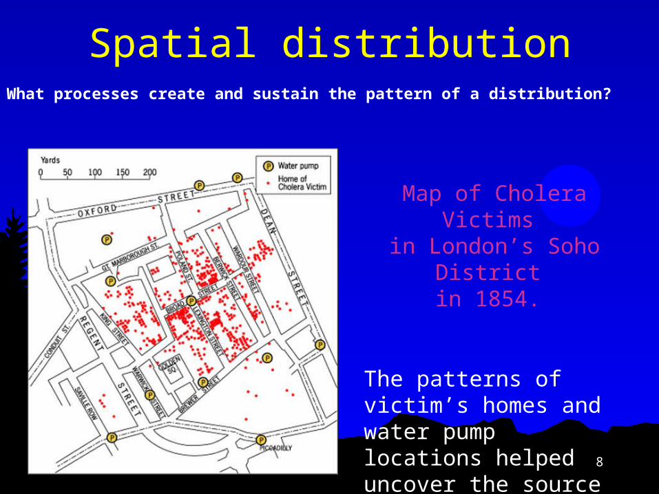
Spatial distributionWhat processes create and sustain the pattern of a distribution?
Map of Cholera Victims in London’s Soho
District in 1854.
The patterns of victim’s homes and water pump locations helped uncover the source of the disease.
9
1. Location – Where is it?
2. Space Patterns and regularities across Earth –
depicted on maps; What is it like there?
3. Place Unique location of everything on Earth;
What makes a place unique?
Key Geographic Concepts

10
Key Geographic Concepts cont…
4. Scale truth is scale dependent, phenomena you
study at one scale (e.g. local) may well be influenced by developments at other scales (e.g. regional, national, or global)
5. Pattern e.g. migration patterns, diffusion of
cultures, languages, religions etc.

11
Key Geographic Concepts cont…
6. Region Areas formed by distinctive
combinations of features; What do areas have in common?
7. Interconnections (Globalization) Relationships of places and regions;
How does one area relate to another?
12
History of Geography
The oldest existing map appears on a clay tablet made in Babylonia before 2000 B.C.
They developed the system of dividing a circle into 360 degrees.
Greek and Roman geographers measured (not always accurately) and devised a grid system of latitudes and longitudes
Ptolemy (2nd c. CE) created first index of locations using grid

13
Ptolemy’s Map

14
Eratosthenes (273-192 BC)
Father of Geography First to use term
Geographica Calculated
circumference of the Earth
Produced map of “Known World”
The First Geographers

15

16
Advances in Geography included:al Idrisi – Muslim
geographic compiler – master of “known world” circa 1050 CE

17
Exploration - 12th to 18th c.Portugal leads the early
explorations – practical in nature
The astrolabe, caravel (ship) and compass assist mariners from Europe who must map what they find
In 1730, John Harrison discovered longitude.

18
Alexander von Humboldt (1769-1859)
Naturalist Traveled extensively Scientific descriptions
Focused on humanity’s interaction with nature
First to include humans as part of natural world

19
Carl Ritter (1779-1859)
Organic view of geographyUniversal laws
Anatomy of the Earth

20
Carl Sauer (1889-1975)
Rejected “environmental determinism” [human behavior is determined by one’s physical environment]His ideas
Cultural Landscape = visible imprint of human activity on the landscape
Possibilism = one’s natural environment only limits the range of choices available to a culture

21
Environmental Determinism
Is when human behavior, individually and collectively, is strongly affected by-even controlled or determined by-the physical environment; climate is the critical factor in how humans behave.

22
PossibilismWhen the natural environment merely serves to
limit the range of choices available to a culture.
1. Choices a culture makes depends on their needs and levels of technology
2. Environmental constraints are less binding as a culture increases its level of technology

23
Example of Possiblilism

The Cultural Landscape
The result of the natural environment and all of the changes to it as a result of a particular culture. (Carl Sauer) Environmental Determinism:
environment is primary determinant of culture.
Possibilism: humans are primary determinant of culture.

25
The Natural Landscape
Physical characteristics of a locale

26
The Cultural LandscapeVisible expression of human activity
on the landscapeCreated by Carl SauerHas layers of imprints from years of
human activity.Successive occupiers bring own
technological and cultural traditions and transform the landscape

27
Cultural Landscape cont…
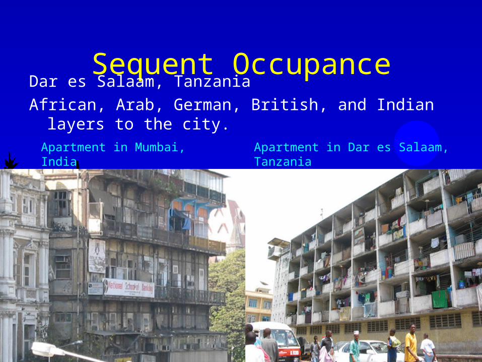
Sequent Occupance – Layers of imprints in a cultural landscape that reflect years of differing human activity.
When an area has been occupied and transformed by successive residents
Area remains imprinted with each successive occupation which creates the cultural landscape

28
Sequent Occupance
Athens, Greece ancient Agora surrounded by modern buildings
29
Sequent OccupanceDar es Salaam, TanzaniaAfrican, Arab, German, British, and Indian layers to the
city.Apartment in Mumbai, India Apartment in Dar es Salaam, Tanzania

The Five Themes of Geography
Human features
Physical featuresRegion united by similar physical conditions
United by common cultural traits
People adapt to the environment
People change the environment
Absolute location (latitude and longitude)
Relative location (in relation to another place)
Travel from place to place
Exchange of goods and ideas
Location
Movement
Place
Region
Interaction

31
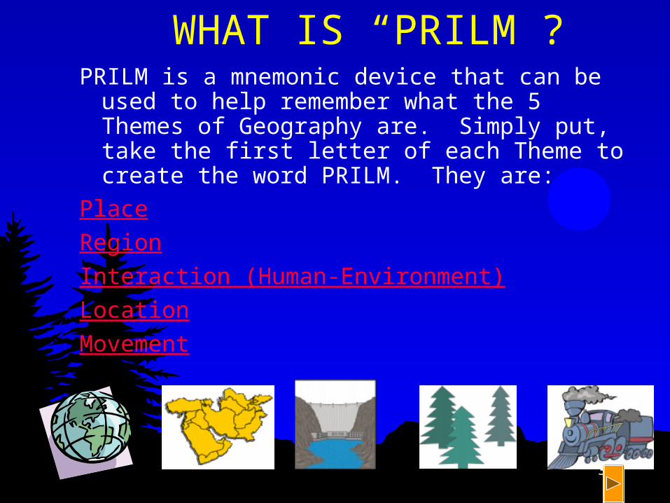
WHERE DID THE 5 THEMES COME FROM?
The 5 Themes of Geography originated by the National Geographic Society to fulfill a need for geographers (people who study the earth and everything on it) categorize everything they learn. These 5 places are easy to remember. Just say the word “PRILM”.
32
WHAT IS “PRILM”?PRILM is a mnemonic device that can be
used to help remember what the 5 Themes of Geography are. Simply put, take the first letter of each Theme to create the word PRILM. They are:
PlaceRegionInteraction (Human-Environment)LocationMovement
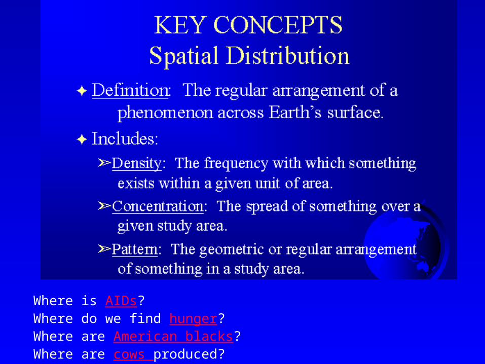
Where is AIDs?Where do we find hunger?Where are American blacks?Where are cows produced?

Describing Distributions
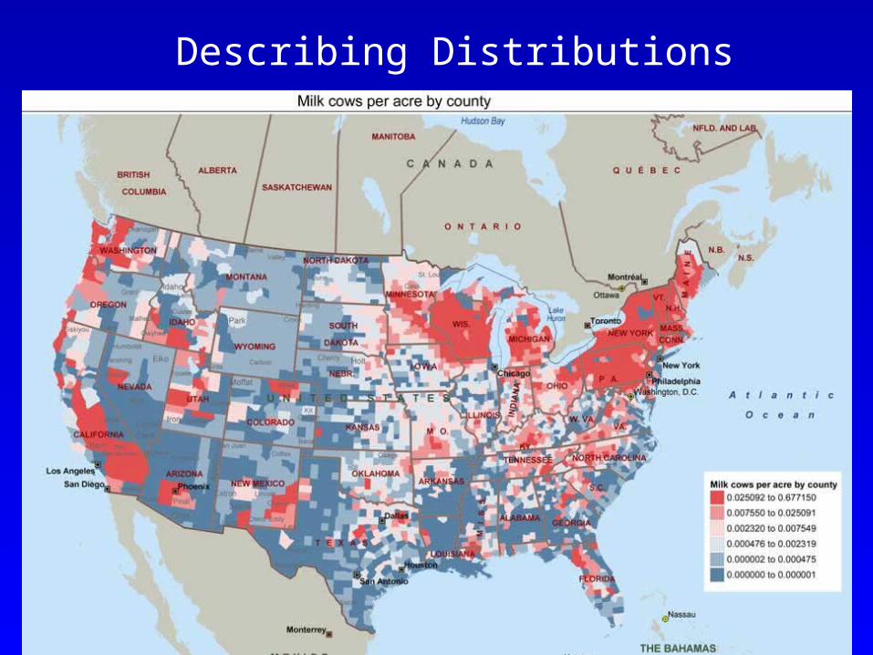
Describing Distributions

Diffusion
• Relocation
• Hierarchical
• Contagious
• Stimulus


Tobler’s 1st Law of Geography
All things are related. However, all other things being equal, those things that are closest together are more related.
Related Concepts: Distance Decay
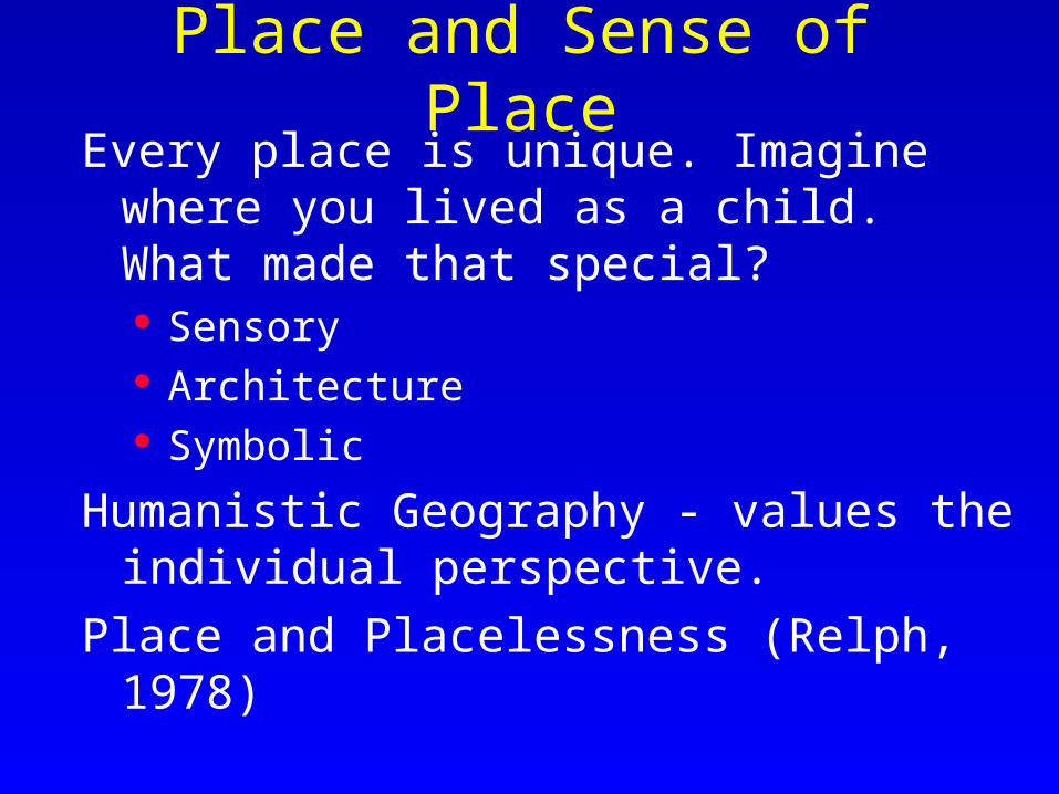
Place and Sense of PlaceEvery place is unique. Imagine where
you lived as a child. What made that special? Sensory Architecture Symbolic
Humanistic Geography - values the individual perspective.
Place and Placelessness (Relph, 1978)

What kinds of cultural values are reflected in each of these American houses?
Gated community?

Climate Characteristics
Areas where certain climates can be found

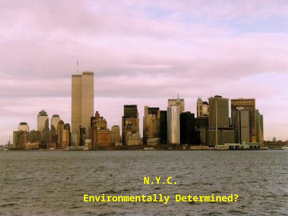
N.Y.C.
Environmentally Determined?

What about Bali,
Indonesia?

Key Concepts:Core-Periphery
Core U.S., Europe,
Japan, Australia Wealthy Powerful Controls Media
and Finance Technologically
advanced
Periphery Less Developed Poor Dependent upon
Core countries for: Education Technology Media Military Equipment

Key C
on
cep
ts:
Core
-Peri
ph
ery

GlobalizationThe increasing
interconnectedness of different parts of the world through common processes of economic, political, and cultural change. The economic, cultural, and environmental effects of globalization are highly contested.
Panama, 1997

49
Location
Location: Where something is
Absolute Location• Describes the exact location of a place.• Often described using Latitude and Longitude or an exact address (14051 Spriggs Rd.)

50
Location
Relative Location Describes where a
place is in relation to something else.
Ex: Hylton is between Bottom Dollar & Saunders Middle School
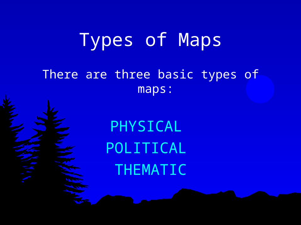
Types of Maps
There are three basic types of maps:
PHYSICAL POLITICAL THEMATIC

Physical MapsShow natural features of Earth.
Do not contain man made features For example, it would appear as if you were looking down on Earth from space.

Political Maps-show how humans impact landscape.
ie:city names, roads, country borders
-change frequently (physical maps change very, very slowly through geologic processes) and must be redrawn often. political map of the world that is 50 years old is no longer accurate.
-wars and ethnic conflict are two major causes political maps change.

Thematic Maps
represent variety of information ie:climate, precipitation, vegetation, elevation, population, life expectancygenerally used when looking at single piece of info
55
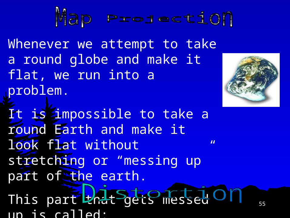
Whenever we attempt to take a round globe and make it flat, we run into a problem.
It is impossible to take a round Earth and make it look flat without stretching or “messing up” part of the earth.
This part that gets messed up is called:

56
There are several ways that a map can be distorted:
Shape: The shape of the landmasses change
Area: The size of the landmasses changeDistance: The distances between the landmasses
change
Direction: The directions between the landmasses change

57
It is distorted greatly at the poles and is least distorted near the equator. (ex: Greenland is huge compared to South America)
This projection is useful for ship navigation because the directions are accurate.
58
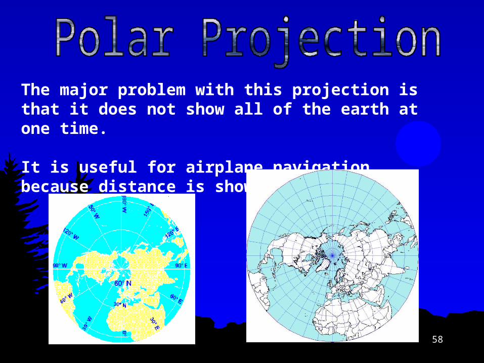
The major problem with this projection is that it does not show all of the earth at one time.
It is useful for airplane navigation because distance is shown correctly

59
The most commonly used map
It minimizes distortion
It is used most often for Data Representation because it has minimal distortion.

60
Shows correct sizes and shapes of landmasses by cutting out parts of oceans
Impossible to measure distances accurately

61
Information can come from a variety of Geographic Sources
GIS - Geographic Information SystemsThis system collects information from a variety of sources and compiles it by computer into useful forms.

62
Information can come from a variety of Geographic Sources
Satellite ImagesImages taken from space have a variety of different uses:
Weather Cartography Defense

63
Aerial Photography & Remote Sensing

64
65
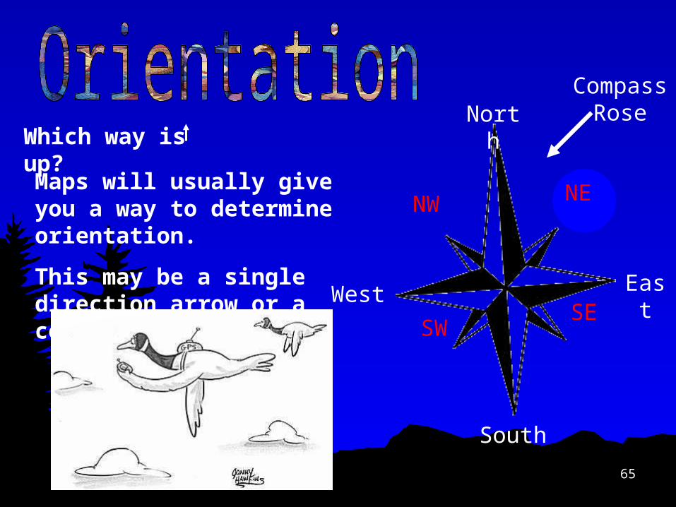
Which way is up? North
South
EastWest
NE
SE
NW
SW
Maps will usually give you a way to determine orientation.
This may be a single direction arrow or a compass rose.
Compass Rose

66
An image or picture of the way space is organized as determined by an individual’s perception, impression, and knowledge of that space; also known as a cognitive map.
67

68
Isoline

69
Isoline - Contour

70
Dot map
71
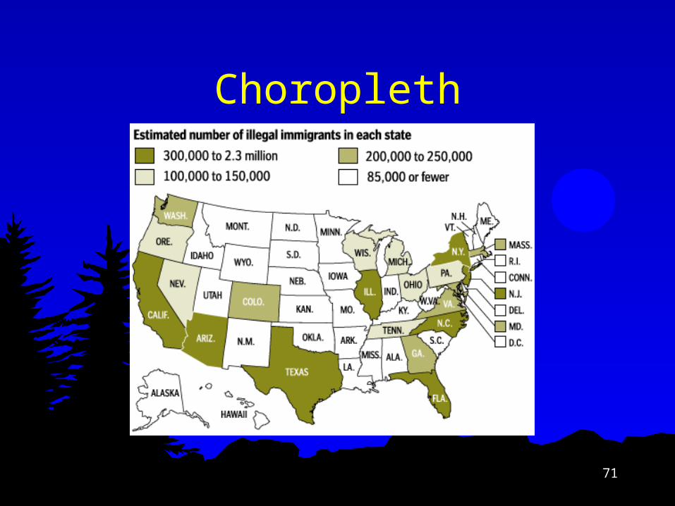
Choropleth

72
Cartogram
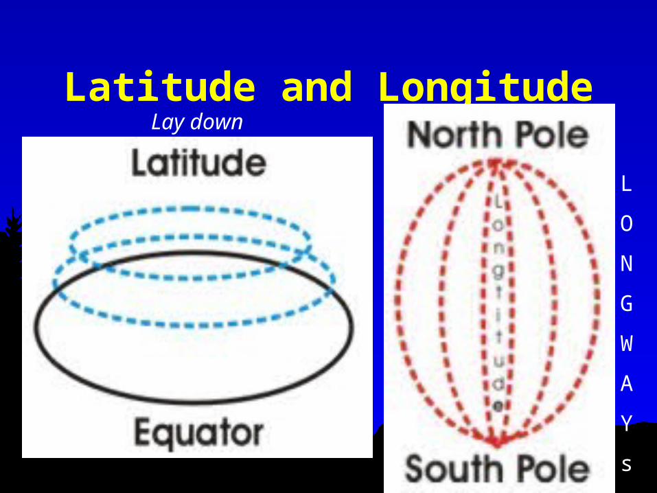
Latitude and LongitudeLay down
L
O
N
G
W
A
Y
s

Lines
Longitude lines run north and south.
Latitude lines run east and west. Measure distances in degrees.
Latitude
Longitude

75
Lines of latitude are measured north and south of the equator and are also called parallels
76
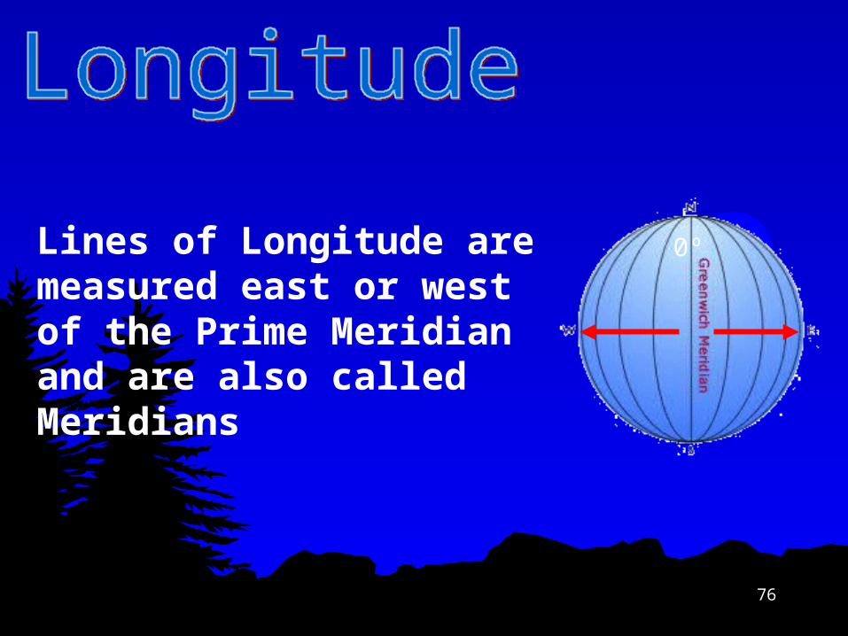
Lines of Longitude are measured east or west of the Prime Meridian and are also called Meridians
0º

77
The Global Grid: Using Latitude and Longitude
CoordinatesEvery measurement using latitude and longitude has a set of coordinates.
One coordinate will be for degrees latitude north or south of the equator
Ex: 30º North lat. is this line30º South lat. is this line
The other coordinate will be degrees east or west of the Prime (Greenwich) Meridian
Ex 30 º East Longitude is this line30 º West Longitude is this line
Put the two together and you have a location Ex: 30 ºN, 30 ºE Latitude should always be listed first. Your north/south will be before your east/west coordinate.
78
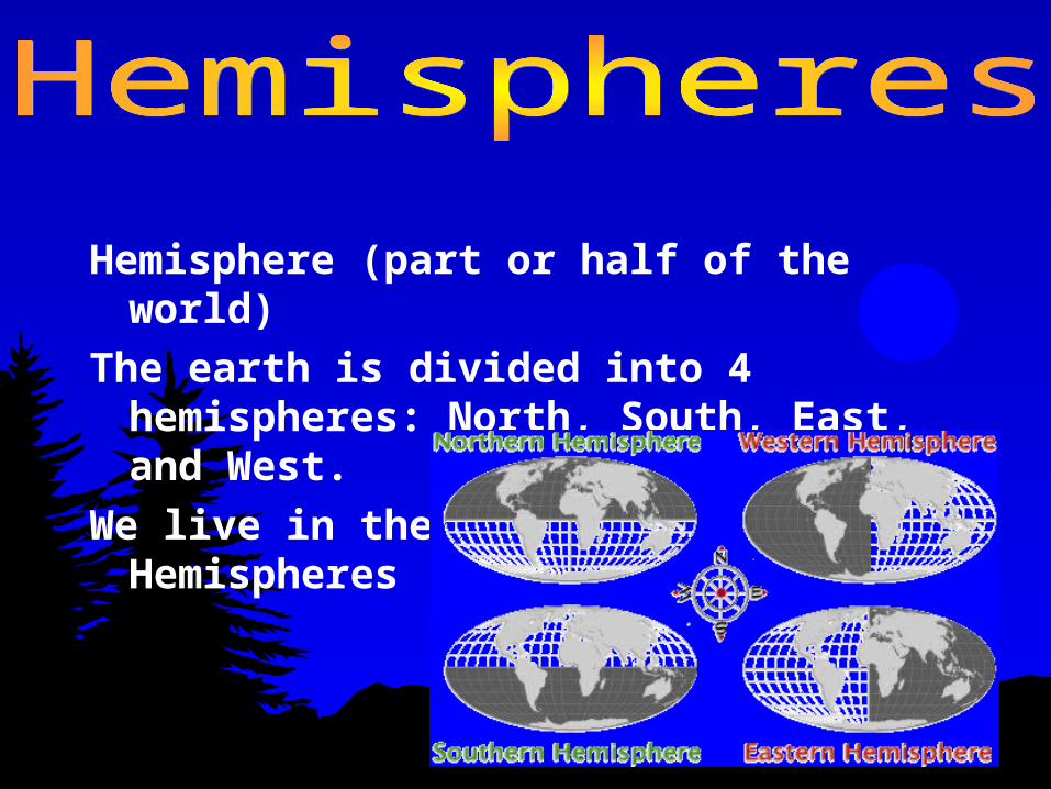
Hemisphere (part or half of the world)
The earth is divided into 4 hemispheres: North, South, East, and West.
We live in the Northern and Western Hemispheres

Where is 0 degree?
equator is 0 degree latitude. imaginary belt that runs halfway
point between North Pole and South Pole.
Equator

Where is 0 degree?
prime meridian is 0 degrees longitude.
imaginary line runs through United Kingdom, France, Spain, western Africa, and Antarctica.


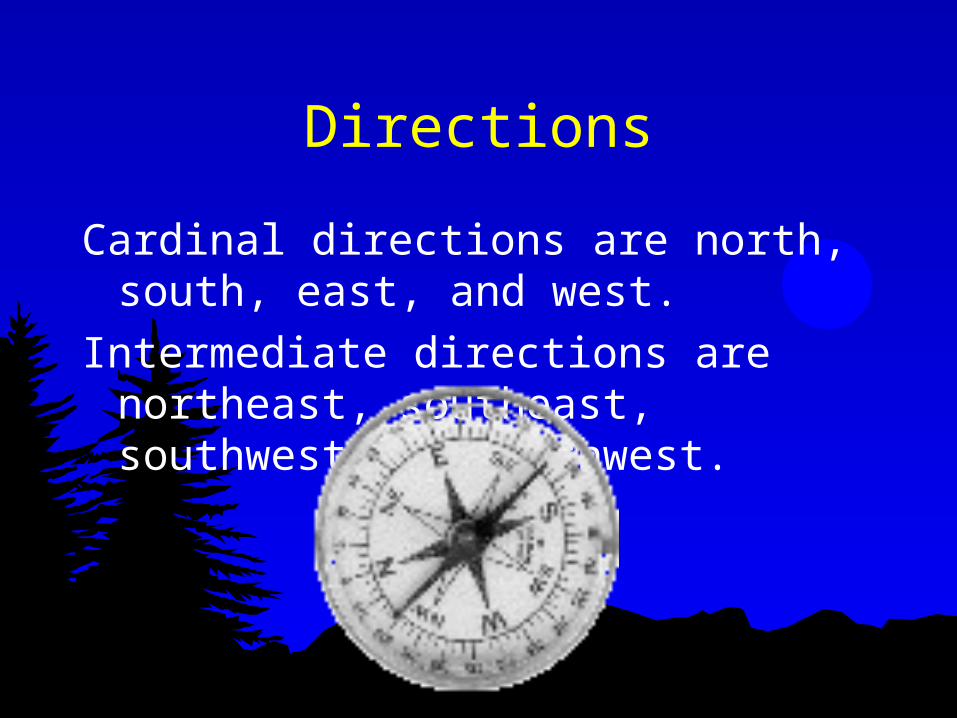
Directions
Cardinal directions are north, south, east, and west.
Intermediate directions are northeast, southeast, southwest and northwest.
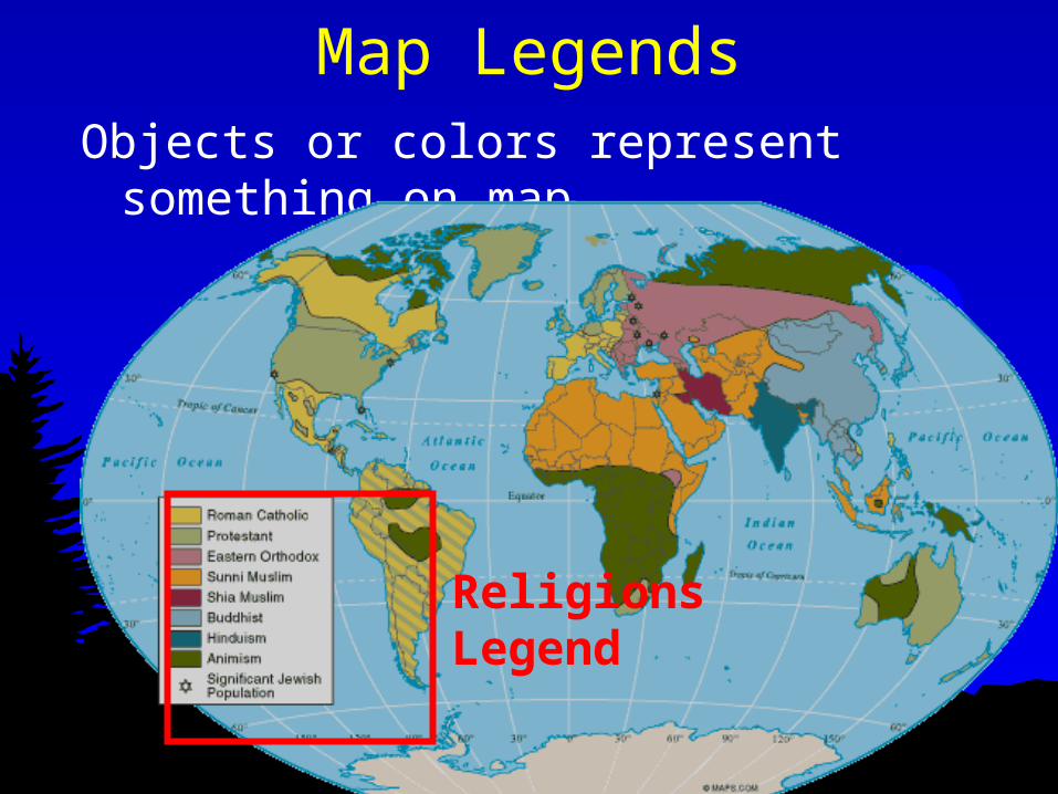
Map LegendsObjects or colors represent something
on map.
Religions Legend

Time Zones
Earth divided into 24 time zones, corresponding to 24 hours in day.
As earth rotates, sun shines in different areas, moving from east to west during course of day.
Places that have the same longitude will be in same time zone.


89
Size and ScaleScale: tells us the relationship between
the distance on the map and the true distance on the surface of the Earth.
Scale can be represented 3 different ways: Local Regional Global

90
Scale

Scale is a powerful concept because:
-Processes operating at different scales influence one another.
- What is occurring across scales provides context for us to understand a phenomenon.

92
Be careful to make sure you have the correct unit.
Many maps have both miles and kilometers
How to use the ScaleTo calculate distance measure the distance on the map and then place on the scale to measure the true difference

93
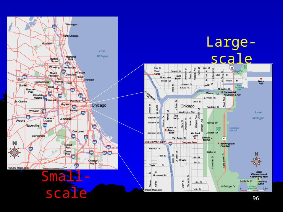
Comparing maps of different scale
Different maps need to show different levels of detail.
Sometimes you need to show a lot detail for a small area, and sometimes you need to show little detail of a larger
area.
A Small-Scale Map shows a large area with small
details.
It is good for relative locations
A Large-Scale Map shows a small area with large
details.
It is good for detailed looks at small areas

94
Map ScalesThe smaller the right hand number the larger the map scale
1:75000 is a more detailed map than 1:600000 which is a small scale map

95
96
Large-scale
Small-scale

97
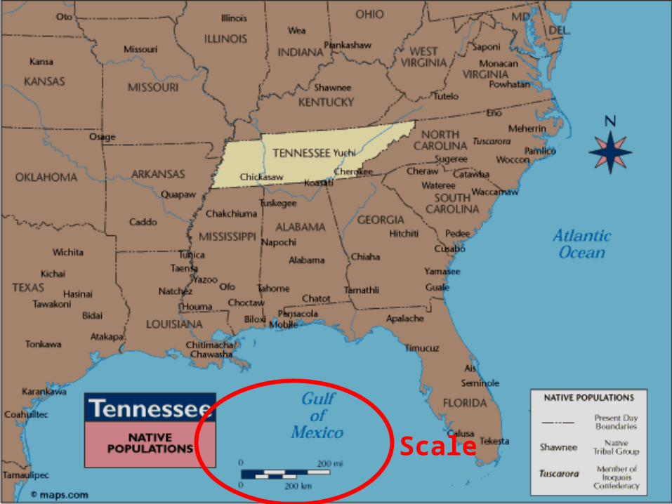
Scale

Key ConceptsREGION - an area that shares common
characteristics Formal - all members legally share a characteristic
(U.S.A.) Functional - defined by a node of activity and
distance decay from center (i.e. cell phone coverage) Vernacular – common perception of cultural identity
(“Deep South”)
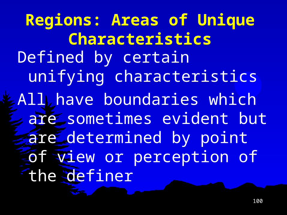
100
Regions: Areas of Unique Characteristics
Defined by certain unifying characteristics
All have boundaries which are sometimes evident but are determined by point of view or perception of the definer

101
Formal/Uniform Region
Areas where specific characteristics are uniform across space Physical
Tibet Cultural
Francophone World Economic
European Union

102
Formal Region

103
Functional/Nodal Regions
Specific social/economic relationships tie area together
Usually a “core” and “periphery” Metropolitan area

104
Functional Region

Functional Regions
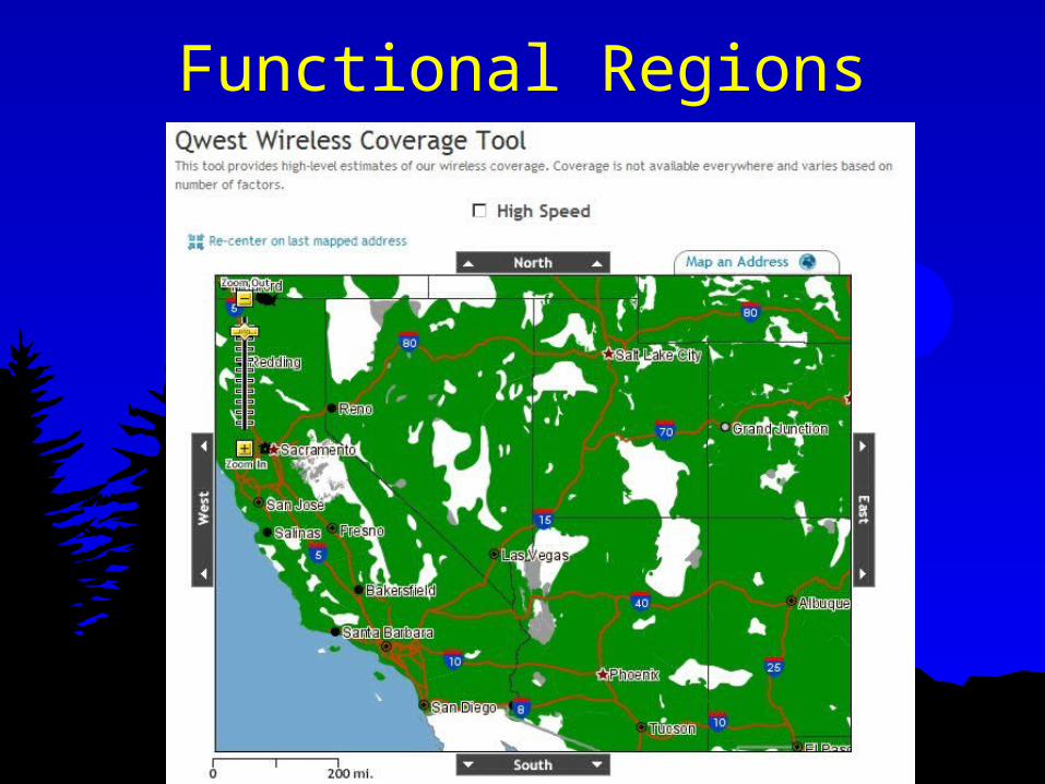
Functional Regions

107
Perceptual/Vernacular Regions
Ideas in our minds, based on accumulated knowledge of places and regions, that define an area of “sameness” or “connectedness.”
e.g. “the South” or the “Bible Belt” Most are determined by local residents
and may not be recognized by outsiders

Vernacular Regions

109


Some 75 percent of the more than 260 million people in the United States live in towns and cities. Yet farmers, accounting for less than 2 percent of the population, lead the world in production of
soybeans and corn.
The 455 million people of North America produce more goods and consume more resources than those on any other continent. Canada and the United States share a 5,500-mile (8,850-kilometer) border, the longest and one of the friendliest anywhere.

The continent has a relatively small population of only 319 million. The population of Brazil almost equals that of all the other South American countries combined. Industry accounts for one-third of the continent's economic activity.

From 1990 to 1995 the countries of Europe mushroomed from 33 to 43, most of which have access to the ocean. In these countries live 686 million people who speak some 80 languages.

Africa is home to 53 independent countries and 720 million people. Africa's population is expanding by 3 percent a year, the highest growth rate of any continent.

Asia consists of more than 40 countries. Its population exceeds three billion. Asia has the distinction of having the most populous country in the world, China.
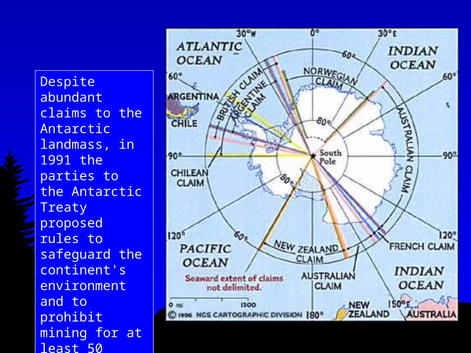
Despite abundant claims to the Antarctic landmass, in 1991 the parties to the Antarctic Treaty proposed rules to safeguard the continent's environment and to prohibit mining for at least 50 years.

The vastness of the oceans has long isolated this country continent. In this land that is virtually the same size as the contiguous United States, sheep outnumber the 18 million people.

118
9 Nations of North America