an forests - southern research · plains were dominated by grasslands and that riparian ......
TRANSCRIPT
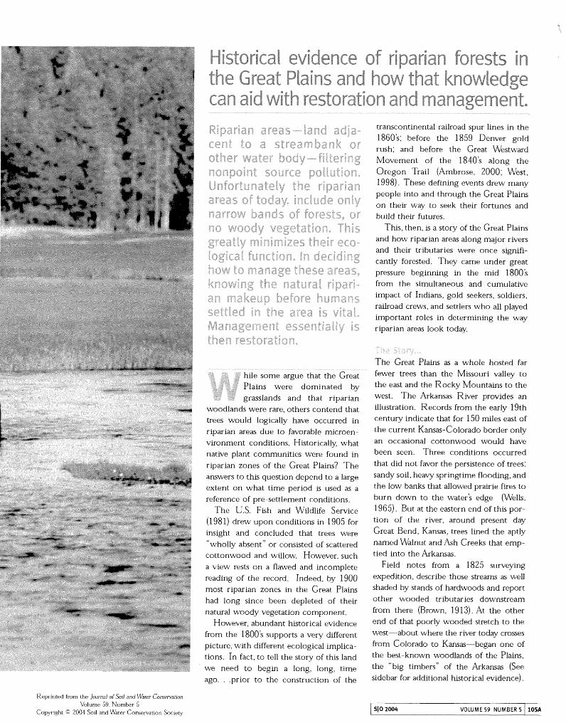
evidence of ripar an forests the Great P ains and how that know
d with restorat on and management.
bile some argue that the Great Plains were dominated by grasslands and that riparian
woodlands were rare, others contend that trees would logically have occurred in riparian areas due to favorable microen- vironment conditions. Historically, what native plant communities were found in riparian zones of the Great Plains? The answers to this question depend to a large extent on what time period is used as a reference of pre-settlement conditions.
The U.S. Fish and Wildlife Service (1 98 1) drew upon conditions in 1905 for insight and concluded that trees were "wholly absent" or consisted of scattered cottonwood and willow. However, such a view rests on a flawed and incomplete reading of the record. Indeed, by 1900 most riparian zones in the Great Plains had long since been depleted of their natural woody vegetation component.
However, abundant historical evidence from the 1800s supports a very different picture, with different ecological implica- tions. In fact, to tell the story of this land we need to begin a long, long, time
transcontinental railroad spur lines in the 1860's; before the 1859 Denver gold rush; and before the Great Westward Movement of the 1840's along the Oregon %ail (Ambrose, 2000; West, 1998). These defining events drew many people into and through the Great Plains on their way to seek their fortunes and build their futures.
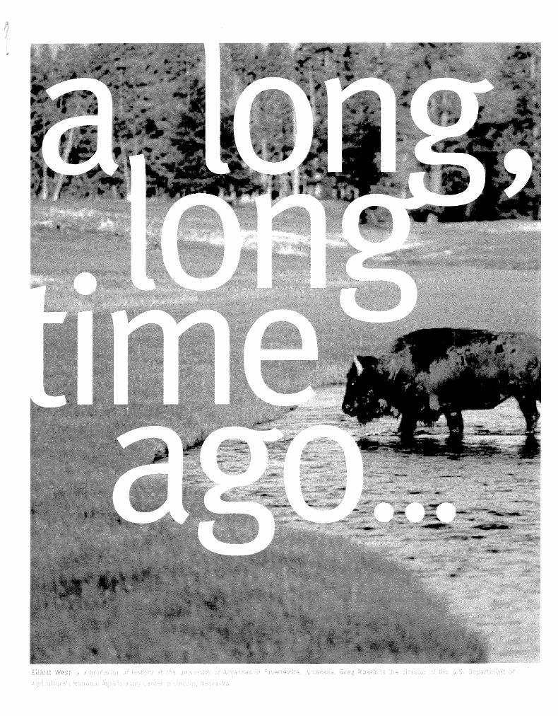
This, then, is a story of the Great Plains and how riparian areas along major rivers and their tributaries were once signifi- cantly forested. They came under great pressure beginning in the mid 1800's from the simultaneous and cumulative impact of Indians, gold seekers, soldiers, railroad crews, and settlers who all played important roles in determining the way riparian areas look today.
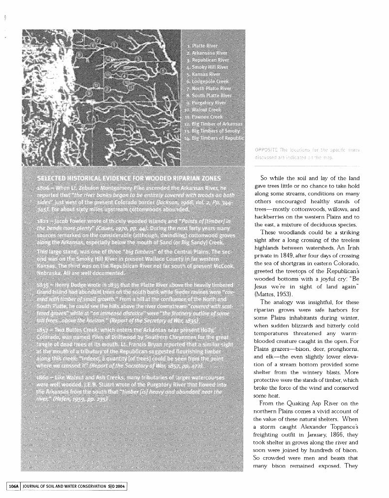
The Great Plains as a whole hosted far fewer trees than the Missouri valley to the east and the Rocky Mountains to the west. The Arkansas River provides an illustration. Records from the early 19th century indicate that for 150 miles east of the current Kansas-Colorado border only an occasional cottonwood would have been seen. Three conditions occurred that did not favor the persistence of trees: sandy soil, heavy springtime flooding, and the low banks that allowed prairie fires to burn down to the water's edge (Wells, 196 5). But at the eastern end of this por- tion of the river, around present day Great Bend, Kansas, trees lined the aptly named walnut and Ash Creeks that emp- tied into the Arkansas.
Field notes from a 1825 surveying expedition, describe those streams as well shaded by stands of hardwoods and report other wooded tributaries do~rnstream from there (Brown, 19 13). At the other end of that poorly wooded stretch to the west-about where the river today crosses from Colorado to Kansas-began one of the best-known woodlands of the Plains, the "big timbers" of the Arkansas (See
ago. . prior to the construction^ of the sidebar for additional historical evidence)
Reprinted from the Journai of Sod and water Conservaoon Volume 59, Number 5
Copyright Q 2004 Soil and Water Conservat~on Society SlO 2004 VOLUME 59 NUMBER 5 105A
So while the soil and lay of the land gave trees little or no chance to take hold along some streams, conditions on many others encouraged healthy stands of trees-mostly cottonwoods, willows, and hackberries on the western Plains and to the east, a mixture of deciduous species.
These woodlands could be a striking sight after a long crossing of the treeless highlands between watersheds. An Irish private in 1849, after four days of crossing the sea of shortgrass in eastern Colorado, greeted the treetops of the Republican's wooded bottoms with a joyful cry: "Be Jesus we're in sight of land again" (Mattes, 1953).
The analogy was insightful, for these riparian groves were safe harbors for some Plains inhabitants during winter, when sudden blizzards and bitterly cold temperatures threatened any warm- blooded creature caught in the open. For Plains grazers-bison, deer, pronghorns, and elk-the even slightly lower eleva- tion of a stream bottom provided some shelter from the wintery blasts. More protective were the stands of timber, which broke the force of the wind and conserved some heat.
From the Quaking Asp River on the northern Plains comes a vivid account of the value of these natural shelters. When a storm caught Alexander Toppance's freighting outfit in January, 1866, they took shelter in groves along the river and soon were joined by hundreds of bison. So crowded were men and beasts that many bison remained exposed. They
/ 106A I JOURNAL OF SOIL AND WATER CONSERVATION SIO 2004 1
froze where they stood, and the next spring Toppance found that their bones formed a bleached border to the stand of timber. (Toppance, 1923)
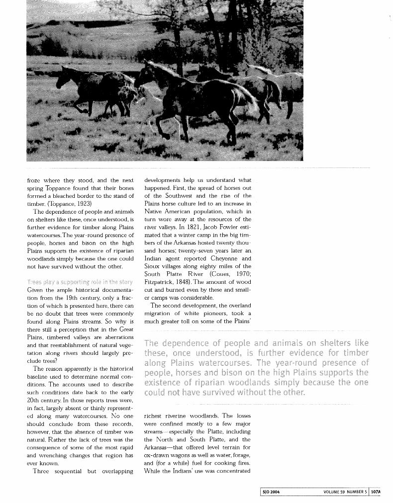
The dependence of people and animals on shelters like these, once understood, is further evidence for timber along Plains watercourses.The year-round presence of people, horses and bison on the high Plains supports the existence of riparian woodlands simply because the one could not have survived without the other.
tion from the 19th century, only a frac- tion of which is presented here, there can be no doubt that trees were commonly found along Plains streams. So why is there still a perception that in the Great Plains, timbered valleys are aberrations and that reestablishment of natural vege- tation along rivers should largely pre- clude trees?
The reason apparently is the historical baseline used to determine normal con- ditions. The accounts used to describe such conditions date back to the early 20th century. In those reports trees were, in fact, largely absent or thinly represent- ed along many watercourses. No one should conclude from these records, however, that the absence of timber was natural. Rather the lack of trees was the consequence of some of the most rapid and wrenching changes that region has ever known.
Three sequential but overlapping
developments help us understand what happened. First, the spread of horses out of the Southwest and the rise of the Plains horse culture led to an increase in Native American population, which in turn wore away at the resources of the river valleys. In 182 1, Jacob Fowler esti- mated that a winter camp in the big tim- bers of the Arkansas hosted twenty thou- sand horses; twenty-seven years later an Indian agent reported Cheyenne and Sioux villages along eighty miles of the South Platte River (Coues, 1970; Fitzpatrick, 1848). The amount of wood cut and burned even by these and small- er camps was considerable.
The second development, the overland migration of white pioneers, took a much greater toll on some of the Plains'
richest riverine woodlands. The losses were confined mostly to a few major streams-especially the Platte, including the North and South Platte, and the Arkansas-that offered level terrain for ox-drawn wagons as well as water, forage, and (for a while) fuel for cooking fires. While the Indians' use was concentrated
/ SlO 2004 VOLUME 59 NUMBER 5 1 107A
in the winters, the overlanders swarmed up trails between February and July. It was a massive onslaught. Between 1840 and 1860 an estimated third of a million persons crossed the Plains en route to Oregon, California, and Utah, and tens of thousands more passed through on their way to Colorado and Montana from 1859 to 1865 stripping virtually all trees from the Platte valley.
The third development, the advance of the farming and stock-raising frontiers onto the Plains, compounded the effects of the first two. Between 1870 and 1880 sixteen new counties were formed in central and western Kansas and several more in western Nebraska. The popula- tion of just four Kansas counties in the watersheds of the Solomon and Republican Rivers increased in that decade from ninety-nine persons to more than forty-one thousand, about twice the peak population of Native Americans on the entire Central Plains (west, 1998). Settlers gravitated to streams for basically the same reasons as Native Americans and overlanders, but unlike the other two groups, they lived there year-round. L%S the settler popula- tion expanded farmers occupied all creeks that offered any significant timber. They did what they could to lessen their dependence on wood-sod houses and barbed wire fences are the best-known adaptations-but for some needs, most importantly winter fuel, trees were an irresistible resource.
These three episodes-the rise of the horse culture, traffic on the overland trails, and the entrenchment of white settlers- were the most significant in the history of the Great Plains during the 19th century. Different in so many ways, they had this in common: all bore down intensely on val- ley timberlands. That is not surprising. Humans, whatever their purposes and means of living, found the riparian wood- lands to be a resource essential to survival. The same was true for animals.
Fortunately, it is possible to piece together the history of land use in the Great Plains and reconstruct a more accurate picture of what riparian zones looked like and their condition.
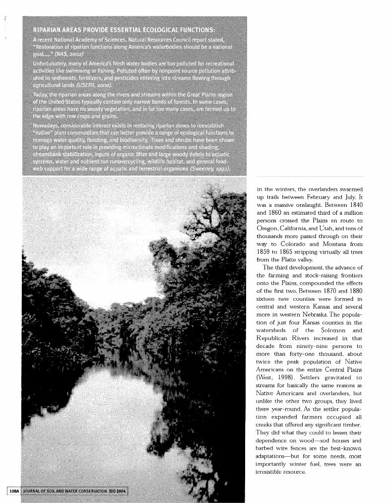
Riparian vegetation experienced sub- stantial change during the mid to late 1800's due to human impacts. By 1900 most of the trees and other woody vegeta- tion along the rivers and streams in the Great Plains had been cut and removed by Indians, gold seekers, soldier, railroad crews, and settlers. These riparian zones were once heavily forested with wide bands of trees but are now occupied primarily by herbaceous plants or cropland.
Natural resource restoration efforts that target "natural" conditions need to use pre- 1843 scenarios to accurately depict the nat- ural state of riparian zones in the Great Plains. Although historical reference points do not necessarily instruct us in what to do, they can provide valuable insight as to what desired future conditions riparian restora- tion efforts should strive toward.
Abert, J.W. 1845. Journal of Lieutenant J.W. Abert
from Bent's Fort t o St. Louis, in 1845, U.S.
Senate, 29th Congress, 1st Session, Senate
Document 438.
Ambrose, S.H. 2000. Nothing like it in the World:
The Men Who Built the Transcontinental
Railroad 1863- 1869. Simon and Schuster,
New York, New York. 432pp.
Bellah, R . G and L.C. Hulbert. 1974. Forest succes-
sion on the Republican River floodplain in
Clay County, Kansas. The Southwestern
Naturalist 19: 155-166.
Bratt, John. 192 1 .Trails ofyescerdaji Lincoln, Nebraska.
Brown, J.C. 1913. Field Notes by Joseph C. Brown,
U.S. Surveying Expedition, 1825-1827,
Eighteenth Biennial Report of the Kansas State
Historical Society Board of Directors,
Topeka, Kansas.
Burton, Richard. 1862. The City of the Saints and
Across the Rocky Mountains to California.
London, England.
Dodge, Richard Irving. 1883. O u r \ibiild Indians:
Thirty Three Years' Personal Experience
among the Red Men of the Great Vlikst.
Hartford, Connecticut.
Fitzpatrick, Thomas J. to Thomas H . Harvey, 24
June, 1848. Bureau of Indian Affairs. Letters
Received, Upper Platte Agency.
Coues, E. 1970. The Journal of Jacob Fowler.
Lincoln, Nebraska.
Hafen, L.R. and A.W. Hafen. 1959. Relations with
the Indians of the Plains, 1857-1861.
Glendale, California.
Jackson, D. 1966. Journals of Zebulon Montgomery
Pike, With Letters and Related Documents.
Norman, Oklahoma.
Kansas State Board of Agriculture. 1878. First
Biennial Report of the State Board of
Agriculture to the Legislature of the State of
Kansas, for the Years 1877-8.
Topeka, Kansas: Kansas State Board of Agriculture.
Rand, McNaliy & Co., Printers and Engravers,
Chicago. URL:http://skyways.lib.ks.us/gen
web/archives/ l878/index.html
Kellogg, R.S. 1905. Forest belts of western Kansas
and Nebraska. U.S. Forest Service Bulletin
No. 6 6 . 4 4 ~ ~ .
Mattes, M.J. 1953. Capt. L.C. Easton's Report:
Fort Laramie to Fort Leavenworth via
Republican River in 1849. Kansas Historical
Quarterly 20.
National Research Council. 2002. Riparian Areas:
Functions and Strategies for Management.
National Academy Press,Washington D.C. 428pp.
I SlO 2004 VOLUME 59 NUMBER 5 1 109A
Report of the Secretary of War. 1835. Journal of a
March of a Detachment of Dragoons, Under
the Command of Colonel Dodge, During the
surnrner of 1835. U.S. Congress, 24th Congress,
1st session. H.E. doc. 181.
Report of the Secretary of War. Report of Lt.
Francis T. Bryan. 1857. U.S. Congress, 35th
Congress, 1st Session. H.E. doc. 2. Appendix H. Sweeney, B.W. 1992. Streamside forests and the
physical, chemical, and trophic characteristics of
Piedmont streams in eastern North America.
water and Science Technology 29:2653-2673.
Toppance, A. 1923. Reminiscences of Alexander
Toppance, Pioneer. Salt Lake City, Utah.
U.S. Environmental Protection Agency (USEPA).
2000. The quality of our Nation's waters:
Summary of the national water quality invento-
ry: 1998 report to Congress. EPA-84 1-5-00-
001. Office ofWater,v\isshington, D.C.
U.S. Fish and Wildlife service (USFWS). 1981. The
Platte River ecology study special research
report. U.S. Fish and Wildlife service,
Jamestown, North Dakota. Northern Prairie
Wildlife Research Center Home Page.
http://www. npwrc.usgs.gov/resource/othrdata/
platteco/platteco. htm.
%ters, Lydia Milner. 1929. Account of a Trip
Across the Plains in 1855. Quarterly of the
Society of California Pioneers 6:59-79.
Vtielts, Y>.V 1965. Scarp woodlands, Transported
Grassland soils, and Concept of Grassland
Climate in the Great Plains Region. Science
148: 246-249.
west, E. 1998. The Contested Plains: Indians, Gold
seekers, & the Rush to Colorado. University
Press of Kansas. Lawrence, Kansas. 422pp.
l l O A JOURNAL OF SOIL AND WATER CONSERVATION S/O 2004