agricultural site assesment tool
TRANSCRIPT

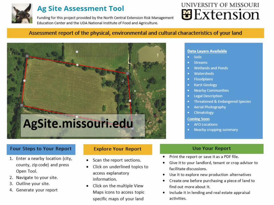
Agricultural Site Assessment ToolAgSite.missouri.edu
Ray MasseyUniversity of MissouriDepartment of Agricultural and Applied Economics

Acknowledgements

AgSite.Missouri.edu
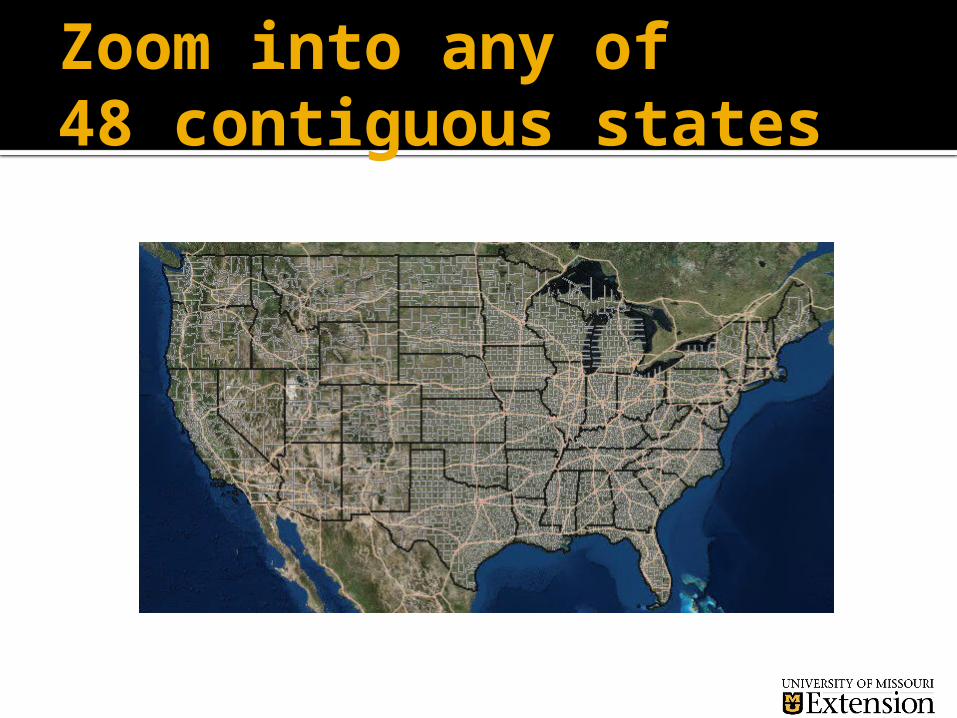
Zoom into any of 48 contiguous states
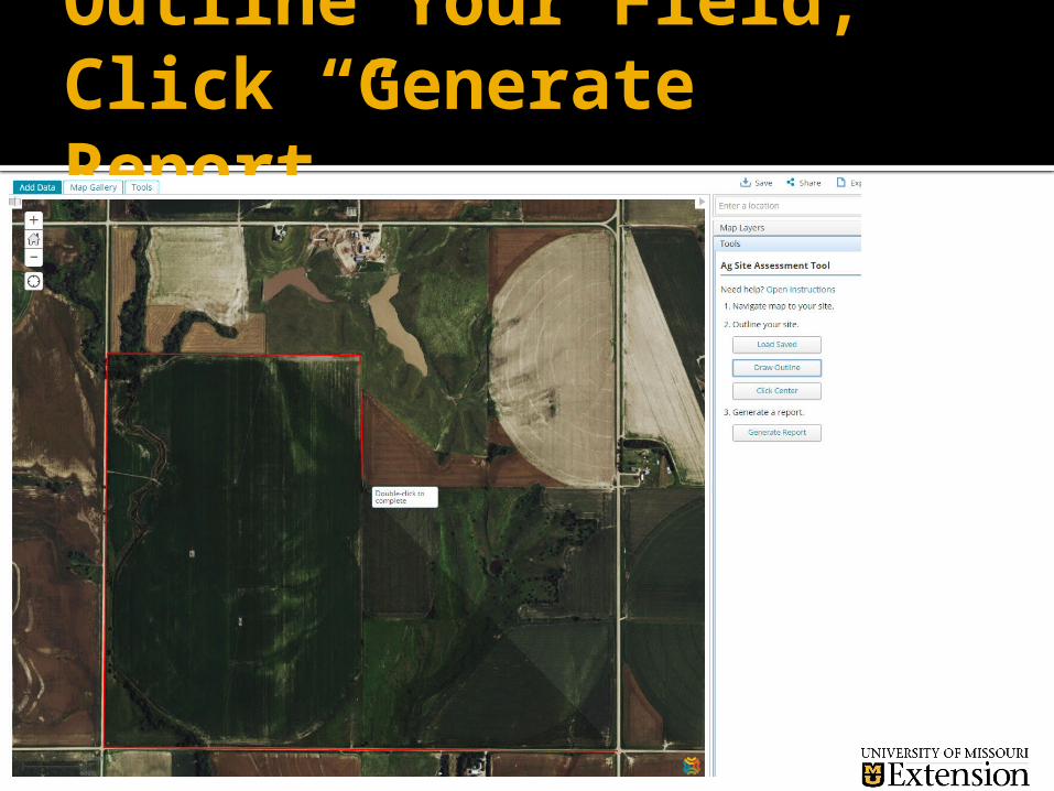
Outline Your Field;Click “Generate Report”

AgSite Report: Geographic Summary
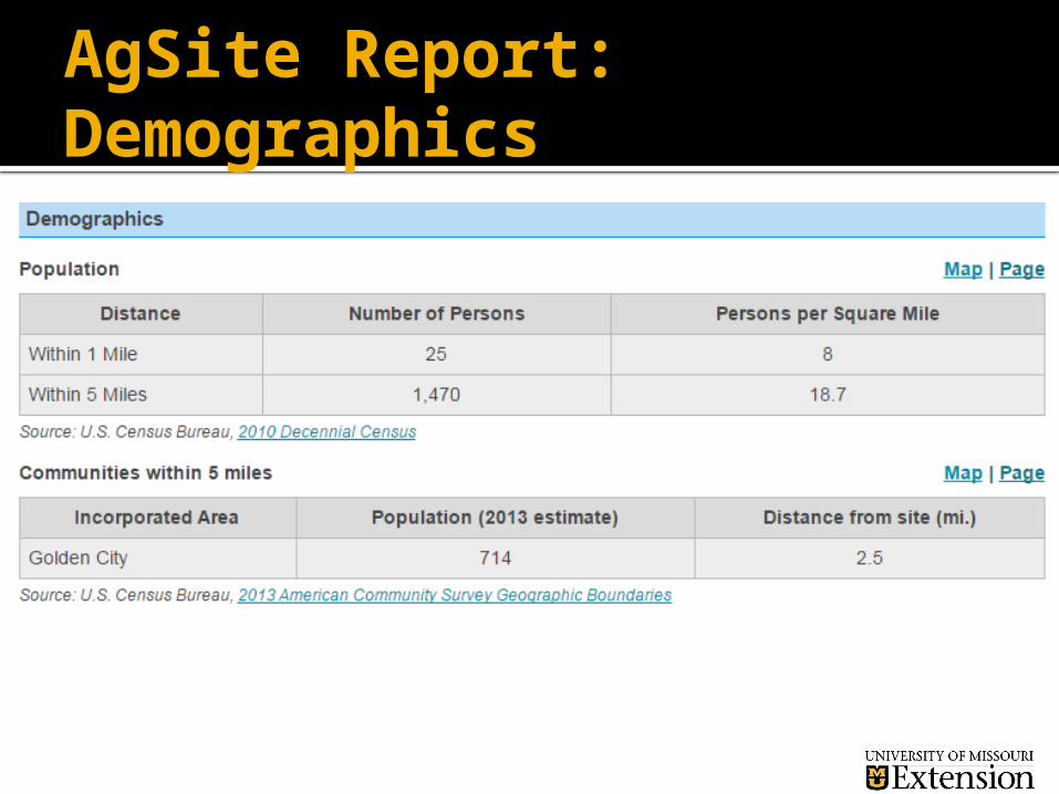
AgSite Report: Demographics

AgSite: Educational Pages
Each table has a “Page” and/or “Map” associated with it.
The “Page” is a link to text on Educational Regulatory and Assistance for management
The “Map” is a link to a map with the table’s features highlighted

AgSite Report: Hydrologic Summary
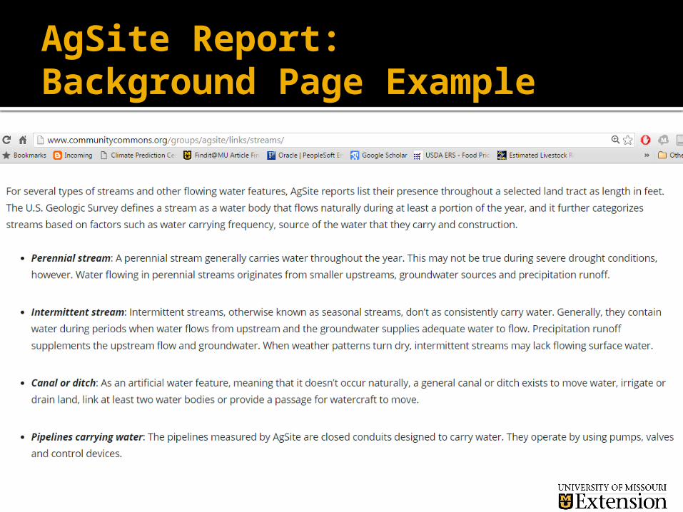
AgSite Report: Background Page Example
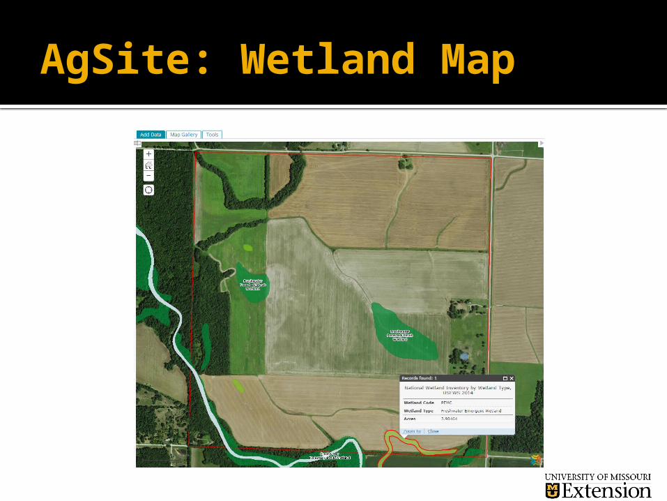
AgSite: Wetland Map

AgSite Report: Slope and Soils

AgSite: Soils Definition
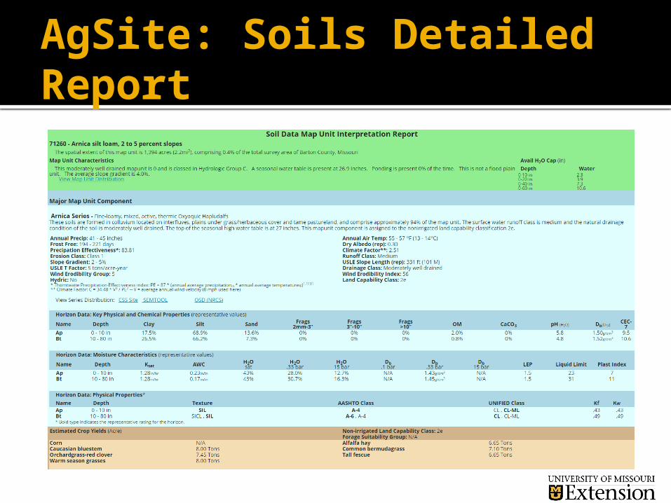
AgSite: Soils Detailed Report

AgSite Report: Environmental Concerns

AgSite Report: Climate Summary

AgSite Report: Climate Summary

AgSite Report: Land Use

AgSite.Missouri.edu
Free to anyone without registering or leaving any information.
Suggested that users join the Community Common AgSite hub in order to: Save the field boundaries for later use Save reports for easy access Access hundreds of additional data layers housed
at Community Commons Communicate easily with the developers

Other options – if signed in as user
To Access other map layers you must Be a Community Commons subscriber – free The data layer must be present for your location
Examples of other layers Tribal lands – many states topography 303(d) streams and lakes – only in MO
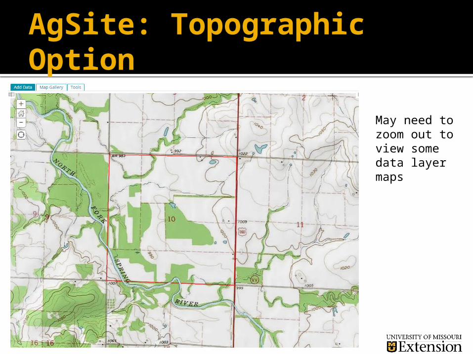
AgSite: Topographic Option
May need to zoom out to view some data layer maps

AgSite Report: Assessment Area

AgSite: Soils Outline

AgSite: Floodplain Designation

WHAT IS COMMUNITY COMMONS?An online mapping, reporting, and collaboration platform designed to help individuals and communities access meaningful data, stories, and tools.
20,000+ data layers
Downloadable data tables
Benchmarking dials
Expandable and editable maps

COLLABORATION HUBS• Customizable online platform• Access data upload and sharing tools
• Access collaboration tools• Share and co-create documents, maps, and reports• Have targeted discussions in Hub forums