advancing the spatially enabled smart campusspatial.ucsb.edu/wp-content/uploads/smart-campus...on...
TRANSCRIPT

Advancing the Spatially Enabled Smart Campus
Specialist Meeting
Final Report
Donald G. Janelle Werner Kuhn
Michael Gould Maureen Lovegreen
Upham Hotel Santa Barbara, California December 11–12, 2013
This specialist meeting was convened by the Center for Spatial Studies at the University of California, Santa Barbara (Werner Kuhn, Director).
Advancing the Spatially Enabled Smart Campus Specialist Meeting (Dec 2013)―Final Report
2
Introduction This 2-day specialist meeting in December 2013 was conceived and organized by The Center for Spatial Studies (spatial@ucsb)1 at the University of California, Santa Barbara (UCSB).
The meeting combined “thinking big” (asking what will make campuses smarter in the future) with “acting small” (focusing on specific organizational and technological measures and their evaluation). Making our daily environments smart through technologies has been on research and political agendas for more than three decades, featuring a primary interest in the outdoor environments of cities. Smart city projects are now found throughout the world, focusing on environmental sustainability, e-governance, transportation, health, and other public goods by deploying innovative technologies for sensing, social networking, and knowledge integration. To some extent, campuses can be seen as “small cities,” raising similar concerns for their unique populations. Additionally, smart campuses have their own challenges and opportunities for support of creativity and interdisciplinary collaboration in science along with the involvement and education of technologically savvy students. Spatial thinking and computing are thought to be key enablers of smart campuses, but this case needs to be made more effectively with university administrators and domain scientists. The scope of these opportunities and challenges provided impetus for bringing together researchers and educators from multiple disciplines, campus planners, and representatives from industry, all of whom share interest in addressing issues of sustainability and knowledge infrastructures.
The call for participation in the meeting included the following statement of purpose:
The Specialist Meeting2 on “Advancing the Spatially Enabled Smart Campus” will focus on sharing ideas of how geospatial cyber-infrastructure, volunteered geographic information, and design technologies may be used to build environmentally and socially sustainable campuses that encourage learning and productivity. This meeting will assemble researchers from different disciplines with
1 Spatial@ucsb is dedicated to promoting campus-wide spatially related events, research, and teaching for all
disciplines that share interest in the importance of spatial thinking in science and in artistic endeavors, the development of spatial analytic tools, and the importance of place in society. The Organizing Committee for the meeting included Werner Kuhn (Chair), Donald G. Janelle, and Maureen Lovegreen from UCSB and Michael Gould from Esri. Funding from spatial@ucsb and Esri is gratefully acknowledged.
2 The Advancing the Spatially Enabled Smart Campus meeting is one of several dozen specialist meetings that have been organized at the Upham Hotel in Santa Barbara over the past 25 years. These meetings combine a small number of context-setting presentations with ample time for discussion in plenary sessions, small groups, and informal social gatherings. Spatial@ucsb specialist meetings promote intensive discussion on themes related to theoretical issues, technological developments, and applications of geographical information science and spatial thinking in science and society. Such meetings are intended as catalysts for new research and teaching programs, new software developments, and funded research initiatives.

Advancing the Spatially Enabled Smart Campus Specialist Meeting (Dec 2013)―Final Report
3
campus planners and administrators to explore possibilities for enhancing campus environments to better serve their educational and civic functions.
The 35 invited participants to this specialist meeting were asked to consider three general categories of questions and to prepare position papers related to their expertise and interests:3
I. General Perspectives on Smart Campuses:
• What services should a smart campus provide?
• How do smart campuses contribute to sustainability?
• Are there best-practice examples of smart campuses?
II. Geospatial and Technological Pre-requisites for Smart Campus Implementations:
• What sensor and other networks are needed to enable smart campus services?
• How are mobile information and communication technologies (ICT) best integrated into the implementation of the smart campus?
• What are the design features of a dashboard for organizing and displaying the availability and results of smart campus implementations?
• How might volunteered geographic information (VGI) inform the design and evaluation of smart campus services?
• How can geospatially enabled ICT/VGI contribute an understanding of diurnal and seasonal demographics of campus buildings and spaces?
III. Integrating Smart Campuses into the Intellectual Mission of Educational Institutions
• How do smart campus implementations contribute to intellectual development?
• How might smart campus databases and resources contribute to teaching and research opportunities for students/faculty?
• What strategies are most successful for engaging students in the implementation and assessment of smart campuses?
• How are the possibilities and accomplishments of smart campuses transferred to broader communities (cities, states, nations, industries, etc.)?
3 More detailed information about the specialist meeting, including the agenda, names and position papers of participants, and copies of plenary presentations, can be found at http://spatial.ucsb.edu/asesc-home/asesc-participants. Also, see the Appendix to this report.
In an effort to attain broader consciousness to thoughts that arise from group discussions and plenary sessions, a real-time collaborative document editor (Etherpad) allowed ongoing interactive commentary by participants during the meeting. This record is available for the input of additional commentary. Readers of this report are invited to share their views and questions at http://epad.ifgi.de/p/smartcampus.

Advancing the Spatially Enabled Smart Campus Specialist Meeting (Dec 2013)―Final Report
4
Objectives and Desired Outcomes
The Specialist Meeting attempted to identify new frontiers for smart campus research and deployment and to provide a prioritized list of services and the research needs with which to realize them. Experiences with smart cities offer inspiration and a reality check for extension to the campus level.4 At the same time, the unique challenges resulting from academic environments will be identified and related to the radical transformation of how universities might better enable learning, discovery, and invention. A particular focus will lie on combining state-of-the-art smart campuses with spatially enabled knowledge infrastructures and sensor networks.
This report highlights outcomes from the meeting that suggest: (1) opportunities to achieve longer-term impact through publications relating to the technological, institutional, and social aspects of sustainable smart campus innovation; (2) exchange of best-practices for implementation of smart campus initiatives in support of sustainability; (3) promotion of a globalized Linked Universities network (http://linkeduniversities.org/) for data infrastructure; (4) establishment of a repository of ongoing smart-campus projects, highlighting best practices; and (5) the building of a case for the spatially enabled smart campus with university administrators, highlighting sustainability, knowledge sharing, student involvement, safety, and other perspectives.
The meeting began with three plenary sessions focused on alternative perspectives for viewing and critiquing the smart campus concept, the opportunities and constraints on implementing smart campus initiatives, and examples of smart-campus implementations. These sessions provided background information from researchers interested in using smart technologies to build campus knowledge infrastructure; from campus planners focused on the functionality, cost, and sustainability attributes of campus facility infrastructure; and from industry representatives whose products support sustainability through the integration of information and communication technologies (ICT) within data management and display environments.
The summaries that follow are best supplemented by reviewing the slide presentations at http://spatial.ucsb.edu/asesc-home/asesc-participants.
_____________________________________________________________________________
4 Batty, M., K. Axhausen, G. Fosca, A. Pozdnoukhov, A. Bazzani, M. Wachowicz, G. Ouzounis, and Y. Portugali, 2012. Smart Cities of the Future. The European Physical Journal, Special Topics 214: 481–518. Published with open access at Springerlink.com, DOI:10.1140/epjst/e2012-01703-3.
Harrison, C., B. Eckman, R. Hamilton, P. Hartswick, J. Kalagnanam, J. Paraszczak, and P. Williams, 2010. Foundations for Smarter Cities IBM Journal of Research & Development. 54(4): 1–16. http://DOI.10.1147/JRD.2010.204825.
Advancing the Spatially Enabled Smart Campus Specialist Meeting (Dec 2013)―Final Report
5
Session 1: Perspectives on the Spatially Enabled Smart Campus
James Nelson (Harvard University) addressed campus facility management and planning in relation to university educational missions. Through commitment to geospatial information infrastructure and integrated Building Information Models (BIM), university planners can refine their understanding of space use in ways that will permit greater flexibility and efficiency in resource/space use, design, and allocation, thereby creating potential savings for teaching, research, and public service. Spatially enabled smart technologies may in the near future offer educational institutions a means to assess whether private offices are needed, the ability to target maintenance and lighting as required, and to heat spaces only when they are occupied. Sensors embedded within buildings offer greater reliability for anonymous tracking than do smart phones, although the sharing of information across platforms can help personalize the use of resources (e.g., enabling real-time access to transit information or in answering such questions as “Where is there an open computer for me to use?” Measuring enhancements to the learning environment may be difficult, and research is needed to assess the value of smart technologies to facilitate community and to reduce the barriers to interactions that offer educational opportunities. In managing the infrastructure of the university, smart technologies could enhance access to operational and administrative data for student and classroom use in exposing students to real-life problem-based teaching and exploratory research in a significant number of fields.
Sean C. Ahearn (Hunter College, City University of New York) reviewed “Vagaries and Efficiencies of our Knowledge Ecosystem,” based on work at the Center for Advanced Research of Spatial Information (CARSI) and for the Geographic Information Science and Technology Body of Knowledge (BoK).5 Articulating a framework for moving beyond BoK, he addressed the value for an ontologically based knowledge ecosystem for data/text mining and time-space analysis across knowledge domains. Drawing on advances in geospatial system architecture and web technology, virtual spaces are seen as supportive frameworks for communication, collaboration, and more efficient ways of linking intellectual spaces across traditional disciplinary boundaries. Examples included creation of a web facility to visualize the content of different courses within the curriculum and to highlight problems in course articulation (e.g., overlap and uniqueness of content). Using an example of interdisciplinary research on equity issues in East Harlem, Ahearn demonstrated how tools such as ArcGISOnline provide efficient means for exploratory spatial-temporal research to help frame issues at different geographical scales. Whereas existing ecosystems for linking data may be hard to use and often lack
5 http://en.wikipedia.org/wiki/Geographic_Information_Science_and_Technology_Body_of_Knowledge
Advancing the Spatially Enabled Smart Campus Specialist Meeting (Dec 2013)―Final Report
6
documentation or ability to treat spatial data, Ahearn illustrated how a multi-layered approach (base layers―> domain layers―> community layers―> project layers) within a GIS web-based platform offers significant advantages for building a spatially enabled/informed knowledge infrastructure (smart data laboratories) for research, teaching, and knowledge dissemination.
Jeremy Crampton (University of Kentucky) focused on contesting positions regarding the use of “big-data” implementations in support of a spatially enabled smart campus. Against the promise that integrating technology in human interactions will yield sustainability for the environment and increases in human well-being, Crampton expressed concerns for issues of privacy and the reinforcement of inequality in power-based human relationships. He also explored the paradoxes of big data (Richards and King6) regarding transparency, identity, and power. Drawing on critiques of smart-city initiatives, Crampton identified problems of oversight for data and the ubiquity of surveillance sensors (cameras, etc.) repeating themselves at the campus level. A central concern is that the privileging of data in municipal development assumes that everything is ultimately knowable, resulting in the potential for more sterile environments, less variability among places (campuses), and reduced vibrancy. Defining sustainability as resilience to change over time, he called for identification of consensual proxy measures for sustainability in terms of the protection of privacy and individual autonomy over choices in space and time and for greater equitability in power relationships.
David Cowen (University of South Carolina), as session discussant, explored questions about (1) the extent to which the educational and research functions of the university remain dependent on the bricks-and-mortar campus, and (2) how a smart campus might shift the balance between training and education. Noting how both social interactions and research collaborations are shifting to virtual space, he speculated on the emerging balance between the physical and virtual realms of research and teaching. He welcomed the virtual availability of BoK as a valuable contribution to structuring knowledge and curriculum more interactively. Similarly, research and problem-solving collaborations have benefited from internet access to data and library resources. However, more must be done to break down the barriers to collaboration in both teaching and research. Cowen suggested that applications of smart-campus technologies to achieve sustainability objectives might be usefully structured to match the needs associated with general kinds of campus configurations (e.g., urban commuter, residential, isolated-standalone, and integrated and spread-out). He observed that focus on population densities of buildings on campuses does not address questions that depend on spatial awareness of the
6 Richards, N.M. and J.H. King. 2013. Three Paradoxes of Big Data. Stanford Law Review Online 66(41): 41–46.

Advancing the Spatially Enabled Smart Campus Specialist Meeting (Dec 2013)―Final Report
7
demographic traits of the occupants of campus spaces. He drew attention to the notion of “a spatial university,” suggesting possible attributes that would be expected for such coveted recognition.
Open discussion on Session 1
Issues and ideas raised by participants included:
• Can a virtual space be as effective as a physical one? For example, things and services that improve lives and support the academic mission may not be sustainable under some restricted interpretations of sustainability. Virtual facilitation does not reduce the need for physical spaces.
• Accounting issues arise over how recharges reflect cost-benefit tradeoffs between the physical and virtual resources/services provided by campuses.
• How are human well-being and sustainability related?
_____________________________________________________________________________
Session 2: Creating a Spatially Enabled University André Skupin (San Diego State University) observed how a campus consists of physical, attribute, and knowledge spaces. He provided illustrations of how these distinct but complementary spaces contribute to and define a spatially enabled smart campus. Further, Skupin provided graphic vignettes based on cell-phone tracking, uses of campus Wi-Fi hotspots, and access to land-use information to represent time-weighted measures of density, distinctions between leisure and work activities, maps of age/gender distribution, and the emotional responses of students to different campus spaces and surrounding neighborhoods. He also explored and illustrated different strategies to display knowledge spaces of science (e.g., clickstream mapping), relationships among learning resources, concept mapping for courses, and other uses of schemas of knowledge organization.
John Wilson (University of Southern California) illustrated what can be done to implement a spatially enabled campus. He cited examples of projects by USC Spatial Sciences Institute staff and students focused on story maps and map-based tours of campus, emphasizing historical buildings and landmarks, and 3D visualizations for routing and walking tours. These projects were selected carefully to emphasize their service to the campus, for promoting the value of spatial thinking, laying the foundation for creating a smart campus, and for engaging diverse audiences in demonstrating the value of spatial perspectives in planning and education.

Advancing the Spatially Enabled Smart Campus Specialist Meeting (Dec 2013)―Final Report
8
Rama Sivakumar (Georgia Institute of Technology) presented examples of projects that promote campus sustainability. He documented campus-wide efforts to document where things are on campus (e.g., a tree inventory). He described efforts to engage stakeholders in the design of buildings and in promoting sustainability, illustrating the value of bottom-up management strategies for solving problems. Examples included applications of augmented reality to visualize alternative designs, sharing the resources of the campus arboretum, and introducing measures to achieve reductions in water and energy use.
David Tulloch (Rutgers University), session discussant, confirmed that the technology, expertise, and interest to build a spatially enabled smart campus does exist. He then questioned why this ambition has not been realized more broadly across campuses? The different perspectives of disciplines, administrators, and facility planners necessitate coordination and communication. The benefits of spatially coordinated infrastructure for achieving higher-ordered principles of holistic sustainability and improved knowledge integration must be defined and expressed clearly in relationship to the interests of students, faculty, administration, and the broader community. Leadership must mobilize resources to create tangible mechanisms to redirect any savings in energy, water, and other resources to enhancing the institutional foundations for teaching, research, and public outreach, as well as convey the sense of pride in building a more modern university..
Open Discussion of Session 2
Participants addressed the need to:
• match enterprise objectives with appropriate measures of success, • direct savings from smart-campus projects back to the general academic mission of the
university, • develop tactical strategies and coherent arguments to document benefit-cost ratios in
support of smart-campus investments, and • construct use cases about the added value associated with a spatially enabled smart-
campus.
In some cases the technology may be insufficiently mature for full-scale adoption. For example, low tolerance for bugs in the micro-mapping of buildings and early-stage 3D routing through buildings make it difficult to move beyond the prototyping stage. On the other hand, universities can benefit by getting together to consider options for resolving common problems (e.g., mitigating and responding to flood events and other hazards).
_____________________________________________________________________________
Advancing the Spatially Enabled Smart Campus Specialist Meeting (Dec 2013)―Final Report
9
Session 3: Demonstrations of Spatially Enabled Smart Campuses
Joaquin Huerta―University Jaume I of Castellón (UJI) was founded in 1991 and now serves 14,000 students. Its smart campus initiative has adopted GIS technology to build a web-services platform for managing campus resources and for integrating information to serve diverse needs. The system serves simultaneously as a smart-city test bed (teaching by building a smart campus), a learning platform (integrated into computer science courses in geospatial technologies), and a collaboration framework for research groups in computer science, engineering, image analysis, and the UJI administration. The platform uses ArcGIS Server, ArcGIS Online, and Community Map, augmented with custom-designed applications to support information search, navigation, monitoring, managing resources, and reporting. Everything on campus was mapped by students in 18 months with a minimal budget. Future expansion will focus on data integration and sharing, publicity and dissemination, and university maintenance. For more information, see the Appendix: Resources in Support of the Spatially Enabled Smart Campus.
Niels la Cour―The University of Massachusetts, Amherst is developing an Enterprise GIS as a framework for integrating, analyzing, visualizing, and sharing diverse data resources to enable a smart campus. Transitioning from Computer Aided Design (CAD) systems, GIS is a preferred platform for data integration and visualization in support of the campus master plan, infrastructure management, and collaboration among decision makers at all levels. A rich GIS environment includes a time sequence of orthophotography and basemapping, LiDAR data, a digital terrain model, and detailed planimetric data on campus infrastructure. A data interoperability workbench supports more than 300 data formats. Using this framework, recent project initiatives in support of campus functions include the creation of 2D and 3D representations of building floor plans, architectural resource information, and geo-referenced surveys of people’s likes and dislikes about the campus. The creation of story maps about campus plans and virtual tours of campus have helped to bring planners, students, staff, and alumni into the discussion of planning issues and have promoted awareness of sustainability issues.
Patrick Wallis (Esri Professional Services) described how GIS and related systems are emerging as key tools for monitoring, analyzing, and managing the built and natural environments of hospitals, corporate-sector real estate holdings, and educational institutions. Knowing “where” (and when) within buildings is critical in the promotion of physical security, maintenance, and customer satisfaction. Esri has focused on the spatially enabled interoperability tools such as

Advancing the Spatially Enabled Smart Campus Specialist Meeting (Dec 2013)―Final Report
10
ArcGIS and Web GIS to provide for integrating data derived from CAD, Building Information Model (BIM), and other information systems. Through its map-based information systems and dashboard interfaces, Esri provides for data visualization, capturing feeds from sensors to depict changes in real time, modeling capabilities for predicting changes, assessing alternative decisions, and taking appropriate actions. By enabling timely spatial understanding of operational environments, new GIS tools are facilitating better stewardship of critical resources, sustainability, and savings that can enhance the operational success of the smart campus.
Joseph Phillips (IBM Global Business Services) reviewed advances in information technologies (IT) in support of smarter buildings and smarter campuses. Building business cases for solving problems requires the evidence-based design of cost-effective integrated systems. He presented examples of specific projects using system analytics of large warehoused data sets to illustrate how buildings can be operated more effectively. The convergence of IT with building management depends on enterprise leadership and improved information to integrate all phases of design, construction, and IT facilities management to refine the performance of capital infrastructure. Transparency, accessibility, and relevancy are central to improved assessments and to achieving optimal results. Ideally, this allows for a shift from calendar-based maintenance to condition-based maintenance and enhanced modeling for energy optimization.
Phillips’ recommendations for building a smarter campus include: (1) de-silo as much as possible, optimizing operations via information technologies and proven analytics; (2) campus integration should consider the externalities of decisions and practices and should be based on an understanding of risks; and (3) focus on instrumentation, interconnectedness of operations, and adoption of smarter technologies and behaviors.
_____________________________________________________________________________

Advancing the Spatially Enabled Smart Campus Specialist Meeting (Dec 2013)―Final Report
11
Breakout Sessions and Group Reports The summaries that follow are based on notes from the recorders of breakout sessions and on plenary reports from each group.
Phase 1, What are the Pre-requisites for Smart Campus Implementations?
Phase 1, Group 1: Sustainability Perspective
Group Participants: Steve Connor; John Cook; Jeremy Crampton; Michael Goodchild; Michael Gould; Niels la Cour; Maureen Lovegreen; Joseph Philips; John Potapenko; Laxmi Ramasubramanian; and John Wilson
Moderator—Laxmi Ramasubramanian; Recorder—Maureen Lovegreen; Reporter—John Cook
Different communities of interest voiced different interpretations of what is meant by sustainability, resilience, adaptation, and systems thinking. The principal divide was between the general stakeholders of the campus (including academic researchers) and the professional perspective of sustainability managers and campus planners. These differences provided context for discussion about a spatially enabled smarter campus that coalesced around a set of interrelated questions.
• What would we like to know that we don’t already know? • What would we like to do that we don’t know how to do? • What can we contribute to expand such knowledge and to use it?
At the outset, we acknowledged we may not arrive at the right questions or the right answers, and we acknowledged that we may not fully understand how answers that seem appropriate at one scale for select constituencies may not be appropriate at other scales or for other groups or places. The group explored these questions around core concepts of vision, research, teaching, integration, process, and metrics, each of which is addressed separately.
Vision—Can sustainable communities/campuses move beyond the bottom line to become restorative environments for living and learning? In this context, the concept of a classroom embraces the campus and neighboring communities; the flows of capital—financial, social, natural—reflect a systems perspective about the interrelatedness of all things. This vision invokes questions about leadership, the will to try new approaches, and the notion that the campus knows no boundaries. Our vision is that “A spatially enabled campus will be more sustainable, readily adaptable, and resilient”—and will be engaged in the milieu of which it is a part.
Advancing the Spatially Enabled Smart Campus Specialist Meeting (Dec 2013)―Final Report
12
Research—Research and teaching are at the heart of the campus mission and it makes sense, therefore, that their link to sustainability be documented clearly. For research, this would entail measures of direct impact on resource use and measures of the extensibility of research findings at the campus, community, and global levels. Researchable questions and funding opportunities are available to explore definitions, metrics, applications, constraints, and critical/reflective approaches for the assessment of how specific research practices impact environmental sustainability at different geographical scales. For example, knowledge about the environmental footprint of proposed research would help make researchers aware of the impact of their research. An immediate research objective would be to assess what measures currently exist and what measures need to be created to better interpret the tradeoffs between the potentially adverse impacts and societal benefits of research enterprises.
Integration is an attribute that addresses how the campus is contextually linked to its surrounding community and to the planet. Scale variations invoke the interrelatedness of events (beneficial and harmful, locally and globally) and the need to acknowledge such interrelatedness in our visions of a smart sustainable campus. To achieve sustainability at any scale, one hopes to co-opt and involve the 7 billion people on the planet in managing the conditions of consumptive culture, but more localized efforts are, at least, a step in the right direction.
Spatial data analysis can foster awareness of interrelatedness across space at different scales. But, what is the role of spatial data in making people aware of context? This is a researchable question that can establish the link between sustainability and spatial understanding. For example, real-time spatially distributed environmental sensors linked to geo-spatial analytic systems and information-communication technologies can provide timely alerts that facilitate rapid and more efficient adaptations to environmental threats. Hence, a spatially enabled campus will be more sustainable, readily adaptable, and resilient.
Research must move beyond consideration of single-factor measures (e.g., carbon, water, reducing inequality, etc.) to achieve a better understanding of progress toward comprehensive sustainability. Spatial data and spatial data analyses allow for integration across broadly diverse variables in contextually relevant ways. The case for this approach should be addressed with organizations such as the Association for the Advancement of Sustainability in Higher Education (AASHE) (see http://www.aashe.org/) and The American College & University Presidents’ Climate Commitment (ACUPCC) (see http://www.presidentsclimatecommitment.org/). Preliminary steps in this direction would include a review of the current measures and approaches adopted by these organizations to assess where greater attention to geo-spatial context would yield more comprehensive integration of research efforts and outcomes.
Teaching—In parallel with integrative context-dependent research, teaching is integral to building awareness and skill sets for enabling spatially-informed learning. The value of spatial data and spatial thinking reach well beyond geography and GIScience disciplines (see the 2012 specialist meeting report on Spatial Thinking across the College Curriculum, http://www.spatial.ucsb.edu/events/STATCC/). That meeting primarily focused on formal

Advancing the Spatially Enabled Smart Campus Specialist Meeting (Dec 2013)―Final Report
13
teaching in disciplinary and trans-disciplinary contexts (e.g., general education courses, learning modules, etc.), however, such approaches can be augmented through treatment of the campus and its environs as a microcosm for a real-world learning environment that integrates teaching and research opportunities that can capitalize on spatial data and spatial methodologies. Such a vision for teaching builds on ideas about “ambient learning environments” and the “Living Learning Environment,” where the campus itself provides context for teaching and learning. Thus, through active critical reflection about the design of the physical campus, students can assess the limits to planning and the need for collaborative engagement with diverse viewpoints.
Process—Process refers to the mechanisms for dealing with issues and reflects institutional practices for making things happen. It calls attention to leadership and partnerships and to the realization that what we do as researchers, teachers, and stewards of sustainability relates to the interests of everyone. Process concerns the politics of participation, the use of inclusive language, and levels of disclosure in arriving at consensus.
Metrics—Measurement relates to issues addressed under the headings of research and integration. What we measure and how we measure determines the added value of adopting smart campus implementations. The spatializing of our metrics is seen here as critical to achieving sustainable outcomes. In this context, it is recommended that researchers, students, planners, and campus sustainability officers review current matrix measurements such as Sustainability Tracking, Assessment and Rating System (STARS), ACUPCC, Leadership in Energy & Environmental Design (LEED) to assess their inclusion of spatial parameters and guidelines on spatial analyses that would allow for refined spatially informed approaches to sustainability planning. For example, do current sustainability rating systems and measures meet the technical pre-requisites for use of GIS and, if not, how can they be modified to allow for meaningful and actionable understanding of such fundamental spatial concepts as distance, scale, and neighborhood effects? ___________________________________________________________________________________
Phase 1, Group 2: New Technologies Perspective
Group Participants: David Abernathy; Jennifer Fu; Joaquín Huerta; Indy Hurt; Jon Jablonski; Bryan Karaffa; James Nelson; Miriam Olivares; Edward Pultar; Stéphane Roche; Johannes Schöning; Michael Scott; Ramachandra Sivakumar; David Tulloch; and Patrick Wallis
Moderator—David Abernathy; Recorder—Jennifer Fu; Reporter—Michael Scott
What are the pre-requisites and desired outcomes of a Spatially Enabled Smart Campus (SESC)?
Advancing the Spatially Enabled Smart Campus Specialist Meeting (Dec 2013)―Final Report
14
Pre-requisites:
• A definition of SESC is needed. Different components of SESC are emphasized by different groups, for different purposes at different times, depending on interest in physical infrastructure, administration, or research and teaching. The Smart City concept stresses the need for digital, intelligent, open, and live attributes. Should we be interchanging the terms city and campus? There are likely important questions about how they are the same (thus, what can we share from work on both) and how they are very different.
• For the SESC, open access to large amounts of unstructured spatial (and non-spatial) data are desirable but without compromising security.
• Spatial and technical competencies of students are important concerns. Beyond a very small select group, many students will not be able to engage with the SESC because of a lack of spatial understanding, technical skills, and information literacy.
• Many of the systems and technologies that we need for a SESC exist today but they need to be reconfigured and made interoperable and transparent.
Desired outcomes:
• Refocus SESC to the learning and research outcomes of the University, so that our work directly impacts the intellectual lives of the people on campus. The physical spaces of SESC are very important and should not be ignored, but much less work has been done on addressing SESC perspectives that relate to student and faculty interests.
• It is useful to think about SESC as either a platform upon which empowering and engaging technologies are built, or as a “state-of-mind” where members of the campus community are empowered, engaged, and able to improve the campus experience in a meaningful way.
• The SESC offers an opportunity to expose the campus community to the messiness of the total educational experience.
• For those who are planning and operating the SESC, an outcome is the realization that much of the experience of the SESC is communication; communication in a highly personal, tangible, and actionable way.
• There is a need for student use cases of how we can leverage the SESC. The use cases for sustainability efforts and campus planning initiatives are well-founded but this is not the case for applications and technology implementations that might expand student experiences for learning in different knowledge and research domains.
______________________________________________________________________________

Advancing the Spatially Enabled Smart Campus Specialist Meeting (Dec 2013)―Final Report
15
Phase 1, Group 3: Knowledge Infrastructure Perspective
Group Participants: Sean Ahearn; David Cowen; Donald Janelle; Carsten Kessler; Werner Kuhn; André Skupin; Kathleen Stewart; and Margaret Tarampi
Moderator—André Skupin; Recorder—Donald Janelle; Reporter—David Cowen
While recognizing their interconnections, this session focused on the knowledge infrastructure of universities rather than the physical facilities and resource uses customarily associated with the smart-city/campus concept. It addressed fundamental questions about the nature of knowledge and what is required to build innovative research and teaching environments. It focused on geographical/spatial knowledge, spatial data, and spatial analyses as a basis for trans-disciplinary collaboration and communications. Spatial data and spatial thinking are seen as catalysts for knowledge integration that moves beyond what is possible through structured discipline-based knowledge silos.
Carsten Kessler described knowledge infrastructure as the physical and institutional mechanisms that enhance connections for accessing resources and learning opportunities. As a principal mission of universities, knowledge creation and acquisition are supported by knowledge systems that consist of departments, courses, lecture rooms, labs, and instructors. These systems enable students to navigate through a knowledge space for attaining the skills and understanding needed to earn credentials and to enhance long-term career contributions. For researchers, these systems provide data, and computational and visualization resources for problem solving, with the results often appearing as publications, presentations, prizes, and patents.
Spatial knowledge infrastructure requires a spatial lens for viewing problems and for spatializing hypotheses within and across disciplines. Werner Kuhn offered the example of pharmacology, where molecular and chemical processes, plant distributions, abstract spaces, and geographic spaces are tied together through the mapping of environmental exposures of disease agents. Andre Skupin noted how in working in many fields it is necessary to broaden the spatial perspective from physical space to an abstract metaphoric space to arrive at deeper understandings of how notions of space might inform ontologies of knowledge and enable a conceptual modeling for the smart campus. Sean Ahearn, using the examples from his plenary presentation on BoK, stressed the need to provide students with learning pathways within geographic information science, a task that could be beneficially repeated for other bodies of specialized knowledge.
The art of spatializing hypotheses capitalizes on recognizing or discovering relationships among things; it often requires identifying ways of filtering information and allowing time for ideas to gestate. Spatializing hypotheses may draw on concepts of clustering, and on the usage of

Advancing the Spatially Enabled Smart Campus Specialist Meeting (Dec 2013)―Final Report
16
network, object, and field views of reality. Sometimes, what GIScience sees as mundane (e.g., the need for a reference system) proves fundamental to other areas of science and research—e.g., in exploring and making sense of citation databases from the Web of Science to map knowledge systems and to track knowledge creation. Measurement and reference systems and object-field representations often facilitate comparisons and allow for transference and integration of data and ideas. Citing the serendipitous nature of early findings about evolution (Darwin) and DNA, David Cowen suggested that knowledge creation does not have to be serendipitous. We can create the conditions to facilitate knowledge growth; spatialization of research hypotheses may be a step in that direction.
Cowen stressed the need to identify impediments that inhibit interactivity across the campus and across disciplines, calling for a formal recognition of “spatial universities.” He noted the activities associated with the Center for Spatial Studies at UCSB and suggested building the case for such recognition on a broader national scale (a theme taken up in the Wrap-up session).
The research problems:
• Document the knowledge discovery roles of object-field and network views of phenomena.
• Document use of spatial reference systems for mapping knowledge organization and for tracking knowledge development. Time-geography perspectives may hold some promise for such documentation.
• Seek understanding about the transferability of core principles from spatial studies to other knowledge domains.
• Explore alternative transformations of space to represent moving objects. • The time perspective of spatial information is critical to understanding infrastructure,
behavior, and sequence to investigate campus dynamics. • Identify optimal ways of filtering information that allow insight and time for ideas to
gestate. • Establish transference of findings across variations in scale (spatial and temporal). • Cognitive research is essential to establishing how personal attributes such as gender
and education relate to the use of knowledge infrastructures and to their impact on human performance.
Questions for further deliberation: Kathleen Stewart and Margaret Tarampi called attention to issues that were not addressed in this breakout session that may warrant further extension (see summary report of the Phase 2, Group 3 breakout session).
• Do the moves to a smarter campus change the balance between training and education and, if so, how can this be tested and what are the implications?

Advancing the Spatially Enabled Smart Campus Specialist Meeting (Dec 2013)―Final Report
17
• To what degree does the smart campus build into ubiquitous computer paradigms? • To what extent are the emotional spaces on campus preserved or supported by smart
campus implementations? • Are assumptions about the value of knowledge infrastructures valid? Do they hold up to
the “so what” question? • How are knowledge infrastructures and management to be integrated into the smart
campus? • How best can the deliberations of this meeting be made informative to students,
administrators, planners, alumni, and other campus stakeholders?
_____________________________________________________________________________
Phase 2, Group 1: The Academic Perspective for Smarter Science How can the unique challenges of academia be aligned with possible smart-campus spatially enabled transformations that enhance learning, discovery, and invention?
Group Participants: David Abernathy; Sean Ahearn; Jeremy Crampton; Jennifer Fu; Michael Goodchild; Joaquín Huerta; Miriam Olivares; John Potapenko; Laxmi Ramasubramanian; Stéphan Roche; Johannes Schöning; and Michael Scott
Moderator—Stéphan Roche; Recorder—Miriam Olivares; Reporter—Laxmi Ramasubramanian
In addressing a science-perspective of the definition of a smart campus, can it be assumed that the outcomes are positive—that they enable transformations for encouraging knowledge discovery? This question probes the role of a university as an agent of innovation that maintains strong standards in adapting to new technologies and social practices and that addresses the changing needs of all participants―students, faculty, staff, and institutional leaders.
The linkages between research and learning pose challenges in how to create a smart campus that benefits both faculty and students. For faculty, efforts to embed spatial thinking across the campus (however desirable this may be) face potential delays resulting from time-consuming approval processes. Such commitments could affect reward structures that frequently downplay the value of inter-departmental and inter-school collaboration. For younger faculty, this could affect privileges such as tenure. The challenge is to recognize that efforts to build new approaches to research and learning take time and leadership. This warrants adjustments in career and merit reward structures and in the provision of incentives, such as a small-grants program to facilitate development of new programs, courses, and collaborative initiatives.

Advancing the Spatially Enabled Smart Campus Specialist Meeting (Dec 2013)―Final Report
18
For students, changes in programs must be rationalized in terms of expectations for employment, and providing learning opportunities that enhance portfolios and work experience with real-world projects and problems. Changes should accord with motivations for peer engagement that offer opportunities to build confidence in social-professional interactions and give a sense of control over learning pathways. In practice, students have little direct control over what is offered and how programs are structured and administered. So the challenges of adding spatial enablement and smart-campus concepts into the curriculum are in providing students with an understanding of how spatial perspectives enhance career prospects and offer a knowledge platform for learning how to learn and for acquiring capabilities for critical assessment and problem solving in the sciences, humanities, and professions. This calls for making the “case for space” (spatial thinking and spatial analysis) not only to university leaders but also to students, staff, and faculty.
The case for space is treated in more detail in the Phase 2, Group 3 breakout session, but an essential feature of any such argument is that “spatial” is the glue for collaboration across fields within the university and among universities. One useful and innovative approach to demonstrating this proposition is to make use of the geo-referencing of diverse phenomena as a basis for integrative management of multiple data sets and research-teaching resources.
Spatial referencing of information and data allows for the potentials of making spatially linked data sets available in real time to facilitate research by students and faculty. Such a resource also provides opportunities to develop highly customized learning experiences for students and offers organizational frameworks for managing the storage, security, and distribution of maps, imagery, publications, and other resources. As such technologies evolve, questions arise about how to incorporate older data and problem-based frameworks, such as Public Participation GIS, VGI, and the contributions from Citizen Science. Spatially linked-data is one example of a spatially enabled innovation that can help maintain the concept of the university as a credentialing body for knowledge transfer and as a place to create and foster new ideas at the interfaces of knowledge domains.
_____________________________________________________________________________
Advancing the Spatially Enabled Smart Campus Specialist Meeting (Dec 2013)―Final Report
19
Phase 2, Group 2: Action Plan for Smarter Planning Devise an action plan for how this meeting might foster an exchange of best practices and experiences among campuses through research, publications, and repositories of smart-campus projects (see possible prototype of a globalized linked universities network at http://linkeduniversities.org/).
Group Participants: Steve Conner; John Cook; Indy Hurt; Jon Jablonski; Bryan Karaffa; Carsten Kessler; Niels la Cour; Maureen Lovegreen; James Nelson; Miriam Olivares; Joseph Phillips; Edward Pultar; and Margaret Tarampi
Moderator—Carsten Kessler; Recorder—Jon Jablonski; Reporter—Margaret Tarampi
Although each campus has its unique challenges, there are general principles that facilitate the development and execution of plans for the campus environment. These include the campus master plan and plans for a smart campus.
Master plan
• A formal master plan is needed but it should accommodate change to reflect emerging conditions and innovations; a plan in this sense is a living document.
• The planning process must have a participatory framework, engaging all stakeholders (administrators, academics, students, alumni, facility planners) in interactive, informative, and timely communication that recognizes competition for resources (time, energy, money) and evaluative assessments based on measurable outcomes of returns on investments. Nonetheless, it is recognized that not all desired outcomes are measurable in the same ways.
• Executive sponsorship of the planning process is essential to successful implementation. Communication is critical to achieving an open, transparent, and inclusive planning effort (involving technical staff, decision makers, users and all potential beneficiaries of planning outcomes).
Smart and smarter campus plans should reflect the principles outlined above, but should be complementary to the master plan―shorter, more adaptable and strategic, and reflective of the circumstances and needs of different client groups at different times. For example, disciplines employ different strategies for pedagogy and research and will use space and other physical infrastructure differently from one another. Nonetheless, buildings will most likely last longer than their current users, and they should be adaptable to rapid introductions of new technologies over time and to transitions to new occupants. Both bottom-up and top-down approaches to planning are needed to deal with timelines for capital projects at the facilities management level, and these must reflect the changing needs of research projects and
Advancing the Spatially Enabled Smart Campus Specialist Meeting (Dec 2013)―Final Report
20
teaching commitments at the academic level. It is in the context of continual change that a smart campus plan seeks to maintain sustainable practices. This breakout session reviewed options that might help in meeting these challenging demands.
Resource repositories. Currently, GIS professionals working in campus planning have no centralized repository of resources or longitudinal data on smart campus experiences and metrics. It would be useful to design a Web service to consolidate and share information among universities. Resources could include case studies on BIM and GIS applications in campus planning, ontologies, and repositories of coding and data that could be repurposed/recycled into new projects. This repository could be modeled after ABCD working groups that foster communication and technical support in specialized areas of computer applications at Harvard University and other institutions.
Monitoring campus resources and activities. A key characteristic of a smart campus is the capability to monitor activities and resource uses in (near) real time, relying on sensor technologies and metrics of environmental indicators (e.g., CO2, temperatures, smoking sensors in proximity to doors and windows), building controls (e.g., operational parameters of heating and lighting equipment, knowing when power goes off), and occupancy of spaces relative to safety codes and other constraints on capacity. Aside from the ability to monitor space and equipment and to obtain measures of air and water composition, it is also critical that resources be in place to act upon such measures when need warrants (e.g., activating generators; dispatching ambulances, fire-fighters, and police investigators; directing traffic; and responding to breaches of security and accidents in relation to chemicals and drugs used in research labs, as well as many other time-sensitive situations.
In assessing the efficacy of sensors, it would be useful to know how they communicate when action is needed, the level of spatial and temporal resolution provided, the extent to which their signals are open to the public and could be used by students and researchers, their accessibility to the public, whether they occupy fixed locations or are mobile, and if they work during power outages. In addition, it is important to understand possible ethical considerations with monitoring―privacy issues and allowances for people to choose whether to share their locational coordinates.
Certification. Should there be a certification process for a university to be designated as a “smart campus”? Is there need for a certification board, such as LEED? Or, can smart campus ideas and measures be inserted into LEED or green protocols? Whatever the solution, it would be desirable if best-practice guidelines and requirements for certification be identified so that the approach to making a campus smarter is transparent. In addition, having a crowd-sourced open-access platform to manage the process and share results would be helpful.

Advancing the Spatially Enabled Smart Campus Specialist Meeting (Dec 2013)―Final Report
21
Smart Campus Planning and the Academic Agenda
Throughout this meeting, there has been discussion about linking smart campus and sustainability planning to the research and teaching missions of the university. For students, project-based learning could draw on real data to evaluate sustainability programs, providing living/learning experiences. For researchers, there is a need to document the extent to which they are using smart campus surveillance and sensor data about buildings and building users in their research, and to know where this research is published and cited.
In theory, the engagement of graduate students with applied campus research is desirable but the operational needs of campus planners and facility managers cannot be dependent on this approach. The goal of a permanent full-time staff member is different from that of a graduate student. To be sustainable, operations require permanent staff committed to the long-term functionality of infrastructure and programs. Dependent on the project, in some cases public safety and security concerns could mitigate the temporary/transient nature of graduate student involvement.
_____________________________________________________________________________
Phase 2, Group 3: Building a/the Case for Space Formulate a “case for space” to university administrators, highlighting evidence-based documentation of contributions to sustainability, knowledge sharing, student involvement, safety, and other perspectives.
Group Participants: David Cowen; Michael Gould; Donald Janelle; Ramachandra Sivakumar; Kathleen Stewart; David Tulloch; Patrick Wallis; and John Wilson
Moderator—Kathleen Stewart; Recorder—Donald Janelle; Reporter—David Tulloch
The case for space entails the need to understand the role of location, place, and proximity for a campus environment and for society in general. The goal of this discussion was to elaborate on a campus-wide implementation of this understanding. For example, can we envision the campus itself as a vehicle for spatial learning and what evidence-based documentation would be needed to evaluate such a proposition?
Transforming Spaces into Places. It is recognized that even the planned formal structuring of a campus physical environment is subject to the creation of informal places by students, faculty, and staff (e.g., at the University of Southern California, South Asian students created a cricket pitch; at the University of Iowa, students attached a tight rope between trees to practice or to show off their balancing skills). In general, spaces are flexible and manipulable—although not necessarily in the same place every week.

Advancing the Spatially Enabled Smart Campus Specialist Meeting (Dec 2013)―Final Report
22
Is there evidence that stakeholders are empowered by being spatially enabled? There is need for evidenced-based evaluation of the “assumptions/ideas” that spatial perspectives and spatial technologies add value and have positive results. For instance, campus police departments are known to value simple maps of crime incidents. It would be useful to extend this idea to include other types of spatialized information that would be valued by other client groups. Spatial analytics can be used to study geo-referenced data that are routinely collected as a short cut to idea/information discovery. As illustrated by the suggestions below, this is of special value when focusing on the dynamics of spatial change, movement trajectories, and events.
• Public Safety has place-based and path-based components—lights, visibility, and flows of people in space and time are measurable via cameras and other sensors, but documentation and analysis are needed and questions about public use of such data require answers.
• Although some attention has been given to flexible and interchangeable classroom spaces, no consideration is given to sun/shade differences for morning and afternoon, yet these parameters are related to electricity demands and monetary savings, and the information is readily analyzable through GIS and spatial analytics.
• Build apps—e.g., spatially aware digital calendars. Could digital calendars be supplemented with geo-referenced information on where meetings might take place to help minimize distances between attendees and available meeting places at alternative times?
• Build mobile apps to engage alumni on tours of campus. These could include identification and interpretation of campus features along paths to the football game, or traffic routing to improve the tailgating experience.
Research foci to document the case for space:
• Identify the space-time strategies for sustainable use of resources on campus. For instance—tailor facility maintenance according to use patterns and environmental conditions (time-of- day and room assignment for heating and cooling buildings).
• How can smart-campus practices improve research opportunities and outcomes? For example, do they provide an accessible cost-effective research environment and an opportunity to train students?
• Engage cognitive scientists to document the benefits to student spatial awareness, spatial learning, and ability to use spatial tools and reasoning.
• Can mobile apps (e.g., smart-phone games to explore and learn about campus environments) facilitate student understanding of fundamental spatial concepts, build awareness of local opportunities, and allow for sustainable choices (e.g., travel mode and food choices)?

Advancing the Spatially Enabled Smart Campus Specialist Meeting (Dec 2013)―Final Report
23
• Assess and measure the value of spatial expertise and student training on a spatially enabled smart campus. Can we measure its value to universities in terms of positive changes in student performance in chemistry, design professions, kinesiology, and other disciplines? Does making maps in a collaborative environment improve spatial literacy and how does that impact learning in other areas?
The elevator pitch for a spatially enabled smart campus:
• Efficiency savings and sustainability: Where and when does it happen? • Better asset management—highest-use optimization of space • Increased interaction—students, researchers, clubs, campus planners, etc. • Educational outcomes—improved spatial literacy (new class projects) • Improved research opportunities and better research outcomes—making use of a data-
rich environment with better-trained student workers • Healthier campus living • Increased enrollments, students attracted to green, technologically savvy campuses
_____________________________________________________________________________

Advancing the Spatially Enabled Smart Campus Specialist Meeting (Dec 2013)―Final Report
24
Wrap-up and Synthesis
Four participants were asked to review the proceedings of the entire meeting to help identify key take-away observations, summarize the meeting’s findings, point to directions for further work, and suggest follow-up initiatives—publications, communications, and projects to execute. The statements below were compiled by the organizers from notes provided by session recorders and from slide presentations available at http://spatial.ucsb.edu/asesc-home/asesc-participants.
Johannes Schöning (Hasselt University) raises the intriguing question: Does a Smart Campus create “smart people”? The answer is that the smart campus alone is totally dependent on smart people doing smart things. Whereas the formative literature comes from smart city initiatives, the smart campus is not equal to the smart city (different in ownership and governance, among other distinguishing characteristics).
The vision of smart campus must be people-centered and go beyond current smart-city/campus dashboards to permit human-computer interactions and allow for inferences about people (students) and their interactions within and beyond the campus environment. The focus should go beyond striving for super efficiency (via sensors and monitoring technologies) to support spaces and places that are conducive to research and scholarly interactions. The question might be: How do we create a space/environment for the next Einstein? Such environments may sacrifice efficiency to become places of creative tensions that yield purposeful scientific or artistic outcomes and accommodate pointless discourse with delight. Smart technologies can accommodate geo-referencing of publicly accessible databases for research, augmented or alternative realities can extend teaching options. As per Schöning’s position paper, “The accumulation of vast amounts of campus sensor data should not become overwhelming, making people feel disempowered or even disengaged. It should be designed to support the main role that space plays in their lives: education, research, and creating a pleasant campus experience.” As an illustration, a photo of Raphael’s painting shows scholars in the Athens school engaged in multiple interactions using physical hardware models (globes, chalk boards). To quote Schöning, “I have three simple rules to build a “smart campus”: Listen to people, make the invisible visible, and create experiences not services.”
Patrick Wallis (Esri)
Are we putting band-aids on our infrastructure? Administration and facility planners must be engaged in the current revolution of enabling technology—yet they are under-represented at this meeting and facilities are underfunded on most campuses. The dashboard application is giving live information that adds decision support to enable a smarter campus. Cloud-based
Advancing the Spatially Enabled Smart Campus Specialist Meeting (Dec 2013)―Final Report
25
sharing of information among faculty and facility personnel allows more interaction through the dashboard. Actionable spatialized information is seen as important to making the business case for smart campus investments. For example, UCSB has about 1.5 million square feet of building space that it services at approximately $15 per square foot. Some of this space is over-utilized; some of it is under-utilized. The new technology can improve on this.
Wallis responded to several questions about linking campus facility management to the academic mission of the university. Summarized briefly, he identified a need for greater interaction between administrators and faculty as a way to exchange expertise, saving resources, making decisions more quickly and effectively, and training students for opportunities in this field. Benchmarks are needed to convey an evidence-based case in support of smart campus technologies, documenting the value of instantaneous feedback to questions via advanced dashboards linked in real-time data to cloud-based data environments. There is, however, a schism in understanding between the academic and administrative facets of most universities that can be seen in the questions they ask, the kinds of spaces they seek to create, and the research and technical extensions required to provide them with what they need to know.
David Cowen (University of South Carolina)
What are the features of a Spatial University? The University Consortium for Geographic Information Science (UCGIS, http://ucgis.org) was created more than twenty 20 years ago to help promote research and applications of geographic information science in the United States. Today, with a greater focus on spatial thinking and the expanded importance of geographical analysis tools and spatially referenced data, should we consider the costs and benefits of conferring the label “spatial university” upon peer-recognized institutions deserving of such a credential? There would be a need to establish criteria for such a designation and careful thought would be needed to set up a transparent process for adjudicating applications. All of these issues were faced by UCGIS at an earlier time. Institutions such as UCSB, Georgia Tech, and Minnesota come to mind as possible prototypes of a spatial university; these are institutions with initiatives that can promote a spatial focus across disciplines are already in place locally, and the existing infrastructure draws on spatial technologies, and where the knowledge infrastructure promotes access to geo-referenced datasets for use in teaching and research.
Cowen is seeking feedback and hopes to present a case for the “spatial university” before UCGIS and the Association of American Geographers. Immediate responses questioned whether or not GIS should be a litmus test for spatial thinking and whether or not the model would be too exclusive. Comments can be sent directly to Cowen at [email protected].
Advancing the Spatially Enabled Smart Campus Specialist Meeting (Dec 2013)―Final Report
26
Michael Goodchild (University of California, Santa Barbara) reviewed the attributes of smartness (e.g., digital, adaptive, sustainable, cost-effective, informed) in relation to the inherent spatiality of a university campus (e.g., buildings that reinforce divisions in knowledge, the application of Tobler’s First Law of Geography in structuring interactions based on ease of access, the micro-geographies of a campus in terms of geographic patterns and human spatial behavior, and the distinction between spatial and placial perspectives). Throughout, he identified opportunities for specific research. Examples include creating a map of academia, developing search algorithms, investigations of spatial resolution in 3D and 4D, measurement problems, supporting the role of place on campus via gazetteers, points-of-interest databases, and sketch maps, among many others.
Goodchild raised issues about policies in the use of space—should the university promote becoming less spatial (do we need offices?)—and the paradox that the loosening of spatial bonds could be facilitated by greater focus on spatially enabled technologies. In looking at the goals of a smart campus, he advocates that sustainability should include indicators of human well-being, that campus performance should consider success in knowledge discovery in addition to the efficient/green uses of space, and that safety be balanced with sustaining the distinct nature of the university-campus concept. Meeting such goals means enhanced data resources on the uses of space, BIM metrics, real-time measures of (?) the state of everything (including social interactions and collaborations), as well as attention to data custodianship procedures and standards that include open access while also addressing issues of privacy and confidentiality. Issues of data maintenance and access attracted significant discussion [the importance of faculty CVs, uses of firewalls, the costs of data management, and balancing needs for both openness and privacy]. Finally, Goodchild called for an agenda in cognitive research to consider how much information is too much, how to present information in ways it can be used effectively, and the need to move beyond making generalizations from limited cases in research. Throughout his summary, Goodchild emphasized the importance of spatial thinking, geo-spatial representation, and the growing ubiquity in access to spatial information as vehicles for advancing different important aspects of the smart campus while also contributing to smarter science and a smarter world.
_____________________________________________________________________________

Advancing the Spatially Enabled Smart Campus Specialist Meeting (Dec 2013)―Final Report
27
Closing Remarks Werner Kuhn (University of California, Santa Barbara)
Some questions remain:
1. What makes us smart? Is this driven by tools, policies, networks, perspective taking, competition, laziness, or something else?
2. What tasks to facilitate? It should be easier for x to do/find y. 3. What data are needed to show how the spatial perspective enables interdisciplinarity in
research and education? 4. What are specific privacy (and other ethical and legal) concerns associated with smart
campus implementations and what methods can be devised to address them? 5. Do we do enough campus “land use mapping” and connect it “outside the polygon”? 6. Are the differences between smart campuses and smart cities more interesting than the
similarities? 7. How do we complement “stats” with “spats” courses?
Comments from anonymous contributors to the real-time collaborative document editor at http://epad.ifgi.de/p/smartcampus provide additional views on meeting outcomes:
“The New Technology [Breakout] group probably didn’t talk enough about the idea that Michael Scott mentioned—leaving room for students to discover/explore. I think that the role of serendipity is key in both innovation and education, creating an environment that encourages active investigation and innovation allows serendipitous opportunities to work.”
“Agreed. There was also some good discussion about ways to create both formal and informal learning opportunities. Courses, makerspaces, hackathons, etc.”
“Recurring theme: Connecting students to the right faculty. Gould called it a ‘Web of Knowledge’ on campus.”
“Here is one vote for permanently modifying the organizing term for the specialist meeting to be ‘spatially-enabled campus’ . . . and drop the smart. The smart doesn’t resonate with some of us, but I think it has real value in explaining this to faculty and decision-makers outside our usual circles perhaps . . . but if, as a group, we feel the term is nebulous, likely others will too, I’d rather see terms like ‘ responsive campus’ or ‘interactive campus.’ Does ‘smart’ really capture what we’re trying to describe?”
For a complementary view of the meeting, see Miriam Olivares’ Story Map: “Hike with Mike 2013” http://bit.ly/1b0jHdb [Awesome!]
Advancing the Spatially Enabled Smart Campus Specialist Meeting (Dec 2013)―Final Report
28
Concluding Observations
The position papers from 35 participants, nearly two-dozen presentations (all available at http://spatial.ucsb.edu/asesc-home/asesc-participants), and notes from breakout sessions and open discussions (summarized in this report) have been reviewed to identify key observations and recommendations for specific actions. Participants reflected the views of campus planners, facility managers, and sustainability officers; librarians, faculty, and students; and representatives from industry (geographic information systems and mapping, sensor networks, and smart-cities software systems for resource management of buildings).
Spatially Enabling the Smart Campus
The primary focus of the meeting was to evaluate and assess the role of spatial technologies to (1) enhance sustainability through management of campus physical infrastructure and (2) to facilitate knowledge infrastructure by integrating information resources that are consistent with the educational and research missions of colleges and universities. Sustainability was central to the interests of planners and facility managers whereas knowledge infrastructure was important to faculty, students, and librarians. The attention given to spatial perspectives and tools provided a common framework for uniting these general constituencies. It was concluded that institutions of higher learning should be vanguards of innovation in demonstrating the value of widespread geo-coding, visualization, and spatial analysis of campus physical recourses, campus intellectual and social activities, interdisciplinary research, and interactions between campuses and neighboring communities.
Emphasis on the physical footprint of buildings, land uses, and other infrastructure must be supplemented with information on the flows of vehicles, pedestrians, energy, water, hazardous materials, air quality indicators, delivery and distribution of goods and services, and data. The assembly and integration of such diverse data can draw on the near-ubiquitous distribution of information and communications technologies (ICT) through GPS built into personal mobile phones and tablets and widespread geo-referenced sensor networks. Enhanced two- and three-dimensional mapping at fine levels of temporal resolution and augmented-reality simulations offer possibilities for near real-time assessments based on the dynamics of interrelated processes that link physical resources with the flows that define the modern academic institution. In addition, social networks and VGI provide windows to more nuanced interpretations of places and events, and to the immediate concerns of campus constituencies. This dynamic paradigm raises a number of issues that warrant further discussion and research, including the following:
• Timely and spatially referenced data systems are important to both the physical and intellectual resources of the university, but there is a need to balance transparency and open access with the cost and manageability of data abundance. Dashboards (represented by IBM smarter cities technologies, Esri GIS-enterprise systems, and other

Advancing the Spatially Enabled Smart Campus Specialist Meeting (Dec 2013)―Final Report
29
commercial software products) provide a basis for assimilating and sharing large quantities of data. However, research is required to investigate questions about over-dependence on such displays, evaluations of different ways of conveying information, and assessments of how much information is required for effective use and sound decision making.
• Privacy issues and concerns for confidentiality clash with concepts of open access and responsiveness to emergencies to ensure safety and to protect people and valued resources. This is especially important with the geo-referencing of campus activities and individual travel and activity tracking. Research is needed to design and evaluate approaches to spatial information filtering and to individual selectivity of privacy levels (including locational privacy). Fundamental knowledge of the human capacity to absorb open ICT engagement is lacking.
The Spatial Dimensions of Sustainability for Campus Environments
Smart-cities concepts and information systems to monitor and manage buildings and other facilities are among the key innovations for promoting sustainable campus environments, offering opportunities for cost savings that can assist with the core teaching and research missions of academic institutions. Rating systems, such as LEED and STARS, focus largely on the lifecycle of buildings for conservation of resources, functionality, and efficiency as a basis for evaluating and certifying green buildings. Yet, the measurement practices embedded in these systems give minimal consideration to the spatial dimensions of building environments. Among the questions that might be addressed more holistically through broader spatial considerations are the following:
• Can individual structures be assessed independently of how they relate to the broader environments and to interactions with other facility infrastructures and neighboring communities?
• How can geospatially enabled ICT/VGI contribute an understanding of diurnal and seasonal demographics of campus buildings and spaces?
• How can geo-spatial inventories and data archives facilitate ways to improve the upkeep of infrastructure and promote a broader geographical perspective of the campus as a whole?
• Can researchers assess the transferability of sustainability practices among different types of campuses—education, business, military, health, and research? More broadly, how might smart campus innovations inform the sustainability strategies of cities, states, and nations?

Advancing the Spatially Enabled Smart Campus Specialist Meeting (Dec 2013)―Final Report
30
• Can the data archives associated with building information management systems and rating systems provide research opportunities in the social and physical/environmental sciences and learning opportunities for students?
This last question was central to discussions regarding the role that spatially grounded sustainability programs and facility management operations might play in advancing interactions with the academic research and teaching functions of universities and colleges. Linking Spatially Enabled Sustainability with Teaching and Research
The meeting began with strong expressions for engagement of students with smart campus and sustainability programs―working as interns, making use of databases in class projects, and assistance in identifying and solving real campus planning problems. By the end of the meeting, significant doubt emerged regarding the incompatibility of student interests and graduation timelines with those of permanent staff seeking to maintain long-term continuity of often complex planning efforts with minimal resources to oversee student work (see the Phase 2, Group 2 summary on “An Action Plan for Smarter Planning”). Experience at UCSB suggests that keeping campus planners and GIS staff professionals informed about learning opportunities and events of likely interest (e.g., talks by GIS or sustainability experts) is a way to maintain active contact between academics and campus management staff. Invitations for campus GIS and planning staff to give presentations about campus planning or campus mapping resources is a useful way to build dialogue and mutual respect and, in some cases, provides a framework for sharing resources and developing joint projects. Other suggestions included the designation of a liaison between staff and faculty to reduce the time commitment in connecting staff expertise with faculty and students, establishing a campus GIS committee to help coordinating resources and commitments, and creating a campus directory for “GIS Help.”
Engaging Students in Knowledge Creation
Undergraduate students did not participate in this meeting, but concern for their academic experience surfaced continually in group discussions. Faculty expressed an inadequate understanding of the skill set of entering freshman students but a desire to identify entrepreneurial and creative students early in their academic careers. The role of social media in guiding students thought process, behavior, and academic interest remains poorly understood by most faculty and may hinder building a sense of community. How do we unite the research questions associated with student behavior and activities within an education experience for students? What spatial tools and guidance do students need to do this? Suggestions of how to engage students in knowledge creation ranged broadly―providing opportunities for them to build their own applications using campus base maps and data platforms; introducing spatial games that encourage healthy behaviors; taking part in or
Advancing the Spatially Enabled Smart Campus Specialist Meeting (Dec 2013)―Final Report
31
designing campus tours focused on ecology, plant identification, architecture, and other topics; and working with high school teachers and students to develop apps of mutual interest. In part, these ideas aim to build a campus that attracts and keeps students in the presence of competitive massive open online courses (MOOCs) and other distance-learning options.
Making Space for Place
It was observed that the “place” perspective received very little attention in the meeting. Yet, place names and place-making in the humanistic context give focus and common ground for interactions among designers, planners, and users of our built environments. Participants cited specific instances and general ideas in support of this consideration: A quiet place for work and study is often an environment for getting work done; CO2 levels of spaces can impact human well-being and decision processes; distinct types of places are needed to address transitions from childhood to adulthood; and places within academic institutions may become less oriented to physical infrastructure and more toward network connectivity (i.e., fewer books but more Wi-Fi and 4G).
Two specific examples address how place creation can provide a foundation for imparting spatial awareness and spatial skills to students.
• A pre-condition for a spatially enabled smart campus calls for spatially enabled students, researchers, and staff personnel. Thus, for Florida International University, it was noted that the library offers a neutral space (a place for learning GIS and map-making skills) for reaching diverse discipline users / building collaborative models / offering free training for students as well as fee-based services in spatial analysis for researchers.
• The second example, from Goodchild’s wrap-up presentation, calls for explicit study of how the physical layout of the typical campus mirrors the artificial intellectual divisions of knowledge―affinities among disciplines (sometimes with associated divisions by gender), the activities and movements of students (possibly conditioning their acquaintance linkages), and access to specific kinds of resources. In addition, questions are advanced regarding new possibilities that take advantage of the ubiquity of access to ICT and research data at any time from any location. For instance, do faculty members need offices? Do courses require classrooms and labs? In such realities, do students gravitate to other kinds of spaces―to cafes, pubs, and clubs?
Interactive Campus Maps
Interactive campus maps, as illustrated by Bryan Karaffa’s demonstration of UCSB efforts (http://map.geog.ucsb.edu/) and by presentations on publicly accessible map interfaces for the University of Massachusetts, Georgia Institute of Technology, University Jaume I of Castellón,

Advancing the Spatially Enabled Smart Campus Specialist Meeting (Dec 2013)―Final Report
32
and Hasselt University, are excellent vehicles for engaging different stakeholders with campus activities for teaching, research, and public outreach. They provide a way to communicate sustainability practices and policies. But research is needed on how they can draw on sensor technologies, metrics of performance, and analytics to enhance the sharing of critical information regarding safety issues and outcomes of sustainability measures. Clearly, campus mobile apps must go beyond interactive campus maps to answer questions from campus users in more targeted ways, as well as provide data to administrators. Privacy issues must be addressed and incentives for sustainable behavior created.
Linked Data Initiatives
Various universities have begun to exploit semantic web technologies for information sharing on campus (some of them are grouped in http://linkeduniversities.org). University libraries are ideal hubs to host repositories for research and education data and to provide attractive services for discovering and linking data spatially, temporally, and thematically. Working with champion disciplines on campuses (domains where the benefits of spatial computing and open access to data are understood) has proven invaluable in creating such knowledge infrastructures in the linked open data project at the University of Muenster (http://lodum.de/). A broader effort along these lines is under way at the University of California, Santa Barbara, where a strong support for interdisciplinary work creates an ideal environment to push the frontier further into the daily practice of curating, sharing, and integrating scientific contents. At the same time, many technical and institutional issues remain to be addressed, creating research opportunities for the spatial, engineering, social, and human sciences.
Creating a Resource Repository for the Smart Campus and Building the Case for Space
The webpage developed in support of this meeting (http://www.spatial.ucsb.edu/events/ASESC/) provides a framework for expanding the existing set of resources (position papers by all participants, plenary presentations, and this final report) to include examples of best practices, experiences from different universities in implementing ideas discussed during the meeting, and publications. Meeting participants and readers of this report are invited to direct contributions to the Center for Spatial Studies (email: [email protected]).
The summaries of two breakout discussion groups detail specific arguments and evidence in support of making a case for space with campus administrators, colleagues, and students (see Phase 2, Group 1: The Academic Perspective for Smarter Science; Phase 2, Group 3: Building a/the Case for Space).

Advancing the Spatially Enabled Smart Campus Specialist Meeting (Dec 2013)―Final Report
33
Final Thoughts and Outcomes
Defining a time horizon for the spatially enabled smart campus involves looking about five years beyond the present, taking into account what currently exists, but recognizing that there can be many iterations of technology within a five-year period. It is important, also, to highlight methodologies that were not discussed in depth at this meeting that hold promise for additional insight, including dynamic micro-simulation, augmented reality, and the theoretical framework of time-geography. These methodologies could easily complement problems addressed at the meeting and deserve careful consideration.
The meeting on Advancing the Spatially Enabled Smart Campus yielded four principal outcomes:
First, it brought together experts from diverse fields (e.g., sustainable development, building information management systems, geographic information systems, library information science, computer science, geography, spatial cognition, and education), providing opportunities to build collaborative relationships that, beginning with this report, will encourage publications that advance our understanding of the technological, institutional, and social aspects of sustainable smart campus innovations.
Second, the establishment of a repository of ongoing smart-campus projects is encouraged, highlighting best practices that emphasize spatial perspectives on the implementation of smart campus initiatives in support of sustainability. This began with the posting of position papers and presentations from this specialist meeting at http://www.spatial.ucsb.edu/events/ASESC/, a resource that will be expanded through solicitations and volunteered contributions.
Third, the meeting helped in the dissemination of information about the globalized Linked Universities Network (http://linkeduniversities.org/) for data that supports intercampus knowledge infrastructures.
Fourth, the meeting itemized arguments and evidence for building a case for the spatially enabled smart campus and presenting it to university administrators, highlighting sustainability, knowledge sharing, cost effectiveness, student involvement and learning, safety, and other perspectives.

Advancing the Spatially Enabled Smart Campus Specialist Meeting (Dec 2013)―Final Report
34
Acknowledgments We recognize Karen Doehner, Administrator for spatial@ucsb, for her superb assistance in all phases of logistics in support of the organizers and participants; the staff the Upham Hotel who operate behind the scenes to assure comfortable working environments and smooth transitions; the reporters and recorders of breakout sessions for taking on the challenging work of listening and synthesizing lively and multi-threaded discussions; presenters who provided an informative contextual framework for breakout discussions; and wrap-up speakers who took on the difficult task of synthesizing and contextualizing two full days of formal and informal discourse on a complex agenda. Finally, we thank Esri, especially Jack Dangermond, David DiBiase, and Michael Gould, for supplementing spatial@ucsb funding in making this meeting possible.

Meeting Agenda REVISED 12/9/13
ADVANCING THE SPATIALLY ENABLED SMART CAMPUS December 11–12, 2013
Upham Hotel, Santa Barbara
TUESDAY DEC 10: ARRIVAL DAY Participants arriving throughout the day
Meet in the Upham lobby at 6:00 p.m. if interested in forming groups for dinner
WEDNESDAY, DEC 11: DAY 1
8:00 am Welcome and Introductions 8:10 Overview of Goals: Werner Kuhn, UCSB
8:20 am Session 1: Perspectives on the Spatially Enabled Smart Campus Moderator: Mike Gould, Esri 8:25 James Nelson, Harvard University 8:45 Sean Ahearn, Hunter College CUNY 9:05 Jeremy Crampton, University of Kentucky 9:25 Discussant: David Cowen, University of South Carolina 9:40 Open discussion Session recorder: Jon Jablonski, UCSB
10:05 am Break
10:30 am Session 2: Creating a Spatially Enabled University Moderator: Kathleen Stewart, University of Iowa 10:35 André Skupin, San Diego State University 10:55 John Wilson, University of Southern California 11:15 Ramachandra Sivakumar, Georgia Tech 11:35 Discussant: David Tulloch, Rutgers University 11:50 Open Discussion Session recorder: John Potapenko, UCSB
12:15 pm Lunch, Louie’s, served in the garden, Upham Hotel
1:30 pm Session 3: Demonstrations in Support of Spatially Enabled Smart Campuses Moderator: Mo Lovegreen, UCSB 1:35 Joaquín Huerta, Universitat Jaume I Castellón de la Plana 2:00 Niels la Cour, University of Massachusetts Amherst 2:25 Patrick Wallis, Esri Facilities Management Team 2:50 Joseph Phillips, IBM, Director, Smarter Buildings/Cities, IBM Global Business Services
3:15 pm Break
3:35 pm Breakout Phase 1—What are the Pre-requisites for Smart Campus Implementations? Participants choose their group.

Advancing the Spatially Enabled Smart Campus Specialist Meeting (Dec 2013)―Final Report
36
Group 1 (Sustainability Perspective): Moderator: Laxmi Ramasubramanian, Hunter College Recorder: Mo Lovegreen Reporter: John Cook, University of California, Riverside Group 2 (New Technologies—e.g., VGI/AR/social network—Perspective): Moderator: David Abernathy, Warren Wilson College Recorder: Jennifer Fu, Florida International University Reporter: Michael Scott, Salisbury University Group 3 (Knowledge Infrastructure Perspective): Moderator: André Skupin Recorder: Don Janelle, UCSB Reporter: David Cowen
5:00 Wine and Cheese reception, Upham Hotel lobby (discussions to continue) Demonstrations, Garden Room:
● Bryan Karaffa, The UCSB Interactive Campus Map—A Web-Based Campus Map System Developed by Student Volunteers and the Geography Department ● John Potapenko, UCSB, Visualizing and Interacting with 3D LiDAR Technology ● Edward Pultar, Valarm, Phones, Tablets, and Other Mobile Devices with External Sensors for
Remote Environmental Monitoring & Mobile Data Acquisition
7:30 Dinner (Opal Restaurant) time is under negotiation
THURSDAY DEC 12 DAY 2
6–8:30 am Mission Canyon Hike (optional)
9:15 Announcements and quick review of the day’s objectives (the organizers)
9:25 Plenary Reports from Breakouts Phase 1 (15 minutes for each report) Moderator: Mo Lovegreen Groups: 1 John Cook, 2 Michael Scott, 3 David Cowen
10:20 Open discussion and plans for phase 2
10:30 Break
10:50 Breakout Phase 2—How to Integrate Knowledge Infrastructures and Management into the Smart Campus Group 1 (The Academic Perspective for Smarter Science) Moderator: Stéphane Roche, Université Laval Recorder: Miriam Olivares, Texas A & M Reporter: Laxmi Ramasubramanian Group 2 (an/the Action Plan for SmarterPlanning) Moderator: Carsten Kessler, Hunter College Recorder: Margaret Tarampi, UCSB Reporter: Jon Jablonski Group 3 (Building a/the Case for Space) Moderator: Kathleen Stewart Recorder: Don Janelle Reporter: David Tulloch

Advancing the Spatially Enabled Smart Campus Specialist Meeting (Dec 2013)―Final Report
37
12:15 am Box Lunch, Upham Hotel Continue Phase 2, working through lunch
12:45 pm Break while Recorders and Reporters meet to prepare presentations
1:30 Plenary Reports from Breakouts Phase 2 (15 minutes for each report) Moderator: Indy Hurt, Apple Groups: 1 Laxmi Ramasubramanian, 2 Jon Jablonski, 3 David Tulloch 2:30 Discussion of reports Session Recorder: Don Janelle
3:00 Break
3:20 Plenary Discussion and Next Steps Moderator: Michael Gould Summary Wrap-up Presentations What are the take-away points from this meeting? • Johannes Schöning, Hasselt University • Patrick Wallis • David Cowen • Michael Goodchild, UCSB
Open Discussion on Planned Initiatives
Closing Remarks: Werner Kuhn
Announcements: Participants will be asked to share information on meetings, publications, and funding opportunities associated with themes addressed at this meeting.
Session Recorder: Steve Conner, UCSB
5:00 Wine and Cheese reception, Upham Hotel lobby 6:00 Dinner on your own in Santa Barbara
FRIDAY DEC 13: DEPARTURE DAY
9:00 am Sustainability at UCSB. Mo Lovegreen is offering a morning tour of campus projects for those interested and available. Please see Karen to arrange for transportation and logistics.

Meeting Participants
Abernathy, David Chair, Dept. of Global Studies Director of Educational Technology Warren Wilson College Email: [email protected] Ahearn, Sean Dept. of Geography, Hunter College The Doctoral Program in Earth & Environmental Sciences, City University of New York Director, Center for Advanced Research of Spatial Information Email: [email protected] Conner, Steve Senior Planner, Office of Campus Planning & Design University of California, Santa Barbara Email: [email protected] Cook, John Director, Office of Sustainability University of California, Riverside Email: [email protected] Cowen, David Distinguished Professor Emeritus Former Chair, Dept. of Geography University of South Carolina Email: [email protected] Crampton, Jeremy Associate Professor, Dept. of Geography University of Kentucky Email: [email protected] Fu, Jennifer Founding Director, Geographic Information Systems Center Founding/Former Director, Certificate Program of GIS Courtesy Professor, Dept. of Earth & Environmental Sciences Florida International University Email: [email protected] Goodchild, Michael Professor Emeritus, Dept. of Geography Director Emeritus, Center for Spatial Studies University of California, Santa Barbara Email: [email protected] Gould, Michael Global Education Manager, Esri Associate Professor, Information Systems, University Jaume I Email: [email protected]
Huerta, Joaquín Associate Professor, Dept. of Information Systems University Jaume I of Castellón Email: [email protected] Hurt, Indy Research Coordinator Apple Inc. Email: [email protected] Jablonski, Jon Dept. Head, Map & Imagery Laboratory Davidson Library University of California, Santa Barbara Email: [email protected] Janelle, Donald Program Director, Center for Spatial Studies University of California, Santa Barbara Professor Emeritus, Geography Western University (Canada) Email: [email protected] Karaffa, Bryan Computer Network Technician, Dept. of Geography University of California, Santa Barbara Email: [email protected] Keßler, Carsten Assistant Professor, Geographic Information Science Dept. of Geography Hunter College City University of New York Assoc. Director, Center for Advanced Research of Spatial Information Email: [email protected] Kuhn, Werner Professor, Dept. of Geography Director, Center for Spatial Studies University of California, Santa Barbara Email: [email protected] la Cour, Niels Senior Physical Planner, Campus Planning Division University of Massachusetts Amherst Email: [email protected] Lovegreen, Mo Executive Officer, Dept. of Geography Director, Campus Sustainability University of California, Santa Barbara Email: [email protected]

39
Nelson, James Director of Planning Resources Dept. of Harvard Planning & Project Management Harvard University Email: [email protected] Olivares, Miriam GIS Coordinator, Maps & GIS Library Texas A&M University Libraries Email: [email protected] Phillips, Joseph Director, Smarter Buildings/Smarter Cities IBM Global Business Services Email: [email protected] Potapenko, John Ph.D. Student Dept. of Geography University of California, Santa Barbara Email: [email protected] Pultar, Edward Founding Director, Valarm Email: [email protected] Ramasubramanian, Laxmi Director, Urban Sustainability Extension Service CUNY Institute for Sustainable Cities Associate Professor, Dept. of Urban Affairs & Planning, Hunter College/CUNY President, Univ. Consortium for Geographic Information Science ACE Fellow, Portland State University Email: [email protected] Roche, Stéphane Professor, Geographical Information Sciences Université Laval Email: [email protected] Schöning, Johannes Assistant Professor, Computer Science Adjunct group-leader HCI research, Expertise Centre for Digital Media Hasselt University, Belgium Visiting Lecturer, University College London Email: [email protected]
Scott, Michael Professor of Geography Salisbury University Email: [email protected] Sivakumar, Ramachandra Research Engineer Center for GIS Georgia Institute of Technology Email: [email protected] Skupin, André Professor, Dept. of Geography San Diego State University Email: [email protected] Stewart, Kathleen Associate Professor & Director of Graduate Studies Geographical & Sustainability Sciences University of Iowa Email: [email protected] Tarampi, Margaret Junior Research Fellow SAGE Center for the Study of the Mind University of California, Santa Barbara Email: [email protected] Tulloch, David Associate Director, Center for Remote Sensing & Spatial Analysis Associate Professor, Landscape Architecture Rutgers University Email: [email protected] Wallis, Patrick Facilities Practice Lead Senior Consultant, Esri Professional Services Email: [email protected] Wilson, John Professor, Spatial Sciences & Sociology Dana & David Dornsife College of Letters, Arts & Sciences Director, Spatial Sciences Institute University of Southern California Email: [email protected]

40
Specialist Meeting Position Papers Advancing the Spatially Enabled Smart Campus
Santa Barbara, CA, December 11–12, 2013
Copies of these papers are available at http://www.spatial.ucsb.edu/events/ASESC/participants.php
Abernathy, David, Advancing the Spatially Enabled Smart Campus Warren Wilson College Ahearn, Sean, Advancing the Spatially Enabled Smart Campus Hunter College, City University of New York Conner, Steve, Perspective on Advancing the Spatially Enabled Smart Campus University of California, Santa Barbara Cook, John, Growing a Smart Campus: Spatial Sustainability and the Living Learning Laboratory University of California, Riverside Cowen, David, What is a Spatial University University of South Carolina Crampton, Jeremy, Critically Assessing Big Data and its Sustainable Implementation in the Spatially Enabled Smart Campus University of Kentucky Fu, Jennifer, Smart Campus—My Experiences and Perspective Florida International University Goodchild, Michael, Advancing the Spatially Enabled Smart Campus University of California, Santa Barbara Gould, Michael, Advancing the Spatially Enabled Smart Campus Esri University Jaume I of Castellón Huerta, Joaquín, smartUJI: Integrating Information, Services, and Participation University Jaume I of Castellón Hurt, Indy, Industry Requirements for Smart Campus Infrastructure Apple Inc. Jablonski, Jon, Advancing the Spatially Enabled Smart Campus University of California, Santa Barbara Janelle, Donald, Questions for the Spatially Enabled Smart Person on a Smart Campus University of California, Santa Barbara Western University (Canada) Karaffa, Bryan, Advancing the Spatially Enabled Smart Campus University of California, Santa Barbara Keßler, Carsten, Advancing the Spatially Enabled Smart Campus Hunter College, City University of New York Kuhn, Werner, What Makes us Smarter on a Campus? University of California, Santa Barbara la Cour, Niels, Keys to Developing a Smart Campus: Communication and Collaboration
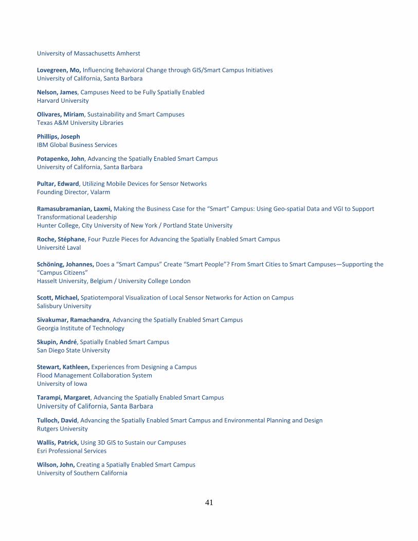
41
University of Massachusetts Amherst Lovegreen, Mo, Influencing Behavioral Change through GIS/Smart Campus Initiatives University of California, Santa Barbara Nelson, James, Campuses Need to be Fully Spatially Enabled Harvard University Olivares, Miriam, Sustainability and Smart Campuses Texas A&M University Libraries Phillips, Joseph IBM Global Business Services Potapenko, John, Advancing the Spatially Enabled Smart Campus University of California, Santa Barbara Pultar, Edward, Utilizing Mobile Devices for Sensor Networks Founding Director, Valarm Ramasubramanian, Laxmi, Making the Business Case for the “Smart” Campus: Using Geo-spatial Data and VGI to Support Transformational Leadership Hunter College, City University of New York / Portland State University Roche, Stéphane, Four Puzzle Pieces for Advancing the Spatially Enabled Smart Campus Université Laval Schöning, Johannes, Does a “Smart Campus” Create “Smart People”? From Smart Cities to Smart Campuses—Supporting the “Campus Citizens” Hasselt University, Belgium / University College London Scott, Michael, Spatiotemporal Visualization of Local Sensor Networks for Action on Campus Salisbury University Sivakumar, Ramachandra, Advancing the Spatially Enabled Smart Campus Georgia Institute of Technology Skupin, André, Spatially Enabled Smart Campus San Diego State University Stewart, Kathleen, Experiences from Designing a Campus Flood Management Collaboration System University of Iowa Tarampi, Margaret, Advancing the Spatially Enabled Smart Campus University of California, Santa Barbara Tulloch, David, Advancing the Spatially Enabled Smart Campus and Environmental Planning and Design Rutgers University Wallis, Patrick, Using 3D GIS to Sustain our Campuses Esri Professional Services Wilson, John, Creating a Spatially Enabled Smart Campus University of Southern California

42
Resources in Support of the Spatially Enabled Smart Campus The following resource suggestions and announcements were derived from meeting presentations and discussions.
Announcements:
The UCSB Center for Spatial Studies' [email protected] symposium on 3 June 2014 will feature Spatially Enabled Smart Places (http://spatial.ucsb.edu/2014/spatially-enabled-smart-places/). The plenary session will include a presentation by Alexander Stepanov (University of Massachusetts Amherst) who will demonstrate how GIS technologies can tie diverse systems together for decision support to enable a smart campus. Following, Jon Jablonski (Director of the Map and Imagery Laboratory, UCSB) will suggest how geo-spatial technologies can be linked to other information and communication systems to provide a primary platform for searching and integrating data to support research and education. The session will be chaired by Werner Kuhn, Director of the Center for Spatial Studies. Following the plenary session, Mo Lovegreen (Director of Sustainability, UCSB) will lead a Campus Sustainability Tour. This annual event is open to the public.
You are invited to attend the Association of Geographic Information Laboratories for Europe (AGILE) conference in Spain, June 2014. http://www.agile-online.org/index.php/conference/conference-2014. It is going to be a very Smart Conference and a perfect opportunity to see our Smart campus live. Don’t miss this opportunity to meet the GIS European community!
“Mapping Urban Intelligence,” July 3–4 2014, Québec City, Canada—CFP, http://www.crg.ulaval.ca/?page_id=2181&lang=en
“Engaging Data” Conference—MIT Sensible City Lab: Good data or bad data, November 2013. The website features a repository of video presentations http://senseable.mit.edu/engagingdata2013/
Smart City: A Critical Perspective―Conference in Bangkok, 7–8 November 2014 http://spacesandflows.com/the-conference/program-and-events/call-for-participants-the-smart-city; http://spacesandflows.com/the-conference
Smart city is an ambiguous concept referring to the idea of building new cities, or restructuring existing ones, so as to encompass ICTs, environmental sustainability, quality of life, social cohesion and economic growth. There is not a commonly agreed upon definition of the smart city, but according to mainstream discourses it is a semantic synthesis and a conventional wisdom evoking efficiency, accountability, self-reliance. The smart city may be conceptualized as a vision for the cities of tomorrow, an urban utopia, a new accumulation regime, a trendy
43
catchword, an urban development policy, a mobile political technology strongly connected to neoliberal rationales.
The session wishes to explore alternative understandings of urban smartness and to analyze ongoing experiences, practices and case studies with different disciplinary perspectives. It specifically aims at critically detecting potentialities and challenges, methodological approaches, comparative perspectives in the global North and South, politico-economic frameworks characterizing smart city projects, and to map forms and practices of resistance and conflict.
The session will refer both to practice, research, and theory. It may be of interest for geographers, sociologists, political scientists, planners, anthropologists, etc.
See links (above) for further details (information from Marco Santangelo (Politecnico di Torino) and Alberto Vanolo (Università di Torino)
Publications:
Next Geographic Information Science progress report of Progress in Human Geography will be about Smart City: Why does a Smart City need to be Spatially Enabled?
New publication: Diana Stuart Sinton, Sarah Bednarz, Phil Gersmehl, Robert Kolvoord, and David Uttal (2013). The Peoples Guide to Spatial Thinking. Washington DC: National Council for Geographic Education. Interactive Campus Maps and Mapping Projects―some examples presented at this meeting include:
• University of California, Santa Barbara, http://map.geog.ucsb.edu/; see related position paper about the UCSB Interactive Campus Map (ICM) by Bryan Karaffa
• University Jaume I of Castellón, http://smart.uji.es/. See related meeting presentation by Joaquin Huerta, Ana Sanchis, and Michael Gould; review the Learning & Collaboration platform, http://uji.maps.arcgis.com, http://uji.maps.arcgis.com/home/groups.html and the Standard & Extensible platform, uji.maps.arcgis.com/home/gallery.html • Videos, http://www.geotec.uji.es/wp,
content/uploads/2013/09/UJISmartCampus.avi, http://www.geotec.uji.es/wp, content/uploads/2013/07/SmartUJIRutas3D.mp4, http://www.geotec.uji.es/wp, content/uploads/2013/07/SmartUJI
• Augmented Reality, Reality2.wmv

44
• University of Southern California, http://web-app.usc.edu/maps/#upc/; examples of story maps, walking tours, timeline maps, and 3-D routing maps of the USC campus are reviewed in the meeting presentation by John Wilson.
• University of Massachusetts Amherst, http://www.umass.edu/cp/maps.htm; for
examples of how maps are integrated into campus planning initiatives, the position paper and plenary presentation by Niels la Cour elaborates on the history, process, and role of mapping and GIS enterprise systems for campus planning and facility management.
• Georgia Institute of Technology, See meeting presentation by Rama Sivakumar for
information on the campus tree survey and examples of geospatial applications in building design and in virtual visualizations.
• For an alternative perspective on the spatially enabled smart campus, see
http://carsilab.org/spatial_lab/; it includes examples of how Hunter College and the City University of New York showcase academic engagement with the urban environment of the campus neighborhood.
BoK. Here it is― Geographic Information Science & Technology Body of Knowledge (BoK system to a knowledge system): http://en.wikipedia.org/wiki/Geographic_Information_Science_and_Technology_Body_of_Knowledge
Foundational Research: • Ahearn, S., I. Icke, R. Datta, B. Plewe, M. DeMere, A. Skupin. (2013). “Re-engineering the Geographic Information System Body of Knowledge” Special Issue on GIS Cyber-infrastructure. International Journal for Geographic Information Science 27(11). •DeMere, M., A. Klimaszewski-Patterson, R. Richman, S.C. Ahearn, B. Plewe, A. Skupin, (2013) in press. “Toward an Immersive 3D Virtual BoK Exploratorium: A Proof of Concept.” Transactions on GIS, 2013, 17(3): 335–352. Links–NSF BoK Project: http://gistbok.org/ –BoK Web Services examples:
•http://www.gistbok.org/gistbok/services/gistbok1hierarchy •http://www.gistbok.org/gistbok/services/conceptmap?concept=Data+mining
–BoKVis: •https://trac.devzing.com/space/BoKVis/wiki
–BoKWiki: Long-term Neighborhood research and Community engagement http://carsilab.org/spatial_lab/

45
Web Links: Does CO2 make you dumb? http://newscenter.lbl.gov/feature-stories/2012/10/17/elevated-indoor-carbon-dioxide-impairs-decision-making-performance/
Is this like Tree Campus USA? http://www.arborday.org/programs/treecampususa/
Popular (Wired) article on how/why we need to do rigorous user testing: http://www.wired.com/wiredscience/2013/11/jpal-randomized-trials/
For an example of converting space into place, see the Starbucks model—a place for experiences intermediate place between home and work (The Third Place): http://www.fastcompany.com/887990/starbucks-third-place-and-creating-ultimate-customer-experience). The Association for the Advancement of Sustainability in Higher Education (AASHE), 2013. The Sustainability Tracking, Assessment, and Rating System (STARS). https://stars.aashe.org/.