advanced operational lidars for challenging …
TRANSCRIPT
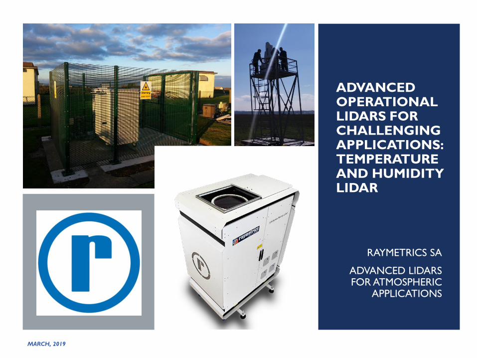
ADVANCED OPERATIONAL LIDARS FOR CHALLENGING APPLICATIONS:TEMPERATURE AND HUMIDITY LIDAR
RAYMETRICS SA
ADVANCED LIDARS FOR ATMOSPHERIC
APPLICATIONS
MARCH, 2019

RAYMETRICS AT A GLANCE
Raymetrics S.A. (“Raymetrics” or the “Company”) is a global leader in atmospheric LiDAR)
manufacturing
The Company mainly serves the meteorology, aviation, mining, military and academia and research sectors with a total installed base of around 70 systems)
The product portfolio comprises Standardized Vertical Profiling- and Standardized 3D-Scanning LiDARs with the ability to combine new technology with existing systems such as RADAR
In addition, Raymetrics offers customization for all its LiDAR-systems as well as installation, systems integration, maintenance services and training for new and existing customers
Founded in 2002, the Company is headquartered in Athens (Greece) and employs ca. 20 people

PRODUCT PORTFOLIO
▪Standardised solutions for
meteorological applications including
cloud height, volcanic ash, dust, fire
smoke and particle detection as well
as atmospheric aerosol loading
measurements
▪Most powerful LiDAR system in the
product portfolio
▪Remains within the limits of the EU
Standard on Laser Safety)
▪Standardised solution mainly for various
applications including incoming fog and
cloud height detection as well as remote
visibility measurements, mapping and
localisation
▪Other application include pollution source
profiling (dust, smoke or plume for
factory operations)
▪Remains within the limits of the EU
Standard on Laser Safety) and complies
with the international standard for air
quality and environmental meteorology)
Standardised
Vertical Profiling
Standardised
3D-Scanning Customized solutions
▪ Custom Lidar development for
various applications
▪Different wavelength options
▪Different telescope diameter
▪DIAL Lidars
▪Rotational Raman Lidars
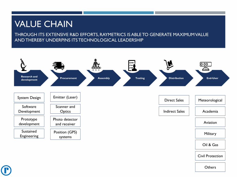
VALUE CHAINTHROUGH ITS EXTENSIVE R&D EFFORTS, RAYMETRICS IS ABLE TO GENERATE MAXIMUM VALUE
AND THEREBY UNDERPINS ITS TECHNOLOGICAL LEADERSHIP
Research and
developmentProcurement Assembly Testing Distribution End-User
System Design Emitter (Laser)Direct Sales Meteorological
Software
Development
Prototype
development
Sustained
Engineering
Scanner and
Optics
Photo detector
and receiver
Position (GPS)
systems
Indirect Sales Academia
Aviation
Military
Oil & Gas
Others
Civil Protection
WHAT IS LIDAR?
The LIDAR technique is based on the emission of laser pulse which interacts
with atmosphere (molecules, particles, pollutants).
LIDAR comes from Light Detection And Ranging
LIDAR is a Remote Sensing Technique
Remote Sensing: A technique (science) of obtaining information about an object
or quantity without having the sensor is direct physical-contact with the object
(like in-situ methods, e.g.: typical thermometers)
However there is a “medium” that carries the information. For lidar is the
Light.
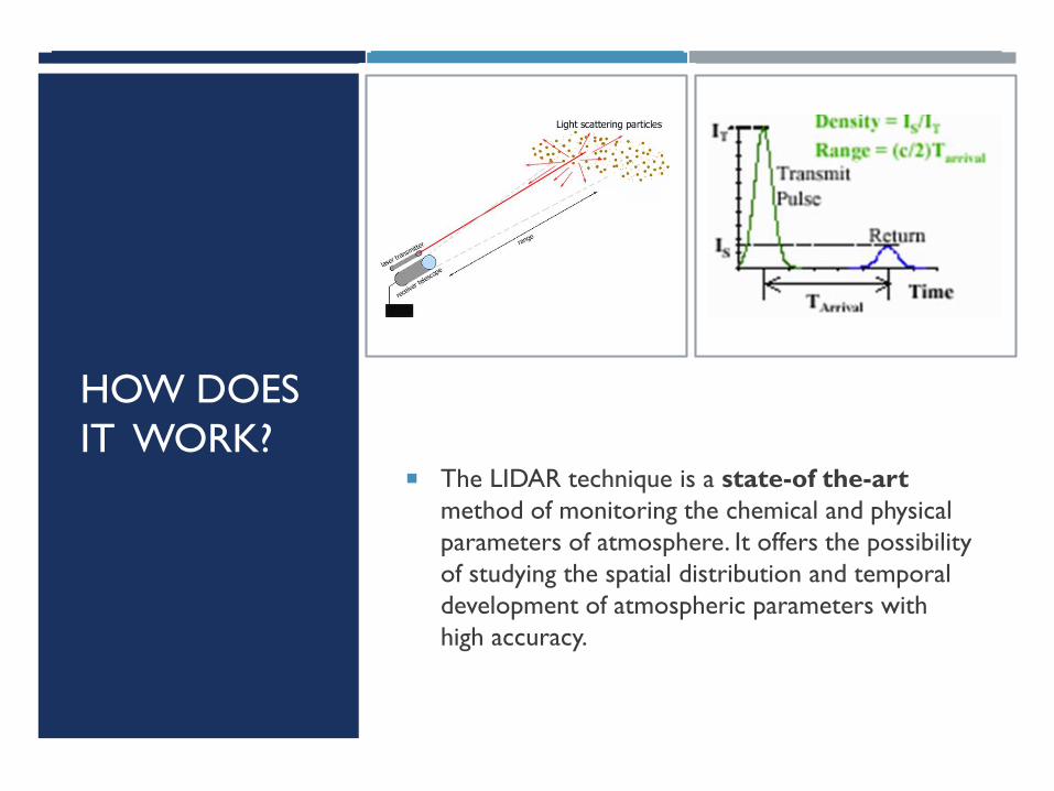
HOW DOES
IT WORK? The LIDAR technique is a state-of the-art
method of monitoring the chemical and physical
parameters of atmosphere. It offers the possibility
of studying the spatial distribution and temporal
development of atmospheric parameters with
high accuracy.
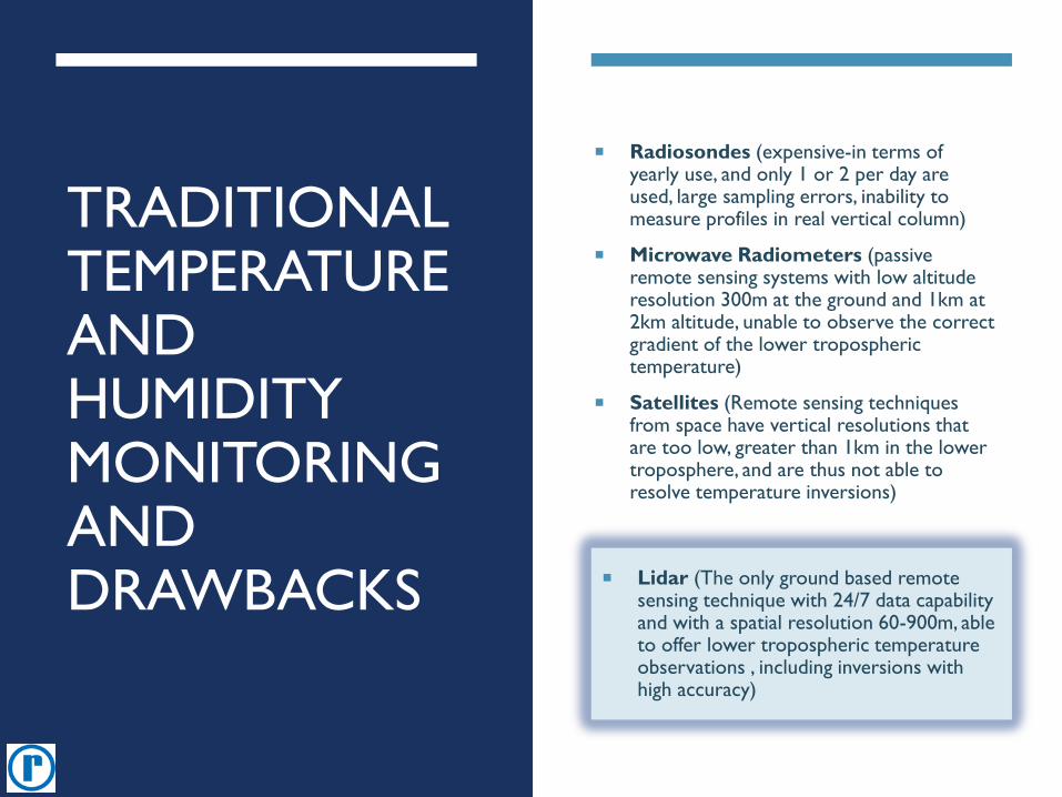
TRADITIONAL TEMPERATURE AND HUMIDITY MONITORING AND DRAWBACKS
Radiosondes (expensive-in terms of yearly use, and only 1 or 2 per day are used, large sampling errors, inability to measure profiles in real vertical column)
Microwave Radiometers (passive remote sensing systems with low altitude resolution 300m at the ground and 1km at 2km altitude, unable to observe the correct gradient of the lower tropospheric temperature)
Satellites (Remote sensing techniques from space have vertical resolutions that are too low, greater than 1km in the lower troposphere, and are thus not able to resolve temperature inversions)
Lidar (The only ground based remote sensing technique with 24/7 data capability and with a spatial resolution 60-900m, able to offer lower tropospheric temperature observations , including inversions with high accuracy)
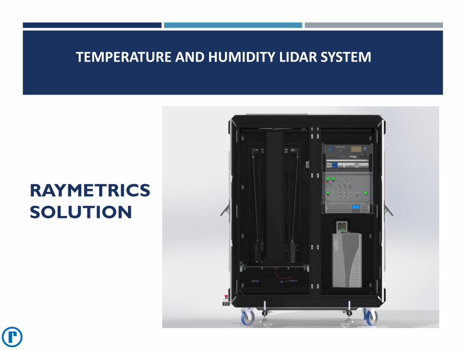
RAYMETRICS
SOLUTION
TEMPERATURE AND HUMIDITY LIDAR SYSTEM
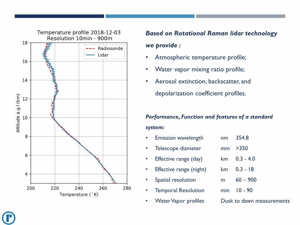
Based on Rotational Raman lidar technology
we provide :
• Atmospheric temperature profile;
• Water vapor mixing ratio profile;
• Aerosol extinction, backscatter, and
depolarization coefficient profiles.
Performance, Function and features of a standard
system:
• Emission wavelength nm 354.8
• Telescope diameter mm >350
• Effective range (day) km 0.3 - 4.0
• Effective range (night) km 0.3 - 18
• Spatial resolution m 60 – 900
• Temporal Resolution min 10 - 90
• Water Vapor profiles Dusk to dawn measurements
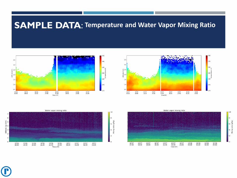
SAMPLE DATA: Temperature and Water Vapor Mixing Ratio
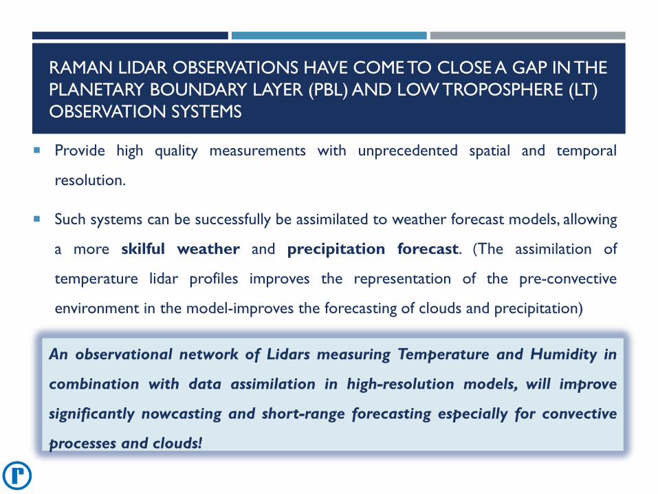
RAMAN LIDAR OBSERVATIONS HAVE COME TO CLOSE A GAP IN THE
PLANETARY BOUNDARY LAYER (PBL) AND LOW TROPOSPHERE (LT)
OBSERVATION SYSTEMS
Provide high quality measurements with unprecedented spatial and temporal
resolution.
Such systems can be successfully be assimilated to weather forecast models, allowing
a more skilful weather and precipitation forecast. (The assimilation of
temperature lidar profiles improves the representation of the pre-convective
environment in the model-improves the forecasting of clouds and precipitation)
An observational network of Lidars measuring Temperature and Humidity in
combination with data assimilation in high-resolution models, will improve
significantly nowcasting and short-range forecasting especially for convective
processes and clouds!
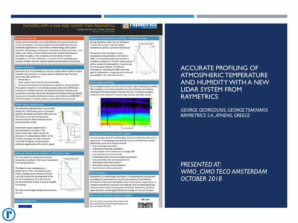
ACCURATE PROFILING OF ATMOSPHERIC TEMPERATURE AND HUMIDITY WITH A NEW LIDAR SYSTEM FROM RAYMETRICS
GEORGE GEORGOUSIS, GEORGE TSAKNAKISRAYMETRICS S.A., ATHENS, GREECE
PRESENTED AT:WMO_CIMO TECO AMSTERDAM OCTOBER 2018
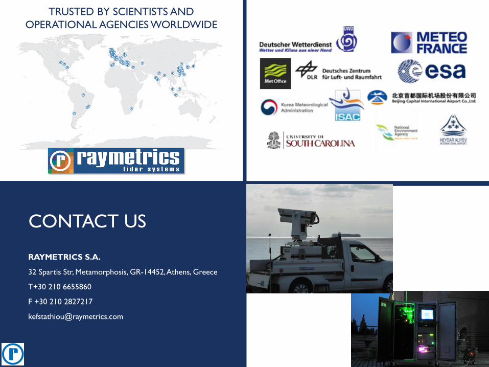
TRUSTED BY SCIENTISTS AND
OPERATIONAL AGENCIES WORLDWIDE
CONTACT US
RAYMETRICS S.A.
32 Spartis Str, Metamorphosis, GR-14452, Athens, Greece
T+30 210 6655860
F +30 210 2827217