addendum 3 temporary staging area-parachini property
TRANSCRIPT

East Contra Costa BART Extension (eBART) Project Final EIR
Addendum 3
Temporary Staging Area-Parachini Property
October 18, 2013
Prepared by:
San Francisco Bay Area Rapid Transit District 300 Lakeside Drive Oakland, CA 94612
East Contra Costa BART Extension (eBART) Project Final EIR
Addendum 3
Staging and Storage Area-Parachini Property


eBART Final EIR Addendum 3
1 October 2013
East Contra Costa BART Extension (eBART) Project
Final EIR-Addendum 3
Staging and Storage Area-Parachini Property
1.0 Summary
Background The San Francisco Bay Area Rapid Transit District (BART) is extending transit services into east Contra Costa County from its existing Pittsburg/Bay Point BART Station. The project is generally known as “eBART” in reference to the extension of service to the “East” portion of Contra Costa County. The Project consists of an approximately 10-mile extension of transit service in the median of State Route 4 (SR 4) from the current BART terminus in Contra Costa County at the Pittsburg/Bay Point BART Station to a point just east of Hillcrest Avenue in the City of Antioch.
The potential environmental effects of the eBART Project were presented in a Final Environmental Impact Report (FEIR) for the purposes of evaluating environmental impacts under the California Environmental Quality Act (Public Resources Code Section 21000, et seq., CEQA). On April 23, 2009, the BART Board of Directors certified the FEIR for the project, adopted a Mitigation Monitoring and Reporting Plan (MMRP),1 and adopted the eBART Project (Project).
There have been two Addenda to the Final EIR since its certification in 2009. The first Addendum analyzed a series of modifications to the project. The Board considered those modifications and the Addendum on April 28, 2011 and adopted the Project as revised. A second Addendum analyzed grading outside the original project footprint. BART’s Assistant General Manager reviewed and considered the second Addendum and approved the project changes. The General Manager notified the Board of the project changes and the second Addendum in a memorandum on May 8, 2012. This current Addendum, the third, concerns the property between the Antioch Station parking lot and the Maintenance Facility. The 7.97-acrea area initially would be used as a temporary staging and storage area during construction. After construction is completed, the site would remain a long-term storage area to support eBART system operations. At this time BART has no plans for any other future development or more intensive use of the site. Should BART elect to develop the site for another use in the future, consistent with BART's existing plans and policies for development, that project would be subject to separate CEQA review.
1 Mitigation Monitoring and Reporting Plan adopted April 23, 2009 and revised April 28, 2011.

eBART Final EIR Addendum 3
2 October 2013
Purpose of Addendum Section 15164 of the CEQA Guidelines allows a Lead Agency to prepare an Addendum to a previously certified EIR if some changes or additions are necessary, as long as none of the conditions described in Guidelines Section 15162 requiring the preparation of a subsequent EIR have occurred. In brief, Section 15162 states that when an EIR has been certified, no subsequent EIR needs to be prepared for the project unless the Lead Agency determines, on the basis of substantial evidence in the light of the whole record, that there are substantial changes proposed in the project that require major revisions of the previous EIR, substantial changes occur with respect to the circumstances under which the project is undertaken, or there is new information of substantial importance regarding new significant effects, substantially more severe effects, or the feasibility or effectiveness of mitigation measures.
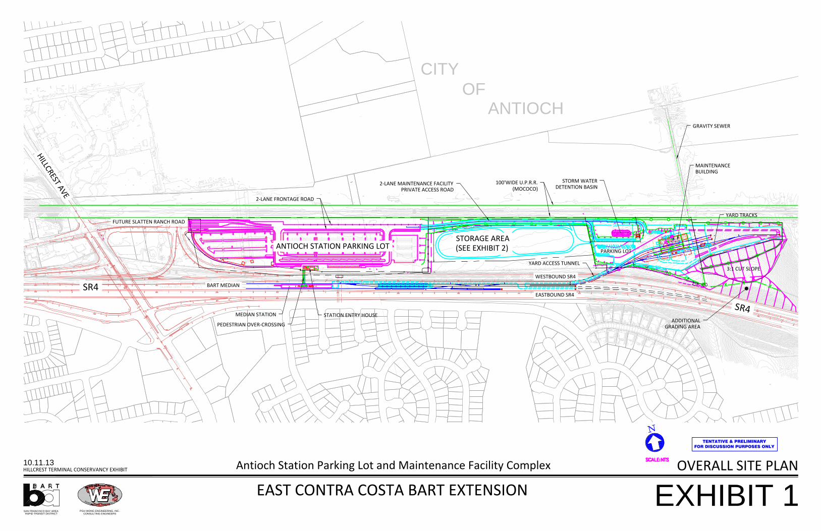
Revisions to the Project The eBART terminus station in Antioch is being constructed adjacent to the north side of SR 4, east of Hillcrest Avenue. The project components at this location include the station platform in the median of SR 4, together with the station entry house, station parking lot, access road, and Maintenance Facility. Exhibit 1 illustrates the overall site plan for the Antioch eBART Station and Maintenance Facility area at Hillcrest, which covers 40.13 acres.
Between the station parking lot to the west and the Maintenance Facility to the east, lies an 18.69-acre parcel, commonly known as the Parachini property after the former owners. Of the original 18.69 acres, BART used 7.94 acres for an access road from the parking lot to the Maintenance Facility and slope easements. This area was included in the eBART Final EIR impact analysis. An additional 2.78 acres adjacent to SR 4 is being transferred to the Contra Costa Transportation Authority (CCTA) for highway widening. The remaining 7.97 acres is undeveloped and will remain in BART ownership for the foreseeable future. BART is proposing to use this 7.97-acre area as a staging and storage area for rails, ties, ballast, heavy equipment, and other material during construction. Following construction, the site would provide long-term storage for eBART system operations. The use of the property as a staging and storage area was not evaluated in the Final EIR.
Determination This Addendum to the eBART Project Final EIR revisits the analysis conducted in the Final EIR and 2011 Addendum and evaluates the potential effects of using the Parachini property for construction staging and a long-term storage area. The proposed storage and staging area is evaluated below for all categories of impact analyzed in the Final EIR (transportation, land use, visual quality, etc.). The analysis did not identify any substantial changes to the affected environment and did not identify any new or substantially more severe impacts not already identified in the Final EIR. All mitigation measures included in the Final EIR and MMRP would also apply to the Revised Project. Based on the evaluation presented in this Addendum, there is no substantial evidence in the light of the whole record that the conditions outlined in Section 15162 of the CEQA Guidelines requiring a subsequent EIR are met. Therefore, an EIR Addendum is appropriate.

eBART Final EIR Addendum 3
3 October 2013
2.0 Revisions to the Project
Background The San Francisco Bay Area Rapid Transit District (BART) is proposing to extend transit services into east Contra Costa County from its existing Pittsburg/Bay Point BART Station in the unincorporated community of Bay Point near the City of Pittsburg. The project is generally known as “eBART” in reference to the extension of service to the “East” portion of Contra Costa County. The Project consists of an approximately 10-mile extension of transit service in the median of State Route 4 from the current BART terminus in Contra Costa County at the Pittsburg/Bay Point BART Station to the new Antioch Station, which is located just east of Hillcrest Avenue in the City of Antioch.
The Antioch Station will be constructed adjacent to the north side of SR 4 east of Hillcrest Avenue. The project components include the station platform in the median of SR 4 and the station entry house, parking lot, access road, and Maintenance Facility adjacent to SR 4 on the north. Exhibit 1 illustrates the overall site plan for the eBART Antioch Station and Maintenance Facility area at Hillcrest Avenue, which covers 40.13 acres.
Proposed Staging and Storage Area The proposed staging and storage area lies between the station parking lot to the west and the Maintenance Facility to the east. Exhibit 1 illustrates the location of the storage area within the overall site plan. The subject parcel (APN# 052-030-017) is commonly known as the Parachini property after the former owners. Of the original 18.69 acres2, BART used 7.94 acres for an access road from the station parking lot to the Maintenance Facility and slope easements. An additional 2.78 acres adjacent to SR 4 is being transferred to the Contra Costa Transportation Authority for the widening of SR 4. The remaining 7.97 acres is undeveloped and will remain in BART ownership.3
The site would initially be used as a staging area for construction of the eBART project. The staging area would be used to store rail, ties, ballast, and heavy equipment, as necessary. It would be used as a staging area for approximately 4 years. This would be the period of the most active use. Once project construction is complete, the site would serve as a long-term storage area to support eBART system operations. The site would continue to store rails, ties and ballast, similar to its use as a staging area.
The site would not be graded. The only improvements would be placement of compacted aggregate (drain rock) to a depth of 12 inches to provide a circular driveway that would make the site useable in wet weather and a fence to provide security for the stored equipment and materials. No night lighting is planned. Exhibit 2 illustrates the BART plan for the staging and storage area.
2 The parcel size initially was stated as 18.67 acres. Subsequent surveys have determined the parcel to be 18.69
acres. 3 BART took possession of the property on August 16, 2013.

eBART Final EIR Addendum 3
4 October 2013
At this time BART has no plans for any more intense, future development of the site. Should BART elect to develop the site for another use in the future, consistent with BART's existing plans and policies for development, that project would be subject to separate CEQA review.
STATION ENTRY HOUSE
2-LANE MAINTENANCE FACILITYPRIVATE ACCESS ROAD
PARKING LOT
YARD ACCESS TUNNEL
TENTATIVE & PRELIMINARYFOR DISCUSSION PURPOSES ONLY
100'WIDE U.P.R.R.(MOCOCO)
MAINTENANCEBUILDING
MEDIAN STATION
PEDESTRIAN OVER-CROSSING
GRAVITY SEWER
YARD TRACKS
3:1 CUT SLOPE
STORM WATERDETENTION BASIN
CITYOF
ANTIOCH
2-LANE FRONTAGE ROAD
SAN FRANCISCO BAY AREA RAPID TRANSIT DISTRICT
PGH WONG ENGINEERING, INC.CONSULTING ENGINEERS
EXHIBIT 110.11.13HILLCREST TERMINAL CONSERVANCY EXHIBIT
EAST CONTRA COSTA BART EXTENSION
Antioch Station Parking Lot and Maintenance Facility Complex OVERALL SITE PLAN
EASTBOUND SR4
WESTBOUND SR4
BART MEDIAN
FUTURE SLATTEN RANCH ROAD
SR4
ANTIOCH STATION PARKING LOT
HILLCREST AVE
SR4ADDITIONAL
GRADING AREA
STORAGE AREA(SEE EXHIBIT 2)

SAN FRANCISCO BAY AREA RAPID TRANSIT DISTRICT
PGH WONG ENGINEERING, INC.CONSULTING ENGINEERS
EXHIBIT 2STORAGE AREA - PARACHINI PROPERTY20131011
K:\17.0 Final Design_Drawings\04SF-150-CONTRACT\Exhibits\PATH.dwgPLAN VIEW

eBART Final EIR Addendum 3
7 October 2013
3.0 Environmental Analysis Existing Conditions The Antioch Station is currently under construction. Excavation and rough grading largely have been completed and the outlines of the station parking lot and Maintenance Facility have taken shape. Utility relocations generally have been completed. The foundations for the Maintenance Facility have been constructed. The Contra Costa Transportation Authority is proceeding with its widening of SR 4 adjacent to the station site. However, the undeveloped area between the station parking lot and the Maintenance Facility was not part of the original project footprint and has been left undisturbed (Photo 1). Conditions in this area are essentially the same as those described in the FEIR and subsequent Addendums.
Photo 1: View of the proposed staging area looking west from the Maintenance Facility. SR 4 construction is
visible left of the fence. Equipment visible in the far background is the parking lot construction.
eBART Final EIR Addendum 3
8 October 2013
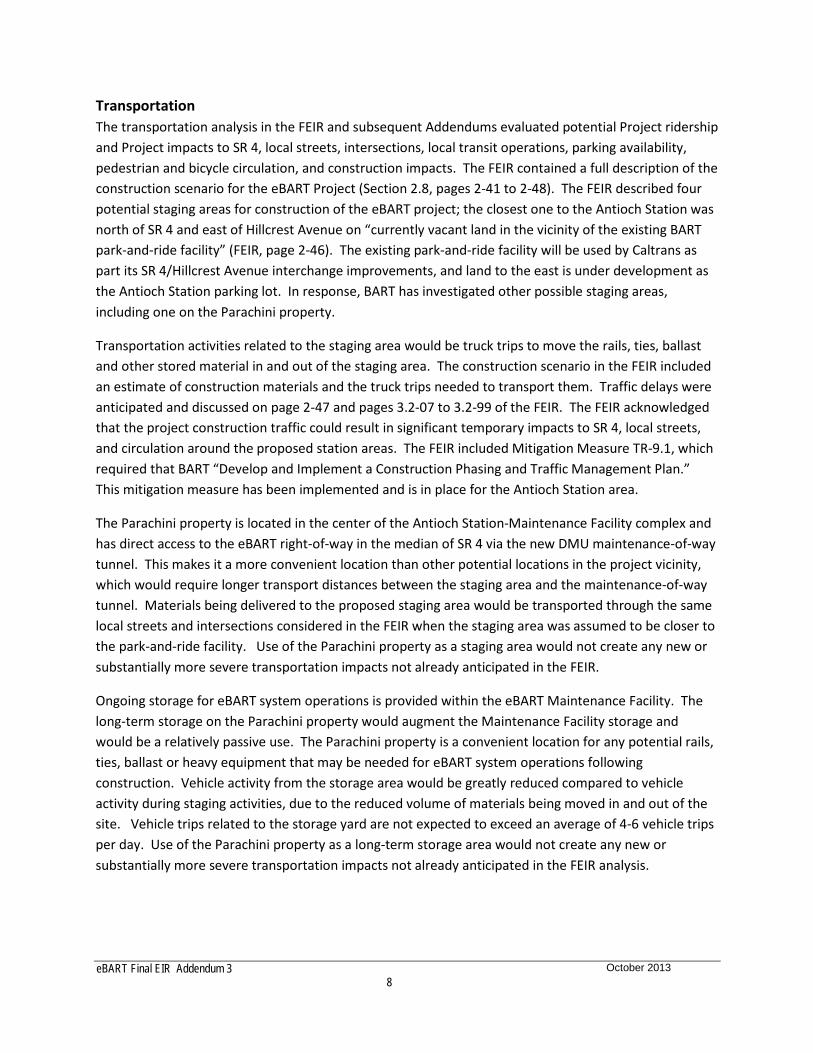
Transportation The transportation analysis in the FEIR and subsequent Addendums evaluated potential Project ridership and Project impacts to SR 4, local streets, intersections, local transit operations, parking availability, pedestrian and bicycle circulation, and construction impacts. The FEIR contained a full description of the construction scenario for the eBART Project (Section 2.8, pages 2-41 to 2-48). The FEIR described four potential staging areas for construction of the eBART project; the closest one to the Antioch Station was north of SR 4 and east of Hillcrest Avenue on “currently vacant land in the vicinity of the existing BART park-and-ride facility” (FEIR, page 2-46). The existing park-and-ride facility will be used by Caltrans as part its SR 4/Hillcrest Avenue interchange improvements, and land to the east is under development as the Antioch Station parking lot. In response, BART has investigated other possible staging areas, including one on the Parachini property.
Transportation activities related to the staging area would be truck trips to move the rails, ties, ballast and other stored material in and out of the staging area. The construction scenario in the FEIR included an estimate of construction materials and the truck trips needed to transport them. Traffic delays were anticipated and discussed on page 2-47 and pages 3.2-07 to 3.2-99 of the FEIR. The FEIR acknowledged that the project construction traffic could result in significant temporary impacts to SR 4, local streets, and circulation around the proposed station areas. The FEIR included Mitigation Measure TR-9.1, which required that BART “Develop and Implement a Construction Phasing and Traffic Management Plan.” This mitigation measure has been implemented and is in place for the Antioch Station area.
The Parachini property is located in the center of the Antioch Station-Maintenance Facility complex and has direct access to the eBART right-of-way in the median of SR 4 via the new DMU maintenance-of-way tunnel. This makes it a more convenient location than other potential locations in the project vicinity, which would require longer transport distances between the staging area and the maintenance-of-way tunnel. Materials being delivered to the proposed staging area would be transported through the same local streets and intersections considered in the FEIR when the staging area was assumed to be closer to the park-and-ride facility. Use of the Parachini property as a staging area would not create any new or substantially more severe transportation impacts not already anticipated in the FEIR.
Ongoing storage for eBART system operations is provided within the eBART Maintenance Facility. The long-term storage on the Parachini property would augment the Maintenance Facility storage and would be a relatively passive use. The Parachini property is a convenient location for any potential rails, ties, ballast or heavy equipment that may be needed for eBART system operations following construction. Vehicle activity from the storage area would be greatly reduced compared to vehicle activity during staging activities, due to the reduced volume of materials being moved in and out of the site. Vehicle trips related to the storage yard are not expected to exceed an average of 4-6 vehicle trips per day. Use of the Parachini property as a long-term storage area would not create any new or substantially more severe transportation impacts not already anticipated in the FEIR analysis.
eBART Final EIR Addendum 3
9 October 2013
Land Use The Final EIR evaluated the Project’s consistency with plans, policies, and programs, and the eBART Project’s compatibility with existing uses. The proposed storage area is located on one parcel: an undeveloped parcel adjacent to SR 4 (APN# 052-030-017). Originally 18.69 acres, 7.97 acres of the parcel will serve as the staging and storage area.
The property is surrounded by transportation-related uses. It is bordered by the Maintenance Facility to the east, the Antioch Station parking lot to the west, the Maintenance Facility access road and the Union Pacific Railroad line to the north, and SR 4 to the south. The nearest residential uses are located across SR 4, more than 300 feet to the south. The nearest residences to the north are approximately 1,100 feet away. There are also some commercial uses, such as a construction equipment storage yard and vehicle salvage and towing yard, along the north side of the Union Pacific Railroad track at Willow Avenue, approximately 500 feet northeast of the property. With no residential, commercial, or industrial uses close to the site, use of the proposed staging area would not interfere with plans policies or programs, or be incompatible with surrounding land uses. The staging area would be a temporary use. After construction is completed, the site would become a long-term storage area. No additional or more severe land use impacts are anticipated due to the use of the staging and storage area.
Population and Housing The Population and Housing evaluation in the Final EIR provided an overview of the population, housing, and economic characteristics of the communities in the project corridor. The construction scenario in the FEIR identified various properties along the eBART alignment as possible staging areas. Activities and employment associated with the staging areas and the Maintenance Facility (including storage) were included in the FEIR analysis, so relocating staging and storage activities to the proposed Parachini staging area would not create any new employment not already anticipated in the FEIR.
Parcel APN# 052-030-017 was identified as a land acquisition in the Draft EIR, Table 3.4-5 (page 3.4-12), and BART acquired the parcel on August 16, 2013, consistent with the requirements of applicable state acquisition and relocation law. The staging and storage area would make use of an undeveloped parcel. No residences or businesses would be affected, so there would be no displacement of existing uses. Impacts to Population and Housing would remain less than significant.
Visual Quality The Visual Quality section of the EIR evaluated the effects of the Project related to its visual compatibility with the surrounding environment, the effect on significant views, and the potential for disruptive light and glare. Although the staging area itself has not changed, the visual environment in the immediate vicinity of the staging area has changed as the Antioch Station and Maintenance Facility have taken shape around it. Both BART and CCTA are conducting major construction projects in the SR 4 corridor between Hillcrest Avenue and the SR 160 interchange: BART is constructing the terminus of the eBART system, and CCTA is widening SR 4 including median widening to accommodate the eBART system. To the casual observer, the north side of SR 4 resembles one large construction zone. Beyond

eBART Final EIR Addendum 3
10 October 2013
the construction in the SR 4 corridor, the visual environment has remained consistent with the description in the Final EIR. The project site is not in a scenic corridor.
The staging area would be used to store railroad rails, ties, ballast and other material prior to use. Rails and ties would be stacked vertically. Ballast is a loose material and would be stored in piles. The typical height for any of the stockpiled material would be approximately 10 to 12 feet high. A driveway of crushed drain rock would be placed on an oval around the property to provide access in wet weather. A fence would be placed around the perimeter of the staging area for security purposes. No nighttime security lighting is planned. Use of the Parachini property for staging would be visually similar to the other construction activities in the area and largely indistinguishable from them. In the short term, the proposed staging area would become one more component of the larger construction landscape. The site would be used as a staging area for approximately 4 years. Following construction, the site would continue as a storage area for many of the same materials used during construction, such as rails, ballast, and ties. Views of the storage area would be similar to views of the staging area, except that the amount of material stored there would be less than during construction staging. The security fencing would be a chain link or other “see through” style; the fencing and the aggregate for the driveway would not be visible to most viewers.
The closest residents are located approximately 300 feet to the south across SR 4. These residences face the street frontage along Bluebell Circle, with the backyards aligned along SR 4. In most cases, these residences have backyard fences that would block most views toward SR 4. There are also residences to the north, but these residences are more than 1,100 feet distant. The closest visual receptors would be auto drivers and passengers along SR 4. Auto speeds along SR 4 are frequently 65 miles per hour. Due to the limited visual exposure at those speeds, the auto drivers and passengers would not perceive the staging and storage area as a substantial change to the viewshed.
Given that the site is not in a scenic corridor, there would be no grading or structures on-site, the site would not generate any light and glare, and the lack of sensitive receptors close to the site, the staging and storage area would not create any new or substantially more severe visual impacts.
Cultural Resources The FEIR evaluated the operational and construction effects of the Project on archaeological and historic resources in the project corridor and determined that construction activities have the potential to damage previously unknown cultural deposits or human remains during ground disturbance. Drain rock would be placed for the driveway, but material would be stored at grade, and no grading would be conducted at the staging area. Extensive grading has taken place around the Parachini property, and there is no indication that there are any unknown subsurface archaeological resources in the project vicinity. There is no reason to assume that the staging and storage area has a greater archaeological sensitivity than other areas of the eBART site. Mitigation measures in the MMRP, CR-2.1 (Follow Protocol and Procedures If Archaeological Resources Are Encountered) and CR-2.2 (Follow Protocol and Procedures If Human Remains Are Encountered), are designed to protect subsurface resources and

eBART Final EIR Addendum 3
11 October 2013
would apply to the staging and storage area. This would ensure that the site activities would have a less-than-significant impact on archaeological resources.
Geology, Soils and Seismicity The Final EIR assessed the geologic, soil, and seismic hazards along the project corridor. There are no known faults, landslides, unstable soils, or other geologic issues on the site. No grading or structures are planned for the site. The proposed staging and storage area would not affect the local geology or be affected by it. Therefore, the site’s use for staging and storage would not create any new or substantially more severe impacts.
Hydrology and Water Quality The Final EIR described the existing hydrology and water quality conditions along the project corridor, and examined the Project with respect to potential impacts on surface water quality, groundwater, flooding, hydrology, and stormwater runoff. There are no wetland areas or drainage ways on the site; the closest wetland area is a small swale east of the Maintenance Facility approximately 1,500 feet from the proposed staging and storage area. Although construction has taken place on three sides of the site, the site itself has not been graded. Drain rock would be placed to create a driveway that would allow access in wet weather; but drain rock is pervious and would not create any new impervious surface that would affect or increase surface runoff from the site. Due to the use of heavy equipment, there is the potential for some soil erosion related to staging activities. The FEIR identified several potential impacts related to erosion control and required mitigation measures for those impacts. Mitigation Measure HY-6 (Develop and Implement a SWPPP4 Outlining Specific Erosion and Sediment BMPs5) was designed to reduce or eliminate soil erosion and siltation. Mitigation Measure HY-6 and other measures would be implemented at the staging and storage area as they would for other elements of the eBART Project. This would ensure that the proposed storage activities would have a less-than-significant impact on hydrology and water quality.
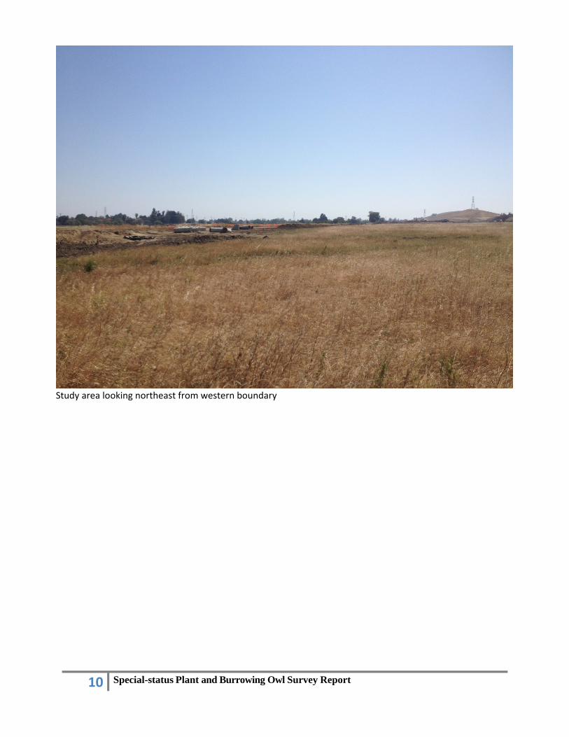
Biological Resources The FEIR evaluated the biological resources along the project corridor and the potential for the Project to disturb sensitive biological species and habitats. The project site is undeveloped pasture land and consists primarily of disturbed non-native grassland. There are no trees on the site. (See the site photo above.)
Surveys for biological resources were conducted as part of the eBART EIR evaluation, and a series of mitigation measures were identified in the EIR for biological impacts and habitat loss. Habitat loss for the eBART project was mitigated through the East Contra Costa County Conservancy Habitat Conservation Plan and Natural Community Conservation Plan (Conservancy). The Conservancy issued a Certificate of Inclusion for the Antioch Station and Maintenance Facility (Phase II) on January 26, 2012 and a second Certificate of Inclusion for additional grading (Phase II-Addendum 1.0) on September 10, 2013.
4 Stormwater Pollution Prevention Plan 5 Best Management Practices
eBART Final EIR Addendum 3
12 October 2013
BART’s agreement with the Conservancy required preconstruction surveys for Western burrowing owl, Swainson’s hawk, and San Joaquin kit fox, which are listed species in the Conservancy’s HCP/NCCP. Biologists began monitoring the eBART site in February 2012, and consistent with BART’s agreement with the Conservancy, preconstruction surveys for sensitive animal species were conducted in August 2012. Surveys and monitoring indicated burrowing owls in the project vicinity, principally along the railroad alignment to the north. There was no evidence of Swainson’s hawk; however, due to the presence of potential nest trees in the site vicinity, continued surveys and minimization measures were warranted. There was no evidence of San Joaquin kit fox; and due to the marginal nature of the habitat and its isolated location, it was determined that no further kit fox monitoring would be conducted.6
Biological surveys of the proposed staging area were conducted in May and August 2013.7 (The biological assessment is attached as Appendix A.) The vegetation community in the expansion area consists primarily of disturbed non-native grassland. A review of the California Natural Diversity Data Base records and the Conservancy’s Habitat Conservation Plan/Natural Community Conservation Plan species lists show that there are occurrences for 11 special-status plant species within 1.5 miles of the study area. None of these special-status plant species was observed during the surveys. The survey was conducted within the bloom period for all target species. Though the grassland in the study area may loosely correspond to the valley and foothill grassland habitat, past agricultural practices have resulted in nearly annual disturbance to this parcel. It is highly unlikely that any of the target special-status plant species remain in the seedbank in this area.
No burrowing owls, burrowing owl sign, or potentially suitable nest burrows were observed in the study area during the survey. One burrowing owl was observed in the Union Pacific Railroad right-of-way to the north and west of the study area (well outside the study area boundaries). The only small mammal burrows observed in the study area included pocket gopher burrows which are far too small to be suitable for burrowing owl occupation. Additionally, vegetation in the study area was generally 2 to 3 feet tall and very dense, which would deter burrowing owl occupation. Due to the lack of suitable burrows, and the height and density of the vegetation in the study area, it is very unlikely that burrowing owls would occupy the study area (though they could potentially forage there).
No suitable habitat for Swainson’s hawk occurs within 1,000 feet of the study area and no individuals of this species were observed at the time of the surveys. The nearest known occurrence for this species occurs approximately 2,000 feet to the east/northeast of the study area. While Swainson’s hawks have been known to nest at this location in the past, red-tailed hawks nested there in 2012. According to the biological technical report, the study area may provide suitable foraging habitat for the Swainson’s hawk; however, there is suitable foraging habitat in the vicinity of the project site, and utilization of the staging area would not constitute a significant impact to foraging habitat for the hawk.
6 San Francisco Bay Area Rapid Transit District, eBART Construction Monitoring Plan, September 17, 2012. 7 Cardno-Entrix, Technical Memorandum: Special-Status Plant and Burrowing Owl Survey for the eBART Hillcrest
Station Parking Lot and Maintenance Facility Project-Antioch, California, October 24, 2013.

eBART Final EIR Addendum 3
13 October 2013
Although no sensitive species were found on-site, the staging and storage area is potential habitat for species covered by the Conservancy’s Habitat Conservation Plan. BART currently is in the process of amending its agreement with the Conservancy to provide for the permanent loss of 7.97 acres of habitat.8 Coverage for habitat loss by the Conservancy would mitigate any potential biological impacts. Therefore, use of the property for a staging and storage area would not create any new or substantially more severe impacts not already identified in the FEIR.
Noise and Vibration The FEIR and 2011 Addendum evaluated the noise and vibration associated with eBART’s proposed Diesel Multiple Unit transit vehicles, increased traffic, and the Project’s construction. The evaluation determined that although construction impacts would be temporary, construction activities (both project specific and cumulative) could have potentially significant impacts on sensitive receptors along the project corridor. Mitigation measures adopted for the overall project would apply to the proposed staging area; however, construction noise and vibration impacts could be significant and unavoidable, even with mitigation measures in place.
Trucks, cranes, and other heavy equipment would be used to move and load rails, ties, and other materials to be stored at the staging area, and noise generated by staging area activities would be similar to that generated by other elements of the eBART project. The eBART station platform will be in the median of SR 4, within approximately 175 feet from the closest residential properties, which are south of SR 4. Elements of the eBART Project north of SR 4, such as the parking lot and station entry house, will be constructed approximately 335 feet from the nearest residential properties. The closest residents to the staging area are located across SR 4, approximately 350 feet to the south; no closer than the closest residents are to other elements of the project. SR 4 is located on an embankment adjacent to the staging area, which would tend to shield those residences south of SR 4 from much of the noise from the staging area. There are also residences to the north, but those residences are more than 1,100 feet distant. Construction noise and vibration impacts would be no greater than those analyzed in the FEIR and 2011 Addendum. Moreover, construction noise and vibration mitigation measures identified in the MMRP would also apply to the staging area. These would include the following measures: NO-6.1 (Employ Noise Reducing Construction Practices), NO-6.2 (Designate a Noise Disturbance Coordinator, Disseminate Information to Residences and Businesses, and Implement a Response/Tracking Program), and NO-7 Employ Vibration-Reducing Construction Practices). Therefore, there would be no new or substantially more severe impacts due to activities at the staging area.
The eBART Maintenance Facility includes storage for system operations, and the long-term proposed storage on the Parachini property following construction would augment that previously planned use. Long-term storage is a relatively passive use without much daily activity. In addition, the lack of night lighting would preclude any nighttime activity, the most noise-sensitive period. Impact NO-3 of the FEIR evaluated the noise from the eBART Maintenance Facility. The analysis was conducted according to Federal Transit Administration Guidelines and found that noise from the Maintenance Facility would 8 BART expects to request approval of Addendum 2.0 to the BART-Conservancy agreement at the Conservancy’s
December 2013 Board meeting.

eBART Final EIR Addendum 3
14 October 2013
have a less-than-significant impact. The closest sensitive receptors to the storage area are residences located south of SR 4. Although the storage area is located adjacent to SR 4, it does not extend as far to the south as the Maintenance Facility and is not as close to sensitive receptors as the Maintenance Facility. Therefore, because noise levels decrease with distance, noise generated by storage activities would not increase the expected noise levels from the Maintenance Facility and noise from operations (including storage activities) would remain less than significant.
Air Quality The eBART EIR and Addendum conducted a full analysis of air quality impacts related to the eBART project, including regional greenhouse gas, ozone precursors, construction exhaust pollutants, fugitive dust, and diesel particulate matter. Where potentially significant impacts were identified, mitigation measures were required.
The staging and storage area would not be graded, but heavy equipment would be employed to transport and stack materials, which could produce dust and diesel particulate matter. Even with the placement of compacted aggregate to form the driveway, there may be some fugitive dust generated by equipment and activities. The FEIR identified these potential impacts and the mitigation measures that would reduce them to a less-than-significant level. These mitigation measures include AQ-8.1 (Incorporate Control Measures and Best Management Construction Practices Into the Construction Contracts) and AQ-8.2 (Implement a Construction Emissions Reduction Plan for Heavy Equipment Exhaust). With the implementation of these air quality mitigation measures, potential air quality impacts from the staging area would continue to be less than significant.
Following construction, the site would continue to be used for long-term storage; however the activity level (and vehicle use) would decrease substantially compared to the construction period. Vehicle trips are estimated to be approximately 4-6 per day. This level of vehicle activity would not generate a substantial amount of fugitive dust or emissions and would be less than significant.
Public Health and Safety The eBART EIR and Addendums identified hazards that may exist along the project corridor. Potential hazards include hazardous materials sites, overall system safety, and hazardous materials used in project construction and operation. Consistent with the mitigation measures in the MMRP, a Phase I Site Assessment Report was produced for properties to be acquired by BART, including the subject Parachini property (APN# 052-030-017).9 Observations made at the site indicated that the westernmost end of the Parachini parcel adjacent to the staging area (APN# 052-030-018) contained multiple pieces of farm equipment, rubbish piles, and two 55-gallon drums with unknown contents. The location of this debris at the west end of the future station parking lot was approximately 1,700 feet (0.32 miles) west of the proposed staging and storage area. Due to its location between SR 4 and the Union Pacific Railroad and its past agricultural use, the Phase I Report also identified potential soil and groundwater contamination on-site from aerially deposited leads (ADLs) from auto exhaust, spills from railroad
9 CDM, San Francisco Bay Area Rapid Transit District, eBART Phase I Environmental Site Assessment Parcels P-
5020, P-5030, P-5040, and P-5060 Antioch, California, Final Report, February 25, 2011.

eBART Final EIR Addendum 3
15 October 2013
operations along the northern property boundary, petroleum pipelines in the railroad right-of-way, and long-term use of agricultural chemicals in the project vicinity. In addition, metals from historic industrial operations uses east of the eBART parcels were identified as potential pollutants.
BART conducted a Phase II soil and groundwater sampling effort to assess the potential presence of soil and groundwater contamination for the eBART project area. The results of the Phase II investigation were intended to determine soil handling requirements for construction, potential disposal issues of impacted soil and potential areas of remediation. The Phase II report was completed for the project footprint, which included the portions of the Parachini property that became the station parking lot and the access road to the Maintenance Facility.10 Because the area proposed for the staging area was not included in the original project footprint, no sampling was conducted for the subject property in the Phase II Report. However, sampling was conducted at locations on three sides of the proposed staging area and may be considered generally representative of the subject property. The Phase II report made the following findings:
Soil characteristics across the top 3 feet of all parcels exhibited no impacts from ADLs. Pesticides were detected at levels below effects screening levels (ESLs) at most locations, with
concentrations exceeding ESLs occurring on the westernmost Parachini property (west of the project site).
Petroleum hydrocarbons were detected in soil samples near the top of the groundwater from an undocumented release and are impacting groundwater.
Metals from historic industrial operations did not appear to affect on-site parcels.
The proposed staging area would be used for material storage only. Given that no grading or construction would take place on-site, disturbance of soils or groundwater at the staging area would be minimal. Therefore, impacts related to the presence of any on-site contaminants would be considered less than significant.
Following construction, the site would be used for the long-term storage of materials similar to those used during construction: rails, ties, ballast, and equipment. Fuels, lubricating oils, solvents, and other vehicle-related materials would be stored elsewhere in the Maintenance Facility. There would be no impact related to hazardous materials.
Community Services The EIR and Addendum described community services, such as police, fire, and emergency medical services along the eBART corridor. The use of the Parachini property as a staging and storage area would not create any new structures, roadways, or other infrastructure that would require the need for, or provision of, community services. Transportation activities related to the staging area would be truck trips to move the rails, ties, ballast and other stored material in and out of the staging area. The FEIR identified the need for a Traffic Management Plan (Mitigation Measure CS-3.1) to reduce the potential
10 CDM, Letter Report of Findings, eBART Phase 2 Environmental Site Assessments of BART Parcels P-5020, P-
5030, P-5040, P-5050, and P-5060, July 7, 2011.
eBART Final EIR Addendum 3
16 October 2013
for traffic disruptions and road detours that could impede emergency response times by police and fire departments. Truck traffic for materials transport was discussed in the construction scenario of the Project Description in the FEIR and included in the transportation analysis in the FEIR. The Traffic Management Plan has been implemented for the Antioch Station area, and one of its effects is to mitigate the potential impacts to emergency service response times. Following completion of construction, long-term storage activities would continue on the site. The small number of daily vehicle trips related to the storage yard (4-6) would not affect local traffic or emergency response times. There would be no new or substantially more severe impacts to community services due to the proposed staging area.
Utilities The FEIR and Addendums described the location of existing utility lines and evaluated how construction and operation of the Project could interrupt or damage the proper functioning of these lines. The Final EIR also considered whether the existing water and wastewater treatment systems serving the project corridor could accommodate the increased load created by the Project. BART has identified the location of utility lines crossing the project site. In addition, because the staging and storage area will not require any excavation or grading, if there were any unidentified utilities under the site, they would not be affected by the on-site activity. There would be no permanent or temporary structures onsite; therefore, the use of the site for staging and storage would not affect the water and wastewater needs of the project. There would be no new or substantially more severe impacts to utilities from the proposed staging and storage area.
Energy The Final EIR considered the energy required for both the construction and operation of the Project, as well as the energy savings associated with the Project’s reduction in vehicle miles traveled. The energy used by the equipment to construct the Project, including staging and storage areas, was included in the energy analysis for eBART project in the FEIR. The proposed staging and storage area would not create any new or substantially more severe impacts not already discussed in the FEIR.

APPENDIX A
Technical Memorandum: Special-Status Plant and Burrowing Owl Survey for the eBART Hillcrest Station Parking Lot and Maintenance Facility Project-Antioch California.
Cardno--ENTRIX
October 24, 2013


Cardno ENTRIX 701 University Ave, Suite 200
Sacramento, CA 95825 916-923-1097 | Fax 916-923-6251 www.cardnoentrix.com
Technical Memorandum Date: October 24, 2013
To: Don Dean From: Laura Burris,
Senior Staff Scientist/Botanist
RE: Special-status Plant and Burrowing Owl Survey for the eBART Hillcrest Station Parking Lot and Maintenance Facility Project – Antioch, California
1.0 INTRODUCTION
The purpose of this Technical Memorandum is to describe the methods and results for the special‐status
plant survey conducted at the Bay Area Rapid Transit’s (BART) eBART Hillcrest Station Parking Lot and
Maintenance Facility Project in Antioch, Contra Costa County, California. This survey was conducted to
classify habitat types and to determine if special‐status plant species are present within a section of BART‐
owned property located between the Parking Lot and Maintenance Facility (north of Highway 4 and south
of the UPRR alignment) where equipment and materials laydown are proposed (study area). The survey
also included a search for potentially suitable Swainson’s hawk nesting trees, burrowing owls, or small
mammal burrows suitable for burrowing owl nesting.
The study area for the special‐status plant survey included the approximately 8‐acre site adjacent to
Highway 4 (Figure 1). The property will first be used as a staging area during the construction phase of the
project, and then it will continue to be used as a permanent long‐term storage yard for eBART system
operations. Proposed activities include the creation of a gravel driveway in preparation for its utilization as a
staging and laydown area, to ensure wet weather access, and the installation of a security fence around the
perimeter of the site (Figure 1).
2.0 METHODS
Prior to the field surveys Cardno ENTRIX biologists conducted a query of the California Department of
Fish and Wildlife’s (CDFW) Natural Diversity Database (CNDDB) to determine if any of the target
special‐status plant species are known to occur in the vicinity of the study area. Additionally, the project
area falls within the jurisdiction of the East Contra Costa County Habitat Conservation Plan/Natural
Community Conservation Plan (HCP/NCCP). A list of “covered or no take plants” with potential to
occur within the habitats identified in the project area was derived from Table 3A Species‐Specific

Y:\GIS\Entrix\33601001_Ebart\map\eBART_LayDownArea_11i8i_11.mxd
Project Area
Proposed Lay Down Area
Project Site Design FeaturesProject Boundary
Date: 8/12/2013Projection: CASP, Zone 3 FT
Datum: NAD 835
eBART HCP Compliance Assis tance
Proposed Design forLay Down Area
Figure 1
0 50 100 15025Feet

Special-status Plant and Burrowing Owl Survey Report3
Planning Survey Requirements Triggered by Land Cover Types and Habitat Elements on the project site
in the HCP’s Project Planning Survey Report template (Refer to Table 1).
Site visits were conducted on May 2 and August 12, 2013. The surveys were conducted in accordance
with the California Department of Fish and Wildlife’s (CDFW’s) Protocols for Surveying and Evaluating
Impacts to Special Status Native Plant Populations and Natural Communities (CDFW, 2009) and the
HCP/NCCP’s guidance for presence/absence surveys as outlined in the Project Planning Survey Report
template. The timing of the surveys was designed to correspond to the blooming period for the target
species. The surveys consisted of walking parallel transects within the study area to determine habitat
suitability for the target plant species and to determine presence/absence of target species. Habitat
types and plant species observed were recorded. Representative photographs were taken during the
survey, and are provided at the end of this report. During the transect surveys, surveyors also watched
for Swainson’s hawk, suitable raptor nesting habitat, burrowing owls, burrowing owl sign (e.g.,
whitewash, feathers, or prey remains), or potential nest burrows.
3.0 RESULTS
The review of CNDDB records and the HCP/NCCP species lists show that there is potential for 11 plants
to occur within the project area (Table 1).
Table 1: Special‐status Plant Species with Potential to Occur in the Study Area
Species Status Habitat requirements/blooming season
Potential for Occurrence
Alkali milkvetch, Astragalus tener ssp.
tener
CRPR 1B.2, HCP‐N
Alkaline soils in Playas, valley and foothill grassland (adobe clay soils), and vernal pools. Blooms: March through June
None: The grasslands in the study area may provide marginally suitable habitat for this species; however, past agricultural practices and the ubiquitous nature of non‐native vegetation preclude the potential for this species to occur.
Big tarplant, Blepharizonia plumosa
CRPR 1B.1, HCP‐C
Valley and foothill grassland. Blooms: July through October
None: The grasslands in the study area may provide marginally suitable habitat for this species; however, past agricultural practices and the ubiquitous nature of non‐native vegetation preclude the potential for this species to occur.
Brewer’s dwarf flax, Hesperolinon breweri
CRPR 1B.2, HCP‐C
Usually serpentine soils in chaparral, cismontane woodland, and valley and foothill grasslands. Blooms: May through July
None: The grasslands in the study area may provide marginally suitable habitat for this species; however, soils in the study area are not

Special-status Plant and Burrowing Owl Survey Report4
comprised of serpentinite and the high degree of past agricultural disturbance likely precludes the potential for this species to occur.
Contra Costa goldfields, Lasthenia conjugens
FE, CRPR 1B.2, HCP‐N
Valley and foothill grassland, vernal pools, cismontane woodland, extirpated from most of its range; extremely endangered. Blooms: March through June
None: The grasslands in the study area may provide marginally suitable habitat for this species; however, past agricultural practices and the ubiquitous nature of non‐native vegetation preclude the potential for this species to occur. Additionally, this species’ range is very restricted and it is not known to currently occur in the vicinity of the study area.
Diamond‐petaled California poppy, Eschscholzia rhombipetala
CRPR 1B.1, HCP‐N
Alkaline and clay soils in valley and foothill grassland Blooms: March through April
None: The grasslands in the study area may provide marginally suitable habitat for this species; however, past agricultural practices and the ubiquitous nature of non‐native vegetation preclude the potential for this species to occur.
Hoover’s cryptantha, Cryptantha hooveri
CRPR 1A Valley and foothill grassland. Blooms: April through May
None: The grasslands in the study area may provide marginally suitable habitat for this species; however, this species is presumed extinct throughout its range. Additionally, past agricultural practices and the ubiquitous nature of non‐native vegetation preclude the potential for this species to occur.
Large‐flowered fiddleneck, Amsinckia grandiflora
FE, SE, CRPR 1B.1, HCP‐N
Cismontane woodland, valley and foothill grassland. Blooms: April through May
None: The grasslands in the study area may provide marginally suitable habitat for this species; however, past agricultural practices and the ubiquitous nature of non‐native vegetation preclude the potential for this species to occur.
Mt. Diablo buckwheat, Eriogonum truncatum
CRPR 1B.1, HCP‐N
Chaparral, coastal scrub, valley and foothill grassland.
None: The grasslands in the study area may provide marginally suitable habitat for

Special-status Plant and Burrowing Owl Survey Report5
Blooms: April through September
this species; however, past agricultural practices and the ubiquitous nature of non‐native vegetation preclude the potential for this species to occur.
Mt. Diablo fairy lantern, Calochortus pulchellus
CRPR 1B.2, HCP‐C
Chaparral, cismontane woodland, riparian woodland, valley and foothill grasslands. Blooms: April through June
None: The grasslands in the study area may provide marginally suitable habitat for this species; however, past agricultural practices and the ubiquitous nature of non‐native vegetation preclude the potential for this species to occur.
Round‐leaved filaree, California macrophylla
CRPR 1B.1, HCP‐C
Cismontane woodland, valley and foothill grassland. Blooms: March through May
None: The grasslands in the study area may provide marginally suitable habitat for this species; however, past agricultural practices and the ubiquitous nature of non‐native vegetation preclude the potential for this species to occur.
Showy madia, Madia radiata
CRPR 1B.1, HCP‐C
Cismontane woodland, valley and foothill grassland. Blooms: March through May
None: The grasslands in the study area may provide marginally suitable habitat for this species; however, past agricultural practices and the ubiquitous nature of non‐native vegetation preclude the potential for this species to occur.
F=Federal; C=California T=Threatened; E=Endangered; R=Rare CRPR=California Rare Plant Rank 1‐4 HCP‐C=East Contra Costa County HCP covered; HCP‐N=East Contra Costa County HCP no take
Habitat within the study area consists of non‐native annual grassland surrounded by roadways and
other urban development. During the May survey, the conditions at the site were dry, possibly due to
lack of rainfall early in the spring, and most of the vegetation was in an advanced stage of senescence,
as is usual later in the season. Dominant species included wild oat (Avena fatua), Italian rye grass
(Festuca perenne), winter vetch (Vicia villosa), spring vetch (V. sativa), black mustard (Brassica nigra),
short pod mustard (Hirschfeldia incana), wild radish (Raphanus sativa), and Italian thistle (Carduus
pycnocephalus). Several species of native forbs occurred in scattered patches in the southern half of the
study area and included purple owl’s clover (Castilleja exserta) and common gum plant (Grindelia
camporum). No tree species occurred within the study area.
None of the target special‐status plant species outlined in Table 1 were observed during the surveys. The

Special-status Plant and Burrowing Owl Survey Report6
surveys were conducted within the bloom period for all target species.
No suitable nesting habitat for Swainson’s hawk occurs within 1,000 feet of the study area and no
individuals of this species were observed at the time of the surveys. The nearest known occurrence for
this species occurs approximately 2,000 feet to the east/northeast of the study area. While Swainson’s
hawk have been known to nest in this location in the past, red‐tailed hawks nested there in 2012. The
study area may provide suitable foraging habitat for Swainson’s hawk; however, there is sufficient
suitable foraging habitat in the vicinity that utilization of this approximately 8‐acre parcel would not
constitute a significant impact to foraging habitat for this species.
No burrowing owls, burrowing owl sign or potentially suitable nest burrows were observed in the study
area during the survey. One burrowing owl was observed in the UPRR ROW to the north and west of
the study area (well outside the study area boundaries). This location had been mapped during the
burrowing owl relocation that occurred for this project in the fall of 2012 and spring of 2013 where it
was identified as BUOW nest #2. The only small mammal burrows observed in the study area included
pocket gopher burrows which are far too small to be suitable for burrowing owl occupation.
Additionally, vegetation in the study area was generally 2 to 3 feet tall and very dense, which would
deter burrowing owl occupation.
4.0 DISCUSSION
None of the target plant species were observed during the surveys. Though the grassland in the study
area may loosely correspond to valley and foothill grassland habitat which presents potentially suitable
habitat for many of these species, past agricultural practices have resulted in nearly annual disturbance
to this area and extensive invasion of the grassland by non‐native grasses and forbs. It is highly unlikely
that any of the target special‐status plant species remain in the seedbank in this area.
Due to the lack of suitable burrows, and the height and density of the vegetation in the study area, it is
very unlikely that burrowing owls would occupy the study area (though they could potentially forage
there).
Based on the results of the survey, no impacts on special‐status plant species, Swainson’s hawk, or
burrowing owl are anticipated to occur as a result of project‐related activities.

Special-status Plant and Burrowing Owl Survey Report7
Site Photos
Photographs of the typical habitat within the study area
Study area, looking northwest from eastern boundary

Special-status Plant and Burrowing Owl Survey Report8
Study area looking southwest from eastern boundary

Special-status Plant and Burrowing Owl Survey Report9
Study area looking southeast from western boundary
Special-status Plant and Burrowing Owl Survey Report10
Study area looking northeast from western boundary