acknowledgement - futuresaudicities.org · jazan has a hot desert climate with an average annual...
TRANSCRIPT

`

Acknowledgement
Table of contents:
List of Tables………………………………………………………………………………..
List of Figures……………………………………………………………………………….
Abbreviations……………………………………………………………………………….
Introduction…………………………………………………………………………………
Overview of Jazan City:
- Historical Background ……………………………………………………………...
- Geography and Location……………………………………………………………
- Demographic Background………………………………………………………….
- Socio-economic Background……………………………………………………….
Assessment of the City Prosperity Index (CPI)
- Analysis of Productivity Index……………………………………………………..
- Analysis of Infrastructure Development Index……………………………………..
- Analysis of Quality of Life Index…………………………………………………..
- Analysis of Equity and Social Inclusion Index…………………………………….
- Analysis of Environmental Sustainability Index…………………………………..
- Analysis of Urban Governance and Legislation Index…………………………….
- SWOT Analysis based on the City’s Prosperity Index…………………………….
Local Urban Observatory
- About Urban Observatories ………………………………………………………..
- Jazan Local Urban Observatory……………………………………………….
- Performance of Jazan Local Urban Observatory……………………….……..
References…………………………………………………………………………………..

List of Tables
Table 1: Scale of Urban Prosperity………………………………………………………....
Table 2: Productivity Index ………………………………………………………………...
Table 3: Infrastructure Development Index………………………………………………...
Table 4: Quality of Life Index ……………………………………………………………..
Table 5: Equity and Social Inclusion Index ………………………………………………..
Table 6: Environmental Sustainability Index ……………………………………………..
Table 7: SWOT Analysis base on City Prosperity Index…………………………………..
List of Figures
Figure 2: Land use and Urban Growth Limit……………………………………………….
Figure 3: Productivity Indicators …………………………………………………………..
Figure 4: Infrastructure Development Indicators…………………………………………...
Figure 5: Quality of Life Indicators………………………………………………………...
Figure 6: Equity and Social Inclusion Indicators…………………………………………..
Figure 7: Environmental Sustainability Indicators…………………………………………
Abbreviations
KSA Kingdom of Saudi Arabia
CPI City Prosperity Index
LUO Local Urban Observatories
SWOT Analysis Strengths, Weaknesses, Opportunities and Threats Analysis
UN-Habitat United Nations Human Settlements Programme
MOMRA Ministry of Municipality and Rural Affairs
FSCP Future Saudi Cities Programme
GIS Geographic Information System
GUO Global Urban Observatory
NUO National Urban Observatory
MDGs Millennium Development Goals
PI Productivity Index
IDI Infrastructure Development Index
QoLI Quality of Life Index
ESII Equity and Social Inclusion Index
ESI Environmental Sustainability Index
GLI Governance and Legislation Index

Introduction
The United Nations Human Settlements Programme (UN-HABITAT) and Ministry of Municipal
and Rural Affairs (MOMRA) in the Kingdom of Saudi Arabia jointly launched the “Future Saudi
Cities Programme (FSCP)”. The UN-HABITAT Office has been providing technical support to
the MOMRA and targets 17 main cities in the Kingdom of Saudi Arabia. The cities include
Riyadh, Makkah, Jeddah, Taif, Medina, Tabouk, Dammam, Qatif, Al Ahsa, Abha, Najran, Jazan,
Hail, Araar, AlBaha, Buraydah, and Sakaka, to respond to national and local urban challenges.
UN-Habitat provides a new approach for measuring urban prosperity: which is holistic,
integrated and essential for the promotion and monitoring of socio-economic development,
inclusion and progressive realization of the urban-related human rights for all. This new
approach redirects cities to function towards an urban future that is economically, politically,
socially and environmentally prosperous. The new approach or monitoring framework, The
Cities Prosperity Index (CPI), is a multidimensional framework that integrates six carefully
selected dimensions made up of several indicators that relate to factors and conditions necessary
for a city to thrive and prosper. The six dimensions include productivity, infrastructure
development, equity and social inclusion, quality of life, environmental sustainability, and urban
governance and legislation. The CPI uses the concept of ‘The Wheel of Urban Prosperity’ and
the ‘Global Scale of Urban Prosperity’ to enable stakeholders to assess achievements in their
respective cities. The City Prosperity Index (CPI) not only provides indices and measurements
relevant to cities, but it is also an assessment tool that enables city authorities, local and national
stakeholders, and policy-makers to identify opportunities and potential areas of intervention for
their cities to become more prosperous.
Under the FSCP, UN-HABITAT, MOMRA, and Jazan Municipality together with its Local
Urban Observatory has been working on developing urban statistics and spatial information
(analyzed through Geographic Information System(GIS)) to provide relevant urban information
that strongly supports evidence-based decision-making process on urban development and urban
planning in the city.
This CPI Profile Report applies the CPI framework and provides a summary of the basic
information and urban statistics about the City and gives an overview of the city’s achievements,
opportunities and potential areas that contribute to its prosperity in areas such productivity,
infrastructure development, quality of life, equity and social inclusion, environmental
sustainability, and urban governance and legislation.
The CPI was developed by UN-Habitat to provide a new approach for measuring urban
prosperity: which is holistic, integrated and essential for the promotion and monitoring of socio-
economic development, inclusion and progressive realization of the urban-related human rights
for all. This new approach redirects cities to function towards an urban future that is
economically, politically, socially and environmentally prosperous. The CPI is a
multidimensional framework that integrates six dimensions made up of several indicators that
relate to factors and conditions necessary for a city to thrive and prosper. The six dimensions
include productivity, infrastructure development, equity and social inclusion, quality of life,
environmental sustainability, and urban governance and legislation. The CPI uses the concept of
‘The Wheel of Urban Prosperity’ and the ‘Global Scale of Urban Prosperity’ to enable cities
assess achievements in terms of service delivery to their residents. The CPI not only provides

indices and measurements relevant to cities, but it is also an assessment tool that enables city
authorities, local and national stakeholders, and policy-makers to identify opportunities and
potential areas of intervention for their cities to become more prosperous.
Historical Background
Jazan was known in ancient times as Almikhlaf Alsulimani. The history of Jizan Province is
strongly linked to its strategic location. Pieces of pottery dating back to the Bronze Age have
been found in a site located 40 kilometers to the south of Jizan City called Sihi that present
similarities with other pieces found not only along the Tihama coastal plain to Aden but also in
Nubia, showing that since early times people were not only traveling along the Arabian coast but
also across the Red Sea from Jazan to Africa.
It is believed that during the 10th century BCE the Phonicean King Hiram of Tyre and King
Solomon, son of David, initiated trade in the Red Sea from the Gulf of Aqaba to the kingdom of
Saba. The shore of today's Jizan Province represents the northern part of the coast of this ancient
kingdom. More recently Jizan Province, with its strategic location, played an important role in
this trade; in order to secure the maritime roads, the Romans sent a military detachment to
Farasan Islands, where they settled and established control over piracy.
Much later during the Ottoman’s rule, in order to keep control on the coast they built forts along
the 2000 kilometers of Red Sea coast, including two places in Jizan Province: the Dosrih fort and
a small one in Farasan Islands, where they also left some brilliant examples of their rich and
refined architecture. The strategic location of Jizan Province, and especially Farasan Islands, still
proved to be of interest in the 20th century as during World War II the Germans built a fort on
one of the islands of the archipelago.
Today Jazan city is the capital of Jizan Province; the headquarters of the Governor, local
councils and branches of governmental departments.
Geography and Location
Jazan city is the capital of Jizan region located to the south west corner of the Kingdom and
adjacent to the north border of Yemen. The region is the second smallest in the Kingdom after Al
Baha, it covers an area of about 11,671 square kilometers; attached to it are 100 islands, the most
important of which is called Farasan Island. Jazan city is located on the south west of the city of
Abha on the west of the tropical Red Sea coast. The city covers an area of about 140 square
kilometers, but the urban development or the built-up area is about 45 square kilometers. Jizan is
the third most important seaport on the Red Sea.
Jazan area consists of fertile plains, forests and mountains. The fertile plains, which extend
behind the coastal swampland, have been created by the alluvial deposits brought down from the
mountains by rivers and floods. The forest region (the Alhazoun district), which is also subject to
flooding, consists of forest interspersed with some areas of rich pasture. The mountain region is
part of the Al sarawat mountain range which constitutes the jagged backbone of the Arabian
Peninsula. The highest peak in Jazan is the Fifa Mountain which rises 11,000 feet above sea
level.

Jazan has a hot desert climate with an average annual temperature above 30 °C (86 °F). The
weather is generally very hot all year round except during the winters which are very mild.
It is very humid but parched in some months; sandstorms are quite common in areas further from
the sea. It is situated at an elevation of 40m above sea level.
Demographic Background
Jazan City is situated on the coast of the Red Sea and serves a large agriculturally productive
region. According to the 2010 census, the population of the region was about 1.5 million. Over
the years the population of Jazan city has increased steadily. In1992, the city had a population of
about 56,000 people and passed the 100,000 mark in 2004 reaching 127,740 in 2010. Between
2010 and 2014 there was a surge and the population increased to 178,210 representing a positive
mean growth rate of 8.68% per year. At this rate of growth, Jazan’s population should surpass
the 200,000 by end of 2017.
Figure 1: Population Growth
The city is among the most densely populated cities in the Kingdom, it has population density of
about 4000 people per square kilometer. The average household size in the city is about 6.7
persons per household. The number of households has been increasing gently but steadily as
shown in the figure2; in 2010 the number of households was 22855, by 2013 the number
increased to 24827 and in 2015 the number of households in the city was 26070. It is estimated
that by 2025 the number of households in the city will be 31081.

Figure 2: Estimated Population and Number of Households
Socio-economic Background
The city is the headquarters of the Governorate, local councils and branches of governmental
departments so these government institutions are significant sources of employment in the city.
Jazan is one of the Kingdom's regions with highest agricultural production, remarkable for both
the quality and variety of its agricultural produce. The area is known for its production of coffee
beans, grain crops (barley, millet and wheat) and fruit (apples, bananas, grapes, lemons,
mangoes, oranges, papayas, plums and tamarinds).
Located on an ancient caravan route, trade in agricultural produce is still one of the most
important sources of livelihood for many residents of the city.
City Prosperity Index (CPI) Assessment
Prosperity implies success, wellbeing, thriving conditions, safety and security, long life etc.
Prosperity in cities therefore is about successfully meeting today’s needs without compromising
tomorrow and working together for a smart, competitive economy, in a socially inclusive society
and a healthy, vibrant environment for individuals, families, and communities. Prosperity in
cities is a process and cities can be at different levels of prosperity. To measure the level and
track how cities progress on the path to becoming more prosperous, UN-Habitat introduced a
monitoring framework: The Cities Prosperity Index (CPI). The CPI is a composite index with six
carefully selected dimensions that captures all important elements of a prosperous city. This
index along with a conceptual matrix, The Wheel of Urban Prosperity and a Global Scale of City
Prosperity, are intended to help city authorities, decision-makers, partners and other stakeholders
to use existing evidence and formulate clear policies and interventions for their cities.
Figure 3: Scale of Urban Prosperity and the Wheel of Urban Prosperity
Global Scale of City Prosperity Wheel of Urban Prosperity
0
50000
100000
150000
200000
250000
2008 2010 2012 2014 2016 2018 2020 2022 2024 2026
Estimated City Population Estimated Number of household

The UN-Habitat’s Cities Prosperity Index (CPI) allows authorities and local groups to identify
opportunities and potential areas for action or adjustments to make their cities more prosperous.
The CPI is a multidimensional framework that integrates several dimensions and indicators that
are not only related but also have a direct and indirect influence on fostering prosperity in cities.
These components are embodied in the following six dimensions: Productivity, Infrastructure
Development, Quality of life, Equity and social inclusion, Environmental sustainability, and
Governance and Legislation. Each of the dimensions is comprised of several indicators measured
differently. Since the indicators are measured in different units, the first step in the index
computation involves the normalization of the indicators into values ranging between 0 and 1;
the normalized values are then aggregated stepwise to create the single value called the City
Prosperity Index.
The following sections applies the CPI framework, the concept of the Wheel of Urban Prosperity
and the Global Scale of Urban Prosperity to assess the level of prosperity in the city of Jazan.
The assessment provides an indication of the strengths or weaknesses in the factors of prosperity
(as per the scale of urban prosperity); it also provides an indication of the level of achievement
towards the set prosperity goals (based on the magnitude of the CPI scores); and highlights
whether there are disparities between and within the six dimensions of prosperity (based on the
concept of the Wheel of Urban Prosperity). An in-depth analysis of the findings will help to
identify which sub dimensions and indicators contribute to the high or low values in each of the
dimensions and the CPI scores.
The Overall City Prosperity Index for Jazan
The overall CPI is the aggregate of the indices of the six dimensions of the CPI. Due to data
unavailability the CPI for Jazan was calculated using five dimensions. The city of Jazan has an
overall prosperity index score of 60.9%, which according to the global scale of urban prosperity
is indicative of moderately strong prosperity factors. This relatively high overall score can partly
be associated with the high score in environmental sustainability (86%). This is the highest
environmental sustainability index across all the 17 cities. If the overall CPI of the city is

calculated without the environmental sustainability index, the remaining four dimensions should
have a score of 55.9%, which is weak according to the prosperity scale. Therefore, there is need
to consider the causes of weaknesses in the other dimensions and improve the overall CPI score
of the city. Prosperity of cities require a good balance of all the indicators of prosperity, it
discourages a combination of indicators where some are too low and others very high, Jazan
exhibits the undesirable imbalance between dimensions. In figure 4, the blue line represents the
dimensional indices and the brown line represents the overall CPI. The chart shows that apart
from the environmental dimension that is very strong, Equity and social inclusion and Quality of
life dimensions are also rated as moderately strong. However, the city seems to be closer to
achieving a balance on all indicators than other cities in the kingdom
Figure 4: Dimensional Indices
Analysis in the next sections will analyse all the five dimensions of prosperity individually and
identify areas of strengths and weaknesses for appropriate interventions.
42.4%
55.0%
64.5%69.1%
86.0%
Productivity
Infrastructure
Development
Quality of LifeEquity and Social
Inclusion
Environmental
Sustainability

The Productivity Dimension
The productivity dimension measures achievement by cities based on how cities contribute to
economic growth and development, how they generate income, employment and equal
opportunities, and how they provide adequate living conditions for the population. The finding in
table 2 shows that Jazan has an overall productivity index of 42.4%, and according to the
prosperity scale it means that the city’s productivity is moderately weak. This weak state could
be linked to the extremely low economic agglomeration sub dimension (3.8%) and moderately
weak economic growth dimension sub dimension (59.1%).
Table 2: Productivity Index
Sub-Dimension Indicator Actual Units Standardized Comments
Economic Growth
(59.1%)
City Product per Capita 8021.33 USD (PPP)/
Inhabitant
48.1% Weak
Mean Household Income 29588.21 USD(PPP) 60.5% M. Strong
Old Age Dependency Ratio 6.65 % 68.6% M. Strong
Employment (64.2%) Employment to Population
Ratio
51.00 % 46.1% Weak
Informal Employment 1.55 % 100.0% V. Strong
Unemployment Rate 8.26 % 46.5% Weak
Economic
Agglomeration (3.8%)
Economic Density 32601807.16 USD (PPP)/
Km2
3.8% V. Weak
Among the weak indicators are, under economic growth sub dimension there is City product per
capita with 48.1%; under the Employment sub dimension there are employment to population
ratio and unemployment rate. Some of the strong indicators include: under economic growth sub
dimension are mean household income and Old age dependency ratio; under employment sub
dimension is informal employment.
The chart below clearly shows the disparities among the indicators of productivity.
Figure 3: Productivity Indicators
48.1%
60.5%
68.6%
46.1% 46.5%
3.8%
City Product per Capita Mean Household Income Old Age Dependency Employment to
Population ratio
Unemployment Rate Economic Density
Economic Strenght Employment Economic Agglomeration

The Infrastructure Development Dimension
The infrastructure dimension measures the level of a city’s achievement in the use of available
resources to deploy a functional and efficient city infrastructure. Infrastructural assets and
services such as piped clean water, sanitation, electricity, road network, ICT are essential in
supporting the city population, economy, and in ensuring a better quality of life. The city of
Jazan has an infrastructure development index of 51.7%, which is moderately weak on the global
scale of prosperity. That notwithstanding, it has a mix of strong and weak sub dimensions and
indicators. Among the moderately strong sub dimensions include the housing infrastructure
(64.5%), ICT infrastructure (64.6%) and street connectivity infrastructures (74.8%). Social
infrastructure and urban mobility still have extreme weakness (21.2%) and (33.3%), respectively.
Table 3: Infrastructure Development Index
Sub-Dimension Indicator Actual Units Standardized Comments
Housing
Infrastructure
(64.5%)
Access to Electricity 94.45 % 94.0% V. Strong
Access to Improved
Sanitation 80.70 % 77.3% Strong
Access to Improved Water 62.28 % 24.6% V. Weak
Access to Improved Shelter 96.80 % 100.0% V. Strong
Population Density 3968.98 Inhabitants/
Km2 26.5% V. Weak
Social Infrastructure
(21.2%)
Number of Public Libraries 0.54 #/100,000
inhabitants. 0.0% V. Weak
Physician Density 1.53 #/1,000
inhabitants. 42.5% Weak
ICT (64.6%) Home Computer Access 39.29 % 39.3% V. Weak
Internet Access 90.00 % 90.0% V. Strong
Urban Mobility
(33.3%)
Average Daily Travel Time 21.60 Minutes 100.0% V. Strong
Road Safety (traffic
fatalities) 36.09
#/100,000
inhabitants. 0.0% V. Weak
Use of Public Transport 0.00 % 0.0% V. Weak
Street Connectivity
(74.8%)
Intersection Density 105.50 #/Km2 100.0% V. Strong
Land Allocated to Streets 22.72 % 55.7% M. Weak
Street Density 13.71 Km/KM2 68.6% M. Strong
The strong indicators under the Housing sub dimension includes access to electricity, improved
sanitation, and access to improved shelter; the weak ones are improved water and population
density. All the indicators under the social infrastructure are weak. The ICT infrastructure sub
dimension also has weakness in terms of access to home computers. The strength of the urban
mobility sector is in average daily travel time which is at about 22minutes round trip; the biggest
weakness in the urban mobility sector is lack of safety and security in terms of fatal traffic
accidents. In term of street connectivity infrastructure where the is performing very well, the two
strong indicators are the intersection density and the street density; while on the other hands its
weakest indicator is the land allocated to streets.
The bar chart below shows the level of disparity between the indicators of the infrastructure
development. It displays the weak indicators which need to be improved as a matter of priority
and the strong factors which need to be consolidated strong to attain some balance as well as
achieve higher levels of prosperity. Some of the indicators which need urgent attention include

the following: the number of public libraries, physician density in the health sector, internet
speed, use of public transport, deal with the high traffic accident rate and land allocated to
streets.
Figure 4: Infrastructure Development Indicators
The Quality of Life Dimension
The quality of life dimension measures the cities achievements in the provision of important
amenities such as social services, education, health, public recreation facilities, and safety and
security required for achieving a high standard of living and enabling the citizens to maximize
their individual potential and to lead long fulfilling lives. In general, the quality of life dimension
in Jazan is ranked as moderately high with CPI score of 62.9%. The moderately strong
performance in the city may be attributed to the good healthcare system with 77.5% and good
safety and security with 71.3%. The city is doing well in the health care provision and this can be
reflected in the high life expectancy and they have kept high vaccination coverage as well.
However, there is a big problem in under five mortality rate which in terms of absolute numbers
(14/1000 birth) and has a score of 58.1%, which is moderately low. The high rate of deaths of
children is not good for the city.
Table 4: Quality of Life Index
Sub-
Dimension Indicator Actual Units Standardized Comments
Health care
(77.5%)
Life Expectancy at Birth 75.00 years 75.4% Strong
Eradicate Under-5 Mortality 14.00 #/1000 live births 58.1% M. Weak
Vaccination Coverage 99.00 % 99.0% V. Strong
Education
(44.6%)
Early Childhood Education 4.11 % 4.1% V. Weak
Net Enrolment in Higher Education 46.25 % 46.3% Weak
Literacy Rate 85.92 % 83.5% V. Strong
Safety and
Security
(71.3%)
Homicide Rate 40.18 #/100,000
inhabitants.
50.2% M. Weak
Theft Rate 56.79 #/100,000
inhabitants.
92.4% V. Strong
94.0%
77.3%
24.6% 26.5%
0.0%
42.5%
0.0%
39.3%
90.0%100.0%
0.0% 0.0%
100.0%
55.7%
68.6%
Access to
Electricity
Access to
Improved
Sanitation
Access to
Improved
Water
Population
Density
Number of
Public
Libraries
Physicians
Density
Average
Broadband
Speed
Home
Computer
Access
Internet
Access
Average
Daily
Travel
Time
Traffic
Fatalities
Use of
Public
Transport
Intersection
Density
Land
Allocated to
Streets
Street
Density
Housing Infrastructure Social Infrastructure ICT Urban Mobility Street Connectivity

Safety and security in the city achieves a moderately strong prosperity score, which is generally
good for the city. The good performance in security is attributable to the efforts made to keep the
theft rate in the city at negligible level. However, there is a significantly high rate of homicides
in the city, in absolute number it stands at 10 persons per 100,000 inhabitants; this is a fairly high
rate and is equivalent to moderately weak, an indication of a problem in the security sector.
The education sector also has some weaknesses, apart from the high literacy rate in the city, all
other indicators are weak; Early childhood education program is extremely weak with 4%, and
net enrolment in higher education is also weak at 46%.
Figure 5: Quality of Life Indicators.
The level of imbalance can be seen from the heights of the bars in the chart above it is clear that
there is significant amount of disparity among the indicators of quality of life. The city has both
extremes of very weak and very strong indicators. To improve the quality of life in the city, a
decrease in the level of disparities is require and at the same time addressing the extremely low
indicators while keeping the strong indicators strong.
The Equity and Social Inclusion Dimension
Studies have shown that disparity in any sector be it social or economic is not sustainable;
studies have also shown that equitability and inclusion creates an environment that spur faster
growth. Cities which are socially inclusive and economically equitable are more likely to be
more productive, exhibit higher living standard and have good quality of life. No matter how
high the productivity or average income or level of infrastructure a city has, no city can claim to
be prosperous when a segment of its inhabitants lives in poverty or deprivation.
The equity and social inclusion dimension measures the level of achievement of cities in the
distribution or sharing of the benefits of prosperity among its inhabitants. Due to data
unavailability problems only one of the three sub dimensions of equity and inclusion was used,
the gender inclusion sub dimension. Based on the available data, the city of Jazan has a gender
inclusion sub dimensional index of 69.1%. This is indicative of a fairly gender inclusive city.
75.4%
4.1%
46.3%
83.5%
0.0%
50.2%
92.4%
Life Expectancy at
Birth
Early Childhood
Education Programme
Net enrollment rate in
higher education
Literacy Rate Mean Years of
Schooling
Reduced Homicide
rate
Reduced Theft rate
Health Education Safety and Security

The main source of strength within the gender inclusion sub dimension is equitable secondary
enrolment and women in local government with 75.9% and 99.4%, respectively. The main
source of weakness is the number of women in the city’s workforce with a score of 32%.
Table 5: Equity and Social Inclusion Index
Sub-Dimension Indicator Actual Units Standardized Comments
Economic Inclusion (-
%)
Gini Coefficient - - -
Poverty Rate - % - -
Social Inclusion (-%) Slum Households - % - -
Youth Unemployment - % - -
Gender Inclusion
(69.1%)
Equitable Secondary School
Enrollment
0.76 75.9% Strong
Women in local government 49.71 % 99.4% V. Strong
Women in the workforce 16.02 % 32.0% V. Weak
The chart below shows some disparity among the indicators in the gender inclusion sub
dimension. To achieve higher prosperity and improve the balance among the indicators, the
number of women in the city’s workforce must be increased; more effort should be directed at
improving the gender parity in secondary schools.
Figure 6: Equity and Social Inclusion Indicators.
75.9%
99.4%
32.0%
Equitable Secondary School
Enrollment
Women in Local Government Women in the work force
Gender Inclusion

The Environmental Sustainability Dimension
The city and its people need an environment that is healthy and productive. Sustainability is
about keeping the city environment healthy and productive for people now and in the future.
Prosperous cities ensure that as they grow and develop economically the city’s environment is
not destroyed or degraded but remains healthy and liveable; the city’s natural assets and
resources are preserved for posterity for the sake of its future inhabitants. This dimension
therefore, measures the achievements of the city in the preservation and conservation of the
environment. Due to data unavailability problems, a few indicators for this dimension were not
included in the calculations. Based on the available data, the findings show that the city generally
performs well with an environmental sustainability score of 86% implying very strong prosperity
factors in the global scale of prosperity.
Table 6: Environmental Sustainability Index
Sub-Dimension Indicator Actual Units Standardized Comments
Air Quality
(96.9%)
Number of Monitoring stations # - -
PM10 Concentration 0.03 ug/m3 93.8% V. Strong
PM2.5 Concentration 0.01 ug/m3 100.0% V. Strong
Water and Energy
(-%)
Share of renewable energy
consumption - ug/m3 - -
Waste
Management
(75.2%)
Solid Waste Collection - % - -
Solid waste recycling share 98.41 % 98.4% V. Strong
Waste water treatment 52.00 % 52.0% M. Weak
Unlike many other cities in Saudi Arabia, Jazan has very high air quality scores, apparently due
to low particulate matter content in the air (PM10 and PM2); these indicators exhibits poor
performance across the cities. The level of solid waste recycling is also very good (98.4%), but
on the other hand much less is being done to recycle waste water in the city (52%).
Figure 7: Environmental Sustainability Indicators.
Apart from low level of waste water treatment, the city has achieve a relatively good level of
balance between environmental indicators.
93.8% 100.0% 98.4%
52.0%
CO2 Emissions PM10 Concentration Solid Waste Collection Waste water treatment
Waste Management

The Governance and Legislation Dimension
Good governance and proper legislation are prerequisites for sustainability and growth. Through
good urban governance and accountable leadership, a city can be able to deploy appropriate and
effective policies, laws and regulations, and create adequate institutional frameworks required
for growth and prosperity. The Governance and legislation dimension measures the level of
achievement cities have attained regarding creating an enabling policy environment that fosters
prosperity and growth. This dimension has the following sub dimensions and indicators: under
the Participation and accountability sub dimension there are Voter turnout rate, Civic
participation, and Corruption index; under the Municipal finance sub dimension the indicators
are Own revenue collection, Days to Start a business and Local expenditure efficiency; and
lastly under the Urban form sub dimension there are Land use mix and Urban sprawl.
The governance dimension is a very important dimension of prosperity in cities, therefore, more
efforts should be put in data collection to ensure it’s include in the next CPI estimation.
SWOT Analysis based on City Prosperity Index
This section further analyses and breaks down the findings of the CPI to identify areas of
Strength, Weaknesses or challenges, Opportunities and Threats that the city may have so that
appropriate recommendations and actions can be designed for more in-depth analysis.
Table 7: SWOT Analysis base on City Prosperity Index STRENGTH WEAKNESSES
1. Good economic growth factors such as moderately high
household income, moderately low old age dependency
ratio and no informal employment sets a good environment
for improvement.
2. Housing infrastructure have good elements like access to
electricity, improved sanitation and improved shelter. These
factors are good for the sector. The ICT sector has good
level of internet access, should improve other indicators as
well. The efficiency of Urban mobility infrastructure is very
good, it has good average travel time. Two of the of the
three street connectivity indicators are good, they are
intersection density and street density.
3. The health sector is doing well generally as reflected in the
high life expectancy and high vaccination coverage. High
literacy rate: the youth and women have untapped potential
to contribute allot to economic growth. There is allot of
unutilised skilled manpower (human capital) especially
among women.
4. Gender parity in secondary school is good and number of
women working in the local government is also very
impressive but the number women in the general workforce
is very bad.
5. Environmental sustainability is good especially the air
quality indicators and solid waste recycling is also very
good.
1. Low economic density- possibly due to the low city product per
capita and possible urban sprawl. The unemployment rate is
also relatively high compare to other cities. The high
unemployment rate can partly be attributed to the low
employment to population ration which is a measure of the
city’s ability to create jobs.
2. The housing sector needs to increase number of houses with
access to improved water. The social infrastructure is generally
weak, more public libraries and more medical professionals.
Access to home computers is a big problem in the city. Urban
mobility has two main problems which are high rate of fatal
traffic accidents and lack of Use of public transport system,
may be due to over dependence on private cars for transport
even for short distances. The only problem with street
connectivity is the land allocated to streets.
3. One of the most important indicators of a good health care
system is low under 5 mortalities rate, in the case of Jazan this
is still moderately high. Enrolment rates in early childhood
education and secondary schools are critically too low for the
city – need to be addressed urgently. Another big challenge in
the city which need urgent attention is safety and security.
4. The number of women in the general city workforce if very
low and should be increased affirmatively.
5. The share of waste water treated is still too low, it amounts to
wastage of water resources.
OPPORTUNITIES THREATS
1. High street intersection density and street density which 1. The ability of the city to create more jobs is at its low
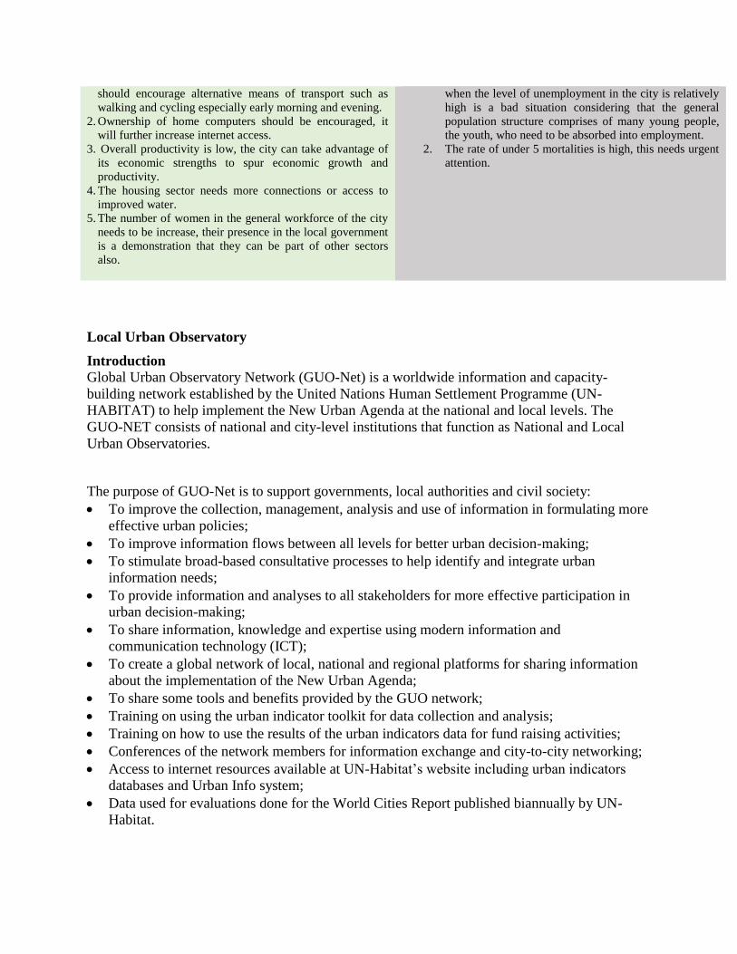
should encourage alternative means of transport such as
walking and cycling especially early morning and evening.
2. Ownership of home computers should be encouraged, it
will further increase internet access.
3. Overall productivity is low, the city can take advantage of
its economic strengths to spur economic growth and
productivity.
4. The housing sector needs more connections or access to
improved water.
5. The number of women in the general workforce of the city
needs to be increase, their presence in the local government
is a demonstration that they can be part of other sectors
also.
when the level of unemployment in the city is relatively
high is a bad situation considering that the general
population structure comprises of many young people,
the youth, who need to be absorbed into employment.
2. The rate of under 5 mortalities is high, this needs urgent
attention.
Local Urban Observatory
Introduction
Global Urban Observatory Network (GUO-Net) is a worldwide information and capacity-
building network established by the United Nations Human Settlement Programme (UN-
HABITAT) to help implement the New Urban Agenda at the national and local levels. The
GUO-NET consists of national and city-level institutions that function as National and Local
Urban Observatories.
The purpose of GUO-Net is to support governments, local authorities and civil society:
To improve the collection, management, analysis and use of information in formulating more
effective urban policies;
To improve information flows between all levels for better urban decision-making;
To stimulate broad-based consultative processes to help identify and integrate urban
information needs;
To provide information and analyses to all stakeholders for more effective participation in
urban decision-making;
To share information, knowledge and expertise using modern information and
communication technology (ICT);
To create a global network of local, national and regional platforms for sharing information
about the implementation of the New Urban Agenda;
To share some tools and benefits provided by the GUO network;
Training on using the urban indicator toolkit for data collection and analysis;
Training on how to use the results of the urban indicators data for fund raising activities;
Conferences of the network members for information exchange and city-to-city networking;
Access to internet resources available at UN-Habitat’s website including urban indicators
databases and Urban Info system;
Data used for evaluations done for the World Cities Report published biannually by UN-
Habitat.

UN-HABITAT achieves these objectives through a global network of local, national and
regional urban observatories and through partner institutions that provide training and other
capacity building expertise.
The UN-Habitat and MOMRA have previously established Local Urban Observatories in the 17
cities covered by the FSCP. A rapid survey conducted by UN-Habitat-KSA in June 2015
targeting the 17 LUO/cities, found out that only 15 LUOs existed. The findings also showed that
88% of Local Urban Observatories are under Municipal Departments while 12% are under
Authority for Development within Municipality. It also revealed that 71% of the Local Urban
Observatories were active while the operations of 23% of them were suspended due to
unaccomplished staff/contractual arrangements.
Some of the data the Local Urban Observatories are required to collect in collaboration with the
Municipals are GIS related, so there is need to have a collaborative work relation between the
LUOs and the GIS departments within the Municipalities. The survey revealed that in terms of
connections with the GIS departments, 59% of the LUOs have work relations with the GIS
department while 18% do not. There was evidence that 71% of the LUOs have GIS data while
6% do not have.

References
A. A. AlKhedheiri (2002) The Role of Secondary Cities in the National Development Process of
the Kingdom of Saudi Arabia.
A. Al-Otaibi (2004) The Aspiration for Housing in Jeddah Saudi Arabia. The university of
Newcastle upon Tyne, UK, Vol. 6, Issue 1, 2004.
Abdul Salam et al (2014) Population Distribution and Household Condition in Saudi Arabia:
Reflection from 2010 Census, Springer Plus 2014, 3:530.
A. A. Abou-Korin & F. S. Al-Shihri (2015) Rapid Urbanization and Sustainability in Saudi
Arabia: The Case of Jazan Metropolitan Area. Journal of Sustainable
Development; Vol. 8, No. 9; 2015 ISSN 1913-9063 E-ISSN 1913-9071.
Published by Canadian Center of Science and Education
A. A. Salam (2013) Population and Household Census, Kingdom of Saudi Arabia 2010: Facts
and Figures. Center for Population Studies King Saud University, Riyadh,
Saudi Arabia. International Journal of Humanities and Social Science Vol. 3
No. 16, August 2013.
High Commission for the Development of Riyadh (2015): ArRiyadh Urban Indicator 2013,
http://www.arriyadh.com/openshare/ar/Photos/----------/En-3-Big.jpg.
I. E. Ascoura (2013) Impact of Pilgrimage (Hajj) on the Urban Growth of the Mecca. Journal of
Educational and Social Research Vol. 3 (2) May 2013. ISSN 2239-978X
J. Gamboa (2008), City Expanding to the Desert Horizon: Riyadh’s problem of explosive growth
and urban sprawl, Geography 554
R Rantala and F Al Mazroa (2011): Intersectoral Action in Abha City, Saudi Arabia – A Healthy
City Tackling NCDs. World Health Organization Centre for Health
Development, Kobe, Japan and Ministry of Health, Kingdom of Saudi Arabia.
Saudi Arabia General Investment Authority (2014): Eastern Region Economic Report 1434-
1435-2014.
UN-Habitat (2012) The State of Arab Cities 2012: Challenges of Urban Transition, United
Nations Human Settlements Programme, Nairobi.
UN-Habitat (2013) The State of the World Cities 2012/2013: Prosperity of Cities, United
Nations Human Settlements Programme, Nairobi.
UN-Habitat (unpublished) MEASUREMENT OF CITY PROSPERITY: Methodology and
Metadata.
UNICEF and WHO (2013) IMMUNIZATION SUMMARY: A statistical reference containing
data through 2011. The 2013 Edition.
Y. H. Yassin (2010) The UN-Support to the National Spatial Strategy and Urban Planning
Efforts of Saudi Arabia UNDP Kingdom of Saudi Arabia.
UN-Habitat NATIONAL SPATIAL FRAMEWORKS: Lessons Learnt from International
Experiences
Dar Al Sahan (1995) Urban Development in Saudi Arabia: Challenges and Opportunities. ISBN
9960-9054-0-3