acknowledgement -...
TRANSCRIPT

1
vs
The Ecosystem based Adaptation (EbA) in Mountain Ecosystems in Nepal, Peru and Uganda aims to strengthen the capacity of these countries, which are particularly vulnerable to climate change impacts, through ecosystem based adaptation approaches. The project targets to strengthen the resiliency of ecosystems within these countries and reduce the vulnerability of local communities with particular emphasis on mountain ecosystems.
The project is funded by the German Federal Ministry for the Environment, Nature Conservation, Building and Nuclear Safety (BMUB) through its International Climate Initiative and is jointly implemented by the International Union for the Conservation of Nature (IUCN), the United Nations Environmental Programme (UNEP) and the United Nations Development Programme (UNDP).
In Nepal, the Ministry of Forests and Soil Conservation (MoFSC)/Department of Forest (DOF) is the implementing agency at the national level in partnership with UNDP, IUCN and UNEP while the Ministry of Science, Technology and Environment, (MoSTE) plays an overall coordination role.
EbA is thankful to GENESIS Consultancy (P).Ltd and Green Governance Nepal for conducting Baseline and Socio-Economic Survey of the Ecosystem based Adaptation Project Area in Panchase. We would like to acknowledge Bhuvan Keshar Sharma, Kiran Timalsina, Roshani Rai, Surya Kumar Maharjan, Dr. Menaka Pant, Anish Joshi, Biplob Rakhal, Basanti Kumpakha, Dikshya Bohara, Suraj Thapa, and Prakash Thapa for their effort and invaluable contribution.
January 2014
ACKNOWLEDGEMENT

2 3
BMUB Germany’s Federal Ministry for the Environment, Nature Conservation, Building and Nuclear Safety
CBD Convention on Biological DiversityCC Climate ChangeEbA Ecosystem based AdaptationES Ecosystem ServicesFGD Focus Group DiscussionGGN Green Governance NepalGIS Geographic Information SystemGPS Global Positioning Systemha. Hectares (1 ha. = 10,000 sq.m)IUCN International Union for Conservation of NatureKII Key Informant InterviewMAPs Medicinal and Aromatic PlantsMoFSC Ministry of Forests and Soil ConservationMoSTE Ministry of Science Technology and EnvironmentMT Metric Tonne (1 MT = 1000 kg)NAPA National Adaptation Programme of ActionNPWC National Parks and Wildlife ConservationNTFP Non Timber Forestry ProductsPA Panchase AreaPPFA Panchase Protected Forest AreaRS Remote SensingTOF Trees Outside ForestUNDP United Nations Development ProgrammeUNEP United Nations Environment ProgrammeUNFCCC United Nations Framework Convention on Climate ChangeVDC Village Development Committee
ABBREVIATIONS

4 5
Acknowledgement 4Abbeviations 5
CHAPTER 1: Ecosystem based Adaptation 71.1 Concept of Ecosystem, Ecosystem Services and EbA 81.2 Panchase Conservation Area 9
CHAPTER 2 : Climate Pattern and Changes 112.1 Precipitation 112.2 Temperature 142.3 Topography 152.4 Geomorphology 162.5 Geology 172.6 Soil type and Soil Fertility 182.7 Watershed and Hydrology 19
CHAPTER 3 : Demography and Socio-Economy 213.1 Settlements 213.2 Demography 223.3 Education 233.4 Household Size 233.5 Occupation 233.6 Migration Pattern 243.7 Household Income Sources 24
CHAPTER 4 : Ecosystem and Ecosystem Services 254.1 Ecosystem Types 254.2 Forest Ecosystem and Coverage 264.3 Forest Diversity 274.3.1 Upper Mixed Hardwood Forest 274.3.2 Pine Forest 284.3.3 Schima-Castanopsis Forest 284.3.4 Hill Sal (Shorea Robusta) Forest 284.3.5 Gurans-Rakchan (Rhododendron-Daphniphyllum) Forest 284.4 Bilogical Diversity 284.4.1 Forest Tree Species 284.4.2 Other Forest Flora 294.4.3 Endemic, Rara and Endangered Flora 304.4.4 Invasive Flora 314.4.5 Forest Fauna 324.5 Forestry Practices 344.5.1 Panchase Protected Forest Area 354.5.2 Dependency on Natural Resources 364.5.3 Payment for Ecosystem Services 364.6 Forest Ecosystem Service 374.6.1 Provisioning Services 384.6.1.1 NTFPs and Fodder 384.6.1.2 Collection of Mushrooms 414.6.1.3 Wild Fruits and Vegetables 414.6.1.4 Timber 424.6.1.5 Biomass-Fuel 424.6.1.6 Medicinal and Aromatic Plants (MAPs) 434.6.1.7 Minerals 44
Contents 4.7 Supporting Services 45 Wildlife Habitat and Hotspots 454.8 Regulating Services 46 Natural Hazard Regulation 464.9 Climate Regulations 484.10 Cultural and Religious Services 514.11 Tourism Services 524.12 Agriculture Ecosystem 544.12.1 Cultivation 544.12.2 Cropping System 554.12.3 Irrigation Practices 564.12.4 Fertilizer & Pesticides Use 574.12.5 Seed and its Sources 574.12.6 Regular Crops 574.12.7 Introduced Crops 584.12.8 Invasive Crops 584.12.9 Endemic and Rare/Endangered Crops 584.13 Cultivation Patterns and Changing Trends 594.13.1 Based on Agriculture Practice 594.13.2 Based on Agriculture System 604.13.3 Based on Arability 604.13.4 Livestock Rearing Practices 604.13.5 Fodder Supply to Livestock 614.13.6 Poultry and others 614.13.7 Agricultural Marketing 614.13.8 Existing & Potential Problems/Challenges/Risk in Crop and Livestock Systems 624.13.9 Climate Change Issues 624.14 Provisioning Services and Agro-Ecosystem 634.14.1 Food Crops 634.14.2 Fodder/Grass 644.14.3 Timber & Fuel Wood 654.14.4 MAPs 654.15 Grassland Ecosystem 664.15.1 Existing and Potential Risks to Grassland 684.16 Aquatic Ecosystem 694.16.1 Fresh Water 694.16.2 Ponds/Lake 704.16.3 Wetlands 704.16.4 Biological Diversity 704.17 Aquatic Ecosystem Provisioning Service 724.17.1 Food - Fish 724.17.2 Water Harvesting 724.17.3 Irrigation 724.17.4 Hydropower 724.17.5 Dependency in Ecosystem Services 744.17.6 Mining 744.17.7 Linkage Between Ecosystem Service and Human Wellbeing 74
CHAPTER 5 : Existing Policies, Acts and Regulations 755.1 Strategies, Plans, Action Plans and Guidelines 765.2 Policy Review 765.3 Ecosysem Management in Watershed Areas are Incorporated at Policy Level 795.4 Policies Addressing the Payment Schemes for Ecosysem Services 825.5 Policy Synopsis 83

76
The concept of Ecosystem based Adaptation (EbA) was first introduced into negotiations at the 14th Conference of the Parties (CoP) to the United Nations Framework Convention on Climate Change (UNFCCC) in 2008. It has since become an increasingly important aspect of the international climate policy debate. EbA measures are often enshrined in adaptation strategies and National Adaptation Programme of Action (NAPA). The Germany's Federal Ministry for the Environment, Nature Conservation, Building and Nuclear Safety (BMUB) specifically promotes the approach through the International Climate Initiative (ICI) (BMU, 2011).
Functioning ecosystems provide important services for human society. For example: they conserve soil fertility, provide clean water and protect against floods and erosion. At the same time functioning ecosystems help people and the natural world adapt to the effects of climate change.
ECOSYSTEM BASED ADAPTATION
CHAPTER 1
Photo 1: Syandaha, Chitre, Parbat

8 9
system.
The impacts of climate change on human and natural systems are already being felt on a global scale and will likely intensify significantly in the future. This could have important implications for the capacity of ecosystems around the world to continue to provide the services upon which a wide range of communities depend upont. Healthy ecosystems and their services provide opportunities for sustainable economic prosperity in combination with the provision of defence against the negative effects of climate change.
EbA addresses these crucial links between climate change, biodiversity, ecosystem services and sustainable resource management. The impacts of climate change are being felt by vulnerable ecosystems. EbA integrates the management of ecosystems and biodiversity into an overall strategy to help people and ecosystems adapt to the adverse impacts of global change. An optimal overall ecosystem-based strategy will seek to maintain ecological functions at the
landscape scale in combination with multi-functional land uses and multi-scale benefits.
Human well-being unreservedly depends on nature. Development, defined broadly with social, economic, and environmental aspects of growth, aims to improve human well-being. An ecosystem is a natural unit of living things (animals, plants and micro-organisms) interacting with each other and with their physical environment. Examples include a rainforest, desert, coral reef, or a cultivated system. A city can be treated as an urban ecosystem. Ecosystem provides a range of goods and services to humans, many of which depend on processes and functions that would be difficult or impossible to replace. The Millennium Ecosystem Assessment (Millennium Ecosystem Assessment, 2005) broadly classified ecosystem services into following categories:
• Provisioning • Regulating • Cultural services
Ecosystem services are the benefits that people obtain from natural environment. Examples include essential ecosystem services of fresh water, timber and desirable services of climate regulation, recreation, and aesthetic values depending on the situation and values of the beneficiary. Ecosystem services are in essence an economic argument to protect biodiversity. They provide outputs or outcomes that directly and indirectly affect human wellbeing.
Some of the ecosystem services are well known like food, fibre and fuel provision and the cultural services that provide benefits to people through recreation and appreciation of nature. Other services provided by ecosystems are not so well known. These include the regulation of the climate, the purification of air and water, flood protection, soil formation and nutrient cycling. The living and non-living elements function together as an interdependent system – if one part is damaged it can have an impact on the whole
1.1 ECOSYSTEM, ECOSYSTEM SERVICES AND EbA
1.2 PANCHASE CONSERVATION AREAPanchase Area (PA) is rich in biodiversity and has high biodiversity value. The region comprising 17 VDCs of Kaski, Parbat and Syangja districts covers a total of 27.91 sq km area. The Panchase Protected Forest Area (PPFA) was gazetted as a 'Protected Forest', under the article 23 of the Forest Act 2002 by recognizing its rich biodiversity, forest resources as well as cultural and spiritual values on 27 February 2011 (Suwal et al., 2013). The PPFA covers 5,775.73 ha. area in nine VDCs (Lumbini Environmental Services, 2011). The PPFA area is buffered with a fringe area covering 3,740.60 ha and a core area covering 2,035.13 ha above 900m altitude (Suwal et al., 2013).
Panchase is located in the middle mountain physiographic region of Nepal. The terrestrial ecosystem of Panchase and its slopes on all directions consists of different land use types such as forest grazing and agricultural land. Human settlements in the area are located on hill slopes and valleys below. Aquatic and wetland ecosystem are also represented in the lower reaches of the Panchase terrestrial ecosystem and valley bottoms. The aquatic ecosystem constitutes a deep water zone and a shallow peripheral zone. The wetland ecosystem is represented by swampy and marshlands located along the flood plains of various streams that drain down from Panchase.
Forest starts from 1,450 m to 2,517 m altitude with sub-tropical to temperate mixed evergreen forest. Rhododendron and oak were the dominant species in the forests which is now replaced by Rakchan (Daphniphyllum himalense), which indicates the degraded condition of the forest.
There are as many as 589 flowering plant species (Suwal et al., 2013) and cultivated fodder and grasses in Panchase area. Various studies have suggested five species of rhododendron, 107 species of medicinal plants, eight species of fiber yielding plants, 24 species of natural dye yielding plants, 18 wild species for floriculture, 56 wild fungi species, 98 fern species (including tree fern) and 94 orchid species along with two endemic species like Panisea panchasenensis and Eria
pokharensia (Suwal et al., 2013). The area is also inhabited by 24 mammal species and more than 260 bird species with seasonal migratory birds visiting the area (Suwal et al., 2013). These figures of both flora and fauna show a very rich biodiversity in the area.
Panchase comprises of three sub-watershed areas of Gandaki Basin–Upper Seti Nadi, Modi Khola and Lower Mid-Kali Gandaki. Modi Khola watershed lies mainly in Parbat and partly in Kaski District. Seti Nadi watershed and Lower Mid-Kali Gandaki watershed share their boundary with Kaski and Syangja respectively. Harpan Khola, the source of Phewa Lake, originates from the Upper Seti Nadi watershed area. Panchase area consists of eight sub-watersheds or catch basins that drain into its river system.
The Panchase area is also known for its cultural and religious significance. The name 'Panchase' literally means ‘five sacred seats’ ('paanch' referring to five and 'asssan' seats in Sanskrit), represented by the confluence of ‘five peaks’ (Machhapuchhre Development Organization Nepal, 2010). These peaks are ancient pilgrimage sites and are popular among both the Hindu and Buddhist devotees during various festivals such as Balachaturdashi, MahaShivaratri, Buddha Purnima and the month of Shrawan.
At the backdrop of its rich ecology, flora and fauna, cultural heritage and human diversity, the climate change and its impact is likely to cause immeasurable and irrevocable damage to the ecosystem and dependent human population in the Panchase area.
ChangeClimate
Ecosystem SocietalSystems
Climate
Regula
tion
Anthropogenic Emissions
CC Impacts
Ecosystem Goods & Services
Destruction & Management
CC Im
pacts
Figure 1: Interaction between climate change, socieity and ecosystem
Photo 2: View of Panchase Peak from Sidhane.

10 11
CLIMATE PATTERN AND CHANGES IN PANCHASE
CHAPTER 2
The Panchase area lies in warm temperate and cool temperate climatic zones with sufficient altitudinal variation and orographic rainfall pattern. The average total precipitation in Panchase over the period of 25 years (1985-2010)1 was 4062 mm with the highest rainfall occurring in the monsoon of 1988 with the total rainfall of 4936.6 mm. The average annual number of days of rainfall occurrence was 128 in 1985-2010 with the maximum of 164 days recorded in the year 1985.
The seasonal2 precipitation trend over the period of past 25 years (1985-2010) shows total average rainfall of 473 mm in pre-monsoon season, 3336 mm in the monsoon season, 171 mm in the post monsoon season and 82 mm in the winter. The highest and lowest mean monsoonal rainfall in the region is 1236 mm and 506 mm respectively over the past 25 years. Similarly, the mean winter rainfall is maximum 63.13 mm and an average of 27.23 mm.
2.1 PRECIPITATION
Photo 3: Bhanjyang in Bhadaure Tamagi VDC with Panchase Peak in the Background.
1 Data based on DHM station 0813 at Bhadaure2 Pre-monsoon months are March-May; Monsoon months are June-September; Post-Monsoon months are October-November and Winter months are December-February

12 13
Based on the global downscale model (Ramirez and Jarvis) of precipitation pattern (1950-2000) [Source http://www.worldclim.org/current], the spatial distribution of monsoonal precipitation over the period from 1950-2000 reveals higher rainfall patterns in the parts of Salyan, Dhikure Pokhari, Chitre, Bhadaure Tamagi, Ramja Deurali, Arthar Dandakharka, KholaLakuri, Wansing, Bangephatke, Arukharka, Chapakot and Pumdibhumdi VDCs while. Sarangkot,
Kaskikot, Tilhar, Pakuwa and Bhatkhola VDCs seem to have received lower rainfall.
The VDCs in the eastern part of Panchase area receives more rainfall during the winter season. The pre-monsoon rainfall pattern observed is almost similar to the monsoonal rainfall pattern. The post-monsoonal rainfall pattern shows similar distribution of rainfall over the entire area. However, the western VDCs of Tilhar and Pakuwa seem to have received lower rainfall.
Figure 2: Seasonal precipitation patterns (1985-2010)
Figure 3: Total average rainfall (1950-2000)

14 15
The Panchase area, situated in subtropical, cool temperate and warm temperate climate zones, has mean annual air temperature of 20-25oC. Subtropical zone lies below 1000m altitude with temperature range of 15–20oC,warm temperate zone lies at an altitude between 1000-2000m where the temperature ranges from 10-15oC and the cool temperate zone in an elevation range of 2000-3000m above the mean sea level.
The average annual maximum-minimum temperatures (from 1981-2011, DHM station no. 0814, Lumle) varies from 21oC to 11oC
Hottest months were recorded in the year 2009 with the maximum of 31oC and the coldest was recorded in the year of 1989 with minimum of -0.3oC..
The hottest months are May, June, July and August with average maximum temperature of 24oC. The coldest months are December, January and February with recorded average minimum temperature of 6oC. The average difference in the minimum and maximum temperature is found to be 8oC and the maximum difference of 10oC is observed in the month of April.
The elevation in Panchase area varies from 500m to 2,500m. The lowest elevation lies in the valley of Seti Nadi and Modi Khola. The altitude rises from all direction to Panchase peak at 2,517m above the mean sea level. The Panchase Area is composed of hills and valleys of different elevation.
Slope is an important physical parameter that plays a vital role in every aspect of a natural
ecosystem. It is directly associated with soil depth and indirectly with vegetation and accessibility. Generally, it can be assumed that lesser the slope higher the soil stability and vice-versa. Since Panchase area is composed of hills and valleys, it has high distribution of sloping with steep to extreme steep slopes. Moderately sloping to gently flat to flatly area are distributed majorly in the valley floors and different terraces of terrain.
2.2 TEMPERATURE 2.3 TOPOGRAPHY
Figure 4: Annual average maximum & minimum temperature; monthly average maximum & minimum temperature (1981-2011)
Figure 5: Terrain Elevation of Panchase Area

16 17
Geo-morphologically Panchase Area can be classified into five major land units:alluvial plains and fans (depositional), alluvial plains, ancient river terraces, moderate to steep sloping mountainous terrain and steep to very steep sloping mountainous terrain. It has a direct and close relation with lithology, hydrology, vegetation, cultural practices and human settlements. Since alluvial plains and
ancient river terraces are comparatively more fertile because of their soil composition more concentration of agriculture practices can be found in this geomorphic unit. However due to moderately sloping by reshaping the slopes into terraces, agriculture cultivation has been made possible in different parts of Nepal including Panchase.
Geologically the Panchase Area exists on a geological rock of mid land group, formed in upper pre cambrian late paleozioc era. The Southern Flank falls under Kushma formation Dailekh Sub group with composition of Greenish grey white fine to medium grained at places ripple marked massive quartzite intercalated with green phyllites. Basic intrusions are abundant in this area. The other major formation of Mid land group
existed in Panchase area are Naudanda Formation and Seti Formation. Naudanda formation is composed of White massive fine to medium grained quartzite with ripple marks interbedded with green phyllites. And Seti Formation has grey greenish grey gritty chlorite muscovite sandstones gritstones with conglomerates & white massive quartzite in the upper parts.
2.4 GEOMORPHOLOGY 2.5 GEOLOGY
Figure 6: Geomorphology of Panchase Area Figure 7: Geology of Panchase Area

18 19
Panchase Area is mainly composed of Inseptisols, Entisols and Alfisols Soils Types. Those belonging to INSEPTISOLS are Ustochrepts with Loamy Bouldary texture soil in Alluvial Plains and Fans adjacent to minor river, AlFISOLS occurs in this region with and Haplustalfs in Alluvial plains and Fans and those of ENTISOLS are Loamy Skeletal textural subgroup of Ustorthonts soil in steep to very steep mountainous terrain of middle mountain physiographic region and Typic, Rhodic, Udic, Anthropic Subgroups of Ustochrepts Dystrochrepts Haplumbrepts with loamy skeletal texture in moderately steep to very steep mountainous terrain. ENTISOLS and ALFISOLS have ustic soil moisture regime that are dry for at least three months in a year where as Inseptisols has aquic soil moisture regime which are saturated by water for significant part of the year.
Panchase protected area consists of almost all the landforms and land types typical of the physiographic region, with few exceptions. Harpan Khola, the major river flowing through
the area along with Khahare Kholas, have made strip of alluvial plains. Soil in these alluvial plains vary with the proximity to the rivers. Areas adjacent to the rivers have fragmental sandy Psaments with some Ustorthents as well. These soils, because of relative coarser texture and excessive drainage, may not be suitable for cultivation. Moreover, they are very prone to flood hazards during the monsoon season. These areas are better left for grass lands and some riverine trees. Those areas which are occasionally flooded have Ustifluvents and Fluvaquents with gravelly sandyloam/loam soils over sands and gravels. These areas with occasional flood hazards are generally suitable for selective winter crops with good water management practices. Areas away from the flood events and adjacent to foothills generally have well to moderately well drained coarse loamy Ustochrepts and at places Eepiaquic Haplustepts. These areas are suitable for paddy in the monsoon season and with an irrigation facility, a wide range of winter crops can be grown.
Situated in the center of Gandaki River Basin, the hydrological processes in Panchase Area is influenced by the hydrology and terrain of three major watersheds viz. Modi Khola Watershed, Upper Seti Watershed and part of Lower Mid- Kali Gandaki Watershed. The geomorphic setup and geological condition over the area has contributed to the formation of dendritic drainage system often common in young fold mountain system of Nepal.
Major rivers and their tributaries
Districts Major River
Contributing River
Parbat Modi Khola
Dhoti KholaRati KholaJare KholaOkadi KholaBhaguawa KholaSisauni KholaJhakri KholaMalyangdi KholaJamale KholaBhudunga Khola
Syangja Andhi Khola
Andha Andhi KholaPatle KholaTuni KholaMulabari KholaSeti KholaBuddha KholaKalche KholaGhyaunung KholaKune Khola
Kaski
Harpan Khola
Sidhane KholaKhahare KholaThulo KholaKupre KholaTora KholaBetani Khola
Phusre Khola
Dhaba Khola
Seti Nadi Ghobang Khola
Watershed area coverage in Panchase Area
Watershed Area (sq.km)Modi Khola Watershed 82.91 Lower Mid Kali Gandaki Nadi Watershed
57.86
Upper Seti Nadi Watershed 137.96
2.6 SOIL TYPE AND SOIL FERTILITY 2.7 WATERSHED AND HYDROLOGY
Figure 8: Soil of Panchase Area
Photo 4: Waterfall in Chitre

20 21
DEMOGRAPHY AND SOCIO-ECONOMIC
CHAPTER 3
Panchase Area is not densely populated compared to the VDCs closer to Pokhara Sub-Metropolitan City. A large part of the area in the region is covered by forests and pasture land. The settlements are situated on the middle to lower part of the Panchase hill.
3.1 SETTLEMENTS
Photo 5: Local people
22 23
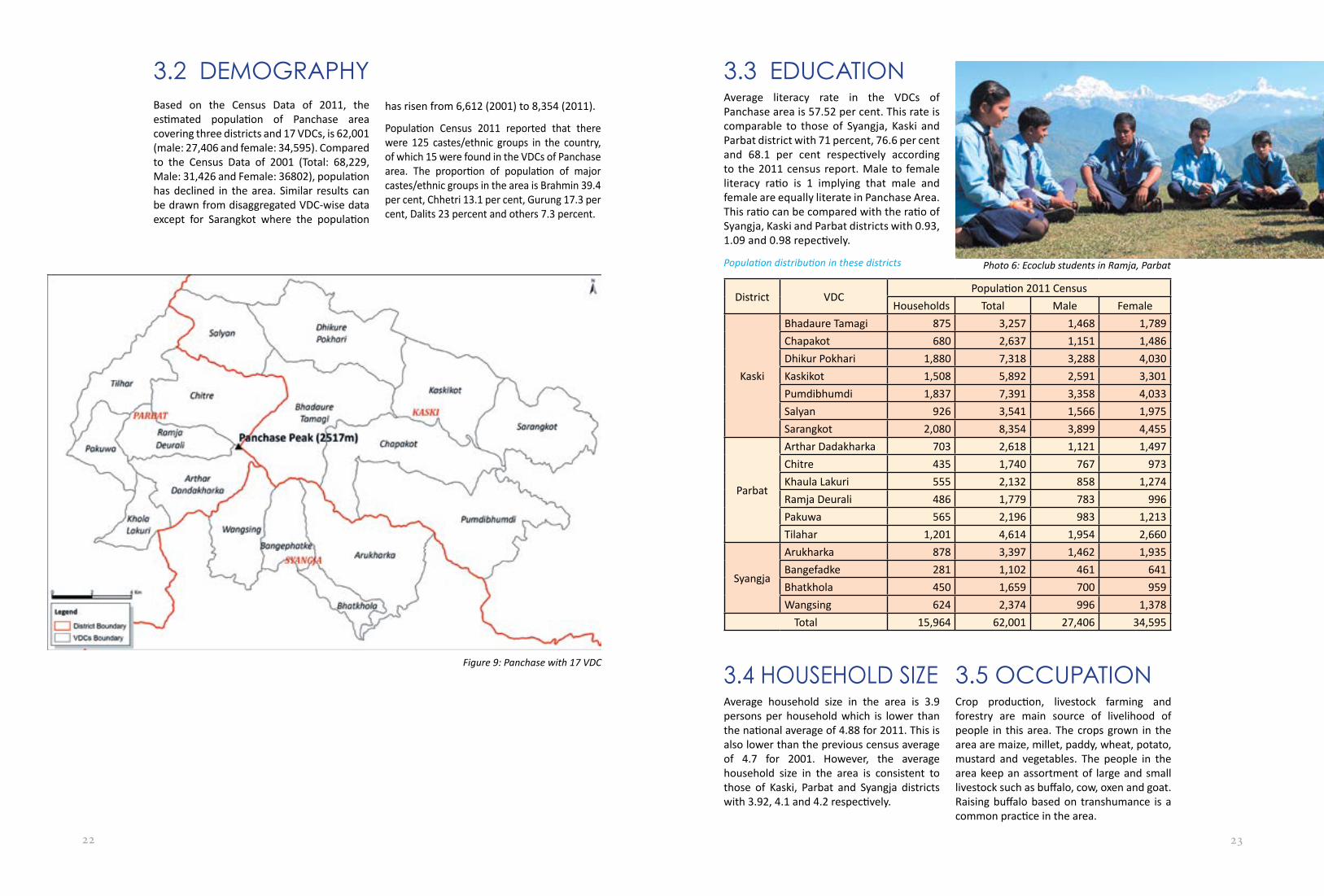
3.2 DEMOGRAPHYBased on the Census Data of 2011, the estimated population of Panchase area covering three districts and 17 VDCs, is 62,001 (male: 27,406 and female: 34,595). Compared to the Census Data of 2001 (Total: 68,229, Male: 31,426 and Female: 36802), population has declined in the area. Similar results can be drawn from disaggregated VDC-wise data except for Sarangkot where the population
has risen from 6,612 (2001) to 8,354 (2011).
Population Census 2011 reported that there were 125 castes/ethnic groups in the country, of which 15 were found in the VDCs of Panchase area. The proportion of population of major castes/ethnic groups in the area is Brahmin 39.4 per cent, Chhetri 13.1 per cent, Gurung 17.3 per cent, Dalits 23 percent and others 7.3 percent.
3.3 EDUCATIONAverage literacy rate in the VDCs of Panchase area is 57.52 per cent. This rate is comparable to those of Syangja, Kaski and Parbat district with 71 percent, 76.6 per cent and 68.1 per cent respectively according to the 2011 census report. Male to female literacy ratio is 1 implying that male and female are equally literate in Panchase Area. This ratio can be compared with the ratio of Syangja, Kaski and Parbat districts with 0.93, 1.09 and 0.98 repectively.
Population distribution in these districts
District VDCPopulation 2011 Census
Households Total Male Female
Kaski
Bhadaure Tamagi 875 3,257 1,468 1,789Chapakot 680 2,637 1,151 1,486Dhikur Pokhari 1,880 7,318 3,288 4,030Kaskikot 1,508 5,892 2,591 3,301Pumdibhumdi 1,837 7,391 3,358 4,033Salyan 926 3,541 1,566 1,975Sarangkot 2,080 8,354 3,899 4,455
Parbat
Arthar Dadakharka 703 2,618 1,121 1,497Chitre 435 1,740 767 973Khaula Lakuri 555 2,132 858 1,274Ramja Deurali 486 1,779 783 996Pakuwa 565 2,196 983 1,213Tilahar 1,201 4,614 1,954 2,660
Syangja
Arukharka 878 3,397 1,462 1,935Bangefadke 281 1,102 461 641Bhatkhola 450 1,659 700 959Wangsing 624 2,374 996 1,378
Total 15,964 62,001 27,406 34,595
3.4 HOUSEHOLD SIZEAverage household size in the area is 3.9 persons per household which is lower than the national average of 4.88 for 2011. This is also lower than the previous census average of 4.7 for 2001. However, the average household size in the area is consistent to those of Kaski, Parbat and Syangja districts with 3.92, 4.1 and 4.2 respectively.
3.5 OCCUPATIONCrop production, livestock farming and forestry are main source of livelihood of people in this area. The crops grown in the area are maize, millet, paddy, wheat, potato, mustard and vegetables. The people in the area keep an assortment of large and small livestock such as buffalo, cow, oxen and goat. Raising buffalo based on transhumance is a common practice in the area.
Photo 6: Ecoclub students in Ramja, Parbat
Figure 9: Panchase with 17 VDC

24 25
ECOSYSTEM AND ECOSYSTEM SERVICES
CHAPTER 4People from this region are also employed as teachers and civil servants in different places of the country and abroad. It was estimated that more than 80% of the total households of the region are employed as school teachers, professors, civil servants and wage labours including foreign employment. As employees they live with their families in their respective working areas.
3.6 MIGRATION PATTERNAll settlements in the Panchase area have experienced migration which is an increasing trend. Foreign employment has facilitated such migration in the villages. The Census Data of 2001 and 2011 also indicated that migration is common in all VDCs of the area except Sarangkot. There is a labour shortage because of the increasing trend of migration. It was estimated that on an average more than two-third of the households are employed abroad, especially in Arab countries.
Traditionally, the number of Gurung households who have family members employed in British and Indian armies, is significant in the area. Now, they have moved to Pokhara as they have the financial capacity to live in the city. Moving to urban areas is also a common trend in this region.
3.7 HOUSEHOLD INCOME SOURCESAgro-based enterprise is one of the most valued green enterprises for example vegetable farming, horticulture, beekeeping, poultry and piggery. Among these, beekeeping can help to diversify income of communities with less resources. Landless and marginalized people can benefit from it. Besides, pollination by honeybees improves fruit and seed set in the farming systems and the surrounding natural flora. There are 80 farmers who have adopted beekeeping with 125 beehives (MDO, 2006).
Vegetable farming is also being practiced by the people in this area. They grow seasonal and off season vegetables and generate income by selling them. The communities in this region annually sell the vegetables worth NRs. 1,700,000 (MDO, 2006).
Organic coffee production is being promoted as an enterprise in the region with the support of International Development Enterprises and Tea and Coffee Global Development Alliance. So far, they have processed five tons of coffee with the help of processing machine. Bio-briquette is emerging as an enterprise as well where it produced a total of 201 briquettes with the selling cost of NRs.10 per briquette. Similarly, tourism is also an enterprise for number of households who run hotels, restaurants, and tea shops.
4.1 ECOSYSTEM TYPESEcosystem in Panchase area was studied on the basis of broad classification into forest, agriculture, grassland, river, lake/pond and wetland ecosystems. These ecosystems are distributed in the sub-tropical, upper-tropical and temperate ecological zones in the area. Forest ecosystem is the dominant type, covering 61 percent of the land area. This is followed by agriculture ecosystem with 34 percent and grassland ecosystem three percent.
Ecosystem types in Panchase
Ecosystem Area(Ha.) Acreage (%)Forest 17,075.01 61.2Agriculture 9,453.04 33.9Grassland 787.22 2.8River 198.68 0.7Wetland 120.21 0.4Other Land 209.56 0.8Total 27,909.74
Photo 7: Parbat
Photo 8: Panchase

26 27
4.2 FOREST ECOSYSTEM AND COVERAGEBased on forest composition (floristic predominance), four types of forests are found in the Panchase area. They are upper mixed hardwood (UMH) or Uttis forest including Rakchan (Daphniphyllum himalense), Chire Pine (Pinus roxburghii), Katus-Chilaune (Schima-Castanopsis) and Hill Sal (Shorea Robusta). The UMH is the most frequent forest type available in all VDCs of the Area. The next
widely distributed forest in 16 VDCs of this area is Schima-Castanopsis. The other forests such as Hill Sal and Pine are less frequently distributed in the nine and seven VDCs respectively.Based on the FGD data, from the forested area, evergreen broadleaved and mixed forest types incorporated high percentage coverage than the other available forest type. In the area the deciduous broadleaved forest has less coverage than that of conifer forest. The area also consists of bush/shrubs with less coverage. The bush/shrub lands are mainly distributed near the settlements.
Forest types and distributions in different VDCs of Panchase Area
VDCForest Type
Upper Mixed Hardwood* Pine Schima-Castanopsis Hill SalArthar Dandakharka √ √ √Arukharka √ √ √Bangephatke √ √ √Bhadaure Tamagi* √ √ √Bhatkhola √ √ √Chapakot √ √Chitre √Dhikur Pokhari √ √ √Kaskikot √ √ √Khaula Lakuri √ √ √ √Pakuwa √ √ √ √Pumdibhumdi √ √ √Ramja Deurali √ √ √ √Salyan √ √Sarangkot √ √Tilhar √ √ √Wangsing √ √ √Total 17 7 16 9
4.3 FOREST DIVERSITYFour types of forest are predominant in the Panchase area, they are Upper Mixed Hardwood including Gurans-Rakchan (Rhododendron-Daphniphyllum) forest, Chir Pine (Pinus roxburghii) forest, Katus-Chilaune (Schima-Castanopsis) forest, and Hill Sal (Shorea robusta) forest. The general description and the species composition of these forests are presented in the following sub-sections.
Based on main tree species mapped in the area, Katus-Chilaune (Schima-Castanopsis)forest is pre-dominant with 57 percent of the total forested area. This is followed by Chir Pine with 19 percent, Gurans-Rakchan (Rhododendron-Daphniphyllum) forest with 16 percent, Hill Sal (Shorea robusta) with three percent and Uttis (Alnus nepalensis) with two percent. Degraded forest represented by shrubs/bush also covers significant portion with three percent of the forested area.
Forest Type Area (Ha.) Average (%)Katus-Chilauni 9,746.29 57.1Chir Pine 3,238.09 19.0Gurans-Rakchan 2,712.09 15.9
Hill Sal 474.68 2.8Utis 387.81 2.3Shrub/Bush 516.05 3.0Total 17,075.00
4.3.1 UPPER MIXED HARDWOOD FORESTThis forest incorporates different tree species with deciduous and evergreen type. These species are distributed from 1000m to 2500m elevation in the area. Major species of this forest are: Albizia lebbeck, Alnus nepalensis, Bombax ceiba, Castanopsis indica, Castanopsis tribuloides, Lyonia ovalifolia, Rhododendron arboreum and Quercus glauca.
Forest types mapped and coverage
Figure 10: Ecosystem type in Panchase area

28 29
4.3.2 PINE FORESTThis forest is distributed in different elevation range of Panchase area. The main species composition in tree canopy differs according to the elevation ranges. In lower elevations (below 1500m) Pinus roxburghii and Pinus patula are common in tree canopy. In the higher elevation, the forest is dominated with the Pinus wallichiana and Abies spectabilis. The other important species incorporated in this forest is endangered Taxus baccata at the higher elevation.
4.3.3 SCHIMA-CASTANOPSIS FORESTThis forest is distributed from 750 m to 2000 m elevation in the area. The main dominant species in the canopy layer were Schima wallichii and Castanopsis indica. The other associated species in the canopy layer are Englehardtia spicata, Macaranga denticulata and Alnus nepalensis.
4.3.4 HILL SAL (SHOREA ROBUSTA) FORESTLess diverse in the tree species composition, this forest is distributed from 750m to 1500m elevation of Panchase area. The dominant species of this forest are Schima wallichii and Shorea robusta.
4.3.5 GURANS - RAKCHAN (RHODODENDRON - DAPHNIPHYLLUM) FORESTThis secondary forest is generated after the degradation of the primary Rhododendron
forest. The major species available in this forest are Daphniphyllum himalense, Lyonia ovalifolia and Rhododendron arboreum. The other associated species of this forest are Quercus glauca, Schima wallichii and Engelhardia spicata.
4.4 BIOLOGICAL DIVERSITY4.4.1 FOREST TREE SPECIESDistribution of the tree species differs on the basis of altitude and aspects. In the lower elevation below 1500 m, the common
species are Shorea robusta, Schima wallichii and Castanopsis indica. Common tree species in the upper elevation above 1500m are Rhododendron arboreum, Daphniphyllum himalense and Quercus semecarpifolia.
4.4.2 OTHER FOREST FLORAA total of 129 species of plants other than tree species were recorded from the Panchase area during EbA survey. They are grouped into seven life forms as shown in Table. Herbs with 48 species constitutes the largest life form while lichens with only two species constitutes the smallest life form in Panchase Area.
Life form and number of floral species recorded from Panchase Area
Life form Number of speciesClimber 8Fern 11Fungi 5Herbs 48Lichen 2Orchid 28Shrub 27Total 129
Photo 9: Aru, Bankephadke
Figure 11: Forest type in Panchase area

30 31
4.4.3 ENDEMIC, RARE AND ENDANGERED FLORANine species of endemic flora have been recorded from Panchase area. Their distributions were reported from six VDCs. Similarly, 14 species of flora were identified as locally rare species. Their distributions were reported from nine VDCs of Panchase area. There were some scattered population of endangered tree fern (Cyathea spinulosa) in the area. Its presence was reported mainly from Bhadaure Tamagi VDC. The area is also a good habitat for orchid species. Total of 107 species of orchids have been reported from Panchase area out of which two are endemic species and 35 species have high commercial value (Subedi, 2004).
4.4.4 INVASIVE FLORAFourteen species of invasive flora were recorded from 15 VDCs of Panchase area. The main invasive species of the area are Banmara
Endemic, rare and invasive flora species observed during transect survey
VDC Endemic Flora Locally rare flora Invasive SpeciesArthar Dandakharka Ficus neriifolia Eupatorium adenophorumArukharka Betula utilis
Cinnamomum tamalaEupatorium adenophorum
Bangephatke Michelia kisopaQuercus glauca
Ageratum houstonianumEupatorium adenophorumGleichenia gigantea
Bhadaure Tamagi Arisaema tortuosumCissampelos pareiraBerberis aristataAsparagus racemosusReinwardtia indica Ficus neriifolia
Cyathea spinulosa Ageratum houstonianumEupatorium adenophorumPistia stratiotes
Bhatkhola Berberis asiaticaRubus ellipticusRhododendron arboreumMyrica esculanta
AalujharAgeratum houstonianumEupatorium adenophorumLalful
Chapakot Phyllanthus emblicaCleistocalyx operculatus
Syzygium cuminiMyrica esculanta
Aalo pateAgeratum houstonianumEupatorium adenophorumGleichenia gigantean
ChitreDhikur Pokhari FulkadoKaskikot Eupatorium adenophorum
FulkadoKhaula Lakuri Castanopsis
tribuloidesLycopodium clavatum Swertia chiraita
Eupatorium adenophorum
Pakuwa Michelia kisopa Ageratum houstonianumEupatorium adenophorumMaruti jhar
Pumdibhumdi Phyllanthus emblicaRamja Deurali Michelia kisopa
Xanthoxylum armatumAgeratum houstonianumEupatorium adenophorum
Salyan Ageratum houstonianumEupatorium adenophorumKatrekanda
Sarangkot Prunus cerasoidesAlnus nepalensis
Bauseful, FulkadoGand Aiselu, Kotrekanda
Tilhar Rubus ellipticusEupatorium adenophorum
Wangsing Ficus neriifolia Ageratum houstonianumEupatorium adenophorumBidens pilosa
(Eupatorium adenophorum) and Nilo gandhe (Ageratum houstonianum). Banmara is distributed in 13 VDCs of Panchase.
Photo 10: Fern, Chitre

32 33
Orchids observed in Panchase Area observed during transect survey.SN Scientific Names1 Bulbophyllum careyanum2 Bulbophyllum striatum3 Coelogyne cristata4 Coelogyne fuscescens5 Coelogyne nitida6 Coelogyne prolifera7 Cymbidium elegans8 Cymbidium eryhaeum9 Cymbidium iridioides10 Dendrobium eriflorum11 Dendrobium heterocarpum12 Eria apertifolia13 Eria bipuncata14 Eria spicata15 Gastrochilus bigibbus16 Goodyera repens17 Liparis nervosa18 Malaxis accuminata19 Malaxis latifolia20 Malaxis purpuriea21 Oberonia falcata22 Otochilus albus23 Otochilus lancilabius24 Pholiidata articulta25 Pholiidata pallida26 Rhynchostylis retusa27 Spiranthes spiralis28 Sunipia bicolor
4.4.5 FOREST FAUNAFrom the FGD 29 faunal species were reported in Panchase area. Among them 15 species were mammals. Common leopard (Panthera pardus) is the biggest cat recorded from the area. The Himalayan black bear (Ursus thibetanus) once common was rarely seen in the area. Due to unknown factor the population of wildlife is continuously declining1. There is also religious belief of eating bush meat of barking deer (Muntiacus muntjack) in January2.
The area is also rich in bird diversity. A total of 14 species of aves were recorded from the area during FGD. This area is also a good habitat for Himalayan Griffon Vulture (Gyps himalayansis).
List of faunal species reported from Panchase Area based on FGDs, KII, local interactions and scats other signs observed in transect surveySN Scientific Name Common Name Nepali Name Class Habitat1 Ursus thibetanus Himalayan Black
BearBhalu Mammalia Terrestrial
2 Muntiacus muntjak Barking Deer Ratuwa Mammalia Terrestrial3 Panthera pardus Common Leopard Chituwa Mammalia Terrestrial4 Macaca mulatta Rhesus Monkey Rato Bandar Mammalia Arboreal5 Canis aureus Golden Jackal Syal Mammalia Terrestrial6 Felis chaus Jungle cat Ban biralo Mammalia Terrestrial7 Mus musculus House Rat Musa Mammalia Terrestrial8 Vulpus vulpus Fox Phyuro Mammalia Terrestrial9 Cania lupus Wolf Bwanso Mammalia Terrestrial10 Hystrix indica Porcupine Dumsi Mammalia Terrestrial11 Lepus nigricollis Rabbit Kharayo Mammalia Terrestrial12 Martes flavigula Yellow-throated
MartenMalsapro Mammalia Terrestrial
13 Prionailurus bengalensis
Leopard Cat Cahri Bagh Mammalia Terrestrial
14 Semnopithecus entellus
Hanumal Langur Langur Mammalia Arboreal
15 Naemorhedus goral Himalayan Ghoral Ghoral Mammalia Terrestrial16 Lophura
leucomelanosKalij Pheasant Kalij Aves Arial
17 Athene brama Spotted Owlet Ullu Aves Arial18 Urocissa flavirostris Yellow-billed Blue
MagpieLampuchhre Aves Arial
19 Accipiter nisus Eurasian Sparrow hawk
Baaj Aves Arial
20 Cuculus canorus Eurasian Cuckoo Koili Aves Arial21 Dicrurus
macrocercusBlack Drongo Chibe Aves Arial
22 Passer domesticus House Sparrow Bhangera Aves Arial23 Upupa epops Common Hoopoe Roopi Aves Arial24 Corvus splendens House Crow Kaag Aves Arial25 Francolinus
francolinusBlack Francolin Titra Aves Arial
26 Gyps himalayensis Himalayan Griffon Giddha Aves Arial27 Streptopelia
chinensisSpotted Dove Dhukur Aves Arial
28 Spizaetus nipalensis Eagle Chil Aves Arial29 Motacilla sp. Wagtail Tiktike Aves Arial
Photo 11: Taxus beccata
Photo 13: Himalayan Griffon- Vulture
1 Based on personal communication with Mr. Chitra Bahadur Gurung, 70 years, Bhadaure 1.2 Based on personal communication with Mr. Ganesh Gurung, Bhadaure 1.
Photo 12: Leopard

34 35
4.5 FORESTRY PRACTICESCommunity forestry is a well-established natural resource management form in the country, as it has been in practice for more than three decades. It is a major programme of the government in the forestry sector and is being implemented throughout the country. Current record indicated that there are 17,808 community forest user groups currently managing over one million hectares of forestlands in the country, involving more than 1.65 million households and 2.19 million people .
Number of CF, members in UG and UGCs
SN Districts Number of CF
CF area (ha)
UG member
UGC member
Women In UGC Women (%)
1 Kaski 109 3,573.65 11,439 1,100 64 292 Parbat 50 1,837.34 5,556 515 216 423 Syanja 49 828.97 3,508 456 150 33
Total 209 6,239.96 20,503 2,071 682 33[Source: CFUG Database, DoF, 2012]
Establishing community forestry is an important dimension to generate a genuine feeling of local ownership which encourages local people to be actively involve in the management of forest resources. Most forests at the lower belt of Panchase hill are handed over as community forests. Total number of community forests in this area is 209 with the total area covering 6,364.24 ha. About one-third, 31 per cent, of the forest area in the region is being managed by local people as community forests.
4.5.1 PANCHASE PROTECTED FOREST AREAThe forest in the Panchase Protected Forest Area (PPFA) is a national forest, designated as a ‘protected’ forest under Forest Act 1993 in the year 2011, and is managed and controlled by the government. The PPFA covers an area of 5,775.73 ha in nine VDCs of Kaski (Bhadaure Tamagi, Chapakot and Pumdibhumdi), Parbat (Ramja Deurali, Chitre and Arthar Dandakharka); and Syangja (Arukharka, Bangephatke and Wangsing) districts.
The PPFA is designated as the ‘core area’ and ‘fringe area’. The forested area within the vicinity of the settlements and villages is the fringe area designated as the ‘intensive use zone’ covering an area of 3,740.60 ha. The remaining inner core area is designated as the ‘protected zone’ and covers an area of 2,035.13 ha. (Lumbini Environmental Services, 2011). Of the total forested area of the PPFA, 79 percent has been handed over to 144 community forest user groups that covers 4,559.31 ha with 13,713 households as their beneficiaries; remaining 21 percent is managed as government forest (Lumbini Environmental Services, 2011).
Photo 14: Syandanha Grass Land, Chitre
Figure 12: Panchase protected area

36 37
4.5.2 DEPENDENCY ON NATURAL RESOURCESForests in Panchase area are the sources of fuel wood, fodder, timber and many other forest products that support the local subsistence economy. Approximately 36,759 people living in this area depend on the forest for fuel wood, timber, livestock grazing and illegal poaching (Aryal and Dhungel, 2009).
Due to open access, some species like Rhododendron arboreum and Quercus semecarpifolia have been extensively used and over harvesting has led to decline of these species in the forest. The extensive use of these species has attributed to overall changes in the forest type in some locations. For instance, previous Rhododendron forest near the settlements is gradually converting to the Rhododendron-Dephniphyllum forest.
4.5.3 PAYMENT FOR ECOSYSTEM SERVICESLegally there is no practice of payment for ecosystem services. Few community forests are charging nominal amount of money, NRs. 200-300 per tree, for the use of timber from their forests. There are, however, potential for payment for ecosystem services. Harpan Khola, which originates from the Panchase area, is the main water source for Phewa Lake, a famous tourist destination in Nepal. The lake is used extensively for tourism and recreational activities. However, there is no payment mechanism for ‘service providing’ sources.
Similarly, Panchase area has good sources for drinking water and can be used and regulated through payment mechanism. The water sources for electricity generated from the Phewa Lake and the Lower Modi Hydropower Plant is also from the Panchase area. So, there are various means to establish and implement payment mechanisms for these services provided by the Panchase ecosystem.
4.6 FOREST ECOSYSTEM SERVICESEcosystem services are the flows of biomass, energy and information from ecosystems to humans and represent actual work performed by ecosystems, affecting environmental conditions for humans. These flows are hard to observe and measure but they can be inferred from observations or measurements of changes over time in stocks, structure and spatial patterns. In turn, these are the types of ecosystem service indicators which seem most likely to be useful for mapping, either directly from aerial photos and remote sensing data or indirectly form databases (Maes, Paracchini and Zulian, 2011).
Besides the agriculture products like food, the local people are utilizing plant based provisioning services provided by the forests in Panchase area. They are using the services as food, water and raw materials for medicinal as well as ornamental resources. They are mainly utilizing the services from non-timber forest products like medicine, fodder, ornamentals, fibre, animal beddings, composting, fertilizer and construction materials. Provisioning services are provided by 174 forest plant species, including species of orchids.
Photo 15:Fuel wood stored in Bhojyang, Bhodaure, Tamagi Photo 16: Water spout providing water for different purpose

38 39
Number of plants species used as provisioning services provided by the forest ecosystem in Panchase Area
VDCsNumber and purpose of species used as provisioning services
NTFPs Fodder-Grass Fodder-LeavesArthar Dandakharka 2 2 3Arukharka 10 10 5Bangephatke 2 1 3Bhadaure Tamagi 8 9 0Bhatkhola 0 9 4Chapakot 0 3 2Chitre 9 7 3Dhikur Pokhari 2 10 0Kaskikot 5 0 0Khaula Lakuri 1 3 4Pakuwa 5 8 3Pumdibhumdi 0 5 2Ramja Deurali 10 10 3Salyan 10 0 0Sarangkot 0 0 0Tilhar 7 7 3Wangsing 2 4 0
4.6.1 PROVISIONING SERVICES4.6.1.1 NTFPS AND FODDER
Commonly used NTFPs in Panchase Area
Scientific Name Nepali Name Latin Name Nepali NameAcorus calamus Bojho Myrica esculenta KafalAelo vera Gheukumari Orchids OrchidsArtemisia indica Chiraitopati Paris polyphylla SatuwaAsparagus racemosus Kurilo Persea duthiei KauloBauhinia variegata Koirala Phyllanthus emblica AmalaBerberis asiatica Chutro Rhododendron arboreum Laligurans Bergenia ciliate Pakhanbed Rubus ellipticus AaiseluBrassaiopsis hainla Chuletro Smilax aspera KukurdainoCastanopsis indica Katus Solanum nigrum KamaruCleistocalyx operculatus Kamuno Solanum surattense KantakariDaphne bholua Lokta Sungava SungavaDendrocalamus hamiltonii Bamboo Swertia chirayita ChiraitoDioscorea pentaphylla Ban tarul Terminalia bellirica BarroEupatorium adenophorum Baanmasa Terminalia chebula HarroFicus religiosa Pipal Tinospora sinensis Gujar laharoGirardinia diversifolia Allo Viscum album HarchulLitsea cubeba Siltimur Vitex negundo SimaliMangifera indica Mango
Thirty different fodder-grass species are in use in Panchase. Among these, Khanyu (Ficus semicordata), Nimaaro (Ficus auriculata), Bedulo (Streblus asper), Pakhuri (Ficus glaberrima), Badahar (Artocarpus lakoocha), Katus (Castanopsis indica) and Kutmero (Litsea monopetala) are most commonly used for various household purposes.
Similarly, leaves of eight tree species are used as fodder. Among these, Chilaune (Schima wallichii), Katus (Castanopsis indica) and Tiju (Picrasma javanica) are found to be most commonly used as fodder leaves.
The most commonly used NTFP's species are Chiraito (Swertia chirayita), Bojho (Acorus calamus), Satuwa (Paris polyphylla), Gurjo
(Tinospora sinensis), Kurilo (Asparagus racemosus) and Pakhanbed (Bergenia ciliata) they serve various purposes.
Photo 17: Mushroom

40 41
List of fodder-grass species
Scientific Name Nepali Name Scientific Name Nepali NameArtocarpus lakoocha Badahar Lithocarpus elegans ArkhaloBauhinia purpurea Tanki Litsea cubeba SiltimurBauhinia variegata Koiralo Litsea monopetala KutmeroBrassaiopsis hainla Chuletro Michelia kisopa ChampCastanopsis indica Katus Mirche MichireCastanopsis tribuloides Musure katus Phyllanthus emblica AmalaDendrocalamus hamiltonii Bamboo Prunus cerasoide PainyuErythrina arborescens Phaledo Quercus glauca PhalantErythrina stricta Fulsito Quercus semecarpifolia KhasruEurya acuminate Jhyano Schima wallichii ChilauneFicus auriculata Nimaro Streblus asper BeduloFicus glaberrima Pakhuri Swertia chirayita ChiraitoFicus neriifolia Dudhilo Thysanolaena maxima AmrisoFicus sarmentosa Timilo Trichilia connaroides Ankhe tariFicus semicordata KhanyuLeucaena leucocephala Epil epil
List of leaves for various Uses
Usages Species
Bedding
Schima wallichii (Chilaune)Castanopsis indica (Katus)Pinus roxburghii (Khote Salla)Picrasma javanica (Tiju)
Composting
Trichilia connaroides (Akhitare)Schima wallichii (Chilaune)Castanopsis indica (Katus)Pinus roxburghii (Khote Salla)Picrasma javanica (Tiju)
Fertilizer
Dendrocalamus strictus (Bamboo)Schima wallichii (Chilaune)Castanopsis indica (Katus)Engelhardia spicata (Mauwa)Daphniphyllum himalense (Rakchan)Pinus roxburghii (Khote Salla)Picrasma javanica (Tiju)Alnus nepalensis (Utis)
Fertilizer or BeddingSchima wallichii (Chilaune)Engelhardia spicata (Mauwa)Picrasma javanica (Tiju)
Household purposeSchima wallichii (Chilaune)Castanopsis indica (Katus)Pinus roxburghii (Khote Salla)
4.6.1.2 COLLECTION OF MUSHROOMSMushroom is extensively used as a supplement of protein in rural parts of Nepal. Wild mushrooms are a seasonal food. In Panchase Area the main season of wild mushroom collection is the cool and dry period from January–April (Magh to Chaitra).
Wild mushrooms are generally collected for household consumptions as food supplement. The study found population of Bangephatke, Bhatkhola, Chapakot, Chitre, Dhikur Pokhari, Pakuwa, Ramja Deurali and Tilhar VDCs collecting and consuming wild mushroom species.
4.6.1.3 WILD FRUITS AND VEGETABLESSeasonal wild fruits are collected for household consumption in Arukharka, Bhatkhola, Chapakot, Chitre, Kaskikot, Khaulalakuri, Pakuwa, Pumdibhumdi, Ramja Deurali and Tilhar VDCs. The wild fruits and vegetables provide locals with necessary vitamins and mineral supplements in their diets.
Wild yam, locally called as Ban Tarul, is a good source of starch for the rural people. This wild resource is collected by the local
people of Arukharka, Chitre, Pumdibhumdi, Ramja Deurali, Tilhar, Pakuwa, Khaula Lakuri, Sarangkot, Arthar Dandakharka, Bhadaure Tamagi, Bangephatke, Salyan VDCs during the months of December and January (Poush-Magh) for household consumption. The most common yam is Gitthe Tarul (Dioscorea pentaphylla) consumed during Maghe Sankranti festival.
List of common wild fruits in Panchase Area
Latin Name Nepali NameAesandra butyracea ChiuriBerberis asiatica ChutroCastanopsis indica KatusChoerospondias axillaris LapsiFicus auriculata NimaaroMaclura cochinchinensis DamaruMyrica esculenta KafalNephrolepis auriculata Paani AmalaPhyllanthus emblica AmalaPicrasma javanica TijuRubus ellipticus Ainselu
Some of the wild plant species are used as vegetables by the local people of Panchase area. There are eight such species in Arukharka, Chapakot, Chitre, Ramja Deurali, Salyan, Sarangkot and Tilhar VDCs.
Photo 18: Phyllanthus emblica (Amala Fruit)

42 43
List of Wild plants collected and consumed as vegetables in Panchase Area
Scientific Names Nepali NamesAsparagus racemosus KuriloBauhinia malabarica KoiraloCrinum amoenum Hade LasonDioscorea pentaphylla Gitthe TtarulDiplazium esculentum NeuroFicus lacor KabroFraxinus floribunda LakhuroThamnocalamus spathiflorus
Tusa
4.6.1.4 TIMBERForests in Panchase area are a source of timber for the local people. Local people collect the timber from the community forests in compliances to their operational plans. 17 tree species have been identified as timber species used in Panchase Area.Schima wallichii, Castanopsis indica, Alnus nepalensis, Shorea robusta, Pinus roxburghii are major species.
List of Timber species used in Panchase Area
Scientific Names Nepali NamesAlnus nepalensis UtisArtocarpus lakoocha BadaharCastanopsis indica KatusCastanopsis tribuloides Musure katusCedrela toona TooniDamaro DamaroDaphniphyllum himalense RakchanDiospyros malabarica TijuEhretia acuminata ChilleEngelhardia spicata MauwaEurya acuminata JhyanoFicus glaberrima PakhuriFicus semicordata KhanyuLitsea cubeba Sil timurMaesia chisia BilaunePatte PattePinus roxburghii SallaRhododendron arboreum Laligurans
Schima wallichii ChilauneShorea robusta SalStreblus asper BeduloSymplocos pyrifolia Seti kath
4.6.1.5 BIOMASS-FUELMost of the trees and shrub species in the forest of Panchase Area are locally considered as biomass fuel. These fuel woods are mostly used for cooking and heating during the winter season. In total, 22 species of woody plants are using for biomass fuel in Panchase Area. Among them Castanopsis indica, Schima wallichii and Alnus nepalensis are the most common ones.
List of species used for biomass fuel
Scientific Names Nepali NamesAlnus nepalensis UtisCastanopsis indica KatusChoerospondias axillaris ALpsiDalbergia sissoo SissooDaphniphyllum himalense RakchanEngelhardia spicata MauwaFraxinus floribunda LakuriMacaranga denticulata MallatoMichelia kisopa ChapoPersea duthii KauloPicrasma javanica TijuPinus roxburghii SallaPrunus cerasoides PaiyunPrunus napaulensis AarupaateeSchima wallichii ChilauneShorea robusta SaalToona ciliata Tooni
4.6.1.6 MEDICINAL AND AROMATIC PLANTS (MAPs)Medicinal and aromatics plants (MAPs) are used in all VDCs of Panchase area. The number of plants used for the medical purpose depends on the availability of these plants and closeness to the allopathic medical facility in the area.The most commonly collected and used MAPs are Chiraito (Swertia angustifolia), Satuwa (Paris poliphylla), Kurilo (Asparagus racemosus), Harro (Terminalia chebula), Chutro (Berberis asiatica) and Timur (Zanthoxylum armatum).
List of some of MAPs found in Panchase Area
Scientific Names Scientific NamesSwertia angustifolia Elephantopus scaberParis poliphylla Eurya acuminataAsparagus racemosus GulfoTerminalia chebula HarchulBerberis asiatica KamaruZanthoxylum armatum KambariAloe vera KammariJatropha curcas Lagerstroemia parvifloraPhyllanthus emblica LisoRhus javanica Litsea cubebaTermenia belerica Lycopodium clavatumTribulus terrestris Myrica esculentaAchyranthes aspera Nephrolepis cordifoliaAmomum aromaticum Ocimum sancatumArisaema erubescens OrchidsArtemisia indica PaakhanbedhBajradante Parthenocissus semicordataBalkapase Pinus roxburghiiBergenia ciliata Prunus cersoidesCentella asiatica Rubus ellipticusChaurajor Shorea robustaChautaghaar SikarolaharoCheilanthes dalhousiae Smilex asperaCinnamomum tamala Solanum surattenseCissampelos pareira Swertia angustifoliapateCleistocalyx operculatus Syzygium cuminiCrinum amoenum Terminalia bellericaCuscuta reflexa ThirajDactylorhiza hatagirea Tinospora sinensisDaiidalo Viburnum mullahaDanakenau YamunoDelphinium denudatum
Photo 19: Coal women collecting firewood a log the trails to Panchase Temple

44 45
4.6.1.7 MINERALSPanchase Area has good sources of minerals. Some of the minerals are being extracted and used by the locals, generally for household purposes and as construction materials.
VDCs Mineral UsageArthar Dandakharka Slate stone Roofing and road constructionArukharka Slate stoneBhatkhola Slate stoneChapakot Talc Pumdibhumdi Slate stone
Talc stoneRamja Deurali Stone mine HouseholdSalyan Iron
Slate
Tilhar Aggregates (Gitti)Roofing stone
SellingSelling and household
Forest ecosystems of Panchase provide good habitat for different wild animals. As per FGD, wildlife population is increasing which indicates good habitat for the wildlife species.
Species such as beer, deer, leopard, pheasant, porcupines, rabbit and snake are found to be increasing in the area. Animals like porcupine and rabbit are found to cause considerable damage to the crops. The population of other wild animals and birds such as jackal, monkey and pigeons are however declining in the area.
4.7 SUPPORTING SERVICES
Wildlife hotspot areas in Panchase
VDC Hotspot AreaRamja Deurali Panchase areaPumdibhumdi Rani BanKhaula Lakuri Kulako ChaurBhadaure Tamagi Aal DandaArthar Dandakharka Kokhe (Sindhu)Bangephatke Dandakateri
WILDLIFE HABITAT AND HOTSPOTS
Commonly used minerals are slate and talc. Local people are also selling some of these minerals such as stone aggregates for road construction and slate for roofing.
Phot
o 20
: Sla
te S
tone
s
Photo 21: Rhesus Monkey
Photo 23: RabbitPhoto 22: Porcupine
Types and uses of minerals in Panchase Area

46 47
Seasonal flood and flash floods are recurring events in Bhat Khola, Harpan Khola, Fusre Khola, Jare Khola and Mahabir Khola. Landslides are also a recurring natural hazard in the Panchase Area. The most recent and the frequent ones located in Arthar Dandankharka, Arukharka, Bangephatke, Kaskikot, Khaula Lakuri, Ramja Deurali, Tilhar and Wansing VDCs. Besides these natural hazards, other frequently occurring natural hazards are hailstorm and drought occurring in Bhatkhola, Kaskikot and Ramjadeurali VDCs.
4.8 REGULATING SERVICES
NATURAL HAZARD REGULATIONS
Landslide in Panchase Aea
VDC LocationsArthar Dandakharka
Net Pahiro
Arukharka Rauche ko PahiroBangephatke LandslideKaskikot LandslideKhaula Lakuri Kahune Pahiro, Seto
Pahiro, Sisne PahiroRamja Deurali LandslidesTilhar Salyan ko PahiroWangsing Kokaleko Pahiro,
Naamdiko Pahiro, Sepatko Pahiro, Simakhoriya Pahiro
GIS based slope stability analysis was done to model susceptible areas of landslides (debris flow) and erosion due to meteorological factors, terrain and soil parameters. Existing landslides were mapped using GPS during field survey. Twenty one existing active landslides were mapped in the area. Most of them are located in unstable zones. Some landslides are also observed in relatively stable zone where significant destabilizing factors such as road construction and river bank cutting have been attributed as a force of instability which are causing landslides
FGDs in Ramja Deurali and Kaskikot have also indicated droughts and in Bhatkhola, occurence of hailstorm has been reported resulting in damage to crops.
Flood in Panchase Area
VDC Flood Name/ Events
Flood Location
Arukharka Bhat KholaBangephatke Flash flood Ward 1-9Bhadaure Tamagi
Harpan Khola
Bhatkhola Bhat Khola Ward 2, 3, 6, 9
Chapakot Flood Ward 1, 2, 3, 5, 7
Pakuwa Flood Pumdibhumdi Fusre KholaRamja Deurali Flash flood in Jaare Khola
and Mahabir KholaWangsing Flood
Photo 24: Landslide view of Bhangefatke from BhatkholaFigure 13: Soil stability index map showing landslide successible zone

48 49
4.9 CLIMATE REGULATIONS
Panchase Area has been experiencing changes in climate patterns in the form of noticeable variations in the temperature extremes (maximum and minimum temperatures), increase in temperature maxima, and changes in rainfall pattern and decrease in intensity. These changes in climatic variables have been experienced in the recent decade which, perhaps could be attributed to climate change
and its impact in the mid-hill region of Nepal.
The precipitation pattern shows considerable variations during the decadal intervals of 1985-1995, 1996-2005 and 2010 onwards. In the period of 1985-95, precipitation trend has decreased; from 1996-2006, it has increased and then decreased towards the end of decade. An increasing pattern is seen from 2006 onwards.
Change in Temperature (Peoples’ Perception)
VDC Change in Temperature StatusArthar Dandakharka Too much cold in winter and too much hot in summer Arukharka Increase in temperatureBangephatke Too much cold in winter and too much hot in summerBhadaure Tamagi Bhatkhola Kaskikot Khaula Lakuri Too much cold in winter and too much hot in summerPumdibhumdi Increase in temperatureRamja Deurali Increasing in temperature
Change in Rainfall (Peoples’ Perception)
VDC Change in rainfall StatusArthar Dandakharka Decrease in rainfall intensityArukharka Decrease in rainfallBangephatke Decrease in rainfall intensity in winter as well as rainy seasonChapakot Decrease in rainfallKhaula Lakuri No rainfall in winter seasonPumdibhumdi No rainfall in winter. No hailRamja Deurali Fluctuation in rainfall patternSalyan Low rainfallWangsing Low rainfall
Decadal Precipitation Pattern 1985-2010
Decade Avg. Rainfall Days Total Average1985-1995 135 4062 30.02071996-2005 123 4204 34.27092006-2010 122 3770 30.9281
Analysis of rainfall days and precipitation showed, total rainfall days have decreased from 135 days during 1985-95, to 123 days during 1996-2005 and 122 days during 2006-
2010. However, during the first two decades the total and average precipitations have increased, but have decreased during the period of 2006 onwards.Further, it was found
that the annual average winter precipitations over these decades had decreased from 30 mm to 17 mm. These analysis based on the precipitation data from station at Bhadaure (DHM Stn. 0183) also confirms the local perception of the changes in rainfall patterns.
It was also found that, over the period of last 30 years (1981-2011), the annual average
maximum temperature had increased by 0.81oC and the annual average minimum temperature had also increased by 0.2oC (based on temperature data from DHM Stn. 0814 Lumle). This change in temperature pattern confirms the local perception of 'hotter in summer and colder in winter' compared previous years.
Figure 14: Average annual precipitation and rainfall days (1985-2010)
Figure 15: Variable in average max. and min. temperature (1985-2010)

50 51
4.10 CULTURAL AND RELIGIOUS SERVICESPanchase area holds various cultural and religious significance and is popular amongst the Hindu and Buddhist in the region and beyond as an ancient pilgrimage climb. This area is a meeting point of the three districts Kaski, Parbat and Syangja and literally means 'five seats' referring to five peaks in the region. The story of the cultural importance is connected with Shrawan Kumar who devoted his life to his blind parents.
The Panchase hill itself has religious significance and is considered as a holy place
Cultural and religious locations in Panchase Area
VDCs Cultural and religious sites Wards
Arthar Dandakharka
Devi Than 6Baraha Than 9Siddha Baraha Than 9Arukharka Ramche DevisthanShivalaya Temple 6
Bhatkhola
Thaplesidha Baba Temple 8Bhadaure Tamagi Siddha Barahi TempleGurukul Bidhya AasramGurung Sangralaya and Gurung Samaj Ghar 1Panchase Siddha Baba TempleDevi Temple 6
Chapakot Makanna Devi Temple 8
Dhikur Pokhari
Bhandari KoKul Temple 4Narnandesor Mahadev Temple 5Shivalaya Temple 5Paudel Ko Kul Temple 7
Kaskikot
Gupta Kalika Temple 5Chandiko Temple 8Khadgaun Kot 1Banspani Kalika Temple 8Maha Kaleshor Temple 8
Khaula Lakuri Deurali 1
PumdibhumdiDurga Temple Thaple Danda, 9Durga Temple Chisapani 8
Salyan Bhume Ko TempleWangsing Srawan Kumar Ko Temple 8
connected to Lord Shiva. The Siddha Baba Temple, Home Kunda, Balaji Panchayan Temple are the notable sites in the region. The Panchase Lake is considered as a famous site for religious pilgrimage for the people of the area during Balachaturdasi in November. Significant cultural sites include the Gurung Museum, caves and historical stone.
Photo 25: Farmer conducting Naag Puja at Bange, Syangja

52 53
4.11 TOURISM SERVICESPanchase area with a majestic view of Dhaulagiri and Annapurna Range, is an idyllic place for domestic and international tourism. Panchase is close to the most popular tourist destination of the country, Pokhara. Its multi-faceted significance of cultural, historic and religious shrines, rich and vivid floral diversity, large varieties of orchids and rhododendron have made this region a touristic destination with immense potential. Recently Panchase received government attention for infrastructure development for tourism in the area(Suwal et al., 2013).
The longest chain of mountain range visible from Panchase includes Mt. Dhawalagiri (8,172m), Annapurna I (8,091m), Annapurna South (7,219m), Himchuli (6,441m), Machhapuchhre (6,993m), Annapurna II (7,934m), Annapurna III (7,575m), Annapurna IV (7,525m), Lamjung (6,998m), Manaslu and more (Machhapuchhre Devlopment Organization Nepal, 2010).
Panchase area has good accessibility from Pokhara, connected by dirt road to Bhanjyang in Bhadaure Tamagi VDC. Other VDCs are also linked with seasonal dirt road. Main trails and trekking tracks crisscross the region. There are good number of accommodations including 11 trained homestays in Arthar Dandakharka affiliated to Nepal Tourism Board. There are ten families in Wards 1, 2 and 4 of Chitre VDC, who are engaged in homestay business with their enterprises registered with the Pokhara based office of the Ministry of Culture, Tourism and Civil Aviation (Suwal et al., 2013). The homestay
programme in the area is in the preliminary stage. Their services somehow meet the basic conditions as required by the government policies.
Tour operators have been providing commercially packaged tours to Panchase to Annapurna-Panchase, Pokhara-Panchase and Panchase-Naudanda and various other short trekking packages. Panchase Area is popular to the residents of Pokhara and surroundings as picnic and camping spots. It is envisaged that the ‘ripple’ and/or ‘spillover effect’ of tourism in the surrounding popular destinations would have a positive impact on tourism promotion in Panchase due to its proximity and accessibility, provided a sound eco-tourism management plan is implemented (Suwal et al., 2013).
There are various accommodation and food options throughout the Panchase Area that caters to domestic as well as international visitors. Until now, visiting permit was not required for both domestic and foreign visitors, therefore actual number of visitors are unknown. However, recently a system to register the visitors to Panchase from Bhadaure has been introduced (Suwal et al., 2013).
Accommodations in Panchase Area based on FGD
Accommodations Nos.Campsite 7Lodge & Restaurant 1Hotel/Lodge 17Hotel/Lodge with Campsite 5Hotel/Lodge with View Point 10
Various other studies and reports have suggested high potentiality of Panchase as a mountain eco-tourism destination due to its prime location to view Dhaulagiri, Annapurna and Manaslu mountain ranges, scenic sunrise and sunset over the mountains, bird watching, orchids and ethnic lifestyle; and adventure activities such as hiking, trekking, mountain biking etc.
Figure 16: Accomodations and tourism sites in Panchase Area

54 55
4.12 AGRICULTURE ECOSYSTEMFarming system (agro-ecosystem) of the area is ecological system ‘modified’ by the people for their own benefit. Crop production, livestock farming and forestry are main sources of livelihood of people in this region. The main crops grown in the area are maize, millet, paddy, wheat, potato, mustard and vegetables.Paddy is the main crop in the irrigated lowland areas and maize and millets are commonly grown in non-irrigated upland areas. Wheat is planted during the dry and cool season in the paddy fields. Potatoes, mustard and vegetables are grown in the irrigated as well as in non-irrigated agriculture lands.
4.12.1 CULTIVATIONFrom the mapping of agriculture land use, total agriculture land was obtained to be 9,453 ha with the proportion of 76 percent of level terraces and 15 percent of sloping terraces in hilly region, five percent of alluvial plains in the river valleys and about three percent of alluvial fans in the foot slopes of the hills. According to the Nepalese classification system, level terraces and alluvial plains are termed as Khet; sloping terraces as Bari’ and alluvial fans as Tar. Monsoonal rice-paddy with winter wheat is common cultivation pattern in the Khet. In Bari, maize, millet with
4.12.2 CROPPING SYSTEMThe study found that there was a uniform distribution of agriculture land use pattern in the Panchase area. In an average, about 54 percent agriculture land area is covered by Khet whereas about 48 percent is covered by Bari, which shows that the arable land in the region is dominated by Khet.
Agriculture Type Area (Ha.) Acreage (%)Alluvial Fan Cultivation
258.74 2.74
Alluvial Plain Cultivation
530.58 5.61
Level Terrace Cultivation
7,201.35 76.18
Sloping Terrace Cultivation
1,462.36 15.47
Total 9,453.04 100.00
soybean, pulses and seasonal vegetables are common. Millet, maize, barley are common in Tar cultivation.
15%3%
82%
Khet Bari Tar
Photo 27: Capsicum
Figure 17: Cultivation types in Panchase Area
Figure 18: Proposition of cultivation types
Photo 26: Crop Field

56 57
Cultivation types and their coverage in the VDCs of Panchase (based on mapping)
VDs Bari Khet Tar TotalArthar Dandakharka 121.92 269.31 - 391.23Arukharka 116.66 799.47 103.19 1,019.32Bangephatke 67.38 164.40 - 231.78Bhadaure Tamagi 204.52 439.18 - 643.70Bhatkhola 21.34 183.08 25.06 229.48Chapakot 21.19 583.50 - 604.70Chitre - 374.61 - 374.61Dhikur Pokhari 61.01 984.02 - 1,045.03Kaskikot 56.65 955.91 9.36 1,021.93Khaula Lakuri 93.89 180.54 - 274.43Pakuwa 111.46 172.13 - 283.60Pumdibhumdi 65.94 869.65 - 935.59Ramja Deurali 156.09 114.20 - 270.29Salyan - 504.44 27.59 532.03Sarangkot 172.64 437.14 69.26 679.04Tilhar 50.79 444.21 24.28 519.28Wangsing 140.87 256.12 - 397.00Total 1,462.36 7,731.93 258.74 9,453.04
(Area in hectares ha.)
Seasonal rainfall is the major source of irrigation for agriculture in the study area. The lowlands in the periphery of Phewa Lake are irrigated by the lake itself. Ponds are also used as a major water source for irrigation in the area. There are a number of irrigation projects constructed by the Government of Nepal, which provide irrigation water to the existing farmlands of the Panchase area.
Year round irrigation facilities are available only in very few areas Chitre, Pakuwa, Pumdibhumdi and Ramja Deurali VDCs of Panchase. Irrigation facility is not available in three VDCs- Kaskikot, Salyan and Tilhar. Remaining VDCs receive seasonal irrigation water.
4.12.4 FERTILIZER & PESTICIDES USEPeople have intensified their farming with the use of chemical fertilizers. Wheat and vegetables were new crops introduced in the village once they started using the fertilizer. Although they introduced new crops and intensified farming, the crop production is decreasing gradually due to lack of availability of fertilizer and shortage of labour. Farmers in the area have experienced increasing requirements of fertilizer to get better harvest. It was found that the average application of the fertilizer in the irrigated field is 3 kg DAP (Diammonium Phosphate) per ropani for rice paddy. Both organic and inorganic fertilizers have been used in agriculture land by the farmers. Most commonly used fertilizer in the area is compost. There are few VDCs where the utilization of chemical fertilizer is not recorded.
Pesticide is not commonly used in the area. Very nominal pesticides are used in commercial products like potatoes and off-season vegetables. For the livestock, pesticides are mainly used for commercial products like poultry farming. In upland areas the use of pesticide is quite less in comparison to the lowland commercial areas. Local people are using available natural resources as pesticides and insecticides. Banmara (Eupatorium adenophorum), Titepati (Artemisia indica), Asuro (Adhatoda vesica) and cattle urine are main local ingredient used for pesticide and insecticide.
Irrigation system practiced in Panchase is divided into different categories. Traditional irrigation system is common in the area which is used to irrigate more than 10 thousand ropanis of agriculture land. Drop and sprinkler irrigation is practiced in Dhikur Pokhari and Pumdibhumdi VDCs for tomato and other vegetable farming.
Five types of irrigation sources are found in Panchase area- pipe, pond, rain, river, and stream water. Besides seasonal rain water, other most frequently used sources for the irrigation are streams and river. Pond and piped water from natural sources are less frequently used for irrigation purposes.
4.12.3 IRRIGATION PRACTICES
4.12.5 SEED AND ITS SOURCESFarmers in this area obtain crop seeds from the local agro-veterinary shops (agro-vets) as well as from Pokhara, a major market for the region. Seeds of hybrid crop species are also supplied from the District Agriculture Development Offices (DADO) service centers and LiBIRD branches.
4.12.6 REGULAR CROPSRegular crop species planted in the study area predominantly are Paddy (Oryza sativa), Maize (Zea mays), Millet (Eleusine coracana), Wheat (Triticum aestivum), Potato (Solanum tuberosum), Barley (Hordeum vulgare) and various fruits and vegetables plants.
Photo 29: Pesticide being used in maize-soyabean crop
Photo 30: Paddy grown in low land area in PA
Phot
o 28
: Wat
er so
urce
in C
hitre

58 59
Regular crops grown in Panchase Area
Scientific Names Nepali NamesOryza sativa PaddyZea mays MaizeEleusine coracana MilletTriticum aestivum WheatSolanum tuberosum PotatoHordeum vulgare BarleyVigna mungo Black LentilAllium sativum GarlicZingiber officinale GingerPsidium guajava GuavaAllium cepa OnionPrunus persica PeachCucurbita spp. PumpkinGlycine max Soybean
4.12.7 INTRODUCED CROPSA number of cereal crop varieties such as paddy, maize and millet have been introduced in the study area as they provide better returns than the local varieties of cereal crops. Fruits such as quince, orange, papaya, and guava have been introduced along with cash crops such as coffee; and vegetables such as cauliflower, tomato, garlic, onion, cabbage, ginger pea, blue potato and beans Bakulla (Vicia faba).
Farmers in the region have introduced Amriso (Thysanolaena maxiama) and Napier varieties in terms of grass species.
4.12.8 INVASIVE CROPSAs in other parts of Nepal, the agriculture land in Panchase is affected by invasive plant species. The major invasive plants that have infested this area are Banmara (Eupatorium adenophorum), Nilo Gandheand Hade Unyu (Dicranopteris linearis).
4.12.9 ENDEMIC AND RARE/ENDANGERED CROPSMajor endemic and rare or endangered agricultural crop species are paddy varieties namely Gudura, Marsi, Hansaraj and Anadi. Kangira rice is an endangered paddy variety. A certain variety of millet and buckwheat have been reported as endemic and rare in Sarangkot VDC as well.
Introduced crops in Panchase Area
Scientific Names Nepali NamesThysanolaena maxima AmrisoVicia faba BakullaBrassica oleracea CabbageBrassica oleracea CauliflowerCoffea arabica CoffeeAllium sativum GarlicZingiber officinale GingerPsidium guajava GuavaZea mays MaizeEleusine coracana Millet
MushroomPennisetum purpureum NapierAmomum aromaticum Nepal
CardamomAllium cepa OnionCitrus aurantium OrangeCarica papaya PapayaPisum sativum PeaSolanum tuberosum PotatoLycopersicum esculentum TomatoOryza sativa PaddyCydonia oblonga Quince
4.13.1 BASED ON AGRICULTURE PRACTICEIn terms of changes in rice/paddy cultivation, it was revealed that majority of the VDCs in the study area faced a decrease in the productivity as well as a shift in the cultivation period. Earlier, this period was the second and third weeks of Jestha (May), now it has shifted to the first and second weeks of Ashad (June). Changes in rice variety as well as replacement of the local varieties by hybrids are some of the issues faced in the region as well. With the introduction of hybrid varieties and shift in cultivation period, decrease in productivity of maize and millet has been observed. It was also observed that the cultivation of certain cash crops such as fruits mainly citrus and vegetable has increased significantly.
4.13 CULTIVATION PATTERNS AND CHANGING TRENDS
Phot
o 31
: Ban
mar
a
Photo 32: Cultivated terraces with wheat crops during Oct-Nov

60 61
Chnages in rice paddy and other crops
VDC Changes in Rice Paddy Cultivation Changes in Other Crops Cultivation
Arthar Dandakharka Decrease in productivityArukharka No change No changeBangephatke Decrease in productivityBhadaure Tamagi 2-3 weeks shift in paddy
cultivation- earlier (2 and 3 weeks of Jestha), now (1 and 2 weeks of Ashad)
1 month shift in cultivation
Bhatkhola No change No changeChapakot Decrease in production Decrease in productionChitre More cultivation, new species,
varietiesMillet cultivation decrease, vegetables farming increase
Dhikur PokhariKaskikot Lacks irrigationKhaula Lakuri Decrease in productivityPakuwaPumdibhumdi Change in variety, local are
replaced by hybridsLocal maize, millet etc. are replaced by hybrids, vegetables cultivation increasing
RamjaDeurali Increase in orange cultivation, decrease in gad cultivation
SalyanSarangkotTilaharWangsing Repining and harvesting time is
changing
4.13.2 BASED ON AGRICULTURE SYSTEMAnother parameter used to analyse the change was based on agriculture system by differentiating systems such as single, mixed, inter, relay and multiple cropping. Paddy-wheat-mustard/barley/potato/maize/millet was the major cropping pattern in the area in all cultivation patterns.
4.13.3 BASED ON ARABILITYCultivation patterns based on the arability is another basis for analysis. It was found that about 69 percent of the Khet and about 63 percent of the Bari was being used for
bring their livestock, mainly buffalos to higher pasture, commonly known as Goth (huts used by herders). However, the number of household taking their livestock to Goth is decreasing. This is due to change in the profession and also introduction of improved variety of livestock in the area. About seven percent of the buffalo population in the region is estimated to be of improved variety.
Apart from this practice, most of the livestock are stall fed. However, they are occasionally allowed to roam and feed in fallow agricultural lands and meadows.
On average each household of the Panchase area has at least one livestock in their house. The main purpose of cattle and buffaloes rearing is milk production. Goats are mainly used for meat production.
4.13.5 FODDER SUPPLY TO LIVESTOCKVillages at the base of Panchase Hill own specific pastures at higher elevations and livestock are traditionally brought only to that particular grazing facility. During earlier times, people had large flocks of livestock and lived in those goths for months. There were more than 50 goths in the Panchase Hill, in the past. Now, the number of goths is declining.
Fodder trees growing in the periphery of the households are major source of fodder for these livestock. People in this area have started planting improved grass varieties such as Napier and Amriso (Thysanolaena maxiama), which grow fast as well as provide better returns. Apart from this, a minimal amount of fodder demand is also met from community forests, which is opened for grass cutting.
Instead of open grazing stall feeding practices are more common in Panchase area. In total 92.3 per cent livestock of Panchase area are stall feed. The current study reported that only 7.7 per cent livestock are open grazer.
36 different species of tree were recorded in agriculture lands as tree outside forest. These
farming. However, it was reported that the increasing area of such lands are being left fallow due to migration and lack of irrigation facilities.
4.13.4 LIVESTOCK REARING PRACTICESPeople in the region keep an assortment of large and small livestock such as buffalo, cow-oxen and goat. Raising buffalo based on transhumance is common practice in this region. Transhumance is defined as transferring livestock from one grazing ground to another with the change of season. Transhumance has been a long-standing practice in high altitude mountains in Nepal. People from villages surrounding Panchase
trees are mainly planted for the fodder. Few of them are also planted to get fuel wood and timber.
4.13.6 POULTRY AND OTHERSThough only for the household use, rearing local breed of the poultry is common in the Panchase Area. Bee farming and piggery are also practiced in some VDCs. These products are either used for household purpose or sold only in local market. Bee keeping is found in Kaskikot, Phumdibhumdi, Ramja Deurali, Salyan, Sarangkot and Wansing VDCs.
4.13.7 AGRICULTURAL MARKETINGAgro-based enterprise is seen as one of the most valued green enterprise with vegetable farming, horticulture, bee keeping, poultry and piggery. Among the agro-based enterprises, bee keeping enterprise can help to diversify income of communities with less resource. Landless and marginalized people of a VDC can get benefit from it. Besides, pollination by honeybees improves fruit and seed set in the farming systems and the surrounding natural flora. Organic coffee is being promoted as an enterprise in the region with the support of International Development Enterprises and Tea and Coffee Global Development Alliance. Two cooperativesare active in coffee processing and collection.
A number of dairy cooperatives are under operation in the area providing a sustained income to the dairy farmers in the area.
Photo 33: Beehive in Phumdibhumdi

62 63
4.13.8 EXISTING & POTENTIAL PROBLEMS/CHALLENGES/RISKS IN CROP AND LIVESTOCK SYSTEMSBoth natural and human induced problems exist in the agriculture system of Panchase. The existing natural problems are decrease in soil fertility, water deficiency, diseases, drought, hailstorm, invasive plants, lack of pasture land, landslide, low amount of grass and crop damage from wildlife. Similarly, the existing human induced problems in the area are excess use of chemical fertilizers, lack of marketing, lack of technical knowledge and migration. 4.14.1 FOOD CROPS
The major provisioning services received by local people from the agro-ecosystems of Panchase Area are the crops, vegetables, spices and fruits. The major crops of the area are cereals, pulses, oil crops and potatoes.
Cereal crops such as paddy, maize, wheat, millet and barley are grown in the study area with paddy being the major cereal crop cultivated in all VDCs; it is grown mainly for household consumption. Largest amount of paddy is grown in Pumdibhumdi VDC (1500 MT).
4.14 PROVISIONING SERVICES AGRO-ECOSYSTEM
Fruits such as oranges and bananas are grown in certain VDCs of Syangja district for household as well as commercial purpose.Those VDCs produce approximately 2,615 tons of such fruits annually.
Pulse crops comprising of Maas (Vigna mungo), Musuro (Lens esculenta), Bhatmas (Glycine max), Bodi (Vigna unguiculata) and Masyang (Vigna umbellate) are grown in the area. These pulses are produced for household consumption. On an average around 12 tonne of pulse crops are produced by these VDCs annually.
Photo 34: Wetland during dry season
Photo 35: View from Chitre
4.13.9 CLIMATE CHANGE ISSUESThe FGD with farmers group also revealed specific issues pertaining to the climate that has adversely affected the agriculture system in the area, specifically in Chitre and Sarangkot VDCs. These issues are:
• appearance of fog • decrease of rainfall in winter• early flowering, early ripening• insects attacking crops• shortened rainy season• increased temperature• hotter summer and colder winter

64 65
SN Products and services Production/year Unit Number of VDCsCrop products1 Paddy 12,120.80 MT 162 Maize 9,772.82 MT 153 Wheat 4,565.60 MT 124 Pulses 75.45 MT 85 Millet 3,034.60 MT 146 Oil crops 87.49 MT 97 Potato 1,952.25 MT 108 Vegetables 4,565.60 MT 149 Spices 907.00 MT 610 Minor products (Barley) 3.00 MT 111 Fruits 4,627.55 MT 12Livestock products12 Milk 661.48 Kilo litre 413 Meat 322.49 Qt 214 Wool 2.10 Qt 115 Honey 0.80 Qt 1
Spice crops comprising of ginger (Zingiber officinale), Onion (Allium cepa), Garlic (Allium sativum), cardamom (Amomum aromaticum) and chilly (Capsicum annuum) are cultivated in some VDCs of Kaski district in the Panchase area. These crops are grown both for household and commercial purposes. A total of 1154.6 tonne of such spices are produced from these VDCs annually.
Oil crops such as mustard, sesame and peanut are also cultivated in this area mainly for household consumption.
Seasonal as well as off-season vegetables are grown in almost all VDCs of the area throughout the year. It is done for both household and commercial purposes. Approximately a total of 4,575.5 tonne vegetables are produced annually from these VDCs. Potato is another vegetable crop that is grown extensively in almost all VDCs. It is grown for household use as well as commercial use. It is grown mainly in the winter and rainy season. Maximum amount of potato is produced in Arukharka VDC (480 tonne) and the least amount is grown in Kaskikot VDC (75 tonne).
Animal products such as meat, milk, wool
VDCs. The most common fodder/grass species are Asuro, Baakle, Badahar, Bamboo, Bedulo, Chilaune, Chuletro, Damauro, Dhurseli, Dudhilo, Jhyanu, Katus, Kauro, Khanyu, Kutmero, Nigalo, Nimaro, Painyu, Pakhuri, Pati, Raikhanyu, Seti kath, Siltimur, Thotne, Tiju and Utis etc.
4.14.3 TIMBER & FUEL WOODAgriculture ecosystem also provides timber, fuel wood and MAPS as other provisioning products. Schima wallichii, Castanopsis indica, Alnus nepalensis, Shorea robusta, Pinus roxburghii and Prunus cerasoide are common species used for timber that are found in agriculture land as tree outside forests. Fuel wood is commonly used for winter heating as well as for cooking in the area.
4.14.4 MAPsThe most common MAPs provisioned by the agro-ecosystem are Aaiselu (Rubus ellipticus), Ghyukumari (Aloe vera), Kurilo (Asparagus racemosus), Tejpat (Cinnamomum tamala), Satuwa (Paris polyphylla), Titepati (Artemisia indica), Chiraito (Swertia chirayita) and Siltimur (Litsea cubeba).
MAPs found in agriculture ecosystem in Panchase
Scientific Names Nepali NamesAloe vera GhyukumariArtemisia indica TitepatiAsparagus racemosus KuriloAstillbe rivularis GurjoBerberis asiatica ChutroBergenia ciliata PakhanbedChoerospondias axillaris ALpsiCinnamomum tamala TejpatCissampelos pareira GudarganoLitsea cubeba SiltimurMentha arvensis PudinaOcimum sancatum TulasiParis polyphylla SatuwaPeriploca calophylla SikariRubus ellipticus AaiseluSolanum nigrum KamaruSwertia chirayita ChiraitoTribulus terrestris GaikhureZanthoxylum armatum Timur Chautajor Harchur Lahare pakhuri Patana Saur Sikari Laharo
and honey are also produced in the area. It is harvested mainly for household and commercial purposes.
4.14.2 FODDER/GRASSOther agricultural products include fodder and grass used for feeding livestock in the
Major crops and their production
Photo 36: Woman carrying fodder, Parbat, Ramja
Photo 37: Woman carrying firewood, Chitre, Parbat

66 67
4.15 GRASSLAND ECOSYSTEMThe grasslands (pastures) are less frequent in the Panchase area. However, small grass patches are found all over the region. Also there is practice of keeping Goth/Kharka in private land. In general cattle in Goth/Kharka are left for free grazing in forests and small patches of grassland.
Among the available plant species in this ecosystem the main local species are Dubo (Cyanodon dactylon), Khar (Cymbopogan microtheca) and Siru (Imperata cylindrical). Different species of grasses such as Napier (Pennisetum purpureum), Amriso (Thysanolaena maxiama) etc. are introduced for the fodder in the area. In the grassland ecosystem different species of plants were recorded as invasive flora. Among the invasive flora Banmara (Eupatorium adenophorum) is, more frequent. Species such as Thaune, Saalim, Bhuikhurse, Damso, Kharibanchi (Arundina sp.) are endemic to the region.
Distribution of grassland ecosystem with the number of species in each VDCs.
VDCType and number of species
Local Introduced Invasive Endemic, rare and endangered
Arthar Dandakharka 4 1 1
Arukharka 7 3 3 1
Bangephatke 8 2 3 2Bhadaure TamagiBhatkholaChapakot 1ChitreDhikur PokhariKaskikotKhaula Lakuri 1 1 1 1Pakuwa 2Pumdibhumdi 3 4 4 1Ramja Deurali 5 1SalyanSarangkotTilharWangsing 4 2 2 2
Photo 38: Grassland/Grazing Patches in Bhadaure, Tamga
Photo 39: Grazing in Chitre
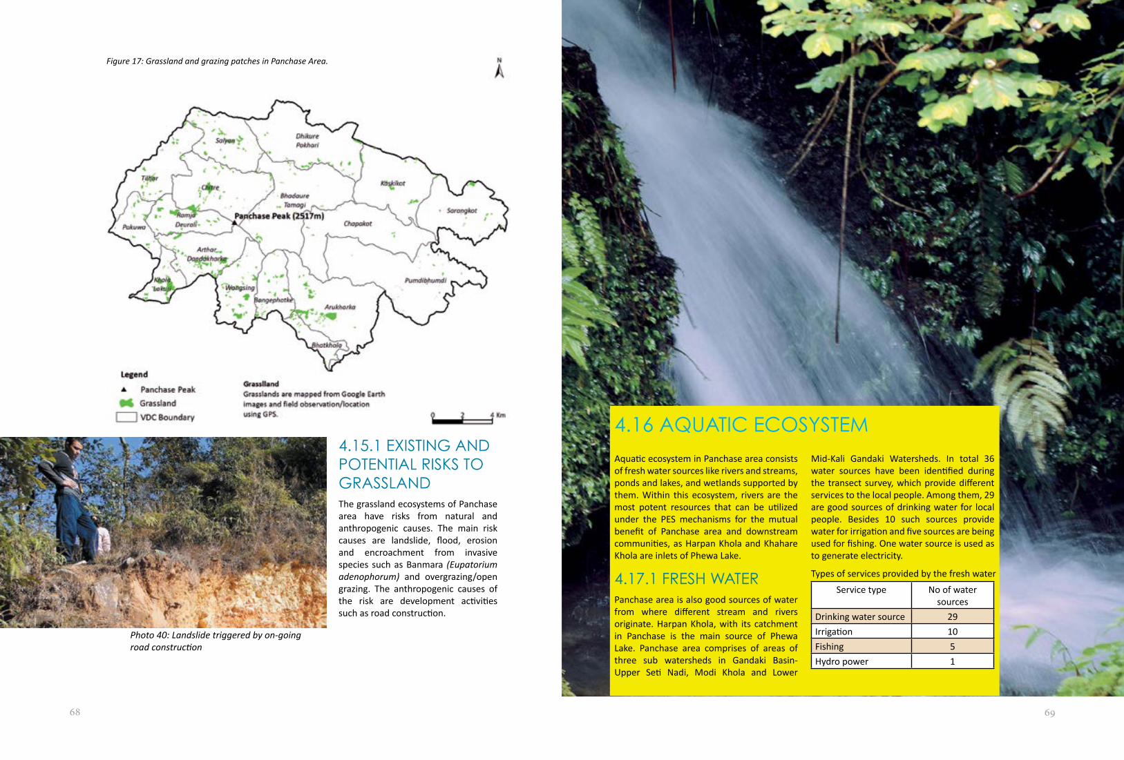
68 69
4.15.1 EXISTING AND POTENTIAL RISKS TO GRASSLANDThe grassland ecosystems of Panchase area have risks from natural and anthropogenic causes. The main risk causes are landslide, flood, erosion and encroachment from invasive species such as Banmara (Eupatorium adenophorum) and overgrazing/open grazing. The anthropogenic causes of the risk are development activities such as road construction.
Aquatic ecosystem in Panchase area consists of fresh water sources like rivers and streams, ponds and lakes, and wetlands supported by them. Within this ecosystem, rivers are the most potent resources that can be utilized under the PES mechanisms for the mutual benefit of Panchase area and downstream communities, as Harpan Khola and Khahare Khola are inlets of Phewa Lake.
4.17.1 FRESH WATERPanchase area is also good sources of water from where different stream and rivers originate. Harpan Khola, with its catchment in Panchase is the main source of Phewa Lake. Panchase area comprises of areas of three sub watersheds in Gandaki Basin- Upper Seti Nadi, Modi Khola and Lower
4.16 AQUATIC ECOSYSTEM
Mid-Kali Gandaki Watersheds. In total 36 water sources have been identified during the transect survey, which provide different services to the local people. Among them, 29 are good sources of drinking water for local people. Besides 10 such sources provide water for irrigation and five sources are being used for fishing. One water source is used as to generate electricity.
Service type No of water sources
Drinking water source 29Irrigation 10Fishing 5Hydro power 1
Photo 40: Landslide triggered by on-going road construction
Figure 17: Grassland and grazing patches in Panchase Area.
Types of services provided by the fresh water

70 71
4.16.2 PONDS/LAKEThere are several ponds and few lakes in the Panchase area, notably Panchase Lake and parts of Phewa Lake in Chapakot VDC. Panchase Lake has religious significance.Other ponds with seasonal water availability are generally used for bathing buffaloes and few are used as fish pond and sources for irrigation.
4.16.3 WETLANDSThere are several wetlands in Panchase. These wetland are formed perennially in and around the water bodies such as ponds and lakes.
4.16.4 BIOLOGICAL DIVERSITYDifferent flora and fauna species are found in aquatic ecosystem in Panchase area. Jalkumbhi (Pistia stratiotes L.), leu-algae (Spirogyra sp.) and hornwort (Ceratophyllum sp.) are commonly found species. Different amphibian, fish, invertebrate and reptilian species are also found in the rivers, ponds and wetland areas.
VDC Name Ward Status Water AvailabilityRamja Deurali Thuli Pokhari 1 Perennial
Sano Pokhari 2 PerennialChapakot Phewa Lake 1, 2 SiltationTilhar Fish ponds (3 nos.) 6 PerennialKaskikot Khadgaun Pokhari 1 Perennial
Maula Pokhari 1 PerennialSyani Pokhari 1 PerennialThuli Pokhari 8 Perennial
Bhadaure Tamagi Pirmisti Pokhari 1 PerennialAal Danda 2 Perennial
Sarangkot Phewa Lake 2, 4 Siltation
Figure 18: Locations of fresh water sources, ponds and wetlands in Panchase Area
Swamps in Panchase Area
Photo 43: Panchase Taal
Photo 41: Ghorlesohara, Harpan, Kaski
Photo 42: Phewa Lake Wetland (swampy) area in Sarangkot, Ward 2

72 73
VDCs River Name Existing Hydropower LocationWards Potential
HydropowerArthar Dandakharka
Jare Khola Ward 4 Jare Khola
Tuni Khola Ward 8Arukharka Dovan (Bhat Khola
and Fedi Khola)Bangephatke Ward 1 Budi Khola
Ward 2 Budi KholaWard 3 Budi Khola
Pakuwa Modi River Modi Hydropower – 15 MWRamja Deurali Modi River Modi Hydropower– 15MWSalyan Dhoti Khola,
Falate Khola, Modi Khola, Rati Khola
Tilhar Lower Modi Khola HhydroElectric – 20 MW Manang Trade Link (under construction)
Tilhar 6
United Tallo Modi -10.5 MW (under construction)
Chuha 4
Modi River Middle Modi Hydropower -15 MW
4.17 AQUATIC ECOSYSTEM PROVISIONING SERVICE
4.17.1 FOOD – FISHFishing is done in Budi Khola, Jare Khola, Modi Khola and Rati Khola.In several fish ponds and in parts of Phewa Lake commercial fishing is in practise.
4.17.2 WATER HARVESTINGWater from fresh water sources such as natural springs and rivers are used for drinking. Water is also harvested for irrigation purposes from the rivers.
4.17.3 IRRIGATIONDifferent Farmer Managed Irrigation System (FMIS) are operational in the Panchase area
for year round irrigation of agricultural fields. Chadi Khola, Dhadko Khola, Fusre Khola, Harpan Khola, Jaare Khola, Mahabir Khola, Mathee Khola, Nyaree Khola, Thado Khola and Tora Khola are being used for irrigation purposes.
4.17.4 HYDROPOWERThe water sources of Panchase have potentiality of hydropower generation. Three rivers namely Jare Khola, Tuni Khola and Modi Khola are the main water sources for hydropower generation. In this area three hydropower stations are already in operation and two are under construction. There is potentiality for hydropower generation from the remaining six river system of the area.
Potential, under construction and existing hydropower from the water sources of Panchase

74 75
EXISTING POLICIES, ACTS AND REGULATIONS
CHAPTER 54.17.5 DEPENDENCY IN ECOSYSTEM SERVICESIn Panchase area 486 households (3.04 per cent of total hh) are dependent on the ecosystem services provided from Panchase forest for their livelihood beside, other 3.24 percent (i.e. 518) households are directly benefiting from the services provided by the cosystems of Panchase Area.
4.17.6 MININGThe region contains some minerals however excavation has not been done except stone mine. There are slate and magnesite in the region which can be extracted for making slate and chalk. Chapakot has plenty of raw materials for chalk. Slate extraction is already in operation in Bhadaure Tamagi, Dhikur Pokhari, Salyan and Arthar Dandakharka VDCs. However, extracting the slate is not being done in a scientific way due to lack of technical knowledge. Environmental awareness is lacking among miners.
4.17.7 LINKAGE BETWEEN ECOSYSTEM SERVICES AND HUMAN WELLBEINGEcosystems of the Panchase area provide services for human wellbeing. Some forest based entrepreneurship like NTFPs marketing and collection, plant nursery and forest based enterprises are providing services for the wellbeing of local people.
Regulation 19979. Local Self-Governance Act 199810. National Wetland Policy 200311. National Agriculture Policy 200412. Agricultural Biodiversity Policy (2007)13. Agri-Business Promotion Policy 200714. Local Self-governance Act 199815. Nepal Agricultural Research Council Act
199116. National Commission on Indigenous and
Ethnic Communities Act 200117. Pesticide Act 199118. Plant Protection Act 197219. Land Act 1964 (Fifth Amendment 2001)20. Nepal Climate Change Policy
The following Policies, Acts and Regulations of Government of Nepal (GoN) addressed the natural resources, environment, biodiversity, ecosystem and its services, and vulnerability:
1. Aquatic Animal Protection Acts (AAPA) 2017 (1961)
2. National Parks and Wildlife preservation Act 1973
3. Soil and Watershed Conservation Act 1982
4. Water Resources Act 19925. Water Resources Regulation 19936. Forest Act 19937. Forest Regulation 19958. Environmental Protection Act 1997 and
Photo 44: Group discussion in Ramja, Parbat

76 77
5.1 STRATEGIES, PLANS, ACTION PLANS AND GUIDELINESThe following are the formulated strategies, plans, action plans and guidelines approved by the GoN.
1. The National Conservation Strategy 19882. The National Environmental Impact
Assessment (EIA) guidelines 1993 3. Nepal Environmental Policy and Action
Plan 19934. Water Resources Sector Guidelines for
Power and Irrigation 19945. Forestry sector EIA Guidelines 19956. Agricultural Perspective Plan 1995-20147. Industry Sector Guidelines 19968. National Plan of Action 19969. Nepal Biodiversity Strategy 200210. Water Resources Strategy 200211. Tenth Five Year Plan 2002-200712. National Water Plan 200513. Three Year Interim Plan 2007-201014. Grassland Management Guidelines for
Grassland Management 201015. Periodic Five-year Plans
The reviewed policies were summarized in eight headings. They are as follows:
• The importance of natural resources and their usages are recognized in different plans, action plans, policies, and regulation
• Biodiversity as fundamental functional element of ecosystem incorporated in different policies
• Ecosystems management in watershed areas are incorporated at policy level
• Ecosystem-based approaches to adaptation are combined with the betterment of environment
• Ecosystem conservation policies envisioned the broader approach to protect the ecosystem from different influencing factors
• Ecosystem-based services and their utilization are addressed either directly or indirectly in different policies
• Policies addressing the payment schemes for ecosystem services
• Vulnerability may cause from different disasters but the strategy to adopt will be the same
5.2 POLICY REVIEWThe importance of natural resources and their usages are recognized in different plans, action plans, policies, and regulation
Natural resources are the main components of any ecosystem having their useful values. So, the wise use of these resources helps to sustain the healthy ecosystem of the specific areas. The Government of Nepal (GoN) incorporated the wise use of these resources in five different policy documents.
During 1960s the term Natural Resources incorporated the biodiversity and ecosystems. In those days protection of the resources was for common terminology used both conservation and protection. In Nepal concept of sustainable use of natural resources was first incorporated in periodic five-year plan in 1980. This plan emphasized resource conservation through watershed management and land use control at the policy level. The explicit concern for
environment was expressed in the Sixth Plan (1980-1985), which stipulated a number of policy measures for conservation and sustainable use of natural resources.
In 1996, National Plan of Action (NAPA) was prepared for the United Nations Conference on Human Settlement (HABITAT I, Turkey 3-14 June, 1996). The National Plan of Action identified prior issues, formulated a plan of action for a period of 1996-2000 and identified key areas for international cooperation and assistance. In this plan environmental policies, such as protection and management of resources along with long-term national plans will focused for poverty alleviation.
Rule 65 of the Forest Regulations 1995 stipulates the payment schemes for ecosystem damage. This regulation clearly mentioned that if any loss or harm made during execution of projects in any forest area to any local individual or community, the developers or proponents of the concerned project must bear the amount of compensation in consideration thereof. Similarly, the entire expenses required for cutting, making into pieces and transporting the forest product to be used by the approved project must be borne by the proponents of the projects.
Natural resource management for sustainability is one of the key priority in Agricultural Perspective Plan 1995-2014. This plan emphasized the irrigation facility to increase and diversify the agriculture products.
National Agriculture Policy 2004 incorporated one of the three objectives as the 'conservation and utilization of natural resources and biodiversity'. It also incorporated the modality of the ex-situ conservation of the seeds.
Biodiversity as fundamental functional element of ecosystem incorporated in different policies
Biological resources are the fundamental components of the ecosystem. They are the essential part to functionalize any ecosystem. Realizing these facts GoN incorporated the biodiversity conservation in different policies.
The biodiversity conservation component is incorporated in 17 policy documents of GoN.
The conservation of the resources, which also incorporated the biological resources, was expressed in the Sixth Plan (1980-1985). The first significant action for the conservation of biodiversity was the formulation of National Conservation Strategy 1988. A number of policy pronouncements and programme interventions followed the adoption of this strategy. The Nepal Biodiversity Strategy 2002 emphasized the conservation and wise use of biological resources of the country.
Forest Act 1993 is the latest one that was formulated in an improved form over the preceding acts and enactment. The act recognises the importance of forests in maintaining healthy environment. This requires decision-makers to take account of biodiversity, and not only for the production of timber and other commodities. The basis of the Act’s approached towards forest and forest products 'resource oriented' rather than 'use oriented'. Section 23 of the Act empowers the government to delineate any part of a national forest, which has special environmental, scientific or cultural importance, as a protected forest.
The legal foundation for the conservation of biodiversity is provided by the National Park and Wildlife Conservation Act 1973. The Section 10 of the act has listed protected wild animal species including fish, reptiles, birds and mammals. The Act prohibits blocking, diverting, or putting hazardous, explosive matters in the river stream or any water source. The new concept of conservation initiated in Nepal with the passage of the National Parks and Wildlife Conservation Act 1973, which provide broad legislation to establish the national parks and reserves for protecting sensitive areas and species. The NPWC Act 1973 and Wildlife Reserve Regulations forbid conducting different anthropogenic activities inside the protected areas to conserve their biodiversity. The first amendment of wildlife regulations allows hunting or trapping of diseased or injured wildlife. Forest Regulations 1995 emphasized the conservation of biodiversity during the execution of any projects.

78 79
The Environment Protection Act was promulgated in 1997, as an umbrella act and necessary regulations to enforce the Act came up in 1997. Prior to the enactment of Environmental Protection Act, existing legislation on the environment revealed that there were too many scattered laws thereby creating a plethora of unrelated laws and confusion of jurisdiction involving too many institutions due to unclear demarcation of responsibilities, lack of co-ordination and duplication of functions.
The Environmental Protection Act and Regulations covered many aspects of the environmental concerns. The objective of the Act is to recognise the interdependence between development activities and the environment, and to maintain a clean and healthy environment by minimising the impacts of environmental degradation on people, biodiversity and physical surroundings. The Act has explicitly made provisions for conserving rare and endangered animals and biodiversity.
The Local Self-Governance Act 1998 provides more autonomy to District Development Committees, Municipalities and Village Development Committees. Section 25 of the Act provides the functions, rights and duties of the Ward Committee. Section 25(e) of the Act requires the ward to help for protection of environment through plantation over the bare land, cliff and mountains. Section 28 has mentioned the functions, rights, and duties of VDC.
VDCs are required to protect the environment, nature and natural resources by formulation and implementation of programmes for biodiversity conservation. Section 189 of the Local Self-Governance Act provides the powers and functions of the District Development Committees (DDC), which include formulation, and implementation of plans for conservation of forest, vegetation, biological diversity and soil. Most of these acts are general. Except for their fragmented nature existing provisions appear to have sufficient legal coverage. However, too many isolated provisions and a weak institutional and financial base render these legislation
ineffective in practice. Besides, there is no distinct chain of legal custody.
Agricultural Perspective Plan 1995-2014 emphasized biodiversity conservation as one of the key priority. It identified different inputs to achieve the key priority. Similarly, one of the three objectives of the National Agriculture Policy 2004 is the conservation and utilization of biodiversity.
Three Year Interim Plan (2007-2010) focused on transforming subsistence farming system to commercial by conserving, protecting and utilizing agricultural biodiversity via development and dissemination of environmentally friendly technologies. Tenth Plan (2002-2007) adopted a strategy to develop sustainable agriculture through the development of agricultural technology, conservation and utilization of biodiversity, and protection of the environment.
Agricultural Biodiversity Policy 2007 incorporated a key point to protect, promote and use agricultural biodiversity for sustainable development of the agricultural sector. The policy has undoubtedly emphasized on biodiversity conservation. The National Agricultural Research Council (NARC) is an autonomous apex body for agricultural research, established by the NARC Act in 1991. The NARC undertakes research activities to increase agricultural productivity and agro-biodiversity by generating appropriate technologies suitable for various agro-ecological zones in Nepal.
The main objective of Pesticide Act 1991 is to regulate the import, export, transportation and use of pesticides and restrict the import and use of those pesticides that are not listed or notified. It helps to develop organic agriculture products and aims to conserve endemic quality and characteristic plants and genetic resources.
5.3 ECOSYSTEMS MANAGEMENT IN WATERSHED AREAS ARE INCORPORATED AT POLICY LEVELWatershed areas incorporated one or more type of ecosystems. There are different policies formulated for the management of watershed areas. There are two policies directly linked with the watershed management. It incorporated an Act and a plan.
Sixth Periodic Five-year Plan (1980-1985) emphasized the conservation of the resources through watershed management and land use control at the policy level. It stipulated a number of policy measures for conservation and sustainable use of natural resources. Section 3 of Soil and Watershed Conservation Act, 1982 empowers GoN to declare any site as a protected watershed area. This act outlines the essential parameters necessary for proper watershed management.
Ecosystem-based approaches to adaptation are combined with the betterment of environment
Conservation of the environment for the betterment of livelihood is commonly addressed during policy formulation by GoN. Concerns regarding the environment conservation are reflected in seven policy documents approved from the government.
As a further refinement of the National Conservation Strategy 1988, the Nepal Environmental Policy and Action Plan (NEPAP) 1993 were formulated to further institutionalise environmental protection in the development processes. The Action Plan for Infrastructure Development within the NEPAP recommends the finalisation of draft National Environmental Impact Assessment (EIA) Guidelines for water resources, the development of the EIA guidelines for road construction and the use of EIA in designing hydroelectric projects. The NEPAP was followed up by NEPAP II, which came up with detailed action plans and identified priority projects for implementation in these sectors. The National Conservation Strategy also recognised impact assessment and the review process as one of the basic criteria for achieving sustainable development. To address this, National Environmental Impact Assessment (EIA) Guidelines were approved in 1993 which emphasized to conserve the
Photo 45: Ecoclub orientation programme

80 81
environment during the implementation of any development works. Rule 65 of the Forest Regulations 1995 stipulates to conserve environment during the execution of national priority projects.
Environment Protection Act and Regulations came up in 1997. Prior to the enactment of Environmental Protection Act the existing legislation on the environment revealed that those legislations were too scattered and difficult to implement. The Environmental Protection Act and Regulations covered most of the aspects of the environmental concerns. The objective of the EPA is to recognise the interdependence between development activities and the environment, maintain a clean and healthy environment by minimising the impacts of environmental degradation. National Agriculture Policy 2004 adopted environment conservation as one of its objective. The major strategy for environment conservation as emphasized by the policy was conserving natural resources and biodiversity.
Ecosystem conservation policies envisioned the broader approach to protect the ecosystem from different influencing factors
Ecosystem conservation is one of the key priority areas in the different policy documents formulated by the Government of Nepal. The importance of the ecosystem conservation in policy documents is mainly reflected after the Rio Earth Summit 1992.
The Aquatic Animals Protection Act 1961 indicates an early recognition of the value of aquatic ecosystems. The Act recognized aquatic resources in section 2 (a) as lakes, ponds, rivulets, stream, river, channel, reservoirs, ditches, and their sources. Section 3 of the Act made provision of punishment for disturbing the aquatic ecosystem and its biodiversity. Aquatic Animal Protection Act has no clear institutional base and the mechanisms of protection.
The conservation of ecologically valuable areas and indigenous wildlife is provided by the National Park and Wildlife Conservation Act 1973. The new concept of conservation
initiated in Nepal with the National Parks and Wildlife Conservation (NPWC) Act which provided broad legislation to establish the national parks and reserves for protecting sensitive ecosystems. The NPWC Act, 1973 and Wildlife Reserve Regulations forbid activities that harms the wildlife.
The basic philosophy of the existing legislation on water resources are exclusive state ownership. According to Water Resources Act 1992 the ownership of water resources within Nepal shall be vested in the State. This stipulates that soil erosion, landslides, floods or adverse impacts on the environment should be avoided from the ecosystem while generating electricity, digging canals and other works. The Act strives to prevent environmental damage to wetlands, lakes, and rivers through EIA studies.
It is mandatory under Rule 17(e) of the Water Resources Regulation 1993 that any person or corporate body, who desires to obtain a license for the utilisation of water resources, must state the appropriate measures to be taken to minimise the adverse effects on the overall aquatic ecosystem. Measures need to be taken for the conservation of aquatic life and water environment. Mitigation of the social and economic effects of the project in the concerned area must be specified in the environmental impact analysis.
Forest Act 1993 is the latest one that was formulated in an improved form over the preceding acts and enactment. The act recognises the importance of forests ecosystem in maintaining healthy environment. Section 23 of the Act empowers the government to delineate any part of a national forest, which has special environmental, scientific or cultural importance, as a 'protected forest'. Rules 65 of the Forest Regulations 1995 stipulates that in case the execution of any projects having national priority in any forest area causes any loss or harm to forest ecosystem the developers or proponents of the concerned project must bear the amount of compensation.
An umbrella act to protect the environment,
Environment Protection Act, was promulgated in 1997 and necessary regulations to enforce the act came up in 1997. The Act emphasized on conducting Environmental Impact Assessment prior to any development works in any ecosystem.
The Local Self-Governance Act 1998 provides more autonomy to District Development Committees, Municipalities and Village Development Committees. Section 25(e) of the Act requires the ward to help in the protection of the ecosystem. Section 189 of the Local Self-Governance Act provides the powers and functions of the District Development Committees (DDC), to formulate and implement plans for ecosystem conservation. The National Wetland Policy 2003 identified the need of conservation and wise use of wetland ecosystem.
National Agriculture Policy 2004 is in place to guide agriculture sector development in the country. The policy adopted objectives to enhance production and productivity of agro-ecosystem. The Three Year Interim Plan (2007-2010) focused on transforming subsistence based farming into commercial one and conserving, protecting and utilizing agro-ecosystem via development and dissemination of environmentally friendly technologies. The Tenth Plan (2002-2007) adopted a strategy to develop sustainable agriculture through the development of agricultural technology by conserving agro-ecosystem.
The Pesticide Act 1991 regulated the import, export, transportation and use of pesticides and restricted the import and use of the pesticides which are not ecosystem friendly. The main objective of the Plant Protection Act 1972 was to regulate the import and export of plants that carry disease and have adverse effects on the environment and ecosystem. The Act can restrict importing of plants, including seeds from outside that is affected by disease or pests and can be harmful for the environment and a particular ecosystem.
National Commission on Indigenous and Ethnic Communities Act 2001 made some important provisions regarding the traditional knowledge of indigenous and
ethnic communities. It aims at conserving and promoting the traditional skills, technology and specific learning of the indigenous and ethnic communities for the conservation of specific ecosystem.
Ecosystem-based services and their utilization are addressed either directly or indirectly in different policies
Different policy documents of GoN addressed the services provided by the ecosystem and their use. The ecosystem services are reflected in the seven policy documents of GoN.
The Aquatic Animals Protection Act 1961 recognized the services provided by wetlands and aquatic animals. The objective of the Water Resources Act 1992 is to make legal arrangements for determining beneficial uses of aquatic ecosystem services, preventing environmental and other hazardous effects thereof and also for keeping water resources free from pollution. The mandatory rule under Water Resources Regulation 1993, 17(e) is that any person or corporate body, who desires to buy a license for the utilisation of water resources, must state the appropriate measures to be taken to minimise the adverse effects on the overall environment.
Forest Act 1993 recognises the importance of forests in maintaining on healthy environment. This requires decision-makers to take account of all forest values, including environment services and biodiversity, not just the production of timber and other commodities.
Section 55 of Local Self-Governance Act, 1998 empowers VDCs to levy taxes on ecosystem services. Section 68 of this Act lists ecosystems as the property of the VDC. National Wetland Policy, 2003 identified major activities for the conservation and wise use of service provided from wetlands.
Agricultural Perspective Plan 1995-2014 incorporated the provision of the services provided from agro-ecosystem. It emphasized on maximizing the use of services provided from agro-ecosystem.

82 83
5.4 POLICIES ADDRESSING THE PAYMENT SCHEMES FOR ECOSYSTEM SERVICESThe ecosystem provided different services. Those services are important for the wellbeing of local people and other. Only one Act of GoN addressed the payment schemes for ecosystem services.
The Local Self-Governance Act 1998 provides more autonomy to District Development Committees, Municipalities and Village Development Committees. Section 25 of the Act provides the functions, rights and duties to the Ward Committee. Section 55 of this Act empowered VDCs to levy taxes on utilisation of ecosystem services. If section 189 and 202 are read together, DDCs have the power to stop certain development projects considered environmentally unsound.
The vulnerability attributed to different disasters is addressed in different policy
documents of GoN. The cause of the vulnerability may be from different disasters, like climate change. The vulnerability is addressed in the five policy document of GoN.
National Agriculture Policy, 2004 incorporated a provision for a gene bank and the promotion of in-situ conservation to mitigate any adverse condition in the agriculture sector. The Three Year Interim Plan (2007-2010) has designed the natural disaster management as minimizing social and economic loss and the damage caused.
The National Water Plan for Disaster Management 2005 addresses the key areas relevant to conservation in the irrigation and hydropower sector. The programmes identified in the sector are:
• water-related disaster management policy and programme
• risk / vulnerability mapping and zoning programme
• disaster networking and information• disaster preparedness plan• relief / rehabilitation
• inundation committee activation• flood / drought, landslide / GLOF
management• watershed management of rivers• operation and maintenance
The Water Resources Strategy 2002 states that catastrophic events that cannot be controlled rendered less dangerous by advance planning and preparation. In addition to preparations for emergency response, rescue and relief, the Water Resources Strategy identifies a number of actions that will be taken to mitigate the effects of water-induced disasters. It has proposed the following activities:• Prepare and implement a water-induced
disaster management policy and plan.• Conduct risk/vulnerability mapping and
zoning.• Strengthen the disaster networking and
information system.• Establish disaster relief and rehabilitation
systems.• Carry out community awareness/
education on disaster management.• Activate Inundation Committee(s) with
respect to neighbouring countries.• Prepare and implement flood plain
action plans.• Implement disaster reduction/mitigation
measures.• Strengthen institutional set-up and
capacity.
Nepal Climate Change Policy aimed to enhance the climate adaptation and resilience capacity of local communities for optimum utilization of natural resources and their efficient management.
Few other sectoral guidelines like the Water Resources Sector Guidelines for Power and Irrigation 1994, Forestry sector EIA Guidelines 1995, Grassland Management Guidelines for grassland management 2010, Industry sector Guidelines 1996 followed NEIA Guidelines and are already prepared. These guidelines are currently awaiting government approval. As these guidelines have not been approved by the government, they do not have any statutory authority or legal base. The hydropower sector and forestry sector has been stringently adhering to the National EIA Guidelines.
5.5 POLICY SYNOPSISThe policies have recognized the importance of natural resources, ecosystem conservation and restoration for the betterment of the socio-economy. Inclusion of ecosystem-based approaches to national policies can contribute to broader development goals with increase in economy.
Most of the policies recognize the importance of ecosystem management for well-being of the people. These policies are unable to address ecosystem-based approaches to adaptation. These policies need to be updated incorporating the current issues on the natural resource management, ecosystem-based approaches, and biodiversity and environment conservation. It will be beneficial to incorporate ecosystem-based approaches to adaptation in natural resource management plans, national plans and policies.
Ecosystem based approaches to adaptation need to incorporate multiple sectors like agriculture, water, forests, biodiversity conservation, energy, health and tourism. One forum is needed to incorporate all stakeholders for ecosystem based adaptation. As There is uncertainty about the likely impacts of climate change on ecosystem services, action research on the ecosystem based approaches to adaptation should be done which will support for further policy formulation.

84