a land resource identification and protection plan for the oberlin project
TRANSCRIPT

ALandResourceIden/fica/onandProtec/onPlanfortheOberlinProject
PaulBoehnleinGIS&Conserva4onPlanningSpecialist
PhotoCredit:JohnPetersen

WesternReserveLandConservancy
• 8NortheastOhiolandtrustsmergedin2006• Over400proper4esmakeupapproximately30,000acrespreserved• Currentgoal:10%of4millionacreserviceareaprotected

Conserva/onPlanningattheLandConservancy
• BayesianBeliefNetworkapproach
• Incorporatesbestavailabledataandopinionoflocalexperts
• Twocomponents• NaturalAreas• WorkingLand


Conserva/onPlanningattheLandConservancy
• NetworkmodeldevelopedinNe4casoRware
• Expertconsensusofvaluecaptured• Representedspa4allyinArcMap


Conserva/onPlanningattheLandConservancy
• Compareandpriori4zeprojects
• Quan4fythequalityofconserva4oneffortover4me
• Setgoalsforfutureconserva4on

NaturalResource-basedEconomicDevelopment
SustainableForestry
• Areasoflowslopeandnohydrologicfeatures
• Approximately400,000acresiden4fiedaspoten4allysuitableforsustainableforestry

NaturalResource-basedEconomicDevelopment
Carbonstoragees/mates
• AbovegroundlivedrybiomassfromNa4onalBiomass&CarbonDataset
• SoilorganiccarbonfromNRCSSSURGOsoils


NaturalResource-basedEconomicDevelopment
WindEnergySuitability
• Landuse,sensi4veareas,exis4ngtransmission,windpoten4al

NaturalResource-basedEconomicDevelopment
SolarRadia/onPoten/al
• OhioStatewideImageryProgram2mLiDARData
• ArcSolartoolbox

NaturalResource-basedEconomicDevelopment
BiofuelProduc/onPoten/al
• VacantagriculturallandwithnocanopynotinCAUV
• 3,158poten4alacresinLorainCo.
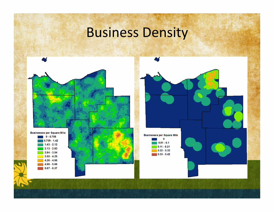
BusinessDensity

RecentIni4a4ves
• GISdatalibrarydevelopmentatOC• High-resolu4onlandusemapofOberlin
• Developmentofstudentprojectsrelatedtocarbonoffsetsandstormwater
• Hollywoodtrailplanning• Adhocmapmaking


facebook.com/WesternReserveLandConservancytwiPer.com/wrlandconservan
440-729-9621
PhotoCredit:DavidOrr