a district level assessment
TRANSCRIPT

A District Level Assessment
Abinash Mohanty and Shreya Wadhawan
Report October 2021
Centre forEnergy Finance
Mapping India’s Climate Vulnerability

Mapping India’s Climate Vulnerability: A District Level Assessment
Image: Shawn Sebastian
CEEW analysis indicates that implementing robust risk mitigation mechanisms and investing in better disaster preparedness alone could have saved India over Rs 6.76 trillion (USD 89.7 billion) in the past two decades.

Report October 2021
ceew.in
Mapping India’s Climate Vulnerability
Abinash Mohanty and Shreya Wadhawan
A District Level Assessment
Centre forEnergy Finance

Mapping India’s Climate Vulnerability: A District Level Assessment
Copyright © 2021 Council on Energy, Environment and Water (CEEW).
Open access. Some rights reserved. This work is licensed under the Creative Commons Attribution-
Noncommercial 4.0. International (CC BY-NC 4.0) license. To view the full license, visit: www.
creativecommons.org/licenses/by-nc/4.0/legalcode.
Suggested citation: Mohanty, Abinash, and Shreya Wadhawan. 2021. Mapping India’s Climate Vulnerability – A District Level
Assessment. New Delhi: Council on Energy, Environment and Water.
Disclaimer: The views expressed in this issue brief are those of the authors and do not necessarily reflect the views
and policies of the Council on Energy, Environment and Water or The Climate Collaborative, or the
EdelGive Foundation.
Cover image: Alamy.
Peer reviewers: Dr Majorie Mcquirk, Subject Matter Expert-WMO & President-CASE; Dr Carmine Gallasso, Professor, UCL
Institute for Risk and Disaster Reduction; Dr Roxy Mathew Koll, Scientist, Centre for Climate Change
Research, IITM, under the aegis of the Ministry of Earth Sciences; Lead Author, Intergovernmental Panel
on Climate Change (IPCC) Special Report on the Ocean and Cryosphere in a Changing Climate; Vaibhav
Chaturvedi, Fellow, CEEW, and Karthik Ganesan, Fellow and Director - Research Coordination, CEEW.
Publication team: Alina Sen (CEEW), Ganesh Radha-Udayakumar (CEEW), The Clean Copy, Twig Designs, and Friends
Digital.
Organisation: The Council on Energy, Environment and Water (CEEW) is one of Asia’s leading not-for-profit policy
research institutions. The Council uses data, integrated analysis, and strategic outreach to explain – and
change – the use, reuse, and misuse of resources. It prides itself on the independence of its high-quality
research, develops partnerships with public and private institutions, and engages with the wider public.
In 2021, CEEW once again featured extensively across ten categories in the 2020 Global Go To Think
Tank Index Report. The Council has also been consistently ranked among the world’s top climate change
think tanks. CEEW is certified as a Great Place To Work®. Follow us on Twitter @CEEWIndia for the latest
updates.
Council on Energy, Environment and Water Sanskrit Bhawan, A-10 Qutab Institutional Area, Aruna Asaf Ali Marg, New Delhi - 110067, India

About CEEW
The Council on Energy, Environment and Water (CEEW) is one of Asia’s leading not-for-profit policy research institutions. The Council uses data, integrated analysis, and strategic outreach to explain — and change — the use, reuse, and misuse of resources. The Council addresses pressing global challenges through an integrated and internationally focused approach. It prides itself on the independence of its high-quality research, develops partnerships with public and private institutions, and engages with the wider public.
The Council’s illustrious Board comprises Mr Jamshyd Godrej (Chairperson), Mr Tarun Das, Dr Anil Kakodkar, Mr S. Ramadorai, Mr Montek Singh Ahluwalia, Dr Naushad Forbes, Ambassador Nengcha Lhouvum Mukhopadhaya, and Dr Janmejaya Sinha. The 120-plus executive team is led by Dr Arunabha Ghosh. CEEW is certified as a Great Place To Work®.
In 2021, CEEW once again featured extensively across ten categories in the 2020 Global Go To Think Tank Index Report, including being ranked as South Asia’s top think tank (15th globally) in our category for the eighth year in a row. CEEW has also been ranked as South Asia’s top energy and resource policy think tank for the third year running. It has consistently featured among the world’s best managed and independent think tanks, and twice among the world’s 20 best climate think tanks. In ten years of operations, The Council has engaged in 278 research projects, published 212 peer-reviewed books, policy reports and papers, created 100+ new databases or improved access to data, advised governments around the world nearly 700 times, promoted bilateral and multilateral initiatives on 80+ occasions, and organised 350+ seminars and conferences. In July 2019, Minister Dharmendra Pradhan and Dr Fatih Birol (IEA) launched the CEEW Centre for Energy Finance. In August 2020, Powering Livelihoods — a CEEW and Villgro initiative for rural start-ups — was launched by Minister Mr Piyush Goyal, Dr Rajiv Kumar (NITI Aayog), and H.E. Ms Damilola Ogunbiyi (SEforAll). The Council’s major contributions include: The 584-page National Water Resources Framework Study for India’s 12th Five Year Plan; the first independent evaluation of the National Solar Mission; India’s first report on global governance, submitted to the National Security Adviser; irrigation reform for Bihar; the birth of the Clean Energy Access Network; work for the PMO on accelerated targets for renewables, power sector reforms, environmental clearances, Swachh Bharat; pathbreaking work for the Paris Agreement, the HFC deal, the aviation emissions agreement, and international climate technology cooperation; the concept and strategy for the International Solar Alliance (ISA); the Common Risk Mitigation Mechanism (CRMM); critical minerals for Make in India; modelling uncertainties across 200+ scenarios for India’s low-carbon pathways; India’s largest multidimensional energy access survey (ACCESS); climate geoengineering governance; circular economy of water and waste; and the flagship event, Energy Horizons. It recently published Jobs, Growth and Sustainability: A New Social Contract for India’s Recovery.
The Council’s current initiatives include: A go-to-market programme for decentralised renewable energy-powered livelihood appliances; examining country-wide residential energy consumption patterns; raising consumer engagement on power issues; piloting business models for solar rooftop adoption; developing a renewable energy project performance dashboard; green hydrogen for industry decarbonisation; state-level modelling for energy and climate policy; reallocating water for faster economic growth; creating a democratic demand for clean air; raising consumer awareness on sustainable cooling; and supporting India’s electric vehicle and battery ambitions. It also analyses the energy transition in emerging economies, including Indonesia, South Africa, Sri Lanka and Vietnam.
The Council has a footprint in 22 Indian states, working extensively with state governments and grassroots NGOs. It is supporting power sector reforms in Uttar Pradesh and Tamil Nadu, scaling up solar-powered irrigation in Chhattisgarh, supporting climate action plans in Gujarat and Madhya Pradesh, evaluating community-based natural farming in Andhra Pradesh, examining crop residue burning in Punjab, promoting and deploying solar rooftops in Delhi, Bihar and Meghalaya.

Mapping India’s Climate Vulnerability: A District Level Assessment
Acknowledgments
We would like to thank Mr Kamal Kishore, Member Secretary, National Disaster Management Authority (NDMA), Government of India, for sharing his time and knowledge and motivating us to undertake this study. We would also like to express our gratitude to the members of High-Level Advisory Group on Climate Risk Atlas (Mr Sandeep Poundrik, Chair and Director General, Coalition of Disaster Resilient Infrastructure (CDRI); Dr Osvaldo L L Moraes Chair, BRICS Working Group on Climate Change and Director, CEMADEN, Brazil; Dr Dipak Gyawali, Former Minister of Water Resources, Government of Nepal; Dr Marjorie McGuirk, Subject Matter Expert, World Meteorological Organization (WMO); Ms Iria Tourzan, Knowledge Management Officer, UNDRR Asia Pacific; Prof Carmine Gallaso Professor, UCL Institute for Risk and Disaster Reduction; Ms Shloka Nath, Executive Director, India Climate Collaborative (ICC); Ms Laura Schafer, Senior Advisor, Germanwatch; and Dr Arunabha Ghosh, CEO, CEEW) for their continued guidance, support, and feedback and for sharing many of their insightful perspectives with us.
We thank Dr A. V. P. Prasad, Deputy Director, Indian Space Research Organisation (ISRO), Government of India, and Dr T. Ravi Sankar, Deputy Director and Group Head, National Remote Sensing Centre (NRSC), ISRO, for supporting us with their valuable comments and providing us access to base-level maps of the Indian subcontinent. We would like to thank Ms Edel Monteiro, Programme Lead at the India Climate Collaborative, for sharing insightful perspectives and for the support. We would also like thank the India Climate Collaborative and the EdelGive Foundation for funding support.
We acknowledge the insights and feedback of domain experts at various national, international, and intergovernmental organisations who participated in various expert consultations panned across the tenure of the project. We also acknowledge the contributions of Ms Anuva Chowdhury, Research Analyst; Ms Shweta Rathore, former consultant; and our research interns, Ms Aditi Kumari, Mr Ginlal Siam, and Ms Ashmita Biswas.
Our reviewers, Dr Majorie Mcquirk, Subject Matter Expert, World Meteorological Organisation; Dr Carmine Gallaso, Professor, UCL Institute for Risk and Disaster Reduction; and Dr Roxy Mathew Koll, Scientist, Centre for Climate Change Research, IITM, Ministry of Earth Sciences; Lead Author, IPCC Special Report on the Ocean and Cryosphere in a Changing Climate, provided thoughtful comments, critical insights, and valuable feedback, which helped us improve this study. For this, we are incredibly thankful.
We are indebted to the CEEW team, particularly to Dr Vaibhav Chaturvedi and Mr Karthik Ganesan, for their insightful comments as internal reviewers and to the CEEW Outreach team for their continued support through the process of developing this document. We would like to thank Ms Shuva Raha for her timely insights and feedback. We would also like to thank Mr Santosh Pal, Mr Gandhar G Ukidve, Ms Harsimran Kaur, and Dr Deepak Yadav for their support in translating the regional DDMPs for the evaluation.


Abinash Mohanty [email protected]
Abinash is a Programme Lead with the Risks and Adaptation research focus area at CEEW. His work primarily involves designing decision-making toolkits for effective policymaking around the intricacies of climate change risks, sustainability, and environmental resources management. He has more than a decade of experience in evidence-based policy research on climate change risks and impacts, water management, climate change financing, and in managing projects. He is also a reviewer of the IPCC’s sixth assessment report on Impacts, Adaptation and Vulnerability (AR6).
Shreya Wadhawan [email protected]
Shreya is a consultant with the Risks and Adaptation team research focus area at CEEW. Her work is focused at extreme events spatio-temporal analysis that helps in designing decision making tools. This includes intersecting science, policy and practice to mainstream climate actions. She holds a master’s degree in Environmental Management from the Guru Gobind Singh Indraprastha University, New Delhi.
“The frequency and intensity of extreme climate events in India have increased by almost 200% since 2005. Our policymakers, industry leaders and citizens must use the district-level analysis to make effective risk-informed decisions. Climate-proofing of physical and ecosystem infrastructures should also now become a national imperative. Further, India must create a new Climate Risk Commission to coordinate the environmental de-risking mission. Finally, with loss and damage rising exponentially due to the climate crisis, India must demand climate finance for adaptation-based climate actions at COP26.”
“Scaling up climate actions is intrinsic to tackle rapidly intensifying climate extremes. The Climate Vulnerability Index (CVI) will help decision-makers identify the changing landscape of risks at a localised level and help take robust risk-informed decisions that can be tailor-made at the landscape level to mitigate the scale of impacts of these extremes. While CVI maps the compounding impacts of these extremes, it centres around the ability of the communities, governance mechanisms to build back better by devising means and ways to enhance the resilient and adaptive capacity.”
The authors

Mapping India’s Climate Vulnerability: A District Level Assessment
Image: Alamy
In 2021, Himachal Pradesh alone witnessed 30 cloud burst incidences, of which 12 in the pre-monsoon season and 18 during southwest monsoon months (SANDRP 2021).

Contents
Executive summary
Why does India need a climate vulnerability index? Developing a climate vulnerability index (CVI) for India Mapping India’s vulnerability: key findings Building India’s climate resilience 1. Understanding the vulnerability landscape of India in a changing climate scenario
1.1 Identifying the climate risk landscape through a vulnerability assessment 1.2 Integrated vulnerability assessment 1.3 Research questions
2. Mapping India’s vulnerability: methodology
2.1 Introduction: spatial index–based vulnerability assessment framework for managing climate extremes
2.2 Development of a composite index–based approach for vulnerability assessment
3. State of vulnerability of Indian districts and states
3.1 State of exposure 3.2 State of sensitivity 3.3 State of adaptive capacity 3.4 State of vulnerability 4. Building a climate-resilient India: Recommendations
4.1 Develop a Climate Risk Atlas 4.2 Establish a climate risk commission 4.3 Climate sensitivity–led landscape restoration Climate sensitivity–led landscape restoration 4.4 Climate risk profile–informed infrastructure planning 4.5 Climate vulnerability index–based risk financing
References
Annexure I
1
9
29
51
54
61
267
10
11
30353942
5252525353
i

Mapping India’s Climate Vulnerability: A District Level Assessment
Tables
Table ES1: Assam, Andhra Pradesh, and Maharashtra are the top three climate vulnerable states in India
Table ES2: Southern-zone is the most vulnerable to all three extreme hydro-met disasters
Table ES3: North-eastern and eastern zones of India are highly exposed to extreme flood events
Table 1: Component-based shortlisted indicators for the vulnerability assessment
Table 2: Classification of extreme events considered in the study
Table 3: Pairwise comparison matrix for flood
Table 4: Comparison between AHP and PCA
Table 5: AHP prioritisation ranking for floods, cyclones, and droughts
Table 6: Correlation of adaptive capacity indicators
Table 7: Top 20 flood-exposed districts
Table 8: The top 20 drought-exposed districts
Table 9: Top 20 highly cyclone-exposed districts
Table 10: Flood hotspots in India
Table 11: Drought hotspots in India
Table 12: Cyclone hotspots in India
Table 13: Key findings on the state of adaptive capacity for hydro-met disasters
Table 14: Dhemaji, Khammam, Gajapati, Vizianagaram and Sangli are the 5 most vulnerable districts of India
Table 15: Assam, Andhra Pradesh, and Maharashtra top India’s CVI
Table A1: List of hotspot districts, their vulnerability indices and ranks in the all-India assessment
Table A2: Comparison of IPCC and DRR terminologies on vulnerability assessment

Figures
Figure ES1: 17 out of 20 people in India are vulnerable to extreme hydro-met disasters
Figure ES2: 27 of 35 states and UTs are highly vulnerable to extreme hydro-met disasters
Figure 1: 75 per cent of Indian districts are extreme event hotspots
Figure 2: Illustration of the IPCC SREX framework for components risk and vulnerability
Figure 3: Integrated vulnerability assessment framework
Figure 4: Hazard-specific vulnerability assessment
Figure 5: Detailed schematic representation of the approach and methodology (IVA)
Figure 6: Snapshot of CEEW consultation workshops
Figure 7: Approach and methodology for exposure assessment
Figure 8: Approach and methodology for mapping the sensitivity index
Figure 9: Gridded exposure spatial layer for drought sensitivity analysis
Figure 10: Correlation of landscape indicators with respect to hydro-met disasters
Figure 11: Adaptive capacity indicators considered in the study
Figure 12: Sub-indicators considered for evaluating DDMPs
Figure 13: The eastern and western coasts are highly exposed to all three hydro-met disasters
Figure 14: The north-eastern zone is only highly exposed to extreme flood events, but the central and eastern zones are exposed to compounded flood events
Figure 15: The southern and central zones are most exposed to drought events
Figure 16: More than 70 per cent of hotspot districts are highly sensitive to extreme drought events
Figure 17: The eastern zone has medium-range adaptive capacity compared to all other zones
Figure 18: Of the 35 states and UTs in India, 27 are extremely vulnerable to hydro-met disasters
Figure 19: Assam, Andhra Pradesh, and Maharashtra are the most vulnerable states in India
Figure 20: More than 80 per cent of Indian population is vulnerable to extreme hydro-met disasters
Figure A1: Spatio-temporal analysis of landscape indicators

Mapping India’s Climate Vulnerability: A District Level Assessment
AHP Analytical hierarchy process
AR-6 IPCC Sixth Assessment Report Prepared by the Intergovernmental Panel on Climate Change (IPCC)
CRED Centre for Research on the Epidemiology of Disasters
CGIAR Consultative Group on International Agricultural Research
CR consistency ratio
CRA Climate Risk Atlas
CRI Climate Risk Index
DDMA District Disaster Management Authority
DDMP District Disaster Management Plan
DEM Digital Elevation Model
DM Disaster management
DRI Disaster Risk Index
DRR Disaster risk reduction
DST Department of Science and Technology
ECMWF European Centre for Medium-range Weather Forecasting
EM-DAT Emergency Events Database
ENSO El Niño Southern Oscillations
EPSEAR Emergency preparedness in South-East Asian region
ES Executive summary
ETM Enhanced Thematic Mapper Plus
FAO Food and Agriculture Organization
GAR Global Assessment Report on Disaster Risk Reduction
GDAL Geospatial Data Abstraction Library
GDP Gross domestic product
GDDP Gross district domestic product
GGCA Global Gender and Climate Alliance
GIS Geographical Information System
GrADS Grid Analysis and Display System
IGBP International Geosphere-Biosphere Programme
IHCAP Indian Himalayas Climate Adaptation Programme
IISD International Institute for Sustainable Development
Acronyms

IMD India Meteorological Department
IPCC Intergovernmental Panel on Climate Change
IRS Indian remote-sensing satellites
IVA Integrated vulnerability assessment framework
LULC land use and land cover
MCDM multi-criteria decision modelling
MEMP Municipal Emergency Management Plan
ML machine-learning
NDMA National Disaster Management Authority
NGN next-generation network
NOAA National Oceanic Atmospheric Administration
NRSC National Remote Sensing Centre, Indian Space Research Organisation
PCA principal component analysis
PIB Press Information Bureau
OECD Organisation for Economic Co-operation and Development
RDM Robust Decision Making
SFDRR Sendai Framework for Disaster Risk Reduction
SREX1-IPCC Special Report on Managing the Risks of Extreme Events and Disasters to Advance Climate Change Adaptation, Prepared by the Intergovernmental Panel on Climate Change (IPCC)
SRTM Shuttle Radar Topography Mission
TM thematic mapper
TNSAPCC Tamil Nadu State Action Plan on Climate Change
UNDP United Nations Development Programme
UNDRR United Nations Office for Disaster Risk Reduction
USGS United States Geological Survey
WGI Working Group Information
WHO World Health Organization
WMO World Meteorological Organization
WRIS Water Resources Information System

Mapping India’s Climate Vulnerability: A District Level Assessment
Image: iStock
The International Labour Organisation (ILO) projects that inaction in the face of slow-onset events like heat waves will cost India 34 million jobs by 2030.

Our worst fears have been confirmed. Human-induced climate change is already causing severe weather events across the world, impacting the lives and livelihoods of
millions. The first tranche of the Intergovernmental Panel on Climate Change’s (IPCC) Sixth Assessment Report is a grim reminder of the make-or-break choices that we need to make in a 1.5°C-breaching climate.
The IPCC report reiterates the dire consequences of this human-induced breach for the Indian subcontinent: increased dry spells, intensification of extreme rainfall by more than 20 per cent, and an exponential surge in heatwaves and cyclonic events.
As global warming reaches a tipping point, India’s growth is linked intricately with climate risks. Such risks have a disproportionate impact on vulnerable communities with low adaptive capacities and pose a critical threat to India’s sustainable development. Investments in infrastructure such as housing, transport, and industries will be threatened, especially along the coasts. Further, with mounting weather-related insurance losses, climate change could trigger the next financial crisis.
This study undertakes a first-of-its-kind district-level vulnerability assessment of India, which maps exposure, sensitivity, and adaptive capacity using spatio-temporal analysis. To do this, we developed a climate vulnerability index (CVI) of Indian states and union territories (UTs). A CVI will help Map critical vulnerabilities; Plan strategies to enhance resilience, and Adapt by climate-proofing communities, economies and infrastructure. Instead of looking at climate extremes in isolation, we map the combined risk of hydro-met disasters and their compounded impacts on vulnerability. By doing so, we aim to inform policy goals in the resource-constrained context of India.
Why does India need a climate vulnerability index?India is the seventh-most vulnerable country with respect to climate extremes (Germanwatch 2020). Climate action needs to be scaled up both at the sub-national and district levels to mitigate the impact of extreme events. An analysis by the Council on Energy, Environment and Water (CEEW) suggests that three out of four districts in India are extreme event hotspots, with 40 per cent of the districts exhibiting a swapping trend, i.e., traditionally flood-prone areas are witnessing more frequent and intense droughts and vice-versa (Mohanty 2020). Further, the IPCC states with high confidence that every degree rise in temperature will lead to a three per cent increase in precipitation, causing increased intensification of cyclones and floods.
Executive summary
i
A Climate Vulnerability Index (CVI) will help map critical vulnerabilities; plan strategies to enhance resilience, and adapt by climate-proofing communities, economies and infrastructure

Mapping India’s Climate Vulnerability: A District Level Assessmentii
Developing a climate vulnerability index (CVI) for IndiaThis study is a first-of-its-kind micro-level vulnerability assessment that maps the climate vulnerability of districts in India. To assess vulnerability, we designed a composite CVI for Indian states and UTs that considers exposure, sensitivity, and adaptive capacity. The study evaluates exposure at the micro-level, assessing sensitivity through spatio-temporal analysis and analysing adaptive capacity by evaluating socio-economic and governance mechanisms. The framework we developed is based on IPCC’s SREX framework, which was also used by DST to map vulnerability to climate change.
As the CVI integrates spatial, temporal, and location-specific indicators, it enables the mapping of critical communities, sectors, and assets. It is unique in that it computes the vulnerability score of each district by taking into consideration all three components of the vulnerability function: exposure, sensitivity, and adaptive capacity. Further, it explores the differential importance of each vulnerability indicator in determining the total vulnerability
This is especially concerning since global, regional, national, and subnational climate actions are geared towards limiting the rise in Earth’s temperature to 2°C above pre-industrial levels. However, storms are already intensifying into cyclones, droughts are affecting more than half of the country, and floods of unprecedented scale are causing catastrophic loss and damage (Mohanty 2020). These trends are the result of a mere 0.6–0.7°C rise in temperature in the last 100 years (IMD 2019). Thus, there is a pressing need to consider the consequences of a 2°C target.
Various studies by the Food and Agriculture Organization of the United Nations (FAO), the United Nations Office for Disaster Risk Reduction (UNDRR), the United Nations Development Programme (UNDP), and the Department of Science & Technology (DST) have highlighted the importance of robust micro-level vulnerability assessments. Given the absence of such an assessment in India, this study undertakes an integrated mapping of exposure (the nature and degree to which a system is exposed), sensitivity (the degree to which a system is affected), and adaptive capacity (the ability of a system to adjust to climate change) using spatio-temporal analysis. Equation ES1 enumerates the vulnerability function.
Managing climate risks requires an enhanced understanding of the underlying drivers of hazards; the exposure of regions and populations; the sensitivity of regions and their resulting vulnerability; and the interactions between these components, as highlighted by the IPCC. While exposure to extreme events is linear, the impacts are non-linear, depending on the sensitivity and adaptive capacity of the affected systems. For some, it may entail adjustments and re-adjustments in livelihood options, but, for others, the impacts can be catastrophic, compounding beyond existing vulnerability thresholds. Thus, identifying the compounding impacts of risk and mapping the vulnerability of geographies and communities is a national imperative.
Equation ES1 Vulnerability function
India is estimated to have suffered losses of almost USD 80 billion due to extreme climate events in the last two decades
V E S AC
Vulnerability (f)Exposure (E) x Sensitivity (S)
Adaptive Capacity (AC)=

iiiExecutive summary
score using composite vulnerability indexing exclusively for hydro-met disasters. Table ES1 enumerates the state-wise vulnerability indexing of Indian states.
The spatial index–based assessment will help mainstream climate actions through a robust decision-making (RDM)1 approach (Lambert, Sharma, & Ryckman 2019). Further, such a composite assessment can help determine policy goals and reprioritise climate adaptation actions in a resource-constrained country like India.
The assessment maps the frequency and intensity of exposure of Indian districts to hydro-met extremes and associated events. Further, these data are integrated with a spatial mapping of the sensitivity of landscape indicators (land-use-land-cover, soil moisture, groundwater, slope, and elevation) to climate extremes. We also assess adaptive capacity by considering a wide set of socio-economic indicators such as population density, GDDP, literacy ratio, sex ratio, availability and accessibility of critical infrastructures, availability and accessibility of shelters, and robustness of district disaster management plans (DDMPs). Extreme event indicators were shortlisted through stakeholder consultations to capture the on-ground consensus regarding the drivers of vulnerability at a micro-scale.
In line with the IPCC’s SREX framework and the DST common vulnerability assessment approach (DST 2020; IPCC 2014), we propose that climate extremes should not be seen as primary events; instead, the combined risk of associated events should be mapped. Thus, we capture the combined risk of hydro-met disasters and their compounded impact on districts’ climate vulnerability.
0.616
0.483
0.478
0.465
0.448
0.424
0.423
0.408
0.370
0.368
0.365
0.339
0.329
0.328
0.290
0.280
0.269
0.257
0.250
0.226
1
2
3
4
5
6
7
8
9
10
11
12
13
14
15
16
17
18
19
20
State Overall Vulnerability Index Score Rank Table ES1 Assam, Andhra Pradesh, and Maharashtra are the top three climate vulnerable states in India
Source: Authors’ analysis
1. The RDM approach applies spatial and temporal tools to contextualise accepted concepts, processes, and tools to yield empirical evidence-based decisions.
Assam
Andhra Pradesh
Maharashtra
Karnataka
Bihar
Manipur
Rajasthan
Arunachal Pradesh
Sikkim
Odisha
Nagaland
Tamil Nadu
Himachal Pradesh
Jammu & Kashmir
NCT Delhi
Gujarat
Uttar Pradesh
West Bengal
Tripura
Kerala

Mapping India’s Climate Vulnerability: A District Level Assessmentiv
Mapping India’s vulnerability: key findings As per our analysis, 27 of 35 states and UTs are highly vulnerable to extreme hydro-met disasters2 and their compounded impacts (Figure ES2). Our analysis suggests that India’s western and central zones are more vulnerable to drought-like conditions and their compounding impacts. The northern and north-eastern zones are more vulnerable to extreme flood events and their compounding impacts. Meanwhile, India’s eastern and southern zones are highly vulnerable to extreme cyclonic events and their impacts. The eastern and southern zones are also becoming extremely prone to cyclones, floods, and droughts combined.
5 out of 20 Indians are highly vulnerable to all three extreme events
We find that the pattern of extreme events is changing across regions and that more than 40 per cent of Indian districts exhibit a swapping trend. Tackling these complex, varying patterns requires concerted risk mitigation strategies at the sub-national level. Our analysis suggests that the CVIs of Assam, Andhra Pradesh, Maharashtra, Karnataka, and Bihar are in the high range, making them the five most vulnerable states in India (Table ES1). However, there are marginal differences in the vulnerability of these states, so it is imperative to step up climate action in all of them. The CVI also helps map the vulnerability of populations residing in Indian districts. We find that more than 80 percent of India’s population lives in districts highly vulnerable to extreme hydro-met disasters (Figure ES1).
Figure ES1 17 out of 20 people in India are vulnerable to extreme hydro-met disasters
Source: Authors’ analysis
2. Hydrological and meteorological (or “hydro-met”) hazards – weather, water, and climate extremes (GFDRR 2018).
iviv
Source for icons: Weepeople

vExecutive summary
We find that the southern and western regions are the most vulnerable to extreme droughts and are affected year on year. These regions are predominantly affected by agricultural droughts. Since the 2000s, the northern, eastern, and central zones have been moderately vulnerable and are predominantly affected by meteorological and agricultural droughts. The north-eastern region is least vulnerable to extreme drought events.
Our composite indexing suggests that more than 59 per cent of districts located in the eastern zone are highly vulnerable to extreme cyclone events. In the western zone, more than 41 per cent of districts are cyclone hotspots. Our analysis shows that the western coast has become increasingly vulnerable to cyclones in the last decade (2010–2019). India’s northern and north-eastern zones face very few extreme cyclone events and are therefore less vulnerable. The central zone is the only zone in India with no hotspots for extreme cyclone events.
Increased drought-like conditions across India trigger the cyclogenesis process by which depressions turn into deep depressions, and deep depressions into cyclonic storms across the rapidly warming Indian Ocean. Since these cyclones are accompanied by floods, several districts across the eastern and western coasts are vulnerable to all three extremes. This makes mitigation and adaptation in these regions a daunting task. Table ES2 enumerates zone-wise vulnerability to extreme hydro-met disasters.
Only 63% of districts have a DDMP, out of which only 32% were updated until 2019
vExecutive summary vExecutive summary
Very Low
0.01 0.20 0.40 0.60 1.00
More VulnerableLess Vulnerable
Flood
Drought & CycloneFlood, Drought & Cyclone
Flood & CycloneFlood & Drought
CycloneDrought
Moderate High Very HighLow
Vulnerability Index
Source: Authors’ analysis
Figure ES2 27 of 35 Indian states and UTs are highly vulnerable to extreme hydro-met disasters

Mapping India’s Climate Vulnerability: A District Level Assessment
Northern
Southern
Eastern
North – Eastern
Western
Central
Northern
Southern
Eastern
North – Eastern
Western
Central
High: (0.41-1) Medium: (0.21-0.40) Low: (0.00-0.20)
High: (0.41-1) Medium: (0.21-0.40) Low: (0.00-0.20)
High
High
High
Medium
Medium
Low
Medium
Medium
High
High
Low
Medium
High
High
High
Medium
Medium
Low
Medium
High
Medium
Low
High
Medium
Low
High
Medium
Low
Low
High
Medium
High
Low
Low
High
Medium
Low
High
High
Low
Medium
None
Medium
High
High
Low
High
Low
Low
Low
Medium
Low
Low
Low
Low
High
High
Low
Medium
Low
Component of vulnerability
Exposure (People, livelihood, assets, etc. that
could be adversely affected)
Sensitivity (The degree to which a system is
affected)
Adaptive capacity3 (The ability of a system to adjust
to climate change or to cope with the consequences)
Zone
Zone
Table ES2 Southern-zone is the most vulnerable to all three extreme hydro-met disasters
Source: Authors’ analysis
Source: Authors’ analysis
A surge in extreme events has been observed across India after 2005. Our sensitivity analysis shows that this is primarily triggered by landscape disruptions. Various studies have confirmed the impact of landscape changes on the incidence of extreme events (UNEP 2009). Other factors, such as the urban heat island effect, land subsidence, and microclimate changes, are also triggering the intensification of extreme events in India. Table ES3 shows how individual regions are affected by each component of vulnerability.
Table ES3 North-eastern and eastern zones of India are highly exposed to extreme flood events
Building India’s climate resilience In an increasingly volatile climate landscape, hyper-local strategies can minimise impacts and avert or reduce loss and damage. The CVI intends to evaluate the vulnerability of Indian districts in a comparable unified matrix and identify the major landscape and socio-economic drivers of vulnerability. This will enable communities to map, plan and adapt against the climate extremes.
Extreme event
Flood Drought Cyclone
3. Adaptive capacity is calculated for combined hydro-met disasters.
vi

With less than a decade left to step up climate actions, our policies need a razor-sharp focus to curtail the compounded impacts of climate extremes. Principles of risk assessment should be at the core of India’s climate risk mitigation strategy. Identifying risk is the first and foremost step to building climate-proofed economies and societies that embrace climate-resilient pathways. Based on our analysis, we make the following recommendations:
1. Develop a high-resolution Climate Risk Atlas (CRA) to map critical vulnerabilities at the district level and better identify, assess, and project chronic and acute risks such as extreme climate events, heat and water stress, crop loss, vector-borne diseases and biodiversity collapse. A CRA can also support coastal monitoring and forecasting, which are indispensable given the rapid intensification of cyclones and other extreme events.
2. Establish a centralised climate-risk commission to coordinate the environmental de-risking mission (Ghosh 2021).
3. Undertake climate-sensitivity-led landscape restoration focused on rehabilitating, restoring, and reintegrating natural ecosystems as part of the developmental process.
4. Integrate climate risk profiling with infrastructure planning to increase adaptive capacity.
5. Provide for climate risk-interlinked adaptation financing by creating innovative CVI-based financing instruments that integrate climate risks for an effective risk transfer mechanism.
India urgently needs national and sub-national strategies to climate-proof its population and economic growth. If a 1.5°C warmer future climate is inevitable, we must brace for its impacts and ensure that we have the means to build back better and faster when disaster strikes. If we fail, we could set our development story back by decades.
India is leading global efforts on disaster risk reduction (DRR). It is a signatory to the SFDRR and is also a permanent chair of the CDRI
viiExecutive summary

Mapping India’s Climate Vulnerability: A District Level Assessment652
Image: iStock
ActionAid estimates that impact of climate change will force more than 45 million people in India to migrate by 2050.

1
In brief In 2020, the Department of Science and Technology (DST), Government of India, published a study ranking Indian
states according to their vulnerability to climate risks. The study highlighted the need for a national-level climate
vulnerability assessment with a particular focus on hydro-met disasters. To address this gap, this study attempts
a first-of-its-kind micro-level vulnerability assessment based on composite indexing. We use a composite index–
based methodology to first map the exposure of Indian districts to extreme events and their associated events
and then map the sensitivity of landscape indicators through spatial indexing, which identifies the drivers of
extreme events. Extreme event stressors were shortlisted through a wide set of stakeholder consultations to
capture the on-ground consensus. The following definitions and terminologies are considered as per the IPCC’s
AR (6) categorisation:
1. Exposure is “the presence of people, livelihoods, species or ecosystems, environmental functions, services,
resources, infrastructure, or economic, social, or cultural assets in places and settings that could be adversely
affected” (IPCC 2014).
2. Sensitivity is “the degree to which a system is affected, either adversely or beneficially, by climate-related
stimuli. The effect may be direct (e.g., a change in crop yield in response to a change in the mean, range, or
variability of temperature) or indirect (e.g., damages caused by an increase in the frequency of coastal flooding
due to sea-level rise)” (IPCC 2001).
3. Adaptive capacity is “the ability of a system to adjust to climate change (including climate variability
and extremes), to moderate potential damages, to take advantage of opportunities, or to cope with the
consequences” (IPCC 2001).
The IPCC acknowledges these three components as key elements of vulnerability. Thus, a comprehensive
vulnerability assessment should consolidate the available temporal and spatial information about a particular
region (district), data confidence levels, knowledge gaps, and allied information. Further, it should combine the
specific elements of exposure, sensitivity, and adaptive capacity to enable more risk-informed decision-making.
1. Understanding the vulnerability landscape of India in a changing climate scenario
Climate action needs to be scaled up at both the sub-national and district levels in India to mitigate the impact of extreme events on the lives and livelihoods of millions. Further, the
threat of increased glacial melting looms large across the Hindu-Kush Himalayan region and will have serious repercussions on communities, economies and infrastructure. The extent of loss and damage from extreme climate events has risen exponentially in recent decades; it is imperative to perform a comprehensive vulnerability assessment of Indian districts to understand their exposure, sensitivity, and vulnerability to hydro-met disasters. Managing climate risks requires an understanding of the drivers of hazards; exposure, sensitivity, and vulnerability; and the interactions between these components, as highlighted by the IPCC. This can be done by explicitly or implicitly analysing the components of risks across different geographies.
Mapping India’s Climate Vulnerability: A District Level Assessment2
1.1 Identifying the climate risk landscape through a vulnerability assessment
Climate change is poised to breach established thresholds on an unprecedented scale. It is a lived reality for many, given the accelerating frequency and intensity with which extreme events ravage lives and livelihoods. It has also altered the spatial extent, interval, and pattern of weather and climate events (Zhai et al. 2018).
India is a tropical country with frequent cyclonic disturbances and monsoon-related extremes (IMD 2015). More than 300 extreme events have hit the country in recent decades, causing losses of more than INR 5,600 billion (5.6 lakh crore; Mohanty 2020). Though exposure to extreme events is linear, the impacts are non-linear and depend on a region’s sensitivity and adaptive capacity. For some, it may entail adjustments and re-adjustments of livelihood options, but for others, the impacts can be catastrophic, compounding beyond existing vulnerability thresholds.
In the coming decades, climate change is likely to make rainfall erratic, cause sea level rise, and accelerate the frequency and intensity of droughts, floods, and heatwaves (IPCC 2018). CEEW estimates that over 75 per cent of Indian districts, including 95 per cent of coastal districts, are extreme event hotspots (Figure 1). Given the circumstances, a comprehensive vulnerability assessment of Indian districts is needed to identify the combined risks of hydro-met disasters and their compounding impacts. The Global Risk Perception Survey (GRPS) identifies climate-related issues as one of the major concerns that can disrupt economic growth (WEF 2020). As the climate risk landscape evolves, our micro-level vulnerability assessment will provide critical information on geographical susceptibility to hydro-met disasters in diverse spatial and environmental settings.
The composite index–based vulnerability assessment method is quite robust, and different organisations have recommended it (OECD 2008; DST 2020; IPCC 2014). However, the IPCC’s Third Assessment Report has acknowledged the evolution of vulnerability assessments for identifying and mapping climate impacts. The scope of such assessments has broadened considerably given the non-linearity, complexity, and compounding impacts of climate extremes. Additionally, the recalibration of the vulnerability function was acknowledged in the Fifth Assessment Report (IPCC 2014). Box 1.1 illustrates the chronology of the vulnerability assessment frameworks. Integrated vulnerability frameworks have often been criticised for using the outcome as an indicator for the analysis (Brien et al. 2007). Thus, to maintain consistency in the approach, we followed the IPCC’s SREX framework (Figure 2) and adhered to the Department of Science and Technology’s (DST; Government of India) common vulnerability assessment approach while developing the vulnerability indexing of Indian districts to hydro-met disasters (DST 2020; IPCC 2014).
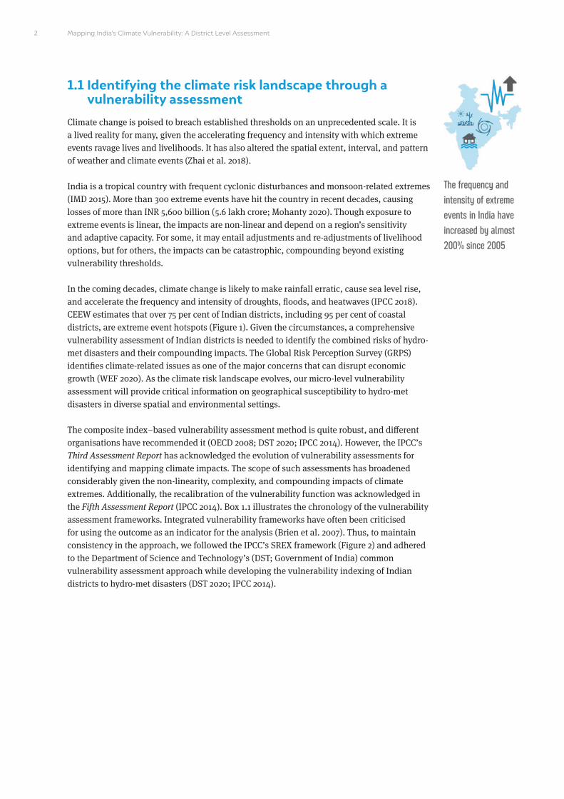
The frequency and intensity of extreme events in India have increased by almost 200% since 2005

3Understanding the vulnerability landscape of India in a changing climate scenario
Figure 1 More than 95 per cent of coastal Indian districts are extreme event hotspots
Source: Mohanty 2020
Figure 2 Illustration of the IPCC SREX framework for components risk and vulnerability
Source: IPCC 2014
Cyclone Drought Flood Cyclone and drought
Flood and cyclone
Flood and drought
Climate
Natural variability
Anthropogenic climate change
Socio-economic processes
Socio-economic pathways Adaptation & mitigation
activities
Governance
Risk
Hazard Exposure
Vulnerability
Emission & land use change
Impacts

Mapping India’s Climate Vulnerability: A District Level Assessment
‘Vulnerability’ is the extent to which climate change may damage or harm a system; it is a function of both sensitivity to climate and the ability to adapt to new conditions.
(IPCC: Special Assessment Report 1998)
• Vulnerability is the degree to which a system is susceptible to, and unable to cope with, the adverse effects of climate change, including climate variability and extremes.
• Vulnerability is a function of the character, magnitude, and rate of climate change and variation to which a system is exposed, the sensitivity and adaptive capacity of that system.
(IPCC: Fourth Assessment Report 2007)
• Vulnerability is the degree to which a system is susceptible to, or unable to cope with, adverse effects of climate change, including climate variability and extremes.
• Vulnerability is a function of the character, magnitude, and rate of climate change and the variation to which a system is exposed, its sensitivity, and its adaptive capacity.
(IPCC: Third Assessment Report 2001)
Vulnerability: The propensity or predisposition to be adversely affected.
(Special report of the IPCC 2012)
• Vulnerability: The propensity or predisposition to be adversely affected.
• Vulnerability encompasses a variety of concepts and elements including sensitivity or susceptibility to harm and lack of capacity to cope and adapt.
(IPCC: Fifth Assessment Report 2014)
BOX 1.1 Evolving definitions of vulnerability
The Pan American Health Organization coined the term ‘vulnerability’ in the early 1980s (WHO). The
Intergovernmental Panel on Climate Change (IPCC) first introduced the term in a Special Assessment Report (SAR)
titled The Regional Impacts of Climate Change: An Assessment of Vulnerability, March 1998. The special report
on vulnerability assessment provided critical information on the potential impacts of climate change for various
sources, including ecological systems, coastal infrastructure, water supply, food production, and human health. The
report acknowledged the extent to which natural ecosystems globally are vulnerable to climate change and form a
key concern for governments worldwide.
The Third Assessment Report (TAR) by the IPCC, published in 2001, built upon the SAR. For the first time it
described vulnerability as a function of exposure, sensitivity, and adaptive capacity. The report also stated that the
vulnerability of a system varies spatially and temporally (IPCC 2001).
The Fifth Assessment Report (AR5) released by the IPCC in 2014 illustrated the core concepts related to risk
assessment. According to the report, risk results from the interaction of climate-related hazards with the
vulnerability and exposure of human and natural systems (IPCC 2014).
1998
2004
2014
2001
2012
4

Types of vulnerability assessments
Physical or biophysical vulnerability assessment
Hazard
Exposure
Sensitivity
“Generic” determinants or factors of social vulnerability
Institutional vulnerabilities
Intensity
Scale
Biophysical
Socio-economic/ institutional
Frequency
Social or inherent vulnerability assessment
Socio-economic vulnerability assessment
Hazard-specific vulnerability assessment
Integrated vulnerability assessment
BOX 1.2 Types of vulnerability assessment frameworks
1. Physical or biophysical vulnerability assessment: “Biophysical vulnerability is concerned with the ultimate
impacts of a hazard event, and is often viewed in terms of the amount of damage experienced by a system as a
result of an encounter with a hazard” ( Jones and Boer 2003).
2. Social vulnerability assessment: “Social vulnerability refers to the characteristics of a person or group in terms
of their capacity to anticipate, cope with, resist and recover from the impact of a natural hazard” (Wisner et al.
2004).
3. Socio-economic vulnerability assessment: “Socio-economic vulnerability is the endogenous inability of the unit
to face shocks. This endogenous inability is a function of risk exposure and other socio-economic factors” (FAO
2003).
4. Hazard-specific vulnerability: “A hazard vulnerability assessment (HVA) is a systematic approach to identify all
possible hazards that may affect a specific population, assess the risk associated with each hazard (e.g., the
probability of hazard occurrence and the consequences for the population), and study the findings to develop a
prioritized comparison of hazard vulnerabilities” (Du et al. 2015).
5. Integrated vulnerability assessment: Integrated vulnerability assessment is based on biophysical, socio-
economic, institutional, and infrastructure-related vulnerability indicators (DST 2020).
5Understanding the vulnerability landscape of India in a changing climate scenario

Mapping India’s Climate Vulnerability: A District Level Assessment
1.2 Integrated vulnerability assessmentAs illustrated in Box 1.2, integrated vulnerability assessment (IVA) combines biophysical and socio-economic/institutional vulnerabilities. We performed an IVA to identify geographical vulnerabilities to hydro-met disasters at the district level. For more on the scope of the method, the selection of the vulnerability assessment framework, and the spatial extent of the indicators, please see Chapter 2.
As confirmed by the IPCC, IVA is one of the most widely accepted frameworks for conducting hazard-specific vulnerability assessments since it robustly captures anthropocentric stressors (Sharma 2019). Beyond the IPCC, different regions across the globe have used IVA to map, capture, and detail micro-level vulnerability as part of their national adaptation policies (IISD 2019). Pacific nations have acknowledged IVA as a key methodology for standardising hazard-specific vulnerability assessments based on the IPCC’s revamped vulnerability framework. Figure 3 enumerates the salient components of the IVA framework.
The main advantage of IVA is that it addresses two key needs for risk-informed adaptation planning: i) establishing a common point of reference through a baseline analysis that incorporates hazard-specific information and ii) creating a base for monitoring and evaluating adaptation outcomes. Further, it institutionalises an inclusive approach to resilient development by placing climate-related interventions in an evolving risk landscape concurrent with national, sub-national, and developmental priorities. It integrates both disaster risk reduction (DRR) and climate-change-linked vulnerability assessments (Gero 2011).
Figure 3 Salient components of Integrated vulnerability assessment framework
Source: GIZ & SPC (2016)
Exposure status quo
• Physical geography
• Demographic trends
• Development trends
• Climate threats/hazards
Assets a social unit has to adapt
• Natural assets
• Physical assets
• Financial assets
• Human asset
What a social unit does to adapt and reduce risk and how
• Institutional/ governmental structure
• Adaptive and risk reduction capacities of institutions (Governance Process)
Guides investment to adaptation measures
• Good governance
• Knowledge management
• Sustainable resource management
• Water and food security
• Disaster preparedness and management
• Health education
Guides investment to adaptation measures
• Access to safe housing
• Access to adequate and health foods
• Access to adequate household income
• Decreased loss of life, injury and property from disaster and other hazards
• Improved health knowledge and skills
Enhanced adaptive and risk reduction capacities of institutions
• Increased participation by women and youth in decision making
• Development of resilient development plans
• Implementation of resilient development plans
• Monitoring and learning from resilient development planning and implementation
• Increased collective action by local communities in resilient development projects.
66
General context Capacity & Sensitivity of Livelihood Assets
Adaptive & Risk Reduction Capacity of Institutions
Resilient development strategyResilient development outcome

The IPCC’s Fifth Assessment Report defines vulnerability as the “propensity or predisposition to be adversely affected, which includes ‘sensitivity or susceptibility to harm and lack of capacity to cope and adapt” (IPCC 2007). The United Nations International Strategy for Disaster Risk Reduction (UNISDR) specifies vulnerability as “characteristics and circumstances of a community, system, or asset that make it susceptible to the damaging effects of a hazard” (UNISDR 2011). Annexure-I (Table A2) illustrates the conceptual framework of vulnerability as defined by the IPCC and UNISDR.
The IVA framework provides broad information and inferences that can enhance countries’ adaptive capacity and enable them to build back better against climate shocks. They also integrate climate adaptation practices with disaster risk reduction (DRR) strategies, which can have multi-faceted benefits including the mitigation of climate-related losses and the enhancement of resource-use efficiency (Shamsuddoha et al. 2013a). Further, resilience pathways identified through IVA frameworks can be integrated with developmental planning, policy monitoring, and evaluation.
1.3 Research questions
Sectoral and national-level assessments have been attempted in India to develop a robust vulnerability index at various spatial scales and extents. However, to our knowledge, there have been no micro-level vulnerability assessments with respect to hydro-met disasters. The previous sections provide an overview of the conceptual framework of the vulnerability assessment and why developing a robust vulnerability assessment framework is of utmost importance for tackling climate change.
In this study, we use an integrated vulnerability assessment framework to derive, at a micro-level, a vulnerability indexing of Indian districts with respect to their exposure to hydro-met disasters and associated events. India does not have a hydro-met-disaster-focused vulnerability assessment to enhance climate actions at a sub-national level. This study attempts to bridge this gap by answering the following research questions.
How vulnerable are Indian districts to the non-linear patterns and frequency of climate extremes?
Robust micro-level vulnerability assessments are intrinsic to risk-informed decisions. India ranks seventh globally in terms of vulnerability to extreme events, making a robust vulnerability assessment of its districts the need of the hour. The DST has highlighted the importance of developing a common framework for vulnerability for building long-term resilience. Based on the common vulnerability framework proposed by the DST (2020), IPCC (2014), O’Brien (2007), and Kelly and Adger (2000), we used an endpoint/outcome approach by drawing upon a pentad decadal multi-hazard assessment inclusive of associated extreme events. While various states have developed vulnerability profiles, there has been no unified common approach, making the comparison of vulnerable districts in terms of varying patterns and frequency of climate extremes impossible. For example, two vulnerable districts exposed to cyclones might have different sensitivities and adaptive capacities to avert the extent of loss and damage. A unified common approach can help governments step up climate actions at the sub-national level by strengthening state action plans on climate change (SAPCCs) and localised district plans. Comparable unified indexing can also aid the mapping of the climate extremes landscape and hence support risk-informed decisions to climate-proof vulnerable regions.
The IPCC acknowledges that data on disasters and DRR is lacking atthe local level, constraining the enhancement of community resilience
7Understanding the vulnerability landscape of India in a changing climate scenario 7Understanding the vulnerability landscape of India in a changing climate scenario

Mapping India’s Climate Vulnerability: A District Level Assessment
How has the change in the pattern of extreme events increased India’s vulnerability, and how is their landscape changing?
Climate change is altering the pattern of extreme events and, as a result, changing the vulnerability landscape of India. For example, traditionally flood-prone areas are becoming drought-prone and vice versa, with some districts witnessing multiple extreme events in the same season or across different seasons. This multiplies the current state of vulnerability and further compounds impacts (Mohanty 2020). These varying patterns eventually increase exposure. Additionally, minimal or low adaptive capacity further increases the vulnerability of these districts.
How have changing landscape indicators contributed to the intensification of climate events across sub-regions?
Human action impacts landscape attributes (land use and land cover, soil moisture, groundwater, slope, and elevation, among others) by disrupting physical processes. This alters the frequency and intensity of extreme events. An analysis by CEEW found that the Indian subcontinent has witnessed more than 478 extreme events since 1970 and has experienced a spurt in their frequency after 2005 (Mohanty 2020). Various studies have confirmed that landscape attribute changes have substantially contributed to this spurt. Using a granular landscape sensitivity analysis, this study generates empirical evidence that shows how landscape attribute changes are linked to hydro-met disasters and how they contribute to intensification. This spatio-temporal sensitivity analysis can help improve localised landscape interventions to enhance regional resilience capacity. For example, various studies have suggested that natural ecosystems such as mangroves and wetlands act as shock absorbers against climate extremes. However, there is inadequate empirical evidence of the extent of loss of these ecosystems and how this has contributed to intensification trends. This study attempts to generate such information at a micro-scale with reference to hydro-met disasters.
8

2. Mapping India’s vulnerability: methodology
Image: Alamy
This chapter outlines the need to carry out an integrated vulnerability assessment (IVA) using a composite indexing approach. Our literature review suggests that IVA is the
most widely accepted approach for vulnerability indexing. The IVA framework considers the vulnerability of a system/geography holistically – i.e., it accounts for both biophysical and socio-economic/institutional vulnerabilities. It captures sector-specific exposure and sensitivity components, ensuring a comprehensive impact assessment. Exposure and sensitivity are mapped vis-à-vis adaptive capacity to derive a district-level vulnerability index. Further, this approach delivers, in a unified manner, critical information on why certain regions are more vulnerable than others at a micro-scale.
9

Mapping India’s Climate Vulnerability: A District Level Assessment
2.1 Introduction: a spatial index–based vulnerability assessment framework for managing climate extremes
Vulnerability assessment is a useful adaptation planning tool for mitigating climate risks (IPCC 2014). To mitigate the loss of lives and livelihoods, India should devise a climate risk strategy based on a robust vulnerability assessment. While India has conducted such assessments for specific sectors and geographies, there is still no unified framework for a micro-level assessment, making comparisons difficult. To address this gap, we assess the vulnerability of Indian districts to hydro-met disasters using a unified approach defined by the IPCC and by drawing lessons from the common approach proposed by the DST.
According to the Fourth Assessment Report of the IPCC, vulnerability is defined as “the propensity or predisposition to be adversely affected. It encompasses a variety of concepts and elements, including sensitivity or susceptibility to harm and lack of capacity to cope and adapt ” (IPCC 2021). The IPCC defines exposure as “the nature and degree to which a system is exposed to significant climatic variations” (IPCC 2001). Vulnerability and exposure are often mistaken to mean the same thing; however, exposure is an independent component and is not dependent upon vulnerability. Still, it is a vital determinant of the overall vulnerability function, as to be vulnerable to an extreme event, it is necessary to also be exposed (Municipal Emergency Management Plan (MEMP) 2013). Thus, creating a composite exposure index is crucial to conducting a robust, integrated vulnerability assessment.
Our research is the first of its kind to combine exposure, sensitivity, and adaptive capacity indicators to create district-level vulnerability scores using spatial, temporal, and socio-economic indicators. Further, it explores the differential importance of each vulnerability indicator in determining the total vulnerability score.
A spatial index–based vulnerability assessment will help mainstream climate actions by enabling a robust decision-making (RDM) approach (Lambert, Sharma, and Ryckman 2019). The RDM approach uses spatial and temporal tools to contextualise accepted concepts, processes, and tools to yield empirical, evidence-based decisions.
BOX 2.1 Learnings from the literature
Spatial vulnerability assessments are limited to the national level and are sector-specific. Several assessments
disregard differences in the spatial distribution of indicators at the district level as well as the influence of specific
indicators on overall vulnerability. Others are in effect sensitivity analyses, as they do not consider the collective
impacts of exposure, sensitivity, and adaptive capacity on vulnerability. These oversights result in incomplete/
non-precise vulnerability analyses. Various existing vulnerability studies are designed for, and rely on, national and
state-level data, making their outcomes too general for a micro-level assessment (Frazier, Thompson, and Dezzani
2014). Hence, a unified approach centred around composite indexing is imperative for developing a granular
understanding of the state of vulnerability.
Evaluating district-level vulnerability is crucial for developing a comprehensive hazard-specific climate risk
mitigation strategy. Methodologies for conducting national and sub-national vulnerability assessments have
evolved over time. In recent years, the analytical hierarchy process (AHP), the geographical information system
(GIS), and additional qualitative indicators have been used in assessments. Further, several studies rely on
stakeholder groups to classify hazards and impacts, but they are limited to sector-, region-, and state-specific
assessments. Many recent studies integrate all these approaches; they use GIS and qualitative/quantitative metrics
and high-level stakeholder participation to perform a robust empirical assessment.
A spatial index–based vulnerability assessment will help mainstream climate actions by enabling a robust decision-making approach
1010

Most dominant indices only capture certain social and physical factors of vulnerability, mostly at the national level
( Jones and Andrey 2007; Wood, Burton, and Cutter 2010). In India, census or household survey data are the primary
sources for spatially mapping social vulnerability in states. The literature confirms that including spatially explicit
indicators in vulnerability assessments helps stakeholders and policymakers identify drivers of vulnerability in
specific districts with reference to a specific hazard (Frazier, Thompson, and Dezzani 2014).
Figure 4 Hazard-specific vulnerability assessment
Source: UNISDR 2011
Climate
• Natural variability
• Anthropogenic changes
Development
• Population growth
• Industrialisation
• Land Planning
• Disaster risk management
Environment
• Ecosystem decline from anthropogenic pressure, investment in natural capital and protection
• Ecosystem services
Risk
Hydro-met Disasters
Exposure
Vulnerability
Vulnerability indices are critical in hazard mitigation planning as they provide concrete scores (Jones and Andrey 2007; Tate 2012; Wood, Burton, and Cutter 2010). Composite index–based vulnerability assessments deliver critical information on why certain regions are more vulnerable than others despite similar landscape attributes and climate zones. This is crucial as climate extremes have the potential to disrupt the thresholds of the Earth system (Lenton et al. 2008), and spatial-index based vulnerability assessments can be an effective tool to minimise the extent of loss and damage.
The combination of exposure and sensitivity define the potential impact (PI) that may occur given a projected change in a climate without considering adaptation (Locatelli et al. 2008). However, projected potential impacts are beyond the scope of this study.
2.2 Development of a composite index–based approach for vulnerability assessment
Our vulnerability assessment uses a multidimensional composite indexing approach. For uniformity, we adhered to the IPCC’s contextual vulnerability assessment framework. The independent indicators used to calculate exposure, sensitivity, and adaptive capacity were selected based on evidence gathered from the literature review and were further validated through stakeholder consultations. For example, frequency and intensity were the sub-indices used to calculate exposure indexing. A similar categorisation of independent indicators has been used by various studies (Chakraborty and Joshi 2016).
A robust vulnerability assessment is a multi-step and multi-approach exercise and requires the explicit selection of spatial and socio-economic indicators. Additionally, the scale and type of assessment are very crucial. Figure 5 illustrates the stepwise methodological approach followed for the study.
Article 8 of the Paris Agreement states that “Parties recognize the importance of averting, minimizing and addressing loss and damage associated with the adverse effects of climate change, including extreme weather events and slow onset events” (Paris Agreement 2015)
11Mapping India’s vulnerability: methodological approach 11Mapping India’s vulnerability: methodological approach

Mapping India’s Climate Vulnerability: A District Level Assessment
Figure 5 Detailed schematic representation of the approach and methodology (IVA)
Source: Authors’ analysis
2.2.1 Selection of spatial and socio-economic indicators
Various studies, including the IPCC’s Fifth Assessment Report, stress that the selection of indicators is an important aspect of vulnerability assessment. Further, the robustness of response and mitigation strategies is directly proportional to the selection of indicators that enable decision makers to map, plan, and adapt to critical vulnerabilities (Rao et al. 2016). An indicator-based approach is also ideal for capturing the residual impacts4 of climate change, such as the number of work hours or school days lost to extreme climate events.
Vulnerability = f (Exposure x Sensitivity)/Adaptive Capacity
Finalisation vulnerability assessment
Spatial index–based vulnerability assessment framework
Selection of indicators and data extraction
Normalisation of scores using the percentile and linear scale approaches
(Values lie between 0 and 1)
Prioritisation of sensitivity indicators using AHP
Extraction of mean value using zonal statistics
Composite vulnerability indexing
District-wise and state-wise ranking based on composite indexing
Spatial mapping on GIS desktop environment
Sensitivity indexingAdaptive capacity
indexingExposure indexing
Pentad decadal analysis
DDMP evaluation and scoring for all seven
indicators
4. According to the IPCC, vulnerability tends to capture the residual impacts of climate change.
12

Figure 6 Snapshot of CEEW consultation workshops
Source: CEEW
5. The Delphi technique provides a flexible and adaptable tool to gather and analyse the required data to those involved or interested in engaging in research, evaluation, fact-finding, issue exploration, or discovering what is actually known or not known about a specific topic.
13Mapping India’s vulnerability: methodological approach
The stakeholder consultation was conducted with the aim of shortlisting sensitivity and adaptive capacity indicators through the Delphi technique5. This technique enables participatory engagement to finalise a list of indicators (Adams 2001). In our study, each of the indicators chosen has a functional relationship with the component as well as the overall vulnerability of a district. Both biophysical and social indicators were taken into consideration. The exposure indicators we considered are the frequency and intensity of extremes; the sensitivity indicators consider landscape attributes; and the adaptive capacity indicators include the socio-economic and evaluation of DDMPs. Table 1 enumerates the details of the selected indicators.
In our study, the top-down approach involved a granular spatio-temporal vulnerability analysis, and the bottom-up approach involved a wider stakeholder consultation with experts, practitioners, and representatives from civil society organisations (CSOs). We selected a comprehensive list of indicators, which we further shortlisted through stakeholder consultations based on the availability of data sources (Figure 8). It must be emphasised that selecting indicators was one of the most crucial steps in the study, as the outcome depends to a large extent on the indicators selected for spatio-temporal analysis. The indicators shortlisted for the assessment are illustrated in Table 3.

Mapping India’s Climate Vulnerability: A District Level Assessment
Table 1 Component-based shortlisted indicators for the vulnerability assessment
Source: Authors’ compilation
Exposure
Sensitivity
Adaptive capacity
Frequency and intensity of extreme events and their associated events
1. Land use and land cover
2. Elevation
3. Slope
4. Ground water
5. Soil moisture
1. District disaster management plans
2. Gross district domestic product
3. Literacy rate
4. Sex ratio
5. Availability and accessibility to critical infrastructure
6. Availability of disaster-ready shelters
7. Population density
Extreme events catalogue developed by CEEW (Mohanty 2020)
1. Bhuvan-Indian Space Research Organisation (ISRO)
2. United States Geological Survey (USGS)
3. USGS
4. Water Resources Information System (WRIS)
5. National Aeronautics and Space Administration (NASA)
Census, 2011| Ministry of Statistics and Program Implementation | Government of India (MoSPI)|Ministry of Agriculture (MoA) and Farmers Welfare|Press Information Bureau (PIB)
Component Selected indicators Sources
BOX 2.2 The rationale for the selection of indicators
1. Exposure indicators
Exposure in this study is referred to as the exposure of districts to extreme events. In recent decades, machine-
learning (ML) simulations and artificial-intelligence (AI) interfaced ML models have provided robust climate
variability and hazard assessments for both the mid-term (2050) and long-term (2100) (IPCC 2018). However, these
climatological and meteorological analyses do not provide any information on vulnerability in the short term. They
do not account for historical events, and thereby lack hazard sensitivity indexing, which can provide granular data
on extreme events’ frequency and intensity. The exposure indicators considered for the study are the frequency
and intensity of hydro-met disasters and their associated events. Table 4 illustrates the categories of hydro-met
disasters considered. It is to be noted that based on EM-Dat6 criteria, the categorisation of extreme events has
been considered to maintain uniformity for the indexing. An extreme events catalogue for a period of (1970-2019)
50 years developed by CEEW was used to identify extreme events district hotspots.
2. Sensitivity indicators
Sensitivity to extreme events is intrinsically linked to changes in landscape indicators. The use of landscape-
based indicator analysis for mapping sensitivity to hydro-met disasters is widely accepted (Ladányi et al. 2015;
Wu et al. 2021). The landscape indicators considered for the study are i) land-use-land-cover (LULC), ii) elevation,
iii) soil moisture, iv) ground-water, and v) slope. At the same time, the correlation of these indicators to hydro-
6. At a global level, the Emergency Events Database (EM-DAT), developed by the Centre for Research on the Epidemiology of Diseases (CRED), Brussels, with support from the World Health Organization (WHO), has country-specific data sets on various major natural, climatic, technological, and biological events (EM-DAT 2015).
14

met disasters has a different degree of proportionality. A popular strategy for mapping sensitivity to hydro-met
disasters is to identify the landscape indicators that have a high degree of proportionality to the impact (Gogoi
et.al 2019). In our study, the degree of proportionality was determined using AHP, which is described in Section
2.2.3.2 of this chapter. Changes in LULC attributes lead to high sensitivity and low resilient capacity. LULC is the
most important of all the landscape indicators, and any change in it is directly proportional to the degree of impact
of a hydro-met disaster. It has a higher degree of correlation for cyclones, followed by flood and drought. Elevation
and slope are associated directly with other topographical attributes like soil moisture, groundwater, and LULC. But
they significantly impact flood and drought sensitivity, and, as a result, a region’s overall sensitivity. Groundwater
and soil moisture are directly correlated with drought and flood sensitivity (Upton and Jackson 2011).
3. Adaptive capacity indicators
The adaptive capacity of a region is broadly dependent on its socio-economic factors. In order to account for the
range of the climate-risk-linked socio-economic indicators, we adopted the following adaptive capacity indicators:
i) GDDP, ii) literacy rate, iii) sex ratio, iv) critical infrastructures (accessibility and availability), v) disaster shelters
(access), vi) population density, and vii) effectiveness of district level disaster management plans7 (DDMPs, which
we evaluate to map their contribution to the adaptive capacity of a particular region/district). These indicators are
directly correlated with adaptive capacity, except for population density and DDMPs. Higher literacy translates to
greater awareness and hence better preparedness, while an increase in GDDP indicates that a district has greater
resources to withstand economic shocks caused by climate risks. Gender is a key determinant of vulnerability to
hydro-met disasters, and so, we include each district’s sex ratio to capture its impact on their adaptive capacity.
National Disaster Management Authority (NDMA) guidelines require every district in India to have an annually
updated DDMP, whose implementation is managed by the district disaster management authority (DDMA). To
better understand the adaptive capacity scenario, we carried out a comprehensive analysis of all available DDMPs.
A total of eight variables and 34 indicators were finalised as per the Sendai Framework for Disaster Risk Reduction
(SFDRR) and NDMA guidelines for evaluating DDMPs. DDMPs are integral to hyper-local preparedness to avert loss
and damage from disasters. Table 6 details the adaptive capacity correlation.
7. To understand the status and dynamism of the DDMPs, a comprehensive evaluation of the DDMPs was carried out to integrate them into the larger adaptive capacity analysis.
8. For a disaster to be entered in the EM-DAT, it must fulfil at least one of the following criteria: i) 10 or more people reported killed; ii) 100 or more people reported affected; iii) declaration of a state of emergency; and iv) call for international assistance.
15Mapping India’s vulnerability: methodological approach
2.2.2 Mapping the exposure index
We conceptualise exposure as the occurrence of a particular event in a particular grid characterised by a district boundary. This is primarily done to identify districts that are extreme event hotspots. CEEW has carried out a first-of-its-kind district-level profiling of India’s extreme climate events, including cyclones, floods, and droughts and their associated events through a pentad decadal analysis (Mohanty, 2020). Table 4 shows the categorisation of hydro-met disasters and their associated events used in the analysis. We followed the classification of extreme events provided by EM-DAT8, IMD, and WMO. The district-level assessment was carried out through spatial and temporal modelling that accounts for complexities and non-linear trends and patterns. The assessment examined the frequency and intensity of hydro-met disasters as well as the pattern of associated events and how the impacts have compounded on a temporal scale of 50 years (1970–2019). Further, it analysed shifts in trends in climate events across sub-regions.

Mapping India’s Climate Vulnerability: A District Level Assessment
We draw from the pentad decadal analysis to develop an extreme climate events catalogue for a historical time scale of 50 years (1970–2019) for the exposure indexing. The outcome was a robust gridded datasheet that captured exposure to extreme hydro-met disasters based on frequency and intensity. Data on the frequency of extreme events by decade for each district between 1970–2019 were collated to obtain pentad frequency scores. We used the percentile approach to normalise the aggregated values. Since our study focuses on extreme hydro-met events, percentile-based indices present a more detailed statistical approach to derive at relative exposure index at a micro level. This method is widely used in climatological studies due to its simplicity, flexibility, and ability to assess changes in extreme events in a particular area (Schär et al. 2016; DST 2020; IHCAP 2018). The percentile-based methodology of data normalisation is commonly used for frequency-based indicators to measure the frequency of extreme event thresholds9. Figure 7 provides a brief overview of the methodological approach used to derive the baseline exposure10 of hotspot districts. Steps 1 and 2 were adopted from the above study, and Step 3 was carried out to derive the district-level exposure index.
Table 2 Classification of extreme events considered in the study
Source: Mohanty 2020
Primary disaster subtype
Associated event(s)
Riverine floods, coastal floods, flash floods, and compounded floods
Extreme rainfall, landslides, hailstorms, cloud bursts, and thunderstorms
Heavy rainfall, floods, hailstorms, cold waves, and tornadoes
NA
Meteorological drought and hydrological and agricultural drought
Storm surges and convective storms
Event type Floods Droughts Cyclones
9. The thresholds refer to the decadal frequency and intensity of the extreme hydro-met events in a particular district.
10. A more detailed methodological approach for the micro-level hazard assessment is available in (Mohanty 2020).
Figure 7 Approach and methodology for exposure assessment
Source: Authors’ analysis
Development of gridded exposure sheet
Geospatial analysis of extreme climate events using coarse-grain resolution temporal maps
Development of exposure indexing
16

The non-consideration of the frequency and intensity of extreme events for developing the exposure index of geographies has been a limitation of previous studies. Our assessment used a spatio-temporal analysis to overcome this gap in line with the recommendations of the IPCC (IPCC 2017). This method is robust and flexible due to the incorporation of a range of indices and values to establish extreme event thresholds. Our methodological approach uses this method to maintain a uniformity that considerably addresses the gaps of a granular hazard assessment.
2.2.3 Mapping the sensitivity index
The first step of any vulnerability assessment is a comprehensive assessment of hazard-linked sensitivity (IPCC 2018). Our sensitivity analysis focuses on providing vital information on landscape-based drivers of hydro-met extremes and how changes in landscape attributes have triggered the intensification of these extremes. The IPCC states that the accuracy of any climate extremes assessment depends on both the quality and quantity of spatial data (IPCC 2018). Further, climatological and meteorological inferences at a coarse-grain resolution can be mapped more effectively through gridded data sheets (GAR 2017). Thus, our methodological approach for deriving the sensitivity index is based on these broad steps:
i) Development of gridded spatial layers: Gridded spatial layers of the indicators form the base for any geo-spatial analysis. First, we developed gridded spatial layers for various landscape indicators (elevation, slope, LULC, groundwater, and soil moisture) from coarse-grain base-level maps at 25 km × 25 km resolution. These base-level maps were spatially analysed using a downscaling approach to derive grid-level attribution data for each indicator at a 30 m × 30 m resolution. The downscaling approach used Q-GIS to re-grid and clip sensitivity spatial layers that could easily be superimposed on exposure gridded sheets that identify the frequency and intensity of primary events (cyclone, flood, and droughts) and their associated events. We performed the grid-based analysis at the district level for all indicators. Since base-level maps from various sources were used for the analysis, there were often outliers. Hence, the data had to be normalised for all landscape indicators, creating a unified raster with respect to their correlations with hydro-met disasters. These correlations were finalised based on a literature review.
17Mapping India’s vulnerability: methodological approach
Figure 8 Approach and methodology for mapping the sensitivity index
Source: Authors’ analysis
Development of gridded spatial layers
Geo-spatial analysis for sensitivity indexing

Mapping India’s Climate Vulnerability: A District Level Assessment
Further, we prioritised the indicators using the AHP model. The AHP model was run on the re-classified raster data with feed-in information on the assigned indicator weightage. The assigned indicator weightage was based on Saaty’s scale (Coyle 2004) and used to establish correlation. This enabled us to rank indicators on a scale of 1–5 for our analysis with respect to their correlation with hydro-met disasters. We describe the steps in detail in Section 2.2.3.1. Since the AHP uses comparative analysis to rank the indicators, we obtained a pairwise matrix (5 × 5) based on the comparison, as illustrated in Table 3.
Finally, since we ranked the indicators on a scale of 1–5 with respect to each event, we validated the results by computing the consistency ratio (CR), as per standard practice. A CR <0.1 indicates a valid AHP ranking (Section 2.2.3.2, equation 1 details the CR calculation). In this way, the gridded spatial layers are developed for further use for geo-spatial analysis and to derive a sensitivity index. We describe the detailed methodological approach in Section 2.2.3.2.
ii) Geo-spatial analysis for sensitivity indexing: The gridded spatial layers for each indicator developed in the previous step form the base for the spatial analysis. To acquire zonal statistics, we modelled the gridded spatial layers on a Q-GIS desktop environment. Zonal statistics help derive the mean pixel value for each indicator in a particular district with respect to a particular hydro-met disaster. We derived the landscape change index by calculating the pixel value across each grid ‘at temporal intervals of 2005–2019’. This enabled us to calculate the indicator-specific weighted values fed into the sensitivity equation (Equation 2). We derived the sensitivity score for each district with respect to particular hydro-met disasters. These scores were further normalised using the linear scale method to obtain the sensitivity index. We describe this methodological step in Section 2.3.2.2.
2.2.3.1 Development of gridded spatial layers
Changes in LULC have been demonstrated to have significant effects on both micro and macro climates as they significantly contribute to land surface temperature and rainfall anomalies (Gogoi et al. 2019). However, very few studies have empirically established such a link in the Indian context. Further, a popular approach for mapping sensitivity to hydro-met disasters is to identify the components that cause the event and then build a sensitivity index. Various studies across small island developing states (SIDS) in the Pacific Islands have followed this approach (SPC, SPREP, and GIZ 2019), but a combined analysis of hydro-met disasters in India has not been done. Our study intends to fill this gap.
Table 3 Pairwise comparison matrix for flood
Source: Authors’ analysis
Elevation
Slope
LULC
Soil moisture
Groundwater
Consistency ratio: 0.06
1.00
0.50
0.33
0.14
0.14
2.00
1.00
0.50
0.14
0.14
3.00
2.00
1.00
0.20
0.20
7.00
7.00
5.00
1.00
0.33
7.00
7.00
5.00
3.00
1.00
Elevation Slope LULC Soil moisture Groundwater
18

In this context, developing gridded spatial layers is the first step in any climatological sensitivity analysis (WMO 2018). In recent years, GIS has been widely used in sensitivity analyses as it is an integrated platform that combines an information database and analytical tools that support vulnerability and risk assessment research and decision-making (Sanyal and Lu 2006; Dewan, Kumamoto, and Nishigaki 2007; Rahmati, Pourghasemi, and Zeinivand 2016; Qi et al. 2009; Khosravi et al. 2016; Tehrany et al. 2017). Thus, we used coarse-grain temporal maps from various observatory sources to develop spatial layers of landscape attributes; we prepared gridded landscape attributes sheets at a 25 km × 25 km resolution using a GIS environment (Q-GIS 3.10 version). This further helped integrate multi-criteria decision-mapping methods like AHP and zonal statistics for robust assessments (Chakraborty and Joshi 2016). We performed a rigorous geospatial analysis of the gridded attribution layers based on selected landscape attributes at intervals of 2005 and 2019 to map the spatial and temporal changes.
Changes in LULC and their implications, and the correlation of the sensitivity of districts to hydro-met extremes have been illustrated in Chapter 3. Changes in the gridded landscape spatial layers have been shown in Annexure 1. We further normalised the gridded spatial layers using the indicator-functional correlation with respect to hydro-met disasters. This methodological approach helps develop unified raster grids (Sathyan et al. 2018). We then re-classified the indicators to unified individual raster grids for spatial analysis at a 30 m × 30 m resolution using the Q-GIS 3.18 desktop environment. Figure 9, in the next page, illustrates a gridded spatial layer for drought sensitivity analysis.
Climate change is a global phenomenon with varied impacts on regional climate zones. Further, landscape attributes have a significant impact on micro-climate zone swapping (Mohanty 2020). The main objective of the gridded spatial data sheet is to provide a unified district-level mapping of the sensitivity of landscape indicators to hydro-met extremes across different temporal scales. These gridded spatial layers were developed using a downscaling approach. We used re-classified, coarse-grain resolution spatial data to derive the sensitivity indexing, which we will discuss in the next section. Coarse-grain resolution is crucial for micro-level assessments, especially composite vulnerability and risk assessments (GAR 2019). These spatial layers can be used to carry out sectoral and regional hazard and vulnerability assessments. They can provide hyperlocal insights to support risk-informed policy decisions at the national, sub-national and regional levels. We intend to develop robust gridded spatial landscape layers for future risk assessments.
Data sources
We procured coarse-grain resolution maps for landscape indicators from various sources. The land-land cover maps were procured from ISRO’s National Remote Sensing Centre (NRSC), elevation and slope maps were procured from the United States Geological Survey (USGS), groundwater from
the Water Resource Information System (WRIS), and soil moisture from NASA Giovanni at 25 km resolution. The slope and elevation map of India was extracted from the Shuttle Radar Topography Mission (SRTM) digital elevation model (DEM) with a resolution of 30 m using the GDAL DEM utility in Q-GIS. The above temporal scale maps at 2005 and 2019 were used for geo-spatial sensitivity analysis.
19Mapping India’s vulnerability: methodological approach

Mapping India’s Climate Vulnerability: A District Level Assessment
Figure 9 Gridded exposure spatial layer for drought sensitivity analysis
Source: Authors’ analysis
2.2.3.2 Development of the sensitivity index
In the IPCC’s Sixth Assessment Report (AR-6), the panel’s Working Group I (WGI) outlines the human-induced climate change (IPCC 2021). One of these is the changes that have occurred in landscape attributes and the manner in which they have adversely impacted he intensification of climate extremes. Sensitivity mapping enables the robust mapping of landscape attribute changes. Sensitivity is an important variable not only for assessing the magnitude of an extreme event’s impact but also for projecting future vulnerability to facilitate effective climate resilience strategies based on the geographical, social, cultural, financial, and political atmosphere (Bocard et al. 2018). This spatial landscape variability assessment helps derive a micro-level sensitivity index with specificity to primary and compounded events. We analysed the compounding impacts through the weighted average of attributes in the gridded layers. After developing the layers, we normalised the indicators and assigned weightage to identify the compounded impacts. This helped us estimate the degree of sensitivity across Indian districts.
20

Several studies have been conducted to evaluate flood, drought, and cyclone vulnerability and risk in different parts of the world (Hu et al. 2017). Various tools and methodologies have been used to identify risk and delineate it into maps; these include multiple criteria analysis (Hazarika et al. 2018; Sharma 2018), frequency ratio, cluster analysis, principal component analysis (PCA), varied statistical models (Fernandez et al. 2016a; Khosravi et al. 2016; Mollah 2016; Rahmati et al. 2016a), AHP (Hu et al. 2017), and indicator-based indexing (Balica et al. 2009; Balica 2012a, b; Balica et al. 2012). In the GIS environment, a multitude of modelling methodologies are possible (Sanyal and Lu 2006; Tehrany et al. 2013, 2014), and we adopted the outlined multi-step process to derive a micro-level sensitivity analysis.
The most commonly adopted methods for assigning weights and establishing correlations are AHP and PCA (Hu et al. 2017). Among them, AHP is extensively used for IVA, especially for spatial sensitivity evaluations (Sinha et al. 2008; Fernandez and Lutz 2010; Kazakis et al. 2015; Elkhrachy 2015; Rahmati et al. 2016b; Hu et al. 2017; Ghosh & Kar 2018). In our study, we used AHP to derive component-wise sensitivity scores for each of the primary hydro-met disasters and also used these criteria to derive compounding scenarios (flood–drought, drought–cyclone, cyclone–flood, and combined cyclone-flood-drought). Box 3 provides a brief comparison of AHP and PCA. This form of multi-criteria decision modelling (MCDM) is becoming increasingly popular for solving complicated problems and assessing risk because of its clear and strong practical applicability and its accurate representation of hydro-met extremes and their impact on systems (Hu et al. 2017). AHP is structured into a multi-level hierarchy containing objectives, criteria (indicators), sub-criteria (sub-indicators), and alternatives when there is no clear best choice (Ishizaka and Labib 2011). For weighing several criteria, it uses a pairwise comparison matrix that considers two indices together at a time; here, five of the landscape attributes were paired against each set of primary events. Further, every criterion is assigned its own ranking, with a higher weight indicating that a criterion/indicator is more critical to the overall decision. Additionally, the consistency ratio is calculated to check the validity of the criteria provided during the formulation of the pairwise comparison matrix.
21Mapping India’s vulnerability: methodological approach
A spatial landscape variability assessment helps derive a micro-level sensitivity index for primary and compounded extreme events
Table 4 Comparison between AHP and PCA
Source: Authors’ compilation
AHP is a decision-making method based on qualitative and quantitative analyses of multi-attribute decision analysis methods for smoothly managing problems, criteria, and alternatives. This study uses multiple criteria decision-making (MCDM) methods to find the appropriate pair of weights. AHP is used extensively because of its simplicity, ease of use, and great flexibility. It is used widely to make objective pairwise judgments to obtain the overall priorities for the attributes (Hoque 2019). AHP is most widely used for its consistency and demarcation of outliers.
This statistical method is used to assess problems with multiple variables. The main aim of applying PCA is to deal with data with high dimensionality. However, PCA faces the limitation of merely using the data distribution without considering domain-related knowledge (Vignesh et al. 2020). This is why integrated vulnerability assessments do not necessarily use a set of indicators that are not intrinsic to vulnerability assessment.
Analytical Hierarchy Process (AHP) Principal Component Analysis (PCA)

Mapping India’s Climate Vulnerability: A District Level Assessment
The normalisation process varies depending on the nature of the relationship of a particular indicator with the vulnerability components (direct or indirect relationship) (IHCAP 2018). Figure 10 illustrates the correlation of landscape indicators with hydro-met disasters. Pairwise comparisons are made for each extreme event – floods, cyclones, and droughts – using a 5 × 5 matrix. Table 5 also illustrates the AHP ranking for cyclones, floods, and droughts.
The comparative ranking is with respect to the landscape indicators (e.g., elevation and slope), which have a higher influence on flood occurrence than the other factors but a lower influence in the case of cyclones and droughts. LULC is significantly more important than groundwater level in case of a flood. Conversely, soil moisture and groundwater are considered more important than elevation, slope, and LULC in case of drought (Table 5). Further, LULC is pivotal for cyclone sensitivity mapping. The pairwise comparison matrix for sensitivity towards each hydro-met disaster helps prioritise attributes. We used the AHP-based weight assignment technique to assign differential weights to indicators to get reliable results. We assigned weights to each indicator according to their significance in determining the overall sensitivity of a system (Song and Kang 2016). Based on these weights, we assigned each indicator a priority rank from 1 to 5 for each extreme event based on the Saaty Rating Scale 9 (Coyle 2004). This was a precursor to sensitivity index scoring. Further, we calculated the consistency ratio11 to check the reliability of the AHP ranks. The combination of AHP with GIS produces accurate environmental assessments in context involving a wide range of geophysical and socio-economic elements (Shukla et al. 2017; Nghiem 2017). Our analysis also considered the median category, i.e., the most recurring type of landform in the area. We derived the values using zonal statistics in the GIS desktop environment.
Figure 10 Correlation of landscape indicators with respect to hydro-met disasters
Source: Authors’ analysis
LULC
Direct correlation
Indirect correlation
Elevation
Flood Cyclone Drought
Slope Soil moisture Groundwater
22

Source: Authors’ analysis
Finally, we calculated the consistency ratio (CR)11 to validate the AHP model. The results are flood CR = 0.05; cyclone CR = 0.02; and drought CR = 0.06. Since the CR value is less than 0.1, the consistency of the weight is in the acceptable range. Equation 1 calculates the CR.
Table 5 AHP prioritisation ranking for floods, cyclones, and droughts
Equation 1 Consistency ratio equation
Indicators
Where, n = number of factors and λ: average value of the consistency vector
Consistency Ratio =
Indicators IndicatorsPriority Priority PriorityRank Rank Rank
AHP prioritisation for floods AHP prioritisation for cyclones AHP prioritisation for droughts
Elevation
Slope
LULC
Soil moisture
Groundwater
LULC
Elevation
Slope
Soil moisture
Groundwater
Soil moisture
Groundwater
LULC
Slope
Elevation
42.60%
29.50%
18.20%
5.90%
3.70%
46.40%
19.30%
19.30%
8.50%
6.40%
34.60%
29.30%
18.60%
9.90%
7.60%
1
2
3
4
5
1
2
2
4
5
1
2
3
4
5
11. Consistency ratio (CR) to measure how consistent the judgements have been relative to large samples of purely random judgements. If the CR is substantially in excess of 0.1, the judgements are untrustworthy because they are too close for comfort to randomness, and the exercise is deemed valueless or must be repeated.
12. The zonal statistics tools allow us to calculate statistics on values of a raster within zones defined by another dataset (vector or raster). The zonal statistics function calculates the values of cells based on groups of cells, or zones, in another dataset. Zonal statistics are output as tables. The mean zonal statistic table is used to assign the average of the values in each zone to all output cells in that zone.
23Mapping India’s vulnerability: methodological approach
Consistency Index
Random Inconsistency Index
CI = n – 1λ -n
Since the CR is in the reliable range, the next step was to derive a sensitivity index of hotspot districts for primary extreme events and associated events. Before calculating the sensitivity index, we conducted a zonal statistical operation12 in a GIS environment to derive the mean pixel values (individual grid values) for indicators and their attributes across all districts. The mean pixel value is important for deriving the sensitivity index for each hydro-met extreme across hotspot districts. Equation 2 illustrates the sensitivity equation. The weighted pixel score of attributes derived through zonal statistics is pivotal for carrying out the geo-spatial sensitivity analysis.
We normalised the resultant sensitivity score. The obtained sensitivity index is represented in the form of maps in Chapter 3. It lies between one and seven, where one indicates the least sensitivity to an extreme event, and seven indicates the most sensitivity. The sensitivity index captures the degree of impact on a system in case of an event. Annexure-I (Figure A1) enumerates the geo-spatial temporal analysis of landscape indicators.

Mapping India’s Climate Vulnerability: A District Level Assessment
Equation 2 Sensitivity Index
Sensitivity Index = (WELV × Elevation + WSL × Slope + WLULC × Land use Land cover + WSM ×
Soil Moisture + WGW × Groundwater)
Where,
WELV = Assigned weightage for elevation;
WSL = Assigned weightage for slope;
WLULC = Assigned weightage for land use land cover;
WSM = Assigned weightage for soil moisture and
WGW = Assigned weightage for groundwater
2.2.4 Development of an adaptive capacity index
We developed a quantitative indicator–based adaptive capacity index13 for our analysis. We finalised adaptive capacity indicators based on an extensive literature survey. Indicators and sub-indicators were prioritised through a stakeholder consultation, and a total of seven indicators were finalised. We used the Delphi technique to finalise the indicators and their sub-indicators and the range for adaptive capacity scoring. We finalised the following ranges: 0–0.2 = very low; 0.21–0.4 = low; 0.41–0.6 = medium; 0.61–0.8 = high; 0.81–1.00 = very high. These indicators were based on their correlation to adaptive capacity, which includes economic, social, infrastructural, and governance aspects; these are integral to the adaptive capacity of a region. The adaptive capacity indicators are illustrated in Figure 11. To derive a robust assessment, we have included assessments of the DDMPs based on the NDMA guidelines (NDMA 2015).
Figure 11 Adaptive capacity indicators considered in the study
Source: Author’s compilation
13. In the context of DRR and disaster management (DM), adaptive capacity is the ability to cope with change in a changing environment (IPCC 2014).
24
Shelters
Sex ratio
Population density
Status of DDMPs
Critical infrastructure
Gross Domestic Product (GDP)
Literacy rate
Capacity building
Adaptive Capacity

Table 6 Correlation of adaptive capacity indicators
Source: Authors’ compilation
Status of DDMPs
Population density
Literacy rate
Gross District Domestic Product (GDDP)
Availability and access to critical infrastructure
Availability and accessibility to shelters
Sex ratio
Every district in India is required to have a DDMP as per NDMA guidelines. Further, these DDMPs should be updated annually. They provide a detailed overview of the state of the district’s disaster preparedness and often describe an institutional mechanism for building back better and developing strategies for effective preparedness. We consider an updated and effective DDMP to be positively correlated with adaptive capacity.
Population is a key demographic characteristic. A densely populated geography has a higher exposure and lower adaptive capacity. Hence, population density is negatively correlated.
A high literacy rate drives higher adaptive capacity because of better risk management knowledge and disaster preparedness (Hoffman et al. 2020). The literacy rate is thus positively correlated.
Economic development leads to higher adaptive capacity since communities become less vulnerable. Regions with a higher GDDP per capita are better able to deal with the consequences of climate change; hence, it is hence positively correlated with adaptive capacity.
Critical infrastructure protects communities from a variety of hazards and enables essential services to operate without disruption (World Risk Report 2016). We have considered educational and medical institutions as they are major disaster-risk-reduction infrastructure, followed by all-weather roads and other critical infrastructure as stated in the DDMPs. This indicator is positively correlated.
Shelters provide basic evacuation support during extreme events. This indicator is highly crucial for flood and cyclone adaptive capacity assessments, and we have considered cyclone and flood rescue shelters enumerated in the DDMPs as part of the evaluation.
Gender is a key determinant of vulnerability to climate change, and women often bear the brunt of climate extremes (UNDP 2012). Marginalised women are the most affected, and the indicator hence has a negative correlation with adaptive capacity.
Indicators Correlation with adaptive capacity
25Mapping India’s vulnerability: methodological approach
To map the adaptive capacity index of Indian districts, we used Census of India (2011) data. For all six indicators except DDMPs, this was the primary source of data. As mentioned in Table 6, the selected indicators cover economic, social, infrastructural, and governance aspects that directly or indirectly affect a district’s adaptive capacity. As mentioned earlier in Section 2.1.1, we adopted the Delphi method based on expert stakeholder consultations to allocate appropriate and accurate scores (between 0 and 1) to each indicator and their corresponding attributes for the adaptive capacity indicator. Learnings from the literature suggest that this methodological approach is widely adopted. We assigned equal weightage to all indicators to maintain uniformity with DST (2019) and Indian Himalayas Climate Adaptation Programme (IHCAP; 2018) guidelines. Further, we normalised weighted scores to obtain mean values for the indexing of a particular district’s overall adaptive capacity. Additionally, we carried out the normalisation of weighted scores based on the indicators’ functional correlation (IISD 2009). We considered various sub-indicators to check the status of DDMPs (Figure 12).

Mapping India’s Climate Vulnerability: A District Level Assessment
This evaluation of DDMPs is a first-of-its-kind attempt to identify disaster preparedness gaps at an institutional level. The DDMPs provide the first line of response mechanisms. Hence, their evaluation reveals the robustness of financial and institutional support available for de-risking at a hyperlocal level.
2.2.5 Development of a vulnerability index of extreme event hotspot districts
As explained in previous sections, we adopted an IVA framework based on composite indicators to derive the vulnerability index of Indian districts. We combined the relative indices of exposure, sensitivity, and adaptive capacity to calculate the cumulative composite vulnerability index and categorise the most and least vulnerable regions in India among the hotspot districts. We carried out this indexing using spatio-temporal analysis. Further, we also created gridded spatial layers for each of the components to help carry out micro-level assessments for sectors and specific elements at risk, and devise targeted actions. We used the vulnerability equation to derive the vulnerability index.
Figure 12 Sub-indicators considered for evaluating DDMPs
Source: Authors’ compilation
26
Availability of DDMP
Response and relief measures
Reconstruction, rehabilitation and recovery measures
Prevention and mitigation
Disaster preparedness
Institutional arrangements
Year of updation of DDMPs
Status of
DDMPs

Equation 2 Vulnerability function
Vulnerability is a complex and multidimensional component of climate risk assessment. Composite indicator–based indexing is one of the most common and widely adopted methodologies for quantifying the multidimensional components of integrated vulnerability assessment (Kelly & Adger 2000; Moss et al. 2001; IPCC 2001; Luers et al. 2003; Turner et al. 2003). Therefore, to conduct an exhaustive integrated vulnerability assessment of India, we adopted a composite index–based approach. This approach requires the selection of indicators explicitly relevant to the disaster/hazard under consideration (Chakraborty and Joshi 2016). Composite indexing for an IVA typically involves three components of vulnerability: i) exposure, ii) sensitivity, and iii) adaptive capacity. The indicators considered for each of the components are i) exposure (frequency and intensity of extreme hydro-met disasters: floods, droughts, cyclones, and their associated events, as well as compounding impacts i.e., flood & drought, flood & cyclone, drought & cyclone, and flood, drought & cyclone events); ii) sensitivity (landscape-based indicators: LULC, elevation, slope, groundwater, and soil moisture); and iii) adaptive capacity (population density, sex ratio, literacy rate, availability and accessibility of critical infrastructure, availability and accessibility to shelters, GDDP at constant rate, and effectiveness of DDMPs).
To create a composite vulnerability index, we normalised the attribute scores of indicators for exposure, sensitivity, and adaptive capacity to avoid any discrepancies that might arise during the aggregation of variables. Exposure, sensitivity, and adaptive capacity consider different ranges of spatial, socio-economic, and developmental indicators; thus, normalisation and standardisation are essential for removing outliers and deriving a robust unified index (OECD 2008). Since we measured each indicator on a different scale, we normalised aggregated values using the percentile method for exposure and the linear scaling method for sensitivity and adaptive capacity (Schär 2016; Jones and Andrey 2007).
We calculated the final composite vulnerability index by aggregating index values for individual components, i.e., exposure, sensitivity, and adaptive capacity (TNSAPCC 2015). Both exposure and sensitivity share a positive correlation with vulnerability as an increase in either of the two values leads to an increase in a system’s vulnerability. Adaptive capacity is negatively correlated to vulnerability (O’Briena 2004; Adger 2006). Event-related assessments do not capture climatological indicators such as changes in temperature and precipitation, which go beyond the scope of this study. The component-wise maps illustrated in Chapter 3 demonstrate index-specific results developed through range-based categorisation. The range-based categorisations are very low, low, medium, high, and very high; these ranges help in the identification of district hotspots and the degree of landscape sensitivity contributing to intensification of extremes. Thus, they enable us to devise response mechanisms. Range-based vulnerability index maps further facilitate risk-informed decision-making.
27Mapping India’s vulnerability: methodological approach
V E S AC
Vulnerability (f)Exposure (E) x Sensitivity (S)
Adaptive Capacity (AC)=

Mapping India’s Climate Vulnerability: A District Level Assessment
Equation 3 Linear scaling approach vis-a-vis max-min scaling
Equation used for positively related indicators, i.e., an increase in their value will cause an increase in the value of the component:
Normalised values of an indicator will lie between 0 and 1.
Equation used for negatively related indicators, i.e., an increase in their value will cause a decrease in the value of the component:
Xij Mini { Xij }
Maxi { Xij } - Mini { Xij }=
-Xij
P
Maxi { Xij } - Xij
Maxi { Xij } - Mini { Xij }=Xij
N
28

3. State of vulnerability of Indian districts and states
Image: Alamy
This chapter discusses the study’s major findings. We carried out an integrated vulnerability assessment (IVA) using a composite indexing approach. An IVA- and
composite index–based assessment delivers critical, comprehensive information at a micro-scale. It explains in a unified manner why certain regions are more vulnerable than others. Our study enumerates exposure, sensitivity, adaptive capacity, and vulnerability at a micro level and outlines the vulnerability status of various zones with respect to hydro-met disasters and associated events. The events considered for indexing are floods; droughts; cyclones; flood & drought; flood & cyclone; drought & cyclone; and flood, drought & cyclone. These categories capture the whole range of vulnerability. This chapter also illustrates the major drivers of vulnerability in specific zones, districts, and states. It also provides a detailed snapshot of the status of DDMPs, which are key to hyperlocal adaptive capacity.
29

Mapping India’s Climate Vulnerability: A District Level Assessment
The risks associated with climate change are complex, non-linear, and human-induced (IPCC, 2021). Micro-level data remain largely absent, precluding the possibility of any effective hyper-local assessment. Our analysis overcomes these gaps by using spatio-temporal analysis to understand the patterns of extreme events and their likely impacts on different districts in India. It is imperative to carry out a comprehensive, robust vulnerability assessment at a granular level using a unified approach. This study enumerates exposure, sensitivity, adaptive capacity, and vulnerability indices for effective risk-informed climate planning and mitigation. The abrupt variability of regional climate processes and phenomena, such as El Niño and El Niño–Southern Oscillation, and a warming climate have collectively triggered a surge in the frequency and intensity of extreme climate events (IPCC 2014). The surge in extremes is projected to intensify, and we need comprehensive and aggressive mitigation measures to tackle them.
This study focuses on the geographical (spatial) and temporal dimensions of vulnerability; it uses an integrated vulnerability framework and composite indexing, and considers the frequency and intensity of extreme events. Such an integrated assessment takes into account the various aspects of vulnerability – socio-economic, socio-cultural, and biophysical – at a regional level. An increase in a region’s vulnerability to extreme hydro-met disasters is bound to impact all these different components, and threaten the economic sectors, populations, and specific elements-at-risk in a particular region.
The next section describes the relationship between vulnerability and its components (exposure, sensitivity and adaptive capacity). Before aggregating the index scores for individual components to assess composite vulnerability, we completed a separate spatio-temporal analysis of exposure, sensitivity, and adaptive capacity. Subsequently, we mapped the CVI at a regional level and drew relevant inferences. The following sections describe the vulnerability landscape of India and empirically establish the links between climate extremes and various socio-economic and landscape attributes. This analysis will inform the planning for and management of disasters at the sub-national and district levels.
3.1. State of exposureIndia ranks seventh in the word in terms of vulnerability to climate extremes and is often called the flood capital. It has experienced an increased frequency and intensity of extreme events in recent decades. Findings from our pentad decadal analysis of extreme hydro-met disasters show that more than 75 per cent of Indian districts are extreme event hotspots for hydro-met disasters like floods, droughts, and cyclones and their associated events (Mohanty 2020). Even more alarmingly, more than 40 per cent of these districts are showcasing a swapping trend, i.e., flood-prone areas are becoming drought-prone and vice versa.
Figure 13 shows the exposure index for Indian districts. Our analysis suggests that both the eastern and western coasts are highly exposed to all three extreme hydro-met disasters, i.e., floods, cyclones, and droughts. Various studies also suggest that India’s coastal belt has been affected by an annual 2.5 mm rise in sea level since 1950. Indeed, a 15 × 38 mm rise in sea level will affect 5,763 km2 of area in coastal states, resulting in an increase in floods and tropical cyclones (Roy 2019).
Based on our analysis Puri, Nayagarh, Khordha, Darbhanga, Ganjam and Gajapati are some of the districts exposed to all three hydro-met disasters
30

As the Indian coastline is highly exposed to all three hydro-met disasters, certain districts adjacent to India’s eastern and western coasts are vulnerable to drought & cyclone and flood & cyclone events. Chennai is the most exposed to flood & cyclone events, followed by Mumbai, Imphal East, Jagatsinghpur, Gajapati, and Paschim Medinipur. Meanwhile, Junagadh, Jalor, Tiruchirappalli, Rohtas, and Sivaganga are the most exposed to drought & cyclone events.
The north-eastern zone of India is highly exposed to extreme flood events. West Tripura, Dhemaji, Dhubri, Dibrugarh, and Lakhimpur are the most vulnerable to extreme floods and have experienced an exponential increase in the frequency of flood events since 2010. Four out of five of these districts are in Assam. Further, more than 20 other districts in Assam fall under this category, making it the most exposed state to extreme flood events.
The central and southern regions of the Indian subcontinent are highly exposed to droughts and flood & drought events. A point of concern here is that some districts are either simultaneously facing extreme droughts and floods or that traditionally drought-prone areas are becoming flood-prone and vice versa (Mohanty 2020). Climate anomalies exist; for instance, some flood-prone districts are surrounded by drought-prone ones in central India. Such microclimatic changes at a granular level will pose challenges to building the resilience and adaptability of states and districts to multiple extreme events.
31State of vulnerability of Indian districts and states
Very Low
0.01 0.20 0.40 0.60 1.00
More ExposedLess Exposed
Flood
Drought & CycloneFlood, Drought & Cyclone
Flood & CycloneFlood & Drought
CycloneDrought
Moderate High Very HighLow
Exposure Index
Source: Authors’ analysis
Figure 13 The eastern and western coasts are highly exposed to all three hydro-met disasters

Mapping India’s Climate Vulnerability: A District Level Assessment
The islands of India – North and Middle Andaman, and South Andaman – are exposed to extreme cyclone events. Our analysis further suggests that most cyclone-exposed districts are experiencing multiple events like flood & cyclones or drought & cyclones, making them susceptible to compounding impacts.
The state of exposure is further detailed in Sections 3.1.1–3.1.3, in which hazard-specific inferences are presented to derive micro-level vulnerability indexing.
3.1.1. State of exposure: flood
The state of flood14 events in India is abrupt and non-linear. The frequency and intensity of extreme events are surging. India has witnessed some devastating floods since the 19th century. Flood events in India are becoming recurrent; associated flood events have surged six-fold since 1970s (Mohanty 2020). Our analysis suggests that more than 60 per cent of Indian districts are extreme flood event hotspots.
The north-eastern zone – including Assam, Manipur, Sikkim, and Arunachal Pradesh – is only highly exposed to extreme flood events. However, the southern and central zones, including states such as Andhra Pradesh, Karnataka, and Uttar Pradesh, are exposed to compounded flood events, i.e., flood & drought. This confirms that most districts are increasingly exposed to more than one extreme hydro-met disaster. Figure 14 illustrates zone-wise exposure to floods and extreme compounded flood events.
Figure 14 The north-eastern zone is only highly exposed to extreme flood events, but the central and eastern zones are exposed to compounded flood events
Source: Author’s analysis
0
5%
Central East North South WestNorth-east
10%
35%
40%
30%
25%
20%
15%
Districts exposed to extreme flood events
Districts exposed to compounded flood events
Our analysis suggests that 57% of hotspot districts in India are vulnerable to extreme flood events and their compounding impacts
14. Flood is “a general term for the overflow of water from a stream channel onto normally dry land in the floodplain (riverine flooding), higher-than-normal levels along the coast and in lakes or reservoirs (coastal flooding) as well as ponding of water at or near the point where the rain fell (flash floods)” (EM-DAT, 2015).
3232

Districts with maximum exposure to extreme flood events include Darbhanga, Madhubani, Samastipur, Nayagarh, Puri, Chennai, and Dhemaji. Table 7 illustrates the top 20 districts exposed to extreme flood events. As home to several of these districts, Assam is India’s flood capital. But what is alarming is the surge in the frequency and intensity of flood events in recent decades. About 97.51 million people are exposed to extreme flood events in India (Mohanty 2020), and most districts are exposed to more than one extreme event. This highlights the importance of conducting robust and granular vulnerability assessments to identify the drivers of extreme events and to strategise hyper-local mitigation measures.
3.1.2. State of exposure: drought
India is highly vulnerable to the impacts of climate change since a large share of its population directly or indirectly depends on agriculture and its allied sectors for their livelihoods (Goodess 2019). Droughts in India are categorised into three subtypes: i) meteorological15, ii) hydrological16, and iii) agricultural17. Further, a CEEW analysis suggests that droughts occur in all climatic zones in India (Mohanty 2020). According to a pentad decadal analysis of extreme hydro-met disasters, 68 per cent of Indian districts are exposed to extreme drought events. The zone-wise analysis of drought hotspot districts shows that India’s southern and central zones are highly exposed to extreme drought events. Further, the eastern and western zones are more exposed to extreme drought events than the north and north-eastern zones. The states with maximum exposure to extreme drought events are Rajasthan, Andhra Pradesh, Maharashtra, Karnataka, and Tamil Nadu. Figure 15 depicts the zonal drought hotspots based on our analysis.
Table 7 Top 20 flood-exposed districts
Source: Authors’ analysis
1
2
3
4
5
6
7
8
9
10
11
12
13
14
15
16
17
18
19
20
Darbhanga
Madhubani
Samastipur
Nayagarh
Puri
Chennai
West Tripura
Dhemaji
Dhubri
Khordha
Mumbai
Dibrugarh
Lakhimpur
Barpeta
Golaghat
Nagaon
Sheohar
Sitamarhi
West Godavari
Darrang
1.000
1.000
1.000
0.947
0.947
0.894
0.894
0.842
0.842
0.842
0.842
0.736
0.736
0.684
0.684
0.684
0.684
0.684
0.684
0.631
District DistrictS. No. S. No.Index Index
Our analysis suggests that 75 % of hotspot districts in India are vulnerable to extreme drought events and their compounding impacts
15. A meteorological drought is defined as the deficiency of precipitation from expected or normal levels over an extended period.
16. A hydrological drought is defined as deficiencies in surface and subsurface water supplies, leading to a lack of water for normal and specific needs.
17. Agricultural drought is usually triggered by meteorological and hydrological droughts; it occurs when soil moisture and rainfall are inadequate during the crop growing season, causing extreme crop stress and wilting.
33State of vulnerability of Indian districts and states 33State of vulnerability of Indian districts and states

Mapping India’s Climate Vulnerability: A District Level Assessment
The most highly drought-exposed districts show increased vulnerability to floods and cyclones. Table 8 provides the top 20 exposed districts.
Figure 15 The southern and central zones are most exposed to drought events
Source: Author’s analysis
Table 8 The top 20 drought-exposed districts
Source: Authors’ analysis
3.1.3 State of exposure: cyclone
In India, cyclones are referred to as tropical cyclones. The zone-wise analysis of cyclone hotspot districts shows that the eastern part of India is highly exposed to extreme cyclone events. Further, the southern and western areas are more exposed than the northern and north-eastern zones. States like Andhra Pradesh, Karnataka, Bihar, Odisha, and Maharashtra are the most exposed to extreme cyclones and associated events.
0
5%
Central East North South WestNorth-east
10%
35%
30%
25%
20%
15%
Districts exposed to extreme drought events
Districts exposed to compounded drought events
34
1
2
3
4
5
6
7
8
9
10
11
12
13
14
15
16
17
18
19
20
Rajkot
Anantapur
Aurangabad
Barmer
Churu
Jaisalmer
Jodhpur
Nagaur
Ahmadnagar
Ajmer
Bhilwara
Bijapur
Chittoor
Osmanabad
Rajsamand
Udaipur
Bidar
Gulbarga
Jalgaon
Kolar
1.0
0.9
0.9
0.9
0.9
0.9
0.9
0.9
0.8
0.8
0.8
0.8
0.8
0.8
0.8
0.8
0.7
0.7
0.7
0.7
District DistrictS. No. S. No.Index Index

Our analysis suggests that 53% of cyclone hotspot districts are highly exposed to extreme cyclone events and their compounding impacts
35State of vulnerability of Indian districts and states
1
2
3
4
5
6
7
8
9
10
11
12
13
14
15
16
17
18
19
20
Nayagarh
Puri
Khordha
Chennai
Baleshwar
Bhadrak
Cuttack
Gajapati
Ganjam
Sri Potti Sriramulu Nellore
East Godavari
Srikakulam
Krishna
Paschim Medinipur
Guntur
Imphal East
Jamnagar
North 24 Parganas
West Godavari
Jagatsinghpur
1.000
1.000
0.944
0.777
0.722
0.722
0.722
0.722
0.722
0.666
0.611
0.611
0.555
0.501
0.444
0.388
0.388
0.388
0.388
0.333
District DistrictS. No. S. No.Index Index
Tropical cyclones in India are primarily the result of the ENSO phenomenon. In India, tropical cyclones primarily occur between November and May (Singh et al., 2000). Various studies show that the warming of oceans causes sea levels to rise, causing thermal-hydro expansion, which intensifies the strength and frequency of cyclones in the coastal regions of India (Mimura N., 2013). A total of 283 cyclones hit the Indian coastline between 1877 and 2005; as many as 106 of these were extreme cyclonic events that affected a 50 km–long strip on the east coast of India, and 35 hit the west coast (ADRC, 2012).
Most districts exposed to cyclone events also show increased vulnerability to flood and drought events. Nayagarh, Puri, Khordha, Baleshwar, Gajapati, and Ganjam are highly exposed to extreme cyclone events and their compounding impacts. Table 9 lists the top 20 exposed districts.
Table 9 Top 20 highly cyclone-exposed districts
Source: Authors’ analysis
3.2 State of sensitivitySensitivity is the degree to which a system is affected by exposure to risks. We looked at district-wise sensitivity using landscape indicators to derive a sensitivity index. A sensitivity analysis helps assess robustness, i.e., the extent to which an indicator influences the overall vulnerability index. Our sensitivity analysis provides information on landscape-based drivers of hydro-met extremes. Sensitivity is a function of vulnerability; it is the degree to which an ecosystem is impacted by extreme climate events. It is useful for forecasting a country’s resilience to climate change based on geographical, social, cultural, financial, and political factors. We calculated sensitivity based on five landscape-based indicators. The following graph provides the correlation between each indicator and floods, cyclones, and droughts. Figure 16 illustrates the sensitivity index of Indian districts to extreme events.

Mapping India’s Climate Vulnerability: A District Level Assessment
3.2.1 State of sensitivity: flood
Our analysis reveals that Indian districts show the highest sensitivity towards extreme flood events (compared to other hydro-met events). Approximately 91 per cent of extreme event–exposed districts are highly sensitive to floods and their associated events. This high sensitivity can be attributed to topographical features and changing land-use surface change.
Based on the ranking of landscape indicators obtained from the AHP, elevation and slope are the dominant drivers of sensitivity to flooding events. The topography of the Indian subcontinent geographically exposes all hotspot districts to extreme floods. Another significant factor is land use/land cover (LULC) changes, which have significant effects on climate. For example, land-surface temperature and rainfall patterns have shifted in several districts due to land-use changes (Gogoi, P.P., Vinoj, V., Swain, D. et al., 2019). Indeed, the recent trend of incessant rainfall across Indian districts has been attributed to land-use surface changes.
LULC indicates the types of landforms present in a geographical area and their uses, whether natural or by humans (SEDAC, NASA 2021). Geographical areas are often fragmented and have a mosaic structure consisting of an assortment of land types. They frequently comprise major and minor land cover types, terms that refer to the most and least common types of land present in a given area (Bogner 2018). Our analysis suggests that 54 per cent of all flood hotspot districts underwent significant LULC changes between 2005 and 2019 across major landscape attributes. Thus, landscape factors can intensify extreme events.
91% of exposed districts are highly sensitive to extreme flood events
Very Low
0.01 0.20 0.40 0.60 1.00
More SensitiveLess Sensitive
Flood
Drought & CycloneFlood, Drought & Cyclone
Flood & CycloneFlood & Drought
CycloneDrought
Moderate High Very HighLow
Sensitivity index
Source: Authors’ analysis
Figure 16 More than 70 per cent of hotspot districts are highly sensitive to extreme drought events
36

37State of vulnerability of Indian districts and states
Soil moisture level is also used to estimate and project flood events, as there is a positive correlation between rainfall and soil moisture content. Indeed, high initial soil moisture content can double the peak of a flood, and low moisture can decrease its impact. Our analysis suggests that abrupt changes in soil moisture were observed between 2005 and 2019. In recent decades, there have been significant changes in soil moisture levels across the north-eastern zone, in particular due to increased dry spells and unsustainable agricultural practices18. The zone-wise analysis of flood hotspot districts shows that India’s southern and eastern zones are the most sensitive to extreme flood events, followed by the northern region. Even though most districts in the NE region are exposed to extreme flood events, they are comparatively less sensitive. The central zone of India shows the least sensitivity to extreme flood events. Table 10 lists zone-wise flood sensitivity.
Table 10 Flood hotspots in India
Source: Authors’ analysis
Central
East
North
North-east
South
West
Bhopal, Tikamgarh, Sagar, Rewa, Balaghat, Chhatarpur, Satna
Bardhaman, Araria, Purnia, Birbhum, Nadia, Gajapati, Jalpaiguri, Maldah, Paschim Champaran, Gopalganj, Ganjam, Baleshwar, Darjeeling, Purulia
Ambala, Shimla, Barabanki, Leh (Ladakh), Bahraich, Kulgam, Hardwar, Kinnaur, Kangra, Yamunanagar, Gorakhpur
Imphal East, Kamrup, Dhalai, Lakhimpur, Karbi Anglong, South Garo Hills, Hailakandi, Tinsukia, South Chandel, Thoubal, Dimapur, North Tripura, Dhemaji
Dakshina Kannada, Mahbubnagar, Kozhikode, Kannur, West Godavari, Uttara Kannada, YSR, Chittoor, Hyderabad
Jalgaon, Kachchh, Anand, Sabar Kantha, Ratnagiri, Rajkot, Bhavnagar, Banas Kantha, Jamnagar, Aurangabad, Pune, Amravati, Surendranagar, Mumbai
Zone District hotspots
3.2.2 State of sensitivity: drought
Our analysis suggests that over 70 per cent of hotspot districts are highly sensitive to extreme drought events. The AHP analysis indicates that while elevation and slope are the least dominant drivers, soil moisture and groundwater levels are key drivers of sensitivity to droughts (Boccard, 2018). The major drivers of meteorological droughts are micro-climatic changes led by anomalies in land-surface temperature and precipitation. Agricultural droughts are linked to changes in LULC, soil moisture levels, and the slope of the ground, which render water insufficient and adversely affect crop production, growth, and health (Sivakumar, Krishnappa, and Nallanathel 2020).
Low soil moisture can indicate the prevalence of drought or drought-like conditions.in an area and therefore receives the top rank based on AHP modelling. It is defined as “the total amount of water, including the water vapour, in an unsaturated soil”. Soil moisture level depends on various factors, including weather conditions, soil type, and vegetation (NIDIS 2021). Agricultural droughts result from short-term temperature anomalies and changes in rainfall; they can be measured by studying soil moisture levels (Drisya 2018). Our analysis
18. Rapid degradation of land occurs due to fragmentation, jhum/shifting agriculture practices, and widespread deforestation. The increase in dry spells is also linked to the higher incidence of forest fires across the region.
More than 70% of exposed Indian districts are highly sensitive to extreme drought events

Mapping India’s Climate Vulnerability: A District Level Assessment
Table 11 Drought hotspots in India
Source: Authors’ analysis
Central
East
North
North-east
South
West
Sagar, Rewa, Sidhi, Balaghat, Bijapur, Chhatarpur, Dewas, Jhabua
Gajapati, Ganjam, Baleshwar, Buxar, Khordha, Bhagalpur, Sundargarh, Bhojpur, Sheohar, Saharsa, Begusarai, Arwal, Darbhanga
Aligarh, Faizabad, Auraiya, Ghaziabad, Budaun, Pilibhit, Azamgarh, Gurgaon, Ambedkar Nagar
Goalpara, Morigaon, Nalbari, Darrang, West Siang, Barpeta, Sivasagar, Cachar
Dakshina Kannada, Mahbubnagar, Vizianagaram, Kozhikode, Kannur, West Godavari, Uttara Kannada, YSR, Hyderabad, Pathanamthitta, Kasaragod, Malappuram, Thiruvallur, Guntur, Koppal, Gadag, Sri Potti Sriramulu Nellore
Jalor, Sangli, Jalgaon, Kachchh, Rajkot, Bhavnagar, Banas Kantha, Jamnagar, Aurangabad, Nagpur, Pune, Amravati, Surendranagar
Zone District hotspots
3.2.3 State of Sensitivity: cyclone
Traditionally, the east coast has been more exposed to cyclones. Since the 2000s, however, the west coast is experiencing extreme cyclone events with increasing frequency and intensity. The intensification of these extreme events can be attributed to changes in landscape attributes that contribute to micro-climatic changes and the cyclogenesis process (Jonathan et al., 2013). A CEEW analysis indicates that drought hotspot districts have been more prone to cyclonic events in recent decades (Mohanty, 2020). The frequency of tropical cyclones depends on humidity and pre-existing disturbances in the atmosphere (Jonathan 2013). The ENSO phenomenon and Madden–Julian Oscillation (MJO) have an impact on
suggests that the maximum abrupt change in soil moisture in the 2005–2019 period occurred in southern India, followed by the western zone.
Groundwater levels are also essential for determining a district’s sensitivity to hydrological droughts and their compounding impacts (Sivakumar, Krishnappa, and Nallanathel 2020). Groundwater levels indicate the water available in an area, while groundwater recharge ‘is a function of rainfall patterns’ in a district. As the groundwater rises, so does the baseflow to surface water bodies. Thus, groundwater aquifers can be tapped for water, decreasing the potential effects and frequency of droughts. Our analysis suggests that the northern zone has the highest groundwater levels, followed by the southern and western areas.
The third most important factor that influences a district’s sensitivity to droughts hazards is LULC. Changes in LULC and precipitation patterns play a crucial role in the occurrence of hydrological droughts (Qi, Yu, and Wang 2020).
Our analysis shows that of all the drought hotspot districts, 46 per cent underwent significant LULC changes between 2005 and 2019 across major classes, which contributed to increased dry spells and the intensification of droughts. Further, higher sensitivity to droughts leads to increased dry spells, which can intensify floods and cyclones.
85% of exposed districts in India are highly sensitive to extreme cyclone events
38

39State of vulnerability of Indian districts and states
tropical cyclones (Camargo, Sobel, Barnston, and Emanuel 2007); indeed, tropical cyclones in India are primarily the result of the former.
Our analysis shows that 85 per cent of the hotspot districts are highly sensitive to extreme cyclone events and their associated events. LULC, elevation, and slope are the dominant drivers of sensitivity to cyclones. The latter two have an indirect correlation with cyclonic events. The most important factor that influences a district’s sensitivity to cyclones is LULC. Changes in forest management practices, increased in deforestation, reduced forest cover, and unsustainable agricultural practices aggravate the impacts of cyclones and prompt the onset of associated hazardous events such as inland flooding and landslides (Srinivas and Nakagawa 2008).
Our analysis suggests that 58 per cent of districts exposed to cyclones have undergone significant LULC changes across major classes, which have significantly contributed to the intensification of such extreme events. Soil moisture variability affects cyclone formation; it contributes to dry spells and, as a result, the convective mechanism that drives depressions over land, thus reducing the intensity of storms before landfall and negatively impacting storm tracking simulations. While cyclonic storms continue to ravage the Indian subcontinent at regular intervals, it is important to focus on restoring and rehabilitating natural ecosystems and specific landscape attributes such as wetlands and tree cover, which can act as natural shock absorbers.
Table 12 Cyclone hotspots in India
Source: Authors’ analysis
East
North
North-east
South
West
Gajapati, Ganjam, Baleshwar, Buxar, Khordha, Bhagalpur, Sundargarh, Bhojpur, North 24 Parganas, Sheohar, Saharsa, Begusarai, Jagatsinghpur, Arwal, Darbhanga
New Delhi, Jammu
Imphal East, Nagaon
Dakshina Kannada, North and Middle Andaman, Vizianagaram, Kozhikode, Kannur, West Godavari, Uttara Kannada, YSR, Hyderabad, Malappuram, Thiruvallur, Guntur, Sri Potti Sriramulu Nellore, Thanjavur
Jalor, Kachchh, Ratnagiri, Rajkot, Bhavnagar, Jamnagar, Mumbai, Porbandar, Navsari
Zone District hotspots
3.3 State of adaptive capacityAdaptive capacity is the ability to respond to evolving stresses and hazards and design effective adaptation strategies to reduce the impact or magnitude of incoming disasters. This process has two fundamental requirements: i) the capacity to learn from past experiences, and ii) the application of learnings to cope with future climate-related stresses. The implementation of effective and efficient adaptation strategies depends on several factors like financial and social capital, institutional setups, skills and knowledge, natural resources and, most importantly, the local government. Successful implementation of robust adaptation strategies is not possible without the drive and willingness of those affected to act (Brooks

Mapping India’s Climate Vulnerability: A District Level Assessment
Very Low
0.20 0.40 0.800.60 1.00
More Adaptive Capacity
Less Adaptive Capacity
Flood
Drought & CycloneFlood, Drought & Cyclone
Flood & CycloneFlood & Drought
CycloneDrought
Moderate High Very HighLow
Adaptive Capacity Index
Source: Authors’ analysis
Figure 17 The eastern zone has medium-range adaptive capacity compared to all other zones
and Adger 2007). Governments and decision-makers can undertake planned or reactive adaptative measures depending on the scale of exposure and degree of sensitivity of states and districts.
Our spatio-temporal analysis of seven adaptive capacity indicators shows that overall, India has a medium-to-low adaptive capacity for extreme hydro-met disasters. Around 67 per cent and 32 per cent of districts fall in the moderate and low ranges, respectively. Only 0.86 per cent of districts in India have a high adaptive capacity. The zone-wise analysis of hotspot districts suggests that five out of six zones in India, i.e., south, north, north-east, west, and central, have low adaptive capacity to extreme hydro-met disasters. However, the eastern zone has medium adaptive capacity. Table 13 illustrates the hazard-specific adaptive capacity status of Indian regions.
40

41State of vulnerability of Indian districts and states
Table 13 Key findings on the state of adaptive capacity for hydro-met disasters
Source: Authors’ analysis
Flood
Drought
Cyclone
Our analysis suggests that 67 per cent of hotspot districts have medium adaptive capacity and 31 per cent have low adaptive capacity for extreme flooding events. Five out of six zones have a medium adaptive capacity, barring the eastern zone, which has a low adaptive capacity. Although the north-eastern zone has a medium adaptive capacity, states like Assam, Arunachal Pradesh, and Manipur have low adaptive capacities and are highly vulnerable to extreme floods. The north-eastern zone bears the brunt of the south-west monsoons, which is responsible for the heavy precipitation that drives flood events in the region. Districts like Pune, Mumbai, Thane, and New Delhi have a high adaptive capacity for extreme flood events, indicating the presence of a prompt and efficient disaster preparedness and adaptation plan at the ground level.
Around 68 per cent of Indian districts are prone to droughts; 33 per cent of the area suffers from chronic drought challenges. (Department of Agriculture, Cooperation and Farmer’s Welfare 2016). According to the Ministry of Rural Development, there has been a 57 per cent increase in the country’s drought-prone areas since 1997 (Chakravartty 2015). Our analysis suggests that out of all the drought hotspot districts, 66 per cent fall in the medium adaptive capacity range, while 34 per cent have a low adaptive capacity for extreme drought events. As mentioned in Section 3.1.2, India’s southern and central zones face maximum exposure to extreme drought events. The southern zone is also the most sensitive to extreme drought events as it has shown the most change in soil moisture levels since the 2005s. All these factors combined make it imperative for authorities to enhance the resilience of these zones to combat the onset of extreme drought events. Our analysis suggests that land-use surface changes, soil moisture, and groundwater depletion have led to agricultural and meteorological droughts across these regions. Projections suggest that densely populated regions19 will be more prone to droughts than other regions, and that the frequency of droughts is likely to increase (IPCC 2014).
Our analysis suggests that overall, India’s southern, eastern, western, and north-eastern zones have a medium adaptive capacity to extreme cyclone events. As mentioned in Section 3.1.3, the southern and eastern zones are highly exposed to extreme cyclone events and their compounding impacts. Our analysis shows that Indian districts have the highest in-built adaptive capacity for extreme cyclone hazards (compared to other hydro-met disasters). Still, only 4 per cent of hotspot districts have a high adaptive capacity to extreme cyclonic events and their compounding impacts. Around 70 per cent of all exposed districts have a medium adaptive capacity, and 26 per cent of districts have a low adaptive capacity for extreme cyclonic events. Since the 2000s, most very severe cyclones have hit Indian coastlines, ravaging livelihoods and infrastructures. States like Odisha, Tamil Nadu, Andhra Pradesh, and Kerala have implemented disaster preparedness and response mechanisms, well-planned evacuation strategies, and robust early warning systems (Roy & Chatterjee 2019).
Type of hydro-met disaster Key findings
19. Population density increases will heighten water scarcity, leading to the acceleration of drought-like conditions (United Nations 2013; Watts 2015).

Mapping India’s Climate Vulnerability: A District Level Assessment
BOX 3.1 Key findings from the evaluation of District Disaster Management Plans
The National Disaster Management Act (2005) directs states and districts to establish disaster management
plans. Further, it requires these plans to be revised annually to enhance resilience and adaptive capacity. Indeed,
a district-level adaptive capacity assessment is incomplete without a robust evaluation of the DDMP. Based on
the NDMA’s guidelines for developing a DDMP, we considered a broad set of indicators of disaster risk reduction:
availability of DDMPs, update year, identification of hazards in DDMPs, institutional arrangements, prevention and
mitigation, preparedness, reconstruction, and rehabilitation and recovery. Through stakeholder consultations, we
shortlisted adaptive capacity indicators using the Delphi technique. All the indicators, except the availability of
DDMPs, were categorised as high, medium, and low to capture the DDMP’s contribution to the adaptive capacity of
that district.
• Our analysis suggests that only 63 per cent of districts have a DDMP, of which only 32 per cent were updated as
of 2019. Most DDMPs acknowledge multiple hazards but none of them capture common trends among hazards.
• Around 45 per cent of hotspot districts have an institutional arrangement in place.
• More than 41 per cent of these districts have established prevention and mitigation strategies. Examples include
Baleshwar, Purvi Champaran, Prakasam, and Dibrugarh.
• Only 17 per cent of districts have a well-structured preparedness strategy that is explicitly mentioned in the
DDMP. Among these are Srikakulam, Ganjam, Darang, and Pune.
Clearly, DDMPs are not robust or updated often. As the first line of institutional defence for communities, they
should be dynamic. Decision-makers must ensure effective and implementable DDMPs to build adaptive and
resilient capacity
3.4 State of vulnerability Vulnerability is a multi-dimensional concept that represents the overall climate risk profile of a region. The literature emphasises that the degree of adverse impacts caused by natural events is not only influenced by the magnitude and intensity of the hazards but also by the level of vulnerability of the affected society (Vittal 2020). Generating a composite district-level vulnerability index allows us to identify and map the individual drivers of vulnerability to facilitate risk-informed decision-making. Therefore, identifying and ranking well-designed indicators are vital for assessing a region’s overall vulnerability, building robust hyper-local adaptation strategies, and allocating appropriate funding (DST 2020; Birkmann 2006).
This section presents findings from our composite vulnerability indexing of Indian districts using a spatio-temporal analysis. The vulnerability index was calculated by aggregating values for individual components, i.e., exposure, sensitivity, and adaptive capacity. Both exposure and sensitivity are positively correlated with vulnerability, as an increase in either of the two values leads to an increase in the system’s vulnerability. By contrast, adaptive capacity is negatively correlated with vulnerability. Our analysis suggests that 27 out of 35 states and UTs in India20 are extremely vulnerable to hydro-met disasters.
20. To maintain uniformity across climatological, meteorological, and socio-economic indicators, we have considered the names and geographical extent of districts and states as per the 2011 Census.
42

43State of vulnerability of Indian districts and states
Our analysis provides a micro-level vulnerability assessment of Indian districts, which captures non-linear patterns and the frequency of extreme events. We thereby derive a first-of-its-kind climate vulnerability index (CVI) for Indian states with respect to hydro-met disasters. Our study also dwells on how India’s vulnerability is triggered by changes to landscape indicators (LULC, soil moisture, groundwater, slope, and elevation). The study captures the status of Indian districts, which is pivotal to designing effective response mechanisms. We also observe a surge in extreme events since 2005, primarily triggered by increasing landscape disruptions (inferred in our sensitivity analysis). Various studies have confirmed that similar landscape changes have contributed to the intensification of extremes (UNEP 2009). Further, the urban heat island (UHI) effect21, land subsidence22, and micro-climate changes23 are intensifying these extremes. The other important classification of land-use changes attribution is land subsidence; studies suggest that land subsidence is one of the primary reasons for sea-level rise (Boccard 2018; Woodruff 2018). West coast states are more exposed to sea level rise; every one-metre rise in sea level can inundate almost 5,763 km2 of land (Woodruff 2018). Section 3.5 describes the CVI. A CVI will help de-risk these tail-end risks by mapping critical vulnerabilities, helping policymakers plan strategic actions and aiding adaptation by enhancing community resilience.
21. A UHI is an urban or metropolitan area that is significantly warmer than its surrounding rural areas due to human activities.
22. Land subsidence is defined as the lowering of the ground level from certain elevated references.
23. A micro-climate is a local set of atmospheric conditions that differ from those of surrounding areas. A micro-climatic zone (MCZ) includes changes in climate variables like temperature and precipitation; such variations lead to UHIs, cloudbursts, hailstorms, and storm surges.
The southern zone is the most vulnerable in India to extreme climate events and their compounding impacts; it is followed by the eastern, western, northern, north-eastern, and central zones
Very Low
0.01 0.20 0.40 0.60 1.00
More VulnerableLess Vulnerable
Flood
Drought & CycloneFlood, Drought & Cyclone
Flood & CycloneFlood & Drought
CycloneDrought
Moderate High Very HighLow
Vulnerability Index
Source: Authors’ analysis
Figure 18 Of the 35 states and UTs in India, 27 are extremely vulnerable to hydro-met disasters

Mapping India’s Climate Vulnerability: A District Level Assessment
Our analysis suggests that 74 per cent of all Indian districts are vulnerable to extreme climate events24. High exposure and sensitivity drive the high vulnerability of Indian states and districts. Our analysis shows that the eastern and southern zones are becoming extremely prone to all three hydro-met disasters.
At the district level, 39.6 per cent of hotspot districts are highly vulnerable to more than one hazard and 23 per cent are vulnerable to all three hydro-met disasters and their compounding impacts. These districts are primarily concentrated in India’s eastern and western coastal belts. Of these, Darbhanga in Bihar is the most vulnerable district, followed by Gajapati, Ganjam, and Nayagarh in Odisha. Multiple districts in Andhra Pradesh like Guntur, Krishna, and West Godavari also fall in this category. Table 14 illustrates the top 20 vulnerable districts in India. Annexure- I (Table A1) enumerates the exposure, sensitivity, and adaptive capacity indices and the district-level vulnerability index scores of the most vulnerable Indian districts.
Table 14 Dhemaji, Khammam, Gajapati, Vizianagaram and Sangli are the 5 most vulnerable districts of India
Source: Authors’ analysis
1
2
3
4
5
6
7
8
9
10
11
12
13
14
15
16
17
18
19
20
Dhemaji
Khammam
Gajapati
Vizianagaram
Sangli
Nagaon
Chennai
Madhepura
Imphal East
Sitamarhi
Banka
Jaisalmer
Paschim Champaran
Darbhanga
Khagaria
Araria
Lakhimpur
Jodhpur
Jalor
Darrang
Flood
Flood & drought
Flood, drought, & cyclone
Drought & cyclone
Drought
Flood & cyclone
Flood & cyclone
Flood & drought
Flood & cyclone
Flood & drought
Flood & cyclone
Drought
Flood
Flood, drought, & cyclone
Flood
Flood
Flood
Drought
Drought & cyclone
Flood & drought
1.000
1.000
1.000
1.000
1.000
1.000
0.976
0.935
0.935
0.934
0.934
0.932
0.925
0.917
0.910
0.907
0.869
0.863
0.857
0.850
District Exposed to extreme climate eventsS. No. Vulnerability index score
24. Around 75 per cent of Indian districts are exposed to extreme events, and 74 per cent are vulnerable; this is a function of exposure, sensitivity, and adaptive capacity.
44

Table 14 Dhemaji, Khammam, Gajapati, Vizianagaram and Sangli are the 5 most vulnerable districts of India
45State of vulnerability of Indian districts and states
3.4.1 State of vulnerability: flood
Our analysis suggests that the southern zone is vulnerable to frequent floods and their compounding impacts. The north-eastern region is relatively more vulnerable because of the intensity of flash floods in the area. The eastern zone is also vulnerable to extreme floods; recurring riverine and coastal floods occur in the region. High flood vulnerability implies increased frequency of localised rainfall resulting from the complex interaction between UHIs and convected rain-bearing clouds that thrust downwind (downward) rainfall.
Our findings indicate that some non-flood hotspots are also experiencing increased incidences of urban flooding. This can be attributed to micro-climate zone shifts, UHIs, and land-surface temperature increases across the central, western, and southern regions. In the north-eastern states, flooding is caused by landscape changes that in turn lead to micro-climate changes and contribute to faster glacial retreat and sudden glacial lake outbursts (GLOFs). Given India’s high flood vulnerability, stringent measures need to be adopted. Chapter 4 enumerates localised recommendations that can enhance adaptive flood capacity.
3.4.2 State of vulnerability: drought
Droughts in India are becoming yearly occurrences; they are characterised by increased dry spells and seasonal rainfall anomalies. The 2002 drought, one of the severest ever to hit the country, affected 56 per cent of India’s geographical area and impacted the livelihoods of 300 million people (WMO, 2007).
Our analysis suggests that the southern and western zones are the most vulnerable to droughts; they are predominantly affected by agricultural droughts. The northern, eastern, and central zones are moderately vulnerable; an increase in the frequency of meteorological and agricultural droughts has been observed in these regions since the 2010s. The north-eastern region is the least vulnerable to extreme drought events.
The increase in drought vulnerability across regions will have ripple effects going forward. This surge will directly impact the vulnerable region’s agrarian sector and continue to cause micro-climate changes, with increased dry spells and climatological anomalies. Given that droughts are climatological phenomena, improving and restoring land-use-surface-change attributes can mitigate the impacts of extremes significantly. At the exposure level, extreme drought hotspots are moving towards the BWh desert climate zone25, further confirming that the micro-climate changes are triggering a year-on-year increase in drought frequency (Mohanty 2020). Monitoring droughts is an economic imperative in a changing climate.
3.4.3 State of vulnerability: cyclones
Cyclones (or tropical cyclones) are being increasingly witnessed across the Indian subcontinent. India has been hit by almost three cyclones every year on average in recent decades. These cyclones are never single events; they are always accompanied by heavy rainfall, storm surges, flooding, and sea-level rise. These associated events contribute the most to ravaging lives and livelihoods.
Southern and western zones are most vulnerable to extreme droughts
25. In a Bwh desert climate zone, there is an excess of evaporation over precipitation. The typically bald, rocky, or sandy surfaces in desert climates hold little moisture. Moreover, the little rainfall these zones receive evaporates.

Mapping India’s Climate Vulnerability: A District Level Assessment
India’s coastline is highly vulnerable to cyclones, and the Bay of Bengal has been the epicentre of these cyclones since the 2010s. Our analysis suggests that the west coast has become increasingly vulnerable to cyclones in the last decade. Further, our composite indexing suggests that the southern and eastern zones are highly vulnerable to extreme cyclone events. However, our spatio-temporal analysis shows that the eastern districts are the most vulnerable to extreme cyclone events. India’s northern and north-eastern zones face few extreme cyclone events and, therefore, have low vulnerability. The central zone is the only area in India with no cyclone hotspots.
The increased drought-like conditions fuel the cyclogenesis process that turns depressions into deep depressions, and deep depressions into cyclonic storms, across the warming Indian Ocean. Studies suggest that every 1oC rise in temperature will lead to a 10-fold increase in cyclone frequency and intensity. While drought-like conditions trigger the cyclogenesis process, cyclones are accompanied by floods, leading to a complex amalgamation of all three extremes. Our analysis infers these compounding trends.
3.4.4 A CVI for Indian states
India incurs losses and damage worth USD 9–10 billion annually due to extreme climate events (Germanwatch 2021). In 2019 alone, it recorded 1,740 deaths due to climate extremes. Between 1953 and 2017, it lost more than 466 million hectares of land – roughly 10 times the size of Chhattisgarh and Madhya Pradesh combined – to floods (Rawat 2020).
Risk identification should form the core of India’s climate de-risking strategy. A comprehensive vulnerability assessment can provide information on the severity of the impacts of extreme climate events, and the IPCC states vulnerability with high-confidence levels (IPCC, 2012). Formulating an index entails analysing a vast amount of data. Thus, data availability, quality, and granularity play an important role for risk analysis (Germanwatch 2020).
The CVI analysis, based on IPCC’s integrated risk and vulnerability assessment framework, ensures a high degree of granularity and accuracy. A CVI helps map critical communities, sectors, assets, and specific elements-at-risk. Further, a CVI encourages climate-proof investments and risk-informed decisions at the sub-national and district levels since it identifies the degree of exposure, sensitivity, and adaptive capacity of Indian districts. In order to maintain uniformity, we also followed a range of indicators given in a common assessment framework used by DST (DST, 2020); (IHCAP, 2018).
This CVI can help reallocate finances and design tailor-made governance mechanisms to enhance communities’ adaptive and resilient capacities. Figure 19 illustrates the CVI for Indian states.
Losses incurred due to damages caused by multi-hazard disasters are nearly USD 9.8 billion, of which the maximum loss, i.e., USD 7.4 billion, is because of flood events (The World Bank and GFDRR 2019)
46

47State of vulnerability of Indian districts and states
Figure 19 Assam, Andhra Pradesh, and Maharashtra are the most vulnerable states in India
Source: Authors’ analysis *The numbers indicate CVI rank of states
We calculated the CVI on a sub-national level as policy planning and the implementation of robust strategies have a top-down- approach. To derive the CVI ranking, we based aggregate district-level index scores on relative absolute relative values.
We then ranked states from most to least vulnerable based on these aggregated scores. We used relative indexing since it provides a unified comparison, making it an important addition to the sub-national vulnerability analysis; absolute values do not often provide this (Campbell 2018; DST 2020). Relative vulnerability indexing offers insight into spatio-temporal attributes. We used an integrated approach with absolute values to derive individual component scores and relative scoring for component-wise and comprehensive indexing. The literature suggests that this integrated approach can be used for geographies, sectors, and even asset-based vulnerability assessments (Eckstein, Künzel, and Schäfer, 2021). This can lead to targeted polices, actions and financing for enhancing resilience capacity.
India’s vulnerability is a matter of national concern and stepping up climate action is essential. Table 15 provides a heat map representation of the CVI for the top 20 states and UTs that need urgent and sustained long-term climate action. Assam, Andhra Pradesh, and Maharashtra are the three-most vulnerable states in India. These states are prone to multiple extreme events, e.g., Andhra Pradesh is vulnerable to cyclones and floods and Maharashtra to cyclones, floods, and droughts. The compounding impacts of extreme events make it a daunting task for decision-makers to plan mitigation strategies.
No zone in India has high adaptive capacity to extreme hydro-met disasters
Very High Very Low
Darbhanga, Sitamarhi, Madhepura, Pashchim Champaran, Banka, Khagaria, and Araria districts in Bihar are most vulnerable to all three hydro-met extreme events.
Dhemaji, Nagaon, Lakhimpur, Dhubri, Darrang, Dibrugarh, Golaghat, Karbi Anglong, Sonitpur, and Bongaigaon districts in Assam are most vulnerable to extreme floods and associated events.
East Godavari, Guntur, Krishna, Prakasam, Sri Potti Sriramulu Nellor, Srikakulam, Vizianagaram, West Godavari and Y.s.r. districts in Andhra Pradesh are very highly vulnerable to all three hydro-met disasters i.e., floods, cyclones and droughts.Gulbarga, Bidar, Chamrajnagar,
Kolar, Davanagere, Mysore, and Bellary are the most vulnerable districts to extreme climate events and their compounding impacts in Karnataka.
Ahmadnagar, Parbhani, Nandurbar, Nanded, and Mumbai districts in Maharashtra are most vulnerable to the compounded impacts of extreme events.
13
21
1524
717
5
9
28
111
8
62819
1827
10
26
22
3
16
2
2312
20
425
28
14

Mapping India’s Climate Vulnerability: A District Level Assessment
Table 15 Assam, Andhra Pradesh, and Maharashtra top India’s CVI
Source: Authors’ analysis
Assam
Andhra Pradesh
Maharashtra
Karnataka
Bihar
Manipur
Rajasthan
Arunachal Pradesh
Sikkim
Odisha
Nagaland
Tamil Nadu
Himachal Pradesh
Jammu and Kashmir
NCT Delhi
Gujarat
Uttar Pradesh
West Bengal
Tripura
Kerala
Uttarakhand
Madhya Pradesh
Puducherry
Haryana
Goa
Chhattisgarh
Jharkhand
Andaman and Nicobar Islands
Dadra and Nagar Haveli
Daman and Diu
Leh Ladakh
Lakshadweep
Meghalaya
Mizoram
Punjab
0.616
0.483
0.478
0.465
0.448
0.424
0.423
0.408
0.370
0.368
0.365
0.339
0.329
0.328
0.290
0.280
0.269
0.257
0.250
0.226
0.190
0.182
0.175
0.116
0.101
0.087
0.067
0.000
0.000
0.000
0.000
0.000
0.000
0.000
0.000
1
2
3
4
5
6
7
8
9
10
11
12
13
14
15
16
17
18
19
20
21
22
23
24
25
26
27
28
28
28
28
28
28
28
28
Overall vulnerability indexState Rank
48
Five out of six zones in India are highly vulnerable to extreme climate events

49State of vulnerability of Indian districts and states
Our CVI mapping and analysis of the Indian population indicates that more than 80 per cent of population resides in districts that are highly vulnerable to extreme climate events. Further, four out of 10 people live in areas that have high exposure, of which two live in areas that do not have the capacity to deal with the event. Indians are extremely vulnerable to hydro-met disasters, and community resilience should be at the core of the India’s de-risking strategy.
Figure 20 More than 80 per cent of the Indian population is vulnerable to extreme hydro-met disasters
Source: Authors’ analysis
Flood & Cyclone
0.5%
Over 8 in 10 Indians live in districts vulnerable to extreme climate events
Flood & Cyclone
Population Vulnerable to Drought
Population with Very High
Vulnerability High Moderate Low Very Low
Population in non-hotspot districts
16%
11%
1%
3.4%
2.3%
2.5%
1.2%
8.7%
4%
8%
4.6%
3% of India’s
population
2.7%
2.3%
2.8%
2.8%
1.3%
1.7%
1.9%
0.8%
7%
3.8%
1.9%
Flood and Drought
Flood
Flood, Drought
and Cyclone
Floodand
Cyclone
Droughtand
Cyclone
...of those eight, roughly two live in districts with high vulnerability
...and roughly four live in districts with low to very low vulnerability
1 in every 10 people in India lives in a district with very low vulnerability towards drought
COMBINED DISTRICT POPULATION BY VULNERABILITY AND TYPE OF EXTREME CLIMATE EVENT
Area signifies population
Source: Comprehensive Vulnerability Assessment of India, CEEW. Census of India 2011.

Mapping India’s Climate Vulnerability: A District Level Assessment 51652
Image: Shawn Sebastian
Between 1953–2017, India has lost agricultural lands 10 times the combined size of Chhattisgarh and Madhya Pradesh to floods (Rawat 2020).

4. Recommendations to build a climate resilient India
51
Climate change is having catastrophic impacts on communities and geographies around the world. India’s state of vulnerability is a grim reality that will only worsen without
immediate intervention. In its Sixth Assessment Report, the IPCC confirms that breaching the 1.5°C mark is inevitable and that it will likely happen by 2030 (IPCC 2021). Given that India, the seventh most vulnerable country in the world, has aspirations of becoming a five-trillion economy, it needs a climate approach that focuses on realising a just transition and on climate proofing. While Indian districts become ever more vulnerable, the country’s leadership has been globally acknowledged for its climate vision. India is a signatory to and an active member of many regional and international disaster risk reduction treaties like the Delhi Declaration, Emergency Preparedness in South-east Asia Region (EPSEAR), the Sendai Framework for Disaster Risk Reduction (SFDRR), and the South Asian Annual Disaster Management Exercise (SAADMEX). The India–led Coalition for Disaster Resilient Infrastructure (CDRI) counts 27 countries as members; its mission is to build climate-/disaster-proof infrastructures with a special focus on extremely vulnerable countries and small island developing states (SIDS) (CDRI 2021).
Our analysis suggests that 27 of India’s 35 states and UTs are extremely vulnerable to hydro-met disasters. Further, one in every two districts in each of India’s six zones is vulnerable to more than one extreme event. More than 40 per cent of Indian districts are exhibiting a swapping trend; further, these districts have a low adaptive capacity for tackling such abrupt changes. Clearly, the numbers offer a harsh reality check. Based on our analysis, we make five key recommendations for building a climate-resilient India:
I. Develop a climate risk atlas (CRA).
II. Establish a climate risk commission (CRC) to mainstream climate risks in a decentralised manner.
III. Restore the landscape to rehabilitate and reintegrate natural ecosystems.
IV. Build climate risk–informed infrastructure across the country.
V. Integrate climate vulnerability index–based financing instruments into investment decision-making.
According to the Central Water Commission (CWC), the cost of damages from climate-related extreme weather events on infrastructure and housing has been 27 million USD or three percent of India’s GDP

Mapping India’s Climate Vulnerability: A District Level Assessment52
India should adopt a climate risk commission for mainstreaming the environmental de-risking mission
More than 45% of hotspot districts have undergone rapid LULC changes
4.1 Develop a Climate Risk AtlasOne key learning from this study is that the traditional approach to conducting vulnerability assessments needs to be enhanced for comprehensive risk assessments. Applying the principles of risk assessment for policy and investment decisions remains central to any risk-assessment process; they should be applied across geographies, sectors, and assets (Ghosh, King, Schrag, Dadi, & Ye 2015). As the morphology of climate change evolves, identifying risks is pivotal to building resilience. Our analysis highlights some grey areas.
We recommend developing a high-resolution Climate Risk Atlas (CRA) – a risk-informed decision-making toolkit that can be used to map critical vulnerabilities at the district level. The atlas can identify, assess, and project chronic and acute risks, such as extreme climate events, heat and water stresses, crop loss, vector-borne diseases, and biodiversity collapse. A CRA will provide the basis for understanding, identifying, and quantifying hazards caused by climate change across geographies, sectors, and assets through dynamic micro-scale risk modelling in the short term. The CRA will further quantify risks through annual and probable loss estimates using a risk-rating index for sectors. It will help build resilient geographies and sectors, emergency support and transportation, and allied sectoral infrastructure.
4.2 Establish a climate risk commission
Climate change is among the most pressing threats to humanity in the 21st century, and it has no simple solution. As the extreme events become more frequent and intense, India needs to adopt a proactive climate risk mitigation strategy. This includes establishing a climate risk commission (CRC) (Ghosh 2021).
The CRC should be empowered to analyse and identify the changing climate risk landscape through consultations beyond climate scientists and academics, and provide a robust directive to pave India’s climate risk strategy. This should be a biennial exercise that is tabled and debated in Parliament. The CRC should also have regional chapters. Our analysis suggests that many areas in India are developing similar, compounding risk profiles; hence coordination for climate actions should go beyond the national and sub-national levels to include regional planning with hyper-local implementation. The CRC’s model should emulate the functionality of the Finance Commission, but its mandates should surpass analysing and consulting. It should include directives for integrating national and sub-national climate plans with DRR plans by decentralising implementation. Currently, climate action plans do not consider national or sub-national assessments during the design or implementation phases. A CRC can bridge this gap by integrating research-based empirical evidence, plans, and recommended action.
4.3 Climate sensitivity–led landscape restorationOur micro-level sensitivity analysis suggests that landscape indicators are changing at a faster rate beyond thresholds. This contributes significantly to high vulnerability in districts and changing micro-climates (Mohanty, 2020). While system, technological, and financial innovations can aid climate action, the restoration, rehabilitation, and reintegration of landscapes and the development of a natural, ecosystems–based climate-sensitivity index

can better contribute to enhancing the adaptive capacity of regions. A climate-sensitivity index will help in identifying and analysing losses and gaps in an ecosystem impacted by one or more hydro-met disasters. It can recommend restoring, rehabilitating, and reintegrating a certain attribute in a particular region. For instance, the west coast has lost most of its mangroves, making it susceptible to coastal flooding and cyclones. A climate-sensitivity index would identify the exact regions that need restoration and rehabilitation to facilitate better rebuilding following an extreme event. Natural ecosystems and landscapes act as shock absorbers, so empirical evidence–led planning will enable us to take advantage of them.
4.4 Climate risk profile–informed infrastructure planningIndia aspires to become a five trillion-dollar economy. The country is committed to investing over USD 1.4 trillion in high-vulnerability infrastructure, most of which has yet to be built; therefore, climate risk–informed planning is a national imperative (Department of Economic Affairs 2019).
Mainstreaming climate risk assessments can make them economically viable. Studies suggest that investing in disaster-/climate-resilient infrastructure can help realise benefits worth USD 4.2 trillion in vulnerable countries; moreover, each dollar invested can fetch benefits worth USD 4 (Mohanty 2021). Agencies like the CDRI, which are leading global Disaster Resilient Infrastructure (DRI)/Climate Resilient Infrastructure (CRI) mandates, should ensure climate risk profile–informed planning for both built-in and planned infrastructures. This should not be limited to just infrastructure planning and integration of climate risk profiles, but should also include enhancing capacity building at the level of decision-makers, who are at the fore front of infrastructure planning. While vulnerability profiles and climate risk impacts are non-linear, the slope is getting steeper, and we are left with only a decade to step up climate actions.
4.5 Climate vulnerability index–based risk financing
High vulnerability calls for climate action, which necessitates investment in climate adaptation strategies. One of the missing links that can be addressed in developing CVI-based risk financing instruments is effective risk transfer mechanisms to climate-proof investments. Current options are limited to catastrophe bonds and sectoral insurance, which do not focus on risk transfer and retention for high frequency/high intensity events. These bonds are expensive, sometimes costing twice the pay-outs, and do not cater to low frequency/low intensity events, which need affordable, accessible, and localised financing based on a region’s vulnerability profile (Mohanty and Raha 2021). Risk financing instruments should integrate physical climate risks into investment decision-making to reduce the cost of financing and increase the deployment of such instruments. Indeed, a CVI-based risk financing instrument could offer an effective risk transfer mechanism through sovereign guarantees while providing access to global investment pools.
These recommendations will equip India formulate strategies to climate-proof its population, economies, and infrastructure. If a 1.5°C warmer future climate is inevitable, we must brace for its impacts and ensure that we have the means to build back better and faster when disaster strikes. We only have a decade left to act. The future of India’s growth story hinges on whether we succeed or fail.
53Recommendations to build a climate resilient India
Each dollar invested in disaster-/climate-resilient infrastructure can fetch benefits worth USD 4
A CVI-based risk financing instrument could offer effective risk transfer mechanisms

Mapping India’s Climate Vulnerability: A District Level Assessment
Adams, S. J. 2001. “Projecting the Next Decade in Safety Management.” American Society of Safety Engineers. https://aeasseincludes.assp.
org/professionalsafety/pastissues/046/10/022236da.pdf.
Adger, W. N. 2006. “Vulnerability.” Global Environmental Change 16 (3): 268–281. https://doi.org/10.1016/j.gloenvcha.2006.02.006.
ADRC. 2012. “Current Status of Emergency Response System (ERS) in India and Model ERS Based on International Best Practices.” Asian
Disaster Reduction Center. https://www.adrc.asia/aboutus/vrdata/finalreport/2012B_IND_fr.pdf.
APSDMA. 2019. “Cyclone Preparedness and Response Plan.” AP State Disaster Management Authority. https://apsdma.ap.gov.in/
latestupdate_pdfs/Cyclone_Preparedness_Response_Plan_09062020.pdf#:~:text=Andhra%20Pradesh%20is%20one%20of%20
the%20most%20vulnerable,because%20of%20its%20widespread%20and%20peculiar%20geographical%20location.
Balica, S. F. 2012a. “Approaches of Understanding Developments of Vulnerability Indices for Natural Disasters.” Environmental Engineering
and Management Journal 11 (5): 963–974. http://dx.doi.org/10.30638/eemj.2012.120.
Balica, S. F. 2012b. “Applying the Food Vulnerability Index as a Knowledge Base for Food Risk Assessment.” TU Delft. https://research.
tudelft.nl/en/publications/applying-the-flood-vulnerability-index-as-a-knowledge-base-for-fl.
Balica, S. F., N. Douben, and N. G. Wright. 2009. Flood Vulnerability Indices at Varying Spatial Scales.” Water Sci Technol 60 (10): 2571–2580.
https://doi.org/10.2166/wst.2009.183.
Birkmann, J. 2006. “Measuring Vulnerability to Natural Hazards: Towards Disaster Resilient Societies.” United Nations University Press.
https://archive.unu.edu/unupress/sample-chapters/1135-MeasuringVulnerabilityToNaturalHazards.pdf.
Boccard, N. 2018. “Natural Disasters over France: A 35 Years Assessment.” Weather and Climate Extremes 22: 59–71. https://doi.org/10.1016/j.
wace.2018.07.005.
Bogner, C., B. Seo, D. Rohner, and B. Reineking. 2018. “Classification of Rare Land Cover Types: Distinguishing Annual and Perennial Crops
in an Agricultural Catchment in South Korea.” PLoS One 13 (1): e0190476. https://doi.org/10.1371/journal.pone.0190476.
Brooks, N., and W. N. Adger. 2007. “7: Assessing and Enhancing Adaptive Capacity.” UNFCCC. https://www4.unfccc.int/sites/NAPC/
Country%20Documents/General/apf%20technical%20paper07.pdf.
Burby, R. J., T. Beatley, P. R. Berke, R. E. Deyle, S. P. French, D. R. Godschalk, E. J. Kaiser, et al. 1999. “Unleashing the Power of
Planning to Create Disaster-resistant Communities.” Journal of the American Planning Association 65 (3): 247–258. https://doi.
org/10.1080/01944369908976055.
Camargo, S. J., A. H. Sobel, A. G. Barnston, and K. A. Emanuel. 2007. “Tropical Cyclone Genesis Potential Index in Climate Models.” Tellus A
59 (4): 428–443. https://doi.org/10.1111/j.1600-0870.2007.00238.x.
Campbell, S., T. A. Remenyi, C. J. White, and F. H. Johnston. 2018. “Heatwave and Health Impact Research: A Global Review.” Health & Place
53: 210–218. https://www.sciencedirect.com/science/article/pii/S1353829218301205.
CDRI. 2021. “ICDRI 2021 Bulletin.” International Conference on Disaster Resistent Infrastructure. https://icdri.cdri.world/assets/ICDRI-2021-
Bulletin-Day2.pdf.
CGIAR. 2012. “Global Flood Hotspots Being Identified.” Climate Change, Agriculture and Food Security. https://ccafs.cgiar.org/news/global-
flood-hotspots-being-identified.
Chakraborty, A., and P. K. Joshi. 2016. “Mapping Disaster Vulnerability in India Using Analytical Hierarchy Process.” Geomatics, Natural
Hazards and Risk 7 (1): 308–325. https://doi.org/10.1080/19475705.2014.897656.
Chakravartty, A. 2015. “Why Manipur is Flooded.” DownToEarth, August 12, 2015. https://www.downtoearth.org.in/news/natural-disasters/
why-manipur-is-flooded-50711#:~:text=According%20to%20the%20disaster%20profile,the%20hilly%20areas%20is%20degraded.
References
54

Church, C., J. Dekens, J.-E. Parry, and P. Dumaru. 2019. “How Integrated Vulnerability Assessments Support NAP Processes in the Pacific
Region.” IISD. https://www.iisd.org/publications/how-integrated-vulnerability-assessments-support-nap-processes-pacific-region.
City of Monash. 2013. “Municipal Emergency Management Plan: Part 4 (Prevention Arrangements).” City of Monash Municipal Emergency
Management Plan. https://www.monash.vic.gov.au/files/assets/public/emergency/memp_parts1-7_2013_update.pdf.
Coyle, G. 2004. Practical Strategy. Open Access Material. AHP. Pearson Education Limited. https://training.fws.gov/courses/references/
tutorials/geospatial/CSP7306/Readings/AHP-Technique.pdf.
Cutter, S. L., and C. T. Emrich. 2006. “Moral Hazard, Social Catastrophe: The Changing Face of Vulnerability Along the Hurricane Coasts.”
The Annals of the American Academy of Political and Social Science 604 (1): 102–112. https://doi.org/10.1177/0002716205285515.
Department of Agriculture, Cooperation and Farmer’s Welfare. 2016. “Manual for drought management.” https://agricoop.nic.in/sites/
default/files/Manual%20Drought%202016.pdf.
Department of Economic Affairs. 2019. “National Infrastructure Pipeline.” Ministry of Finance, Government of India. https://static.pib.gov.
in/WriteReadData/userfiles/DEA%20IPF%20NIP%20Report%20Vol%201.pdf.
Dewan, A. M., M. M. Islam, T. Kumamoto, and M. Nishigaki. 2007. “Evaluating Food Hazard for Land-use Planning in Greater Dhaka of
Bangladesh Using Remote Sensing and GIS Techniques.” Water Resource Management 21: 1601–1612. https://doi.org/10.1007/
s11269-006-9116-1.
Drisya J., S. Kumar D., and T. Roshni. 2018. “Chapter 27 – Spatiotemporal Variability of Soil Moisture and Drought Estimation Using a
Distributed Hydrological Model.” Integrating Disaster Science and Management: 451–460. https://doi.org/10.1016/b978-0-12-812056-
9.00027-0.
DST. 2020. “Climate Vulnerability Assessment for Adaptation Planning in India Using a Common Framework.” DST. https://dst.gov.in/sites/
default/files/Full%20Report%20%281%29.pdf.
Du, Y., Y. Ding, Z. Li, and G. Cao. 2015. “The Role of Hazard Vulnerability Assessments in Disaster Preparedness and Prevention in China.”
Military Med Res 27. https://doi.org/10.1186/s40779-015-0059-9.
Eckstein, D., V. Künzel, L. Schäfer, and M. Winges. 2020. “Global Climate Risk Index 2020.” Germanwatch. https://germanwatch.org/sites/
default/files/20-2-01e%20Global%20Climate%20Risk%20Index%202020_14.pdf.
Eckstein, D., V. Künzel, and L. Schäfer. 2018. “The Global Climate Risk Index 2018.” Germanwatch. https://germanwatch.org/sites/default/
files/publication/20432.pdf.
Eckstein, D., V. Künzel, and L. Schäfer. 2021. “Global Climate Risk Index 2021.” Germanwatch. https://germanwatch.org/sites/default/files/
Global%20Climate%20Risk%20Index%202021_2.pdf.
EM-DAT. 2015. “EM-DAT Database.” Accessed . https://www.emdat.be/database.
Fekete, A., M. Damm, and J. Birkmann. 2010. “Scales as a Challenge for Vulnerability Assessment.” Natural Hazards, 55 (3): 729–747.
https://doi.org/10.1007/s11069-009-9445-5.
Fernandez, D. S., and M. A. Lutz. 2010. “Urban Food Hazard Zoning in Tucumán Province, Argentina, Using GIS and Multicriteria Decision
Analysis.” Engineering Geology 111 (1–4): 90–98. https://doi.org/10.1016/j.enggeo.2009.12.006.
Fernandez P, Mourato S, Moreira M, Pereira L .2016a. “A new approach for computing a food vulnerability index using cluster analysis.”
Phys Chem Earth 94:47–5.
Frazier, T. G., C. M. Thompson, and R. J. Dezzani. 2013. “Development of a Spatially Explicit Vulnerability-resilience Model for Community
Level Hazard Mitigation Enhancement.” In Disaster Management and Human Health Risk III, edited by C. A. Brebbia, 13–24.
London: WIT Press.
Frazier, T. G., N. Wood, B. Yarnal, and D. H. Bauer. 2010. “Influence of Potential Sea Level Rise on Societal Vulnerability to Hurricane Storm-
surge Hazards, Sarasota County, Florida.” Applied Geography 30 (4): 490–505. https://doi.org/10.1016/j.apgeog.2010.05.005.
Frazier, T. G., C. M. Thompson, and R. J. Dezzani. 2014. “A Framework for the Development of the SERV model: A Spatially Explicit
Resilience-vulnerability Model.” Applied Geography 51: 158–172. https://doi.org/10.1016/j.apgeog.2014.04.004.
GAR. 2017. “Atlas: Unveiling Global Disaster Risk.” Global Assessment Report. https://www.preventionweb.net/files/53086_garatlaslr2.pdf.
55References

Mapping India’s Climate Vulnerability: A District Level Assessment
Gero, A., K. Méheux, and D. Dominey-Howes. 2011. “Integrating Community Based Disaster Risk Reduction and Climate Change Adaptation:
Examples from the Pacific.” Nat. Hazards Earth Syst Sci 11: 101–113. https://doi.org/10.5194/nhess-11-101-2011.
Ghosh, A. 2021. “Climate Crisis: Be the Indian Elephant.” Hindustan Times, May 10, 2021. https://www.hindustantimes.com/opinion/
climate-crisis-be-the-indian-elephant-101620652579039.html.
GIZ. 2016. “Integrated Vulnerability Assessment Framework for Atoll Islands.” Pacific Community, Secretariat of the Pacific Regional
Environment Programme, and Deutsche Gesellschaft für Internationale Zusammenarbeit. https://www.nab.vu/sites/default/files/
nab/projects/iva-framework-atolls.pdf.
Gogoi, P. P., V. Vinoj, D. Swain, G. Roberts, J. Dash, and S. Tripathy. 2019. “Land Use and Land Cover Change Effect on Surface Temperature
Over Eastern India.” Scientific Reports 9 (1): 1–10. https://doi.org/10.1038/s41598-019-45213-z.
Goodess, C., C. Harpham, N. Kent, R. Urlam, S. Chaudhary, and H. H. Dholakia. 2019. “Amaravati: Building Climate Resilience.” CEEW.
https://www.ceew.in/sites/default/files/ceew-Amaravati.pdf.
Government of Tamil Nadu, Department of Environment. 2015. “Draft Tamil Nadu State Action Plan On Climate Change – 2.0.” Government
of Tamil Nadu, Department of Environment. https://www.environment.tn.gov.in/tnsapcc-draft.
Hazarika, N., D. Barman, A. K. Das, A. K. Sarma, and S. B. Borah. 2018. “Assessing and Mapping Flood Hazard, Vulnerability and Risk in the
Upper Brahmaputra River Valley Using Stakeholders’ Knowledge and Multicriteria Evaluation (MCE).” Journal of Flood 11: S700–
S716. https://doi.org/10.1111/jfr3.12237.
Hoque, Muhammad A.-A., Saima Tasfia, Naser Ahmed, and Biswajeet Pradhan. 2019. “Assessing Spatial Flood Vulnerability at Kalapara
Upazila in Bangladesh Using an Analytic Hierarchy Process” Sensors 19, no. 6: 1302. https://doi.org/10.3390/s19061302.
Hoffman, R., and Blecha D. 2020. “ Education and Disaster Vulnerability in Southeast Asia: Evidence and Policy Implications”.
Sustainability 2020, 12, 1401; doi:10.3390/su12041401.
Hu, S., X. Cheng, D. Zhou, and H. Zhang. 2017. “GIS-based Food Risk Assessment in Suburban Areas: A Case Study of the Fangshan District,
Beijing.” Natural Hazards 87: 1525–1543. https://doi.org/10.1007/s11069-017-2828-0.
IHCAP. 2018. “Climate Vulnerability Assessment for the Indian Himalayan Region Using a Common Framework.” Indian Institute of
Technology Guwahati and Indian Institute of Technology Mandi. https://dst.gov.in/sites/default/files/IHCAP_Climate%20
Vulnerability%20Assessment_30.
IMD. 2015. “IMD (India Meteorological Department), National Climate Centre.” Accessed May 12, 2020. mausam.imd.gov.in/imd_latest/
contents/press_release.php.
India Today. 2018. “Kerala Floods Caused Damage Worth Rs 20,000 Crore: Assocham.” India Today, August 8, 2018. https://www.indiatoday.
in/india/story/kerala-floods-damage-20000-crore-assocham-1318996-2018-08-20.
Institute for Sustainable Communities. 2021. “Climate Change Impacts on Maharashtra Agriculture.” Institute for Sustainable Communities.
https://sustain.org/wp-content/uploads/2021/06/ISC-Report_Impact-of-Climate-Change-on-Maharashtra-Agriculture.pdf.
IPCC. 2012. “Managing the Risks of Extreme Events and Disasters to Advance Climate Change Adaptation.” Cambridge University Press.
https://www.ipcc.ch/pdf/special-reports/srex/SREX_Full_Report.pdf.
IPCC. 2014. “Climate Change 2014: Impacts, Adaptation, and Vulnerability. Part A: Global and Sectoral Aspects.” Cambridge University
Press. https://www.cambridge.org/core/books/climate-change-2014-impacts-adaptation-and-vulnerability-part-a-global-and-
sectoral-aspects/1BE4ED76F97CF3A75C64487E6274783A.
IPCC. 2018. “Summary for Policymakers of IPCC Special Report on Global Warming of 1.5°C Approved by Governments.” IPCC. https://www.
ipcc.ch/2018/10/08/summary-for-policymakers-of-ipcc-special-report-on-global-warming-of-1-5c-approved-by-governments/.
IPCC. 2021. “AR6 Climate Change 2021: The Physical Science Basis.” IPCC. https://www.ipcc.ch/report/ar6/wg1/.
Ishizaka, A., and A. Labib. 2011. “Review of the Main Developments in the Analytic Hierarchy Process.” Expert Systems with Applications 38:
14336–14345. https://doi.org/10.1016/j.eswa.2011.04.143.
Jones, B., and J. Andrey. 2007. “Vulnerability Index Construction: Methodological Choices and Their Influence on Identifying Vulnerable
Neighbourhoods.” International Journal of Emergency Management 4 (2): 269–295. https://doi.org/10.1504/IJEM.2007.013994.
56

Kazakis, N., I. Kougias, and T. Patsialis. 2015. “Assessment of Flood Hazard Areas at a Regional Scale Using an Index-based Approach
and Analytical Hierarchy Process: Application in Rhodope–Evros Region, Greece.” Science of the Total Environment 538: 555–563.
https://doi.org/10.1016/j.scitotenv.2015.08.055.
Kelly, P. M., and W. N. Adger. 2000. “Theory and Practice in Assessing Vulnerability to Climate Change and Facilitating Adaptation.”
Climatic Change 47 (4): 325–352. https://doi.org/10.1023/A:1005627828199.
Khosravi, K., E. Nohani, E. Maroufinia, and H. R. Pourghasemi. 2016. “A GIS-based Food Susceptibility Assessment and its Mapping in Iran:
A Comparison Between Frequency Ratio and Weights-of-evidence Bivariate Statistical Models with Multi-criteria Decision-making
Technique.” Natural Hazards 83 (2): 947–987.
King, D. Schrag, Z. Dadi, Q. Ye, and Ghosh, A. 2015. “Climate Change: A Risk Assessment.” CEEW. https://www.ceew.in/sites/default/files/
CEEW_Climate_Change_A_Risk_Assessment.pdf.
KSDMA. 2019. “Karnataka State Disaster Management Plan: 2019–20.” Karnataka State Disaster Management Authority and Revenue
Department (Disaster Management). https://atimysore.gov.in/wp-content/uploads/final-english-ksdmp-2019-20.pdf.
KSDMP. 2020. “Karnataka State Disaster Management Policy.” Karnataka State Disaster Management Authority and Revenue Department
(Disaster Management). https://ksdma.karnataka.gov.in/storage/pdf-files/Policy%20Revision%20DM2020.pdf.
Ladányi, Z., V. Blanka, B. Meyer, G. Mezősi, and J. Rakonczai. 2015. “Multi-indicator Sensitivity Analysis of Climate Change Effects on
Landscapes in the Kiskunság National Park, Hungary.” Ecological Indicators 58: 8–20. https://doi.org/10.1016/j.ecolind.2015.05.024.
Lambert, A., T. Sharma, and N. Ryckman. 2019. “Accident Vulnerability and Vision for Action.” Vision 4 (2): 26. https://doi.org/10.3390/
vision4020026.
Lenton, T. M., H. Held, E. Kriegler, J. W. Hall, W. Lucht, S. Rahmstorf, and H. J. Schellnhuber. 2008. “Tipping Elements in the Earth’s Climate
System.” Proceedings of the National Academy of Sciences 105 (6): 1786–1793. https://doi.org/10.1073/pnas.0705414105.
Locatelli B, Herawati H, Brockhaus M, et al. (2008) “Methods and tools for assessing the vulnerability of forests and people to climate
change: an introduction.” CIFOR, Bogor. https://agritrop.cirad.fr/548484/.
Luers, A. L., D. B. Lobell, L. S. Sklar, C. L. Addams, and P. A. Matson. 2003. “A Method for Quantifying Vulnerability, Applied to the
Agricultural System of the Yaqui Valley, Mexico.” Global Environmental Change 13 (4): 255–267. https://doi.org/10.1016/S0959-
3780(03)00054-2.
McCarthy, J. J., O. F. Canziani, N. A. Leary, D. J. Dokken, and K. S. White. 2001. “Climate Change 2001: Impacts, Adaptation, and
Vulnerability.” IPCC. https://www.ipcc.ch/site/assets/uploads/2018/03/WGII_TAR_full_report-2.pdf.
Mimura, N. 2013. “Sea-level Rise Caused by Climate Change and its Implications for Society.” Proceedings of the Japan Academy Series B
Physical and Biological Sciences 89 (7): 281–301. https://doi.org/10.2183/pjab.89.281.
Mohanty, A. 2020. “Preparing India for Extreme Climate Events: Mapping Hotspots and Response Mechanisms.” CEEW. https://www.ceew.
in/sites/default/files/CEEW-Preparing-India-for-extreme-climate-events-10Dec20_1.pdf.
Mohanty, A. 2021. “View: The Cost of Inaction in a Changing Climate.” The Economic Times, July 2, 2021. https://economictimes.indiatimes.
com/news/india/view-the-cost-of-inaction-in-a-changing-climate/articleshow/84059299.cms.
Mollah S.2016. “Assessment of food vulnerability at village level for Kandi block of Murshidabad district, West Bengal” Curr Sci 110(1):81–
86.
Morrow, B. H. 1999. “Identifying and Mapping Community Vulnerability.” Disasters 23 (1): 1–18. https://doi.org/10.1111/1467-7717.00102.
Moss, R. H., A. L., Brenkert, and E. L. Malone. 2001. “Vulnerability to Climate Change: A Quantitative Approach.” US Department of Energy.
https://silo.tips/download/vulnerability-to-climate-change-a-quantitative-approach.
Narasimhan, B., S. M. Bhallamudi, A. Mondal, S. Ghosh, P. Mujumdar. 2016. “Chennai Floods 2015: A Rapid Assessment.” CAG. https://
www.cag.org.in/sites/default/files/database/chennai-floods-rapid-assessment-report_1.pdf.
NDMA. 2015. “NDMA Annual Report.” National Disaster Management Authority. https://ndma.gov.in/sites/default/files/PDF/Reports/ENG-
2014-15-AR.pdf.
57References

Mapping India’s Climate Vulnerability: A District Level Assessment
NDMA. 2015. “Tamil Nadu Floods: Lesson Learnt & Best Practices.” National Disaster Management Authority. https://www.ndma.gov.in/
sites/default/files/PDF/Reports/TAMIL-NADU-FLOODS-english.pdf.
Nghiem, Q. H. 2017. “Developing a Vulnerability Assessment Model Using GIS and the Analytic Hierarchy Process: The Case of Bach Ma
National Park and Its Buffer Zone.” DNB. https://d-nb.info/113578874X/34.
NIDIS. 2021. “The National Coordinated Soil Moisture Monitoring Network: Transforming Soil Moisture Information Delivery.” National
Integrated Drought Information System. https://www.drought.gov/drought-in-action/national-coordinated-soil-moisture-
monitoring-network.
NIDM. 2013. “Bihar Floods: 2007.” National Institute of Disaster Management. https://nidm.gov.in/PDF/pubs/India%20Disaster%20
Report%202013.pdf.
NSDMA. 2021. “Disaster in Nagaland.” Nagaland State Disaster Management Authority. Accessed September 9, 2021. https://nsdma.
nagaland.gov.in/disaster-in-nagaland.
O’Brien, K., R. Leichenko, U. Kelkar, H. Venema, G. Aandahl, H. Tompkins, A. Javed, et al. 2004. “Mapping Vulnerability to Multiple
Stressors: Climate Change and Globalization in India.” Global Environmental Change 14 (4): 303–313. https://doi.org/10.1016/j.
gloenvcha.2004.01.001.
O’Brien, K., S. Eriksen, L. P. Nygaard, and A. Schjolden. 2007. “Why Different Interpretations of Vulnerability Matter in Climate Change
Discourses.” Climate Policy 7 (1): 73–88. https://doi.org/10.1080/14693062.2007.9685639.
OECD. 2008. “Handbook on Constructing Composite Indicators.” OECD. https://www.oecd.org/els/soc/handbookonconstructingcompos-
iteindicatorsmethodologyanduserguide.htm.
Pachauri, R. K., and L. A. Meyer. 2014. “Climate Change 2014: Synthesis Report.” IPCC. https://www.ipcc.ch/report/ar5/syr/.
Pacific Community (SPC), Secretariat of the Pacific Regional Environment Programme (SPREP) and Deutsche Gesellschaft für Internationale
Zusammenarbeit (GIZ), “Integrated Vulnerability Assessment Framework for Atoll Islands”. http://ccprojects.gsd.spc.int/documents/
new_docs/14_04/web_%20IVA_Framework_for_Atoll_Islands_FINAL.pdf.
Qi, P., Y. J. Yu, and G. Wang. 2020. “Quantifying the Individual Contributions of Climate Change, Dam Construction, and Land Use/Land
Cover Change to Hydrological Drought in a Marshy River.” Sustainability 12 (9): 3777. https://doi.org/10.3390/su12093777.
Qi, S., D. G. Brown, Q. Tian, L. Jiang, T. Zhao, and K. M. Bergen. 2009. “Inundation Extent And Food Frequency Mapping Using LANDSAT
Imagery and Digital Elevation Models.” GIScience & Remote Sensing 46 (1): 101–127. https://doi.org/10.2747/1548-1603.46.1.101.
Rahmati, O., H. R. Pourghasemi, and H. Zeinivand. 2016. “Flood Susceptibility Mapping Using Frequency Ratio and Weights-of-evidence
Models in the Golastan Province, Iran.” Geocarto International 31 (1): 42–70. https://doi.org/10.1080/10106049.2015.1041559.
Rahmati O, Zeinivand H, Besharat M. 2016b. “Flood hazard zoning in Yasooj region, Iran, using GIS and multi criteria decision analysis.”
Geomat Nat Hazards Risk 7(3):1000–1017. https://doi. org/10.1080/19475705.2015.1045043.
Rao, C. R., B. M. K. Raju, A. S. Rao, K. V. Rao, V. U. M. Rao, K. Ramachandran, B. Venkateswarlu, et al. 2016. “A District Level Assessment of
Vulnerability of Indian Agriculture to Climate Change.” Current Science 110 (10): 1939–1946. https://www.jstor.org/stable/24908182.
Rawat, M. 2020. “What India Suffered Due to Floods in 65 Yrs as Skies Rained Death & Destruction.” India Today, July 23, 2020. https://www.
indiatoday.in/india/story/loss-due-floods-india-people-killed-crop-houses-damaged-in-65-years-1591205-2019-08-27.
Roy, A. 2019. “Making India’s Coastal Infrastructure Climate Resilient, Challenges and Opportunities.” ORF. https://www.orfonline.org/
research/making-indias-coastal-infrastructure-climate-resilient-challenges-and-opportunities-54330/#_edn30.
Roy , A. and Chatterjee B. 2019. “After a month of cyclone Fani Odisha remains shattered, are we a resilient enough state to face a natural
disaster?”. Observer Research Foundation. https://www.orfonline.org/expert-speak/after-a-month-of-cyclone-fani-odisha-remains-
shattered-are-we-resilient-enough-state-to-face-a-natural-disaster-51632/.
Sanyal, J., and X. X. Lu. 2006. “GIS-based Flood Hazard Mapping at Different Administrative Scales: A Case Study in Gangetic West Bengal,
India.” Singapore Journal of Tropical Geography 27 (2): 207–220. https://doi.org/10.1111/j.1467-9493.2006.00254.x.
Sathyan, A. R., C. Funk, T. Aenis, P. Winker, and L. Breuer. 2018. “Sensitivity Analysis of a Climate Vulnerability Index – A Case Study from
Indian Watershed Development Programmes.” Climate Change Responses 5 (1): 1–14. https://doi.org/10.1186/s40665-018-0037-z.
58

Schär, C., N. Ban, E. M. Fischer, J. Rajczak, J. Schmidli, C. Frei, F. Giorgi, et al. 2016. “Percentile Indices for Assessing Changes in Heavy
Precipitation Events.” Climatic Change 137: 201–216. https://doi.org/10.1007/s10584-016-1669-2.
SEDAC, NASA. 2021. “Land Use and Land Cover (LULC).” NASA. https://sedac.ciesin.columbia.edu/data/collection/lulc.
Sehgal, M. 2021. “14 Dead, 4 Missing After Parts of Himachal Pradesh Witness Flash Floods.” India Today, July 28, 2021. https://www.
indiatoday.in/india/himachal-pradesh/story/flash-floods-himachal-pradesh-missing-dead-1833805-2021-07-28.
Shamsuddoha, M., E. Roberts, A. Hasemann, S. Roddick. 2013a. “Establishing Links Between Disaster Risk Reduction and Climate Change
Adaptation in the Context of Loss and Damage: Policies and Approaches in Bangladesh.” International Centre for Climate Change
and Development (ICCCAD). http://www.lossanddamage.net/.
Sharma, S. V. S., P. S. Roy, V. Chakravarthi, and S. Rao G. 2018. “Flood Risk Assessment Using Multi-criteria Analysis: A Case Study from
Kopili River Basin, Assam, India.” Geomatics, Natural Hazards and Risk 9 (1): 79–93. https://doi.org/10.1080/19475705.2017.1408705.
Shukla, A., V. Kumar, and K. Jain. 2017. “Site Suitability Evaluation for Urban Development Using Remote Sensing, GIS and Analytic
Hierarchy Process (AHP).” Proceedings of International Conference on Computer Vision and Image Processing 460: 377–388. https://
doi.org/10.1007/978-981-10-2107-7_34.
Sinha, R., G. V. Bapalu, L. K. Singh, and B. Rath. 2008. “Flood Risk Analysis in the Kosi River Basin, Using Multi-parametric Approach of
Analytical Hierarchy Process (AHP).” Journal of Indian Society of Remote Sensing 36: 335–349. https://doi.org/10.1007/s12524-008-
0034-y.
Sivakumar V. L., R. R. Krishnappa, and M. Nallanathel. 2020. “Drought Vulnerability Assessment and Mapping Using Multi-criteria Decision
Making (MCDM) and Application of Analytic Hierarchy Process (AHP) for Namakkal District, Tamilnadu, India.” Materials Today:
Proceedings. https://doi.org/10.1016/j.matpr.2020.09.657.
Song, B., and S. Kang. 2016. “A Method of Assigning Weights Using a Ranking and Nonhierarchy Comparison.” Advances in Decision
Sciences. https://downloads.hindawi.com/archive/2016/8963214.pdf.
South Asia Network on Dams, Rivers and People (SNDRP). 2021. “Himachal Pradesh: Cloud Bursts in Monsoon 2021”. https://sandrp.
in/2021/10/21/himachal-pradesh-cloud-bursts-in-monsoon-2021/.
Srinivas, H., and Y. Nakagawa 2008. “Environmental Implications for Disaster Preparedness: Lessons Learnt from the Indian Ocean
Tsunami.” Journal of Environmental Management 89 (1): 4–13. https://doi.org/10.1016/j.jenvman.2007.01.054.
Swanson, D., J. Hiley, H. D. Venema, and R. Grosshans. 2009. “Indicators of Adaptive Capacity to Climate Change for Agriculture in the
Prairie Region of Canada.” IISD. https://www.iisd.org/system/files/publications/pcr_adaptive_cap_ag.pdf.
Tate, E. 2012. “Social Vulnerability Indices: A Comparative Assessment Using Uncertainty and Sensitivity Analysis.” Natural Hazards 63 (2):
325–347. https://doi.org/10.1007/s11069-012-0152-2.
Tehrany, M. S., B. Pradhan, and M. N. Jebur. 2013. “Spatial Prediction of Food Susceptible Areas Using Rule Based Decision Tree (DT) and
a Novel Ensemble Bivariate and Multivariate Statistical Models in GIS.” Journal of Hydrology 504: 69–79. https://doi.org/10.1016/j.
jhydrol.2013.09.034.
Tehrany. 2014. “Flood Susceptibility Mapping Using a Novel Ensemble Weights-of-evidence and Support Vector Machine Models in GIS.”
Journal of Hydrology 512: 332–343. https://doi.org/10.1016/j.jhydrol.2014.03.008.
Tehrany, M. S., F. Shabani, M. N. Jebur, H. Hong, W. Chen, and X. Xie. 2017. “GIS-based Spatial Prediction of Flood Prone Areas Using
Standalone Frequency Ratio, Logistic Regression, Weight of Evidence and Their Ensemble Techniques.” Geomatics, Natural
Hazards and Risk 8 (2): 1538–1561. https://doi.org/10.1080/19475705.2017.1362038.
The World Bank and GFDRR. 2019. “World Bank’s India Disaster Risk Management Program, India Brochure.”
Times Now News. 2019. “Flash flood in Tripura Leaves 739 People Homeless, Causes Damage to over 1000 Houses.” Times Now News, May
26, 2019. https://www.timesnownews.com/india/article/flash-flood-in-tripura-leaves-739-people-homeless-causes-damage-to-
over-1000-houses/425418#:~:text=Agartala%3A%20Heavy%20rainfall%20leading%20to,Tripura%2C%20Unakoti%20and%20
Dhalai%20districts.&text=A%20total%20o.
59References

Mapping India’s Climate Vulnerability: A District Level Assessment
Turner II, B. L., R. E. Kasperson, P. A. Matson, R. W. Corell, L. Christensen, N. Eckley, J. X. Kasperson, et al. 2003. “A Framework for
Vulnerability Analysis in Sustainability Science.” Proceedings of the National Academy of Sciences 100 (14): 8074–8079. https://doi.
org/10.1073/pnas.1231335100.
UNEP. 2009. “UNEP Year Book 2009.” United Nations Environment Programme. https://www.uncclearn.org/wp-content/uploads/library/
unep06.pdf.
UNFCCC. “The Paris Agreement.” 2015. https://unfccc.int/process-and-meetings/the-paris-agreement/the-paris-agreement.
UNISDR. 2009. “2008 UNISDR Terminology on Disaster Risk Reduction.” UNDRR. https://www.undrr.org/publication/2009-unisdr-
terminology-disaster-risk-reduction.
UPENVIS. 2021. “Disaster Management.” Envis Centre, Ministry of Environment & Forest, Government of India. http://www.upenvis.nic.in/
Database/Disastermanagement_870.aspx?format=Print.
Upton, K. A., and C. R. Jackson. 2011. “Simulation of the Spatio-temporal Extent of Groundwater Flooding Using Statistical Methods of
Hydrograph Classification and Lumped Parameter Models.” Hydrological Processes 25 (12): 1949–1963. https://doi.org/10.1002/
hyp.7951.
Vittal, H., S. Karmaka, S. Ghosh, and R. Murtugudde. 2020. “A Comprehensive India-wide Social Vulnerability Analysis: Highlighting Its
Influence on Hydro-Climatic Risk.” Environmental Research Letters 15. https://iopscience.iop.org/article/10.1088/1748-9326/ab6499.
Watson, R. T. 2001. “Climate Change 2001: Synthesis Report” IPCC. https://www.ipcc.ch/site/assets/uploads/2018/05/SYR_TAR_full_report.
pdf.
WBDMD. 2013. “Natural Disaster: Flood.” West Bengal Disaster Management & Civil Defence Department. http://wbdmd.gov.in/pages/
flood2.aspx.
WEF. 2020. ““The Global Risks Report 2020.” World Economic Forum. http://www3.weforum.org/docs/WEF_Global_Risk_Report_2020.pdf.
WHO. n.d. “Definitions: Emergencies.” World Health Organization. https://www.who.int/hac/about/definitions/en/#:~:text=Term%20
coined%20in%20the%201980s%20by%20the%20Pan,administration%2C%20and%20organized%20abilities%20in%20all%20
fields%20.
Wisner B, Blaikie P, Cannon T, and Davis I. 2004. At risk: natural hazards, people’s vulnerability, and disasters. 2nd ed. London: Routledge.
https://www.taylorfrancis.com/books/mono/10.4324/9780203974575/risk-piers-blaikie-terry-cannon-ian-davis-ben-wisner.
WMO. 2007. “Flood and Drought Management Through Water Resources Development in India.” 56 (3). https://public.wmo.int/en/bulletin/
flood-and-drought-management-through-water-resources-development-india.
Wood, N. J., C. G. Burton, and S. L. Cutter. 2010. “Community Variations in Social Vulnerability to Cascadia-related Tsunamis in the US
Pacific Northwest.” Natural Hazards 52 (2): 369–389. https://link.springer.com/article/10.1007/s11069-009-9376-1.
Woodruff, S., T. K. BenDor, and A. L. Strong. 2018. “Fighting the Inevitable: Infrastructure Investment and Coastal Community Adaptation to
Sea Level Rise.” System Dynamics Review 34 (1–2): 48–77. https://doi.org/10.1002/sdr.1597.
World Risk Report. 2016. http://collections.unu.edu/view/UNU:5763.
Wu, M., Z. Wu, W. Ge, H. Wang, Y. Shen, and M. Jiang. 2021. “Identification of Sensitivity Indicators of Urban Rainstorm Flood Disasters: A
Case Study in China.” Journal of Hydrology 599: 126393. https://doi.org/10.1016/j.jhydrol.2021.126393.
60

Annexure I
Table A1 List of hotspot districts, their vulnerability indices and ranks
Dhemaji
Khamman
Gajapati
Vizianagaram
Sangli
Nagaon
Chennai
Madhepura
Imphal East
Sitamarhi
Banka
Jaisalmer
Pashchim Champaran
Darbhanga
Khagaria
Araria
Lakhimpur
Jodhpur
Jalor
Darrang
Mahbubnagar
Ahmadnagar
Dhubri
Jagatsinghapur
Dibrugarh
Bijnor
Khordha
Purnia
Solapur
Tirunelveli
Golaghat
West Godavari
Goalpara
Dhule
Ganjam
Mumbai
Karbi Anglong
Barmer
Flood
Flood & Drought
Flood & Cyclone
Drought & Cyclone
Drought
Flood, Drought & Cyclone
Flood & Cyclone
Flood & Drought
Flood & Cyclone
Flood & Drought
Flood & Cyclone
Drought
Flood
Flood, Drought & Cyclone
Flood
Flood
Flood
Drought
Drought & Cyclone
Flood & Drought
Flood & Drought
Drought
Flood
Flood & Cyclone
Flood
Drought
Flood, Drought & Cyclone
Flood
Drought
Flood & Drought
Flood
Flood, Drought & Cyclone
Flood & Drought
Drought
Flood, Drought & Cyclone
Flood & Cyclone
Flood
Drought
0.980
0.450
0.875
0.909
0.820
0.830
1.000
0.860
0.720
0.970
0.610
0.990
0.810
0.925
0.780
0.700
0.950
0.990
0.818
0.960
0.630
0.960
0.980
0.830
0.950
0.820
0.950
0.590
0.820
0.890
0.940
0.750
0.860
0.820
0.875
0.940
0.780
0.990
0.900
0.740
0.960
1.000
1.000
0.890
0.690
0.750
1.000
0.710
0.770
0.690
0.950
0.810
0.990
0.980
0.870
0.730
1.000
0.800
1.000
0.650
0.880
0.840
0.980
0.620
0.900
0.970
0.750
0.720
0.870
0.970
0.860
0.750
0.920
0.760
0.860
0.570
0.350
0.140
0.360
0.400
0.470
0.470
0.450
0.290
0.490
0.310
0.320
0.420
0.330
0.350
0.310
0.300
0.410
0.480
0.420
0.380
0.320
0.440
0.430
0.560
0.440
0.370
0.480
0.290
0.470
0.360
0.440
0.420
0.420
0.480
0.470
0.620
0.400
0.450
1.000
1.000
1.000
1.000
1.000
1.000
0.976
0.935
0.935
0.934
0.934
0.932
0.925
0.917
0.910
0.907
0.869
0.863
0.857
0.850
0.828
0.813
0.796
0.792
0.791
0.788
0.763
0.751
0.750
0.748
0.745
0.742
0.740
0.734
0.734
0.733
0.729
0.719
Very High
Very High
Very High
Very High
Very High
Very High
Very High
Very High
Very High
Very High
Very High
Very High
Very High
Very High
Very High
Very High
Very High
Very High
Very High
Very High
Very High
Very High
Very High
Very High
Very High
Very High
Very High
Very High
Very High
Very High
Very High
Very High
Very High
Very High
Very High
Very High
Very High
Very High
Rank District Event Exposure Sensitivity Adaptive Capacity
Vulnerability Index
Vulnerability
1
1
1
1
1
1
2
3
3
4
4
5
6
7
8
9
10
11
12
13
14
15
16
17
18
19
20
21
22
23
24
25
26
27
27
28
29
30
61

Mapping India’s Climate Vulnerability: A District Level Assessment
Rank District Event Exposure Sensitivity Adaptive Capacity
Vulnerability Index
Vulnerability
31
32
33
34
35
36
37
38
39
40
41
42
43
44
45
46
47
47
48
49
49
50
51
52
53
54
55
56
56
57
58
59
60
61
61
61
62
63
64
65
66
67
Yamunanagar
Sonitpur
Nayagarh
Banswara
Kupwara
Bongaigaon
Buldana
Gulbarga
Jhunjhunun
Bijapur
Bara Banki
Barpeta
Samastipur
Jorhat
Pathanamthitta
Pashchim Medinipur
Pilibhit
West Siang
Jalaun
Hingoli
Jalgaon
Guntur
Anantapur
Osmanabad
Bhopal
Surendranagar
Sheohar
Koppal
Sidhi
Krishna
Puri
Parbhani
Agra
Kushinagar
Nandurbar
Nagpur
East Siang
Baleshwar
Patna
Kendrapara
Ahmadabad
Karimganj
Flood
Flood
Flood, Drought & Cyclone
Drought
Flood
Flood
Drought
Drought
Drought
Flood & Drought
Flood
Flood & Drought
Flood & Drought
Flood
Flood & Drought
Flood & Cyclone
Flood & Drought
Flood & Drought
Drought
Drought
Flood & Drought
Flood, Drought & Cyclone
Flood & Drought
Drought
Flood
Flood & Drought
Flood, Drought & Cyclone
Flood & Drought
Drought
Flood, Drought & Cyclone
Flood, Drought & Cyclone
Drought
Drought
Flood & Drought
Drought
Drought
Flood
Flood, Drought & Cyclone
Flood & Drought
Flood & Cyclone
Flood & Drought
Flood
0.780
0.910
1.000
0.760
0.590
0.810
0.820
0.930
0.820
0.930
0.810
0.970
1.000
0.930
0.740
0.720
0.630
0.630
0.820
0.760
0.630
0.700
0.740
0.960
0.700
0.860
0.575
0.740
0.680
0.850
1.000
0.820
0.680
0.890
0.760
0.680
0.900
0.675
0.890
0.610
0.930
0.910
0.950
0.870
0.740
0.630
0.960
0.870
0.650
0.610
0.730
0.660
0.860
0.740
0.540
0.880
0.920
0.750
0.780
0.780
0.490
0.520
0.970
0.840
0.630
0.550
0.930
0.780
0.860
0.840
0.670
0.700
0.700
0.430
0.690
0.700
0.550
0.800
0.940
0.910
0.570
0.760
0.750
0.930
0.380
0.450
0.450
0.390
0.320
0.410
0.440
0.470
0.500
0.380
0.440
0.450
0.340
0.490
0.440
0.540
0.330
0.330
0.370
0.370
0.420
0.420
0.330
0.510
0.370
0.490
0.370
0.460
0.460
0.450
0.530
0.360
0.480
0.470
0.430
0.560
0.400
0.480
0.390
0.540
0.540
0.470
0.713
0.709
0.705
0.704
0.701
0.698
0.694
0.692
0.686
0.679
0.674
0.671
0.668
0.663
0.651
0.636
0.626
0.626
0.622
0.612
0.612
0.600
0.594
0.593
0.586
0.576
0.573
0.568
0.568
0.567
0.566
0.561
0.560
0.557
0.557
0.557
0.556
0.548
0.547
0.546
0.543
0.542
Very High
Very High
Very High
Very High
Very High
Very High
Very High
Very High
Very High
Very High
Very High
Very High
Very High
Very High
Very High
Very High
Very High
Very High
Very High
Very High
Very High
Very High
High
High
High
High
High
High
High
High
High
High
High
High
High
High
High
High
High
High
High
High
62

Rank District Event Exposure Sensitivity Adaptive Capacity
Vulnerability Index
Vulnerability
68
69
70
71
72
73
73
74
75
76
77
78
79
79
80
81
82
83
84
85
86
87
88
89
90
91
92
92
93
94
95
96
97
98
98
99
100
102
101
101
102
103
Satara
Sri Potti Sriramulu Nellore
Bidar
Chittoor
Hardoi
Yadgir
Ramanagara
Akola
Kishanganj
Auraiya
Bagalkot
Saharsa
Muzaffarpur
Nanded
Vaishali
Tinsukia
Bid
Thanjavur
Cachar
Mysore
Churu
Aurangabad
Sivasagar
Gopalganj
Rohtas
Nagappattinam
Nagaur
Rajouri
Tiruppur
Bhadrak
North 24 Parganas
West Tripura
Thoothukkudi
Kullu
Gadag
Chamrajnagar
Bhagalpur
Dharwad
Kamrup
Cuddalore
Chitradurga
Pali
Drought
Flood, Drought & Cyclone
Drought
Flood
Drought
Drought
Drought
Drought
Flood
Flood & Drought
Flood & Drought
Flood, Drought & Cyclone
Flood & Drought
Drought
Flood & Drought
Flood
Drought
Flood, Drought & Cyclone
Flood & Drought
Drought
Flood
Flood & Drought
Flood & Drought
Flood
Drought & Cyclone
Flood, Drought & Cyclone
Flood & Drought
Flood
Drought
Flood, Drought & Cyclone
Flood & Cyclone
Flood
Flood & Drought
Flood & Drought
Flood & Drought
Drought
Flood, Drought & Cyclone
Flood & Drought
Flood
Flood & Drought
Flood
Drought
0.820
0.750
0.930
0.810
0.680
0.760
0.820
0.680
0.870
0.570
0.740
0.400
0.740
0.760
0.630
0.700
0.820
0.525
0.960
0.820
0.870
0.740
0.930
0.470
0.545
0.575
0.860
0.810
0.680
0.650
0.440
1.000
0.890
0.890
0.630
0.820
0.400
0.740
0.590
0.740
0.700
0.820
0.650
0.830
0.480
1.000
0.490
0.510
0.540
0.700
0.680
0.810
0.770
0.850
0.580
0.460
0.680
0.850
0.580
0.810
0.610
0.520
0.910
0.810
0.630
0.850
0.740
0.700
0.620
0.910
0.440
0.800
0.870
0.510
0.520
0.600
0.830
0.360
0.880
0.710
0.890
0.610
0.860
0.400
0.570
0.500
0.480
0.510
0.360
0.420
0.480
0.520
0.290
0.380
0.470
0.290
0.360
0.400
0.360
0.470
0.550
0.370
0.500
0.500
0.460
0.520
0.510
0.320
0.370
0.360
0.470
0.550
0.360
0.470
0.520
0.460
0.430
0.500
0.490
0.380
0.340
0.500
0.440
0.430
0.490
0.430
0.536
0.534
0.533
0.532
0.531
0.529
0.529
0.525
0.522
0.511
0.510
0.502
0.501
0.501
0.500
0.497
0.496
0.493
0.492
0.489
0.486
0.485
0.483
0.482
0.480
0.479
0.477
0.477
0.476
0.474
0.468
0.455
0.452
0.449
0.449
0.445
0.444
0.442
0.441
0.441
0.438
0.437
High
High
High
High
High
High
High
High
High
High
High
High
High
High
High
High
High
High
High
High
High
High
High
High
High
High
High
High
High
High
High
High
High
High
High
High
High
High
High
High
High
High
63Annexures

Mapping India’s Climate Vulnerability: A District Level Assessment
Rank District Event Exposure Sensitivity Adaptive Capacity
Vulnerability Index
Vulnerability
103
104
105
105
106
107
108
109
110
110
111
112
113
114
114
114
115
116
117
118
118
119
120
121
122
123
124
125
125
125
126
127
128
128
129
129
130
130
131
132
132
133
Flood, Drought & Cyclone
Flood
Flood
Flood & Drought
Drought
Drought
Drought
Drought
Flood, Drought & Cyclone
Flood & Drought
Drought
Flood & Drought
Flood
Flood
Flood
Flood & Drought
Drought
Flood
Flood & Drought
Flood & Drought
Flood & Cyclone
Flood & Drought
Flood
Flood & Drought
Drought
Drought
Flood & Drought
Flood & Drought
Flood
Flood
Flood & Drought
Drought
Flood & Drought
Flood
Drought
Flood
Flood
Flood & Drought
Flood, Drought & Cyclone
Drought
Drought
Flood, Drought & Cyclone
0.625
0.590
0.700
0.450
0.820
0.680
0.760
0.960
0.500
1.000
0.410
0.570
0.700
0.590
0.590
0.570
0.820
0.700
0.740
0.450
0.440
0.450
0.590
0.740
0.680
0.410
0.720
0.630
0.470
0.470
0.630
0.410
0.450
0.470
0.820
0.590
0.590
0.450
0.750
0.960
0.760
0.375
0.880
0.890
0.860
0.860
0.460
0.510
0.530
0.330
0.940
0.440
0.620
0.810
0.800
0.850
0.930
0.710
0.420
0.950
0.790
0.720
0.500
0.690
0.510
0.650
0.450
0.580
0.700
0.570
0.930
0.950
0.480
0.550
0.850
0.920
0.370
0.970
0.930
0.630
0.590
0.290
0.350
0.970
0.540
0.460
0.520
0.380
0.510
0.470
0.550
0.440
0.490
0.450
0.360
0.480
0.530
0.470
0.480
0.430
0.500
0.560
0.630
0.350
0.360
0.340
0.520
0.530
0.460
0.360
0.560
0.400
0.400
0.310
0.340
0.350
0.440
0.450
0.480
0.550
0.550
0.330
0.530
0.450
0.430
0.440
0.437
0.434
0.428
0.428
0.424
0.423
0.420
0.413
0.411
0.411
0.405
0.404
0.397
0.396
0.396
0.396
0.395
0.394
0.390
0.389
0.389
0.384
0.383
0.382
0.381
0.379
0.378
0.377
0.377
0.377
0.374
0.369
0.365
0.365
0.362
0.362
0.361
0.361
0.358
0.355
0.355
0.354
High
High
High
High
High
High
High
High
High
High
Moderate
Moderate
Moderate
Moderate
Moderate
Moderate
Moderate
Moderate
Moderate
Moderate
Moderate
Moderate
Moderate
Moderate
Moderate
Moderate
Moderate
Moderate
Moderate
Moderate
Moderate
Moderate
Moderate
Moderate
Moderate
Moderate
Moderate
Moderate
Moderate
Moderate
Moderate
Moderate
64
Rajkot
Bishnupur
Darjiling
Marigaon
Hassan
Jhansi
Jaipur
Ajmer
Y.s.r.
Madhubani
Bulandshahr
Ghaziabad
Kinnaur
Gorakhpur
Hugli
Raichur
Latur
Kangra
Pune
Munger
Koraput
Saran(chhapra)
Mandi
Ernakulam
Jaunpur
Amreli
Srinagar
Nainital
Kiphire
Upper Siang
Nalgonda
Fatehpur
Nalbari
Jalpaiguri
Bellary
North (Sikkim)
South (Sikkim)
Kollam
Cuttack
Bhilwara
Bangalore
Kachchh

Rank District Event Exposure Sensitivity Adaptive Capacity
Vulnerability Index
Vulnerability
134
135
136
137
138
139
140
141
142
143
144
145
146
147
148
149
149
150
151
151
152
153
154
155
156
157
158
159
160
161
162
163
163
164
164
165
166
167
168
169
170
170
Virudunagar
Amravati
Ballia
Tikamgarh
Doda
Junagadh
Belgaum
Banas Kantha
Tumkur
Jamnagar
Etawah
Mandya
Visakhapatnam
Srikakulam
Nashik
Bangalore Rural
Thoubal
Jalna
Garhchiroli
Mahesana
Katihar
Viluppuram
Namakkal
Dewas
Karur
Palakkad
Ratlam
Shahdol
Idukki
Medak
Nadia
Mainpuri
Chikkaballapura
Haveri
Sundargarh
Hyderabad
Begusarai
Sheopur
New Delhi
Pratapgarh
Puducherry
Panna
Drought
Flood & Drought
Flood & Drought
Flood
Flood
Drought & Cyclone
Flood & Drought
Flood & Drought
Drought
Flood, Drought & Cyclone
Drought
Drought
Flood, Drought & Cyclone
Flood, Drought & Cyclone
Flood & Drought
Drought
Flood
Drought
Drought
Flood & Drought
Flood & Drought
Flood & Drought
Drought
Drought
Drought
Drought
Drought
Drought
Flood & Drought
Flood & Drought
Flood
Drought
Drought
Drought
Drought & Cyclone
Flood, Drought & Cyclone
Flood, Drought & Cyclone
Drought
Flood
Drought
Flood
Drought
0.410
0.450
0.570
0.470
0.700
1.000
0.570
0.450
0.930
0.400
0.410
0.820
0.525
0.700
0.720
0.820
0.470
0.410
0.680
0.570
0.450
0.450
0.410
0.410
0.410
0.410
0.410
0.410
0.450
0.280
0.470
0.680
0.820
0.760
0.363
0.350
0.250
0.410
0.440
0.410
0.470
0.680
0.540
0.780
0.710
0.810
0.760
0.340
0.750
0.840
0.340
0.840
0.540
0.380
0.790
0.480
0.610
0.300
0.910
0.650
0.390
0.700
0.500
0.630
0.550
0.610
0.540
0.560
0.580
0.560
0.790
0.800
0.960
0.350
0.290
0.330
0.880
0.930
0.840
0.510
0.630
0.430
0.360
0.310
0.360
0.420
0.490
0.460
0.560
0.440
0.530
0.470
0.540
0.430
0.380
0.540
0.540
0.440
0.570
0.440
0.470
0.480
0.480
0.530
0.300
0.380
0.420
0.470
0.420
0.440
0.460
0.450
0.520
0.330
0.500
0.490
0.490
0.520
0.510
0.510
0.330
0.440
0.660
0.380
0.480
0.460
0.353
0.351
0.347
0.345
0.342
0.340
0.339
0.338
0.336
0.335
0.334
0.331
0.329
0.327
0.324
0.320
0.320
0.318
0.317
0.317
0.315
0.314
0.308
0.305
0.302
0.299
0.296
0.292
0.287
0.285
0.281
0.278
0.278
0.276
0.276
0.274
0.273
0.272
0.267
0.266
0.263
0.263
Moderate
Moderate
Moderate
Moderate
Moderate
Moderate
Moderate
Moderate
Moderate
Moderate
Moderate
Moderate
Moderate
Moderate
Moderate
Moderate
Moderate
Moderate
Moderate
Moderate
Moderate
Moderate
Moderate
Moderate
Moderate
Moderate
Moderate
Moderate
Moderate
Moderate
Moderate
Moderate
Moderate
Moderate
Moderate
Moderate
Moderate
Moderate
Moderate
Moderate
Moderate
Moderate
65Annexures

Mapping India’s Climate Vulnerability: A District Level Assessment
Rank District Event Exposure Sensitivity Adaptive Capacity
Vulnerability Index
Vulnerability
171
171
172
173
174
175
175
175
175
176
177
178
178
179
181
182
183
183
184
184
185
185
186
187
187
188
188
188
189
190
190
190
191
192
193
193
194
195
196
197
198
198
Ratnagiri
Etah
Kanpur Nagar
Maldah
Dimapur
Udaipur
Imphal West
Erode
Chittaurgarh
Kaushambi
Lahul & Spiti
Unnao
Madurai
Azamgarh
Shivpuri
Washim
Giridih
Anand
Vidisha
Thiruvananthapuram
Warangal
Rayagada
Dakshina Kannada
Bahraich
Raigarh
Mau
Umaria
Hamirpur
Banda
Mahoba
Kasaragod
Ariyalur
Chandrapur
Chirang
Hailakandi
Bokaro
Farrukhabad
Barddhaman
Gondiya
Thrissur
Sehore
Perambalur
Flood & Cyclone
Drought
Drought
Flood
Flood
Drought
Flood
Drought
Drought
Drought
Flood
Drought
Flood & Drought
Flood & Drought
Drought
Drought
Drought
Flood
Drought
Flood & Drought
Flood & Drought
Flood
Flood, Drought & Cyclone
Flood
Drought
Drought
Drought
Flood & Drought
Flood & Drought
Drought
Flood & Drought
Drought
Drought
Flood
Flood
Drought
Drought
Flood
Drought
Flood & Drought
Drought
Drought
0.170
0.680
0.410
0.470
0.470
0.960
0.590
0.410
0.760
0.410
0.590
0.410
0.280
0.280
0.410
0.410
0.410
0.280
0.410
0.570
0.280
0.280
0.250
0.280
0.410
0.410
0.410
0.450
0.280
0.410
0.280
0.410
0.410
0.280
0.280
0.410
0.410
0.280
0.410
0.450
0.410
0.410
0.890
0.240
0.430
0.860
0.420
0.220
0.930
0.450
0.260
0.340
0.940
0.380
0.800
0.730
0.490
0.520
0.360
0.280
0.500
0.510
0.690
0.540
1.000
0.910
0.490
0.440
0.440
0.680
0.680
0.320
0.890
0.310
0.500
0.930
0.920
0.330
0.430
0.760
0.420
0.540
0.430
0.280
0.370
0.360
0.390
0.470
0.530
0.480
0.530
0.420
0.450
0.320
0.480
0.360
0.380
0.350
0.470
0.500
0.350
0.380
0.490
0.510
0.340
0.370
0.450
0.410
0.490
0.450
0.450
0.560
0.350
0.330
0.460
0.320
0.520
0.390
0.420
0.350
0.460
0.580
0.460
0.490
0.490
0.320
0.260
0.260
0.259
0.258
0.253
0.252
0.252
0.252
0.252
0.250
0.249
0.248
0.248
0.246
0.245
0.244
0.242
0.242
0.240
0.240
0.239
0.239
0.238
0.235
0.235
0.230
0.230
0.230
0.229
0.228
0.228
0.228
0.226
0.225
0.222
0.222
0.220
0.217
0.215
0.208
0.206
0.206
Moderate
Moderate
Moderate
Moderate
Moderate
Moderate
Moderate
Moderate
Moderate
Moderate
Moderate
Moderate
Moderate
Moderate
Moderate
Moderate
Moderate
Moderate
Moderate
Moderate
Moderate
Moderate
Moderate
Moderate
Moderate
Moderate
Moderate
Moderate
Moderate
Moderate
Moderate
Moderate
Moderate
Moderate
Moderate
Moderate
Moderate
Moderate
Moderate
Low
Low
Low
66

Rank District Event Exposure Sensitivity Adaptive Capacity
Vulnerability Index
Vulnerability
199
199
200
200
200
201
201
201
202
202
203
204
205
205
206
207
208
209
210
211
211
212
212
213
214
215
216
216
217
218
218
219
220
221
222
223
224
225
226
227
228
229
East Godavari
Rampur
Ashoknagar
Dumka
Kolar
North Tripura
Sagar
Kulgam
Muzaffarnagar
Nalanda
Kurnool
Mathura
Kheri
Anantnag
Prakasam
Rajsamand
Kanpur Dehat
Patan
Rewa
Mirzapur
Jajapur
Vellore
Theni
Wardha
Thiruvallur
Chhatarpur
Siwan
Bhojpur
Tiruchirappalli
Sawai Madhopur
Chitrakoot
Krishnagiri
Porbandar
Shimoga
Alappuzha
Adilabad
Deoria
Bhind
Rangareddy
Pithoragarh
Kozhikode
Morena
Flood, Drought & Cyclone
Drought
Drought
Drought
Drought
Flood
Flood & Drought
Flood
Flood & Drought
Flood & Drought
Flood & Drought
Drought
Flood
Flood
Flood, Drought & Cyclone
Drought
Flood & Drought
Flood & Drought
Flood & Drought
Drought
Flood
Drought
Drought & Cyclone
Flood & Drought
Flood, Drought & Cyclone
Flood & Drought
Flood & Drought
Flood, Drought & Cyclone
Drought & Cyclone
Drought
Drought
Drought
Flood, Drought & Cyclone
Flood & Drought
Flood & Drought
Flood & Drought
Flood & Drought
Drought
Flood & Drought
Flood & Drought
Flood, Drought & Cyclone
Drought
0.750
0.410
0.410
0.760
0.930
0.280
0.280
0.280
0.280
0.280
0.740
0.410
0.280
0.470
0.475
0.960
0.280
0.280
0.280
0.410
0.280
0.410
0.363
0.280
0.250
0.280
0.160
0.150
0.545
0.410
0.410
0.410
0.250
0.280
0.280
0.160
0.450
0.410
0.630
0.160
0.150
0.410
0.330
0.260
0.390
0.210
0.190
0.830
0.850
0.970
0.590
0.540
0.290
0.390
0.890
0.990
0.390
0.140
0.580
0.740
0.750
0.270
0.790
0.330
0.420
0.720
0.850
0.660
0.810
0.870
0.300
0.310
0.290
0.230
0.700
0.670
0.630
0.690
0.330
0.310
0.190
0.700
0.990
0.280
0.520
0.300
0.460
0.460
0.510
0.430
0.510
0.460
0.360
0.330
0.470
0.480
0.470
0.570
0.430
0.420
0.380
0.490
0.500
0.360
0.520
0.450
0.390
0.510
0.560
0.480
0.340
0.350
0.460
0.470
0.440
0.350
0.490
0.520
0.500
0.320
0.440
0.520
0.370
0.360
0.490
0.510
0.204
0.204
0.199
0.199
0.199
0.196
0.196
0.196
0.193
0.193
0.192
0.191
0.190
0.190
0.185
0.183
0.180
0.178
0.177
0.176
0.176
0.172
0.172
0.166
0.163
0.162
0.160
0.160
0.156
0.155
0.155
0.154
0.153
0.152
0.148
0.145
0.142
0.140
0.136
0.131
0.130
0.129
Low
Low
Low
Low
Low
Low
Low
Low
Low
Low
Low
Low
Low
Low
Low
Low
Low
Low
Low
Low
Low
Low
Low
Low
Low
Low
Low
Low
Low
Low
Low
Low
Low
Low
Low
Low
Low
Low
Low
Low
Low
Low
67Annexures

Mapping India’s Climate Vulnerability: A District Level Assessment
Rank District Event Exposure Sensitivity Adaptive Capacity
Vulnerability Index
Vulnerability
230
230
231
232
233
234
234
235
236
237
237
238
238
239
240
241
242
243
244
245
246
247
248
249
249
250
251
252
253
254
255
256
257
258
259
259
260
261
262
263
263
264
264
Faizabad
East Nimar
Yavatmal
Uttara Kannada
Balrampur
Damoh
Aligarh
Jammu
Tiruvannamalai
Bhavnagar
Kheda
Karnal
Purba Champaran
Coimbatore
Shimla
Kottayam
Gandhinagar
Dindigul
Chandel
Gaya
Kannur
Bharuch
Satna
Bilaspur
Sikar
Vadodara
Sivaganga
Thiruvarur
Thane
Surat
Ramanathapuram
Shajapur
Saharanpur
Kolkata
Kalahandi
Nizamabad
Sitapur
Ambedkar Nagar
Kurukshetra
Ghazipur
Budaun
Buxar
Shahjahanpur
Flood & Drought
Drought
Drought
Flood, Drought & Cyclone
Flood & Drought
Flood & Drought
Flood & Drought
Flood & Cyclone
Drought
Flood, Drought & Cyclone
Flood & Drought
Flood
Flood & Cyclone
Flood & Drought
Flood
Flood & Drought
Drought
Drought
Flood
Drought
Flood, Drought & Cyclone
Flood & Drought
Flood & Drought
Flood & Drought
Drought
Flood & Drought
Drought & Cyclone
Drought
Flood & Cyclone
Flood & Cyclone
Flood, Drought & Cyclone
Flood & Drought
Drought
Flood & Cyclone
Flood & Drought
Flood & Drought
Flood
Flood & Drought
Drought
Flood & Drought
Flood & Drought
Flood, Drought & Cyclone
Flood & Drought
0.160
0.410
0.410
0.150
0.160
0.280
0.160
0.170
0.410
0.150
0.160
0.280
0.110
0.160
0.280
0.160
0.680
0.410
0.280
0.410
0.100
0.160
0.160
0.160
0.680
0.450
0.545
0.680
0.170
0.170
0.100
0.160
0.410
0.060
0.040
0.040
0.280
0.040
0.410
0.040
0.040
0.025
0.040
0.840
0.250
0.270
0.940
0.690
0.480
0.840
0.600
0.210
0.860
0.740
0.220
0.750
0.620
0.430
0.620
0.120
0.190
0.280
0.140
0.980
0.640
0.610
0.560
0.100
0.190
0.140
0.070
0.380
0.320
0.700
0.410
0.080
0.550
0.700
0.700
0.180
0.710
0.070
0.680
0.780
0.900
0.580
0.440
0.460
0.510
0.500
0.390
0.480
0.480
0.580
0.450
0.510
0.460
0.500
0.490
0.410
0.550
0.440
0.500
0.480
0.460
0.360
0.490
0.520
0.500
0.470
0.490
0.490
0.480
0.410
0.620
0.530
0.490
0.470
0.360
0.470
0.300
0.300
0.480
0.340
0.510
0.370
0.430
0.340
0.350
0.128
0.128
0.124
0.121
0.119
0.118
0.118
0.112
0.110
0.108
0.108
0.107
0.107
0.102
0.100
0.095
0.094
0.093
0.092
0.091
0.086
0.083
0.082
0.080
0.080
0.073
0.070
0.067
0.066
0.065
0.061
0.059
0.052
0.045
0.039
0.039
0.038
0.035
0.032
0.031
0.031
0.028
0.028
Low
Low
Low
Low
Low
Low
Low
Low
Low
Low
Low
Low
Low
Low
Low
Low
Low
Low
Low
Low
Low
Low
Low
Low
Low
Low
Low
Low
Low
Low
Low
Low
Low
Low
Low
Low
Low
Low
Low
Low
Low
Low
Low
68

Rank District Event Exposure Sensitivity Adaptive Capacity
Vulnerability Index
Vulnerability
265
266
267
268
269
270
271
272
272
272
272
272
272
272
272
272
272
272
272
272
272
272
272
272
272
272
272
272
272
272
272
272
272
272
272
272
272
272
272
272
272
272
272
Bankura
Allahabad
The Nilgiris
Kanniyakumari
Jabalpur
Lakhisarai
Rohtak
Kodagu
Bandipore
Aizawl
Ambala
Anugul
Birbhum
Chandauli
Chandigarh
Chikmagalur
Dhalai
Hardwar
Kancheepuram
Kandhamal
Katni
Kokrajhar
Leh (ladakh)
Lohit
Malkangiri
Mandla
Puruliya
Sabar Kantha
Shrawasti
Sirsa
South 24 Parganas
South Garo Hills
South Goa
Supaul
The Dangs
Uttarkashi
Balaghat
Balangir
Chatra
Karimnagar
Sultanpur
Navsari
North Goa
Flood & Drought
Flood & Drought
Flood & Drought
Flood, Drought & Cyclone
Flood & Drought
Flood & Drought
Flood & Drought
Flood & Drought
Flood
Flood
Flood
Flood
Flood
Flood
Flood
Flood
Flood
Flood
Flood
Flood
Flood
Flood
Flood
Flood
Flood
Flood
Flood
Flood
Flood
Flood
Flood
Flood
Flood
Flood
Flood
Flood
Flood & Drought
Flood & Drought
Flood & Drought
Flood & Drought
Flood & Drought
Flood & Cyclone
Flood & Cyclone
0.040
0.040
0.040
0.025
0.040
0.040
0.040
0.040
0.280
0.000
0.000
0.000
0.000
0.000
0.000
0.000
0.000
0.000
0.000
0.000
0.000
0.000
0.000
0.000
0.000
0.000
0.000
0.000
0.000
0.000
0.000
0.000
0.000
0.000
0.000
0.000
0.000
0.000
0.000
0.740
0.000
0.000
0.390
0.770
0.620
0.400
0.770
0.490
0.110
0.120
0.010
0.460
1.000
0.790
0.970
0.730
0.490
0.790
0.990
0.910
0.790
0.720
0.570
0.000
0.860
0.940
0.080
0.680
0.520
0.910
0.940
0.810
0.690
0.850
0.960
0.850
0.830
0.100
0.220
0.660
0.660
0.300
0.000
0.480
0.640
0.000
0.510
0.490
0.340
0.460
0.510
0.320
0.380
0.490
0.520
0.510
0.380
0.440
0.440
0.350
0.480
0.490
0.450
0.500
0.400
0.310
0.480
0.390
0.600
0.330
0.340
0.460
0.520
0.540
0.290
0.480
0.550
0.460
0.330
0.300
0.470
0.470
0.470
0.470
0.320
0.330
0.460
0.510
0.480
0.025
0.021
0.020
0.018
0.016
0.006
0.005
0.000
0.000
0.000
0.000
0.000
0.000
0.000
0.000
0.000
0.000
0.000
0.000
0.000
0.000
0.000
0.000
0.000
0.000
0.000
0.000
0.000
0.000
0.000
0.000
0.000
0.000
0.000
0.000
0.000
0.000
0.000
0.000
0.000
0.000
0.000
0.000
Low
Low
Low
Low
Low
Low
Low
Very Low
Very Low
Very Low
Very Low
Very Low
Very Low
Very Low
Very Low
Very Low
Very Low
Very Low
Very Low
Very Low
Very Low
Very Low
Very Low
Very Low
Very Low
Very Low
Very Low
Very Low
Very Low
Very Low
Very Low
Very Low
Very Low
Very Low
Very Low
Very Low
Very Low
Very Low
Very Low
Very Low
Very Low
Very Low
Very Low
69Annexures

Mapping India’s Climate Vulnerability: A District Level Assessment
Rank District Event Exposure Sensitivity Adaptive Capacity
Vulnerability Index
Vulnerability
272
272
272
272
272
272
272
272
272
272
272
272
272
272
272
272
272
272
272
272
272
272
272
272
272
272
272
272
272
272
272
272
272
272
272
272
272
272
272
272
272
272
272
Alwar
Anuppur
Baran
Bareilly
Basti
Bhandara
Bhiwani
Bikaner
Bundi
Burhanpur
Datia
Dausa
Davanagere
Deoghar
Dhamtari
Dhanbad
Dhar
Dharmapuri
Dindori
Dungarpur
Durg
Firozabad
Garhwa
Gautam Buddha Nagar
Godda
Gumla
Guna
Gurgaon
Gwalior
Hanumangarh
Hazaribagh
Hisar
Indore
Jamtara
Jamui
Janjgir-champa
Jehanabad
Jhabua
Jhalawar
Jyotiba Phule Nagar
Kabeerdham
Kannauj
Kodarma
Drought
Drought
Drought
Drought
Drought
Drought
Drought
Drought
Drought
Drought
Drought
Drought
Drought
Drought
Drought
Drought
Drought
Drought
Drought
Drought
Drought
Drought
Drought
Drought
Drought
Drought
Drought
Drought
Drought
Drought
Drought
Drought
Drought
Drought
Drought
Drought
Drought
Drought
Drought
Drought
Drought
Drought
Drought
0.000
0.000
0.000
0.000
0.000
0.000
0.000
0.000
0.000
0.000
0.000
0.000
0.820
0.000
0.000
0.000
0.000
0.000
0.000
0.000
0.000
0.000
0.000
0.000
0.000
0.000
0.000
0.000
0.000
0.000
0.000
0.000
0.000
0.000
0.000
0.000
0.000
0.000
0.000
0.000
0.000
0.000
0.000
0.630
0.280
0.480
0.550
0.450
0.520
0.460
0.690
0.370
0.560
0.100
0.250
0.000
0.470
0.260
0.290
0.580
0.430
0.410
0.380
0.320
0.560
0.270
0.540
0.370
0.370
0.440
0.720
0.320
0.560
0.340
0.300
0.520
0.410
0.270
0.330
0.320
0.610
0.500
0.520
0.370
0.350
0.360
0.540
0.450
0.460
0.450
0.320
0.370
0.370
0.500
0.430
0.440
0.490
0.470
0.440
0.480
0.420
0.510
0.430
0.340
0.440
0.390
0.460
0.470
0.320
0.520
0.310
0.320
0.440
0.520
0.510
0.480
0.480
0.520
0.500
0.320
0.320
0.490
0.330
0.380
0.450
0.440
0.300
0.360
0.330
0.000
0.000
0.000
0.000
0.000
0.000
0.000
0.000
0.000
0.000
0.000
0.000
0.000
0.000
0.000
0.000
0.000
0.000
0.000
0.000
0.000
0.000
0.000
0.000
0.000
0.000
0.000
0.000
0.000
0.000
0.000
0.000
0.000
0.000
0.000
0.000
0.000
0.000
0.000
0.000
0.000
0.000
0.000
Very Low
Very Low
Very Low
Very Low
Very Low
Very Low
Very Low
Very Low
Very Low
Very Low
Very Low
Very Low
Very Low
Very Low
Very Low
Very Low
Very Low
Very Low
Very Low
Very Low
Very Low
Very Low
Very Low
Very Low
Very Low
Very Low
Very Low
Very Low
Very Low
Very Low
Very Low
Very Low
Very Low
Very Low
Very Low
Very Low
Very Low
Very Low
Very Low
Very Low
Very Low
Very Low
Very Low
70

Rank District Event Exposure Sensitivity Adaptive Capacity
Vulnerability Index
Vulnerability
272
272
272
272
272
272
272
272
272
272
272
272
272
272
272
272
272
272
272
272
272
272
272
272
272
272
272
272
272
272
272
272
272
272
272
272
272
272
272
272
272
272
272
272
Kolhapur
Korba
Koriya
Kota
Lalitpur
Latehar
Lohardaga
Lucknow
Maharajganj
Mahasamund
Mahendragarh
Meerut
Narayanpur
Nawada
Nuapada
Palamu
Pashchimi Singhbhum
Rae Bareli
Raipur
Raisen
Rajnandgaon
Ranchi
Salem
Sant Kabir Nagar
Saraikela-kharsawan
Siddharth Nagar
Simdega
Sirohi
Sonbhadra
Tonk
Udupi
Ujjain
Varanasi
Wayanad
North & Middle Andaman
South Andaman
Yanam
Arwal
Dhenkanal
Ramgarh
Sambalpur
Malappuram
Pudukkottai
Sheikhpura
Drought
Drought
Drought
Drought
Drought
Drought
Drought
Drought
Drought
Drought
Drought
Drought
Drought
Drought
Drought
Drought
Drought
Drought
Drought
Drought
Drought
Drought
Drought
Drought
Drought
Drought
Drought
Drought
Drought
Drought
Drought
Drought
Drought
Drought
Cyclone
Cyclone
Cyclone
Drought & Cyclone
Drought & Cyclone
Drought & Cyclone
Drought & Cyclone
Flood, Drought & Cyclone
Flood, Drought & Cyclone
Flood, Drought & Cyclone
0.000
0.000
0.000
0.000
0.000
0.000
0.000
0.000
0.000
0.000
0.000
0.000
0.000
0.000
0.000
0.000
0.000
0.000
0.000
0.000
0.000
0.000
0.000
0.000
0.000
0.000
0.000
0.000
0.000
0.000
0.000
0.000
0.000
0.000
0.000
0.000
0.000
0.000
0.000
0.000
0.000
0.000
0.025
0.000
0.510
0.100
0.150
0.500
0.200
0.340
0.180
0.370
0.370
0.480
0.460
0.380
0.540
0.330
0.400
0.330
0.550
0.300
0.320
0.450
0.460
0.460
0.480
0.350
0.260
0.290
0.350
0.430
0.440
0.310
0.320
0.450
0.090
0.360
1.000
0.600
0.000
0.820
0.650
0.690
0.000
0.890
0.000
0.700
0.510
0.460
0.470
0.460
0.320
0.300
0.310
0.370
0.440
0.470
0.370
0.470
0.400
0.320
0.360
0.480
0.320
0.350
0.530
0.500
0.430
0.370
0.490
0.370
0.340
0.410
0.320
0.420
0.440
0.440
0.480
0.470
0.380
0.440
0.380
0.380
0.470
0.320
0.440
0.340
0.440
0.440
0.420
0.310
0.000
0.000
0.000
0.000
0.000
0.000
0.000
0.000
0.000
0.000
0.000
0.000
0.000
0.000
0.000
0.000
0.000
0.000
0.000
0.000
0.000
0.000
0.000
0.000
0.000
0.000
0.000
0.000
0.000
0.000
0.000
0.000
0.000
0.000
0.000
0.000
0.000
0.000
0.000
0.000
0.000
0.000
0.000
0.000
Very Low
Very Low
Very Low
Very Low
Very Low
Very Low
Very Low
Very Low
Very Low
Very Low
Very Low
Very Low
Very Low
Very Low
Very Low
Very Low
Very Low
Very Low
Very Low
Very Low
Very Low
Very Low
Very Low
Very Low
Very Low
Very Low
Very Low
Very Low
Very Low
Very Low
Very Low
Very Low
Very Low
Very Low
Very Low
Very Low
Very Low
Very Low
Very Low
Very Low
Very Low
Very Low
Very Low
Very Low
71Annexures
Source: Authors’ analysis; Data from EDGAR, ECLIPSE, REAS, SMoG and TERI

Mapping India’s Climate Vulnerability: A District Level Assessment
Figure A1 Spatio-temporal analysis of landscape indicators
Source: Authors’ analysis Source: Authors’ analysis
Source: Authors’ analysisSource: Authors’ analysis
72

Source: Authors’ analysis
Source: Authors’ analysis
Source: Authors’ analysis
Source: Authors’ analysis
73Annexures
Source: Authors’ analysis Source: Authors’ analysis

Mapping India’s Climate Vulnerability: A District Level Assessment74
Table A2 Comparison of IPCC and DRR terminologies on vulnerability assessment
Source: Authors compilation from (IPCC 2014 and UNISDR 2011)
Vulnerability
Exposure
Sensitivity
Adaptive Capacity
The propensity or predisposition to be adversely affected. Vulnerability encompasses a variety of concepts and elements including sensitivity or susceptibility to harm and lack of capacity to cope and adapt.
The presence of people, livelihoods, species or ecosystems, environmental functions, services, resources, infrastructure, or economic, social, or cultural assets in places and settings that could be adversely affected.
The degree to which a system is affected, either adversely or beneficially, by climate-related stimuli. The effect may be direct (e.g., a change in crop yield in response to a change in the mean, range, or variability of temperature) or indirect (e.g., damages caused by an increase in the frequency of coastal flooding due to sea-level rise).
The ability of a system to adjust to climate change (including climate variability and extremes), mitigate potential damages, take advantage of opportunities, or cope with the consequences.
The conditions determined by physical, social, economic, and environmental factors or processes which increase the susceptibility of individuals, communities, assets, or systems to the impacts of hazards.
The situation of people, infrastructure, housing, production capacities and other tangible human assets located in hazard-prone areas.
UNISDR adopts the same terminology that is provided by IPCC.
Coping capacity is the ability of people, organisations, and systems, using available skills and resources, to manage adverse conditions, risks, or disasters. The capacity to cope requires continuing awareness, resources, and good management, both in normal times as well as during disasters or adverse conditions. Coping capacities contribute to the reduction of disaster risks.
Climate change adaptation (IPCC 2014)Term Disaster risk reduction (UNISDR 2009)

Image: Alamy
CEEW estimates that the direct costs of India’s lack of disaster preparedness in the last two decades amounted to Rs 13.14 lakh crore (USD 179.5 billion). Extreme climate events in particular have cost India over USD 99 billion in the last 50 years.

Mapping India’s Climate Vulnerability: A District Level Assessment
COUNCIL ON ENERGY, ENVIRONMENT AND WATER (CEEW)
Sanskrit Bhawan, A-10, Qutab Institutional AreaAruna Asaf Ali Marg, New Delhi - 110067, IndiaT: +91 (0) 11 4073 3300
[email protected] | ceew.in | @CEEWIndia | ceewindia