90 §¨¦ - grantcountywa.gov t24 -0 r2 8-0 s27 s an oc ul e sy phon roun lak e e e e e e k e k) k)...
TRANSCRIPT

!(
!(
!(
!(
!(
!(
!(
!(
!(
!(
!(
!(
!(
!.
!(Upper Crab Creek
Coffee Lake
Thompson Lake
Alkali Lake
Little Soap Lake
Brook Lake
Soap Lake Un-named Lake in T22-0N R29-0E S23
Rocky Ford Creek
Wilson Creek
Un-named Reservoir in T24-0N R28-0E S27
Sand Coulee Syphon
Round Lake
Osborn Bay Lake
Deep Lake
Billy Clapp Lake
Park Lake
Blue Lake
Upper Crab Creek
Banks Lake
Rocky Ford Creek(Lake - North)
Rocky Ford Creek(Lake - South)
Long Lake(North)
KoontzvilleElmer City
Coulee Dam
GrandCouleeElectric
City
Hartline
Almira
CouleeCity
Stratford
Soap Lake
Wilson Creek
Krupp
Ephrata
UV28
UV282
UV155
UV172
UV174
UV17
UV17
£¤2
£¤2
Map 1aEnvironment Designations
Grant County Shoreline Master ProgramGrant County, WA
Q:\Jo
bs\11
0827
-01.01
_Gran
t_Cou
nty_S
MP\M
aps\E
nviro
nmen
t_Des
ignati
ons\G
rant_C
ounty
- Env
ironm
ent D
esign
ation
s Cou
nty 4
Pane
l.mxd
lhud
son
6/24/2
013
11:21
:26 AM
0 3 6Miles
[DRAFT
!( Populated Place!. County Seat
InterstatesHighwaysRailroad: ActiveRailroad: AbandonedIncorporated CityUnincorporated Urban Growth AreaCounty BoundarySMA Lakes and Streams
Extent of Shoreline Jurisdiction:200 feet from Mapped OrdinaryHigh Water Mark, and IncludingAssociated Wetlands
Environment DesignationHigh Intensity - Public FacilityNaturalPublic Recreation ConservancyRecreationRural ConservancyShoreline ResidentialShoreline Residential - Low IntensityUrban Conservancy
£¤97
§̈¦82
§̈¦90Grant
FerryStevensOkanoganChelan
Douglas
Lincoln
Kittitas Adams
Yakima FranklinBenton Walla
Walla
NOTES:1. This information is to be used for planning purposes only. Data is displayed as is and without any guarantee of accuracy or completeness.2. Aerial image courtesy of ESRI and Bing Maps.

!.
!(!(
!(
!(
!(
!(
!(
!(
!(
Pit Lakes
Un-named Lake in T22-0N R29-0E S23
Winchester Lakes
Un-named Lake in T18-0N R26-0E S14
Un-named Lake in T17-0N R26-0E S07
Corral Lake
Royal Lake
Saddle Mountain Wasteway
Rocky Ford Creek
Lower Crab Creek
Sand Coulee Syphon
Frenchman Hills Wasteway
Upper Crab Creek
Moses Lake
Warden Lake
Soda Lake
South Teal Lake
North Teal Lake
Drumheller Channels
WinchesterWasteway
Rocky Ford Creek(Lake - North)
Rocky Ford Creek(Lake - South)
Susan Lake
South Warden Lake
Hiawatha Lake
Marine View Area
McConihie
Hanford Nuclear Reservation
Cascade ValleyMoses Lake
Ruff
Wheeler
McDonald
Royal City
Warden
Othello
Ephrata
UV171
UV17
UV170
UV260
UV28
UV262
UV282
UV28
UV17
UV17
UV24
UV26
§̈¦90
Map 1bEnvironment Designations
Grant County Shoreline Master ProgramGrant County, WA
Q:\Jo
bs\11
0827
-01.01
_Gran
t_Cou
nty_S
MP\M
aps\E
nviro
nmen
t_Des
ignati
ons\G
rant_C
ounty
- Env
ironm
ent D
esign
ation
s Cou
nty 4
Pane
l.mxd
lhud
son
6/24/2
013
11:22
:18 AM
0 3 6Miles
[DRAFT
!( Populated Place!. County Seat
InterstatesHighwaysRailroad: ActiveRailroad: AbandonedIncorporated CityUnincorporated Urban Growth AreaCounty BoundarySMA Lakes and Streams
Extent of Shoreline Jurisdiction:200 feet from Mapped OrdinaryHigh Water Mark, and IncludingAssociated Wetlands
Environment DesignationHigh Intensity - Public FacilityNaturalPublic Recreation ConservancyRecreationRural ConservancyShoreline ResidentialShoreline Residential - Low IntensityUrban Conservancy
£¤97
§̈¦82
§̈¦90Grant
FerryStevensOkanoganChelan
Douglas
Lincoln
Kittitas Adams
Yakima FranklinBenton Walla
Walla
NOTES:1. This information is to be used for planning purposes only. Data is displayed as is and without any guarantee of accuracy or completeness.2. Aerial image courtesy of ESRI and Bing Maps.

!(
!(
!.
!(
!(
!(
!(
!(
!(
!.
!(
!(
!(
!(
!(
Alkali Lake
Little Soap Lake
Soap Lake
Babcock Ridge Lake
Winchester Lakes
Un-named Lake in T18-0N R26-0E S14
Hillton Lake
Un-named Lake in T18-0N R25-0E S31
Rocky Ford Creek
Frenchman Hills Wasteway
Flat Lake
Columbia River
Potholes Coulee Lakes
WinchesterWasteway
Rocky Ford Creek(Lake - North)
Martha Lake
Sunland Estates
CrescentBar
Entiat
Withrow
Douglas Farmer
Alstown
Palisades
RockIsland
QuincyWinchester
George
Waterville
Ephrata
UV281
UV282
UV17
UV283
UV28
UV172
UV28
§̈¦90
£¤97
£¤2
Map 1cEnvironment Designations
Grant County Shoreline Master ProgramGrant County, WA
Q:\Jo
bs\11
0827
-01.01
_Gran
t_Cou
nty_S
MP\M
aps\E
nviro
nmen
t_Des
ignati
ons\G
rant_C
ounty
- Env
ironm
ent D
esign
ation
s Cou
nty 4
Pane
l.mxd
lhud
son
6/24/2
013
11:23
:01 AM
0 3 6Miles
[DRAFT
!( Populated Place!. County Seat
InterstatesHighwaysRailroad: ActiveRailroad: AbandonedIncorporated CityUnincorporated Urban Growth AreaCounty BoundarySMA Lakes and Streams
Extent of Shoreline Jurisdiction:200 feet from Mapped OrdinaryHigh Water Mark, and IncludingAssociated Wetlands
Environment DesignationHigh Intensity - Public FacilityNaturalPublic Recreation ConservancyRecreationRural ConservancyShoreline ResidentialShoreline Residential - Low IntensityUrban Conservancy
£¤97
§̈¦82
§̈¦90Grant
FerryStevensOkanoganChelan
Douglas
Lincoln
Kittitas Adams
Yakima FranklinBenton Walla
Walla
NOTES:1. This information is to be used for planning purposes only. Data is displayed as is and without any guarantee of accuracy or completeness.2. Aerial image courtesy of ESRI and Bing Maps.
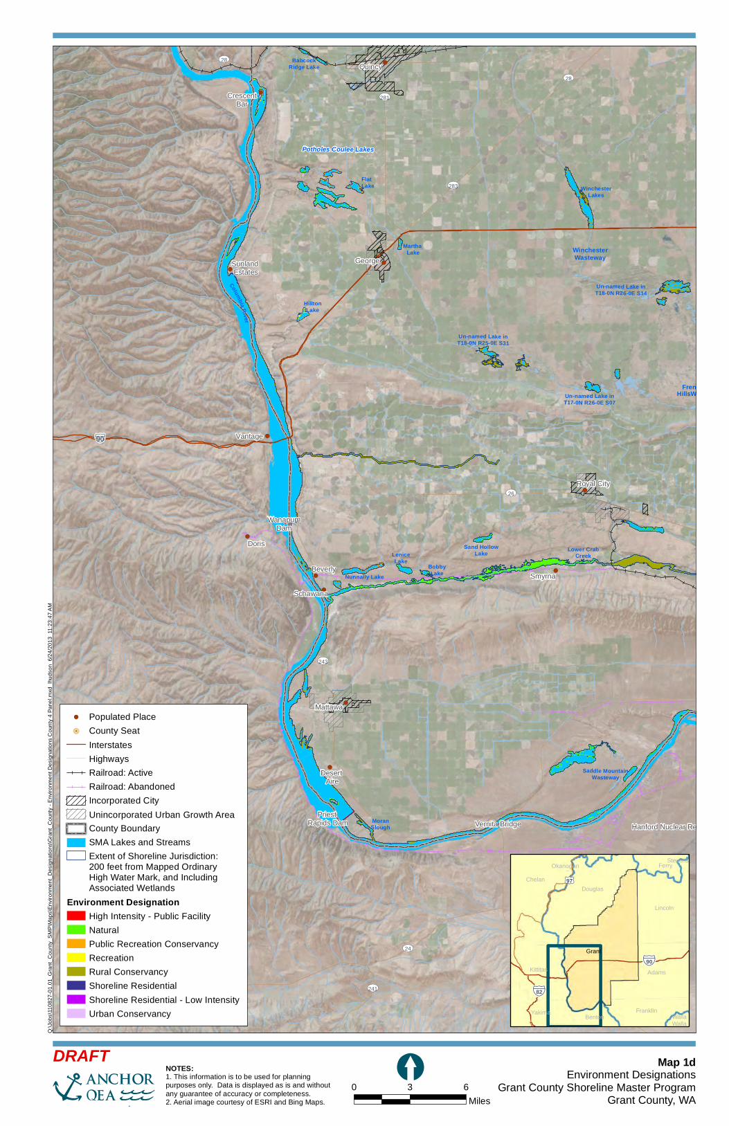
!(
!(
!(
!(
!(
!(
!(!(
!(
!(
!(
!(
!(
Babcock Ridge Lake
Winchester Lakes
Un-named Lake in T18-0N R26-0E S14
Hillton Lake
Un-named Lake in T18-0N R25-0E S31
Un-named Lake in T17-0N R26-0E S07
Sand Hollow Lake
Saddle Mountain Wasteway
Lower Crab Creek
Moran Slough
Lenice Lake
Frenchman Hills Wasteway
Flat Lake
Columbia River
Potholes Coulee Lakes
WinchesterWasteway
BobbyLakeNunnally Lake
Martha Lake
Sunland Estates
Desert Aire
WanapumDam
Priest Rapids Dam Vernita Bridge
Schawana
Hanford Nuclear Reservation
CrescentBar
Quincy
George
Vantage
Doris
Royal City
BeverlySmyrna
Mattawa
UV281
UV241
UV28
UV28
UV283
UV240
UV26
UV243
UV24
§̈¦90
Map 1dEnvironment Designations
Grant County Shoreline Master ProgramGrant County, WA
Q:\Jo
bs\11
0827
-01.01
_Gran
t_Cou
nty_S
MP\M
aps\E
nviro
nmen
t_Des
ignati
ons\G
rant_C
ounty
- Env
ironm
ent D
esign
ation
s Cou
nty 4
Pane
l.mxd
lhud
son
6/24/2
013
11:23
:47 AM
0 3 6Miles
[DRAFT
£¤97
§̈¦82
§̈¦90Grant
FerryStevensOkanoganChelan
Douglas
Lincoln
Kittitas Adams
Yakima FranklinBenton Walla
Walla
!( Populated Place!. County Seat
InterstatesHighwaysRailroad: ActiveRailroad: AbandonedIncorporated CityUnincorporated Urban Growth AreaCounty BoundarySMA Lakes and StreamsExtent of Shoreline Jurisdiction:200 feet from Mapped OrdinaryHigh Water Mark, and IncludingAssociated Wetlands
Environment DesignationHigh Intensity - Public FacilityNaturalPublic Recreation ConservancyRecreationRural ConservancyShoreline ResidentialShoreline Residential - Low IntensityUrban Conservancy
NOTES:1. This information is to be used for planning purposes only. Data is displayed as is and without any guarantee of accuracy or completeness.2. Aerial image courtesy of ESRI and Bing Maps.