8 geology and soils - marin county · geology and soils road and trail ... downward movement of...
TRANSCRIPT

Marin County Open Space District 8-1 Road and Trail Management Plan September 2013 Draft TPEIR
8 GEOLOGY AND SOILS
This chapter provides an evaluation of the potential effect of geologic and soil hazards on the implementation of the proposed Road and Trail Management Plan (RTMP). As established in the Notice of Preparation for the proposed RTMP (see Appendix A, Notice of Preparation), activities subject to the RTMP may result in degradation of the geologic and soils environment or the exposure of roads, trails, and recreationists to hazardous conditions.
The following environmental assessment includes a review of the geologic and soil resources potentially affected by the implementation of the RTMP, including the county’s soil types and their geologic originations, and the seismically active faults in or bordering county lines. Geologic and soil conditions and hazards were compiled and analyzed based on California Environmental Quality Act (CEQA) assessment criteria.
This analysis also includes a review of applicable regulations, requirements, plans, and policies from the following sources:
• United States Geological Survey • USDA Natural Resource Conservation Service • California Division of Mines and Geology • California Geological Survey • California Building Standards Commission • State Mining and Geology Board • Marin Countywide Plan (Marin County 2007) • Marin Countywide Plan Background Report (Marin County 2007b) • Marin County Open Space District (MCOSD) Road and Trail Assessment (MCOSD 2011a)
8.1 SETTING
The environmental and regulatory setting of the MCOSD open space preserves with respect to geologic and soil resources and hazards is described below for both the physical environment and the body of local, state, and federal policies and regulations with respect to geologic and soil resources and hazards.
8.1.1 ENVIRONMENTAL SETTING The MCOSD’s open space preserves are dispersed throughout an active and varied geologic landscape situated along the San Andreas Fault. This section highlights the geology and soil characteristics that influence road and trail conditions in the area of the preserves, and to a certain degree, public safety. This section also provides an evaluation of the impacts that implementation of the proposed RTMP may have on geologic and soils resources.
GEOLOGY The MCOSD preserves are located within the central portion of the Coast Range Physiographic Province of California, composed of a series of northwest-southeast aligned coastal mountain chains dominated by a similar trending San Andreas Fault Zone (MCOSD 2011a). See Figures 8-1 and 8-2 for maps of Marin County geology.

Marin County Open Space DistrictFigure 8-1
Geology of East Marin CountySOURCE: USGS, 2000

Marin County Open Space DistrictFigure 8-2
Geology of West Marin CountySOURCE: USGS, 2000

Geology and Soils
Road and Trail Management Plan 8-4 Marin County Open Space District Draft TPEIR September 2013
Regional Geology
• Geology and associated hazards on either side of the active strike slip fault (i.e. San Andreas Fault) are distinctly different, with areas east of the fault dominated by the Franciscan Formation and associated mélange1 and west of the fault by granitic rocks and overlying sedimentary rocks.
• Open space preserve areas, mainly located east of the San Andreas Fault, have a geology dominated by Cretaceous and Jurassic Age Franciscan Complex bedrock composed of sedimentary and volcanic rocks, serpentine, and sheared mélange. Overlying the bedrock is a layer of colluvium2 and soil of varying thickness.
• Slopes underlain by the sheared mélange bedrock tend to have a higher density of deep-seated landslides compared to those areas underlain by more competent sandstone. Alluvial sediments made up of unconsolidated sands, gravels, and silts are found along the valley bottoms (MCOSD 2011a).
Fault ing and Seismic Act iv i ty
• Marin County has several faults delineated by the California Division of Mines and Geology, (DOC 2000) however, the San Andreas is the only zone deemed sufficiently active under the Alquist-Priolo Earthquake Fault Zoning Act as is shown in Figure 8-3, where red and orange display the active faults.
• An active portion of the Hayward fault lies near the county, but offshore. • The last ground rupture along the San Andreas in Marin County was in 1906. • It is possible, but with a low probability, that earthquakes may occur on inactive or
previously unidentified faults. A 62 percent likelihood of fault rupture with a magnitude of 6.7 or greater has been forecast to occur on one of the San Francisco Bay Area active faults, including the San Andreas or the Hayward faults, before the year 2032 (Marin County 2007)
• The surficial deposits on either side of, and within, the San Andreas fault zone have greater potential for geologic hazards than elsewhere in Marin County, including: liquefaction, amplified shaking, subsidence, differential settlement and shallow slope failures.
Ground shaking and l iquefact ion
• Ground shaking is one of the key geologic hazards associated with seismic activity, with some areas more susceptible to strong shaking and potential damage due to their proximity to the fault zone or their underlying soil composition.
• Soils most susceptible to seismic shaking amplification tend to be younger alluvial deposits, bay mud, and artificial fill found in the lower lying areas around open water including Bolinas, San Pablo and Richardson Bays.
1 A mixture of rock types - in this case a tectonic mixture of sheared shale and sandstone. 2 Weathered rock materials transported by gravity.

Marin County Open Space DistrictFigure 8-3
Fault Hazards in Marin CountySOURCE: California Department of Conservation, Division of Mines and Geology, 2000

Geology and Soils
Road and Trail Management Plan 8-6 Marin County Open Space District Draft TPEIR September 2013
• Some areas of Marin County have encountered liquefaction during previous large earthquakes. Liquefaction is when granular material quickly becomes unstable by moving from a solid state to a liquefied state because of increased pore-water pressure. Soils experiencing liquefaction lose their structural supporting capacity that can result in a range of effects, from the minor displacement of constructed buildings to the total collapse of structures. Engineering methods and land use restrictions can be used to reduce the risk and damage caused by liquefaction events.
Slope instabi l i ty and landsl ides
• The main geologic hazards for the MCOSD’s open space areas and trail infrastructure are landslides and other related slope stability hazards under strong seismic shaking, or more commonly, during intense rainfall events that quickly saturate the soil. Landslides are the downward movement of materials such as rock, soil, or fill under the direct influence of gravity as a result of slope instability. Debris flows are a rapid downslope movement of a thick slurry composed of loose soil, rock, and organic material entrained with air and water; a debris avalanche is a more rapid or extreme debris flow. Landslides along the coast and bluff erosion may also occur and are due to active erosional processes on the Marin County coastline.
• Landslides, particularly debris flows, have been widespread in Marin County during periods of heavy and intense rainfall. Figure 8-4 shows the extensive distribution of mapped slides throughout Marin County. More than 4,500 debris flows were mapped following the large January 1982 storm events and these slides displayed the following commonalities:
√ Steep slopes (80 percent of the slides occurred on slopes steeper than 27.5 degrees) √ Granular soil mantle or granular soil mantle with both bedrock contacts and materials
with permeability constraints √ Closely associated with drainages √ Associated with intense rainstorms
• Several shallow landslides have occurred on the MCOSD parklands in recent years from high intensity and long-duration storm events. The slides are more often found in areas where steep slopes are over-steepened due to bank erosion, or along ravines or swales where surface- and groundwater concentrates. Some of the noted landslides were in areas where fill was placed on already steep slopes, or where roadways concentrated storm runoff (MCOSD 2011a). Table 11-4 and Figures 11-1a to 11-1f in Chapter 11, Hydrology and Water Quality show the MCOSD preserves with existing slides. Among these are six slides in the Gary Giacomini Preserve below San Geronimo Ridge, and four slides in the Loma Alta Preserve along the Smith Ridge Trail.

GEOLOGY, MINERAL RESOURCES AND HAZARDOUS MATERIALS
Geology, Mineral Resources and Hazardous Materials Updated November 2005 39
Marin County Open Space DistrictFigure 8-4
Marin County SlidesSOURCE: USGS, 1997

Geology and Soils
Road and Trail Management Plan 8-8 Marin County Open Space District Draft TPEIR September 2013
SOILS Erosion
• Soils within the MCOSD preserves are predominantly loam to clay loam with severe to very severe erosion hazard, particularly in regards to the MCOSD’s earthen trails and roads (MCOSD 2011a).
• According to field observations recorded during mapping and assessing the MCOSD’s trail and road network, soils in the vicinity of roads and trails were moderately drained with high erosion potential, which was most evident in areas where runoff was concentrated. The breakdown of soil under heavy trail use often leads to accelerated erosion and trail rutting (MCOSD 2011a).
Creep
• Creep is the very slow downward movement of slope-forming soil or rock evident in curved tree trunks, bent or tilted fences, or small soil ripples. Creep can contribute to slope failure.
• Many of the soils in Marin County have moderate to high expansion potential that is oftentimes responsible for surficial creep and slope failure in upland areas. Expansive soils are generally cohesive, with a high clay content prone to substantial changes in volume through absorption of pore water. These soils often expand or swell in the winter and shrink in the dry summer months. Many of the earth flows that occur in the hillslopes are due to a thick accumulation of expansive soils, particularly in areas underlain by Franciscan mélange.
Subsidence
• Collapsible soils with the potential for subsidence (i.e., vertical displacement of the ground surface over a locality or region) are more present in the low-lying flatland deposits along the County’s valley basins and bays. The most susceptible areas are those underlain with the younger Holocene unconsolidated alluvial and colluvial sediments, and even more so the younger bay muds. Human and natural induced processes can cause subsidence and differential settlement of collapsible soils.
MINERALS • The 367.2-acre Ring Mountain Preserve exhibits rare, colorful metamorphic rock and the
mineral Lawsonite in addition to its many rare plant species. Known for its hardness, Lawsonite, named after Professor Andrew Lawson of the University of California, is a mineral of the glaucophane schist facies3 associated with chlorite, epidote, sphene, glaucophane, garnet, and quartz. The 1,627-acre Mt Burdell Preserve contains a hard, dense mineral named andesite often used in concrete aggregate. Given the MCOSD’s prohibition against the collection or exploitation of minerals from its lands, these two sites should remain protected from resource extraction.
3 A facies is a group of metamorphic rock types formed under similar conditions of pressure and temperature.
Metamorphic rocks are rocks that have been subject to changes within the Earth’s crust by the agencies of heat, pressure, and chemically active fluids.

Geology and Soils
Marin County Open Space District 8-9 Road and Trail Management Plan September 2013 Draft TPEIR
REGULATORY SETTING The following summarizes regulatory laws and regional policies established to protect public safety in regards to geologic and soil hazards that may require consideration when implementing various elements of the RTMP.
FEDERAL AND STATE LAWS AND REGULATIONS
The National Earthquake Hazards Reduct ion Program (NERHP), The Alquist -Prio lo Earthquake Fault Zoning Act (APEFZA) (1972), and the Seismic Hazards Mapping Act (1991)
These Acts were established to help protect the public from earthquake effects including ground shaking and ground failure. The APEFZA prohibits construction of any buildings over or within 50 feet of an active fault trace as identified by the State Geologist’s Fault Zone Mapping.
The 1975 Surface Mining and Rec lamation Act (SMARA)
This act regulates the permitting, inspection, and later remediation actions of mining operations, and requires the California Division of Mines and Geology to prepare a mineral resource report for the county.
The 2010 Cali fornia Bui lding Code (CBC)
The CBC builds upon the 2009 International Building Code (IBC), and provides additional criteria for the sizing and design of engineered structures and buildings to withstand certain geologically induced loading. The CBC and IBC design standards are typically incorporated into county regulations and codes. Structural design under the CBC requires that projects be classified, and in turn designed according to the proposed building’s use and site geologic conditions.
The Cali fornia Off i ce o f Emergency Management
This office evaluates the safety of dam facilities that pose a potential threat if they were to fail under a large seismic event. The Department of Water Resources (DWR) inspects these facilities annually.
State Water Resources Contro l Board (SWRCB)
In California, the National Pollution Discharge Elimination System (NPDES) stormwater permitting program is administered by the SWRCB through its nine Regional Water Quality Control Boards (RWQCB). The SWRCB has established a construction General Permit that can be applied to most construction activities in the state. The NPDES California General Permit (SWRCB Order No. 2009-0009-DWQ effective in July 2010) uses a risk-based approach, with increased monitoring and oversight for construction activities resulting in greater than one acre of disturbance. The new permit requires potential dischargers to develop a Storm Water Pollution Prevention Plan (SWPPP), implement Best Management Practices (BMP) to prevent erosion and sedimentation, provide on-site and storm related monitoring, and design for post construction runoff reduction requirements.

Geology and Soils
Road and Trail Management Plan 8-10 Marin County Open Space District Draft TPEIR September 2013
LOCAL LAWS AND REGULATIONS
Marin Countywide Plan
The Marin Countywide Plan includes policies to protect people and property from risks associated with seismic activity and geologic conditions. The following policies would be relevant in implementation of the RTMP.
Table 8-1 Marin Countywide Plan Policies Related to Geologic Hazards
Policy Description
Natura l Sys t ems and Agr i cu l ture Element – Environmenta l Hazards
EH-2.1: Avoid Hazard Areas
Require development to avoid or minimize potential hazards from earthquakes and unstable ground conditions.
EH-2.2: Comply with Alquist Priolo Act
Continue to implement and enforce the Alquist-Priolo Earthquake Fault Zoning Act
EH 2.a: Require Geotechnical Reports
Require Geotechnical Reports. Continue to require any applicant for land division, master plan, development approval, or new construction in a geologic hazard area to submit a geotechnical report prepared by a State-certified Engineering Geologist or a Registered Geotechnical Engineer that: • evaluates soil, slope, and other geologic hazard conditions; • commits to appropriate and comprehensive mitigation measures sufficient
to reduce risks to acceptable levels, including post-construction site monitoring, if applicable;
• addresses the impact of the project on adjacent lands, and potential impacts of offsite conditions; and
• meets the requirements of other agency regulations with jurisdiction in the hazard area, such as BCDC requirements for the safety of fills consistent with the Bay Plan.
EH-2.b: Require Construction Observation and Certification
Require any work or construction undertaken to correct slope instability or mitigate other geologic hazard conditions to be supervised and certified by a geotechnical engineer and/or an engineering geologist.
EH-2.c: Prohibit Structures in Active Fault Traces
Prohibit placement of specified types of structures intended for human occupancy within 50 feet of an active fault trace in compliance with the Alquist-Priolo Earthquake Fault Zoning Act.
EH-2.f: Avoid Known Landslide Areas
Continue to prohibit development in landslide areas and on landslide-prone deposits on steep slopes, except where the required geotechnical report indicates that appropriate mitigation measures can stabilize the site for construction.
EH-2.g: Identify Compressible Soil Potential
Require that geotechnical reports for projects on land underlain by compressible materials (such as fill, bay mud, and marsh or slough areas) delineate locations where settlement will be greatest and subsidence may occur, and recommend site preparation and construction techniques necessary to reduce risk and public liability to an acceptable level.
EH-2.h: Match Uses to Conditions
Amend the Development Code to limit uses in areas with high potential for slope instability or differential soil activity to those that would not be damaged by ground movement and provide minimum inducement to slope failure or differential settlement.
EH-2.i: Minimize Impacts of Site Alteration
Amend the Development Code to strictly limit the extent of any proposed fill, excavation, or other grading activities that could create or exacerbate risks in areas susceptible to geologic hazards.

Geology and Soils
Marin County Open Space District 8-11 Road and Trail Management Plan September 2013 Draft TPEIR
Table 8-1 Marin Countywide Plan Policies Related to Geologic Hazards
Policy Description
EH-2.l: Reliability of Lifelines and Access (Evacuation) Routes
In cooperation with utility system providers, emergency management agencies, and others, assist in the development of strategies to reduce adverse effects of geologic hazards, especially fault surface rupture and landslides to critical public lifelines, and access (i.e., evacuation) routes in an emergency.
Source: Marin County 2007.
8.2 ENVIRONMENTAL EFFECTS
The geology and soil resource analysis evaluates whether implementation of the proposed RTMP would result in a significant impact to these resources from the maintenance and construction of roads and trails.
8.2.1 SIGNIFICANCE CRITERIA The following criteria have been established to define the level of adverse effect that would result in a significant geology or soil resource impact pursuant to CEQA if a proposed project would:
• Expose people or structures to potential substantial adverse effects, including the risk of loss, injury, or death involving: √ Rupture of a known earthquake fault as delineated on the most recent Alquist-Priolo
Earthquake Fault Zoning Map issued by the State Geologist for the area or based on other substantial evidence of a known fault? (VI.a)
√ Strong seismic ground shaking? (VI.a) √ Seismic related ground failure, including liquifaction, slope instabilities or landslides, or
creep and subsidence? (VI.a) • Result in substantial soil erosion or topsoil loss from exposure to wind or water erosion?
(VI.b) • Be located on a geologic unit or soil that is unstable, or that would become unstable as a
result of the project, and potentially result in on- or off-site landslide, lateral spreading, subsidence, liquefaction, or collapse? (VI.c)
• Be located expansive soil, as defined in Table 18-1-B of the Uniform Building Code (1994), creating substantial risks to life or property? (VI.d)
• Have soils incapable of adequately supporting the use of septic tanks or alternative waste water disposal systems where sewers are not available for the disposal of waste water? (VI.e)
8.2.2 ANALYSIS METHODOLOGY The evaluation of potential seismic hazards and soil resource impacts associated with implementation of the proposed RTMP was based on a review of the Marin Countywide Plan Background Reports (Marin County 2007b); applicable federal, state, and regional laws, regulations, codes, and guidelines; and seismic hazard maps.
The purpose of the RTMP is to develop a procedure to prioritize proposed maintenance and construction projects, and to ensure that projects selected for funding are environmentally

Geology and Soils
Road and Trail Management Plan 8-12 Marin County Open Space District Draft TPEIR September 2013
beneficial. The RTMP additionally establishes policies, BMPs, and road and trail design standards to reduce the environmental effects of constructing, maintaining, and operating both existing and future roads and trails. The RTMP does not envision or mandate an increase in maintenance or construction activities, but rather seeks to prioritize and manage existing and future levels of road and trail maintenance and construction more efficiently and appropriately.
RTMP BEST MANAGEMENT PRACTICES Table 8-2 sets forth the proposed RTMP BMP requirements for assessing and mitigating geologic hazards.
Table 8-2 Proposed RTMP Best Management Practices Related to Geologic Hazards
BMP ID Description Geologic Hazards-1: Assessment and Requirements in Areas of Potential Geologic Hazard
Given the unique and potentially high risks associated with geologic hazards, general best management practices for these types of potential impacts are not appropriate. Instead, when new trails or trail improvements are proposed in preserve areas with a propensity for geologic instabilities, including slides or debris flows in the more elevated areas and subsidence or liquefaction in the low-lying areas, a site assessment will be conducted by a certified geologist or geotechnical engineer. If geologic hazards are confirmed in the area, the site assessment will propose adequate avoidance measures or engineering elements to ensure trail and infrastructure stability and maintained public safety.
Geologic Hazards-2: Construction in Areas of Slides and Debris Flows
In areas of identified slide and debris flow hazards, locate and design new trails, drainage improvements, or irrigation so as not to alter the shape or stability, or change the drainage or groundwater conditions, of an existing slide area. (Such alterations would potentially result in reactivation or further destabilization of the slope.)
Geologic Hazards-3: Construction in Areas of Erodible and Expansive Soils
Use avoidance tactics or engineered grading to mitigate adverse geologic conditions and potential hazards. Prior to final road or trail project design, consult with engineering geologists and/or geotechnical engineers to identify and implement mitigating road or trial designs for new facility locations or when improving existing facilities.
Geologic Hazards-4: Construction in Areas of Collapsible Soils
In any of the lower elevation preserves (i.e., those near sea level) assess soil type and the potential for subsidence to determine optimum trail location and structural foundations necessary to avoid collapsible soils. In consultation with a certified geologist or geotechnical engineer, design roads and trails to avoid or reduce this potential hazard through optimizing location or by implementing appropriate engineering designs.
Source: MCOSD, 2013. 8.2.3 ENVIRONMENTAL TOPICS NOT ADVERSELY AFFECTED BY THE RTMP Question (VI.e) Have soils incapable of adequately supporting the use of septic tanks or alternative waste water disposal systems where sewers are not available for the disposal of waste water: No impact.
The MCOSD does not provide restrooms or other facilities within its preserves that would generate wastewater. Therefore, there would be no impact.
8.2.4 ENVIRONMENTAL TOPICS POTENTIALLY AFFECTED BY THE RTMP The following impact evaluations examine the potential impacts of the proposed project based on the impact threshold criteria and the RTMP policies described above.

Geology and Soils
Marin County Open Space District 8-13 Road and Trail Management Plan September 2013 Draft TPEIR
Impact GEO-1: Expose people or s tructures to potent ia l substant ia l adverse e f f e c t s , inc luding the r i sk of loss , in jury , or death involv ing : Rupture o f a known earthquake faul t as de l ineated on the most recent Alquist -Prio lo Earthquake Fault Zoning Map, s trong se i smic ground shaking, or se i smic re lated ground fai lure , inc luding l iquefact ion (Cri ter ion VI.a)
Existing and future roads and trails within the MCOSD preserves could fail or be exposed to seismic related hazards from earthquakes. Because the RTMP includes policies and BMPs to ensure that the location and type of any existing or new road or trail would be evaluated, selected, and designed to minimize any risks from strong ground shaking, liquefaction, or landslides that may result from earthquakes or fault ruptures, this impact would be less than significant.
As indicated in Figure 8-3, a large number of earthquake faults are located within and adjacent to Marin County and the MCOSD open space preserves. It is possible, but with a low probability, that earthquakes may occur on inactive or previously unidentified faults. A 62 percent likelihood of fault rupture with a magnitude of 6.7 or greater has been forecast to occur on one of the San Francisco Bay Area active faults, including the San Andreas or the Hayward faults, before the year 2032.
High intensity ground shaking during an earthquake on a local or regional fault could expose the MCOSD roads and trails to strong ground shaking, potentially leading to ground or slope failure and damage to the MCOSD facilities. Several MCOSD roads or trails could cross faults, and these MCOSD facilities could be damaged during an earthquake on underlying faults.
However, the risk to recreationists from failure or damage of the MCOSD roads and trails would be considered to be a low magnitude hazard since no occupied structures would be involved and the number and density of persons at any given time using the MCOSD facilities that could be adversely affected is low. The risk of injury or death for a substantial number of people using the MCOSD facilities during an earthquake would be much lower than for that of an urban area of Marin County.
The Marin Countywide Plan and the MCOSD Policy Review Initiative contain policies to limit the exposure of the public to earthquake risks. The proposed RTMP also sets forth policies and BMPs to avoid or reduce earthquake risks to recreationists and the MCOSD roads and trails. These policies and implementation measures, and their effects on limiting the impacts of the RTMP implementation related to earthquake hazards, are evaluated in Table 8-3.
Table 8-3 Marin Countywide Plan and MCOSD Policy Review Initiative Policies, and Proposed RTMP Implementation Measures Related to Seismic Hazards
Implementation Measure Identification Implementation Measure Text
How the Implementation Measure Avoids or Reduces
Impact Marin Countywide Plan
Natura l Sys t ems and Agr i cu l ture Element - Trai l s
TRL-2.3: Ensure User Safety
Plan and maintain trails to protect the safety of trail users.
Earthquake hazards would be considered when planning and maintaining trials.

Geology and Soils
Road and Trail Management Plan 8-14 Marin County Open Space District Draft TPEIR September 2013
Table 8-3 Marin Countywide Plan and MCOSD Policy Review Initiative Policies, and Proposed RTMP Implementation Measures Related to Seismic Hazards
Implementation Measure Identification Implementation Measure Text
How the Implementation Measure Avoids or Reduces
Impact Policies from the MCOSD Policy Review Initiative
Policy T2a The MCOSD will use best management practices in the design, construction, and maintenance of trails.
Trail construction that meets seismic design standards would minimize potential hazards from earthquakes.
Systemwide Policies (to be adopted as part of the Road and Trail Management Plan)
Policy SW.17: Decommissioning of Existing Roads and Trails
The MCOSD may decommission any road or trail at any time to protect environmental resources, enhance user safety, or align maintenance costs with available funds, unless a road or trail is required under license, lease, or easement for non-recreational purposes (e.g., utility access), or for maintenance access by the MCOSD staff, or emergency access by fire and other personnel.
Structural stability and seismic safety would be considered in prioritizing road decommissioning.
Policy SW.18: Conversion of Existing Roads to Trails
The MCOSD may convert existing roads to trails, unless a road in its existing configuration is required under license, lease, or easement for non-recreational purposes (e.g., utility access) or it is required for maintenance access by the MCOSD staff or emergency access by fire and other personnel. Subject to the foregoing, the MCOSD may convert any road to a trail at any time to protect environmental resources, enhance user safety, or align maintenance costs with available funds.
Seismic safety would be considered in determining which roads to convert to trails.
Best Management Practices (to be adopted as part of the Road and Trail Management Plan)
Geologic Hazards-1: Assessment and Requirements in Areas of Potential Geologic Hazard
Given the unique and potentially high risks associated with geologic hazards, general best management practices for these types of potential impacts are not appropriate. Instead, when new trails or trail improvements are proposed in preserve areas with a propensity for geologic instabilities, including slides or debris flows in the more elevated areas and subsidence or liquefaction in the low-lying areas, a site assessment will be conducted by a certified geologist or geotechnical engineer. If geologic hazards are confirmed in the area, the site assessment will propose adequate avoidance measures or engineering elements to ensure trail and infrastructure stability and maintained public safety.
Risks would be mitigated and avoided through assessment, engineering design and avoidance.
Source: Marin County 2007; Marin County Open Space District 2005, 2013; Planning Partners 2013. Proposed road or trail construction that is located in areas of moderate to very high liquefaction susceptibility, or within other areas exposed to earthquake hazards, would be preceded by a thorough, site-specific geotechnical investigation to evaluate liquefaction susceptibility and other

Geology and Soils
Marin County Open Space District 8-15 Road and Trail Management Plan September 2013 Draft TPEIR
earthquake hazards in accordance with California Geological Survey (CGS) guidelines. This would allow for proper mitigation or avoidance of these potential hazards.
Proper construction and avoidance of hazard areas for new roads or trails, and decommissioning existing facilities exposed to high risk or earthquake hazards, as regulated by the policies and BMPs evaluated in Table 8-3 would avoid or reduce the effect of seismic hazards. Thus, this impact would be less than significant and no mitigation would be necessary.
Significance of Impact: Less than significant.
Mitigation Measure GEO-1: None required.
Impact GEO-2: Expose people or s tructures to potent ia l substant ia l adverse e f f e c t s , inc luding
the r i sk of loss , in jury , or death involv ing : s lope instabi l i ty or landsl ides (Cri ter ion VI.c)
The RTMP could lead to the construction, decommissioning, or maintenance of roads and trails, or changes in use on or near areas subject to slope instabilities or landslides. Because the RTMP includes policies and BMPs to ensure that the location and type of any existing or new road or trail would be evaluated, selected, and designed to minimize risks from slope instability or landslide, this impact would be less than significant.
Roads and trails could contribute to destabilization of slopes or alteration of water flow patterns that could exacerbate landslide hazards. Roads or trails could be damaged or destroyed in the event of a landslide if the MCOSD facilities were located on a failed slope. Landslides and other related slope-stability hazards are likely the main geologic hazards for the MCOSD preserves and trail infrastructure. Hazards might occur as a result of strong seismic shaking (discussed above), or more commonly, during intense rainfall events that quickly saturate the soil.
Landslides, particularly debris flows, have been widespread in Marin County during periods of heavy and intense rainfall. Figure 3.50 of the RTMP shows the extensive distribution of mapped slides throughout Marin County. More than 4,500 debris flows were mapped following the large January 1982 storm events; they displayed the following commonalities:
• steep slopes (80 percent of the slides occurred on slopes steeper than 27.5 degrees) • granular soil mantle or granular soil mantle with both bedrock contacts and materials with
permeability constraints • closely associated with drainages • associated with intense rainstorms
Locations of existing slides in Marin County, including those located on the MCOSD preserves, have been mapped by the USGS (see Figure 8-4) (USGS 1997).
The Marin Countywide Plan and the MCOSD Policy Review Initiative contain policies to limit the exposure of the public to hazards related to slope instability or landslides. The proposed RTMP also sets forth policies and BMPs to avoid or reduce risks to recreationists and the MCOSD roads and trails. These policies and implementation measures, and their effects on limiting the impacts of the RTMP implementation related to slope instability and landslides, are evaluated in Table 8-4.

Geology and Soils
Road and Trail Management Plan 8-16 Marin County Open Space District Draft TPEIR September 2013
Table 8-4 Marin Countywide Plan and MCOSD Policy Review Initiative Policies, and Proposed RTMP Implementation Measures Related to Slope Instability or Landslides
Implementation Measure Identification Implementation Measure Text
How the Implementation Measure Avoids or Reduces
Impact Marin Countywide Plan
Natura l Sys t ems and Agr i cu l ture Element - Trai l s
TRL-2.3: Ensure User Safety
Plan and maintain trails to protect the safety of trail users.
Slope instability and landslide hazards would be considered when planning and maintaining trials.
TRL-2.b: Design, Build, and Manage Trails in a Sustainable Manner
Incorporate design measures that protect vegetation, protect habitats, and minimize erosion.
Minimizing erosion would reduce areas of unstable soils and prevent erosion contributing to slope instabilities or landslides.
Policies from the MCOSD Policy Review Initiative
Policy T2a The MCOSD will use best management practices in the design, construction, and maintenance of trails.
Trail construction that meets geotechnical design standards would minimize potential hazards from slope instability and landslides.
Systemwide Policies (to be adopted as part of the Road and Trail Management Plan)
Policy SW.17: Decommissioning of Existing Roads and Trails
The MCOSD may decommission any road or trail at any time to protect environmental resources, enhance user safety, or align maintenance costs with available funds, unless a road or trail is required under license, lease, or easement for non-recreational purposes (e.g., utility access), or for maintenance access by the MCOSD staff, or emergency access by fire and other personnel.
Structural, slope stability and seismic safety would be considered in prioritizing road decommissioning.
Policy SW.18: Conversion of Existing Roads to Trails
The MCOSD may convert existing roads to trails, unless a road in its existing configuration is required under license, lease, or easement for non-recreational purposes (e.g., utility access) or it is required for maintenance access by the MCOSD staff or emergency access by fire and other personnel. Subject to the foregoing, the MCOSD may convert any road to a trail at any time to protect environmental resources, enhance user safety, or align maintenance costs with available funds.
Structural, slope stability and seismic safety would be considered in determining which roads to convert to trails.
Best Management Practices (to be adopted as part of the Road and Trail Management Plan)
Geologic Hazards-2: Construction in Areas of Slides and Debris Flows
In areas of identified slide and debris flow hazards, locate and design new trails, drainage improvements, or irrigation so as not to alter the shape or stability, or change the drainage or groundwater conditions, of an existing slide area. Such alterations would potentially result in reactivation or further destabilization of the slope.
Risks would be minimized and avoided through assessment, engineering design, water management and avoidance.
Source: Marin County 2007; Marin County Open Space District 2005, 2013; Planning Partners 2013.

Geology and Soils
Marin County Open Space District 8-17 Road and Trail Management Plan September 2013 Draft TPEIR
With implementation of the policies and BMPs set forth in the RTMP, the MCOSD would use avoidance tactics or engineered grading to mitigate adverse geologic conditions and potential hazards. Consultation with engineering geologists and/or geotechnical engineers would help mitigate potential hazards when identifying new trail locations or improving existing trails in areas prone to geologic hazards.
As demonstrated in Table 8-4, the MCOSD would consider potential slide and debris flow hazards when deciding whether to maintain, decommission, or relocate an existing road or trail, and in locating and designing new roads, trails, and drainage improvements under the RTMP so as not to alter or change the shape, stability, drainage, or groundwater conditions of an existing slide area that would result in the reactivation of a previous slope failure or in destabilization of the slope.
Any development of roads or trails within the vicinity of a coastal bluff would be preceded by a detailed engineering geologic and geotechnical engineering investigation in order to accurately characterize the site geologic conditions and determine the stability of the slope and bluff retreat rates. This would allow for the development and implementation of proper setback and/or mitigation recommendations by the project geotechnical engineer.
The RTMP includes policies and BMPs to ensure that the location and type of any new road or trail would be evaluated, selected, and designed to minimize any risks from slope instabilities and landslides. Therefore, this impact would be less than significant, and no mitigation would be necessary.
Significance of Impact: Less than significant.
Mitigation Measure GEO-2: None required.
Impact GEO-3: Expose people or s tructures to potent ia l substant ia l adverse e f f e c t s , inc luding
the r i sk of loss , in jury , or death involv ing : s lope creep or subsidence (Cri ter ia VI.c and VI.d)
The RTMP could lead to the construction, relocation or maintenance of roads and trails, or changes in use, on soils subject to slope creep and/or subsidence. Because the RTMP includes policies and BMPs to ensure that the location and type of any existing or new road or trail would be evaluated, selected, and designed to minimize risks from creep or subsidence, this impact would be less than significant.
Roads and trails could contribute to destabilization of slopes or alteration of water flow patterns that could exacerbate creep or subsidence hazards. Roads or trails could be damaged or destroyed by creep or subsidence if the MCOSD facilities were located in areas susceptible to these hazards. Slope and soil stability hazards are likely the main geologic hazards for the MCOSD preserves and trail infrastructure.
The Marin Countywide Plan and the MCOSD Policy Review Initiative contain policies to limit the exposure of the public to hazards related to creep or subsidence. The proposed RTMP also sets forth policies and BMPs to avoid or reduce risks to recreationists and the MCOSD roads and trails. These policies and implementation measures, and their effects on limiting the impacts of the RTMP implementation related to slope creep or subsidence are evaluated in Table 8-5.

Geology and Soils
Road and Trail Management Plan 8-18 Marin County Open Space District Draft TPEIR September 2013
Table 8-5 Marin Countywide Plan and MCOSD Policy Review Initiative Policies, and Proposed RTMP Implementation Measures Related to Creep or Subsidence
Implementation Measure Identification Implementation Measure Text
How the Implementation Measure Avoids or Reduces
Impact Marin Countywide Plan
Natura l Sys t ems and Agr i cu l ture Element - Trai l s
TRL-2.3: Ensure User Safety
Plan and maintain trails to protect the safety of trail users.
Slope instability and soil hazards would be considered when planning and maintaining trials.
TRL-2.b: Design, Build, and Manage Trails in a Sustainable Manner
Incorporate design measures that protect vegetation, protect habitats, and minimize erosion.
Minimizing erosion would reduce areas of unstable soils and prevent erosion contributing to slope instabilities or landslides.
Policies from the MCOSD Policy Review Initiative
Policy T2a The MCOSD will use best management practices in the design, construction, and maintenance of trails.
Trail construction that meets geotechnical design standards would minimize potential hazards from slope instability and landslides.
Systemwide Policies (to be adopted as part of the Road and Trail Management Plan)
Policy SW.17: Decommissioning of Existing Roads and Trails
The MCOSD may decommission any road or trail at any time to protect environmental resources, enhance user safety, or align maintenance costs with available funds, unless a road or trail is required under license, lease, or easement for non-recreational purposes (e.g., utility access), or for maintenance access by the MCOSD staff, or emergency access by fire and other personnel.
Structural, slope stability, soil characteristics, and seismic safety would be considered in prioritizing road decommissioning.
Policy SW.18: Conversion of Existing Roads to Trails
The MCOSD may convert existing roads to trails, unless a road in its existing configuration is required under license, lease, or easement for non-recreational purposes (e.g., utility access) or it is required for maintenance access by the MCOSD staff or emergency access by fire and other personnel. Subject to the foregoing, the MCOSD may convert any road to a trail at any time to protect environmental resources, enhance user safety, or align maintenance costs with available funds.
Structural, slope stability, soil characteristics, and seismic safety would be considered in determining which roads to convert to trails.
Best Management Practices (to be adopted as part of the Road and Trail Management Plan)
Geologic Hazards-3: Construction in Areas of Erodible and Expansive Soils
Use avoidance tactics or engineered grading to mitigate adverse geologic conditions and potential hazards. Prior to final road or trail project design, consult with engineering geologists and/or geotechnical engineers to identify and implement mitigating road or trial designs for new facility locations or when improving existing facilities.
Risks would be minimized and avoided through assessment, engineering design, and avoidance.

Geology and Soils
Marin County Open Space District 8-19 Road and Trail Management Plan September 2013 Draft TPEIR
Table 8-5 Marin Countywide Plan and MCOSD Policy Review Initiative Policies, and Proposed RTMP Implementation Measures Related to Creep or Subsidence
Implementation Measure Identification Implementation Measure Text
How the Implementation Measure Avoids or Reduces
Impact Geologic Hazards-4: Construction in Areas of Collapsible Soils
In any of the lower elevation preserves (i.e., those near sea level) assess soil type and the potential for subsidence to determine optimum trail location and structural foundations necessary to avoid collapsible soils. In consultation with a certified geologist or geotechnical engineer, design roads and trails to avoid or reduce this potential hazard through optimizing location or by implementing appropriate engineering designs.
Risks would be minimized and avoided through assessment, engineering design, and avoidance.
Source: Marin County 2007; Marin County Open Space District 2005, 2013; Planning Partners 2013. As set forth in Table 8-5, the MCOSD would use avoidance tactics or engineered measures to mitigate adverse geologic conditions and potential hazards including creep and subsidence. Consultation with engineering geologists and/or geotechnical engineers would help mitigate potential hazards when identifying new trail locations or improving existing trails in areas prone to these hazards. For areas that cannot be avoided, site-specific detailed engineering and geological analysis would be conducted to properly evaluate and mitigate the unfavorable site conditions. The MCOSD would use avoidance tactics or engineered grading to mitigate adverse geologic conditions and potential hazards. When designing for trails and infrastructure in any of the lower elevation preserves, the MCOSD would assess soil type and the potential for subsidence to determine optimum trail location and structural foundations.
Because the RTMP includes goals and policies to ensure that the location and type of any existing or new road or trail would be evaluated, selected and designed to minimize any risks from creep and subsidence, this impact would be less than significant. No mitigation would be necessary.
Significance of Impact GEO-3: Less than significant.
Mitigation Measure: None required.
Impact GEO-4: Substant ial so i l eros ion or topsoi l loss f rom addit ional exposure to wind or
water eros ion (Cri ter ion VI.b)
Implementation of the proposed RTMP could result in new road and trail development, which could increase the potential for soil erosion and loss during construction related soil disturbance activities. Additionally, exposed soil on trails and roads is subject to ongoing erosion. Because the RTMP includes policies and BMPs to prevent, manage, and reduce sediment generated from maintenance and construction activities, and from roads and trails generally, this impact would be less than significant. (For additional information on this topic, please refer to Impact HYD-1 in Chapter 11, Hydrology and Water Quality, of this Draft TPEIR.)
Implementation of the RTMP would result in the continued maintenance of existing roads and trails, and the construction or re-construction of new and existing roads and trails. Soils disturbed

Geology and Soils
Road and Trail Management Plan 8-20 Marin County Open Space District Draft TPEIR September 2013
during these activities would be susceptible to heightened levels of wind and water erosion during the construction period, and after completion of construction until soils within the work area had compacted and stabilized. Additionally, many existing roads and trails were constructed without regard to drainage prior to acquisition by the MCOSD, and many of these existing facilities are susceptible to erosion during operation.
The Marin Countywide Plan and the MCOSD Policy Review Initiative contain policies to minimize erosion from both new and existing roads and trails. The proposed RTMP also sets forth policies and BMPs to avoid or reduce the hazard of erosion during construction, maintenance, and operation of roads and trails. These policies and implementation measures, and their effects on limiting the impacts of the RTMP implementation related to erosion, are evaluated in Table 8-6.
Table 8-6 Marin Countywide Plan and MCOSD Policy Review Initiative Policies, and Proposed RTMP Implementation Measures Related to Erosion
Implementation Measure Identification Implementation Measure Text
How the Implementation Measure Avoids or Reduces
Impact Marin Countywide Plan
Natura l Sys t ems and Agr i cu l ture Element - Trai l s
TRL-2.b: Design, Build, and Manage Trails in a Sustainable Manner
Incorporate design measures that protect vegetation, protect habitats, and minimize erosion.
Trail design standards would minimize erosion.
Policies from the MCOSD Policy Review Initiative
Policy T2a The MCOSD will use best management practices in the design, construction, and maintenance of trails.
Trail construction and maintenance best management practices would reduce erosion.
Systemwide Policies (to be adopted as part of the Road and Trail Management Plan)
Policy SW.17: Decommissioning of Existing Roads and Trails
The MCOSD may decommission any road or trail at any time to protect environmental resources, enhance user safety, or align maintenance costs with available funds, unless a road or trail is required under license, lease, or easement for non-recreational purposes (e.g., utility access), or for maintenance access by the MCOSD staff, or emergency access by fire and other personnel.
Decommissioning of roads and trails would be done in a way that reduces erosion potential from these sites. Construction BMPs that minimize and manage erosion would be used. Authorizes the MCOSD to decommission existing facilities that exhibit unsatisfactory levels of erosion.
Policy SW.18: Conversion of Existing Roads to Trails
The MCOSD may convert existing roads to trails, unless a road in its existing configuration is required under license, lease, or easement for non-recreational purposes (e.g., utility access) or it is required for maintenance access by the MCOSD staff or emergency access by fire and other personnel. Subject to the foregoing, the MCOSD may convert any road to a trail at any time to protect environmental resources, enhance user safety, or align maintenance costs with available funds.
Conversion of roads to trails would be done in a way that reduces erosion potential from these sites. Construction BMPs that minimize and manage erosion would be used. Authorizes the MCOSD to decommission existing facilities that exhibit unsatisfactory levels of erosion.

Geology and Soils
Marin County Open Space District 8-21 Road and Trail Management Plan September 2013 Draft TPEIR
Table 8-6 Marin Countywide Plan and MCOSD Policy Review Initiative Policies, and Proposed RTMP Implementation Measures Related to Erosion
Implementation Measure Identification Implementation Measure Text
How the Implementation Measure Avoids or Reduces
Impact Best Management Practices (to be adopted as part of the Road and Trail Management Plan)
Geologic Hazards-3: Construction in Areas of Erodible and Expansive Soils
Use avoidance tactics or engineered grading to mitigate adverse geologic conditions and potential hazards. Prior to final road or trail project design, consult with engineering geologists and/or geotechnical engineers to identify and implement mitigating road or trial designs for new facility locations or when improving existing facilities.
Erosion risk would be minimized and avoided through assessment, engineering design, and avoidance.
Source: Marin County 2007; Marin County Open Space District 2005, 2013; Planning Partners 2013. Pursuant to state law, future road and trail construction projects implemented under the RTMP would be required to comply with existing federal, state, and county regulations designed to protect water quality that include designing for, monitoring, and installing temporary BMPs to minimize erosion. Temporary soil erosion prevention measures are enforced by the RWQCB under the NPDES program for active construction sites greater than one acre in area and under the storm water phase II permit for construction sites less than one acre. Measures include watering for dust control, treating exposed slopes and material stockpiles, and reducing runoff post construction. Soil loss would be minimized as potential runoff waters would be infiltrated on-site and/or attenuated prior to release.
Construction design standards for trails and roads set forth in the RTMP4 that properly manage surface water flow are intended to reduce ongoing erosion after construction. Design standards include using siting, grading, water bars, rolling dips, outsloping, and surfacing, among other approaches, to minimize and control erosion.
Additionally, the MCOSD, in evaluating existing roads and trails for decommissioning or conversion, would evaluate the level of existing erosion on the road or trail segment under review to determine whether a particular road or trail would be maintained in its existing condition, decommissioned, re-routed, re-constructed, or converted.
Because of a comprehensive body of federal, state, and county requirements, and with implementation of the policies and BMPs set forth in the RTMP that would avoid or reduce the effect of erosion hazards, this impact would be less than significant. No mitigation would be necessary.
Significance of Impact: Less than significant.
Mitigation Measure GEO-4: None required.
4 Please refer to Chapter 6 of the Road and Trail Management Plan for a discussion of road and trail design standards
that would be implemented upon adoption of the RTMP. The majority of the identified standards are designed to control drainage from roads and trails and otherwise minimize erosion.

Geology and Soils
Road and Trail Management Plan 8-22 Marin County Open Space District Draft TPEIR September 2013
This page intentionally left blank.

Marin County Open Space District 9-1 Road and Trail Management Plan September 2013 Draft TPEIR
9 GLOBAL CLIMATE CHANGE
This chapter provides an evaluation of how implementation of the proposed Road and Trail Management Plan (RTMP) would change existing levels of greenhouse gas (GHG) emissions, and the potential for impacts on global climate change. As established in the Notice of Preparation for the proposed RTMP (see Appendix A, Notice of Preparation), activities subject to the RTMP may result in changes in GHG emissions.
The following environmental assessment includes a review of activities resulting in GHG emissions affected by the implementation of the RTMP, such as the maintenance of existing roads and trails, and the construction of new facilities within the Marin County Open Space District (MCOSD) preserves.
This analysis includes a review of applicable regulations, requirements, plans, and policies from the following sources:
• United States Environmental Protection Agency (EPA 2013) • California Air Resources Board (CARB 2012) • California Attorney General (California AGO 2010) • Bay Area Air Quality Management District (BAAQMD 2012) • Marin Countywide Plan (Marin County 2007) • Marin Countywide Plan DEIR/FEIR (Marin County 2007a) • Marin County Re-Inventory of Greenhouse Gas Emissions (Marin County 2007c) • Marin County Greenhouse Gas Reduction Plan (Marin County 2006)
Information regarding the existing conditions of GHG emissions in Marin County was obtained from Marin County GHG emission inventories. Rules and regulations affecting GHG emissions were identified by a review of federal and state requirements, and BAAQMD rules and regulations. Potential impacts as a result of GHG emissions were determined by comparing potential MCOSD road and trail management activities to the existing environment using CEQA assessment criteria and guidelines adopted by the BAAQMD.
9.1 SETTING
The environmental and regulatory setting of Marin County with respect to GHG emissions is described below for both the physical environment and the body of local, state, and federal policies and regulations with respect to GHG emissions and global climate change.
9.1.1 ENVIRONMENTAL SETTING Greenhouse Gases and Climate Change
Global warming is a public health and environmental concern around the world. As global concentrations of atmospheric greenhouse gases increase, global temperatures increase, as do weather extremes and air pollution concentrations. Nine of the ten warmest years (through 2012) in modern meteorological record (since 1880) have occurred since the year 1998 (NASA 2013). Global temperatures have risen by 1.3ºF over the past century, and if greenhouse gas emissions continue to increase, climate models predict that the average temperature at the Earth’s surface could increase by

Global Climate Change
Road and Trail Management Plan 9-2 Marin County Open Space District Draft TPEIR September 2013
2 to 11.5ºF by the year 2100 (IPCC 2007). Hotter days facilitate formation of ozone, increases in smog emissions, and increases in public health impacts (e.g. premature deaths, hospital admissions, asthma attacks and respiratory conditions, and acute bronchitis) (ALA California 2011).
Global warming has been observed to contribute to poor air quality, rising sea levels, melting glaciers, stronger storms, more intense and longer droughts, more frequent heat waves, increases in the number of wildfires and their intensity, and other threats to human health (IPCC 2007). Local Marin County projections include:
• Increased flooding, erosion, and sedimentation • Increased risk of drought and a shrinking snow pack • Increased risk of wildfires • Risk of saltwater contamination in low-lying aquifers (Marin County 2007c)
The San Francisco Bay Conservation and Development Commission produced a series of sea level rise maps to be used as information for future planning efforts within the Bay Area. The maps show shoreline and tributary areas along the San Francisco, Richardson, and San Pablo Bays that are vulnerable to 16 inches of sea level rise predicted for mid-century and 55 inches for the end of the century based on data from the United States Geological Survey (SFBCDC 2002). Earlier EPA estimates indicated that sea level is likely to rise 1.8 feet along most of the West Coast by 2100. Comparatively, there has been about a 4-inch increase of the San Francisco Bay level since 1850. With a 1-foot rise in sea level, the frequency of a 100-year storm event would increase tenfold, as the current 100-year high in the storm surge felt on the levee system of inland San Francisco Bay and the Delta would become the 10-year high (Marin County 2007).
The resulting warmer ocean waters and saltwater inundation from climate change could impact coastal ecosystems by speeding the decline in fish populations and marine ecosystems that are already stressed from habitat loss and reduced freshwater flows. In addition, climate change would directly affect terrestrial wildlife populations, and the number of threatened and endangered species could see a marked increase (Marin County 2007).
Higher temperatures as a result of climate change are likely to lead to higher evaporation rates, as well as reductions in stream flow and an increased frequency of droughts, which affect terrestrial and marine ecosystems. Droughts are a problem in Marin County, since 80 percent of the county’s water comes from rainfall (Marin County 2007).
The Greenhouse Effec t (Natural and Anthropogenic)
The Earth naturally absorbs and reflects incoming solar radiation and emits longer wavelength terrestrial (thermal) radiation back into space. On average, the absorbed solar radiation is balanced by the outgoing terrestrial radiation emitted to space. A portion of this terrestrial radiation, though, is itself absorbed by gases in the atmosphere. The energy from this absorbed terrestrial radiation warms the Earth’s surface and atmosphere, creating what is known as the “natural greenhouse effect.” Without the natural heat-trapping properties of these atmospheric gases, the average surface temperature of the Earth would be below the freezing point of water (IPCC 2007). Although the Earth’s atmosphere consists mainly of oxygen and nitrogen, neither plays a significant role in this greenhouse effect because both are essentially transparent to terrestrial radiation. The greenhouse effect is primarily a function of the concentration of water vapor, carbon dioxide, methane, nitrous oxide, ozone, and other trace gases in the atmosphere that absorb the terrestrial radiation leaving the

Global Climate Change
Marin County Open Space District 9-3 Road and Trail Management Plan September 2013 Draft TPEIR
surface of the Earth (IPCC 2007). Changes in the atmospheric concentrations of these greenhouse gases can alter the balance of energy transfers between the atmosphere, space, land, and the oceans. Holding everything else constant increases in greenhouse gas concentrations in the atmosphere will likely contribute to an increase in global average temperature and related climate changes (EPA 2013a).
Scientific Consensus Regarding Climate Change
In 1988, the United Nations established the Intergovernmental Panel on Climate Change (IPCC) to evaluate the impacts of global warming and to develop strategies that nations could implement to curtail global climate change. In 1992, the United States joined with other countries around the world in signing the United Nations’ Framework Convention on Climate Change (UNFCCC) agreement; the goal of the agreement was to control greenhouse gas emissions, including methane.
The UNFCCC definition of climate change is “a change of climate which is attributed directly or indirectly to human activity that alters the composition of the global atmosphere and which is in addition to natural climate variability observed over comparable time periods.” Given that definition, in its 2007 assessment of the science of climate change, the IPCC stated that:
Global atmospheric concentrations of carbon dioxide, methane and nitrous oxide have increased markedly as a result of human activities since 1750 and now far exceed pre-industrial values determined from ice cores spanning many thousands of years. The global increases in carbon dioxide concentration are due primarily to fossil fuel use and land use change, while those of methane and nitrous oxide are primarily due to agriculture (IPCC 2007).
The IPCC went on to report in its scientific assessment that:
Warming of the climate system is unequivocal, as is now evident from observations of increases in global average air and ocean temperatures, widespread melting of snow and ice, and rising global average sea level (IPCC 2007).
The 2007 IPCC report states that numerous long-term changes in climate have been observed at continental, regional, and ocean basin scales, including changes in arctic temperatures and ice, widespread changes in precipitation amounts, ocean salinity, wind patterns, and aspects of extreme weather including droughts, heavy precipitation, heat waves, and the intensity of tropical cyclones. Continued greenhouse gas emissions at or above current rates would cause further warming and induce many changes in the global climate system during the 21st century that would very likely be larger than those observed during the 20th century (IPCC 2007).
Greenhouse Gases, their Major Sources, and Atmospheric Concentrations
Naturally occurring greenhouse gases include water vapor, carbon dioxide (CO2), methane (CH4), nitrous oxide (N2O), and ozone (O3). Several classes of halogenated substances that contain fluorine, chlorine, or bromine are also greenhouse gases, but they are, for the most part, emitted solely by human activities. There are also several gases that, although they do not have a direct radiative forcing effect, do influence the formation and destruction of ozone, which does have such a terrestrial radiation absorbing effect. These gases, referred to here as ozone precursors, include carbon monoxide (CO), oxides of nitrogen (NOX), and non-methane volatile organic compounds (NMVOC). Aerosols (extremely small particles or liquid droplets emitted directly or produced as a

Global Climate Change
Road and Trail Management Plan 9-4 Marin County Open Space District Draft TPEIR September 2013
result of atmospheric reactions) can also affect the absorptive characteristics of the atmosphere (EPA 2013a).
Carbon dioxide, methane, and nitrous oxide are continuously emitted to and removed from the atmosphere by natural processes on Earth. Human activities, however, can cause additional quantities of these and other greenhouse gases to be emitted or sequestered1, thereby changing their global average atmospheric concentrations. Natural activities such as respiration by plants or animals and seasonal cycles of plant growth and decay are examples of processes that only cycle carbon or nitrogen between the atmosphere and organic biomass. Such processes, except when directly or indirectly perturbed out of equilibrium by human activities, generally do not alter average atmospheric greenhouse gas concentrations over decadal timeframes. Climatic changes resulting from human activities, however, can have positive or negative feedback effects on these natural systems (EPA 2013a).
Greenhouse gas emissions are produced from: electricity generation, road transportation, and other energy sources; industrial processes; agriculture, forestry, and other land use; solid waste disposal; and wastewater treatment and discharge. In 2011 in the United States, energy-related activities accounted for the majority of human-generated greenhouse gas emissions, mostly in the form of carbon dioxide emissions from burning fossil fuels. Energy-related emissions represent approximately 85.7 percent of total GHG emissions in 2011. More than half the energy-related emissions come from large stationary sources such as power plants, while about a third comes from transportation. Industrial processes (such as the production of cement, steel, and aluminum), agriculture, forestry, other land use, and waste management are also important sources of greenhouse gas emissions in the United States. From 2010 to 2011, GHG emissions in the United States decreased by 1.6 percent. Multiple factors contribute to this trend, including reduced emissions from electricity generation, improvements in fuel efficiency in vehicles with reductions in miles traveled, and year-to-year changes in the prevailing weather. (EPA 2013)
A brief description of each greenhouse gas, its sources, and its role in the atmosphere is given below.
Carbon Dioxide (CO2). In nature, carbon is cycled between various atmospheric, oceanic, land biotic, marine biotic, and mineral reservoirs. In the atmosphere, carbon predominantly exists in its oxidized form as carbon dioxide (CO2). Atmospheric carbon dioxide is part of this global carbon cycle, and therefore its fate is a complex function of geochemical and biological processes. Carbon dioxide concentrations in the atmosphere increased from approximately 280 parts per million (ppm) in pre-industrial2 times to 379 ppm in 2005, a more than 25 percent increase (IPCC 2007).3 Emissions of CO2 from fossil fuel use and from the effects of plant and soil carbon are the primary sources of increased atmospheric CO2 (IPCC 2007).
Methane (CH4). Methane, an odorless gas, is produced through anaerobic decomposition of organic matter and is emitted from a variety of both human-related (anthropogenic) and natural sources. Agricultural processes such as wetland rice cultivation, enteric fermentation in animals, and 1 Carbon from carbon dioxide is sequestered when it is removed from the atmosphere for a long time period. For
example, forests sequester carbon in trees. 2 The pre-industrial period is defined as the time preceding the year 1750 (IPCC 2007). 3 Carbon dioxide concentrations over the 8,000 years prior to industrialization, a time of relative climate stability,
fluctuated by about +20 ppmv (IPCC 2007).

Global Climate Change
Marin County Open Space District 9-5 Road and Trail Management Plan September 2013 Draft TPEIR
the decomposition of animal wastes emit methane, as does the decomposition of municipal solid wastes. Methane is also emitted during the production and distribution of natural gas and petroleum, and is released as a by-product of coal mining and incomplete fossil fuel combustion (EPA 2010). Natural sources of methane include wetlands, gas hydrates, permafrost, termites, oceans, freshwater bodies, non-wetland soils, and other sources such as wildfires (EPA 2013).
Methane is a long-lived greenhouse gas – once emitted, methane remains in the atmosphere for approximately 12 years before removal and ultimate conversion to carbon dioxide (EPA 2013). The global atmospheric concentration of methane has increased approximately 150 percent from pre-industrial concentrations, although the rate of increase has been declining. It is estimated that more than 60 percent of global methane emissions are related to human-related activities (EPA 2013b).
Nitrous Oxide (N2O). Anthropogenic sources of N2O emissions include agricultural soils, especially the use of synthetic and manure fertilizers; fossil fuel combustion, especially from mobile sources; adipic (nylon) and nitric acid production; wastewater treatment and waste combustion; and biomass burning. The atmospheric concentration of nitrous oxide (N2O) in 2007 was about 312 - 322 ppb, while pre-industrial concentrations were roughly 270 ppb. The majority of this 18 percent increase has occurred after the pre-industrial period and is most likely due to human activities. Nitrous oxide is removed from the atmosphere primarily by the photolytic action of sunlight in the stratosphere (IPCC 2007). N2O has an atmospheric lifetime of about 114 years, and over a 100-year period, each molecule of N2O has a direct global warming potential 298 times that of a single molecule of CO2 (EPA 2013).
Carbon Sequestrat ion
Carbon storage (sequestration) occurs in forests and soils primarily through the natural process of photosynthesis. Atmospheric carbon dioxide is taken up through leaves and becomes carbon in the woody biomass of trees and other vegetation. Approximately half of vegetation mass (biomass) is carbon. When vegetation dies and decays, some of this carbon makes its way into soils; however, carbon (in the form of carbon dioxide) can return to the atmosphere when agricultural tillage practices stir up soils or when biomass decays and/or burns. Forests and agricultural soils can both sequester and release carbon dioxide, and the net effect is dependent upon site-specific circumstances.
The term “sinks” is used to refer to forests, croplands, and grazing lands, and their ability to sequester carbon. Agriculture and forestry activities can release CO2 to the atmosphere. Therefore, a carbon sink occurs when carbon sequestration is greater than carbon releases over some time period. Carbon sequestration rates vary by tree species, soil type, regional climate, topography, and management practice.
Carbon can be sequestered in forests/woodlands over decades or even centuries, until mature ecosystems reach a stage of carbon saturation; however, as natural decay or other events such as fire or harvesting occur, carbon is released back to the atmosphere as carbon dioxide. Carbon from forests can be stored in wood products like furniture and housing lumber for up to several decades. However, ultimately much of the carbon in wood products eventually decays and can be released back to the atmosphere as carbon dioxide. (EPA 2013)

Global Climate Change
Road and Trail Management Plan 9-6 Marin County Open Space District Draft TPEIR September 2013
MARIN COUNTY GREENHOUSE GAS EMISSIONS In recognition of the global threat of climate change, Marin County completed a GHG emissions inventory in 2003, and updated the inventory in 2007. The GHGs analyzed in Marin County’s GHG emissions inventory included carbon dioxide, methane, nitrous oxide, and various hydrofluorocarbons. Table 9-1 lists 1990 through 2005 Marin County GHG emissions as estimated by the County in the Marin County Re-Inventory of Greenhouse Gas Emissions (2007c) based on carbon dioxide equivalent (CO2e) emission rates. Marin County CO2e emissions were approximately 3,188,522 tons in 2005. As shown in the table, of GHG emissions from within Marin County in 2005, transportation is the largest contributor, accounting for approximately 62 percent of countywide emissions.
Table 9-1 Marin Countywide Carbon Dioxide Equivalents (CO2e) Emissions in Tons and Percent by Sector
Tons CO2 Equivalent (% of Annual Total) Source 1990 1995 2000 2005
Residential 598,000 (20%) 600,000 (21%) 660,000 (20%) 596,000 (19%)
Commercial and Industrial 366,200 (12%) 366,000 (13%) 516,000 (16%) 455,000 (14%)
Transportation 1,849,400 (62%) 1,756,000 (60%) 1,933,000 (59%) 1,983,000 (62%)
Waste 74,054 (2%) 90,935 (3%) 36,757 (1%) 56,965 (2%)
Agricultural 118,000 (4%) 112,000 (4%) 107,000 (3%) 97,000 (3%)
Total Tons CO2e 3,005,674 2,916,005 3,252,049 3,188,522
% Change from 1990 0% -3% 8% 6%
Addition may not be exact due to rounding. Source: Marin County 2007c. As shown above, total countywide greenhouse gas emissions of CO2e increased approximately 6 percent between 1990 and 2005: from 3,005,674 to 3,188,522 tons CO2e.
Exist ing Road and Trai l Management Greenhouse Gas Emiss ions
Existing GHG emissions occur from the following sources: emissions from on-road vehicles transporting visitors and employees to and from trailheads, and fuel combustion related to periodic maintenance, repair, and improvement of the trail system. Because of the periodic and varying nature of these activities, the emissions from such sources are not quantifiable.
9.1.2 REGULATORY SETTING The following regulations of federal, state, and local agencies govern various aspects of GHG emissions. The regulatory setting for GHG emissions consists of:
FEDERAL PLANS, POLICIES, REGULATIONS, AND LAWS The United States Environmental Protection Agency (EPA) is the federal agency responsible for implementing the federal Clean Air Act (CAA). The U.S. Supreme Court ruled on April 2, 2007 that carbon dioxide is an air pollutant as defined under the CAA, and that EPA has the authority to regulate emissions of GHGs. However, there are no federal regulations or policies regarding GHG emissions thresholds applicable to the proposed project at the time of this EIR.

Global Climate Change
Marin County Open Space District 9-7 Road and Trail Management Plan September 2013 Draft TPEIR
Greenhouse Gas Reporting Program. On September 22, 2009, the EPA administrator signed the Final Mandatory Reporting of Greenhouse Gas Rule to require large emitters and suppliers of GHGs to begin collecting data starting January 1, 2010 under a new reporting system. Under this rule, suppliers of fossil fuels or industrial GHGs including carbon dioxide (CO2), methane, nitrous oxide (N2O), and fluorinated gases, manufacturers of vehicles or engines, and facilities that emit more than 25,000 metric tons (t) or more per year (yr) of GHGs are required to submit annual reports to EPA. This comprehensive, nationwide emissions data will provide a better understanding the sources of GHGs and will guide development of the policies and programs to reduce emissions.
Climate Change Action Plan. The Climate Change Action Plan was developed by the EPA to address reduction of greenhouse gases in the United States. In March 2006, the California Environmental Protection Agency released its “Climate Action Team Report to Governor Schwarzenegger and the Legislature.” In the report, the action team evaluates a number of strategies that could be implemented in California to reduce greenhouse gas emissions.
Kyoto Protocol. The Kyoto Protocol is an addition to the UNFCCC initially adopted in December 1997, and came into force in February 2005, aimed at combating global warming. The major feature of the Kyoto Protocol is that it sets binding targets for 37 industrialized countries and the European community for reducing GHG emissions. This amounts to an average of five percent below 1990 levels during the first commitment period (2008-2012). During the second commitment period, parties to the Protocol committed to reduce GHG emissions by at least 18 percent below 1990 levels in the eight-year period from 2013 to 2020; however, the composition of the parties in the second commitment period is different from the first.
Among nations other than the United States, there appears to be consensus on the need to address human-induced climate change responsibly, and to stabilize greenhouse gas emissions (EOS 2000). Remaining issues include the environmental effectiveness of provisions, and the reasonable economic costs. Emissions trading and recognition of carbon sinks, including forest and agriculture land uses, are important considerations in these issues. Finally, participation by developing countries is viewed as fundamental to the ultimate effectiveness of the Protocol. The United States signed but did not ratify the Protocol.
CALIFORNIA LAWS AND REGULATIONS The ARB is the agency responsible for coordination and oversight of state and local air pollution control programs in California, and for implementing the California Clean Air Act (CCAA). Various statewide and local initiatives to reduce the state’s contribution to GHG emissions have raised awareness that, even though the various contributors to and consequences of global climate change are not yet fully understood, global climate change is under way, and there is a real potential for severe adverse environmental, social, and economic effects in the long-term.
Assembly Bill 1493. In 2002, Assembly Bill (AB) 1493 (Stats. 2002, ch. 200) was approved, amending Health & Safety Code, Section 42823 and adding Health & Safety Code, Section 43018.5. AB 1493 authorized the ARB to develop and adopt regulations to reduce GHGs from passenger vehicles. To meet the requirements of AB 1493, in 2004 the ARB approved amendments to the California Code of Regulations adding GHG emissions standards to California’s existing standards for motor vehicle emissions. In 2009, the ARB adopted amendments to the “Pavley” regulations that reduce GHG emissions in new passenger vehicles from 2009 through 2016.

Global Climate Change
Road and Trail Management Plan 9-8 Marin County Open Space District Draft TPEIR September 2013
Executive Order S-3-05. Executive Order S-3-05, which was signed by then-Governor Schwarzenegger in 2005, proclaims that California is vulnerable to the impacts of climate change. It declares that increased temperatures could reduce the Sierra’s snowpack, further exacerbate California’s air quality problems, and potentially cause a rise in sea levels. To combat those concerns, the Executive Order established total greenhouse gas emission targets. Specifically, emissions are to be reduced to the 2000 level by 2010, the 1990 level by 2020, and to 80 percent below the 1990 level by 2050.
The Executive Order directed the Secretary of the California Environmental Protection Agency (CalEPA) to coordinate a multi-agency effort to reduce greenhouse gas emissions to the target levels. Under the Order, the Secretary is required to submit biannual reports to the governor and state legislature describing: progress made toward reaching the emission targets; impacts of global warming on California’s resources; and mitigation and adaptation plans to combat these impacts. To comply with the Executive Order, the Secretary of the CalEPA created the California Climate Action Team (CCAT), made up of members from various state agencies and commissions. CCAT released its first report in March 2006, to be issued and updated every two years. The report proposed to achieve the targets by building on voluntary actions of California businesses, local government and community actions, as well as through state incentive and regulatory programs.
Assembly Bill 32, the California Climate Solutions Act of 2006. In September 2006, then-Governor Arnold Schwarzenegger signed AB 32, the California Climate Solutions Act of 2006 (see Stats. 2006, ch. 488, enacting Health & Safety Code, Sections 38500–38599). AB 32 establishes regulatory, reporting, and market mechanisms to achieve quantifiable reductions in GHG emissions and a cap on statewide GHG emissions. AB 32 requires that statewide GHG emissions be reduced to 1990 levels by 2020. This reduction will be accomplished through an enforceable statewide cap on GHG emissions that were to be phased in starting in 2012. To effectively implement the cap, AB 32 directs ARB to develop and implement regulations to reduce statewide GHG emissions from stationary sources. AB 32 specifies that regulations adopted in response to AB 1493 should be used to address GHG emissions from vehicles. However, AB 32 also includes language stating that if the AB 1493 regulations cannot be implemented, then the ARB should develop new regulations to control vehicle GHG emissions under the authorization of AB 32.
AB 32 requires that the ARB adopt a quantified cap on GHG emissions representing 1990 emissions levels and disclose how it arrives at the cap; institute a schedule to meet the emissions cap; and develop tracking, reporting, and enforcement mechanisms to ensure that the state achieves the reductions in GHG emissions necessary to meet the cap. AB 32 also includes guidance to institute emissions reductions in an economically efficient manner and condition to ensure that businesses and consumers are not unfairly affected by the reductions.
Climate Change Scoping Plan. The Scoping Plan was first approved by the ARB in 2008 and must be updated every five years to evaluate the mix of AB 32 policies to ensure that California is on track to achieve the 2020 GHG reduction goal. In early 2013, ARB initiated activities to update the AB 32 Scoping Plan. The Scoping Plan includes regulations and alternative compliance mechanisms, such as monetary and non-monetary incentives, voluntary actions, and market-based mechanisms, such as a cap-and-trade program. The 2013 AB 32 Scoping Plan update will define the ARB’s climate change priorities for the next five years and lay the groundwork to reach post-2020 goals set forth in Executive Orders S-3-05 and B-16-2012. In mid-August 2013, ARB expects to release a preliminary draft of the 2013 update to the AB 32 Scoping Plan report for public review and

Global Climate Change
Marin County Open Space District 9-9 Road and Trail Management Plan September 2013 Draft TPEIR
comment. In November 2013, ARB expects to bring an updated Scoping Plan document to the Board for consideration. (CARB 2013a)
Senate Bill 1368. A companion bill to AB 32, Senate Bill 1368 (Perata, Chapter 598, Statutes of 2006) requires the California Public Utilities Commission and California Energy Commission to establish GHG emission performance standards for the generation of electricity. These standards will generally apply to power generated outside of California and imported into the State.
Senate Bill 97. SB 97, signed August 2007, acknowledges that climate change is a prominent environmental issue that requires analysis under CEQA (Stats. 2007, ch. 185 enacting PRC Sections 21083.05 and 21097). This bill directs the State Office of Planning and Research (OPR) to prepare, develop, and transmit to the Resources Agency guidelines for the feasible mitigation of GHG emissions or the effects of GHG emissions, as required by CEQA by July 1, 2009. The Resources Agency certified and adopted those guidelines on December 30, 2009. The Amendments were made effective March 18, 2010. The amendments contain changes to fourteen sections of the existing guidelines, including: the determination of significance as well as thresholds; statements of overriding consideration; mitigation; cumulative impacts; and specific streamlining approaches. The amendments also include an explicit requirement that EIRs analyze GHG emissions resulting from a project when the incremental contribution of those emissions may be cumulatively considerable.
Senate Bill 375, Sustainable Communities and Climate Protection Act of 2008. SB 375 enhances California’s ability to reach its AB 32 goals by promoting good planning with the goal of more sustainable communities. SB 375 requires the ARB to develop regional greenhouse gas emission reduction targets for passenger vehicles. The ARB is to establish targets for 2020 and 2035 for each region covered by one of the state’s 18 Metropolitan Planning Organizations (MPO). Each of California’s MPOs then prepare a “sustainable communities strategy” that demonstrates how the region will meet its greenhouse gas reduction target through integrated land use, housing and transportation planning.
Executive Order B-16-2012. In March 2012, Governor Brown issued an Executive Order directing state government to help significantly expand the market for Zero-Emission Vehicles (ZEV) in California. The Executive Order established several milestones, highlighted by the target of 1.5 million ZEVs in California by the year 2025.
Office of the Attorney General. The State Attorney General has challenged several CEQA lead agency environmental review documents because they did not adequately evaluate GHG emissions. Several settlement agreements have resulted in which communities have agreed to develop GHG emission reduction plans. However, none of these efforts has resulted in a published appellate court precedent creating binding principles on the subject. The Attorney General’s Office has identified various measures for all development types that may reduce the global warming impacts at the individual project level. They include the following list categories:
• Energy Efficiency • Renewable Energy and Energy Storage • Water Conservation and Efficiency • Solid Waste Measures • Land Use Measures • Transportation and Motor Vehicles • Agriculture and Forestry

Global Climate Change
Road and Trail Management Plan 9-10 Marin County Open Space District Draft TPEIR September 2013
The Attorney General’s Office also suggests that if, after analyzing and requiring all reasonable and feasible on-site mitigation measures for avoiding or reducing greenhouse gas-related impacts, the lead agency determines that additional mitigation is required, the agency may consider additional off-site mitigation. For example, the project proponent could fund off-site mitigation projects that will reduce carbon emissions, conduct an audit of its other existing operations and agree to retrofit, or purchase verifiable carbon “credits” from another entity that will undertake mitigation (AGO 2010).
The Attorney General’s views regarding the feasibility of these suggested measures are not binding on Marin County, but they represent a viewpoint well known in the public arena on a matter of continuing public interest. Plainly, not every suggested mitigation strategy will apply to each and every project type. Rather, individual projects must be assessed based on their own characteristics and circumstances. Strategies that are feasible and cost-effective in some circumstances may not make sense in other circumstances. Some strategies are costlier than others, and some yield greater returns than others. All measures must be viewed in light of the state’s evolving policies and mandates under AB 32. Locally imposed requirements should not be at odds with strategies developing at the state level between the present and the end of the statutory AB 32 rulemaking processes.
LOCAL LAWS AND REGULATIONS Bay Area Air Quali ty Management Distr i c t
The BAAQMD is the agency primarily responsible for air pollution control in the San Francisco Bay Area Air Basin. BAAQMD has also published CEQA Guidelines (2012) for the purpose of evaluating the air quality and GHG emission impact of projects and plans.
The BAAQMD adopted a resolution in 2005 to establish a Climate Protection Program and acknowledged the link between climate protection and programs to reduce air pollution in the Bay Area. A Committee on Climate Protection was formed to provide direction on BAAQMD climate protection activities. The BAAQMD’s climate protection program emphasizes the integration of climate protection activities into existing BAAQMD programs. The BAAQMD also integrates climate protection into current BAAQMD functions, including grant programs, CEQA commenting, regulations, inventory development, and outreach. The BAAQMD also seeks to collaborate with climate protection efforts at the local and State level by providing public education and outreach, and technical assistance to cities and counties.
As part of the Climate Protection Program, the BAAQMD prepared an emission inventory of greenhouse gas sources in the Bay Area in 2007. The inventory estimated direct and indirect emissions from sources within the BAAQMD jurisdiction for carbon dioxide, methane, nitrous oxides, hydrofluorocarbons, perfluorocarbons, and sulfur hexafluoride.
Marin County
The Marin Countywide Plan (Marin County 2007) is the general plan for Marin County that guides the conservation and development of the county. The Natural Systems and Agriculture Element of the plan includes a discussion of goals and policies related to GHG emissions; the following policies and implementation programs are relevant to the RTMP:

Global Climate Change
Marin County Open Space District 9-11 Road and Trail Management Plan September 2013 Draft TPEIR
• AIR-4.1 Reduce Greenhouse Gas Emissions. Adopt practices that promote improved efficiency and energy management technologies; shift to low-carbon and renewable fuels and zero emission technologies
• AIR-4.2 Foster the Absorption of Greenhouse Gases. Foster and restore forests and other terrestrial ecosystems that offer significant carbon mitigation potential
The Marin County Greenhouse Gas Reduction Plan (2006) set out policies to help achieve the County’s greenhouse gas emissions targets. The target established is to reduce GHG emissions 15 to 20 percent below 1990 levels by the year 2020 for internal government and 15 percent countywide, which exceeds the state target for GHG emissions reductions. The Plan describes measures related to building, transportation, waste, and land use. Many of these actions and measures are supported by policies in the Marin Countywide Plan (2007) and some reflect activities that are already underway and could be expanded.
9.2 ENVIRONMENTAL EFFECTS
9.2.1 SIGNIFICANCE CRITERIA The following criteria have been established to quantify the level of significance of an adverse effect as a result of GHG emissions evaluated pursuant to CEQA. An impact would exceed an impact threshold under these circumstances:
• Generate greenhouse gas emissions, either directly or indirectly, that may have a significant impact on the environment? (VII.a)
• Conflict with an applicable plan, policy or regulation adopted for the purpose of reducing the emissions of greenhouse gases? (VII.b)
The BAAQMD CEQA Guidelines (May 2012) provides guidance for lead agencies to evaluate impacts from GHG emissions at the plan level. This includes preparing an emissions inventory, preparing projections of GHG emissions at buildout, and implementing mitigation measures to reduce impacts.
9.2.2 ANALYSIS METHODOLOGY As defined in the RTMP, construction of roads and trails includes reconstruction, rerouting, active decommissioning, and active road-to-trail conversion. Maintenance activities that could result in GHG emissions include grading and other minor maintenance construction activities that use machinery. Ongoing over the life of the RTMP, construction and maintenance would be a continuous, but periodic, process occurring at various locations over time at varying intervals for any particular road or trail segment. These activities would generate GHG emissions, including exhaust emissions from diesel-powered equipment and indirect emissions from construction and employee vehicles traveling to and from the MCOSD trails. Even though the emissions can be considered permanent, because the activities subject to the RTMP involve construction activities, they would result in a GHG emissions profile similar to a standard construction project.
The purpose of the RTMP is to develop a procedure to prioritize proposed maintenance and construction projects, and to ensure that projects selected for funding are environmentally beneficial. The RTMP additionally establishes policies, Best Management Practices (BMP), and road and trail design standards to reduce the environmental effects of constructing, maintaining, and

Global Climate Change
Road and Trail Management Plan 9-12 Marin County Open Space District Draft TPEIR September 2013
operating both existing and future roads and trails. The RTMP does not envision or mandate an increase in maintenance or construction activities, but rather seeks to prioritize and manage existing and future levels of road and trail maintenance and construction more efficiently and appropriately. Further, implementation of the RTMP would not permit the expansion of the road and trail system. Thus, there would be no increase in GHG emissions attributable to the RTMP4.
Operational GHG emissions associated with the RTMP would be considered indirect emissions of air pollutants from on-road vehicles transporting visitors and employees to and from trailheads. As stated in Chapter 13, Transportation and Traffic, the RTMP involves activities that are not expected to generate a considerable number of new vehicle trips. Since the RTMP is not designed to increase visitation, there would be no increase in operational GHG emissions as a result of the RTMP. Therefore, because there would be no measurable increment of increase in operational GHG emissions with implementation of the RTMP, this analysis will evaluate construction and operational impacts of the RTMP relative to GHG emissions on a qualitative level.
9.2.3 ENVIRONMENTAL TOPICS NOT ADVERSELY AFFECTED BY THE RTMP Based on the evaluations set forth below, one potential impact with respect to GHG emissions was found to have no impact or be less than significant. Therefore, it will not be evaluated further in this chapter. Other impacts were determined to be either potentially significant, or less than significant as a result of the resource protection offered by the policies, standards, and BMPs of the RTMP. These effects are discussed in the impact statements presented in Section 9.2.4 of this chapter.
Question (VII.b) Increase in GHG emissions that would conflict with an applicable plan, policy, or regulation adopted for the purpose of reducing GHG emissions: No impact.
The Marin County Greenhouse Gas Reduction Plan (2006) set out policies to help achieve the County’s greenhouse gas emissions targets, which include reducing GHG emissions 15 to 20 percent below 1990 levels by the year 2020 for internal government and 15 percent countywide. The RTMP project would not result in an increase in construction or operation-related GHG emissions. Because the RTMP project would not result in an increase in GHG emissions, the project would not conflict with any applicable plan, policy, or regulation to reduce GHG emissions.
9.2.4 ENVIRONMENTAL TOPICS POTENTIALLY AFFECTED BY THE RTMP The following discussion examines the potential impacts of the proposed project based on the impact threshold criteria described above.
Impact GHG-1: Direc t and indirec t greenhouse gas emiss ions from pro jec t construct ion and operat ion (Cri ter ion VII.a)
Implementation of the RTMP project would generate short-term, temporary GHG emissions during construction and long-term indirect operational GHG emissions from on-road vehicles. Because there would be no increase in construction or operation related GHG emissions with
4 For additional information concerning the intensity of future activities pursuant to the RTMP, including an increase
in construction and maintenance pursuant to Measure A, please refer to Chapter 4, Introduction to the Environmental Analysis, of this Draft TPEIR.

Global Climate Change
Marin County Open Space District 9-13 Road and Trail Management Plan September 2013 Draft TPEIR
implementation of the RTMP, and policies and implementation measures contained within the RTMP would further minimize GHG emissions, this impact would be less than significant.
Construction-related GHG emissions associated with the RTMP planned reconstruction, rerouting, active decommissioning, and active road-to-trail conversion activities would include exhaust emissions from diesel-powered equipment and indirect emissions from construction and employee vehicles traveling to and from the MCOSD trails. These construction improvements would occur at various locations throughout the MCOSD, which are currently unknown and not specifically identified by the RTMP. The majority of construction activities would occur from April to October, but would vary from day to day and year to year depending on the prioritization of trail projects. However, because the RTMP does not propose an increase in maintenance or construction activities, and solely would act to manage ongoing road and trail maintenance and construction more efficiently and effectively, there would be no net increase in construction-related GHG emissions from existing conditions.
On-road and off-road exhaust emissions associated with construction activities are regulated by the ARB. The ARB is responsible for developing statewide programs and strategies to reduce the emission of smog-forming pollutants, particulate matter, and toxics emitted by on and off-road mobile sources, which would also reduce GHG emissions. The ARB has developed diesel exhaust reduction programs for both on and off-road diesel vehicles. These programs work to retrofit existing diesel engines, in addition to developing appropriate certifications standards for new diesel engines (ARB 2012). The majority of construction GHG emissions are generated by diesel-powered equipment.
Operation-related GHG emissions would be considered indirect emissions of GHG from on-road vehicles transporting visitors and employees to and from trailheads. While there may be increased visitation at MCOSD trails in the future, the RTMP is not designed to increase visitation; rather, increases in vehicle trips to visit the trails system would be a function of population growth or changes in the popularity of recreational activities within the MCOSD. There would be no increase in operational GHG emissions as a result of the RTMP.
Table 9-2 includes goals and policies from Marin County planning documents applicable to the RTMP designed to reduce air pollutant emissions, particularly particulate matter from construction activities.
Table 9-2 Marin Countywide Plan and MCOSD Policy Review Initiative Policies, and Proposed RTMP Implementation Measures Related to Climate Change and Greenhouse Gas Emissions
Implementation Measure Identification
Implementation Measure Text How the Implementation
Measure Avoids or Reduces Impact
Marin Countywide Plan
Natura l Sys t ems and Agr i cu l ture Element – Atmosphere and Cl imate
AIR-4.1: Reduce Greenhouse Gas Emissions
Adopt practices that promote improved efficiency and energy management technologies; shift to low-carbon and renewable fuels and zero emission technologies.
Directs the County to adopt practices that would minimize GHG emissions.

Global Climate Change
Road and Trail Management Plan 9-14 Marin County Open Space District Draft TPEIR September 2013
Table 9-2 Marin Countywide Plan and MCOSD Policy Review Initiative Policies, and Proposed RTMP Implementation Measures Related to Climate Change and Greenhouse Gas Emissions
Implementation Measure Identification
Implementation Measure Text How the Implementation
Measure Avoids or Reduces Impact
AIR-4.2: Foster the Absorption of Greenhouse Gases
Foster and restore forests and other terrestrial ecosystems that offer significant carbon mitigation potential.
Directs the County to maintain and increase forest resources that could act to sequester GHG emissions.
Policies from the MCOSD Policy Review Initiative
Policy P3: The MCOSD will encourage open space visitors to walk, bicycle and carpool to open space.
Minimizes vehicle trips from visitors, which would minimize vehicle GHG emissions.
Systemwide Policies (to be adopted as part of the Road and Trail Management Plan)
Policy SW.16: Redundant Roads and Trails
Redundant roads or trails are defined as those that roughly parallel an existing route serving essentially the same purposes, uses, and user groups. The MCOSD may decommission one of a pair of redundant roads or trails and will select for decommissioning the road or trail segment that has the worst overall condition, presents the highest maintenance costs, or contributes to the most environmental effects.
While there would be short-term increases in GHG emissions from decommissioning redundant roads and trails, this policy minimizes GHG emissions from long-term maintenance activities by removing redundant trails.
Policy SW.17: Decommissioning of Existing Roads and Trails
The MCOSD may decommission any road or trail at any time to protect environmental resources, enhance user safety, or align maintenance costs with available funds, unless a road or trail is required under license, lease, or easement for non-recreational purposes (e.g., utility access), or for maintenance access by the MCOSD staff or emergency access by fire and other personnel.
While there would be short-term increases in GHG emissions from decommissioning existing roads and trails, this policy minimizes GHG emissions from long-term maintenance activities at these roads and trails.
Policy SW.25: Decommission Nonessential Roads
Nonessential roads in the interiors of the preserves will be decommissioned to increase habitat connectivity and reduce the potential for invasive species. This will be completed in consultation with Marin County Fire and local fire agencies.
While there would be short-term increases in GHG emissions from decommissioning existing nonessential roads, this policy minimizes GHG emissions from long-term maintenance activities at these roads.
Source: Marin County 2007; Marin County Open Space District 2013; Planning Partners 2013. Compliance with the RTMP policies cited in Table 9-2, in combination with the ARB’s construction equipment exhaust standards, would ensure that short-term construction-related GHG emissions generated by continued RTMP trail construction activities would be minimized to the maximum extent feasible. In addition, Mitigation Measure AQ-1 in Chapter 5, Air Quality, would require the addition of a policy to the RTMP that would result in the retrofit of existing equipment or the purchase or rental of low-emissions construction equipment that would result in a reduction of air pollutant and GHG emissions from activities identified in the RTMP.

Global Climate Change
Marin County Open Space District 9-15 Road and Trail Management Plan September 2013 Draft TPEIR
Table 9-3 Proposed RTMP Zone-Specific Policies that would Reduce Overall Road and Trail Mileage
Policy Identification Policy Text How the Policy Avoids
or Reduces Impact
Zone-Specific Policies (to be adopted as part of the Road and Trail Management Plan)
Zone 1: New Roads and Trails
Construction of new trails will be permitted only where the net adverse environmental effect would be reduced, to enhance environmental protection, or if necessary to achieve critical connections within the overall road and trail system. Construction of any new trail will require a corresponding net reduction in total disturbed acreage achieved by decommissioning existing roads or trails at a 2:1 acreage ratio in the same zone or in another Zone 1 area in the vicinity.
Prohibits the construction of new roads or trails if there is a net increase in environmental effect or if the new facility would result in environmental degradation. Requires a 2:1 offset in acreage between a new facility and facilities to be decommissioned.
Zones 2, 3, and 4: New Roads and Trails
Construction of new roads and trails will be permitted only with corresponding decommissioning of existing roads or trails at a 1:1 acreage ratio,
Prohibits any net expansion of the road and trail system by requiring a 1:1 offset between a new facility and facilities to be decommissioned
Zones 1 and 2: Existing Roads and Trails
Existing roads and trails will be decommissioned or rerouted outside of Zones 1 or 2 unless no other option is available to maintain or establish a necessary road/trail connection. Necessary roads and trails will be rerouted outside stream conservation areas unless no other option is available for that segment.
Directs MCOSD to decommission or reroute existing roads and trails outside of sensitive resource zones, thereby preventing a net increase in road and trail mileage.
Source: Marin County Open Space District 2013; Planning Partners 2013. As shown in Table 9-3, the RTMP includes some management zone policies that potentially could lead to an increase in short-term construction-related GHG emissions, but an overall reduction in long-term maintenance GHG emissions. Policies regarding New Roads and Trails would require offsetting the construction of any new trail with decommissioning of varying amounts of existing roads and trails, depending on the management zone of the new road or trail. While construction of the new road or trail in addition to decommissioning of the old trail could result in increased GHG emissions in the short term, longer-term maintenance activities would be reduced as high-maintenance existing roads and trails were replaced with better constructed, lower maintenance facilities. Because the ultimate selection of improvement activities in unknown and would vary over the course of implementing the RTMP, the increase of GHG emissions from construction activities or reduction from lowered maintenance requirements cannot be quantified for any given time or particular location.
While the RTMP project does not envision the planting of additional forest resources or additional acreage, it provides a comprehensive management plan for 34 open space preserves owned and managed by the MCOSD ranging in size from 8 acres to more than 1,600 acres, which together total approximately 15,000 acres scattered throughout central and eastern Marin County. These preserves represent a potential carbon “sink” in their ability to sequester carbon. While the RTMP plan requires some trimming of trees for construction and maintenance of roads and trails, tree removal would be generally avoided if possible. By maintaining these preserves, the RTMP project would foster some absorption of greenhouse gases.

Global Climate Change
Road and Trail Management Plan 9-16 Marin County Open Space District Draft TPEIR September 2013
Because the RTMP project would not result in a net increase in either construction or operation related GHG emissions, implementation of the RTMP would not generate GHG emissions that would have a significant impact on the environment. A less-than-significant impact would result, and no mitigation would be necessary.
Significance of Impact: Less than significant.
Mitigation Measure GHG-1: None required.

Marin County Open Space District 10-1 Road and Trail Management Plan September 2013 Draft TPEIR
10 HAZARDS AND HAZARDOUS MATERIALS
This chapter provides an evaluation of the potential effects related to hazards and hazardous materials of implementing the proposed Road and Trail Management Plan (RTMP). As established in the Notice of Preparation for the proposed RTMP (see Appendix A, Notice of Preparation), activities subject to the RTMP may result in impacts related to hazards and hazardous materials.
For the RTMP, the most relevant hazards relate to wildfires and proximity to airports. In addition, to analyzing these potential hazards, this chapter also addresses affects related to the storage, use, and transportation of hazardous materials at Marin County Open Space District (MCOSD) open space preserves.
This analysis includes a review of applicable regulations, requirements, plans and policies from the following sources:
• Marin Countywide Plan (Marin County 2007) • Final EIR for the Marin Countywide General Plan Update (Marin County 2007a) • Marin Countywide Plan Background Reports (Geology, Mineral Resources, and Hazardous
Materials) (Marin County 2007b) • MCOSD Policy Review Initiative (MCOSD 2005)
Information about existing hazards and hazardous materials in Marin County was obtained from a review of the Marin Countywide Plan Update Final EIR (Marin County 2007a), the Geology, Mineral Resources, and Hazardous Materials Technical Background Report to Marin Countywide Plan (Marin County 2007b), and searches of environmental databases.
Potential impacts related to hazards and hazardous materials were determined by comparing potential MCOSD road and trail management activities to the existing environment, based on CEQA assessment criteria and considering the policies, regulations and guidelines adopted by Marin County and state and federal resource agencies. 10.1 SETTING
This section describes the environmental and regulatory setting for the MCOSD’s preserves with respect to hazards and hazardous materials, encompassing both the physical environment and the body of local, state, and federal policies and regulations related to hazards and hazardous materials.
10.1.1 ENVIRONMENTAL SETTING This section describes existing conditions on the MCOSD preserves with respect to three types of hazards: wildfires, proximity to airports, and hazardous materials.

Hazards and Hazardous Materials
Road and Trail Management Plan 10-2 Marin County Open Space District Draft TPEIR September 2013
WILDFIRES Wildland fire hazards in Marin County create the potential for injury, loss of life, and property damage. Wildland fires affect grass, forest, and brushlands, as well as any structures on these lands. Such fires can result from either human-made or natural causes. The region’s topography, type, and amount of fuel, climate, and the availability of water for firefighting are the primary factors influencing the degree of fire risk.
Throughout California, communities are increasingly concerned about wildfire safety as increased development occurs in rural areas and previous and ongoing fire control measures have affected the natural cycle of the ecosystem. Suppression of natural fires allows the understory to become dense, creating the potential for larger and more intense wildland fires. Wind, weather, climate conditions, steepness of terrain, and naturally volatile or hot-burning vegetation provide fuels that contribute to the potential for wildland fires. In easily accessible wildland areas, the risk of fire increases because of a greater chance for human carelessness and historic/current fire management practices. Human activities such as smoking, debris burning, and equipment operation are often the major causes of wildland fires.
Wildland fire hazards exist in varying degrees over much of rural Marin County. The fire season extends approximately five to six months, from late spring to fall, and is influenced by a combination of climatic, vegetative, and physiographic conditions. In general, the county’s wildfire hazards are dictated by several factors, including the region’s topography, vegetation (surface fuels), climate, and fire history.
To assist state and local entities in assessing the hazards associated with wildland fires, particularly in the Wildland Urban Interface (WUI), the California Department of Forestry and Fire Protection (CAL FIRE) Fire and Resource Assessment Program (FRAP) has developed a series of computer models to assess fire hazard. FRAP’s data collection takes into account many of the factors that dictate where fires may and may not occur, and models the data in order to provide detailed analysis and mapping of fuels, fire weather, historical fire occurrences, and ignition location and frequency. All of these inputs are analyzed and modeled to develop fire hazard severity rankings for lands throughout California.
The FRAP fire hazard model considers several parameters to determine wildfire hazard severity zones, including: topography, such as steepness of slopes, since fires burn faster as they burn up-slope; weather (e.g., temperature, humidity, and wind), which has a significant influence on fire behavior; and the surface vegetation fuel coverage, also known as wildland fuels.
California Public Resources Code Sections 4201-4204 and California Government Code Sections 51175-89 direct CAL FIRE to map areas of significant fire hazards based on fuels, terrain, weather, and other relevant factors. These zones, referred to as Fire Hazard Severity Zones (FHSZ), then define the application of various mitigation strategies to reduce risk associated with wildland fires. FHSZ maps were issued for Marin County in 2007 and 2008. Figure 10-1 shows FHSZs in relation to the MCOSD open space preserves.

MT. BURDELL
LUCAS VALLEY
GARY GIACOMINI
BOLINAS LAGOON
IGNACIO VALLEY
LOMA ALTA
INDIAN VALLEY
RUSH CREEK
WHITE HILL
BLITHEDALE SUMMIT
PACHECO VALLEY
CASCADE CANYON
FRENCH RANCH
RING MOUNTAIN
LOMA VERDE
TERRA LINDA/SLEEPY HOLLOW DIVIDE
INDIAN TREE
ROYS REDWOODS
SAN PEDRO MOUNTAIN
LITTLE MOUNTAIN
CAMINO ALTO
DEER ISLAND
BALTIMORE CANYON
OLD ST. HILARY'S
VERISSIMO HILLS
BOTHIN MARSH
HORSE HILL
ALTO BOWL
BALD HILL
KING MOUNTAIN
MAURICETHORNER
SANTA VENETIA MARSH
STRAWBERRY POINTTIDAL AREA
SANTA MARGARITA ISLAND
TIBURON RIDGE
MCOSD Preserves
MCOSD Preserves - 0.5 mile Buffer
Fire Hazard Severity ZoneModerate
High
Very High
Marin County Open Space DistrictFigure 10-1
Fire Hazard Severity ZonesSOURCE: CalFIRE Fire and Resource Assessment Program, 2013

Hazards and Hazardous Materials
Road and Trail Management Plan 10-4 Marin County Open Space District Draft TPEIR September 2013
Table 10-1 Acreage of MCOSD Preserves by Fire Hazard Severity Zone and Wildland Urban Interface
Open Space Preserve Name Region Total Acres
Fire Hazard - Moderate (Acres)
Fire Hazard - High (Acres)
Fire Hazard - Very High (Acres)
Wildland-Urban Interface (Acres)
Alto Bowl 1 39.54 x x x 39.54 Baltimore Canyon 1 201.61 x 200.64 0.97 117.23 Blithedale Summit 1 639.13 x 43.64 x 397.66
Camino Alto 1 170.94 x x x 170.94 Horse Hill 1 51.36 x x x 51.36
King Mountain 1 105.90 40.33 x x 90.94 Cascade Canyon 2 516.47 2.61 441.53 14.48 151.74 French Ranch 2 398.38 157.84 240.54 x 104.46
Gary Giacomini 2 1,525.49 4.31 1521.18 x 407.40 Loma Alta 2 511.38 508.06 x x 165.14
Maurice Thorner Memorial 2 31.76 31.76 x x 31.76 Roy’s Redwoods 2 281.58 281.58 x x 41.11
White Hill 2 381.68 118.96 206.00 56.72 59.03 Ignacio Valley 3 940.06 0.09 x x 392.80 Indian Valley 3 637.04 571.93 1.33 x 137.60 Loma Verde 3 277.20 x x x 175.86 Lucas Valley 3 1,671.22 1670.33 x x 263.38
Pacheco Valley 3 460.50 0.07 x x 276.73 Deer Island 4 164.57 x 0.59 x 11.05 Indian Tree 4 236.01 236.01 x x 2.61
Little Mountain 4 239.08 233.34 5.74 x 98.67 Mount Burdell 4 1618.87 97.80 x x 443.27
Rush Creek 4 490.73 246.37 x x 205.82 Verissimo Hills 4 114.68 20.65 93.66 x 114.68
Bald Hill 5 32.58 0.49 x x 32.58 San Pedro Mountain 5 352.00 351.99 x x 147.06
Santa Margarita Island 5 8.75 x x x x Santa Venetia Marsh 5 32.63 x x x 0.50

Hazards and Hazardous Materials
Marin County Open Space District 10-5 Road and Trail Management Plan September 2013 Draft TPEIR
Table 10-1 Acreage of MCOSD Preserves by Fire Hazard Severity Zone and Wildland Urban Interface
Open Space Preserve Name Region Total Acres
Fire Hazard - Moderate (Acres)
Fire Hazard - High (Acres)
Fire Hazard - Very High (Acres)
Wildland-Urban Interface (Acres)
Terra Linda/Sleepy Hollow Divide 5 1,148.09 182.44 x x 942.32
Bolinas Lagoon 6 1,105.90 42.79 41.78 x 82.28
Bothin Marsh 6 116.23 x x x 0.31 Old Saint Hilary's 6 123.77 x 0.18 x 123.77
Ring Mountain 6 388.81 x 312.74 x 294.50 Tiburon Ridge 6 14.71 x 0.05 x 14.71
4,799.75 3,109.61 72.17 5,588.84
Source: Marin County GIS 2013.

Hazards and Hazardous Materials
Road and Trail Management Plan 10-6 Marin County Open Space District Draft TPEIR September 2013
As indicated in Table 10-1, the majority of the preserves are located in Moderate and High FHSZs; there is a relatively small area of Very High FHSZ located within the Baltimore Canyon, Cascade Canyon, and White Hill open space preserves. Within the MCOSD’s administrative regions, Region 3 has the highest acreage of Moderate fire hazard, and Region 2 has the greatest area of High fire hazard.
When discussing wildland fire hazards, the Wildland Urban Interface is commonly described as the zone where structures and other human development meet and intermingle with undeveloped wildland or vegetative fuels. Often a Wildland Urban Interface is an area extending one-half mile to 1.5 miles from the boundary of an at-risk community, or an area adjacent to an evacuation route for an at-risk community. The Wildland Urban Interface zone is located on 5,589 acres of the preserves. Regions 1 and 5 have the highest percentage of preserve lands within the Wildland Urban Interface.
Fire protection services in Marin County are provided by 16 fire protection districts, including the Marin County Fire Department. The County, through County Service Areas (CSA), provides fire protection to areas outside of MCOSD boundaries. Table 10-2 shows the agencies providing fire protection to preserves within each region. As can be seen in Table 10-2, multiple agencies provide fire protection within each region, except Region 4; in fact, in some cases, more than one agency provides protection within an individual open space preserve.
Much of the total road mileage on the MCOSD’s lands, or 113 miles, consists of what are considered fire roads. This equates to approximately 19 miles of fire roads per region. Region 2 contains the most fire roads (38 miles), and Region 6 contains the fewest fire roads (3 miles). Region 1 contains 18 miles, Region 3 contains 19 miles, Region 4 contains 21 miles, and Region 5 contains 14 miles of fire roads.
Table 10-2 Agencies Providing Fire Protection for Preserves by Region
MCOSD Region Agencies Providing Fire Protection Region 1 Mill Valley Fire Department
Corte Madera Fire Department Larkspur Fire Department Kentfield Fire Protection District Marin County Fire Department (CSA 31)
Region 2 Ross Valley Fire Service Marin County Fire Department (CSA 31)
Region 3 Novato Fire Protection District Marinwood Community Services District Marin County Fire Department (CSA 13 and 31)
Region 4 Novato Fire Protection District
Region 5 Ross Valley Fire Service Sleepy Hollow Fire Protection District San Rafael Fire Department Marin County Fire Department (CSA 31)
Region 6 Tiburon Fire Protection District Corte Madera Fire Department Southern Marin Fire Protection District Mill Valley Fire Department Bolinas Fire Protection District Stinson Beach Fire Protection District Marin County Fire Department (CSA 31)
Sources: Marin County 2013.

Hazards and Hazardous Materials
Marin County Open Space District 10-7 Road and Trail Management Plan September 2013 Draft TPEIR
AIRPORTS As discussed in Chapter 13, Transportation and Traffic, Marin County has three airfields: Gnoss Field County Airport, a public airport north of Novato; Smith Ranch, a private airstrip near San Rafael; and the Richardson Bay Heliport, a helicopter-landing pad and providing seaplane rides, located north of Sausalito (Marin County 2007b).
Mount Burdell Preserve is located less than a mile east of Gnoss Field, but it is on the other side of U.S. 101 from the airport. Santa Venetia Marsh Preserve is located less than 0.2 miles from the end of the Smith Ranch Airport runway. There are no preserves in the vicinity of Richardson Bay Heliport.
HAZARDOUS MATERIALS The Marin Countywide Plan EIR (Marin County 2007a) provides the following definition of hazardous materials:
A hazardous material is defined as a substance or combination of substances that, because of its quantity, concentration, or physical, chemical or infectious characteristics, may:
• Cause or significantly contribute to an increase in mortality or an increase in serious irreversible or incapacitating reversible illness
• Pose a substantial present or potential hazard to human health or environment when improperly treated, stored, transported or disposed of or otherwise managed
A hazardous material becomes hazardous waste when either of the following occurs:
• The material has been used for its original intended purpose • When there is no use or intended use for the material and it is to be discarded
Hazardous substances are substances that have been designated in government codes and regulations or that exhibit certain characteristics such as being toxic, corrosive, flammable, reactive or explosive. A non-hazardous substance can become a hazardous waste if during its normal use it comes to meet the definition of a hazardous material or hazardous substance. Since hazardous wastes and hazardous substances fit the definition of being hazardous material, the broader term hazardous material will be used. Hazardous materials can take the form of a gas, liquid, or solid.
The Hazardous Waste and Substances Sites (Cortese) List is a planning document used by the state, local agencies and developers to comply with California Environmental Quality Act requirements in providing information about the location of hazardous materials release sites. Government Code Section 65962.5 requires the California Environmental Protection Agency (CalEPA) to develop at least annually an updated Cortese List. The Department of Toxic Substances Control (DTSC) within CalEPA is responsible for a portion of the information contained in the Cortese List. Other state and local government agencies are required to provide additional hazardous material release information for the Cortese List. DTSC’s Brownfields and Environmental Restoration Program (Cleanup Program) EnviroStor database provides DTSC’s component of Cortese List data by identifying Annual Workplan (now referred to State Response and/or Federal Superfund), and Backlog sites listed under Health and Safety Code Section 25356. Sites within current and former military facilities are under the authority of the Department of Defense, and are noted as Military

Hazards and Hazardous Materials
Road and Trail Management Plan 10-8 Marin County Open Space District Draft TPEIR September 2013
Evaluation in the database. For more information about regulations related to hazardous wastes, see Section 10.1.2, Regulatory Setting below. Table 10-3 lists active Cortese List sites within Marin County. None of these sites is within an MCOSD open space preserve.
Table 10-3 Active Hazardous Waste and Substances in Marin County
Site or Facility Name Site or Facility Type
Address City
Fair Anselm Center, Inc. State Response 709 & 711 Center Boulevard Fairfax
Stinson Beach Fire Control Station
Military Evaluation
N/A San Rafael
Hamilton GSA Lot 7 State Response U.S. 101, 3 miles north of Lucas Valley Road
Novato
Novato DOD Housing State Response U.S. 101, 3 miles north of Lucas Valley Road
Novato
Drakes Bay Range MMRP Military Evaluation
1 Bear Valley Road Point Reyes Station
Hamilton AAF North Antenna Field IR/MMRP
State Response U.S. 101, 3 miles north of Lucas Valley Road
Novato
Bolinas Avenue Center State Response 4 and 8 Bolinas Avenue & 21 San Anselmo Avenue
San Anselmo
Fort McDowell MMRP State Response 4 miles north of San Francisco Angel Island
San Francisco Nike Battery 93 Military Evaluation
N/A San Rafael
Hamilton AAF GSA Phase II IR
State Response U.S. 101, 3 miles north of Lucas Valley Road
Novato
Fort Barry State Response 9 miles northwest of San Francisco in Golden Gate National Recreation Area
Sausalito
Source: California Environmental Protection Agency 2013. 10.1.2 REGULATORY SETTING Different laws and regulations pertain to the hazards posed by wildfires, proximity to airports, and hazardous materials. There are federal laws and regulations that relate to wildfire, but these only pertain to federally-owned lands, and all of the open space preserves are owned by the MCOSD. There are federal laws that pertain to the operation of airplanes and airports, but none of these pertain to the RTMP, which would have no effects on airplanes or airports. There are a number of federal laws and regulations that pertain to hazardous materials; those that pertain to the RTMP activities are described below.
FEDERAL LAWS AND REGULATIONS The U.S. Environmental Protection Agency (EPA) is the federal agency designated to oversee hazardous materials. The USEPA exercises authority over hazardous materials through a variety of laws; the most relevant to the RTMP are:
• Toxic Substances Control Act of 1976 (15 U.S.C. s/s 2601 et seq.) gives EPA the ability to screen, track and control chemicals as necessary to protect public safety and the environment.

Hazards and Hazardous Materials
Marin County Open Space District 10-9 Road and Trail Management Plan September 2013 Draft TPEIR
• Resource Conservation and Recovery Act of 1976 (42 U.S.C s/s 6901 et seq.) gives EPA authority to regulate all aspects of hazardous waste including generation, transportation, treatment, storage and disposal. The disposal section of this act deals only with active and future disposal sites, so it is not relevant to the RTMP.
CALIFORNIA LAWS AND REGULATIONS Hazardous Waste and Substances Site (Cortese) List
The Department of Toxic Substances Control, a division of CalEPA, has primary regulatory responsibility over hazardous materials in California, working in conjunction with the federal EPA to enforce hazardous materials laws and regulations. The Hazardous Waste and Substances Site (Cortese) List is a planning document used by State, local agencies, and developers to comply with CEQA requirements to provide information about the location of hazardous materials release sites in the vicinity of proposed projects. More information about the Cortese List is provided above in Section 10.1.1, Environmental Setting. It should be noted that The Department of Pesticide Regulation protects human health and the environment by regulating pesticide sales and use. However, the use of these chemicals by the MCOSD on preserves to control unwanted vegetation, including non-native invasive plant species is covered by the draft Vegetation and Biodiversity Management Plan being prepared by the MCOSD. The use of these chemicals is not part of the RTMP.
LOCAL LAWS AND REGULATIONS California’s Secretary for Environmental Protection has established a unified hazardous waste and hazardous materials management regulatory program as required by Senate Bill 1082. The Marin County Certified Unified Program Agency (CUPA) was established to provide a unified hazardous waste and hazardous materials management program. This agency deals with the day-to-day programs required to protect Marin communities from unsafe use and practices related to hazardous materials and provide a coordinated emergency response in the case of an accidental release.
The regulation and enforcement of hazardous materials use in Marin County falls primarily under the Department of Public Works and the Community Development agency. The CUPA function is within the Department of Public Works while environmental health is within the Community Development Agency. The CUPA program consolidates, coordinates and makes consistent portions of the following programs relevant to the RTMP:
• Hazardous Material Release Response Plans and Inventories • California Accidental Release Prevention Program • Uniform Fire Code Hazardous Material Management Plans and Inventories
The safety of Marin County citizens living or working near airports is the responsibility of the Marin County Airport Land Use Commission. The Commission prepared the Marin County Airport Land Use Plan in 1991. However, although some MCOSD open space preserves are located near to airports, the RTMP would not affect either airport operations or use, change any land uses on preserves, nor result in anyone living or working near to an airport. Therefore, the Marin County Airport Land Use Plan does not apply to the RTMP.

Hazards and Hazardous Materials
Road and Trail Management Plan 10-10 Marin County Open Space District Draft TPEIR September 2013
Marin County and the MCOSD have adopted policies regarding hazards and hazardous materials as listed in Table 10-4.
Marin Countywide Plan
The Marin Countywide Plan (Marin County 2007) contains a Natural Systems and Agriculture Element and a Socioeconomic Element, which include the County’s goals, policies, and programs related to hazards and hazardous materials
MCOSD Pol i cy Review Ini t iat ive
In 2005, the MCOSD Open Space and Trails Committee conducted a review of its land management policies in 11 policy areas related to core land management, fire, trail use, non-native plants and animals, special status species, parking, camping, visitor amenities, disabled access, countywide and regional trail systems, and public outreach (MCOSD 2005). The product of this endeavor was a set of 51 new policies to guide land management decision-making in the subject policy areas. Eight policies pertain to fire management.
Table 10-4 Marin Countywide Plan and MCOSD Policy Review Initiative Policies Related to Hazards and Hazardous Materials
Policy Identification Policy Text
Marin Countywide Plan
Natura l Sys t ems and Agr i cu l ture Element – Environmenta l Hazards
Goal EH-1: Hazard Awareness
Raise public awareness and responses about potential environmental hazards.
EH-1.1: Enhance Public Awareness
Advise the public regarding the availability of countywide and local area environmental hazards studies, sources of hazard information, and public services.
EH-1.2: Improve Information Base
Support scientific studies that increase and refine the body of knowledge regarding hazardous conditions in Marin County.
EH-1.3: Identify Evacuation Routes
Provide the public with information identifying accessible evacuation routes for fire, geologic, and other hazards.
EH-1.d: Facilitate Scientific Investigation
Continue to support scientific study of hazard potential in Marin, including by providing investigators with access to public land and facilitating access to other areas.
EH-1.e: Support Emergency Preparedness Training
Support the activities of Local Disaster Councils and fire departments in offering community emergency response training courses.
Goal EH-4: Safety from Fires
Protect people and property from hazards associated with wildland and structural fires.
EH-4.3: Adopt and Implement a Fire Management Plan
Develop a proactive approach to manage wildfire losses by identifying hazard risks and enacting effective mitigation strategies.
EH-4.g: Develop and Maintain Fuel Breaks and Access Routes
Work with public agencies and private landowners to construct and maintain fuel breaks and emergency access routes to facilitate effective fire suppression.
EH-4.k: Adopt Amended Urban Wildlands Interface Regulations
Work with Marin fire departments to prepare and adopt urban wildlands interface regulations for new development and substantial remodels in order to reduce fire hazards in high and extreme fire hazard areas.

Hazards and Hazardous Materials
Marin County Open Space District 10-11 Road and Trail Management Plan September 2013 Draft TPEIR
Table 10-4 Marin Countywide Plan and MCOSD Policy Review Initiative Policies Related to Hazards and Hazardous Materials
Policy Identification Policy Text
EH-4.o: Support a Fire Management Plan
Adopt a resolution supporting a Fire Management Plan (including a fuel break plan), and encourage Marin cities and towns to also support its recommendations.
EH-4.g: Develop and Maintain Fuel Breaks and Access Routes
Work with public agencies and private landowners to construct and maintain fuel breaks and emergency access routes to facilitate effective fire suppression.
EH-4.k: Adopt Amended Urban Wildlands Interface Regulations
Work with Marin fire departments to prepare and adopt urban wildlands interface regulations for new development and substantial remodels in order to reduce fire hazards in high and extreme fire hazard areas.
Soc io e conomic Element – Publ i c Sa fe ty
Goal PS-4: Decreased Exposure to Hazardous Materials
Reduce the risks to human and environmental health from hazardous materials.
PS-4.d: Prepare for Hazardous Materials Incidents
Plan for response to an emergency involving a major release of hazardous materials.
PS-4.e: Precautionary Principle
Continue to implement the precautionary principle in County purchases and actions, which calls for a careful analysis and selection of the available alternatives presenting the least potential threat to human health and natural systems.
PS-4.f: Reduce Hazardous Materials on County Property
Develop and implement a policy to reduce the use of hazardous materials in County buildings, on County property, and in County operations.
PS-4.g: Promote Ecologically Friendly Products
Continue to evaluate and provide incentives for use of ecologically friendly products. This includes County procurement policies that give price preferences to recycled or post-consumer products, use of integrated pest management products that are nontoxic, and the promotion of green businesses that incorporate ecologically friendly products into their business operation.
Policies from the MCOSD Policy Review Initiative
Policy F-1 The MCOSD shall strive to reduce fire hazards on its lands in partnership with local fire agencies and communities, in recognition of the importance of wildfire prevention to every Marin County resident.
Policy F-2 The MCOSD shall strive to plan and conduct fire fuel reduction activities in a manner that protects natural resources.
Policy F-3 The MCOSD shall participate in countywide fire hazard reduction planning.
Policy F-4 The MCOSD shall assess fire hazard conditions when acquiring new lands and in land management planning.
Policy F-5 The MCOSD shall determine annual fire fuel reduction priorities on its lands, in consultation with Marin County’s fire agencies.
Policy F-6 The MCOSD shall consider the use of prescribed burns, grazing, and other fire hazard reduction practices to reduce fire hazard and restore or maintain native ecosystems.
Policy F-7 The MCOSD shall encourage adjoining property owners to create defensible space surrounding homes and other improvements.
Policy F-8 The MCOSD shall strive to resolve issues of defensible space in cooperation with Marin County fire agencies, planning authorities, and communities.
Sources: Marin County 2007, MCOSD 2005.

Hazards and Hazardous Materials
Road and Trail Management Plan 10-12 Marin County Open Space District Draft TPEIR September 2013
10.2 ENVIRONMENTAL EFFECTS
10.2.1 SIGNIFICANCE CRITERIA The following criteria have been established to quantify the level of significance of an adverse effect to noise, pursuant to CEQA. As set forth in Appendix G of the State CEQA Guidelines, implementation of the RTMP would result in a significant impact if it would:
• Create a significant hazard to the public or the environment through the routine transport, use, or disposal of hazardous materials? (X.a)
• Create a significant hazard to the public or the environment through reasonably foreseeable upset and accident conditions involving the release of hazardous materials into the environment? (X.b)
• Emit hazardous emissions or handle hazardous materials, substances or waste within one-quarter mile of an existing or proposed school? (X.c)
• Be located on a site which is included on a list of hazardous materials sites compiled pursuant to Government Code Section 65962.5 and, as a result, create a significant hazard to the public or the environment? (X.d)
• For a project located within an airport land use plan or, where such a plan has not been adopted, within two miles of a public airport or public use airport, result in a safety hazard for people residing or working in the project area? (X.e)
• For a project within the vicinity of a private airstrip, result in a safety hazard for people residing or working in the project area? (X.f)
• Impair implementation of or physically interfere with an adopted emergency response plan or emergency evacuation plan? (X.g)
• Expose people or structures to a significant risk of loss, injury, or death involving wildland fires? (X.h)
10.2.2 ANALYSIS METHODOLOGY The purpose of the RTMP is to develop a procedure to prioritize proposed maintenance and construction projects, and to ensure that projects selected for funding are environmentally beneficial. The RTMP additionally establishes policies, Best Management Practices (BMP), and road and trail design standards to reduce the environmental effects of constructing, maintaining, and operating both existing and future roads and trails. The RTMP does not envision or mandate an increase in maintenance or construction activities, but rather seeks to prioritize and manage existing and future levels of road and trail maintenance and construction more efficiently and appropriately.
The analysis of the impacts of the RTMP on hazards and hazardous materials was conducted in a general manner, because the RTMP is a programmatic document, and thus specific projects to be implemented under the RTMP are not known at this time. Also, no hazardous materials sites were identified within an MCOSD open space preserve, so specific hazardous materials impacts are not likely to occur. Therefore, the analysis of impacts focuses on the consistency of the RTMP with adopted Marin Countywide Plan and the MCOSD goals, policies, and implementing programs to manage hazards and hazardous materials.

Hazards and Hazardous Materials
Marin County Open Space District 10-13 Road and Trail Management Plan September 2013 Draft TPEIR
10.2.3 ENVIRONMENTAL TOPICS NOT ADVERSELY AFFECTED BY THE RTMP Question (X.d) Be located on a site which is included on a list of hazardous materials sites: No impact.
As described above under Environmental Setting, no identified active Cortese List (Government Code Section 65962.5) site is located within an MCOSD open space preserve. Therefore, there is no impact.
Questions (X.e and X.f) Result in a safety hazard for people residing or working in a portion of the project area within an airport land use plan or near a private airstrip: No impact.
Two of the reserves are located near airfields, but, nothing about the proposed project would change airport operations or air travel at any of these facilities, nor would it result in any changes to where people live or work. Therefore, the proposed project would not change the exposure of people living or working near one of these fields, and there would be no impact.
10.2.4 ENVIRONMENTAL TOPICS POTENTIALLY AFFECTED BY THE RTMP Impact HAZ-1: Create a s igni f i cant hazard to the publ i c or the environment through the
rout ine transport , use , or disposal o f hazardous mater ia ls , or through reasonably foreseeable acc ident or upset condit ion (Cri ter ia X.a and X.b)
The RTMP would result in maintenance and construction activities (including constructing new trails, and maintaining or improving existing trails) that would require the use of heavy construction equipment that use petroleum based fuels and petrochemicals. Though the release of these chemicals could adversely affect the environment, implementation of existing County requirements and the RTMP BMPs would reduce the level of this potential effect to less than significant.
Maintenance and construction activities would require the transport of some hazardous materials to and from preserves, and the use of these materials within preserves. Construction fuels and chemicals would be similar to those used in construction projects throughout the region, and would not be used in unusually large amounts. Neither the use of other hazardous materials on preserves or the transport of such materials to or through preserves is anticipated. Construction usage would be periodic and temporary, and in most cases would not be adjacent to inhabited areas. Because implementation of the RTMP would not permit the expansion of the road and trail system or require increases in maintenance activities, no changes in the amounts or frequency of use of such chemicals would occur1. No spills of hazardous substances during maintenance or construction within the MCOSD preserves have been reported (Holland 2013).
The Marin Countywide Plan contains policies to limit the exposure of the public to hazardous materials. The proposed RTMP also sets forth policies and BMPs to avoid or reduce hazardous materials risks to recreationists and MCOSD roads and trails. These goals, policies, and BMPs, and their effects on limiting the impacts of the RTMP implementation related to hazardous materials, are shown in Table 10-5.
1 For additional information concerning the intensity of future activities pursuant to the RTMP, including an increase
in construction and maintenance pursuant to Measure A, please refer to Chapter 4, Introduction to the Environmental Analysis, of this Draft TPEIR.

Hazards and Hazardous Materials
Road and Trail Management Plan 10-14 Marin County Open Space District Draft TPEIR September 2013
Table 10-5 Marin Countywide Plan Policies and Proposed RTMP Best Management Practices Related to Hazardous Materials
Implementation Measure Identification Implementation Measure Text
How the Implementation Measure Avoids or Reduces Impact
Marin Countywide Plan
Natura l Sys t ems and Agr i cu l ture Element – Environmenta l Hazards
Policy EH-1.1: Enhance Public Awareness
Advise the public regarding the availability of countywide and local area environmental hazards studies, sources of hazard information, and public services.
Reduces the likelihood of exposure of the public to environmental hazards by increasing public awareness regarding potential environmental hazards and the appropriate ways to respond.
Policy EH-1.2: Improve Information Base
Support scientific studies that increase and refine the body of knowledge regarding hazardous conditions in Marin County.
Reduces the likelihood of exposure of the public to environmental hazards, including hazardous materials, by increasing scientific understanding about the nature of environmental hazards in Marin County.
Policy EH-1.3: Identify Evacuation Routes
Provide the public with information identifying accessible evacuation routes for fire, geologic, and other hazards.
Reduces the likelihood of impacts on the public of environmental hazards, by increasing public awareness of evacuation routes.
Implementing Program EH-1.d: Facilitate Scientific Investigation
Continue to support scientific study of hazard potential in Marin, including by providing investigators with access to public land and facilitating access to other areas.
Reduces the likelihood of exposure of the public to environmental hazards, including hazardous materials, by increasing scientific understanding about the nature of environmental hazards in Marin County.
Implementing Program EH-1.e: Support Emergency Preparedness Training
Support the activities of Local Disaster Councils and fire departments in offering community emergency response training courses.
Reduces the likelihood of exposure of the public to environmental hazards, including hazardous materials, by improving the effectiveness of emergency response by authorities.
Soc io e conomic Element – Publ i c Sa fe ty
Policy PS-4.d: Prepare for Hazardous Materials Incidents
Plan for response to an emergency involving a major release of hazardous materials.
Reduces the likelihood of exposure of the public to environmental hazards, including hazardous materials, by improving the effectiveness of emergency response by authorities.

Hazards and Hazardous Materials
Marin County Open Space District 10-15 Road and Trail Management Plan September 2013 Draft TPEIR
Table 10-5 Marin Countywide Plan Policies and Proposed RTMP Best Management Practices Related to Hazardous Materials
Implementation Measure Identification Implementation Measure Text
How the Implementation Measure Avoids or Reduces Impact
Policy PS-4.e: Precautionary Principle
Continue to implement the precautionary principle in County purchases and actions, which calls for a careful analysis and selection of the available alternatives presenting the least potential threat to human health and natural systems.
Reduces the likelihood of exposure of the public to environmental hazards, including hazardous materials, by encouraging County agencies (including the MCOSD) to purchase products that present the least threat of exposure to hazardous materials.
Policy PS-4.f: Reduce Hazardous Materials on County Property
Develop and implement a policy to reduce the use of hazardous materials in County buildings, on County property, and in County operations.
Reduces the likelihood of exposure of the public to environmental hazards, including hazardous materials, by encouraging County agencies (including the MCOSD) to reduce the use of hazardous materials on County properties (including open space preserves).
Implementing Program PS-4.g: Promote Ecologically Friendly Products
Continue to evaluate and provide incentives for use of ecologically friendly products. This includes County procurement policies that give price preferences to recycled or post-consumer products, use of integrated pest management products that are nontoxic, and the promotion of green businesses that incorporate ecologically friendly products into their business operation.
Reduces the likelihood of exposure of the public to environmental hazards, including hazardous materials, by encouraging County agencies (including the MCOSD) to use non-toxic products and pest management approaches.
Best Management Practices (to be adopted as part of the Road and Trail Management Plan)
Water Quality-1: Modifications to Road and Trail Management Actions to Protect Water Bodies, Wetlands, and Tidally Influenced Areas
Road and trail management activities will be restricted near wetlands and other waters to reduce the potential for sediment or pollutants to enter water bodies or wetlands. If work occurs during the dry season and is greater than 100 feet from creeks and wetlands, erosion control and water quality protection measures will not be necessary.
If possible, avoid work around water bodies, wetlands, and tidally influenced areas, including a buffer area of 100 feet around these areas (i.e., as measured from the top bank of creeks, streams, or ponds).
If construction work in wetlands, riparian areas, or tidally influenced areas cannot be fully avoided, consult with the appropriate state and federal agencies to obtain permits.
Protects streams, wetlands, and tidally influence areas by siting construction to avoid such areas, and by implementing avoidance and containment measures for accidental releases of construction materials.

Hazards and Hazardous Materials
Road and Trail Management Plan 10-16 Marin County Open Space District Draft TPEIR September 2013
Table 10-5 Marin Countywide Plan Policies and Proposed RTMP Best Management Practices Related to Hazardous Materials
Implementation Measure Identification Implementation Measure Text
How the Implementation Measure Avoids or Reduces Impact
Within the 100 foot buffer, limit construction activities. Limit activities to least-harmful methods; restrict herbicides to those that are EPA-approved for use near water. Prohibit activities that disturb soil or could cause soil erosion or changes in water quality.
Within the 100 foot buffer, limit work that might cause erosion to low-flow or low-tide periods. Low-flow months for local creeks are typically August to October. For tidal areas, work will not occur within two hours of high-tide events at construction sites when high tide is greater than 6.5 feet as measured at the Golden Gate Bridge, using corrections for areas near individual the MCOSD preserves. Tide charts are available online from the National Oceanic and Atmospheric Agency / National Weather Service (http://www.wrh.noaa.gov/mtr/sunset.php).
Within the 100 foot buffer, minimize erosion and sedimentation by maintaining erosion- and sediment-control devices during ground-disturbing activities and until all disturbed soils have been stabilized. Control devices include weed-free straw, hydromulch, geofabrics, wattles, sediment traps, check dams, drainage swales, and sand bag dikes. Materials must be certified weed-free to prevent the introduction of wheat, barley, and other nonnative plant seeds. Erosion-control materials must be constructed of natural fibers (e.g., coconut fiber mats, burlap and rice straw wattles) and may not be constructed with plastic monofilaments or other materials that could entrap snakes or amphibians.
Water Quality-4: Preventing or Reducing the Potential for Pollution
Include spill prevention and clean-up in annual staff training sessions.
Properly use, store, and dispose of chemicals, fuels, and other toxic materials according to manufacturer’s specifications and agency regulations.
Prohibit or restrict equipment refueling, fluid leakage, equipment maintenance, and road surfacing activities near wetlands. Fuel storage and refueling will occur in safe areas well away from wetlands; safe areas may include paved or cleared roadbeds and other contained areas, such as lined truck beds. Equipment and vehicles will be inspected regularly for hydraulic and oil leaks, and leaking vehicles will not be
Protects against hazardous materials spills by implementing avoidance and containment measures for accidental releases of construction materials

Hazards and Hazardous Materials
Marin County Open Space District 10-17 Road and Trail Management Plan September 2013 Draft TPEIR
Table 10-5 Marin Countywide Plan Policies and Proposed RTMP Best Management Practices Related to Hazardous Materials
Implementation Measure Identification Implementation Measure Text
How the Implementation Measure Avoids or Reduces Impact
allowed on the MCOSD preserves. Drip pans will be placed underneath equipment stored on site. Vehicles and construction equipment will be maintained in good working condition, and any necessary on-site servicing of equipment will be conducted away from the wetlands.
Require all contractors to possess, and all vehicles to carry, emergency spill containment materials. Absorbent materials will be on hand at all times to absorb any minor leaks and spills.
Source: Marin County 2007b; Marin County Open Space District 2013; Planning Partners 2013. As shown in Table 10-5, the Marin Countywide Plan and the RTMP provide numerous goals, policies, and implementation programs intended to protect the health and safety of residents and visitors from the improper use, transport, and disposal of hazardous materials. For example, Implementing Programs PS-4.f and PS-4.g encourage County agencies, including the MCOSD, to reduce the use of hazardous materials on County properties, and to purchase non-toxic products when available. This would include the use of chemicals by the MCOSD on preserves.
In addition, implementation measures EH-1.e and PS-4.d of the Countywide Plan are intended to strengthen the training and preparation of County emergency personnel to respond to environmental emergencies such as wildfires and accidental spills of hazardous materials.
Best Management Practices proposed within the RTMP would further limit the release of construction chemicals to the environment, and would minimize the effects of any accidental releases that could occur.
Although the risk of the accidental release of hazardous materials into the environment would remain, the RTMP and Marin Countywide Plan include many goals, policies, and implementation measures to substantially reduce and manage that risk. Therefore, implementation of the RTMP would not create a reasonably foreseeable increase in risk. This would be a less-than-significant impact, and no mitigation would be necessary.
Significance of Impact: Less than significant.
Mitigation Measure HAZ-1: None required.
Impact HAZ-2: Emit hazardous emiss ions or handle hazardous mater ia ls , substances or
waste within one-quarter mile o f an exist ing or proposed school (Cri ter ion X.c)
Implementation of the RTMP could involve maintenance and construction activities near schools that would involve the use of heavy construction machinery, which would require the occasional

Hazards and Hazardous Materials
Road and Trail Management Plan 10-18 Marin County Open Space District Draft TPEIR September 2013
transport and use of fuel and petrochemicals on preserves. Because Marin County and the RTMP contain policies and programs to reduce the risk of exposure to these chemicals, this impact would be less than significant.
Multiple schools are located within one-quarter mile of 16 MCOSD preserves (Marin County GIS, 2013), including the following:
• Camino Alto • Horse Hill • King Mountain • French Ranch • Loma Alta • Maurice Thorner
Memorial • Ignacio Valley • Loma Verde
• Lucas Valley • Pacheco Valley • Mount Burdell • Verissimo Hills • San Pedro Mountain • Terra Linda/Sleepy
Hollow Divide • Bolinas Lagoon • Ring Mountain
Construction fuels and chemicals would be similar to those used in construction projects throughout the region, and would not be used in unusually large amounts. Neither the use of other hazardous materials on preserves or the transport of such materials to or through preserves is anticipated. Construction usage would be periodic and temporary, and in most cases would not be adjacent to inhabited areas. Because implementation of the RTMP would not permit the expansion of the road and trail system or require increases in maintenance activities, no changes in the amounts or frequency of use of such chemicals would occur. (See footnote 1 in this chapter regarding the intensity of future activities pursuant to the RTMP.) No spills of hazardous substances during maintenance or construction within the MCOSD preserves have been reported (Holland 2013).
As shown in Table 10-5, the Marin Countywide Plan and the RTMP provide numerous goals, policies, and implementation programs intended to protect the health and safety of residents and visitors from the improper use, transport, and disposal of hazardous materials. For example, Implementing Programs PS-4.f and PS-4.g encourage County agencies, including the MCOSD, to reduce the use of hazardous materials on County properties, and to purchase non-toxic products when available. This would include the use of chemicals by the MCOSD on preserves.
In addition, implementation measures EH-1.e and PS-4.d of the Countywide Plan are intended to strengthen the training and preparation of County emergency personnel to respond to environmental emergencies such as wildfires and accidental spills of hazardous materials.
Best Management Practices proposed within the RTMP would further limit the release of construction chemicals to the environment, and would minimize the effects of any accidental releases that could occur.
Although the risk of the accidental release of hazardous materials into the environment near a school would remain, the RTMP and Marin Countywide Plan include many goals, policies, and implementation measures to substantially reduce and manage that risk. Therefore, implementation of the RTMP would not create a reasonably foreseeable increase in risk. This would be a less-than-significant impact, and no mitigation would be necessary.
Significance of Impact: Less than significant.
Mitigation Measure HAZ-2: None required.

Hazards and Hazardous Materials
Marin County Open Space District 10-19 Road and Trail Management Plan September 2013 Draft TPEIR
Impact HAZ-3 Impair implementat ion o f or phys i cal ly inter f ere with an adopted emergency response plan or emergency evacuat ion plan (Cri ter ion X.g)
An evaluation of the potential for the RTMP to interfere with emergency response is presented in Impact TRF-3 in Chapter 13, Transportation and Traffic, of this Draft TPEIR. For the reasons set forth in Impact TRF-3, this potential effect would be less than significant, and no mitigation would be necessary.
Significance of Impact: Less than significant.
Mitigation Measure HAZ-3: None required.
Impact HAZ-4: Expose people or s tructures to a s igni f i cant r i sk o f loss , in jury , or death
involv ing wi ldland f i res (Cri ter ion X.h)
Implementation of the RTMP could expose people or structures to wildland fires. Because existing County policies and proposed policies in the RTMP would result in no increased wildland fire risk, this impact would be less than significant.
Many MCOSD preserves are located in areas of moderate or high wildland fire risk, and within the Highly Disturbed Zone wildland fire risk designation, where residences and other developed uses are located adjacent to wildlands. Preserves located partially or wholly within the Highly Disturbed Zone (Marin County GIS 2013) include all preserves except Santa Margarita Island. The MCOSD administrative zones with the largest percentage of land within the Highly Disturbed Zone are Zones 1 (71.8 percent) and 5 (71.3 percent). No other administrative zone exceeds 31 percent within the Interface.
As discussed in Section 10.1.1 above, the risk of wildland fire is a community concern within Marin County. In response to this concern and adopted Marin County and MCOSD policies, many of the roads within the open space preserves serve as fire and access (i.e., patrol, maintenance, emergency) roads in addition to their recreational use. Much of the total road mileage on the MCOSD lands (113 miles) consists of what are considered fire roads. This equates to approximately 19 miles of fire roads per region. Region 2 contains the most fire roads (38 miles), and Region 6 contains the fewest fire roads (3 miles). Region 1 contains 18 miles, Region 3 contains 19 miles, Region 4 contains 21 miles, and Region 5 contains 14 miles of fire roads. Several small wild fires have occurred over the past several years within the MCOSD preserves, notably the Ring Mountain Open Space Preserve. The primary cause of such fires has been children playing with fireworks (Holland 2013).
The Marin Countywide Plan, the MCOSD Policy Review Initiative and the proposed RTMP contain policies to reduce the likelihood of wildfires, and to improve access and response by emergency personnel when wildfires do occur. The RTMP additionally contains policies to limit the use of open space preserves to reduce fire risk. These goals, policies, and implementation measures, and their effects on limiting the impacts of the RTMP implementation related to wildfires are shown in Table 10-6.

Hazards and Hazardous Materials
Road and Trail Management Plan 10-20 Marin County Open Space District Draft TPEIR September 2013
Table 10-6 Marin Countywide Plan and MCOSD Policy Review Initiative Policies, and Proposed RTMP Implementation Measures Related to Wildfire
Implementation Measure Identification Implementation Measure Text
How the Implementation Measure Avoids or Reduces
Impact Marin Countywide Plan
Natura l Sys t ems and Agr i cu l ture Element – Environmenta l Hazards
Goal EH-4: Safety from Fire
Protect people and property from hazards associated with wildland and structural fires.
Reduces the likelihood of wildfires, and the adverse effects of wildfires on people and property by focusing County agencies on protecting people from wildfires.
Policy EH-4.3: Adopt and Implement a Fire Management Plan
Develop a proactive approach to manage wildfire losses by identifying hazard risks and enacting effective mitigation strategies.
Reduces the likelihood of wildfires, and the adverse effects of wildfires on people and property by focusing County agencies on proactively managing wildfires and developing strategies to minimize the risks of wildfires and losses from wildfires.
Policy EH-4.g: Develop and Maintain Fuel Breaks and Access Routes
Work with public agencies and private landowners to construct and maintain fuel breaks and emergency access routes to facilitate effective fire suppression.
Reduces the likelihood of wildfires, and the adverse effects of wildfires on people and property by creating and maintaining fuel breaks and emergency access routes.
Policy EH-4.k: Adopt Amended Urban Wildlands Interface Regulations
Work with Marin fire departments to prepare and adopt urban wildlands interface regulations for new development and substantial remodels in order to reduce fire hazards in high and extreme fire hazard areas.
Reduces the likelihood that wildfires on preserves will spreading to adjacent urbanized areas by requiring new developments in high fire hazard areas to include design features intended to minimize the spread of fire from adjacent wildlands.
Policy EH-4.o Support a Fire Management Plan
Adopt a resolution supporting a Fire Management Plan (including a fuel break plan), and encourage Marin cities and towns to also support its recommendations.
Reduces the likelihood of wildfires on preserves spreading to adjacent urbanized areas by encouraging cities and towns to support the creation of fuel breaks between preserves and urbanized areas.
Policies from the MCOSD Policy Review Initiative
Policy F-1 The MCOSD shall strive to reduce fire hazards on its lands in partnership with local fire agencies and communities, in recognition of the importance of wildfire prevention to every Marin County resident.
Reduces the likelihood of wildfires, and the adverse effects of wildfires on people and property by focusing the MCOSD staff on reducing fire hazards on preserves and cooperating with local fire agencies and communities.

Hazards and Hazardous Materials
Marin County Open Space District 10-21 Road and Trail Management Plan September 2013 Draft TPEIR
Table 10-6 Marin Countywide Plan and MCOSD Policy Review Initiative Policies, and Proposed RTMP Implementation Measures Related to Wildfire
Implementation Measure Identification Implementation Measure Text
How the Implementation Measure Avoids or Reduces
Impact Policy F-2 The MCOSD shall strive to plan and conduct
fire fuel reduction activities in a manner that protects natural resources.
Reduces the likelihood of wildfires, and the adverse effects of wildfires on people and property by reducing the buildup of fuels on preserves.
Policy F-3 The MCOSD shall participate in countywide fire hazard reduction planning.
Reduces the likelihood of wildfires, and the adverse effects of wildfires on people and property, by participating in cooperative fire hazard planning activities with other County agencies.
Policy F-4 The MCOSD shall assess fire hazard conditions when acquiring new lands and in land management planning.
Reduces the likelihood of wildfires, and the adverse effects of wildfires on people and property, by focusing the MCOSD staff on fire hazards in land management activities, and the purchase of new properties.
Policy F-5 The MCOSD shall determine annual fire fuel reduction priorities on its lands, in consultation with Marin County’s fire agencies.
Reduces the likelihood of wildfires, and the adverse effects of wildfires on people and property, by working with local fire agencies to focus increase the effectiveness of fuel reduction activities.
Policy F-6 The MCOSD shall consider the use of prescribed burns, grazing, and other fire hazard reduction practices to reduce fire hazard and restore or maintain native ecosystems.
Reduces the likelihood of wildfires, and the adverse effects of wildfires on people and property, by using a variety of tools to reduce fuel buildup on preserves.
Policy F-7 The MCOSD shall encourage adjoining property owners to create defensible space surrounding homes and other improvements.
Reduces the likelihood of wildfires on preserves spreading to adjacent urbanized areas, by encouraging adjoining property owners to create defensible spaces around their homes and businesses.

Hazards and Hazardous Materials
Road and Trail Management Plan 10-22 Marin County Open Space District Draft TPEIR September 2013
Table 10-6 Marin Countywide Plan and MCOSD Policy Review Initiative Policies, and Proposed RTMP Implementation Measures Related to Wildfire
Implementation Measure Identification Implementation Measure Text
How the Implementation Measure Avoids or Reduces
Impact Policy F-8 The MCOSD shall strive to resolve issues of
defensible space in cooperation with Marin County fire agencies, planning authorities, and communities.
Reduces the likelihood of wildfires on preserves spreading to adjacent urbanized areas, by working cooperatively with other responsible agencies to implement defensible spaces on adjacent properties.
Systemwide Policies (to be adopted as part of the Road and Trail Management Plan)
Policy SW.13: Prohibition of Uses
The MCOSD may prohibit certain trail uses or apply increased trail use restrictions within certain areas to enhance safety, minimize conflicts between trail users, and protect natural resources. Examples of areas where this policy may apply include those proximate to stables and those traditionally heavily traveled by equestrians, or areas of significant habitat value.
Permits the MCOSD to restrict access or other aspects of trail use to enhance safety, including to reduce fire hazards.
Policy SW.16: Redundant Roads and Trails
Redundant roads or trails are defined as those that roughly parallel an existing route serving essentially the same purposes, uses, and user groups. The MCOSD may decommission one of a pair of redundant roads or trails and will select for decommissioning the road or trail segment that has the worst overall condition, presents the highest maintenance costs, or contributes to the most environmental effects in consultation with Marin County Fire and local fire agencies.
Maintains emergency access for firefighting.
Policy SW.17: Decommissioning of Existing Roads and Trails
The MCOSD may decommission any road or trail at any time to protect environmental resources, enhance user safety, or align maintenance costs with available funds, unless a road or trail is required under license, lease, or easement for non-recreational purposes (e.g., utility access), or for maintenance access by the MCOSD staff or emergency access by fire and other personnel.
Maintains emergency access for firefighting
Policy SW.18: Conversion of Existing Roads to Trails
The MCOSD may convert existing roads to trails, unless a road in its existing configuration is required under license, lease, or easement for non-recreational purposes (e.g., utility access) or it is required for maintenance access by the MCOSD staff or emergency access by fire and other personnel. Subject to the foregoing, the MCOSD may convert any road to a trail at any time to protect environmental resources, enhance user safety, or align maintenance costs with available funds.
Maintains emergency access for firefighting

Hazards and Hazardous Materials
Marin County Open Space District 10-23 Road and Trail Management Plan September 2013 Draft TPEIR
Table 10-6 Marin Countywide Plan and MCOSD Policy Review Initiative Policies, and Proposed RTMP Implementation Measures Related to Wildfire
Implementation Measure Identification Implementation Measure Text
How the Implementation Measure Avoids or Reduces
Impact Policy SW.21: Remove or Realign Roads and Trails Away from High-Value Biological Resources.
As a general policy, redundant and/or poorly sited roads and trails will be decommissioned and/or rerouted away from high-value resources. Areas where roads or trails are removed will be restored to natural conditions. The removal or realignment of roads will be done in consultation with Marin County Fire and local fire agencies.
Requires consultation with fire agencies regarding roads to be removed or realigned to maintain needed emergency access for firefighters
Policy SW.24: Control or Restrict Access to Ignition Prevention Zones when Red-Flag Conditions Exist
Appropriate actions will be taken to minimize the risk of wildfire ignition when red-flag conditions exist. These actions may include prohibiting vehicle access, closing trails, or closing entire areas to all human activities until red-flag conditions subside. The public will be informed of the reasons why such actions are being taken, and areas will be patrolled to ensure compliance.
Reduces the likelihood of wildfires, and the adverse effects of wildfires on people and property by limiting access to high-risk areas when the risk of wildfire is highest.
Best Management Practices (to be adopted as part of the Road and Trail Management Plan)
Construction Contracts – 1: Equip all vehicles with a suitable fire extinguisher.
Reduces the likelihood of wildfires, and the adverse effects of wildfires on people and property, by ensuring that all construction vehicles are equipped with fire extinguishers so that construction crews can fight any fires started by construction equipment.
Source: Marin County 2007b; Marin County Open Space District 2005, 2013; Planning Partners 2013. The RTMP includes some activities, including the use of small mechanical tools during maintenance activities and the use of heavy construction equipment during large construction activities that could cause accidental wildfires. As shown in Table 10-3, the Marin Countywide Plan, the MCOSD, and the RTMP provide numerous goals, policies, and implementation measures intended to minimize the likelihood of wildfires, and to protect people and property on adjacent parcels from harm due to wildfires on the MCOSD open space preserves. The MCOSD Policy F-2 directs staff to conduct fuels reduction activities on open space preserves, and Policy F-5 directs the MCOSD to coordinate with Marin County Fire and local fire agencies, and communities to establish priorities for fuel reduction activities. Policies F-7 and F-8 commit the MCOSD to work with adjacent landowners, Marin County Fire and local fire agencies, and communities to reduce fire fuel loads on parcels adjacent to preserves.
RTMP Systemwide Policies SW.16 – SW.18, and SW.21 would require consultation with fire agencies to ensure that necessary emergency access is retained throughout open space preserves for use in firefighting. Policies SW.13 and SW.24 permit the MCOSD to temporarily or permanently close preserves or restrict uses in preserves, including construction and/or maintenance, to reduce fire risk or during periods of high fire danger. In addition, RTMP best management measure

Hazards and Hazardous Materials
Road and Trail Management Plan 10-24 Marin County Open Space District Draft TPEIR September 2013
Construction Contracts-1 requires that all construction contracts be written to require the installation of fire extinguishers on all construction vehicles to allow the construction contractor to fight any wildfires created by construction activities.
Although the implementation of the RTMP would not eliminate the existing risk of wildfire, it includes many policies to reduce the current risk, and activities conducted under the RTMP would not create a reasonably foreseeable increase in risk. Existing fire access would be maintained, and implementation of the RTMP would not interfere with any existing or future fire prevention activities. For these reasons, this would be a less-than-significant impact, and no mitigation would be necessary.
Significance of Impact HAZ-4: Less than significant.
Mitigation Measure: None required.

Marin County Open Space District 11-1 Road and Trail Management Plan September 2013 Draft TPEIR
11 HYDROLOGY AND WATER QUALITY
This section provides an evaluation of the potential effects on hydrology and water quality following implementation of the Marin County Open Space District’s (MCOSD) proposed Road and Trail Management Plan (RTMP). As established in the Notice of Preparation for the proposed RTMP (see Appendix A, Notice of Preparation), road and trail management actions for the 34 open space preserves with implementation of the RTMP could have potential hydrology and water quality impacts to surface water and groundwater resources, particularly where existing and proposed trails and roads intersect streams and drainages, or steep and erodible slopes. Trail construction and operation under the RTMP could modify how storm water is conveyed and collected. These possible changes could lead to the potential to exceed natural and manmade system capacities within the preserves, and potentially cause erosion or even flooding.
This analysis also includes a review of applicable regulations, requirements, plans, and policies from the following sources:
• United States Environmental Protection Agency (US EPA) • United States, Federal Emergency Management Agency (FEMA) • United States Army Corps of Engineers (Corps) • California State Water Resources Control Board (SWRCB) • San Francisco Bay Regional Water Quality Control Board (SF RWQCB) • San Francisco Bay Conservation and Development Commission (BCDC) • Marin County Stormwater Pollution Prevention Program (MCSTOPPP) • Marin County Watershed Program • Marin County Ordinances • Marin Countywide Plan (Marin County 2007) • North Bay Watershed Association • Marin County Flood Control and Water Conservation District • Marin County Office of Emergency Services
The following assessment includes a review of hydrology and water resources potentially affected by implementation of the RTMP, including descriptions of existing surface water and groundwater resources, and existing County programs for storm water conveyance and flood protection. Existing and future hydrology and water quality conditions were compiled and analyzed based on California Environmental Quality Act (CEQA) assessment criteria.
11.1 SETTING
The environmental and regulatory setting of the MCOSD’s open space preserves with respect to hydrology and water quality is described below for both the physical environment and the body of local, state, and federal policies and requirements that regulate these resources.
11.1.1 ENVIRONMENTAL SETTING The MCOSD encompasses a sizable array of public and conservation lands scattered throughout Marin County with varying acreage, micro-climates, ecosystems, elevations, surface- and

Hydrology and Water Quality
Road and Trail Management Plan 11-2 Marin County Open Space District Draft TPEIR September 2013
groundwater features, vegetation characteristics, and trail and road installations and conditions. Each of the 34 preserves, grouped into six geographic regions, drains to unique stream, estuarine, or bay systems and resides in one or more watersheds. Figures 11-1a through 11-1f show the location of each preserve within each MCOSD administrative region, and display the information relevant to the hydrology and water quality setting discussed in this chapter, including:
• Watershed boundary • Surface water features • Topography • Road and trail type, placement, and grade • Evidence of concentrated flow or gullying within the trail network • Locations where drainage crossing infrastructure exists (i.e., culverts, fords or bridges) and
where it doesn’t (i.e., undesignated).
Regional Climate
Marin County has a mild Mediterranean climate with mean temperatures ranging from high 40s (°F) in the colder winter months to the low 70s (°F) during the peak summer months of July and August. Most rainfall occurs in the winter during the months of November through March. Average annual rainfall varies greatly across the county, with a low of 18 inches at Point San Pedro up to 50 inches or more along the Mt. Tamalpais ridgeline. The central portion of the county, where the bulk of the MCOSD preserves are located, averages 30 to 40 plus inches a year. Often, significant runoff events occur in these areas in response to prolonged rainfall over two to three days interspersed with short bursts of intense rainfall (Marin County 2005). Table 11-1 shows rainfall amounts that can be generated under various storm scenarios following saturation conditions (i.e., assuming zero infiltration) for two areas of Marin County.
Table 11-1 Rainfall Amounts for Select Storm Return Intervals in Select Marin County Areas
Average Annual Rainfall
2-Year 24-Hour Storm
25-Year 24-Hour Storm
50-Year 24-Hour Storm Location
Inches Inches Ft3/acre1 Inches Ft3/acre1 Inches Ft3/acre1
Bolinas 36 3.5 12,705 6.5 23,595 7.5 27,225
Novato 30 3.0 10,890 4.7 17,061 6.2 22,506
Note: 1 Assumes zero infiltration. Source: University of California Agriculture and Natural Resources 2012.
Due to its varying topography and proximity to the Pacific Ocean and San Francisco Bay, Marin County has notable microclimates where weather can vary dramatically even within short distances. For example, fog and winds often linger along the coastal areas during the summer months while inland areas just 10 to 15 miles away can be sunny and hot. The three climate zones categorized for Marin County are shown in Table 11-2.

Marin County Open Space DistrictFigure 11-1a
Hydrology Characteristics of MCOSD Preserves Region 1SOURCE: MCOSD Opportunities and Constraints Report (Planning Partners), 2012

Marin County Open Space DistrictFigure 11-1b
Hydrology Characteristics of MCOSD Preserves Region 2SOURCE: MCOSD Opportunities and Constraints Report (Planning Partners), 2012

Marin County Open Space DistrictFigure 11-1c
Hydrology Characteristics of MCOSD Preserves Region 3SOURCE: MCOSD Opportunities and Constraints Report (Planning Partners), 2012

Marin County Open Space DistrictFigure 11-1d
Hydrology Characteristics of MCOSD Preserves Region 4SOURCE: MCOSD Opportunities and Constraints Report (Planning Partners), 2012

Marin County Open Space DistrictFigure 11-1e
Hydrology Characteristics of MCOSD Preserves Region 5SOURCE: MCOSD Opportunities and Constraints Report (Planning Partners), 2012

Marin County Open Space DistrictFigure 11-1f
Hydrology Characteristics of MCOSD Preserves Region 6SOURCE: MCOSD Opportunities and Constraints Report (Planning Partners), 2012

Hydrology and Water Quality
Marin County Open Space District 11-9 Road and Trail Management Plan September 2013 Draft TPEIR
Table 11-2 Marin Climate Zone and Condition
Zone Climate Condition Average Low Temperature
Examples of Preserves Located in each Zone
15 – Coastal Climate
Some winter frosts, warmer summers with afternoon winds.
28° – 21° F Terra Linda/Sleepy Hollow Divide, Lucas Valley, Ignacio Valley, Indian Valley
16 – North Coast Thermal Belt
More heat than Zone 17 and warmer winters than Zone 15. Summer afternoon winds Lowland valley areas and hilltops will experience colder winters.
32°-19° F San Anselmo, Lagunitas, Mill Valley, Ross, Kentfield, Larkspur
17- Marin Effects
Mild, wet winters and cool summers with frequent fog and wind. Hilltops with southwest facing slopes experience hotter summers.
36° to 23° F Bothin Marsh, Bolinas Lagoon, Ring Mountain, Old Saint Hilary’s, and San Pedro Mountain
Source: Sunset 2012; University of California Marin Master Gardener 2012.
Watershed
The MCOSD preserves span several of the Marin County watersheds shown in Figure 11-2. Starting from the north, the watersheds that include the MCOSD lands are described as follows (Marin County 2009):
• Novato Creek Watershed, a 45 square mile watershed, encompasses seven open space preserves, including Mt. Burdell, Little Mountain, Verissimo Hills, Indian Tree, Deer Island, Indian Valley, and Ignacio Valley. Six tributaries drain to the 17-mile long Novato Creek and eventually to San Pablo Bay.
• Rush Creek Watershed (not shown on Figure 11-2) is located to the northeast of Novato Creek watershed, and includes the Rush Creek Preserve and part of the Mt. Burdell Open Space Preserve. Rush Creek itself provides year-round wetland and saltmarsh habitat, and is managed through a series of levees and floodgates.
• Lagunitas Creek Watershed is the largest subwatershed to Tomales Bay, and includes San Geronimo Creek, Devils Gulch, Nicasio Creek, and Olema Creek, and five Marin Municipal Water District reservoirs including Lagunitas and Nicasio. The San Geronimo Creek watershed contains critical Coho salmon spawning and rearing habitat.
• The Lucas Valley and Terra Linda/ Sleepy Hollow Divide Open Space Preserves reside in the Miller Creek Watershed, a 12 square mile watershed that drains to San Francisco Bay via Miller Creek.
• The 5.6 square mile Gallinas Creek Watershed, set between the Miller Creek and San Rafael Creek watersheds, drains from the ridgelines to the South Gallinas Slough, and out to San Pablo Bay. The San Pedro Mountain Preserve and a portion of the Terra Linda/Sleepy Hollow Divide Open Space Preserve are in this watershed.

Marin County Open Space DistrictFigure 11-2
Major Watersheds in Marin CountySOURCE: Marin County, 2007

Hydrology and Water Quality
Marin County Open Space District 11-11 Road and Trail Management Plan September 2013 Draft TPEIR
• A small portion of Terra Linda/Sleepy Hollow Divide Open Space Preserve resides within the more developed 11 square mile San Rafael Creek Watershed. The creek flows through residential and industrialized areas to San Rafael Bay via the San Rafael Canal near U.S. 101.
• The 28 square mile Corte Madera Watershed includes 44 miles of stream channels that span from Mt. Tamalpais to the San Francisco Bay and cross a variety of habitats including redwood forests, oak woodlands, and tidal wetlands, as well as the communities of Fairfax, San Anselmo, Ross, Larkspur, and Corte Madera. There are several open space preserves in this watershed, including Loma Alta, White Hill, Cascade Canyon, Baltimore Canyon, Lucas Valley, Terra Linda/Sleepy Hollow Divide, Blithedale Summit, and Ring Mountain. Ross Creek and San Anselmo Creek join to form Corte Madera Creek, which outlets into the Corte Madera Marsh Ecological Reserve. Several of the local cities and towns have partnered with Marin County to initiate the Ross Valley Flood Protection and Watershed Program with a mandate to develop and implement flood reduction and watershed improvement measures.
• The lands that include the towns and cities of Mill Valley, Tiburon, Marin City, and Belvedere are part of the Richardson Bay Watershed to the south. The Camino Alto, Horse Hill, Ring Mountain, and Bothin Marsh Open Space Preserves are also a part of this watershed that drains to Richardson Bay.
• Several creeks, including Pine Gulch Creek, drain into Bolinas Lagoon Watershed which includes the Bolinas Lagoon Open Space Preserve to the north of Stinson Beach.
Sensi t ive and Benef i c ia l Water Features
The San Francisco Regional Water Quality Control Board (SF RWQCB) regards several water bodies in Marin County as beneficial for various reasons, including key agricultural, domestic, or industrial water supply sources, critical aquatic or wildlife habitat, or its importance to recreational uses. Many of the MCOSD preserves drain to, or encompass, sensitive or listed beneficial water bodies, and all ultimately drain to the Pacific Ocean, which is also listed. Table 11-3 lists the beneficial waters within the MCOSD preserves that drain to, or contain, identified beneficial waters. Figures 11-3 and 11-4 depict the beneficial waters within the Coastal and Central Marin Basins.
In addition to listed beneficial water bodies, several of the preserves include ephemeral, intermittent, and perennial creeks and streams and associated riparian and wetland habitat that are still important resources for water quality. These waterways within each preserve are listed in Table 11-4 and include Sutton Manor Creek in the Alto Bowl Open Space Preserve, Clear Creek, French Drain, Larsen, and Spirit Rock Creek in the Roy’s Redwoods Preserve, and Miller Creek in the Lucas Valley Preserve.

Cla
rem
ont Cr.
Coy
ote Cr.
Lark
spur C
r.
Sleepy Hollow
Cr.
Lobos Cr.
Warne
r Cr.
Arroyo Corte Madera del
Presidio
Ro
ss Cr.
Codornices Cr.
Strawberry Cr.
Temescal Cr.
Phoenix Cr.
San Anselmo Cr.
CascadeCr.
TamalpaisCr.
Corte Mad
era C
r.
Cerrito Cr.
Bill Williams Cr.
Nyhan Cr.
Ba
xter
Cr.
San Francisco Co.
Contra Costa Co.
San Francisco
Co.Alam
eda Co.
Marin
Co.
Cont
ra Cos
ta Co
.
Contra Costa Co.
Alameda Co.
Golden GatePark Lakes
MountainLake
LakeTemescal
BerkeleyAquatic
Park Lagoon
PhoenixLake
CrissyField Lagoon
San R afael Cr.
Fairfax Cr.
Willow Reed Cr.
Old
M ill Cr.
101
101
580
80
0 63
Miles
C e n t r a l B a yC e n t r a l B a y
Golden Gate Golden Gate ChannelChannel
P a c i f i c O c e a nP a c i f i c O c e a n
L o w e r B a yL o w e r B a y
S a n P a b l o B a yS a n P a b l o B a y
San Francisco
Richmond
RichardsonRichardsonBayBay
RichmondRichmondInner HarborInner Harbor
Capistrano Cr.
Marin County Open Space DistrictFigure 11-3
Beneficial Waters of Marin County Central BasinSOURCE: San Francisco Regional Water Quality Control Board, San Francisco Bay Basin (Region 2) Water Quality Control Plan, 2011
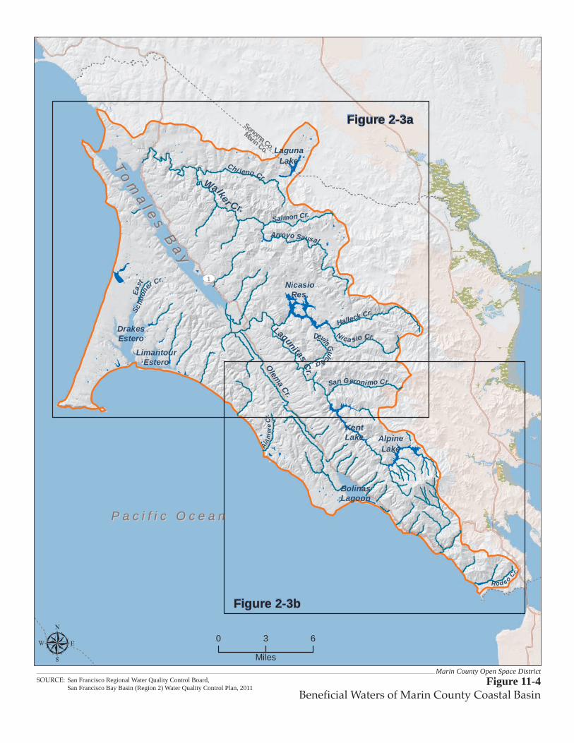
P a c i f i c O c e a nP a c i f i c O c e a n
Sch
oon
er Cr.
Ea
st
Figure 2-3a
Figure 2-3b
Chi leno Cr.
Lagunitas Cr.
1
Olem
a Cr.
Ala
mer
e C
r.
Walker Cr.
Halleck Cr.
Nica sio Cr.
Salmon Cr.
San Geronimo Cr.
Arroyo Sausal
DrakesEstero
To
ma
l es
Ba
y
To
ma
l es
Ba
y
BolinasLagoon
LimantourEstero
Devils Gulch cr
AlpineLake
KentLake
NicasioRes.
LagunaLake
Sonoma Co.
Marin Co.
0 3 6
Miles
Rod eo
Cr.
Marin County Open Space DistrictFigure 11-4
Beneficial Waters of Marin County Coastal BasinSOURCE: San Francisco Regional Water Quality Control Board, San Francisco Bay Basin (Region 2) Water Quality Control Plan, 2011

Hydrology and Water Quality
Road and Trail Management Plan 11-14 Marin County Open Space District Draft TPEIR September 2013
Table 11-3 Water Bodies in Marin County with Existing and Potential Beneficial Uses
Waterbody Existing Human Uses
Existing Aquatic Life Uses Wildlife Use/Habitat
Existing Recreational Uses
Preserves that Drain to or Include Waterbody
Marin County Coastal Basin
Pacific Ocean Industrial Service Supply
Commercial and Sport Fishing, Shellfish Harvesting, Marine Habitat, Fish Migration, Preservation of Rare and Endangered Species, Fish Spawning
X Contact and Non-Contact Water Recreation, Navigation
All Preserves
San Geronimo Cold and Warm freshwater habitat, Fish Migration, Preservation of Rare Endangered Species, Fish Spawning
X Contact and Non-Contact Water Recreation
French Ranch, Maurice Thorner Memorial Open Space, Roy’s Redwoods, Gary Giacomini, and (small portion) White Hill
Lagunitas Creek Agriculture, Municipal and Domestic, Industrial Service Supply
Cold and Warm freshwater habitat, Fish Migration, Preservation of Rare Endangered Species, Fish Spawning
X Contact and Non-Contact Water Recreation
French Ranch, Maurice Thorner Memorial Open Space, Roy’s Redwoods, Gary Giacomini, and (small portion) White Hill
Bolinas Lagoon Commercial and Sport Fishing, Shellfish Harvesting, Marine Habitat, Fish Migration, Preservation of Rare and Endangered Species, Fish Spawning
X Contact and Non-Contact Water Recreation, Navigation
Bolinas Lagoon
Pine Gulch Creek Agriculture, Municipal and Domestic, and Industrial Service Supply
Cold and Warm freshwater habitat, Fish Migration, Preservation of Rare and Endangered Species, Fish Spawning
X Contact and Non-Contact Water Recreation
Bolinas Lagoon
Woodacre Creek Cold and Warm freshwater habitat, Fish Migration, Preservation of Rare and Endangered Species
X Contact and Non-Contact Water Recreation
Gary Giacomini
Marin County Central Basin
Larkspur Creek Cold and Warm freshwater habitat, Preservation of Rare and Endangered Species, Fish Spawning
X Contact and Non-Contact Water Recreation
Baltimore Canyon (headwaters) and Blithedale Summit

Hydrology and Water Quality
Marin County Open Space District 11-15 Road and Trail Management Plan September 2013 Draft TPEIR
Table 11-3 Water Bodies in Marin County with Existing and Potential Beneficial Uses
Waterbody Existing Human Uses
Existing Aquatic Life Uses Wildlife Use/Habitat
Existing Recreational Uses
Preserves that Drain to or Include Waterbody
Corte Madera Creek
Commercial and Sport Fishing Cold and Warm freshwater habitat, Fish Migration, Preservation of Rare and Endangered Species, Fish Spawning
X Contact and Non-Contact Water Recreation, Navigation
Baltimore Canyon and Blithedale Summit
San Rafael Creek Cold and Warm freshwater habitat X Contact and Non-Contact Water Recreation, Navigation
Terra Linda/Sleepy Hollow Divide
San Anselmo Creek Cold and Warm freshwater habitat, Fish Migration, Preservation of Rare and Endangered Species, Fish Spawning
X Contact and Non-Contact Water Recreation
Cascade Canyon, White Hill and Gary Giacomini
Fairfax Creek Cold and Warm freshwater habitat, Fish Spawning
X Contact and Non-Contact Water Recreation
Loma Alta
Sleepy Hollow Creek
Cold and Warm freshwater habitat, Fish Migration, Preservation of Rare and Endangered Species, Fish Spawning
X Contact and Non-Contact Water Recreation
Terra Linda/Sleepy Hollow Divide and Bald Hill
Tamalpais Creek Cold and Warm freshwater habitat, Fish Migration, Preservation of Rare and Endangered Species, Fish Spawning
X Contact and Non-Contact Water Recreation
Baltimore Canyon
Arroyo Corte Madera Del Presidio
Shellfish Harvesting, Cold and Warm freshwater habitat, Fish Migration, Preservation of Rare and Endangered Species, Fish Spawning
X Contact and Non-Contact Water Recreation
Blithedale Summit
Warner Canyon Creek
Cold and Warm freshwater habitat, Fish Migration, Preservation of Rare and Endangered Species, Fish Spawning
X Contact and Non-Contact Water Recreation
Blithedale Summit and Camino Alto
Richardson Bay Industrial Service Supply
Commercial and Sport Fishing, Shellfish Harvesting, Estuarine Habitat, Fish Migration, Preservation of Rare and Endangered Species, Fish Spawning
X Contact and Non-Contact Water Recreation, Navigation
Blithedale Summit, Camino Alto, Horse Hill, Ring Mountain, Bothin Marsh, and Old Saint Hilary’s
Source: SF RWQCB 2011.

Hydrology and Water Quality
Road and Trail Management Plan 11-16 Marin County Open Space District Draft TPEIR September 2013
Table 11-4 Summary of Hydrology and Water Quality Conditions by MCOSD Preserve
Physical Features Preserve Name
Area (acres)
Watershed(s) (WS)
Terrain/Climate
Wetlands/ Sensitive Water
Bodies
General Road and Trail Condition Hydrologic and Historical Setting
Region 1
Baltimore Canyon
193.1 Corte Madera (part of Ross Valley WS at 28-sq mi)
Mostly steep canyon and ridge line
Yes. Larkspur Creek headwaters and numerous springs
• Fire roads are typically 30’ wide ingress/egress (tractor mow), and 50’ or 100’ wide defensible space.
• Extensive gullying along Hoo Koo E Koo and Indian Fire trails.
• Hoo Koo E Koo and Southern Marin Line trails cross Larkspur Creek and Dawn Falls Trail runs immediately adjacent to the creek crossing some of its tributary drainages.
• Slide at Windy Ridge Trail • Northwestern section of Dawn
Falls Trail has grades > than 15 and 25 percent.
• Redwoods were logged in the mid-1800s, all in less than one decade.
• West property boundary is shared with MMWD.
• Part of watershed also known as Ross Valley Watershed where in 2006, the County of Marin, City of Larkspur and Towns of Fairfax, Ross and San Anselmo formed the Ross Valley Flood Protection and Watershed Program (RVFPWP) to develop and implement a flood management program that promotes with healthy watershed processes (Marin County 2009).
King Mountain
107.5 Corte Madera (part of Ross Valley WS)
Steep • Ranching in late 1800. Goats grazing in early to mid-1900s. Parcels acquired in 1988 and 1990.
Blithedale Summit
640.2 Corte Madera (part of Ross Valley WS) and Arroyo Corte Madera del Presidio (part of Richardson Bay WS)
Steep The northwest portion of the preserve drains to Larkspur Creek. The southwest portion of the ridge drains to Warner Canyon Creek and Arroyo Corte Madera del Presidio Creek
• Fire roads are 30’ wide ingress/egress (tractor mow, installed after 1994).
• Contains miles of proposed primary fuelbreaks along ridge top roads in mixed chaparral
• Several trails with active erosion and gullying including Blithedale Ridge, Madera Ridge and Middle Summit fire roads and Huckleberry Trail.
• Blithedale Summit adjoins MMWD, state park, and national park lands providing a linkage between the waters of San Francisco Bay and the Pacific Ocean.
• Shares property boundary with MMWD. Saved from development in the 1970s.
• A Special Flood Hazard Area (i.e. 100-year flood zone) initiates and widens along Larkspur Creek after it leaves the preserve and begins to wind through the lower elevation residential and town areas (FEMA 2009).

Hydrology and Water Quality
Marin County Open Space District 11-17 Road and Trail Management Plan September 2013 Draft TPEIR
Table 11-4 Summary of Hydrology and Water Quality Conditions by MCOSD Preserve
Physical Features Preserve Name
Area (acres)
Watershed(s) (WS)
Terrain/Climate
Wetlands/ Sensitive Water
Bodies
General Road and Trail Condition Hydrologic and Historical Setting
• Stream crossings on Southern Marin and Corte Madera trails.
• Several trail segments within the preserve occur on fall lines and large portions of Blithedale and Corte Madera Ridge fire roads are steeper than 15% grade often coinciding with prominent gully formation.
• The Southern Marin Watershed Program is a collaborative effort of the City of Mill Valley, the County of Marin, and Flood Control Zones 3 and 4 that integrates flood protection and environmental restoration within the Richardson Bay WS. Marin County Department of Public Works was authorized to begin implementation of a county-wide Watershed Program on May 13, 2008 (Marin County 2009).
Camino Alto
170.3 Corte Madera (part of Ross Valley WS) and Arroyo Corte Madera del Presidio (part of Richardson Bay WS)
Steep, mostly along a ridgeline
Yes Creeks/Riparian woodlands
• Numerous social trails; major road erosion; heavy public use with dogs.
• Cascade Canyon Bottomlands and Cascade Canyon fire trail are very heavily used.
• A high concentration of eroded/gullying roads.
• Several fall line trails and trails >25% grade, particularly along Lower and Middle Summit Roads. Many other trails at >15% grade.
• Northridge acquisition from 1970s • Grazing - Bottini Ranch - until 1914. • Hunting - “Elliot Nature Preserve” – from mid
1900s to 1970s. • Parcels purchased in 1974, 1976, 1978, 1987,
1994, and 1995. • Shares boundary with MMWD land to the west,
abuts residential neighborhoods along its eastern margin and is adjacent to the Mill Valley Golf Course to the west.
• Flood Control Zones 3 and 4 were formed in the late 1950s to address flooding in low-lying areas bordering Richardson Bay at the downstream end of the watershed. Since then numerous flood control facilities have been constructed and continue to be in operation.
• Following the floods of 2005/06 the City of Mill Valley has allocated funding for flood control projects to increase the level of flood protection within Arroyo Corte Madera del Presidio watershed (Marin County 2009).

Hydrology and Water Quality
Road and Trail Management Plan 11-18 Marin County Open Space District Draft TPEIR September 2013
Table 11-4 Summary of Hydrology and Water Quality Conditions by MCOSD Preserve
Physical Features Preserve Name
Area (acres)
Watershed(s) (WS)
Terrain/Climate
Wetlands/ Sensitive Water
Bodies
General Road and Trail Condition Hydrologic and Historical Setting
Alto Bowl 37.1 Arroyo Corte Madera del Presidio (part of Richardson Bay WS)
Yes Sutton Manor Creek
Fire roads are 60’ wide ingress/egress and 100’ wide defensible space. Hand mow.
• Former dairy ranches - Tunnel Ranch and Alto Dairy - until 1940. Parcels acquired in 1974, 1985, and 1990.
• Three springs were successfully enclosed in large grazing enclosures, and replanted with native species. No recent monitoring has been conducted but staff believes the spring fencing project was a success.
Horse Hill 50.2 Arroyo Corte Madera del Presidio (part of Richardson Bay WS)
Steep Yes Three springs grazed by horses occur on the preserve
• Fire roads are 30’ wide defensible space (hand and tractor mow, installed since 1994).
• Horses have created numerous trails.
• Almost all the trails within the preserve show evidence of gullying and erosion.
• Several trails on fall line and/or steeper than 25% grade.
• Oak groves are suffering from soil compaction and poor regeneration.
• Horses have grazed Horse Hill for over 40 years. Purchased in 1995.
• Privately owned horses (max. 14) are grazed over 60 acres, including land belonging to Mill Valley Meadows Homeowners’ Association. It is assumed that equine use is the dominant use of Horse Hill and will remain so for the foreseeable future.
• Abuts U.S. 101 to the east
Region 1 Total
1,198.4 • Steep trails with almost 70 percent at 15% grade or steeper and 25% positioned along fall line.
• 16.5 miles of trail with extensive gullying. • 78 undesignated stream crossings. • 35 miles of redundant trails.

Hydrology and Water Quality
Marin County Open Space District 11-19 Road and Trail Management Plan September 2013 Draft TPEIR
Table 11-4 Summary of Hydrology and Water Quality Conditions by MCOSD Preserve
Physical Features Preserve Name
Area (acres)
Watershed(s) (WS)
Terrain/Climate
Wetlands/ Sensitive Water
Bodies
General Road and Trail Condition Hydrologic and Historical Setting
Region 2
French Ranch
402.6 San Geronimo Creek (part of Tomales Bay WS via Lagunitas Creek)
Steep Yes Clear Creek
• Fire roads are 30’ wide ingress /egress, mostly maintained via hand and tractor mowing.
• There are three steep main trails, one of which is French Ranch Road, with 15% or greater grades, sections along the fall line and extensive gullying.
• Area drains to San Geronimo Creek, which feeds Tomales Bay designated by the US Fish and Wildlife Service in 2002 as a Wetland of International Importance (Marin County 2009).
• Marin County Department of Public Works has prepared a Salmon Enhancement Plan to guide development in the San Geronimo Valley since it includes the last un-dammed headwaters of Lagunitas Creek with critical Coho salmon habitat (Marin County 2009).
Maurice Thorner Memorial
32.8 San Geronimo Creek (part of Tomales Bay WS via Lagunitas Creek)
Ridge line • Fire roads with 30’ wide ingress/egress and mostly hand and tractor mowed.
• A wildland fire in 2008 was caused by a model rocket launched by a neighbor.
• Property acquired in 1981. Gold mining in late 1800s on slope south of the preserve.
• Area drains to San Geronimo Creek, which feeds Tomales Bay designated by the US Fish and Wildlife Service in 2002 as a Wetland of International Importance (Marin County 2009).
• Marin County Department of Public Works has prepared a Salmon Enhancement Plan to guide development in the San Geronimo Valley since it includes the last un-dammed headwaters of Lagunitas Creek with critical Coho salmon habitat (Marin County 2009).
Roy’s Redwoods
293.0 San Geronimo Creek (part of Tomales Bay WS via Lagunitas Creek)
Steep Yes Larsen Creek Spirit Rock Creek
• Fire roads are 30’ wide ingress/egress with mostly hand and tractor mowing.
• Gullying on Roy’s Loop Trail and Dickson’s Ridge Fire Trail.
• Purchased in 1978. Select-cut logging, Grazing in mid-1900s.
• Golf course along southwestern boundary. 463 acres - French Ranch
• Area drains to San Geronimo Creek, which feeds Tomales Bay designated by the US Fish and Wildlife Service in 2002 as a Wetland of International Importance (Marin County 2009).

Hydrology and Water Quality
Road and Trail Management Plan 11-20 Marin County Open Space District Draft TPEIR September 2013
Table 11-4 Summary of Hydrology and Water Quality Conditions by MCOSD Preserve
Physical Features Preserve Name
Area (acres)
Watershed(s) (WS)
Terrain/Climate
Wetlands/ Sensitive Water
Bodies
General Road and Trail Condition Hydrologic and Historical Setting
• Marin County Department of Public Works has prepared a draft Salmon Enhancement Plan to guide development in the San Geronimo Valley since it includes the last un-dammed headwaters of Lagunitas Creek with critical Coho salmon habitat (Marin County 2009).
Gary Giacomini
1,475.9 San Geronimo Creek (part of Tomales Bay WS via Lagunitas Creek) The southeast portion of Giacomini drains to San Anselmo Creek and the Ross Valley Watershed
Yes San Geronimo Creek Montezuma Creek Candelero Creek Creamery Creek Deer Camp Creek Willis Evans Canyon Creek Woodacre Creek Pine Mountain Creek
• There is a large network of illegal trails used by bikers and hikers in this preserve that cut through manzanita and other native plant communities.
• Cortez Fire Road was converted from single-track trail to fire road in 2007 after pressure from local residents to provide an escape route in case of wildland fire.
• Several steep trails with sections along fall line and extensive gullying. Including Manzanita, Juniper, Grange and Conifer Ridge trails.
• Numerous stream crossings including several each at Sylvestris Fire Road, Contour Trail, Candelero Canyon Trail, and Lagunitas Trail.
• Six slides below San Geronimo Ridge.
• Parcels purchased from developers in 1991 and 1995.
• MMWD shares the western boundary of preserve.

Hydrology and Water Quality
Marin County Open Space District 11-21 Road and Trail Management Plan September 2013 Draft TPEIR
Table 11-4 Summary of Hydrology and Water Quality Conditions by MCOSD Preserve
Physical Features Preserve Name
Area (acres)
Watershed(s) (WS)
Terrain/Climate
Wetlands/ Sensitive Water
Bodies
General Road and Trail Condition Hydrologic and Historical Setting
Loma Alta 508.5 Fairfax Creek part of larger Ross Valley Watershed
Yes Fairfax Creek Seasonal wetlands
• Fire trails are 30’ wide ingress/egress and hand and tractor mowed maintenance.
• The majority of trails exhibit extensive gullying including Hill Fire Road, Old Railroad Grade and Gunshot Fire Road.
• Four stream crossings within the preserve.
• Four slides along Smith Ridge trail.
History of grazing. Parcels acquired in 1988, 1989, and 1990.
White Hill 390.0 Fairfax Creek part of larger Ross Valley Watershed Very small portion of preserve to the west drains to San Geronimo Creek (part of Tomales Bay WS via Lagunitas Creek)
Ridge line Yes Pine Mountain Creek Cascade Falls Creek Wet meadow (sedge-rush-wet meadow)
• Fire trails are 30’ wide and maintained with tractor mow.
• Some fall line trail sections and gullying.
• History of grazing, probably until the 1920s. • Purchased from Boy Scouts of America in 1994
and 1997-1998. • North Shore Railroad built tunnel (now Bothin
Tunnel) through ridge north from White Hill. • Shares western boundary with MMWD land.
Cascade Canyon
504.4 San Anselmo Creek part of the larger Ross Valley WS
Steep Yes Pine Mountain Creek Cascade Falls Creek Carey Camp Creek Rush Creeks Vernal pool Numerous springs (inc. serpentine seep)
• Fire trails are typically 30’ wide. • Vegetation in Cascade Canyon
bottomlands along San Anselmo Creek has been displaced by the road system and several recognized and non-recognized bike trails.
• Numerous steep trails (>15%-25% gradient) with gullying.
• Grazing - Bottini Ranch - until 1914. • Hunting - “Elliot Nature Preserve” – from mid
1900s to 1970s. • Parcels purchased in 1974, 1976, 1978, 1987,
1994, and 1995. • Cascade Canyon Bottomlands and Cascade
Canyon fire trail are very heavily used. • Shares boundary with MMWD land.

Hydrology and Water Quality
Road and Trail Management Plan 11-22 Marin County Open Space District Draft TPEIR September 2013
Table 11-4 Summary of Hydrology and Water Quality Conditions by MCOSD Preserve
Physical Features Preserve Name
Area (acres)
Watershed(s) (WS)
Terrain/Climate
Wetlands/ Sensitive Water
Bodies
General Road and Trail Condition Hydrologic and Historical Setting
• Four slides in the area and two stream crossings.
• Contains the 38-acre Elliott Nature Preserve
Region 2 Total
3,607.2 • Steep trails with almost 83 percent at 15% grade or steeper and 25% positioned along fall line.
• 40 miles of trail with extensive gullying. • 241 undesignated stream crossings. • 70 miles of redundant trails.
Region 3
Indian Valley
557.6 Ignacio Creek part of larger Novato Creek WS (45 sq mi)
Steep Yes Arroyo Avichi, south fork One unnamed creek
• Fire trails are 30’ wide with mostly hand and tractor mow maintenance.
• Proposed break on the MCOSD lands utilizes an unmaintained and problematic road cut.
• Several steep and eroding trails including Susan Alexander, Waterfall, and Burgh trails.
• One stream crossing on Waterfall Trail.
• First parcel purchased in 1975. Previously part of the Back Ranch.
• A Novato Watershed Program is underway and in 2006, the Marin County Flood Control District completed the final phase of a 15-year, multi-phase flood control project that provides protection from the 50-year storm event along the lower reaches of Arroyo Avichi, Warner, and Novato Creeks (Marin County 2009).
Lucas Valley
1,270.9 Miller Creek (12 sq mi)
Steep Yes Miller Creek and several tributaries Pristine coastal prairie is also present and several uncommon plants along ridgeline
• Lower concentration of trails per area of open space compared to many of the other preserves.
• Grady and Luis Fire Roads and Rubicon and Vogelsang Trails have several steep gradient reaches (>15% - 25%) with erosion issues.
• History of ranching since 1860. Parcels acquired in 1975, 1986, 1989, 1990, and 1996.
• Properties to the west are privately owned ranches, some by George Lucas. County lands to the east, managed by the Lucas Valley Homeowners’ Association.

Hydrology and Water Quality
Marin County Open Space District 11-23 Road and Trail Management Plan September 2013 Draft TPEIR
Table 11-4 Summary of Hydrology and Water Quality Conditions by MCOSD Preserve
Physical Features Preserve Name
Area (acres)
Watershed(s) (WS)
Terrain/Climate
Wetlands/ Sensitive Water
Bodies
General Road and Trail Condition Hydrologic and Historical Setting
Loma Verde
319.6 Ignacio Creek part of larger Novato Creek WS (45 sq mi)
Steep • Pebble Beach and Escondido Fire Roads have long reaches on the fall line and exhibit extensive gullying.
• Adjacent to Ignacio Valley and Pacheco Valle Open Space Preserves.
• History of ranching. • A Novato Watershed Program is underway and
in 2006, the Marin County Flood Control District completed the final phase of a 15-year, multi-phase flood control project that provides protection from the 50-year storm event along the lower reaches of Arroyo Avichi, Warner, and Novato Creeks (Marin County 2009).
Pacheco Valle
503.9 Pacheco Creek to larger Novato Creek WS (45 sq mi) via Ignacio Creek
Steep Yes Pacheco Creek
• Fire trails are 30’ wide ingress/egress maintained with mostly hand and tractor mowing.
• Gullying along ridgeline fire roads, Chicken Shack, Little Cat and Ponti.
• Adjacent to Ignacio Valley and Loma Verde Open Space Preserves.
• Parcels acquired in 1975 and 1995. • A Novato Watershed Program is underway and
in 2006, the Marin County Flood Control District completed the final phase of a 15-year, multi-phase flood control project that provides protection from the 50-year storm event along the lower reaches of Arroyo Avichi, Warner, and Novato Creeks (Marin County 2009).
Ignacio Valley
885.3 Arroyo de San Jose in larger Novato Creek WS
Steep Yes Arroyo de San Jose Creek Two unnamed creeks
• Fire trails installed in 1994 are 30’ wide and maintained with hand mowing.
• One unnamed trail entirely on fall line but no reported evidence of gullying.
• Chicken Shack Fire Road on ridgeline has several steep portions with gullying.
• Adjacent to Loma Verde and Pacheco Valle Open Space Preserves.
• Purchased in 1975. • A Novato Watershed Program is underway and
in 2006, the Marin County Flood Control District completed the final phase of a 15-year, multi-phase flood control project that provides protection from the 50-year storm event along the lower reaches of Arroyo Avichi, Warner, and Novato Creeks (Marin County 2009).
Region 3 Total
3,573.3 • Steep trails with 90 percent at 15% grade or steeper and almost 50% positioned along fall line.
• 30 miles of trail with extensive gullying. • 66 undesignated stream crossings. • 35 miles of redundant trails.

Hydrology and Water Quality
Road and Trail Management Plan 11-24 Marin County Open Space District Draft TPEIR September 2013
Table 11-4 Summary of Hydrology and Water Quality Conditions by MCOSD Preserve
Physical Features Preserve Name
Area (acres)
Watershed(s) (WS)
Terrain/Climate
Wetlands/ Sensitive Water
Bodies
General Road and Trail Condition Hydrologic and Historical Setting
Region 4
Mount Burdell
1,627.3 Novato Creek WS (45 sq mi) Eastern edge of preserve is in Rush Creek WS
Mostly steep
Yes Two small, unnamed creeks Hidden Lake, one of Marin County’s few vernal pools
• Fire trails are 30’ wide ingress/egress and maintained with hand and tractor mowing.
• Large proportion of preserve trails exhibit erosion and gullying.
• At least one social trail has been closed by ripping the trail bed.
• Recent grazing plan recommends some changes, including timing and intensity of grazing and changes in protection of rare plants.
• Previously part of C Ranch. Purchased in 1977. • California Department of Parks and Recreation
owns Olompali property to the northeast. Northwest and west slopes are privately owned dairy ranches.
• Some riparian areas have been fenced to protect from cattle, but may need additional restoration.
Rush Creek 522.1 Rush Creek WS Steep and gently sloped
Yes Rush Creek runs along boundary Seasonal wetlands (Cemetery Marsh) Wet meadow
• Fire trails are 30’ wide ingress/egress with hand and tractor mowed maintenance since acquisition.
• Minimal steep trail sections, however evidence of gullying on Pinheiro Fire Road and Rush Creek Trail.
• Chicken ranch in early 1900s. Received land in late 1990s.
• California Department of Fish and Game owns adjacent properties.
Little Mountain
214.1 Novato Creek WS (45 sq mi)
Steep Yes Small vernal pool is at this site; Novato Creek runs along the preserve boundary; Undifferentiated marsh
• Trails are 30’ wide ingress/egress and maintained via tractor and hand mowing
• Steep sections along ridgeline trail in center of preserve.
• Gullying along Doe Hill Fire Road.
• Previously part of E Ranch. • Purchased in 1995. • Adjacent residential community is essentially
surrounded by MCOSD lands. • NMWD lands are adjacent on west boundary.
Verissimo Hills
114.6 Novato Creek WS (45 sq mi)
Steep • Fire trails are 30’ wide and maintained via hand mowing.
• Sanchez Fire Road is steep with eroded sections.
• Gift from Sanchez family in 1985. • Adjacent residential community is essentially
surrounded by MCOSD lands.

Hydrology and Water Quality
Marin County Open Space District 11-25 Road and Trail Management Plan September 2013 Draft TPEIR
Table 11-4 Summary of Hydrology and Water Quality Conditions by MCOSD Preserve
Physical Features Preserve Name
Area (acres)
Watershed(s) (WS)
Terrain/Climate
Wetlands/ Sensitive Water
Bodies
General Road and Trail Condition Hydrologic and Historical Setting
Indian Tree 242.0 Novato Creek WS (45 sq mi)
Steep Yes Vineyard Creek and one unnamed creek
• Fire trails are 30’ wide ingress/egress (hand mow).
• Evidence of gullying on switchback trails between Willow Tree Stables and ridge top.
• Purchased in 1977. Previously part of French Ranch.
• Adjacent properties owned by Marin Agricultural land Trust and North Marin Water District.
• No road access.
Deer Island 134.8 Novato Creek WS (45 sq mi)
Steep and gently sloped
Yes Estuarine marsh habitats Novato Creek and Deer Island Channel Creek run outside preserve edges
• Fire trails are 30’ wide ingress/egress with mostly tractor mowing for maintenance.
• Evidence of concentrated flow along trails but no gullying.
• Island until late 19th century and diked and drained for pasture land. History of ranching since 1890. Parcels acquired in 1978 and 1983 (9-acre grazing lease ended).
• Property is surrounded by parcels owned by Marin County Public Works Department/Flood Control District, Novato Sanitary District, California Department of Fish and Game, Marin Audubon Society.
Region 4 Total
2,854.9 • Steep trails with 80 percent at 15% grade or steeper and almost 30% positioned along fall line.
• 50 miles of trail with extensive gullying. • 65 undesignated stream crossings. • 56 miles of redundant trails.

Hydrology and Water Quality
Road and Trail Management Plan 11-26 Marin County Open Space District Draft TPEIR September 2013
Table 11-4 Summary of Hydrology and Water Quality Conditions by MCOSD Preserve
Physical Features Preserve Name
Area (acres)
Watershed(s) (WS)
Terrain/Climate
Wetlands/ Sensitive Water
Bodies
General Road and Trail Condition Hydrologic and Historical Setting
Region 5
Terra Linda/ Sleepy Hollow Divide
1,171.8 Crosses 4WS: 1) Gallinas Creek WS, 5.6 sq mi (eastern and largest portion) 2) Sleepy Hollow Creek part of larger 28 sq mi Ross Valley WS (western portion) 3) San Rafael Creek , 11 sq mi (southern tip) 4) Miller Creek, 12 sq mi (northern portion)
Mostly ridge line
Yes Part of Miller Creek
• Trails are 30’ wide with hand and tractor mowing and every five years. The MCOSD hires contract crews to do major tree pruning per the terms of the acquisition.
• Controlled burns have been conducted in this preserve annually since 2006 as part of goatgrass management.
• 75 signed entrances. • Several short fall line trails
interspersed throughout the preserve with associated erosion and gullying.
• Two stream crossings, one on Miller Creek near Lucas Valley Road and one on Sleepy Hollow Creek tributary.
• Department of Public Works has stated that Miller Creek is one of the best remaining habitats for steelhead in Marin County.
• Numerous parcel acquisitions from 1972 through 1989. Sheep grazing from 1981-1987 for fuel reduction.
• The MCOSD is entering into the sixth season of the Terra Linda / Sleepy Hollow Goatgrass Removal Project. Their goal is to remove barbed goatgrass to preserve native biological diversity and promote wildlife habitat, using Integrated Pest Management.
• Fuel reduction in eucalyptus grove, no removal of eucalyptus greater than 13dbh unless hazard.
• A Gallinas Creek Watershed Program is underway. Goals under the program include developing cost effective flood control solutions, improving navigational access to Lower Las Gallinas Creek, and protecting and enhancing the sensitive creek and wetland habitat and water quality (Marin County 2009).
Santa Margarita Island
8.8 Gallinas Creek WS, 5.6 sq mi
Gently sloped
Yes Preserve is surrounded by the South Fork of the Gallinas Creek Riparian woodlands Salt marsh Brackish marsh Seasonal wetlands
• Erosion and gullying on trail that encircles the island.
• Land used for soil disposal after WWII. Dumping of dredging spoils in 1969 and 1987. Purchased in 1974; marshland filled in and canals built, “thousands of rare and exotic plants brought in.”
• The lower portions of the island, what appears to be the land below the trail, are within the Special Flood Hazard Area (i.e. 100-year flood) of the South Fork of Gallinas Creek (FEMA 2009).
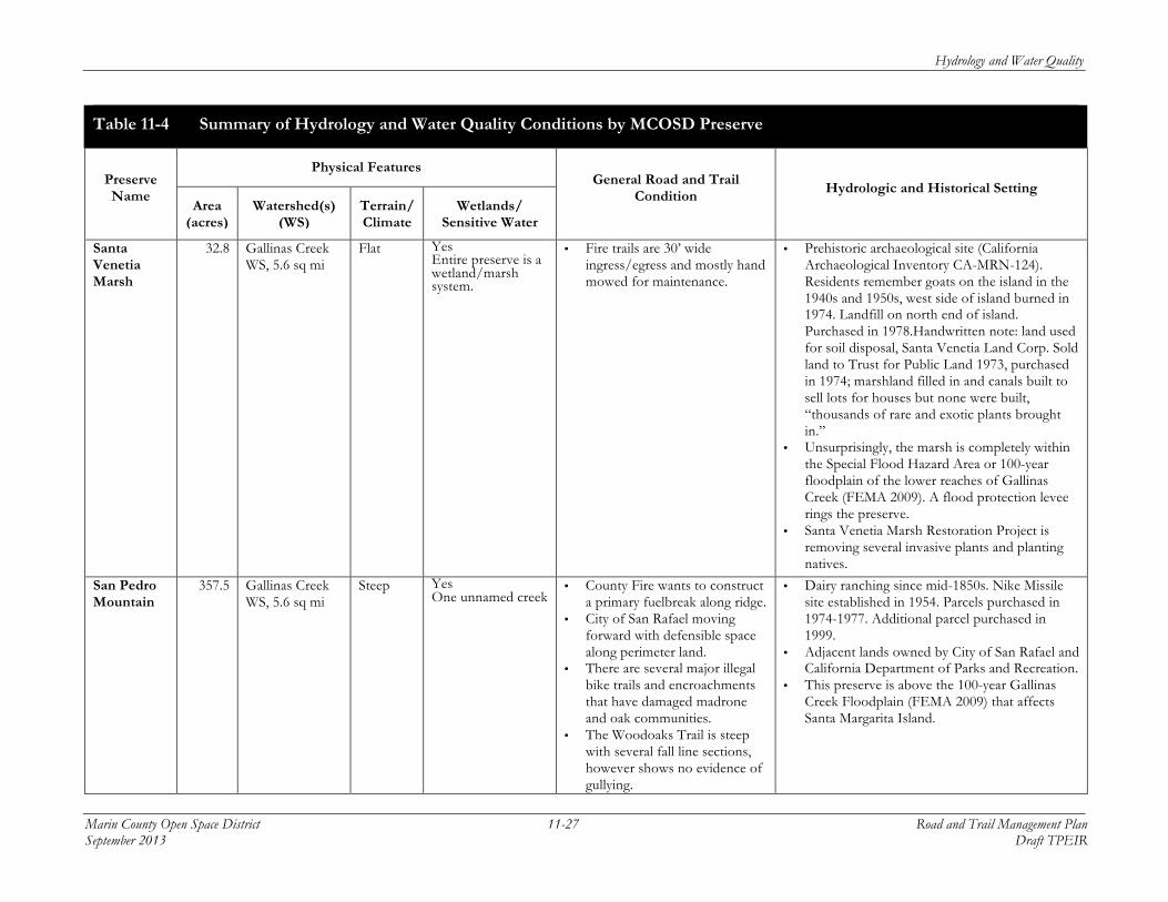
Hydrology and Water Quality
Marin County Open Space District 11-27 Road and Trail Management Plan September 2013 Draft TPEIR
Table 11-4 Summary of Hydrology and Water Quality Conditions by MCOSD Preserve
Physical Features Preserve Name
Area (acres)
Watershed(s) (WS)
Terrain/Climate
Wetlands/ Sensitive Water
Bodies
General Road and Trail Condition Hydrologic and Historical Setting
Santa Venetia Marsh
32.8 Gallinas Creek WS, 5.6 sq mi
Flat Yes Entire preserve is a wetland/marsh system.
• Fire trails are 30’ wide ingress/egress and mostly hand mowed for maintenance.
• Prehistoric archaeological site (California Archaeological Inventory CA-MRN-124). Residents remember goats on the island in the 1940s and 1950s, west side of island burned in 1974. Landfill on north end of island. Purchased in 1978.Handwritten note: land used for soil disposal, Santa Venetia Land Corp. Sold land to Trust for Public Land 1973, purchased in 1974; marshland filled in and canals built to sell lots for houses but none were built, “thousands of rare and exotic plants brought in.”
• Unsurprisingly, the marsh is completely within the Special Flood Hazard Area or 100-year floodplain of the lower reaches of Gallinas Creek (FEMA 2009). A flood protection levee rings the preserve.
• Santa Venetia Marsh Restoration Project is removing several invasive plants and planting natives.
San Pedro Mountain
357.5 Gallinas Creek WS, 5.6 sq mi
Steep Yes One unnamed creek
• County Fire wants to construct a primary fuelbreak along ridge.
• City of San Rafael moving forward with defensible space along perimeter land.
• There are several major illegal bike trails and encroachments that have damaged madrone and oak communities.
• The Woodoaks Trail is steep with several fall line sections, however shows no evidence of gullying.
• Dairy ranching since mid-1850s. Nike Missile site established in 1954. Parcels purchased in 1974-1977. Additional parcel purchased in 1999.
• Adjacent lands owned by City of San Rafael and California Department of Parks and Recreation.
• This preserve is above the 100-year Gallinas Creek Floodplain (FEMA 2009) that affects Santa Margarita Island.

Hydrology and Water Quality
Road and Trail Management Plan 11-28 Marin County Open Space District Draft TPEIR September 2013
Table 11-4 Summary of Hydrology and Water Quality Conditions by MCOSD Preserve
Physical Features Preserve Name
Area (acres)
Watershed(s) (WS)
Terrain/Climate
Wetlands/ Sensitive Water
Bodies
General Road and Trail Condition Hydrologic and Historical Setting
• Two other steep unnamed trails that lead to the ridgeline do exhibit erosion. The trail east of Woodoaks Trail has several ford crossings and it follows a natural drainage and the trail to the west has one ford crossing on the unnamed creek.
Bald Hill 31.0 Sleepy Hollow Creek part of larger 28 sq mi Ross Valley WS
Steep • Fire trails are 30’ wide ingress/egress, tractor mowed and installed in 2006.
• No maintained trails.
• Parcels acquired in 1994 and 1995. • Shares a boundary with MMWD land.
Region 5 Total
1601.9 • Steep trails with 76 percent at 15% grade or steeper and 40% positioned along fall line.
• 25 miles of trail with extensive gullying. • 32 undesignated stream crossings. • 27 miles of redundant trails.

Hydrology and Water Quality
Marin County Open Space District 11-29 Road and Trail Management Plan September 2013 Draft TPEIR
Table 11-4 Summary of Hydrology and Water Quality Conditions by MCOSD Preserve
Physical Features Preserve Name
Area (acres)
Watershed(s) (WS)
Terrain/Climate
Wetlands/ Sensitive Water
Bodies
General Road and Trail Condition Hydrologic and Historical Setting
Region 6
Ring Mountain
367.2 Crosses 2 WS: Northern portion drains to San Pablo Bay and is part of the 28 sq mi Ross Valley WS and West and East Creeks drain the southern portion in the Richardson Bay WS
Mostly Steep
Yes East Creek West Creek Three other unnamed creeks
• Fire trails are 30’ wide ingress/egress with hand and tractor mowed maintenance.
• Extensive network of overlapping steep trails with high concentration of gullying.
• Many ford crossings at drainages.
• Mineral lawsonite first discovered here in the 1890s.
• Geologically diverse and unique. • Earliest Miwok village dated to 370 BC. Part of
Reed Ranch for 130 years until 1965. Army installed guns on summit in 1950s, deactivated in 1960s. Management turned over to the MCOSD in 1995 from Nature Conservancy.
• Town of Tiburon owns several significant adjacent properties.
• Southern portion drains to Richardson Bay considered one of the most pristine estuaries on the Pacific Coast and part of the Southern Marin Watershed Program initiated in 2008 (Marin County 2009).
• The low lying portion of land north of Paradise Drive (Marin Audubon) is within the Special Flood Hazard Zone (i.e. 100-year flood area) (FEMA 2009).
Old Saint Hilary’s
121.8 Richardson Bay WS
Mostly Steep
Yes Preserve includes two unnamed creeks
• Trails are 30’ wide ingress/egress with mostly hand and also tractor mowing maintenance.
• Preserve contains “One of the most interesting and beautiful wildflower gardens in California, and thus in all the world.” John Thomas Howell, author of Marin Flora.
• Acquired parcels in 1993 and 1997. • Marin County Parks owns adjacent land. • Drains to Richardson Bay considered one of
the most pristine estuaries on the Pacific Coast and part of the Southern Marin Watershed Program initiated in 2008 (Marin County 2009).

Hydrology and Water Quality
Road and Trail Management Plan 11-30 Marin County Open Space District Draft TPEIR September 2013
Table 11-4 Summary of Hydrology and Water Quality Conditions by MCOSD Preserve
Physical Features Preserve Name
Area (acres)
Watershed(s) (WS)
Terrain/Climate
Wetlands/ Sensitive Water
Bodies
General Road and Trail Condition Hydrologic and Historical Setting
Bothin Marsh
105.9 Richardson Bay WS
Flat Yes Salt marsh (high, intermediate, low marsh) Brackish marsh Seasonal wetlands
• Fire trails are 30’ wide ingress/egress. Hand and machine mowed maintained since acquisition.
• North and South Basins are essentially man made marshes. 1851 map shows tidal marshes extending to base of the hills. Dikes built in 1950s and 1960s. Shellmound in North Basin.
• Filling and building in 1970s. Acquired in 1976. Pathway (old railroad right of way) acquired in 1981 through Rails to Trails Program.
• 2008 grant-funded restoration project with Save The Bay removed invasive plants and replanted natives.
• Almost the entire preserve is in a FEMA Special Flood Hazard Area (i.e. 100-year flood area) (FEMA 2009).
• The Southern Marin Watershed Program is a collaborative effort of the City of Mill Valley, the County of Marin, and Flood Control Zones 3 and 4 that integrates flood protection and environmental restoration within the Richardson Bay WS. Marin County Department of Public Works was authorized to begin implementation of a county-wide Watershed Program on May 13, 2008 (Marin County 2009).
Bolinas Lagoon
1,076.9 Bolinas Lagoon WS
Mixture flat and steep areas
Yes Salt marsh (high, intermediate, low marsh) Brackish marsh Seasonal wetlands
• • Bolinas Lagoon is also a Wetland of International Importance. The area is also part of the Gulf of the Farallones National Marine Sanctuary.
• High marsh ecotone at Kent Island is the only location in California that includes a zonation from Vancouver wildrye (Leymus x vancouveriensis), red fescue (Festuca rubra) to saltgrass, pickleweed.

Hydrology and Water Quality
Marin County Open Space District 11-31 Road and Trail Management Plan September 2013 Draft TPEIR
Table 11-4 Summary of Hydrology and Water Quality Conditions by MCOSD Preserve
Physical Features Preserve Name
Area (acres)
Watershed(s) (WS)
Terrain/Climate
Wetlands/ Sensitive Water
Bodies
General Road and Trail Condition Hydrologic and Historical Setting
• Management turned over to the MCOSD in 1988 from Marin County Parks Dept.
• Audubon Canyon Ranch owns a portion of Kent Island and has expressed interest in cooperating with restoration work. Adjacent properties owned by California Dept. of Parks and Recreation and National Park Service.
• In 2008, the “Bolinas Lagoon Ecosystem Restoration Project: Recommendations for Restoration and Management” was completed by a working group of community representatives and scientists. Recommended actions include restoring natural sediment transport and ecological functions of the lagoon, identifying and managing non-native species, and protecting water quality (Marin County 2009).
• Low lying areas adjacent to the lagoon are in the FEMA Special Flood Hazard (100-year flood area). Base flood elevations are around 8-feet on the south end and up to 22 to 23 feet in the coastal flood zone where wave action increases the hazard (FEMA 2009).
• The Stinson Beach Watershed Program is a collaborative effort of the County of Marin, and Flood Control Zone 5 that integrates flood protection and environmental restoration within the Easkoot Creek WS. Marin County Department of Public Works was authorized to begin implementation of a county-wide Watershed Program on May 13, 2008 (Marin County 2009).

Hydrology and Water Quality
Road and Trail Management Plan 11-32 Marin County Open Space District Draft TPEIR September 2013
Table 11-4 Summary of Hydrology and Water Quality Conditions by MCOSD Preserve
Physical Features Preserve Name
Area (acres)
Watershed(s) (WS)
Terrain/Climate
Wetlands/ Sensitive Water
Bodies
General Road and Trail Condition Hydrologic and Historical Setting
Tiburon Ridge
15.1 Richardson Bay WS
Region 6 Total
1,686.9 • Steep trails with more than 80 percent at 15% grade or steeper and more than 30% positioned along fall line.
• 201 miles of trail with extensive gullying. • 14 undesignated stream crossings. • 14 miles of redundant trails.
Source: MCOSD 2011a; and Marin County 2012.

Hydrology and Water Quality
Marin County Open Space District 11-33 Road and Trail Management Plan September 2013 Draft TPEIR
Surface Water Qual i ty
• Activities that impact surface water quality in the region include agricultural irrigation and cattle grazing, forest management, municipal and industrial uses, storm water, and historic mineral extraction.
• Development patterns in Marin County impact geographic variation of surface water quality. The MCOSD preserves are scattered throughout the county, which is largely divided between the urbanized eastern section centered on San Francisco Bay and the mostly undeveloped western section. Almost half of western Marin County is publicly managed for resource protection. This part of the county also supports small rural communities, agriculture, and livestock grazing. (Marin County 2004).
• Historic mercury mining in western Marin has left legacy contamination, most significantly at the Gambonini mine in the Walker Creek watershed. The mine was closed in 1970 but a 1982 storm washed out a large amount of mercury-laden sediment into the creek. Declared a Superfund site in 1998, the area has been stabilized through a joint effort between the U.S. EPA and the SF RWQCB. (Marin County 2004).
• Degradation of water quality negatively impacts aquatic wildlife. Dramatic declines in Coho salmon and steelhead populations during the 1970s and 1980s have been attributed to sedimentation of spawning gravel and rearing pools in the Tomales Bay watershed, Bolinas Lagoon, and Redwood Creek. Other water quality issues limiting aquatic wildlife include: temperature and mercury in the Walker Creek watershed; nutrients and pathogens in Tomales Bay and its tributaries, Stemple Creek and the Estero Americano; and mercury in Tomales Bay.
• Pathogens in Lagunitas Creek and Tomales Bay may be caused by sub-standard septic systems in these watersheds. Marin County is working with landowners and communities to provide small-scale treatment systems to alleviate this problem (Marin County, 2004).
• Numerous water bodies in Marin County are, or have been, listed as impaired pursuant to §303(d) of the Clean Water Act. Table 11-5 lists those water bodies with pending Total Maximum Dairy Load (TMDL) programs. Table 11-6 lists water bodies with EPA-approved TMDL programs.
Table 11-5 Clean Water Act 303(d) Listed Water Quality Limited Segments in Marin County with Pending TMDL Programs
Water Body Pollutant/ Stressor Potential Source(s) Size of
Affected Area
Proposed TMDL
Completion Bodega HU, Estero Americano HA, Americano Creek
Nutrients Agriculture 38 miles 2019
China Camp Beach Indicator Bacteria Source Unknown 0.08 miles 2019 Golden Hinde Beach Indicator Bacteria Source Unknown 0.11 miles 2019
Nutrients Urban Runoff 17 miles 2013 Lagunitas Creek
Sedimentation/ Siltation Urban Runoff 17 miles 2013 Lawsons Landing Indicator Bacteria Source Unknown 3.2 miles 2019 McNears Beach Indicator Bacteria Source Unknown 0.18 miles 2019 Millerton Point Indicator Bacteria Source Unknown 0.25 miles 2019

Hydrology and Water Quality
Road and Trail Management Plan 11-34 Marin County Open Space District Draft TPEIR September 2013
Table 11-5 Clean Water Act 303(d) Listed Water Quality Limited Segments in Marin County with Pending TMDL Programs
Water Body Pollutant/ Stressor Potential Source(s) Size of
Affected Area
Proposed TMDL
Completion Pacific Ocean at Bolinas Beach
Indicator Bacteria Source Unknown 0.39 miles 2019
Diazinon Urban Runoff 22 miles 2019 Nutrients Urban Runoff, Construction/
Land Development 22 miles 2019
Pathogens Urban Runoff, Construction/ Land Development
22 miles 2019
Sedimentation/ Siltation Urban Runoff, Construction/ Land Development
22 miles 2019
Petaluma River
Trash Urban Runoff 22 miles 2019 Diazinon Urban Runoff 1.1 miles 2019 Nickel Municipal Wastewater,
Atmospheric Deposition, Urban Runoff
1.1 miles 2019
Nutrients Construction/ Land Development, Urban Runoff
1.1 miles 2019
Petaluma River (tidal portion)
Pathogens Construction/ Land Development, Urban Runoff
1.1 miles 2019
Mercury Mining 8545 acres 2013 Nutrients Agriculture 8545 acres 2013
Tomales Bay
Sedimentation/ Siltation Hydromodification 8545 acres 2013 Nutrients Agriculture 16 miles 2013 Walker Creek
Sedimentation/ Siltation Agriculture 16 miles 2013 Source: State Water Quality Control Board; http://www.waterboards.ca.gov/water_issues/programs/tmdl/integrated2010.shtml) 2013

Hydrology and Water Quality
Marin County Open Space District 11-35 Road and Trail Management Plan September 2013 Draft TPEIR
Table 11-6 Clean Water Act 303(d) Listed Water Quality Limited Segments In Marin County with Approved TMDL Programs
Water Body Pollutant/ Stressor Potential Source(s) Size of
Affected Area US EPA
Approved TMDL Arroyo Corte Madera Del Presidio
Diazinon Urban runoff/ storm sewers
4.0 miles 2007
Nutrients Unknown 61 miles 1997 Bodega HU, Estero de San Antonio HA, Stemple Creek/ Estero de San Antonio Sediment Agriculture,
Construction/ Land Development, Habitat Modification
61 miles 1997
Chicken Ranch Beach Indicator Bacteria Source Unknown 0.17 miles 2010
Corte Madera Creek Diazinon Urban Runoff 4.1 miles 2007
Coyote Creek (Marin County) Diazinon Urban Runoff 2.6 miles 2007
Gallinas Creek Diazinon Urban Runoff 2.1 miles 2007
Hearts Desire Beach Indicator Bacteria Source Unknown 0.38 miles 2010
Lagunitas Creek Pathogens Urban Runoff 17 miles 2007
Miller Creek Diazinon Urban Runoff 9.0 miles 2007
Novato Creek Diazinon Urban Runoff 17 miles 2007
Olema Creek Pathogens Source Unknown 11 miles 2007
San Antonio Creek (Marin/ Sonoma Co)
Diazinon Urban Runoff 18 miles 2007
San Rafael Creek Diazinon Urban Runoff 3.6 miles 2007
Tomales Bay Pathogens Septage Disposal/ Animal Feeding Operations
8545 acres 2007
Mercury Mining 16 miles 2008 Walker Creek
Pathogens Source Unknown 16 miles 2007
Source: State Water Quality Control Board 2013. Flooding
The majority of flooding in Marin County is confined to the low-lying areas near Tomales, San Pablo, San Rafael, and San Francisco bays and Bolinas Lagoon (see Figure 11-5). The following preserves are either partially or completely within the 100-year regulatory flood zone (FEMA 2009):
• Santa Margarita Island • Santa Venetia Marsh • Bothin Marsh • Bolinas Lagoon

Marin County Open Space DistrictFigure 11-5
FloodingSOURCE: Marin County, 2007

Hydrology and Water Quality
Marin County Open Space District 11-37 Road and Trail Management Plan September 2013 Draft TPEIR
Flooding is less of a concern for the remaining preserves given they are more typically located in the upper elevations of the watersheds closer to the stream headwaters. There is a potential for localized flooding of trails or roads within these upper elevation preserves where there can be a sharp rise in peak flow during a large storm event. Some of the preserves drain to creeks that tightly wind through neighborhoods and urban areas with 100-year flood zones that penetrate property lines and infrastructure downstream of the preserves. An example of this is Larkspur Creek, whose 100-year flood zone initiates and widens in the neighborhoods downstream of Blithedale Summit Open Space Preserve (FEMA 2009).
Groundwater
There are three main groundwater basins in the vicinity of the MCOSD lands. Their designation and a brief description are as follows:
The Novato Valley Basin is a 32 square mile structural depression north of San Rafael and west of San Pablo Bay. Streams discharging to San Pablo Bay drain the basin and are tidally influenced in their lower reaches. Water in the basin occurs primarily in semi-confined alluvial deposits composed of unconsolidated clay, silt, sand and intermittent gravel lenses. The alluvial deposits range from 60 to 200 feet thick and 25 to 50 feet deep wells yield an average of 50 gallons per minute. Groundwater type is typically calcium bicarbonate with the tidally influenced alluvium showing sodium chloride type. Tidal fluctuations can introduce brackish water into the groundwater reservoir, degrading water quality (DWR 2004).
The smaller 1.4 square mile San Rafael Valley Groundwater Basin is centered near the City of San Rafael, and is bounded on the east by San Rafael Bay. The basin margins approximate the border between the artificial bay fill and alluvium, and the surrounding bedrock. There is minimal to no data on groundwater levels, storage capacity, yield, or quality of this basin (DWR 2004), although prior reports have suggested that sea-water intrusion may be a problem with water quality.
The 2.8 square mile Ross Valley Basin covers portions of the towns of Corte Madera and Larkspur, with Corte Madera Creek defining its northern boundary and San Francisco Bay to the east. Similar to the San Rafael Valley groundwater basin, the basin margins closely follow where the artificial fill and alluvium meet the surrounding bedrock with the water bearing sediments composed of the unconsolidated alluvium. Again, there is little data available to characterize groundwater levels, storage capacity, yield, or quality of this basin (DWR 2004).
Hydrolog i c Features Relevant to Each Preserve
Specific road and trail attributes within each preserve relevant to location and configuration can affect hydrologic resources and water quality. This section summarizes these attributes and how they relate to hydrology and water quality. Table 11-4 lists more specific information regarding hydrologic features pertinent to each preserve; Figures 11-1a through 11-1f display these features.
Topography and Road and Trail Conditions
Many of the open space preserves are situated within the steeper elevations above the more populated residential and urban areas, and some are even directly along the ridgeline traversing more than one watershed. Examples of this include the following preserves: Blithedale Summit and Camino Alto in Region 1; Lucas Valley in Region 3, Mt. Burdell in Region 4; and Terra Linda/Sleepy Hollow Divide in Region 5. Earthen and gravel trails and fire roads within these

Hydrology and Water Quality
Road and Trail Management Plan 11-38 Marin County Open Space District Draft TPEIR September 2013
ridgelines and more mountainous areas are often steeply cut or situated on the fall line (i.e., the path that aligns directly down a hillside) resulting in slopes greater than 15 percent, or even 25 percent in some cases. These steep installations typically concentrate stormwater runoff along the road or trail, resulting in sharply increased velocities and shear stresses that incite erosion and sediment loss, the formation of rills and gullies, and the transport of sediment-laden water to adjacent drainages and creeks. Figures 11-1a through 11-1f highlight the trails within each preserve that show evidence of gullying and concentrated flow; Table 11-4 summarizes the general trail conditions for each preserve.
Not all preserves are in the steep terrain, high elevation areas however. There are a handful of MCOSD open space areas with much gentler gradients in the lower elevations, such as Bolinas Lagoon, Deer Island, Santa Margarita Island, Santa Venetia Marsh, and Bothin Marsh. Of greater hydrologic and water quality concern as it relates to trail installation and operation in these areas is proximity to surface and groundwater, and the tidal and flooding influences discussed above.
Drainage and Trail Crossings
Another potential impact to water quality is the MCOSD’s trail network that frequently passes through steeply inclined landscapes as well as several steep canyon drainages and riparian creeks. Trails that cross directly over existing drainages and streams can lead to accelerated erosion at the point of intersection, thereby leading to potential increases in sediment loads to receiving water bodies.
There are close to 500 undesignated stream crossings within the MCOSD’s preserves that have the potential to add increased sediment to downstream waterways. Crossings with existing infrastructure may also need upgrades in order to convey the 50-year design flow without flooding or eroding stream bed and banks. Table 11-4 provides information on stream crossings specific to each preserve, and Figures 11-1a to 11-1f display the undesignated crossings and bridge, culvert, and ford crossings within each preserve. In the Baltimore Canyon Preserve, the Hoo Koo E Koo and Southern Marin Line trails cross Larkspur Creek, and the Dawn Falls Trail runs immediately adjacent to Larkspur Creek, crossing some of its drainages. Roads and trails within the Gary Giacomini Preserve have numerous stream crossings, including several each on the Sylvestris Fire Road, Contour Trail, Candalero Canyon Trail, and Lagunitas Trail.
11.1.2 REGULATORY SETTING The following summarizes federal, state, and regional laws and requirements established to protect surface and groundwater resources and water quality that will need to be considered when implementing various elements of the RTMP. Additional regulations related to the protection of sensitive water resources including streams, lakes, and riparian habitat are discussed in Chapter 6, Biological Resources, of this Draft TPEIR.
FEDERAL REGULATIONS Federal Clean Water Act
The 1972 Clean Water Act (CWA) regulates discharges into waters of the United States, including a range of potential point and non-point sources of water-transported pollutants and fill into stream channels and wetlands. The purpose of the CWA is to restore and maintain the chemical, physical

Hydrology and Water Quality
Marin County Open Space District 11-39 Road and Trail Management Plan September 2013 Draft TPEIR
and biological integrity of the nation’s waters through pollution prevention and elimination. There are several CWA programs that protect water quality resources and include the following:
• Section 404 requires a permit from the United States Army Corps of Engineers (Corps) prior to any dredge or fill materials being placed into waters of the United States or adjacent wetlands
• Section 401 requires a water quality certificate from the Regional Water Quality Control Board for any federal authorized activity that may result in a discharge to a water body
• Section 402(p) established the National Pollutant Discharge Elimination System (NPDES) and is administered by the state under the supervision of the EPA, and establishes effluent water discharge limitations to protect water quality for beneficial uses
• Section 303(d) requires states to identify impaired waters and establish Total Maximum Daily Loads (TMDLs) for those waters
The current San Francisco Regional Water Quality Control Board Basin Plan provides Water Quality Attainment Strategies and TMDLs for Marin County’s Central and Coastal Basins, which include Richardson and Tomales Bays. Pathogens are a target of the TMDL program for each of these bays, due to fecal coliform bacteria levels exceeding water quality objectives for shellfish harvesting and water contact recreational uses. In addition, the Regional Water Quality Control Board is developing sediment TMDLs for the Lagunitas watershed. The countywide Marin County Stormwater Pollution Prevention Program (MCSTOPPP) is assisting in efforts to reduce pathogens in stormwater runoff by working with equestrian facilities, implementing educational outreach, and monitoring the maintenance of pet waste dispensers (SF RWQCB 2011; Marin County 2011c).
Section 402(p) of the CWA requires a NPDES permit for storm water discharges from municipal separate storm sewer systems, industrial activities, construction activities, and designated dischargers that are considered significant contributors of pollutants to waters of the United States. The General NPDES Permit for discharges associated with construction activities (Order No. 99-08-DWQ) regulates storm water discharge from construction project land disturbance for storm water discharge from sites equal to or greater than one acre. The SWRCB adopted Order No. 2009-0009-DWQ (NPDES No. CAS000002), which supersedes Order No. 99-08-DWQ) and became effective on July 1, 2010. The General Permit under Order NO. 2009-0009-DWQ contains significant differences from the prior permit. The existing permit required dischargers to file a Notice of Intent (NOI) to be covered under the permit and to:
• Develop and implement an adequate Storm Water Pollution Prevention Plan (SWPPP) with BMPs that prevent all construction pollutants from contacting storm water and with the intent of keeping all products of erosion from moving off site into receiving waters
• Eliminate or reduce non-storm water discharges to storm sewer systems and other waters of the nation
• Perform inspections of all Best Management Practices (BMP)
As of July 1, 2010, in addition to the above, permit requirements include several modified elements, including:
• Three Risk-Based variations based on both project sediment potential and receiving water • More minimum BMPs and monitoring requirements • Numeric effluent limitations and action levels for pH and turbidity for Risk Level 3 and 2 sites

Hydrology and Water Quality
Road and Trail Management Plan 11-40 Marin County Open Space District Draft TPEIR September 2013
• Required effluent monitoring and reporting for pH and turbidity in stormwater discharges for Risk Level 3 and 2 sites
• Additional receiving water monitoring for some Risk Level 3 dischargers; • Requirements for a Rain Event Action Plan to protect exposed portions of some sites within
48 hours • Options for small construction sites (greater than one to less than five acres) to apply for a
low rainfall erosivity waiver • Annual reporting for all projects enrolled for more than one continuous three-month period • Specific training/certification requirements for key personnel performing the compliance
REGULATED FLOODPLAINS Floodplain Management Executive Order 11988 (May 24, 1977) directs all federal agencies to evaluate potential effects of any actions it may take in the floodplain and to avoid all adverse impacts associated with modifications to floodplains. It also directs federal agencies to avoid floodplain development whenever there is a practicable alternative, and to restore and preserve the natural and beneficial values served by the floodplains (EPA 1997).
The Federal Emergency Management Agency (FEMA) oversees floodplain management and runs the National Flood Insurance Program (NFIP) adopted under the National Flood Insurance Act of 1968. FEMA prepares Flood Insurance Rate Maps that delineate the regulatory floodplain to assist communities with land use and floodplain management decisions in order to meet the requirements of the NFIP. In general, the NFIP mandates that development is not to proceed within the 100-year regulatory floodplain if the development is expected to increase flood elevation by one foot or more, and zero development is allowed in 100-year floodways.
As of April 2013, there were three separate FEMA studies being conducted to revise flood maps in Marin County. The Ross Valley and Mill Valley riverine studies had been completed and the revised maps are under public review, with a predicted map effective date of March 2014. A San Francisco Bay Coastal Study has been completed and the maps defining how low-lying areas along the coastline from San Francisco north to Petaluma will be affected are expected to be finalized in 2015. An Open Pacific Coast study is underway that should predict flood risk along the Marin County coastline, and map revisions based on that study are expected to be effective sometime after 2015 (Marin County 2013c).
STATE REGULATIONS Cali fornia Water Code
In California, the State Water Resource Control Board (SWRCB) and the nine Regional Water Quality Control Boards (RWQCB) are the primary state agencies that regulate impacts to waters of the state. Their regulatory authority comes from the Porter-Cologne Water Quality Control Act (Porter Cologne) and Sections 22560 through 22565 of Title 27 of the California Code of Regulations (CCR). The Basin Plan for the San Francisco Region (SF RWQCB 2011) incorporates by reference the SWRCB water quality control plans and policies to protect beneficial uses of state water resources. The Basin Plan states the beneficial uses of specific water bodies and the levels of quality introduced in the sections above that must be met and maintained to protect those uses. Regional plan objectives and discharge requirements are included in waste discharge requirements (WDR) or NPDES permits.

Hydrology and Water Quality
Marin County Open Space District 11-41 Road and Trail Management Plan September 2013 Draft TPEIR
REGIONAL AND LOCAL REGULATIONS San Francisco Bay Conservat ion and Development Commiss ion
The San Francisco Bay Conservation and Development Commission (SF BCDC) produced a series of sea level rise maps to be used as information for future planning efforts within the Bay Area. The maps show shoreline and tributary areas along the San Francisco, Richardson, and San Pablo Bays that are vulnerable to 16 inches of sea level rise predicted for mid-century and 55 inches for the end of the century based on data from the United States Geological Survey. Figure 11-6 shows areas of inundation under both scenarios within the eastern portions of Marin County (SFBCDC 2002).
The SF BCDC through permitting also regulates the placement of fill in the open waters, marshes, and mudflats in and around San Rafael, San Pablo and San Francisco Bays (SF BCDC 2013).
Marin County
Marin County’s Urban Runoff Pollution Prevention Ordinance establishes a program that includes:
• Minimizing discharges other than storm runoff to storm drains or watercourses • Controlling the discharge to storm drains or watercourses from spills, dumping, or disposal
of materials other than rain water • Reducing pollutants in stormwater discharges to the maximum extent practicable • Complying with the County’s NPDES permit that requires implementation of appropriate
source control and site design measures and stormwater treatment measures for projects • Maintaining pre-development stormwater runoff rates and preventing nonpoint source
pollution whenever possible, through stormwater management controls and ensuring that these management controls are properly maintained
The ordinance requires that any construction in the county meet the requirements of the federal Clean Water Act and the current and future versions of the SF RWQCB Basin Plan and NPDES permits. Additionally, any operational facilities shall include programs for prohibiting illicit discharges and reducing stormwater pollutants to the maximum extent practicable (Marin County 2011d).
Marin County Stormwater Pol lut ion Prevent ion Program
The Marin County Stormwater Pollution Prevention Program is a joint effort of the cities, towns and unincorporated areas of Marin County that began in 1993 to address stormwater pollution prevention with the following objectives:
• prevent stormwater pollution • protect and enhance water quality in creeks and wetlands • preserve beneficial uses of local waterways
MCSTOPPP helps coordinate and provide consistency between the individual participants and documents their efforts in annual reports. These reports include information on illegal discharges, street cleaning efforts, creek maintenance, new development, and other issues of concern (Marin County 2012b).

Marin County Open Space DistrictFigure 11-6
Sea Level Rise Inundation MapSOURCE: San Francisco Bay Conservation and Development Commission, Shoreline Areas Potentially Exposed to Sea Level Rise: Central Bay North

Hydrology and Water Quality
Marin County Open Space District 11-43 Road and Trail Management Plan September 2013 Draft TPEIR
Marin County Watershed Program
The Marin County Watershed Program (Program) was initiated in 2008 to develop a partnership and framework for integrating flood protection, creek and wetland restoration, fish passage, and water quality improvements to enhance Marin County’s watersheds. Master plans and technical studies for certain Marin County watersheds are being developed under the Program. Funds will need to be identified in the future to implement and construct the improvements under the individual master plans. Individual watershed and flood protection programs relevant to the MCOSD’s preserves that are underway under this program include (Marin County 2009):
• Gallinas Creek • Miller Creek • Novato • Ross Valley • San Geronimo Valley • Southern Marin (includes Arroyo Corte Madera del Presidio and East and West Creek
watersheds) • Easkoot Creek (Stinson Beach)
North Bay Watershed Assoc iat ion
The North Bay Watershed Association (NBWA) is a partnership of 16 regional and local public agencies throughout Marin, Sonoma, and Napa counties working to promote the stewardship of the San Pablo Bay watershed. (NBWA 2011).
Marin County Flood Contro l Distr i c t s
Flood control in Marin County is managed by the Marin County Flood Control and Water Conservation District, which is part of the County of Marin Public Works Department. The county is divided into eight zones, each of which has a local advisory board comprised of residents appointed by the Board of Supervisors (Marin County 2013b). These flood control district zones are shown in Figure 11-7 and listed below:
Zone 1: Novato Zone 3: Richardson Bay Zone 4: Bel Aire & Strawberry Circle Zone 5: Stinson Beach Zone 6: San Rafael Meadows Zone 7: Santa Venetia Zone 9: Ross Valley Zone 10: Inverness
Because many of the MCOSD preserves are located within the Ross Valley Flood Control Zone, it is depicted in Figure 11-8.
Marin County Off i ce o f Emergency Servi ces
The Marin County Office of Emergency Services has Tsunami Evacuation Planning Maps for communities along the coastline and in and around the bay. The purpose of these maps is to support evacuation planning efforts for various public service organizations. Figures 11-9 and 11-10 show the coastal map and one of the bayland maps.

This map is a user generated static output from an Internet mapping site and is for reference only. Data layers that appear on this map may or may not be accurate, current, or otherwise reliable. THIS MAP IS REPRESENTATIONAL ONLY. DATA ARE NOT SURVEY PRECISE. 343,949
Legend
1:
Major RoadHighway 101, 580Major Road
City Limit LineCounty BoundaryFlood Control District
Zone 1Zone 10Zone 3Zone 4Zone 4AZone 5Zone 6Zone 7Zone 9
Ocean Bay
LegendMajor RoadHighway 101, 580Major Road
City Limit Line
County Boundary
Flood Control DistrictZone 1 - Novato
Zone 10
Zone 3 - Richardson BayZone 4 - Bel Aire & Strawberry CircleZone 5 - Stinson Beach
Zone 6 - San Rafael MeadowsZone 7 - Santa VenetiaZone 9 - Ross Valley
Ocean Bay
Marin County Open Space DistrictFigure 11-7
Flood Control District ZonesSOURCE: Marin County Watershed Program

Marin County Open Space DistrictFigure 11-8
Flood Control District Zone 9 Ross ValleySOURCE: Marin County Watershed Program, 2013

Marin County Open Space DistrictFigure 11-9
Tsunami Evacuation MapSOURCE: Marin County Office of Emergency Services, 2013
MARIPOSA CO.
MADERA CO.

Marin County Open Space DistrictFigure 11-10
Tsunami Inundation MapSOURCE: Marin County 2009; Tsunami Inundation Map – San Rafael Quadrangle – San Quentin Quadrangle. July 2009

Hydrology and Water Quality
Road and Trail Management Plan 11-48 Marin County Open Space District Draft TPEIR September 2013
11.2 ENVIRONMENTAL EFFECTS
This section evaluates whether implementation of the RTMP would result in any adverse impacts to hydrology or water quality.
11.2.1 SIGNIFICANCE CRITERIA The following criteria have been established to quantify the level of significance of an adverse effect being evaluated pursuant to CEQA. Implementation of the RTMP would result in a significant hydrology, water quality, or flooding impact if the Plan would:
• Violate any federal, state, or regional water quality standards or waste discharge requirements or otherwise substantially degrade surface or groundwater quality? (IX.a and IX.f)
• Substantially alter existing drainage patterns within the MCOSD lands or in areas downstream, including alteration of a stream course or river, in a manner which would result in detrimental flooding to property or infrastructure, or substantial erosion or siltation that may be carried to a receiving water body? (IX.c)
• Significantly increase the rate or amount of storm water runoff within the MCOSD lands or in areas adjacent to those lands that would exceed the capacity of existing or planned storm water drainage systems or facilities, resulting in increased sources of polluted runoff or detrimental flooding to property or infrastructure? (IX.d and IX.e)
• Substantially deplete groundwater supplies or interfere substantially with groundwater recharge such that there would be a net reduction in aquifer volume, or a lowering of the local groundwater table level that would negatively impact existing users or habitat needs (IX.b)
• Place housing within a 100-year flood hazard area? (IX.g) • Expose people or structures to a significant risk of loss, injury, or death involving flooding,
including flooding as a result of the failure of a levee or dam? (IX.h and IX.i) • Expose people or structures to a significant risk of loss, injury, or death due to inundation by
seiche, tsunami, or mudflow? (IX.j)
11.2.2 ANALYSIS METHODOLOGY The purpose of the RTMP is to develop a procedure to prioritize proposed maintenance and construction projects, and to ensure that projects selected for funding are environmentally beneficial. The RTMP additionally establishes policies, BMPs, and road and trail design standards to reduce the environmental effects of constructing, maintaining, and operating both existing and future roads and trails. The RTMP does not envision or mandate an increase in maintenance or construction activities, but rather seeks to prioritize and manage existing and future levels of road and trail maintenance and construction more efficiently and appropriately.
The evaluation of potential hydrology, water quality, and flooding impacts associated with implementation of the RTMP was based on a review of the Marin Countywide Plan Background Reports, applicable federal, state, and regional laws, regulations, codes, and guidelines, and flood hazard maps. The evaluation also assessed whether the policies set forth in the RTMP promote adequate planning, design, and oversight over road and trail rehabilitation, new construction, and continued operations within the MCOSD’s jurisdiction in order to prevent potential impacts to hydrology, water quality, and flooding.

Hydrology and Water Quality
Marin County Open Space District 11-49 Road and Trail Management Plan September 2013 Draft TPEIR
11.2.3 ENVIRONMENTAL TOPICS NOT ADVERSELY AFFECTED BY THE RTMP Question (IX.g) Place housing within a 100-year flood hazard area: No impact.
The MCOSD does not currently provide housing within its preserves that could be exposed to floodwaters, and would not construct residences within preserves with implementation of the RTMP. Therefore, there would be no impact.
11.2.4 ENVIRONMENTAL TOPICS POTENTIALLY AFFECTED BY THE RTMP The following discussion examines the potential impacts of the proposed project based on the impact threshold criteria described above.
Impact HYD-1: Violate water qual i ty s tandards or waste discharge requirements , or otherwise substant ial ly degrade water qual i ty (Cri ter ia IX.a and IX.f)
Future maintenance activities, road and trail construction, and changes in use with implementation of the RTMP could release sediment and other pollutants into streams and watercourses within and adjacent to the MCOSD preserves. Additionally, continued operation of existing roads and trails could generate sediment from improperly designed and located facilities. Existing federal, state, and local policies and regulations act to limit pollutant generation. The policies, procedures, and BMPs contained in the RTMP would manage maintenance and construction activities and result in the decommissioning, re-routing, or reconstruction of improperly designed or located facilities to reduce erosion and sediment generation. For these reasons, this would be a less-than-significant impact.
Construction and maintenance activities on existing roads and trails have the potential to result in erosion; these activities could result in the release of chemicals, principally fuels, to the environment. Sediments and other pollutants could adversely affect water quality. Stream crossings and other features of roads and trails could result in continuing sources of erosion and sedimentation in areas where roads and trails are improperly sited. Construction of new roads and trails could adversely affect water quality from sedimentation and the possible release of other contaminants if constructed within or adjacent to water bodies.
The RTMP is a key element in the MCOSD’s overall resource management program. It consists of a comprehensive management plan for the maintenance and construction of existing and new roads and trails, and for the management of uses within the MCOSD’s road and trail network. The RTMP would establish and maintain a sustainable system of roads and trails that meet design and management standards. It would also include BMPs and design and construction standards to reduce sedimentation from roads and trails in critical watersheds, preserve in-stream habitat for populations of rare and threatened or endangered fish species, and protect water quality. According to the MCOSD’s Resource Management Plan Framework (Marin County 2008a), the proposed plan would be the “key vehicle for striking the appropriate balance between resource protection and public use, and providing guidance for the sustainable maintenance of roads and trails.” The RTMP is intended to serve that purpose. The RTMP would be comprehensive in its coverage, and guide all management activities related to roads and trails in all 34 open space preserves for the next 15 years.
Construction activities associated with decommissioning and improving roads and trails can create temporary disturbance and serve as a sediment source. However, one of the primary objectives of the RTMP is to reduce the environmental impact of roads and trails on sensitive resources, habitats,

Hydrology and Water Quality
Road and Trail Management Plan 11-50 Marin County Open Space District Draft TPEIR September 2013
riparian areas, and special status plant and animal species. The long-term effect of implementation of the RTMP would be to improve water quality over existing conditions.
The RTMP also includes a decision-making process developed to support project priority setting for road and trail projects. This decision-making process would guide the MCOSD in its consideration of all manner of projects, including decommissioning, rerouting, upgrading/improving, or constructing roads and trails. This decision-making process would engage the public, and integrate physical and biological data, social information, along with funding, policy, and regulatory information, in setting priorities. The most sustainable and beneficial projects would be prioritized as part of an annual or multi-year funding and workload cycle.
Additional objectives in establishing the RTMP relative to hydrology and water quality include creating a road and trail system that:
• minimizes impacts to the natural environment • complies with the requirements of the California Environmental Quality Act and other
applicable local, state, and federal environmental laws and regulations
There are several existing and proposed Marin County and MCOSD Systemwide and Visitor Use Management Zone specific policies to guide the development, maintenance, and use of roads and trails in the MCOSD preserves that would ultimately contribute to the continued and improved protection of hydrology and water quality resources. Table 11-7 lists adopted and proposed policies that would act to protect water quality. Tables 11-8 through 11-12 evaluate the proposed RTMP policies, design and construction standards, and BMPs that would act to protect water quality.
Table 11-7 Marin Countywide Plan and MCOSD Policy Review Initiative Policies Related to Water Quality Protection
Implementation Measure Identification
Implementation Measure Text How the Implementation Measure Avoids or Reduces Impact
Marin Countywide Plan
Natura l Sys t ems and Agr i cu l ture Element – Bio log i ca l Resource s
BIO-4.14: Reduce Road Impacts in Stream Conservation Areas (SCA)
Locate new roads and road fill slopes outside SCAs, except at stream crossings, and consolidate new road crossings wherever possible to minimize disturbance in the SCA. Require spoil from road construction to be deposited outside the SCA, and take special care to stabilize soil surfaces.
Minimizes road and trail conflicts with streams and prevents loose soil material from entering waterways.
BIO-4.k: Locate Trails Appropriately
Situate trails at adequate distances from streams to protect riparian and aquatic habitat and wildlife corridors. Trails may occasionally diverge close to the top of the bank to provide visual access and opportunities for interpretive displays on the environmental sensitivity of creek habitats.
Scrutinizes trail development in or near existing water resources to ensure trail construction and use doesn’t result in detrimental water quality impacts.

Hydrology and Water Quality
Marin County Open Space District 11-51 Road and Trail Management Plan September 2013 Draft TPEIR
Table 11-7 Marin Countywide Plan and MCOSD Policy Review Initiative Policies Related to Water Quality Protection
Implementation Measure Identification Implementation Measure Text How the Implementation Measure
Avoids or Reduces Impact Natura l Sys t ems and Agr i cu l ture Element – Trai l s
TRL-2.1: Preserve the Environment
In locating trails, protect sensitive habitat and natural resources by avoiding those areas.
Encourages trail planning efforts to protect habitat and indirectly water quality.
TRL-2.7: Ensure Sustainable Maintenance
Continue to ensure that trails are responsibly maintained.
Continual maintenance of trails and culvert crossings would prevent aggravated erosion, rilling and gullying along trails and drainages from going unnoticed and protect water quality.
TRL-2.a: Locate Trails to Protect Habitat
Align or relocate trails to avoid impacting sensitive habitats such as wetlands and areas where endangered species are present. Avoid aligning trails along the boundaries of sensitive habitats.
Protects water resources associated with wetland habitats.
TRL-2.b: Design, Build, and Manage Trails in a Sustainable Manner
Incorporate design measures that protect vegetation, protect habitats, and minimize erosion.
Prevents aggravated erosion and in turn protects water quality.
TRL-2.c: Eliminate Trail Redundancy
Identify, abandon, and restore redundant or otherwise unnecessary trails or trail segments.
By reducing the number of redundant trails, the remaining trails could be better maintained and there would be fewer locations with the potential to capture and redirect drainage or cause erosion.
TRL-2.k: Ensure Trail Maintenance
Encourage public agencies to develop trail maintenance plans and enter into cooperative trail maintenance agreements. Encourage volunteer trail stewardship programs
Any trail issues related to erosion or drainage capture would be more readily identified with the promotion of cooperative trail maintenance and stewardship.
TRL-2.l: Ensure Trail Maintenance Funding
Strive to identify and secure consistent sources of funding for trail maintenance. Develop a program for funding that explores trail adoption, trail maintenance annuities, jurisdictional cooperation, and other sustainable methodology.
Maintenance programs that reduce trail erosion can be sustained financially.
TRL-2.m: Maintain Trails in a Sustainable Manner
Consider and implement as appropriate. Sustainable trails should have less potential for aggravated erosion and therefore higher water quality protection.
TRL-2.n: Promote Interagency Cooperation.
Encourage information sharing and cooperation among public agencies concerning sustainable trail maintenance.
Through agency participation and cooperation BMPs and sustainable trail design can be continuously updated and promoted to protect water quality.
Policies from the MCOSD Policy Review Initiative
Policy T1f The MCOSD will prohibit the use of trails that are not part of its system of maintained trails when use of such trails is inconsistent with natural resource protection.
Helps minimize the footprint of volunteer trails that sometimes lead to new or increased sources of erosion and water quality degradation due to their placement or lack of maintenance.

Hydrology and Water Quality
Road and Trail Management Plan 11-52 Marin County Open Space District Draft TPEIR September 2013
Table 11-7 Marin Countywide Plan and MCOSD Policy Review Initiative Policies Related to Water Quality Protection
Implementation Measure Identification Implementation Measure Text How the Implementation Measure
Avoids or Reduces Impact Policy T2a The MCOSD will use best management
practices in the design, construction, and maintenance of trails
Temporary and permanent BMPs would protect hydrology and water quality during construction and operation of existing and new roads and trails.
Systemwide Policies (to be adopted as part of the Road and Trail Management Plan)
Policy SW.15: Unauthorized Trail Construction and Maintenance
The MCOSD has zero tolerance for unauthorized trail construction and unauthorized reopening of closed or decommissioned roads and trails. The MCOSD will prosecute such violations to the fullest extent of the law. The MCOSD will apply new deterrence methods, including rigorous investigation and increased penalties to stop such damaging and unlawful activities.
Helps prevent the continued use of decommissioned trails and therefore any new disturbance that could result in erosion and water quality degradation in areas previously restored.
Policy SW.16: Redundant Roads and Trails
Redundant roads or trails are defined as those that roughly parallel an existing route serving essentially the same purposes, uses, and user groups. The MCOSD may decommission one of a pair of redundant roads or trails and will select for decommissioning the road or trail segment that has the worst overall condition, presents the highest maintenance costs, or contributes to the most environmental effects, in consultation with Marin County Fire and local fire agencies.
Reduces the number of unsustainable roads and trails that are likely to have erosion and water quality issues.
Policy SW.17: Decommissioning of Existing Roads and Trails
The MCOSD may decommission any road or trail at any time to protect environmental resources, enhance user safety, or align maintenance costs with available funds, unless a road or trail is required under license, lease, or easement for non-recreational purposes (e.g., utility access), or for maintenance access by the MCOSD staff, or emergency access by fire and other personnel.
Encourages the decommissioning of roads and trails that are causing water quality degradation.
Policy SW.18: Conversion of Existing Roads to Trails
The MCOSD may convert existing roads to trails, unless a road in its existing configuration is required under license, lease, or easement for non-recreational purposes (e.g., utility access) or it is required for maintenance access by the MCOSD staff or emergency access by fire and other personnel. Subject to the foregoing, the MCOSD may convert any road to a trail at any time to protect environmental resources, enhance user safety, or align maintenance costs with available funds.
Encourages the decommissioning of roads and trails that are causing water quality degradation.
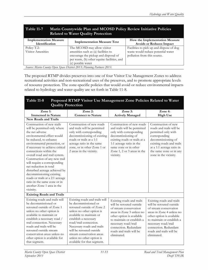
Hydrology and Water Quality
Marin County Open Space District 11-53 Road and Trail Management Plan September 2013 Draft TPEIR
Table 11-7 Marin Countywide Plan and MCOSD Policy Review Initiative Policies Related to Water Quality Protection
Implementation Measure Identification Implementation Measure Text How the Implementation Measure
Avoids or Reduces Impact Policy T.2: Visitor Amenities
The MCOSD may allow visitor amenities such as (a) facilities to encourage the pickup and disposal of pet waste, (b) other equine facilities, and (c) potable water
Facilities to pick up and dispose of dog waste would reduce potential water pollution from this source.
Source: Marin County Open Space District 2013; Planning Partners 2013.
The proposed RTMP divides preserves into one of four Visitor Use Management Zones to address recreational activities and non-recreational uses of the preserves, and to promote appropriate levels of resource protection. The zone-specific policies that would avoid or reduce environmental impacts related to hydrology and water quality are set forth in Table 11-8.
Table 11-8 Proposed RTMP Visitor Use Management Zone Policies Related to Water Quality Protection
Zone 1: Immersed in Nature
Zone 2: Connect to Nature
Zone 3: Actively Managed
Zone 4: High Use
New Roads and Trails
Construction of new trails will be permitted only where the net adverse environmental effect would be reduced, to enhance environmental protection, or if necessary to achieve critical connections within the overall road and trail system. Construction of any new trail will require a corresponding net reduction in total disturbed acreage achieved by decommissioning existing roads or trails at a 2:1 acreage ratio in the same zone or in another Zone 1 area in the vicinity.
Construction of new roads and trails will be permitted only with corresponding decommissioning of existing roads or trails at a 1:1 acreage ratio in the same zone, or in other Zone 1 or 2 areas in the vicinity.
Construction of new roads and trails will be permitted only with corresponding decommissioning of existing roads or trails at a 1:1 acreage ratio in the same zone or in other Zone 1, 2 or 3 areas in the vicinity.
Construction of new roads and trails will be permitted only with corresponding decommissioning of existing roads and trails at a 1:1 acreage ratio in the same zone or in any zone in the vicinity.
Existing Roads and Trails
Existing roads and trails will be decommissioned or rerouted outside of Zone 1 unless no other option is available to maintain or establish a necessary road / trail connection. Necessary roads and trails will be rerouted outside stream conservation areas unless no other option is available for that segment.
Existing roads and trails will be decommissioned or rerouted outside of Zone 2 unless no other option is available to maintain or establish a necessary road/trail connection. Necessary roads and trails will be rerouted outside stream conservation areas unless no other option is available for that segment.
Existing roads and trails will be rerouted outside of stream conservation areas in Zone 3 unless no other option is available to maintain or establish a necessary road/trail connection. Redundant roads and trails will be eliminated.
Existing roads and trails will be rerouted outside of stream conservation areas in Zone 4 unless no other option is available to maintain or establish a necessary road/trail connection. Redundant roads and trails will be eliminated.

Hydrology and Water Quality
Road and Trail Management Plan 11-54 Marin County Open Space District Draft TPEIR September 2013
Table 11-8 Proposed RTMP Visitor Use Management Zone Policies Related to Water Quality Protection
Zone 1: Immersed in Nature
Zone 2: Connect to Nature
Zone 3: Actively Managed
Zone 4: High Use
At-grade stream crossings would be minimized.
At-grade stream crossings would be minimized.
At-grade stream crossings would be minimized.
At-grade stream crossings would be minimized.
Existing roads will be converted to trails unless (1) prevented by license, lease, or easement; or (2) the road passes through multiple zones and a consistent width is needed to maintain drivability.
Road and trail conditions will be improved to protect sensitive resources and reduce maintenance requirements.
Road and trail conditions will be improved to protect sensitive resources, to reduce maintenance requirements, and to support moderate to high levels of use.
Road and trail conditions will be improved to protect sensitive resources, to reduce maintenance requirements, and to support moderate to high levels of use.
Road and trail conditions would be improved to protect sensitive resources, to reduce maintenance requirements, and to support moderate to high levels of use.
Source: Marin County Open Space District 2013; Planning Partners 2013.
The proposed RTMP contains special use policies to address larger scale recreational activities and non-recreational uses of the preserves. In evaluating and conditioning special uses, the RTMP special use policies require that MCOSD evaluate potential environmental effects, and condition special uses to avoid or reduce such effects as set forth in Table 11-9.
Table 11-9 Proposed RTMP Special Use Policies that would Avoid or Reduce Impacts to Environmental Resources
Implementation Measure Identification Implementation Measure Text
How the Implementation Measure Avoids or Reduces
Impact Special Use Policies (to be adopted as part of the Road and Trail Management Plan)
Policy SP-1: Permit/Lease/License Required for Land Management or Utility Activities
All agencies and service providers requesting access to open space lands will be required to obtain a lease, license, or other form of approval from MCOSD detailing the purpose and timing of their activities. The MCOSD may impose fees and conditions necessary for the protection of the environment. Such fees and conditions may include, but will not be limited to, the timing of the activity with respect to seasonal, weather, and wildlife concerns or constraints, and the location of the activity. … Additional fees may be incurred by the applicant for administration and monitoring of the activity by the MCOSD staff, or if compliance with the California Environmental Quality Act or any regulatory compliance is required. …
Requires MCOSD to issue a special lease, license, or other form of approval for non-recreational activities, to evaluate activities for potential effects on the environment, and condition such activities to avoid or reduce identified effects.

Hydrology and Water Quality
Marin County Open Space District 11-55 Road and Trail Management Plan September 2013 Draft TPEIR
Table 11-9 Proposed RTMP Special Use Policies that would Avoid or Reduce Impacts to Environmental Resources
Implementation Measure Identification Implementation Measure Text
How the Implementation Measure Avoids or Reduces
Impact Policy SP-2: Permit Required for Organized Recreational Activities or Event
All private parties or other public agencies requesting access to MCOSD lands for recreation-related or other special events will be required to complete and obtain a lease, license or other form of approval detailing the purpose and timing of their activities. The MCOSD may impose fees and conditions necessary for the safety of participants and for protection of the environment. Such fees and conditions may include, but will not be limited to, the timing of the activity with respect to seasonal and weather concerns, the number of participants, and the location of the activity. ... Additional fees may be incurred by the permit applicant for administration and monitoring of the event by the MCOSD staff, or if compliance with the California Environmental Quality Act or any environmental permit is required. ...
Requires MCOSD to issue a special lease, license, or other form of approval for larger scale recreational activities and special events, to evaluate activities for potential effects on the environment, and condition such activities to avoid or reduce identified effects.
Source: Marin County Open Space District 2013; Planning Partners 2013.
The RTMP sets forth design and operational standards for the following aspects of roads and trails as indicated in Table 11-10 to avoid or reduce potential impacts from sedimentation by minimizing erosion, controlling drainage, and imposing rigorous creek, drainage, or wetland crossing requirements for new or maintained roads and trails.
Table 11-10 Proposed RTMP Road and Trail Standards
Standards (to be adopted as part of the Road and Trail Management Plan)1 Road and trail cross sections Dips and water bars Road or trail surface treatment and
delineation Runoff conveyances Ditch relief culverts and outlets Conveyance flow attenuation
Drainage, wetland, or stream crossings
Slope stability Trail buttressing
Catchment basins Decommissioning existing roads or trails
Note: 1 Please refer to Chapter 6 of the Road and Trail Management Plan for a discussion of road and trail design
standards that would be implemented upon adoption of the RTMP. The majority of the identified standards are designed to control drainage from roads and trails and otherwise minimize erosion.
Source: Marin County Open Space District 2013.
The RTMP would establish a series of rigorous BMPs as indicated in Table 11-11 to avoid or reduce potential impacts from sedimentation and other forms of pollution by preventing or minimizing erosion, imposing construction management measures, requiring the regular inspection of road and trail facilities, and imposing maintenance measures where necessary to protect water quality.

Hydrology and Water Quality
Road and Trail Management Plan 11-56 Marin County Open Space District Draft TPEIR September 2013
Table 11-11 Proposed RTMP Best Management Practices Related to Water Quality Protection and Erosion Control
Implementation Measure Identification
Implementation Measure Text How the Implementation Measure Avoids or Reduces Impact
Best Management Practices (to be adopted as part of the Road and Trail Management Plan)
Water Quality-1: Modifications to Road and Trail Management Actions to Protect Water Bodies, Wetlands, and Tidally Influenced Areas
Road and trail management activities will be restricted near wetlands and other waters to reduce the potential for sediment or pollutants to enter water bodies or wetlands. If work occurs during the dry season and is greater than 100 feet from creeks and wetlands, erosion control and water quality protection measures will not be necessary. • If possible, avoid work around water bodies, wetlands, and tidally influenced areas, including a
buffer area of 100 feet around these areas (i.e., as measured from the top bank of creeks, streams, or ponds and outer edges of wetland boundaries).
• If construction work in wetlands, riparian areas, or tidally influenced areas cannot be fully avoided, consult with the appropriate state and federal agencies to obtain permits.
• Within the 100 foot buffer, limit construction activities. Limit activities to least-harmful methods; restrict herbicides to those that are EPA-approved for use near water. Prohibit activities that disturb soil or could cause soil erosion or changes in water quality.
• Within the 100 foot buffer, limit work that might cause erosion to low-flow or low-tide periods. Low-flow months for local creeks are typically August to October. For tidal areas, work will not occur within two hours of high-tide events at construction sites when high tide is greater than 6.5 feet as measured at the Golden Gate Bridge, using corrections for areas near individual MCOSD preserves. Tide charts are available online from the National Oceanic and Atmospheric Agency / National Weather Service (http://www.wrh.noaa.gov/mtr/sunset.php).
• Within the 100 foot buffer, minimize erosion and sedimentation by maintaining erosion- and sediment-control devices during ground-disturbing activities and until all disturbed soils have been stabilized. Control devices include weed-free straw, hydromulch, geofabrics, wattles, sediment traps, check dams, drainage swales, and sand bag dikes. Materials must be certified weed-free to prevent the introduction of wheat, barley, and other nonnative plant seeds. Erosion-control materials must be constructed of natural fibers (e.g., coconut fiber mats, burlap and rice straw wattles) and may not be constructed with plastic monofilaments or other materials that could entrap snakes or amphibians.
Avoids impacts to wetlands and water bodies by restricting construction activities and minimizing erosion and sedimentation.

Hydrology and Water Quality
Marin County Open Space District 11-57 Road and Trail Management Plan September 2013 Draft TPEIR
Table 11-11 Proposed RTMP Best Management Practices Related to Water Quality Protection and Erosion Control
Implementation Measure Identification
Implementation Measure Text How the Implementation Measure Avoids or Reduces Impact
Water Quality-2: Temporary Erosion and Sediment Control
Temporary sediment-control practices will be implemented when new trail construction or existing trail improvements will result in greater than 1 acre of disturbance. Temporary practices may also be required when disturbance is less than 1 acre but close to a sensitive resource or has the potential to discharge a significant amount of sediments or pollutants to surface water. Several of the listed temporary practices can also be used as post-construction stabilization measures: Information and standard details for temporary erosion-control BMPs can be found in the California Stormwater BMP Handbook – Construction (CASQA 2009). • Install temporary fencing around staging areas and along limits of construction when work
areas are immediately adjacent to sensitive resources. This will limit the disturbance footprint and help protect resources, including native vegetation, wetlands, and streams, during grading operations.
• Install linear sediment barriers to slow and filter stormwater runoff from disturbed areas. Fiber or straw roll barriers can also be spaced along the contours of a disturbed area after construction to prevent concentrated flow and stabilize the area until there is sufficient vegetation coverage.
• Apply one or more of the following to restore or protect areas disturbed by excavation or grading operations: • tilling (minimum 6 inch depth) and seeding • hydromulch and tackifier • planting • straw or wood mulch • coir (jute) netting • biodegradable erosion-control blankets • plastic sheeting (only as an interim protection during storm events when construction site is
still active) • Cover soil and loose material stockpiles with weighted plastic sheeting when inactive or prior
to storm events. Active and inactive material stockpiles will be encircled at all times with a linear sediment barrier.
• Manage sediment when diverting streamflow. When constructing trail or road stream crossings, a temporary clear-water diversion may be required. The following options will be considered for isolating the work area and protecting resources when diverting streamflow via gravity-fed flexible pipe or active pumping around the work area: sand or gravel bag coffer dam enclosed in plastic sheeting, water-filled dam (e.g., Aquadam), sheet piling, and turbidity curtains.
• Manage sediment during dewatering operations. The following options will be considered for applying or containing and treating sediment-laden water produced during dewatering operations: sprinkler system to open area (as long as there is no visible surface runoff), temporary constructed sediment basin or trap, rented sedimentation tank (e.g., Baker Tank).
Acts to minimize erosion and sedimentation to avoid disturbance of water bodies, and maintains the integrity of the existing soils and landscape.

Hydrology and Water Quality
Road and Trail Management Plan 11-58 Marin County Open Space District Draft TPEIR September 2013
Table 11-11 Proposed RTMP Best Management Practices Related to Water Quality Protection and Erosion Control
Implementation Measure Identification
Implementation Measure Text How the Implementation Measure Avoids or Reduces Impact
Water Quality-3: Erosion Control Measures
• Avoid the use of heavy equipment in areas with soils that are undisturbed, saturated, or subject to extensive compaction.
• If no feasible alternative is available and staging of heavy equipment, vehicles, or stockpiles is unavoidable, limit the disturbance footprint and flag or mark the allowable disturbance area in the field. Following the end of work, newly disturbed soils will be scarified to retard runoff and promote rapid revegetation.
• Immediately rehabilitate areas where project actions have disturbed soil. Require areas disturbed by equipment or vehicles to be rehabilitated as quickly as possible to prevent erosion, discourage the colonization of invasive plants, and address soil compaction. Techniques include decompacting and aerating soils, recontouring soils to natural topography, stabilizing soils via erosion-control materials, revegetating areas with native plants, and removing and monitoring invasive plants.
• Leave the roots of target invasive trees and shrubs in place in areas with highly erosive soils or steep slopes. Stumps may be cut or ground down to the ground level.
If work occurs during the dry season and is greater than 100 feet from water bodies and wetlands, erosion control and water quality protection measures will not be necessary.
In conjunction with the BMPs outlined in Water Quality-2, minimizes erosion and sedimentation to avoid disturbance of water bodies, and maintains the integrity of the existing soils and landscape.
Water Quality-4: Preventing or Reducing the Potential for Pollution
• Include spill prevention and clean-up in annual staff training sessions. • Properly use, store, and dispose of chemicals, fuels, and other toxic materials according to
manufacturer’s specifications and agency regulations. • Prohibit or restrict equipment refueling, fluid leakage, equipment maintenance, and road
surfacing activities near wetlands. Fuel storage and refueling will occur in safe areas well away from wetlands; safe areas may include paved or cleared roadbeds and other contained areas, such as lined truck beds. Equipment and vehicles will be inspected regularly for hydraulic and oil leaks, and leaking vehicles will not be allowed on the MCOSD preserves. Drip pans will be placed underneath equipment stored on site. Vehicles and construction equipment will be maintained in good working condition, and any necessary on-site servicing of equipment will be conducted away from the wetlands.
• Require all contractors to possess, and all vehicles to carry, emergency spill containment materials. Absorbent materials will be on hand at all times to absorb any minor leaks and spills.
Avoids impacts to water quality by minimizing erosion and sedimentation, and other forms of pollution.

Hydrology and Water Quality
Marin County Open Space District 11-59 Road and Trail Management Plan September 2013 Draft TPEIR
Table 11-11 Proposed RTMP Best Management Practices Related to Water Quality Protection and Erosion Control
Implementation Measure Identification
Implementation Measure Text How the Implementation Measure Avoids or Reduces Impact
Water Quality-5: Road and Trail Inspections
• Inspect roads and trails for conditions that might adversely affect water quality or other resources. Road and trail maintenance inspectors will use road/trail inspection forms to facilitate complete and consistent data capture and reporting of the following conditions: • concentrated flows on roads and trails that cause erosion, rilling, or gullying • runoff and effects to water quality of nearby habitats • the spread of invasive exotic plants near wetlands and waters • the status and quality of any known sensitive resources in the immediate vicinity that could
be affected by road or trail use and/or maintenance Inspectors will report any findings and make recommended corrective actions if appropriate.
Inspections and maintenance would ensure that water bodies are protected from erosion and sedimentation, and that water features experience no long-term direct or indirect impacts from the RTMP activities.
Water Quality-6: Grading Windows
Restrict grading activity to the dry months (generally May 15 to October 15), when associated erosion will be reduced to the maximum extent possible.
Minimizes erosion and sedimentation to avoid disturbance of water bodies and maintains the integrity of the existing soils and landscape.
Water Quality-7: Culvert Inspection
Inspect culverts on a regular basis. Inspections will ensure that culverts do not clog with sediment or debris. Blocked culverts may affect water quality, change the water course, increase erosion or sediment runoff, or affect wildlife. Any materials blocking culverts will be removed and disposed of outside of the watercourse in an area not subject to erosion. If a significant blockage or sedimentation exists, the MCOSD will plan and implement corrective actions as necessary. Excavation of sediments within streams may require a maintenance permit from the U.S. Army Corps of Engineers, the California Department of Fish and Wildlife, and/or the San Francisco Water Quality Control Board.
Inspections and maintenance would ensure that water bodies are protected from erosion and sedimentation, and that water features experience no long-term direct or indirect impacts from the RTMP activities.
Water Quality-8: Proper Disposal of Excess Materials
Avoid resource impacts when disposing of materials. Any excess material related to new construction, maintenance, or decommissioning (including soils, debris, trash, or other materials that need to be removed as part of management activities) will be disposed of at an appropriate site where materials could not impact sensitive resources. For example, grading-related excess soils or removed debris will not be placed in or around a water body or wetland, where the materials could be subject to erosion that would affect water quality.
Avoids impacts to water bodies by disposing waste and excess materials away from sensitive resources.

Hydrology and Water Quality
Road and Trail Management Plan 11-60 Marin County Open Space District Draft TPEIR September 2013
Table 11-11 Proposed RTMP Best Management Practices Related to Water Quality Protection and Erosion Control
Implementation Measure Identification
Implementation Measure Text How the Implementation Measure Avoids or Reduces Impact
Water Quality-9: Sidecasting Construction Material
Avoid sidecasting, or at a minimum contain and remove sidecast material when it has the potential to reach surface waters. The following “rules of thumb” based on Fishnet 4C Guidelines (2007) will be used as guidance:
Slope gradient Distance to watercourse Sidecast rule
Any slope Will likely enter watercourse Not allowed
≤20% ≥150 feet Allowed
≤50% ≥300 feet Allowed
> 50% Long vegetated slope Allowed
>50% Shorter, sparsely vegetated slope
Not allowed
Avoids impacts to water bodies by disposing waste and excess materials away from sensitive resources.
Source: Marin County Open Space District, 2013; Planning Partners, 2013.

Hydrology and Water Quality
Marin County Open Space District 11-61 Road and Trail Management Plan September 2013 Draft TPEIR
As set forth in the reasoning expressed in Tables 11-7 through 11-11, implementation of existing Marin County and MCOSD policies, together with new policies, road standards, permitting requirements, and BMPs set forth in the RTMP, would in aggregate reduce or avoid adverse effects to water resources.
Implementation of the existing Marin County and MCOSD policies identified in Table 11-7 would act to reduce potential adverse impacts to water quality from all development activities in the county, including roads and trails. New RTMP systemwide policies identified in Table 11-8 would result in a reduction in roads and trails in sensitive areas of the preserves, and would direct new facility location, construction, recreation uses, and maintenance to avoid sensitive water resources and eliminate sources of pollution. Policies and BMPs that would be implemented with adoption of the RTMP as set forth in Tables 11-7 through 11-11 would result in further protection of water resources from adverse effects caused by management actions associated with the RTMP by establishing procedures and performance standards for erosion, sedimentation, and water pollution to be followed in the design, construction, and maintenance of existing and new trails. Visitor Use Management Zone polices would result in a reduction of the number and footprint of roads and trails in the most environmentally sensitive areas, including within Stream Conservation Areas. These policies would also limit the construction of new roads or trails in environmentally sensitive areas, and require modification of existing roads and trails in such areas to protect environmental resources. Special permit requirements as set forth in Table 11-9 would require that the MCOSD evaluate the potential effects of non-recreational and larger scale recreation uses to determine what adverse environmental impacts such activities could pose, and to implement conditions to avoid or reduce such effects. Road and trail design and operational standards identified in Table 11-10 would avoid or reduce potential environmental effects from existing and new roads and trails, and from decommissioned facilities by controlling erosion, drainage, and crossings of sensitive resources. Finally, the BMPs identified in Table 11-11 would prevent or minimize erosion, impose construction management measures, require the regular inspection of road and trail facilities, and impose maintenance measures where necessary to protect water quality.
The practices discussed in this impact discussion and set forth in Tables 11-8 through 11-12 would be followed by the MCOSD, its representatives, and project contractors as applicable and appropriate. Permits from the SF RWQCB may be applied for on a site-specific basis as needed, and all mandatory mitigation or conditions would be implemented by the MCOSD. When required, this process typically results in implementation of measures to protect water quality related to trail construction that would be in addition to the RTMP BMPs set forth in Table 11-12. Compliance would include adhering to the NPDES programs, including the development of a SWPPP, rigorous site monitoring, and storm water sampling and reporting required for any construction sites greater than one acre under the recently adopted Construction General Permit. Where these measures overlap, the more protective measure will apply. For projects not requiring permits or regulatory involvement, the RTMP BMPs will be implemented to protect sensitive resources.
As set forth in Tables 11-7 through 11-11, with implementation of the RTMP, the MCOSD would take a proactive approach to comply with sensitive resource regulations and protect water quality. The policies and BMPs of the RTMP would standardize practices when planning, designing, and constructing any road and trail management action. Implementation of the RTMP policies for improving the road and trail system, moving facilities out of the more sensitive and erosion prone locations, standardizing sustainable road and trail designs, implementing temporary and permanent BMPs, and complying with existing NPDES and other water quality regulations would reduce or

Hydrology and Water Quality
Road and Trail Management Plan 11-62 Marin County Open Space District Draft TPEIR September 2013
avoid potential impacts to water quality. At a programmatic level, this would be a less than significant impact, and no mitigation would be necessary.
Significance of Impact: Less than significant.
Mitigation Measure HYD-1: None required.
Impact HYD-2: Substant ial ly al t er exist ing drainage patterns within MCOSD lands or in
areas downstream, inc luding al terat ion o f a s tream course or r iver , or substant ia l eros ion or s i l tat ion that may be carr ied to a rece iv ing water body (Cri ter ion IX.c)
Future maintenance or construction activities, or changes in use, with implementation of the RTMP, could alter waterways within MCOSD preserves and provide an ongoing source of erosion and sedimentation of water bodies. The policies, procedures, standards, and BMPs contained in the RTMP as set forth in Tables 11-7 through 11-11 would manage maintenance and construction activities, and result in the improvement, decommissioning, re-routing, or reconstruction of improperly designed or located facilities to reduce erosion and sediment generation. For these reasons, this would be a less-than-significant impact.
There are close to 500 undesignated stream crossings within the MCOSD’s preserves that have the potential to add increased sediment inputs to downstream waterways. These existing roads and trails cross directly over drainages and streams, which can lead to accelerated erosion within the confluence, thereby leading to potential increases in sediment loads to receiving water bodies. Improperly designed stream crossings may also create impediments to fish passage. Degraded and undersized culverts can cause further channel degradation and soil loss from eroding bed and banks.
Improperly sited trails and roadways often intercept drainages. In this situation, roads and trails can become a conduit for stormwater that can lead to increased erosion along the road or trail footprint, or even localized flooding. With 75 miles of trails steeper than 15 percent, 86 miles steeper than 25 percent, and 201 miles of fall line trails, there are a significant number of trails that can capture runoff and alter existing drainage patterns leading to detrimental erosion.
Operating under the RTMP policies, procedures, standards, and BMPs described above (see Impact HYD-1, and Tables 11-7 through 11-11), the MCOSD would begin to alleviate these existing issues by further identifying, assessing, and prioritizing improvements to existing drainage crossings, including the relocation of trails and roadways away from streams, drainages and sensitive wetland areas or the installation of improvements such as appropriately sized culverts, fords, terraces, or bridges in order to separate and stabilize the drainage, creek, or wetland from continued trail use by pedestrians, equestrians, bicyclists, and maintenance and fire crews. Standardized road and trail designs under the RTMP would provide for appropriate crossing infrastructure to ensure that 50-year design flows can be adequately conveyed without flooding or sharp increases in velocities or shear stresses. Permanent BMPs, channel grade control measures, and biotechnical treatments would be designed and applied along the bed and banks in the vicinity of the crossing to ensure that crossings remain stable and when needed, passable by fish. Under the RTMP, the MCOSD would continue to take steps to install road and trail improvements, including rolling dips and water bars to interrupt road capture of runoff and prevent erosion and water quality degradation.

Hydrology and Water Quality
Marin County Open Space District 11-63 Road and Trail Management Plan September 2013 Draft TPEIR
Implementation of the RTMP policies, standards, and BMPs cited in Tables 11-7 through 11-11 for improving the road and trail system, moving facilities out of the sensitive and erosion-prone locations, standardizing sustainable road and trail designs, and implementing BMPs would reduce or avoid potential impacts to water quality from improperly sited, designed, or constructed roads and trails. At a programmatic level, this would be a less-than-significant impact, and no mitigation would be necessary.
Significance of Impact: Less than significant.
Mitigation Measure HYD-2: None required.
Impact HYD-3: Signi f i cant ly increase the rate or amount o f s torm water runof f within
MCOSD lands or in areas adjacent to those lands that would exceed the capaci ty o f exist ing or planned storm water drainage systems or fac i l i t i es , resul t ing in increased sources o f pol luted runof f or detr imental f looding to property or infrastructure (Cri ter ia IX.d and IX.e)
With implementation of the RTMP, future development of impervious surfaces such as roadways, trails, or parking areas with hardened gravel or asphalt surfaces could limit infiltration and increase runoff volumes and peak flows. Increased runoff volumes and peak flows associated with impervious surfaces may lead to increased erosion and resultant pollution, or overwhelm downstream storm drain facilities or waterways. Because the development of large areas of impervious surfaces would be rare within MCOSD open space preserves, and the RTMP contains policies to avoid these adverse effects, this impact would be less than significant.
Existing and proposed policies of the MCOSD seek to reduce the development of additional impervious surfaces. The RTMP does not include plans for large developments or extensive facilities within the preserves, but rather emphasizes the preservation of riparian corridors and sensitive wetland areas that provide for increased stormwater infiltration and detention, and the decommissioning of redundant and unstable roads and trails. The decommissioning of roads and trails would result in an overall reduction in the number of trails and impervious surfaces rather than an increase. Under the zone-specific policies set forth in Table 11-8, there would be a required net reduction in total disturbed acreage by decommissioning existing roads and trails at a 2:1 acreage ratio for Visitor Use Management Zone 1 to offset the construction of new roads or trails. Similarly, there would be no increase in road or trail mileage or area within Zones 2 through 4 due to the requirement to decommission existing facilities at a 1:1 acreage ratio as an offset for new facilities.
Existing policies P1, P3, and P5 from the MCOSD Policy Review Initiative address strategies for parking management. Visitors will be encouraged to walk, bike, and carpool to open space facilities; parking will be focused on existing right-of-way; and new parking will be considered on a case-by-case basis. If new or increased parking facilities are implemented, they would be required to design for post-construction runoff reductions under the NPDES California General Permit, thereby alleviating any potential for increased runoff impacting downstream areas or facilities.
The RTMP Policy SW.29, Permeable Paving, requires all new impervious surfaces to be constructed of permeable paving or an equivalent. Implementation of this policy would permit the infiltration of rainfall from parking areas and other impermeable surfaces.

Hydrology and Water Quality
Road and Trail Management Plan 11-64 Marin County Open Space District Draft TPEIR September 2013
Hardened surface treatments may be used on heavily used road and trail segments to prevent erosion. The RTMP proposes road aggregate surfacing, permeable pavers, and pervious concrete in these locations. Use of permeable paving will minimize runoff problems from newly paved roads and trails. When paired with drainage controls and conveyances, runoff will be managed and prevent negative downstream impacts. Runoff from paved roadways will be conveyed with lined ditches, vegetated swales or subdrains. Ditches and swales allow for attenuation and infiltration of stormwater runoff, minimizing downstream impacts. Because implementation of the RTMP would not result in increased runoff volumes or peak flows, a less-than-significant impact would result.
Level of Significance: Less than significant.
Mitigation Measure HYD-3: None required
Impact HYD-4: Substant ial ly deple te groundwater suppl ies or inter f ere substant ial ly with
groundwater recharge such that there would be a net reduct ion in aqui fer vo lume, or a lower ing o f the local groundwater table l eve l that would negat ive ly impact exis t ing users or habitat needs (Cri ter ion IX.b)
Implementation of the RTMP would not result in the use of groundwater or interfere with groundwater recharge. This impact would be less than significant.
As discussed in Impact HYD-3, there would be no net increase in the area or mileage of roads and trails with implementation of the RTMP. Additionally, roads and trails within MCOSD preserves typically maintain a natural surface composed of the rock and soil materials on which the facility is constructed. Hardened surfaced road and trail facilities would be constructed only to protect environmental resources by minimizing the potential for erosion or to maintain fish passage at stream crossings.
MCOSD’s existing policy and past practice has been to rely upon existing public streets near trailheads for parking. Existing MCOSD Policy P5 would permit the construction and operation of parking facilities within preserves where necessary for public safety and where resource conditions permit. The RTMP would be consistent with this existing policy. The development of parking facilities would be infrequent and in limited locations. The capacity of such facilities would tend to be the smallest possible to meet safety needs. Because any developed parking facilities would be small, even if they were developed with impermeable paving, they would not substantially interfere with groundwater recharge. There are three main groundwater basins in the vicinity of MCOSD lands ranging in size from 1.4 to 32 square miles. Because of the relative size of potential limited parking areas compared to the size of the basins, construction of any new parking facilities would not substantially affect groundwater recharge.
Based on the foregoing, because construction and operation of roads, trails, and limited parking facilities would not substantially reduce aquifer recharge, this would be a less-than-significant impact.
Significance of Impact: Less than significant.
Mitigation Measure HYD-4: None required.

Hydrology and Water Quality
Marin County Open Space District 11-65 Road and Trail Management Plan September 2013 Draft TPEIR
Impact HYD-5: Expose people or s tructures to a s igni f i cant r i sk o f loss , in jury , or death involv ing f looding, inc luding f looding as a resul t o f the fai lure o f a l evee or dam (Criter ia IX.h, IX.i , and IX.j)
Implementation of the RTMP would not expose people or structures to flooding. This would be a less-than-significant impact.
As reported in the Environmental Setting of this chapter, flooding is not often a concern for most MCOSD lands since preserves are typically located in the upper elevations of watersheds closer to stream headwaters. There is a potential for localized flooding of trails or roads within these upper elevation preserves where there can be a flashy but sharp rise in peak flow during a large storm event, and some of the preserves drain to creeks that tightly wind through neighborhoods and urban areas with 100-year flood zones that penetrate property lines and infrastructure downstream of the preserves. An example of this is Larkspur Creek, whose 100-year flood zone initiates and widens in the neighborhoods downstream of the Blithedale Summit Open Space Preserve (FEMA 2009).
Flooding is probable and often beneficial in the lower elevation wetland and lagoon preserves. Trail installation and operation with minimal maintenance, adequate public safety measures, and water quality protection in these preserves requires a current understanding of potential impacts due to tidal fluctuations, groundwater influence, flooding, and anticipated future sea level rise.
The following preserves in the low-lying baylands and coastal region are either partially or completely within the 100-year regulatory flood zone (FEMA 2009), and with increased inundation areas as a result of predicted sea level rise (Figure 11-6), flooding in these locations could become worse in the future:
• Santa Margarita Island • Santa Venetia Marsh • Bothin Marsh • Bolinas Lagoon
Many of the same areas subjected to potential flooding are also at risk of sudden high water from a tsunami event. Marin County is in a seismically active area as described in Chapter 8, Geology and Soils, that could result in a rare yet catastrophic tsunami event.
Proposed Policy SW.30, Floodplain Policy for New and Improved Roads, Trails, and Associated Facilities addresses flooding and tsunami. Additionally, many of the actions under the RTMP would help to alleviate localized flooding by eliminating and properly designing for stream and drainage crossings, and minimizing the extent of trail disturbance. For the current preserves in the 100-year regulatory floodplain, any new trail or facility construction proposed in those areas would be required to demonstrate there would be no increase in flood elevation by one foot or more.
This measure would protect the public from flood and tsunami risks. Because implementation of the RTMP would not unnecessarily result in the exposure of people or structures to the risks of flooding or tsunami after mitigation, a less-than-significant impact would result
Level of Significance: Less than significant.
Mitigation Measure HYD-5: None required.

Hydrology and Water Quality
Road and Trail Management Plan 11-66 Marin County Open Space District Draft TPEIR September 2013
This page intentionally left blank.

Marin County Open Space District 12-1 Road and Trail Management Plan September 2013 Draft TPEIR
12 NOISE
This chapter provides an evaluation of the potential noise effects of implementing the proposed Road and Trail Management Plan (RTMP). As established in the Notice of Preparation for the proposed RTMP (see Appendix A, Notice of Preparation), activities subject to the RTMP may result in degradation of noise conditions.
The following environmental assessment includes a review of noise conditions potentially affected by the implementation of the RTMP within Marin County Open Space District (MCOSD) open space preserves.
This analysis includes a review of applicable regulations, requirements, plans, and policies from the following sources:
• Marin Countywide Plan (Marin County 2007) • Marin Countywide Plan Noise Technical Background Report (Marin County 2007b) • MCOSD Policy Review Initiative (Marin County 2005) • Marin County Noise Ordinance (Marin County 2005)
Information about existing noise conditions in Marin County was obtained from a review of the Marin Countywide Plan Update Final EIR (Marin County 2007a) and the Marin Countywide Plan Background Report (Marin County 2007b). Potential impacts related to noise were determined by comparing potential MCOSD road and trail management activities to the existing environment, based on CEQA assessment criteria and considering the policies, regulations, and guidelines adopted by Marin County and state and federal resource agencies.
12.1 SETTING
This section describes the environmental and regulatory setting for the MCOSD’s open space preserves with respect to noise conditions, encompassing both the physical environment and the body of local, state, and federal policies and regulations related to noise.
12.1.1 ENVIRONMENTAL SETTING
BACKGROUND INFORMATION ON NOISE This discussion of background information about noise is taken from the Marin Countywide Plan Update Final EIR (Marin County 2007a). It is provided prior to the discussion of environmental setting conditions in order to provide the reader with an understanding of noise terminology and concepts needed to understand the environmental setting discussion.
Noise is defined as unwanted sound. Noise is usually objectionable because it is disturbing or annoying. For most people, sensitivity to noise increases during the evening and at night. This is because ambient noise levels tend to be lower during those hours, and because excessive noise interferes with their ability to sleep.
The objectionable nature of sound can be caused by either its pitch or its loudness. Pitch is the height or depth of a tone or sound, caused by the relative rapidity (i.e., frequency) of the vibrations that produce it. Higher pitched signals sound louder to humans than sounds with a lower pitch.

Noise
Road and Trail Management Plan 12-2 Marin County Open Space District Draft TPEIR September 2013
Loudness is determined by a combination of the amplitude of the waves producing the sound and the reception characteristics of the human ear. The amplitude of sound waves is analogous to the height of an ocean wave, and as with ocean waves, the bigger the wave, the more energy it contains.
Several noise measurement scales are used to describe noise. A decibel (dB) is a unit of measurement that indicates the relative amplitude (and therefore energy) of a sound. The zero on the decibel scale is based on the lowest sound level that a healthy, unimpaired human ear can detect. Sound levels in decibels are calculated using a logarithmic function. Thus, an increase of 10 decibels represents a ten-fold increase in acoustic energy, while an increase of 20 decibels represents a 100-fold increase, and an increase of 30 decibels represents a 1,000-fold increase. There is a different relationship between the subjective noisiness or loudness of a sound and its decibel level. Each 10-decibel increase in sound level is perceived as approximately a doubling of loudness, over a fairly wide range of decibel levels.
Several methods of characterizing sound are commonly used. The most common in California is the A-weighted sound level or dBA. All sound levels discussed in this report utilize the A-weighting scale. This scale gives greater weight to the frequencies of sound to which the human ear is most sensitive. Representative outdoor and indoor noise levels in units of dBA are shown in Table 12-1.
Table 12-1 Typical A-Weighted Sound Levels of Common Noise Sources
Loudness Ratio dBA Description
128 130 Threshold of pain
64 120 Jet aircraft take-off at 100 feet
32 110 Riveting machine at operators position
16 100 Shotgun at 200 feet
8 90 Bulldozer at 50 feet
4 80 Diesel locomotive at 300 feet
2 70 Commercial jet aircraft interior during flight
1 60 Normal conversation speech at 5-10 feet
1/2 50 Open office background level
1/4 40 Background level within a residence
1/8 30 Soft whisper at 2 feet
1/16 20 Interior of recording studio
Source: Bollard Acoustical Consultants, 2013.
Because sound levels can vary markedly over a short period, an average of the energy contained in the sound over a period of time is used to characterize these varying sounds. This sound energy-equivalent descriptor is called Leq.
EXISTING NOISE LEVELS No existing noise level information is available for the MCOSD preserves. The noise environment in Marin County is dominated by transportation. Highway and roadway traffic affect the greatest number of people, followed by aircraft over-flights, localized stationary sources (e.g., San Rafael Rock Quarry and other smaller quarries), dog kennels, and other commercial facilities. The highest

Noise
Marin County Open Space District 12-3 Road and Trail Management Plan September 2013 Draft TPEIR
noise levels in the county are generated along U.S. 101. Noise levels are quietest in the more remote areas of West Marin. (Marin County 2007a)
Existing noise levels at most of the preserves are expected to be representative of rural areas of Marin County, except where preserves abut developed residential areas or major transportation facilities such as Sir Francis Drake Boulevard. Near residential areas or roadways, noise levels within preserves would be dominated by those sources. Except for noise levels near major roadways, noise levels within and adjacent to preserves are expected to range from 40-60 dBA during daytime, and from 20-40 dBA at night (Caltrans 2009). The MCOSD preserves share 110.5 miles of preserve boundaries with adjacent residentially designated and zoned areas (MCOSD 2011). As of August 2013, no formal complaints regarding noises generated within preserves had been received by the MCOSD (Holland pers. comm. 2013).
12.1.2 REGULATORY SETTING No federal or state regulations related to noise are relevant to the proposed project, as the project has no federal connection (i.e., no federal or state funds are being used and no federal permits are required). However, the local policies and ordinances listed below are relevant to the consideration of the noise impacts of the RTMP.
Marin Countywide Plan
The Marin Countywide Plan (Marin County 2007) contains a Noise Chapter in the Built Environment Element, which describes the County’s goals, policies, and programs related to noise. Goal NO-1 states:
Protection from Excessive Noise - Ensure that new land uses, transportation activities, and construction do not create noise levels that impair human health or quality of life.
The Noise Chapter contains the following policies of relevance to the RTMP:
NO-1.2 Minimize Transportation Noise. Ensure that transportation activities do not generate noise beyond acceptable levels, including in open space, wilderness, wildlife habitat, and wetland areas.
NO-1.3 Regulate Noise Generating Activities. Require measures to minimize noise exposure to neighboring properties, open space, and wildlife habitat from construction-related activities, yard maintenance equipment, and other noise sources, such as amplified music.
The Noise Chapter also contains the following relevant implementing programs:
NO-1.i Regulate Noise Sources. Sections 6.70.030(5) and 6.70.040 of the Marin County Code establish allowable hours of operation for construction-related activities. As a condition of permit approval for projects generating significant construction noise impacts during the construction phase, construction management for any project shall develop a construction noise reduction plan and designate a disturbance coordinator at the construction site to implement the provisions of the plan.
NO-1.k Minimize Noise Impacts from Temporary Land Uses. Amend the Development Code to include standards for temporary land uses, such as fairs or exhibits,

Noise
Road and Trail Management Plan 12-4 Marin County Open Space District Draft TPEIR September 2013
that require mitigation of noise impacts on surrounding areas in conformance with state and County noise level guidelines for nearby land uses.
The Noise Chapter sets forth the following standards for community noise exposure guidelines:
Figure 12-1 Community Noise Exposure Guidelines
Source: Marin County, 2007. 250 General Plan Guidelines
!"#$%&'()$*+$,-.$/!01+*2"1!$3.-140.$/*#.5$!6$7.00$!6
.84.6619.$ 6:..#$ 0!765$;!<$=.$!::01.#$ ,*$4>2,!10$ ,-16
:2*=0.;?$@*,-$,-.$A1B-7!<$C!,2*0$!"#$,-.$D.:!2,;.",
*+$A.!0,-$E.2914.6$F,-2*>B-$0*4!0$-.!0,-$#.:!2,;.",6G
!2.$!9!10!=0.$,*$!1#$0*4!0$!>,-*21,1.6$1"$4*#.$."+*24.H
;.",$!"#$ ,2!1"1"B$:>26>!",$ ,*$:2*:.2$9.-140.$6*>"#H
0.9.0$;.!6>2.;.",6?
!"#$%&'(/*;;.241!0$!"#$:>=014$!12:*2,6$*:.2!,1"B$>"#.2$!
:.2;1,$+2*;$/!0,2!"6I$J.2*"!>,146$C2*B2!;$!2.$2.K>12.#
,*$4*;:0<$71,-$=*,-$6,!,.$!.2*"!>,146$6,!"#!2#6$B*9H
.2"1"B$!1242!+,$"*16.$!"#$!00$!::014!=0.$0.B160!,1*"$B*9H
.2"1"B$,-.$+*2;!,1*"$!"#$!4,191,1.6$*+$!$0*4!0$J12:*2,
L!"#$M6.$/*;;1661*"$FJLM/G?$N-.$+>"4,1*"$*+$,-.
JLM/$165$!;*"B$*,-.2$ ,-1"B65$ ,*$#.9.0*:$!$:0!"$+*2
"*16.H4*;:!,1=0.$0!"#$>6.$1"$,-.$1;;.#1!,.$:2*81;1,<
*+$,-.$!12:*2,?$N-.$0*4!0$B.".2!0$:0!"$;>6,$=.$2.91.7.#
+*2$4*;:!,1=101,<$71,-$,-16$J12:*2,$L!"#$M6.$C0!"$!"#
!;."#.#$1+$".4.66!2<$FC>=014$M,101,1.6$/*#.$O'PQ(QG?
N-.2.+*2.5$,-.$#.9.0*:.26$*+$,-.$"*16.$.0.;.",$7100$"..#
,*$4**2#1"!,.$,-.12$!4,191,1.6$71,-$,-.$0*4!0$JLM/$,*
Appendix C: Noise Element Guidelines

Noise
Marin County Open Space District 12-5 Road and Trail Management Plan September 2013 Draft TPEIR
Marin County Code
The Marin County Noise Ordinance is codified as Section 6.70 of the Marin County Code. This ordinance addresses two issues pertaining to the noise environment within and adjacent to the MCOSD preserves: loud and unnecessary noises, and construction noise.
With respect to loud and unnecessary noises, the Code states:
6.70.020 Prohibition. It is unlawful for any person to make, continue, or cause to be made or continued, any loud, unnecessary or unusual noise which either annoys, disturbs, injures or endangers the comfort, repose, health or peace of others.
6.70.030 (4) Enumerated Noises. Yelling, shouting, etc. Yelling, shouting, hooting, whistling, or singing on public roads between the hours of eleven p.m. and seven a.m. so as to annoy or disturb the quiet, comfort, or repose of persons in any dwelling, hotel or other type of residence in the vicinity.
Regarding construction noise, the Code states:
6.70.030 (5) Construction activities and related noise. Hours for construction activities and other work undertaken in connection with building, plumbing, electrical, and other permits issued by the Community Development Agency shall be limited to the following:
Monday - Friday: 7 am to 6 pm; Saturday: 9 am to 5 pm; prohibited on Sundays and Holidays (New Year’s Day, President’s Day, Memorial Day, Independence Day, Labor Day, Thanksgiving Day, and Christmas Day.)
Loud noise-generating construction-related equipment (e.g., backhoes, generators, jackhammers) can be maintained, operated, or serviced at a construction site for permits administered by the Community Development Agency from 8 am to 5 pm Monday – Friday only. Special exceptions to these limitations may occur for:
• Emergency work as defined in M.C.C 22.130.030, provided written notice is given to the Community Development Director within 48 hours of commencing work.
• Construction projects of City, County, state, other public agency, or other public utility.1 • When written permission of the Community Development Director has been
obtained, for showing of sufficient cause.
MCOSD Code
Another section of the Marin County Code, entitled the Marin County Open Space District Code (Section 02.02), addresses noise specifically within the MCOSD open space preserves. According to Section 02.02.100, Noise and Audio Devices, of the MCOSD Code:
No person while on district lands shall make or cause to be made any loud, unnecessary or unusual noise which disturbs the peace and quiet within any area within the district or which causes discomfort or annoyance to any reasonable person of normal sensitivity utilizing any facility of the district. No person shall operate or possess any public address system, amplified musical instrument or other noise-producing or transmitting device on district lands.
1 Although this exemption applies to the activities of the MCOSD, Best Management Practice Noise-1 of the RTMP
obligates the MCOSD to adhere to the construction requirements of the Marin County Noise Ordinance.

Noise
Road and Trail Management Plan 12-6 Marin County Open Space District Draft TPEIR September 2013
MCOSD Pol i cy Review Ini t iat ive
In 2005, the MCOSD Open Space and Trails Committee conducted a review of its land management policies in 11 policy areas related to core land management, fire, trail use, non-native plants and animals, special status species, parking, camping, visitor amenities, disabled access, countywide and regional trail systems, and public outreach (MCOSD 2005). The product of this endeavor was a set of 51 new policies to guide land management decision-making in the subject policy areas. The following policy addresses noise.
Policy T1g: The MCOSD will prohibit the use of motorized vehicles on open space, with authorized exceptions.
12.2 ENVIRONMENTAL EFFECTS
12.2.1 SIGNIFICANCE CRITERIA The following criteria have been established to determine the level of significance of an adverse effect to noise, pursuant to CEQA. As set forth in Appendix G of the State CEQA Guidelines, an impact would exceed an impact threshold if it would result in:
• Exposure to noise levels in excess of applicable standards and to substantial permanent increase in ambient noise in the project vicinity (XII.a).
• Exposure of persons to or generation of excessive groundborne vibration or groundborne noise levels? (XII.b)
• A substantial permanent increase in ambient noise levels in the project vicinity above levels existing without the project? (XII.c.)
• A substantial temporary or periodic increase in ambient noise levels in the project vicinity above levels existing without the project? (XII.d)
• For a project located within an airport land use plan, or where such a plan has not been adopted, within two miles of a public airport or public use airport, would the project expose people residing or working in the project areas to excessive noise levels? (XII.e)
• For a project in the vicinity of a private airstrip, would the project expose people residing or working in the project area to excessive noise levels? (XII.f)
12.2.2 ANALYSIS METHODOLOGY The purpose of the RTMP is to develop a procedure to prioritize proposed maintenance and construction projects, and to ensure that projects selected for funding are environmentally beneficial. The RTMP additionally establishes policies, Best Management Practices (BMP), and road and trail design standards to reduce the environmental effects of constructing, maintaining, and operating both existing and future roads and trails. The RTMP does not envision or mandate an increase in maintenance or construction activities, but rather seeks to prioritize and manage existing and future levels of road and trail maintenance and construction more efficiently and appropriately.
As defined in the RTMP, construction of roads and trails includes reconstruction, rerouting, active decommissioning, and active road-to-trail conversion. Maintenance activities that could result in noise generation include grading, cleaning drainage features, other minor maintenance construction activities, passive decommissioning, and passive road-to-trail conversion. Though ongoing over the life of the RTMP, construction and maintenance would be a continuous, but periodic, process

Noise
Marin County Open Space District 12-7 Road and Trail Management Plan September 2013 Draft TPEIR
occurring at various locations over time at varying intervals for any particular road or trail segment. These activities would generate noise, primarily from equipment used in maintenance and construction. Except for special uses permitted on the MCOSD preserves, activities subject to the RTMP involve construction-like activities and they would result in noise generation similar to a standard construction project. Because the RTMP does not envision or mandate an increase in these activities, but rather seeks to prioritize and manage existing levels of road and trail maintenance and construction more efficiently and appropriately, there would be no increase over existing conditions in construction-related noise generation.
The analysis of the impacts of the RTMP on the noise environment was completed on a qualitative basis for the following reasons:
• The RTMP is a programmatic document describing the types of activities to be undertaken by the MCOSD rather than specific projects, so a site-specific noise analysis is not possible
• The RTMP involves activities that are not expected to generate substantial numbers of new vehicle trips (that could increase noise levels), particularly in urbanized areas or during peak hours where current noise conditions are the worst. Most new trips would be the result of population growth and changes in the popularity of recreational activities
• The activities associated with the RTMP that are likely to generate a substantial amount of noise are construction related, and thus periodic and temporary
12.2.3 ENVIRONMENTAL TOPICS NOT ADVERSELY AFFECTED BY THE RTMP Based on the evaluations set forth below, several potential impacts with respect to noise were found to clearly have no impact or to be less than significant. They will therefore not be evaluated further in this chapter. Other impacts were determined to be either potentially significant, or less than significant as a result of the resource protection offered by the policies, standards, and BMPs of the RTMP. These effects are discussed in the impact statements presented in Section 12.2.4 of this chapter.
Questions (XII.e and XII.f) Expose people residing or working in the project areas to excessive noise levels from a public airport, public use airport, or private airstrip: Less-than-significant impact.
Implementation of the RTMP would not expose people residing or working in open space preserves to excessive aircraft noise. This would be a less-than-significant impact.
Mount Burdell and Rush Creek Preserves are located less than a mile from Gnoss Field. Santa Venetia Marsh Preserve is located less than 0.2 miles from the end of the Smith Ranch Airport runway. There are no preserves in the vicinity of Richardson Bay Heliport. However, nothing about the proposed project would change air travel at any of these facilities, nor would it result in any changes to where people live or work. Therefore, the proposed project would not change the exposure of people living or working near one of these fields. This would be a less-than significant impact, and no mitigation would be needed.

Noise
Road and Trail Management Plan 12-8 Marin County Open Space District Draft TPEIR September 2013
12.2.4 ENVIRONMENTAL TOPICS POTENTIALLY AFFECTED BY THE RTMP Impact NSE-1: Expose persons/generate noise l eve l s in excess o f s tandards , cause a
s igni f i cant permanent increase in noise l eve l s , or resul t in a substant ia l t emporary or permanent increase in ambient noise l eve l s (Cri ter ia XII.a, XII.c , and XII.d)
Implementation of the RTMP could result in maintenance and construction activities that could raise noise levels in the vicinity of work areas, or result in the rerouting of roads or trails adjacent to existing residential uses. All future construction or maintenance activities initiated under the RTMP would meet Marin County noise standards. Excessive noise generated by recreational users of the open space preserves is, and would continue to be, prohibited under the Marin County Code and the MCOSD Code. For these reasons, this impact would be less than significant.
Implementation of the RTMP project would generate short-term, temporary noise during construction, and contribute to long-term indirect noise levels from on-road vehicles during operation. Because implementation of the RTMP would not permit the expansion of the road and trail system or require increases in maintenance activities, these noise-generating activities would not, however, represent an increase over existing conditions2.
Noise generation associated with the RTMP planned reconstruction, rerouting, active decommissioning, and active road-to-trail conversion activities would result in noise generated from powered equipment, and traffic from construction and employee vehicles to and from the MCOSD roads and trails. These construction improvements would occur at various locations throughout the preserves; the locations are currently unknown and not specifically identified by the RTMP. The majority of construction activities would occur from April to October, but would vary from day to day and year to year depending on the prioritization of road and trail projects.
Major noise-generating construction activities associated with construction and maintenance of roads and trails could include grading and excavation. Construction equipment would typically include, but would not be limited to, earth-moving equipment, mowers, compressors, generators, and powered, pneumatic, hydraulic, and electric tools. Table 12-2 presents the typical range of noise levels generated by different phases of construction.
2 For additional information concerning the intensity of future activities pursuant to the RTMP, including an increase
in construction and maintenance pursuant to Measure A, please refer to Chapter 4, Introduction to the Environmental Analysis, of this Draft TPEIR.

Noise
Marin County Open Space District 12-9 Road and Trail Management Plan September 2013 Draft TPEIR
Table 12-2 Typical Noise Levels during Construction
Approximate Distance (ft.) to Reduce Noise to Given Level (dBA, Leq) /b/
Construction Activity
Noise Level at 50 feet (dBA, Leq) /a/
60 65 70
Ground Clearing 84 790 450 250 Excavation 89 1,400 800 450
/a/U.S. Environmental Protection Agency, Noise from Construction Equipment and Operations, Building Equipment, and Home Appliances, December 1971.
/b/Calculations assume a 6 dBA reduction for each doubling of distance from the noise source. Source: U.S. Environmental Protection Agency, Noise from Construction Equipment and Operations, Building Equipment, and Home
Appliances 1971.
Large pieces of earth-moving equipment, such as graders, scrapers, and bulldozers, generate maximum noise levels of 85 to 90 dBA Leq at a distance of 50 feet. Typical average construction-generated noise levels are about 81 to 89 dBA Leq measured at a distance of 50 feet from the site during busy construction periods. During each stage of development, there would be a different mix of equipment in operation, and noise levels would vary based on the amount of equipment in operation and the location of the activity. These noise levels drop off at a rate of approximately 6 dBA per doubling of distance between the noise source and receptor. Intervening structures or terrain would also reduce noise levels.
As noted above, open space preserves share 110.5 miles of boundary with areas designated and zoned for residential uses, although most roads and trails are within the interiors of preserves and not at their boundaries. Construction noise from activities adjacent to preserve boundaries conducted under the RTMP could result in a temporary annoyance for residents of these areas.
During operations, substantial increases in the use of preserves could generate additional transportation and use-related noise. Because implementation of the RTMP would not permit the expansion of the road and trail system or require increases in maintenance activities, implementation of the RTMP would not result in substantial increases in the usage of open space preserves since the RTMP does not propose an increase in facilities within preserves, but rather would act to manage road and trail maintenance and construction more efficiently and effectively.
An unlikely, though potential, source of operational noise could be recreation activities where existing or relocated facilities would be adjacent to residences, and large-scale recreation activities permitted through the MCOSD’s special use permit system. Yelling by recreational users was identified as annoying in comments received by the MCOSD in response to the NOP for this EIR (see Appendix B). Uses such as weddings and other celebrations could include amplified music or other sound-generating activities that could annoy nearby residents.
Marin County and the MCOSD have both adopted ordinances and policies with respect to noise generation and permitted noise levels. These regulatory standards are set forth in Section 12.1.2 of this chapter. The Marin Countywide Plan contains policies to limit noise; both the Marin County Noise Ordinance (MCC Chapter 6.70) and the MCOSD Code (Chapter 02.02) prohibit loud or unnecessary noises; and the Marin County Code places limitations on days and times when construction may occur. Additionally, the MCOSD policy review initiative contains a policy that would limit noise impacts. These policies, the Noise Ordinance, MCOSD policies, and RTMP BMPs, and their effects to limit the noise impacts of the RTMP implementation are shown in Table 12-3.

Noise
Road and Trail Management Plan 12-10 Marin County Open Space District Draft TPEIR September 2013
Table 12-3 Marin Countywide Plan and MCOSD Policy Review Initiative Policies, and Proposed RTMP Implementation Measures Related to Noise
Implementation Measure Identification
Implementation Measure Text How Implementation
Measure Avoids or Reduces Impact
Marin Countywide Plan
The Bui l t Environment Element - Noise
NO-1.2: Minimize Transportation Noise
Ensure that transportation activities do not generate noise beyond acceptable levels, including in open space, wilderness, wildlife habitat, and wetland areas.
This policy to minimize transportation-related noise, will contribute to generally quieter conditions at preserves.
NO-1.3: Regulate Noise Generating Activities
Require measures to minimize noise exposure to neighboring properties, open space, and wildlife habitat from construction-related activities, yard maintenance equipment, and other noise sources, such as amplified music.
This policy to minimize noise exposure from construction near to preserves, will contribute to generally quieter conditions at preserves.
Implementing Program NO-1.i: Regulate Noise Sources; and Marin County Ordinance 3431
Sections 6.70.030(5) and 6.70.040 of the Marin County Code establish allowable hours of operation for construction-related activities.
This Countywide Plan implementing program and the Ordinance that enshrines the day/hour limitations in law, ensure that noise related to construction will be prohibited during times when people are most sensitive to noise.
NO-1.k: Minimize Noise Impacts from Temporary Land Uses
Amend the Development Code to include standards for temporary land uses, such as fairs or exhibits that require mitigation of noise impacts on surrounding areas in conformance with state and county noise level guidelines for nearby land uses.
Requires the County to impose adopted noise standards on temporary land uses, similar to those subject to the RTMP special use policies.
Policies from the MCOSD Policy Review Initiative
Policy T1g The MCOSD will prohibit the use of motorized vehicles on open space, with authorized exceptions.
The prohibition of motorized vehicle use with preserves will forestall a significant potential future source of noise.
Special Use Policies (to be adopted as part of the Road and Trail Management Plan)
Policy SP-1: Permit/Lease/License Required for Land Management or Utility Activities
All agencies and service providers requesting access to open space lands will be required to obtain a lease, license, or other form of approval from the MCOSD detailing the purpose and timing of their activities. The MCOSD may impose fees and conditions necessary for the protection of the environment. Such conditions may include, but will not be limited to, the timing of the activity with respect to seasonal, weather, and wildlife concerns or constraints, and the location of the activity. … Additional fees may be incurred by the applicant for administration and monitoring of the activity by the MCOSD staff, or if compliance with the California Environmental Quality Act or any regulatory compliance is required. …
Requires the MCOSD to issue special leases, licenses, or other forms of approval for non-recreational activities, to evaluate activities for potential effects on the environment (including noise generation), and condition such activities to avoid or reduce identified effects.

Noise
Marin County Open Space District 12-11 Road and Trail Management Plan September 2013 Draft TPEIR
Table 12-3 Marin Countywide Plan and MCOSD Policy Review Initiative Policies, and Proposed RTMP Implementation Measures Related to Noise
Implementation Measure Identification
Implementation Measure Text How Implementation
Measure Avoids or Reduces Impact
Policy SP-2: Permit Required for Organized Recreational Activities or Event
All private parties or other public agencies requesting access to the MCOSD lands for recreation-related or other special events will be required to complete and obtain a lease, license or other form of approval detailing the purpose and timing of their activities. The MCOSD may impose fees and conditions necessary for the safety of participants and for protection of the environment. Such fees and conditions may include, but will not be limited to, the timing of the activity with respect to seasonal and weather concerns, the number of participants, and the location of the activity. ... Additional fees may be incurred by the permit applicant for administration and monitoring of the event by the MCOSD staff, or if compliance with the California Environmental Quality Act or any environmental permit is required.
Requires the MCOSD to issue special permits for organized recreational activities, to evaluate activities for potential effects on the environment (including noise generation), and condition such activities to avoid or reduce identified effects.
Best Management Practices (to be adopted as part of the Road and Trail Management Plan)
Noise-1: County Noise Ordinance Requirements
For all maintenance and construction projects using powered or heavy equipment, implement the day and time restrictions for equipment operation and maintenance specified by Marin County.
Adherence to the day and time restrictions on construction equipment operations will minimize the temporary noise impacts of this construction on preserve neighbors.
Noise-2: Noise Control during Construction within and Adjacent to Sensitive Wildlife Populations
Ensure than equipment and vehicles utilize the best available noise-control techniques (e.g., improved mufflers, equipment redesign, and use of intake silencers, ducts, engine enclosures and acoustically attenuating shields or shrouds) to prevent disturbance of nearby wildlife populations. Except for emergency projects, prohibit nighttime operations or planned operations during breeding season in areas adjacent to sensitive wildlife populations.
Implementation of vehicle noise control measures and the prohibition of nighttime operations during the breeding season, intended to prevent disturbance to wildlife, will also reduce noise impacts on neighbors.
Source: Marin County 2007; Marin County Open Space District 2005, 2013; Planning Partners 2013.
In addition to the goals, policies, and implementation measures listed in Table 12-3, the RTMP includes the following text:
Prior to any road and trail management work, the MCOSD will secure all applicable authorizations and permits from federal, state, and local resource and regulatory agencies. When required, this process will typically result in implementation of measures to protect natural and cultural resources, protect air and water quality, and reduce construction nuisance effects (e.g., dust and noise). These requirements will be in addition to the RTMP BMPs. Where these measures overlap, the more protective measure will apply.

Noise
Road and Trail Management Plan 12-12 Marin County Open Space District Draft TPEIR September 2013
Most construction and maintenance activities would occur within the interiors of preserves, shielded by topography and vegetation from neighboring land uses. The RTMP would not substantially increase visitation to preserves and includes implementation measures that commit the MCOSD to comply with the Marin County Noise Ordinance to minimize the noise impacts of construction activities on adjacent sensitive groups. The RTMP additionally includes policies to prohibit the use of recreational motorized vehicles within preserves and to regulate special uses to prevent adverse levels of noise. Finally, both the Marin County and MCOSD codes prohibit loud or unnecessary noises within and adjacent to open space preserves. For these reasons, there would be no increases in either permanent or temporary noise levels that would exceed local standards, or that would result in an adverse impact. Implementation of the RTMP would not expose persons to noise levels in excess of adopted standards, cause a significant permanent increase in noise levels, or result in a substantial temporary or permanent increase in ambient noise levels. This impact would be less than significant, and no mitigation would be required.
Significance of Impact: Less than significant.
Mitigation Measure NO-1: None required.
Impact NSE-2: Expose persons/generate excess ive groundborne v ibrat ion or noise l eve l s
(Cri ter ion XII.b)
Implementation of the RTMP could result in maintenance and construction activities that could generate groundborne vibration or noise in the vicinity of work areas. Because all activities initiated under the RTMP would meet Marin County noise standards or would occur in remote locations well removed from any surrounding sensitive land uses, this impact would be less than significant.
Implementation of the RTMP project could generate short-term, temporary groundborne noise or vibration during construction. Because implementation of the RTMP would not permit the expansion of the road and trail system or require increases in maintenance activities, these groundborne noise-generating activities would not, however, represent an increase over existing conditions.
As described above, implementation of the RTMP would involve construction activities. Some of these construction activities may involve the use of heavy construction equipment, including excavators, dozers, skip loaders, and mowers. To date, the MCOSD construction and maintenance activities have not included high vibration activities such as pile driving or blasting. Construction and maintenance activities would continue to be periodic and temporary, and in most cases would not be adjacent to inhabited areas, so any vibrational effects would be attenuated. Further, the RTMP Best Management Practice Noise-1 would minimize any potential vibration effects during evening, night, or holiday periods.
Most construction and maintenance activities would continue to occur within the interiors of preserves, shielded by topography and vegetation from neighboring land uses. The RTMP includes implementation measures that commit the MCOSD to comply with Marin County Ordinance 3431 to minimize the noise impacts of construction activities on adjacent sensitive groups. For these reasons, implementation of the RTMP would not expose persons to adverse levels of groundborne vibration or noise. This impact would be less than significant, and no mitigation would be required.
Significance of Impact: Less than significant.
Mitigation Measure NO-2: None required.