300th anniversary expedition of robinson crusoe
TRANSCRIPT
1
The Explorers Club Flag Report no.60 300th Anniversary Expedition of Robinson Crusoe
Excavation in Search of the Real-Life Robinson Crusoe
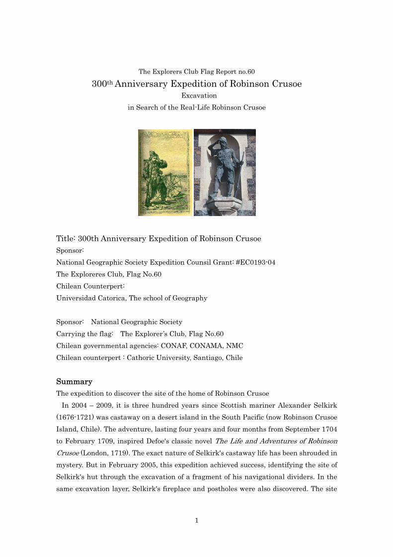
Title: 300th Anniversary Expedition of Robinson Crusoe Sponsor: National Geographic Society Expedition Counsil Grant: #EC0193-04 The Exploreres Club, Flag No.60 Chilean Counterpert: Universidad Catorica, The school of Geography Sponsor: National Geographic Society Carrying the flag: The Explorer’s Club, Flag No.60 Chilean governmental agencies: CONAF, CONAMA, NMC Chilean counterpert : Cathoric University, Santiago, Chile Summary The expedition to discover the site of the home of Robinson Crusoe In 2004 – 2009, it is three hundred years since Scottish mariner Alexander Selkirk (1676-1721) was castaway on a desert island in the South Pacific (now Robinson Crusoe Island, Chile). The adventure, lasting four years and four months from September 1704 to February 1709, inspired Defoe's classic novel The Life and Adventures of Robinson Crusoe (London, 1719). The exact nature of Selkirk's castaway life has been shrouded in mystery. But in February 2005, this expedition achieved success, identifying the site of Selkirk's hut through the excavation of a fragment of his navigational dividers. In the same excavation layer, Selkirk's fireplace and postholes were also discovered. The site

2
at Aguas Buenas consists of the ruins of a building with an adjacent level piece of ground or yard (confirmed as a Spanish Gunpowder warehouse of the late 18th century). The site Aguas Buenas, Robinson Crusoe Island, The Juan Fernandez Archipelago, Republic of Chile S 33 ゚ 38'19.1" W 78 ゚ 50' 47.1" H 274m There is a stone building and it is now in a clearing in the forest with a good view over Cumberland Bay (Photo1) and up to Selkirk's Lookout (El Mirador) (Photo2).
(Map1)
(Map2)

3
(Photo1) (Photo2)
Project time and duration Project fieldwork in Chile: January 06 – February 28, 2005 Archaeological excavation: January 13 – February 10, 2005 Post-excavation analysis: February 11 – mid June Team members Daisuke Takahashi (Expedition leader) Explorer. Author of In Search of Robinson Crusoe (Cooper Square Press, NY, 2002). An Fellow of both the Explorers Club (USA) and the Royal Geographical Society (UK) Address: 8-28 Kamenocho Minamidori Akita 010-0011 Japan Telephone: +81-(0)90-9000-8575 e-mail: [email protected] Dr. David Caldwell Keeper of Scotland and Europe in the National Museums of Scotland. Address: National Museums of Scotland, Chambers Street, Edinburgh, United Kingdom Telephone: +44-131-247-4068 e-mail: [email protected] Ivan Caceres Roqur Archeologist, He works for Soluziona in Chile. Address: Soluziona Dario, Urzua 1994, Providencia 6640683 Santiago Chile Telephone: +56-2-442-3200 e-mail: [email protected]
Miguel Saavedra Villanueva Freelance archeologist in Chile Address: Lago Yelcho No 6028 Villa el Alba, Puente Alto, Santiago Chile Telephone: +56-2-6753111 e-mail: [email protected]

4
Mauricio Calderon, B.S. in Agronomy, MSc. in Soil Science. Soil scientist, He works for the National Forestry Service (CONAF). From 1992-94, he served as administrator CONAF in Juan Fernandez National Park. Address: CONAF, Valenzuela Castillo No 1868 Providencia. Santiago Chile Telephone: 3414668 - 3414669 e-mail: [email protected]
(Field workers of local residence) Pedro Tobar Chamorro Lester Chamorro C. Expedition Objective The main aim of the project was to identify evidence for the activity of Alexander Selkirk, marooned on the island 1704-1709, or other early castaways. It was also hoped to provide an explanation for the ruined building. Methodology
Archaeological excavation fell into two phases. Firstly, from 13 to 18 January initial planning was done of the site and small trenches (1 to 5) excavated outside the building to test for archaeological deposits and as a guide to where to place the main trenches. From 26 January to 10 February excavations (trench 6 to 12) were undertaken within the building and the area immediately adjacent to it.
All deposits excavated in trench 1 to 8 were sieved and all artifacts, including fragments of tile and brick, retained. The deposits in trench 9 to 12 were sieved more selectively. Some representative piece of tile and brick kept for thermoluminsecence analysis and piece of pottery for culture study. Soil samples were taken from occupation deposits and features for C14 dating and archaeobotanical analysis.
Also by an ethnographical approach, interviewing local people about the history and historical site of the island, we sought information on the function of the building and the history of the Aguas Buenas area.

5
Archaeological excavation Phase 1 (Trenches 1-5) Excavation of 5 sondages provided little clue to the function of the building. The ceramic material – roof tiles, bricks and pottery – tended to suggest a date in the 18th or 19th century, almost certainly later than Selkirk’s stay on the island. It also seemed reasonable to conclude that the leveling of the yard, likely to be associated with the use of the building, would have removed any earlier traces of occupation. It was therefore decided in phase 2 to concentrate attention on the building itself with the intention of explaining its purpose and date, and hopefully uncovering earlier occupation deposits preserved underneath it. Phase 2 (Trenches 6-12)
(Photo3) (Photo4) Trenches 6 & 7
Trench 6, 1m by 2m, was laid out in the SW corner of the building. Its excavation demonstrated that there is a meter or more of debris, earth and stones from the collapse or destruction of the building. The walls of the building are of clay, faced inside and out with stone, mostly ‘field stones’, undressed, locally gathered and of a size and weight that could readily be handled by individual men. The walls are about 1m thick and survive to a height of over 1m above the level of the floor internally. No actual floor surface was found but only the upper surface of the natural clay, scarped to form a level surface for a floor. Neatly sectioned by the E baulk of the trench was a shallow, circular, basin-shaped pit containing a deposit of dark brown silt with many small pieces of charcoal.
Trench 7, contiguous with the E side of trench 6 and with an area of 2m by 1m, was opened, thus exposing the whole area of feature. It is 0.7m by 0.8m with a depth of up to 0.2m. It is interpreted as a hearth of earlier date than the building, the upper part of it,
6
and the associated living surface, removing during the leveling for the floor of the building. Trenches 8 and 9
The next trench to be opened was trench 8, 2m E-W, and extending the full width of the building. It was placed over what was supposed to be the position of the E wall and entrance into the building. This turned out to be the case. The entrance is located centrally in the E wall, is slightly over 1m wide, splaying internally to a width of 1.8m. The original floor surface survives in the entrance as rough paving, extending eastwards beyond the entrance into the area of a porch formed by two flanking buttresses, the 1m long extensions to the building’s N and S walls. There is a clear break in the paving, probably a slot for the timber of the doorway, 0.2m wide, running the full width of the threshold. It was not excavated, but some of the nails recovered form the debris accumulated in and around the building may be associated with the door frame.
Trench 8 was extended westwards into the interior of the building as trench 9, with and E-W width of 1m. This demonstrates that the paving in the entranceway does not extend beyond the thickness of the E wall. The floor level in the interior was clearly at a higher level, at least 0.01m higher, and about 0.02m if the floor was paved with the bricks of which many fragments were found in the debris within and around the ruins. Only a few bricks were actually recovered lying flat on the make-up level for the floor. Although the evidence for a brick floor is not overwhelming there is no other obvious explanation for the quantities recovered from the excavation. The bricks are 135mm x 270mm x 45mm, and about 400 would have been necessary to cover the entire floor. At least one appears to have been cut neatly, diagonally, perhaps indicating that they were not laid parallel to the walls.
The paving in the entrance was left in place, but further excavation below the floor level in trench 9 revealed further evidence of earlier occupation of the site. Only half exposed, since the rest of it is stratified under the paving, is a hearth with a complex sequence of deposits of ash, charcoal and small fragments of burnt bone. It appears to be a shallow, basin-shaped hollow and has a diameter of about 1.1m and it is possible that some smallish stones around its rim served as a kerb. Samples were taken for radiocarbon determinations and archaeobotanic evidence.
Further indications of human activity prior to the construction of the building were discovered in trench 9, and also in an extension to trench 9, about 1m square, added on its W side. Firstly there is a group of small post-or stake-holes (Photo 5). Stratigraphical

7
evidence demonstrates in the case of one of these that it was dug from the old ground surface that supported the hearth in trench 8. It has a diameter of about 140mm and is cut into the natural clay for a depth of about 100mm. Its original depth when dug, however, would probably have been about 300mm. At least two other post-holes were tentatively identified. It is possible that all three post-holes represent part of the side of a structure supported on a wooden framework.
(Photo5) (Photo6)
From this area of trench 9, to the S of hearth in trench 8 was recovered an artifact of copper alloy (Photo 6). It has been identified as the tip from a pair of dividers such as would have been included amongst the navigational instruments that Selkirk is said to have had with him during his stay on the island.
Other evidence for occupation of the site prior to the erection of the building came in the form of a thin deposit of dark brown powdered ash set in or on the old ground surface, encountered in the trench 9 extension, and to a lesser extent in trench 9 adjacent to the N wall of the building. It is not clear if it might have been cut away by the digging of a foundation trench for the N wall, in which case it might be the tenuous

8
remains of another hearth. Perhaps a more likely interpretation is that it represents ash cleared from the hearth in trench 8 and dumped down the hillside.
With the excavation of trench 9 and its extension it became clear that much of the interior of the building had had a large pit or trench dug into it when already choecked with debris from its collapse. It was back-filled soon afterwards, mostly with a mixed deposit of silty clay containing many fragments of brick and roof tiles. This pit extended up to the W and S walls of the building, cutting below the floor level in places. Fortunately, an area was left unaffected at the E end of the interior. The edge of this pit was traced in trench 9 running approximately NNE-SSW. The date and purpose of this excavation is unrecorded. Trenches 10, 11 & 12
The area towards the E of the building’s entrance was opened up as trenches 10 and 11 in order to explore the porch and the extent of the paved surface(Photo 7). It was not possible to dig all of this owing to the presence of indigenous trees, but eventually the margins of the paving were uncovered, lying under a thin layer of topsoil. Overall, it formed an area the full width of the building (5.5m) and sloped down hill for almost 2m in front of the entrance. From its surface and within the area of the entrance were recovered several sherds of a few large water jars, glazed internally. Perhaps because they had not been dug up and smashed by the excavators of the pit within the building there were also many more substantial pieces of roof tile here (Photo8), indicating that they are about 220mm in width and greater in length than 430mm. They have a curved profile, giving them a maximum height of about 50mm.

9
Trench 12, about a meter by a meter and a half, was excavated adjacent to the exterior of the S wall of the building, as an extension at the SW corner of trench 11. The intention was to check for the presence of earlier occupation deposits outside the building. No clear traces of these were found at this point.
(Photo7) (Photo8) OVERALL INTERPRETATION
The recovery of a copper alloy point and its interpretation as part of a pair of dividers is evidence of the utmost importance in interpreting the history of the site. Dividers with copper alloy points like this are unlikely to be any later in date than the early 18th century. The only person known to have been on the island at that time or earlier who is likely to have had dividers, and indeed, who is specifically said to have had his navigational instruments, is Alexander Selkirk. Since, also, the location for the excavations was selected on the basis that it was likely to be the place where Selkirk resided, this artifact must be viewed as pointing to his presence here, to the likelihood that the hearths and post-holes are also his. Given Selkirk’s limited range of equipment and resources, and his cultural background, he might have been expected to erect a simple hut with a framework of stakes, set in post-holes and tied together at the top, rather like the ‘shieling’ huts build as temporary summer shelters in many parts of Scotland in Selkirk’s time (Photo 9). The excavated post-holes would not be inconsistent with such an interpretation, although they could obviously have many alternative functions.

10
(Photo9) © “A Tour in Scotland and voyage to the Hebrides” 1772 Thomas Pennant
The building can be identified as ‘Almacen de Polvora’ (Map 4), the gunpowder store
first recorded on a map of the island published in 1795, “Isla De Juan Fernandez Levantadopor orden del Gobernador Fernnando de Amaya” (Map 3). Since the fort of St Barbara on Cumberland Bay was constructed in the mid 18th century, perhaps the gunpowder store is that early as well. It may have been more than a coincidence that it was sited on the same location as that occupied by an earlier inhabitant of the island. The path leading to it may still have been evident, and perhaps a clearing in the forest.
(Map3) (Map4)
A level platform was first terraced into the side of the hill, partly to create a yard and partly to provide clay as a building material. In the process, much of the evidence for earlier occupation was removed. Such evidence as was recovered was protected by the need to build up a platform over it to create a level surface for the building’s floor.
The ancestors of the present population of the island only arrived in the mid 19th

11
century, by which time the gunpowder store had probably fallen out of use and became a ruin. There was thus no memory of it on the island, and when its ruins were rediscovered in the 20th century, no one on the island had a clear idea as to what it was.
At some date after its ruin, perhaps in the 20th century, the interior of the building was largely dug out. Perhaps this was an amateur archaeological effort, a search for artifacts. Whatever the case, the excavation was filled back in again so that this activity was not immediately evident. Study of the copper alloy artifact It is a piece of copper alloy about 16mm long by 3mm across. It is rectangular in cross-section and narrows to a point. The other end is clearly broken. Its point is fashioned in such a way that, if it had a pair, the two together would make one pointed head. A program of research and analysis on the copper alloy by a team in the National Museums of Scotland is taking place to identify comparisons with other early navigational dividers. The Museum owns three dividers that were recovered from H.M.S. Dartmouth that was sunk in 1690 off the coast of Scotland, and two from the Castle of Eilean Dearg, blown up in 1685. Brief note of post-excavation analysis Among the finds from the later occupation of the site are shards of domestic pottery, thought to be of local manufacture since they have small inclusions of volcanic rock. The majority of the ceramic material, however, has been imported to the island, including the roof tiles, the most abundant group in the finds inventory. A sample of tile has been submitted for thermoluminescence (TL) dating and has produced a date of 1730 ± 25 AD. Other imported ceramics include Spanish or Chilean lustre or glazed wares, and shards of china - English white ware dating post-1810. There are also pieces of large earthenware jars, such as were commonly used as containers for food or liquid on ships from the sixteenth to the twentieth century. These discoveries of ceramics are consistent with the presence at Aguas Buenas of a small garrison or complement of personnel in the later part of the eighteenth and the early nineteenth century, tasked with guard or security duties. The evidence for a fire and burnt material recovered under the floor of the building clearly relates to deliberate human activity. Archaeobotanical analysis of samples from the hearth demonstrates the presence, only, of non-cultivated species that served to fuel

12
the fire, and no traces of food. A radiocarbon determination from charcoal from the hearth gives a 68% probability that it dates between 1640 and 1660 AD. This is valuable evidence that there was human occupation at Aguas Buenas several years prior to the erection of the building. It should be noted that charcoal from the core of trees might produce a date several years earlier than the date of its burning. Alexander Selkirk owned navigational dividers
What did Alexander Selkirk have with him during his castaway’s life on Robinson Crusoe Island in 1704 –09? A British buccaneer, Captain Woodes Rogers rescued him and wrote about his experience on the island. His book, “A Cruising Voyage Round the World, 1712” describes his belongings as follows; “He had with him his Clothes and Bedding, with a Firelock, some Powder, Bullets, and Tobacco, a Hatchet, a Knife, a Kettle, a Bible, some practical Pieces, and his Mathematical Instruments and Books”. According to this record, he had “mathematical instruments” with him. What were they? A hint to answering this question is also found in Roger’s book. It mentions Selkirk’s position as a “Master of the Cinque-Ports (the galley ship)”. He was a navigational master when he decided to leave the galley ship and live by himself on the island after quarreling with his Captain, Thomas Stradling.
Thanks to Mr. Richard Dann, a researcher in the National Maritime Museum in the U.K., it is possible to suggest that a navigational master’s regular equipment would consist of the following items: a back staff (Photo 10), a cross-staff (Photo 11) and a set of drawing instruments (Photo 12) for use with charts etc. The drawing instruments would have included dividers, parallel rules, a sector, pens etc. The back staff and cross-staff were both used for measuring angles (e.g. height of the sun or pole star to determine the latitude). Selkirk may also have owned a mariner's quadrant, a nocturnal and a sundial, in particular for time-telling. Some individuals also owned their own mariner's compasses, although the ship's equipment would certainly have included compasses. They may also have carried a lodestone for 'retouching' (i.e. re-magnetizing) the compass needle.

13
(Photo10) (Photo11) (Photo12) ©British Maritime Museum So it is clear that Selkirk’s mathematical instruments were navigational equipment and the piece of bronze alloy from the excavations can be identified as a piece from a pair of navigational dividers. Pre and Post-Selkirk visitors Our research shows that Alexander Selkirk would have had navigational dividers and we have identified an artifact found by our expedition as part of such dividers. However, it is true that there were some visitors to the island before and after Alexander Selkirk. We need to check these visitors to see if they could have had dividers to help confirm who built and owned the hearths and postholes in Aguas Buenas.
From the first discovery of the island by Juan Fernandez in 1574 to the establishment of the Spanish village called San Juan Bautista in 1750, there are thirteen documented visits to the island. Visitors like Shelvocke, Roggewin and Anson are known to have established their camps near the shore. 1574: A Spanish mariner, Juan Fernandez, discovers the island 1624: De Witte’s Men 16** : Man mentioned by Ringrose 1681-4: A Mosquito Indian, Will, spends 3 years 1687: Davis’s Men 16**: French Buccaneers 1704: Stradling’s men 1704-9: Alexander Selkirk spends 4 years and 4 months 1712: Fishery established by Spanish and French 1919: Two men escape Captain John Clipperton, are captured by Spaniards 1720: George Shelvocke runs aground off the coast

14
1722: Jacob Roggewin visits (Later see Clipperton’s men in Lima, Peru) 1741: George Anson sees Selkirk’s goat on the island 1750: Spanish build “San Juan Bautista” (The source for Pre and Post-Selkirk visitors) *Harris, John. Navigantium atque Itinerantium Bibliotheca, or, a Complete Collection of Voyage and Travels, consisting of above six hundred of the most Authentic Writers, beginning with Hackluit, Purchass, &c. in Italian; Thevenot, Renaudot, Labat, &c. in French; DeBrye, Grynaeus, Maffeus, &c. in Ltin; Herrena, Oviedo, Coreal, &c. in Spanish; and the Voyages under the Direction of the East-India Company in Holland, in Dutch; Together with Such other Histories, Voyages, Travels, or Discoveries, as arre in General Esteem; Whether published in English, Latin, French, Italian, Spanish, Portuguese, High and Low Dutch, or in any other European Language, containing whatever has been observed worthy of Notice in Europe, Asia, Africa, and America; in respect to the Extent and Situation of Empires, Kingdoms, Provinces, &c. The Climate, Soil, and Produce, whether Animal, Vegetable, or Mineral, of Each Country: Likewise the Religion, Manners, and Customs of the several inhabitants, their Government, Arts and Sciences, Public Buildings, Mountains, Rivers, Harbours, &c. Illustrated by Proper Charts, Maps, and Cuts. To which is prefixed a copious Introduction, comprehending the Rise and Progress of the Art of Navigation, and its successive Improvements; together with the Invention and Use of Loadstone, and its Variation. 2 vols. Rev. ed. London 1744 *Providence Displayed: or, the remarkable adventures of Alexander Selkirk, Issac James, 1800 London *Juan Fernandez Historia Verdadera de la isla de Robinson Crusoe Benjamin Vicuna Mackenna Ediciones Universitarias de Valparaiso, Chile 1974 Original edition;1883 *Robinson Crusoe’s Island ; A history of the Juan Fernandez Islands Ralph Lee Woodward, Jr., The university of North Carolina Press Chapel Hill 1969 Historical review on Aguas Buenas as the place where Selkirk lived. Residence of Alexander Selkirk
Selkirk’s island life is contained in the account of his rescuer, Captain Woodes Rogers (A Cruising Voyage Round the World, 1712). Regarding his residence, Woodes Rogers says as follows:

15
“He built two Hutts with Pimento Trees, cover’d them with long Grass, and lin’d them with the Skins of Goats, which he kill’d with his Gun … In the lesser Hutt, at some distance from the other, he dress’d his Victuals, and in the larger he slept, and employ’d himself in reading, singing Psalms.”
Woodes Rogers also mentioned where Selkirk lived. “We sent her (boat) to the South End of the Island to get Goats. The governour
(Selkirk) told us, during his stay he could not get down to that end from the Mountains where he liv’d, they were so steep and rocky; but that there were abundance of Goats there, and that part of the Island was plainer.”
“Goats, which are of a larger sort, and not so wild as those on the higher part of the Island where the Governour liv’d”.
According to this document, he lived in the high mountains and could not get down
from there to the southern part of the island where there were lots of goats. A map that was copied by the English from the original Spanish map in the 18th century endorses Rogers’ document (Map 5). It is clear that the “Goat Quarters” are located in the southern part of the island and in the center, there are high mountains. Three bays, Puerto Ingles, Cumberland Bay and Puerto Frances are shown on the north-eastern part of the island. The huts of Alexander Selkirk must have been located on this mountain where he was only able to see the Goat Quarters, not go there.

16
(Map5 ) (Map6) (Map5 Taunton, UK Hydrographic Office MS 4, page 147. Journal entries for 1 & 2 January 1681.
(Map6 “A Voyage Round the World in the Years MDCCXL,1,2,3,4, by George Anson, Esq., Commander-in-Chief of a Squadron of His Majesty’s ships sent upon an Expedition to the South Seas, compiled from his Papers and Materials by Richard Walter, M.A., Chaplain of his Majesty’s Ship the Centurion, in that Expedition” 1748)
Another early map (Map 6) further confirms the statements of Woodes Rogers. It was made by the English crew of George Anson’s voyage in 1742 (See Map 2) about 30 years after Selkirk’s stay. It shows that there was a route to the point and Selkirk’s Lookout was the single spot open to the south-east part of the island, called the Goat Quarters in early sources. Now it is obvious that Selkirk’s huts must have been on this mountain which has the pioneer route leading to Selkirk’s Lookout.(Map 2)
Selkirk’s Lookout “Selkirk’s Lookout” is at a height of 565 meters between Cerro Portezuelo and Cerro Central or Cerro La Piramide.(Photo13) It is a small, natural lookout affording a good view of both the east and the southwest side (photo 14) of the island. There is no other place like it, and Selkirk must often have climbed up here, scanning the horizon for any sign of a ship that might bring rescue. In the early 18th century, a rough old road led to the point and the route became known to islanders as “Camino Colono Antiguo”(Old Pioneer Route). Selkirk’s Lookout was confirmed by Commodore Powell and British naval officers of HMS Topaze in 1868.
(Photo13) (Photo14)

17
Ethnographical approach to “Camino Colono Antiguo” (Old Pioneer Route) Our expedition also focused on the ancient lost route from Cumberland Bay to
Selkirk’s Lookout. We interviewed local people and a few old men remembered about the stones on the mountain carved with inscriptions. We successfully rediscovered the stones in the bush, particularly three stones with the same name and year, “Pedro Arredondo 1866”.
A row of these stones marks the old path to Selkirk’s Lookout (Map 7). The present path to Selkirk’ s Lookout was only created in 1960, replacing the ancient paths.
According to Jorje Chamorro Arredondo, 80 years old, a third generation descendant from Pedro Arredondo, their family history in Robinson Crusoe Island started when Pedro arrived with his children to work as a sealer. Now Jorje is one of the oldest people on the island and it is clear that the present islanders’ ancestors can only be traced back to around the mid 19th century.
The stones have initials and graffiti including dates that indicate that many of them were carved in the 20th century, probably by tourists. But one of the stones located near the ruin in Aguas Buenas on the ancient path has the initials “AS”. It is not certainly by Alexander Selkirk himself. However, according to Rogers’ account he did, put his name on surrounding objects such as tree trunks:
“After he had conquer’d his Melancholy, he diverted himself sometimes by cutting his
Name on the Trees, and the Time of his being left and Continuance there.”

18
(Map7) History of Aguas Buenas Firstly in 1704-09, Alexander Selkirk found a fairly level spot in Aguas Buenas. It fit his survival requirement perfectly because it was half way to the lookout and also it was a hideaway on the mountain from the Spaniards. He built the hut and lived there. When he left the island, the area was covered by bush but in the late 18th century, the spot was re-discovered by Spanish immigrants. The Lookout and the level spot in Aguas Buenas were useful for their military purposes, protecting the hinterland of their newly established town. They cut the slope, cleared the area and erected a stone building on the old surface where once Selkik’s hut had been build. Much evidence of Selkirk’s time here was lost by these activities. The stone building was used as a gunpowder warehouse but in course of time, it was lost and forgotten again. In the 20th century some locals found the ruin and it was excavated, but again it was lost until our scientific expedition in 2005. Selkirk’s survival strategy as a castaway Our evaluation of Selkirk and his stay on the island lead us to three significant

19
conclusions. Firstly, he did not plan to live there permanently and consequently thought in terms of temporary solutions to accommodation needs. Secondly, he only had access to a limited range of building options, based on Scottish experience and one pair of hands. Thirdly, he was very aware of his position as a fugitive in enemy territory and therefore took precautions not to draw attention to his presence on the island. The ruin in Aguas Buenas fits perfectly these three factors. Although it was a deserted island, his situation was always dangerous. He had to hide away from the Spaniards who occasionally landed on the island for fresh food and water. On the other hand, he had to attract the attention of any rescue ship from Britain or France. So he had to live close to the lookout in the mountain. His circumstances were unusual and his living place reflects his presence in enemy territory. The location in Aguas Buenas is a unique spot fitting Selkirk’s strategy for survival.. Brief Expedition Diary 06jan05 thu day 1 Arrived in Chile. Daisuke Takahashi (dt) from Japan, Dr. David Caldwell (dc) from Scotland joining a Chilean member, Mr. Mauricio Calderon (mc). 07jan05 fri day 2 Preparation for the expedition in Santiago. Buying some equipment. 08jan05 sat day 3 Preparation for the expedition in Santiago. Buying some equipment. Had a meeting with two Chilean archaeologists, Mr. Ivan Caceres (ic) and Mr. Miguel Saavedra (ms). 09jan05 sun day 4 Preparation for the expedition in Santiago. Had a meeting with mc,dc and dt. 10jan05 mon day 5 Visited Chilean authorities, CONAF (for permission to work in National Park) and CONAMA (Environmental permission) in Viña del Mar and Valparaiso. 11jan05 tue day 6 Preparation for the expedition in Santiago. Buying some equipment. Visited to Chilean authority, NMC (in charge of cultural conservation) 12jan05 wed day 7 Starting out to Robinson Crusoe Island. The first expedition members are dc, mc, ms and dt. 13jan05 thu day 8 Had a meeting at local CONAF office and village office(AM). Weeded and cleaned the site and started survey (PM). 14jan05 fri day 9 Weeded and cleaned the site and survey work. Removed the protective fence. 15jan05 sat day 10 Survey and checking the ground with metal detector. Excavation of Trenches 1 and 2. 16jan05 sun day 11 Made a table for sieving. Excavation of Trench 3 and unearthed

20
small pieces of ceramics, bone and charcoal. 17jan05 mon day 12 Started Trench3 and unearthed ceramics. Started Trench 4 and found roof tiles and ceramics. 18jan05 tue day 13 Excavation of Trench 5 and unearthed roof tiles and ceramics. The end of the first phase of excavation. 19jan05 wed day 14 ms departed form the island. dc, mc and dt visited Puerto Ingles for research. 20jan05 thu day 15 Visited to interior of Cumberland in search of “Camino Colono Antiguo” (ancient pioneer route) to Selkirk’s lookout. Found a stone monument engraved “Pedro Arredondo” and a stone with the initials “AS”. 21jan05 fri day 16 Made a rubbing of two stones. 22jan05 sat day 17 Visit to and research about, Selkirk’s Lookout. 23jan05 sun day 18 Ethnographical research – interview with a local old man about “Arredondo”. Washed artifacts. 24jan05 mon day 19 GIS Research at CONAF local office. Visited Puerto Ingles for taking soil sample. 25jan05 tue day 20 mc departed from the island and ic arrived. 26jan05 wed day 21 Started the second phase of archaeological research. Survey and excavation of Trench6. Roof tiles and piece of pottery ware unearthed. 27jan05 thu day 22 Continued the excavation of Trench 6 and unearthed a doornail, bricks, ceramics and part of a hearth. 28jan05 fri day 23 Excavation of a sondage in Trench 6 but nothing is found. Started Trench 7and unearthed roof tiles and ceramics. 29jan05 sat day 24 Kept on digging Trench 7 and unearthed bricks, roof tiles and pottery sherds. Finally the rest of the hearth found in Trench 6 appeared. 30jan05 sun day 25 Laid out and started Trench 8 in entrance of the building. Unearthed roof tiles, bricks and ceramics. 31jan05 mon day 26 Continued with Trench 8. The stone floor in the entrance of the building appeared. Further excavation within the building to explore its structure. 01feb05 tue day 27 Continued with Trench 8. Unearthed bricks, roof tiles, ceramics and doornail. 02feb05 wed day 28 Laid out and started Trench 9. Confirmed the stone floor did not
extend into the interior of the building. 03feb05 thu day 29 Kept on digging Trench 9. Unearthed half of another hearth, the rest being underneath the stone floor. Also unearthed a piece of copper alloy by sieving. Near the hearth, post-holes were also unearthed.

21
04feb05 fri day 30 Continued with Trench 9 and a sondage was dug in Trench 9. 05feb05 sat day 31 Rain in the morning so only started the excavation in the afternoon. Laid out Trench 10 and unearthed roof tiles and ceramics. The post-holes in Trench 9 were also excavated carefully. 06feb05 sun day 32 A few more post-holes were found in Trench 9. Laid out Trench 11 and started to clear the stone pavement in front of the building. Checked and examined the copper alloy artifact and identified it as a piece from a pair of navigational dividers. 07feb05 mon day 33 Rain in the morning and so the excavation started in the
afternoon. Kept on with Trench 11. 08feb05 tue day 34 Continued with Trench 11. Nail, roof tiles and some pieces of a big pottery vessel unearthed. 09feb05 wed day 35 Kept on with Trench 11. Cleared and confirmed the exterior stone floor as much as possible. Laid out Trench 12 and many roof tiles were unearthed. 10feb05 thu day 36 Took soil samples from the hearth in Trench 9. Kept on with Trench 12. End of the excavation project. 11feb05 fri day 37 dc & ic departed from the island. dt washed the artifacts. 12feb05 sat day 38 kept on washing artifacts. 13feb05 sun day 39 Cleaned-up the site and took photographs. 14feb05 mon day 40 Refilled the trenches with soil and covered the site over again. 15feb05 tue day 41 Cleaned-up the site and explored and confirmed a spot for getting water close to the site in Aguas Buenas. 16feb05 wed day 42 GIS research in local CONAF. Washed the artifacts. 17feb05 thu day 43 Washed the artifacts. 18feb05 fri day 44 Explored the “Camino Colono Antiguo”, the ancient path from Cumberland Bay to Selkirk’s Lookout, with two locals. 19feb05 sat day 45 Weighed the artifacts. 20feb05 sun day 46 Took photos for National Geographic Magazine. 21feb05 mon day 47 Visited CONAF and returned their tools. Took photos of the site for NGM. 22feb05 tue day 48 Weighed the artifacts and made a list. Posted the films to NGM. 23feb05 wed day 49 Explored the northern side of the mountain in Cumberland. Took photos for NGM. 24feb05 thu day 50 Posted the films to NGM. Made a rubbing of stone relief for ethnographical research. 25feb05 fri day 51 Made a rubbing of stone relief with AS initials for ethnographical research. Visited CONAF and gave a report on the expedition to the local

22
administrator. 26feb05 sat day 52 Visited to the Village office and gave a report on the expedition to the governor. 27feb05 sun day53 End of the expedition. 28feb05 mon day54 dt left the island.
(Excavation in Phase One) (Excavation Phase Two)