2015 ottawa-carleton student northern research symposium ... · 2015 ottawa-carleton student...
TRANSCRIPT
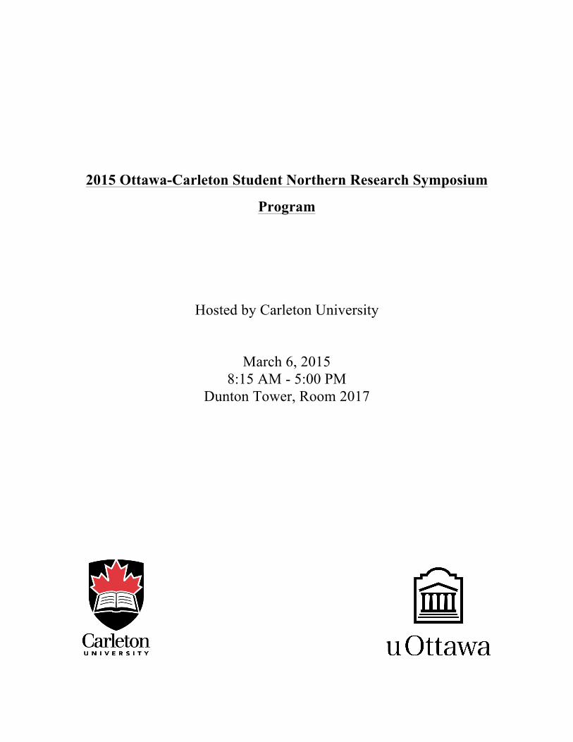
2015 Ottawa-Carleton Student Northern Research Symposium
Program
Hosted by Carleton University
March 6, 2015
8:15 AM - 5:00 PM Dunton Tower, Room 2017

The Ottawa-Carleton Northern Research Symposium (OCSNRS) is an annual opportunity for undergraduate and graduate students from Carleton University and the University of Ottawa to gather and share high-quality northern research studies, in the natural and social sciences and humanities. As a platform to showcase our excellence and common interests, Carleton University is pleased to host the 2015 OCSNRS. Place and Time: March 6, 2015 8:15 AM - 5:00 PM Dunton Tower, Room 2017 RSVP to Keegan Smith at [email protected] is required by Monday, March 2. Further details are available at: http://www.carleton.ca/northernresearch/ocsnrs/2015-ocsnrs/. The organizing committee would like to thank our funding sources at Carleton University: Faculty of Graduate and Postdoctoral Affairs Department of Geography and Environment Department of Biology Department of Anthropology and Sociology The organizing committee would also like to thank: Dr. Derek Mueller (Department of Geography and Environment, Carleton University) for organizational, communication and website support, Dr. Audrey Giles (School of Human Kinetics, University of Ottawa) for aiding with communications at Ottawa University, Dr. John Osborne (Dean of Arts and Social Sciences, Carleton University) and Elder Ovilu Goo Doyle for opening the Symposium, Dr. Jeff Saarela (Canadian Museum of Nature) for providing our keynote address, Claire Elliott for organizing the first OCSNRS photo competition, Christina Williamson for coordinating with the Carleton University Centre for Aboriginal Culture and Education, and for providing transportation for Mrs. Goo Doyle. 2015 Symposium Organising Committee: Chair: Keegan Smith (M.Sc. student, Geography) Jill Rajewicz (M.Sc. student, Geography) Zoe Panchen (Ph.D. student, Biology) Marcus Phillips (Ph.D. student, Geography) Anna Crawford (Ph.D. student, Geography) Alexander Castleton (Ph.D. student, Sociology) Claire Elliott (M.Sc. student, Geography) Christina Williamson (Ph.D. student, Cultural Mediations)
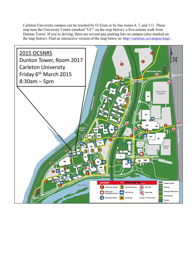
Carleton University campus can be reached by O-Train or by bus routes 4, 7, and 111. These stop near the University Centre (marked “UC” on the map below), a five-minute walk from Dunton Tower. If you’re driving, there are several pay-parking lots on campus (also marked on the map below). Find an interactive version of the map below at: http://carleton.ca/campus/map/.
2015 OCSNRSDunton Tower, Room 2017Carleton UniversityFriday 6th March 20158:30am – 5pm

2015 Ottawa-Carleton Student Northern Research Symposium
Schedule
March 6th, 2015 – Dunton Tower, Room DT2017, Carleton University
08:15 – 08:40 Registration and Poster Set Up
08:40 – 09:00 Opening Remarks, Prayer from Elder Ovilu Goo-Doyle
09:00 – 09:45 Keynote Address -Dr. Jeff Saarela, Canadian Museum of Nature
Oral Presentations – Session 1 Chair: Keegan Smith
Title Presenter
09:45 – 10:00 Design and manufacturing of a zero emissions, locally built, electric Arctic vehicle
Sarah Wert
10:00 – 10:15 Testing Nunavut's IQ: Inuit Qaujimajatuqangit and climate change policy in the Canadian Arctic
Holly Jones
10:15 – 10:30 Seasonal variability of groundwater discharge in a continuous permafrost watershed, Ogilvie River, Yukon Territory
Natalia Baranova
10:30 – 10:45 Break
Oral Presentations – Session 2 Chair: Claire Elliott
10:45 – 11:00 Unearthing baseload power in Canada’s North: A feasibility study on the implementation of an enhanced geothermal system power plant in Fort Simpson
Stephen Malesevich
11:00 – 11:15 The paleoclimate of the Holocene warm period as archived by lakes in the central Northwest Territories, Canada
Andrew L. Macumber
11:15 – 11:30 Community ready or capitalism ready: The Community Readiness Initiative and capitalist-colonialism in Nunavut
Dana Holtby
11:30 – 11:45 Later flowering Arctic plant species are flowering and fruiting earlier due to rising temperatures of climate change
Zoe Panchen
11:45 – 12:00 Trends in permafrost patch size across the sporadic and isolated permafrost zones, southern Yukon and northern B.C.
Olivier Bellehumer-Génier

12:00 – 12:45 Lunch
Oral Presentations – Session 3 Chair: Alexander Castleton
12:45 – 13:00 A contemporary re-evaluation of permafrost in the Labrador region of northeastern Canada
Robert Way
13:00 – 13:15 Investigating a grounded ice island's biological impact on the surrounding water column near Resolute Bay, Nunavut
Melissa Nacke
13:15 – 13:30 Making sense of Inuit sovereignty claims in Baffin Bay, Nunavut
Tad Lemieux
13:30 – 13:45 Arcellaceans (testate lobose amoeba) as bio-indicators of arsenic contamination in the Yellowknife region, Northwest Territories, Canada
Nawaf A. Nasser
13:45 – 14:00 Permafrost degradation adjacent to snow fences along the Dempster Highway, Peel Plateau, NWT
Brenden O’Neill
14:00 – 14:15 Near-surface ground ice conditions in University Valley, McMurdo Dry Valleys of Antarctica
Caitlin Lapalme
14:15 – 14:30 Break
Oral Presentations – Session 4 Chair: Zoe Panchen
14:30 – 14:45 Investigation of changes in surface area of Barnes Ice Cap, Nunavut, from 1980 to 2014
Frances Delaney
14:45 – 15:00 Permafrost characterization for the Dempster Highway, Yukon and NWT
Jeff Moore
15:00 – 15:15 Tracking the impact of Giant Mine on a small lake near Yellowknife, NT, Canada using lake sediments
Alexa D'Addario
15:15 – 15:30 Benthic foraminiferal morphotype response to benthic oxygen conditions within the Cretaceous Kanguk Formation, Sverdrup Basin, Nunavut
Anika Smithson
15:30 – 15:45 Variability in calving behaviour at Rink Isbræ, west Greenland
Dorota Medrzycka
15:45 – 16:00 Load Transfer of Helical Piles in Frozen Ground Abdulghader Abdulrahman Aldaeef

Poster Presentations – Session 5
16:00 – 16:45 Inter-annual variability of dissolved CO2 concentrations and fluxes for ponds in Canada’s Low Arctic
Alice Wilson
Foraminifera in the Late Cretaceous Polar Sea: Understanding paleoenvironmental conditions and ecological responses to a greenhouse Arctic in the Sverdrup Basin, Nunavut, Canada
Marissa A. Davies
The Role of NFATs in Molecular Adaptation to Stress in Wood Frogs
Rasha Al-attar
Marine nutrient subsidies to the terrestrial environment of Common Eider nesting islands in the Canadian Arctic
Nikolas Clyde
Effects of chromium (CrCl3•6H2O) toxicity on germination and health of wild terrestrial plants commonly growing in Northern Ontario
Anna Lukina
Using DEM differencing to calculate volume change of two alpine glaciers on Axel Heiberg Island, Nunavut, Canada, 1959-2014
Mike Hackett
Marine Mammal and Shipping Interactions in a Changing Climate
Alexandra Abram
What is successful economic development to Nunavummiut? A key informant analysis of the secondary impacts of climate change
Kathryn Lupton
Cyanobacteria north of 60º Katherine Alambo
Relating low Arctic tundra - atmospheric CO2 exchange to satellite-derived NDVI using phenological analysis at Daring Lake, NWT
Claire Elliott
Climate change adaptation assessment for transportation in Arctic Waters: A policy delphi approach
Lindsay Matthews
16:45 – 17:00 Awards and Closing Remarks
Keynote Address
Biodiversity of the Canadian Arctic Vascular Plant Flora Jeff Saarela1
1 Research Scientist & Director, Centre for Arctic Knowledge and Exploration, Canadian Museum of Nature
Exploration of the vascular plant flora of the Canadian Arctic has been ongoing for almost two hundred years, yet substantial gaps remain in our floristic understanding of this large, rapidly changing and difficult-to-access region. Detailed information on the diversity and distribution of Arctic plants is urgently needed to understand the potential impacts of climate change on the region’s flora. Since 2008 we have been conducting detailed floristic surveys in botanically-understudied regions of the Canadian Arctic. The comprehensive baseline data of our >5000 new collections adds important knowledge to our understanding of Arctic plant biodiversity, which may inform future terrestrial monitoring efforts by identifying areas that contain rare species or unique habitats, for example. Many of our collections represent first records for specific areas, others represent the second or third collections of poorly-known species at the edge of their ranges in the Canadian Arctic, and many fill in gaps in the known distributions of Arctic species. We are building a DNA barcode library of Canadian Arctic plants to facilitate their rapid identification, reconstructing the phylogeographic history of widespread Arctic species, and preparing a new Arctic Flora of Canada and Alaska treating the ca. 1200 species in the Arctic ecozone.

Oral Presentations
Design and manufacturing of a zero emissions, locally built, electric Arctic vehicle
Sarah Wert1, Craig G. Merrett1
1 Department of Mechanical and Aerospace Engineering, Carleton University
The goal of the Arctic vehicle project is to design a zero emissions vehicle that will operate in Canadian Arctic conditions. This project was chosen based on the high fuel costs in the Arctic region as well as the elevated wind speeds that have the potential to make a zero emissions vehicle possible. The first objective was to research the Arctic region’s environment and inhabitants in order to determine criteria for the Arctic vehicle. The resulting criteria were to design an off-road vehicle that could occupy two passengers with a large enough storage area for a full size seal. The second objective was to determine the main components and configuration. A retractable gyro mill was chosen to generate electricity when the vehicle was stationary. The electricity would be stored in 15 lithium ion batteries. For vehicle operation, the generator would be used as a motor to rotate a propeller located at the rear of the vehicle. The batteries, motor and propeller were selected based on the calculated power required to move the Arctic vehicle at a speed of 23 km/h which is comparable to the speed of a dog sled team. The third objective was to determine the material and manufacturing method. The properties of several materials were compared for suitability through stress and cost analyses with fiberglass as the recommended material. The final objective is the development of a manufacturing plan for the design that leverages local resources and labour in an Arctic community.

Testing Nunavut's IQ: Inuit Qaujimajatuqangit and climate change policy in the Canadian Arctic
Holly Jones1 1 Department of Public Affairs, Carleton University
The consequences of anthropogenic climate change present a very immediate and significant challenge to Inuit. Researchers have increasingly drawn upon Inuit expertise to investigate evidence of climate change and to explore the human-environment interactions at risk from rapid environmental change. Inuit Qaujimajatuqangit (IQ) is an embodiment of all aspects of traditional Inuit culture and can be described as a uniquely Inuit epistemology. Despite the creation of an IQ Task Force by the Government of Nunavut (GN), the territorial policy development structure currently used to address environmental and climate issues has proven insufficiently flexible and fails to consider the traditional context of Inuit cultural principles. Research will investigate the relationship between IQ principles and the Qallunaat (Euro-Canadian) structure of the GN and will aim to determine how IQ can be used in governance and policy development both in Nunavut and across the circumpolar Arctic to address a climate change agenda. Through a comparison of the UNESCO Traditional Knowledge Initiative framework for climate change adaptation policy and current GN agendas and strategies involving IQ, a considerable disconnect between global economic development goals within Western policy systems and Indigenous values and governance systems is demonstrated. Advancing the field of climate change research in the North is incomplete without collaborative action and an understanding of distinct Inuit cultural knowledge and the context in which it exists. This understanding can be promoted through the application of IQ in policy development.

Seasonal variability of groundwater discharge in a continuous permafrost watershed, Ogilvie River, Yukon Territory
Natalia Baranova1, Ian Clark1 1 Department of Earth Sciences, University of Ottawa
The groundwater contribution to the streamflow in some permafrost watersheds has been shown to increase in the last several decades while the overall flow has remained largely unchanged. The potential implications of increased groundwater discharge include changes to the hydrological regime and to the carbon exports from permafrost catchments. This study examines upper Ogilvie River, a mid-size watershed in a continuous permafrost area of central Yukon, with the objective to correlate groundwater discharge with geological, cryological and meteorological controls. The groundwater and other components of the annual hydrograph will be characterized using geochemical tracers and stable isotopes (δ2H, δ18O, and δ13C ). The age of the flow components will be estimated using radioactive carbon and tritium isotopes. Mixing model approach will be used to identify various contributions to the hydrograph. Carbon flux can be then characterized in terms of its age and geochemistry. Water samples from the river, runoff, seeps, and precipitation have been collected in 2014 with the second set of data to be collected in the summer of 2015. Some preliminary results from the 2014 season will be presented. Additionally, precipitation data will be obtained from the GPM satellite launched in early 2014.
Unearthing baseload power in Canada’s North: A feasibility study on the implementation of an enhanced geothermal system power plant in Fort
Simpson Tiwa Lawal1, Stephen Malesevich1, Peter Massie1
1 Sustainable Energy Engineering and Policy, Carleton University
Communities in the Canadian Arctic face a number challenges to economic development. One of the main impediments common to all Arctic communities is the supply of reliable and affordable electricity. Conventionally, electricity is supplied via massive centralized generation units to take advantage of economies of scale. However, sparse population densities in the Canadian North prohibit this model. Instead, utilities have developed a system of fragmented local generation, which predominantly relies on diesel. This approach burdens Northern communities with electricity rates up to six times higher than the average Canadian, and subjects to volatile commodity prices. While renewables such as wind and solar have attracted a great degree of attention for their potential to reduce the North’s dependence on diesel fired electricity, their ability to displace fossil fuels is limited. This paper suggests that geothermal offers a new path towards Northern electricity security that is reliable, affordable, and does not compromise the environmental integrity of Northern ecosystems. This concept is explored using Fort Simpson in the Northwest Territories as a potential site. Geothermal power produces electricity constantly, and is not subject to the intermittency of other renewables such as wind and solar. Further, research by the Geologic Survey of Canada indicates that the Arctic holds Canada’s greatest geothermal potential. Economic analysis indicates that geothermal energy could supply electricity at a rate below the current cost of diesel generation. Displacing diesel with non-emitting geothermal plants would also cause substantial reductions in emissions of greenhouse gases and other air pollutants. Finally, the deployment of geothermal facilities could empower Northern communities by directly engaging with First Nations as partners.

The paleoclimate of the Holocene warm period as archived by lakes in the central Northwest Territories, Canada
Andrew L Macumber1, R. Timothy Patterson1, Jennifer M Galloway2, Jesse C. Vermaire3, Hendrick Falck4, Ian Clark5
1 Department of Earth Sciences, Carleton University 2 Geological Survey of Canada 3 Department of Geography and Environmental Studies, Carleton University 4 Northwest Territories Geoscience Office 5 Department of Earth Sciences, University of Ottawa
The central Northwest Territories of Canada is a vast region known to be sensitive to Holocene climate variability. Glacial erosion has resulted in a landscape characterized by abundant lakes that archive continuous records of Holocene climate variability. One key feature of the region is the taiga-tundra treeline, which during the Holocene warm period (HWP) was situated over 100 km to the north of its present day location.
Carleton Lake (informal name) is located 120 km north of treeline. We collected a frozen sediment core that gave a basal date of 7500 cal yr BP. The record constrains the HWP between 6 to 3.8 kyr BP when there was a sharp increase in both total organic carbon and the C/N ratio. Analysis of grain size parameters, stable isotopes and Arcellacea (testate lobose amoebae) provided confirmation that the warm period ended at this site ~3750 cal yr BP.
Arcellacea are benthic heterotrophs that are sensitive to limnological change. Principal component analysis (PCA) of the assemblage data revealed two PCA axes that show significant changes during this period. The second PCA axis showed an increase during the initial phase of the HWP. The third PCA axis showed increases before and after the warm phase. A similar pattern is seen in both axes subsequent to the termination of the Little Ice Age. Studying the impact of Holocene climate variability on Arcellacea during the HWP has importance for understanding the impact of climate warming in the region.

Community ready or capitalism ready: The Community Readiness Initiative and capitalist-colonialism in Nunavut
Dana Holtby1 1 Department of Geography and Environmental Studies, Carleton University
Under the Harper government the Canadian Northern Development Agency (CanNor) was founded and has launched the “Community Readiness Initiative” (CRI). The CRI was formed to assess the socio-economic status and development needs of Nunavut communities before the territory’s anticipated boom in mining. With its heavy emphasis on creating mine ready labour, the CRI presents a unique opportunity to trace the development, structure, and impacts of mining programming in northern communities.
Kugluktuk, NU, one of the CRI’s seven pilot communities, has contracted Carleton and McMaster Universities to conduct its CRI assessment with the hope of employing a more community-based approach than the methodology proposed by the government plan. During the summer of 2014 I spent several weeks in the community assisting with the Hamlet’s CRI assessment.
Informed by my work, my presentation will explore the entrenchment of capitalist-colonial policies in Nunavut using the CRI as a case study. My proposed research will critically assess the neo-liberal origins and objectives of the CRI, the governmental possibilities opened by this federal project, as well as community response thus far.
With increasing government support for mining, Nunavut communities are being presented with a particular framework for community development. By exploring the establishment of the CRI, my proposed research will provide important insight into the particularities of capitalist-colonial entrenchment in Nunavut and the response of northern community members to this rapidly changing economic landscape.
Later flowering Arctic plant species are flowering and fruiting earlier due to rising temperatures of climate change
Zoe Panchen1 1 Department of Biology, Carleton University
In temperate regions there are clear indications that spring flowering plants are flowering earlier due to the rising temperatures of climate change. Temperatures in temperate regions are rising predominantly in the spring, however Arctic regions are seeing unprecedented climate change with temperatures rising predominantly later in the growing season. Parks Canada has been monitoring the timing of flowering and fruiting of purple saxifrage (Saxifraga oppositifolia) and mountain avens (Dryas integrifolia) for the past 20 years at Tanquary Fiord, Quttinirpaaq National Park, Ellesemere Island. Purple saxifrage is one of the first plants to flower in spring while mountain avens is a mid-summer flowering plant. Starting in 1994, Parks Canada staff have counted the number of open flowers and mature fruits every three days on 25 plants of each species at Tanquary Fiord. I used the flower and fruit counts to determine the species’ peak flowering and fruiting times each year. My analysis indicates that mountain avens is trending towards earlier flowering and fruiting times but purple saxifrage has shown no significant change in its flowering and fruiting time over the 20 year period. Temperatures are rising significantly at Tanquary Fiord. The timing of flowering of both species is correlated to Tanquary Fiord’s mean monthly temperatures prior to flowering. Arctic plants are exhibiting a different pattern of flowering and fruiting time climate change response with summer rather than spring flowering plants trending towards earlier flowering and fruiting. This difference will contribute to understanding how plants may respond to different climate change scenarios.

Trends in permafrost patch size across the sporadic and isolated permafrost zones, southern Yukon and northern B.C.
Olivier Bellehumer-Génier1, Antoni G. Lewkowicz1
1 Department of Geography, University of Ottawa
Little is known about trends of permafrost patch size, distribution and dynamics from the margins of the isolated patches through to the boundary between extensive discontinuous and continuous permafrost. This research focused on initiating measurements of permafrost patch size along a 1400 km transect in western Canada, between Fort St-John, BC and Whitehorse, YT.
The methodology used during fieldwork consisted of electrical resistivity tomography (ERT), active layer measurement, historic aerial photos of sites and near-vertical aerial photography using a remotely-controlled airborne photography platform. The previous year’s climate data (air temperature, ground surface temperature, snow cover thickness and temperature at the base of the active layer) were downloaded during site visits.
Field observations suggest that strong relationships may exist between permafrost boundaries and topography, drainage, soils (including the organic mat), and past disturbance. For example, analyses of field site MP 681, which represents the middle of the transect, show a strong correlation between local drainage and the boundaries of a permafrost patch. Where permafrost is present at the site, ground temperatures vary from 0°C to -0.5°C. Snow cover, topography and vegetation were not significant factors influencing the permafrost distribution at MP 681. A comparison of the new imaging with aerial photos from 1964 show no significant changes over the past 50 years. Ongoing data analysis is expected to establish whether spatial trends in permafrost patch size and characteristics exist along the transect or whether local factors are the primary controls.

Creating high-resolution spatially-distributed air temperature maps for Labrador
Robert Way1, Antoni Lewkowicz1, Philip P. Bonnaventure1,2
1 Department of Geography, University of Ottawa 2 Department of Geography, Queen’s University
The Labrador Permafrost Project was launched in 2013 with the goal of enhancing knowledge of the distribution of permafrost in the Labrador region of northeastern Canada. Given recent regional warming (e.g. Way and Viau, in press), it is probable that changes in the distribution are occurring but quantifying these changes is challenged by the lack of information on the current distribution of regional permafrost. Estimating the spatial distribution of permafrost under current and former climate conditions will employ the equilibrium temperature at the top of permafrost (TTOP) (Smith and Riseborough, 2002) model. This model requires as inputs detailed climatological grids which are not readily available for the region in real-time. This study documents the creation of high resolution (100 m) gridded topoclimatic datasets covering the entire Labrador-Ungava for a series of climate indices including monthly air temperature, freezing degree days and thawing degree days. Incorporating a novel spatio-temporal infilling technique (Way and Bonnaventure, Accepted), this study develops temporally-consistent climate grids spanning the period of 1948-2014 available at a monthly resolution. A comparison of several widely-used interpolation techniques demonstrates the improved skill of the method employed in this study. Modelled air temperatures for the region are converted to thawing and freezing degree days using an empirical transfer function that compensates for the impacts of continentality and coastal proximity in its derivation. These datasets will form the basis of inputs into a regional TTOP model that will be used to assess former, current and future permafrost conditions in the eastern Labrador-Ungava.

Investigating a grounded ice island's biological impact on the surrounding water column near Resolute Bay, Nunavut
Melissa Nacke1, Derek Mueller1, Christine Michel2
1 Department of Geography and Environmental Studies, Carleton University 2 Freshwater Institute, Fisheries and Oceans Canada
Ice islands in the open ocean can be surrounded by relatively high biological activity as the result of increased limiting nutrients in the photic zone of the water column. Ice island melt water can enhance the delivery of nutrients in two ways: upwelling of marine deep waters adjacent to the ice island as the consequence of a buoyant convection cell or the ice island itself which serves as a source of limiting nutrients. The objective of this study was to characterize the physical and biological oceanography of the water column surrounding a grounded ice island near Resolute Bay, Nunavut. In particular, the potential for ice islands to alter the phytoplankton biomass in the surrounding water was considered. Fieldwork was conducted in the summer of 2014. A comparison of locations near vs. far from the ice island was used to study phytoplankton biomass. Samples were collected at five depths adjacent to the ice island as well as 8 km south of the ice island, which was deemed outside the range of influence. A survey of the physico-chemical properties (salinity, temperature, δ18O, and nutrients) of the water column was conducted at several distances from the ice island along four transects. Preliminary results indicate that the water column adjacent to the ice island was stratified and a sharp pycnocline existed at 25 m depth. This depth corresponds to the maximum phytoplankton biomass observed, with values around 20 mg chl a m-3, which is indicative of phytoplankton bloom conditions.

Making sense of Inuit sovereignty claims in Baffin Bay, Nunavut Tad Lemieux1
1 Department of English Language and Literature, Carleton University
In June 2014, after four years of opposition from the surrounding Inuit communities of Clyde River, Pond Inlet, and Qikiqtarjuaq, the National Energy Board (NEB) approved a five-year proposal for seismic survey operations in Baffin Bay and Davis Strait, Nunavut, set to begin in July 2015. With the Norwegian tripartite consortium leading the survey located just outside of the Nunavut Settlement Area, the borders of the Nunavut Land Claims Agreement are enacted to deafen the cultural and historical claim of surrounding Inuit communities. Though in July 2014 the hamlet of Clyde River filed for a judicial review of the approval at the Federal Court of Appeal, which is expected to set a hearing in April, this case highlights some of the nuances and challenges to Inuit sovereignty and its claims to a particular geography. In this paper, I perform a rhetorical analysis of the various claims made by surrounding communities: in petition, protest, and community meetings. I argue that community responses illustrate an “ambient rhetoric” (Rickert 2013) that extends the border of Inuit sovereignty claims in Baffin Bay beyond the spatial divisions of the NSA: in the cadences, rhythms, migrations, and hearing of narwhals. Claims against the sensory imprint of the seismic survey on narwhal hearing – the consequences of neoliberal speculative futurity, and the “use it or lose it” mentality of Canadian Arctic sovereignty – enunciates the contours of a cognitive and historical timeline for Inuit, a series of claims made through and within the rhythms of a culturally significant ecology of locales, languages, migrations, economies, and interruptions.

Arcellaceans (testate lobose amoeba) as bio-indicators of arsenic contamination in the Yellowknife region, Northwest Territories, Canada
Nawaf A. Nasser1, R. Timothy Patterson1, Helen M. Roe2, Jennifer M. Galloway3, Hendrick Falck2, Michael J. Palmer4, Steve V. Kokelj4, Hamed Sanei3, Andrew L.
Macumber1, Lisa A. Neville3
1 Department of Earth Sciences, Carleton University 2 School of Geography, Archaeology and Palaeoecology, Queen's University, Belfast 3 Geological Survey of Canada 4 Northwest Territories Geoscience Office
Arcellaceans were examined in 61 sediment-water interface samples from 59 lakes in the region surrounding the Giant Mine near Yellowknife, Northwest Territories and related to sediment element and organic geochemistry to determine their utility as bio-indicators of arsenic and other contaminants and quantify the Mine impact on the region surrounding its lease area. Cluster analysis and detrended correspondence analysis (DCA) were used to discriminate five arcellacean assemblages. Redundancy analysis (RDA) revealed that assemblages are controlled by 14 statistically significant environmental parameters that collectively explain 57% of the faunal distribution. Partial RDA indicated that As had the most significant influence on assemblage variance (10.7%; p<0.10), followed by P (8.5%; p<0.01), Ba (6.2%; p<0.01), S1 carbon (6%; P<0.01) and Ca (4.5%; p<0.01). Stress-indicating species (primarily centropyxids) characterize assemblages associated with lake substrates with high As concentrations, while species assemblages (typically dominated by difflugids) characterize lakes with lower As concentrations. These results demonstrate that arcellaceans have considerable potential as indicators of As contamination. These benthic organisms may be a means to assess the legacy sediment quality, ecological impact, and efficacy of remediation associated with mineral development.

Permafrost degradation adjacent to snow fences along the Dempster Highway, Peel Plateau, NWT
H. Brendan O'Neill1, Chris R. Burn1 1 Department of Geography and Environmental Studies, Carleton University
In permafrost regions, snow fences alter the ground thermal regime by increasing snow cover. The objective of this study was to examine long-term ground thermal effects of snow fences on Peel Plateau, NWT. A secondary objective was to describe resulting active-layer thicknesses and vegetation changes near the fences.
Shallow ground thermal, active-layer, snow, and vegetation conditions were examined in detail during 2012-14 at a 1-m high snow fence (Fence 1) located beside the Dempster Highway at the Midway Airstrip, about 36 km from Fort McPherson. Active-layer thicknesses were measured in August 2014 at three other 1-m high snow fences, to assess fence effects in a range of topographic settings. Since the fences were erected in the early 1980s, present conditions reflect the effects on permafrost of over 30 years of modification to snow conditions.
Snow depths were up to 1.5 m in drifts near Fence 1, while in surrounding tundra, snow was commonly <1-m deep. The mean annual ground temperature at 1-m depth beside Fence 1 was -0.1 to 0.6 °C, while at an adjacent control site, the temperature was -0.8 to -1.1 °C. Active-layer thicknesses of >1.75 m were measured beside the fence, while in undisturbed ground they are about 0.5 m. The combined effects of increased snow cover, active-layer thickness, and moisture content have prevented winter freezeback of the active layer near the fence, so that a talik has developed at the site. Among all fences studied, active-layer thicknesses were statistically related to the distance from the fence at flat sites, but not at sites with slope ≥5°.

Near-surface ground ice conditions in University Valley, McMurdo Dry Valleys of Antarctica
Caitlin Lapalme1, Denis Lacelle1 1 Department of Geography, University of Ottawa
The distribution and nature of ground ice is of importance to our understanding of polar environments. In the Arctic, the ground ice content of permafrost is fairly well characterized. By contrast, the ground ice content of permafrost in Antarctica is not as well understood. In the McMurdo Dry Valleys (MDV) of Antarctica, three types of permafrost have been advanced: i) dry permafrost; ii) ice-cemented permafrost; and iii) ground ice or buried ice. The prevalence of dry permafrost in areas of the MDV known to also contain ground ice has steered several studies related to subsurface ice conditions. However, only a limited number of studies determined the ground ice content in the MDVs’ permafrost and none have described the soil’s cryostructures. The objective of this research project is to describe the cryostructures in permafrost, quantify the ground ice content and determine the origin of ground ice in University Valley, McMurdo Dry Valleys of Antarctica. Methodologies include: i) sampling of fifteen shallow permafrost cores (<1 m); ii) determining the ice content of the permafrost cores; and iii) using computed tomography scanning and imaging of the permafrost cores to determine cryostructures in permafrost. Additionally, relations between permafrost, ground ice and environmental factors (e.g., soil surface temperature, potential incoming solar radiation and soil texture) will be investigated. This contribution will help advance our current understanding of ground ice conditions in cold-dry environments and will evaluate the applicability of Arctic-centric cryostratigraphic classification schemes to Antarctic permafrost. Moreover, due to the similarity between the MDV of Antarctica and the Martian landscape, results from this study may enable comparisons between Antarctic and Martian permafrost.

Investigation of changes in surface area of Barnes Ice Cap, Nunavut, from 1980 to 2014
Frances Delaney1, Wesley Van Wychen1 1 Department of Geography, University of Ottawa
Due to recent climate warming in the Canadian Arctic, studies have shown dramatic mass wastage of glaciers and ice caps (Gardner et al., 2012). Previous studies indicate that Barnes Ice Cap (BIC) lost approximately 2% of its total area from 1958/60 to 2000/01 (Sharp et al., 2014). To update this to the present day, a quantification of temporal changes in BIC’s extents was undertaken from an analysis of Landsat 2, 5, 7, and 8 satellite scenes and the editing of previously digitized drainage basins. Using georeferenced, late summer, cloud-free imagery, the extent of the ice cap was digitized for the years 1980, 1988, 1998, 2008, and 2014. Barnes Ice Cap lost the most ice between 1980-1988, with a total loss of 67.86 km2, ~1.1% of its total area, followed by a loss of 43.34 km2 (~0.73%), 48.02 km2 (~0.82%), and 45.21 km2 (~0.80%) for the following periods, a total loss of 204.43 km2 (~3.4%) from 1980 to 2014. Rapid mass wastage occurred in the Northeast, where ice was in contact with proglacial Conn and Bieler lakes, in the West and Northeast from elevation changes, and in the West from the Northwestward orientation of BIC (Holdsworth, 1977). These results provide information on the impact of recent climate change in central Baffin Island, and can be used in ice dynamic models, derivations of iceberg calving fluxes, and predictions of the future evolution of the ice cap.

Permafrost characterization for the Dempster Highway, Yukon and NWT Jeffrey Moore1, Chris Burn1
1 Department of Geography and Environmental Studies, Carleton University
The Dempster Highway, a 736-km long public road, connects the Yukon transportation network, 40 km east of Dawson City, to Inuvik, NWT. The most southerly 80 km of the route is in discontinuous permafrost, but the remainder runs over continuous permafrost. Recently, there has been interest in the state of permafrost along the route, in order to assess the risks posed to infrastructure by climate warming.
Air and ground temperatures have been collected primarily near NorthwesTel’s telecommunication towers. Annual mean air temperatures along the route decline northwards from approximately -4 °C at Dawson to -9 °C at Inuvik. An exception to this pattern is the value of -9 °C for the Ogilvie Maintenance Camp, located in a steep-sided gorge at km 220. Mean summer (JJA) temperatures are relatively consistent along the route, but winter (DJF) mean temperatures decline northwards from about -19 °C at Dawson to -29 °C at Inuvik, with a value of -30 °C at Ogilvie. (These data are for 2003-04, a year with complete records.) In contrast, measured annual mean ground temperatures do not vary systematically with latitude, but vary between -4.5 °C and -1.5 °C.
Ground ice conditions along the route vary with surficial geology. The most abundant ground ice has been found in glaciated landscapes. Ice-wedge polygons are common in the high valley of the Blackstone River and in the Richardson Mountains. Most of the highway lies below terrain of considerable relief. As a result, icings build up over winter at many points along the route and complicate management of the freshet.

Tracking the impact of Giant Mine on a small lake near Yellowknife, NT, Canada using lake sediments
Alexa D'Addario1, Joshua Thienpont2 1 Integrated Science Institute, Carleton University 2 Department of Geography, Brock University
Among the most detrimental anthropogenic influences on natural ecosystems are the impacts associated with resource extraction, which can be both direct and indirect. In Canada’s Northwest Territories, resource extraction and activities associated with this industry have a long history, and represent one of the key contributors to overall economic development. The Giant Gold Mine, located in the capital city of Yellowknife, is one of the best known examples of both historical northern development, and unfortunately, the detrimental impacts of resource extraction. Operational between 1948 and 2004, Giant Mine produced over 200,000 kg of gold. However, one of the environmental impacts of gold extraction from arsenopyrite ore through roasting was the release of large quantities of toxic, water-soluble arsenic trioxide dust. It is estimated that remediation of the Giant Mine site will top $1 billion, most going to managing the 233,000 tonnes of As2O3. My research is assessing the impact of development at Giant Mine on nearby aquatic ecosystems by examining a lake sediment core from Pocket Lake, a small site ~1 km from the NW tailings pond. I am assessing changes in both Chironomidae (the non-biting) and Chaoboridae (phantom) midge community composition over the recent past. These organisms are important indicators of changes in ecosystem health, and by assessing fluctuations in chironomid abundance and chaoborid assemblage composition I will infer whether contamination of this lake by activities at Giant Mine resulted in major changes to aquatic ecosystems, as well as whether any recovery has occurred to date.

Benthic foraminiferal morphotype response to benthic oxygen conditions within the Cretaceous Kanguk Formation, Sverdrup Basin, Nunavut
Anika Smithson1, Claudia Schröder-Adams1 1 Department of Earth Sciences, Carleton University
In Nunavut, Cretaceous strata of the Sverdrup Basin are widely exposed and have been studied to understand the response of the Polar Sea to the greenhouse climate. The Kanguk Formation encompasses the upper Cenomanian to Santonian interval. At Glacier Fjord on Axel Heiberg Island the formation is approximately 510 m thick and is composed of mudstone interbedded with siltstone and very fine sandstone. It contains the globally recognized Oceanic Anoxic Event 2 (OAE 2) at its base, which is characterised by bottom water anoxia and increased carbon burial. Foraminiferal assemblages have been used as indicators for various paleoenvironmental events and geological boundary identification. This assemblage is dominated by benthic species which respond to habitat changes as for example benthic redox conditions within the ancient Polar Sea. Based on morphotype analysis of the benthic foraminifera, fluctuation of the local paleoenvironment is evident. Epifaunal species dominate the entire interval and deep infaunal species are predominant during the OAE 2 indicating this location may not have been entirely anoxic for the duration of the event. Outside of the OAE 2, foraminifera indicate a return to a more habitable environment with a repopulation event in the early middle Turonian. This coincides with the onset of climatic cooling that continues throughout the middle and upper Turonian. Benthic foraminifera show a favourable response to this temperature change with an increase in the diversity and abundance of organisms inhabiting the substrate at that time.

Variability in calving behaviour at Rink Isbræ, west Greenland Dorota Medrzycka1, Doug Benn2, Jason Box3, Luke Copland1
1 Department of Geography, University of Ottawa 2 Department of Arctic Geology, University Centre in Svalbard 3 Geological Survey of Denmark and Greenland
The diversity in calving behaviours observed at marine-terminating glaciers points to the fact that iceberg production is the result of a series of different processes, and the precise mechanisms responsible remain largely unknown. This study presents detailed observations of calving behaviour variability from daily oblique photographs acquired over a five year period (2007-2011) over the terminus of Rink Isbræ, a major outlet glacier in west Greenland. The evidence suggests that calving at Rink is characterized by two distinct styles with different temporal and spatial footprints. The first calving style is characterised by frequent small magnitude events which show clear seasonal variability with a marked increase in frequency immediately following ice mélange breakup. The second style is characterised by the sporadic detachment of km-sized tabular icebergs with no clear seasonal signal. It is suggested that at least two (sets of) mechanisms are controlling calving variability at this location, namely (1) melt-driven processes enhancing submarine undercutting, and (2) mechanically-driven buoyant flexure. The presence of sea ice/ice mélange in the fjord presents an additional factor limiting calving in the winter. As the mechanically-driven major calving events are responsible for most of the mass lost through calving at Rink, the same mechanism could potentially represent an important control on the stability of other Greenland glaciers.
Load Transfer of Helical Piles in Frozen Ground Abdulghader Abdulrahman Aldaeef1, Mohammad Rayhani1
1 Department of Civil and Environmental Engineering, Carleton University
Helical piles (aslo known as screw piles) are often used in industry to minimize the frost heave normally generated in frozen ground. However the performance of these piles in frozen ground has not been well understood. Most of the existing literatures discuss the performance of this type of piles in unfrozen soils. Therefore, the present paper is dedicated to investigate the performance of helical piles in frozen ground when temperature is below freezing point. Pile-load tests are conducted to investigate the bearing capacity of helical piles in both frozen and unfrozen conditions. The obtained results are also compared to the pile-load tests conducted on conventional open-ended steel piles under similar conditions.
Poster Presentations
Inter-annual variability of dissolved CO2 concentrations and fluxes for ponds in Canada’s Low Arctic
Alice Wilson1, Elyn Humphreys1, Mary-Claire Buell2
1 Department of Geography and Environmental Studies, Carleton University 2 Environmental and Life Sciences, Trent University
Carbon (C) is playing a large role in global climate change and a greater understanding of its cycling in the Arctic is important. The study of carbon dioxide (CO2) fluxes is important for understanding the current C sink or source status of the Arctic landscape, yet small water bodies, which have been known to be strong sources of C to the atmosphere, are typically excluded from CO2 flux monitoring studies. Additionally, most studies that have examined aquatic C fluxes obtained CO2 flux estimates from discrete sampling methods and often over one field season. Therefore the inter-annual variability of the CO2 dynamics of small Arctic aquatic systems remains largely unknown. The aim of this study was to examine the CO2 dynamics of four Low Arctic ponds over the snow free seasons of 2013 and 2014. This study was conducted near the Daring Lake Tundra Ecosystem Research Station (64°52’N, 111° 35’W), Northwest Territories, Canada. Continuous CO2 concentrations were measured in the ponds using a NDIR sensor adapted for submersion in the ponds. Weekly headspace samples were also taken along with measurements of each pond’s water chemistry and temperature. This study will examine the importance of atmospheric weather and pond conditions (including temperature, water depth, pH, and dissolved organic carbon) on the magnitude of inter-annual variability in CO2 emissions in both hydraulically connected and isolated ponds of varying sizes. These results reiterate the importance of including ponds in estimates of the C budgets of Arctic landscapes.

Foraminifera in the Late Cretaceous Polar Sea: Understanding paleoenvironmental conditions and ecological responses to a greenhouse
Arctic in the Sverdrup Basin, Nunavut, Canada Marissa A. Davies1, Claudia Schröder-Adams1, Jens O. Herrle2
1 Department of Earth Sciences, Carleton University 2 Institute of Geosciences, Goethe-University Frankfurt
During the Cretaceous Period (145 to 65 million years ago) Earth was under a greenhouse climate, with warmer temperatures and higher sea levels than present day. Cretaceous greenhouse conditions serve as a potential analogue for a warming Arctic climate in the future, as the region was considered temperate at this time. Foraminifera, a group of marine protists, are commonly used to understand paleoceanographic and paleoclimatic conditions, due to their sensitivity to factors such as temperature, oxygen, and nutrient levels. Due to the remote conditions of the Canadian High Arctic, few studies have been performed addressing foraminifera and their response to Cretaceous polar paleoclimate and sea-level history to date. This project aims to create two high resolution foraminiferal records in the Kanguk Formation, a unit of mainly mudstone to siltstone deposited in a marine shelf environment of the Sverdrup Basin in the Late Cretaceous. Samples from the Sawtooth Range and Slidre Fiord on Ellesmere Island, Nunavut, Canada will be analyzed. Benthic foraminifera dominate the assemblages and their morphotypes are a response to benthic paleoredox conditions. Sedimentological, geochemical, and carbon isotope (δ13C) data will be combined with faunal assemblages to understand oceanographic and climatic conditions in the Polar Sea during the Late Cretaceous. This project will contribute to the understanding of spatial and temporal faunal responses to a temperate Arctic climate and will contribute to the refinement of Late Cretaceous Arctic biostratigraphy. Furthermore, understanding paleoceanographic conditions in the past may help to predict the Arctic’s response to warming in the future.

The Role of NFATs in Molecular Adaptation to Stress in Wood Frogs Rasha Al-attar1, Kenneth B. Storey1
1 Department of Biology, Carleton University
The wood frog (Rana sylvatica) is a freeze-tolerant vertebrate that is mainly distributed in Alaska, however colonies can also be found in northeast of Canada and British Columbia. These organisms are adapted to withstand 65-70% total body freezing leading to cessation of all biochemical and physiological activities which will resume after thawing. Freezing prevents oxygen delivery to organs and draws water from inside the cell to the skin to form ice crystals resulting in anoxia and dehydration. These adaptations are as a result of fine tuning of genes by transcription factors. This study focuses on a family of transcription factors called nuclear factor of activated T cells (NFATs 1-5) which are responsible for expressing various genes. Currently, total NFATs (1-5) levels were analyzed in liver/muscle of tissues that were frozen, dehydrated or anoxic using western blotting techniques. NFATC1 increased significantly in anoxic liver, but decreased during dehydration and freezing in liver. NFATC1 decreased in all muscle conditions. NFATC2 was the same in frozen liver but decreased in all other conditions of both tissues. NFATC3 decreased in liver for all conditions and was undetected in muscle. NFATC4 stayed the same in anoxic/frozen for liver/muscle but decreased for dehydrated liver/muscle. NFATC5 decreased in anoxic/dehydrated liver and it increased in dehydrated/frozen muscle. Further analysis will be conducted to analyze the influence of NFATs on different genes.
Marine nutrient subsidies to the terrestrial environment of Common Eider nesting islands in the Canadian Arctic
Nikolas Clyde1,2, Grant Gilchrist1, Mark Forbes2 1 National Wildlife Research Centre, Environment Canada 2 Department of Biology, Carleton University
Habitat quality is one of the largest drivers of species distribution. Some animals, like the North American Beaver (Castor canadensis), act as ecosystem engineers, directly or indirectly altering their habitats. We aim to study if the Common Eider (Somateria mollissima) is acting as an ecosystem engineer by enriching the habitat of nesting islands through excretion, thereby promoting plant growth and organic build-up on nesting islands. This could improve nesting habitat and increase species richness on islands with eider colonies by altering the topography and hydrology of the islands themselves. We aim to test if there are significant differences between the biological characteristics of similar islands with and without eider colonies, investigate the role of marine nutrient input through eider excretion, and establish minimum age estimates for the communities. We will use biological inventories, historical data, stable isotope analysis, radio-carbon dating, and spatial mapping techniques. We predict that islands with eider colonies will have more vegetation, deeper freshwater ponds, and a higher biodiversity than similar islands without large numbers of eiders. Early results from the initial field season indicate these predictions are correct. Suitable nesting islands are already limited by predator interactions, climate, and basic habitat requirements. With increases in shipping, exploration and predation pressure from Polar Bears (Ursus maritimus) in Hudson Strait, understanding how eiders may be affecting their own ecosystems and possible nesting alternatives is crucial in ensuring they are properly managed as a harvested species.

Effects of chromium (CrCl3•6H2O) toxicity on germination and health of wild terrestrial plants commonly growing in Northern Ontario
Anna Lukina1, Celine Boutin2, Owen Rowland1 1 Department of Biology, Carleton University 2 National Wildlife Research Centre, Environment Canada
Increasing levels of chromium in soil following industrial activities (e.g. mining for the production of stainless steel) can significantly impact floral biodiversity, from the individual species to the community. Extensive chromite ore deposits have been discovered in Northern Ontario (Ring of Fire region), thus chromium mining may increase in this area. The selective toxicity of chromium on wild plants is still poorly understood. In the present study, a dose-response experiment was conducted to evaluate the effects of chromium toxicity on the emergence and health of terrestrial plants with diverse characteristics (e.g. group, lifespan, habitat, and growth habit). All selected species are native to Northern Ontario. Artificial soil was used for the experiment and seeds of tested plants were exposed to chromium (CrCl3•6H2O) at different doses (0, 250, 500 and 1000 mg/kg) simulating different potential levels of contamination. Results showed that alterations in seedlings emergence and health depend on the dose and plant species: many plants were not significantly affected at the lowest dose, yet the highest dose was harmful to all tested species. The present study represents the first step in understanding deleterious effects of chromium toxicity on plants and can be used for ecological risk assessments. Further work is being conducted using soil from Northern Ontario.

Using DEM differencing to calculate volume change of two alpine glaciers on Axel Heiberg Island, Nunavut, Canada, 1959-2014
Mike Hackett1, Luke Copland1, Laura Thomson1
1 Department of Geography, University of Ottawa
Small high elevation glaciers can be sensitive indicators of climate change. To assess the magnitude of recent glacier changes in the Canadian Arctic, we conducted an oblique aerial photographic survey in summer 2014 of Baby and Trent Glaciers on Axel Heiberg Island. Using structure from motion photogrammetry, we created a new high-resolution DEM of the glaciers. This was differenced from DEMs created from 2001-2012 ASTER stereo satellite imagery, and historical stereo-aerial photography from 1959 and 1977, to measure volume changes over time. Both glaciers have significantly reduced in size, thinned, become narrower and reduced in their terminus widths over the study period. For example, nunataks at the upper extent of both glaciers are now more exposed, indicating that losses have occurred across the entire elevation range of these ice masses. This study has also demonstrated the structure from motion technique can provide very accurate DEMs of an area from oblique air photos, which greatly facilitates the collection of topographic data compared to previous photogrammetric techniques that required nadir (vertical) photos as inputs.

Marine mammal and shipping interactions in a changing climate Alexandra Abram1, Jackie Dawson2
1 Institute of the Environment, University of Ottawa 2 Department of Geography, University of Ottawa
Climate change is influencing Arctic sea ice conditions, allowing for extended open water and longer shipping seasons in the Canadian Arctic. Increased shipping activity compounds the existing, non-anthropogenic impacts that climate change is already having on Arctic marine mammals. This study aims to determine areas in which marine mammals are experiencing higher than normal levels of disturbance due to increased vessel traffic in Arctic Canada and to identify mitigation measures that can be used to reduce negative impacts while still supporting northern economic development related to trade, transport, and tourism by ship. Spatial and temporal data sets of marine mammal range distributions, as well as spatial and temporal data sets for Arctic marine traffic will be used to identify overlap areas between vessel patterns and marine mammal movement and range patterns as well as ‘hot spot’ areas that may require increased regulatory attention. Mitigating ship-based impacts to marine mammals in the Arctic is essential to the sustainability of human animal relationships, and the economic and social benefits to people in this region. The research will also assist policy makers with the federal initiative to establish strategic shipping corridors in Arctic Canada and to recommend other adaptation strategies for shipping through sensitive areas.

What is successful economic development to Nunavummiut? A key informant analysis of the secondary impacts of climate change Kathryn Lupton1, Jackie Dawson2, Margaret Johnston3
1 Institute of the Environment, University of Ottawa 2 Department of Geography, University of Ottawa 3 Department of Outdoor Recreation, Parks and Tourism, Lakehead University
The primary, biophysical impacts of climate change in Canada's Arctic have been studied extensively over the past three decades. However, the secondary climatic impacts – implications for social and economic development – have received limited attention. Some of these indirect impacts are already manifesting themselves. As the Arctic becomes more ice-free, developments in natural resource extraction, trade, transport, and tourism are rapidly increasing. This is particularly important to Inuit communities since change may provide an opportunity for political, social, and economic self-determination. In contrast to much of Southern Canada, the Nunavut economy is a mix of traditional and market-based structures. Decision-making is informed by the integration of traditional and western scientific knowledge systems. This study will therefore explore the question: What does successful economic development look like to Nunavummiut and what are the implications of these views in light of environmental change? The research will expand upon the 'nation-building' framework developed by the Harvard Project on American Indian Economic Development. The framework focuses on enabling communities to attach traditional and cultural significance to local governing systems with the desired outcome of economic gains. Approximately 35 semi-structured interviews will be conducted with key informants in Nunavut and, in some cases, outside of the region to develop picture of the attributes and processes of successful economic growth. The interviews will be coded and analyzed using a constant-comparison analysis. This analysis will provide practical information for development decision-making in Nunavut and expand upon current theoretical understandings of environmental and economic change in the Canadian Arctic.

Cyanobacteria north of 60º Katherine Alambo1, Shinjini Pal1, Frances Pick1, John Chetelat2
1 Department of Biology, University of Ottawa 2 Environment Canada
A recent report of a potential cyanobacterial bloom in Great Slave Lake has sparked concern due to the propensity of such blooms to affect water quality, in particular through the production of toxic metabolites. Cyanobacterial blooms are common in temperate and tropical waters, but are not normally found at high latitudes. This study will investigate the incidence of cyanobacterial blooms in the high north and identify whether microcystin (a hepatotoxin) producing taxa are present. Through the analysis of sediment cores, planktonic and benthic species assemblages will be assessed in order to establish the occurrence and history of blooms in Yellowknife Bay, Great Slave Lake and other nearby lakes in the North West Territories. The presence of microcystin genes (mcyD and mcyE) and potential toxic taxa (16S RNA specific to Anabaena and Microcystis) will be tested for using PCR and qPRC. Historical data from cores will be compared to present day planktonic assemblages as determined using light microscopy. Microcystin concentrations in surface waters will be assessed using an ELISA. Preliminary results indicate the presence of microcystin genes in top core sediments from Great Slave Lake as well as low numbers of potentially toxic cyanobacteria in the water column. It is hypothesized that as a consequence of climate change and/or cultural eutrophication, planktonic, bloom-forming cyanobacteria are becoming more abundant in northern lakes and an increase in these taxa will be seen over time.

Relating Low Arctic tundra–atmosphere CO2 exchange to satellite-derived NDVI using phenological analysis at Daring Lake, NWT
Claire Elliott1, Elyn Humphreys1
1 Department of Geography and Environmental Studies, Carleton University
A rapidly warming climate is predicted to alter tundra vegetation community composition and phenology resulting in changes to carbon cycling. At the Daring Lake Ecosystem Research Station, NWT, carbon exchange between the atmosphere and biosphere has been monitored continuously using eddy covariance systems since 2004. Eddy covariance towers placed in fen, mesic heath, and low shrub communities measure net ecosystem exchange of carbon dioxide (CO2) over footprints of ~200 m. Through the use of the normalized difference vegetation index (NDVI), temporal and spatial trends of vegetation productivity can be used to infer CO2 exchange should the relation between the two variables be simply generalized over a full growing season. A series of nested sampling plots were established in the eddy covariance tower footprints to provide field-based measurements of NDVI at 0.5 m, 5 m, 30 m, and 200 m. Field measurements were taken weekly at each tower site from June through August 2014. Concurrent measurements of leaf area index (LAI) and percent vegetation cover were also collected. For each nested measurement resolution, the temporal variations in field-based NDVI and complimentary LAI and percent cover will be compared with related IKONOS, Landsat 8, and MODIS NDVI data. The satellite derived NDVI data will then be compared with CO2 exchange collected from the eddy covariance towers. This analysis will be conducted using TIMESAT software to generate phenological event information from the NDVI and CO2 flux datasets. The goal of this study is to determine the potential for satellite NDVI-derived phenological indices for estimating growing season CO2 exchange in Low Arctic tundra communities.
Climate change adaptation assessment for transportation in arctic waters: A policy Delphi approach
Lindsay Matthews1, Jackie Dawson1 1 Department of Geography, University of Ottawa
Environmental change and resource development is having a profound impact on the Canadian Arctic. This research focuses on adaptation processes in the context of rapid economic development that is occurring in Arctic Canada due in part to a reduction in sea ice extent and possible increases in shipping activity. Through the lens of socio-technical system theory, this research contributes to a new level of analysis on the development path through which adaptation options are identified and implemented. The aim of this research is to identify and assess adaptation and policy options for Arctic marine transportation in Canada. This research seeks to identify enablers, barriers, and policy options with co-benefits for economic development and sovereignty in the Canadian Arctic. The main objective of this research is an evaluation of adaptation strategies and policy options for the marine transportation industry using a policy Delphi approach. Using a prioritization matrix, an expert policy Delphi survey will be undertaken to rank strategies and to determine their priority and feasibility based on affordability and ease of implementation. The policy Delphi survey will be administered to an expert key-informant group that will include 60 individuals from industry, government, community bodies and non-governmental organizations. Overall, a set of recommended policy options for Arctic shipping will be identified based on stakeholder input through industry surveys and policy-maker interviews.