2013 5 dec wma reg update - mwra.state.ma.us · water 310 cmr 36.21(4) mitigation conditions by...
TRANSCRIPT

Sustainable Water Management Initiative
Advisory CommitteeAdvisory CommitteePresentation Title: Incorporating SWMI into the Water Resources
Management Program Regulationsg g g
Date of Presentation: 5 December 20135 December 2013
Presented by: Beth Beth Card, MassDEP Card, MassDEP Duane LeVangie, MassDEPDuane LeVangie, MassDEPAnne Carroll, Mass DCRAnne Carroll, Mass DCR
The following presentation is offered for discussion purposes only and does not necessarily represent current statute, regulation, or policy positions of the
Anne Carroll, Mass DCRAnne Carroll, Mass DCR
Commonwealth of Massachusetts unless specifically acknowledged.
This presentation is not to be cited as a reference. It’s purpose is to foster open and broad discussion of the issues of sustainable water management as well as help broad discussion of the issues of sustainable water management as well as help assure public awareness of the discussions as of the date of the presentation.

Update for the SWMI Advisory CommitteeD b December 5, 2013

P i O iPresentation Overview SWMI Mission SWMI Timeline & Accomplishments Incorporating SWMI into WMA Regulations and Guidance
Safe Yield Permit Requirements‐ Overview Standard Permit Conditions CFR Consult
Mi i i ti Minimization Mitigation by Tier Cost Considerations and Crediting Mechanisms Site Specific Fish Community Assessment & Data Refinement Site Specific Fish Community Assessment & Data Refinement Tools and Resources Permit Process Grants and Pending LegislationGrants and Pending Legislation

SWMI Advisory CommitteeMission:Mission:Advise EEA and agencies on how to ensure that the Commonwealth’s abundant water resources are protected and sustainably managed
Overall principle adopted: “The Commonwealth’s water resources are public
h i i bl resources that require sustainable management practices for the well‐being and safety of our citizens protection of the natural environment citizens, protection of the natural environment, and for economic growth.”

SWMI TimelineTimeframe Accomplishment
2007 to 2011 USGS Studies
January 2010 to SWMI Process:Ja ua y 0 0 toFebruary 2012
SWM ocess:15 Advisory Committee Meetings18 Technical Committee MeetingsNumerous Work Group Meetings
November 2012 SWMI Framework released
May 2012 to February 2013 SWMI Pilots
January to June 2013 SWMI Grants, round 1 (round 2 under review)J y J 3 , ( )
Ongoing Deliberations with stakeholder representatives
Ongoing since March 2013 Regulation and Guidance development
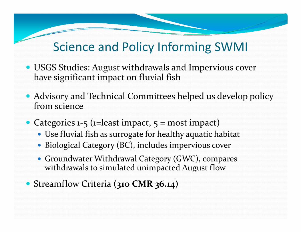
S i d P li I f i SWMIScience and Policy Informing SWMI USGS Studies: August withdrawals and Impervious cover g phave significant impact on fluvial fish
Advisory and Technical Committees helped us develop policy from science
Categories 1‐5 (1=least impact, 5 = most impact)fl l f h f h l h h b Use fluvial fish as surrogate for healthy aquatic habitat
Biological Category (BC), includes impervious cover
Groundwater Withdrawal Category (GWC) compares Groundwater Withdrawal Category (GWC), compares withdrawals to simulated unimpacted August flow
Streamflow Criteria (310 CMR 36.14)


SWMI Pilot Study Road tested the SWMI framework
Amherst Danvers‐Middleton Dedham‐Westwood Shrewsbury
Mock consultation/review of presenting icircumstances
Source review Withdrawal request Impact on BC/GWC and CFR Minimization/Mitigation
Site Specific Stud (Amherst and Shre sbur ) Site‐Specific Study (Amherst and Shrewsbury)

Wh t did l f th Pil t ?What did we learn from the Pilots?Need more guidance on: Q tif i iti ti dit Quantifying mitigation credits Credits for on‐going mitigation measures Defining minimization requirements Clarifying the timing of mitigation measures Clarifying the timing of mitigation measures Evaluating cost and feasibility How affordability is considered
Mock consultation Applicants will need more prep time vs. existing process
Site‐Specific Study Options Need to define the goal Method needs clarification Who is eligible

Financial Resources: Grants andFinancial Resources: Grants and Proposed Legislation
A li t t b bli t li d/ Applicants must be a public water supplier and/or municipality with a valid WMA Permit. Partnerships encouragedp g Highly impacted basins or subbasins
Funds to assist with WMA complianceC l i d i l i j Covers planning and implementation projects
~$900,000 awarded in 2013 $1 million proposed for 2014 ~$1 million proposed for 2014 10 recipients in 2013, with awards ranging from
$50,000 to $140,000$5 , $ 4 , Senate Bill 1880 (pending)

Incorporating SWMIFrom the SWMI FRAMEWORK and PILOTS to the WMA REGULATIONS and GUIDANCE
Sustainable Management, Protection of the Natural Environment, and Economic Growth.

SWMI Components and Achievements Safe Yield Streamflow Criteria based on Science Permitting
Balance human and environmental needbli h f i l d di i Establish up front permit rules and conditions
Minimize use and mitigate commensurate with impact where applicablewhere applicable
Encourage Economic Growth and Sustainable Long‐term Water Use

Safe Yield and Environmental ProtectionSafe Yield and Environmental Protection310 CRM 36.13
WMA Safe Yield = 55% of Drought Basin Yield + Reservoir Storage
Safe Yield Drought Safe Yield Drought Protection =
Remaining 45% of Drought BasinYield
Streamflow Criteria+
13
e d

Permit Conditions Summary Standard Conditions for all permitted groundwater and surface water withdrawals
CFR C l f d d f CFR Consult for groundwater and surface water withdrawals in subbasins with potentially impacted Coldwater Fishery Resources (CFRs)
Minimization for groundwater withdrawals in “>25% August Net Groundwater Depleted” Subbasins
Mitigation Tiers in consultation with agencies based on Tier determination for withdrawal (ground or surface) requests above baselineq

Permit Requirements (new in green)
Applicability of Requirements
1. Water Conservation Standards Yes, required for all
2. Performance Standards (65 rgpcd and 10% UAW)
Yes, required for all(with exceptions on Cape & Islands for RGPCD)
l d f ll3. Limits on non‐essential water use Yes, required for all(with alternative approach for Cape & Islands)
4. Minimization of existing impacts Required if 25% Aug net groundwater depleted
5. Coldwater Fish Optimization Plan Required if CFR present in source subbasin

WMA Standard Permit Conditions310 CMR 36.28(4)(c)
Conservation Requirements 1 65 residential gallons per capita day (RGPCD) 1. 65 residential gallons per capita day (RGPCD) 2. 10% unaccounted‐for‐water (UAW)3. BMPS (leak detection & repair, metering etc.)g4. Seasonal limits on nonessential outdoor water use
(revised per SWMI with inclusion of 7‐ Day Low Flow Trigger)Flow Trigger)

Nonessential Outdoor Water Use
Uses that are not required: for health or safety reasons; by regulation; for the
Restrictions Alternative plan for Cape and Islands to be developed
CALENDAR STREAMFLOW
production of food or fiber; for the maintenance of livestock; or to meet the core function of a business
StartingMay 1
7 day Low Flow Trigger
Below 65 7 days * 1 day *
Flow above ABF
Flowbelow ABF
7 day Low Flow Trigger
7 days 7 days* 1 day*Below 65 7 days 1 day
Above 65 2 days * 1 day*
7 days 7 days 1 day
7 days 2 days* 1 day*
* No watering 9 am to 5 pm on any day
ABF: Aquatic Base Flow7 Day Low Flow is calculated from the period of record flows from a local USGS stream gage

MinimizationMinimizationMinimization is required in subbasins defined as having an A d d l i f % b MWI* August net groundwater depletions of 25% or more by MWI* data.
August net groundwater depletion is the estimated streamflow level in an unimpacted subbasin, minus groundwater withdrawals, plus returns to groundwater via septic systems and/or groundwater discharges, for the month of August.
Minimization Requirements: Desktop Optimization Water Releases and Returns ‐ to the greatest extent feasible Water Releases and Returns to the greatest extent feasible Additional Conservation Measures ‐ to the greatest extent
feasible
* MWI data is based on estimated and reported withdrawals and returns for the years 2000‐2004

Minimization‐ Desktop Optimization
Compare and screen subbasins with groundwater sources1. Is a Coldwater Fishery Resource present?
Ch i t if i hift d?2. Change in category if pumping shifted?3. How much water is available (considering withdrawals and
returns)?4. What is the GWC percentage? (withdrawals/unaffected
flow)5 Other sensitive receptors? 5. Other sensitive receptors?
Compare groundwater to surface water sources
6 Is there a surface water supply? With a release plan?6. Is there a surface water supply? With a release plan?

Minimization Optimization ExampleMinimization‐ Optimization Example
Optimization Parameterssubbasin
Asubbasin
Bsubbasin
Csubbasin
DOptimization Parameters A B C D
1) CFR present? yes yes no yes
2) Change in BC/GWC? no no no no
3) Net water available (cfsm) 0.02 .35 .35 0.01
4) GWC % 90% 29% 26% 80%
Preferred results highlighted in blue
Screening shows subbasin C most preferred for shifting/increasing pumpingpumping

Minimization Surface Water Releases andMinimization‐ Surface Water Releases and Returns
ReleasesIf li t h f t l i d t( ) If applicant has surface water supply impoundment(s),
And impoundments have the capacity for releases,
Then suppliers would determine if releases could be made and develop and implement a release plan subject to MassDEP approval.

Minimization Outdoor Water UseMinimization‐ Outdoor Water Use Restrictions
Requirement: Implement restrictions on nonessential outdoor water use that go beyond standard permit g y pconditions
If you are above 65 rgpcd: no more than 1 day per week If you are below 65 rgpcd: no more than 2 days per week i l i or propose an equivalent action.

Minimization Additional ReasonableMinimization‐ Additional Reasonable Conservation Adopt reasonable and cost‐effective water conservation measures that go beyond the S d d C di iStandard Conditions
Guidance provides 18 additional measures (from precommendations in Water Conservation Standards )
Minimization plan should focus first on meeting 65 rgpcd and 10% UAW if not meeting

Coldwater Fishery Resource (CFR) Consult
DFW will screen subbasins for potential impacts to CFRs impacts to CFRs
Basin Meeting serves as preliminary consultpreliminary consult
Goal‐ identify ways to reduce impacts through
310 CMR 36.22(4)
optimization

Mitigation Overview Mitigation Tiers Mitigation Hierarchy E l C l l ti Example Calculation
Wastewater Adjustments Direct Mitigation Direct Mitigation Location Adjustment Factor Indirect Mitigationg Timing and Implementation Mitigation and Cost Feasibility Guidance Credit for On‐going Mitigation Measures

Tier Determination for MitigationTier Determination for Mitigation 3 Permit Tiers define mitigation requirements
310 CMR 36.19g
“Impact” quantified as increase over baseline and if increase causes a category change (i.e. backsliding)g y g ( g)
Tier 1: no increase above baselineTier 2: increase above baseline
Baseline is based on the largest of either:• 2003 – 2005 water use + 5%• 2005 water use +5 %th it ’ i t d lTier 2: increase above baseline
but no change in BC or GWCTier 3: increase above baseline AND change in BC or GWC
• the community’s registered volume•Volume must be in compliance
change in BC or GWC is evaluated for August unless withdrawals are greater during other periodsg g p
Cumulative Assessment

Mitigation Tier Conditions‐ Groundwater
Groundwater Miti ti Ti Ti Ti
310 CMR 36.21(3)
MitigationConditions by Tier
Tier 1 Tier 2 Tier 3
a Commensurate Not required Yes required for Yes required for a. Commensurate Mitigation
Not required Yes, required for all
Yes, required for all (up to 2x indirect)
b. No feasible Not required Not required Yes, required for alternative source
q q , qall

Mitigation Tier Conditions SurfaceMitigation Tier Conditions ‐ Surface Water 310 CMR 36.21(4)
Mitigation Conditions by Tier
for Surface Water WithdrawalsTier 1 Tier 2
1. Summer Management Plan with Environmental Considerationsa. restrictions tied to reservoir elevations and other
environmental considerations (such as evaluating releases, Required when requestingfisheries management plan, or consideration of analternative approach for watering restrictions) in theseplans.
Required when requesting alternative summer outdoor
water use restrictions
2. Mitigation2. commensurate with impact from withdrawal above
baseline, in consultation with agencies. Surface WaterR l f d if ibl
Not applicableYes, required
for allRelease preferred if possible. for all

Mitigation‐ Plans R t ti iti ti dit f Mitigation PlansAction hierarchy 1st: Demand Management to keep volumes below baseline
Retroactive mitigation credits for activities completed and still in effect
g p 2nd: Direct/quantifiable mitigation 3rd: Indirect/non‐quantifiable mitigation
Location hierarchy (where a choice exists) 1st: same subbasin as withdrawals (considering water quality) 2nd: same major basin as withdrawalsj 3rd: different major basin
Mitigation Plan Timelinesg Mitigation Plan must be submitted at start of permit period Timeline may phase implementation of mitigation Any volumes withdrawn over Baseline must be mitigated prior to when
th l ithdthose volumes are withdrawn DEP will make reasonable allowances if withdrawals are already over
baseline

Mitigation‐ Example CalculationMitigation Example Calculation1.5
4
1.6
0.6
1
1.2
1.4
Baseline = 1 MGD
0.5
Additional Demand
0.9
0.6
0.8
1
MGD
Current Use
20 Yr Projection
Baseline = 1 MGD
0.3
0.3
0.4
MGD
Management
Wastewater
0.2
0.4
20‐Yr Projection
0.1
0.1
0.2
Wastewater Adjustment
0Current and Forecasted
Water Use
0.1
0
0.1
Increase above Baseline
Mitigation Plan Volume
Take cost and feasibility into account

Accounting for Wastewater ReturnsAccounting for Wastewater Returns
Wastewater Returns via groundwater discharge:310 CMR 36.21(3)(b)(1) & (4)(b)(1)
Wastewater Returns via groundwater discharge:Mitigation volumes may be adjusted downward based on the volume of water returned via septic systems and permitted
d t di h l ti (l % ti f t ) groundwater discharge locations (less a 15% consumption factor).
Wastewater Returns via surface water discharge (NPDES): Eligible Wastewater Returns via surface water discharge (NPDES): Eligible sources located on stream reaches with significant surcharge volumes ( >10% above annual average flow & more than 1 mgd) may receive direct or indirect credits based on source and location may receive direct or indirect credits based on source and location specifics Blackstone, Concord and Taunton are the only basins with subbasins
meeting this surcharged reach criteriameeting this surcharged reach criteria

Direct MitigationBased on a calculated volume of water returned within the basin, due to enhanced groundwater contribution to streamflow or surface water releases to streamflow or surface water releases.
Eligible Activities:1 Surface Water Releases1. Surface Water Releases2. Stormwater Recharge (directly connected
impervious area redevelop to recharge)impervious area redevelop to recharge)3. Infiltration and Inflow Improvements

Miti ti L ti Adj t tMitigation‐ Location Adjustment Factor 310 CMR 36 21(3) & (4) FactorWastewater Adjustments and Direct Mitigation shall be
310 CMR 36. 21(3) & (4)
subject to a Location Adjustment Factor (LAF) 100% in major basin* 50% outside major basin* 75% outside major basin if shown that area of return is more depleted that area of withdrawal*more depleted that area of withdrawal*
* (less 15% consumption factor for wastewater)

Indirect Mitigation Based on a qualitative assessment of environmental improvements that help compensate for the stream impacts of the withdrawals impacts of the withdrawals.
The relative value of the mitigation activity is determined by a credit system that scores benefit to:determined by a credit system that scores benefit to: Instream flow Aquatic Habitat (water quality, physical habitat and q q y p ystream continuity)
Water Supply Protection

Retroactive Mitigation Credit Previously completed activities may be credited
Benefit On‐going Subject to DEP Review and Approval
Examples: Examples: Stormwater retrofits since 2005 Bringing wastewater back (since 2005) via new Groundwater Di h itDischarge permits
Longstanding release requirements or fishery management plans

Indirect Mitigation Activities* Remove dam/flow barrier
Culvert replacements meeting crossing standards
Stormwater utility *
Implement MS4 4*
Aquatic habitat restoration g g
Stream bank/channel/buffer restoration
Aquatic habitat restoration fund
Infiltration/Inflow removal program
Install & maintain fish ladder
Acquire property in Zone I or II, or for other resource
program Surcharged Reach
Optimization Plan P i t W ll B l II, or for other resource
protection
Stormwater bylaw with recharge requirements
Private Well Bylaw Other *must result in increase
h direcharge requirements recharge to get credit

Indirect Mitigation‐ Credit TableIndirect mitigation (mgd) Credits required for Tier 2 Credits required for Tier 3
0 to 0.1 Up to 10 Up to 20
0.1 to 0.2 Up to 20 Up to 40
0.2 to 0.3 Up to 30 Up to 60
0.3 to 0.4 Up to 40 Up to 80
0.4 to 0.5 Up to 50 Up to 100
0.5 to 0.6 Up to 60 Up to 120
0 6 to 0 7 Up to 70 Up to 1400.6 to 0.7 Up to 70 Up to 140
0.7 to 0.8 Up to 80 Up to 160
0.8 to 0.9 Up to 90 Up to 180
0.9 to 1 Up to 100 Up to 200
1.0 or more case by case case by case

Mitigation Cost Feasibility Designed for applicants who are concerned that their mitigation plan is cost prohibitive.
Applicant may submit a 20 year budget along with Applicant may submit a 20‐year budget along with their mitigation plan. estimated operating costs estimated capital improvement costs
MassDEP will review the mitigation plan and budget with the applicantwith the applicant.
Cost feasibility assessments will be based on impacts to rates, both year over year and over the 20‐year permit period.

Data Refinement Options Data Refinements used in determining BC or GWC
Pumping volume adjustments310 CMR 36.20
Subbasin boundary adjustments Hydrologic/geologic considerations Other refinements through groundwater modeling
3 3(1) and (2)
Other refinements through groundwater modeling Schedule for submitting Data Refinements
Submit by date outlined in regulations to be considered Submit by date outlined in regulations to be considered as part of the cumulative picture for the 20‐Year Renewal or first Post‐SWMI 5‐Year Review for the basin
Submit as part of new permit application

Site Specific Fish CommunitySite Specific Fish Community Assessment 310 CMR 36.20 (3)
Only available to Tier 1 applicants subject to Minimization Conduct the site‐specific fish community assessment in accordance with a fish sampling and collection protocol approved by DFW
Applicants fish community will be compared to other fish Applicants fish community will be compared to other fish communities in the same GWC
If fluvial fish relative abundance is greater than 75th percentile of those in the same GWC, minimization will not be required
Minimization conditions suspended for duration of study (5 years)years)

Tools and Resources DEP WebsiteTools and Resources‐ DEP Website
http://www.mass.gov/eea/agencies/massdep/water/watersheds/sustainable-water-management-initiative-swmi.html

Tools and Resources‐ DEP Permitting ToolTools and Resources DEP Permitting Tool

Permit Renewal ProcessMonthsbefore permit
Activity
Permit Renewal Processbefore permit expires20 months Start Basin Planning Process
•Draft water needs forecasts developed, p•consultations upon request
16 months Basin Outreach Meeting
12 months Permit Filing Deadline•Public Comment Period•consultations as necessary
h O d C l I d b DEP9 months Orders to Complete Issued by DEP
6 months Response to Orders to Complete Due
3 months Draft Permit Issued for Comment

What’s Next? Formal Public Hearings and Comment – January‐February (60 Days)O h P d R l i O i Outreach on Proposed Regulations – Ongoing
Final Regulations Promulgated – Summer 2014Addi i l USGS S di Additional USGS Studies Surface Water Groundwater recharge areas Groundwater recharge areas Impervious Cover
Resume PermittingResume Permitting

River Basin P itti D t
Water Source Expiration Date Outreach Meeting
Permitting Dates Cape Cod * November 2014 January 2015
Ipswich * Early 2015 March 2015Boston Harbor */Taunton * February 2015 April 20151 Year Interim Permits
expected to be issued Islands * February 2015 May 2015
Buzzards Bays May 2015 February 2015
Concord August 2015 May 2015
South Coastal * August 2015 October 2014
expected to be issued.
Ten Mile November 2015 August 2014
Deerfield February 2016 November 2014
Housatonic May 2016 February 2015
Westfield November 2016 August 2015
Basins previously permitted to be adjusted at next 5‐Year ReviewWater Source Projected 5- Year Westfield November 2016 August 2015
Millers February 2017 November 2015Chicopee May 2017 February 2016Quinebaug August 2017 May 2016
Connecticut November 2017 August 2016
Water Source Projected 5 Year Review Issuance
Hudson November 2015
Blackstone February 2017
Charles February 2017 Connecticut November 2017 August 2016
Nashua February 2018 November 2016French May 2018 February 2017Shawsheen August 2018 May 2017
Merrimack November 2018 August 2017
Charles February 2017
North Coastal February 2016
Merrimack November 2018 August 2017
Parker February 2019 November 2017
Narragansett May 2019 February 2018* Basins with Permits on File