2011 census topic report - bristol.gov.uk
TRANSCRIPT

2011 Census Topic ReportCommunity Cohesion Statistics
July 2013

Contents
1. Introduction ....................................................................2
2. Community change since 2001 ......................................2
3. Population ......................................................................3
4. Ethnic group ...................................................................6
5. Religion ........................................................................10
6. Country of Birth ............................................................13
7. Migrants .......................................................................16
8. Language .....................................................................18
9. Quality of Life – community cohesion indicators ..........22
Note.....................................................................................30
Useful links ..........................................................................30
Further information ..............................................................30
Appendix: Community Cohesion Statistics by ward ...........30

2
1. Introduction This report presents community cohesion statistics from the 2011 Census and Quality of Life survey 2007–2012 for the Bristol Local Authority area.
2. Community change since 2001 Figure 1: Community change 2001-11 Source: Office for National Statistics © Crown Copyright 2013.
Since 2001 there has been a large increase in the total number of people living in Bristol which has resulted in a changing population profile. In Bristol, there are now at least 45 religions and at least 50 countries of birth represented and at least 91 main languages spoken by people living in Bristol. Bristol has experienced similar trends to England and Wales as whole in terms of changes to the population. The total population is estimated to have grown by 38,100 (9.7%) between 2001 and 2011, from 390,000 in 2001 to 428,100 in 2011. The proportion of the population who are not ‘White British’ has increased from 12% to 22% of the total population. The largest growth has been in the White Other, Black African and Black Other groups – this includes growth particularly in the Polish and Somali populations. Overall the Black and Minority Ethnic group (BME1) population has increased from 8.2% in 2001 to 16% in 2011. The proportion of people living in Bristol who were not born in the UK has increased from 8% of all people in 2001 to 15% of all people in 2011. Of all the people not born
1 The BME population includes people of all ethnic groups other than White British, White Irish, White Other and White Gypsy or
Irish Traveller

3
in the UK, 61% of them have arrived in the UK in the last decade (ie between 2001 and 2011). The proportion of people who are Christian has decreased from 62% to 47%, whilst the proportion of people stating that they have no religion has increased from 25% to 37%. The Muslim population living in Bristol has increased from 2% of all people to 5% of all people. Although all parts of the city have experienced changes in the people living in their area since 2001, in terms of changes which may have the greatest effect on community cohesion, changes have been concentrated in the inner city and inner east areas of the city, in particular in the wards of Lawrence Hill, Ashley, Easton and Eastville. Cabot has also experienced a large growth in population but this is mainly attributable to a large increase in the number of students since 2001, in particular international students. Statistics summarising change by ward between 2001 and 2011 can be found in the appendix.
3. Population As outlined above, there has been a substantial increase in the number of people usually resident in Bristol over the past decade (2001 to 2011). The total population is estimated to have grown by 9.7%, from 390,000 in 2001 to 428,100 in 2011, a higher rate of growth than the England and Wales average of 7.3%. The growth includes an additional 10,100 students living in Bristol during term time. The estimated components of population change in Bristol are shown in Figure 2. This shows that population growth in Bristol has been generated by international in-migration, increasing numbers of births and decreasing numbers of deaths. There has been a notable spike in international in-migration between 2004 and 2005, thought to result from the accession countries joining the European Union in 2004. Figure 2: Components of population change in Bristol 2001-11 Source: Office for National Statistics © Crown Copyright 2013.

4
Figure 3: Population change mid-2001 to mid-2011 by ward Source: Office for National Statistics © Crown Copyright 2013.

5
Whilst there have been significant estimated increases in population across many wards in Bristol between 2001 and 2011, there has been exceptional increases in Cabot of 6,100 (62.2%) people and Lawrence Hill of 5,700 (43.2%) people. Other wards which have experienced large increases in the population since 2001 are Ashley 2,800 (20.9%), Southville 2,200 (21.5%), Bedminster 1,700 (15.7%), Bishopston 1,700 (13.8%) and Cotham 1,600 (15.1%). At the same time there has also been decreasing populations in Henleaze, Stockwood, Whitchurch Park, Stoke Bishop and Kingsweston wards. Figure 3 illustrates the distribution of population change across Bristol between 2001 and 2011.

6
4. Ethnic group
The Black or Minority Ethnic group (BME) population (all groups with the exception of all the White groups) make up 16% of the total population in Bristol. This is an increase from 8.2% of all people in 2001. The non-‘White British’ population (all groups with the exception of White British) make up 22% of the total population in Bristol. This is an increase from 12% of all people in 2001. The largest increases since 2001 have been in Other White, Black African, Black Other and Multiple/mixed ethnic groups. These changes reflect the large growth in the Somali and the Polish populations in Bristol. The BME population varies significantly across the city (see Figure 6) - in Lawrence Hill ward 55% of all people belong to a BME group compared to 4% in Whitchurch Park. This difference is emphasised even more when looking at areas smaller than wards – in ‘St Pauls Grosvenor Road’ 80% of all people belong to a BME group whilst just 1.4% are BME in ‘The Coots’ in Stockwood. Figure 4: Population by ethnic group Source: ONS © Crown Copyright 2013.ONS Crown Copyright Reserved [from Nomis]
Since 2001, the distribution of the BME population of Bristol has changed considerably - figure 6 maps the percentage of people who belong to a BME group by ward both in 2001 and in 2011. Whilst in 2001 the BME population largely lived in the inner city wards of Ashley, Easton, Lawrence Hill and Eastville, with all other wards having a BME population of below 14%, in 2011 the distribution of the BME

7
population had extended out to the north east of the city. Now wards with a BME population of above 14% include Lawrence Hill, Easton, Ashley, Eastville, Lockleaze, Cabot, Hillfields, St George West, Frome Vale, Horfield and Southmead. Figure 5: Population by ethnic group Source: ONS © Crown Copyright 2013.ONS Crown Copyright Reserved [from Nomis]
Bristol % E&W%
White British 333,432 77.9 80.5
Other White 21,950 5.1 4.4
Mixed/multiple ethnic group 15,438 3.6 2.2
Black African 12,085 2.8 1.8
Other Black 6,922 1.6 0.5
Pakistani 6,863 1.6 2.0
Black Caribbean 6,727 1.6 1.1
Indian 6,547 1.5 2.5
Other Asian 4,255 1.0 1.5
Chinese 3,886 0.9 0.7
White Irish 3,851 0.9 0.9
Any other ethnic group 2,543 0.6 0.6
Bangladeshi 2,104 0.5 0.8
Arab 1,272 0.3 0.4
White Gypsy or Irish Traveller 359 0.1 0.1
Total White 359,592 84.0 86.0
Total Black and minority ethnic groups 68,642 16.0 14.0
All people 428,234 100.0 100.0
Somali population estimate The Somali population are not identified as a separate ethnic group in the 2011 Census but are included in both the Black African and Black Other groups, depending on which tick box people chose on the Census questionnaire. The best estimate we can make of the number of Somalis living in Bristol is to take the number of Black Africans and Black Others who identified themselves as Muslims and to then subtract those Muslims born in parts of Africa outside Eastern Africa. This gives us a Somali population estimate of 8,100. Local knowledge suggests that it is likely that some Somalis, in particular men living in informal accommodation, may have been under estimated by the 2011 Census. Taking this into consideration, the likely number of Somalis living in Bristol in 2011 could be around 10,000.

8
Figure 6: Black and Minority ethnic group population by ward – 2001 and 2011 Source: ONS © Crown Copyright 2013.ONS Crown Copyright Reserved [from Nomis]
2011 Map

9
2001 Map

10
5. Religion There are at least 45 religions represented in Bristol (see Figure 8). The largest religion is Christian (47%), although following national trends the proportion of people stating that they are Christian has fallen from 62% of all people living in Bristol in 2001. Bristol is ranked 7th in England and Wales for the proportion of people stating that they have no religion - 37% of the population state they have no religion, up from 25% in 2001.
Since 2001 the religion to increase the most in Bristol has been the Muslim religion which increased from 2% of all people in Bristol in 2001 to 5% of all people in 2011 (see Figure 9). Figure 7: Population by religion Source: ONS © Crown Copyright 2013.ONS Crown Copyright Reserved [from Nomis]
Bristol % E&W%
Total population 428,234 100.0 100.0
Christian 200,254 46.8 59.3
Buddhist 2,549 0.6 0.4
Hindu 2,712 0.6 1.5
Jewish 777 0.2 0.5
Muslim 22,016 5.1 4.8
Sikh 2,133 0.5 0.8
Other religion 2,793 0.7 0.4
No religion 160,218 37.4 25.1
Religion not stated 34,782 8.1 7.2

11
Figure 8: Number of people by religion in Bristol Source: ONS © Crown Copyright 2013.ONS Crown Copyright Reserved [from Nomis]
Religions stated:
Christian 200,254 Shamanism 17
Muslim (Islam) 22,016 Occult 15
Hindu 2,712 New Age 13
Buddhist 2,549 Traditional African Religion 13
Sikh 2,133 Scientology 12
Jewish 777 Shintoism 11
Pagan 575 Theism 11
Mixed Religion 415 Deist 10
Spiritualist 376 Universalist 9
Spiritual 269 Witchcraft 7
Rastafarian 243 Animism 5
Other religions 189 Reconstructionist 5
Wicca 99 Church of All Religion 4
Baha'i 83 Ravidassia 4
Taoist 81 Thelemite 4
Believe in God 80 Eckankar 3
Druid 47 Native American Church 3
Pantheism 44 Vodun 2
Own Belief System 34 Brahma Kumari 1
Satanism 34 Confucianist 1
Jain 30 Mysticism 1
Heathen 21 Unification Church 1
Zoroastrian 21
No religion (total) 160,218
No religion 156,666 Humanist 190
Jedi Knight 2,310 Heavy Metal 61
Agnostic 506 Free Thinker 5
Atheist 476 Realist 4
Religion not stated 34,782

12
Figure 9: Muslim population by ward Source: ONS © Crown Copyright 2013.ONS Crown Copyright Reserved [from Nomis]
13
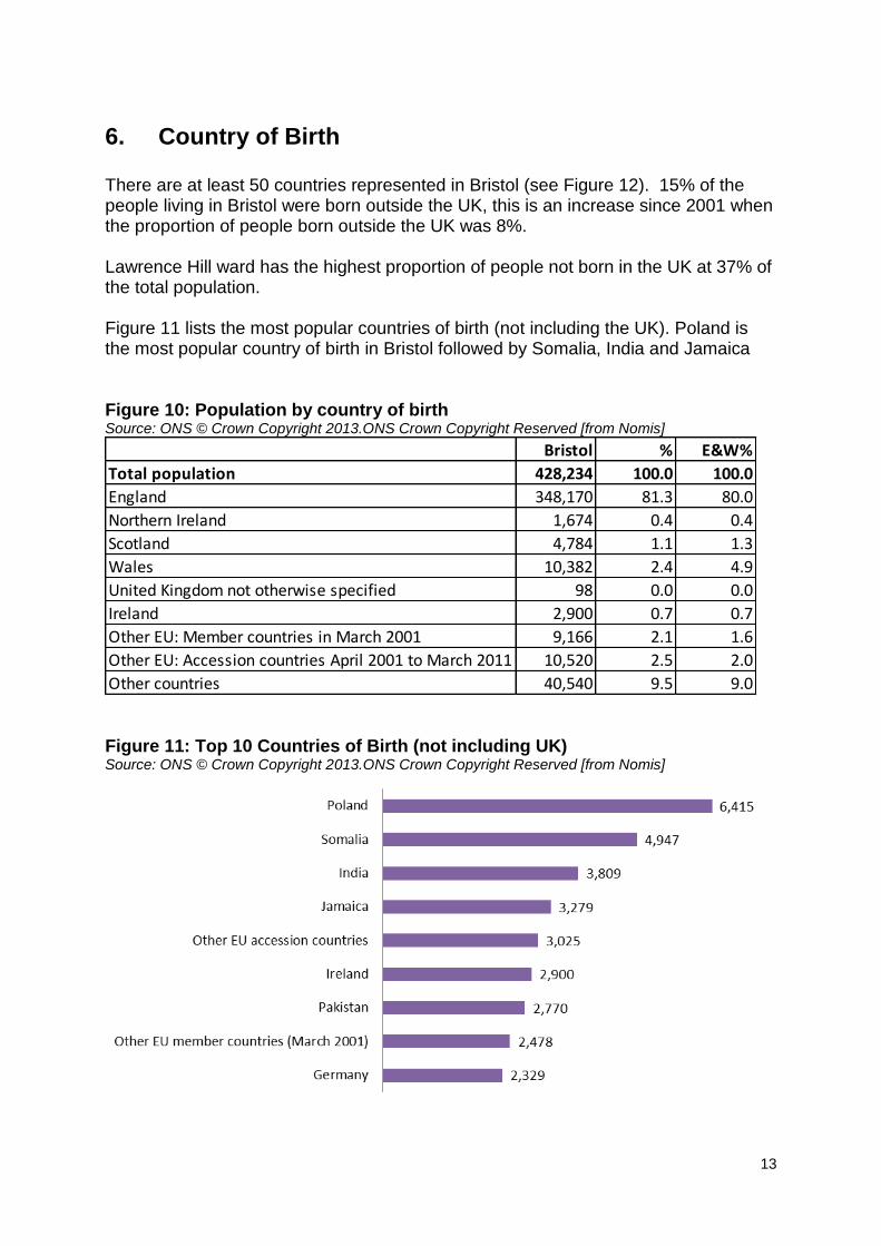
6. Country of Birth There are at least 50 countries represented in Bristol (see Figure 12). 15% of the people living in Bristol were born outside the UK, this is an increase since 2001 when the proportion of people born outside the UK was 8%. Lawrence Hill ward has the highest proportion of people not born in the UK at 37% of the total population. Figure 11 lists the most popular countries of birth (not including the UK). Poland is the most popular country of birth in Bristol followed by Somalia, India and Jamaica Figure 10: Population by country of birth Source: ONS © Crown Copyright 2013.ONS Crown Copyright Reserved [from Nomis]
Bristol % E&W%
Total population 428,234 100.0 100.0
England 348,170 81.3 80.0
Northern Ireland 1,674 0.4 0.4
Scotland 4,784 1.1 1.3
Wales 10,382 2.4 4.9
United Kingdom not otherwise specified 98 0.0 0.0
Ireland 2,900 0.7 0.7
Other EU: Member countries in March 2001 9,166 2.1 1.6
Other EU: Accession countries April 2001 to March 2011 10,520 2.5 2.0
Other countries 40,540 9.5 9.0 Figure 11: Top 10 Countries of Birth (not including UK) Source: ONS © Crown Copyright 2013.ONS Crown Copyright Reserved [from Nomis]

14
Figure 12: Number of people by country of birth represented in Bristol Source: ONS © Crown Copyright 2013.ONS Crown Copyright Reserved [from Nomis]
UK 365,108 Hong Kong 959
Poland 6,415 Zimbabwe 944
Somalia 4,947 Philippines 924
India 3,809 Other North America 812
Jamaica 3,279 Kenya 774
Other EU accession 3,025 Iran 638
Ireland 2,900 Romania 587
Pakistan 2,770 Other Eastern Asia 579
Other EU members (March 2001) 2,478 Other Caribbean 530
Germany 2,329 Lithuania 493
Other South-East Asia 2,065 Other Australasia 486
China 1,750 Portuga 469
Other Middle East 1,603 Turkey 413
France 1,458 Sri Lanka 382
South Africa 1,390 Ghana 329
United States 1,354 Other Southern Asia 307
Other South and Eastern Africa 1,346 Central America 163
Italy 1,322 Jersey 144
Other Europe 1,243 Guernsey 85
Nigeria 1,124 Isle of Man 79
Spain (including Canary Islands) 1,110 Africa not otherwise specified 70
South America 1,104 Other Oceania 60
Bangladesh 1,039 Central Asia 58
Australia 1,025 Channel Islands other 22
North Africa 972 Antarctica 0
Other Central & Western Africa 962 Other 0

15
Figure 13: Population not born in the UK by ward Source: ONS © Crown Copyright 2013.ONS Crown Copyright Reserved [from Nomis]

16
7. Migrants
For the first time in 2011, the census asked a series of questions about migration, including a question about when people migrated to the UK. Of the people living in Bristol not born in the UK, the majority (60%) have been resident in the UK for less than 10 years. Of the people not born in the UK, 69% arrived in the UK when they were of working age and 30% arrived as children. Figure 14: Length of residence in the UK Source: ONS © Crown Copyright 2013.ONS Crown Copyright Reserved [from Nomis]
Bristol % E&W%
Born in the UK 365,108 85.3 86.6
Resident in UK: Less than 2 years 9,610 2.2 1.7
Resident in UK: 2 years or more but less than 5 years 12,256 2.9 2.1
Resident in UK: 5 years or more but less than 10 years 16,262 3.8 2.8
Resident in UK: 10 years or more 24,998 5.8 6.8
Total population 428,234 100.0 100.0

17
Figure 15: Population who have been resident in the UK for less than 10 years by ward Source: ONS © Crown Copyright 2013.ONS Crown Copyright Reserved [from Nomis]
18
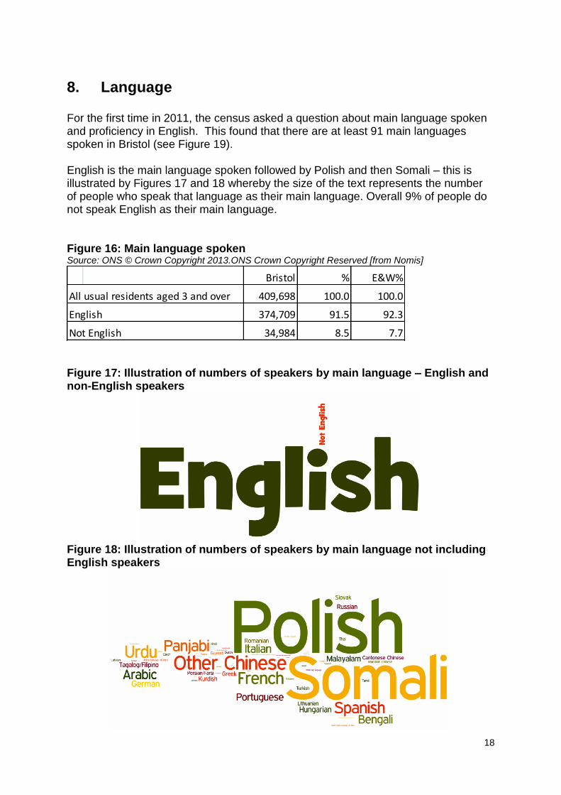
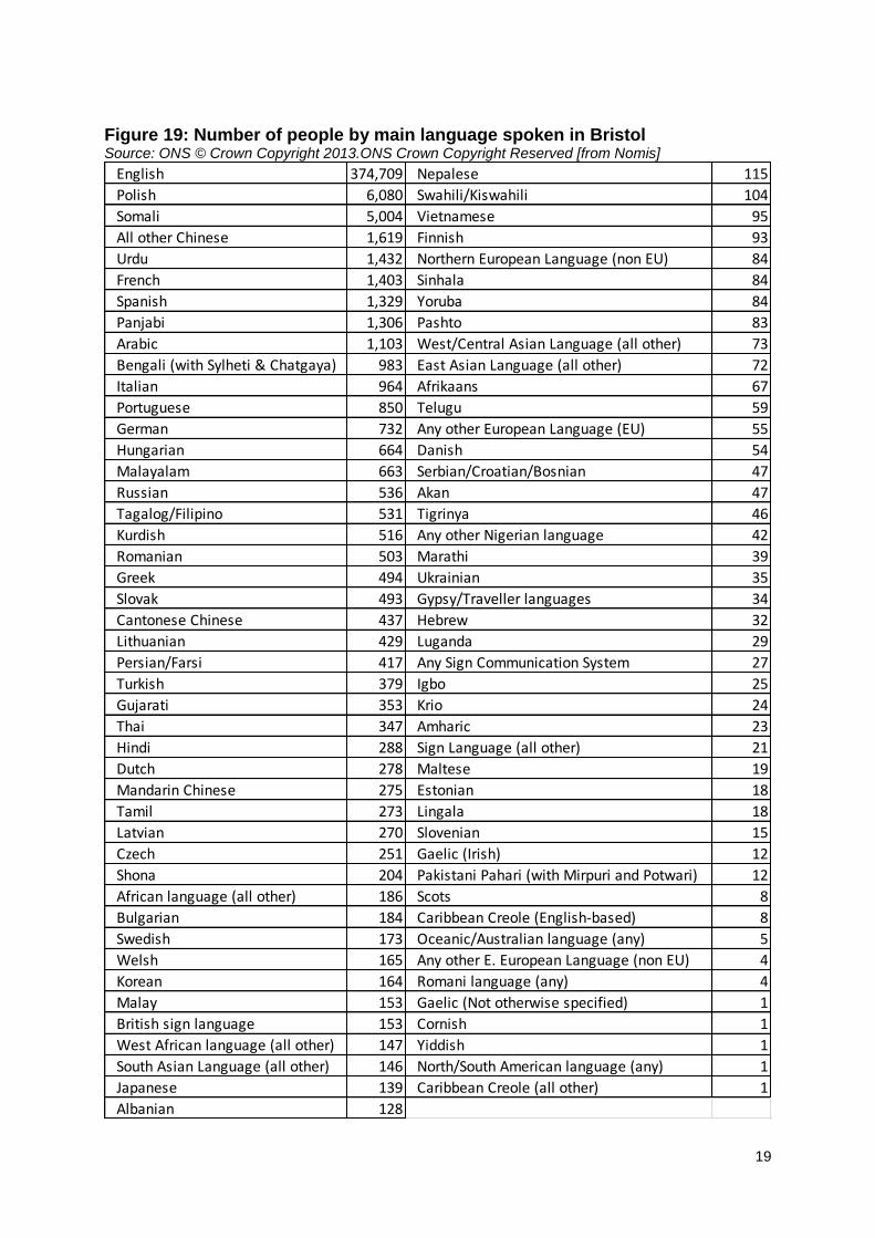
8. Language For the first time in 2011, the census asked a question about main language spoken and proficiency in English. This found that there are at least 91 main languages spoken in Bristol (see Figure 19). English is the main language spoken followed by Polish and then Somali – this is illustrated by Figures 17 and 18 whereby the size of the text represents the number of people who speak that language as their main language. Overall 9% of people do not speak English as their main language. Figure 16: Main language spoken Source: ONS © Crown Copyright 2013.ONS Crown Copyright Reserved [from Nomis]
Bristol % E&W%
All usual residents aged 3 and over 409,698 100.0 100.0
English 374,709 91.5 92.3
Not English 34,984 8.5 7.7 Figure 17: Illustration of numbers of speakers by main language – English and non-English speakers
Figure 18: Illustration of numbers of speakers by main language not including English speakers
19
Figure 19: Number of people by main language spoken in Bristol Source: ONS © Crown Copyright 2013.ONS Crown Copyright Reserved [from Nomis]
English 374,709 Nepalese 115
Polish 6,080 Swahili/Kiswahili 104
Somali 5,004 Vietnamese 95
All other Chinese 1,619 Finnish 93
Urdu 1,432 Northern European Language (non EU) 84
French 1,403 Sinhala 84
Spanish 1,329 Yoruba 84
Panjabi 1,306 Pashto 83
Arabic 1,103 West/Central Asian Language (all other) 73
Bengali (with Sylheti & Chatgaya) 983 East Asian Language (all other) 72
Italian 964 Afrikaans 67
Portuguese 850 Telugu 59
German 732 Any other European Language (EU) 55
Hungarian 664 Danish 54
Malayalam 663 Serbian/Croatian/Bosnian 47
Russian 536 Akan 47
Tagalog/Filipino 531 Tigrinya 46
Kurdish 516 Any other Nigerian language 42
Romanian 503 Marathi 39
Greek 494 Ukrainian 35
Slovak 493 Gypsy/Traveller languages 34
Cantonese Chinese 437 Hebrew 32
Lithuanian 429 Luganda 29
Persian/Farsi 417 Any Sign Communication System 27
Turkish 379 Igbo 25
Gujarati 353 Krio 24
Thai 347 Amharic 23
Hindi 288 Sign Language (all other) 21
Dutch 278 Maltese 19
Mandarin Chinese 275 Estonian 18
Tamil 273 Lingala 18
Latvian 270 Slovenian 15
Czech 251 Gaelic (Irish) 12
Shona 204 Pakistani Pahari (with Mirpuri and Potwari) 12
African language (all other) 186 Scots 8
Bulgarian 184 Caribbean Creole (English-based) 8
Swedish 173 Oceanic/Australian language (any) 5
Welsh 165 Any other E. European Language (non EU) 4
Korean 164 Romani language (any) 4
Malay 153 Gaelic (Not otherwise specified) 1
British sign language 153 Cornish 1
West African language (all other) 147 Yiddish 1
South Asian Language (all other) 146 North/South American language (any) 1
Japanese 139 Caribbean Creole (all other) 1
Albanian 128

20
Figure 20: Population who do not speak English or do not speak English very well by ward Source: ONS © Crown Copyright 2013.ONS Crown Copyright Reserved [from Nomis]

21
Proficiency in English is categorised into people who can speak English very well, those who can speak English well, those who cannot speak English well and those who cannot speak English. Overall in Bristol 1.5% of people cannot speak English or cannot speak English very well. Figure 20 shows the distribution across Bristol. Interestingly, although there is a high proportion of people whose main language is not English living in Cabot ward (19.3%), there is a very low proportion of those who do not speak English or do not speak it well (1.5%). This reflects the high proportion of foreign students living in the ward.

22
9. Quality of Life – community cohesion indicators
The following five indicators have been measured in the Quality of Life annual residents’ satisfaction survey for the past eight years. Each indicator also includes a graphical interpretation with a map, graphs and figures for wards and equalities groups.
% respondents who feel they belong to their neighbourhood
This indicator fell for the first time in seven years from 64% in 2011 to 60% in 2012, but is still a significant improvement from the figure in 2006 when it measured 57%. The ward pattern across the city has been similar each year, with the highest sense of belonging in the west/northwest (particularly Stoke Bishop, Westbury-on-Trym, Henleaze, Bishopston, Redland, Clifton and Southville) plus Ashley in the Inner City (all 67% or above in 2012). Hillfields (43% in 2012), Lawrence Hill (49% in 2012) and Henbury (51% in 2012) have tended to be the wards with the lowest percentages of respondents 'who feel they belong to their neighbourhood'. The indicator was also significantly lower in deprived areas of the city (52%). Equalities analysis indicated significantly more of the older people (67%) had a higher sense of belonging. Fewer people who said they had ‘no faith’ felt they belonged to their neighbourhood (56%). This pattern was the same as in 2011. Further analysis (not shown) suggests that significant predictors for having a sense of belonging to the neighbourhood are age, having a Black or minority ethnicity, living in a deprived area and housing tenure. Attachment to the local area increases with age, from 43% of people in their twenties to 77% of those aged seventy or over. Black and minority ethnic groups are more likely to say they 'feel they belong to their neighbourhood' (66%). Living in a rented accommodation appears to lessen the feeling of investment in the neighbourhood (53% of people living in social housing; 48% of people privately renting). There is some weaker evidence that people with lower educational qualifications and men are less likely to feel that they belong to their local area. % respondents who agree people from different backgrounds get on well
together
This indicator improved from 53% in 2005 to 59% in 2008 and remained at this level, measuring 60% in 2012. The ward pattern has been similar in recent years. Ashley, Bishopston, Henleaze and
Redland usually have some of the highest values of the indicator (at least 74% in
2012), and deprived areas record the lowest (52%). In Hillfields the proportion of
residents who agree that 'people from different backgrounds get on well together'
rose from 35% in 2011 to 55% in 2012.
Further analysis (not shown) suggests that more Black and minority ethnic residents (67%), people aged seventy and over (66%) and respondents with higher educational qualifications thought people in their neighbourhood got on well together.

23
Ward %
lower
confidence
limit
upper
confidence
limit
Ashley 68 59.4 75.0
Avonmouth 58 48.5 66.5
Bedminster 60 51.8 68.4
Bishopston 70 62.1 76.1
Bishopsworth 56 46.9 63.8
Brislington East 51 42.3 59.4
Brislington West 64 54.5 72.4
Cabot 60 48.5 70.5
Clifton 67 58.4 74.8
Clifton East 64 53.3 73.5
Cotham 63 53.1 71.9
Easton 60 52.4 67.6
Eastville 48 39.3 56.0
Filwood 53 44.1 60.8
Frome Vale 55 46.4 64.0
Hartcliffe 53 45.4 60.4
Henbury 51 41.3 60.6
Hengrove 51 42.5 59.8
Henleaze 86 78.8 90.3
Hillfields 43 33.9 52.2
Horfield 62 53.4 70.0
Kingsweston 50 40.8 59.0
Knowle 72 63.8 79.6
Lawrence Hill 49 41.4 57.2
Lockleaze 54 45.5 62.1
Redland 75 67.6 81.9
Southmead 55 45.3 63.8
Southville 71 62.0 78.3
St George East 53 44.4 60.4
St George West 54 43.5 63.5
Stockwood 60 50.4 67.9
Stoke Bishop 77 69.3 83.5
Westbury-on-Trym 74 66.9 80.7
Whitchurch Park 54 45.1 61.9
Windmill Hill 68 60.7 74.9
BRISTOL 60.3 58.8 61.7
Question number 6g
Sample size 4706Year 2012Priority neighbourhoods 52.4 49.4 55.4Older people 67.4 65.5 69.3Disabled people 62.5 58.2 66.6
BME 66 60.3 70.7
Carer 60 56.4 62.9
LGBT 52 41.4 61.6
Male 59.8 57.5 62.0
Female 60.7 58.8 62.6
Christian 63.1 61.2 65.0
Muslim 70 59.7 78.6
No faith 55.8 53.4 58.2
% respondents who feel they belong to neighbourhood
0
10
20
30
40
50
60
70
% 60.363.762.260.55858.356.659.9
20122011201020092008200720062005
0
10
20
30
40
50
60
70
80
90
100
All
Pri
ori
ty
neig
hb
ou
rho
od
s
Old
er
peo
ple
Dis
ab
led
peo
ple
BM
E
Ca
rer
LG
BT
Ma
le
Fem
ale
Ch
ris
tia
n
Mu
sli
m
No
fa
ith
0
10
20
30
40
50
60
70
80
90
100
Hillf
ield
s
Eastv
ille
Law
ren
ce H
ill
Kin
gsw
esto
n
Bri
slin
gto
n E
ast
Hen
bu
ry
Hen
gro
ve
Filw
oo
d
St
Geo
rge E
ast
Hart
cliff
e
St
Geo
rge W
est
Wh
itch
urc
h P
ark
Lo
ckle
aze
So
uth
mead
Fro
me V
ale
Bis
ho
psw
ort
h
Avo
nm
ou
th
Sto
ckw
oo
d
Cab
ot
Easto
n
Bed
min
ste
r
Ho
rfie
ld
Co
tham
Bri
slin
gto
n W
est
Clift
on
East
Clift
on
Ash
ley
Win
dm
ill H
ill
Bis
ho
psto
n
So
uth
ville
Kn
ow
le
We
stb
ury
on
Try
m
Red
lan
d
Sto
ke B
ish
op
Hen
leaze
51.3 to 59.8
59.9 to 68.3
68.4 to 77
77 to 85.5
Source:
Quality of Life survey
Bristol City Council 2012
%
42.8 to 51.2

24
Ward %
lower
confidence
limit
upper
confidence
limit
Ashley 74 66.8 80.5
Avonmouth 64 54.7 72.0
Bedminster 48 39.4 56.3
Bishopston 78 71.4 83.9
Bishopsworth 42 33.8 50.4
Brislington East 52 43.3 60.5
Brislington West 64 54.5 71.6
Cabot 57 45.4 67.7
Clifton 66 57.2 73.8
Clifton East 62 51.0 72.1
Cotham 69 58.4 77.1
Easton 59 50.7 65.9
Eastville 58 49.1 65.8
Filwood 53 44.7 61.4
Frome Vale 60 51.8 68.3
Hartcliffe 49 41.4 56.7
Henbury 49 38.6 58.5
Hengrove 54 45.2 62.5
Henleaze 74 66.2 80.8
Hillfields 55 45.5 63.7
Horfield 68 59.5 75.1
Kingsweston 42 33.6 50.7
Knowle 73 64.1 79.5
Lawrence Hill 54 45.4 61.5
Lockleaze 63 54.8 71.1
Redland 74 66.0 80.9
Southmead 55 45.0 64.4
Southville 67 58.1 75.2
St George East 48 40.1 56.3
St George West 46 36.0 56.0
Stockwood 58 48.9 65.7
Stoke Bishop 63 55.1 70.9
Westbury-on-Trym 72 65.0 78.8
Whitchurch Park 53 44.8 61.6
Windmill Hill 73 65.6 79.3
BRISTOL 60.0 58.5 61.4
Question number 6c
Sample size 4682Year 2012Priority neighbourhoods 52.2 49.2 55.2Older people 61.7 59.7 63.7Disabled people 57.9 53.5 62.2
BME 67 61.2 71.5
Carer 60 56.4 62.8
LGBT 66 55.7 75.1
Male 60.9 58.6 63.1
Female 59.5 57.6 61.4
Christian 59.9 58.0 61.8
Muslim 69 58.7 77.3
No faith 59.9 57.5 62.3
% respondents who agree people from different backgrounds get on well together
0
10
20
30
40
50
60
70
% 6058.959.259.558.654.853.652.5
20122011201020092008200720062005
0
10
20
30
40
50
60
70
80
90
100
All
Pri
ori
ty
neig
hb
ou
rho
od
s
Old
er
peo
ple
Dis
ab
led
peo
ple
BM
E
Care
r
LG
BT
Male
Fem
ale
Ch
risti
an
Mu
sli
m
No
fait
h
0
10
20
30
40
50
60
70
80
90
100
Bis
ho
psw
ort
h
Kin
gsw
esto
n
St
Geo
rge W
est
Bed
min
ste
r
St
Geo
rge E
ast
Hen
bu
ry
Hart
cliff
e
Bri
slin
gto
n E
ast
Filw
oo
d
Wh
itch
urc
h P
ark
Law
ren
ce H
ill
Hen
gro
ve
Hillf
ield
s
So
uth
mead
Cab
ot
Sto
ckw
oo
d
Eastv
ille
Easto
n
Fro
me V
ale
Clift
on
East
Lo
ckle
aze
Sto
ke B
ish
op
Bri
slin
gto
n W
est
Avo
nm
ou
th
Clift
on
So
uth
ville
Ho
rfie
ld
Co
tham
We
stb
ury
on
Try
m
Kn
ow
le
Win
dm
ill H
ill
Red
lan
d
Ash
ley
Hen
leaze
Bis
ho
psto
n
49.2 to 56.4
56.5 to 63.6
63.7 to 71
71 to 78.3
Source:
Quality of Life survey
Bristol City Council 2012
%
41.9 to 49.1

25
% respondents who agree people treat other people with respect in their
neighbourhood
This indicator steadily increased from 57% in 2006 until 2010, when it measured 67%. This proportion remained unchanged in 2011 and 2012. The indicator pattern is similar each year with a good deal of variation across the city, from 46% Filwood to 93% in Henleaze. Over the past seven years, the indicator has shown a significant improvement in Avonmouth, Brislington West, Lawrence Hill, Lockleaze and St George East. This improvement has narrowed the gap between deprived areas and the rest of the city. Still significantly fewer people (51%) in deprived areas agreed people treat each other with respect and consideration. Further analysis (not shown) suggests that people of Muslim faith (75%), people aged seventy and over (80%) and people with higher qualifications agreed people are treated with respect. People who live in social housing and carers (62%) are less likely to agree that people are treated with respect. % respondents who feel they can influence decisions in their local
neighbourhood
Only one in four (24%) of residents feel influential, which is not significantly different from the situation in 2005 , when 22% of respondents felt influential. There is little variation across the city for this indicator. St George East and St George West neighbourhood partnership, at 15%, has the smallest proportion of residents feeling influential whilst Windmill Hill has the biggest, at 32%. The position has worsened in Ashley where the indicator has decreased from 35% in 2008 to 21% in 2012. Further analysis (not shown) suggests predictors for feeling influential are having higher educational qualifications and being older. There is evidence for people of Muslim faith and people living in social housing feeling more influential.

26
Ward %
lower
confidence
limit
upper
confidence
limit
Ashley 74 66.8 80.5
Avonmouth 63 54.1 71.1
Bedminster 72 63.8 79.6
Bishopston 84 77.2 88.6
Bishopsworth 55 47.0 63.5
Brislington East 61 52.0 68.7
Brislington West 69 60.0 75.9
Cabot 71 59.6 79.6
Clifton 85 77.5 89.7
Clifton East 86 76.4 91.8
Cotham 79 68.3 86.2
Easton 61 52.8 68.5
Eastville 60 51.2 67.9
Filwood 46 38.3 54.4
Frome Vale 61 52.9 69.1
Hartcliffe 53 45.7 59.7
Henbury 48 38.6 58.2
Hengrove 66 56.9 73.4
Henleaze 93 88.0 96.2
Hillfields 48 38.5 56.9
Horfield 61 52.6 68.6
Kingsweston 53 44.2 61.9
Knowle 70 61.1 76.7
Lawrence Hill 53 44.2 60.7
Lockleaze 62 53.7 69.6
Redland 91 84.4 94.4
Southmead 52 42.4 60.8
Southville 74 64.9 81.1
St George East 65 56.5 73.0
St George West 57 46.5 66.4
Stockwood 62 52.3 69.9
Stoke Bishop 90 84.3 94.2
Westbury-on-Trym 88 82.0 92.3
Whitchurch Park 62 54.0 69.6
Windmill Hill 74 67.0 79.9
BRISTOL 67.0 65.6 68.3
Question number 6e
Sample size 4703Year 2012Priority neighbourhoods 51 48.0 53.9Older people 70 68.1 71.8Disabled people 63 58.6 67.1
BME 70 64.7 74.8
Carer 63 59.6 65.9
LGBT 64 53.6 73.1
Male 67.5 65.3 69.6
Female 66.7 64.9 68.5
Christian 68.2 66.4 70.0
Muslim 75 65.2 82.9
No faith 65.2 62.8 67.4
% respondents who agree that people treat other people with respect in their neighbourhood
0
10
20
30
40
50
60
70
80
% 6767.5676561.859.856.9
20122011201020092008200720062005
0
10
20
30
40
50
60
70
80
90
100
All
Pri
ori
ty
neig
hb
ou
rho
od
s
Old
er
peo
ple
Dis
ab
led
peo
ple
BM
E
Care
r
LG
BT
Male
Fem
ale
Ch
risti
an
Mu
sli
m
No
fait
h
0
10
20
30
40
50
60
70
80
90
100
Filw
oo
d
Hillf
ield
s
Hen
bu
ry
So
uth
mead
Law
ren
ce H
ill
Hart
cliff
e
Kin
gsw
esto
n
Bis
ho
psw
ort
h
St
Geo
rge W
est
Eastv
ille
Bri
slin
gto
n E
ast
Easto
n
Ho
rfie
ld
Fro
me V
ale
Sto
ckw
oo
d
Lo
ckle
aze
Wh
itch
urc
h P
ark
Avo
nm
ou
th
St
Geo
rge E
ast
Hen
gro
ve
Bri
slin
gto
n W
est
Kn
ow
le
Cab
ot
Bed
min
ste
r
So
uth
ville
Win
dm
ill H
ill
Ash
ley
Co
tham
Bis
ho
psto
n
Clift
on
Clift
on
East
We
stb
ury
on
Try
m
Sto
ke B
ish
op
Red
lan
d
Hen
leaze
55.7 to 65
65.1 to 74.3
74.4 to 83.8
83.8 to 93.2
Source:
Quality of Life survey
Bristol City Council 2012
%
46.3 to 55.6

27
Ward %
lower
confidence
limit
upper
confidence
limit
Ashley 21 15.2 28.1
Avonmouth 25 18.3 33.5
Bedminster 23 16.4 30.6
Bishopston 25 19.2 32.6
Bishopsworth 18 12.1 25.5
Brislington East 18 12.1 25.4
Brislington West 24 17.1 32.5
Cabot 28 18.6 39.7
Clifton 25 18.5 33.8
Clifton East 25 16.7 35.5
Cotham 32 23.2 42.5
Easton 27 20.3 33.9
Eastville 21 15.1 28.5
Filwood 27 19.8 35.5
Frome Vale 25 18.3 33.7
Hartcliffe 24 18.4 31.5
Henbury 20 13.6 28.9
Hengrove 16 10.6 23.1
Henleaze 26 19.6 33.9
Hillfields 25 17.4 33.5
Horfield 24 17.4 31.5
Kingsweston 21 14.7 29.4
Knowle 23 16.2 30.4
Lawrence Hill 31 23.5 38.5
Lockleaze 21 14.4 28.6
Redland 25 18.2 32.3
Southmead 23 15.3 31.7
Southville 31 23.7 39.8
St George East 14 9.5 21.1
St George West 16 9.4 25.0
Stockwood 20 13.4 27.7
Stoke Bishop 29 21.3 36.9
Westbury-on-Trym 26 19.8 33.8
Whitchurch Park 21 14.6 28.5
Windmill Hill 32 25.6 39.9
BRISTOL 23.5 22.3 24.8
Question number 6a
Sample size 4660Year 2012Priority neighbourhoods 23 20.5 25.6Older people 25.2 23.5 27.0Disabled people 22.8 19.3 26.7
BME 30 25.2 35.4
Carer 24 21.4 27.0
LGBT 30 21.1 39.9
Male 22.6 20.7 24.6
Female 24.2 22.6 25.9
Christian 25 23.3 26.7
Muslim 31 23.0 41.2
No faith 20.5 18.6 22.6
% respondents who feel they can influence decisions
0
5
10
15
20
25
30
% 23.525.923.223.224.82624.422.4
20122011201020092008200720062005
0
10
20
30
40
50
60
70
80
90
100
All
Pri
ori
ty
neig
hb
ou
rho
od
s
Old
er
peo
ple
Dis
ab
led
peo
ple
BM
E
Ca
rer
LG
BT
Ma
le
Fem
ale
Ch
ris
tia
n
Mu
sli
m
No
fa
ith
0
10
20
30
40
50
60
70
80
90
100
St
Geo
rge E
ast
St
Geo
rge W
est
Hen
gro
ve
Bri
slin
gto
n E
ast
Bis
ho
psw
ort
h
Sto
ckw
oo
d
Hen
bu
ry
Lo
ckle
aze
Wh
itch
urc
h P
ark
Ash
ley
Eastv
ille
Kin
gsw
esto
n
Kn
ow
le
So
uth
mead
Bed
min
ste
r
Ho
rfie
ld
Bri
slin
gto
n W
est
Hart
cliff
e
Hillf
ield
s
Red
lan
d
Clift
on
East
Avo
nm
ou
th
Fro
me V
ale
Bis
ho
psto
n
Clift
on
Hen
leaze
We
stb
ury
on
Try
m
Easto
n
Filw
oo
d
Cab
ot
Sto
ke B
ish
op
Law
ren
ce H
ill
So
uth
ville
Co
tham
Win
dm
ill H
ill
17.9 to 21.4
21.5 to 25.1
25.2 to 28.8
28.8 to 32.4
Source:
Quality of Life survey
Bristol City Council 2012
%
14.3 to 17.8

28
% respondents satisfied with their local neighbourhood (or area) as a place to
live
Supplementary indicator: % respondents who feel their neighbourhood has got
better/worse/not changed in the last 2 years
In 2012, 83% of residents said they were satisfied with their neighbourhood, a steady
and significant improvement since 2005, when 77% of residents said the same.
Bristol also compares well with similar cities: Manchester 77%, Newcastle 77%,
Nottingham 84% and Sheffield 81%.
Satisfaction was significantly lower in deprived areas of the city (70%) but the gap
between the deprived areas and the rest of the city has narrowed since 2005.
Satisfaction was also lower for disabled people (78%), people in their twenties (78%)
and carers (not shown), but was highest for people aged 70 years and over (88%)
and people with higher qualifications (not shown). Most satisfied residents lived in
Westbury-on-Trym, at 99% and the least in Lawrence Hill at 65%.
Questions were also asked about neighbourhood change in the last 2 years (graph
below). The Greater Fishponds area (Hillfields, Eastville and Frome Vale) had a
higher proportion of residents who said their neighbourhood had got worse (36%).
% respondents who think their neighbourhood has got worse over the last 2 years
36
32
26
25
24
23
22
22
22
18
18
17
14
10
0 5 10 15 20 25 30 35 40 45
Eastville, Hillfields and Frome Vale
Brislington East and Brislington West
Avonmouth and Kingsweston
Horfield and Lockleaze
St George East and St George West
Bishopsworth, Hartcliffe and Whitchurch Park
Hengrove and Stockwood
Ashley, Easton and Lawrence Hill
Bedminster and Southville
Cabot, Clifton and Clifton East
Henbury and Southmead
Filwood, Knowle and Windmill Hill
Bishopston, Cotham and Redland
Henleaze, Stoke Bishop and Westbury-on-Trym
Neighbourhood Partnership Areas

29
Ward %
lower
confidence
limit
upper
confidence
limit
Ashley 79 71.9 84.9
Avonmouth 78 70.9 84.5
Bedminster 81 73.1 86.7
Bishopston 95 89.6 97.2
Bishopsworth 77 68.2 83.5
Brislington East 77 68.6 83.3
Brislington West 84 75.9 89.6
Cabot 83 73.2 90.0
Clifton 96 90.4 98.0
Clifton East 97 90.3 98.9
Cotham 94 85.4 98.0
Easton 71 62.2 77.5
Eastville 73 64.8 80.2
Filwood 69 61.1 76.0
Frome Vale 83 75.1 88.3
Hartcliffe 78 71.4 82.7
Henbury 76 66.4 83.5
Hengrove 84 77.3 89.6
Henleaze 97 93.5 99.0
Hillfields 73 63.5 80.1
Horfield 80 72.3 85.9
Kingsweston 73 63.9 79.7
Knowle 88 81.2 93.1
Lawrence Hill 65 57.3 72.6
Lockleaze 79 71.8 85.1
Redland 97 93.2 99.0
Southmead 72 62.5 79.6
Southville 94 88.0 96.6
St George East 81 73.3 86.8
St George West 74 64.3 82.1
Stockwood 86 79.0 91.2
Stoke Bishop 96 91.4 98.4
Westbury-on-Trym 99 94.3 99.6
Whitchurch Park 73 64.8 79.6
Windmill Hill 87 81.4 90.9
BRISTOL 82.5 81.4 83.6
Question number 2
Sample size 4758Year 2012Priority neighbourhoods 70.1 67.2 72.7Older people 84.6 83.2 86.0Disabled people 77.7 73.9 81.1
BME 78.7 73.8 82.8
Carer 81 78.0 83.1
LGBT 82 72.2 88.5
Male 82.1 80.3 83.8
Female 83 81.5 84.4
Christian 83.7 82.3 85.1
% respondents satisfied with neighbourhood
0
10
20
30
40
50
60
70
80
90
% 82.582.679.680.379.476.874.576.8
20122011201020092008200720062005
0
10
20
30
40
50
60
70
80
90
100
All
Pri
ori
ty
neig
hb
ou
rho
od
s
Old
er
peo
ple
Dis
ab
led
peo
ple
BM
E
Care
r
LG
BT
Male
Fem
ale
Ch
risti
an
Mu
sli
m
No
fait
h
71.9 to 78.5
78.6 to 85.1
85.2 to 91.9
91.9 to 98.5
Source:
Quality of Life survey
Bristol City Council 2012
%
65.3 to 71.8
Muslim 75 65.3 83.1
No faith 81.9 79.9 83.7
0
10
20
30
40
50
60
70
80
90
100
All
Pri
ori
ty
neig
hb
ou
rho
od
s
Old
er
peo
ple
Dis
ab
led
peo
ple
BM
E
Care
r
LG
BT
Male
Fem
ale
Ch
risti
an
Mu
sli
m
No
fait
h
0
10
20
30
40
50
60
70
80
90
100
Law
ren
ce H
ill
Filw
oo
d
Easto
n
So
uth
mead
Hillf
ield
s
Kin
gsw
esto
n
Wh
itch
urc
h P
ark
Eastv
ille
St
Geo
rge W
est
Hen
bu
ry
Bis
ho
psw
ort
h
Bri
slin
gto
n E
ast
Hart
cliff
e
Avo
nm
ou
th
Ash
ley
Lo
ckle
aze
Ho
rfie
ld
Bed
min
ste
r
St
Geo
rge E
ast
Fro
me V
ale
Cab
ot
Bri
slin
gto
n W
est
Hen
gro
ve
Sto
ckw
oo
d
Win
dm
ill H
ill
Kn
ow
le
So
uth
ville
Co
tham
Bis
ho
psto
n
Clift
on
Sto
ke B
ish
op
Clift
on
East
Red
lan
d
Hen
leaze
We
stb
ury
on
Try
m

30
Note
In order to protect against disclosure of personal information, Census records have been swapped between different geographic areas. Some counts will be affected, particularly small counts at the lowest geographies.
Useful links All 2011 Census data is available from the NOMIS web site https://www.nomisweb.co.uk/census/2011 Further census data including 2011 Census Profiles for wards and other areas are available on the Bristol City Council census web page http://www.bristol.gov.uk/census The Quality of Life report 2013 and the Excel spreadsheet tool with over 200 indicators measured 2005-2012 is available at http://bristol.gov.uk/qualityoflife
Further information Community Cohesion Ian Quaife, Community Cohesion and Equalities team E: [email protected] W: www.bristol.gov.uk/page/community-and-safety/community-cohesion-and-integration 2011 Census statistics Jayne Mills, Strategic Planning, Neighbourhoods and City Development E: [email protected] W: www.bristol.gov.uk/census Quality of Life Survey Sarah McMahon, Consultation, Research and Intelligence E: [email protected] W: www.bristol.gov.uk/qualityoflife July 2013

31
Appendix: Community Cohesion Statistics by ward
Figure A1: Selected Community Cohesion Statistics - Change 2001 to 2011 Source: Office for National Statistics © Crown Copyright 2013. ONS Crown Copyright Reserved [from Nomis]
Ward 2001 2011 change rank 2001 2011 change rank 2001 2011 change rank 2001 2011 change rank
Ashley 13,422 16,225 2,803 3 2,860 5,766 2,906 3 2,108 4,032 1,924 4 742 2,381 1,639 2
Avonmouth 12,150 12,485 335 26 366 773 407 23 458 1,175 717 16 56 173 117 17
Bedminster 10,749 12,448 1,699 5 340 744 404 24 439 1,094 655 19 87 117 30 30
Bishopston 12,207 13,871 1,664 6 978 1,446 468 19 1,255 1,633 378 25 176 276 100 21
Bishopsworth 11,352 11,576 224 29 299 564 265 30 309 557 248 30 99 114 15 31
Brislington East 11,508 11,584 76 30 365 1,004 639 17 421 1,070 649 20 66 182 116 18
Brislington West 10,623 11,355 732 21 325 1,003 678 16 420 1,089 669 18 26 223 197 13
Cabot 9,849 15,940 6,091 1 1,276 4,199 2,923 2 1,796 4,856 3,060 2 277 966 689 7
Clifton 10,536 11,237 701 22 790 1,185 395 25 1,584 1,878 294 29 103 158 55 25
Clifton East 9,612 10,581 969 14 894 1,144 250 31 1,608 1,965 357 27 149 142 -7 35
Cotham 10,938 12,554 1,616 7 824 1,257 433 20 1,419 1,851 432 22 145 177 32 29
Easton 12,213 13,541 1,328 10 2,667 5,135 2,468 4 1,582 3,688 2,106 3 899 2,030 1,131 4
Eastville 10,989 12,455 1,466 8 1,914 4,318 2,404 5 1,211 2,836 1,625 5 599 1,808 1,209 3
Filwood 11,637 12,267 630 23 436 1,173 737 14 345 1,108 763 14 85 218 133 16
Frome Vale 10,776 11,616 840 19 861 2,211 1,350 8 724 1,633 909 11 230 734 504 8
Hartcliffe 11,232 11,474 242 28 263 484 221 33 263 465 202 31 42 42 0 33
Henbury 9,507 10,699 1,192 11 410 1,274 864 12 511 1,269 758 15 61 274 213 12
Hengrove 11,334 11,723 389 25 256 599 343 27 356 684 328 28 40 80 40 27
Henleaze 10,521 10,402 -119 31 528 750 222 32 986 1,089 103 33 89 84 -5 34
Hillfields 12,354 13,504 1,150 12 991 3,034 2,043 7 706 1,985 1,279 7 262 1,112 850 6
Horfield 11,394 12,827 1,433 9 1,077 2,411 1,334 9 1,173 2,248 1,075 10 231 541 310 10
Kingsweston 10,905 10,337 -568 35 481 772 291 28 543 961 418 23 69 163 94 22
Knowle 10,989 11,315 326 27 623 1,003 380 26 592 1,110 518 21 235 316 81 23
Lawrence Hill 13,179 18,942 5,763 2 3,360 10,449 7,089 1 2,040 7,081 5,041 1 1,110 5,713 4,603 1
Lockleaze 11,178 12,080 902 16 1,524 3,634 2,110 6 1,094 2,431 1,337 6 412 1,276 864 5
Redland 10,866 11,801 935 15 759 1,191 432 21 1,190 1,567 377 26 128 236 108 20
St George East 11,358 12,157 799 20 500 1,258 758 13 405 1,076 671 17 103 334 231 11
St George West 10,908 11,895 987 13 965 2,281 1,316 10 676 1,939 1,263 8 211 629 418 9
Southmead 11,100 11,956 856 18 661 1,887 1,226 11 591 1,851 1,260 9 144 318 174 14
Southville 10,293 12,543 2,250 4 477 1,190 713 15 794 1,668 874 12 83 229 146 15
Stockwood 10,938 10,802 -136 32 238 504 266 29 343 492 149 32 43 84 41 26
Stoke Bishop 9,711 9,269 -442 34 721 869 148 34 1,174 1,241 67 34 120 153 33 28
Westbury-on-Trym 10,341 10,754 413 24 485 907 422 22 871 1,262 391 24 86 158 72 24
Whitchurch Park 11,055 10,839 -216 33 372 394 22 35 326 388 62 35 75 81 6 32
Windmill Hill 12,321 13,180 859 17 1,199 1,829 630 18 998 1,854 856 13 381 494 113 19
Bristol 390,045 428,234 38,189 31,085 68,642 37,557 31,311 63,126 31,815 7,664 22,016 14,352
BMETotal population Non-UK born Muslim

32
Figure A2: 2011 Census: Ethnic Group by ward Source: Office for National Statistics © Crown Copyright 2013. ONS Crown Copyright Reserved [from Nomis]
Ward To
tal
po
pu
lati
on
Wh
ite B
riti
sh
Wh
ite I
rish
Wh
ite G
yp
sy o
r
Iris
h T
ravell
er
Oth
er
Wh
ite
BM
E T
ota
l
% Mix
ed
Ind
ian
Pakis
tan
i
Ban
gla
desh
i
Ch
inese
Oth
er
Asia
n
Bla
ck A
fric
an
Bla
ck
Cari
bb
ean
Oth
er
Bla
ck
Ara
b
Oth
er
eth
nic
gro
up
Ashley 16,225 9,176 183 13 1,087 5,766 35.5 1,018 150 553 63 104 153 1,470 927 1,062 65 201
Avonmouth 12,485 10,959 87 5 661 773 6.2 241 111 20 30 24 69 108 60 52 14 44
Bedminster 12,448 10,985 116 12 591 744 6.0 343 78 30 18 32 78 56 39 27 12 31
Bishopston 13,871 11,444 233 16 732 1,446 10.4 499 147 67 42 90 104 173 123 111 31 59
Bishopsworth 11,576 10,737 67 7 201 564 4.9 264 45 20 16 32 27 58 33 33 7 29
Brislington East 11,584 9,992 67 1 520 1,004 8.7 324 61 78 36 44 57 155 105 105 16 23
Brislington West 11,355 9,705 87 2 558 1,003 8.8 341 92 99 11 55 47 127 88 91 23 29
Cabot 15,940 9,992 162 17 1,570 4,199 26.3 623 533 137 25 1,161 399 681 143 189 143 165
Clifton 11,237 9,172 148 5 727 1,185 10.5 360 132 24 2 246 118 100 41 34 72 56
Clifton East 10,581 8,409 137 4 887 1,144 10.8 353 129 39 15 247 137 76 25 31 33 59
Cotham 12,554 10,319 172 13 793 1,257 10.0 412 191 40 10 166 112 133 49 63 43 38
Easton 13,541 7,103 127 59 1,117 5,135 37.9 914 384 947 245 63 151 727 840 589 61 214
Eastville 12,455 7,386 117 13 621 4,318 34.7 749 481 913 219 85 189 653 496 313 71 149
Filwood 12,267 10,535 80 2 477 1,173 9.6 411 30 65 10 47 196 268 56 37 12 41
Frome Vale 11,616 8,837 103 6 459 2,211 19.0 508 200 310 134 79 120 356 261 128 38 77
Hartcliffe 11,474 10,732 50 13 195 484 4.2 226 49 11 2 11 27 57 41 39 12 9
Henbury 10,699 8,810 73 5 537 1,274 11.9 369 184 72 84 46 84 207 105 57 28 38
Hengrove 11,723 10,769 83 3 269 599 5.1 205 64 40 20 26 48 85 57 28 6 20
Henleaze 10,402 9,113 96 6 437 750 7.2 266 119 35 10 70 59 43 44 43 23 38
Hillfields 13,504 9,831 93 4 542 3,034 22.5 614 342 462 168 73 160 422 356 296 36 105
Horfield 12,827 9,488 147 7 774 2,411 18.8 533 532 105 82 78 188 344 187 249 51 62
Kingsweston 10,337 9,047 73 9 436 772 7.5 246 32 35 16 19 97 151 63 73 7 33
Knowle 11,315 9,690 98 10 514 1,003 8.9 289 93 301 24 44 48 74 54 36 15 25
Lawrence Hill 18,942 7,133 150 28 1,182 10,449 55.2 1,211 501 976 329 196 350 3,474 1,123 1,760 151 378
Lockleaze 12,080 7,646 81 13 706 3,634 30.1 600 319 480 189 107 197 568 464 583 46 81
Redland 11,801 9,724 179 5 702 1,191 10.1 432 112 115 17 112 96 73 55 90 38 51
St George East 12,157 10,433 58 20 388 1,258 10.3 318 115 95 70 61 79 199 178 78 17 48
St George West 11,895 8,675 117 15 807 2,281 19.2 528 268 222 47 42 99 335 287 300 18 135
Southmead 11,956 9,371 91 9 598 1,887 15.8 362 456 47 85 57 257 311 131 101 27 53
Southville 12,543 10,324 163 7 859 1,190 9.5 463 125 57 34 85 68 125 76 66 42 49
Stockwood 10,802 10,083 58 0 157 504 4.7 175 56 26 13 37 30 71 30 31 10 25
Stoke Bishop 9,269 7,885 70 5 440 869 9.4 219 154 76 3 129 101 64 14 26 27 56
Westbury-on-Trym 10,754 9,306 102 1 438 907 8.4 257 156 46 0 139 142 54 24 19 21 49
Whitchurch Park 10,839 10,253 46 16 130 394 3.6 185 8 25 3 11 30 60 27 20 3 22
Windmill Hill 13,180 10,368 137 8 838 1,829 13.9 580 98 295 32 68 138 227 125 162 53 51
Bristol 428,234 333,432 3,851 359 21,950 68,642 16.0 15,438 6,547 6,863 2,104 3,886 4,255 12,085 6,727 6,922 1,272 2,543

33
Figure A3: 2011 Census: Religion by ward Source: Office for National Statistics © Crown Copyright 2013. ONS Crown Copyright Reserved [from Nomis]
Ward
Total
population Christian Buddhist Hindu Jewish Muslim Sikh
Other
religions No religion
Religion not
stated
Ashley 16,225 4,206 210 56 30 2,381 87 289 7,155 1,811
Avonmouth 12,485 7,120 27 26 9 173 29 44 4,243 814
Bedminster 12,448 6,067 60 49 21 117 6 64 5,119 945
Bishopston 13,871 5,112 145 71 42 276 63 109 6,835 1,218
Bishopsworth 11,576 6,293 25 27 6 114 6 49 4,227 829
Brislington East 11,584 6,117 35 26 4 182 14 59 4,236 911
Brislington West 11,355 5,967 50 43 11 223 11 81 4,176 793
Cabot 15,940 5,312 281 278 63 966 84 135 7,490 1,331
Clifton 11,237 4,753 114 90 50 158 11 98 4,974 989
Clifton East 10,581 4,338 115 81 66 142 28 54 4,873 884
Cotham 12,554 4,563 97 91 68 177 34 90 6,393 1,041
Easton 13,541 4,893 118 98 25 2,030 206 153 4,719 1,299
Eastville 12,455 5,296 70 148 8 1,808 267 113 3,729 1,016
Filwood 12,267 5,832 30 21 3 218 22 60 5,227 854
Frome Vale 11,616 6,054 60 64 14 734 154 86 3,541 909
Hartcliffe 11,474 5,911 12 4 6 42 6 42 4,625 826
Henbury 10,699 5,660 37 75 7 274 37 59 3,720 830
Hengrove 11,723 7,053 20 30 15 80 8 20 3,701 796
Henleaze 10,402 5,990 41 94 32 84 10 48 3,239 864
Hillfields 13,504 6,647 56 71 13 1,112 162 74 4,287 1,082
Horfield 12,827 6,399 69 224 17 541 126 81 4,397 973
Kingsweston 10,337 5,657 29 19 8 163 10 50 3,672 729
Knowle 11,315 5,945 47 40 9 316 14 41 4,053 850
Lawrence Hill 18,942 5,979 138 218 28 5,713 217 132 4,812 1,705
Lockleaze 12,080 5,648 52 120 15 1,276 151 76 3,694 1,048
Redland 11,801 4,681 86 58 53 236 61 110 5,430 1,086
St George East 12,157 6,587 45 50 5 334 49 53 4,130 904
St George West 11,895 5,873 70 68 7 629 133 84 3,961 1,070
Southmead 11,956 6,372 46 120 8 318 31 47 4,073 941
Southville 12,543 5,019 93 82 16 229 19 97 5,889 1,099
Stockwood 10,802 6,302 26 36 1 84 10 35 3,445 863
Stoke Bishop 9,269 5,516 58 90 60 153 18 51 2,676 647
Westbury-on-Trym 10,754 6,651 51 83 25 158 23 51 2,860 852
Whitchurch Park 10,839 5,497 17 6 8 81 8 37 4,393 792
Windmill Hill 13,180 4,944 119 55 24 494 18 121 6,224 1,181
Bristol 428,234 200,254 2,549 2,712 777 22,016 2,133 2,793 160,218 34,782

34
Figure A4: 2011 Census: Country of Birth by ward Source: Office for National Statistics © Crown Copyright 2013. ONS Crown Copyright Reserved [from Nomis]
Summary table
Ward
Total
population UK %
Other EU
member
countries %
Other
countries % Ward Poland
EU A8
countries
(not
including
Poland)# Somalia India Jamaica
Ashley 16,225 12,193 75.1 1,073 6.6 2,959 18.2 Ashley 210 161 928 97 505
Avonmouth 12,485 11,310 90.6 688 5.5 487 3.9 Avonmouth 411 101 9 71 21
Bedminster 12,448 11,354 91.2 610 4.9 484 3.9 Bedminster 198 124 12 48 9
Bishopston 13,871 12,238 88.2 707 5.1 926 6.7 Bishopston 118 114 37 68 43
Bishopsworth 11,576 11,019 95.2 311 2.7 246 2.1 Bishopsworth 104 45 17 28 17
Brislington East 11,584 10,514 90.8 525 4.5 545 4.7 Brislington East 232 121 13 37 51
Brislington West 11,355 10,266 90.4 547 4.8 542 4.8 Brislington West 182 150 24 47 49
Cabot 15,940 11,084 69.5 1,378 8.6 3,478 21.8 Cabot 135 308 242 243 63
Clifton 11,237 9,359 83.3 644 5.7 1,234 11.0 Clifton 43 86 13 69 6
Clifton East 10,581 8,616 81.4 714 6.7 1,251 11.8 Clifton East 75 96 3 73 13
Cotham 12,554 10,703 85.3 714 5.7 1,137 9.1 Cotham 71 78 25 77 17
Easton 13,541 9,853 72.8 1,199 8.9 2,489 18.4 Easton 435 293 301 232 416
Eastville 12,455 9,619 77.2 726 5.8 2,110 16.9 Eastville 261 145 226 291 250
Filwood 12,267 11,159 91.0 508 4.1 600 4.9 Filwood 243 103 14 22 23
Frome Vale 11,616 9,983 85.9 460 4.0 1,173 10.1 Frome Vale 127 90 129 114 114
Hartcliffe 11,474 11,009 95.9 219 1.9 246 2.1 Hartcliffe 84 31 7 37 30
Henbury 10,699 9,430 88.1 545 5.1 724 6.8 Henbury 206 117 11 107 43
Hengrove 11,723 11,039 94.2 342 2.9 342 2.9 Hengrove 151 47 16 41 25
Henleaze 10,402 9,313 89.5 431 4.1 658 6.3 Henleaze 50 67 4 71 21
Hillfields 13,504 11,519 85.3 638 4.7 1,347 10.0 Hillfields 218 118 143 192 146
Horfield 12,827 10,579 82.5 825 6.4 1,423 11.1 Horfield 259 130 93 348 84
Kingsweston 10,337 9,376 90.7 497 4.8 464 4.5 Kingsweston 171 75 14 24 27
Knowle 11,315 10,205 90.2 543 4.8 567 5.0 Knowle 198 126 10 54 28
Lawrence Hill 18,942 11,861 62.6 1,516 8.0 5,565 29.4 Lawrence Hill 375 283 2,111 296 631
Lockleaze 12,080 9,649 79.9 775 6.4 1,656 13.7 Lockleaze 327 120 205 187 212
Redland 11,801 10,234 86.7 665 5.6 902 7.6 Redland 89 96 44 64 23
St George East 12,157 11,081 91.1 414 3.4 662 5.4 St George East 149 85 41 74 57
St George West 11,895 9,956 83.7 881 7.4 1,058 8.9 St George West 410 159 103 127 128
Southmead 11,956 10,105 84.5 605 5.1 1,246 10.4 Southmead 268 126 35 339 82
Southville 12,543 10,875 86.7 840 6.7 828 6.6 Southville 207 151 39 77 41
Stockwood 10,802 10,310 95.4 196 1.8 296 2.7 Stockwood 49 31 3 30 19
Stoke Bishop 9,269 8,028 86.6 403 4.3 838 9.0 Stoke Bishop 24 55 1 75 10
Westbury-on-Trym 10,754 9,492 88.3 429 4.0 833 7.7 Westbury-on-Trym 41 73 8 68 11
Whitchurch Park 10,839 10,451 96.4 186 1.7 202 1.9 Whitchurch Park 50 28 14 11 17
Windmill Hill 13,180 11,326 85.9 832 6.3 1,022 7.8 Windmill Hill 244 172 52 70 47
Bristol 428,234 365,108 85.3 22,586 5.3 40,540 9.5 Bristol 6,415 4,105 4,947 3,809 3,279
Individual selected countries (not UK) with more than 3,000 residents
# EU Accession countries April 2001-March 2011 Czech Republic, Estonia, Hungary, Latvia,
Lithuania, Poland, Slovak Republic, Slovenia

35
Figure A5: 2011 Census: Migrants by ward Source: Office for National Statistics © Crown Copyright 2013. ONS Crown Copyright Reserved [from Nomis]
Resident in UK:
Ward
Total
population Born in UK %
Less than 2
years %
2 years or
more but
less than 5
years %
5 years or
more but
less than 10
years %
10 years or
more %
Ashley 16,225 12,193 75.1 443 2.7 596 3.7 1,120 6.9 1,873 11.5
Avonmouth 12,485 11,310 90.6 131 1.0 307 2.5 354 2.8 383 3.1
Bedminster 12,448 11,354 91.2 158 1.3 288 2.3 258 2.1 390 3.1
Bishopston 13,871 12,238 88.2 216 1.6 209 1.5 296 2.1 912 6.6
Bishopsworth 11,576 11,019 95.2 51 0.4 103 0.9 136 1.2 267 2.3
Brislington East 11,584 10,514 90.8 116 1.0 208 1.8 344 3.0 402 3.5
Brislington West 11,355 10,266 90.4 111 1.0 245 2.2 301 2.7 432 3.8
Cabot 15,940 11,084 69.5 1,831 11.5 1,168 7.3 871 5.5 986 6.2
Clifton 11,237 9,359 83.3 476 4.2 336 3.0 280 2.5 786 7.0
Clifton East 10,581 8,616 81.4 492 4.6 411 3.9 371 3.5 691 6.5
Cotham 12,554 10,703 85.3 353 2.8 343 2.7 306 2.4 849 6.8
Easton 13,541 9,853 72.8 439 3.2 782 5.8 1,012 7.5 1,455 10.7
Eastville 12,455 9,619 77.2 432 3.5 520 4.2 714 5.7 1,170 9.4
Filwood 12,267 11,159 91.0 70 0.6 275 2.2 437 3.6 326 2.7
Frome Vale 11,616 9,983 85.9 168 1.4 313 2.7 420 3.6 732 6.3
Hartcliffe 11,474 11,009 95.9 36 0.3 92 0.8 131 1.1 206 1.8
Henbury 10,699 9,430 88.1 123 1.1 263 2.5 347 3.2 536 5.0
Hengrove 11,723 11,039 94.2 51 0.4 144 1.2 174 1.5 315 2.7
Henleaze 10,402 9,313 89.5 128 1.2 101 1.0 132 1.3 728 7.0
Hillfields 13,504 11,519 85.3 213 1.6 334 2.5 662 4.9 776 5.7
Horfield 12,827 10,579 82.5 373 2.9 419 3.3 613 4.8 843 6.6
Kingsweston 10,337 9,376 90.7 81 0.8 172 1.7 230 2.2 478 4.6
Knowle 11,315 10,205 90.2 122 1.1 207 1.8 261 2.3 520 4.6
Lawrence Hill 18,942 11,861 62.6 974 5.1 1,401 7.4 2,427 12.8 2,279 12.0
Lockleaze 12,080 9,649 79.9 235 1.9 455 3.8 796 6.6 945 7.8
Redland 11,801 10,234 86.7 229 1.9 243 2.1 311 2.6 784 6.6
St George East 12,157 11,081 91.1 90 0.7 229 1.9 348 2.9 409 3.4
St George West 11,895 9,956 83.7 252 2.1 494 4.2 546 4.6 647 5.4
Southmead 11,956 10,105 84.5 213 1.8 417 3.5 650 5.4 571 4.8
Southville 12,543 10,875 86.7 270 2.2 376 3.0 368 2.9 654 5.2
Stockwood 10,802 10,310 95.4 37 0.3 54 0.5 115 1.1 286 2.6
Stoke Bishop 9,269 8,028 86.6 205 2.2 158 1.7 173 1.9 705 7.6
Westbury-on-Trym 10,754 9,492 88.3 171 1.6 185 1.7 203 1.9 703 6.5
Whitchurch Park 10,839 10,451 96.4 34 0.3 59 0.5 76 0.7 219 2.0
Windmill Hill 13,180 11,326 85.9 286 2.2 349 2.6 479 3.6 740 5.6
Bristol 428,234 365,108 85.3 9,610 2.2 12,256 2.9 16,262 3.8 24,998 5.8

36
Figure A6: 2011 Census: Language by ward Source: Office for National Statistics © Crown Copyright 2013. ONS Crown Copyright Reserved [from Nomis]
Ward
All people aged 3
and over
Main language is
English %
Main language is
not English %
People who
cannot speak
English or not
speak English very
well %
Ashley 15,526 13,262 85.4 2,264 14.6 437 2.8
Avonmouth 11,902 11,139 93.6 763 6.4 162 1.4
Bedminster 11,959 11,343 94.8 616 5.2 99 0.8
Bishopston 13,197 12,539 95.0 658 5.0 97 0.7
Bishopsworth 11,048 10,750 97.3 298 2.7 55 0.5
Brislington East 11,065 10,476 94.7 589 5.3 94 0.8
Brislington West 10,859 10,245 94.3 614 5.7 119 1.1
Cabot 15,626 12,606 80.7 3,020 19.3 230 1.5
Clifton 11,000 10,238 93.1 762 6.9 68 0.6
Clifton East 10,364 9,492 91.6 872 8.4 56 0.5
Cotham 12,309 11,567 94.0 742 6.0 65 0.5
Easton 12,707 10,484 82.5 2,223 17.5 520 4.1
Eastville 11,857 10,205 86.1 1,652 13.9 359 3.0
Filwood 11,638 10,956 94.1 682 5.9 134 1.2
Frome Vale 11,177 10,289 92.1 888 7.9 169 1.5
Hartcliffe 10,928 10,698 97.9 230 2.1 36 0.3
Henbury 10,155 9,482 93.4 673 6.6 123 1.2
Hengrove 11,240 10,909 97.1 331 2.9 85 0.8
Henleaze 9,980 9,575 95.9 405 4.1 62 0.6
Hillfields 12,816 11,615 90.6 1,201 9.4 259 2.0
Horfield 12,283 11,084 90.2 1,199 9.8 186 1.5
Kingsweston 9,834 9,351 95.1 483 4.9 99 1.0
Knowle 10,839 10,193 94.0 646 6.0 125 1.2
Lawrence Hill 17,620 12,694 72.0 4,926 28.0 1,124 6.4
Lockleaze 11,486 10,009 87.1 1,477 12.9 295 2.6
Redland 11,456 10,811 94.4 645 5.6 61 0.5
St George East 11,665 11,051 94.7 614 5.3 111 1.0
St George West 11,212 10,000 89.2 1,212 10.8 265 2.4
Southmead 11,390 10,355 90.9 1,035 9.1 178 1.6
Southville 12,022 11,120 92.5 902 7.5 109 0.9
Stockwood 10,433 10,192 97.7 241 2.3 36 0.3
Stoke Bishop 9,036 8,581 95.0 455 5.0 32 0.4
Westbury-on-Trym 10,290 9,766 94.9 524 5.1 61 0.6
Whitchurch Park 10,281 10,126 98.5 155 1.5 31 0.3
Windmill Hill 12,498 11,506 92.1 992 7.9 147 1.2
Bristol 409,698 374,709 91.5 34,989 8.5 6,089 1.5