201 3 hazard mitigation plan - city of duluth, mn · 201 3 hazard mitigation plan st. louis county,...
TRANSCRIPT
St. Louis County 1 2013 Hazard Mitigation Plan
2013 HAZARD MITIGATION PLAN St. Louis County, Minnesota Sheriff’s Office - Emergency Operations
St. Louis County 2 2013 Hazard Mitigation Plan
PREFACE The purpose of the St. Louis County Hazard Mitigation plan is to determine how to reduce or eliminate the loss of life and property damage resulting from natural and human-caused hazards. The plan was first adopted in 2005 and was reviewed and updated in 2012 in preparation for approval by FEMA in 2012. The plan encompasses all natural, technological, and human-caused hazards rather than only focusing on one type of hazard. For the planning process, St. Louis County followed the guidelines and handbooks that FEMA has created and any resources provided by HSEM.
The hazard planning process included several steps which were undertaken simultaneously, these included: Identifying and organizing interested members of the community as well as the technical expertise required for the planning process; identifying the characteristics and potential consequences of hazards; determining our priorities; and looking at possible ways to avoid or minimize the undesired effects (mitigation projects). St. Louis County will continue to utilize the plan by implementing specific mitigation projects or changing day-to-day operations within the local government. It will also be important to conduct periodic evaluations and make revisions to the plan as needed. The plan resides with the St. Louis County Sheriff’s Department, who is responsible for maintenance and updates.
ACKNOWLEDGEMENTS: St. Louis County would like to acknowledge the following individuals for their contributions to the St. Louis County Hazard Mitigation Plan.
Hazard Mitigation Planning Team Dave Aspie…Minnesota Power RC. Boheim…South St. Louis County Soil and Water Conservation District Bill Bussey…Lake Country Power Tim Campbell…MN Office of Tourism Scott Camps…St. Louis County Sheriff’s Office/HSEM Larry DiDomenico…U.S. Coast Guard – MSU Duluth Cassie Diver…Fond du Lac Reservation Jim Foldesi…St. Louis County Public Works Chuck Froseth…City of Duluth Planning Department Jim Gangl…St. Louis County Public Health & Human Services Shaun Germolus….Chisholm-Hibbing Airport Authority William Glesener…MN Dept. of Natural Resources – Forestry Stefanie Hayes…Minnesota Power Barbara Johnson…City of Orr Kevin Koski…Bois Forte Band of Chippewa Steve Lapinsky…Duluth Utilities Pat Lee…Arrowhead EMS Paul Lee…St. Louis County Sheriff’s Office/HSEM Ross Litman…St. Louis County Sheriff’s Office Amy Loiselle…MN Department of Natural Resources Barbara Manahan-Thompson…U.S. Forest Service Bob Manzolines…Regional Railroad Authority Paul Ojanen…North St. Louis County Soil and Water Conservation District Thor Pakosz…MN Department of Natural Resources – Forestry Mike Peloquin…MN Dept. of Natural Resources - Waters Blaine Peterson…Duluth Airport Authority Mark Reed…St. Louis County Land and Minerals Department Kurt Rogers…Lakehead Mutual Aid Association David Slauson…Canadian National Ron Stoffel…MN Department of Natural Resources John Strongitharm – City of Duluth Fire Department Mark J. Willoughby…Enbridge, Inc
Hazard Mitigation Guidance and Input Federal Emergency Management Agency Minnesota Division of Homeland Security and Emergency Management Minnesota Department of Health Minnesota Department of Natural Resources Minnesota Department of Transportation Minnesota Land Management Information Center US Forest Service St. Louis County Departments: - Administration -Board of Commissioners -Environmental Services - Land and Minerals -Planning and Community Development -Public Health and Human Services -Public Works -Sherriff’s Office St. Louis County Staff Assistance Sheriff's Office Ross Litman, Sheriff Scott Camps, Emergency Services Manager Marcus Bruning, Supervising Deputy Paul Lee, Emergency Management Coordinator
Planning and Community Development Department Barbara Hayden, Director Darren Jablonsky, Deputy Director Susan Koschak, Planner II Mark Johnson, Planner II Lea Bergwall, GIS Specialist Bruce Grohn, GIS Specialist
UPDATE HISTORY March - 2013 April-2005
INFORMATION:
St. Louis County Sheriff's Office 5735 Old Miller Trunk Hwy Duluth, MN 55811 218-625-3966 Financial Support provided by a grant from the Federal Emergency Management Agency

St. Louis County 3 2013 Hazard Mitigation Plan
PARTICIPATION Participants in 2012 Update of Hazard Mitigation Plan Participants included all local governments and other agencies and organizations that participated in the planning process by attending meetings and providing feedback during the planning process. Following adoption of the plan by the St. Louis County Board, each city is expected to adopt the plan. Townships are included in adoption by the county and participated in development of goals, strategies and objectives. Cities (26)
Aurora Babbitt Biwabik Brookston Buhl
Chisholm Cook Duluth Ely Eveleth
Floodwood Gilbert Hermantown Hibbing Hoyt Lakes
Iron Junction Kinney Leonidas McKinley Meadowlands
Mountain Iron Orr Proctor Tower Virginia
Winton
Townships (75 Organized)
Alango
Alborn
Alden
Angora
Arrowhead
Ault
Balkan
Bassett
Beatty
Biwabik
Breitung
Brevator
Camp Five
Canosia
Cedar Valley
Cherry
Clinton
Colvin
Cotton
Crane Lake
Culver
Duluth
Eagles Nest
Ellsburg
Elmer
Embarrass
Fairbanks
Fayal
Field
Fine Lakes
Floodwood
Fredenberg
French
Gnesen
Grand Lake
Great Scott
Greenwood
Halden
Industrial
Kabetogama
Kelsey
Kugler
Lakewood
Lavell
Leiding
Linden
Grove
Mcdavitt
Meadowlands
Midway
Morcom
Morse
Ness
New
Independence
Normanna
North Star
Northland
Owens
Pequaywan
Pike
Portage
Prairie Lake
Rice Lake
Sandy
Solway
Stoney Brook
Sturgeon
Toivola
Van Buren
Vermilion Lake
Waasa
White
Willow Valley
Wuori
Unorganized Townships
52-21
53-15
53-16
54-13
54-14
54-15
55-14
55-15
55-21
56-14
56-16
56-17
57-14
57-16
58-14
59-16
59-21
60-18
60-19
60-20
61-12
61-13
61-14
61-17
62-17
62-21
63-14
63-15
63-17
63-19
63-21
64-12
64-13
64-14
64-15
64-16
64-17
64-21
65-12
65-13
65-14
65-15
65-16
65-21
66-12
66-13
66-14
66-15
66-16
66-20
66-21
67-13
67-14
67-15
67-18
67-19
67-20
67-21
68-13
68-14
68-15
68-18
68-19
68-20
68-21
69-17
69-18
69-19
69-20
70-18
70-19
70-20
70-21
71-20
71-21
Tribal (2)
Bois Forte Band of Chippewa Fond du Lac Band of Lake Superior Chippewa
School Districts (18)
Cloquet
Lake Superior
Chisholm
Ely
Floodwood
Hermantown
Hibbing
Proctor
Virginia
Nett Lake
Duluth
Mountain
Iron-Buhl
St. Louis
County
Eveleth
Gilbert
Mesabi East
St. Louis County 4 2013 Hazard Mitigation Plan
Contents
SECTION 1: INTRODUCTION AND BACKGROUND ...................................................................... 8 1.1 Introduction ...................................................................................................................................... 8
1.1.1 Scope ......................................................................................................................................... 8 1.1.2 Hazard Mitigation Definition .................................................................................................... 8 1.1.3 Plan Objectives ......................................................................................................................... 9
1.2 State Mitigation Program Overview ................................................................................................ 9 1.2.1 Hazard Mitigation Grant Program (HMGP) ............................................................................. 9
1.2.2 Pre-Disaster Mitigation Program (PDM) .................................................................................. 9 1.2.3 Flood Mitigation Assistance Program (FMA) ........................................................................ 10
1.3 Floodplain Management Activities ................................................................................................ 10 1.4 Planning Process Background........................................................................................................ 11
1.4.1 Planning Process ..................................................................................................................... 11 1.4.2 Planning Process Timeline ...................................................................................................... 11
1.5 Assessing the State of the County .................................................................................................. 12 1.5.1 Risk Assessment ..................................................................................................................... 12 1.5.2 Setting the Course of St. Louis County .................................................................................. 13
1.6 Public Involvement ........................................................................................................................ 13 1.7 Implementation .............................................................................................................................. 14
SECTION 2: COMMUNITY PROFILE ................................................................................................ 16 2.1 Introduction .................................................................................................................................... 16
2.2 General County Description .......................................................................................................... 16 2.3 Physical Characteristics ................................................................................................................. 20 2.4 Community Services and Infrastructure ........................................................................................ 28
2.5 Public Services ............................................................................................................................... 30 2.6 Public Safety Providers/Services ................................................................................................... 32
2.7 Transportation Infrastructure ......................................................................................................... 33 2.8 Socio-Economic Profile ................................................................................................................. 41
SECTION 3: HAZARDS FACING ST. LOUIS COUNTY ................................................................ 46 3.1 Natural Hazards ............................................................................................................................. 46
3.1.2 Drought ................................................................................................................................... 46
3.1.3 Earthquake .............................................................................................................................. 48 3.1.4 Extreme Temperatures (Summer and Winter) ........................................................................ 49 3.1.5 Flooding .................................................................................................................................. 53 3.1.6 Hailstorms ............................................................................................................................... 59 3.1.7 Heavy Rainfall ........................................................................................................................ 62
3.1.8 Infectious Diseases.................................................................................................................. 65 3.1.9 Lightning ................................................................................................................................. 66 3.1.10 Solar Storm ........................................................................................................................... 67 3.1.11 Thunderstorms ...................................................................................................................... 68
3.1.12 Tornadoes .............................................................................................................................. 70 3.1.13 Wildland Fire ........................................................................................................................ 71 3.1.14 Windstorms ........................................................................................................................... 74 3.1.15 Winter Storms: Blizzards, Snow, Ice Storms ....................................................................... 75
3.2 Technological (Human Caused) Hazards ...................................................................................... 80 3.2.2 Dam Failure ............................................................................................................................ 80

St. Louis County 5 2013 Hazard Mitigation Plan
3.2.3 Fire .......................................................................................................................................... 82
3.2.4 Hazardous Materials ............................................................................................................... 84 3.2.5 Radiological ............................................................................................................................ 88 3.2.6 Terrorism................................................................................................................................. 90
3.2.7 Wastewater Treatment System Failure ................................................................................... 91 3.2.8 Water Supply Contamination .................................................................................................. 93 3.2.9 Hazard Events and Impacts on St. Louis County Communities ............................................. 95
SECTION 4: RISKS AND VULNERABILITIES .............................................................................. 100 4.1 Introduction .................................................................................................................................. 100
4.2 Evaluating Risks .......................................................................................................................... 100 4.3 Hazard Priority Rating and Vulnerability Assessment ................................................................ 103 4.4 Natural Hazards of Specific Concern .......................................................................................... 106 4.5 Human Caused Hazards of Specific Concern .............................................................................. 107
SECTION 5: GOALS, OBJECTIVES, AND STRATEGIES .......................................................... 109 5.1 Introduction .................................................................................................................................. 109
5.2 Goals, Objectives, and Strategies ................................................................................................. 109 5.3 Hazard Mitigation Vision ............................................................................................................ 109
5.4 Implementation and Review ........................................................................................................ 109 5.5 Implementation Tools .................................................................................................................. 111
5.6 Chart ............................................................................................................................................. 112
St. Louis County 6 2013 Hazard Mitigation Plan
Appendix A: St. Louis County Maps
Population Distribution Parcel Ownership Public Land Use Private Land Use Tribal Lands Watersheds Parks and Forest Areas Emergency Response Transportation Systems Red Cross Shelters Hazard Mitigation Sectors Flood Plains
Appendix B: Communications City, Township and Tribal Government contacts and participation Planning Team member list and participation Memo to Cities and Townships: Request for contact information and participation Memo to Planning Team members: Request for contact information and participation Memo to Community Contacts: Request for hazard event updates E-mail text: Reminder to Community Contacts to send hazard event updates Memo to Community Contacts and Planning Team Members: Request for review and feedback on draft plan E-mail reminder to review plan and send feedback E-mail reminder (second) to review plan and send feedback Appendix C: Public Involvement Documentation Documentation of Public Notice placement in Minnesota Legal section of Duluth News Tribune Screen image of Public Notice on Duluth News Tribune website Screen image of Hazard Mitigation Plan feedback request on St. Louis County homepage Screen image of Hazard Mitigation Plan feedback request on St. Louis County Sheriff’s Office – Emergency Management page Memo to St. Louis County Board Members: Notification of Public Notice posting and process update News Release inviting public participation List of media contacts News release for public meetings Media contact list Screen image of Duluth News Tribune website Screen image of Northland News TV Public meeting comment form
Appendix D: Risk Assessment Survey E-mail text to Community Contacts and Planning Team Members: Request participation in survey Survey question responses
Appendix E: Plan Approval and Adoption Appendix F: Tribal Government Hazard Mitigation Plans Boise Forte Band of Chippewa

St. Louis County 7 2013 Hazard Mitigation Plan
SECTION ONE: Introduction and Background
Section 1: Introduction and Background
St. Louis County 8 2013 Hazard Mitigation Plan
SECTION 1: INTRODUCTION AND BACKGROUND
1.1 Introduction
St. Louis County is vulnerable to a variety of potential
natural and technological (human caused) disasters that
can threaten property and life.
Natural disaster risks include drought, earthquakes,
extreme temperatures, flooding, hailstorms, heavy rain,
infectious disease, lighting, solar storms, thunderstorms,
tornadoes, wildland fires, wind storms, and winter storms
(blizzards, snow, and ice storms).
Technological disaster hazard risks include dam failure,
structural fires, hazardous materials, radiological,
terrorism, wastewater treatment system failure, and water
supply contamination.
Although mitigation efforts will not eliminate disasters,
the county strives to be as prepared as possible. Such
preparation includes having a plan in place with overall
goals, measurable objectives, specific strategies intended
to prevent injury and loss of life, and minimize damage to
property.
This Hazard Mitigation Plan represents the efforts and
cooperation of local, regional, tribal, state, and federal
agencies, non-profits, and private industry in St. Louis
County to meet the responsibility of hazard mitigation
planning. The intent of the plan is to reduce the threat of
specific hazards by limiting the impact of damages and
losses by implementing strategies and monitoring
objectives over time.
1.1.1 Scope
Natural and technological caused hazards have been
evaluated and prioritized based on findings from the
research done for the 2005 plan and input from Planning
Team members and Community Representatives for the
2012 update. Goal statements and objectives are clarified.
Objectives are stated in measurable terms to facilitate
future monitoring. Ongoing strategies are carried over
from the 2005 plan and strategies are added or clarified
based on feedback.
Feedback was gathered from across the county. Specific
strategies will be implemented based on further
evaluation of need and capacity by local entities.
1.1.2 Hazard Mitigation Definition
For the purposes of this plan, hazard mitigation is defined
as any action intended to eliminate or reduce the risk to
human life and property from natural and technological
caused hazards. Potential types of hazard mitigation
actions include:
Structural hazard control
Retrofitting of facilities
Acquisition and/or relocation of structures
Development of mitigation standards, regulations,
policies, and programs
Public awareness and education programs
Development and/or improvement of warning
systems
BENEFITS OF MITIGATION PLANNING
The benefits of hazard mitigation include:
Save lives, prevent injuries, and protect public health
Prevent or reduce property damage
Reduce economic losses
Minimize social dislocation and stress
Reduce agricultural losses
Maintain function of critical facilities
Protect infrastructure from damage
Reduce legal liability of government and public
officials
Section 1: Introduction and Background
St. Louis County 9 2013 Hazard Mitigation Plan
1.1.3 Plan Objectives
1. Determine the extent of existing mitigation programs
and policy capabilities within St. Louis County.
2. Evaluate and prioritize the hazards that may impact
St. Louis County.
3. Establish and sustain cooperative efforts between
local, state, and federal entities in the case of a
disaster.
4. Establish strategies that can be funded and
implemented at the local level.
5. Familiarize state and local officials and the general
public about hazard mitigation objectives and
strategies identified for St. Louis County and obtain
their support.
5
1.2 State Mitigation Program Overview
FEMA mitigation grant programs that are administered by
the State of Minnesota: the Hazard Mitigation Grant
Program (HMGP), the Pre-Disaster Mitigation program
(PDM), and the Flood Mitigation Assistance (FMA)
program. Both HMGP and PDM are administered through
the Department of Public Safety, Division of Homeland
Security and Emergency Management; the FMA is
administered by the Minnesota Department of Natural
Resources. In order to continue to receive funding
through these programs after November 2004, each local
unit of government will need to have a FEMA approved
hazard mitigation plan in place under the Disaster
Mitigation Act of 2000.
1.2.1 Hazard Mitigation Grant Program (HMGP)
Authorized under Section 404 of the Stafford Act, the
Hazard Mitigation Grant Program (HMGP) provides
grants to states and local governments to implement long-
term hazard mitigation measures after a major disaster
declaration. The purpose of the program is to reduce the
loss of life and property due to natural disasters and to
enable mitigation measures to be implemented during the
immediate recovery from a disaster.
Hazard Mitigation Grant Program funding is only
available to states following a Presidential disaster
declaration. Eligible applicants are:
State and local governments
Indian tribes or other tribal organizations
Certain private non-profit organizations
Individual homeowners and businesses may not apply
directly to the program; however, a community may
apply on their behalf. HMGP funds may be used to fund
projects that will reduce or eliminate the losses from
future disasters. Projects must provide a long-term
solution to a problem, for example, elevation of a home to
reduce the risk of flood damages as opposed to buying
sandbags and pumps to fight a flood.
In addition, a project's potential savings must be more
than the cost of implementing the project. Funds may be
used to protect either public or private property or to
purchase property that has been subjected to, or is in
danger of, repetitive damage.
1.2.2 Pre-Disaster Mitigation Program (PDM)
Pre-Disaster Mitigation (PDM), as federal law and a
program activity, began in 1997. Congress established a
pilot program, which FEMA named “Project Impact,” to
test the concept of investing prior to disasters to reduce
the vulnerability of communities to future disasters. P.L.
106-390, the Disaster Mitigation Act of 2000, authorized
the PDM program in law as Section 203 of the Robert T.
Stafford Disaster Relief and Emergency Assistance Act.
The Pre-Disaster Mitigation (PDM) program provides
funds to states, territories, Indian tribal
governments, communities, and universities for hazard
mitigation planning and the implementation of mitigation
projects prior to a disaster event.
Funding these plans and projects reduces overall risks to
the population and structures, while also reducing
reliance on funding from actual disaster declarations.
PDM grants are to be awarded on a competitive basis and
without reference to state allocations, quotas, or other
formula-based allocation of funds.
Section 1: Introduction and Background
St. Louis County 10 2013 Hazard Mitigation Plan
1.2.3 Flood Mitigation Assistance Program (FMA)
The FMA program was created as part of the National
Flood Insurance Reform Act (NFIRA) of 1994 (42 U.S.C.
4101) with the goal of reducing or eliminating claims
under the National Flood Insurance Program (NFIP).
FEMA provides FMA funds to assist states and
communities implement measures that reduce or
eliminate the long-term risk of flood damage to buildings,
manufactured homes, and other structures insured under
the National Flood Insurance Program.
Three types of FMA grants are available to states and
communities:
Planning Grants to prepare Flood Mitigation Plans.
Only NFIP-participating communities with approved
Flood Mitigation Plans can apply for FMA Project
grants.
Project Grants to implement measures to reduce flood
losses, such as elevation, acquisition, or relocation of
NFIP-insured structures. States are encouraged to
prioritize FMA funds for applications that include
repetitive loss properties; these include structures with 2
or more losses each with a claim of at least $1,000 within
any 10-year period since 1978.
Management Cost Grants for the state to help
administer the FMA program and activities. Up to ten
percent (10%) of Project grants may be awarded to
states for Management Cost Grants.
1.3 Floodplain Management Activities
How flood prone areas are developed and used is limited
through planning, land acquisition, or regulation.
Preventive strategies that prevent damage from flooding
or minimize the potential negative impact of floods are
often implemented through building, zoning, planning,
and/or code enforcement offices. Strategies may include:
Planning and zoning
Storm water management
Open space preservation
Drainage system maintenance
Floodplain regulations
Dune and beach maintenance
Property protection strategies are usually undertaken by
property owners on a building-by-building or parcel basis
and may include:
Relocation
Flood proofing
Acquisition
Sewer backup protection
Building elevation insurance
Natural resource protection strategies preserve or restore
natural areas or the natural functions of floodplain and
watershed areas. Parks, recreation, or conservation
agencies or organizations usually implement strategies
such as:
Wetlands protection
Management using best practices
Erosion and sediment control
Emergency services strategies are implemented during or
immediately after a flood to minimize its impact. These
strategies are usually the responsibility of agencies or
entities described in the emergency operations plans:
Flood warning
Critical facilities protection
Flood response
Health and safety maintenance
Structural projects keep floodwaters away from an area
with a levee, reservoir, or other flood control measure.
They are usually designed by engineers and managed or
maintained by public works staff and include:
Reservoirs
Channel modifications
Levees
Floodwalls
Seawalls beach nourishment
Diversions
Storm sewers
Public information strategies aim to educate and advise
property owners, potential property owners, and visitors
about flood hazards and ways to protect people and
property. Such strategies often include information about
the natural and beneficial functions of local floodplains. A
public information office usually implements strategies
such as:
Maps and Geographic Information System (GIS) data
Outreach projects
Technical assistance
Real estate disclosure
Environmental education
Section 1: Introduction and Background
St. Louis County 11 2013 Hazard Mitigation Plan
1.4 Planning Process Background
The purpose of this plan is to guide St. Louis County to
reduce and minimize the human, environmental, and
economic costs of disasters. This plan includes a risk
assessment, a countywide vulnerability analysis,
mitigation strategies, and implementation priorities.
Natural and technological caused hazards are included.
1.4.1 Planning Process
For its 2005 Hazard Mitigation plan, St. Louis County
used a process as laid out by the FEMA 386 Local
Mitigation Planning “How To Guide “series. The St.
Louis County Board adopted a resolution approving the
development of a St. Louis County Hazard Mitigation
Plan on April 22, 2003. St. Louis County Sheriff’s Office
Emergency Management staff developed, with the
assistance of Arrowhead Regional Development
Commission (ARDC) staff members, a work plan to guide
the planning process. A planning team representing a
broad range of interests for St. Louis County was
developed as the core group responsible for guiding the
planning process. The plan was adopted in 2005.
For the 2012 update, all local units of government, cities
and townships in St. Louis County were notified of the
planning process prior to the start of the project and
invited to participate. Communication throughout the
process was conducted by e-mail, mail, phone, and the
county website. Community contacts received at least 6
communications by e-mail. Depending on need and
preference, some received additional contact by USPS mail
and/or by phone. Participation and response rate was
excellent and significantly more than in 2005. Each
communication included an invitation to contact the lead
planner and Emergency Management Coordinator by
phone or e-mail at any time.
The Planning Team members were selected to represent a
broad range of entities. A memo was sent to the entities
and/or the individuals who were likely to participate,
along with a return form requesting contact information.
Thirty-three individuals agreed to participate and they
were kept informed of the process by e-mail. Individual
team members were contacted for technical assistance as
needed. For example, when updated data was needed
regarding wildland fires, representatives from the US
Forest Service and the MN Dept. of Natural Resources
were contacted. All members were sent an e-mail request
to review the draft plan, including a PDF copy of the plan.
Of those, nine sent replies with suggestions, changes and
additional information or replied that they had no
comments.
Both community contacts and planning team members
expressed concern about the amount of time and travel
required to participate in the process. St. Louis County is
geographically very large and driving time can be several
hours for a round trip. The Work Team noted that
attendance at meetings during the 2005 process was poor.
It was agreed that all work would be by e-mail unless
there was a compelling reason to do otherwise. Phone and
USPS mail would supplement as needed.
St. Louis County has made great effort over the past five
years to increase access to information, access to services
and opportunities to offer feedback via our website. The
geography of the county makes it challenging for residents
to attend meetings in person and attendance is
consistently very low. Use of technology has become
extremely common in all areas of life and business and we
have embraced that fact. The website was completely
redesigned to be user friendly in 2011 and is now being
redesigned further to be more usable with mobile devises.
It is expected that, unless a face-to-face meeting is
required, the trend for a preference to use online services
will continue and will likely increase with residents,
visitors, agencies, other local governments and businesses.
1.4.2 Planning Process Timeline
The planning process for the 2012 update was directed by
staff members of the St. Louis County Sheriff’s Office
Emergency Management and managed by staff members
of the St. Louis County Planning and Community
Development Department. An internal Work Team was
established to draft the plan update, collect GIS data, and
gather input and feedback.
A Planning Team was established by inviting key contacts
from a wide variety of agencies and governmental units.
Many members of the 2005 Steering Committee
Section 1: Introduction and Background
St. Louis County 12 2013 Hazard Mitigation Plan
responded. A list of the Planning Team members can be
found on the acknowledgement page of this plan.
Each local unit of government, including tribes, cities and
townships were invited to participate in the planning
process. A brief memo, attached in Appendix C describing
the need for a plan update, was mailed and a form
requesting contact information was enclosed, along with a
return envelope. All respondents were included in the risk
assessment survey and requests for review and feedback
of the plan.
November 2011: St. Louis County Planning and
Community Development Director and staff members
meet with St. Louis County Sheriff’s Office Emergency
Management Staff to discuss the update of the Hazard
Mitigation Plan.
December 2011: Work Team established. Work plan
outlined. Team includes Planners, GIS Specialists and
Sheriff’s Office Emergency Management staff members.
December 2011: Memo mailed to city and township
contacts to introduce the planning process and update
contact list.
December 2011: Web page established on County website.
Develop updated list for Planning Team members. Begin
demographic updates and GIS data updates.
January 2012: Continued progress on demographic
updates and GIS data.
February 2012: Memo to Planning Team members to
introduce the planning process, explain member roles, and
update contact list.
February 2012: Draft risk assessment survey questions.
March 2012: Finalize Planning Team member list and
contacts. Finalize list of GIS needs and identify gaps.
Finalize risk assessment survey questions.
March 2012: Risk Assessment Survey sent to all
Community Contacts and all Planning Team members via
Survey Monkey.
April 2012: Final checklist of GIS data and first review of
data from Risk Assessment Survey.
June/July 2012: Analyze survey data, review, edit plan
and update goals, objectives, and strategies.
August 2012: Meetings with officials and representatives
from Fond du Lac Reservation and Bois Forte Reservation
to assure inclusion in planning process and the goals,
objectives, and strategies are included in the plan update.
August 2012: Collect data on hazard events since 2005
from cities, reservations and townships.
October 4-November 16: Send draft plan to Planning
Team members and Community Contacts for review and
feedback.
November 10-Decmber 3: Public Comment period
announced and open, draft plan and contact information
posted on website.
November 13: Board memo and draft plan to St. Louis
County Commissioners informing of public comment
period and expected review and adoption time line.
February 2013: News release sent to 44 media contacts
inviting public participation by attending meeting,
sending e-mail/fax/letter and phone. Public feedback
meetings held in Ely, Duluth and Virginia were attended
by 12 residents.
1.5 Assessing the State of the County
All participating local units of government and Steering
Committee members received an online survey via Survey
Monkey. The intent was to gather data about perceived
risks of hazards and which hazards have impacted St.
Louis County during the previous five years. The survey
tool also collected data about what strategies should be
prioritized for this plan update.
Staff members in the St. Louis County Planning and
Community Development Department updated the
county profile using current county plans and census
information. They also developed and updated related
GIS data that allows for the analysis of information and
the production of maps. When appropriate, maps are
included in the body of this plan document and in the
appendixes. All GIS data is readily available from the St.
Louis County Planning, Research and Geographical
Information System (PRAGIS) team. Some data is
protected for confidentiality purposes and public safety.
1.5.1 Risk Assessment
An early step in the update process was to identify which
hazards most impact or is likely to impact St. Louis
County. Using the current plan as a model, as well as
examples from other successful plans across the country,
Section 1: Introduction and Background
St. Louis County 13 2013 Hazard Mitigation Plan
survey questions were developed and sent out using
Survey Monkey. Survey questions and summary data are
in Appendix D.
Surveys were sent to 33 members of the planning team
and 66 contacts from townships and cities. The response
rate was high with 54.5% surveys returned.
The questions were modeled after surveys used by other
counties and designed to identify and update risks and
mitigation strategies for the next five years. Open ended
questions allowed respondents to provide information
and suggestions in addition to the formatted survey
questions.
Based on survey responses and discussions, it was agreed
that risk levels are largely the same as in 2005. Depending
on location and land type, the highest risk hazard is
wildfire. Feedback from Planning Team members from the
DNR and USFS indicate that most wildfires in St. Louis
County are started by people and suggested that, while
wildfire is listed in the category of natural hazards, in
future plans it might be better described as human caused.
It is not known whether climate changes will have any
local affects such as in precipitation levels, temperatures
or vegetation. When the next plan update is done,
significant time and resources are expected to be invested
to conduct a more thorough and comprehensive risk
assessment and analysis.
1.5.2 Setting the Course of St. Louis County
The risk assessment and analysis offered a starting point
to update hazard mitigation needs. The Planning Team
and community leaders provided input for hazard
mitigation. Based on review comments from St. Louis
County Sheriff’s Office Emergency Management staff
members and survey data, strategies were updated. Goal
and objective statement content remains largely the same
as in 2005, however, more concrete and measurable goals
and objectives where established.
1.6 Public Involvement
The 2005 plan was posted on the St. Louis County website
and available to the public. Following the review of the
draft by Planning Team members, Community Contacts
and the St. Louis County Sheriff’s Office Emergency
Management staff members, the draft plan was posted on
the county website and open for public feedback.
In December 2012, request for public feedback was
advertised in the official newspaper according to standard
county requirements and an announcement was posted on
the home page of the county website.
The draft plan was available on the county website as well
as in hard-copy form at county offices in Duluth, Virginia
and Commissioner’s offices.
No comments or questions were submitted by the public.
In February 2013, three Public Meetings were held to
collect ideas and suggestions. A media release announcing
the meetings was sent to all 44 media contacts in the
region, including newspapers, radio stations and
television stations. To cover the large area of the county,
meetings were held in Ely, Duluth and Virginia in order to
reduce travel time and distance for participants. A total of
13 participants attended and changes were made to the
draft plan based on their comments. At the same time, the
draft plan was posted on the website inviting comments
by e-mail, mail, phone or fax.
Documentation is in Appendix C.
St. Louis County has made great effort over the past 5
years to increase access to information, access to services
and opportunities to offer feedback via our website. The
geography of the county makes it challenging for residents
to attend meetings in person and attendance is
consistently very low. Use of technology has become
extremely common in all areas of life and business and we
have embraced that fact. The website was completely
redesigned to be user friendly in 2011 and is now being
redesigned further to be more usable with mobile devises.
It is expected that, unless a face-to-face meeting is
required, the trend for a preference to use online services
will continue and will likely increase with residents,
visitors, agencies, other local governments and businesses.
Section 1: Introduction and Background
St. Louis County 14 2013 Hazard Mitigation Plan
Early in the process for the next plan update, a media
release will be made announcing the purpose of the plan,
a review of progress to date and an invitation for ongoing
public participation. It is anticipated that most comments
from residents and visitors will be received electronically
either by direct email or from a link on the St. Louis
County website. The Work Group for the next update
should recruit one or more residents to participate on the
Planning Team.
The Hazard Mitigation page on the St. Louis County
website will remain active. The plan will be posted and
comments from the public will be welcome at any time.
Contact information for Emergency Management staff
members is readily available on the website. Local
jurisdictions that plan and implement mitigation projects
should include the public by seeking input and feedback.
1.7 Implementation
Before implementation, the draft plan must be reviewed
and approved by HSEM and FEMA. This will be complete
before the final plan is presented to the St. Louis County
Board to adopt.
The first step in implementation of the plan is the official
adoption by the St. Louis County Board. As part of the
plan adoption process, the plan is available to the public
and local units of government online.
Following the official adoption of the plan, city and tribal
government units that have participated in the planning
process and identified specific strategies for their
community can adopt the plan by resolution as their own
plan. Resolutions from these entities will be added to
Appendix E of this document as they become available.
Local governments carry the primary responsibility to
implement and coordinate the implementation of each
strategy. The ability to implement each strategy depends
to a great extent on available resources and staff time.

Section 2: Community Profile
St. Louis County 15 2013 Hazard Mitigation Plan
SECTION TWO: St. Louis County Community Profile
Section 2: Community Profile
St. Louis County 16 2013 Hazard Mitigation Plan
SECTION 2: COMMUNITY PROFILE
2.1 Introduction
The Community Profile includes characteristics of the
community such as the physical environment, population,
and the location and distribution of services. Throughout
this section reference is made to maps that display some of
the items discussed. Although not all maps are shown,
GIS data is maintained and available from the St. Louis
County Planning and Community Development
Department. Most GIS data is public. Some is limited for
security purposes. All GIS data is checked at least
annually to assure it is as current and accurate as possible.
Other hazard mitigation data is or will be integrated into
the county's 911 emergency communication system where
appropriate.
2.2 General County Description
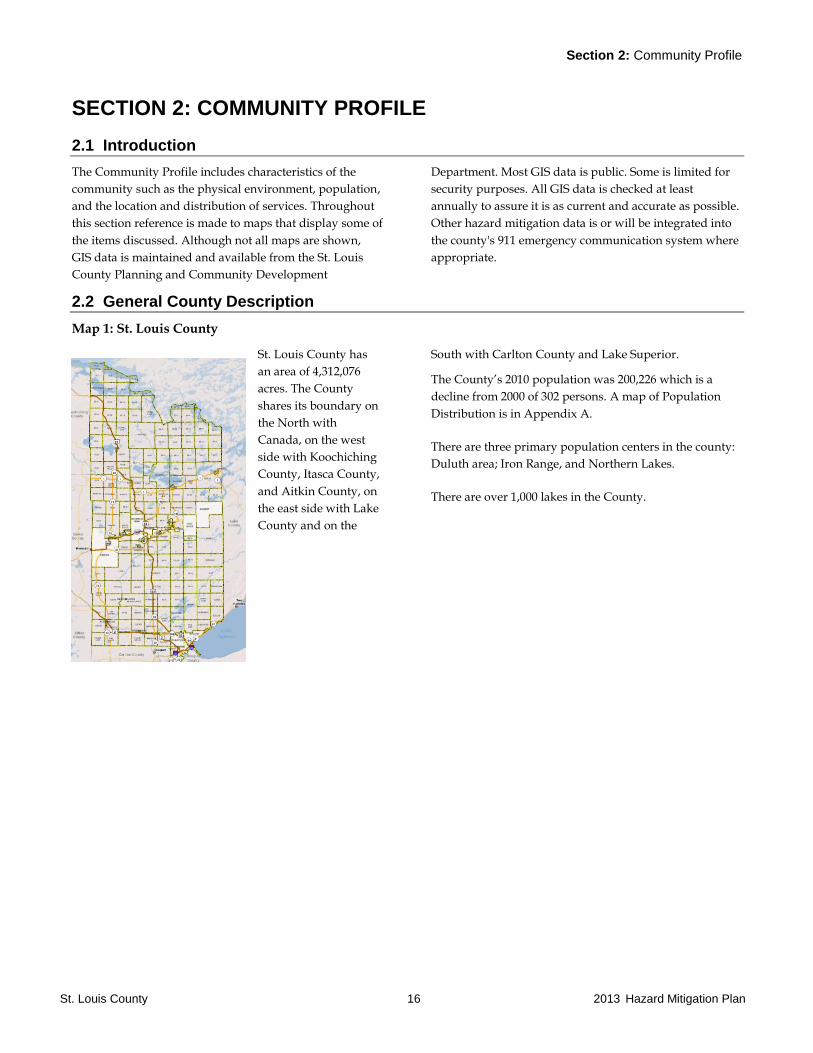
Map 1: St. Louis County
St. Louis County has
an area of 4,312,076
acres. The County
shares its boundary on
the North with
Canada, on the west
side with Koochiching
County, Itasca County,
and Aitkin County, on
the east side with Lake
County and on the
South with Carlton County and Lake Superior.
The County’s 2010 population was 200,226 which is a
decline from 2000 of 302 persons. A map of Population
Distribution is in Appendix A.
There are three primary population centers in the county:
Duluth area; Iron Range, and Northern Lakes.
There are over 1,000 lakes in the County.
Section 2: Community Profile
St. Louis County 17 2013 Hazard Mitigation Plan
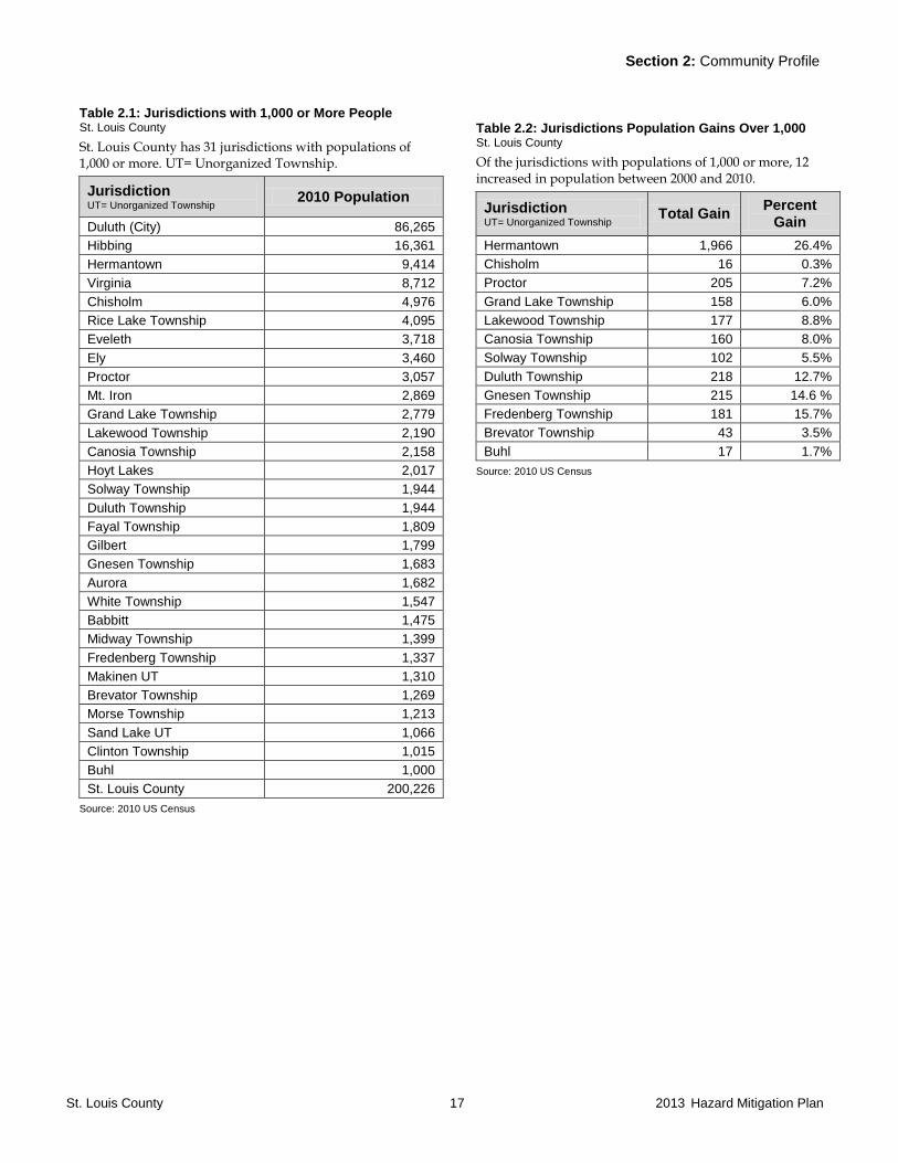
Table 2.1: Jurisdictions with 1,000 or More People St. Louis County
St. Louis County has 31 jurisdictions with populations of 1,000 or more. UT= Unorganized Township.
Jurisdiction UT= Unorganized Township
2010 Population
Duluth (City) 86,265
Hibbing 16,361
Hermantown 9,414
Virginia 8,712
Chisholm 4,976
Rice Lake Township 4,095
Eveleth 3,718
Ely 3,460
Proctor 3,057
Mt. Iron 2,869
Grand Lake Township 2,779
Lakewood Township 2,190
Canosia Township 2,158
Hoyt Lakes 2,017
Solway Township 1,944
Duluth Township 1,944
Fayal Township 1,809
Gilbert 1,799
Gnesen Township 1,683
Aurora 1,682
White Township 1,547
Babbitt 1,475
Midway Township 1,399
Fredenberg Township 1,337
Makinen UT 1,310
Brevator Township 1,269
Morse Township 1,213
Sand Lake UT 1,066
Clinton Township 1,015
Buhl 1,000
St. Louis County 200,226
Source: 2010 US Census
Table 2.2: Jurisdictions Population Gains Over 1,000 St. Louis County
Of the jurisdictions with populations of 1,000 or more, 12 increased in population between 2000 and 2010.
Jurisdiction UT= Unorganized Township
Total Gain Percent
Gain
Hermantown 1,966 26.4%
Chisholm 16 0.3%
Proctor 205 7.2%
Grand Lake Township 158 6.0%
Lakewood Township 177 8.8%
Canosia Township 160 8.0%
Solway Township 102 5.5%
Duluth Township 218 12.7%
Gnesen Township 215 14.6 %
Fredenberg Township 181 15.7%
Brevator Township 43 3.5%
Buhl 17 1.7%
Source: 2010 US Census
Section 2: Community Profile
St. Louis County 18 2013 Hazard Mitigation Plan
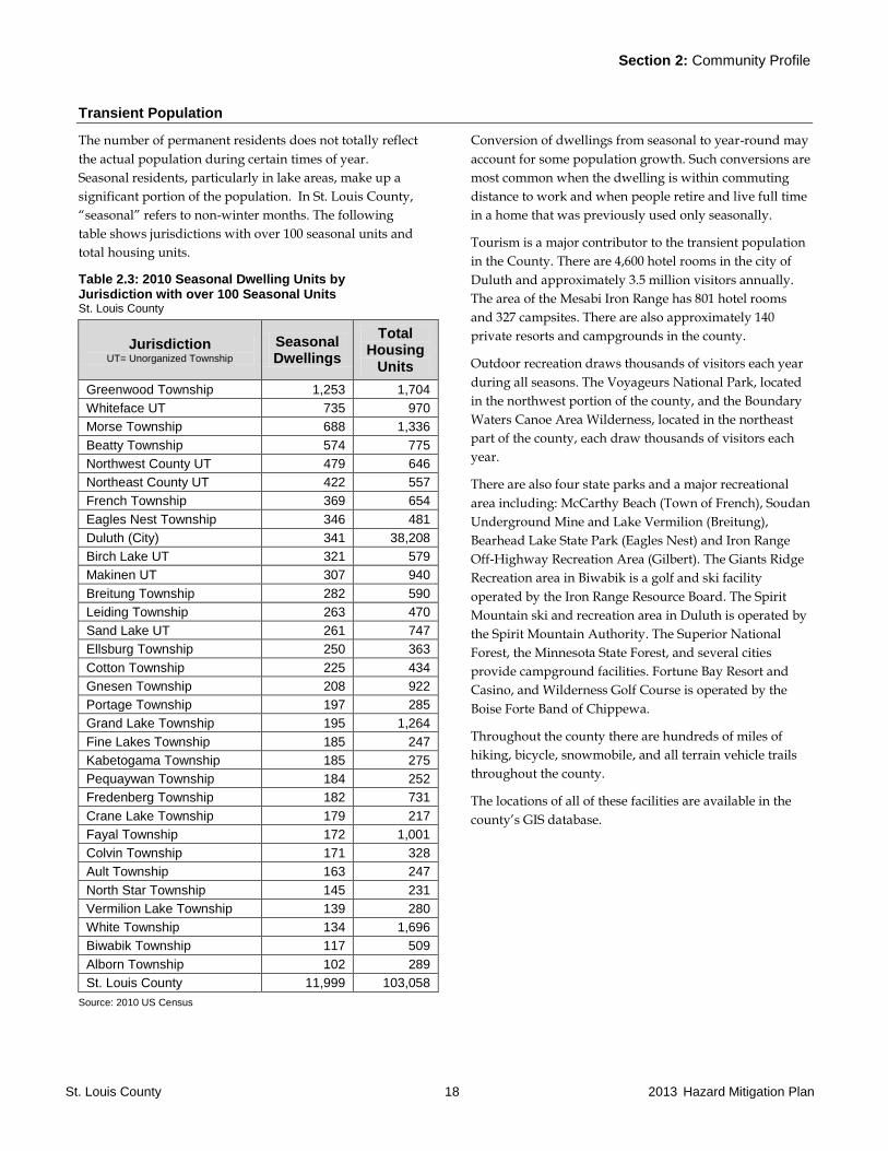
Transient Population
The number of permanent residents does not totally reflect
the actual population during certain times of year.
Seasonal residents, particularly in lake areas, make up a
significant portion of the population. In St. Louis County,
“seasonal” refers to non-winter months. The following
table shows jurisdictions with over 100 seasonal units and
total housing units.
Table 2.3: 2010 Seasonal Dwelling Units by Jurisdiction with over 100 Seasonal Units St. Louis County
Jurisdiction UT= Unorganized Township
Seasonal Dwellings
Total Housing
Units
Greenwood Township 1,253 1,704
Whiteface UT 735 970
Morse Township 688 1,336
Beatty Township 574 775
Northwest County UT 479 646
Northeast County UT 422 557
French Township 369 654
Eagles Nest Township 346 481
Duluth (City) 341 38,208
Birch Lake UT 321 579
Makinen UT 307 940
Breitung Township 282 590
Leiding Township 263 470
Sand Lake UT 261 747
Ellsburg Township 250 363
Cotton Township 225 434
Gnesen Township 208 922
Portage Township 197 285
Grand Lake Township 195 1,264
Fine Lakes Township 185 247
Kabetogama Township 185 275
Pequaywan Township 184 252
Fredenberg Township 182 731
Crane Lake Township 179 217
Fayal Township 172 1,001
Colvin Township 171 328
Ault Township 163 247
North Star Township 145 231
Vermilion Lake Township 139 280
White Township 134 1,696
Biwabik Township 117 509
Alborn Township 102 289
St. Louis County 11,999 103,058
Source: 2010 US Census
Conversion of dwellings from seasonal to year-round may
account for some population growth. Such conversions are
most common when the dwelling is within commuting
distance to work and when people retire and live full time
in a home that was previously used only seasonally.
Tourism is a major contributor to the transient population
in the County. There are 4,600 hotel rooms in the city of
Duluth and approximately 3.5 million visitors annually.
The area of the Mesabi Iron Range has 801 hotel rooms
and 327 campsites. There are also approximately 140
private resorts and campgrounds in the county.
Outdoor recreation draws thousands of visitors each year
during all seasons. The Voyageurs National Park, located
in the northwest portion of the county, and the Boundary
Waters Canoe Area Wilderness, located in the northeast
part of the county, each draw thousands of visitors each
year.
There are also four state parks and a major recreational
area including: McCarthy Beach (Town of French), Soudan
Underground Mine and Lake Vermilion (Breitung),
Bearhead Lake State Park (Eagles Nest) and Iron Range
Off-Highway Recreation Area (Gilbert). The Giants Ridge
Recreation area in Biwabik is a golf and ski facility
operated by the Iron Range Resource Board. The Spirit
Mountain ski and recreation area in Duluth is operated by
the Spirit Mountain Authority. The Superior National
Forest, the Minnesota State Forest, and several cities
provide campground facilities. Fortune Bay Resort and
Casino, and Wilderness Golf Course is operated by the
Boise Forte Band of Chippewa.
Throughout the county there are hundreds of miles of
hiking, bicycle, snowmobile, and all terrain vehicle trails
throughout the county.
The locations of all of these facilities are available in the
county’s GIS database.
Section 2: Community Profile
St. Louis County 19 2013 Hazard Mitigation Plan
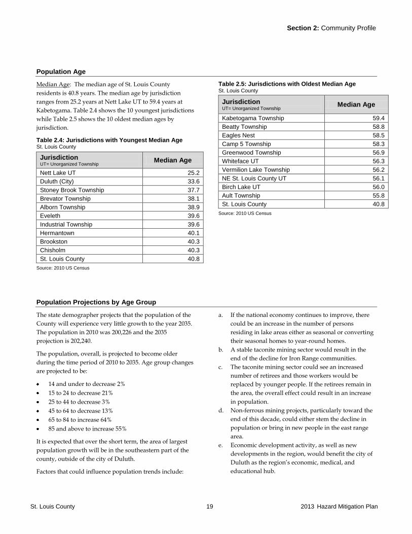
Population Age
Median Age: The median age of St. Louis County
residents is 40.8 years. The median age by jurisdiction
ranges from 25.2 years at Nett Lake UT to 59.4 years at
Kabetogama. Table 2.4 shows the 10 youngest jurisdictions
while Table 2.5 shows the 10 oldest median ages by
jurisdiction.
Table 2.4: Jurisdictions with Youngest Median Age St. Louis County
Jurisdiction UT= Unorganized Township
Median Age
Nett Lake UT 25.2
Duluth (City) 33.6
Stoney Brook Township 37.7
Brevator Township 38.1
Alborn Township 38.9
Eveleth 39.6
Industrial Township 39.6
Hermantown 40.1
Brookston 40.3
Chisholm 40.3
St. Louis County 40.8
Source: 2010 US Census
Table 2.5: Jurisdictions with Oldest Median Age St. Louis County
Jurisdiction UT= Unorganized Township
Median Age
Kabetogama Township 59.4
Beatty Township 58.8
Eagles Nest 58.5
Camp 5 Township 58.3
Greenwood Township 56.9
Whiteface UT 56.3
Vermilion Lake Township 56.2
NE St. Louis County UT 56.1
Birch Lake UT 56.0
Ault Township 55.8
St. Louis County 40.8
Source: 2010 US Census
Population Projections by Age Group
The state demographer projects that the population of the
County will experience very little growth to the year 2035.
The population in 2010 was 200,226 and the 2035
projection is 202,240.
The population, overall, is projected to become older
during the time period of 2010 to 2035. Age group changes
are projected to be:
14 and under to decrease 2%
15 to 24 to decrease 21%
25 to 44 to decrease 3%
45 to 64 to decrease 13%
65 to 84 to increase 64%
85 and above to increase 55%
It is expected that over the short term, the area of largest
population growth will be in the southeastern part of the
county, outside of the city of Duluth.
Factors that could influence population trends include:
a. If the national economy continues to improve, there
could be an increase in the number of persons
residing in lake areas either as seasonal or converting
their seasonal homes to year-round homes.
b. A stable taconite mining sector would result in the
end of the decline for Iron Range communities.
c. The taconite mining sector could see an increased
number of retirees and those workers would be
replaced by younger people. If the retirees remain in
the area, the overall effect could result in an increase
in population.
d. Non-ferrous mining projects, particularly toward the
end of this decade, could either stem the decline in
population or bring in new people in the east range
area.
e. Economic development activity, as well as new
developments in the region, would benefit the city of
Duluth as the region’s economic, medical, and
educational hub.

Section 2: Community Profile
St. Louis County 20 2013 Hazard Mitigation Plan
2.3 Physical Characteristics
St. Louis County is the
largest county east of
the Mississippi,
covering 6,860 square
miles, including water
surfaces based on the
Census Bureau data.
St. Louis County is
known for its natural
beauty, including the
Superior National
Forest and Voyageur
National Park, the
Boundary Waters Canoe Area, five state parks and 1,040
lakes. Three of the state’s drainage basins are located in St.
Louis County and include:
Upper Mississippi Basin (water flows west and
southward) which is located in the southwest corner
of the county around Prairie Lake and the Hibbing
area near the Itasca County line;
Lake Superior Basin (water flows east and
southward) which includes the Mesabi Iron Range on
the northern portion of the basin and the Duluth area;
Rainy River Basin (water flows north and westward)
which includes the cities of Orr, Cook, Tower and Ely,
Boundary Waters Canoe Area, and the Voyageurs
National Park.
Each of the basins are divided into major watersheds. The
Table 2.6 describes each of these watersheds by Basin.
Table 2.6: Basins and Watersheds St. Louis County
Basin Major Watershed
Description
Upper Mississippi
Basin
Mississippi-
Grand Rapids
Mining areas west of the urban area of Hibbing and in southwest corner of the County around
Prairie Lake.
Lake Superior Basin St. Louis
This is the largest major watershed in the County. City of Duluth west of Park Point and all
Mesabi Range Cities including Hibbing, Chisholm, Mt. Iron, Virginia, Biwabik, and Aurora.
Includes Whiteface Reservoir. Urban and Suburban areas along Iron Range and Duluth area.
The Duluth area has numerous short streams flowing from Hermantown-Proctor area into the St.
Louis River. These streams have a relatively higher potential for flash floods. The city of
Floodwood has experienced flooding from the three rivers within the city.
Many of the streams in this watershed support cold water fisheries and are sensitive to pollution
from runoff. Taconite facilities are within the watershed in the northern areas. There are
extensive peat and agricultural areas in the central area including Floodwood and Meadowlands,
and extensive peat lands in the Meadowlands area.
Lake Superior
South
City of Duluth east of Park Point and streams flowing into Lake Superior along the North Shore.
These streams originate in Hermantown, Rice Lake, and Lakewood and flow through Duluth into
Lake Superior. These streams are subject to flash flooding. Many of these streams support cold
water fisheries and are sensitive to pollution from runoff.
Cloquet Minnesota Power Reservoir Lakes north of Duluth and areas northeast of those reservoirs.
Extensive forested areas.
Rainy River Basin Little Fork City of Cook westward and the Side Lake area north of Hibbing. Flooding has occurred in the
Cook area. Extensive agricultural and forested areas.
Vermilion River
Cities of Tower and Orr, Pelican Lake, Lake Vermilion, Crane Lake, and western area of
BWCAW. Primarily forest area except for recreational and housing developments along Lake
Vermilion, Crane Lake, and other area lakes. Major resort area of the county.
Rainy Lake Kabetogama, Voyageurs National Park and Rainy Lake. Relatively high concentration of resorts
on Kabetogama and Ash River Trail.
Rainy River
Headwaters City of Ely, BWCAW, Echo Trail, Birch Lake. Major resort area of the county.
Source: Minnesota Pollution Control Agency
Section 2: Community Profile
St. Louis County 21 2013 Hazard Mitigation Plan
Climate and Precipitation
The climate of St. Louis County is classified as a
continental climate regime characterized by wide
variations in temperature. Temperatures range from 100
degrees (all temperatures in Fahrenheit) in the summer to
-50 degrees in the winter. The record cold temperature for
all of Minnesota was -60 degrees set in Tower on February
3, 1996.
The average yearly temperature is 38 degrees. The average
date of the first frost ranges from October 18 at the Duluth
harbor to September 10 at Cook. The last frost date ranges
from May 1 at the Duluth Harbor to June 4 at Cook.
The climate of the county, especially along the North
Shore, is greatly influenced by Lake Superior. The effect of
the lake results in cooler summer temperatures and
warmer winter temperatures. The lake also effects winter
precipitation as heavy lake effect snowfall generally
occurs five to seven miles inland from Lake Superior.
Annual precipitation in St. Louis County ranges from 30
inches in the south to 28 inches in the north. The highest
single day snowfall in the County was in Duluth on
November 1, 1991 where 24.1 inches of snow fell in a
single day with other cities records being about one foot of
snow in a single day. Average annual snowfall ranges
from 52.1 inches at Kabetogama to 86.7 inches in Duluth.
The National Weather Service (NWS) issues small stream
flash flood guidance based on terrain and existence of
urban areas due to a specific amount of rainfall. Table 2.7
shows the NWS Flash Flood Guidance amount for St.
Louis County and adjacent counties.
Table 2.7: National Weather Service Flash Flood Guidance St. Louis County
County 1 Hour rainfall
3 hour rainfall
6 hour rainfall
Aitkin 2.3 2.9 3.6
Carlton 2.4 2.8 3.1
Itasca 2.8 3.4 3.9
Koochiching 3.5 4.0 4.5
Lake 3.4 4.0 4.5
Douglas (WI) 3.3 3.8 4.3
St. Louis 3.3 3.9 4.4
Source: National Weather Service Flash Flood Guidance
Large areas of St. Louis County experienced drought
conditions from the spring of 2010 into 2012. The U.S.
Drought Monitor in January 2012 showed the entire
county in a moderate drought while lands to the east of
the county experienced a severe drought.
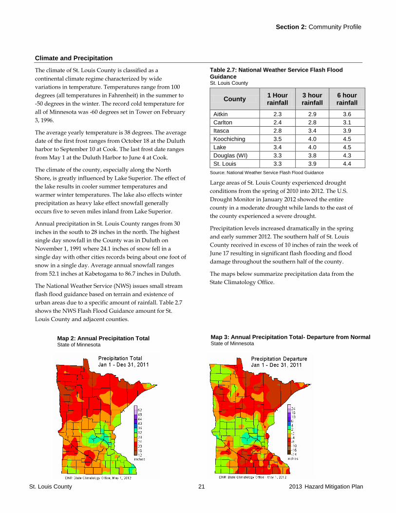
Precipitation levels increased dramatically in the spring
and early summer 2012. The southern half of St. Louis
County received in excess of 10 inches of rain the week of
June 17 resulting in significant flash flooding and flood
damage throughout the southern half of the county.
The maps below summarize precipitation data from the
State Climatology Office.
Map 2: Annual Precipitation Total State of Minnesota
Map 3: Annual Precipitation Total- Departure from Normal State of Minnesota
Section 2: Community Profile
St. Louis County 22 2013 Hazard Mitigation Plan
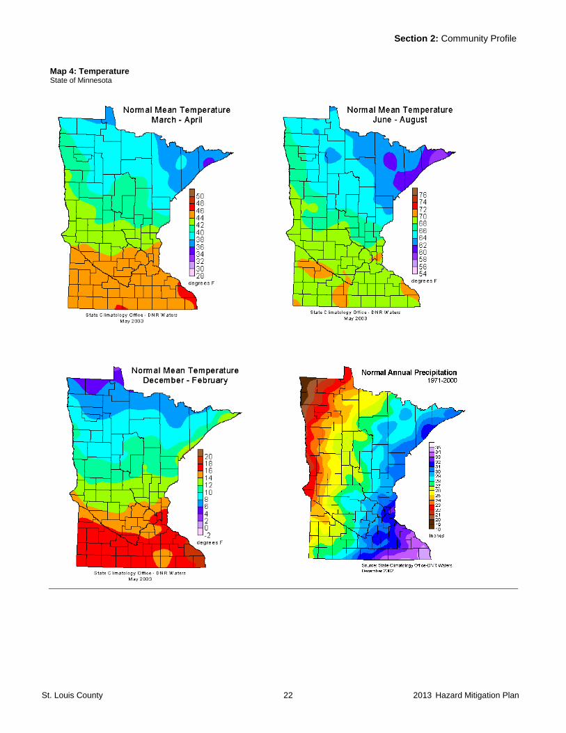
Map 4: Temperature State of Minnesota

Section 2: Community Profile
St. Louis County 23 2013 Hazard Mitigation Plan
Geology/Topography
The lowest elevation point in Minnesota is in Duluth at
the level of Lake Superior. It is at 602 feet above sea level
with the terrain rising steeply from there to an altitude
above sea level of 1,428 feet at the Duluth International
Airport.
The highest elevation point in St. Louis County is Pike
Mountain on the Laurentian Divide northeast of Virginia
at 1,950 feet above sea level.
Map 5 shows the terrain of St. Louis County. The dark
green adjacent to Lake Superior is the lowest area of the
county while the dark brown area represents the highest
area and is the location of the Mesabi Iron Range. The
lighter green in the southwest includes a considerable area
of peat lands and agricultural areas. The brown shaded
area between Tower and Ely is the Vermilion Iron Range.
Map 5: Topography St. Louis County
Source: St. Louis County
Section 2: Community Profile
St. Louis County 24 2013 Hazard Mitigation Plan
Groundwater/Geology
The groundwater resources of St. Louis County are
dominated by the extensive areas in which the underlying
bedrock is exposed or is less than 30 feet from the surface
soils. Fully three-fourths of the county has bedrock within
30 feet of the surface. This means that groundwater is
being extracted from either shallow surficial-drift aquifers
or from fractures within the crystalline bedrock aquifer.
The one exception is the sedimentary sandstone aquifer
band beginning near Buhl and running southwest along
the southern edge of the Iron Range.
Notes on St. Louis County’s bedrock aquifers include:
Much of the county is underlain by a Precambrian
undifferentiated aquifer consisting of igneous and
metamorphic rocks. Well depths range from 30 to 450
feet deep. The common yield is 5-25 gallons per minute
(gpm) but may exceed 100 gpm. The water is usually
“hard”.
Along the North Shore lies the North Shore Volcanic
aquifer. Water comes from interflow sediments and
joints and fractures in the basalt. Wells are typically 20-
930 feet deep. Yields are low, at 5-25 gpm with some
wells exceeding 100 gpm. Some areas will contain
noticeable levels of salt.
A thin band of the Biwabik Iron-Formation aquifer
stretches from just east and north of Babbitt across the
entire Range past the county line near Nashwauk. The
aquifer is generally confined but some local areas are
unconfined. Common well depths fall in the 170-600
foot range. This is the most productive source of
groundwater on the Iron Range with typical yields
ranging 250-750 gpm, and some exceeding 1,000 gpm.
Localities will evidence hard water and large iron
concentrations.
The Mesabi, and to a lesser extent, the Vermilion Iron
Range have extensive areas of mine pit lakes which
formed after mining and associated pumping activity
ceased. These pit lakes are primarily ground water and
are the source of drinking water for several cities. There
are also numerous mine tailing basins and overburden
piles throughout the range.
The lone sedimentary bedrock lies along the southern
edge of the Range running from Buhl in an increasingly
wider band to the western county line. Although some
test holes in the Hibbing area have penetrated the
Cretaceous and some bedrock wells may be open to the
base of the Cretaceous, no water wells on record use the
Cretaceous as a sole aquifer.
The southwestern quarter of the county has a generally
deeper depth to bedrock and is underlain by the
Proterozoic aquifer. Wells range from 30-500 feet deep
and yield 5-70 gpm; some will exceed 250 gpm. Quality
is generally good with small levels of dissolved solids. It
is commonly used in conjunction with the underlying
Biwabik Iron Formation aquifer for public and
industrial supplies.
Surficial-drift aquifers are exposed at the land surface
while buried drift aquifers are located beneath a confining
layer. Overall, one-third of Minnesota is covered by
surficial-drift aquifers. Notes on both types in St. Louis
County include:
Surficial drift aquifers generally consist of sand and
gravel deposits located at or near the land surface.
Generally, they are unconfined aquifers. Well depths
will range from 30-240 feet. Common yields will be
from 100-800 gpm with some wells exceeding 2,000
gpm. Water quality is generally good but can be
contaminated by nearby sources such as septic systems,
feedlots, and chemical activities.
Surficial-drift aquifers are limited in St. Louis County
with the most productive areas being two small
outwash plains south of Hibbing and near Keewatin.
Larger, but less productive areas are found in a
southwest-northeast band north of Duluth and in a
series of bands north of the Iron Range.
A low to moderate yielding buried drift aquifer is
situated in a broad band across the Iron Range running
from Aurora to the western county line. Commonly,
well depths in this type of aquifer will range from 80-
380 feet. Yields will vary from 100-600 gpm with some
wells exceeding 1,500 gpm. Usually the water will be
hard with large iron, sulfate and chloride concentrations
being possible in some areas. Numerous mine pit lakes
and tailings basins are in this area.
Most of St. Louis County is covered with a thin to
moderately deep layer of glacial till. The southwestern
and far northwestern sections possess clay and silt lake
deposits. All these areas generally have poor sustained
yield ratings.
Section 2: Community Profile
St. Louis County 25 2013 Hazard Mitigation Plan
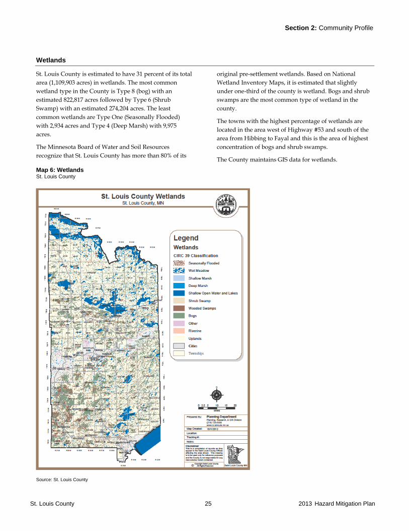
Wetlands
St. Louis County is estimated to have 31 percent of its total
area (1,109,903 acres) in wetlands. The most common
wetland type in the County is Type 8 (bog) with an
estimated 822,817 acres followed by Type 6 (Shrub
Swamp) with an estimated 274,204 acres. The least
common wetlands are Type One (Seasonally Flooded)
with 2,934 acres and Type 4 (Deep Marsh) with 9,975
acres.
The Minnesota Board of Water and Soil Resources
recognize that St. Louis County has more than 80% of its
original pre-settlement wetlands. Based on National
Wetland Inventory Maps, it is estimated that slightly
under one-third of the county is wetland. Bogs and shrub
swamps are the most common type of wetland in the
county.
The towns with the highest percentage of wetlands are
located in the area west of Highway #53 and south of the
area from Hibbing to Fayal and this is the area of highest
concentration of bogs and shrub swamps.
The County maintains GIS data for wetlands.
Map 6: Wetlands St. Louis County
Source: St. Louis County
Section 2: Community Profile
St. Louis County 26 2013 Hazard Mitigation Plan
Land Use and Ownership
Land characteristics vary greatly throughout St. Louis
County. Maps of Parcel Ownership, Public Land Use,
Private Land Use and Tribal Lands in Appendix A
provide an overview of the land cover in St. Louis County.
The majority of the county population lives in the City of
Duluth, the adjacent cities of Hermantown and Proctor
and the surrounding townships. The next greatest
population concentration is in the Iron Range
communities, including Hibbing, Chisholm, Mountain
Iron, Virginia, Eveleth, and Hoyt Lakes.
St. Louis County has a large number (over 1,000) of lakes
with significant development on them. This includes year-
round homes, seasonal cabins and resorts. There are large
areas in St. Louis County that have very low-density
development and are primarily used for forestry, wildlife
habitat and recreation.
St. Louis County has an area of 6,906 square miles
excluding the coastal area of Lake Superior and St. Louis
Bay (Duluth Harbor) based upon GIS analysis. Public
lands consist of 56.1% of the land area, private land is
37.5% and water is 6.4% of the total area. The county’s
public lands include: Voyageurs National Park, Boundary
Waters Canoe Area Wilderness, Superior National Forest,
four state parks and off road vehicle park, Giants Ridge
Recreation area, state forests, and tax forfeited lands. Table
2.8 shows the square miles of public lands by type.
Table 2.8: Public Land Classification St. Louis County
Public Land Classification Square Miles
County Tax Forfeited (State of MN) 1,456.5
Federal Forest Lands 1,375.5
State Forest Lands 882.0
Municipal Property 89.3
Other Public-Auxiliary Forest 19.3
County Fee Land 15.6
State Public 11.7
Public Hospitals, Colleges, K-12, Cemeteries
7.5
Federal Public 2.5
Total 3,859.9
Source: St. Louis County GIS file Parcel Data
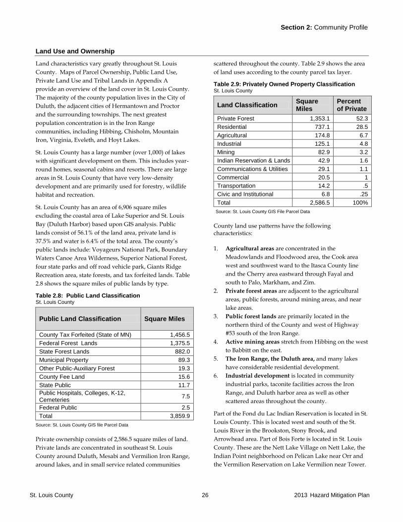
Private ownership consists of 2,586.5 square miles of land.
Private lands are concentrated in southeast St. Louis
County around Duluth, Mesabi and Vermilion Iron Range,
around lakes, and in small service related communities
scattered throughout the county. Table 2.9 shows the area
of land uses according to the county parcel tax layer.
Table 2.9: Privately Owned Property Classification St. Louis County
Land Classification Square Miles
Percent of Private
Private Forest 1,353.1 52.3
Residential 737.1 28.5
Agricultural 174.8 6.7
Industrial 125.1 4.8
Mining 82.9 3.2
Indian Reservation & Lands 42.9 1.6
Communications & Utilities 29.1 1.1
Commercial 20.5 1
Transportation 14.2 .5
Civic and Institutional 6.8 .25
Total 2,586.5 100%
Source: St. Louis County GIS File Parcel Data
County land use patterns have the following characteristics:
1. Agricultural areas are concentrated in the
Meadowlands and Floodwood area, the Cook area
west and southwest ward to the Itasca County line
and the Cherry area eastward through Fayal and
south to Palo, Markham, and Zim.
2. Private forest areas are adjacent to the agricultural
areas, public forests, around mining areas, and near
lake areas.
3. Public forest lands are primarily located in the
northern third of the County and west of Highway
#53 south of the Iron Range.
4. Active mining areas stretch from Hibbing on the west
to Babbitt on the east.
5. The Iron Range, the Duluth area, and many lakes
have considerable residential development.
6. Industrial development is located in community
industrial parks, taconite facilities across the Iron
Range, and Duluth harbor area as well as other
scattered areas throughout the county.
Part of the Fond du Lac Indian Reservation is located in St.
Louis County. This is located west and south of the St.
Louis River in the Brookston, Stony Brook, and
Arrowhead area. Part of Bois Forte is located in St. Louis
County. These are the Nett Lake Village on Nett Lake, the
Indian Point neighborhood on Pelican Lake near Orr and
the Vermilion Reservation on Lake Vermilion near Tower.
Section 2: Community Profile
St. Louis County 27 2013 Hazard Mitigation Plan
Forests, Parks and Recreation Areas
The forests and parks of St. Louis County provide timber
resources, commercial peat, and wide range of
recreational facilities. This varies from the wilderness in
the BWCA portion of the Superior National Forest to off
road and snowmobile use, significant wildlife habitat, and
scientific purposes.
Public land ownership within the County consists of
56.1% of the total county area. The forest areas are not
completely public lands, with farms, private forests,
residential, and hunting lands often found within the
boundaries of the public forests.
The three largest components of public ownership are:
County Tax Forfeit - 1,456 square miles
Federal Forest - 1,375 square mile
State Forest - 882 square miles
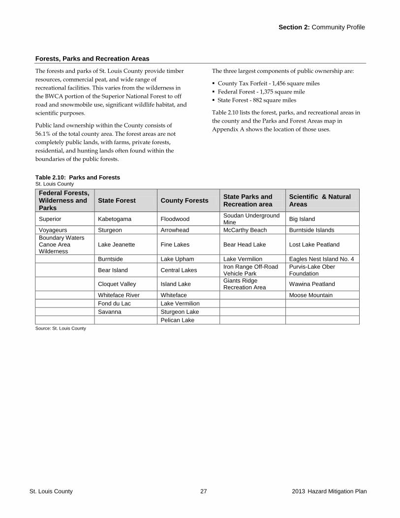
Table 2.10 lists the forest, parks, and recreational areas in
the county and the Parks and Forest Areas map in
Appendix A shows the location of those uses.
Table 2.10: Parks and Forests St. Louis County
Federal Forests, Wilderness and Parks
State Forest County Forests State Parks and Recreation area
Scientific & Natural Areas
Superior Kabetogama Floodwood Soudan Underground Mine
Big Island
Voyageurs Sturgeon Arrowhead McCarthy Beach Burntside Islands
Boundary Waters Canoe Area Wilderness
Lake Jeanette Fine Lakes Bear Head Lake Lost Lake Peatland
Burntside Lake Upham Lake Vermilion Eagles Nest Island No. 4
Bear Island Central Lakes Iron Range Off-Road Vehicle Park
Purvis-Lake Ober Foundation
Cloquet Valley Island Lake Giants Ridge Recreation Area
Wawina Peatland
Whiteface River Whiteface Moose Mountain
Fond du Lac Lake Vermilion
Savanna Sturgeon Lake
Pelican Lake
Source: St. Louis County
Section 2: Community Profile
St. Louis County 28 2013 Hazard Mitigation Plan
2.4 Community Services and Infrastructure
Community services include health care and public safety.
Community infrastructure includes power utilities, water
and sewer facilities, and the transportation network.
Health Care
St. Louis County has an extensive network of hospitals,
clinics, nursing homes, hospice services, and assisted
living facilities. While many of these facilities are
concentrated in the major cities, there are many in the
smaller cities and towns.
There are eight hospitals in the county. The largest are
located in Duluth, Hibbing and Virginia. Three of the
eight have nursing homes at the facility. Table 2.11 lists
the hospitals and number of beds.
GIS data for all facilities is maintained by St. Louis
County.
Table 2.11: Hospitals St. Louis County
Name and phone Address City Phone (218)
Hospital Beds
Infant Bassinets
*Cook Community Hospital 10 Southeast Fifth Street Cook 666-5945 14 2
Ely Bloomenson Community Hospital 328 West Conan Street Ely 365-3271 25 3
Essentia Health Miller Dwan 502 East Second Street Duluth 727-8762 165 0
Essentia Health St. Mary’s Medical 407 East Third Street Duluth 786-4000 380 46
*Northern Pines Medical Center 5211 Highway 110 Aurora 229-2211 16 4
St. Luke’s Hospital 915 East First Street Duluth 249-5555 267 18
Fairview University Central Mesabi 750 East 34th
Street Hibbing 262-4881 175 16
*Virginia Regional Medical Center 901 Ninth Street North Virginia 742-3405 742-3410
83 6
*Also has nursing home beds
Source: State Health Department License information
Note: Number of Beds based on state licensed capacity not federally certified beds.
Clinics and Hospice
There are 37 general purpose medical clinics within St.
Louis County. Hospice services are provided in hospitals,
nursing homes, assisted living, and private residences.
There is one hospice house in the county with a capacity
of 12 beds and it is located in Duluth.
GIS data for all facilities is maintained by St. Louis
County.
Section 2: Community Profile
St. Louis County 29 2013 Hazard Mitigation Plan
Nursing Homes and Boarding Care Facilities
There are 17 nursing homes and 1 boarding care facility in
St. Louis County. The total number of licensed beds is
1,421. The facilities range in size from 24 to 170 beds.
The Minnesota Long Term Care (LTC) Preparedness
Toolkit was developed to assist with emergency
preparedness planning for this specialized healthcare
population. St. Louis County uses this toolkit as needed.
GIS data for all facilities is maintained by St. Louis
County.
Assisted Living and Housing With Services
Assisted Living facilities, along with other housing with
services facilities have greatly changed housing for
residents over the age of 55 and residents who have
disabilities. County-wide there is a capacity for 4,102
persons in 70 assisted living facilities. Facilities range in
size from 6 to 170 person maximum capacity.
There are 12 facilities classified as housing with services in
the county. They range in capacity size from 6 to 288
persons maximum capacity. The county-wide maximum
capacity is 1,092 persons.
GIS data for all facilities is maintained by St. Louis
County.
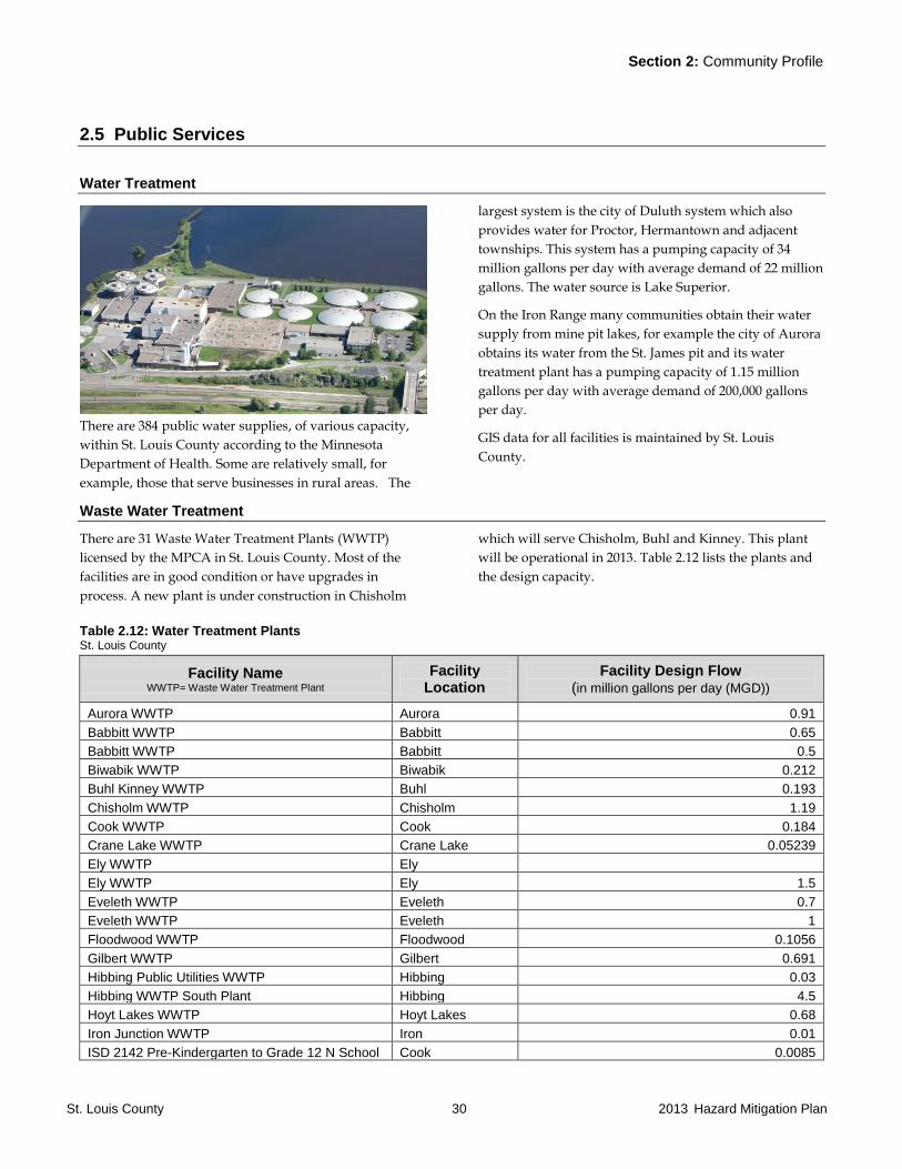
Section 2: Community Profile
St. Louis County 30 2013 Hazard Mitigation Plan
2.5 Public Services
Water Treatment
There are 384 public water supplies, of various capacity,
within St. Louis County according to the Minnesota
Department of Health. Some are relatively small, for
example, those that serve businesses in rural areas. The
largest system is the city of Duluth system which also
provides water for Proctor, Hermantown and adjacent
townships. This system has a pumping capacity of 34
million gallons per day with average demand of 22 million
gallons. The water source is Lake Superior.
On the Iron Range many communities obtain their water
supply from mine pit lakes, for example the city of Aurora
obtains its water from the St. James pit and its water
treatment plant has a pumping capacity of 1.15 million
gallons per day with average demand of 200,000 gallons
per day.
GIS data for all facilities is maintained by St. Louis
County.
Waste Water Treatment
There are 31 Waste Water Treatment Plants (WWTP)
licensed by the MPCA in St. Louis County. Most of the
facilities are in good condition or have upgrades in
process. A new plant is under construction in Chisholm
which will serve Chisholm, Buhl and Kinney. This plant
will be operational in 2013. Table 2.12 lists the plants and
the design capacity.
Table 2.12: Water Treatment Plants St. Louis County
Facility Name WWTP= Waste Water Treatment Plant
Facility Location
Facility Design Flow (in million gallons per day (MGD))
Aurora WWTP Aurora 0.91
Babbitt WWTP Babbitt 0.65
Babbitt WWTP Babbitt 0.5
Biwabik WWTP Biwabik 0.212
Buhl Kinney WWTP Buhl 0.193
Chisholm WWTP Chisholm 1.19
Cook WWTP Cook 0.184
Crane Lake WWTP Crane Lake 0.05239
Ely WWTP Ely
Ely WWTP Ely 1.5
Eveleth WWTP Eveleth 0.7
Eveleth WWTP Eveleth 1
Floodwood WWTP Floodwood 0.1056
Gilbert WWTP Gilbert 0.691
Hibbing Public Utilities WWTP Hibbing 0.03
Hibbing WWTP South Plant Hibbing 4.5
Hoyt Lakes WWTP Hoyt Lakes 0.68
Iron Junction WWTP Iron 0.01
ISD 2142 Pre-Kindergarten to Grade 12 N School Cook 0.0085
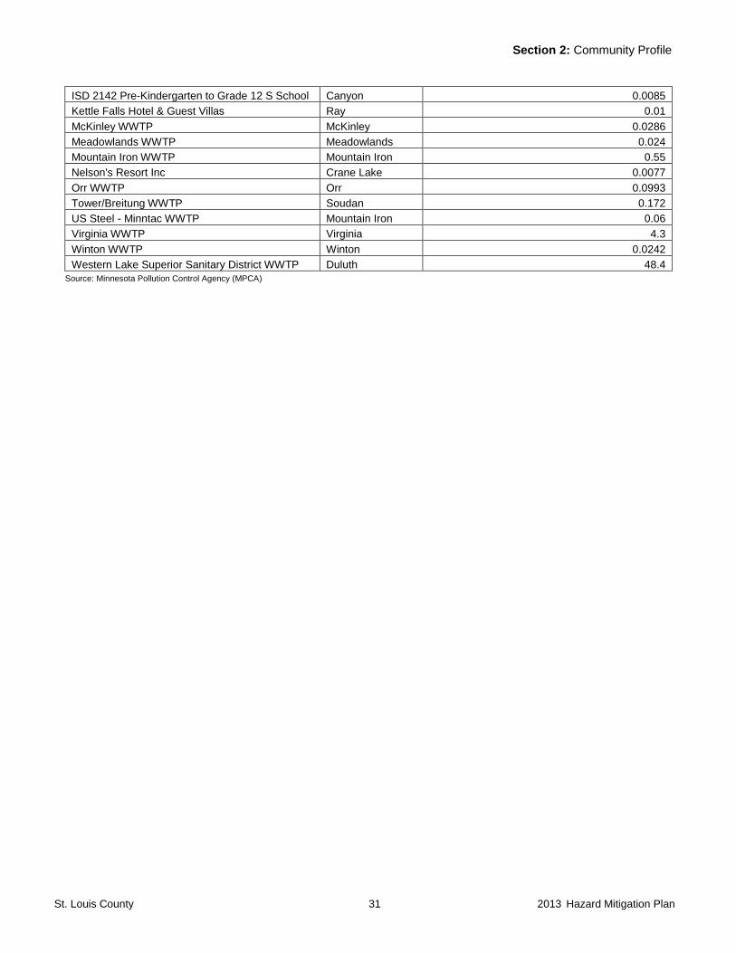
Section 2: Community Profile
St. Louis County 31 2013 Hazard Mitigation Plan
ISD 2142 Pre-Kindergarten to Grade 12 S School Canyon 0.0085
Kettle Falls Hotel & Guest Villas Ray 0.01
McKinley WWTP McKinley 0.0286
Meadowlands WWTP Meadowlands 0.024
Mountain Iron WWTP Mountain Iron 0.55
Nelson's Resort Inc Crane Lake 0.0077
Orr WWTP Orr 0.0993
Tower/Breitung WWTP Soudan 0.172
US Steel - Minntac WWTP Mountain Iron 0.06
Virginia WWTP Virginia 4.3
Winton WWTP Winton 0.0242
Western Lake Superior Sanitary District WWTP Duluth 48.4
Source: Minnesota Pollution Control Agency (MPCA)
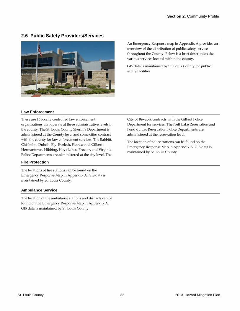
Section 2: Community Profile
St. Louis County 32 2013 Hazard Mitigation Plan
2.6 Public Safety Providers/Services
An Emergency Response map in Appendix A provides an
overview of the distribution of public safety services
throughout the County. Below is a brief description the
various services located within the county.
GIS data is maintained by St. Louis County for public
safety facilities.
Law Enforcement
There are 16 locally controlled law enforcement
organizations that operate at three administrative levels in
the county. The St. Louis County Sheriff’s Department is
administered at the County level and some cities contract
with the county for law enforcement services. The Babbitt,
Chisholm, Duluth, Ely, Eveleth, Floodwood, Gilbert,
Hermantown, Hibbing, Hoyt Lakes, Proctor, and Virginia
Police Departments are administered at the city level. The
City of Biwabik contracts with the Gilbert Police
Department for services. The Nett Lake Reservation and
Fond du Lac Reservation Police Departments are
administered at the reservation level.
The location of police stations can be found on the
Emergency Response Map in Appendix A. GIS data is
maintained by St. Louis County.
Fire Protection
The locations of fire stations can be found on the
Emergency Response Map in Appendix A. GIS data is
maintained by St. Louis County.
Ambulance Service
The location of the ambulance stations and districts can be
found on the Emergency Response Map in Appendix A.
GIS data is maintained by St. Louis County.

Section 2: Community Profile
St. Louis County 33 2013 Hazard Mitigation Plan
2.7 Transportation Infrastructure
The transportation system of St. Louis County
accommodates all modes on its local roads, highways,
airports, transit, railroads, waterways, and trails. The
system serves residential, industrial, commercial, and
tourism needs. The Transportation Systems map in
Appendix A shows an overview of the county’s
transportation infrastructure. GIS data is maintained by St.
Louis County.
Roads and Highways
There are multiple layers of road jurisdictions within St.
Louis County. These range from local city streets to
interstate highways. Other road types include township
roads, county roads, county state-aid highways, forest
roads, and Indian reservation roads. In total, there are
5,943.95 miles of roadway in St. Louis County. The
breakdown of mileage by jurisdiction type is shown in
Table 2.13.
Table 2.13: Road Jurisdictions St. Louis County
Road Type Mileage
County Roads 1,616.69
County State-aid Highways 1,390.83
Township Roads 976.73
Municipal Streets 754.77
U.S. and State Highways 632.76
Forest Roads 230.03
Municipal State-aid Streets 201.49
Forest Roads (State & National) 89.55
Interstate Highway 31.75
Ramps 19.35
TOTAL 5,943.95
Source: St. Louis County
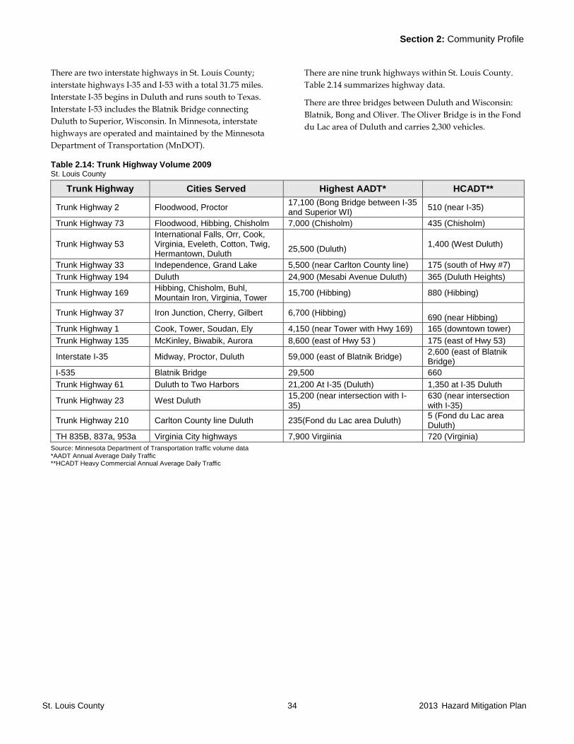
Section 2: Community Profile
St. Louis County 34 2013 Hazard Mitigation Plan
There are two interstate highways in St. Louis County;
interstate highways I-35 and I-53 with a total 31.75 miles.
Interstate I-35 begins in Duluth and runs south to Texas.
Interstate I-53 includes the Blatnik Bridge connecting
Duluth to Superior, Wisconsin. In Minnesota, interstate
highways are operated and maintained by the Minnesota
Department of Transportation (MnDOT).
There are nine trunk highways within St. Louis County.
Table 2.14 summarizes highway data.
There are three bridges between Duluth and Wisconsin:
Blatnik, Bong and Oliver. The Oliver Bridge is in the Fond
du Lac area of Duluth and carries 2,300 vehicles.
Table 2.14: Trunk Highway Volume 2009 St. Louis County
Trunk Highway Cities Served Highest AADT* HCADT**
Trunk Highway 2 Floodwood, Proctor 17,100 (Bong Bridge between I-35 and Superior WI)
510 (near I-35)
Trunk Highway 73 Floodwood, Hibbing, Chisholm 7,000 (Chisholm) 435 (Chisholm)
Trunk Highway 53 International Falls, Orr, Cook, Virginia, Eveleth, Cotton, Twig, Hermantown, Duluth
25,500 (Duluth)
1,400 (West Duluth)
Trunk Highway 33 Independence, Grand Lake 5,500 (near Carlton County line) 175 (south of Hwy #7)
Trunk Highway 194 Duluth 24,900 (Mesabi Avenue Duluth) 365 (Duluth Heights)
Trunk Highway 169 Hibbing, Chisholm, Buhl, Mountain Iron, Virginia, Tower
15,700 (Hibbing) 880 (Hibbing)
Trunk Highway 37 Iron Junction, Cherry, Gilbert 6,700 (Hibbing) 690 (near Hibbing)
Trunk Highway 1 Cook, Tower, Soudan, Ely 4,150 (near Tower with Hwy 169) 165 (downtown tower)
Trunk Highway 135 McKinley, Biwabik, Aurora 8,600 (east of Hwy 53 ) 175 (east of Hwy 53)
Interstate I-35 Midway, Proctor, Duluth 59,000 (east of Blatnik Bridge) 2,600 (east of Blatnik Bridge)
I-535 Blatnik Bridge 29,500 660
Trunk Highway 61 Duluth to Two Harbors 21,200 At I-35 (Duluth) 1,350 at I-35 Duluth
Trunk Highway 23 West Duluth 15,200 (near intersection with I-35)
630 (near intersection with I-35)
Trunk Highway 210 Carlton County line Duluth 235(Fond du Lac area Duluth) 5 (Fond du Lac area Duluth)
TH 835B, 837a, 953a Virginia City highways 7,900 Virgiinia 720 (Virginia)
Source: Minnesota Department of Transportation traffic volume data *AADT Annual Average Daily Traffic **HCADT Heavy Commercial Annual Average Daily Traffic
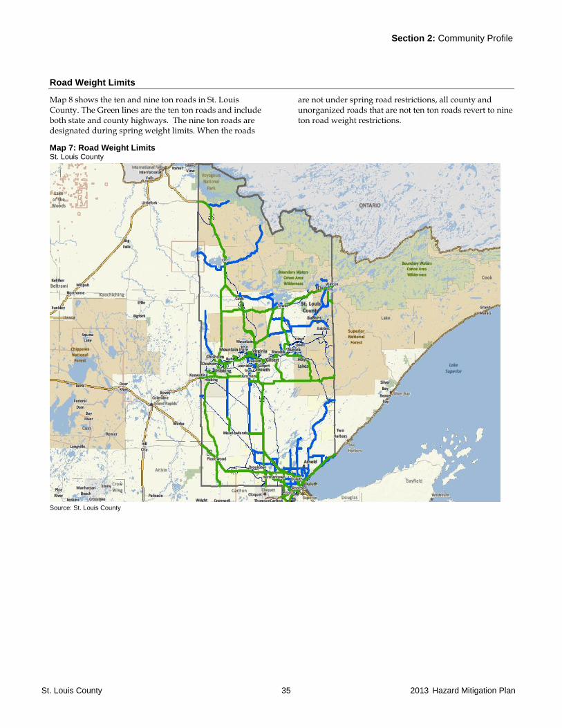
Section 2: Community Profile
St. Louis County 35 2013 Hazard Mitigation Plan
Road Weight Limits
Map 8 shows the ten and nine ton roads in St. Louis County. The Green lines are the ten ton roads and include both state and county highways. The nine ton roads are designated during spring weight limits. When the roads
are not under spring road restrictions, all county and unorganized roads that are not ten ton roads revert to nine ton road weight restrictions.
Map 7: Road Weight Limits St. Louis County
Source: St. Louis County
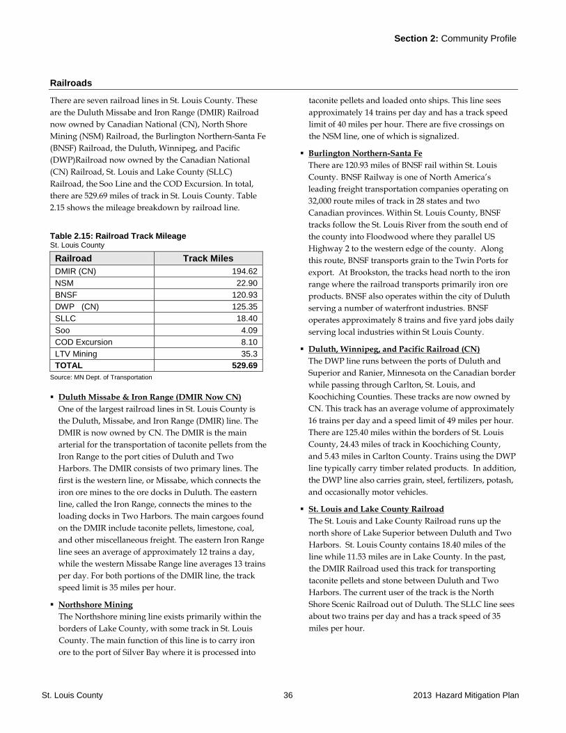
Section 2: Community Profile
St. Louis County 36 2013 Hazard Mitigation Plan
Railroads
There are seven railroad lines in St. Louis County. These
are the Duluth Missabe and Iron Range (DMIR) Railroad
now owned by Canadian National (CN), North Shore
Mining (NSM) Railroad, the Burlington Northern-Santa Fe
(BNSF) Railroad, the Duluth, Winnipeg, and Pacific
(DWP)Railroad now owned by the Canadian National
(CN) Railroad, St. Louis and Lake County (SLLC)
Railroad, the Soo Line and the COD Excursion. In total,
there are 529.69 miles of track in St. Louis County. Table
2.15 shows the mileage breakdown by railroad line.
Table 2.15: Railroad Track Mileage St. Louis County
Railroad Track Miles
DMIR (CN) 194.62
NSM 22.90
BNSF 120.93
DWP (CN) 125.35
SLLC 18.40
Soo 4.09
COD Excursion 8.10
LTV Mining 35.3
TOTAL 529.69
Source: MN Dept. of Transportation
Duluth Missabe & Iron Range (DMIR Now CN)
One of the largest railroad lines in St. Louis County is
the Duluth, Missabe, and Iron Range (DMIR) line. The
DMIR is now owned by CN. The DMIR is the main
arterial for the transportation of taconite pellets from the
Iron Range to the port cities of Duluth and Two
Harbors. The DMIR consists of two primary lines. The
first is the western line, or Missabe, which connects the
iron ore mines to the ore docks in Duluth. The eastern
line, called the Iron Range, connects the mines to the
loading docks in Two Harbors. The main cargoes found
on the DMIR include taconite pellets, limestone, coal,
and other miscellaneous freight. The eastern Iron Range
line sees an average of approximately 12 trains a day,
while the western Missabe Range line averages 13 trains
per day. For both portions of the DMIR line, the track
speed limit is 35 miles per hour.
Northshore Mining
The Northshore mining line exists primarily within the
borders of Lake County, with some track in St. Louis
County. The main function of this line is to carry iron
ore to the port of Silver Bay where it is processed into
taconite pellets and loaded onto ships. This line sees
approximately 14 trains per day and has a track speed
limit of 40 miles per hour. There are five crossings on
the NSM line, one of which is signalized.
Burlington Northern-Santa Fe
There are 120.93 miles of BNSF rail within St. Louis
County. BNSF Railway is one of North America’s
leading freight transportation companies operating on
32,000 route miles of track in 28 states and two
Canadian provinces. Within St. Louis County, BNSF
tracks follow the St. Louis River from the south end of
the county into Floodwood where they parallel US
Highway 2 to the western edge of the county. Along
this route, BNSF transports grain to the Twin Ports for
export. At Brookston, the tracks head north to the iron
range where the railroad transports primarily iron ore
products. BNSF also operates within the city of Duluth
serving a number of waterfront industries. BNSF
operates approximately 8 trains and five yard jobs daily
serving local industries within St Louis County.
Duluth, Winnipeg, and Pacific Railroad (CN)
The DWP line runs between the ports of Duluth and
Superior and Ranier, Minnesota on the Canadian border
while passing through Carlton, St. Louis, and
Koochiching Counties. These tracks are now owned by
CN. This track has an average volume of approximately
16 trains per day and a speed limit of 49 miles per hour.
There are 125.40 miles within the borders of St. Louis
County, 24.43 miles of track in Koochiching County,
and 5.43 miles in Carlton County. Trains using the DWP
line typically carry timber related products. In addition,
the DWP line also carries grain, steel, fertilizers, potash,
and occasionally motor vehicles.
St. Louis and Lake County Railroad
The St. Louis and Lake County Railroad runs up the
north shore of Lake Superior between Duluth and Two
Harbors. St. Louis County contains 18.40 miles of the
line while 11.53 miles are in Lake County. In the past,
the DMIR Railroad used this track for transporting
taconite pellets and stone between Duluth and Two
Harbors. The current user of the track is the North
Shore Scenic Railroad out of Duluth. The SLLC line sees
about two trains per day and has a track speed of 35
miles per hour.
Section 2: Community Profile
St. Louis County 37 2013 Hazard Mitigation Plan
SOO and COD Excursion
Soo line is in the Duluth Harbor area and the COD
excursion line is in West Duluth
LTV Mining
The LTV line is not active but the tracks remain place
and the line has not been abandoned. The LTV line in St.
Louis County is 35.30 miles long before entering Lake
County. Polymet mining intends to use this line as well
as construct additional tracks in the area of the mine
and the plant. The LTV line is now owned by Canadian
National (CN).
Section 2: Community Profile
St. Louis County 38 2013 Hazard Mitigation Plan
Air Transportation
There are nine airports in St. Louis County. Each airport is
briefly described below:
Range Regional (Chisholm-Hibbing) Airport
Located four miles east of Hibbing on Trunk Highway
37. The longest runway at the airport is paved and
extends 6,758 feet. The second runway extends 3,096
feet. The facility is at an elevation of 1,353 feet and
provides passenger service. The airport supports the
MN DNR Aerial Fire Suppression Operations and
supports Life Link III medical helicopter operations.
Airport building/hangar utilization for supply storage
and distribution in the case of a large scale incident is
available. There is a sea plane base at Carey Lake.
The Duluth International Airport
This is the main unit in the Northeast Minnesota
Regional Airport System. The airport is designated as a
primary facility with daily commercial service. This
facility serves as a resource for the Air National Guard
fighter planes. Companies using the airport include:
Delta Airline, United Airline, Allegiant Air, Monaco Air,
the United Postal Service, Federal Express, United States
Postal Service, AAR Aircraft Services, Inc, and Cirrus
Design Corporation. Lake Superior College has an
Aviation Campus located at the airport. The longest
runway is 10,162 feet. The second runway length is
5,718 feet. Customs service is available. A new airport
terminal is under construction. The facility is at an
elevation of 1,428 feet.
Duluth Sky Harbor Airport
Sky Harbor airport is administered by the Duluth
Airport Authority and is located at the end of Park
Point. The paved runway extends 3,050 feet. The facility
is at an elevation of 610 feet. The seaplane base is
adjacent to the runway on Superior Bay.
Ely Municipal Airport
Serves Ely and St Louis County and is owned by the
City of Ely. The paved runway at the airport extends
approximately 5600 feet. The facility is at an elevation
of 1455 feet located four miles from Ely. The airport
provides seasonal commercial service and largely serves
tourists visiting the Boundary Waters Canoe Area
Wilderness (BWCAW).
Eveleth-Virginia Airport
Owned and operated by the cities of Eveleth and
Virginia. The longest runway at the airport is paved and
extends approximately 4,694 feet. The facility is at an
elevation of 1,378 feet located about 3 miles outside of
Eveleth. The airport also serves as a seaplane port on
Ely Lake.
Orr Regional Airport
Serves the City of Orr and St Louis County and is
owned by the City of Orr. The paved runway at the
airport extends 4,001 feet. The facility is at an elevation
of 1,311 feet approximately three miles west of Orr. The
airport is classified as an intermediate and general
aviation facility.
Cook Municipal Airport
Located approximately 12 miles west of the City of
Cook. The paved runway at the airport extends 4,000
feet. The facility has an elevation of 1,327 feet and is
rated as a general aviation airport. The facility is open
year round.
Scotts Seaplane Base
Seaplane base located on the southwest corner of Crane
Lake located near the Canadian border. Customs service
is available. The elevation is 1,119 feet.
Tower Municipal Airport
Located north of the city of Tower on Lake Vermilion.
Elevation is 1,369 feet. The paved runway is 3,400 feet in
length. The seaplane base is located adjacent to the
airport. Tower is classified as an Intermediate airport.

Section 2: Community Profile
St. Louis County 39 2013 Hazard Mitigation Plan
Water Ports
The Port of Duluth is the one major port located within St.
Louis County. Duluth/Superior is the furthest inland port
of the Great Lakes and marks the end of the St. Lawrence
Seaway system. The port contains nearly 49 miles of
shoreline and contains approximately 19 square miles of
water.
The direct job impact according to a 2011 report on the
economic impact of the port is 2,985 jobs. The 2010 direct
business revenue was $1.5 billion. In 2011, there were 894
vessel arrivals, down from 991 the previous year. The
average number of vessels from 2000 to 2009 was 1,078.
The Twin Ports primarily exports cargo, but does see a
wide range of imported shipments. With iron ore docks,
coal docks, grain elevators, and specialized cargo facilities
lining the industrial waterfronts of both Duluth and
Superior, the port serves shippers and receivers
throughout the U.S. Midwest and the Great Plains. It also
has some customers in Canada's western provinces.
The port averages about 40 million metric tons of cargo in
a navigation season that usually begins in late March and
continues until mid-January. Duluth-Superior is by far the
largest port on the Great Lakes and is one of the premier
bulk cargo ports in North America.
Coal followed by iron ore accounts for most of the export
tonnage. Grain amounts to between five to ten percent of
outbound cargo. There are inbound shipments of
limestone, salt, cement, energy related project cargo, and
general cargo.
There is also occasional cruise ship visits to the port.
Shipping to and from the Port of Duluth is by rail and
truck. The major facilities at the port listed by the Port
Authority include:
Ore Docks
1 Coal transshipment terminal
10 bulk terminals
7 grain elevators (55 million bushel capacity)
1 general cargo terminal distribution hub
1 fueling depot
1 Shipyard with 2 dry docks
Transit Systems
Duluth
The Duluth Transit Authority (DTA) is a large urban
transit system with 71 buses. The transit system operates
approximately 22 regular routes in Duluth, Proctor, and
Superior, Wisconsin. The DTA also operates special
services for tourists during the summer months; the Port
Town Trolley circulates between downtown Duluth and
the Canal Park waterfront. The transit system operates
Sunday through Saturday from 4:30 A.M. to 12:45 A.M.
Ridership for the DTA in 2011 was 3,264,469.
The Duluth STRIDE is a dial-a-ride service, which
operates six small buses throughout the Twin Ports. To
meet requirements of the Americans with Disabilities Act,
STRIDE provides curb-to-curb service to disabled riders
who cannot access lift-equipped regular route buses. The
Duluth STRIDE operates Sunday through Saturday from
4:30 A.M. to 12:45 A.M. The Duluth STRIDE is operated
and managed by a private contractor, Transit Special
Services, Inc. The DTA provides and maintains the
vehicles. A special STRIDE Advisory Committee advises
the DTA Board of Directors on service issues and policy
matters. Ridership for STRIDE in 2011 was 25,285 people.
Hibbing
Hibbing Area Transit is a small urban transit system
which operates four medium class buses within the City of
Hibbing, including Kelly Lake. The transit system
operates route deviation and dial-a-ride services Monday
through Friday 6 a.m. to 7 p.m., Saturday 9 a.m. to 3 p.m.
and Sunday 9 a.m. to 2 p.m. The City of Hibbing Finance
Department manages the system, with daily operations
being handled by a private contractor. In 2011, Hibbing
Area Transit had a ridership of 55,052.
AEOA and Dial-a-Ride
Arrowhead Transit is a rural public transit system
providing coordinated public transit service to the
residents within eight counties of northeast
Minnesota. Those counties are Aitkin, Carlton, Cook,
Itasca, Koochiching, Lake, Pine and St. Louis (excluding
the cities of Duluth and Hibbing). The Arrowhead
Section 2: Community Profile
St. Louis County 40 2013 Hazard Mitigation Plan
Economic Opportunity Agency (AEOA), a private non-
profit agency, operates the transit system.
Arrowhead Transit is the largest rural transit system in the
state with a fleet of 81 buses, 17 Class 400 and 64 Class 500.
Ridership was approximately 558,325 riders in 2011.
The transit system provides route deviation and dial-a-
ride service on weekdays from 5:00 A.M. to 7:00 P.M.,
with some exceptions. Dial-A-Ride service is provided in
the cities of Aitkin, Cloquet, Grand Marais, Grand Rapids,
International Falls, Two Harbors, Pine City, Virginia, Ely
and Floodwood.
Power Facilities
St. Louis County is supplied by four electric companies
including Minnesota Power, Cooperative Light and
Power, Lake Country Power and Northstar. Municipal
facilities include Hibbing Public Utilities and Virginia
Public Utilities.
GIS data is maintained by St. Louis County.
Broadband Infrastructure
Wireless communications and broadband access has
become increasingly important to report emergency
situations as well as agencies to communicate to residents
and visitors. The 2011 Broadband Service Inventory from
Connect Minnesota indicates that the trunk highway
system throughout the county has mobile wireless access
although there are spots where coverage can be weak.
The following areas in the inventory have no service:
Nett Lake outside of the village
Buyck and the Echo Trail to the Fenske Lake area
Brimson area east of the Whiteface outside the
immediate Brimson and Rollins area
Southeast of Babbitt near the Lake County line
The Northeast Service Cooperative Middle Mile project is
underway and when completed in 2012 will improve
broad band access through most of St. Louis County.

Section 2: Community Profile
St. Louis County 41 2013 Hazard Mitigation Plan
2.8 Socio-Economic Profile
Economy
The number of employed persons has remained between
93,000 and 95,000 since the year 2000. Table 2.16 shows
employment numbers by industry group.
Table 2.16: Average Employment by Major Industry St. Louis County
Industry 2000 2010
Education and Health Services 25,668 32,837
Trade, Transportation and Utilities 20,653 17,054
Leisure and Hospitality 11,032 11,148
Professional/Business Services 6,494 7,022
Public Administration 6,170 5,680
Financial Activities 3,834 4,338
Manufacturing 6,389 4,110
Construction 4,130 3,558
Natural Resources and Mining 4,882 2,992
Other Services 3,293
All Industries 95,068 93,300
Source: Minnesota Department of Economic Security Research and Statistics Office.
Characteristics of industry employment are as follows:
Natural Resources and Mining is concentrated around
the Iron Range mining and taconite facilities. This is an
area of potential future growth in the East Iron Range
area if the non-ferrous mining industry grows over the
next ten years. Others in this category are employed in
the logging industry throughout rural St. Louis County.
This number has declined in recent years due to the
effects on forest products due to the national economy.
The Transportation sector is dominated by activity
around the port of Duluth and rail centers in Proctor
and on the Iron Range.
Education and Health Services is centered in Duluth,
Hibbing, Virginia, and Ely.
Leisure and Hospitality jobs are about half in Duluth
and half concentrated in the lake area.
Table 2.17 shows the 2010 employment numbers by the
five most populace cities in the county. A total of 84% of
all employment in the county is located in these five cities.
Table 2.17: Employment St. Louis County
City 2010
Employment
Percent of County wide employment
Duluth 58,123 62.3%
Hibbing 8,535 9.1%
Virginia 6,862 7.3%
Hermantown 3,636 3.9%
Chisholm 1,323 1.4%
Total St. Louis County 93,300 100%
Source: Minnesota Department of Economic Security Research and Statistics Office
Socio Economic
St. Louis County has the following characteristics in 2010:
English is spoken “less than very well” by 0.9% of the
population.
12.7% of the civilian non-institutionalized population
was considered disabled with the 65 year old and older
group having a disabled population of 33.6% or 10,359
persons.
Mean travel time to work was 20 minutes.
11.1% of families population was below the poverty
level, which is 17.9% of total population.
Median household income was $41,801.
The unemployment rate was 9.8%
Households are heated by utility gas/45.4%, LP
gas/13.3%, electricity/17.3% and oil/14.3%.
A total of 8,778 households have no personal vehicle
available.
8.8% of the population had no health insurance
coverage.
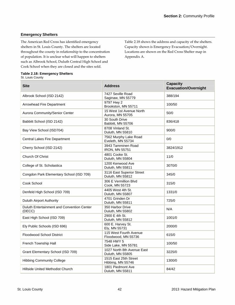
Section 2: Community Profile
St. Louis County 42 2013 Hazard Mitigation Plan
Emergency Shelters
The American Red Cross has identified emergency
shelters in St. Louis County. The shelters are located
throughout the county in relationship to the concentration
of population. It is unclear what will happen to shelters
such as Albrook School, Duluth Central High School and
Cook School when they are closed and the sites sold.
Table 2.18 shows the address and capacity of the shelters.
Capacity shown is Emergency Evacuation/Overnight.
Locations are shown on the Red Cross Shelter map in
Appendix A.
Table 2.18: Emergency Shelters St. Louis County
Site Address Capacity Evacuation/Overnight
Albrook School (ISD 2142) 7427 Seville Road Saginaw, MN 55779
388/194
Arrowhead Fire Department 9797 Hwy 2 Brookston, MN 55711
100/50
Aurora Community/Senior Center 15 West 1st Avenue North Aurora, MN 55705
50/0
Babbitt School (ISD 2142) 30 South Drive Babbitt, MN 55706
836/418
Bay View School (ISD704) 8708 Vinland St. Duluth, MN 55810
900/0
Central Lakes Fire Department 7562 Murphy Lake Road Eveleth, MN 55734
0/0
Cherry School (ISD 2142) 3943 Tamminen Road IRON, MN 55751
3824/1912
Church Of Christ 4801 Cooke St. Duluth, MN 55804
11/0
College of St. Scholastica 1200 Kenwood Ave Duluth, MN 55811
3070/0
Congdon Park Elementary School (ISD 709) 3116 East Superior Street Duluth, MN 55812
345/0
Cook School 306 E Vermillion Blvd Cook, MN 55723
315/0
Denfeld High School (ISD 709) 4405 West 4th St. Duluth, MN 55807
1331/0
Duluth Airport Authority 4701 Grinden Dr Duluth, MN 55811
725/0
Duluth Entertainment and Convention Center (DECC)
350 Harbor Drive Duluth, MN 55802
N/A
East High School (ISD 709) 2900 E 4th St. Duluth, MN 55812
1001/0
Ely Public Schools (ISD 696) 600 E. Harvey St. Ely, MN 55731
2000/0
Floodwood School District 115 West Fourth Avenue Floodwood, MN 55736
615/0
French Township Hall 7548 HWY 5 Side Lake, MN 55781
100/50
Grant Elementary School (ISD 709) 1027 North 8th Avenue East Duluth, MN 55805
3225/0
Hibbing Community College 1515 East 25th Street Hibbing, MN 55746
1300/0
Hillside United Methodist Church 1801 Piedmont Ave Duluth, MN 55811
84/42
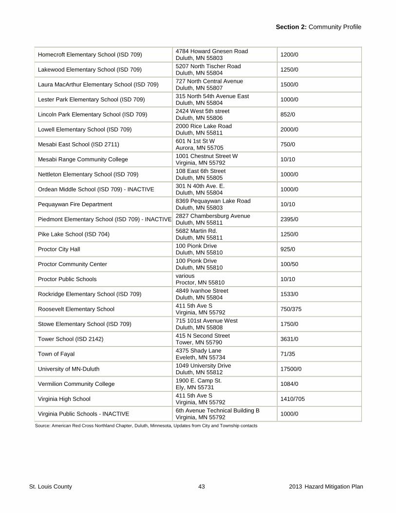
Section 2: Community Profile
St. Louis County 43 2013 Hazard Mitigation Plan
Homecroft Elementary School (ISD 709) 4784 Howard Gnesen Road Duluth, MN 55803
1200/0
Lakewood Elementary School (ISD 709) 5207 North Tischer Road Duluth, MN 55804
1250/0
Laura MacArthur Elementary School (ISD 709) 727 North Central Avenue Duluth, MN 55807
1500/0
Lester Park Elementary School (ISD 709) 315 North 54th Avenue East Duluth, MN 55804
1000/0
Lincoln Park Elementary School (ISD 709) 2424 West 5th street Duluth, MN 55806
852/0
Lowell Elementary School (ISD 709) 2000 Rice Lake Road Duluth, MN 55811
2000/0
Mesabi East School (ISD 2711) 601 N 1st St W Aurora, MN 55705
750/0
Mesabi Range Community College 1001 Chestnut Street W Virginia, MN 55792
10/10
Nettleton Elementary School (ISD 709) 108 East 6th Street Duluth, MN 55805
1000/0
Ordean Middle School (ISD 709) - INACTIVE 301 N 40th Ave. E. Duluth, MN 55804
1000/0
Pequaywan Fire Department 8369 Pequaywan Lake Road Duluth, MN 55803
10/10
Piedmont Elementary School (ISD 709) - INACTIVE 2827 Chambersburg Avenue Duluth, MN 55811
2395/0
Pike Lake School (ISD 704) 5682 Martin Rd. Duluth, MN 55811
1250/0
Proctor City Hall 100 Pionk Drive Duluth, MN 55810
925/0
Proctor Community Center 100 Pionk Drive Duluth, MN 55810
100/50
Proctor Public Schools various Proctor, MN 55810
10/10
Rockridge Elementary School (ISD 709) 4849 Ivanhoe Street Duluth, MN 55804
1533/0
Roosevelt Elementary School 411 5th Ave S Virginia, MN 55792
750/375
Stowe Elementary School (ISD 709) 715 101st Avenue West Duluth, MN 55808
1750/0
Tower School (ISD 2142) 415 N Second Street Tower, MN 55790
3631/0
Town of Fayal 4375 Shady Lane Eveleth, MN 55734
71/35
University of MN-Duluth 1049 University Drive Duluth, MN 55812
17500/0
Vermilion Community College 1900 E. Camp St. Ely, MN 55731
1084/0
Virginia High School 411 5th Ave S Virginia, MN 55792
1410/705
Virginia Public Schools - INACTIVE 6th Avenue Technical Building B Virginia, MN 55792
1000/0
Source: American Red Cross Northland Chapter, Duluth, Minnesota, Updates from City and Township contacts
Section 2: Community Profile
St. Louis County 44 2013 Hazard Mitigation Plan
Childcare and Children Residential Facilities
In St. Louis County, there are 66 large childcare and
children residential facilities that are licensed by the State.
Childcare facilities in private homes are not included in
this number. The capacity of these licensed facilities range
from 6 to 143. They include facilities for infants, toddlers,
preschool, and school age.
The County maintains GIS data for these facilities with
information on facility type and capacity.
Correctional Facilities
There are eight correctional facilities in St. Louis County.
Juvenile facilities include:
Arrowhead Juvenile Center in Duluth
Woodland Hills in Duluth
Kids Peace Mesabi Academy in Buhl
Adult facilities include:
Federal Prison Camp in Hermantown
St. Louis County Jail in Duluth
72 hour holding facilities in Hibbing
72 hour holding facilities in Virginia
Northeast Regional Corrections in the Town of Grand
Lake
The County maintains GIS data on these facilities.
Student Housing
There are four communities in St. Louis County with on
campus, student residential structures such as dormitories
and student-only apartments. The communities where
they are located and the 2010 U.S Census shows:
Duluth - 3,929
Ely - 165
Virginia - 89
Hibbing - 76
Numbers do not include students residing in off campus
housing.
St. Louis County 45 2013 Hazard Mitigation Plan
SECTION THREE: Hazards Facing St. Louis County
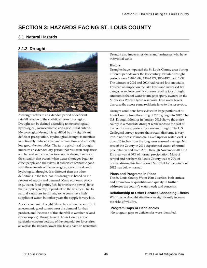
Section 3: Hazards Facing St. Louis County
St. Louis County 46 2013 Hazard Mitigation Plan
SECTION 3: HAZARDS FACING ST. LOUIS COUNTY
3.1 Natural Hazards
3.1.2 Drought
A drought refers to an extended period of deficient
rainfall relative to the statistical mean for a region.
Drought can be defined according to meteorological,
hydrological, socioeconomic, and agricultural criteria.
Meteorological drought is qualified by any significant
deficit of precipitation. Hydrological drought is manifest
in noticeably reduced river and stream flow and critically
low groundwater tables. The term agricultural drought
indicates an extended dry period that results in crop stress
and harvest reduction. Socioeconomic drought refers to
the situation that occurs when water shortages begin to
effect people and their lives. It associates economic good
with the elements of meteorological, agricultural, and
hydrological drought. It is different than the other
definitions in the fact that this drought is based on the
process of supply and demand. Many economic goods
(e.g., water, food grains, fish, hydroelectric power) have
their supplies greatly dependent on the weather. Due to
natural variations in climate, some years have high
supplies of water, but other years the supply is very low.
A socioeconomic drought takes place when the supply of
an economic good cannot meet the demand for that
product, and the cause of this shortfall is weather-related
(water supply). Droughts in St. Louis County are of
particular concern because of the potential for forest fires
as well as the impacts lower lake levels have on recreation.
Drought also impacts residents and businesses who have
individual wells.
History
Droughts have impacted the St. Louis County area during
different periods over the last century. Notable drought
periods were 1987-1989, 1976-1977, 1954-1961, and 1934.
The winters of 2002 and 2003 had record low snowfalls.
This had an impact on the lake levels and increased fire
danger. A socio-economic concern relating to a drought
situation is that of water frontage property owners on the
Minnesota Power Hydro reservoirs. Low water levels
decrease the access some residents have to the reservoirs.
Drought conditions have existed in large portions of St.
Louis County from the spring of 2010 going into 2012. The
U.S. Drought Monitor in January 2012 shows the entire
county in a moderate drought while lands to the east of
the county are experiencing a severe drought. The U.S
Geological survey reports that stream discharge is very
low in northeast Minnesota. Lake Superior water level is
down 13 inches from the long term seasonal average. No
area of the County in 2011 experienced excess of normal
precipitation and from April through November 2011 the
Ely area was at 60% of normal precipitation. Most of
central and northern St. Louis County was at 70% of
normal during this time period. Snowfall for the winter of
2012 was below normal.
Plans and Programs in Place The St. Louis County Water Plan describes both surface
and groundwater quantities and quality. It further
addresses the county’s water needs and concerns.
Relationship to Other Hazards-Cascading Effects
Wildfires: A drought situation can significantly increase
the risks of wildfire.
Program Gaps or Deficiencies
No program gaps or deficiencies were identified.
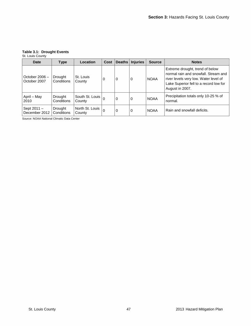
Section 3: Hazards Facing St. Louis County
St. Louis County 47 2013 Hazard Mitigation Plan
Table 3.1: Drought Events St. Louis County
Date Type Location Cost Deaths Injuries Source Notes
October 2006 – October 2007
Drought Conditions
St. Louis County
0 0 0 NOAA
Extreme drought, trend of below
normal rain and snowfall. Stream and
river levels very low. Water level of
Lake Superior fell to a record low for
August in 2007.
April – May 2010
Drought Conditions
South St. Louis County
0 0 0 NOAA Precipitation totals only 10-25 % of
normal.
Sept 2011 – December 2012
Drought Conditions
North St. Louis County
0 0 0 NOAA Rain and snowfall deficits.
Source: NOAA National Climatic Data Center

Section 3: Hazards Facing St. Louis County
St. Louis County 48 2013 Hazard Mitigation Plan
3.1.3 Earthquake
An earthquake is defined as a shaking or trembling of the
crust of the earth by underground volcanic forces or by
breaking and shifting of rock beneath the surface. St. Louis
County is located in an area with a zero percent Peak
Ground Acceleration rating.
Relationship to Other Hazards-Cascading Effects N/A
Plans and Programs in Place None needed.
Program Gaps or Deficiencies
No program gaps or deficiencies have been identified.
Table 3.2: Earthquake Events St. Louis County
Date Type Location Cost Deaths Injuries Source Notes
No major earthquake has been documented for St. Louis County.
Source: St. Louis County
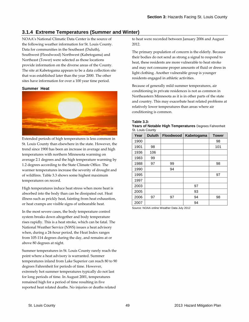
Section 3: Hazards Facing St. Louis County
St. Louis County 49 2013 Hazard Mitigation Plan
3.1.4 Extreme Temperatures (Summer and Winter)
NOAA’s National Climatic Data Center is the source of
the following weather information for St. Louis County.
Data for communities in the Southeast (Duluth),
Southwest (Floodwood) Northwest (Kabetogama) and
Northeast (Tower) were selected as those locations
provide information on the diverse areas of the County.
The site at Kabetogama appears to be a data collection site
that was established later than the year 2000. The other
sites have information for over a 100 year time period.
Summer Heat
Extended periods of high temperatures is less common in
St. Louis County than elsewhere in the state. However, the
trend since 1900 has been an increase in average and high
temperatures with northern Minnesota warming on
average 2.1 degrees and the high temperature warming by
1.2 degrees according to the State Climate Office. The
warmer temperatures increase the severity of drought and
of wildfires. Table 3.3 shows some highest maximum
temperatures on record.
High temperatures induce heat stress when more heat is
absorbed into the body than can be dissipated out. Heat
illness such as prickly heat, fainting from heat exhaustion,
or heat cramps are visible signs of unbearable heat.
In the most severe cases, the body temperature control
system breaks down altogether and body temperature
rises rapidly. This is a heat stroke, which can be fatal. The
National Weather Service (NWS) issues a heat advisory
when, during a 24-hour period, the Heat Index ranges
from 105-114 degrees during the day, and remains at or
above 80 degrees at night.
Summer temperatures in St. Louis County rarely reach the
point where a heat advisory is warranted. Summer
temperatures inland from Lake Superior can reach 80 to 90
degrees Fahrenheit for periods of time. However,
extremely hot summer temperatures typically do not last
for long periods of time. In August 2001, temperatures
remained high for a period of time resulting in five
reported heat related deaths. No injuries or deaths related
to heat were recorded between January 2006 and August
2012.
The primary population of concern is the elderly. Because
their bodies do not send as strong a signal to respond to
heat, these residents are more vulnerable to heat stroke
and may not consume proper amounts of fluid or dress in
light clothing. Another vulnerable group is younger
residents engaged in athletic activities.
Because of generally mild summer temperatures, air
conditioning in private residences is not as common in
Northeastern Minnesota as it is in other parts of the state
and country. This may exacerbate heat related problems at
relatively lower temperatures than areas where air
conditioning is common.
Table 3.3: Years of Notable High Temperatures Degrees Fahrenheit St. Louis County
Year Duluth Floodwood Kabetogama Tower
1900 98
1901 98 101
1936 106
1983 99
1988 97 99 98
1990 94
1995 97
1997
2003 97
2005 93
2006 97 97 94 98
2007 94
Source: NOAA online Weather Data July 2012

Section 3: Hazards Facing St. Louis County
St. Louis County 50 2013 Hazard Mitigation Plan
Table 3.4: Extreme Heat Events St. Louis County
Date Type Location Cost Deaths Injuries Source Notes
No major extreme heat events have been documented for St. Louis County since 2006
Source: NOAA online Weather Data July 2012
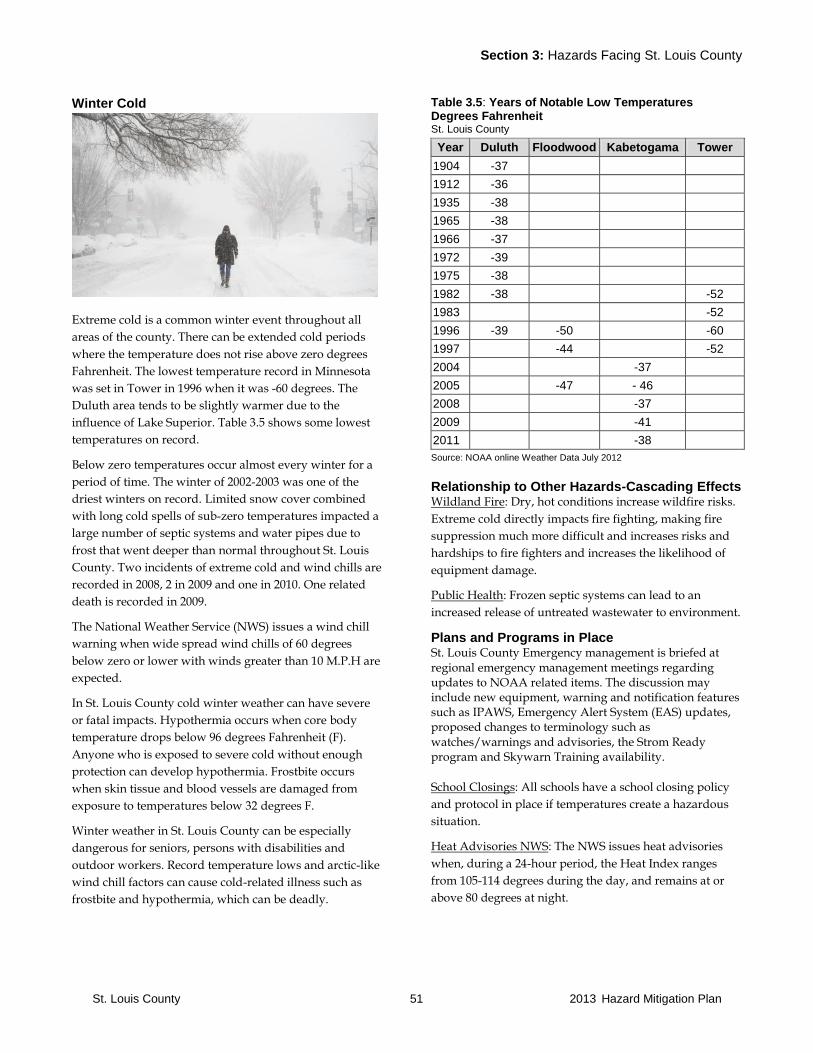
Section 3: Hazards Facing St. Louis County
St. Louis County 51 2013 Hazard Mitigation Plan
Winter Cold
Extreme cold is a common winter event throughout all
areas of the county. There can be extended cold periods
where the temperature does not rise above zero degrees
Fahrenheit. The lowest temperature record in Minnesota
was set in Tower in 1996 when it was -60 degrees. The
Duluth area tends to be slightly warmer due to the
influence of Lake Superior. Table 3.5 shows some lowest
temperatures on record.
Below zero temperatures occur almost every winter for a
period of time. The winter of 2002-2003 was one of the
driest winters on record. Limited snow cover combined
with long cold spells of sub-zero temperatures impacted a
large number of septic systems and water pipes due to
frost that went deeper than normal throughout St. Louis
County. Two incidents of extreme cold and wind chills are
recorded in 2008, 2 in 2009 and one in 2010. One related
death is recorded in 2009.
The National Weather Service (NWS) issues a wind chill
warning when wide spread wind chills of 60 degrees
below zero or lower with winds greater than 10 M.P.H are
expected.
In St. Louis County cold winter weather can have severe
or fatal impacts. Hypothermia occurs when core body
temperature drops below 96 degrees Fahrenheit (F).
Anyone who is exposed to severe cold without enough
protection can develop hypothermia. Frostbite occurs
when skin tissue and blood vessels are damaged from
exposure to temperatures below 32 degrees F.
Winter weather in St. Louis County can be especially
dangerous for seniors, persons with disabilities and
outdoor workers. Record temperature lows and arctic-like
wind chill factors can cause cold-related illness such as
frostbite and hypothermia, which can be deadly.
Table 3.5: Years of Notable Low Temperatures Degrees Fahrenheit St. Louis County
Year Duluth Floodwood Kabetogama Tower
1904 -37
1912 -36
1935 -38
1965 -38
1966 -37
1972 -39
1975 -38
1982 -38 -52
1983 -52
1996 -39 -50 -60
1997 -44 -52
2004 -37
2005 -47 - 46
2008 -37
2009 -41
2011 -38
Source: NOAA online Weather Data July 2012
Relationship to Other Hazards-Cascading Effects Wildland Fire: Dry, hot conditions increase wildfire risks.
Extreme cold directly impacts fire fighting, making fire
suppression much more difficult and increases risks and
hardships to fire fighters and increases the likelihood of
equipment damage.
Public Health: Frozen septic systems can lead to an
increased release of untreated wastewater to environment.
Plans and Programs in Place St. Louis County Emergency management is briefed at regional emergency management meetings regarding updates to NOAA related items. The discussion may include new equipment, warning and notification features such as IPAWS, Emergency Alert System (EAS) updates, proposed changes to terminology such as watches/warnings and advisories, the Strom Ready program and Skywarn Training availability.
School Closings: All schools have a school closing policy
and protocol in place if temperatures create a hazardous
situation.
Heat Advisories NWS: The NWS issues heat advisories
when, during a 24-hour period, the Heat Index ranges
from 105-114 degrees during the day, and remains at or
above 80 degrees at night.

Section 3: Hazards Facing St. Louis County
St. Louis County 52 2013 Hazard Mitigation Plan
Wind Chill Warnings NWS: The NWS issues wind chill
warnings when conditions are such that skin tissue may
freeze within a short period of exposure time.
Program Gaps and Deficiencies High Temperatures: More education would be beneficial
to inform residents, particularly the elderly and those
engaging in strenuous physical activities, of the dangers of
heat stroke.
School Closing Days: School districts determine a set
number of days for school closings each academic year. If
a school runs out of school closing days during a
particularly severe winter, a situation may be created
where children could be at risk if school is not closed.
Table 3.6: Extreme Cold St. Louis County
Date Location Cost Deaths Injuries Source Notes
Feb 2-3, 2007 St. Louis County 0 0 0 NOAA
Extreme cold temperatures with lows of -30.
Winds 10-20 mph with wind chills of -40 t0 -50.
Some closed schools and stress on electric grid.
Jan 19, 2008 North St. Louis County
0 0 0 NOAA Bitter cold in teens and 20s with wind chills as low
as -40.
Jan 29, 2008 North St. Louis County
0 0 0 NOAA Wind chills of -40 to -55.Many schools closed.
Dec 15, 2008 St. Louis County 0 0 0 NOAA Bitter cold temperatures. Wind chills of -40 to -52.
Jan 13-16, 2009 St. Louis County 0 0 0 NOAA
Low temperatures of -30 to -40 with 90-100
consecutive hours below zero. Wind chills of -40
to -50. Most schools and outdoor recreation
closed.
Jan 1, 2010 South St. Louis County
0 0 0 NOAA Dangerously cold wind chills of -40 to -50.
Jan 19, 2012 North St. Louis County
0 0 0 NOAA Wind gusts to 30 mph and wind chills of -40 to -
50.
Source: NOAA National Climatic Data Center

Section 3: Hazards Facing St. Louis County
St. Louis County 53 2013 Hazard Mitigation Plan
3.1.5 Flooding
The National Weather Service makes a distinction
between a flood and a flash flood. The definitions are:
Flood – An overflow of water onto normally dry land. The
inundation of a normally dry area caused by rising water
in an existing waterway, such as a river, stream or
drainage ditch. Ponding of water at or near the point
where the rain fell. Flooding is a longer term event than
flash flooding and may last days or weeks.
Flash flood – A flood caused by heavy or excessive rainfall
in a short period of time, generally less than 6 hours. Flash
floods are usually characterized by raging torrents after
heavy rains that rip through river beds, urban streets or
mountain canyons sweeping everything before them.
They can occur within minutes or a few hours of excessive
rainfall. They can also occur even if no rain has fallen, for
instance, after a levee or dam has failed or after a sudden
release of water by a debris or ice jam.
Snow melts from heavy snows and rain from slow moving
thunderstorms can cause localized flooding which can
impact property and infrastructure such as roads. Often
this flooding is not related to structures being located in
flood plains but a result of storm water management or
limited capacity of the soil to absorb water due to frost in
the ground in early spring resulting in flooded basements.
Some flooding in St. Louis County is usually a result of
small-scale flash floods resulting from slow moving
thunderstorms and during the spring as a result of
snowmelt and ice dams aggravated by increased surface
run-off due to frost in the ground which does not allow
the soil to absorb moisture.
Another type of flooding results from poor infrastructure.
For example, inadequate sewer and storm water
management systems such as ditches and culverts.
Finally, rising lake levels can cause flooding. This type of
flooding is caused by a long-term, above average
precipitation trend in landlocked basins with a poor lake
outlet. This type of flooding occurs over a period of
months or years and is not caused by a single event.
Note: Additional June 2012 Flooding details are in the heavy rain section.
Flooding Concerns for St. Louis County
Lack of snow and continuous freezing can result in
localized flooding in and outside the channels of local
streams. Each spring, some locations in the area of Fond
du Lac in West Duluth along Water Street may flood due
to normal spring flows in the St. Louis River. Records
indicate that the duration of flooding can last several days
due to rising waters of the St. Louis River and Mission
Creek. There can also be spotty flooding each spring
where culverts need to be unplugged and storm sewers
need to be replaced.
The North Shore of Lake Superior and Minnesota Point
have been periodically damaged due to high lake levels
and storm generated waves from Nor’easters. The damage
is mostly loss of shore land from erosion along the entire
shoreline of Lake Superior.
Flood damage in some urban areas is generally from
storm water runoff. Flooding as a result of beaver dams is
a concern in some of the rural areas. Flood damage
includes flooding of residences, businesses, industries,
transportation facilities, utilities, water supply and
sanitary systems, and storm water conduits. Risk of injury
or death is also related to flood events.
Lake flooding sometimes occurs along the shores of Lake
Kabetogama, the Whiteface River, the St. Louis River and
Lake Esquagamah. Most of these floods are directly
related to heavy rainfall over a short period of time.
Further, rain events that occur during spring melt can
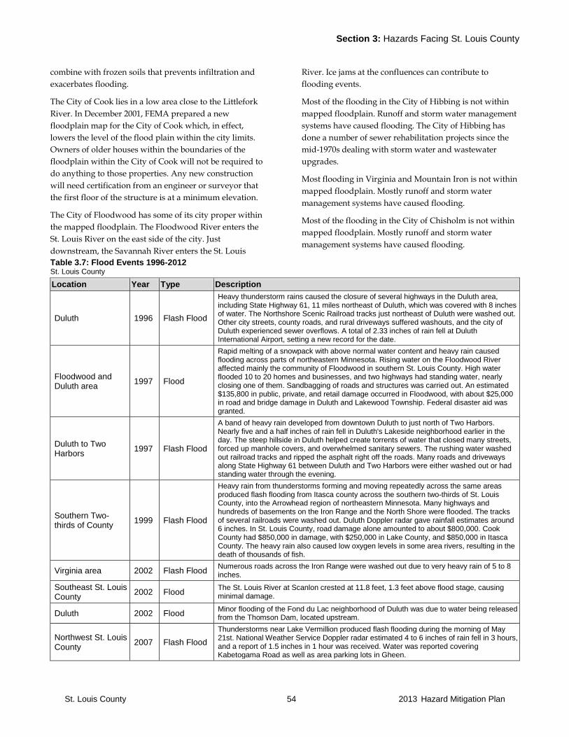
Section 3: Hazards Facing St. Louis County
St. Louis County 54 2013 Hazard Mitigation Plan
combine with frozen soils that prevents infiltration and
exacerbates flooding.
The City of Cook lies in a low area close to the Littlefork
River. In December 2001, FEMA prepared a new
floodplain map for the City of Cook which, in effect,
lowers the level of the flood plain within the city limits.
Owners of older houses within the boundaries of the
floodplain within the City of Cook will not be required to
do anything to those properties. Any new construction
will need certification from an engineer or surveyor that
the first floor of the structure is at a minimum elevation.
The City of Floodwood has some of its city proper within
the mapped floodplain. The Floodwood River enters the
St. Louis River on the east side of the city. Just
downstream, the Savannah River enters the St. Louis
River. Ice jams at the confluences can contribute to
flooding events.
Most of the flooding in the City of Hibbing is not within
mapped floodplain. Runoff and storm water management
systems have caused flooding. The City of Hibbing has
done a number of sewer rehabilitation projects since the
mid-1970s dealing with storm water and wastewater
upgrades.
Most flooding in Virginia and Mountain Iron is not within
mapped floodplain. Mostly runoff and storm water
management systems have caused flooding.
Most of the flooding in the City of Chisholm is not within
mapped floodplain. Mostly runoff and storm water
management systems have caused flooding.
Table 3.7: Flood Events 1996-2012 St. Louis County
Location Year Type Description
Duluth 1996 Flash Flood
Heavy thunderstorm rains caused the closure of several highways in the Duluth area, including State Highway 61, 11 miles northeast of Duluth, which was covered with 8 inches of water. The Northshore Scenic Railroad tracks just northeast of Duluth were washed out. Other city streets, county roads, and rural driveways suffered washouts, and the city of Duluth experienced sewer overflows. A total of 2.33 inches of rain fell at Duluth International Airport, setting a new record for the date.
Floodwood and Duluth area
1997 Flood
Rapid melting of a snowpack with above normal water content and heavy rain caused flooding across parts of northeastern Minnesota. Rising water on the Floodwood River affected mainly the community of Floodwood in southern St. Louis County. High water flooded 10 to 20 homes and businesses, and two highways had standing water, nearly closing one of them. Sandbagging of roads and structures was carried out. An estimated $135,800 in public, private, and retail damage occurred in Floodwood, with about $25,000 in road and bridge damage in Duluth and Lakewood Township. Federal disaster aid was granted.
Duluth to Two Harbors
1997 Flash Flood
A band of heavy rain developed from downtown Duluth to just north of Two Harbors. Nearly five and a half inches of rain fell in Duluth's Lakeside neighborhood earlier in the day. The steep hillside in Duluth helped create torrents of water that closed many streets, forced up manhole covers, and overwhelmed sanitary sewers. The rushing water washed out railroad tracks and ripped the asphalt right off the roads. Many roads and driveways along State Highway 61 between Duluth and Two Harbors were either washed out or had standing water through the evening.
Southern Two-thirds of County
1999 Flash Flood
Heavy rain from thunderstorms forming and moving repeatedly across the same areas produced flash flooding from Itasca county across the southern two-thirds of St. Louis County, into the Arrowhead region of northeastern Minnesota. Many highways and hundreds of basements on the Iron Range and the North Shore were flooded. The tracks of several railroads were washed out. Duluth Doppler radar gave rainfall estimates around 6 inches. In St. Louis County, road damage alone amounted to about $800,000. Cook County had $850,000 in damage, with $250,000 in Lake County, and $850,000 in Itasca County. The heavy rain also caused low oxygen levels in some area rivers, resulting in the death of thousands of fish.
Virginia area 2002 Flash Flood Numerous roads across the Iron Range were washed out due to very heavy rain of 5 to 8 inches.
Southeast St. Louis County
2002 Flood The St. Louis River at Scanlon crested at 11.8 feet, 1.3 feet above flood stage, causing minimal damage.
Duluth 2002 Flood Minor flooding of the Fond du Lac neighborhood of Duluth was due to water being released from the Thomson Dam, located upstream.
Northwest St. Louis County
2007 Flash Flood
Thunderstorms near Lake Vermillion produced flash flooding during the morning of May 21st. National Weather Service Doppler radar estimated 4 to 6 inches of rain fell in 3 hours, and a report of 1.5 inches in 1 hour was received. Water was reported covering Kabetogama Road as well as area parking lots in Gheen.
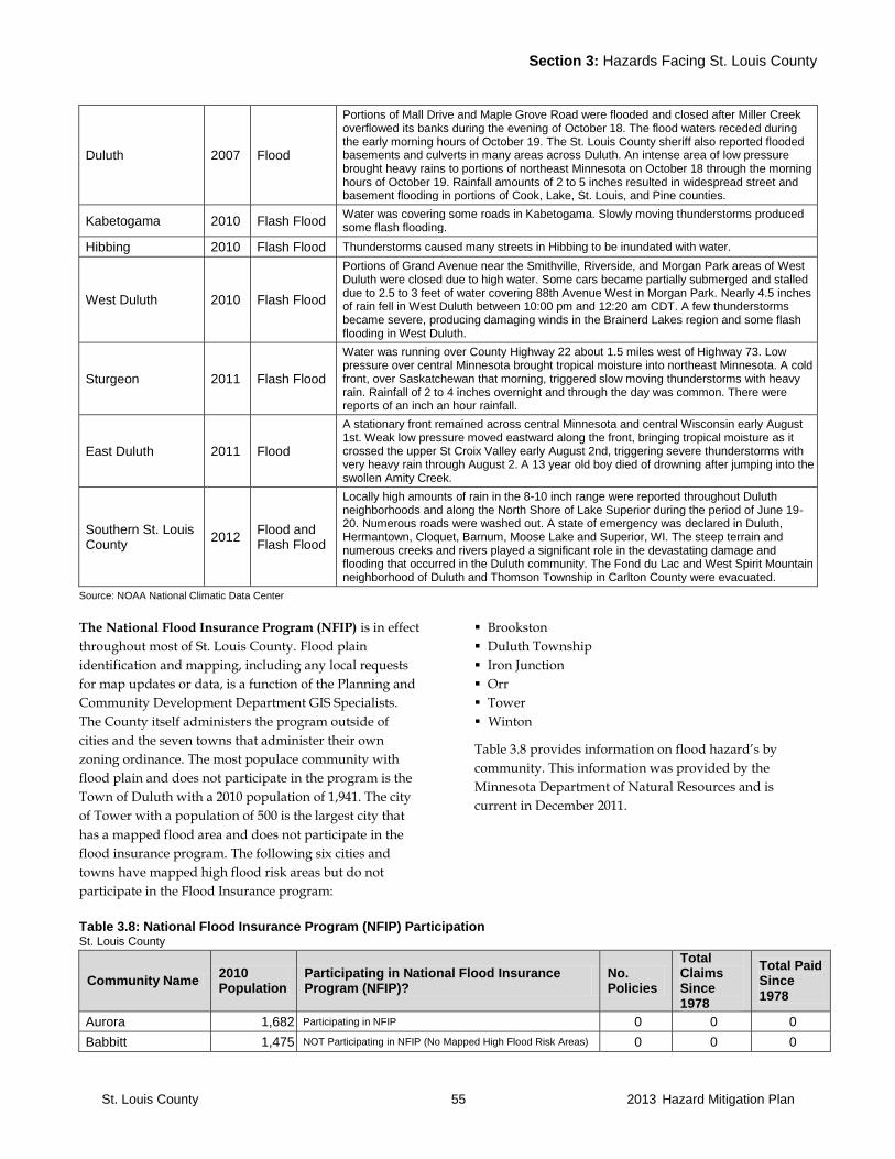
Section 3: Hazards Facing St. Louis County
St. Louis County 55 2013 Hazard Mitigation Plan
Duluth 2007 Flood
Portions of Mall Drive and Maple Grove Road were flooded and closed after Miller Creek overflowed its banks during the evening of October 18. The flood waters receded during the early morning hours of October 19. The St. Louis County sheriff also reported flooded basements and culverts in many areas across Duluth. An intense area of low pressure brought heavy rains to portions of northeast Minnesota on October 18 through the morning hours of October 19. Rainfall amounts of 2 to 5 inches resulted in widespread street and basement flooding in portions of Cook, Lake, St. Louis, and Pine counties.
Kabetogama 2010 Flash Flood Water was covering some roads in Kabetogama. Slowly moving thunderstorms produced some flash flooding.
Hibbing 2010 Flash Flood Thunderstorms caused many streets in Hibbing to be inundated with water.
West Duluth 2010 Flash Flood
Portions of Grand Avenue near the Smithville, Riverside, and Morgan Park areas of West Duluth were closed due to high water. Some cars became partially submerged and stalled due to 2.5 to 3 feet of water covering 88th Avenue West in Morgan Park. Nearly 4.5 inches of rain fell in West Duluth between 10:00 pm and 12:20 am CDT. A few thunderstorms became severe, producing damaging winds in the Brainerd Lakes region and some flash flooding in West Duluth.
Sturgeon 2011 Flash Flood
Water was running over County Highway 22 about 1.5 miles west of Highway 73. Low pressure over central Minnesota brought tropical moisture into northeast Minnesota. A cold front, over Saskatchewan that morning, triggered slow moving thunderstorms with heavy rain. Rainfall of 2 to 4 inches overnight and through the day was common. There were reports of an inch an hour rainfall.
East Duluth 2011 Flood
A stationary front remained across central Minnesota and central Wisconsin early August 1st. Weak low pressure moved eastward along the front, bringing tropical moisture as it crossed the upper St Croix Valley early August 2nd, triggering severe thunderstorms with very heavy rain through August 2. A 13 year old boy died of drowning after jumping into the swollen Amity Creek.
Southern St. Louis County
2012 Flood and Flash Flood
Locally high amounts of rain in the 8-10 inch range were reported throughout Duluth neighborhoods and along the North Shore of Lake Superior during the period of June 19-20. Numerous roads were washed out. A state of emergency was declared in Duluth, Hermantown, Cloquet, Barnum, Moose Lake and Superior, WI. The steep terrain and numerous creeks and rivers played a significant role in the devastating damage and flooding that occurred in the Duluth community. The Fond du Lac and West Spirit Mountain neighborhood of Duluth and Thomson Township in Carlton County were evacuated.
Source: NOAA National Climatic Data Center
The National Flood Insurance Program (NFIP) is in effect
throughout most of St. Louis County. Flood plain
identification and mapping, including any local requests
for map updates or data, is a function of the Planning and
Community Development Department GIS Specialists.
The County itself administers the program outside of
cities and the seven towns that administer their own
zoning ordinance. The most populace community with
flood plain and does not participate in the program is the
Town of Duluth with a 2010 population of 1,941. The city
of Tower with a population of 500 is the largest city that
has a mapped flood area and does not participate in the
flood insurance program. The following six cities and
towns have mapped high flood risk areas but do not
participate in the Flood Insurance program:
Brookston
Duluth Township
Iron Junction
Orr
Tower
Winton
Table 3.8 provides information on flood hazard’s by
community. This information was provided by the
Minnesota Department of Natural Resources and is
current in December 2011.
Table 3.8: National Flood Insurance Program (NFIP) Participation St. Louis County
Community Name 2010 Population
Participating in National Flood Insurance Program (NFIP)?
No. Policies
Total Claims Since 1978
Total Paid Since 1978
Aurora 1,682 Participating in NFIP 0 0 0
Babbitt 1,475 NOT Participating in NFIP (No Mapped High Flood Risk Areas) 0 0 0
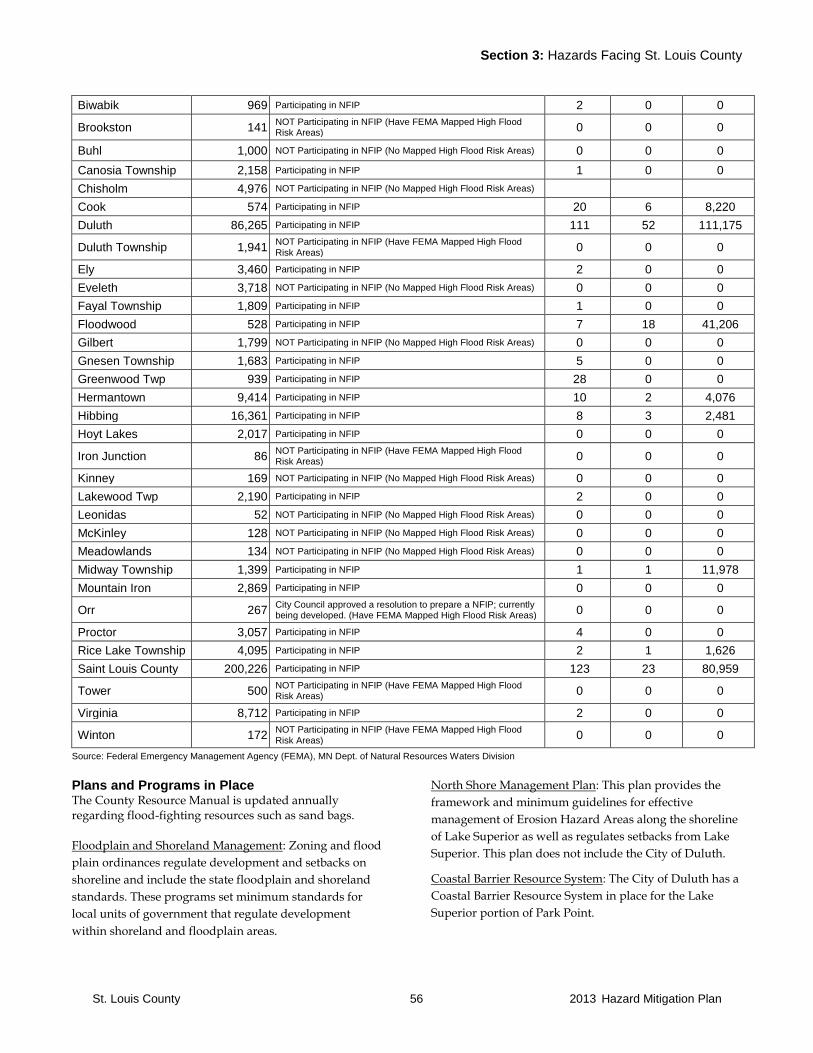
Section 3: Hazards Facing St. Louis County
St. Louis County 56 2013 Hazard Mitigation Plan
Biwabik 969 Participating in NFIP 2 0 0
Brookston 141 NOT Participating in NFIP (Have FEMA Mapped High Flood Risk Areas) 0 0 0
Buhl 1,000 NOT Participating in NFIP (No Mapped High Flood Risk Areas) 0 0 0
Canosia Township 2,158 Participating in NFIP 1 0 0
Chisholm 4,976 NOT Participating in NFIP (No Mapped High Flood Risk Areas)
Cook 574 Participating in NFIP 20 6 8,220
Duluth 86,265 Participating in NFIP 111 52 111,175
Duluth Township 1,941 NOT Participating in NFIP (Have FEMA Mapped High Flood Risk Areas)
0 0 0
Ely 3,460 Participating in NFIP 2 0 0
Eveleth 3,718 NOT Participating in NFIP (No Mapped High Flood Risk Areas) 0 0 0
Fayal Township 1,809 Participating in NFIP 1 0 0
Floodwood 528 Participating in NFIP 7 18 41,206
Gilbert 1,799 NOT Participating in NFIP (No Mapped High Flood Risk Areas) 0 0 0
Gnesen Township 1,683 Participating in NFIP 5 0 0
Greenwood Twp 939 Participating in NFIP 28 0 0
Hermantown 9,414 Participating in NFIP 10 2 4,076
Hibbing 16,361 Participating in NFIP 8 3 2,481
Hoyt Lakes 2,017 Participating in NFIP 0 0 0
Iron Junction 86 NOT Participating in NFIP (Have FEMA Mapped High Flood Risk Areas) 0 0 0
Kinney 169 NOT Participating in NFIP (No Mapped High Flood Risk Areas) 0 0 0
Lakewood Twp 2,190 Participating in NFIP 2 0 0
Leonidas 52 NOT Participating in NFIP (No Mapped High Flood Risk Areas) 0 0 0
McKinley 128 NOT Participating in NFIP (No Mapped High Flood Risk Areas) 0 0 0
Meadowlands 134 NOT Participating in NFIP (No Mapped High Flood Risk Areas) 0 0 0
Midway Township 1,399 Participating in NFIP 1 1 11,978
Mountain Iron 2,869 Participating in NFIP 0 0 0
Orr 267 City Council approved a resolution to prepare a NFIP; currently being developed. (Have FEMA Mapped High Flood Risk Areas) 0 0 0
Proctor 3,057 Participating in NFIP 4 0 0
Rice Lake Township 4,095 Participating in NFIP 2 1 1,626
Saint Louis County 200,226 Participating in NFIP 123 23 80,959
Tower 500 NOT Participating in NFIP (Have FEMA Mapped High Flood Risk Areas) 0 0 0
Virginia 8,712 Participating in NFIP 2 0 0
Winton 172 NOT Participating in NFIP (Have FEMA Mapped High Flood Risk Areas)
0 0 0
Source: Federal Emergency Management Agency (FEMA), MN Dept. of Natural Resources Waters Division
Plans and Programs in Place The County Resource Manual is updated annually regarding flood-fighting resources such as sand bags.
Floodplain and Shoreland Management: Zoning and flood
plain ordinances regulate development and setbacks on
shoreline and include the state floodplain and shoreland
standards. These programs set minimum standards for
local units of government that regulate development
within shoreland and floodplain areas.
North Shore Management Plan: This plan provides the
framework and minimum guidelines for effective
management of Erosion Hazard Areas along the shoreline
of Lake Superior as well as regulates setbacks from Lake
Superior. This plan does not include the City of Duluth.
Coastal Barrier Resource System: The City of Duluth has a
Coastal Barrier Resource System in place for the Lake
Superior portion of Park Point.
Section 3: Hazards Facing St. Louis County
St. Louis County 57 2013 Hazard Mitigation Plan
Road Drainage: Public works staff at the township, county
and city level work on culvert and ditch maintenance to
prevent road flooding.
Duluth National Pollutant Discharge Elimination System
(NPDES) Storm Water Management Permit: Actions
related to this permit will improve storm water
management for Duluth over time. The city focuses its
storm water management within the watersheds of major
streams.
Flood Mitigation Assistance (FMA): This program is
authorized by Section 1366 of the National Flood
Insurance Act of 1968, as amended (NFIA), 42 U.S.C. 410c,
with the goal of reducing or eliminating claims under the
National Flood Insurance Program (NFIP).
Repetitive Flood Claims (RFC): This program is
authorized by Section 1323 of the NFIA, 42 U.S.C. 4030,
with the goal of reducing flood damages to individual
properties for which one or more claim payments for
losses have been made under flood insurance coverage
and that will result in the greatest savings to the National
Flood Insurance Fund in the shortest period of time.
Severe Repetitive Loss (SRL): This program is authorized
by Section 1361A of the NFIA, 42 U.S.C. 4102a, with the
goal of reducing flood damages to residential properties
that have experienced severe repetitive losses under flood
insurance coverage and that will result in the greatest
amount of savings to the NFIF in the shortest period of
time.
Program Gaps or Deficiencies
Surface Water Run-off Management: The State has
developed a Coastal Non-point Pollution Control Program
under the guidance of NOAA and the EPA. This program
found that the state lacks watershed wide implementation
of management measures to control post development
runoff from development on lands outside the shoreland
and floodplain zone. Controlling post development
runoff, both peak flow and volume, throughout the entire
watershed needs to be implemented in order to further
reduce the risk of damage to property from flooding.
Development up-hill from Duluth can have impacts
downstream. There is currently no regional plan in place
that looks in a comprehensive way at how future
development patterns may impact storm water related
flooding.
Repetitive Loss Structures: St. Louis County has 7
repetitive loss properties listed by the MN DNR. These are
located in Duluth (2) Floodwood (2) Proctor (1) and
Saginaw (2). Of these, one is a business and the rest are
residences. Four of the 7 are insured.
Road Infrastructure: Costs related to culvert replacement
to prevent road flooding is a problem for some of the
townships that have a small tax-base.
Erosion Hazard Mapping: There is an ongoing need to
improve the Erosion Area Hazard mapping on Lake
Superior.
Stream Gauging and Flood Mapping: There is an ongoing
need to improve the stream gauging program and
associated flood hazard mapping
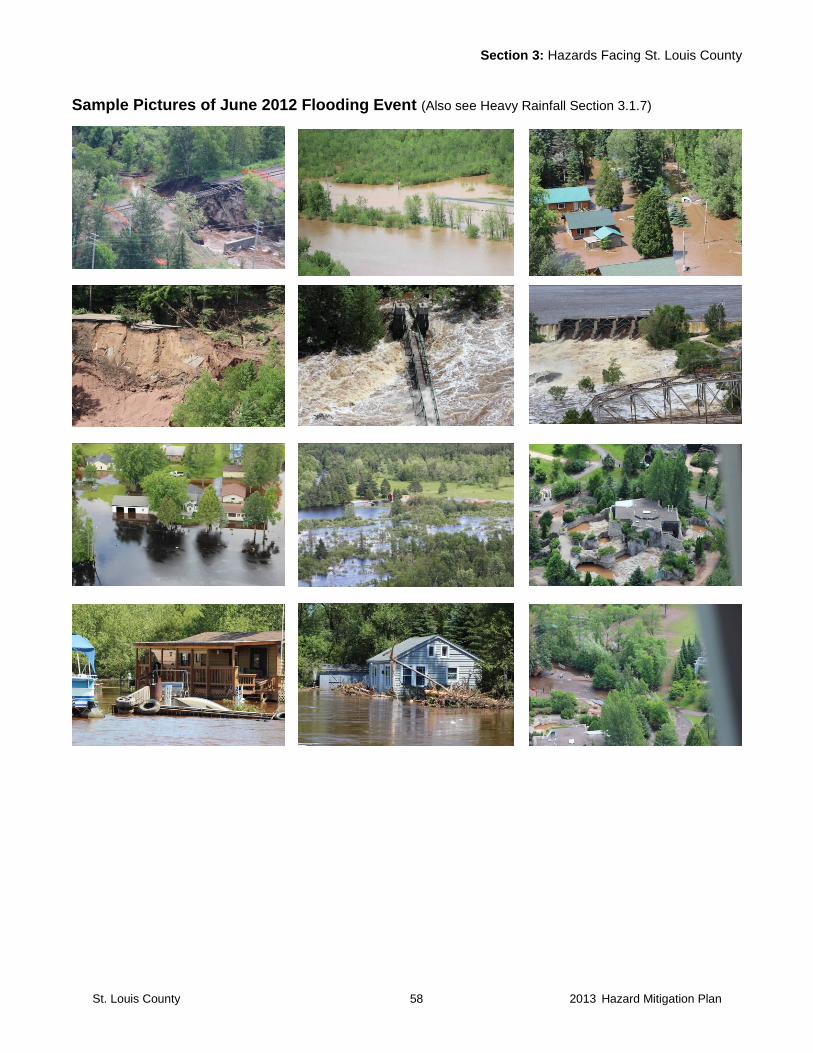
Section 3: Hazards Facing St. Louis County
St. Louis County 58 2013 Hazard Mitigation Plan
Sample Pictures of June 2012 Flooding Event (Also see Heavy Rainfall Section 3.1.7)
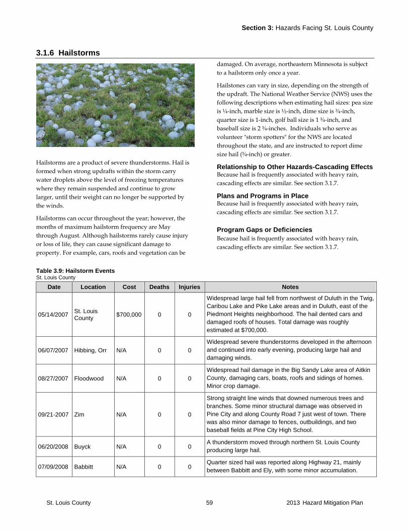
Section 3: Hazards Facing St. Louis County
St. Louis County 59 2013 Hazard Mitigation Plan
3.1.6 Hailstorms
Hailstorms are a product of severe thunderstorms. Hail is
formed when strong updrafts within the storm carry
water droplets above the level of freezing temperatures
where they remain suspended and continue to grow
larger, until their weight can no longer be supported by
the winds.
Hailstorms can occur throughout the year; however, the
months of maximum hailstorm frequency are May
through August. Although hailstorms rarely cause injury
or loss of life, they can cause significant damage to
property. For example, cars, roofs and vegetation can be
damaged. On average, northeastern Minnesota is subject
to a hailstorm only once a year.
Hailstones can vary in size, depending on the strength of
the updraft. The National Weather Service (NWS) uses the
following descriptions when estimating hail sizes: pea size
is ¼-inch, marble size is ½-inch, dime size is ¾-inch,
quarter size is 1-inch, golf ball size is 1 ¾-inch, and
baseball size is 2 ¾-inches. Individuals who serve as
volunteer "storm spotters" for the NWS are located
throughout the state, and are instructed to report dime
size hail (¾-inch) or greater.
Relationship to Other Hazards-Cascading Effects Because hail is frequently associated with heavy rain,
cascading effects are similar. See section 3.1.7.
Plans and Programs in Place Because hail is frequently associated with heavy rain,
cascading effects are similar. See section 3.1.7.
Program Gaps or Deficiencies
Because hail is frequently associated with heavy rain,
cascading effects are similar. See section 3.1.7.
Table 3.9: Hailstorm Events St. Louis County
Date Location Cost Deaths Injuries Notes
05/14/2007 St. Louis County
$700,000 0 0
Widespread large hail fell from northwest of Duluth in the Twig,
Caribou Lake and Pike Lake areas and in Duluth, east of the
Piedmont Heights neighborhood. The hail dented cars and
damaged roofs of houses. Total damage was roughly
estimated at $700,000.
06/07/2007 Hibbing, Orr N/A 0 0
Widespread severe thunderstorms developed in the afternoon
and continued into early evening, producing large hail and
damaging winds.
08/27/2007 Floodwood N/A 0 0
Widespread hail damage in the Big Sandy Lake area of Aitkin
County, damaging cars, boats, roofs and sidings of homes.
Minor crop damage.
09/21-2007 Zim N/A 0 0
Strong straight line winds that downed numerous trees and
branches. Some minor structural damage was observed in
Pine City and along County Road 7 just west of town. There
was also minor damage to fences, outbuildings, and two
baseball fields at Pine City High School.
06/20/2008 Buyck N/A 0 0 A thunderstorm moved through northern St. Louis County
producing large hail.
07/09/2008 Babbitt N/A 0 0 Quarter sized hail was reported along Highway 21, mainly
between Babbitt and Ely, with some minor accumulation.
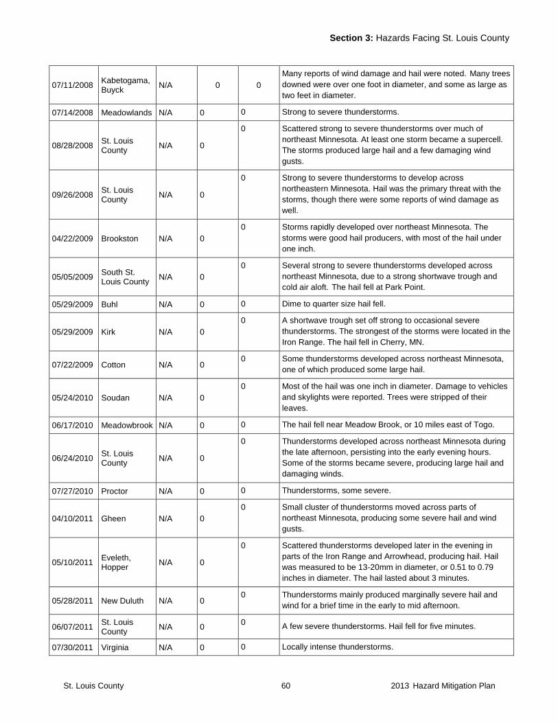
Section 3: Hazards Facing St. Louis County
St. Louis County 60 2013 Hazard Mitigation Plan
07/11/2008 Kabetogama, Buyck
N/A 0 0
Many reports of wind damage and hail were noted. Many trees
downed were over one foot in diameter, and some as large as
two feet in diameter.
07/14/2008 Meadowlands N/A 0 0 Strong to severe thunderstorms.
08/28/2008 St. Louis County
N/A 0
0 Scattered strong to severe thunderstorms over much of
northeast Minnesota. At least one storm became a supercell.
The storms produced large hail and a few damaging wind
gusts.
09/26/2008 St. Louis County
N/A 0
0 Strong to severe thunderstorms to develop across
northeastern Minnesota. Hail was the primary threat with the
storms, though there were some reports of wind damage as
well.
04/22/2009 Brookston N/A 0
0 Storms rapidly developed over northeast Minnesota. The
storms were good hail producers, with most of the hail under
one inch.
05/05/2009 South St. Louis County
N/A 0
0 Several strong to severe thunderstorms developed across
northeast Minnesota, due to a strong shortwave trough and
cold air aloft. The hail fell at Park Point.
05/29/2009 Buhl N/A 0 0 Dime to quarter size hail fell.
05/29/2009 Kirk N/A 0
0 A shortwave trough set off strong to occasional severe
thunderstorms. The strongest of the storms were located in the
Iron Range. The hail fell in Cherry, MN.
07/22/2009 Cotton N/A 0 0 Some thunderstorms developed across northeast Minnesota,
one of which produced some large hail.
05/24/2010 Soudan N/A 0
0 Most of the hail was one inch in diameter. Damage to vehicles
and skylights were reported. Trees were stripped of their
leaves.
06/17/2010 Meadowbrook N/A 0 0 The hail fell near Meadow Brook, or 10 miles east of Togo.
06/24/2010 St. Louis County
N/A 0
0 Thunderstorms developed across northeast Minnesota during
the late afternoon, persisting into the early evening hours.
Some of the storms became severe, producing large hail and
damaging winds.
07/27/2010 Proctor N/A 0 0 Thunderstorms, some severe.
04/10/2011 Gheen N/A 0
0 Small cluster of thunderstorms moved across parts of
northeast Minnesota, producing some severe hail and wind
gusts.
05/10/2011 Eveleth, Hopper
N/A 0
0 Scattered thunderstorms developed later in the evening in
parts of the Iron Range and Arrowhead, producing hail. Hail
was measured to be 13-20mm in diameter, or 0.51 to 0.79
inches in diameter. The hail lasted about 3 minutes.
05/28/2011 New Duluth N/A 0 0 Thunderstorms mainly produced marginally severe hail and
wind for a brief time in the early to mid afternoon.
06/07/2011 St. Louis County
N/A 0 0
A few severe thunderstorms. Hail fell for five minutes.
07/30/2011 Virginia N/A 0 0 Locally intense thunderstorms.
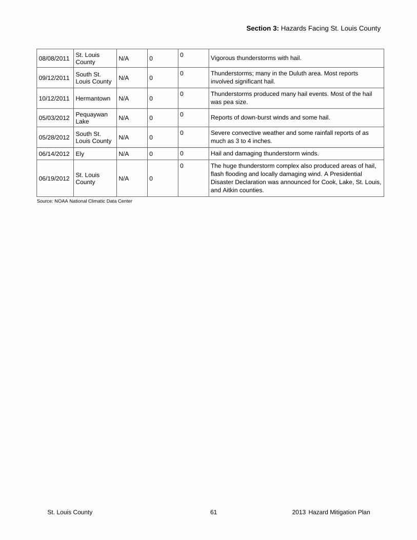
Section 3: Hazards Facing St. Louis County
St. Louis County 61 2013 Hazard Mitigation Plan
08/08/2011 St. Louis County
N/A 0 0
Vigorous thunderstorms with hail.
09/12/2011 South St. Louis County
N/A 0 0 Thunderstorms; many in the Duluth area. Most reports
involved significant hail.
10/12/2011 Hermantown N/A 0 0 Thunderstorms produced many hail events. Most of the hail
was pea size.
05/03/2012 Pequaywan Lake
N/A 0 0
Reports of down-burst winds and some hail.
05/28/2012 South St. Louis County
N/A 0 0 Severe convective weather and some rainfall reports of as
much as 3 to 4 inches.
06/14/2012 Ely N/A 0 0 Hail and damaging thunderstorm winds.
06/19/2012 St. Louis County
N/A 0
0 The huge thunderstorm complex also produced areas of hail,
flash flooding and locally damaging wind. A Presidential
Disaster Declaration was announced for Cook, Lake, St. Louis,
and Aitkin counties.
Source: NOAA National Climatic Data Center
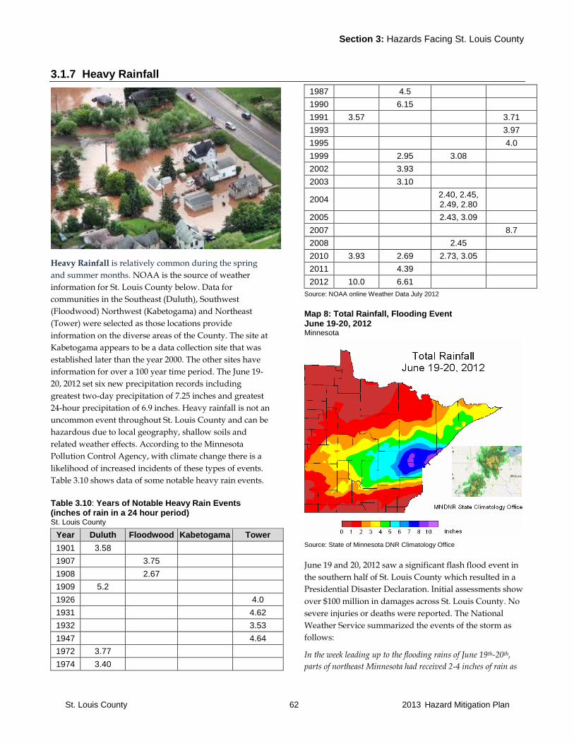
Section 3: Hazards Facing St. Louis County
St. Louis County 62 2013 Hazard Mitigation Plan
3.1.7 Heavy Rainfall
Heavy Rainfall is relatively common during the spring
and summer months. NOAA is the source of weather
information for St. Louis County below. Data for
communities in the Southeast (Duluth), Southwest
(Floodwood) Northwest (Kabetogama) and Northeast
(Tower) were selected as those locations provide
information on the diverse areas of the County. The site at
Kabetogama appears to be a data collection site that was
established later than the year 2000. The other sites have
information for over a 100 year time period. The June 19-
20, 2012 set six new precipitation records including
greatest two-day precipitation of 7.25 inches and greatest
24-hour precipitation of 6.9 inches. Heavy rainfall is not an
uncommon event throughout St. Louis County and can be
hazardous due to local geography, shallow soils and
related weather effects. According to the Minnesota
Pollution Control Agency, with climate change there is a
likelihood of increased incidents of these types of events.
Table 3.10 shows data of some notable heavy rain events.
Table 3.10: Years of Notable Heavy Rain Events (inches of rain in a 24 hour period) St. Louis County
Year Duluth Floodwood Kabetogama Tower
1901 3.58
1907 3.75
1908 2.67
1909 5.2
1926 4.0
1931 4.62
1932 3.53
1947 4.64
1972 3.77
1974 3.40
1987 4.5
1990 6.15
1991 3.57 3.71
1993 3.97
1995 4.0
1999 2.95 3.08
2002 3.93
2003 3.10
2004 2.40, 2.45, 2.49, 2.80
2005 2.43, 3.09
2007 8.7
2008 2.45
2010 3.93 2.69 2.73, 3.05
2011 4.39
2012 10.0 6.61
Source: NOAA online Weather Data July 2012
Map 8: Total Rainfall, Flooding Event June 19-20, 2012 Minnesota
Source: State of Minnesota DNR Climatology Office
June 19 and 20, 2012 saw a significant flash flood event in
the southern half of St. Louis County which resulted in a
Presidential Disaster Declaration. Initial assessments show
over $100 million in damages across St. Louis County. No
severe injuries or deaths were reported. The National
Weather Service summarized the events of the storm as
follows:
In the week leading up to the flooding rains of June 19th-20th,
parts of northeast Minnesota had received 2-4 inches of rain as
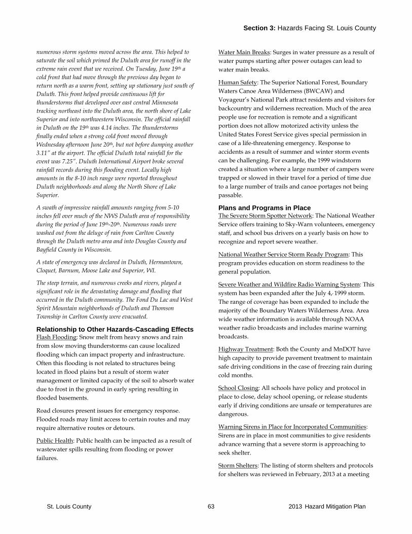
Section 3: Hazards Facing St. Louis County
St. Louis County 63 2013 Hazard Mitigation Plan
numerous storm systems moved across the area. This helped to
saturate the soil which primed the Duluth area for runoff in the
extreme rain event that we received. On Tuesday, June 19th a
cold front that had move through the previous day began to
return north as a warm front, setting up stationary just south of
Duluth. This front helped provide continuous lift for
thunderstorms that developed over east central Minnesota
tracking northeast into the Duluth area, the north shore of Lake
Superior and into northwestern Wisconsin. The official rainfall
in Duluth on the 19th was 4.14 inches. The thunderstorms
finally ended when a strong cold front moved through
Wednesday afternoon June 20th, but not before dumping another
3.11” at the airport. The official Duluth total rainfall for the
event was 7.25”. Duluth International Airport broke several
rainfall records during this flooding event. Locally high
amounts in the 8-10 inch range were reported throughout
Duluth neighborhoods and along the North Shore of Lake
Superior.
A swath of impressive rainfall amounts ranging from 5-10
inches fell over much of the NWS Duluth area of responsibility
during the period of June 19th-20th. Numerous roads were
washed out from the deluge of rain from Carlton County
through the Duluth metro area and into Douglas County and
Bayfield County in Wisconsin.
A state of emergency was declared in Duluth, Hermantown,
Cloquet, Barnum, Moose Lake and Superior, WI.
The steep terrain, and numerous creeks and rivers, played a
significant role in the devastating damage and flooding that
occurred in the Duluth community. The Fond Du Lac and West
Spirit Mountain neighborhoods of Duluth and Thomson
Township in Carlton County were evacuated.
Relationship to Other Hazards-Cascading Effects Flash Flooding: Snow melt from heavy snows and rain
from slow moving thunderstorms can cause localized
flooding which can impact property and infrastructure.
Often this flooding is not related to structures being
located in flood plains but a result of storm water
management or limited capacity of the soil to absorb water
due to frost in the ground in early spring resulting in
flooded basements.
Road closures present issues for emergency response.
Flooded roads may limit access to certain routes and may
require alternative routes or detours.
Public Health: Public health can be impacted as a result of
wastewater spills resulting from flooding or power
failures.
Water Main Breaks: Surges in water pressure as a result of
water pumps starting after power outages can lead to
water main breaks.
Human Safety: The Superior National Forest, Boundary
Waters Canoe Area Wilderness (BWCAW) and
Voyageur’s National Park attract residents and visitors for
backcountry and wilderness recreation. Much of the area
people use for recreation is remote and a significant
portion does not allow motorized activity unless the
United States Forest Service gives special permission in
case of a life-threatening emergency. Response to
accidents as a result of summer and winter storm events
can be challenging. For example, the 1999 windstorm
created a situation where a large number of campers were
trapped or slowed in their travel for a period of time due
to a large number of trails and canoe portages not being
passable.
Plans and Programs in Place The Severe Storm Spotter Network: The National Weather
Service offers training to Sky-Warn volunteers, emergency
staff, and school bus drivers on a yearly basis on how to
recognize and report severe weather.
National Weather Service Storm Ready Program: This
program provides education on storm readiness to the
general population.
Severe Weather and Wildfire Radio Warning System: This
system has been expanded after the July 4,, 1999 storm.
The range of coverage has been expanded to include the
majority of the Boundary Waters Wilderness Area. Area
wide weather information is available through NOAA
weather radio broadcasts and includes marine warning
broadcasts.
Highway Treatment: Both the County and MnDOT have
high capacity to provide pavement treatment to maintain
safe driving conditions in the case of freezing rain during
cold months.
School Closing: All schools have policy and protocol in
place to close, delay school opening, or release students
early if driving conditions are unsafe or temperatures are
dangerous.
Warning Sirens in Place for Incorporated Communities:
Sirens are in place in most communities to give residents
advance warning that a severe storm is approaching to
seek shelter.
Storm Shelters: The listing of storm shelters and protocols
for shelters was reviewed in February, 2013 at a meeting
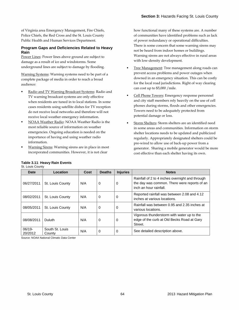
Section 3: Hazards Facing St. Louis County
St. Louis County 64 2013 Hazard Mitigation Plan
of Virginia area Emergency Management, Fire Chiefs,
Police Chiefs, the Red Cross and the St. Louis County
Public Health and Human Services Department.
Program Gaps and Deficiencies Related to Heavy Rain Power Lines: Power lines above ground are subject to
damage as a result of ice and windstorms. Some
underground lines are subject to damage by flooding.
Warning Systems: Warning systems need to be part of a
complete package of media in order to reach a broad
audience:
Radio and TV Warning Broadcast Systems: Radio and
TV warning broadcast systems are only effective
when residents are tuned in to local stations. In some
cases residents using satellite dishes for TV reception
do not receive local networks and therefore will not
receive local weather emergency information.
NOAA Weather Radio: NOAA Weather Radio is the
most reliable source of information on weather
emergencies. Ongoing education is needed on the
importance of having and using weather radio
information.
Warning Sirens: Warning sirens are in place in most
incorporated communities. However, it is not clear
how functional many of these systems are. A number
of communities have identified problems such as lack
of power redundancy or operational difficulties.
There is some concern that some warning sirens may
not be heard from indoor homes or buildings.
Warning sirens are not always effective in rural areas
with low-density development.
Tree Management: Tree management along roads can
prevent access problems and power outages when
downed in an emergency situation. This can be costly
for the local road jurisdictions. Right of way clearing
can cost up to $5,000 /mile.
Cell Phone Towers: Emergency response personnel
and city staff members rely heavily on the use of cell
phones during storms, floods and other emergencies.
Towers need to be adequately protected from
potential damage or loss.
Storm Shelters: Storm shelters are an identified need
in some areas and communities. Information on storm
shelter locations needs to be updated and publicized
regularly. Appropriately designated shelters could be
pre-wired to allow use of back-up power from a
generator. Sharing a mobile generator would be more
cost effective than each shelter having its own.
Table 3.11: Heavy Rain Events St. Louis County
Date Location Cost Deaths Injuries Notes
06/27/2011 St. Louis County N/A 0 0
Rainfall of 2 to 4 inches overnight and through
the day was common. There were reports of an
inch an hour rainfall.
08/02/2011 St. Louis County N/A 0 0 Reported rainfall was between 2.08 and 4.12
inches at various locations.
08/05/2011 St. Louis County N/A 0 0 Rainfall was between 0.95 and 2.35 inches at
various locations.
08/08/2011 Duluth N/A 0 0
Vigorous thunderstorm with water up to the
edge of the curb at Old Becks Road at Gary
Street.
06/19-20/2012
South St. Louis County
N/A 0 0 See detailed description above.
Source: NOAA National Climatic Data Center
Section 3: Hazards Facing St. Louis County
St. Louis County 65 2013 Hazard Mitigation Plan
3.1.8 Infectious Diseases
In the years following World War II, many life threatening
infectious diseases were cured using antibiotics and
further prevented the spreading of infectious disease
through vaccination. However, new diseases continue to
emerge. New strains of influenza require yearly updates
of vaccinations. The recent surfacing of diseases for which
there is no cure or vaccination and bio-terrorism threats
underscore the need for a good public health system to
early detect new diseases in order to prevent a large scale
epidemic. Increased resistance of diseases to various
antibiotics is another area of concern.
Other concerns include diseases impacting livestock such
as hoof and mouth disease that recently resurged in
Europe, and diseases impacting wildlife population such
as chronic wasting disease affecting deer populations.
St. Louis County has an All Hazard Response and
Recovery Plan which is implemented to prevent loss and
damage related to public health concerns. The plan was
updated in 2012.
Relationship to Other Hazards-Cascading Effects
Associated with another disaster: Infectious disease
outbreaks can occur as primary events themselves or they
may be secondary events to another disaster or emergency
such as a terrorist attack or natural disaster.
Civil unrest: If a disease outbreak would occur, deaths,
fear and misinformation could trigger civil unrest,
lawlessness and panic.
Plans and Programs in Place
Emergency Operations Plans: The County EOP outlines
procedures to respond to an outbreak of infectious
disease. This plan outlines procedures for County and
local units of government for contacting appropriate state
and federal agencies and provides guidelines and
strategies for dealing with infectious disease and
command structures with County Health Department and
Emergency Manager for St. Louis County. An appropriate
response can limit the spread of a disease and reduce the
number of people or livestock impacted.
Public Health Preparedness and Bio-terrorism: St. Louis
County has a Public Health Coordinator position
responsible for developing a response plan for natural and
human caused emergencies, including bio-terrorism.
Internal public health improvements include:
Public Health Emergency Response Plan
Mass Clinic Protocol for Immunizations and Distribution
of Antibiotics
Disease Prevention and Control Framework
Communicable Disease Investigations
The Public Health Coordinator collaborates with area
officials and organizations, such as hospitals and
emergency response workers, who would or could be
involved in responding to a terrorist event.
Public Health Preparedness Programs: Disease
surveillance, food, restaurant and lodging inspections,
WIC assessments for young children, and immunization
programs.
Arrowhead Hospitals Mutual Aid: There is a mutual aid
agreement in place between the 16 hospitals in the
Arrowhead Region that allows sharing of
decontamination technology.
Program Gaps or Deficiencies There is an ongoing need for training to practice
responding with the plans and programs in place. Practice
that includes all the parties involved would help ensure
that a response to an event is coordinated in case of a real
occurrence.
Table 3.12: Infectious Disease Events St. Louis County
Date Type Location Cost Deaths Injuries Source Notes
No major disease outbreaks have been documented for St. Louis County.
Source: St. Louis County

Section 3: Hazards Facing St. Louis County
St. Louis County 66 2013 Hazard Mitigation Plan
3.1.9 Lightning
Lightning is caused by the discharge of electricity between
clouds or between clouds and the earth. In a thunderstorm
there is a rapid gathering of particles of moisture into
clouds and forming of large drops of rain. This gathers
with it electric potential until the surface of the cloud (or
the enlarged water particles) is insufficient to carry the
charge, and a discharge takes place, producing a brilliant
flash of light.
The power of the electrical charge and intense heat
associated with lightning can electrocute on contact, split
trees, ignite fires, and cause electrical failures. Most
lightning casualties occur in the summer months, during
the afternoon and early evening. An average of 215
structural and non-structural fires are caused by lightning
each year in Minnesota, with average annual damages
totaling $3,013,171. Lightning causes an average of 35
wildfires per year in Minnesota, with average annual
suppression costs totaling $54,864 and average annual
damages totaling $10,357 based upon statistics maintained
by the MN Department of Natural Resources (MN DNR)
Division of Forestry. Wildfires caused by lightning are a
concern for St. Louis County.
Relationship to Other Hazards-Cascading Effects Lightning strikes may cause wildland fires or structural
fires.
Plans and Programs in Place None known.
Program Gaps or Deficiencies
Cell Phone Towers: Emergency response personnel and
city staff members rely heavily on the use of cell phones
during storms, floods and other emergencies. Towers need
to be adequately protected from potential damage or loss.
Table 3.13: Lightning Events St. Louis County
Date Location Cost Deaths Injuries Notes
09/20/2007 Grand Lake N/A 0 0 A garage in Grand Lake Township was destroyed by
fire after being struck by lightning.
07/27/2010 Nopeming N/A 0 1
A 16 year old boy was struck by lightning along West
Skyline Parkway near Spirit Mountain. The boy was
knocked unconscious by the strike, and after coming
to, was treated for third-degree burns on his right
ankle and second-degree burns down the back of his
legs.
08/09/2012 Duluth NA 1 N/A Lightning hit a sail boat that was beached on Park
Point killing one boy and injuring many others.
09/19/12 Duluth N/A 0 0 Lightning strike at St. Louis County Pike Lake
Campus. Phones and computers knocked out.
Source: NOAA National Climatic Data Center, St. Louis County, City and Township contacts updates

Section 3: Hazards Facing St. Louis County
St. Louis County 67 2013 Hazard Mitigation Plan
3.1.10 Solar Storm
A solar storm is defined as solar flares and other related
eruptions from the sun that blast energy and energy-
charged material through interplanetary space at more
than 600,000 mph. As this energy impacts the earth’s
protective upper atmosphere, magnetic storms are
produced that affect our climate and occasionally result in
temporary damages to some or our most critical
technological systems.
Solar storms can impact the power grid, communications
systems, satellites and navigation systems that depend on
accurate satellite information.
Relationship to Other Hazards-Cascading Effects None known.
Plans and Programs in Place St. Louis County has no specific plans and programs in
place to respond to solar storms. The State Hazard
Mitigation Plan identifies no mitigation recommendations
other than to promote awareness and understanding of
the impacts a solar storm can have on technological
systems.
Program Gaps or Deficiencies
None known.
Table 3.14: Solar Storms St. Louis County
Date Type Location Cost Deaths Injuries Source Notes
No solar storms have been documented for St. Louis County.
Source: NOAA National Climatic Data Center

Section 3: Hazards Facing St. Louis County
St. Louis County 68 2013 Hazard Mitigation Plan
3.1.11 Thunderstorms
Thunderstorms are the most common summer storm in St.
Louis County, occurring primarily during the months of
May through August. The most severe storms are most
likely to occur in June and July. Thunderstorms are
usually localized events, produced by cumulonimbus
clouds, always accompanied by lightning, and often
having strong wind gusts, heavy rain and sometimes hail
and tornadoes. Straight-line winds and heavy rain
associated with thunderstorms are one of the greatest
concerns for St. Louis County. They can cause downed
power lines, damage trees and damage buildings.
Relationship to Other Hazards-Cascading Effects
Because thunderstorms are frequently associated with
heavy rain and wind, cascading effects are similar. See
sections 3.1.7. and 3.1.14.
Plans and Programs in Place
Thunderstorms are frequently associated with heavy rain
and wind. See sections 3.1.7 and 3.1.14.
Program Gaps or Deficiencies
Thunderstorms are frequently associated with heavy rain
and wind, cascading effects are similar. See sections 3.1.7.
and 3.1.14.
Table 3.15: Thunderstorm Events St. Louis County
Date Location Cost Deaths Injuries Notes
06/07/2007 St. Louis County N/A 0 0
Severe thunderstorms developed in the afternoon
and continued into early evening, producing large
hail and damaging winds. A gust front ahead of a
line of storms produced up to 70 mph winds from
Itasca County through southern St. Louis County. Numerous trees were blown down by the strong
thunderstorm winds.
09/20/2007 Side Lake N/A 0 0
Severe thunderstorms with damaging winds and
large hail. The St. Louis County Sheriff's Office
reported that winds up to 60 mph caused damage
in French Township around Side Lake, with
downed trees and power lines.
06/12/2008 Brookston N/A 0 0
Thunderstorms produced strong winds and some
hail. Twenty trees were blown down. A shed was
blown over and a greenhouse flattened by the
strong winds.
07/14/2008 St. Louis County N/A 0 0 Numerous trees were blown down.
09/23/2008 West Duluth N/A 0 0 A large tree up to two feet in diameter was blown
down across 59th Avenue West in Duluth.
09/26/2008 Silica N/A 0 0
Hail was the primary threat with the storms,
though there were some reports of wind damage
as well. Several dead tree limbs were blown
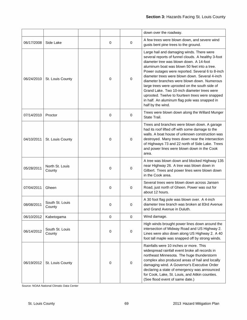
Section 3: Hazards Facing St. Louis County
St. Louis County 69 2013 Hazard Mitigation Plan
down over the roadway.
06/17/2008 Side Lake 0 0 A few trees were blown down, and severe wind
gusts bent pine trees to the ground.
06/24/2010 St. Louis County 0 0
Large hail and damaging winds. There were
several reports of funnel clouds. A healthy 3-foot
diameter tree was blown down. A 14-foot
aluminum boat was blown 50 feet into a tree.
Power outages were reported. Several 6 to 8-inch
diameter trees were blown down. Several 4-inch
diameter branches were blown down. Numerous
large trees were uprooted on the south side of
Grand Lake. Two 10-inch diameter trees were
uprooted. Twelve to fourteen trees were snapped
in half. An aluminum flag pole was snapped in
half by the wind.
07/14/2010 Proctor 0 0 Trees were blown down along the Willard Munger
State Trail.
04/10/2011 St. Louis County 0 0
Trees and branches were blown down. A garage
had its roof lifted off with some damage to the
walls. A boat house of unknown construction was
destroyed. Many trees down near the intersection
of Highways 73 and 22 north of Side Lake. Trees
and power lines were blown down in the Cook
area.
05/28/2011 North St. Louis County
0 0
A tree was blown down and blocked Highway 135
near Highway 26. A tree was blown down in
Gilbert. Trees and power lines were blown down
in the Cook area.
07/04/2011 Gheen 0 0
Several trees were blown down across Jansen
Road, just north of Gheen. Power was out for
about 12 hours.
08/08/2011 South St. Louis County
0 0
A 30 foot flag pole was blown over. A 4-inch
diameter tree branch was broken at 83rd Avenue
and Grand Avenue in Duluth.
06/10/2012 Kabetogama 0 0 Wind damage.
06/14/2012 South St. Louis County
0 0
High winds brought power lines down around the
intersection of Midway Road and US Highway 2.
Lines were also down along US Highway 2. A 40
foot tall maple was snapped off by strong winds.
06/19/2012 St. Louis County 0 0
Rainfalls were 10 inches or more. This
widespread rainfall event broke all records in
northeast Minnesota. The huge thunderstorm
complex also produced areas of hail and locally
damaging wind. A Governor's Executive Order
declaring a state of emergency was announced
for Cook, Lake, St. Louis, and Aitkin counties.
(See flood event of same date.)
Source: NOAA National Climatic Data Center
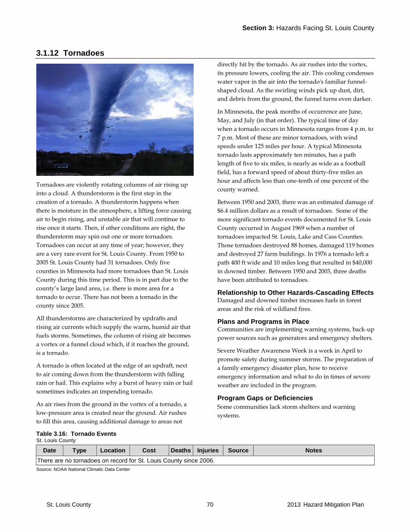
Section 3: Hazards Facing St. Louis County
St. Louis County 70 2013 Hazard Mitigation Plan
3.1.12 Tornadoes
Tornadoes are violently rotating columns of air rising up
into a cloud. A thunderstorm is the first step in the
creation of a tornado. A thunderstorm happens when
there is moisture in the atmosphere, a lifting force causing
air to begin rising, and unstable air that will continue to
rise once it starts. Then, if other conditions are right, the
thunderstorm may spin out one or more tornadoes.
Tornadoes can occur at any time of year; however, they
are a very rare event for St. Louis County. From 1950 to
2005 St. Louis County had 31 tornadoes. Only five
counties in Minnesota had more tornadoes than St. Louis
County during this time period. This is in part due to the
county’s large land area, i.e. there is more area for a
tornado to occur. There has not been a tornado in the
county since 2005.
All thunderstorms are characterized by updrafts and
rising air currents which supply the warm, humid air that
fuels storms. Sometimes, the column of rising air becomes
a vortex or a funnel cloud which, if it reaches the ground,
is a tornado.
A tornado is often located at the edge of an updraft, next
to air coming down from the thunderstorm with falling
rain or hail. This explains why a burst of heavy rain or hail
sometimes indicates an impending tornado.
As air rises from the ground in the vortex of a tornado, a
low-pressure area is created near the ground. Air rushes
to fill this area, causing additional damage to areas not
directly hit by the tornado. As air rushes into the vortex,
its pressure lowers, cooling the air. This cooling condenses
water vapor in the air into the tornado's familiar funnel-
shaped cloud. As the swirling winds pick up dust, dirt,
and debris from the ground, the funnel turns even darker.
In Minnesota, the peak months of occurrence are June,
May, and July (in that order). The typical time of day
when a tornado occurs in Minnesota ranges from 4 p.m. to
7 p.m. Most of these are minor tornadoes, with wind
speeds under 125 miles per hour. A typical Minnesota
tornado lasts approximately ten minutes, has a path
length of five to six miles, is nearly as wide as a football
field, has a forward speed of about thirty-five miles an
hour and affects less than one-tenth of one percent of the
county warned.
Between 1950 and 2003, there was an estimated damage of
$6.4 million dollars as a result of tornadoes. Some of the
more significant tornado events documented for St. Louis
County occurred in August 1969 when a number of
tornadoes impacted St. Louis, Lake and Cass Counties.
Those tornadoes destroyed 88 homes, damaged 119 homes
and destroyed 27 farm buildings. In 1976 a tornado left a
path 400 ft wide and 10 miles long that resulted in $40,000
in downed timber. Between 1950 and 2003, three deaths
have been attributed to tornadoes.
Relationship to Other Hazards-Cascading Effects Damaged and downed timber increases fuels in forest
areas and the risk of wildland fires.
Plans and Programs in Place Communities are implementing warning systems, back-up
power sources such as generators and emergency shelters.
Severe Weather Awareness Week is a week in April to
promote safety during summer storms. The preparation of
a family emergency disaster plan, how to receive
emergency information and what to do in times of severe
weather are included in the program.
Program Gaps or Deficiencies
Some communities lack storm shelters and warning
systems.
Table 3.16: Tornado Events St. Louis County
Date Type Location Cost Deaths Injuries Source Notes
There are no tornadoes on record for St. Louis County since 2006.
Source: NOAA National Climatic Data Center
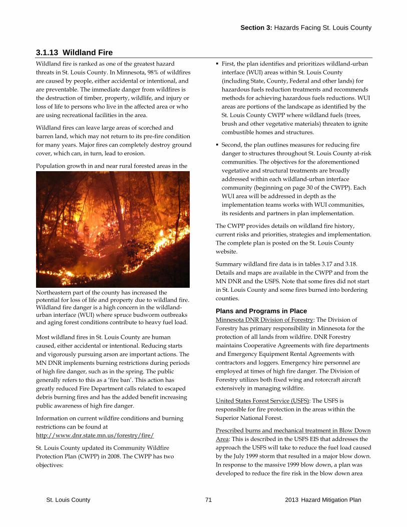
Section 3: Hazards Facing St. Louis County
St. Louis County 71 2013 Hazard Mitigation Plan
3.1.13 Wildland Fire
Wildland fire is ranked as one of the greatest hazard
threats in St. Louis County. In Minnesota, 98% of wildfires
are caused by people, either accidental or intentional, and
are preventable. The immediate danger from wildfires is
the destruction of timber, property, wildlife, and injury or
loss of life to persons who live in the affected area or who
are using recreational facilities in the area.
Wildland fires can leave large areas of scorched and
barren land, which may not return to its pre-fire condition
for many years. Major fires can completely destroy ground
cover, which can, in turn, lead to erosion.
Population growth in and near rural forested areas in the
Northeastern part of the county has increased the potential for loss of life and property due to wildland fire. Wildland fire danger is a high concern in the wildland-urban interface (WUI) where spruce budworm outbreaks and aging forest conditions contribute to heavy fuel load. Most wildland fires in St. Louis County are human
caused, either accidental or intentional. Reducing starts
and vigorously pursuing arson are important actions. The
MN DNR implements burning restrictions during periods
of high fire danger, such as in the spring. The public
generally refers to this as a ‘fire ban’. This action has
greatly reduced Fire Department calls related to escaped
debris burning fires and has the added benefit increasing
public awareness of high fire danger.
Information on current wildfire conditions and burning
restrictions can be found at
http://www.dnr.state.mn.us/forestry/fire/
St. Louis County updated its Community Wildfire
Protection Plan (CWPP) in 2008. The CWPP has two
objectives:
First, the plan identifies and prioritizes wildland-urban
interface (WUI) areas within St. Louis County
(including State, County, Federal and other lands) for
hazardous fuels reduction treatments and recommends
methods for achieving hazardous fuels reductions. WUI
areas are portions of the landscape as identified by the
St. Louis County CWPP where wildland fuels (trees,
brush and other vegetative materials) threaten to ignite
combustible homes and structures.
Second, the plan outlines measures for reducing fire
danger to structures throughout St. Louis County at-risk
communities. The objectives for the aforementioned
vegetative and structural treatments are broadly
addressed within each wildland-urban interface
community (beginning on page 30 of the CWPP). Each
WUI area will be addressed in depth as the
implementation teams works with WUI communities,
its residents and partners in plan implementation.
The CWPP provides details on wildland fire history,
current risks and priorities, strategies and implementation.
The complete plan is posted on the St. Louis County
website.
Summary wildland fire data is in tables 3.17 and 3.18.
Details and maps are available in the CWPP and from the
MN DNR and the USFS. Note that some fires did not start
in St. Louis County and some fires burned into bordering
counties.
Plans and Programs in Place
Minnesota DNR Division of Forestry: The Division of
Forestry has primary responsibility in Minnesota for the
protection of all lands from wildfire. DNR Forestry
maintains Cooperative Agreements with fire departments
and Emergency Equipment Rental Agreements with
contractors and loggers. Emergency hire personnel are
employed at times of high fire danger. The Division of
Forestry utilizes both fixed wing and rotorcraft aircraft
extensively in managing wildfire.
United States Forest Service (USFS): The USFS is
responsible for fire protection in the areas within the
Superior National Forest.
Prescribed burns and mechanical treatment in Blow Down
Area: This is described in the USFS EIS that addresses the
approach the USFS will take to reduce the fuel load caused
by the July 1999 storm that resulted in a major blow down.
In response to the massive 1999 blow down, a plan was
developed to reduce the fire risk in the blow down area
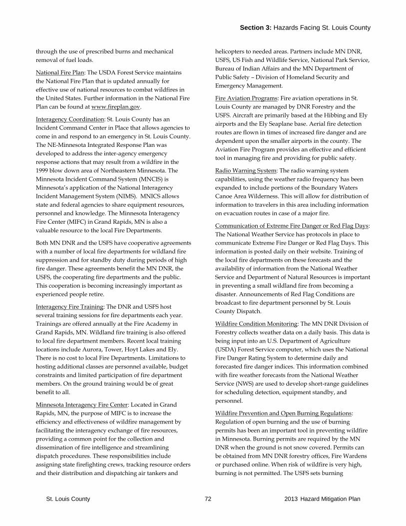
Section 3: Hazards Facing St. Louis County
St. Louis County 72 2013 Hazard Mitigation Plan
through the use of prescribed burns and mechanical
removal of fuel loads.
National Fire Plan: The USDA Forest Service maintains
the National Fire Plan that is updated annually for
effective use of national resources to combat wildfires in
the United States. Further information in the National Fire
Plan can be found at www.fireplan.gov.
Interagency Coordination: St. Louis County has an
Incident Command Center in Place that allows agencies to
come in and respond to an emergency in St. Louis County.
The NE-Minnesota Integrated Response Plan was
developed to address the inter-agency emergency
response actions that may result from a wildfire in the
1999 blow down area of Northeastern Minnesota. The
Minnesota Incident Command System (MNCIS) is
Minnesota’s application of the National Interagency
Incident Management System (NIMS). MNICS allows
state and federal agencies to share equipment resources,
personnel and knowledge. The Minnesota Interagency
Fire Center (MIFC) in Grand Rapids, MN is also a
valuable resource to the local Fire Departments.
Both MN DNR and the USFS have cooperative agreements
with a number of local fire departments for wildland fire
suppression and for standby duty during periods of high
fire danger. These agreements benefit the MN DNR, the
USFS, the cooperating fire departments and the public.
This cooperation is becoming increasingly important as
experienced people retire.
Interagency Fire Training: The DNR and USFS host
several training sessions for fire departments each year.
Trainings are offered annually at the Fire Academy in
Grand Rapids, MN. Wildland fire training is also offered
to local fire department members. Recent local training
locations include Aurora, Tower, Hoyt Lakes and Ely.
There is no cost to local Fire Departments. Limitations to
hosting additional classes are personnel available, budget
constraints and limited participation of fire department
members. On the ground training would be of great
benefit to all.
Minnesota Interagency Fire Center: Located in Grand
Rapids, MN, the purpose of MIFC is to increase the
efficiency and effectiveness of wildfire management by
facilitating the interagency exchange of fire resources,
providing a common point for the collection and
dissemination of fire intelligence and streamlining
dispatch procedures. These responsibilities include
assigning state firefighting crews, tracking resource orders
and their distribution and dispatching air tankers and
helicopters to needed areas. Partners include MN DNR,
USFS, US Fish and Wildlife Service, National Park Service,
Bureau of Indian Affairs and the MN Department of
Public Safety – Division of Homeland Security and
Emergency Management.
Fire Aviation Programs: Fire aviation operations in St.
Louis County are managed by DNR Forestry and the
USFS. Aircraft are primarily based at the Hibbing and Ely
airports and the Ely Seaplane base. Aerial fire detection
routes are flown in times of increased fire danger and are
dependent upon the smaller airports in the county. The
Aviation Fire Program provides an effective and efficient
tool in managing fire and providing for public safety.
Radio Warning System: The radio warning system
capabilities, using the weather radio frequency has been
expanded to include portions of the Boundary Waters
Canoe Area Wilderness. This will allow for distribution of
information to travelers in this area including information
on evacuation routes in case of a major fire.
Communication of Extreme Fire Danger or Red Flag Days:
The National Weather Service has protocols in place to
communicate Extreme Fire Danger or Red Flag Days. This
information is posted daily on their website. Training of
the local fire departments on these forecasts and the
availability of information from the National Weather
Service and Department of Natural Resources is important
in preventing a small wildland fire from becoming a
disaster. Announcements of Red Flag Conditions are
broadcast to fire department personnel by St. Louis
County Dispatch.
Wildfire Condition Monitoring: The MN DNR Division of
Forestry collects weather data on a daily basis. This data is
being input into an U.S. Department of Agriculture
(USDA) Forest Service computer, which uses the National
Fire Danger Rating System to determine daily and
forecasted fire danger indices. This information combined
with fire weather forecasts from the National Weather
Service (NWS) are used to develop short-range guidelines
for scheduling detection, equipment standby, and
personnel.
Wildfire Prevention and Open Burning Regulations:
Regulation of open burning and the use of burning
permits has been an important tool in preventing wildfire
in Minnesota. Burning permits are required by the MN
DNR when the ground is not snow covered. Permits can
be obtained from MN DNR forestry offices, Fire Wardens
or purchased online. When risk of wildfire is very high,
burning is not permitted. The USFS sets burning
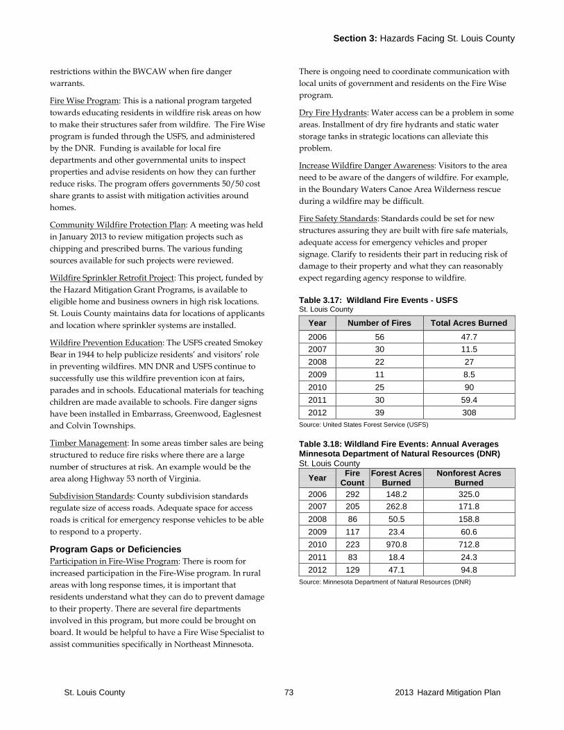
Section 3: Hazards Facing St. Louis County
St. Louis County 73 2013 Hazard Mitigation Plan
restrictions within the BWCAW when fire danger
warrants.
Fire Wise Program: This is a national program targeted
towards educating residents in wildfire risk areas on how
to make their structures safer from wildfire. The Fire Wise
program is funded through the USFS, and administered
by the DNR. Funding is available for local fire
departments and other governmental units to inspect
properties and advise residents on how they can further
reduce risks. The program offers governments 50/50 cost
share grants to assist with mitigation activities around
homes.
Community Wildfire Protection Plan: A meeting was held
in January 2013 to review mitigation projects such as
chipping and prescribed burns. The various funding
sources available for such projects were reviewed.
Wildfire Sprinkler Retrofit Project: This project, funded by
the Hazard Mitigation Grant Programs, is available to
eligible home and business owners in high risk locations.
St. Louis County maintains data for locations of applicants
and location where sprinkler systems are installed.
Wildfire Prevention Education: The USFS created Smokey
Bear in 1944 to help publicize residents’ and visitors’ role
in preventing wildfires. MN DNR and USFS continue to
successfully use this wildfire prevention icon at fairs,
parades and in schools. Educational materials for teaching
children are made available to schools. Fire danger signs
have been installed in Embarrass, Greenwood, Eaglesnest
and Colvin Townships.
Timber Management: In some areas timber sales are being
structured to reduce fire risks where there are a large
number of structures at risk. An example would be the
area along Highway 53 north of Virginia.
Subdivision Standards: County subdivision standards
regulate size of access roads. Adequate space for access
roads is critical for emergency response vehicles to be able
to respond to a property.
Program Gaps or Deficiencies
Participation in Fire-Wise Program: There is room for
increased participation in the Fire-Wise program. In rural
areas with long response times, it is important that
residents understand what they can do to prevent damage
to their property. There are several fire departments
involved in this program, but more could be brought on
board. It would be helpful to have a Fire Wise Specialist to
assist communities specifically in Northeast Minnesota.
There is ongoing need to coordinate communication with
local units of government and residents on the Fire Wise
program.
Dry Fire Hydrants: Water access can be a problem in some
areas. Installment of dry fire hydrants and static water
storage tanks in strategic locations can alleviate this
problem.
Increase Wildfire Danger Awareness: Visitors to the area
need to be aware of the dangers of wildfire. For example,
in the Boundary Waters Canoe Area Wilderness rescue
during a wildfire may be difficult.
Fire Safety Standards: Standards could be set for new
structures assuring they are built with fire safe materials,
adequate access for emergency vehicles and proper
signage. Clarify to residents their part in reducing risk of
damage to their property and what they can reasonably
expect regarding agency response to wildfire.
Table 3.17: Wildland Fire Events - USFS St. Louis County
Year Number of Fires Total Acres Burned
2006 56 47.7
2007 30 11.5
2008 22 27
2009 11 8.5
2010 25 90
2011 30 59.4
2012 39 308
Source: United States Forest Service (USFS)
Table 3.18: Wildland Fire Events: Annual Averages Minnesota Department of Natural Resources (DNR)
St. Louis County
Year Fire
Count Forest Acres
Burned Nonforest Acres
Burned
2006 292 148.2 325.0
2007 205 262.8 171.8
2008 86 50.5 158.8
2009 117 23.4 60.6
2010 223 970.8 712.8
2011 83 18.4 24.3
2012 129 47.1 94.8
Source: Minnesota Department of Natural Resources (DNR)
Section 3: Hazards Facing St. Louis County
St. Louis County 74 2013 Hazard Mitigation Plan
3.1.14 Windstorms
Wind storms can and do occur in all months of the year,
however, the most severe windstorms usually occur
during severe thunderstorms during the warm months.
The most common type of windstorms to affect St. Louis
County are straight-line winds and downbursts associated
with strong thunderstorms.
A downburst is a severe, localized downdraft from a
thunderstorm or a rain shower. This outflow of cool or
colder air can create damaging winds at or near the
surface. Winds up to 130 M.P.H. have been reported in the
strongest thunderstorms. Downburst winds can cause as
much damage as a small tornado and are frequently
confused with tornadoes because of the extensive damage
they cause. As these downburst winds spread out, they
are often referred to as straight-line winds. They can cause
major structural and tree damage over a relatively large
area. They can also create a hazard for small watercraft on
Lake Superior.
Winds of greater than 60 M.P.H. are associated with
intense winter, spring, and fall low-pressure systems.
These can cause damage to buildings and, in some cases,
overturn high profile vehicles. This type of windstorm can
impact residents living on the shore of Lake Superior and
watercraft on Lake Superior and damage shoreland
structures such as docks and marinas.
Most of the Arrowhead Region of Minnesota, including St.
Louis County, is located in Wind Zone II. Wind Zone I is
designated as a moderate wind speed area while Wind
Zone II is a high wind speed area. Buildings in Wind Zone
II should be constructed to withstand wind speeds of up
to 160 M.P.H.
Relationship to Other Hazards-Cascading Effects
Timber blowdown related to windstorms may increase
fuels and risk of wildland fires.
Wind storms can cause downed trees on power lines
leading to fires and increasing fire department calls.
Plans and Programs in Place
None known.
Program Gaps or Deficiencies
None known.
Table 3.19: Windstorm Events St. Louis County
Date Type Location Cost Deaths Injuries Source Notes
There are no windstorm events on record for St. Louis County since 2006.
Source: NOAA National Climatic Data Center
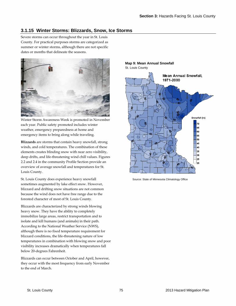
Section 3: Hazards Facing St. Louis County
St. Louis County 75 2013 Hazard Mitigation Plan
3.1.15 Winter Storms: Blizzards, Snow, Ice Storms
Severe storms can occur throughout the year in St. Louis
County. For practical purposes storms are categorized as
summer or winter storms, although there are not specific
dates or months that delineate the seasons.
Winter Storm Awareness Week is promoted in November
each year. Public safety promoted includes winter
weather, emergency preparedness at home and
emergency items to bring along while traveling.
Blizzards are storms that contain heavy snowfall, strong
winds, and cold temperatures. The combination of these
elements creates blinding snow with near zero visibility,
deep drifts, and life-threatening wind chill values. Figures
2.2 and 2.4 in the community Profile Section provide an
overview of average snowfall and temperatures for St.
Louis County.
St. Louis County does experience heavy snowfall
sometimes augmented by lake effect snow. However,
blizzard and drifting snow situations are not common
because the wind does not have free range due to the
forested character of most of St. Louis County.
Blizzards are characterized by strong winds blowing
heavy snow. They have the ability to completely
immobilize large areas, restrict transportation and to
isolate and kill humans (and animals) in their path.
According to the National Weather Service (NWS),
although there is no fixed temperature requirement for
blizzard conditions, the life-threatening nature of low
temperatures in combination with blowing snow and poor
visibility increases dramatically when temperatures fall
below 20-degrees Fahrenheit.
Blizzards can occur between October and April, however,
they occur with the most frequency from early November
to the end of March.
Map 9: Mean Annual Snowfall St. Louis County
Source: State of Minnesota Climatology Office

Section 3: Hazards Facing St. Louis County
St. Louis County 76 2013 Hazard Mitigation Plan
Ice storms are events when damaging accumulations of
ice occur during freezing rain situations. The terms
freezing rain and freezing drizzle warn the public that a
coating of ice is expected on the ground and on other
exposed surfaces. Heavy accumulations of ice can bring
down trees, electrical wires, telephone poles and lines, and
communication towers.
Communications and power can be disrupted for days
while utility companies work to repair damage. Ice
formed on exposed surfaces can range from a thin glaze to
coatings approximately one inch thick. Even thin
accumulations of ice on sidewalks, streets, and highways
cause extreme hazards to motorists and pedestrians.
Sleet does not stick to trees or wires, however, in sufficient
depth it does cause hazardous driving conditions. Heavy
sleet, defined as an accumulation of ice pellets covering
the ground to a depth of ½-inch or more, is a relatively
rare event.
Ice and sleet storms can occur from October through
April. According to statistics maintained by the National
Climatic Data Center (NCDC), in St. Louis County,
freezing rain and freezing drizzle events occur on average
of at least one day per year. The month of March has, on
average, the greatest number of days in which freezing
rain and freezing drizzle occurs.
The National Weather Service (NWS) notes that over 85-
percent of all ice storm deaths are traffic related.
Winter Storm History
Based upon the 1975-1991 historical record, Minnesota has
an average of one blizzard per year. The greatest number
of blizzards occurred in the month of January, followed by
March and November, respectively.
St. Louis County, along with all areas of the state, is
susceptible to heavy snowstorms. However, the relatively
level and tree-barren terrain of western and southern
Minnesota makes those regions more susceptible to the
high wind speeds which are intrinsic to blizzard
conditions than is the case for St. Louis County.
Damages from blizzards can range from human and
livestock deaths to significant snow removal costs. During
the 1975-1991 time period, there were 49 deaths associated
with blizzards statewide, or an average of three deaths per
year. Deaths attributable to blizzards have dropped in
recent years, primarily due to increased weather
awareness and warning capabilities. An overview of major
storm events can be found in Table 3.20.
Table 3.20: Winter Storm Events Northeast Minnesota
Date Type Location Cost Deaths Injuries Notes
Jan-72 Blizzard NE MN N/A 1 4 Schools closed.
Jan-75 Blizzard MN $14,000,000 35 N/A 18 inches of snow in Silver Bay (Lake County) and 9.5 inches
in Duluth.
Jan-82 Blizzard NE MN N/A N/A 4
52 mph winds. Duluth Transit Authority busses canceled, 20+
cars stranded, access to Park Point closed off, Blatnik Bridge
to Superior, WI closed to traffic, all schools closed, 21 traffic
accidents. Snow Emergency declared.
Oct-91 Blizzard NE MN N/A N/A N/A
Most businesses closed, no bus service. 21 inches of snow
fell in less than 24 hrs. Cook County schools closed. 70 traffic
accidents were reported in Duluth.
Jan-97 Snow & Ice Storm
NE MN N/A N/A N/A
21 inches of snow fell in Duluth, 23 inches in Pequot Lakes,
18 inches in Finlayson, 16 inches in Two Harbors, and 12
inches in Babbitt.
12/30-31/06
Winter Storm
St. Louis County
N/A 0 0
Freezing rain. One-quarter inch of ice in the Orr area. Up to ½
inch of ice and 10 inches of snow in the Babbitt area with
downed trees and power lines. Five inches of snow in the Ely
area. Up to 7.5 inches of snow around Embarrass and
Floodwood.
04/03/07 Winter Storm
S St. Louis County
N/A 0 0
Six to 10 inches of snow across the region with 12.1 inches
reported in Duluth. Winds of over 20 mph created blowing
and drifting conditions.
12/01-02/07
Winter Storm
St. Louis County
N/A 0 0 Cities of Duluth and Hermantown had 14-16 inches of snow.
Wind gusts of 30-40 mph caused blowing and drifting snow.
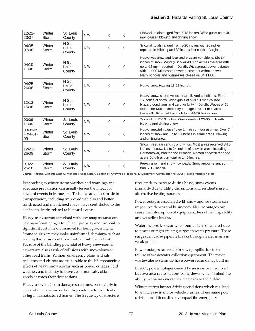
Section 3: Hazards Facing St. Louis County
St. Louis County 77 2013 Hazard Mitigation Plan
12/22-23/07
Winter Storm
St. Louis County
N/A 0 0 Snowfall totals ranged from 6-18 inches. Wind gusts up to 40
mph caused blowing and drifting snow.
04/05-07/08
Winter Storm
N St. Louis County
N/A 0 0 Snowfall totals ranged from 8-20 inches with 26 inches
reported in Hibbing and 32 inches just north of Virginia.
04/10-11/08
Winter Storm
N St. Louis County
N/A 0 0
Heavy wet snow and localized blizzard conditions. Six-14
inches of snow. Wind gust over 40 mph across the area with
up to 62 mph reported in Duluth. Widespread power outages
with 11,000 Minnesota Power customers without power.
Many schools and businesses closed on 04-11-08.
04/25-26/08
Winter Storm
N St. Louis County
N/A 0 0 Heavy snow totaling 11-15 inches.
12/13-15/08
Winter Storm
N St. Louis County
N/A 0 0
Heavy snow, strong winds, near-blizzard conditions. Eight –
15 inches of snow. Wind gusts of over 50 mph caused
blizzard conditions and zero visibility in Duluth. Waves of 15
feet at the Duluth ship entry damaged part of the Duluth
Lakewalk. Bitter cold wind chills of 40-50 below zero.
03/09-11/09
Winter Storm
St. Louis County
N/A 0 0 Snowfall of 15-19 inches. Gusty winds of 25-35 mph with
blowing and drifting snow.
03/31/09 – 04-01-09
Winter Storm
St. Louis County
N/A 0 0
Heavy snowfall rates of over 1 inch per hour at times. Over 7
inches of snow and up to 18 inches in some areas. Blowing
and drifting snow.
12/23-26/09
Winter Storm
St. Louis County
N/A 0 0
Snow, sleet, rain and strong winds. Most areas received 8-10
inches of snow. Up to 24 inches of snow in areas including
Hermantown, Proctor and Brimson. Record snowfall reported
at the Duluth airport totaling 24.5 inches.
01/23-25/10
Winter Storm
St. Louis County
N/A 0 0 Freezing rain and snow. Icy roads. Snow amounts ranged
from 7-12 inches.
Source: National Climatic Data Center and Public Library Search by Arrowhead Regional Development Commission for 2005 Hazard Mitigation Plan
Responding to winter storm watches and warnings and
adequate preparation can usually lessen the impact of
blizzard events in Minnesota. Technical advances made in
transportation, including improved vehicles and better
constructed and maintained roads, have contributed to the
decline in deaths related to blizzard events.
Heavy snowstorms combined with low temperatures can
be a significant danger to life and property and can lead to
significant cost in snow removal for local governments.
Stranded drivers may make uninformed decisions, such as
leaving the car in conditions that can put them at risk.
Because of the blinding potential of heavy snowstorms,
drivers are also at risk of collisions with snowplows or
other road traffic. Without emergency plans and kits,
residents and visitors are vulnerable to the life threatening
effects of heavy snow storms such as power outages, cold
weather, and inability to travel, communicate, obtain
goods or reach their destinations.
Heavy snow loads can damage structures, particularly in
areas where there are no building codes or for residents
living in manufactured homes. The frequency of structure
fires tends to increase during heavy snow events,
primarily due to utility disruptions and resident’s use of
alternative heating sources.
Power outages associated with snow and ice storms can
impact residences and businesses. Electric outages can
cause the interruption of equipment, loss of heating ability
and waterline breaks.
Waterline breaks occur when pumps turn on and off due
to power outages causing surges in water pressure. These
surges can cause pipeline breaks through water mains in
weak points.
Power outages can result in sewage spills due to the
failure of wastewater collection equipment. The major
wastewater systems do have power redundancy built in.
In 2001, power outages caused by an ice-storm led to all
but two area radio stations being down which limited the
ability to spread emergency messages to the public.
Winter storms impact driving conditions which can lead
to an increase in motor vehicle crashes. These same poor
driving conditions directly impact the emergency
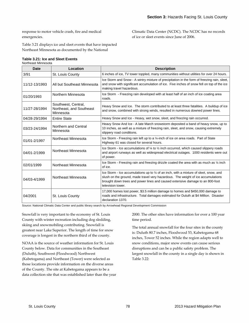
Section 3: Hazards Facing St. Louis County
St. Louis County 78 2013 Hazard Mitigation Plan
response to motor vehicle crash, fire and medical
emergencies.
Table 3.21 displays ice and sleet events that have impacted
Northeast Minnesota as documented by the National
Climatic Data Center (NCDC). The NCDC has no records
of ice or sleet events since June of 2006.
Table 3.21: Ice and Sleet Events Northeast Minnesota
Date Location Description
3/91 St. Louis County 6 inches of ice, TV tower toppled, many communities without utilities for over 24 hours.
11/12-13/1993 All but Southeast Minnesota
Ice Storm and Snow - A wintry mixture of precipitation in the form of freezing rain, sleet,
and snow with significant accumulation of ice. Five inches of snow fell on top of the ice
making travel hazardous.
01/20/1993 Northern Minnesota
Ice Storm - Freezing rain developed with at least half of an inch of ice coating area
roads.
11/27-28/1994 Southwest, Central, Northeast, and Southeast Minnesota
Heavy Snow and Ice. The storm contributed to at least three fatalities. A buildup of ice
and snow, combined with strong winds, resulted in numerous downed power lines.
04/28-29/1994 Entire State Heavy Snow and Ice - Heavy, wet snow, sleet, and freezing rain occurred.
03/23-24/1994 Northern and Central Minnesota
Heavy Snow And Ice - A late March snowstorm deposited a band of heavy snow, up to
10 inches, as well as a mixture of freezing rain, sleet, and snow, causing extremely
slippery road conditions.
01/01-2/1997 Northeast Minnesota
Ice Storm - Freezing rain left up to a ¼-inch of ice on area roads. Part of State
Highway 61 was closed for several hours.
04/01-2/1999 Northeast Minnesota
Ice Storm - Ice accumulations of ¼ to ½ inch occurred, which caused slippery roads
and airport runways as well as widespread electrical outages. 1000 residents were out
of power.
02/01/1999 Northeast Minnesota Ice Storm - Freezing rain and freezing drizzle coated the area with as much as ¼ inch
of ice.
04/03-4/1999 Northeast Minnesota
Ice Storm - Ice accumulations up to ¼ of an inch, with a mixture of sleet, snow, and
slush on the ground, made travel very hazardous. The weight of ice accumulations
brought down trees and power lines and caused extensive damage to an 800-foot
television tower.
04/2001 St. Louis County
17,000 homes lost power, $3.5 million damage to homes and $450,000 damage to
roads and infrastructure. Total damages estimated for Duluth at $4 Million. Disaster
declaration 1370.
Source: National Climatic Data Center and public library search by Arrowhead Regional Development Commission
Snowfall is very important to the economy of St. Louis
County with winter recreation including dog sledding,
skiing and snowmobiling contributing. Snowfall is
greatest near Lake Superior. The length of time for snow
coverage is longest in the northern third of the county.
NOAA is the source of weather information for St. Louis
County below. Data for communities in the Southeast
(Duluth), Southwest (Floodwood) Northwest
(Kabetogama) and Northeast (Tower) were selected as
those locations provide information on the diverse areas
of the County. The site at Kabetogama appears to be a
data collection site that was established later than the year
2000. The other sites have information for over a 100 year
time period.
The total annual snowfall for the four sites in the county
is: Duluth 80.7 inches, Floodwood 53, Kabetogama 68
inches, Tower 52 inches. While the region adapts well to
snow conditions, major snow events can cause serious
disruptions and can be a public safety problem. The
largest snowfall in the county in a single day is shown in
Table 3.22:
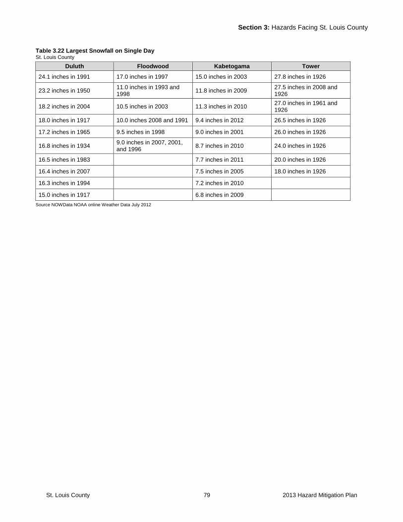
Section 3: Hazards Facing St. Louis County
St. Louis County 79 2013 Hazard Mitigation Plan
Table 3.22 Largest Snowfall on Single Day St. Louis County
Duluth Floodwood Kabetogama Tower
24.1 inches in 1991 17.0 inches in 1997 15.0 inches in 2003 27.8 inches in 1926
23.2 inches in 1950 11.0 inches in 1993 and 1998
11.8 inches in 2009 27.5 inches in 2008 and 1926
18.2 inches in 2004 10.5 inches in 2003 11.3 inches in 2010 27.0 inches in 1961 and 1926
18.0 inches in 1917 10.0 inches 2008 and 1991 9.4 inches in 2012 26.5 inches in 1926
17.2 inches in 1965 9.5 inches in 1998 9.0 inches in 2001 26.0 inches in 1926
16.8 inches in 1934 9.0 inches in 2007, 2001, and 1996
8.7 inches in 2010 24.0 inches in 1926
16.5 inches in 1983 7.7 inches in 2011 20.0 inches in 1926
16.4 inches in 2007 7.5 inches in 2005 18.0 inches in 1926
16.3 inches in 1994 7.2 inches in 2010
15.0 inches in 1917 6.8 inches in 2009
Source NOWData NOAA online Weather Data July 2012
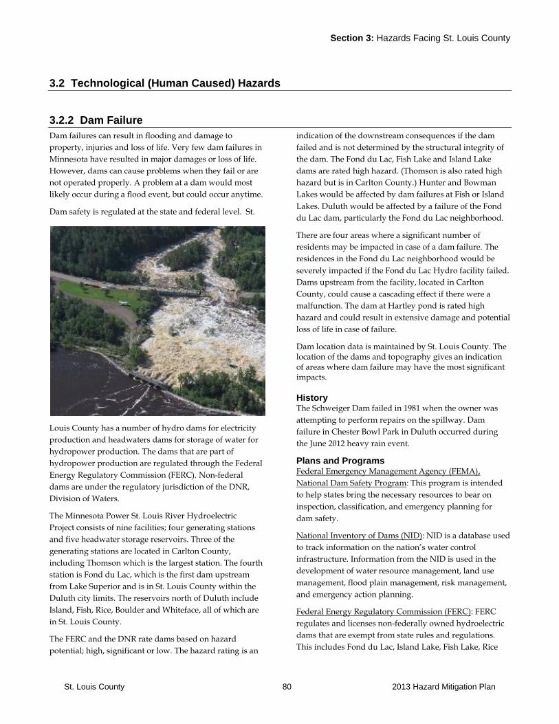
Section 3: Hazards Facing St. Louis County
St. Louis County 80 2013 Hazard Mitigation Plan
3.2 Technological (Human Caused) Hazards
3.2.2 Dam Failure
Dam failures can result in flooding and damage to
property, injuries and loss of life. Very few dam failures in
Minnesota have resulted in major damages or loss of life.
However, dams can cause problems when they fail or are
not operated properly. A problem at a dam would most
likely occur during a flood event, but could occur anytime.
Dam safety is regulated at the state and federal level. St.
Louis County has a number of hydro dams for electricity
production and headwaters dams for storage of water for
hydropower production. The dams that are part of
hydropower production are regulated through the Federal
Energy Regulatory Commission (FERC). Non-federal
dams are under the regulatory jurisdiction of the DNR,
Division of Waters.
The Minnesota Power St. Louis River Hydroelectric
Project consists of nine facilities; four generating stations
and five headwater storage reservoirs. Three of the
generating stations are located in Carlton County,
including Thomson which is the largest station. The fourth
station is Fond du Lac, which is the first dam upstream
from Lake Superior and is in St. Louis County within the
Duluth city limits. The reservoirs north of Duluth include
Island, Fish, Rice, Boulder and Whiteface, all of which are
in St. Louis County.
The FERC and the DNR rate dams based on hazard
potential; high, significant or low. The hazard rating is an
indication of the downstream consequences if the dam
failed and is not determined by the structural integrity of
the dam. The Fond du Lac, Fish Lake and Island Lake
dams are rated high hazard. (Thomson is also rated high
hazard but is in Carlton County.) Hunter and Bowman
Lakes would be affected by dam failures at Fish or Island
Lakes. Duluth would be affected by a failure of the Fond
du Lac dam, particularly the Fond du Lac neighborhood.
There are four areas where a significant number of
residents may be impacted in case of a dam failure. The
residences in the Fond du Lac neighborhood would be
severely impacted if the Fond du Lac Hydro facility failed.
Dams upstream from the facility, located in Carlton
County, could cause a cascading effect if there were a
malfunction. The dam at Hartley pond is rated high
hazard and could result in extensive damage and potential
loss of life in case of failure.
Dam location data is maintained by St. Louis County. The location of the dams and topography gives an indication of areas where dam failure may have the most significant impacts.
History The Schweiger Dam failed in 1981 when the owner was
attempting to perform repairs on the spillway. Dam
failure in Chester Bowl Park in Duluth occurred during
the June 2012 heavy rain event.
Plans and Programs Federal Emergency Management Agency (FEMA),
National Dam Safety Program: This program is intended
to help states bring the necessary resources to bear on
inspection, classification, and emergency planning for
dam safety.
National Inventory of Dams (NID): NID is a database used
to track information on the nation’s water control
infrastructure. Information from the NID is used in the
development of water resource management, land use
management, flood plain management, risk management,
and emergency action planning.
Federal Energy Regulatory Commission (FERC): FERC
regulates and licenses non-federally owned hydroelectric
dams that are exempt from state rules and regulations.
This includes Fond du Lac, Island Lake, Fish Lake, Rice

Section 3: Hazards Facing St. Louis County
St. Louis County 81 2013 Hazard Mitigation Plan
Lake, Boulder Lake and Whiteface Reservoirs which are
operated by Minnesota Power. These facilities are
required to have an emergency plan in place identifying
the areas that could be impacted and the response in case
of a dam failure.
Minnesota Power officials who prepare the Dam Failure
response plans meet annually with affected community
and county emergency management staff members. The
Minnesota Power representatives also meet with the
county communications division to review warning and
notification procedures.
Minnesota Department of Natural Resources (DNR),
Division of Waters: An existing dam safety program and
current dam safety regulations require the safe design,
construction, operation, and maintenance of dams in
Minnesota. The state program includes review of design
plans and plans for proposed dams, safety inspections of
existing dams, and repair of dams.
Minnesota Department of Public Safety (DPS), Division of
Homeland Security and Emergency Management (HSEM):
The mission of HSEM is to reduce the threat posed by
hazards that can affect the state, plan ways to cope with
disasters when they occur, coordinate the response of state
and federal agencies in assisting local government when
disasters occur, and coordinate the recovery efforts of state
and federal agencies in conjunction with local
governments when disaster strikes.
Action Plan Requirement for High Hazard Dams: All high
hazard dams are required to have a dam specific action
plan in place to respond to an emergency.
Minnesota DNR Administered Mitigation Grant
Programs: The Minnesota DNR Division of Waters
administers a program to provide grants to local units of
government to help pay for the cost of dam repair. They
also administer the Hazard Mitigation Grant Program,
which can be used to repair and upgrade levees.
National Weather Service, Weather Alert Transmitters:
Weather alert radios can warn the general public within
their broadcast range function as the primary warning
system for the general public.
Program Gaps or Deficiencies Risk Ratings: These were done over 20 years ago, may be
outdated in some areas due to increased development
within the shoreland areas.
Inventory of Jurisdictions for Unregulated Dams: There
are a number of small dams for which it is not clear under
who has jurisdiction. Action may need to take place
relating to operation and maintenance of these smaller
dams and levees.
Public Awareness of Dam Safety Issues: There may be
need for public awareness building with populations in
areas that could be impacted by dam failure.
Table 3.23: Dam Failure Events St. Louis County
Date Location Cost Deaths Injuries Notes
06/19/12 St. Louis County N/A 0 0
Dam Failure at the Forbay reservoir
associated with the June 2012 flood event.
The Forbay reservoir breached and had a
complete dam failure. This failure did much
of the damage to Highway 210.
Source: City and Township Contacts
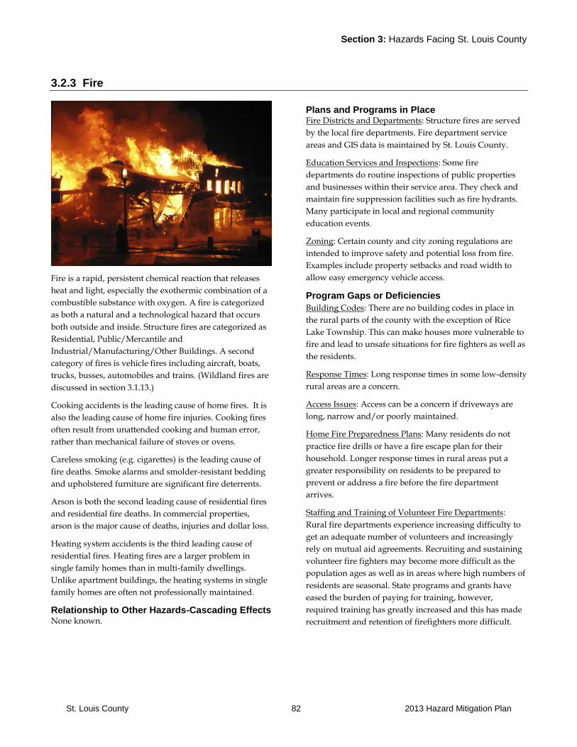
Section 3: Hazards Facing St. Louis County
St. Louis County 82 2013 Hazard Mitigation Plan
3.2.3 Fire
Fire is a rapid, persistent chemical reaction that releases
heat and light, especially the exothermic combination of a
combustible substance with oxygen. A fire is categorized
as both a natural and a technological hazard that occurs
both outside and inside. Structure fires are categorized as
Residential, Public/Mercantile and
Industrial/Manufacturing/Other Buildings. A second
category of fires is vehicle fires including aircraft, boats,
trucks, busses, automobiles and trains. (Wildland fires are
discussed in section 3.1.13.)
Cooking accidents is the leading cause of home fires. It is
also the leading cause of home fire injuries. Cooking fires
often result from unattended cooking and human error,
rather than mechanical failure of stoves or ovens.
Careless smoking (e.g. cigarettes) is the leading cause of
fire deaths. Smoke alarms and smolder-resistant bedding
and upholstered furniture are significant fire deterrents.
Arson is both the second leading cause of residential fires
and residential fire deaths. In commercial properties,
arson is the major cause of deaths, injuries and dollar loss.
Heating system accidents is the third leading cause of
residential fires. Heating fires are a larger problem in
single family homes than in multi-family dwellings.
Unlike apartment buildings, the heating systems in single
family homes are often not professionally maintained.
Relationship to Other Hazards-Cascading Effects None known.
Plans and Programs in Place Fire Districts and Departments: Structure fires are served
by the local fire departments. Fire department service
areas and GIS data is maintained by St. Louis County.
Education Services and Inspections: Some fire
departments do routine inspections of public properties
and businesses within their service area. They check and
maintain fire suppression facilities such as fire hydrants.
Many participate in local and regional community
education events.
Zoning: Certain county and city zoning regulations are
intended to improve safety and potential loss from fire.
Examples include property setbacks and road width to
allow easy emergency vehicle access.
Program Gaps or Deficiencies
Building Codes: There are no building codes in place in
the rural parts of the county with the exception of Rice
Lake Township. This can make houses more vulnerable to
fire and lead to unsafe situations for fire fighters as well as
the residents.
Response Times: Long response times in some low-density
rural areas are a concern.
Access Issues: Access can be a concern if driveways are
long, narrow and/or poorly maintained.
Home Fire Preparedness Plans: Many residents do not
practice fire drills or have a fire escape plan for their
household. Longer response times in rural areas put a
greater responsibility on residents to be prepared to
prevent or address a fire before the fire department
arrives.
Staffing and Training of Volunteer Fire Departments:
Rural fire departments experience increasing difficulty to
get an adequate number of volunteers and increasingly
rely on mutual aid agreements. Recruiting and sustaining
volunteer fire fighters may become more difficult as the
population ages as well as in areas where high numbers of
residents are seasonal. State programs and grants have
eased the burden of paying for training, however,
required training has greatly increased and this has made
recruitment and retention of firefighters more difficult.
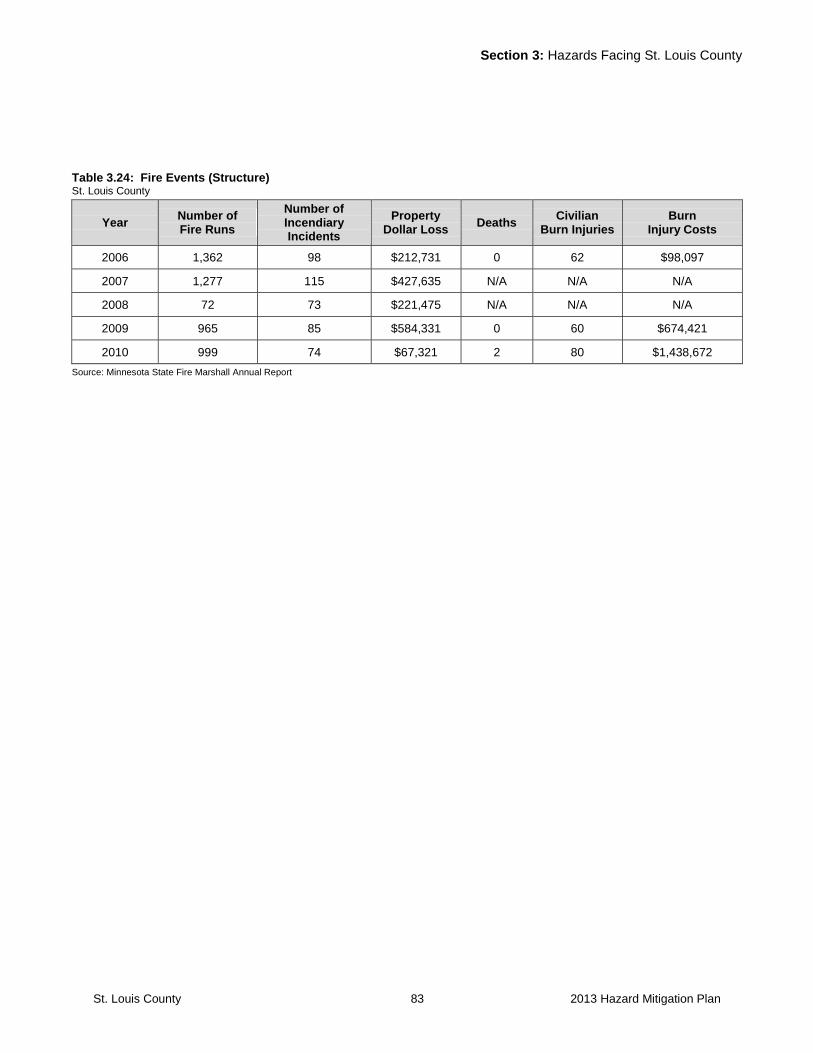
Section 3: Hazards Facing St. Louis County
St. Louis County 83 2013 Hazard Mitigation Plan
Table 3.24: Fire Events (Structure) St. Louis County
Year Number of Fire Runs
Number of Incendiary Incidents
Property Dollar Loss
Deaths Civilian
Burn Injuries Burn
Injury Costs
2006 1,362 98 $212,731 0 62 $98,097
2007 1,277 115 $427,635 N/A N/A N/A
2008 72 73 $221,475 N/A N/A N/A
2009 965 85 $584,331 0 60 $674,421
2010 999 74 $67,321 2 80 $1,438,672
Source: Minnesota State Fire Marshall Annual Report
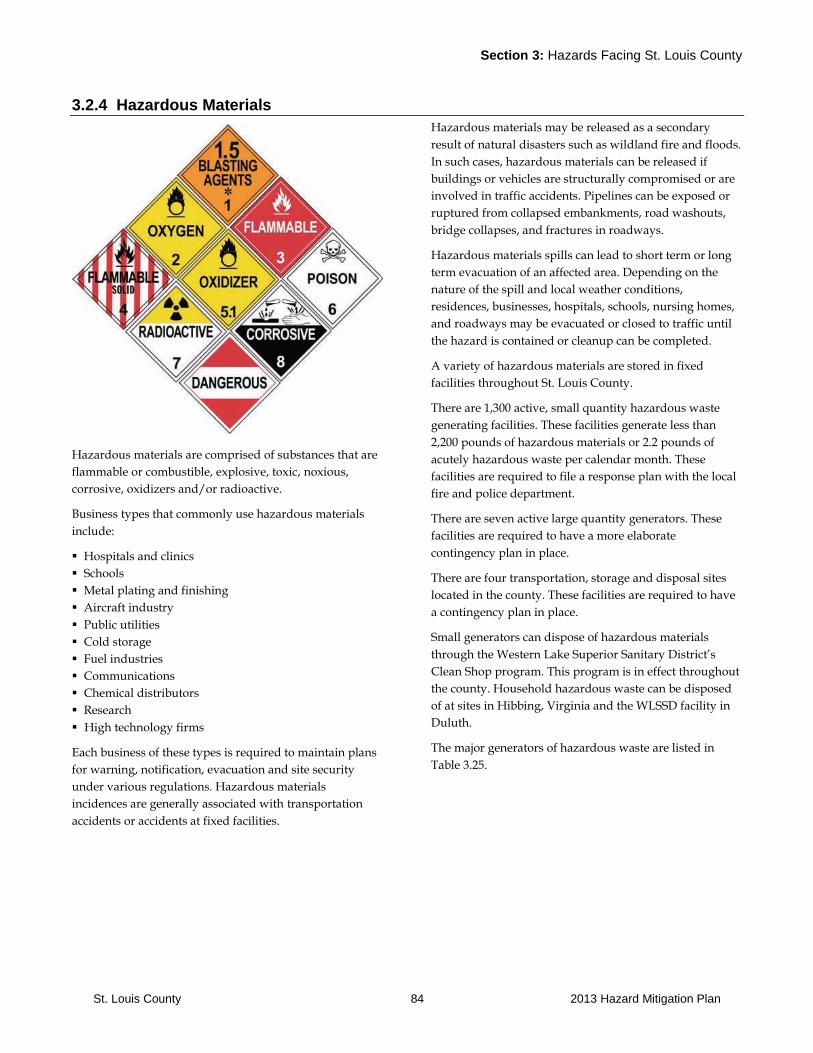
Section 3: Hazards Facing St. Louis County
St. Louis County 84 2013 Hazard Mitigation Plan
3.2.4 Hazardous Materials
Hazardous materials are comprised of substances that are
flammable or combustible, explosive, toxic, noxious,
corrosive, oxidizers and/or radioactive.
Business types that commonly use hazardous materials
include:
Hospitals and clinics
Schools
Metal plating and finishing
Aircraft industry
Public utilities
Cold storage
Fuel industries
Communications
Chemical distributors
Research
High technology firms
Each business of these types is required to maintain plans
for warning, notification, evacuation and site security
under various regulations. Hazardous materials
incidences are generally associated with transportation
accidents or accidents at fixed facilities.
Hazardous materials may be released as a secondary
result of natural disasters such as wildland fire and floods.
In such cases, hazardous materials can be released if
buildings or vehicles are structurally compromised or are
involved in traffic accidents. Pipelines can be exposed or
ruptured from collapsed embankments, road washouts,
bridge collapses, and fractures in roadways.
Hazardous materials spills can lead to short term or long
term evacuation of an affected area. Depending on the
nature of the spill and local weather conditions,
residences, businesses, hospitals, schools, nursing homes,
and roadways may be evacuated or closed to traffic until
the hazard is contained or cleanup can be completed.
A variety of hazardous materials are stored in fixed
facilities throughout St. Louis County.
There are 1,300 active, small quantity hazardous waste
generating facilities. These facilities generate less than
2,200 pounds of hazardous materials or 2.2 pounds of
acutely hazardous waste per calendar month. These
facilities are required to file a response plan with the local
fire and police department.
There are seven active large quantity generators. These
facilities are required to have a more elaborate
contingency plan in place.
There are four transportation, storage and disposal sites
located in the county. These facilities are required to have
a contingency plan in place.
Small generators can dispose of hazardous materials
through the Western Lake Superior Sanitary District’s
Clean Shop program. This program is in effect throughout
the county. Household hazardous waste can be disposed
of at sites in Hibbing, Virginia and the WLSSD facility in
Duluth.
The major generators of hazardous waste are listed in
Table 3.25.
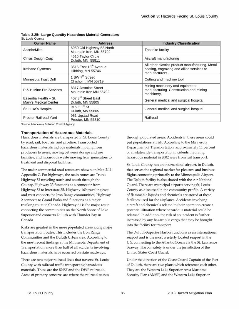
Section 3: Hazards Facing St. Louis County
St. Louis County 85 2013 Hazard Mitigation Plan
Table 3.25: Large Quantity Hazardous Material Generators St. Louis County
Owner Name Address Industry Classification
AccelorMittal 5950 Old Highway 53 North Mountain Iron, MN 55792
Taconite facility
Cirrus Design Corp 4515 Taylor Circle Duluth, MN 55811
Aircraft manufacturing
Irathane Systems 3516 East 13
th Avenue
Hibbing, MN 55746
All other plastics product manufacturing. Metal coating, engraving and allied services to manufacturers.
Minnesota Twist Drill 1 SW 7
th Street
Chisholm, MN 55719 Cutting and machine tool
P & H Mine Pro Services 8317 Jasmine Street Mountain Iron MN 55792
Mining machinery and equipment manufacturing. Construction and mining machinery.
Essentia Health – St. Mary’s Medical Center
407 3rd
Street East Duluth, MN 55805
General medical and surgical hospital
St. Luke’s Hospital 915 E 1
st St
Duluth, MN 55805 General medical and surgical hospital
Proctor Railroad Yard 951 Ugstad Road Proctor, MN 55810
Railroad
Source: Minnesota Pollution Control Agency
Transportation of Hazardous Materials Hazardous materials are transported in St. Louis County
by road, rail, boat, air, and pipeline. Transported
hazardous materials include materials moving from
producers to users, moving between storage and use
facilities, and hazardous waste moving from generators to
treatment and disposal facilities.
The major commercial road routes are shown on Map 2.11,
Appendix C. For highways, the main routes are Trunk
Highway 53 traveling north and south through the
County, Highway 33 functions as a connector from
Highway 53 to Interstate 35. Highway 169 traveling east
and west connects the Iron Range communities; Highway
2 connects to Grand Forks and functions as a major
trucking route to Canada. Highway 61 is the major route
connecting the communities on the North Shore of Lake
Superior and connects Duluth with Thunder Bay in
Canada.
Risks are greatest in the more populated areas along major
transportation routes. This includes the Iron Range
Communities and the Duluth Urban area. According to
the most recent findings at the Minnesota Department of
Transportation, more than half of all accidents involving
hazardous materials have occurred on state roadways.
There are two major railroad lines that traverse St. Louis
County with railroad traffic transporting hazardous
materials. These are the BNSF and the DWP railroads.
Areas of primary concerns are where the railroad passes
through populated areas. Accidents in these areas could
put populations at risk. According to the Minnesota
Department of Transportation, approximately 11 percent
of all statewide transportation incidents involving
hazardous material in 2002 were from rail transport.
St. Louis County has an international airport, in Duluth,
that serves the regional market for pleasure and business
flights connecting primarily to the Minneapolis Airport.
The Duluth facility is also shared with the Air National
Guard. There are municipal airports serving St. Louis
County as discussed in the community profile. A variety
of flammable liquids and chemicals are stored at these
facilities used for the airplanes. Accidents involving
aircraft and chemicals related to their operation create a
potential situation where hazardous material could be
released. In addition, the risk of an incident is further
increased by any hazardous cargo that may be brought
into the facility for transport.
The Duluth-Superior Harbor functions as an international
seaport and is the most westerly located seaport in the
U.S. connecting to the Atlantic Ocean via the St. Lawrence
Seaway. Harbor safety is under the jurisdiction of the
United States Coast Guard.
Under the direction of the Coast Guard Captain of the Port
of Duluth, there are two plans which reference each other.
They are the Western Lake Superior Area Maritime
Security Plan (AMSP) and the Western Lake Superior
Section 3: Hazards Facing St. Louis County
St. Louis County 86 2013 Hazard Mitigation Plan
Area Contingency Plan (ACP). The AMSP’s purpose is to
ensure effective governmental and private sector
measures to deter, detect, disrupt, respond to and recover
from a Transportation Security Incident (TSI) or threat
thereof across the inter-modal MTS within specific port
areas. In addition, the AMSP has a Maritime
Transportation System Recovery (MTSR) annex, in an
effort to get the port open after an incident. The ACP
describes the strategy for a coordinated federal, tribal,
state and local response to a discharge or substantial
threat of discharge of oil, or a release or substantial threat
of release of hazardous substances(s) within the
boundaries of the coastal and inland area of Western Lake
Superior.
The security plan assesses risks for infrastructure and
facilities within the coastal area and makes
recommendations for improvements. The plan looks at
infrastructure that in case of an event may have impacts
that would fall under the Coast Guard’s responsibility to
respond to and that may have an impact on shipping
commerce. This plan is reviewed on a yearly basis.
Key infrastructure that has been assessed under this plan
includes power generating facilities such as the Thompson
Hydro Dam system, bridges, port facilities, structures that
could be vulnerable from the waterfront such as the
Duluth Entertainment and Convention Center (DECC).
The security plan identifies Marine Security (MARSEC)
Levels. Under each MARSEC level for different
jurisdictions there is a listing of assistance each law
enforcement entity can provide. This can include staff and
equipment. The MARSEC levels are related to the
Homeland Security threat levels. Further, the Captain of
the Port can raise the level of readiness for the port if there
is intelligence regarding a local threat.
All shipping facilities have a security plan in place that is
filed with the Captain of the Port. Vessels need to file
plans with Headquarters of the Coast Guard. The Duluth
Superior Port Authority is in the process of setting up a
cooperative to assist in the development of the facility
security plans since the cost of doing plans independently
may be a concern for some of the smaller port operations.
Fixed Facilities
A variety of hazardous materials are stored in fixed
facilities throughout St. Louis County. There are 47 small
quantity hazardous waste generating facilities. These
facilities are required to file a response plan with the local
fire and police department. Further, there are 8 large
quantity generators. These facilities are required to have a
more elaborate contingency plan in place. There are 4
transportation, storage and disposal sites located within
the county. These facilities are also required to have a
contingency plan in place.
Relationship to Other Hazards-Cascading Effects Wastewater supply contamination as a result of
improper disposal of chemicals.
Impacts on surface and groundwater resources and
fisheries as a result of a spill.
Soil contamination.
Plans and Programs State Agency Cooperation: St. Louis County works
directly with the appropriate state agencies to address
needs for responding to and mitigating the impacts of a
hazardous event.
Emergency Operations Plan: St. Louis County has an EOP
in place that outlines procedures for dealing with
hazardous materials accidents, spills or releases.
Hazardous Materials Response Team: The hazardous
materials response team is located in Duluth and staffed
by the Duluth Fire Department under a state contract.
Local units of government can contact this resource
through the State Duty Officer.
55th Civil Support Group: This unit can provide assistance
in analyzing threat and proper response. Local units of
government need to make contact through the State Duty
Officer to access this resource.
Western Lake Superior Area Maritime Security Committee
(AMSC): The AMSP’s purpose is to ensure effective
governmental and private sector measures to deter, detect,
disrupt, respond to and recover from a Transportation
Security Incident (TSI) or threat thereof across the inter-
modal MTS within specific port areas. In addition, the
AMSP has a Maritime Transportation System Recovery
(MTSR) annex, in an effort to get the port open after an
incident.
Western Lake Superior Port Area Committee (PAC): The
PAC plans the strategy for a coordinated federal, tribal,
state and local response to a discharge or substantial
threat of discharge of oil, or a release or substantial threat
of release of hazardous substances(s) within the
boundaries of the coastal and inland area of Western Lake
Superior.
Program Gaps or Deficiencies Warning Systems: Warning and notification of
populations is important in case of a hazardous materials
related emergency. Communities need ongoing action to
Section 3: Hazards Facing St. Louis County
St. Louis County 87 2013 Hazard Mitigation Plan
ensure that warning systems are functional and residents
know how to access information in case of an emergency.
Access Concerns for Emergency Response in Case of a
Train Derailment: Access by emergency vehicles is a
concern in Orr. A derailment in town can prevent direct
access to Highway 53 by emergency and fire response
vehicles. Access to the hospital in Cook can be a concern if
a derailment would take place in town. The hospital and
emergency response services are located on opposite sides
of the tracks. Access concerns exist for emergency
response in the case of a derailment in Floodwood which
could cut off direct access to US Highway 2.
Need for Increased Training in Response to Hazardous
Materials: There is an ongoing need for training and
updates for current and new personnel.
Grant Writing Assistance: Local fire departments write
grant proposals and, in some cases, must secure local
match funds to ensure adequate equipment is available to
respond to an incident or to pay for training.
Table 3.26: Hazardous Material Events St. Louis County
Date Type Location Cost Deaths Injuries Source Notes
No events reported.
Source: EPA

Section 3: Hazards Facing St. Louis County
St. Louis County 88 2013 Hazard Mitigation Plan
3.2.5 Radiological
A radiological hazard is defined as an unintentional
exposure to materials that emit ionizing radiation.
The primary radiological hazard is the health effects
resulting from unintentional exposure to ionizing
radiation. When radiation interacts with atoms, energy is
deposited, resulting in ionization (electron excitation). This
ionization may damage certain critical molecules or
structures in a cell. Ionizing radiation is emitted from
molecular elements generally referred to as radio nuclides,
and this radiation has the ability to alter in varying
amounts the function of living processes at the cellular
level. Types of ionizing radiation include Alpha particles,
Beta particles, Gamma rays, X-rays, and Neutron particles.
Radiation is measured in different ways. Measurements
used in the United States include Roentgen, radiation
absorbed dose (RAD), and roentgen equivalent man
(REM). See
http://www.nrc.gov/NRC/EDUCATE/REACTOR/05/p
art10.html. The term RAD is being replaced by the
International System skin dose unit for radiation absorbed
dose, the gray (Gy) which is a measurement of absorbed
dose in any material. 1 Gy = 100 RAD.
Radiation effects fall into two broad categories:
Direct effect on cells (direct impact with a particularly
sensitive atom or molecule in a cell).
Indirect effect on cells (interaction with water molecules
in the body where the deposited energy in the water
leads to the creation of unstable, toxic hyperoxide
molecules which then damage sensitive molecules and
afflict subcellular structures).
The nature and extent of damage caused by ionizing
radiation depend on a number of factors including the
amount of exposure (energy strength), the frequency
and/or duration of exposure, and the penetrating power
of the radiation to which an individual is exposed. Acute
exposure to very high doses of ionizing radiation is rare
but can cause death within a few days or months. The
sensitivity of the exposed cells also influences the extent of
damage. For example, rapidly growing tissues, such as
developing embryos, are particularly vulnerable to harm
from ionizing radiation.
Nuclear power plants are a significant potential source of
ionizing radiation. The health and environment impacts
from the Three-Mile Island and Chernobyl, Russia
disasters illustrate the potential hazards from nuclear
power plants. Other sources of ionizing radiation include
medical and diagnostic X-ray machines, certain surveying
instruments, some imaging systems used to check
pipelines, radioactive sources used to calibrate radiation
detection instruments, and even some household fire
detectors.
History On December 7, 1979, following the March 1979 Three
Mile Island nuclear power plant accident in Pennsylvania,
President Carter transferred the Federal lead role in off-
site radiological emergency planning and preparedness
activities from the Nuclear Regulatory Commission (NRC)
to Federal Emergency Management Agency (FEMA).
FEMA established the Radiological Emergency
Preparedness (REP) Program to (1) ensure that the public
health and safety of citizens living around commercial
nuclear power plants would be adequately protected in
the event of a nuclear power station accident and (2)
inform and educate the public about radiological
emergency preparedness. FEMA's REP Program
responsibilities encompass only "off-site" activities, that is
state and local government emergency preparedness
activities that take place beyond the nuclear power plant
boundaries. Onsite activities continue to be the
responsibility of the NRC. See the REP site for additional
information: http://www.fema.gov/pte/rep/
The U.S. Department of Energy (DOE) occasionally
transports radioactive material through Minnesota via
road and rail. Information on these shipments can be
located at www.ntp.doe.gov.
University laboratories, medical treatment facilities and
medical laboratories also contain a large number of
radionuclides. These materials are used in research,
diagnostics and treatment.

Section 3: Hazards Facing St. Louis County
St. Louis County 89 2013 Hazard Mitigation Plan
Plans and Programs At the federal and national level there are a number of
agencies that have capabilities to respond to radiological
emergencies these include: U.S. Department of Energy
(DOE), Nuclear Regulatory Commission (NRC), Federal
Emergency Management Agency (FEMA), U.S.
Department of Transportation (DOT), American Nuclear
Society (ANS). More information on these agencies and
their roles and responsibilities can be found in the State
All Hazard Mitigation Plan.
At the state level the following agencies have capabilities:
Department of Public Safety (DPS), Homeland
Security and Emergency Management (HSEM):
HSEM has response equipment and capabilities
related to radiological incidents. In addition, HSEM
shall assess the need for protective actions in the
event of a radiological incident at a nuclear power
plant.
Department of Health (MDH): MDH has response
and laboratory equipment capabilities related to
radiological incidents.
Department of Health, Environmental Health (EH),
Asbestos, Indoor Air, Lead, and Radiation Program:
The Section of Asbestos, Indoor Air, Lead and
Radiation regulates radioactive materials under letter
agreement with the NRC and is prepared to provide
accident assessment and advisory support in the
event of a nuclear power plant emergency. See
http://www.health.state.mn.us/divs/eh/about.html
#programs
State Hazardous Materials (HAZMAT) teams, based
in Duluth for St. Louis County, have equipment to
respond to a radiological incident.
The Federal Radiological Emergency Response Plan
(FRERP) is in place to establish an organized and
integrated capability for a timely, coordinated
response by Federal agencies to peacetime
radiological emergencies.
The MN Department of Health has a response plan
for radiological incidents.
The Minnesota Emergency Operations Plan (MEOP)
addresses the response to radiological incidents for
Minnesota Government Agencies.
The St. Louis County Emergency Operations Plan
outlines County’s role in a response to a radiological
incident.
Program Gaps or Deficiencies No program gaps or deficiencies at the County level have
been identified.
Table 3.27: Radiological Events St. Louis County
Date Type Location Cost Deaths Injuries Source Notes
No known radiological events in St. Louis County.
Source: St. Louis County
Section 3: Hazards Facing St. Louis County
St. Louis County 90 2013 Hazard Mitigation Plan
3.2.6 Terrorism
Human caused hazards are intentional, criminal,
malicious uses of force and violence to perpetrate disasters
against people or property. They can be the result of
terrorism, actions intended to intimidate or coerce a
government or the civilian population to further political
or social objectives, which can be either domestic or
international, depending on the origin, base and objectives
of the terrorist organization. Or they can be acts of
individuals perpetrated for personal reasons.
Hazards can result from the use of weapons of mass
destruction, including biological, chemical, nuclear and
radiological weapons; arson, incendiary, explosive and
armed attacks; industrial sabotage and intentional
hazardous materials releases; and cyber terrorism.
The Duluth Superior Harbor and the Duluth Airport could
be potential targets for terrorism as well as other
infrastructure such as power and pipelines traversing the
County. The Coast Guard has conducted a risk assessment
for facilities within the Duluth Superior Harbor as part of
their Western Lake Superior Maritime Security Plan.
History St. Louis County has no history of terrorist activity or
individual acts to cause disasters against people or
property. However, during the Anthrax scare there were a
number of false anthrax threats that had to be responded
to in the County. Vandalism, assaults and other criminal
acts do occur, but these isolated incidents fall within the
purview of local law enforcement.
Relationship to Other Hazards-Cascading Effects Cascading effects of an intentional human-caused disaster
are highly dependent on the specific mode used and asset
targeted. Impacts could include spread of infectious
disease, fires and secondary explosions are possible with
explosive attacks and fires from arson attacks can extend
beyond intended targets such as cause forest fires. Further,
impacts could include the ability to use the harbor or
airport for trade and transportation purposes.
Plans and Programs Cooperation with State and Federal Officials: St. Louis
County officials work with state and federal officials on
domestic preparedness efforts.
Western Lake Superior Area Maritime Security Plan: This
document includes a risk assessment of all facilities within
the Duluth Superior Harbor and along the shoreline of
Lake Superior.
Western Lake Superior Area Maritime Security Committee
(AMSC): The AMSP’s purpose is to ensure effective
governmental and private sector measures to deter, detect,
disrupt, respond to and recover from a Transportation
Security Incident (TSI) or threat thereof across the inter-
modal MTS within specific port areas. In addition, the
AMSP has a Maritime Transportation System Recovery
(MTSR) annex, in an effort to get the port open after an
incident.
Program Gaps or Deficiencies No gaps or deficiencies have been identified at this point.
Table 3.28: Terrorism Events St. Louis County
Date Type Location Cost Deaths Injuries Source Notes
No known terrorism events in St. Louis County.
Source: St. Louis County
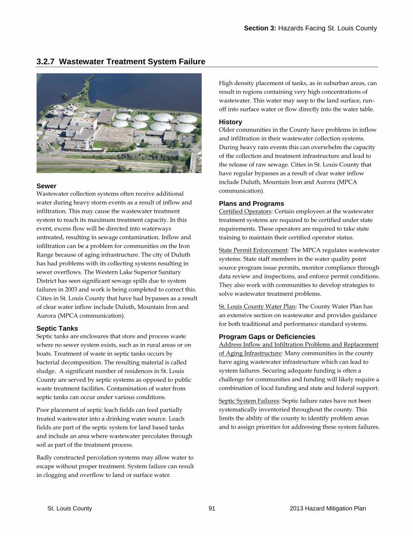
Section 3: Hazards Facing St. Louis County
St. Louis County 91 2013 Hazard Mitigation Plan
3.2.7 Wastewater Treatment System Failure
Sewer Wastewater collection systems often receive additional
water during heavy storm events as a result of inflow and
infiltration. This may cause the wastewater treatment
system to reach its maximum treatment capacity. In this
event, excess flow will be directed into waterways
untreated, resulting in sewage contamination. Inflow and
infiltration can be a problem for communities on the Iron
Range because of aging infrastructure. The city of Duluth
has had problems with its collecting systems resulting in
sewer overflows. The Western Lake Superior Sanitary
District has seen significant sewage spills due to system
failures in 2003 and work is being completed to correct this.
Cities in St. Louis County that have had bypasses as a result
of clear water inflow include Duluth, Mountain Iron and
Aurora (MPCA communication).
Septic Tanks Septic tanks are enclosures that store and process waste
where no sewer system exists, such as in rural areas or on
boats. Treatment of waste in septic tanks occurs by
bacterial decomposition. The resulting material is called
sludge. A significant number of residences in St. Louis
County are served by septic systems as opposed to public
waste treatment facilities. Contamination of water from
septic tanks can occur under various conditions.
Poor placement of septic leach fields can feed partially
treated wastewater into a drinking water source. Leach
fields are part of the septic system for land based tanks
and include an area where wastewater percolates through
soil as part of the treatment process.
Badly constructed percolation systems may allow water to
escape without proper treatment. System failure can result
in clogging and overflow to land or surface water.
High density placement of tanks, as in suburban areas, can
result in regions containing very high concentrations of
wastewater. This water may seep to the land surface, run-
off into surface water or flow directly into the water table.
History Older communities in the County have problems in inflow
and infiltration in their wastewater collection systems.
During heavy rain events this can overwhelm the capacity
of the collection and treatment infrastructure and lead to
the release of raw sewage. Cities in St. Louis County that
have regular bypasses as a result of clear water inflow
include Duluth, Mountain Iron and Aurora (MPCA
communication).
Plans and Programs Certified Operators: Certain employees at the wastewater
treatment systems are required to be certified under state
requirements. These operators are required to take state
training to maintain their certified operator status.
State Permit Enforcement: The MPCA regulates wastewater
systems. State staff members in the water quality point
source program issue permits, monitor compliance through
data review and inspections, and enforce permit conditions.
They also work with communities to develop strategies to
solve wastewater treatment problems.
St. Louis County Water Plan: The County Water Plan has
an extensive section on wastewater and provides guidance
for both traditional and performance standard systems.
Program Gaps or Deficiencies Address Inflow and Infiltration Problems and Replacement
of Aging Infrastructure: Many communities in the county
have aging wastewater infrastructure which can lead to
system failures. Securing adequate funding is often a
challenge for communities and funding will likely require a
combination of local funding and state and federal support.
Septic System Failures: Septic failure rates have not been
systematically inventoried throughout the county. This
limits the ability of the county to identify problem areas
and to assign priorities for addressing these system failures.

Section 3: Hazards Facing St. Louis County
St. Louis County 92 2013 Hazard Mitigation Plan
Table 3.29: Wastewater Treatment Plants Failure Events St. Louis County
Date Type Location Cost Deaths Injuries Source Notes
No Wastewater Treatment Plant Failures reported since 2006
Source: MPCA, EPA

Section 3: Hazards Facing St. Louis County
St. Louis County 93 2013 Hazard Mitigation Plan
3.2.8 Water Supply Contamination
Water supply contamination is the introduction of point
and non-point source pollutants into public ground water
and or surface water supplies. Although minimal, water
supply contamination does pose a threat to the county.
The causes of water contamination are numerous and
range from failing septic systems, to leaking underground
tanks, and improper use of household chemicals.
Residences near lakes and rivers often have wells that use
shallow ground water that is particularly at risk for
contamination. Seasonal homes or cottages may have
older wells that need repair or replacement, but are a
lower priority than the primary residence.
In some instances surface water is used for the household
water supply. Surface water presents a different set of
risks and problems; information about special
consideration and testing for surface water is available
from the MN Department of Health (MDH).
The most obvious concern about an unsafe water supply is
the health risk to family or guests. Wastewater
contamination can be a source of bacteria, viruses, and
parasites that can cause gastrointestinal problems or
transmit contagious diseases.
History Residents in the Duluth area of St. Louis County who are
connected to municipal systems use Lake Superior as their
primary source for drinking water. Residents in the Iron
Range area and northern St. Louis County rely on either
groundwater or a surface water source. No records were
found of any significant drinking water contamination
incident.
Relationship to Other Events-Cascading Effects Infectious Diseases: Polluted human water resources can
cause illness and epidemics in both humans and animals.
Plans and Programs St. Louis County Water Plan: the St. Louis County Water
Plan identifies issues and strategies regarding protection
of the County’s water supply. The plan includes a listing
of the ranking of vulnerability of public water supplies.
Drinking Water Standards, Requirements: The U.S.
Environmental Protection Agency (EPA), as required by
the Safe Drinking Water Act of 1974, sets uniform
nationwide minimum standards for drinking water. State
public health and environmental agencies have the
primary responsibility for ensuring that these federal
drinking water standards, or more stringent ones
established by the state, are met by each public water
supplier.
Public Water Supply Monitoring: The EPA requires an
ongoing water quality monitoring program to ensure
public water systems are working properly. Local officials
work together with the Minnesota Department of Health
and the EPA to ensure that all public water supplies are
safe. Testing includes resort and hotel facilities under the
Department of Health Program water monitoring
program.
Wellhead Protection Program: St. Louis County
cooperates with utilities that need assistance as they work
with the State Health Department on the development of a
wellhead protection program. This program identifies
wellhead protection areas.
Well Construction and Testing: Since 1974, all water wells
constructed in Minnesota must meet the location and
construction requirements of the Minnesota Well Code. It
is recommended that private wells be tested annually,
however this is at the discretion of the property owner.
Program Gaps or Deficiencies Groundwater Study Needed for the Iron Range and
Gravel Area Near the City of Duluth: The County Water
Plan identifies the need to conduct a level 2 ground water
study in cooperation with the MNDNR. For more
information see the St. Louis County Water Plan.
Testing of Individual Drinking Water Wells: Residents
carry personal responsibility to test their well water on a
regular basis to ensure their water supply is safe. If
residents do not take this responsibility, there is no
mechanism in place to protect their drinking water.

Section 3: Hazards Facing St. Louis County
St. Louis County 94 2013 Hazard Mitigation Plan
Table 3.30: Water Supply Contamination Events St. Louis County
Date Type Location Cost Deaths Injuries Source Notes
No events reported
Source: Minnesota State Health Department
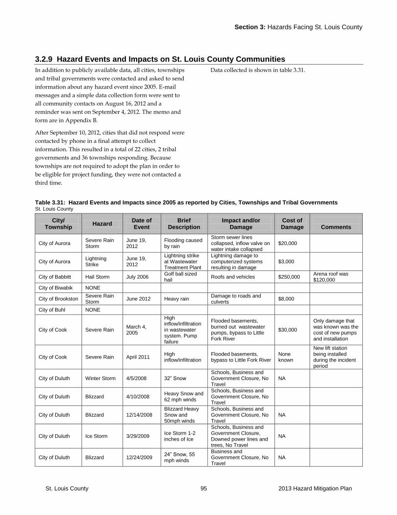
Section 3: Hazards Facing St. Louis County
St. Louis County 95 2013 Hazard Mitigation Plan
3.2.9 Hazard Events and Impacts on St. Louis County Communities
In addition to publicly available data, all cities, townships
and tribal governments were contacted and asked to send
information about any hazard event since 2005. E-mail
messages and a simple data collection form were sent to
all community contacts on August 16, 2012 and a
reminder was sent on September 4, 2012. The memo and
form are in Appendix B.
After September 10, 2012, cities that did not respond were
contacted by phone in a final attempt to collect
information. This resulted in a total of 22 cities, 2 tribal
governments and 36 townships responding. Because
townships are not required to adopt the plan in order to
be eligible for project funding, they were not contacted a
third time.
Data collected is shown in table 3.31.
Table 3.31: Hazard Events and Impacts since 2005 as reported by Cities, Townships and Tribal Governments St. Louis County
City/ Township
Hazard Date of Event
Brief Description
Impact and/or Damage
Cost of Damage
Comments
City of Aurora Severe Rain Storm
June 19, 2012
Flooding caused by rain
Storm sewer lines collapsed, inflow valve on water intake collapsed
$20,000
City of Aurora Lightning Strike
June 19, 2012
Lightning strike at Wastewater Treatment Plant
Lightning damage to computerized systems resulting in damage
$3,000
City of Babbitt Hail Storm July 2006 Golf ball sized hail
Roofs and vehicles $250,000 Arena roof was $120,000
City of Biwabik NONE
City of Brookston Severe Rain Storm
June 2012 Heavy rain Damage to roads and culverts
$8,000
City of Buhl NONE
City of Cook Severe Rain March 4, 2005
High inflow/infiltration in wastewater system. Pump failure
Flooded basements, burned out wastewater pumps, bypass to Little Fork River
$30,000
Only damage that was known was the cost of new pumps and installation
City of Cook Severe Rain April 2011 High inflow/infiltration
Flooded basements, bypass to Little Fork River
None known
New lift station being installed during the incident period
City of Duluth Winter Storm 4/5/2008 32” Snow Schools, Business and Government Closure, No Travel
NA
City of Duluth Blizzard 4/10/2008 Heavy Snow and 62 mph winds
Schools, Business and Government Closure, No Travel
City of Duluth Blizzard 12/14/2008 Blizzard Heavy Snow and 50mph winds
Schools, Business and Government Closure, No Travel
NA
City of Duluth Ice Storm 3/29/2009 Ice Storm 1-2 inches of Ice
Schools, Business and Government Closure, Downed power lines and trees, No Travel
NA
City of Duluth Blizzard 12/24/2009 24” Snow, 55 mph winds
Business and Government Closure, No Travel
NA

Section 3: Hazards Facing St. Louis County
St. Louis County 96 2013 Hazard Mitigation Plan
City of Duluth Wind/Rain/ Snow Event
10/26/2010
Heavy Rain, snow mixture with 60mph + Winds
Downed trees, power lines, flooding
City of Duluth Hail 5/30/2012 Hail Storm Widespread damaged roofs, vehicles, etc
NA
City of Duluth Drought 10/1/2012-6/18/2012
Limited to no precipitation causing very dry conditions
No long term effect NA
City of Duluth Flooding 6/19/2012
10 inches of rain causing widespread flooding, landslides, and damaged roads
Declared disaster. Infrastructure, homes, parks, and river and creek beds severely damaged
100 million+
City of Eveleth Hail Storm July 2, 2012 Sever Storm with Large Hail
Vehicular and residential damage to roofs and siding
Hundreds of thousands
Claims to vehicles and structures are still coming in to insurance companies
City of Ely Chemical Oct 2011 Meth lab clean up
County did clean up and paid cost
City of Ely Chemical 2006 Meth lab clean up
County did clean up and paid cost
City of Floodwood
Flood June 2012 Flood Three homes and infrastructure
$250,000
City of Hermantown
Flood June 20, 2012
Major flood event
Roads, bridges and homes damaged
$571,000
City of Hoyt Lakes
NONE
City of Hibbing NONE
City of Kinney NONE
City of Leonidas NONE
City of Meadowlands
NONE
City of Mountain Iron
NONE
City of Orr NONE
City of Proctor Flood June 20, 2012
City flooded after receiving 8” of rain in a 24 hour period
Several city streets were washed out. Downtown businesses flooded. Basements of many homes flooded.
$750,000
City of Tower Hail Storm July 2010 Hail Damage to water tower, lift station house, pump house, well house
$8,100
City of Tower Hail Storm July 2011 Hail Damage to train canopy and depot roof
$12,000
City of Tower Winter Storm April 16, 2012
10” or more snow fall in one 24 hour period
Severe power outages and major damage to sanitary sewer system and lift stations
$15,000
City of Winton NONE
Angora Township
NONE
Arrowhead Township
NONE
Ault Township NONE
Balkan Township NONE
Basset Township NONE
Biwabik NONE
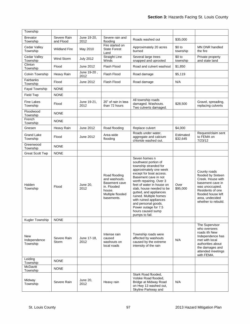
Section 3: Hazards Facing St. Louis County
St. Louis County 97 2013 Hazard Mitigation Plan
Township
Brevator Township
Severe Rain and Flood
June 19-20, 2012
Severe rain and flooding
Roads washed out $35,000
Cedar Valley Township
Wildland Fire May 2010 Fire started on State Forest Land
Approximately 20 acres burned
$0 to township
MN DNR handled the fire
Cedar Valley Township
Wind Storm July 2012 Straight Line Winds
Several large trees snapped and uprooted
$0 to township
Private property and state land
Clinton Township
Flood June 2012 Flash Flood Road and culvert washout $1,850
Colvin Township Heavy Rain June 19-20 , 2012
Flash Flood Road damage $5,119
Fairbanks Township
Flood June 2012 Flash Flood Road damage N/A
Fayal Township NONE
Field Twp NONE
Fine Lakes Township
Flood June 19-21, 2012
20” of rain in less than 72 hours
All township roads damaged. Washouts. Two culverts damaged.
$28,500 Gravel, spreading, replacing culverts
Floodwood Township
NONE
French Township
NONE
Gnesen Heavy Rain June 2012 Road flooding Replace culvert $4,000
Grand Lake Township
Flood June 2012 Area-wide flooding
Roads under water, aggregate and calcium chloride washed out.
Estimated $32,645
Request/claim sent to FEMA on 7/23/12
Greenwood Township
NONE
Great Scott Twp NONE
Halden Township
Flood June 20, 2012
Road flooding and washouts. Basement cave in. Flooded house. Multiple flooded basements.
Seven homes n southwest portion of township stranded for approximately one week except for boat access. Basement cave in not worth repairing. Over 3 feet of water in house on slab, house needed to be gutted, and appliances ruined. Multiple homes with ruined appliances and personal goods. Power outage for 7.5 hours caused sump pumps to fail.
Over $95,000
County roads flooded by Sixteen Creek. House with basement cave in was unoccupied. Residents of one flooded house left area, undecided whether to rebuild.
Kugler Township NONE
New Independence Township
Severe Rain Storm
June 17-18, 2012
Intense rain caused washouts on local roads
Township roads were affected by washouts caused by the extreme intensity of the rain
N/A
The Supervisor who oversees roads ith New Independence has met with local authorities about the damages and attended meetings with FEMA.
Leiding Township
NONE
McDavitt Township
NONE
Midway Township
Severe Rain June 20, 2012
Heavy rain
Stark Road flooded, Volske Road flooded, Bridge at Midway Road on Hwy 13 washed out, Skyline Parkway and
N/A
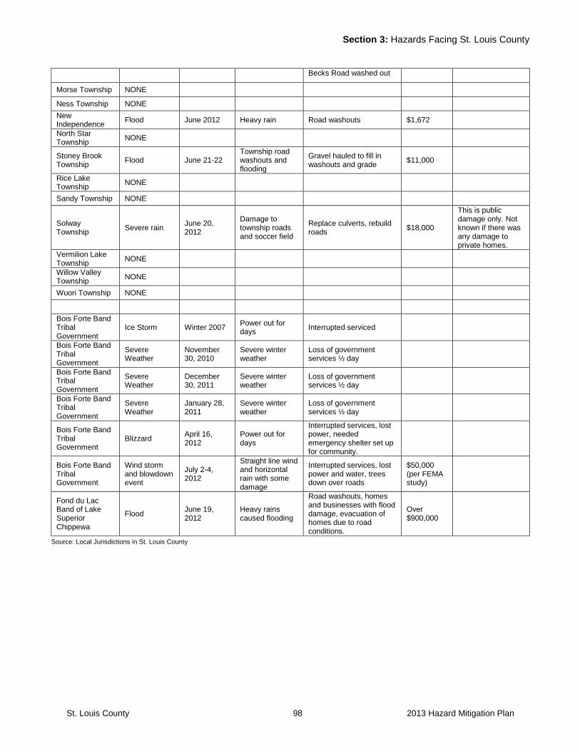
Section 3: Hazards Facing St. Louis County
St. Louis County 98 2013 Hazard Mitigation Plan
Becks Road washed out
Morse Township NONE
Ness Township NONE
New Independence
Flood June 2012 Heavy rain Road washouts $1,672
North Star Township
NONE
Stoney Brook Township
Flood June 21-22 Township road washouts and flooding
Gravel hauled to fill in washouts and grade
$11,000
Rice Lake Township
NONE
Sandy Township NONE
Solway Township
Severe rain June 20, 2012
Damage to township roads and soccer field
Replace culverts, rebuild roads
$18,000
This is public damage only. Not known if there was any damage to private homes.
Vermilion Lake Township
NONE
Willow Valley Township
NONE
Wuori Township NONE
Bois Forte Band Tribal Government
Ice Storm Winter 2007 Power out for days
Interrupted serviced
Bois Forte Band Tribal Government
Severe Weather
November 30, 2010
Severe winter weather
Loss of government services ½ day
Bois Forte Band Tribal Government
Severe Weather
December 30, 2011
Severe winter weather
Loss of government services ½ day
Bois Forte Band Tribal Government
Severe Weather
January 28, 2011
Severe winter weather
Loss of government services ½ day
Bois Forte Band Tribal Government
Blizzard April 16, 2012
Power out for days
Interrupted services, lost power, needed emergency shelter set up for community.
Bois Forte Band Tribal Government
Wind storm and blowdown event
July 2-4, 2012
Straight line wind and horizontal rain with some damage
Interrupted services, lost power and water, trees down over roads
$50,000 (per FEMA study)
Fond du Lac Band of Lake Superior Chippewa
Flood June 19, 2012
Heavy rains caused flooding
Road washouts, homes and businesses with flood damage, evacuation of homes due to road conditions.
Over $900,000
Source: Local Jurisdictions in St. Louis County
St. Louis County 99 2013 Hazard Mitigation Plan
SECTION FOUR: St. Louis County Risks and Vulnerabilities
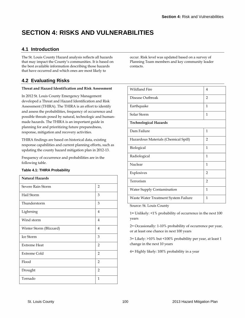
Section 4: Risk and Vulnerabilities
St. Louis County 100 2013 Hazard Mitigation Plan
SECTION 4: RISKS AND VULNERABILITIES
4.1 Introduction
The St. Louis County Hazard analysis reflects all hazards that may impact the County’s communities. It is based on the best available information describing those hazards that have occurred and which ones are most likely to
occur. Risk level was updated based on a survey of Planning Team members and key community leader contacts.
4.2 Evaluating Risks
Threat and Hazard Identification and Risk Assessment
In 2012 St. Louis County Emergency Management
developed a Threat and Hazard Identification and Risk
Assessment (THIRA). The THIRA is an effort to identify
and assess the probabilities, frequency of occurrence and
possible threats posed by natural, technologic and human-
made hazards. The THIRA is an important guide in
planning for and prioritizing future preparedness,
response, mitigation and recovery activities.
THIRA findings are based on historical data, existing
response capabilities and current planning efforts, such as
updating the county hazard mitigation plan in 2012-13.
Frequency of occurrence and probabilities are in the
following table.
Table 4.1: THIRA Probability
Natural Hazards
Severe Rain Storm 2
Hail Storm 3
Thunderstorm 3
Lighrning 4
Wind storm 4
Winter Storm (Blizzard) 4
Ice Storm 3
Extreme Heat 2
Extreme Cold 2
Flood 2
Drought 2
Tornado 1
Wildland Fire 4
Disease Outbreak 2
Earthquake 1
Solar Storm 1
Technological Hazards
Dam Failure 1
Hazardous Materials (Chemical Spill) 2
Biological 1
Radiological 1
Nuclear 1
Explosives 2
Terrorism 2
Water Supply Contamination 1
Waste Water Treatment System Failure 1
Source: St. Louis County
1= Unlikely: <1% probability of occurrence in the next 100
years
2= Occasionally: 1-10% probability of occurrence per year,
or at least one chance in next 100 years
3= Likely: >10% but <100% probability per year, at least 1
change in the next 10 years
4= Highly likely: 100% probability in a year
Section 4: Risk and Vulnerabilities
St. Louis County 101 2013 Hazard Mitigation Plan
Sectoring is dividing a community into manageable
segments or portions based on local geography in relation
to a specific hazard event. The St. Louis County Hazard
Mitigation Sectors map in Appendix A shows the
boundaries of each sector.
Sectors in St. Louis County were created to identify local
areas of service, identify vulnerable areas and determine
risks for future events. Sectors allow the County to
evaluate how an area could be impacted or how it has
been impacted, and what can be done to mitigate impacts
from a specific event. They can also be used to organize
and conduct emergency response activities.
St. Louis County is divided into eight sectors. The sectors
were defined by the hazard mitigation team and mapped.
The sectors follow primarily existing emergency response
district boundaries but also take into consideration special
characteristics such as the Duluth Superior Harbor.
Sector One: Duluth Metro Area The Duluth Metro Area includes the cities of Duluth,
Proctor and Hermantown as well as Midway, Solway,
Grand Lake, Fredenberg, Canosia, Rice Lake, Lakewood
and Duluth Township. Over half of the County
population is concentrated in this area. Canal Park
located on Duluth’s waterfront is a major tourist draw.
Duluth serves as the government and business services
center for Northeast Minnesota. The City is further home
to two major medical centers, Essentia Health and St.
Luke’s Hospitals and Clinics that serve a regional
function. The City is home to the County Seat and a
number of federal offices are located in the City as well.
The main transportation connections are Interstate 35,
Highway 61, Highway 2, and Highway 53. A number of
railroads run through Sector One. There are three dams in
Sector One: Fond du Lac, Rice Lake and Fish Lake. The
Haz-Mat Response Team is located in Duluth.
Sector Two: Duluth-Superior Harbor The Duluth-Superior Harbor is the most westerly located
seaport offering access to the Atlantic Ocean. The U.S.
Coast Guard is responsible for port security as well as
coordination of response to oil spills, hazardous substance
discharges or other incidents in the Harbor that may
interfere with commerce. The U.S. Coast Guard has a Port
Security Plan, and an Oil Spill and Hazardous Substance
Response Plan. As part of these planning efforts, the U.S.
Coast Guard coordinates with agencies from both the City
of Duluth and the City of Superior as well as with
appropriate tribal, state and federal agencies. The recent
increase in terrorism threat has increased the U.S. Coast
Guard’s activities regarding port security. Under the
direction of the Coast Guard Captain of the Port of
Duluth, there are two plans which reference each other.
The Western Lake Superior Area Maritime Security
Committee (AMSC) is comprised of representatives from a
variety of port related sources to continually assess
security risks to the ports, determine appropriate risk
mitigation strategies and develop, revise and implement
the Area Maritime Security Plan. The AMSC also serves as
a mechanism by witch security threats and changes in
MARSEC Levels are communicated to port stake holders.
The Western Lake Superior Port Area Committee is a
planning and preparedness organization. Individual
members may have an oil and hazardous substance
response role. The planning role is required by Sections
311(a)(18) and (j)(4) of the Clean Water Act (CWA) as
amended. The Area Committee is mandated to prepare
and submit for approval an Area Contingency Plan (ACP)
which describes the strategy for a coordinated federal
tribal, state and local response to a discharge or
substantial threat of discharge of oil or a release or
substantial threat of release of hazardous substances(s)
within the boundaries of the coastal and inland area of
Western Lake Superior.
Sector Three: South Central St. Louis County Lakes Area This sector is characterized in general by low density
population. The landscape has a forest character and
includes large portions of wetlands. Cities in this sector
include the cities of Floodwood and Meadowlands.
Flooding is a concern in the city of Floodwood and the
immediate surrounding area. This sector also includes a
portion of the Fond Du Lac Indian Reservation. Main
transportation routes in this sector include Highway 53,
Highway 2 and Highway 33 offering a connection to I-35.
The St. Louis River drains into a large portion of this
sector in the western half. The Cloquet River originates in
the eastern half and drains the majority of that side of the
sector and flows into the St. Louis River. This sector
further includes three Minnesota Power reservoirs.
Sector Four: West St. Louis County Iron Range Communities This sector includes the cities of Hibbing, Chisholm,
Kinney, Buhl and Mountain Iron and the surrounding
townships. Hibbing, with a population of over 17,000, is
the second largest community in the County. There is a
County Courthouse and county offices in Hibbing.
Section 4: Risk and Vulnerabilities
St. Louis County 102 2013 Hazard Mitigation Plan
Taconite mining, manufacturing and call centers are the
primary economic activities in this area. Highway 169 is
the primary transportation route through this sector. The
Laurentian Divide runs through this sector. The taconite
pellets are shipped out by rail. Iron World, a major tourist
attraction interpreting the mining and cultural history, is
located in this sector.
Sector Five: Central St. Louis County Iron Range Communities This sector includes the communities of Eveleth, Virginia,
Gilbert, Biwabik, Aurora and Hoyt Lakes and the
surrounding townships. Mining, manufacturing and a
number of call center operations are the primary economic
activities in this area. The City of Virginia further houses a
number of county offices serving the northern half of St.
Louis County. Main transportation routes include
Highway 169 and Highway 53. The Laurentian Divide
runs through this sector. The DWP railroad, which serves
as an important international railroad connection, travels
through this sector as well. The taconite pellets are
shipped out by rail. The Giants Ridge Recreation Area
serves as an important tourist attraction in this sector and
includes a ski-hill and golf course.
Sector Six: East St. Louis County Iron Range Communities This sector includes the communities of Babbitt, Tower
and Ely as well as a number of townships. It also includes
the Lake Vermillion Section of the Bois Forte Reservation
which includes the Fortune Bay resort complex. Portions
of this sector are located within the Superior National
Forest. Mining used to be an important part of the
economic activity in this area, but currently there are no
active mines. The LTV mine was recently closed, however
there is potential for a precious metal mining operation in
the future on this site or in its proximity. The area includes
a large portion of public lands and is part of the Canadian
Shield. The Laurentian Divide runs through this sector.
Development predominantly is located on the lakes
located within the area. The area experiences a great
seasonal fluctuation in the number of residents. Road
infrastructure is limited in this area. A significant number
of properties in this sector are in remote locations and
sometimes have water access only. The primary
transportation routes are Highway 169, Highway 135 and
Highway 1. These routes serve in general a more regional
function. Provision of emergency services is a challenge in
this area due to its low-density population, seasonal
population fluctuations and remote character. Impacts
from wildfire on residences are a concern in this area.
Sector Seven: North St. Louis County This sector includes the communities of Cook, Orr and
Crane Lake as well as Pelican Lake and portions of Lake
Vermilion. It further includes a small portion of Nett Lake,
which is part of the Boise Forte Reservation. This area is
similar in characteristics as section six. Population
densities are low in general and a large number of
seasonal residences are located on the lakes within the
area. The emergency response districts are geographically
spread out and many properties are located in remote
areas with limited access. Wildfire is a concern in this area.
Other concerns include the potential for derailments on
the DWP railroad and chemical spills in the communities
of Orr and Cook where the location of emergency services
poses logistical challenges in case of an event within these
communities. In the city of Cook, flooding of the Little
Fork River is a concern. Primary economic activities are
logging and wood producing industries as well as
tourism.
Sector Eight: Boundary Waters Canoe Area Wilderness and Voyageurs National Park This sector includes a Federal designated wilderness area
and a national park. The primary functions of these areas
are wilderness and recreation. In general, natural
processes such as wildfires are not being interfered with
but rather are monitored to ensure populated areas
outside these areas are not negatively impacted. The
BWCAW does not allow motorized access with a few
small exceptions on the large border lakes. This impacts
the ability to respond to emergencies or wildfires within
the area. Exceptions can be made only for special
circumstances. The BWCAW and Voyageurs National
Park straddle the Canadian Boundary. Customs and
Immigration monitor this area through the International
Borders Enforcement Team (IBET). The recent terrorism
concerns have increased the need to monitor this area.
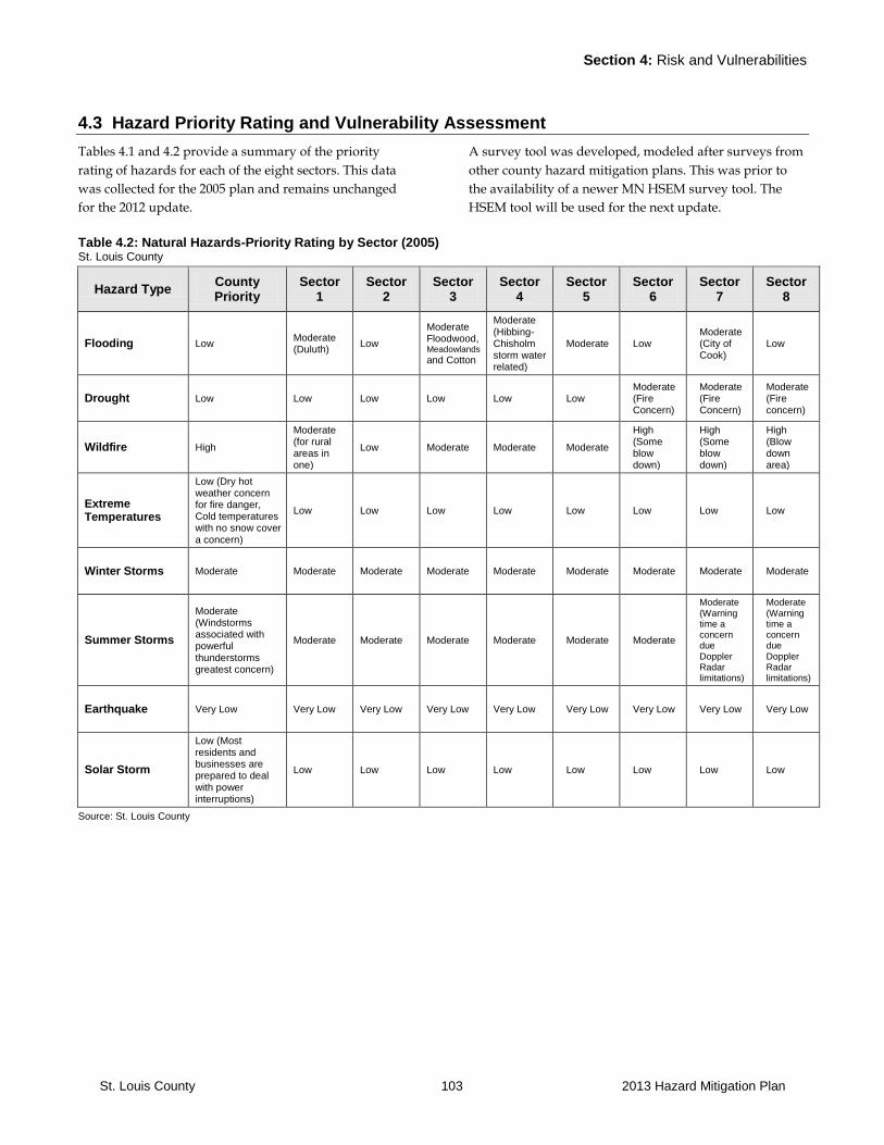
Section 4: Risk and Vulnerabilities
St. Louis County 103 2013 Hazard Mitigation Plan
4.3 Hazard Priority Rating and Vulnerability Assessment
Tables 4.1 and 4.2 provide a summary of the priority
rating of hazards for each of the eight sectors. This data
was collected for the 2005 plan and remains unchanged
for the 2012 update.
A survey tool was developed, modeled after surveys from
other county hazard mitigation plans. This was prior to
the availability of a newer MN HSEM survey tool. The
HSEM tool will be used for the next update.
Table 4.2: Natural Hazards-Priority Rating by Sector (2005) St. Louis County
Hazard Type County Priority
Sector 1
Sector 2
Sector 3
Sector 4
Sector 5
Sector 6
Sector 7
Sector 8
Flooding Low Moderate (Duluth)
Low
Moderate Floodwood, Meadowlands and Cotton
Moderate (Hibbing-Chisholm storm water related)
Moderate Low Moderate (City of Cook)
Low
Drought Low Low Low Low Low Low Moderate (Fire Concern)
Moderate (Fire Concern)
Moderate (Fire concern)
Wildfire High
Moderate (for rural areas in one)
Low Moderate Moderate Moderate
High (Some blow down)
High (Some blow down)
High (Blow down area)
Extreme Temperatures
Low (Dry hot weather concern for fire danger, Cold temperatures with no snow cover a concern)
Low Low Low Low Low Low Low Low
Winter Storms Moderate Moderate Moderate Moderate Moderate Moderate Moderate Moderate Moderate
Summer Storms
Moderate (Windstorms associated with powerful thunderstorms greatest concern)
Moderate Moderate Moderate Moderate Moderate Moderate
Moderate (Warning time a concern due Doppler Radar limitations)
Moderate (Warning time a concern due Doppler Radar limitations)
Earthquake Very Low Very Low Very Low Very Low Very Low Very Low Very Low Very Low Very Low
Solar Storm
Low (Most residents and businesses are prepared to deal with power interruptions)
Low Low Low Low Low Low Low Low
Source: St. Louis County
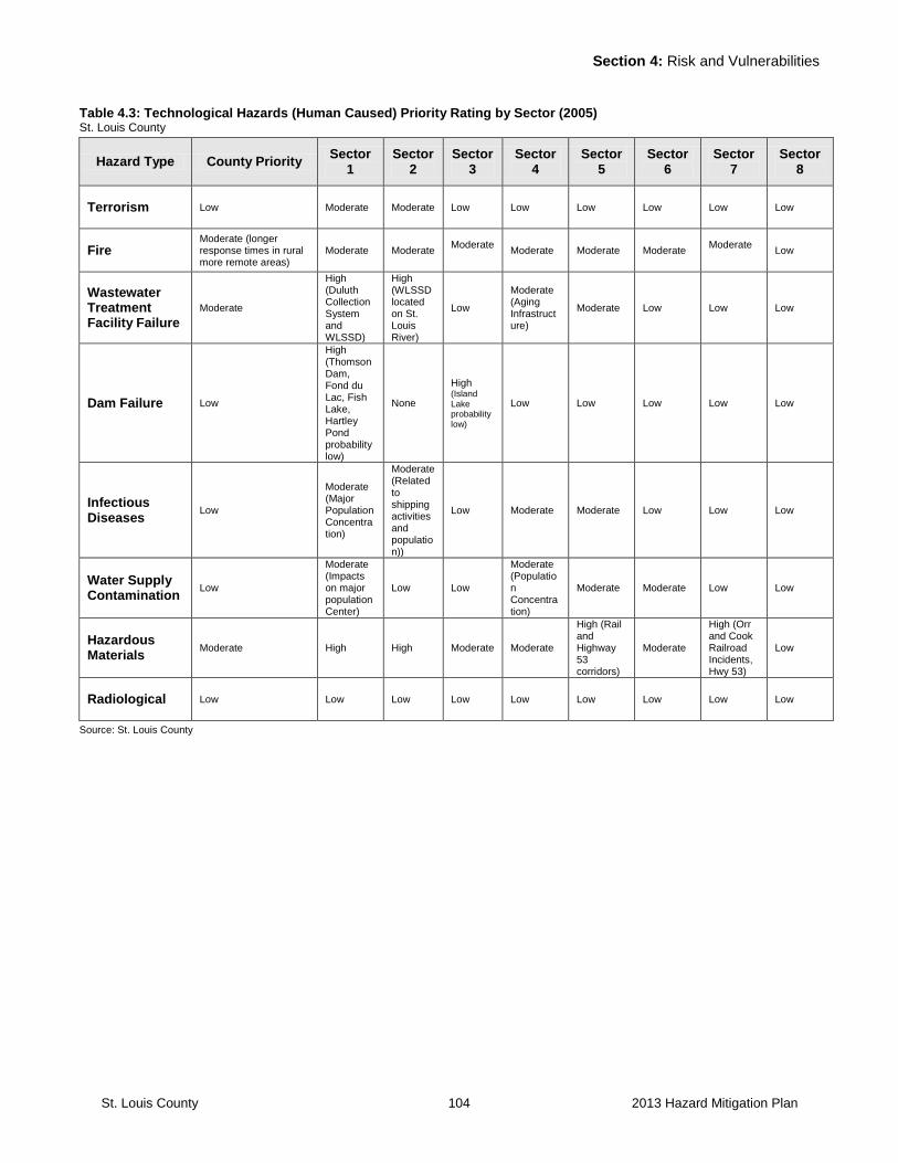
Section 4: Risk and Vulnerabilities
St. Louis County 104 2013 Hazard Mitigation Plan
Table 4.3: Technological Hazards (Human Caused) Priority Rating by Sector (2005) St. Louis County
Hazard Type County Priority Sector
1 Sector
2 Sector
3 Sector
4 Sector
5 Sector
6 Sector
7 Sector
8
Terrorism Low Moderate Moderate Low Low Low Low Low Low
Fire Moderate (longer response times in rural more remote areas)
Moderate Moderate Moderate
Moderate Moderate Moderate Moderate
Low
Wastewater Treatment Facility Failure
Moderate
High (Duluth Collection System and WLSSD)
High (WLSSD located on St. Louis River)
Low
Moderate (Aging Infrastructure)
Moderate Low Low Low
Dam Failure Low
High (Thomson Dam, Fond du Lac, Fish Lake, Hartley Pond probability low)
None
High (Island Lake probability low)
Low Low Low Low Low
Infectious Diseases
Low
Moderate (Major Population Concentration)
Moderate (Related to shipping activities and population))
Low Moderate Moderate Low Low Low
Water Supply Contamination
Low
Moderate (Impacts on major population Center)
Low Low
Moderate (Population Concentration)
Moderate Moderate Low Low
Hazardous Materials
Moderate High High Moderate Moderate
High (Rail and Highway 53 corridors)
Moderate
High (Orr and Cook Railroad Incidents, Hwy 53)
Low
Radiological Low Low Low Low Low Low Low Low Low
Source: St. Louis County
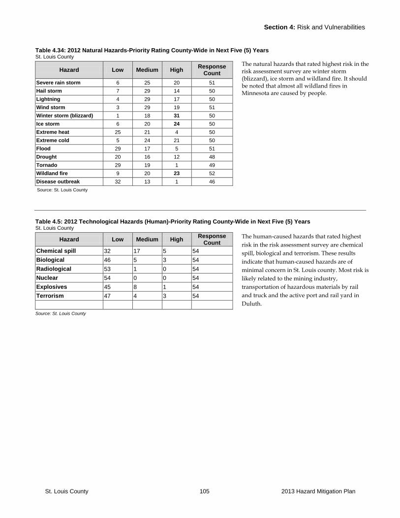
Section 4: Risk and Vulnerabilities
St. Louis County 105 2013 Hazard Mitigation Plan
Table 4.34: 2012 Natural Hazards-Priority Rating County-Wide in Next Five (5) Years St. Louis County
Hazard Low Medium High Response
Count
Severe rain storm 6 25 20 51
Hail storm 7 29 14 50
Lightning 4 29 17 50
Wind storm 3 29 19 51
Winter storm (blizzard) 1 18 31 50
Ice storm 6 20 24 50
Extreme heat 25 21 4 50
Extreme cold 5 24 21 50
Flood 29 17 5 51
Drought 20 16 12 48
Tornado 29 19 1 49
Wildland fire 9 20 23 52
Disease outbreak 32 13 1 46
Source: St. Louis County
Table 4.5: 2012 Technological Hazards (Human)-Priority Rating County-Wide in Next Five (5) Years St. Louis County
Hazard Low Medium High Response
Count
Chemical spill 32 17 5 54
Biological 46 5 3 54
Radiological 53 1 0 54
Nuclear 54 0 0 54
Explosives 45 8 1 54
Terrorism 47 4 3 54
Source: St. Louis County
The natural hazards that rated highest risk in the risk assessment survey are winter storm (blizzard), ice storm and wildland fire. It should be noted that almost all wildland fires in Minnesota are caused by people.
The human-caused hazards that rated highest
risk in the risk assessment survey are chemical
spill, biological and terrorism. These results
indicate that human-caused hazards are of
minimal concern in St. Louis county. Most risk is
likely related to the mining industry,
transportation of hazardous materials by rail
and truck and the active port and rail yard in
Duluth.
Section 4: Risk and Vulnerabilities
St. Louis County 106 2013 Hazard Mitigation Plan
4.4 Natural Hazards of Specific Concern
Flooding in general is low to medium concern in St. Louis
County and damages from flooding events in general
have been limited. Three areas have ongoing concern
relating to flooding and these include the cities of Duluth,
Floodwood and Cook (Sectors 1, 3 and 7). Flooding is
primarily a concern during the spring snowmelt combined
with rain and faster run-off due to poor drainage as a
result of frozen ground.
Concerns for Floodwood include the need for better
mapping of flood zones in order to prevent future
development from taking place in potentially flood prone
areas. Floodwood also has a need to relocate and mitigate
existing flood prone structures. The majority of the City of
Cook is within the flood zone (See Map 2.4 Appendix C).
For the City of Cook a mitigation plan was developed
using retention ponds to slow down the flow of water.
This plan has not been able to be implemented because
some of the properties needed for the retention ponds
could not be acquired.
Some of the Iron Range communities (Sectors 4 and 5)
have flooding concerns which are a combination of storm
water related and poor drainage during extreme rain
storm events.
Flash flooding is a concern in areas, such as Duluth, where
heavy rain and runoff fills and overflows streambeds.
Parts of the County were declared disaster areas and
suffered significant damage due to a June 2012 storm.
Throughout the county localized flood damage to road
infrastructure is an ongoing concern during extreme
summer storm events and spring snowmelt. Danger to
motorist related to road outwashes and people being
stranded are a concern.
Severe storms can impact all sectors in St. Louis County.
Severe winter storms can pose risks for certain population
groups living in the more remote parts of St. Louis
County. The population in these areas may have some
delays in getting roads cleared. Power may be interrupted
for a period of time. However, in general, populations
living in more remote areas are well prepared with extra
food and water and back-up heat available. Winter travel
can be a concern during severe storms and cold weather.
Ongoing education on the importance of winter storm
preparedness can help ensure risks are limited.
Severe thunderstorms producing straight-line winds can
cause significant damage. Downed timber, debris
clearance, infrastructure damage to roads and power lines
and loss of business amounted to the greatest losses as a
result of this storm. St. Louis County does experience low
intensity tornadoes that can cause localized damage. Large
waves as a result of strong Nor’easter storms on Lake
Superior can damage the shoreline and infrastructure such
as the Lakewalk in Duluth.
Older residents in rural areas sometimes have challenges
in the aftermath of severe storms. They sometimes have
limited options to clear snow or debris and ongoing
medical needs may be a concern as well. Education and
personal preparedness are important tools to reduce risks.
Wildland fire presents risk of damage to forest resources,
property and lives across the County. Wildland fire is a
natural part of the Northern Minnesota forest ecosystem.
The current risk of a large wildfire in northeast St. Louis
County is a result of insect and disease damage to certain
tree species and aging forest resulting in heavy fuel
loading. The sectors where wildfire is a primary concern
are 3, 4, 5, 6, 7 and 8. However, any wildland urban
interface area has risks. Spring grass fires along railways
are a concern for rural townships.
Estimating potential losses due to wildfire is difficult.
Losses depend on the size of the fire, the area through
which it burns, weather conditions and the speed at which
it moves. The FEMA 386-2 Understanding Your Losses
Manual does not offer standards for calculating potential
losses to structures or content due to wildfires. The
wildland fire hazard rating form included in this manual
does not provide a very applicable methodology to rate
the risk of wildland fire hazard for properties, as
development tends to be scattered in low densities
interspersed with larger sections of public lands.
Northeastern St. Louis County has the greatest risk of
larger scale wildland fires impacting residences. Average
prices for residences in the rural areas are between
$150,000 and $250,000 with lake properties being on the
higher end of this price range. However, in some cases
lake properties may be at lower risk from wildland fire.
Further, a large-scale fire in the BWCAW could impact
visitors in this area.
Section 4: Risk and Vulnerabilities
St. Louis County 107 2013 Hazard Mitigation Plan
4.5 Human Caused Hazards of Specific Concern
Terrorism and technological hazards caused by humans
have historically been a low risk in St. Louis County. With
increased concerns regarding terrorism, Sectors 1 and 2
are most vulnerable as these two sectors hold the main
population concentration and include the Duluth-Superior
Port, the Duluth International Airport and National Guard
Airbase, as well as a number of local, state and federal
government offices. Other potential targets include electric
power facilities and lines, and oil and gas transportation
and distribution lines traversing the County. The remote
border with Canada, Sector 8, may pose challenges related
to monitoring illegal entry into the U.S.
Hazardous materials and chemical spills pose the greatest
concerns in relation to impacts on the population.
Concerns are in all sectors that include major
transportation routes or concentrations of businesses that
use chemicals. Sectors of particular concern include
Sectors 1 and 2 where most of the population and
commercial shipping activity is located. Sector 7 also has
two areas of concern; the communities of Orr and Cook,
where chemicals transported by rail may pose risks to the
population and where the location of rail and emergency
response infrastructure may pose challenges to respond to
a major incident. Highway 53 is a major transportation
corridor and chemicals transported on this road continue
to be a concern.

Section 5: Goals, Objectives, and Strategies
St. Louis County 108 2013 Hazard Mitigation Plan
SECTION FIVE: St. Louis County Goals, Objectives and Strategies

Section 5: Goals, Objectives, and Strategies
St. Louis County 109 2013 Hazard Mitigation Plan
SECTION 5: GOALS, OBJECTIVES, AND STRATEGIES
5.1 Introduction
Section five discusses the vision, goals, objectives, and
strategies and outlines an implementation strategy. The
goals, objectives, and strategies are listed in a matrix
format for each hazard. To facilitate implementation, the
strategies have been rated whether they are a high,
medium, or low priority. An updated project timeline and
a list of responsible parties have been identified for each
goal, objective, and strategy.
5.2 Goals, Objectives, and Strategies
For each hazard, the plan presents a goal that reflects the
desired end condition to be achieved as part of this plan.
For each goal, measurable objectives have been identified.
Finally, implementation strategies are identified for each
objective, and where appropriate, stakeholders that need
to be involved. Goals and objectives provide a long-range
perspective and tend to remain the same over time.
Strategies will change over time as projects are completed,
needs change and opportunities arise.
Implementation of strategies and decisions about
mitigation projects will largely occur at the local level.
Tribal, city and township governments have the best
understanding of the risks, needs and capacity for their
residents and visitors.
In the chart that follows, the “Implementation” column
indicates which jurisdiction will likely participate in the
strategy. For some specific or unique strategies, one or
more jurisdictions may be named. For strategies that
indicate implementation will include all jurisdictions in St.
Louis County, it is assumed that all cities, townships and
tribal governments have an interest and probability of
participation.
5.3 Hazard Mitigation Vision
For the 2005 plan, the Planning Team agreed upon a
vision for all hazard mitigation strategies that unifies the
goals, objectives, and strategies. The vision remains the
same for this update. The vision statement reads:
“St. Louis County will strive to work on an ongoing basis
on identifying risks and the development of programs and
partnerships at the local, state, tribal, and federal level that
reduce risks and damages as a result of natural,
technological, and human caused hazards and will strive
to make St. Louis County and the region a safer place to
live.”
5.4 Implementation and Review
The St. Louis County All Hazard Mitigation Plan is a
“living document.” The plan should at a minimum be
reviewed every five-years. The matrix included in this
chapter functions as the primary tool to review progress
on the implementation of the St. Louis County All Hazard
Plan. St. Louis County Emergency Management
Coordinator will initiate and lead meetings on a regular
basis to monitor plan implementation progress and to
reassess needs and opportunities.
A plan monitoring workgroup with representatives that
reflect the planning team that assisted in the development
of this plan and includes representatives
from the various County Departments will be
implemented. Beginning in 2014, this will be done
annually during the third quarter and/or in response to
funding cycles of programs that provide resources for
hazard mitigation activities. Additional meetings will be
held following any significant hazard event. Participants
will include representatives from St. Louis County
departments including Planning and Community
Development, Public Health and Human Services, Land
and Minerals, Public Works and the County Board.
Additional stakeholders, including members of the public,
will be included based on need. The review or an update
of the plan could be an agenda item on an annual basis at
a regularly scheduled County Board meeting. Distribution
of the plan and ongoing posting on the County website
will promote implementation.

Section 5: Goals, Objectives, and Strategies
St. Louis County 110 2013 Hazard Mitigation Plan
Plan updates will be the responsibility of the St. Louis
Sheriff’s Office Emergency Management staff. The update
process will be managed by the Emergency Management
Coordinator. The planning process, data collection, draft
and layout will be contracted, as it has been in the past.
Contracted planners will be St. Louis County staff
members if available. If more appropriate, qualified
planning consultants will be hired under contract to
complete the process according to specifications.

Section 5: Goals, Objectives, and Strategies
St. Louis County 111 2013 Hazard Mitigation Plan
5.5 Implementation Tools
A number of implementation tools are available to
address and mitigate hazards. Many of these tools are
identified in the matrix, however, in some cases additional
discussion is needed in order to identify what strategies
are most appropriate. One tool that local jurisdictions
might use is the FEMA Evaluating Alternative Mitigation
Actions – STAPLEE Worksheet. This will be part of an
ongoing discussion as the County and communities look
for opportunities for plan implementation. The following
tools should be considered:
Education: In many cases education of residents has
been identified as one of the most effective mitigation
strategies. St. Louis County is a large rural county with
low population densities. This limits the ability to
provide services and increases the responsibility
residents have to prepare for natural and man caused
hazards.
Capital Investments: Capital investments such as fire
and ambulance equipment, sprinkler systems and dry
fire hydrants are tools that can limit risks and impacts of
natural and human caused hazards.
Cost-Benefit Review: Whenever a project is planned, an
analysis of cost-benefit should be completed. Using this
tool assures that funds spent and resources used are of
value in the long term in relation to the results expected
and the property and lives protected.
Data Collection and Needs Assessments: Data
collection and needs assessments can aid in gaining a
better understanding of threats and promote planning
for mitigation strategies accordingly. Evaluation and
data collection is likely to be an ongoing activity as
resources become available.
Coordination: Responsibilities for implementation of
mitigation strategies run across various county
departments, local fire and ambulance departments,
tribal, city and township governments, and several state
and federal agencies. Ongoing coordination is
important to ensure resources are used efficiently.
Coordination can help to avoid duplication of efforts or
prevent gaps that are created if roles and responsibilities
are unclear. The mitigation plan review process can
function to promote and facilitate ongoing discussion
about roles and responsibilities and opportunities for
coordination.
Ongoing Integration: Integration of mitigation data,
information, goals and strategies into planning
documents and mechanisms are the responsibly of
various county departments, local fire and ambulance
departments, tribal, city and township governments and
state and federal agencies.
Regional Cooperation: Counties and public safety
services providers throughout the Arrowhead Region
often share similar challenges and opportunities. In
some cases a regional approach to mitigation strategies
may be warranted in order to save resources. Mutual-
aid agreements are already in use for a number of
services. Needs assessments for fire and ambulance
services and development of assistance for volunteer
recruiting, training, and retention could benefit from a
regional approach. Cooperation between counties could
be effective when lobbying for certain funding priorities
that address concerns related to challenges in service
delivery in rural areas. Organizations such as the
Arrowhead EMS, Arrowhead Regional Development
Commission and the State Regional Emergency
Coordinator offer tools and resources to assist in these
cooperative efforts.
Regulation: Regulation is an important mitigation tool
for St. Louis County. Regulation is particularly
important for land use, access to structures and the
protection of water resources and public health.
Key Contacts: Maintain communication with a key
contact person at each city, reservation and township to
monitor project implementation. Consult with planning
team members as appropriate.
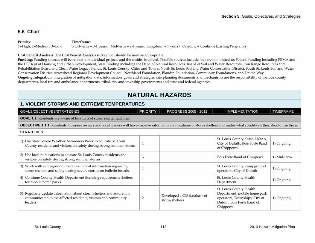
Section 5: Goals, Objectives, and Strategies
St. Louis County 112 2013 Hazard Mitigation Plan
5.6 Chart
Priority: Timeframe: 1=High, 2=Medium, 3=Low Short-term = 0-1 years, Mid-term = 2-4 years, Long-term = 5 years+, Ongoing = Continue Existing Program(s) Cost Benefit Analysis: The Cost Benefit Analysis survey tool should be used as appropriate. Funding: Funding sources will be related to individual projects and the entities involved. Possible sources include, but are not limited to: Federal funding including FEMA and the US Dept of Housing and Urban Development, State funding including the Dept. of Natural Resources, Board of Soil and Water Resources, Iron Range Resources and Rehabilitation Board and Clean Water Legacy Funds, St. Louis County, Cities and Towns, North St. Louis Soil and Water Conservation District, South St. Louis Soil and Water Conservation District, Arrowhead Regional Development Council, Northland Foundation, Blandin Foundation, Community Foundations, and United Way. Ongoing Integration: Integration of mitigation data, information, goals and strategies into planning documents and mechanisms are the responsibility of various county departments, local fire and ambulance departments, tribal, city and township governments and state and federal agencies.
NATURAL HAZARDS
1. VIOLENT STORMS AND EXTREME TEMPERATURES
GOALS/OBJECTIVES/STRATEGIES PRIORITY PROGRESS 2005 - 2012 IMPLEMENTATION TIMEFRAME
GOAL 1.1: Residents are aware of locations of storm shelter facilities.
OBJECTIVE 1.1.1: Residents, business owners and local leaders will have/receive information on locations of storm shelters and under what conditions they should use them.
STRATEGIES
1) Use State Severe Weather Awareness Week to educate St. Louis County residents and visitors on safety during strong summer storms.
1 St. Louis County, State, NOAA, City of Duluth, Bois Forte Band of Chippewa
1) Ongoing
2) Use local publications to educate St. Louis County residents and visitors on safety during strong summer storms.
3 Bois Forte Band of Chippewa 1) Mid-term
3) Work with campground operators to post information regarding storm shelters and safety during severe storms on bulletin boards.
1 St. Louis County, campground operators, City of Duluth
1) Ongoing
4) Continue County Health Department licensing requirement shelters for mobile home parks.
1 St. Louis County Health Department
1) Ongoing
5) Regularly update information about storm shelters and assure it is communicated to the affected residents, visitors and community leaders.
2 Developed a GIS database of storm shelters
St. Louis County Health Department, mobile home park operators, Townships, City of Duluth, Bois Forte Band of Chippewa
1) Ongoing

Section 5: Goals, Objectives, and Strategies
St. Louis County 113 2013 Hazard Mitigation Plan
GOAL 1.2: Residents and visitors will have ample and effective advance warning of approaching severe weather.
OBJECTIVE 1.2.1: Each emergency personnel member is trained and able to recognize approaching severe weather and know how to respond to notifications of approaching severe weather.
STRATEGIES
1) Ensure storm spotters in St. Louis County receive training on a regular basis in order to maintain their storm spotting skill level.
1 Skywarn training is offered annually at a minimum of two locations in the County.
National Weather Service, Emergency Manager, Sheriff’s Department local Fire and EMS Departments, City of Duluth
1) Ongoing
2) Ensure procedures are in place so that area emergency management personnel, county sheriffs, and other emergency response teams are notified as soon as possible in the event of an approaching storm.
1
National Weather Service, Emergency Manager, Sheriff’s Department local Fire and EMS Departments, City of Duluth, Bois Forte Band of Chippewa
2) Ongoing
OBJECTIVE 1.2.2: Residents and visitors receive ample and timely warning of approaching severe weather.
STRATEGIES
1) Install strategically located signage along roadways informing people about emergency information radio frequency.
3 Emergency Manager, Highway Department, School Districts, businesses
1) Mid-Term
2) Promote the use of NOAA weather radios for weather related emergency information during storm awareness weeks.
1
NOAA weather radios provided to schools in the County; provided by NOAA and distributed by the Duluth office of the National Weather Service. Implemented and completed in 2007.
Emergency Manager, City of Duluth
2) Ongoing
3) Assure the functionality of warning systems for the areas with warning systems in place.
2
Duluth has installed a new siren/voice warning system. Duluth and the National Weather Service has implemented an elaborate warning system for Rip Currents in Lake Superior.
Emergency Manager, local units of government including Hibbing, Chisholm, Moutain Iron, Virginia, Gilbert, Aurora, Hoyt Lakes, Babbit, Ely, Duluth, Floodwood.
3) Mid-Term
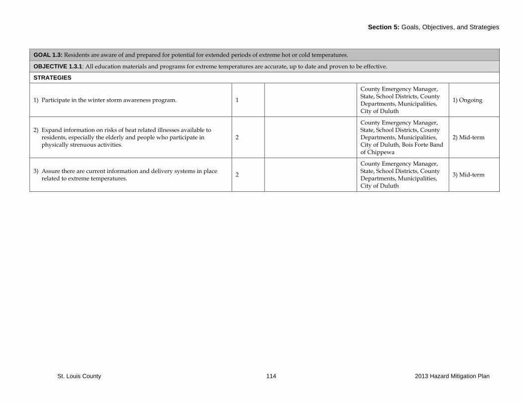
Section 5: Goals, Objectives, and Strategies
St. Louis County 114 2013 Hazard Mitigation Plan
GOAL 1.3: Residents are aware of and prepared for potential for extended periods of extreme hot or cold temperatures.
OBJECTIVE 1.3.1: All education materials and programs for extreme temperatures are accurate, up to date and proven to be effective.
STRATEGIES
1) Participate in the winter storm awareness program. 1
County Emergency Manager, State, School Districts, County Departments, Municipalities, City of Duluth
1) Ongoing
2) Expand information on risks of heat related illnesses available to residents, especially the elderly and people who participate in physically strenuous activities.
2
County Emergency Manager, State, School Districts, County Departments, Municipalities, City of Duluth, Bois Forte Band of Chippewa
2) Mid-term
3) Assure there are current information and delivery systems in place related to extreme temperatures.
2
County Emergency Manager, State, School Districts, County Departments, Municipalities, City of Duluth
3) Mid-term

Section 5: Goals, Objectives, and Strategies
St. Louis County 115 2013 Hazard Mitigation Plan
GOAL 1.4 Residents have access to safe shelters as needed during violent storms or periods of extreme temperatures.
OBJECTIVE 1.4.1: All locations where shelters are needed are identified and current shelter locations are in the County GIS database.
STRATEGIES
1) Update and maintain a database of shelters including capacity and features such as air conditioning and back-up power.
3 Developed a GIS database of storm shelters.
County emergency managers, all jurisdictions in St. Louis County, Red Cross, City of Duluth. St. Louis County Planning and Community Development Department
Long-term
2) Assure shelter is available to residents and visitors based on geographic distribution and will meet needs including features such as pre-wiring for generator power and provision of air conditioning.
3
St. Louis County has been awarded a grant to update the shelter and capabilities list. The survey work is being implemented in 2012.
All jurisdictions in St. Louis County, County emergency managers, all local units of government, Red Cross, City of Duluth, Bois Forte Band of Chippewa
Long-term
3) Build and/or maintain storm shelters for residents and visitors who are vulnerable because such shelter is not available such as in their homes, cabins or camping facilities.
1
All jurisdictions including cities, tribal governments and townships. Owners of private resorts, campgrounds, camps and mobile home parks. City of Duluth.
Long-term
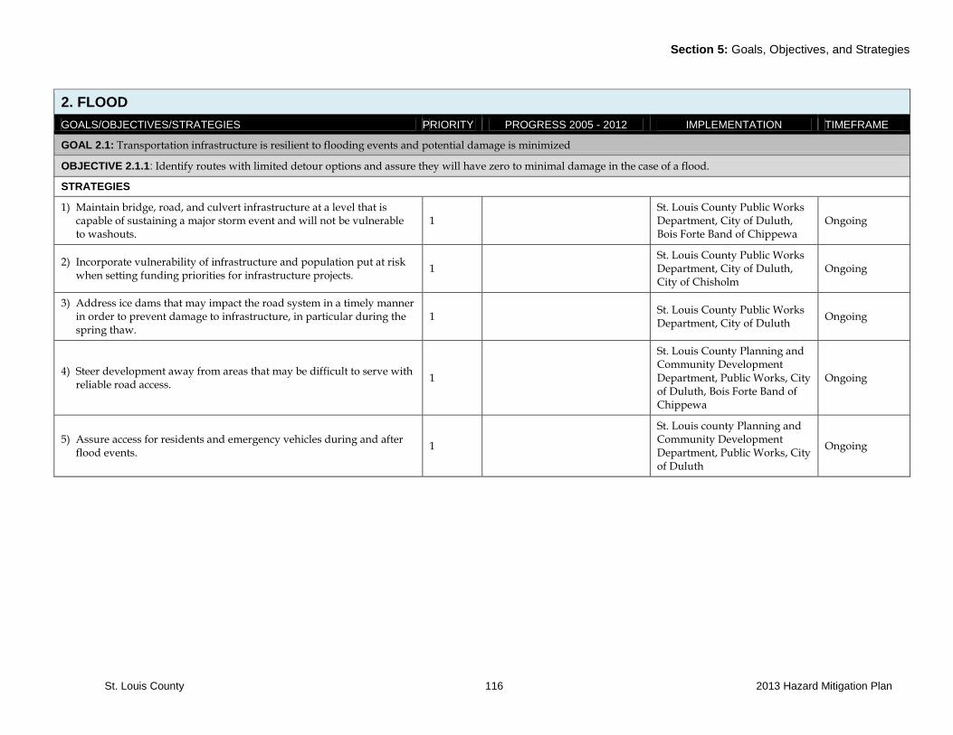
Section 5: Goals, Objectives, and Strategies
St. Louis County 116 2013 Hazard Mitigation Plan
2. FLOOD
GOALS/OBJECTIVES/STRATEGIES PRIORITY PROGRESS 2005 - 2012 IMPLEMENTATION TIMEFRAME
GOAL 2.1: Transportation infrastructure is resilient to flooding events and potential damage is minimized
OBJECTIVE 2.1.1: Identify routes with limited detour options and assure they will have zero to minimal damage in the case of a flood.
STRATEGIES
1) Maintain bridge, road, and culvert infrastructure at a level that is capable of sustaining a major storm event and will not be vulnerable to washouts.
1 St. Louis County Public Works Department, City of Duluth, Bois Forte Band of Chippewa
Ongoing
2) Incorporate vulnerability of infrastructure and population put at risk when setting funding priorities for infrastructure projects.
1 St. Louis County Public Works Department, City of Duluth, City of Chisholm
Ongoing
3) Address ice dams that may impact the road system in a timely manner in order to prevent damage to infrastructure, in particular during the spring thaw.
1 St. Louis County Public Works Department, City of Duluth
Ongoing
4) Steer development away from areas that may be difficult to serve with reliable road access.
1
St. Louis County Planning and Community Development Department, Public Works, City of Duluth, Bois Forte Band of Chippewa
Ongoing
5) Assure access for residents and emergency vehicles during and after flood events.
1
St. Louis county Planning and Community Development Department, Public Works, City of Duluth
Ongoing
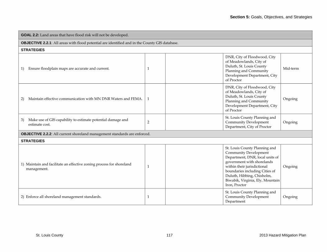
Section 5: Goals, Objectives, and Strategies
St. Louis County 117 2013 Hazard Mitigation Plan
GOAL 2.2: Land areas that have flood risk will not be developed.
OBJECTIVE 2.2.1: All areas with flood potential are identified and in the County GIS database.
STRATEGIES
1) Ensure floodplain maps are accurate and current. 1
DNR, City of Floodwood, City of Meadowlands, City of Duluth, St. Louis County Planning and Community Development Department, City of Proctor
Mid-term
2) Maintain effective communication with MN DNR Waters and FEMA. 1
DNR, City of Floodwood, City of Meadowlands, City of Duluth, St. Louis County Planning and Community Development Department, City of Proctor
Ongoing
3) Make use of GIS capability to estimate potential damage and estimate cost.
2 St. Louis County Planning and Community Development Department, City of Proctor
Ongoing
OBJECTIVE 2.2.2: All current shoreland management standards are enforced.
STRATEGIES
1) Maintain and facilitate an effective zoning process for shoreland management.
1
St. Louis County Planning and Community Development Department, DNR, local units of government with shorelands within their jurisdictional boundaries including Cities of Duluth, Hibbing, Chisholm, Biwabik, Virginia, Ely, Mountain Iron, Proctor
Ongoing
2) Enforce all shoreland management standards. 1 St. Louis County Planning and Community Development Department
Ongoing
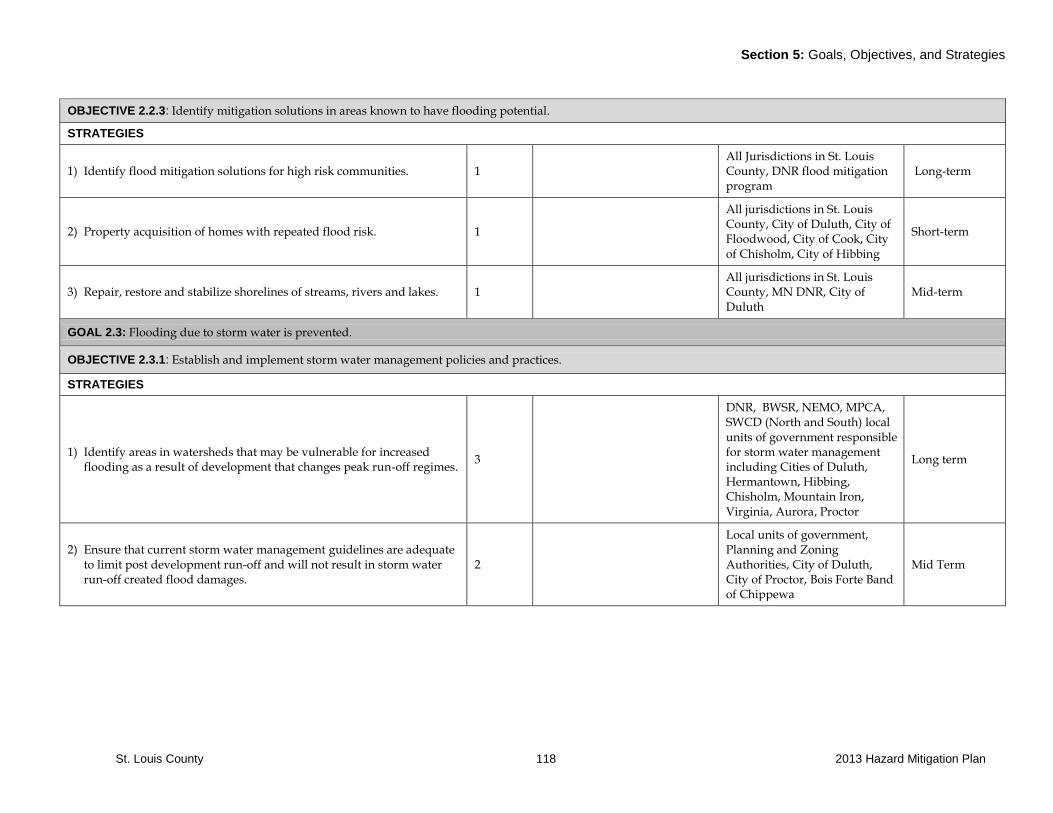
Section 5: Goals, Objectives, and Strategies
St. Louis County 118 2013 Hazard Mitigation Plan
OBJECTIVE 2.2.3: Identify mitigation solutions in areas known to have flooding potential.
STRATEGIES
1) Identify flood mitigation solutions for high risk communities. 1 All Jurisdictions in St. Louis County, DNR flood mitigation program
Long-term
2) Property acquisition of homes with repeated flood risk. 1
All jurisdictions in St. Louis County, City of Duluth, City of Floodwood, City of Cook, City of Chisholm, City of Hibbing
Short-term
3) Repair, restore and stabilize shorelines of streams, rivers and lakes. 1 All jurisdictions in St. Louis County, MN DNR, City of Duluth
Mid-term
GOAL 2.3: Flooding due to storm water is prevented.
OBJECTIVE 2.3.1: Establish and implement storm water management policies and practices.
STRATEGIES
1) Identify areas in watersheds that may be vulnerable for increased flooding as a result of development that changes peak run-off regimes.
3
DNR, BWSR, NEMO, MPCA, SWCD (North and South) local units of government responsible for storm water management including Cities of Duluth, Hermantown, Hibbing, Chisholm, Mountain Iron, Virginia, Aurora, Proctor
Long term
2) Ensure that current storm water management guidelines are adequate to limit post development run-off and will not result in storm water run-off created flood damages.
2
Local units of government, Planning and Zoning Authorities, City of Duluth, City of Proctor, Bois Forte Band of Chippewa
Mid Term

Section 5: Goals, Objectives, and Strategies
St. Louis County 119 2013 Hazard Mitigation Plan
OBJECTIVE 2.3.2: Flooding that results from beaver dams are addressed in a timely manner.
STRATEGIES
1) Identify and address beaver problem areas. 3 DNR, Local Units of Government
Ongoing
2) Maintain effective communication with MN DNR. 3 St. Louis County, City of Duluth
Ongoing
OBJECTIVE 2.3.3: Locate and correct/maintain infrastructure that may pose flooding risk by functioning as a dam.
STRATEGIES
1) Work with right of way owners to address ditch and drainage maintenance concerns
2 Local units of government public works and highway maintenance departments
Ongoing
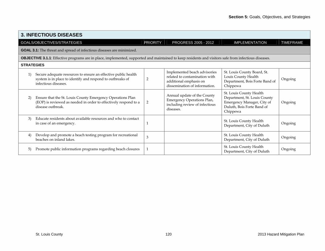
Section 5: Goals, Objectives, and Strategies
St. Louis County 120 2013 Hazard Mitigation Plan
3. INFECTIOUS DISEASES
GOALS/OBJECTIVES/STRATEGIES PRIORITY PROGRESS 2005 - 2012 IMPLEMENTATION TIMEFRAME
GOAL 3.1: The threat and spread of infectious diseases are minimized.
OBJECTIVE 3.1.1: Effective programs are in place, implemented, supported and maintained to keep residents and visitors safe from infectious diseases.
STRATEGIES
1) Secure adequate resources to ensure an effective public health system is in place to identify and respond to outbreaks of infectious diseases.
2
Implemented beach advisories related to contamination with additional emphasis on dissemination of information.
St. Louis County Board, St. Louis County Health Department, Bois Forte Band of Chippewa
Ongoing
2) Ensure that the St. Louis County Emergency Operations Plan (EOP) is reviewed as needed in order to effectively respond to a disease outbreak.
2
Annual update of the County Emergency Operations Plan, including review of infectious diseases.
St. Louis County Health Department, St. Louis County Emergency Manager, City of Duluth, Bois Forte Band of Chippewa
Ongoing
3) Educate residents about available resources and who to contact in case of an emergency.
1
St. Louis County Health Department, City of Duluth
Ongoing
4) Develop and promote a beach testing program for recreational beaches on inland lakes.
3 St. Louis County Health Department, City of Duluth
Ongoing
5) Promote public information programs regarding beach closures 1 St. Louis County Health Department, City of Duluth
Ongoing
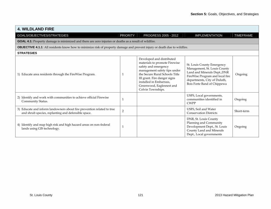
Section 5: Goals, Objectives, and Strategies
St. Louis County 121 2013 Hazard Mitigation Plan
4. WILDLAND FIRE
GOALS/OBJECTIVES/STRATEGIES PRIORITY PROGRESS 2005 - 2012 IMPLEMENTATION TIMEFRAME
GOAL 4.1: Property damage is minimized and there are zero injuries or deaths as a result of wildfire.
OBJECTIVE 4.1.1: All residents know how to minimize risk of property damage and prevent injury or death due to wildfire.
STRATEGIES
1) Educate area residents through the FireWise Program. 1
Developed and distributed materials to promote Firewise safety and emergency management safety tips under the Secure Rural Schools Title III grant. Fire danger signs installed in Embarrass, Greenwood, Eaglesnest and Colvin Townships.
St. Louis County Emergency Management, St. Louis County Land and Minerals Dept.,DNR FireWise Program and local fire departments, City of Duluth, Bois Forte Band of Chippewa
Ongoing
2) Identify and work with communities to achieve official Firewise Community Status.
1 USFS, Local governments, communities identified in CWPP
Ongoing
3) Educate and inform landowners about fire prevention related to tree and shrub species, replanting and defensible space.
2 USFS, Soil and Water Conservation Districts
Short-term
4) Identify and map high risk and high hazard areas on non-federal lands using GIS technology.
1
DNR, St. Louis County Planning and Community Development Dept., St. Louis County Land and Minerals Dept., Local governments
Ongoing
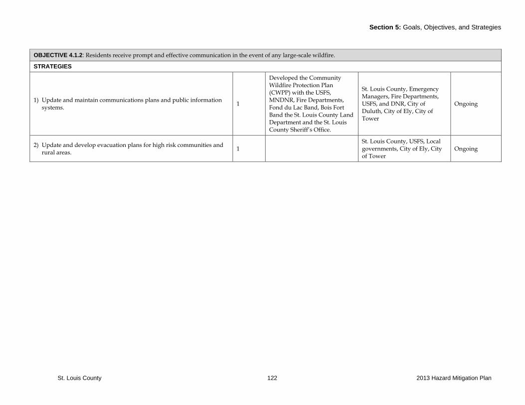
Section 5: Goals, Objectives, and Strategies
St. Louis County 122 2013 Hazard Mitigation Plan
OBJECTIVE 4.1.2: Residents receive prompt and effective communication in the event of any large-scale wildfire.
STRATEGIES
1) Update and maintain communications plans and public information systems.
1
Developed the Community Wildfire Protection Plan (CWPP) with the USFS, MNDNR, Fire Departments, Fond du Lac Band, Bois Fort Band the St. Louis County Land Department and the St. Louis County Sheriff’s Office.
St. Louis County, Emergency Managers, Fire Departments, USFS, and DNR, City of Duluth, City of Ely, City of Tower
Ongoing
2) Update and develop evacuation plans for high risk communities and rural areas.
1 St. Louis County, USFS, Local governments, City of Ely, City of Tower
Ongoing
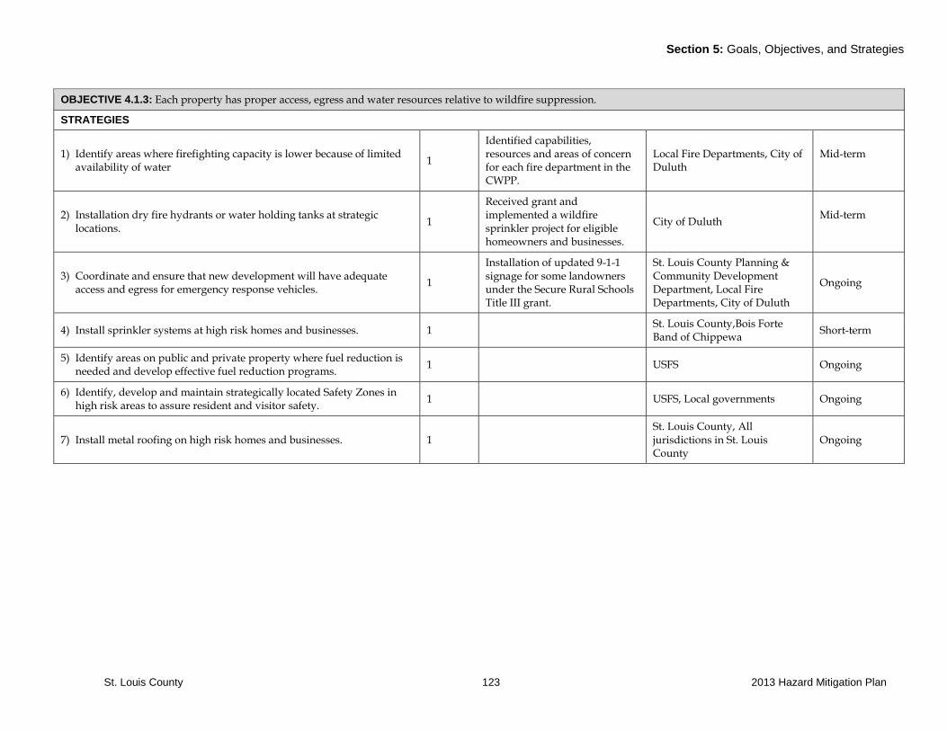
Section 5: Goals, Objectives, and Strategies
St. Louis County 123 2013 Hazard Mitigation Plan
OBJECTIVE 4.1.3: Each property has proper access, egress and water resources relative to wildfire suppression.
STRATEGIES
1) Identify areas where firefighting capacity is lower because of limited availability of water
1
Identified capabilities, resources and areas of concern for each fire department in the CWPP.
Local Fire Departments, City of Duluth
Mid-term
2) Installation dry fire hydrants or water holding tanks at strategic locations.
1
Received grant and implemented a wildfire sprinkler project for eligible homeowners and businesses.
City of Duluth Mid-term
3) Coordinate and ensure that new development will have adequate access and egress for emergency response vehicles.
1
Installation of updated 9-1-1 signage for some landowners under the Secure Rural Schools Title III grant.
St. Louis County Planning & Community Development Department, Local Fire Departments, City of Duluth
Ongoing
4) Install sprinkler systems at high risk homes and businesses. 1 St. Louis County,Bois Forte Band of Chippewa
Short-term
5) Identify areas on public and private property where fuel reduction is needed and develop effective fuel reduction programs.
1 USFS Ongoing
6) Identify, develop and maintain strategically located Safety Zones in high risk areas to assure resident and visitor safety.
1 USFS, Local governments Ongoing
7) Install metal roofing on high risk homes and businesses. 1 St. Louis County, All jurisdictions in St. Louis County
Ongoing

Section 5: Goals, Objectives, and Strategies
St. Louis County 124 2013 Hazard Mitigation Plan
OBJECTIVE 4.1.4: Effective inter-agency and multi-jurisdiction efforts are in place and employed to prevent, identify, contain and extinguish wildfires.
STRATEGIES
1) Continue inter-agency training efforts. 1 USFS, DNR, Local Fire Departments
Ongoing
2) Continue to involve residents of at risk communities in planning efforts.
1 USFS, DNR, City of Ely, City of Winton, City of Tower, City of Babbitt, City of Duluth
Ongoing
3) Develop and implement protocol to warn fire departments of high-risk fire days to ensure adequate staff is on hand.
1 Cooperative protocol in place with St. Louis County Dispatch and MN DNR
USFS, DNR, Local Fire Departments
Short-Term
4) Assure effective forest management and wildland fuels management practices.
1
Identified area of high risk for wildland fires. Implemented chipping projects to eliminate fuels in highest risk areas.
US Forest Service, St. Louis County Emergency Management, MN DNR, Fire Departments, St. Louis County Land and Minerals Dept.
Ongoing
5) Recruit and train firefighters to assure adequate fire response capacity. 1 Local fire departments, City of Chisholm
Ongoing
6) Update and implement the Community Wildfire Protection Program 1 USFS Mid-term
7) Collaborate on landscape level fuels reduction and forest management.
1 USFS, MN DNR, St. Louis County, all local jurisdictions
Ongoing
8) Explore and develop biomass options to lower costs when implementing fuels reduction.
2 USFS Ongoing
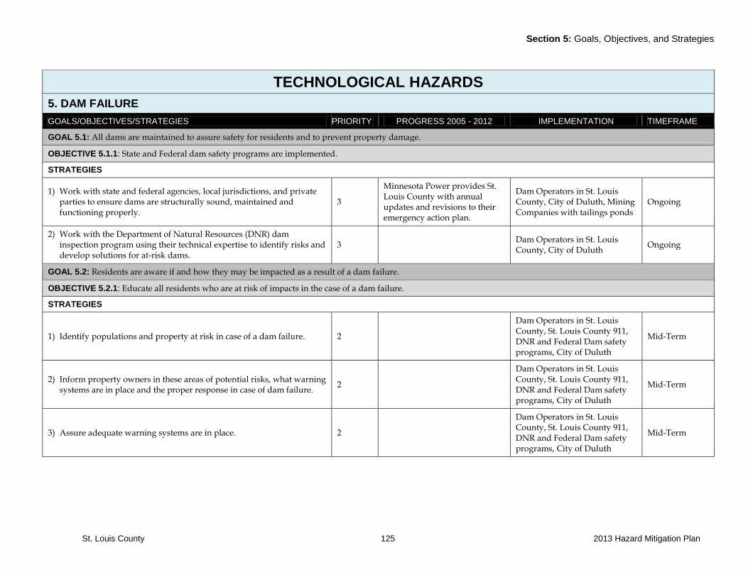
Section 5: Goals, Objectives, and Strategies
St. Louis County 125 2013 Hazard Mitigation Plan
TECHNOLOGICAL HAZARDS
5. DAM FAILURE
GOALS/OBJECTIVES/STRATEGIES PRIORITY PROGRESS 2005 - 2012 IMPLEMENTATION TIMEFRAME
GOAL 5.1: All dams are maintained to assure safety for residents and to prevent property damage.
OBJECTIVE 5.1.1: State and Federal dam safety programs are implemented.
STRATEGIES
1) Work with state and federal agencies, local jurisdictions, and private parties to ensure dams are structurally sound, maintained and functioning properly.
3
Minnesota Power provides St. Louis County with annual updates and revisions to their emergency action plan.
Dam Operators in St. Louis County, City of Duluth, Mining Companies with tailings ponds
Ongoing
2) Work with the Department of Natural Resources (DNR) dam inspection program using their technical expertise to identify risks and develop solutions for at-risk dams.
3 Dam Operators in St. Louis County, City of Duluth
Ongoing
GOAL 5.2: Residents are aware if and how they may be impacted as a result of a dam failure.
OBJECTIVE 5.2.1: Educate all residents who are at risk of impacts in the case of a dam failure.
STRATEGIES
1) Identify populations and property at risk in case of a dam failure. 2
Dam Operators in St. Louis County, St. Louis County 911, DNR and Federal Dam safety programs, City of Duluth
Mid-Term
2) Inform property owners in these areas of potential risks, what warning systems are in place and the proper response in case of dam failure.
2
Dam Operators in St. Louis County, St. Louis County 911, DNR and Federal Dam safety programs, City of Duluth
Mid-Term
3) Assure adequate warning systems are in place. 2
Dam Operators in St. Louis County, St. Louis County 911, DNR and Federal Dam safety programs, City of Duluth
Mid-Term

Section 5: Goals, Objectives, and Strategies
St. Louis County 126 2013 Hazard Mitigation Plan
6. HAZARDOUS MATERIALS
GOALS/OBJECTIVES/STRATEGIES PRIORITY PROGRESS 2005 - 2012 IMPLEMENTATION TIMEFRAME
GOAL 6.1: Personnel are trained and equipment prepared to handle hazardous materials events.
OBJECTIVE 6.1.1: Data and information on what and where hazardous materials are located in or are moved through the County is accurate and up to date.
STRATEGIES
1) Maintain current information on hazardous materials that typically travel through St. Louis County.
3 Emergency Managers, MN Dept. of Transportation, City of Duluth
Mid-term
2) Maintain communication with MN-DOT, MN State Patrol and U.S. Customs regarding hazardous material transportation.
3
Implemented in 2011, the county requests DOT Hazardous Materials Guidebooks from the State of MN, which is published every four years. Guides are distributed to local fire departments, EMA, law enforcement, public works, emergency managers and others.
Emergency Managers and Minnesota Pollution Control Agency, US Coast Guard, City of Duluth, Coast Guard MSU Duluth
Ongoing
3) Continue to work with MPCA, MN Division of Homeland Security and Emergency Management (EPCRA) to identify and map all fixed hazardous materials sites within St. Louis County.
3
The Emergency Operations Plan (EOP) is updated regarding hazardous materials in the county. Data from hazardous materials reports to the State of MN and other agencies provide the county with an updated inventory of extremely hazardous substances (EHS) that are used in the county. The facilities with EHS materials are noted in the EOP.
Emergency Managers, Minnesota Pollution Control Agency, Local Governments, HSEM/EPCRA, City of Duluth
Ongoing
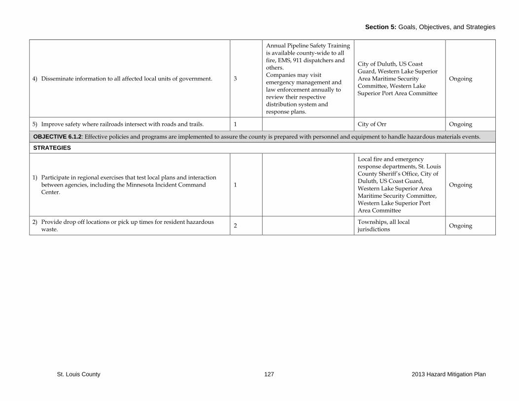
Section 5: Goals, Objectives, and Strategies
St. Louis County 127 2013 Hazard Mitigation Plan
4) Disseminate information to all affected local units of government. 3
Annual Pipeline Safety Training is available county-wide to all fire, EMS, 911 dispatchers and others. Companies may visit emergency management and law enforcement annually to review their respective distribution system and response plans.
City of Duluth, US Coast Guard, Western Lake Superior Area Maritime Security Committee, Western Lake Superior Port Area Committee
Ongoing
5) Improve safety where railroads intersect with roads and trails. 1 City of Orr Ongoing
OBJECTIVE 6.1.2: Effective policies and programs are implemented to assure the county is prepared with personnel and equipment to handle hazardous materials events.
STRATEGIES
1) Participate in regional exercises that test local plans and interaction between agencies, including the Minnesota Incident Command Center.
1
Local fire and emergency response departments, St. Louis County Sheriff’s Office, City of Duluth, US Coast Guard, Western Lake Superior Area Maritime Security Committee, Western Lake Superior Port Area Committee
Ongoing
2) Provide drop off locations or pick up times for resident hazardous waste.
2 Townships, all local jurisdictions
Ongoing
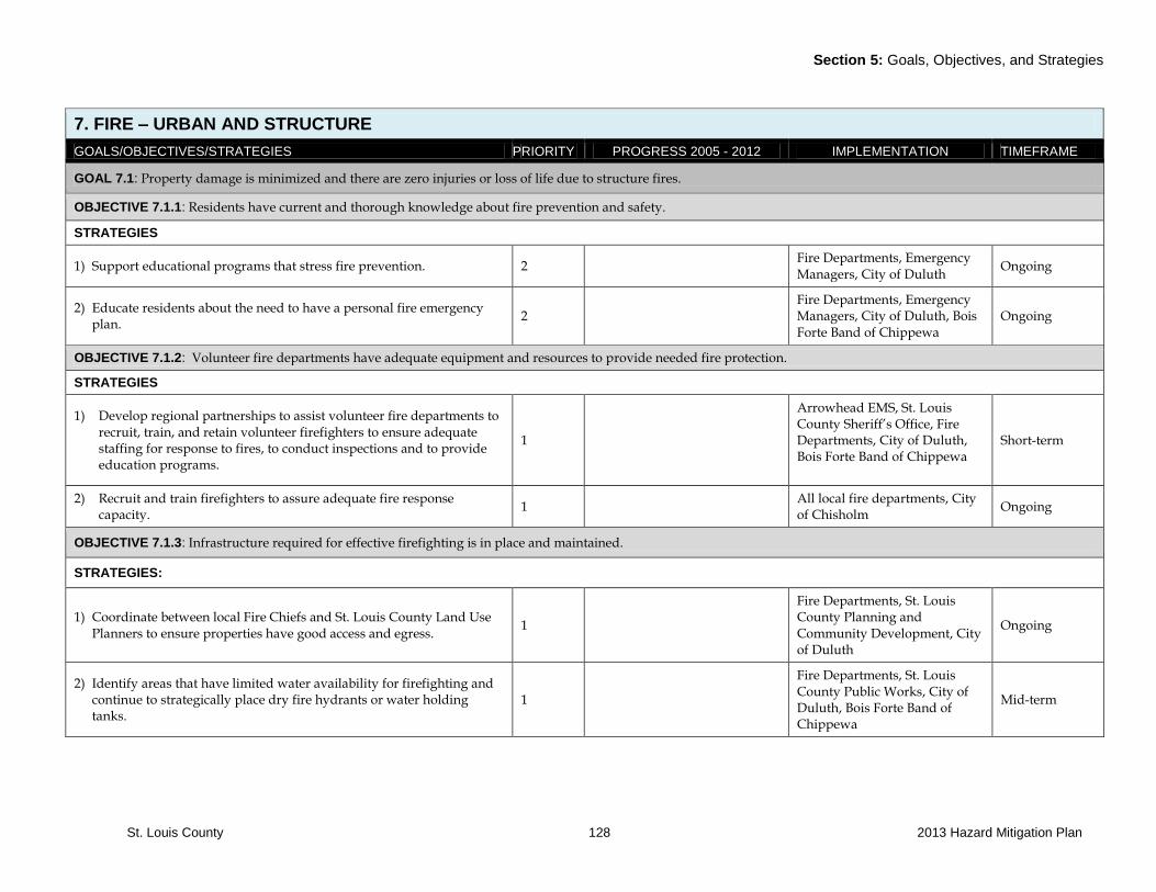
Section 5: Goals, Objectives, and Strategies
St. Louis County 128 2013 Hazard Mitigation Plan
7. FIRE – URBAN AND STRUCTURE
GOALS/OBJECTIVES/STRATEGIES PRIORITY PROGRESS 2005 - 2012 IMPLEMENTATION TIMEFRAME
GOAL 7.1: Property damage is minimized and there are zero injuries or loss of life due to structure fires.
OBJECTIVE 7.1.1: Residents have current and thorough knowledge about fire prevention and safety.
STRATEGIES
1) Support educational programs that stress fire prevention. 2 Fire Departments, Emergency Managers, City of Duluth
Ongoing
2) Educate residents about the need to have a personal fire emergency plan.
2 Fire Departments, Emergency Managers, City of Duluth, Bois Forte Band of Chippewa
Ongoing
OBJECTIVE 7.1.2: Volunteer fire departments have adequate equipment and resources to provide needed fire protection.
STRATEGIES
1) Develop regional partnerships to assist volunteer fire departments to recruit, train, and retain volunteer firefighters to ensure adequate staffing for response to fires, to conduct inspections and to provide education programs.
1
Arrowhead EMS, St. Louis County Sheriff’s Office, Fire Departments, City of Duluth, Bois Forte Band of Chippewa
Short-term
2) Recruit and train firefighters to assure adequate fire response capacity.
1 All local fire departments, City of Chisholm
Ongoing
OBJECTIVE 7.1.3: Infrastructure required for effective firefighting is in place and maintained.
STRATEGIES:
1) Coordinate between local Fire Chiefs and St. Louis County Land Use Planners to ensure properties have good access and egress.
1
Fire Departments, St. Louis County Planning and Community Development, City of Duluth
Ongoing
2) Identify areas that have limited water availability for firefighting and continue to strategically place dry fire hydrants or water holding tanks.
1
Fire Departments, St. Louis County Public Works, City of Duluth, Bois Forte Band of Chippewa
Mid-term
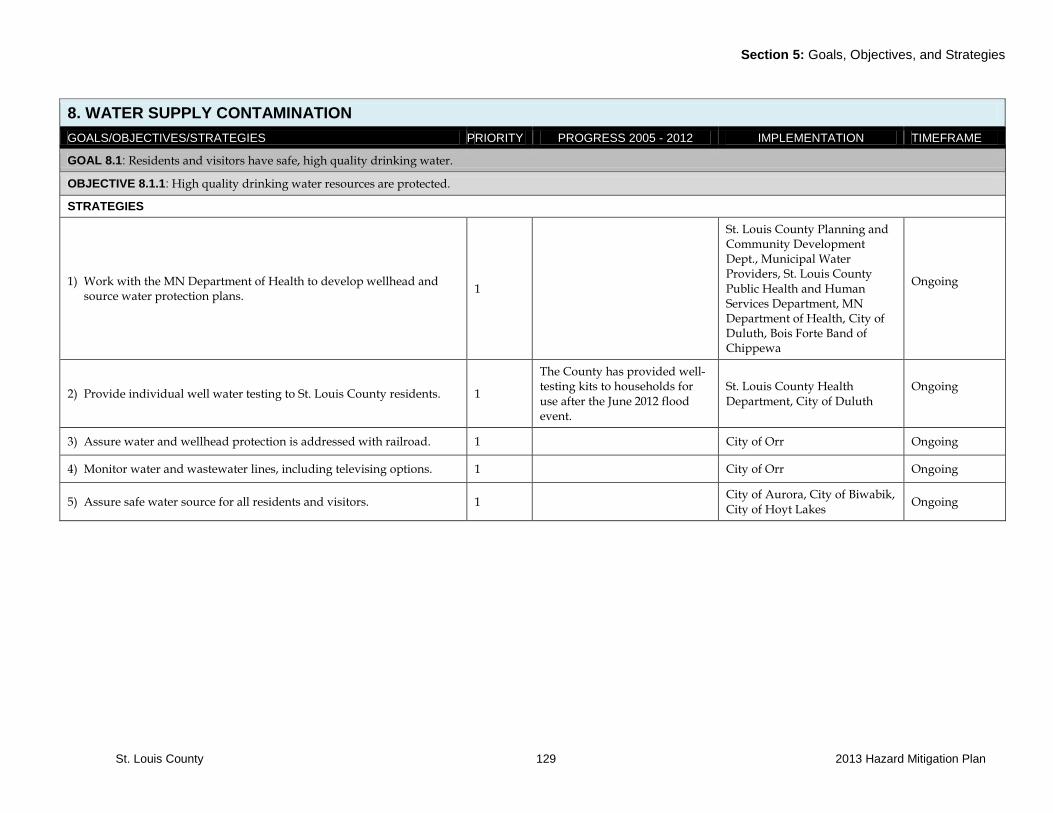
Section 5: Goals, Objectives, and Strategies
St. Louis County 129 2013 Hazard Mitigation Plan
8. WATER SUPPLY CONTAMINATION
GOALS/OBJECTIVES/STRATEGIES PRIORITY PROGRESS 2005 - 2012 IMPLEMENTATION TIMEFRAME
GOAL 8.1: Residents and visitors have safe, high quality drinking water.
OBJECTIVE 8.1.1: High quality drinking water resources are protected.
STRATEGIES
1) Work with the MN Department of Health to develop wellhead and source water protection plans.
1
St. Louis County Planning and Community Development Dept., Municipal Water Providers, St. Louis County Public Health and Human Services Department, MN Department of Health, City of Duluth, Bois Forte Band of Chippewa
Ongoing
2) Provide individual well water testing to St. Louis County residents. 1
The County has provided well-testing kits to households for use after the June 2012 flood event.
St. Louis County Health Department, City of Duluth
Ongoing
3) Assure water and wellhead protection is addressed with railroad. 1 City of Orr Ongoing
4) Monitor water and wastewater lines, including televising options. 1 City of Orr Ongoing
5) Assure safe water source for all residents and visitors. 1 City of Aurora, City of Biwabik, City of Hoyt Lakes
Ongoing
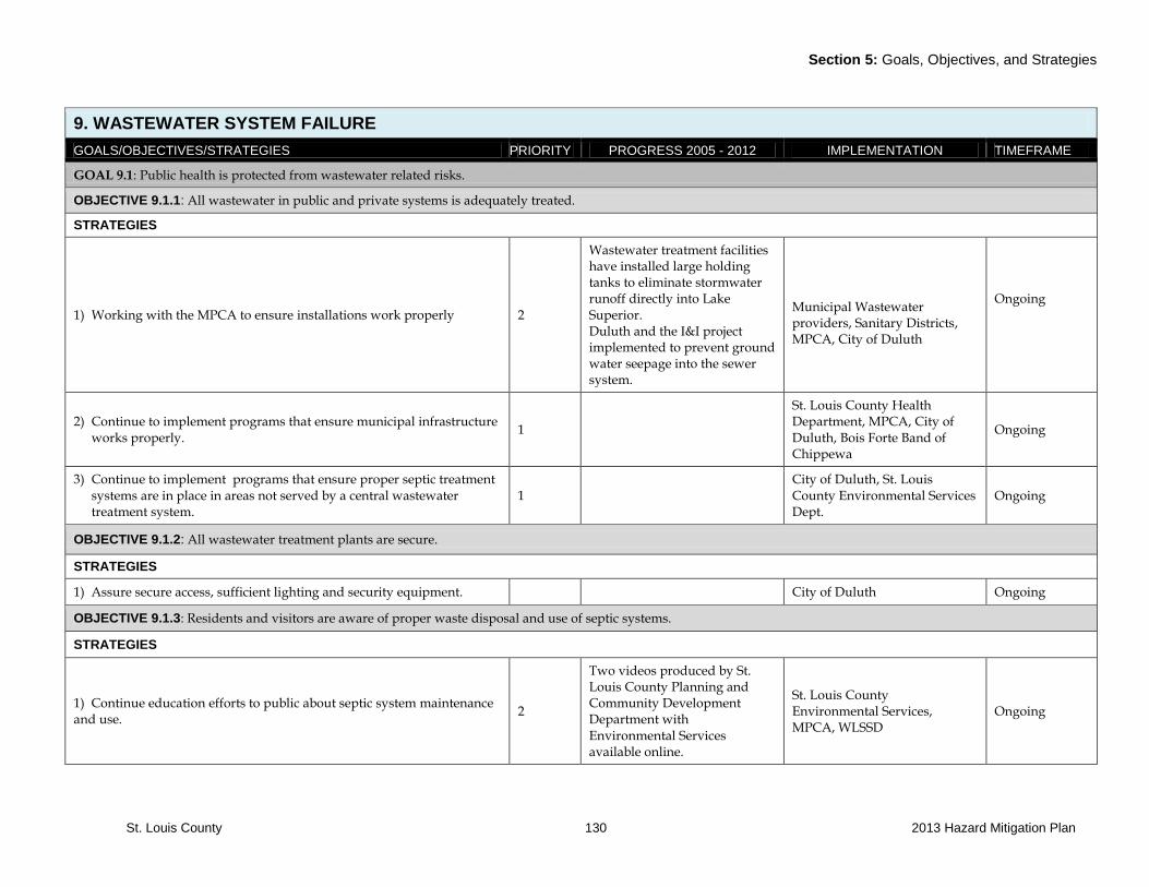
Section 5: Goals, Objectives, and Strategies
St. Louis County 130 2013 Hazard Mitigation Plan
9. WASTEWATER SYSTEM FAILURE
GOALS/OBJECTIVES/STRATEGIES PRIORITY PROGRESS 2005 - 2012 IMPLEMENTATION TIMEFRAME
GOAL 9.1: Public health is protected from wastewater related risks.
OBJECTIVE 9.1.1: All wastewater in public and private systems is adequately treated.
STRATEGIES
1) Working with the MPCA to ensure installations work properly 2
Wastewater treatment facilities have installed large holding tanks to eliminate stormwater runoff directly into Lake Superior. Duluth and the I&I project implemented to prevent ground water seepage into the sewer system.
Municipal Wastewater providers, Sanitary Districts, MPCA, City of Duluth
Ongoing
2) Continue to implement programs that ensure municipal infrastructure works properly.
1
St. Louis County Health Department, MPCA, City of Duluth, Bois Forte Band of Chippewa
Ongoing
3) Continue to implement programs that ensure proper septic treatment systems are in place in areas not served by a central wastewater treatment system.
1 City of Duluth, St. Louis County Environmental Services Dept.
Ongoing
OBJECTIVE 9.1.2: All wastewater treatment plants are secure.
STRATEGIES
1) Assure secure access, sufficient lighting and security equipment. City of Duluth Ongoing
OBJECTIVE 9.1.3: Residents and visitors are aware of proper waste disposal and use of septic systems.
STRATEGIES
1) Continue education efforts to public about septic system maintenance and use.
2
Two videos produced by St. Louis County Planning and Community Development Department with Environmental Services available online.
St. Louis County Environmental Services, MPCA, WLSSD
Ongoing

Section 5: Goals, Objectives, and Strategies
St. Louis County 131 2013 Hazard Mitigation Plan
10. TERRORISM
GOALS/OBJECTIVES/STRATEGIES PRIORITY PROGRESS 2005 - 2012 IMPLEMENTATION TIMEFRAME
GOAL 10.1: Critical infrastructure and government facilities are protected from acts of terrorism.
OBJECTIVE 10.1.1: All facilities and critical infrastructure have established and implemented safety measures in place against acts of terrorism.
STRATEGIES
1) Work with operators of critical infrastructure to assess needs and implement safety measures such as restricted access and monitoring capabilities.
1
Emergency Management staff attended training related to the Protected Critical Infrastructure Information Program (PCII) with implementation in 2009. Emergency Management staff attended training for the Automated Computer Asset Management System (ACAMS) in 2012 and use of the software system related to Critical Infrastructure and Key Resources (CIR) was implemented in 2010.
Emergency Managers, Sheriff’s Office, local law enforcement offices, City of Duluth, US Coast Guard, Western Lake Superior Area Maritime Security Committee, Western Lake Superior Port Area Committee
Short-term
GOAL 10.2: The county has strong inter-agency cooperation for terrorism prevention.
OBJECTIVE 10.2.1: The county has effective communication and preparation with state and federal agencies to protect against terrorism.
STRATEGIES:
1) Participate and assist in regional preparedness exercises using the Homeland Security Exercise Evaluation Program.
1
Received training related to Enhanced Risk and Threat Assessment. The ability to assess property was implemented in 2012.
Emergency Managers, Sheriff’s Office, Local Fire Departments, City of Duluth, US Coast Guard, Western Lake Superior Area Maritime Security Committee, Western Lake Superior Port Area Committee
Ongoing
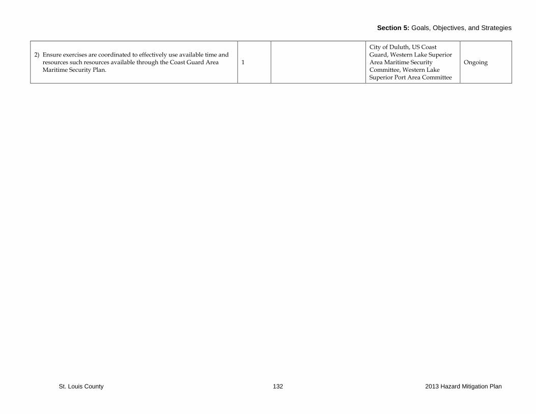
Section 5: Goals, Objectives, and Strategies
St. Louis County 132 2013 Hazard Mitigation Plan
2) Ensure exercises are coordinated to effectively use available time and resources such resources available through the Coast Guard Area Maritime Security Plan.
1
City of Duluth, US Coast Guard, Western Lake Superior Area Maritime Security Committee, Western Lake Superior Port Area Committee
Ongoing
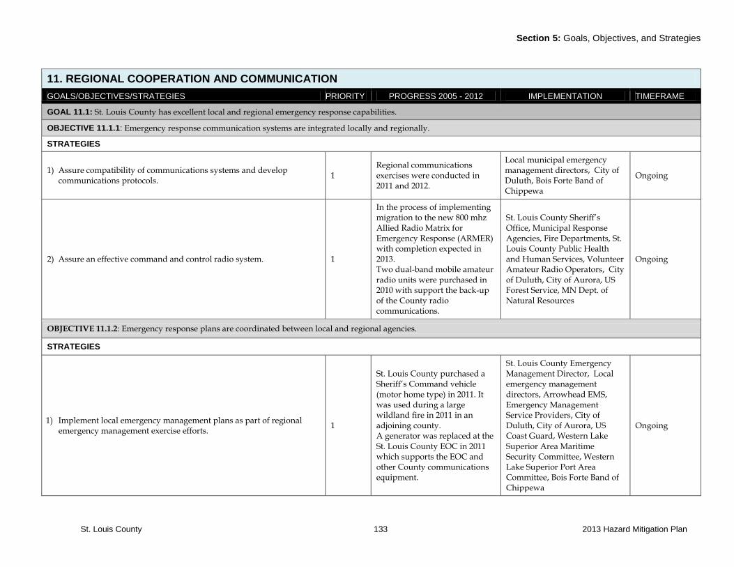
Section 5: Goals, Objectives, and Strategies
St. Louis County 133 2013 Hazard Mitigation Plan
11. REGIONAL COOPERATION AND COMMUNICATION
GOALS/OBJECTIVES/STRATEGIES PRIORITY PROGRESS 2005 - 2012 IMPLEMENTATION TIMEFRAME
GOAL 11.1: St. Louis County has excellent local and regional emergency response capabilities.
OBJECTIVE 11.1.1: Emergency response communication systems are integrated locally and regionally.
STRATEGIES
1) Assure compatibility of communications systems and develop communications protocols.
1 Regional communications exercises were conducted in 2011 and 2012.
Local municipal emergency management directors, City of Duluth, Bois Forte Band of Chippewa
Ongoing
2) Assure an effective command and control radio system. 1
In the process of implementing migration to the new 800 mhz Allied Radio Matrix for Emergency Response (ARMER) with completion expected in 2013. Two dual-band mobile amateur radio units were purchased in 2010 with support the back-up of the County radio communications.
St. Louis County Sheriff’s Office, Municipal Response Agencies, Fire Departments, St. Louis County Public Health and Human Services, Volunteer Amateur Radio Operators, City of Duluth, City of Aurora, US Forest Service, MN Dept. of Natural Resources
Ongoing
OBJECTIVE 11.1.2: Emergency response plans are coordinated between local and regional agencies.
STRATEGIES
1) Implement local emergency management plans as part of regional emergency management exercise efforts.
1
St. Louis County purchased a Sheriff’s Command vehicle (motor home type) in 2011. It was used during a large wildland fire in 2011 in an adjoining county. A generator was replaced at the St. Louis County EOC in 2011 which supports the EOC and other County communications equipment.
St. Louis County Emergency Management Director, Local emergency management directors, Arrowhead EMS, Emergency Management Service Providers, City of Duluth, City of Aurora, US Coast Guard, Western Lake Superior Area Maritime Security Committee, Western Lake Superior Port Area Committee, Bois Forte Band of Chippewa
Ongoing
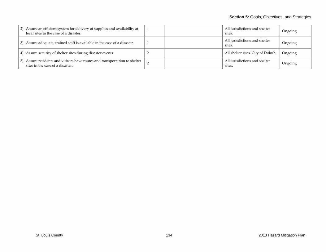
Section 5: Goals, Objectives, and Strategies
St. Louis County 134 2013 Hazard Mitigation Plan
2) Assure an efficient system for delivery of supplies and availability at local sites in the case of a disaster.
1 All jurisdictions and shelter sites.
Ongoing
3) Assure adequate, trained staff is available in the case of a disaster. 1 All jurisdictions and shelter sites.
Ongoing
4) Assure security of shelter sites during disaster events. 2 All shelter sites. City of Duluth. Ongoing
5) Assure residents and visitors have routes and transportation to shelter sites in the case of a disaster.
2 All jurisdictions and shelter sites.
Ongoing

Appendix: St. Louis County
St. Louis County
APPENDIX A: Maps

Appendix: St. Louis County
St. Louis County
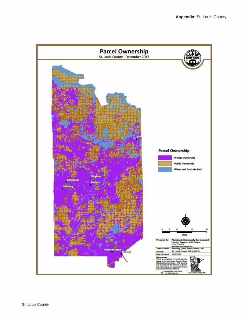
Appendix: St. Louis County
St. Louis County
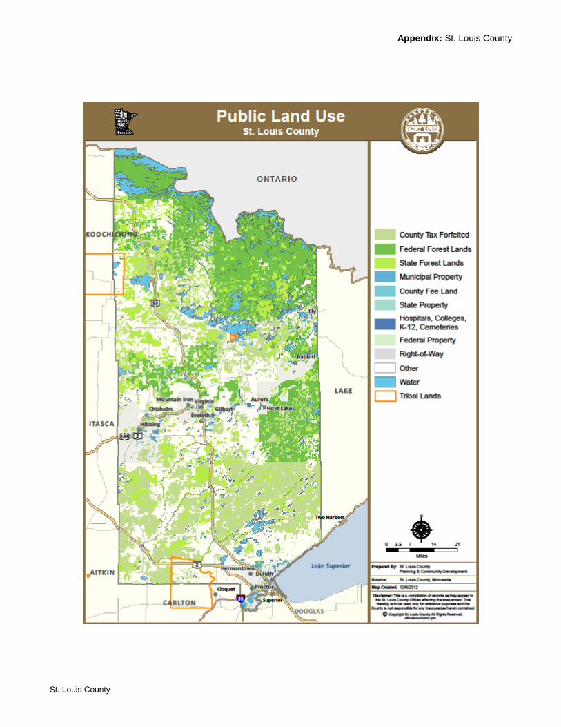
Appendix: St. Louis County
St. Louis County
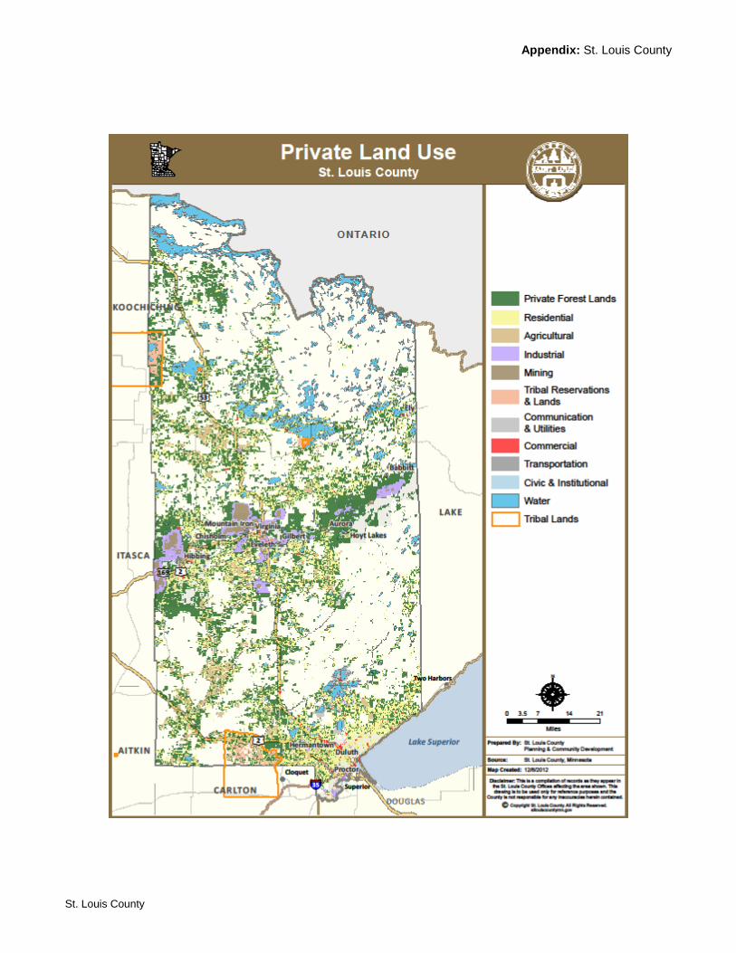
Appendix: St. Louis County
St. Louis County
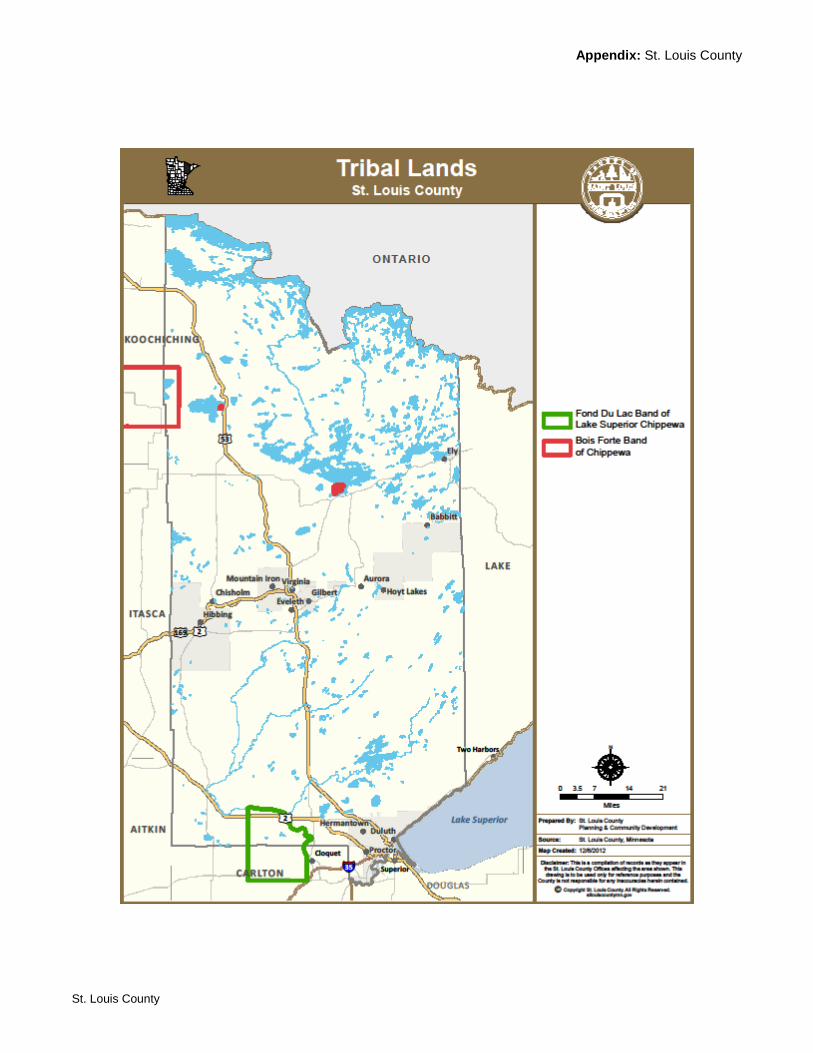
Appendix: St. Louis County
St. Louis County
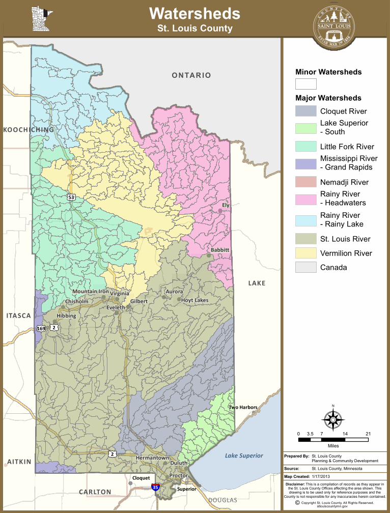
ONTAR IO
SuperiorSuperiorCloquetCloquet
Two HarborsTwo Harbors
Ely
Aurora
Duluth
Babbitt
GilbertEveleth
Hibbing
Proctor
VirginiaChisholm Hoyt Lakes
Hermantown
Mountain Iron
Lake Superior
LAKE
ITASCA
CARLTON
AITKIN
KOOCHICHING
DOUGLAS§̈¦35
£¤53
£¤2
£¤169 £¤2
0 7 14 213.5
Miles
N
WatershedsSt. Louis County
Map Created:Source: St. Louis County, Minnesota
St. Louis CountyPlanning & Community Development
Prepared By:
Disclaimer: This is a compilation of records as they appear inthe St. Louis County Offices affecting the area shown. Thisdrawing is to be used only for reference purposes and the
County is not responsible for any inaccuracies herein contained.
stlouiscountymn.gov
1/17/2013
Copyright St. Louis County. All Rights Reserved.©
Minor Watersheds
Major WatershedsCloquet RiverLake Superior- SouthLittle Fork RiverMississippi River- Grand RapidsNemadji RiverRainy River- HeadwatersRainy River- Rainy LakeSt. Louis RiverVermilion RiverCanada
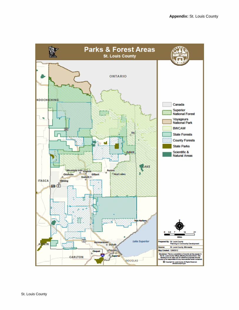
Appendix: St. Louis County
St. Louis County

Appendix: St. Louis County
St. Louis County

Appendix: St. Louis County
St. Louis County
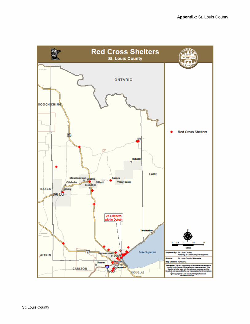
Appendix: St. Louis County
St. Louis County
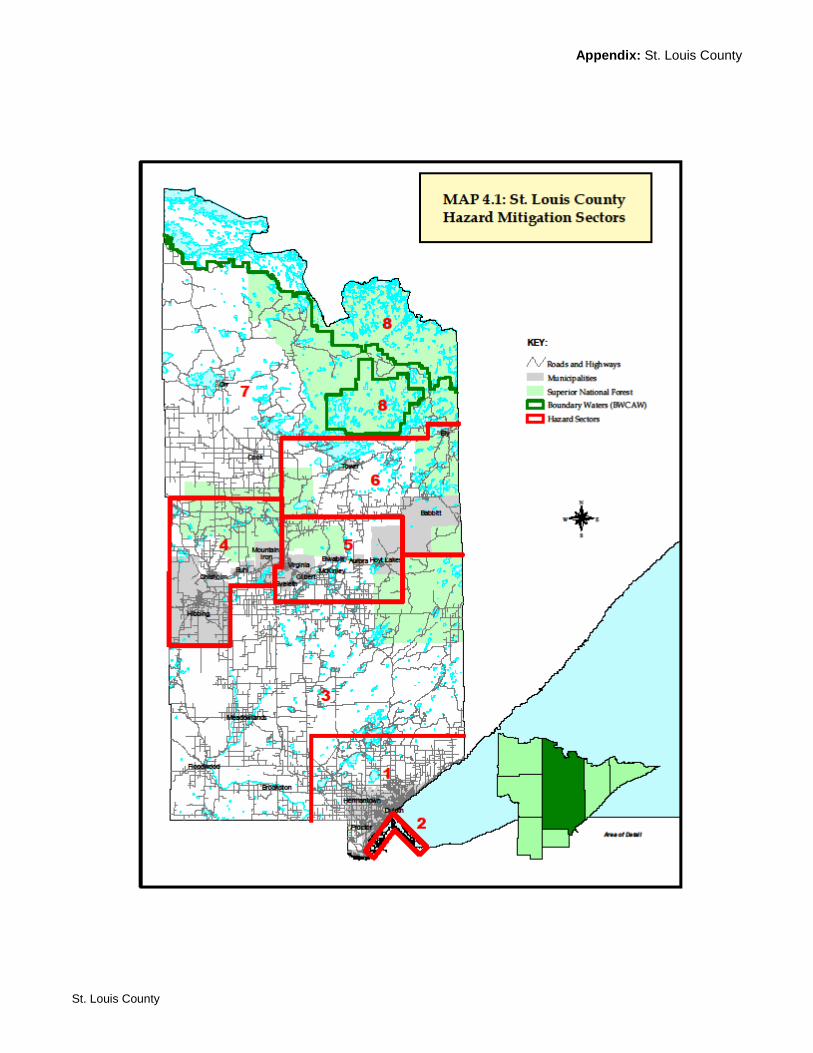
Appendix: St. Louis County
St. Louis County
Appendix: St. Louis County
St. Louis County
APPENDIX B: Communications with Community Contacts and Planning Team Members
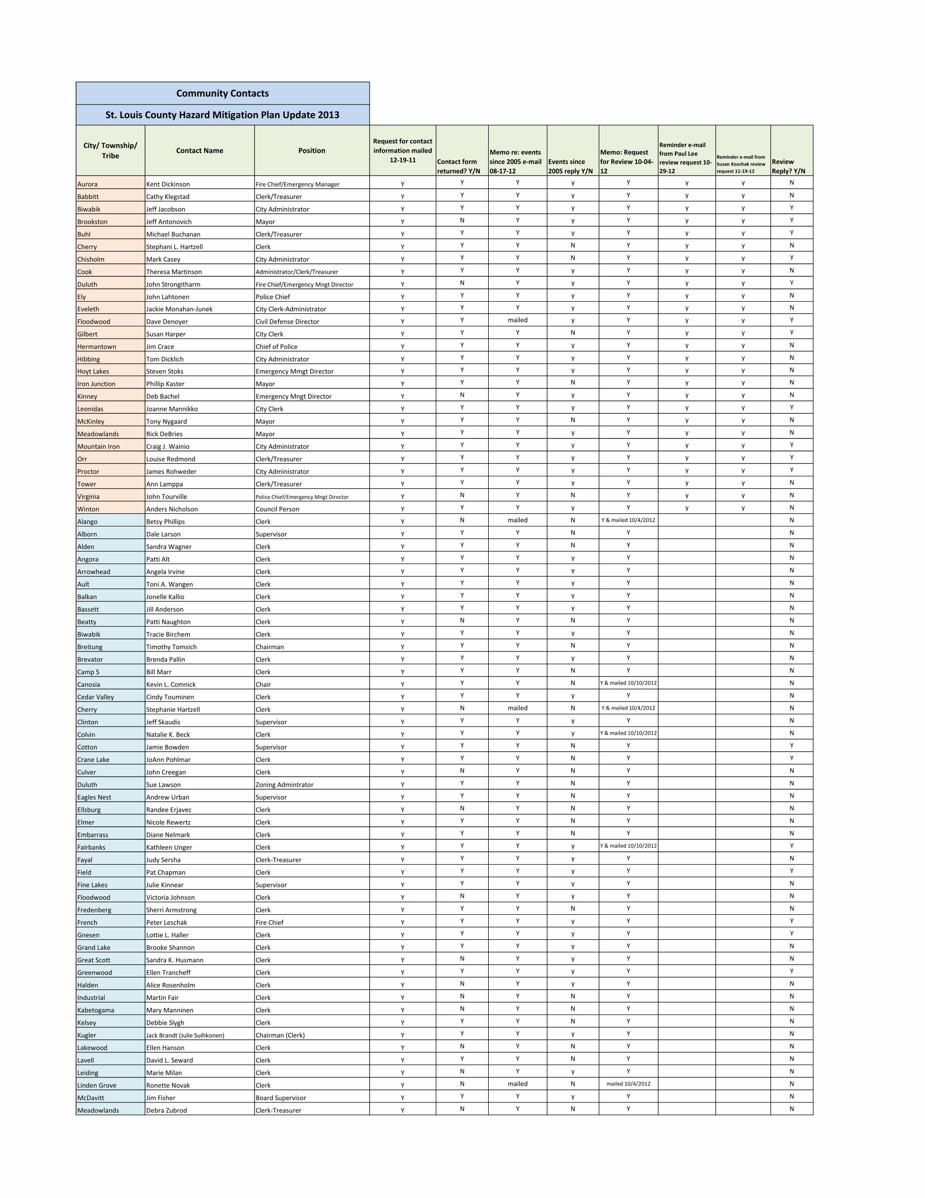
City/ Township/
TribeContact Name Position
Request for contact
information mailed
12-19-11 Contact form
returned? Y/N
Memo re: events
since 2005 e-mail
08-17-12
Events since
2005 reply Y/N
Memo: Request
for Review 10-04-
12
Reminder e-mail
from Paul Lee
review request 10-
29-12
Reminder e-mail from
Susan Koschak review
request 11-19-12
Review
Reply? Y/N
Aurora Kent Dickinson Fire Chief/Emergency Manager Y Y Y y Y y y N
Babbitt Cathy Klegstad Clerk/Treasurer Y Y Y y Y y y N
Biwabik Jeff Jacobson City Administrator Y Y Y y Y y y Y
Brookston Jeff Antonovich Mayor Y N Y y Y y y Y
Buhl Michael Buchanan Clerk/Treasurer Y Y Y y Y y y Y
Cherry Stephani L. Hartzell Clerk Y Y Y N Y y y N
Chisholm Mark Casey City Administrator Y Y Y N Y y y Y
Cook Theresa Martinson Administrator/Clerk/Treasurer Y Y Y y Y y y N
Duluth John Strongitharm Fire Chief/Emergency Mngt Director Y N Y y Y y y Y
Ely John Lahtonen Police Chief Y Y Y y Y y y N
Eveleth Jackie Monahan-Junek City Clerk-Administrator Y Y Y y Y y y N
Floodwood Dave Denoyer Civil Defense Director Y Y mailed y Y y y Y
Gilbert Susan Harper City Clerk Y Y Y N Y y y Y
Hermantown Jim Crace Chief of Police Y Y Y y Y y y N
Hibbing Tom Dicklich City Administrator Y Y Y y Y y y N
Hoyt Lakes Steven Stoks Emergency Mmgt Director Y Y Y y Y y y N
Iron Junction Phillip Kaster Mayor Y Y Y N Y y y N
Kinney Deb Bachel Emergency Mngt Director Y N Y y Y y y N
Leonidas Joanne Mannikko City Clerk Y Y Y y Y y y Y
McKinley Tony Nygaard Mayor Y Y Y N Y y y N
Meadowlands Rick DeBries Mayor Y Y Y y Y y y N
Mountain Iron Craig J. Wainio City Administrator Y Y Y y Y y y Y
Orr Louise Redmond Clerk/Treasurer Y Y Y y Y y y Y
Proctor James Rohweder City Administrator Y Y Y y Y y y Y
Tower Ann Lamppa Clerk/Treasurer Y Y Y y Y y y N
Virginia John Tourville Police Chief/Emergency Mngt Director Y N Y N Y y y N
Winton Anders Nicholson Council Person Y Y Y y Y y y N
Alango Betsy Phillips Clerk Y N mailed N Y & mailed 10/4/2012 N
Alborn Dale Larson Supervisor Y Y Y N Y N
Alden Sandra Wagner Clerk Y Y Y N Y N
Angora Patti Alt Clerk Y Y Y y Y N
Arrowhead Angela Irvine Clerk Y Y Y y Y N
Ault Toni A. Wangen Clerk Y Y Y y Y N
Balkan Jonelle Kallio Clerk Y Y Y y Y N
Bassett Jill Anderson Clerk Y Y Y y Y N
Beatty Patti Naughton Clerk Y N Y N Y N
Biwabik Tracie Birchem Clerk Y Y Y y Y N
Breitung Timothy Tomsich Chairman Y Y Y N Y N
Brevator Brenda Pallin Clerk Y Y Y y Y N
Camp 5 Bill Marr Clerk Y Y Y N Y N
Canosia Kevin L. Comnick Chair Y Y Y N Y & mailed 10/10/2012 N
Cedar Valley Cindy Touminen Clerk Y Y Y y Y N
Cherry Stephanie Hartzell Clerk Y N mailed N Y & mailed 10/4/2012 N
Clinton Jeff Skaudis Supervisor Y Y Y y Y N
Colvin Natalie K. Beck Clerk Y Y Y y Y & mailed 10/10/2012 N
Cotton Jamie Bowden Supervisor Y Y Y N Y Y
Crane Lake JoAnn Pohlmar Clerk Y Y Y N Y Y
Culver John Creegan Clerk Y N Y N Y N
Duluth Sue Lawson Zoning Admintrator Y Y Y N Y N
Eagles Nest Andrew Urban Supervisor Y Y Y N Y N
Ellsburg Randee Erjavec Clerk Y N Y N Y N
Elmer Nicole Rewertz Clerk Y Y Y N Y N
Embarrass Diane Nelmark Clerk Y Y Y N Y N
Fairbanks Kathleen Unger Clerk Y Y Y y Y & mailed 10/10/2012 Y
Fayal Judy Sersha Clerk-Treasurer Y Y Y y Y N
Field Pat Chapman Clerk Y Y Y y Y Y
Fine Lakes Julie Kinnear Supervisor Y Y Y y Y N
Floodwood Victoria Johnson Clerk Y N Y y Y N
Fredenberg Sherri Armstrong Clerk Y Y Y N Y N
French Peter Leschak Fire Chief Y Y Y y Y Y
Gnesen Lottie L. Haller Clerk Y Y Y y Y Y
Grand Lake Brooke Shannon Clerk Y Y Y y Y N
Great Scott Sandra K. Husmann Clerk Y N Y y Y N
Greenwood Ellen Trancheff Clerk Y Y Y y Y Y
Halden Alice Rosenholm Clerk Y N Y y Y N
Industrial Martin Fair Clerk Y N Y N Y N
Kabetogama Mary Manninen Clerk Y N Y N Y N
Kelsey Debbie Slygh Clerk Y Y Y N Y N
Kugler Jack Brandt (Julie Suihkonen) Chairman (Clerk) Y Y Y y Y N
Lakewood Ellen Hanson Clerk Y N Y N Y N
Lavell David L. Seward Clerk Y Y Y N Y N
Leiding Marie Milan Clerk Y N Y y Y N
Linden Grove Ronette Novak Clerk Y N mailed N mailed 10/4/2012 N
McDavitt Jim Fisher Board Supervisor Y Y Y y Y N
Meadowlands Debra Zubrod Clerk-Treasurer Y N Y N Y N
Community Contacts
St. Louis County Hazard Mitigation Plan Update 2013
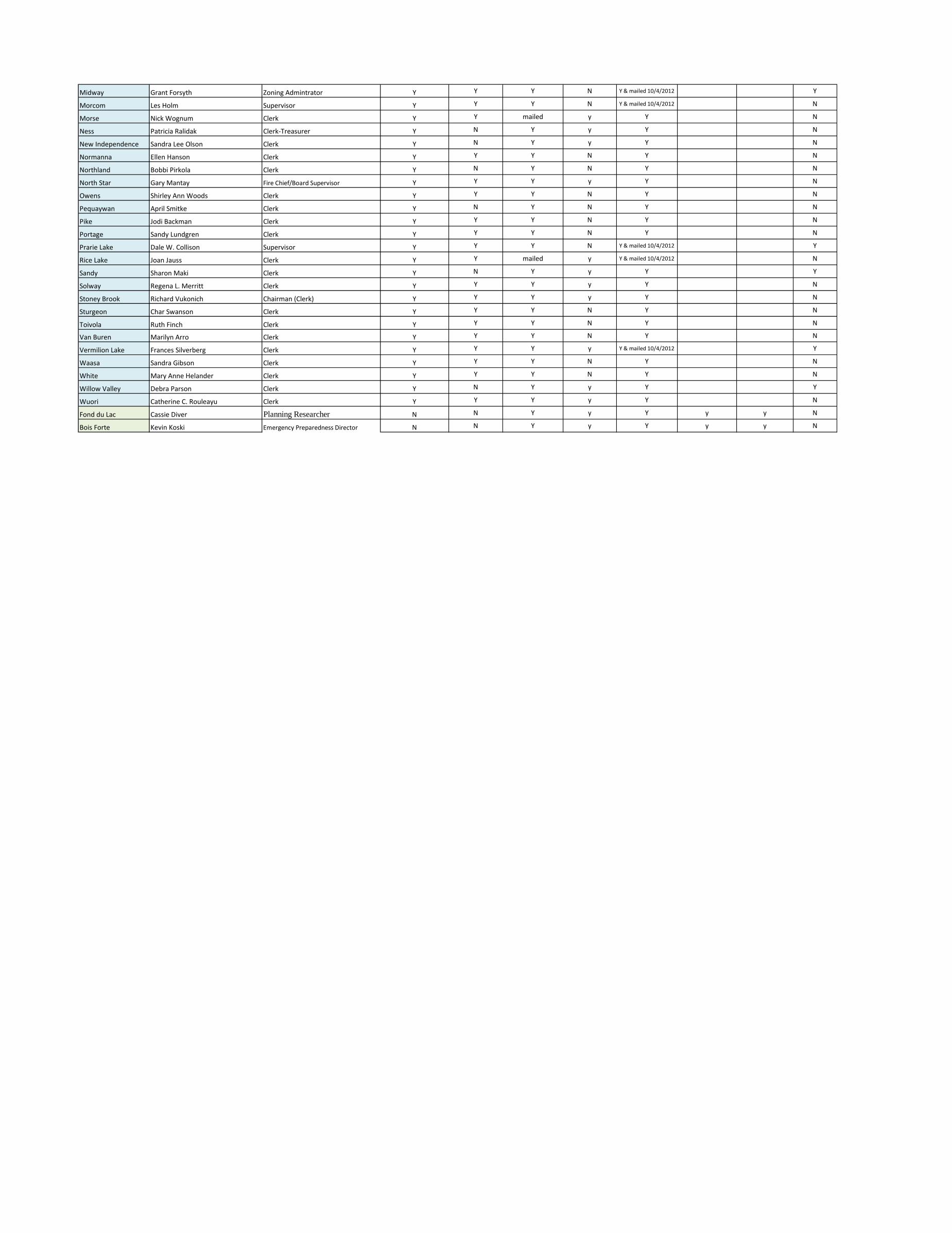
Midway Grant Forsyth Zoning Admintrator Y Y Y N Y & mailed 10/4/2012 Y
Morcom Les Holm Supervisor Y Y Y N Y & mailed 10/4/2012 N
Morse Nick Wognum Clerk Y Y mailed y Y N
Ness Patricia Ralidak Clerk-Treasurer Y N Y y Y N
New Independence Sandra Lee Olson Clerk Y N Y y Y N
Normanna Ellen Hanson Clerk Y Y Y N Y N
Northland Bobbi Pirkola Clerk Y N Y N Y N
North Star Gary Mantay Fire Chief/Board Supervisor Y Y Y y Y N
Owens Shirley Ann Woods Clerk Y Y Y N Y N
Pequaywan April Smitke Clerk Y N Y N Y N
Pike Jodi Backman Clerk Y Y Y N Y N
Portage Sandy Lundgren Clerk Y Y Y N Y N
Prarie Lake Dale W. Collison Supervisor Y Y Y N Y & mailed 10/4/2012 Y
Rice Lake Joan Jauss Clerk Y Y mailed y Y & mailed 10/4/2012 N
Sandy Sharon Maki Clerk Y N Y y Y Y
Solway Regena L. Merritt Clerk Y Y Y y Y N
Stoney Brook Richard Vukonich Chairman (Clerk) Y Y Y y Y N
Sturgeon Char Swanson Clerk Y Y Y N Y N
Toivola Ruth Finch Clerk Y Y Y N Y N
Van Buren Marilyn Arro Clerk Y Y Y N Y N
Vermilion Lake Frances Silverberg Clerk Y Y Y y Y & mailed 10/4/2012 Y
Waasa Sandra Gibson Clerk Y Y Y N Y N
White Mary Anne Helander Clerk Y Y Y N Y N
Willow Valley Debra Parson Clerk Y N Y y Y Y
Wuori Catherine C. Rouleayu Clerk Y Y Y y Y N
Fond du Lac Cassie Diver Planning Researcher N N Y y Y y y N
Bois Forte Kevin Koski Emergency Preparedness Director N N Y y Y y y N
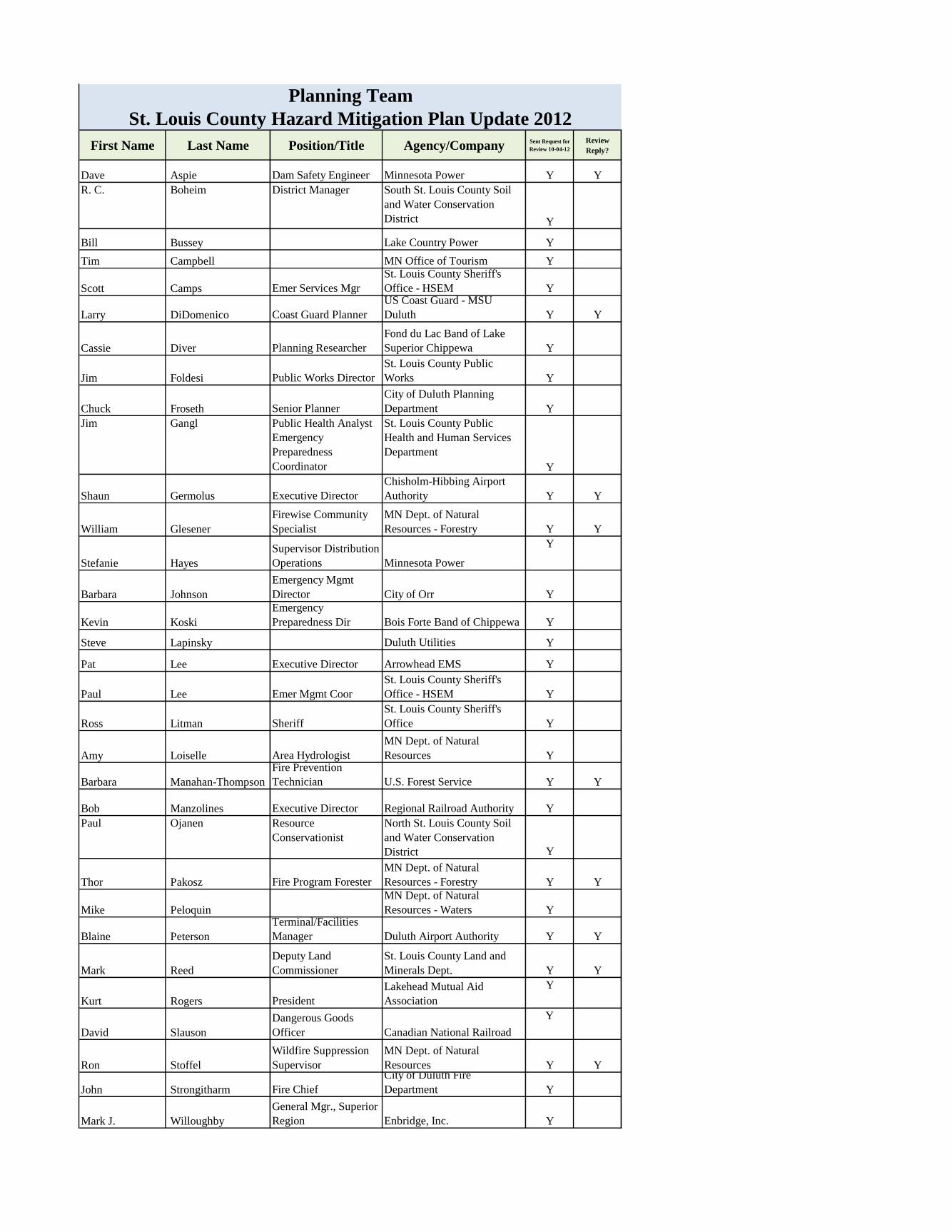
First Name Last Name Position/Title Agency/CompanySent Request for
Review 10-04-12
Review
Reply?
Dave Aspie Dam Safety Engineer Minnesota Power Y Y
R. C. Boheim District Manager South St. Louis County Soil
and Water Conservation
District Y
Bill Bussey Lake Country Power Y
Tim Campbell MN Office of Tourism Y
Scott Camps Emer Services Mgr
St. Louis County Sheriff's
Office - HSEM Y
Larry DiDomenico Coast Guard Planner
US Coast Guard - MSU
Duluth Y Y
Cassie Diver Planning Researcher
Fond du Lac Band of Lake
Superior Chippewa Y
Jim Foldesi Public Works Director
St. Louis County Public
Works Y
Chuck Froseth Senior Planner
City of Duluth Planning
Department Y
Jim Gangl Public Health Analyst
Emergency
Preparedness
Coordinator
St. Louis County Public
Health and Human Services
Department
Y
Shaun Germolus Executive Director
Chisholm-Hibbing Airport
Authority Y Y
William Glesener
Firewise Community
Specialist
MN Dept. of Natural
Resources - Forestry Y Y
Stefanie Hayes
Supervisor Distribution
Operations Minnesota Power
Y
Barbara Johnson
Emergency Mgmt
Director City of Orr Y
Kevin Koski
Emergency
Preparedness Dir Bois Forte Band of Chippewa Y
Steve Lapinsky Duluth Utilities Y
Pat Lee Executive Director Arrowhead EMS Y
Paul Lee Emer Mgmt Coor
St. Louis County Sheriff's
Office - HSEM Y
Ross Litman Sheriff
St. Louis County Sheriff's
Office Y
Amy Loiselle Area Hydrologist
MN Dept. of Natural
Resources Y
Barbara Manahan-Thompson
Fire Prevention
Technician U.S. Forest Service Y Y
Bob Manzolines Executive Director Regional Railroad Authority Y
Paul Ojanen Resource
Conservationist
North St. Louis County Soil
and Water Conservation
District Y
Thor Pakosz Fire Program Forester
MN Dept. of Natural
Resources - Forestry Y Y
Mike Peloquin
MN Dept. of Natural
Resources - Waters Y
Blaine Peterson
Terminal/Facilities
Manager Duluth Airport Authority Y Y
Mark Reed
Deputy Land
Commissioner
St. Louis County Land and
Minerals Dept. Y Y
Kurt Rogers President
Lakehead Mutual Aid
Association
Y
David Slauson
Dangerous Goods
Officer Canadian National Railroad
Y
Ron Stoffel
Wildfire Suppression
Supervisor
MN Dept. of Natural
Resources Y Y
John Strongitharm Fire Chief
City of Duluth Fire
Department Y
Mark J. Willoughby
General Mgr., Superior
Region Enbridge, Inc. Y
Planning Team
St. Louis County Hazard Mitigation Plan Update 2012
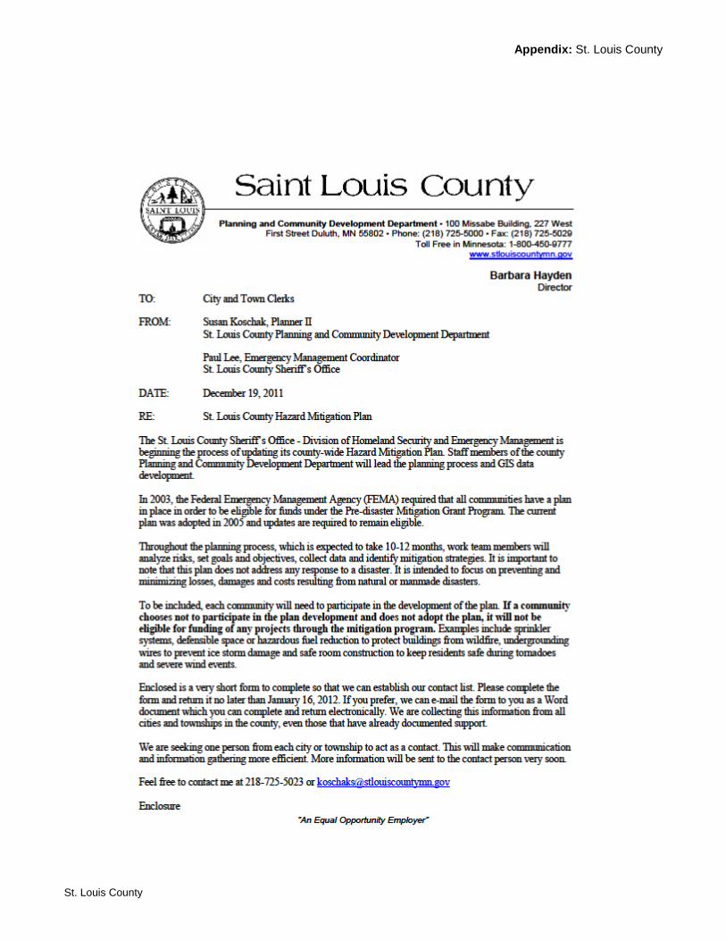
Appendix: St. Louis County
St. Louis County

2012 St. Louis County Hazard Mitigation Plan
Community Contact
Please return this form by January 16, 2012 to
Attn: Susan Koschak
St. Louis County Planning and Community Development Department
227 W 1st St, #100
Duluth, MN 55802
If you prefer to complete and return this form electronically (Word document) e-mail me at
City or Township: ______________________________________________
Name: _______________________________________________________
Position/Title: _________________________________________________
Mailing Address/ Zip: ___________________________________________
Phone: _______________________________________________________
E-mail: _______________________________________________________
Does your city or township have a website? ____yes _____no
If yes, what is the address? ________________________________________
Does your city or township have an adopted comprehensive plan? _____yes _____no
If yes, is it available online? _____yes _____no
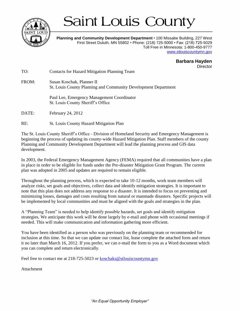
“An Equal Opportunity Employer”
Planning and Community Development Department • 100 Missabe Building, 227 West
First Street Duluth, MN 55802 • Phone: (218) 725-5000 • Fax: (218) 725-5029 Toll Free in Minnesota: 1-800-450-9777
www.stlouiscountymn.gov
Barbara Hayden Director
TO: Contacts for Hazard Mitigation Planning Team
FROM: Susan Koschak, Planner II
St. Louis County Planning and Community Development Department
Paul Lee, Emergency Management Coordinator
St. Louis County Sheriff’s Office
DATE: February 24, 2012
RE: St. Louis County Hazard Mitigation Plan
The St. Louis County Sheriff’s Office - Division of Homeland Security and Emergency Management is
beginning the process of updating its county-wide Hazard Mitigation Plan. Staff members of the county
Planning and Community Development Department will lead the planning process and GIS data
development.
In 2003, the Federal Emergency Management Agency (FEMA) required that all communities have a plan
in place in order to be eligible for funds under the Pre-disaster Mitigation Grant Program. The current
plan was adopted in 2005 and updates are required to remain eligible.
Throughout the planning process, which is expected to take 10-12 months, work team members will
analyze risks, set goals and objectives, collect data and identify mitigation strategies. It is important to
note that this plan does not address any response to a disaster. It is intended to focus on preventing and
minimizing losses, damages and costs resulting from natural or manmade disasters. Specific projects will
be implemented by local communities and must be aligned with the goals and strategies in the plan.
A “Planning Team” is needed to help identify possible hazards, set goals and identify mitigation
strategies. We anticipate this work will be done largely by e-mail and phone with occasional meetings if
needed. This will make communication and information gathering more efficient.
You have been identified as a person who was previously on the planning team or recommended for
inclusion at this time. So that we can update our contact list, lease complete the attached form and return
it no later than March 16, 2012. If you prefer, we can e-mail the form to you as a Word document which
you can complete and return electronically.
Feel free to contact me at 218-725-5023 or [email protected]
Attachment

2012 St. Louis County Hazard Mitigation Plan
Planning Team Member Contact
Please return this form by March 16, 2012 to
St. Louis County Planning and Community Development Department
Attn: Susan Koschak
227 W 1st St, #100
Duluth, MN 55802
If you prefer to complete and return this form electronically (Word document) or send the
information below in a message, please e-mail me at [email protected]
Phone 218-725-5023
Fax 218-725-5029
Company/Agency: ______________________________________________
Name: _______________________________________________________
Position/Title: _________________________________________________
Mailing Address: ______________________________________________
City/Zip: ______________________________________________________
Phone: _______________________________________________________
E-mail: _______________________________________________________
Notes/Comments:
“An Equal Opportunity Employer”
Planning and Community Development Department • 100 Missabe Building, 227 West
First Street Duluth, MN 55802 • Phone: (218) 725-5000 • Fax: (218) 725-5029 Toll Free in Minnesota: 1-800-450-9777
www.stlouiscountymn.gov
Barbara Hayden Director
TO: Community Contacts for Hazard Mitigation Plan Update
FROM: Susan Koschak, Planner II
DATE: August 16, 2012
RE: Information needed for hazard events since 2005
CC: Paul Lee, Emergency Management Coordinator
As you know, St. Louis County is in the process of updating its Hazard Mitigation Plan. Recent
events such as the flash flooding in southern areas of the county and the blow down in the northern
areas have increased our awareness of the importance of this plan.
Along with goals and strategies for future mitigation efforts, documentation of past events is a key
part of the plan to assure that projects are eligible for funding. The most accurate data about hazard
events since the 2005 plan was written will come from you, the leaders of local jurisdictions.
Attached in this e-mail is a form that outlines the information we need. You may complete it in
whatever way best suits your jurisdiction:
Save the word document, fill in the information then re-save and send back to me as an
attachment in an e-mail
Save the word document, fill it in and mail it back to me
Use the form as an outline and send me an e-mail with your information
If you had no events in your jurisdiction since 2005, you may simply type in “none”, send me an e-
mail or call me and let me know.
Thanks for your participation in the planning process to this point. There will be a few more times
over the next months when additional feedback will be requested. This plan is very important
because order to be eligible for federal funding, mitigation strategies must be included in the plan.
As always, feel free to contact me if you have any questions or feedback. You can email me at
[email protected] or call 218-725-5023. Thank you for your attention and time.
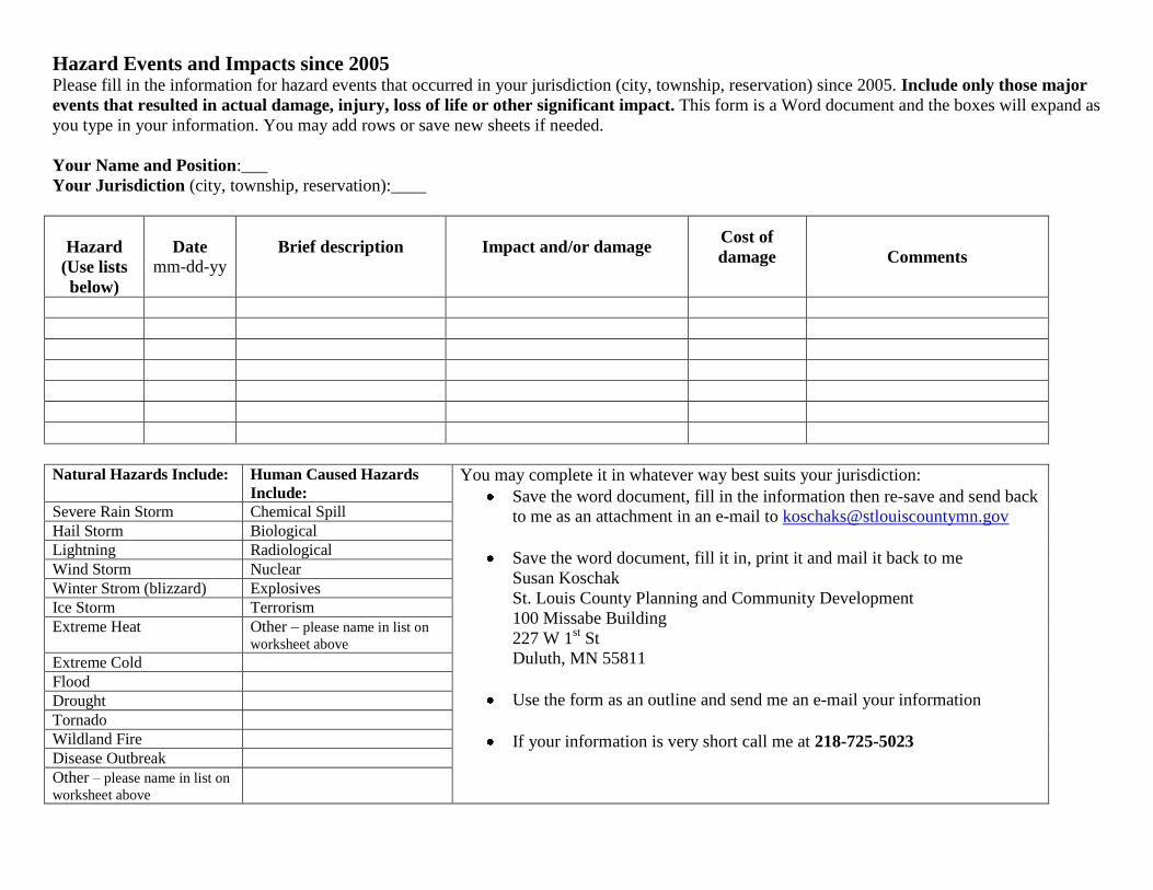
Hazard Events and Impacts since 2005 Please fill in the information for hazard events that occurred in your jurisdiction (city, township, reservation) since 2005. Include only those major
events that resulted in actual damage, injury, loss of life or other significant impact. This form is a Word document and the boxes will expand as
you type in your information. You may add rows or save new sheets if needed.
Your Name and Position:___
Your Jurisdiction (city, township, reservation):____
Hazard
(Use lists
below)
Date
mm-dd-yy Brief description
Impact and/or damage
Cost of
damage
Comments
Natural Hazards Include: Human Caused Hazards
Include: You may complete it in whatever way best suits your jurisdiction:
Save the word document, fill in the information then re-save and send back
to me as an attachment in an e-mail to [email protected]
Save the word document, fill it in, print it and mail it back to me
Susan Koschak
St. Louis County Planning and Community Development
100 Missabe Building
227 W 1st St
Duluth, MN 55811
Use the form as an outline and send me an e-mail your information
If your information is very short call me at 218-725-5023
Severe Rain Storm Chemical Spill
Hail Storm Biological
Lightning Radiological
Wind Storm Nuclear
Winter Strom (blizzard) Explosives
Ice Storm Terrorism
Extreme Heat Other – please name in list on
worksheet above
Extreme Cold
Flood
Drought
Tornado
Wildland Fire
Disease Outbreak
Other – please name in list on
worksheet above
September 4, 2012
To Community Contacts for St. Louis County Hazard Mitigation Plan Update
Hello,
Just over two weeks ago I sent you a request to send information about any significant hazard
events that occurred in your city or township since 2005. If you have already sent your reply,
thank you!
If not, this is a reminder to do so. This information is an important part of our Hazard Mitigation
Plan Update, which is required in order to be eligible for mitigation funding in the future.
I am again attaching the memo and form that I sent. If you have not already done so, please
respond no later than Monday, September 10.
As always, please contact me at [email protected] or 218-725-5023 if you have
any questions.
Thanks again,
Susan Koschak
“An Equal Opportunity Employer”
Planning and Community Development Department • 100 Missabe Building, 227 West
First Street Duluth, MN 55802 • Phone: (218) 725-5000 • Fax: (218) 725-5029 Toll Free in Minnesota: 1-800-450-9777
www.stlouiscountymn.gov
Barbara Hayden Director
TO: City, Township and Tribal Government Contacts and Planning Team Members
FROM: Susan Koschak, Planner II
DATE: October 4, 2012
RE: Review and Feedback on Draft Hazard Mitigation Plan Update
As you know, work on the update of the St. Louis County Hazard Mitigation Plan has been underway for the
past several months. Although we are still collecting some data and organizing maps and the appendixes, the
draft plan is ready for your review and comments. After your suggestions are incorporated, the next draft will
be available for public comment. The draft plan is attached in PDF format. If you are unable to open this
attachment, please call me and I will mail you a copy.
Of particular importance for your review is Section 5, Goals and Strategies, beginning on page 103. Only
strategies included in this plan will be eligible for federal funding. If there are strategies missing or if you
have project ideas that do not seem to fit into any of the listed strategies, it is critical to let me know so that I
can add them.
Of special note to Cities: participation in the planning process is required in order to be eligible for funding
so a response to this request for feedback is important to implementation of any mitigation projects for the
next five years. Townships are included under the umbrella of the county adoption of the plan. Each Tribal
Government will submit an annex to the plan.
If you are the contact person for a city, please give special attention to and include in your comments which
strategies you might implement and/or what mitigation projects you may seek funding for. Being listed does
not commit you to implementation but, if a city is not named in the implementation column, it will not be
eligible for mitigation funds during the period for which the plan is in effect, which is five years. For
some strategies, all jurisdictions may be covered when the implementation includes ‘all jurisdictions within
the county’. If you have specific strategies or unique projects in mind, we will name your jurisdiction where
you indicate to do so.
You may use the form attached to this e-mail to send your comments (add rows as needed) or e-mail or mail
me your comments in whatever format you’d like. Please include what page each of your comments refers to.
Please send your comments to me no later than Friday, November 16, 2012. If you have questions, contact
me at [email protected] or 218-725-5023.
Attachments
cc: Paul Lee, Coordinator, St. Louis County Sheriff's Office/Division of HS/EM
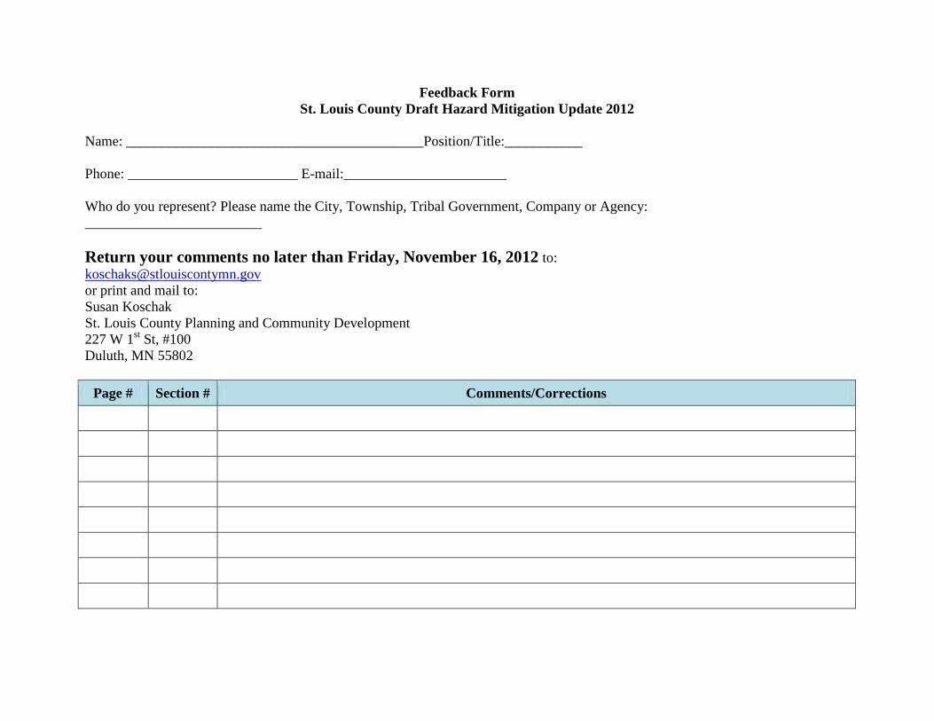
Feedback Form
St. Louis County Draft Hazard Mitigation Update 2012
Name: __________________________________________Position/Title:___________
Phone: ________________________ E-mail:_______________________
Who do you represent? Please name the City, Township, Tribal Government, Company or Agency:
_________________________
Return your comments no later than Friday, November 16, 2012 to:
or print and mail to:
Susan Koschak
St. Louis County Planning and Community Development
227 W 1st St, #100
Duluth, MN 55802
Page # Section # Comments/Corrections
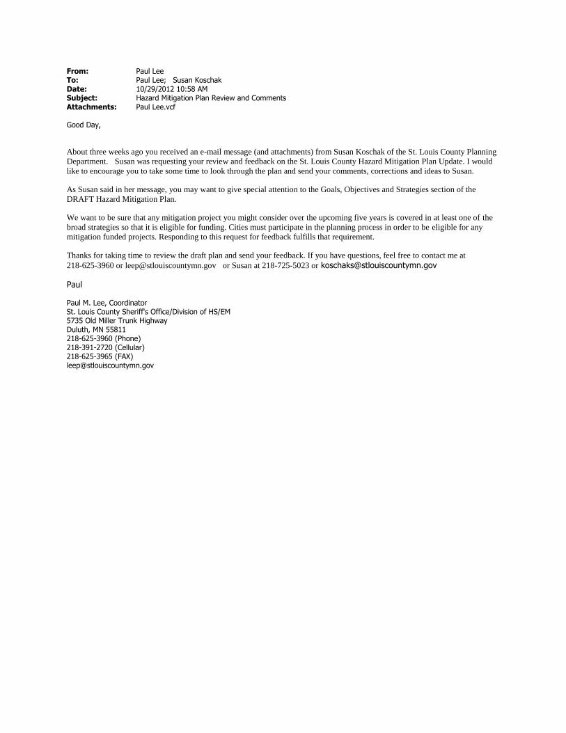
From: Paul Lee To: Paul Lee; Susan Koschak Date: 10/29/2012 10:58 AM Subject: Hazard Mitigation Plan Review and Comments Attachments: Paul Lee.vcf Good Day,
About three weeks ago you received an e-mail message (and attachments) from Susan Koschak of the St. Louis County Planning
Department. Susan was requesting your review and feedback on the St. Louis County Hazard Mitigation Plan Update. I would
like to encourage you to take some time to look through the plan and send your comments, corrections and ideas to Susan. As Susan said in her message, you may want to give special attention to the Goals, Objectives and Strategies section of the
DRAFT Hazard Mitigation Plan.
We want to be sure that any mitigation project you might consider over the upcoming five years is covered in at least one of the
broad strategies so that it is eligible for funding. Cities must participate in the planning process in order to be eligible for any
mitigation funded projects. Responding to this request for feedback fulfills that requirement. Thanks for taking time to review the draft plan and send your feedback. If you have questions, feel free to contact me at
218-625-3960 or [email protected] or Susan at 218-725-5023 or [email protected]
Paul Paul M. Lee, Coordinator St. Louis County Sheriff's Office/Division of HS/EM 5735 Old Miller Trunk Highway Duluth, MN 55811 218-625-3960 (Phone) 218-391-2720 (Cellular) 218-625-3965 (FAX) [email protected]

From: Susan Koschak To: Susan Koschak CC: Paul Lee Date: 11/19/2012 3:01 PM Subject: Action needed: Please reply to request for feedback on Hazard Mitigation Plan November 19, 2012 Hello, We are just a few weeks away from sending the draft Hazard Mitigation Plan Update out for the review and approval process. I have not yet heard back from you in response to our request for comments on the draft. If you have any mitigation projects in mind for the next five years and/or would like to be listed in the implementation column for any of the mitigation strategies, I need to hear from you to include that information. It is especially important for each city to be included in order to be eligible for mitigation funds during the five years this plan covers. After the plan is adopted by the St. Louis County Board next spring, cities will be encouraged to adopt the plan as well. Please e-mail me any comments or corrections to the plan as well as projects you may implement as soon as possible. Please reply even if you have no projects planned. If you have questions you can contact me at [email protected] or Paul Lee at [email protected] The draft plan is posted on our website at www.stlouiscountymn.gov. Thanks and have a great Thanksgiving holiday. Susan Koschak Susan Koschak Planner II St. Louis County, Minnesota Planning and Community Development 100 Missabe Building 227 W. First Street Duluth, MN 55802 Phone: 218-725-5023 Fax: 218-725-5029 Email: [email protected] Web: www.stlouiscountymn.gov
Appendix: St. Louis County
St. Louis County
APPENDIX C: Public Involvement Documentation
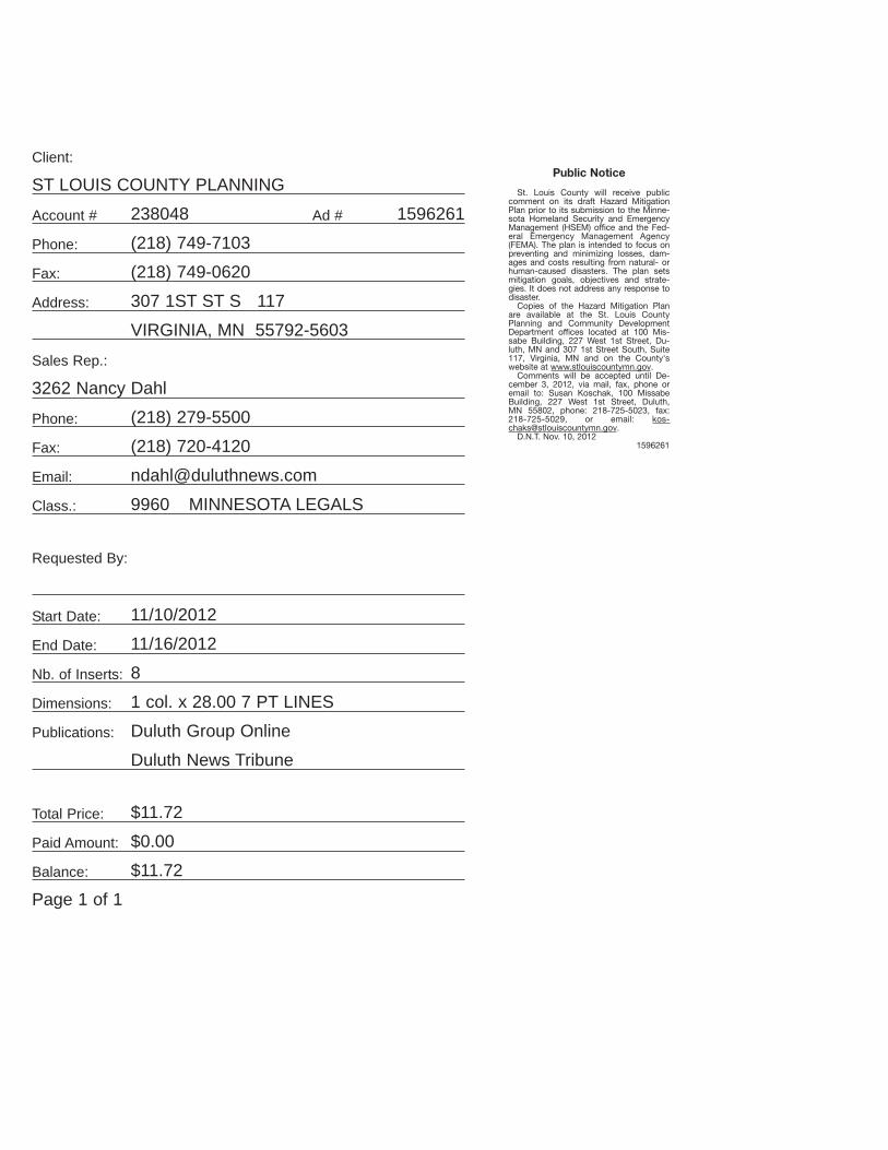
Client:
ST LOUIS COUNTY PLANNING
Account # 238048 Ad # 1596261
Phone: (218) 749-7103
Fax: (218) 749-0620
Address: 307 1ST ST S 117
VIRGINIA, MN 55792-5603
Sales Rep.:
3262 Nancy Dahl
Phone: (218) 279-5500
Fax: (218) 720-4120
Email: [email protected]
Class.: 9960 MINNESOTA LEGALS
Requested By:
Start Date: 11/10/2012
End Date: 11/16/2012
Nb. of Inserts: 8
Dimensions: 1 col. x 28.00 7 PT LINES
Publications: Duluth Group Online
Duluth News Tribune
Total Price: $11.72
Paid Amount: $0.00
Balance: $11.72
Page 1 of 1
Public Notice
St. Louis County will receive public comment on its draft Hazard Mitigation Plan prior to its submission to the Minne-sota Homeland Security and Emergency Management (HSEM) office and the Fed-eral Emergency Management Agency (FEMA). The plan is intended to focus on preventing and minimizing losses, dam-ages and costs resulting from natural- or human-caused disasters. The plan sets mitigation goals, objectives and strate-gies. It does not address any response to disaster.
Copies of the Hazard Mitigation Plan are available at the St. Louis County Planning and Community Development Department offices located at 100 Mis-sabe Building, 227 West 1st Street, Du-luth, MN and 307 1st Street South, Suite 117, Virginia, MN and on the County's website at www.stlouiscountymn.gov.
Comments will be accepted until De-cember 3, 2012, via mail, fax, phone or email to: Susan Koschak, 100 Missabe Building, 227 West 1st Street, Duluth, MN 55802, phone: 218-725-5023, fax: 218-725-5029, or email: [email protected].
D.N.T. Nov. 10, 20121596261

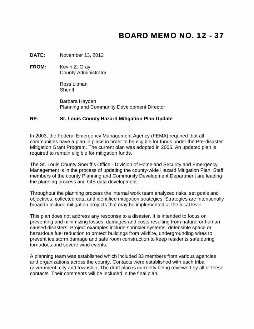
BOARD MEMO NO. 12 - 37 DATE: November 13, 2012 FROM: Kevin Z. Gray
County Administrator
Ross Litman Sheriff
Barbara Hayden Planning and Community Development Director RE: St. Louis County Hazard Mitigation Plan Update In 2003, the Federal Emergency Management Agency (FEMA) required that all communities have a plan in place in order to be eligible for funds under the Pre-disaster Mitigation Grant Program. The current plan was adopted in 2005. An updated plan is required to remain eligible for mitigation funds. The St. Louis County Sheriff’s Office - Division of Homeland Security and Emergency Management is in the process of updating the county-wide Hazard Mitigation Plan. Staff members of the county Planning and Community Development Department are leading the planning process and GIS data development. Throughout the planning process the internal work team analyzed risks, set goals and objectives, collected data and identified mitigation strategies. Strategies are intentionally broad to include mitigation projects that may be implemented at the local level. This plan does not address any response to a disaster. It is intended to focus on preventing and minimizing losses, damages and costs resulting from natural or human caused disasters. Project examples include sprinkler systems, defensible space or hazardous fuel reduction to protect buildings from wildfire, undergrounding wires to prevent ice storm damage and safe room construction to keep residents safe during tornadoes and severe wind events. A planning team was established which included 33 members from various agencies and organizations across the county. Contacts were established with each tribal government, city and township. The draft plan is currently being reviewed by all of these contacts. Their comments will be included in the final plan.
A public comment period has begun. The plan is posted on the St. Louis County website and was announced through an official published public notice. The public comment period will last through December 3, 2012. After all comments are collected and the draft plan is complete, it will be sent to the Minnesota Homeland Security and Emergency Management (HSEM) office for a review period that is expected to take up to 30 days. Any needed changes based on this review will be made, after which the draft plan will be sent to FEMA for review and approval which is expected to take up to 30 days. The final step, which is expected to be in March 2013, is for the St. Louis County Board to adopt the plan. Each city and tribal government in the county is also encouraged to adopt the plan. Townships are eligible for mitigation funds as part of the county. The draft plan is posted on the county website and a copy will also be sent to each commissioner.

An Equal Opportunity Employer
Sheriff’s Office • 100 North Fifth Avenue West, Room 103 • Duluth, MN 55802
Phone: (218) 726-2340 • Fax: (218) 726-2171 • www.stlouiscountymn.gov
Ross Litman Sheriff
N E W S R E L E A S E For immediate release:
February 12, 2013 MEDIA CONTACT: Marcus Bruning, Director
Sheriff’s Office Emergency Management Division
(218) 336-4340
Paul Lee, Coordinator
Sheriff’s Office Emergency Management Division
(218) 625-3960
St. Louis County to host public meetings about Hazard Mitigation Plan
Reducing and preventing loss of life, damage and costs from a disaster, whether natural or
human-caused – that is the purpose of a Hazard Mitigation Plan. The Federal Emergency
Management Agency (FEMA) requires all communities to have such a plan in place in order to
qualify for funds through its Hazard Mitigation Grant Program.
St. Louis County has a Hazard Mitigation Plan in place, and is working to update that plan.
The Sheriff’s Office – Division of Homeland Security and Emergency Management, along with the
County’s Planning and Community Development Department, worked with a team of more than 30
individuals chosen for their technical expertise to analyze risks, set goals, collect data and identify
mitigation strategies.
A draft of the plan can be viewed on the County’s website. Additionally, the County will host
three public meetings for anyone interested in offering feedback about the plan:
Tuesday, February 19, 11 a.m. to 1:30 p.m.
Richard H. Hanson Public Works and Transportation Complex
4787 Midway Road, Pike Lake
Wednesday, February 20, 11 a.m. to 1: 30 p.m.
Ely Maintenance Facility
2210 East Sheridan Street, Ely
-more-
An Equal Opportunity Employer
Thursday, February 21, noon to 2:30 p.m.
Northland Office Center
307 South First Street, Virginia
The document outlines the County’s risk for various types of disasters, such as extreme
winter storms, floods, wildfires, terrorism, chemical spills and drinking water contamination. It also
identifies strategies that may be implemented to reduce the impact of a disaster.
Once the plan is complete, it must be approved by both FEMA and the St. Louis County
Board. To view a draft of the Hazard Mitigation Plan, visit stlouiscountymn.gov/mitigation, or
contact the Sheriff’s Office – Emergency Management Division at (218) 336-4340.
# # #

Media List To: Associated Press To: Babbitt Weekly To: Budgeteer newspaper To: Business North To: Butcher, Mark (WCCO) To: Cloquet Pine Journal To: Cook News Herald To: Duluth News Tribune To: Ely Echo To: Floodwood Forum To: Fox 21 News To: Frederick, Chuck (DNT) To: Grand Rapids Herald To: Grell, Gregg (WDSE) To: Hermantown Star To: Hibbing Tribune To: Howie Hanson (Duluth.com) To: KDAL AM Radio To: Kraker, Dan (MPR) To: KUMD To: Labor World To: Lake County News Chronicle To: Minnesota News Network To: MPR To: Myers, John (DNT) To: Nelson, Peter (WCCO) To: [email protected] To: Northland News Center To: Portage News To: Proctor Journal To: Ramsay, Charles (Mesabi Daily News) To: Range Times To: Superior Telegram To: Timberjay To: Warren, John (KDAL-AM) To: WCCO News Tips To: WCCO-AM Radio To: WDIO TV To: WELY AM To: WEVE Radio Eveleth To: White, Jesse (Mesabi Daily News) To: Wisconsin Public Radio To: WNMT Radio Hibbing To: WTBX Radio-Hibbing


St. Louis County Hazard Mitigation Plan Update
February 19 – 20 – 21, 2013
Use the space below to leave your feedback and comments.
Page # Section # Comments
Optional:
Name ________________________________________________________________________
City __________________________ Township _____________________________________
E-mail address ________________________________________________________________

Appendix: St. Louis County
St. Louis County
APPENDIX D: St. Louis County Risk Assessment Survey
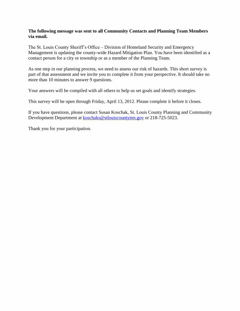
The following message was sent to all Community Contacts and Planning Team Members
via email.
The St. Louis County Sheriff’s Office – Division of Homeland Security and Emergency
Management is updating the county-wide Hazard Mitigation Plan. You have been identified as a
contact person for a city or township or as a member of the Planning Team.
As one step in our planning process, we need to assess our risk of hazards. This short survey is
part of that assessment and we invite you to complete it from your perspective. It should take no
more than 10 minutes to answer 9 questions.
Your answers will be compiled with all others to help us set goals and identify strategies.
This survey will be open through Friday, April 13, 2012. Please complete it before it closes.
If you have questions, please contact Susan Koschak, St. Louis County Planning and Community
Development Department at [email protected] or 218-725-5023.
Thank you for your participation.
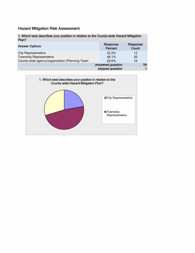
Response
Percent
Response
Count
22.2% 12
48.1% 26
29.6% 16
54
1skipped question
Township Representative
1. Which best describes your position in relation to the County-wide Hazard Mitigation
Plan?
answered question
City Representative
Hazard Mitigation Risk Assessment
County-wide agency/organization (Planning Team
Answer Options
1. Which best describes your position in relation to the County-wide Hazard Mitigation Plan?
City Representative
Township Representative
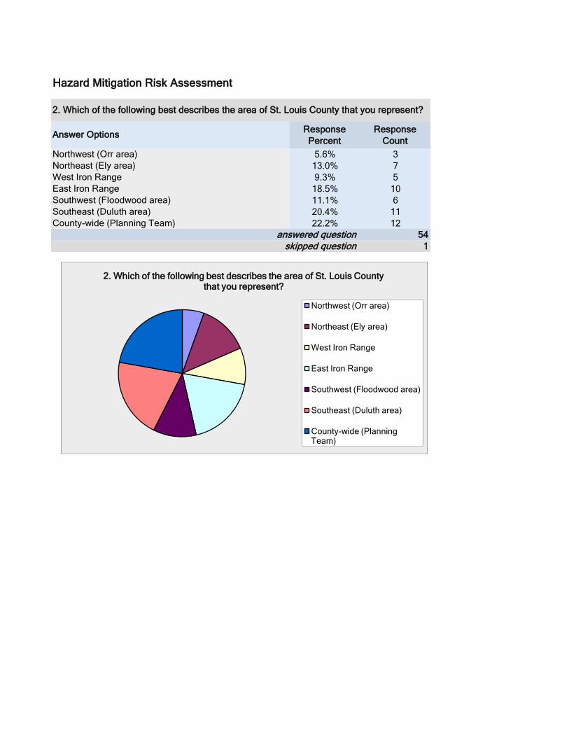
Response
Percent
Response
Count
5.6% 3
13.0% 7
9.3% 5
18.5% 10
11.1% 6
20.4% 11
22.2% 12
54
1
Hazard Mitigation Risk Assessment
West Iron Range
answered question
Answer Options
Southwest (Floodwood area)
Northeast (Ely area)
County-wide (Planning Team)
2. Which of the following best describes the area of St. Louis County that you represent?
East Iron Range
skipped question
Northwest (Orr area)
Southeast (Duluth area)
2. Which of the following best describes the area of St. Louis County that you represent?
Northwest (Orr area)
Northeast (Ely area)
West Iron Range
East Iron Range
Southwest (Floodwood area)
Southeast (Duluth area)
County-wide (Planning Team)
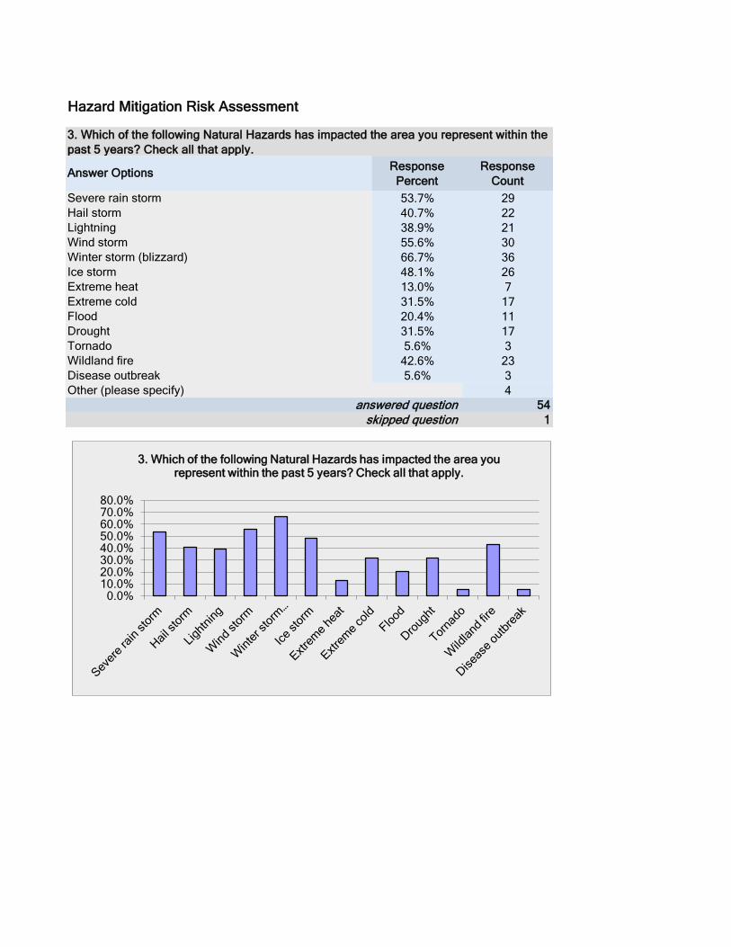
Response
Percent
Response
Count
53.7% 29
40.7% 22
38.9% 21
55.6% 30
66.7% 36
48.1% 26
13.0% 7
31.5% 17
20.4% 11
31.5% 17
5.6% 3
42.6% 23
5.6% 3
4
54
1
Hazard Mitigation Risk Assessment
Tornado
Lightning
skipped question
Extreme cold
Answer Options
Disease outbreak
Winter storm (blizzard)
Drought
Hail storm
answered question
Extreme heat
3. Which of the following Natural Hazards has impacted the area you represent within the
past 5 years? Check all that apply.
Wildland fire
Wind storm
Flood
Severe rain storm
Other (please specify)
Ice storm
0.0% 10.0% 20.0% 30.0% 40.0% 50.0% 60.0% 70.0% 80.0%
3. Which of the following Natural Hazards has impacted the area you represent within the past 5 years? Check all that apply.
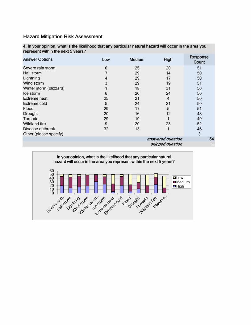
Low Medium HighResponse
Count
6 25 20 51
7 29 14 50
4 29 17 50
3 29 19 51
1 18 31 50
6 20 24 50
25 21 4 50
5 24 21 50
29 17 5 51
20 16 12 48
29 19 1 49
9 20 23 52
32 13 1 46
3
54
1
Hazard Mitigation Risk Assessment
Tornado
Lightning
skipped question
Extreme cold
Answer Options
Disease outbreak
Winter storm (blizzard)
Drought
Hail storm
answered question
Extreme heat
4. In your opinion, what is the likelihood that any particular natural hazard will occur in the area you
represent within the next 5 years?
Wildland fire
Wind storm
Flood
Severe rain storm
Other (please specify)
Ice storm
0 10 20 30 40 50 60
In your opinion, what is the likelihood that any particular natural hazard will occur in the area you represent within the next 5 years?
Low Medium High
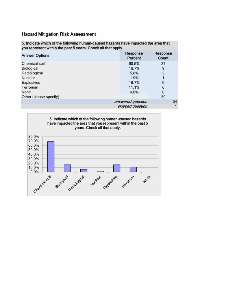
Response
Percent
Response
Count
68.5% 37
16.7% 9
5.6% 3
1.9% 1
16.7% 9
11.1% 6
0.0% 0
30
54
1
Hazard Mitigation Risk Assessment
Radiological
Other (please specify)
Answer Options
Explosives
skipped question
Biological
None
5. Indicate which of the following human-caused hazards have impacted the area that
you represent within the past 5 years. Check all that apply.
Nuclear
answered question
Chemical spill
Terrorism
0.0% 10.0% 20.0% 30.0% 40.0% 50.0% 60.0% 70.0% 80.0%
5. Indicate which of the following human-caused hazards have impacted the area that you represent within the past 5
years. Check all that apply.
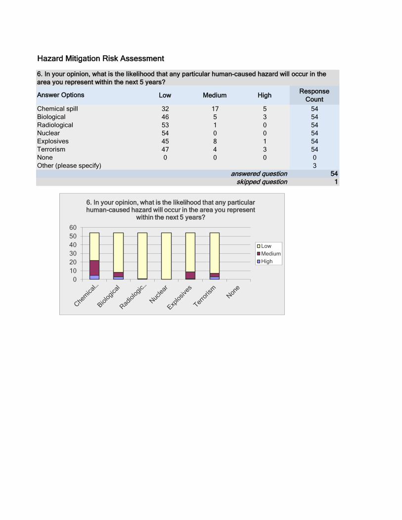
Low Medium HighResponse
Count
32 17 5 54
46 5 3 54
53 1 0 54
54 0 0 54
45 8 1 54
47 4 3 54
0 0 0 0
3
54
1
answered question
Chemical spill
Terrorism
Hazard Mitigation Risk Assessment
Radiological
Other (please specify)
Answer Options
Explosives
skipped question
Biological
None
6. In your opinion, what is the likelihood that any particular human-caused hazard will occur in the
area you represent within the next 5 years?
Nuclear
0
10
20
30
40
50
60
6. In your opinion, what is the likelihood that any particular human-caused hazard will occur in the area you represent
within the next 5 years?
Low
Medium
High

Low Medium HighResponse
Count
12 18 24 54
14 26 14 54
11 22 21 54
24 22 8 54
7 19 28 54
7 20 27 54
0
54
1
Hazard Mitigation Risk Assessment
Natural Resource Protection – Actions that minimize
answered question
Answer Options
Emergency Services – Actions that protect people and
Property Protection – Actions that involve the modification
Other (please specify)
7. A number of activities can reduce our risk and damage from hazards. In general, those activities fall into
one of the following six broad categories. Please indicate how important you think each category is.
Structural Projects – Actions intended to lessen the
skipped question
Prevention – Administrative or regulatory actions that
Public Education and Awareness – Actions that inform
0 10 20 30 40 50 60
Pre
ve
ntio
n –
A
dm
inis
tra
tive
or
reg
ula
tory
actio
ns
tha
t in
flu
en
ce
…
Pro
pe
rty
Pro
tectio
n –
A
ctio
ns th
at
invo
lve
th
e …
Na
tura
l R
eso
urc
e
Pro
tectio
n –
A
ctio
ns th
at
min
imiz
e h
aza
rd …
Str
uctu
ral
Pro
jects
– A
ctio
ns
inte
nd
ed
to
le
sse
n th
e …
Em
erg
en
cy
Se
rvic
es –
Actio
ns
tha
t p
rote
ct
pe
op
le a
nd
…
Pu
blic E
du
ca
tio
n
an
d A
wa
ren
ess –
A
ctio
ns th
at
info
rm c
itiz
en
s …
7. A number of activities can reduce our risk and damage from hazards. In general, those activities fall into one of the following six broad
categories. Please indicate how important you think each category is.
Low
Medium
High
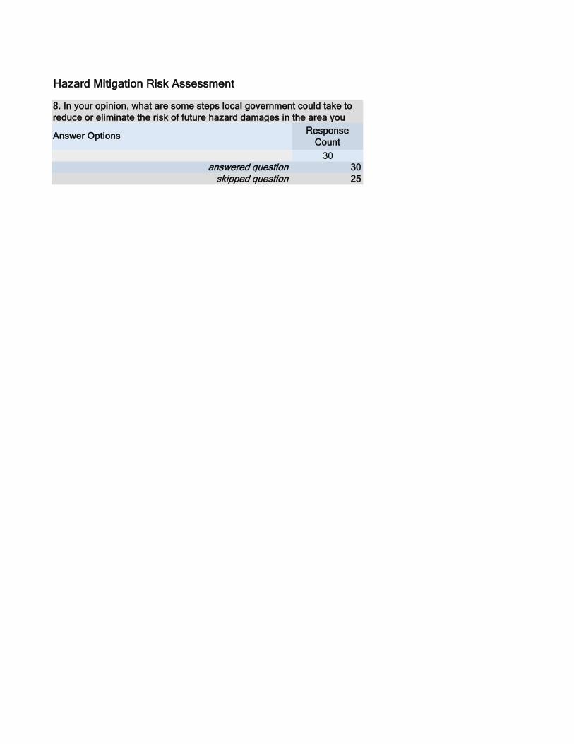
Response
Count
30
30
25
Hazard Mitigation Risk Assessment
8. In your opinion, what are some steps local government could take to
reduce or eliminate the risk of future hazard damages in the area you
Answer Options
answered question
skipped question

Response
Count
27
27
28
Hazard Mitigation Risk Assessment
9. What other issues regarding the reduction of risk and loss associated
with hazards or disasters in St. Louis County do you think are important?
Answer Options
answered question
skipped question
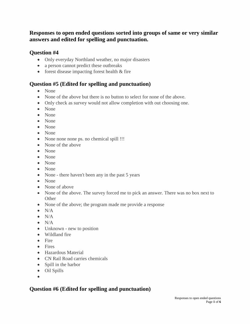
Responses to open ended questions Page 1 of 6
Responses to open ended questions sorted into groups of same or very similar
answers and edited for spelling and punctuation.
Question #4
Only everyday Northland weather, no major disasters
a person cannot predict these outbreaks
forest disease impacting forest health & fire
Question #5 (Edited for spelling and punctuation)
None
None of the above but there is no button to select for none of the above.
Only check as survey would not allow completion with out choosing one.
None
None
None
None
None
None none none ps. no chemical spill !!!
None of the above
None
None
None
None
None - there haven't been any in the past 5 years
None
None of above
None of the above. The survey forced me to pick an answer. There was no box next to
Other
None of the above; the program made me provide a response
N/A
N/A
N/A
Unknown - new to position
Wildland fire
Fire
Fires
Hazardous Material
CN Rail Road carries chemicals
Spill in the harbor
Oil Spills
Question #6 (Edited for spelling and punctuation)

Responses to open ended questions Page 2 of 6
None
CN Railroad carries most of hazardous items
Oil spill (high)
Question #8 (Edited for spelling and punctuation)
Forest management; land use planning; emergency preparedness and training; public
awareness; road improvements; ditch and drainage management
Do not increase property tax on persons making improvements for protection.
Have a better plan on what people should do if a hazard happens and make sure the
people know the plan
Take a better look at potential mitigation projects and to see if their project is eligible for
funding via the mitigation program administered by FEMA.
Provide education and awareness sessions and local news stories.
More education
You cannot predict a storm related disaster, dry conditions may lead to fires; keep the
issues to local govt such as township...bigger is not better...
Education/ handouts from St. Louis Co.
Develop joint powers agreements/ Motions of Understanding re: joint reponses to
disasters, develop warning systems for rural areas
Consider wildland fuels management.
Education, Material supply support. Tech assistance with related equipment and training.
Direct and open communications both from the elected officials as well as Government
departments i.e. Public Safety, Health & Human Service, Forestry and so on. The
Departments that would have a direct effect and outcome of support in such a hazard.
In our township a gas pipeline and two railroads increase our risk for chemical disasters.
However we don't have any control over these. Perhaps we should have more control and
these business should have to put more money into our fire department so we our better
able to deal with these possibilities.
NONE
Education/Training
Public education combined with local government developing plans, which are
implementable, to recognize and prepare for the obvious hazards.
Continue to ensure a Pro-active approach (preparedness) for response to natural
disasters; Ensure citizens are prepared in the event of a disaster so not to become a
victim and be self sufficient until government can support.
Replacing the storm drains and infrastructure on some of our streets City issue
Public awareness meetings or having information available at community areas such as
town halls and community centers.
We are most affected by natural hazards, particularly wildfire issues. Do not know what
local government could to prevent issues- Minnesota DNR does a fire watch.
Run some educational TV ads aimed at citizens on what to do in the event of: a number
of possible hazards that are more likely to occur in our county
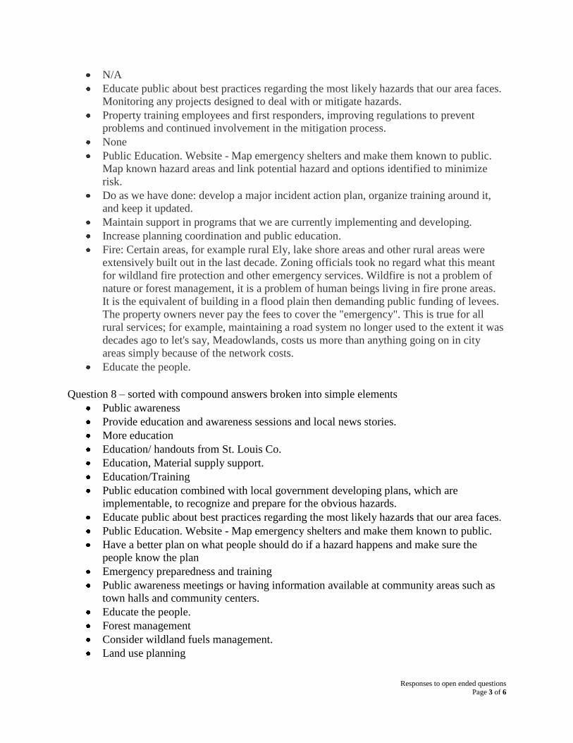
Responses to open ended questions Page 3 of 6
N/A
Educate public about best practices regarding the most likely hazards that our area faces.
Monitoring any projects designed to deal with or mitigate hazards.
Property training employees and first responders, improving regulations to prevent
problems and continued involvement in the mitigation process.
None
Public Education. Website - Map emergency shelters and make them known to public.
Map known hazard areas and link potential hazard and options identified to minimize
risk.
Do as we have done: develop a major incident action plan, organize training around it,
and keep it updated.
Maintain support in programs that we are currently implementing and developing.
Increase planning coordination and public education.
Fire: Certain areas, for example rural Ely, lake shore areas and other rural areas were
extensively built out in the last decade. Zoning officials took no regard what this meant
for wildland fire protection and other emergency services. Wildfire is not a problem of
nature or forest management, it is a problem of human beings living in fire prone areas.
It is the equivalent of building in a flood plain then demanding public funding of levees.
The property owners never pay the fees to cover the "emergency". This is true for all
rural services; for example, maintaining a road system no longer used to the extent it was
decades ago to let's say, Meadowlands, costs us more than anything going on in city
areas simply because of the network costs.
Educate the people.
Question 8 – sorted with compound answers broken into simple elements
Public awareness
Provide education and awareness sessions and local news stories.
More education
Education/ handouts from St. Louis Co.
Education, Material supply support.
Education/Training
Public education combined with local government developing plans, which are
implementable, to recognize and prepare for the obvious hazards.
Educate public about best practices regarding the most likely hazards that our area faces.
Public Education. Website - Map emergency shelters and make them known to public.
Have a better plan on what people should do if a hazard happens and make sure the
people know the plan
Emergency preparedness and training
Public awareness meetings or having information available at community areas such as
town halls and community centers.
Educate the people.
Forest management
Consider wildland fuels management.
Land use planning
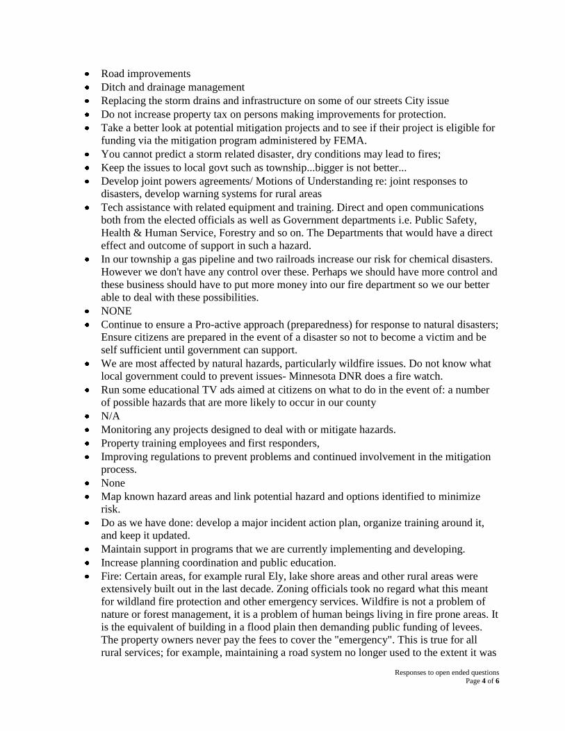
Responses to open ended questions Page 4 of 6
Road improvements
Ditch and drainage management
Replacing the storm drains and infrastructure on some of our streets City issue
Do not increase property tax on persons making improvements for protection.
Take a better look at potential mitigation projects and to see if their project is eligible for
funding via the mitigation program administered by FEMA.
You cannot predict a storm related disaster, dry conditions may lead to fires;
Keep the issues to local govt such as township...bigger is not better...
Develop joint powers agreements/ Motions of Understanding re: joint responses to
disasters, develop warning systems for rural areas
Tech assistance with related equipment and training. Direct and open communications
both from the elected officials as well as Government departments i.e. Public Safety,
Health & Human Service, Forestry and so on. The Departments that would have a direct
effect and outcome of support in such a hazard.
In our township a gas pipeline and two railroads increase our risk for chemical disasters.
However we don't have any control over these. Perhaps we should have more control and
these business should have to put more money into our fire department so we our better
able to deal with these possibilities.
NONE
Continue to ensure a Pro-active approach (preparedness) for response to natural disasters;
Ensure citizens are prepared in the event of a disaster so not to become a victim and be
self sufficient until government can support.
We are most affected by natural hazards, particularly wildfire issues. Do not know what
local government could to prevent issues- Minnesota DNR does a fire watch.
Run some educational TV ads aimed at citizens on what to do in the event of: a number
of possible hazards that are more likely to occur in our county
N/A
Monitoring any projects designed to deal with or mitigate hazards.
Property training employees and first responders,
Improving regulations to prevent problems and continued involvement in the mitigation
process.
None
Map known hazard areas and link potential hazard and options identified to minimize
risk.
Do as we have done: develop a major incident action plan, organize training around it,
and keep it updated.
Maintain support in programs that we are currently implementing and developing.
Increase planning coordination and public education.
Fire: Certain areas, for example rural Ely, lake shore areas and other rural areas were
extensively built out in the last decade. Zoning officials took no regard what this meant
for wildland fire protection and other emergency services. Wildfire is not a problem of
nature or forest management, it is a problem of human beings living in fire prone areas. It
is the equivalent of building in a flood plain then demanding public funding of levees.
The property owners never pay the fees to cover the "emergency". This is true for all
rural services; for example, maintaining a road system no longer used to the extent it was
Responses to open ended questions Page 5 of 6
decades ago to let's say, Meadowlands, costs us more than anything going on in city
areas simply because of the network costs.
Question #9 (Edited for spelling and punctuation)
Water quality control; cell phone and broadband signal availability for personal and local
fire department access; funding for local fire department training and equipment
compatible with other county emergency agencies
Education must be a top priority to reduce the risks. If the public does not know what to
do and how to prepare, how can we reduce risk?
We need to realize that federal assistance may not be available following a disaster. We
need to do the best we can to try to decrease the impact of a disaster.
Well coordinated effort among all agencies when called with a direct lead in charge.
Fire
People need to prepare for disasters. ie. have food and water on hand, plus evacuation
plan.
Development of regions staging areas, incident command areas, and list of equipment
available to respond from each city and township
Show attention to the county transition to 800 mhz.
Cannot say enough about Educate in all aspects of this question.
We seem to be willing to increase our risk of pollution and manmade disasters for jobs.
May need to redefine the importance of jobs versus environment.
NONE
Generally, government will recognize a risk or potential risk and not be willing to have
adequate funds or staff or space set aside for: education, physical actions such as storm
shelters or food or safe drinking water as example. I am not sure that local governments
in the area have been involved with a large scale exercise that includes
citizens/hospitals/schools/transportation. I recall the spill in WI and it seemed there was
not enough planning or preparation for such an event.
Bridge collapse; lake superior vessel incident (sinking, fire, oil spill);
N/A
Send out flyer or kitchen magnet listing the emergency numbers to call for our
county/area and list a few emergency examples with each number, so they are readily
available for people
N/A
I would like to see our industry, Railroads, become more integrated into the planning
section for emergency response. As a carrier of hazardous material, we have a lot of
resources and information that could be utilized in the pre- planning and in actual
responses.
With the likelihood of Copper-Nickel mining, all issues dealing with water quality are
critical. Unless we have plans to deal with inevitable accidents or violations, St. Louis
County may become dotted with super fund sites. As I write this, legislation is being
proposed to lower water and air quality standards in the state.
Responses to open ended questions Page 6 of 6
Spend more time on physical improvements and training and less on "terrorism" type
activities
Take the matches away from the Forest Service.
Coordinating public communication between agencies. Information sharing, resource
options
Firewise and Fire Adapted Communities programs.
Emergency Response planning, what resources are readily available to protect or to react
to situations
Communications - availability to communicate with 800 MHz radios and contingency
plans for cell phone or landline phone loss.
Railroad and Highway hazards
Maintaining a public health infrastructure. Accepting the fact of climate warming and
weather instability; floods and droughts will be more frequent and more intense.
Wild life, lakes, water sources Give towns money so they can prepare for such action.
Appendix: St. Louis County
St. Louis County
APPENDIX E: Review and Resolutions adopting plan

Appendix: St. Louis County
St. Louis County
Appendix F: Tribal Government Annexes
Bois Forte Annex 1 Hazard Mitigation Plan
Hazard Mitigation Plan Annex
Bois Forte Band of Chippewa
An Annex to the 2012 Hazard Mitigation Plan
St. Louis County, Minnesota
Prepared by Kevin Koski, Emergency Preparedness Director
December 6, 2012

Bois Forte Annex 2 Hazard Mitigation Plan
Introduction
The intent of this Annex was to analyze the Bois Forte Band’s current capabilities, plans,
policies and programs with regard to Hazard Mitigation, and to align our goals and strategies
with those of the greater St. Louis County where possible. The Bois Forte Band has an emerging
Emergency Preparedness Program, and as we plan for future work to prevent and mitigate
disasters related to all hazards, both natural and man-made, we are hoping to isolate which plans
and programs we have in place which can be built upon, while also identifying any program gaps
or deficiencies which can be targeted for future improvement.
This annex was prepared in partnership with the following individuals:
Paul Lee, Emergency Management Coordinator, St. Louis County
Susan Koschak, Planner II, St. Louis County
Joan Tweedale, Mitigation Branch, FEMA Region 5
Jennifer E. Nelson, State Hazard Mitigation Officer, MN HSEM
An initial planning meeting was conducted with the above-mentioned staff in Nett Lake at the
Bois Forte Government Center on August 14, 2012. Follow-up phone and email conversations
were also held. Assistance was also provided by Cassie Diver, Planning Researcher for the Fond
du Lac Tribe in Cloquet, MN.
Bois Forte Emergency Staff/Community Contacts
Bois Forte Reservation Tribal Council - Kevin Leecy, Chairman
Brandon Benner, District I Representative
Karlene Chosa, District I Representative
David Morrison, Secretary/Treasurer
Ray Toutloff, District II Representative
Corey Strong - Executive Director
Kevin Koski - Emergency Preparedness Director
Bois Forte Volunteer Fire Department, Treasurer
Office 218-757-3261 ext 194, Cell 218-780-7621
Andy Datko - Commissioner, Planning Division
Robbie Goggleye - Fire Chief, Bois Forte Volunteer Fire Department
Pete Drift - Police Chief, Bois Forte Police Department
Kim Griener - Chief Financial Officer
Tara Geshick - Commissioner, Natural Resources Division
Joel Asterford - Commissioner, Public Works Division
Mark Olson - Risk Manager, Fortune Bay Resort & Casino
Teri Morrison - Community Health Nurse, Health & Human Services
Doris Isham - EMT/Ambulance Director
Dave Larson - Reservation Forester
Randy Long – Commissioner, IT Division
Carol Burr – Commissioner, Housing Division
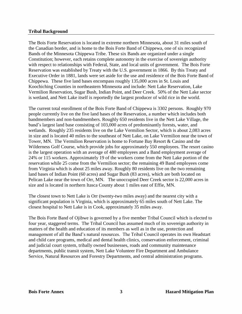
Bois Forte Annex 3 Hazard Mitigation Plan
Tribal Background
The Bois Forte Reservation is located in extreme northern Minnesota, about 31 miles south of
the Canadian border, and is home to the Bois Forte Band of Chippewa, one of six recognized
Bands of the Minnesota Chippewa Tribe. These six Bands are organized under a single
Constitution; however, each retains complete autonomy in the exercise of sovereign authority
with respect to relationships with Federal, State, and local units of government. The Bois Forte
Reservation was established by Treaty with the U.S. government in 1866. By this Treaty and
Executive Order in 1881, lands were set aside for the use and residence of the Bois Forte Band of
Chippewa. These five land bases encompass roughly 135,000 acres in St. Louis and
Koochiching Counties in northeastern Minnesota and include: Nett Lake Reservation, Lake
Vermilion Reservation, Sugar Bush, Indian Point, and Deer Creek. 50% of the Nett Lake sector
is wetland, and Nett Lake itself is reportedly the largest producer of wild rice in the world.
The current total enrollment of the Bois Forte Band of Chippewa is 3302 persons. Roughly 970
people currently live on the five land bases of the Reservation, a number which includes both
bandmembers and non-bandmembers. Roughly 650 residents live in the Nett Lake Village, the
band’s largest land base consisting of 103,000 acres of predominantly forests, water, and
wetlands. Roughly 235 residents live on the Lake Vermilion Sector, which is about 2,083 acres
in size and is located 40 miles to the southeast of Nett Lake, on Lake Vermilion near the town of
Tower, MN. The Vermilion Reservation is home to Fortune Bay Resort & Casino and the
Wilderness Golf Course, which provide jobs for approximately 550 employees. The resort casino
is the largest operation with an average of 480 employees and a Band employment average of
24% or 115 workers. Approximately 19 of the workers come from the Nett Lake portion of the
reservation while 25 come from the Vermilion sector; the remaining 49 Band employees come
from Virginia which is about 25 miles away. Roughly 80 residents live on the two remaining
land bases of Indian Point (60 acres) and Sugar Bush (83 acres), which are both located on
Pelican Lake near the town of Orr, MN. The unoccupied Deer Creek sector is 22,000 acres in
size and is located in northern Itasca County about 1 miles east of Effie, MN.
The closest town to Nett Lake is Orr (twenty-two miles away) and the nearest city with a
significant population is Virginia, which is approximately 65 miles south of Nett Lake. The
closest hospital to Nett Lake is in Cook, approximately 35 miles away.
The Bois Forte Band of Ojibwe is governed by a five member Tribal Council which is elected to
four year, staggered terms. The Tribal Council has assumed much of its sovereign authority in
matters of the health and education of its members as well as in the use, protection and
management of all the Band’s natural resources. The Tribal Council operates its own Headstart
and child care programs, medical and dental health clinics, conservation enforcement, criminal
and judicial court system, tribally owned businesses, roads and community maintenance
departments, public transit system, Nett Lake Volunteer Fire Department and Ambulance
Service, Natural Resources and Forestry Departments, and central administration programs.

Bois Forte Annex 4 Hazard Mitigation Plan
Emergency Plans and Programs
As mentioned, the Band has an emerging Emergency Preparedness program in place, and has
had a full-time Emergency Preparedness Director on staff since December 2011. An original
Emergency Operations Plan (EOP) was completed by the Band in 1997 and is currently being
revised. A Tribal Emergency Response Committee (TERC) has also been formed and will soon
begin revising the EOP, as well as preparing a more detailed risk analysis for the Band and its
potential hazards. The Band also has a Pandemic Influenza Plan which was completed as an
annex to the EOP in 2007, as well as a Community Health All Hazard Response and Recovery
Plan (AHRRP), also completed in 2007. Fortune Bay Resort and Casino also has their own
stand-alone Emergency Operations Plan, completed in 2003 and currently being revised.
The Bois Forte Band has its own Police Department, which serves both the Nett Lake and
Vermilion Reservations. It also has its own Volunteer Fire Department, with 22 crew members
and four fire rigs to serve the Nett Lake Reservation. The Vermilion Reservation is covered by
an agreement with the Greenwood Township Fire Department. Nett Lake also has its own
ambulance service, with two ambulances and 5 drivers, 11 EMT’s and 3 First Responders. The
Vermilion Reservation is covered by an agreement with Tower ambulance.
The Band also has a warning siren system with 4 sirens in place (Nett Lake Village, Palmquist,
Indian Point, and Vermilion) and a fully-functional Emergency Operations Center in the Tribal
Government Center in Nett Lake.
The Band also has clinics in both Nett Lake and Vermilion, and a K-6 school in Nett Lake with
approximately 100 students. There are also designated emergency sheltering sites with backup
power and emergency supplies at the Tribal Government Center Ballroom in Nett Lake and at
Fortune Bay Resort & Casino in Vermilion. Both locations are also outfitted with mass casualty
trailers with emergency supplies and equipment.
Figure 1 : Location of Nett Lake and Vermilion Reservations Within St. Louis County
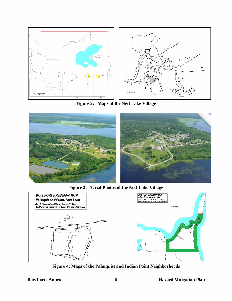
Bois Forte Annex 5 Hazard Mitigation Plan
Figure 2: Maps of the Nett Lake Village
Figure 3: Aerial Photos of the Nett Lake Village
Figure 4: Maps of the Palmquist and Indian Point Neighborhoods
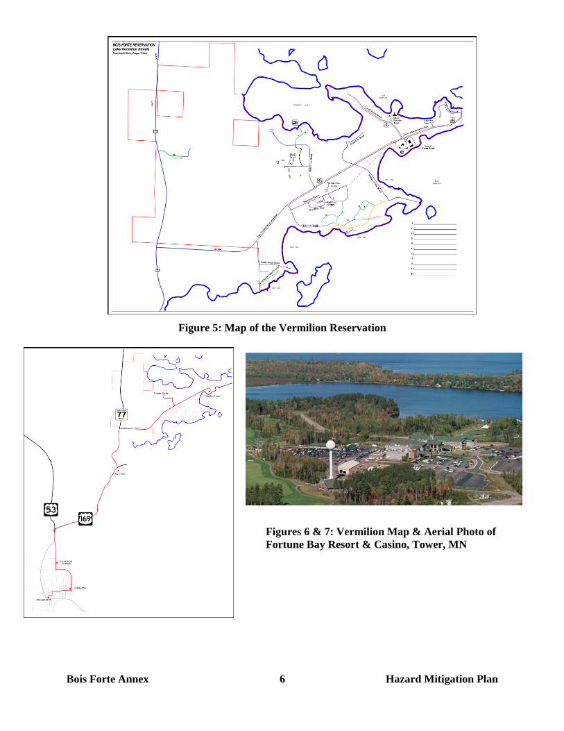
Bois Forte Annex 6 Hazard Mitigation Plan
Figure 5: Map of the Vermilion Reservation
Figures 6 & 7: Vermilion Map & Aerial Photo of
Fortune Bay Resort & Casino, Tower, MN
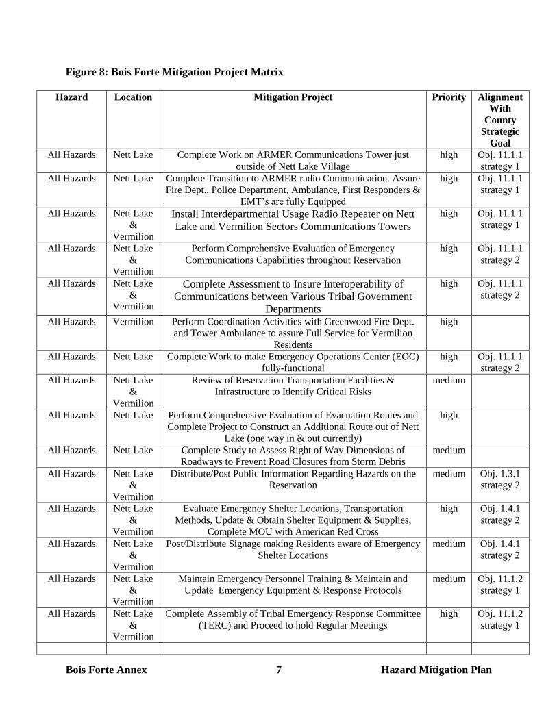
Bois Forte Annex 7 Hazard Mitigation Plan
Figure 8: Bois Forte Mitigation Project Matrix
Hazard Location Mitigation Project Priority Alignment
With
County
Strategic
Goal
All Hazards Nett Lake Complete Work on ARMER Communications Tower just
outside of Nett Lake Village
high Obj. 11.1.1
strategy 1
All Hazards Nett Lake Complete Transition to ARMER radio Communication. Assure
Fire Dept., Police Department, Ambulance, First Responders &
EMT’s are fully Equipped
high Obj. 11.1.1
strategy 1
All Hazards Nett Lake
&
Vermilion
Install Interdepartmental Usage Radio Repeater on Nett
Lake and Vermilion Sectors Communications Towers
high Obj. 11.1.1
strategy 1
All Hazards Nett Lake
&
Vermilion
Perform Comprehensive Evaluation of Emergency
Communications Capabilities throughout Reservation
high Obj. 11.1.1
strategy 2
All Hazards Nett Lake
&
Vermilion
Complete Assessment to Insure Interoperability of
Communications between Various Tribal Government
Departments
high Obj. 11.1.1
strategy 2
All Hazards Vermilion Perform Coordination Activities with Greenwood Fire Dept.
and Tower Ambulance to assure Full Service for Vermilion
Residents
high
All Hazards Nett Lake Complete Work to make Emergency Operations Center (EOC)
fully-functional
high Obj. 11.1.1
strategy 2
All Hazards Nett Lake
&
Vermilion
Review of Reservation Transportation Facilities &
Infrastructure to Identify Critical Risks
medium
All Hazards Nett Lake Perform Comprehensive Evaluation of Evacuation Routes and
Complete Project to Construct an Additional Route out of Nett
Lake (one way in & out currently)
high
All Hazards Nett Lake Complete Study to Assess Right of Way Dimensions of
Roadways to Prevent Road Closures from Storm Debris
medium
All Hazards Nett Lake
&
Vermilion
Distribute/Post Public Information Regarding Hazards on the
Reservation
medium Obj. 1.3.1
strategy 2
All Hazards Nett Lake
&
Vermilion
Evaluate Emergency Shelter Locations, Transportation
Methods, Update & Obtain Shelter Equipment & Supplies,
Complete MOU with American Red Cross
high Obj. 1.4.1
strategy 2
All Hazards Nett Lake
&
Vermilion
Post/Distribute Signage making Residents aware of Emergency
Shelter Locations
medium Obj. 1.4.1
strategy 2
All Hazards Nett Lake
&
Vermilion
Maintain Emergency Personnel Training & Maintain and
Update Emergency Equipment & Response Protocols
medium Obj. 11.1.2
strategy 1
All Hazards Nett Lake
&
Vermilion
Complete Assembly of Tribal Emergency Response Committee
(TERC) and Proceed to hold Regular Meetings
high Obj. 11.1.2
strategy 1
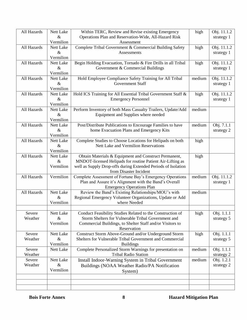
Bois Forte Annex 8 Hazard Mitigation Plan
All Hazards Nett Lake
&
Vermilion
Within TERC, Review and Revise existing Emergency
Operations Plan and Reservation-Wide, All-Hazard Risk
Assessment
high Obj. 11.1.2
strategy 1
All Hazards Nett Lake
&
Vermilion
Complete Tribal Government & Commercial Building Safety
Assessments
high Obj. 11.1.2
strategy 1
All Hazards Nett Lake
&
Vermilion
Begin Holding Evacuation, Tornado & Fire Drills in all Tribal
Government & Commercial Buildings
high Obj. 11.1.2
strategy 1
All Hazards Nett Lake
&
Vermilion
Hold Employee Compliance Safety Training for All Tribal
Government Staff
medium Obj. 11.1.2
strategy 1
All Hazards Nett Lake
&
Vermilion
Hold ICS Training for All Essential Tribal Government Staff &
Emergency Personnel
high Obj. 11.1.2
strategy 1
All Hazards Nett Lake
&
Vermilion
Perform Inventory of both Mass Casualty Trailers, Update/Add
Equipment and Supplies where needed
medium
All Hazards Nett Lake
&
Vermilion
Post/Distribute Publications to Encourage Families to have
home Evacuation Plans and Emergency Kits
medium Obj. 7.1.1
strategy 2
All Hazards Nett Lake
&
Vermilion
Complete Studies to Choose Locations for Helipads on both
Nett Lake and Vermilion Reservations
high
All Hazards Nett Lake
&
Vermilion
Obtain Materials & Equipment and Construct Permanent,
MNDOT-licensed Helipads for routine Patient Air-Lifting as
well as Supply Drop-offs during Extended Periods of Isolation
from Disaster Incident
high
All Hazards Vermilion Complete Assessment of Fortune Bay’s Emergency Operations
Plan and Assure it’s Alignment with the Band’s Overall
Emergency Operations Plan
medium Obj. 11.1.2
strategy 1
All Hazards Nett Lake
&
Vermilion
Review the Band’s Existing Relationships/MOU’s with
Regional Emergency Volunteer Organizations, Update or Add
where Needed
medium
Severe
Weather
Nett Lake
&
Vermilion
Conduct Feasibility Studies Related to the Construction of
Storm Shelters for Vulnerable Tribal Government and
Commercial Buildings, to Shelter Staff and/or Visitors to
Reservation
high Obj. 1.1.1
strategy 5
Severe
Weather
Nett Lake
&
Vermilion
Construct Storm Above-Ground and/or Underground Storm
Shelters for Vulnerable Tribal Government and Commercial
Buildings
high Obj. 1.1.1
strategy 5
Severe
Weather
Nett Lake Complete Personalized Storm Warnings for presentation on
Tribal Radio Station
medium Obj. 1.1.1
strategy 2
Severe
Weather
Nett Lake
&
Vermilion
Install Indoor-Warning System in Tribal Government
Buildings (NOAA Weather Radio/PA Notification
System)
medium Obj. 1.2.1
strategy 2

Bois Forte Annex 9 Hazard Mitigation Plan
Severe
Weather
Nett Lake
&
Vermilion
Use Severe Weather Awareness Week to Educate Residents on
Tips to Prepare for and Combat Severe Weather
medium Obj. 1.1.1
strategy 1
Debris
Removal
Nett Lake
&
Vermilion
Assess Public Works Department’s Capabilities and
Assess/Update Equipment Related to Roadway and Building
Perimeter Storm Debris Removal
high
Flooding Nett Lake
&
Vermilion
Complete Study to Assess whether Transportation
Infrastructure is Resilient to Flooding Events
medium Obj. 2.1.1
strategy 1
Flooding Nett Lake
&
Vermilion
Complete Study to Determine Need for use of Zoning to
Prevent Development of Flood-Vulnerable Lands
low Obj. 2.1.1
strategy 4
Structural Fire Nett Lake
&
Vermilion
Complete Survey of Fire Hydrants to Assess Vulnerabilities &
Capabilities for Fire Protection
low Obj. 7.1.3
strategy 2
Structural Fire Nett Lake Update Nett Lake Fire Dept.’s Turnout Gear and SCBA
Equipment
high Obj. 7.1.2
strategy 1
Structural Fire Nett Lake
&
Vermilion
Post/Distribute Publications to Encourage Families to hold
Home Fire Drills
medium Obj. 7.1.1
strategy 2
Wildland Fire Nett Lake
&
Vermilion
Assess Tribal Government & Commercial Buildings, and
Tribal Housing Units’ Adherence to FireWise Program
Principles.
high Obj. 4.1.1
strategy 1
Wildland Fire Nett Lake
&
Vermilion
Develop / Integrate FireWise Principles in to the Housing
Department’s Rental Unit Lease Contracts. Develop all
New Structures with Consideration of FireWise
Principles.
medium Obj. 4.1.1
strategy 1
Wildland Fire Nett Lake
&
Vermilion
Perform Tree and Brush Clearing Work where needed to
adhere to FireWise Program Principles.
high Obj. 4.1.1
strategy 1
Wildland Fire Nett Lake
&
Vermilion
Perform Assessment of Tribal Government & Commercial
Buildings Exterior Fire Protection Needs
medium Obj. 4.1.3
strategy 4
Wildland Fire Nett Lake
&
Vermilion
Install Exterior Fire Protection to Tribal Government &
Commercial Buildings where needed
medium Obj. 4.1.3
strategy 4
Wildland Fire Nett Lake Install 20,000 Gallon Underground Water Tank
at Palmquist Community to serve as Dry Hydrant for
Structural and Wildland firefighting
medium Obj. 4.1.3
strategy 2
Hazardous
Materials
Spills
Nett Lake
&
Vermilion
Improvements to Traffic Infrastructure & Emergency Response
Training & Equipment
medium