2006 severe weather awareness noaa’s national weather service warning and forecast office...
TRANSCRIPT
2006 Severe Weather Awareness
NOAA’s National Weather Service
Warning and Forecast Office
Hastings, Nebraska
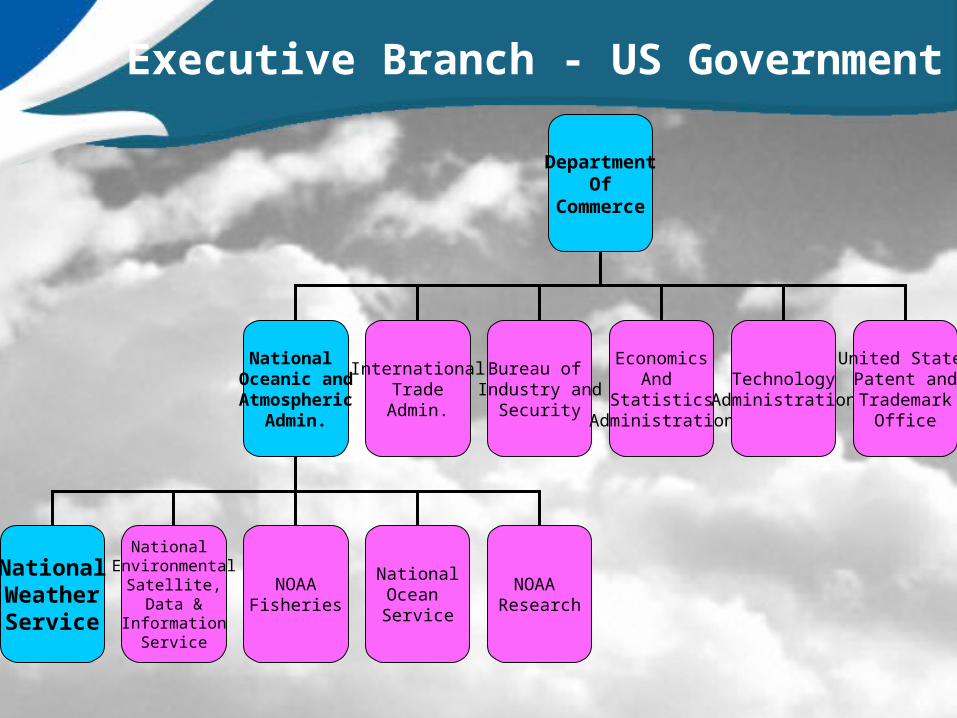
DepartmentOf
Commerce
National Oceanic andAtmospheric
Admin.
InternationalTradeAdmin.
Bureau of Industry and
Security
EconomicsAnd
StatisticsAdministration
TechnologyAdministration
United StatesPatent andTrademark
Office
NationalWeatherService
National Environmental
Satellite,Data &
InformationService
NOAAFisheries
NationalOcean Service
NOAA Research
Executive Branch - US Government
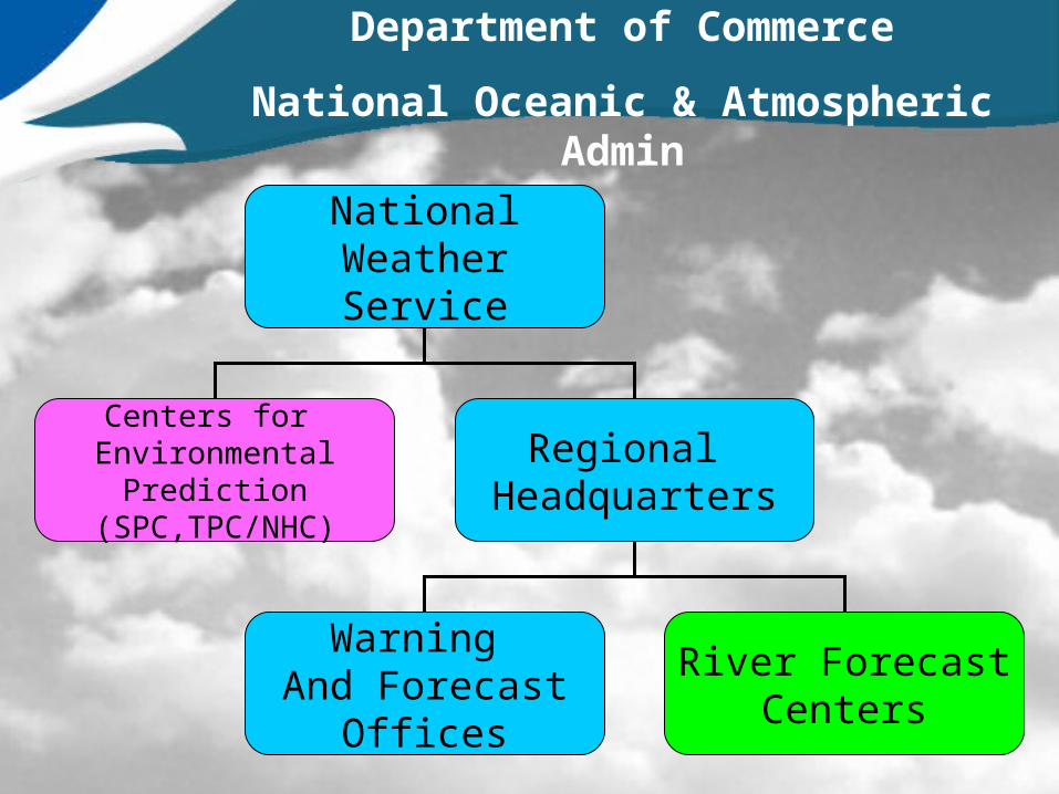
NationalWeatherService
Centers for Environmental
Prediction(SPC,TPC/NHC)
Regional Headquarters
Warning And Forecast
Offices
River ForecastCenters
Department of Commerce
National Oceanic & Atmospheric Admin

The Hastings NWS
• Located just north of Hastings on the west side of 281.
• Open year round, 24 hours a day
• About twenty technicians and meteorologists.

Service Area
• County Warning and Forecast Area
• 297,000 people in 30 counties

2005 – Year in Review
• Number of Tornadoes– 135 Tornadoes in Kansas - A Record– 40 Tornadoes in Nebraska
• Most in a Month– 50 Tornadoes in Kansas in June– 18 Tornadoes in Nebraska in May
• NO Deaths or Injuries

April = 4
May = 12
June = 5
September = 2
23

Hastings, NE HailstormMay 11, 2005
Photo provided by Adams County Emergency Management

Be Informed!!Follow the weather forecast;
Know what is expected!!
Keep an Eye to the Sky!
SEVERE WEATHER PREPARATION (Both for Spotters and Public)
When you know what is coming, you can prepare and be ready!

Ways to Be Informed
• National Weather Service (24/7)NOAA All-Hazards Weather Radio
Internet Home PageTelephone
• Local Broadcast Media TV/Radio
The Weather Channel
• OtherPC/Desktop/PDA/Cell Phone Fax/Pagers/ScannerNewspaper
Word-of-Mouth Look out the Window!
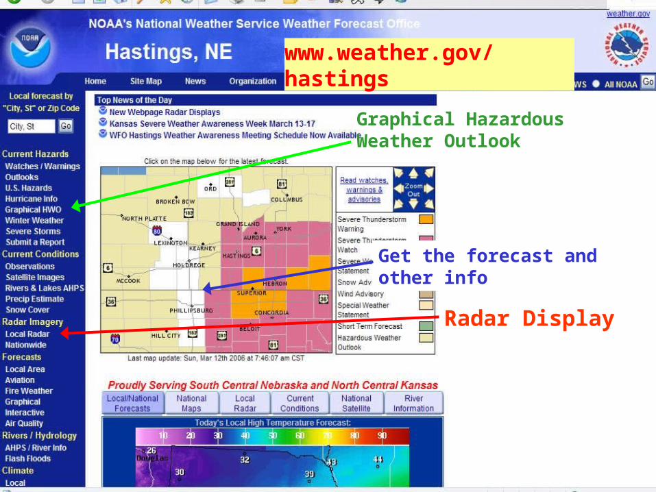
www.weather.gov/hastings
Get the forecast and other info
Radar Display
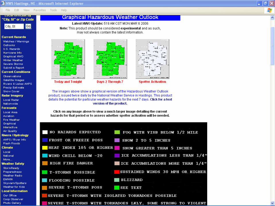
Graphical Hazardous Weather Outlook


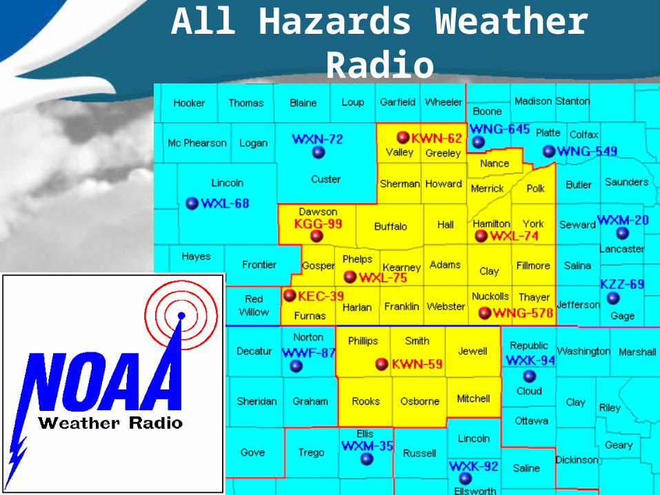
All Hazards Weather Radio

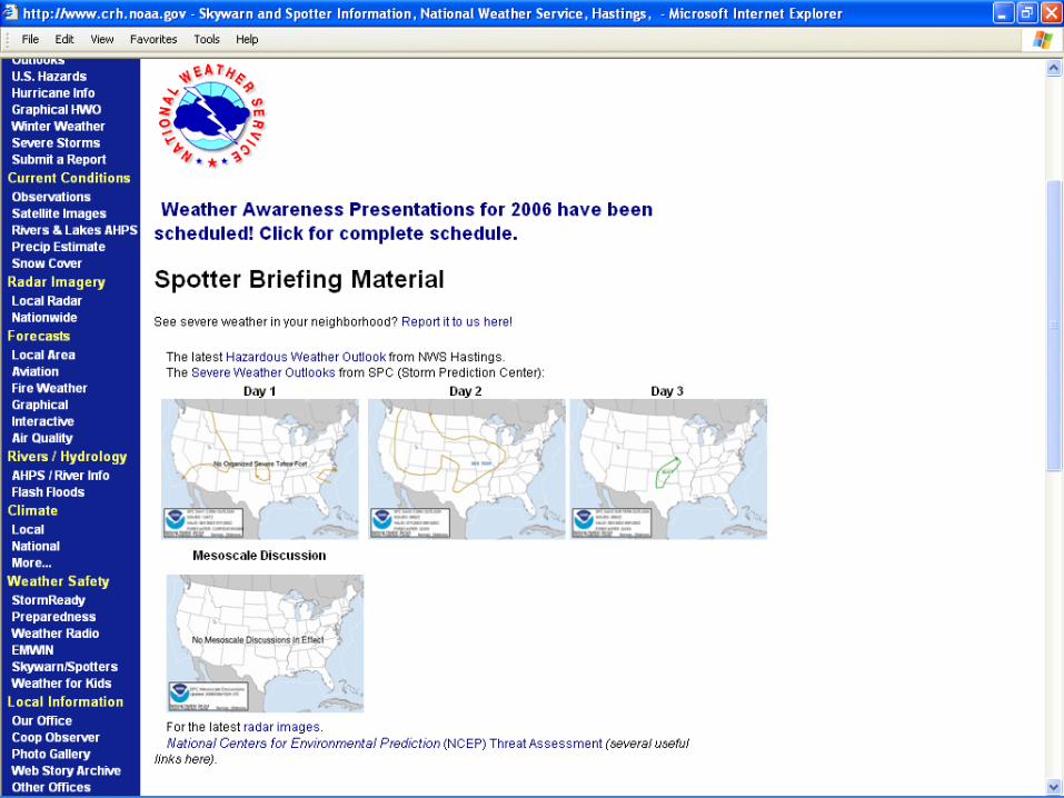
Spotters Skywarn Page
• Hazardous Weather Outlook
• Storm Prediction Center– Day 1, 2, 3 outlooks– Mesoscale Discussions
• Area Forecast Discussions
• Report Severe Weather
• Spotter/Skywarn Information
www.weather.gov/hastings

Skywarn/Spotters web page

Now We Are Informed
Here come the storms!
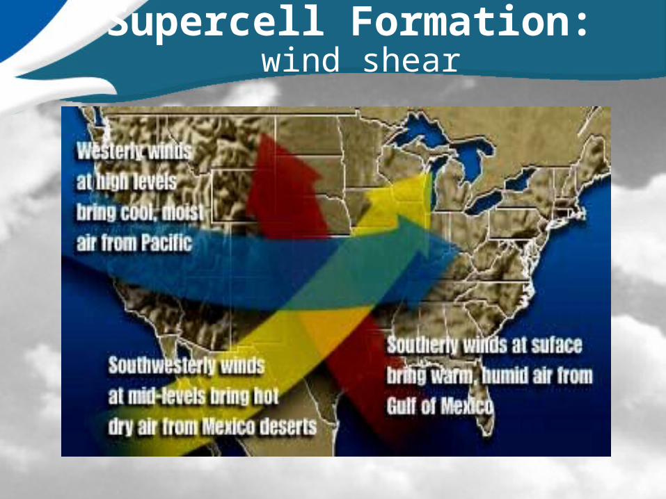
Supercell Formation: wind shear

The BIG Picture!
Wall Cloud Shelf Cloud
Rain
Courtesy: Wichita Eagle Beacon

The Top of the Storm(best seen 20-40 miles from storm)
• Overshooting Top
- large cloud dome
- extends above anvil
• Back-sheared Anvil
- well defined edges
• Updraft Strength
• Lightning Frequency

Look for these Low Level Thunderstorm Features
• Rain-Free Base: Low, flat cloud base with updraft towers and no visible rain. Common to most storms.
• Wall Cloud: isolated lowering attached to the rain-free base, on the back side of the storm, may rotate. Tornadoes form on Wall Clouds… But most storms do not have wall clouds.

Putting it all Together

TT
RFD
(Top view)
UPDRAFT
DOWNDRAFT
N
Rear Flank Downdraft (RFD)

Rear Flank Downdraft (RFD)
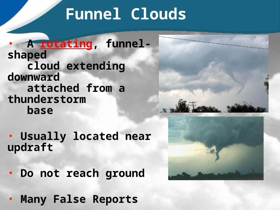
• A rotating, funnel-shaped cloud extending downward attached from a thunderstorm base
• Usually located near updraft
• Do not reach ground
• Many False Reports
Funnel Clouds

Tornado Variations!
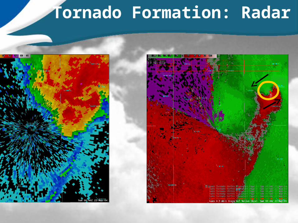
Tornado Formation: Radar
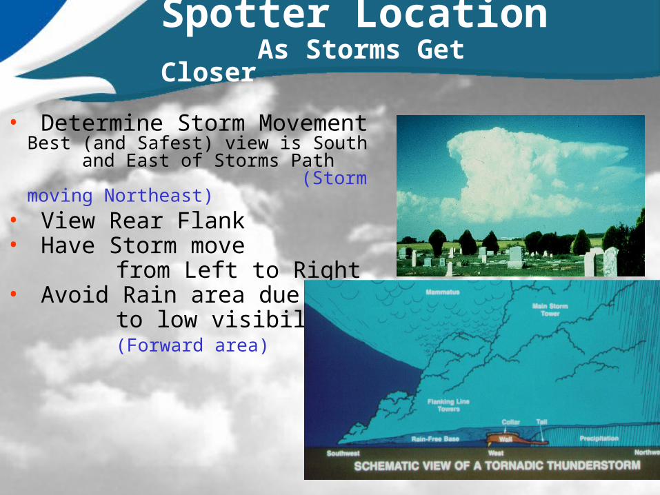
Spotter Location As Storms Get Closer
• Determine Storm Movement Best (and Safest) view is South and East of Storms Path
(Storm moving Northeast)• View Rear Flank• Have Storm move from Left to Right• Avoid Rain area due to low visibility (Forward area)
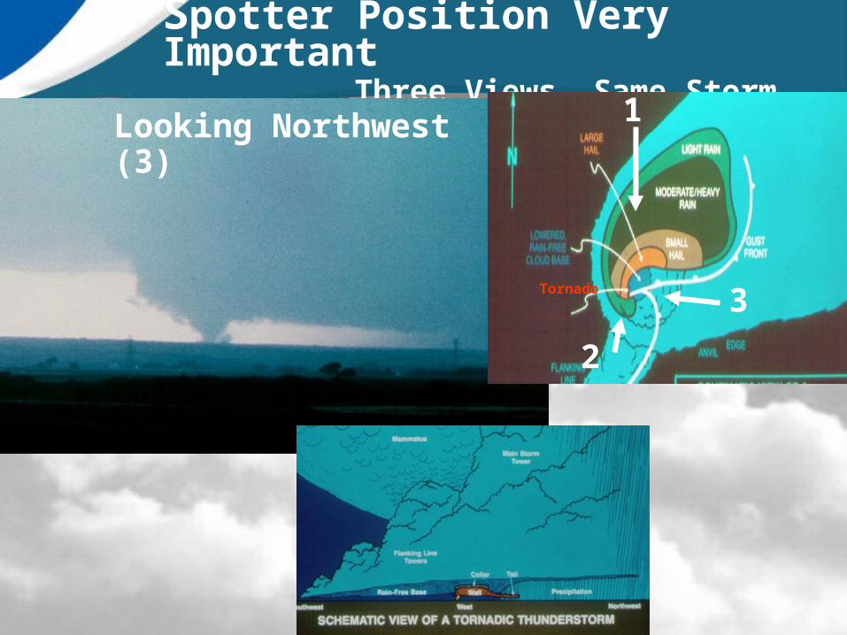
Spotter Position Very Important Three Views, Same Storm
Looking South (1)
Looking Northeast (2)
Looking Northwest (3)
Tornado 3
2
1

Nighttime Spotting
Mobile spotting at night is especially dangerous
Watch for flashes by a tornado breaking power lines
Note the wind direction and changes in wind direction
Utilize lightning for storm structure and cloud base
Know your directional relationship to the storm
Don’t confuse shelf clouds with wall clouds, look for signs of rising or rotating clouds.
Drive very carefully!

LIGHTNING SAFETY
• ALL Thunderstorms have Lightning• Can Strike Miles from Storm • If you hear Thunder, Take Cover!• Hotter than the Sun!
Sun: 11,000 °F Lightning: 50,000 °F
• No Warnings for Lightning• 30/30 Rule• Bottom Line:• Stay Inside Vehicle or Building!
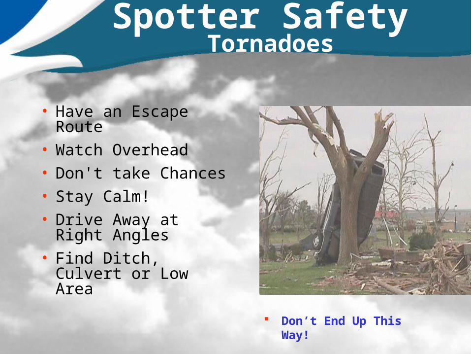
Spotter Safety Tornadoes
• Have an Escape Route
• Watch Overhead
• Don't take Chances
• Stay Calm!
• Drive Away at Right Angles
• Find Ditch, Culvert or Low Area
Don’t End Up This Way!
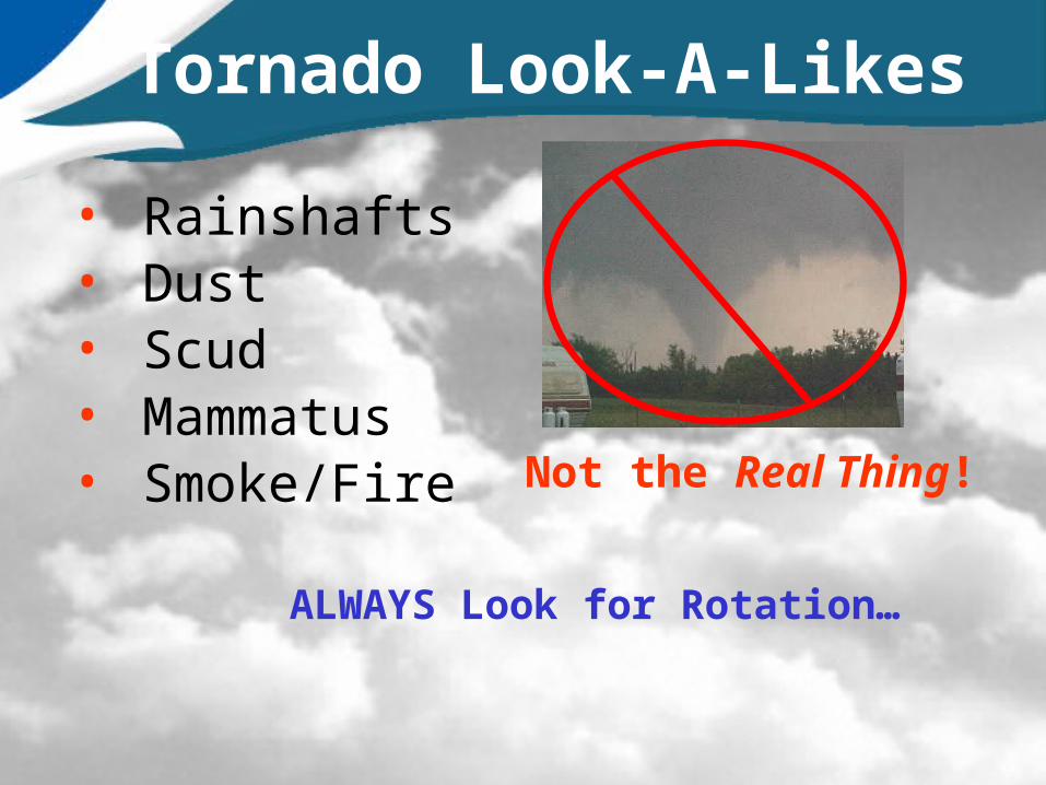
Tornado Look-A-Likes
• Rainshafts• Dust• Scud• Mammatus• Smoke/Fire Not the Real Thing!
ALWAYS Look for Rotation…

Tornado Look-A-Likes
• Precipitation Shafts– Streaks of
precipitation falling from a cloud and reaching the ground
• Watch Closely– Cascading or
“dispersed” nature
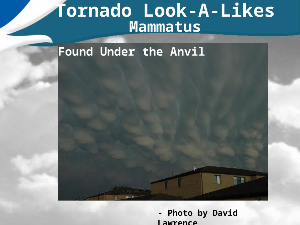
Tornado Look-A-LikesMammatus
Found Under the Anvil
- Photo by David Lawrence

Tornado Look-A-Likes Scud Clouds
Not Attached to Storm Base
Not Rotating
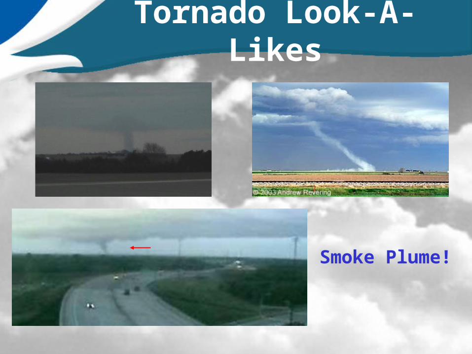
Tornado Look-A-Likes
Smoke Plume!

Squall Line

Shelf Cloud
• A long Cigar Shaped Cloud, on the leading edge of a T-storm• Be Alert to Strong Shifting Winds• Wind First, then Rain
Radar of Squall Line

Shelf Cloud

Severe Storm: Two Faces
Wall Clouds Back of storm Inflow/Updraft Possible Tornado Near Hail Region Points toward Rain
Shelf Cloud Front of Storm Outflow/Downdraft Long Large Cloud Downburst Wind

Storm Spotter Reports
• Tornadoes, Funnels and Wall Clouds
• Hail• Damaging Wind
Gusts– Report Damage
• Flash flooding

Estimating/Reporting Hail Size
Pea…………..0.25”Penny……….0.75”Nickel……….0.88”Quarter……..1.00”Half-Dollar…1.25”Golf Ball…....1.75”Tennis Ball...2.50”Baseball……2.75”Grapefruit….4.00”
Special Evaluation Test:A Severe Thunderstorm is 1.00” hail or greater.
Continue to report all hail!

Estimating Wind Speeds
50 – 57 MPH: Small Branches/Limbs Broken (Less Than 2 inches Diameter)
58 – 69 MPH: Large Limbs/Power Lines Down (2-4 Inches Diameter)
70 – 80 MPH: Small Trees Uprooted, Very Large Limbs Down, Shingles Torn Off
> 80 MPH: Large Trees Uprooted, Power Poles Snapped Off, Cars Blown Off Roads
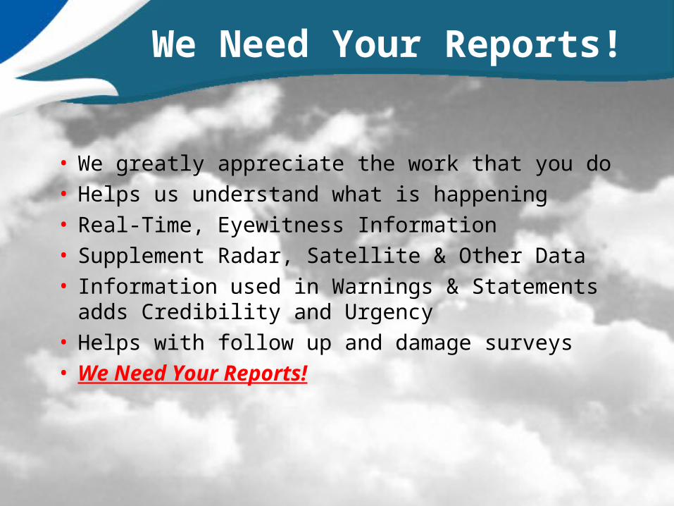
We Need Your Reports!
• We greatly appreciate the work that you do• Helps us understand what is happening• Real-Time, Eyewitness Information• Supplement Radar, Satellite & Other Data• Information used in Warnings & Statements
adds Credibility and Urgency• Helps with follow up and damage surveys• We Need Your Reports!
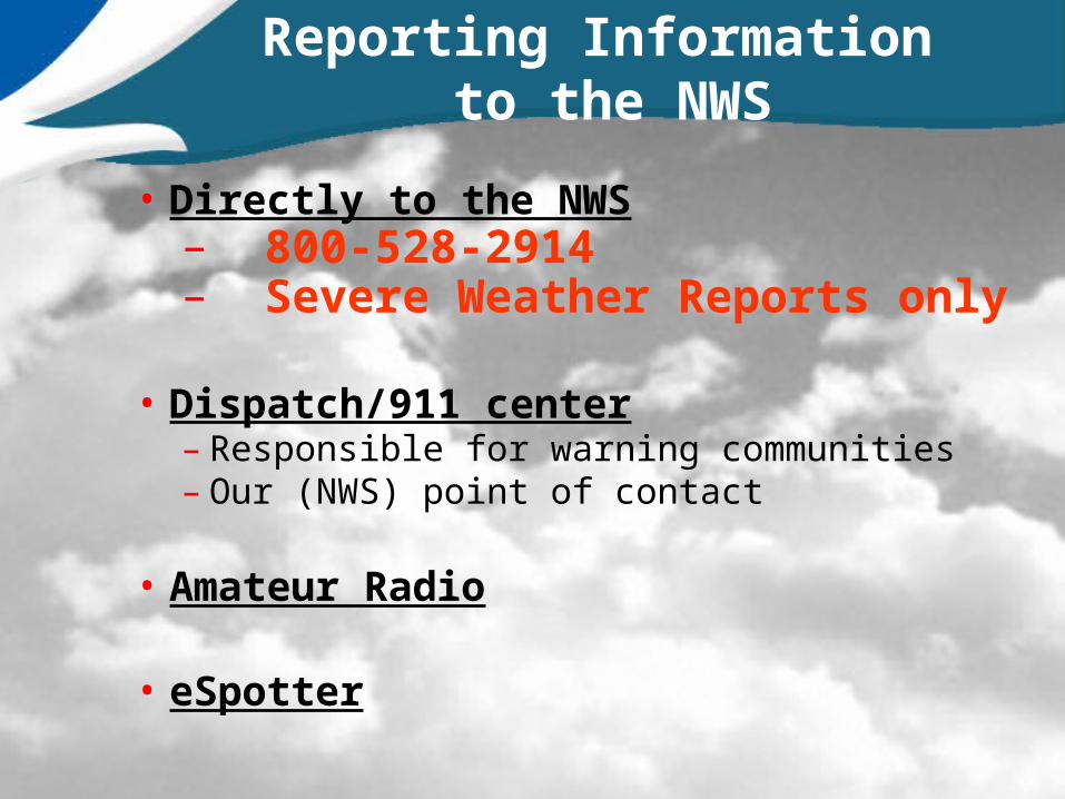
Reporting Information to the NWS
• Directly to the NWS– 800-528-2914– Severe Weather Reports only
• Dispatch/911 center– Responsible for warning communities– Our (NWS) point of contact
• Amateur Radio
• eSpotter

espotter.weather.gov

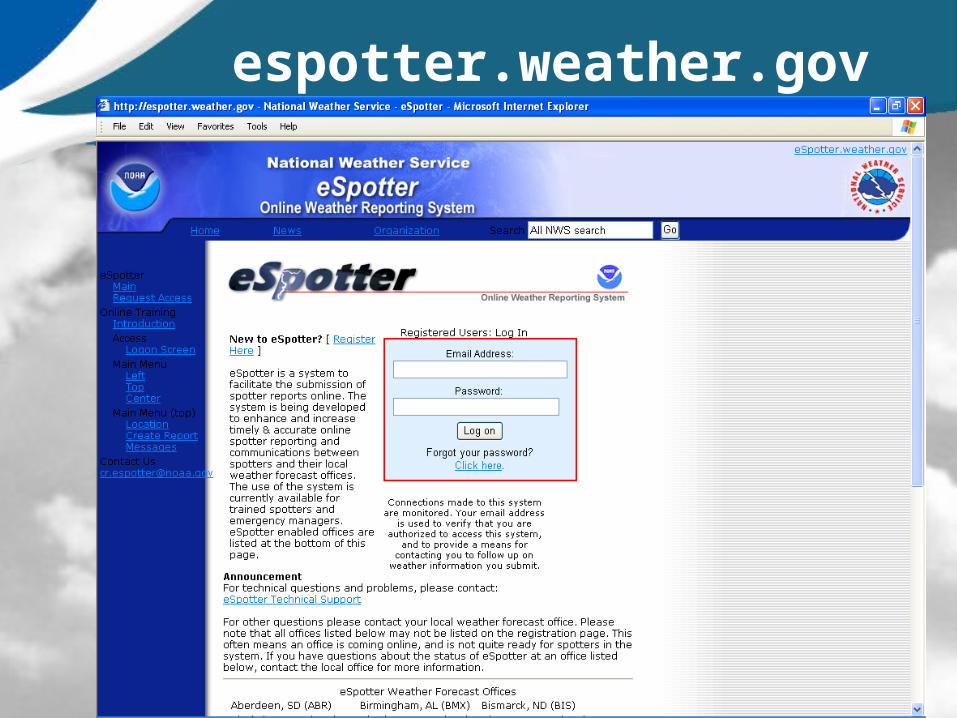
espotter.weather.gov
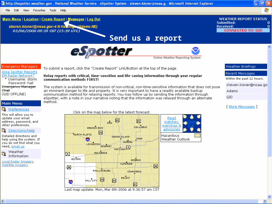
Send us a report

That’s it!
Thanks for watching!
www.weather.gov/hastings
800-528-2914Reporting severe weather ONLY!
402-462-4287For all other calls