2005 the lure of distant lands: european travellers 1790-1850
TRANSCRIPT
Deep Blue https://deepblue.lib.umich.edu/documents
2005
The Lure of Distant Lands: European
Travellers 1790-1850
Williams-Capone, Dan; Beam, Kathryn
https://hdl.handle.net/2027.42/120260
https://creativecommons.org/licenses/by/4.0/
Downloaded from Deep Blue, University of Michigan's institutional repository
-- 1
~. -~
- ' ,
uropean Travellers 1790 - 1850
European Travellers 1 790 - 1850
Originally curated by Dan Williams-Capone Revised by Kathryn Beam
February 7 - March 26, 2005

Special Collections Library Exhibit Hours:
Monday - Friday: 10:00 - 5 :00 Saturday: 10:00 - Noon
Copyright 2005 by the Un ivers ity of Michigan Library University of Michigan, Ann Arbor, MI
University of Michigan Board of Reg ents:
Dav id A. Brandon Laurence B. Deitch Olivia P. Maynard
Rebecca McGowan Andrea Fischer Newman
Andrew C. Richner S. Martin Taylor Katherine E. White
Mary Sue Coleman (ex officio)
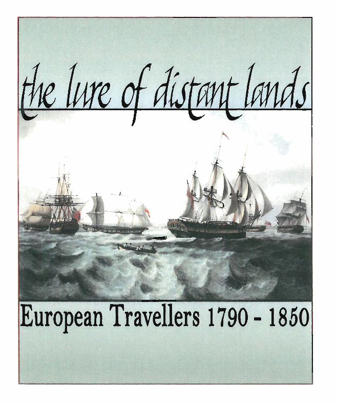
Cover Illustration: Thomas Luny. "A Fleet of Merchantmen ." Reproduced in: The Great Age of Sail ; Maritime Art and Ph%graphy. ed. Peter Kemp . New York : Facts on File Publications, 1986 . Plate 53 Cover design by Franki Hand
INTRODUCTION
Europeans published a large number of travel accounts during the late-eighteenth and early-nineteenth centuries. Many of the voyages were significant scientific expeditions; some were conducted as official embassies from one government to another; some were part of the Grand Tour; and others were carried out by seekers of adventure and exotic scenery. But whatever the initial purpose, authors of the period repeatedly expressed their desire to present factual travel narratives and depictions of the world and its peoples as actually experienced prior to the onslaught of Western influence.
They were strongly influenced by those earlier explorers of the mid-eighteenth century who sought to reveal at last the true face of the globe. Ships were transformed into veritable floating laboratories, carrying mariners and research teams equipped with all the latest apparatus that had then been designed for observation and navigational purposes. Coastlines that had hitherto been dotted lines and sketchy shapes gradually became accurate. One voyage succeeded another until the mid-nineteenth century when little remained to be discovered.
The sailors, explorers, adventurers, diplomats, and scholars represented in this exhibit were from England, France, Italy, and Germany. After the Napoleonic wars, these na tions enjoyed a period of economic expansion and trade, and expeditions were sent out in pursuit of military, political, and commercial interests, with the scientist, cartographer, or artist accompanying them, documenting events and describing new lands and scenes.
In publishing the accounts of their travels, writers of this time usually selected some form of etching or engraving as a means of illustration. Aquatint etching was greatly popular (largely due to the work of the London publisher, Rudolph Ackermann), having been developed primarily as a method of reproducing paintings done in watercolor. However, this period also saw the introduction of lithography, which by the 1830s had superseded the use of aquatint in book illustration as a less expensive and far less involved alternative. Included in this exhibit are examples of both colored and uncolored aquatints, etchings, engravings, and lithographs. Many publishers produced books as cheaply as possible to meet a seemingly insatiable market for reading matter of all kinds. But there were those, particularly the ones included here, who employed artists of great skill and produced work of lasting value.
1
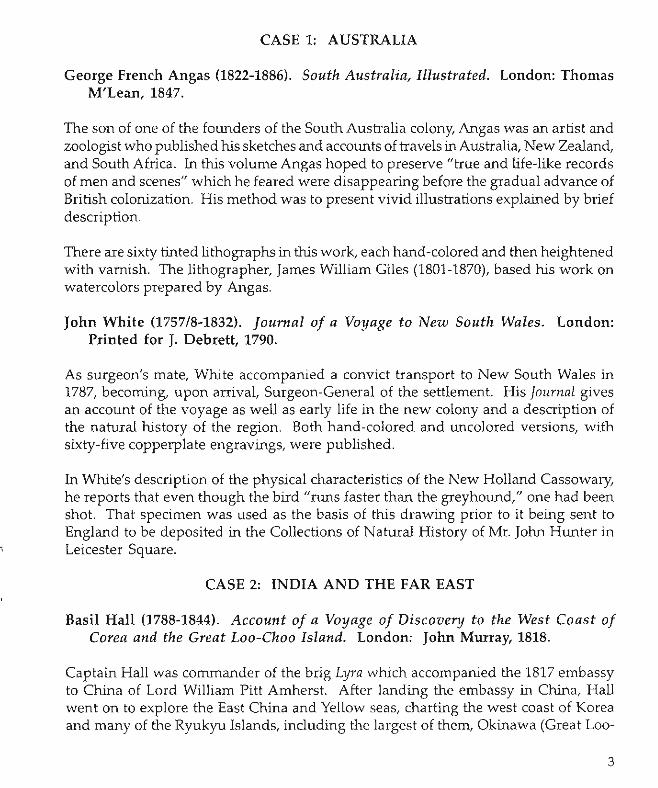
CASE 1: AUSTRALIA
George French Angas (1822-1886). South Australia, Illustrated. London: Thomas M'Lean, 1847.
The son of one of the founders of the South Australia colony, Angas was an artist and zoologist who published his sketches and accounts of travels in Australia, New Zealand, and South Africa. In this volume Angas hoped to preserve "true and life-like records of men and scenes" which he feared were disappearing before the gradual advance of British colonization. His method was to present vivid illustrations explained by brief description.
There are sixty tinted lithographs in this work, each hand-colored and then heightened with varnish. The lithographer, James William Giles (1801-1870), based his work on watercolors prepared by Angas.
John White (1757/8-1832). Journal of a Voyage to New South Wales. London: Printed for J. Debrett, 1790.
As surgeon's mate, White accompanied a convict transport to New South Wales in 1787, becoming, upon arrival, Surgeon-General of the settlement. His Journal gives an account of the voyage as well as early life in the new colony and a description of the natural history of the region. Both hand-colored and uncolored versions, with sixty-five copperplate engravings, were published.
In White's description of the physical characteristics of the New Holland Cassowary, he reports that even though the bird "runs faster than the greyhound," one had been shot. That specimen was used as the basis of this drawing prior to it being sent to England to be deposited in the Collections of Natural History of Mr. John Hunter in Leicester Square.
CASE 2: INDIA AND THE FAR EAST
Basil Hall (1788-1844). Account of a Voyage of Discovery to the West Coast of Corea and the Great Loa-Chao Island. London: John Murray, 1818.
Captain Hall was commander of the brig Lyra which accompanied the 1817 embassy to China of Lord William Pitt Amherst. After landing the embassy in China, Hall went on to explore the East China and Yellow seas, charting the west coast of Korea and many of the Ryukyu Islands, including the largest of them, Okinawa (Great Loo-
3

Choo Island). His account contains detailed descriptions of the lands and peoples he encountered. It went through several editions, of which this is the first.
Napakiang, shown here, was the chief city of the Great Loo-Choo Island (present-day Naha, capital of Okinawa). The illustration is drawn by William Havell (1782-1857), a landscape painter who was also part of Lord Amherst's party on the embassy to China. Havell based several of his drawings, including this one, on sketches made by Captain Hall himself.
John Barrow (1764-1848). Travels in China. London: Printed by A. Strahan for T. Cadell and W. Davies, 1804.
The British embassy to China, led by Lord George Macartney (1737-1806) in 1792, provided the occasion for John Barrow to observe and later present much information new to the Western world. Accompanying Macartney as comptroller of the household, Barrow recorded his experiences in this attractive work illustrated with hand-colored aquatints. The plate on display depicts "A Foreign Trader," while the text on the opposite page describes Chinese trading vessels.
Barrow also traveled to South Africa (see Case 6), serving as Macartney's private secretary. Later, as second secretary of the Admiralty, he proposed a plan of two voyages for the discovery of a Northwest passage which contributed greatly to British efforts in Arctic exploration. Various places in the polar seas have been named for him including Point Barrow, Cape Barrow, and Barrow Straits.
James Prinsep (1799-1840). Benares Illustrated, in a Series of Drawings. Calcutta: Baptist Mission Press; and London: Smith, Elder, & Co., 1830-34.
The city of Benares had long been of interest to Europeans, in part because it is one of India's most ancient cities, but primarily because it is the holy city of the Hindus and the object of constant pilgrimages. During the 1820s James Prinsep became closely acquainted with the city. He worked there as assay-master in the mint until 1830 during which time he was also actively engaged in the architectural renovation of several buildings, in improving the drainage of the city by constructing tunnels, and in building a bridge of five arches over the Karamnasa River.
These experiences, coupled with his training as an architect and his extensive study of Indian history and antiquities, led to the creation of this invaluable set of illustrations. Prinsep prepared the initial sketches which were then lithographed in England by eminent artists of the day. In all there are thirty-three plates, each accompanied by text explaining local history and customs. 4
The plates originally appeared in three series via an unusual Anglo-Indian publishing project. This volume includes the first editions of all three series, and is an excellent copy of a very rare work. For this plate, Prinsep admires in his text the construction of the two minarets, pointing out that they are "only 8 Yz feet in diameter at the base, and the breath [sic] decreases to 7 Y2 feet, while they have an altitude of 147 feet 2 inches .. .. "
Isaac Titsingh (1744-1812). Illustrations of Japan. London: Printed for R. Ackermann, 1822.
For f~urteen years chief agent of the Dutch East India Company in Nagasaki, Titsingh IS saId to have been one of the earliest European collectors of Japanese prints. This volume contains eighteen hand-colored plates which were copied from Japanese ongmals. The work itself contains an historical section on the sovereigns of Japan and sections on Japanese feasts and ceremonies. The plate shown here is one of several depicting the marriage ceremony.
For this volume, Titsingh arranged to have Rudolph Ackermann (1764-1834) serve as publisher (see also Case 7). Ackermann was the major publisher of colored aquatint books during the early-nineteenth century. Originally trained in stagecoach design, he turned to the book trades in 1795 when he opened a print shop at No. 101 Strand, a location which became famous as The Repository of Arts from which he issued many of the most popular aquatint titles of the day. In addition to his involvement with books, Ackermann was active in numerous experiments in science and manufacture, including the waterproofing of paper, leather, and fabric; the use of balloons in distributing printed matter; the introduction of gas lighting to London; and the improvement of lithography.
CASE 3: NORTHERN EUROPE
John Dundas Cochrane (1780-1825). Narrative of a Pedestrian Journey through Russia and Siberian Tartary. 2nd ed. London: Printed for Charles Knight, 1824. 2 vols.
Nephew of Admiral Alexander Cochrane, John Dundas Cochrane entered the Royal Navy at the age of ten and served until Napoleon first capitulated in 1814. Cochrane then made an extended trip on foot through France, Spain, and Portugal. Receiving no encouragement from the Admiralty for exploring the Niger, Cochrane left England ill February, 1820, with the intention of making a tour around the world by way of Russia, Siberia, and North America. He made his way to St. Petersburg, mostly on
5

foot, traveling through Dieppe, Paris, and Berlin. Fortunately, the Russian government was persuaded to supply him with horses, sledges, and canoes that enabled him, with amazing facility, to reach Otkotsk by June, 1821, a distance of more than four thousand miles. Cochrane's bride in Kamchatka apparently preferred to see England rather than encourage the rest of his intended journey; they arrived in his home country the next year. In June, 1824, this intrepid, resourceful, and somewhat eccentric traveler set out for the Western Hemisphere and died of a virulent fever in Venezuela. Embellished with anecdotes and written in a lively style, Cochrane's Narrative passed through several editions and translations.
This book forms part of the original library of the University of Michigan bought in Europe, 1838 to 1839, by Asa Gray.
Sir Arthur De Capell Brooke (1791-1858). A Winter in Lapland and Sweden, with Various Observations relating to Finmark and its Inhabitants.... London: John Murray, 1827.
Educated at Magdalen College, Oxford, Brooke, the oldest son of a baronet, was an original member of the Travelers Club. Feeling that many of the newly elected members preferred exploration in an arm chair, he formed the Raleigh Club in 1821, of which he was president for many years before it merged with the Royal Geographical SOCiety. In 1823 he published Travels through Sweden, Norway, and Finrnark to the North Cape in the Summer of 1820, which was followed in 1827 by his A Winter in Lapland and Sweden.
The splendid illustrative plates in this publication are lithographs based on sketches by the author. The frontispiece is a tinted lithograph, using just one tint to emphasize a northern winter day "illuminated by the pale moon."
In 1829 De Capell Brooke succeeded his father in the title and estates, entered the army, and by 1846 had advanced to the rank of major. A bachelor "of a reserved and retiring disposition," he published subsequent travels in Sketches in Spain and Morocco (London, 1831) and spent much of his later life in quiet philanthropy.
This book forms part of the original library of the University of Michigan bought in Europe, 1838 to 1839, by Asa Gray.
6
.,
Robert Pinkerton. Russia: or, Miscellaneous Observations on the Past and Present State of that Country and its Inhabitants. London: Seeley & Sons, 1833. 2 vols.
This work derives from the journal notes and observations made by Pinkerton during his extenSIve travels ill Russia in the service of the British and Foreign Bible Society. HIS purpose here was to clear away some of the misconceptions about the Russian character,about the condition of the people, and about Russian institutions, particularly the eccleSIastical estabhshment. The plate shown is one of eight colored lithographs, taken from a collection depicting the dress and amusements of the people which he brought with him from Russia.
This book forms part of the original library of the University of Michigan bought in Europe, 1838 to 1839, by Asa Gray.
Sir George Steuart Mackenzie (1780-1848) [with Sir Henry Holland and Dr. Richard BrightJ. Travels in the Island of Iceland. Edinburgh: Printed for Thomas Allan and Co. for Archibald Constable and Co., 1811.
Son of Major General Sir Alexander Mackenzie, George Steuart Mackenzie succeeded to his father's baronetcy in 1796. His lifetime interest in mineralogy and geology led hIm m 1810 to undertake, with two friends, a journey to Iceland, famous for its volcanoes, glaciers, and geysers. His narrative has had continuing interest because of his keen observation of the population of Iceland as well as its natural phenomena. His scientific studies led him to travel to the Faroe Islands in 1812, and to develop a collection of mineralogical specimens much admired by the famous British geologist Sir Charles Lyell.
The plates included with this narrative are copper engravings, aquatints, and etchings, as is this depiction of Reikiavik as it looked in 1810. Now the capital of Iceland, Reykjavik is a modern city of approximately 180,000 inhabitants.
CASE 4: SOUTHERN EUROPE
Thomas Thornton (1757-1823). A Sporting Tour through Various Parts of France, in the Year 1802. London: Longman, Hurst, Rees, and Orme, 1806. 2 vols.
A zealous sportsman known for reviving falconry, Thornton was also something of a Regency buck and a Francophile who moved to France after the Napoleonic Wars, assuming titles as well as property, while vainly trying to gain citizenship. His earlier visits to France began before the Revolution, and then again in 1803 during the Peace
7
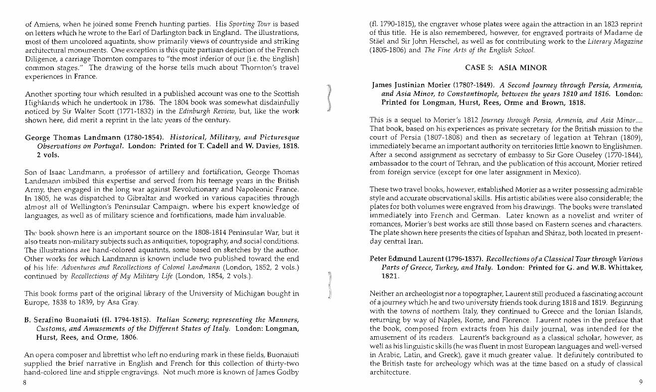
of Amiens, when he joined some French hunting parties. His Sporting Tour is based on letters which he wrote to the Earl of Darlington back in England. The illustrations, most of them uncolored aquatints, show primarily views of countryside and striking architectural monuments. One exception is this quite partisan depiction of the French Diligence, a carriage Thornton compares to "the most inferior of our [i.e. the English 1 common stages." The drawing of the horse tells much about Thornton's travel experiences in France.
Another sporting tour which resulted in a published account was one to the Scottish Highlands which he undertook in 1786. The 1804 book was somewhat disdainfully noticed by Sir Walter Scott (1771-1832) in the Edinburgh Review, but, like the work shown here, did merit a reprint in the late years of the century.
George Thomas Landmann (1780-1854). Historical, Military, and Picturesque Observations on Portugal. London: Printed for T. Cadell and W. Davies, 1818. 2 vols.
Son of Isaac Landmann, a professor of artillery and fortification, George Thomas Landmann imbibed this expertise and served from his teenage years in the British Army, then engaged in the long war against Revolutionary and Napoleonic France. In 1805, he was dispatched to Gibraltar and worked in various capacities through almost all of Wellington's Peninsular Campaign, where his expert knowledge of languages, as well as of military science and fortifications, made him invaluable.
The book shown here is an important source on the 1808-1814 Peninsular War, but it also treats non-military subjects such as antiquities, topography, and social conditions. The illustrations are hand-colored aquatints, some based on sketches by the author. Other works for which Landmann is known include two published toward the end of his life: Adventures and Recollections of Colonel Landmann (London, 1852, 2 vols.) continued by Recollectiol1s of My Military Life (London, 1854, 2 vols.).
This book forms part of the original library of the University of Michigan bought in Europe, 1838 to 1839, by Asa Gray.
B. Serafino Buonaiuti (fl. 1794-1815). Italian Scenery; representing the Manners, Customs, and Amusements of the Different States of Italy. London: Longman, Hurst, Rees, and Orme, 1806.
An opera composer and librettist who left no enduring mark in these fields, Buonaiuti supplied the brief narrative in English and French for this collection of thirty-two hand-colored line and stipple engravings. Not much more is known of James Godby
8
(f1. 1790-1815), the engraver whose plates were again the attraction in an 1823 reprint of this title. He is also remembered, however, for engraved portraits of Madame de Shiel and Sir John Herschel, as well as for contributing work to the Literary Magazil1e (1805-1806) and The Fine Arts of the El1glish School.
CASE 5: ASIA MINOR
James Justinian Morier (1780?-1849). A Second Journey through Persia, Armenia, and Asia Minor, to Constantinople, between the years 1810 and 1816. London: Printed for Longman, Hurst, Rees, Orme and Brown, 1818.
This is a sequel to Morier's 1812 Journey through Persia, Armmia, a/1d Asia Mil1or .... That book, based on his experiences as private secretary for the British mission to the court of Persia (1807-1808) and then as secretary of legation at Tehran (1809), immediately became an important authority on territories little known to Englishmen. After a second assignment as secretary of embassy to Sir Gore Ouseley (1770-1844), ambassador to the court of Tehran, and the publication of this account, Morier retired from foreign service (except for one later assignment in Mexico).
These two travel books, however, established Morier as a writer possessing admirable style and accurate observational skills. His artistic abilities were also considerable; the plates for both volumes were engraved from his drawings. The books were translated immediately into French and German. Later known as a novelist and writer of romances, Morier's best works are still those based on Eastern scenes and characters. The plate shown here presents the cities of Ispahan and Shiraz, both located in presentday central Iran.
Peter Edmund Laurent (1796-1837). Recollections of a Classical Tour through Various Parts of Greece, Turkey, and Italy. London: Printed for G. and W.B. Whittaker, 1821.
Neither an archeologist nor a topographer, Laurent still produced a fascinating account of a journey which he and two university friends took during 1818 and 1819. Beginning with the towns of northern Italy, they continued to Greece and the Ionian Islands, returning by way of Naples, Rome, and Florence. Laurent notes in the preface that the book, composed from extracts from his daily journal, was intended for the amusement of its readers. Laurent's background as a classical scholar, however, as well as his linguistic skills (he was fluent in most European languages and well-versed in Arabic, Latin, and Greek), gave it much greater value. It definitely contributed to the British taste for archeology which was at the time based on a study of classical architecture.
9
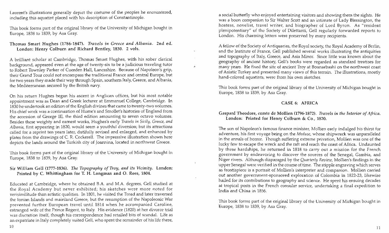
Laurent's illustrations generally depict the costume of the peoples he encountered, including this aquatint placed with his description of Constantinople.
This book forms part of the original library of the University of Michigan bought in Europe, 1838 to 1839, by Asa Gray.
Thomas Smart Hughes (1786-1847). Travels in Greece and Albania. 2nd ed. London: Henry Colburn and Richard Bentley, 1830. 2 vols.
A brilliant scholar at Cambridge, Thomas Smart Hughes, with his sober clerical background, appeared even at the age of twenty-six to be a judicious travelin? tutor to Robert Townley Parker of Cuerden Hall, Lancashire. Because of Napoleon s gnp, their Grand Tour could not encompass the traditional France and central Europe, but for two years they made their way through Spain, southern Italy, Greece, and Albania, the Mediterranean secured by the British navy.
On his return Hughes began his ascent in Anglican offices, but his most notable appointment was as Dean and Greek lecturer at Emmanuel College, Cambndge. In 1830 he undertook an edition of the English divines that came to twenty-two volumes. His chief work was a continuation of Hume's and Smollet's histories of England from the accession of George Ill, the third edition amounting to seven octavo volumes. Besides these weighty and earnest works, Hughes's early Travels in Sicily, Greece, and Albania, first appearing in 1820, would seem a youthful diversion; but its attractions called for a reprint ten years later, dutifully revised and enlarged, and enhanced by plates from the drawings of C. R. Cockerell. The impressive illustration shown here depicts the lands around the Turkish city of Joannina, located m northwest Greece.
This book forms part of the original library of the University of Michigan bought in Europe, 1838 to 1839, by Asa Gray.
Sir William Gell (1777-1836). The Topography of Troy, and its Vicinity. London: Printed by C. Whittingham for T. H. Longman and O. Rees, 1804.
Educated at Cambridge, where he obtained B.A. and M.A. degrees, Gell studied at the Royal Academy but never exhibited; his sketches were more noted for verisimilitude than artistic qualities. In 1801, he visited the Troad and later traversed the Ionian Islands and mainland Greece, but the resumption of the Napoleonic War prevented further European trave l until 1814 when he accompanied Caroline, estranged wife of the Prince Regent, to Italy. His evidence (182.0) at her d,vorce tnal was discretion itself, though his correspondence had retailed b,ts of scandal. Life as an expatriate in Italy completely suited Gell, who spent the remainder of his life there,
10
I
)
a social butterfly who enjoyed entertaining visitors and showing them the sights. He was a boon companion to Sir Walter Scott and an intimate of Lady Blessington, the hostess, novelist, travel writer, and biographer of Lord Byron. As "resident plenipotentiary" of the Society of Dilettanti, Gell regularly forwarded reports to London. His charming letters were preserved by many recipients.
A fellow of the Society of Antiquaries, the Royal society, the Royal Academy of Berlin, and the Institute of France, Gell published several works illustrating the antiquities and topography of Italy, Greece, and Asia Minor. Since little was known about the geography of ancient history, Gell's books were regarded as standard treatises for many years. He fixed the site of ancient Troy at Bounarbashi on the northwest coast of Asiatic Turkey and presented many views of this terrain. The illustrations, mostly hand-colored aquatints, were from his own sketches.
This book forms part of the original library of the University of Michigan bought in Europe, 1838 to 1839, by Asa Gray.
CASE 6: AFRICA
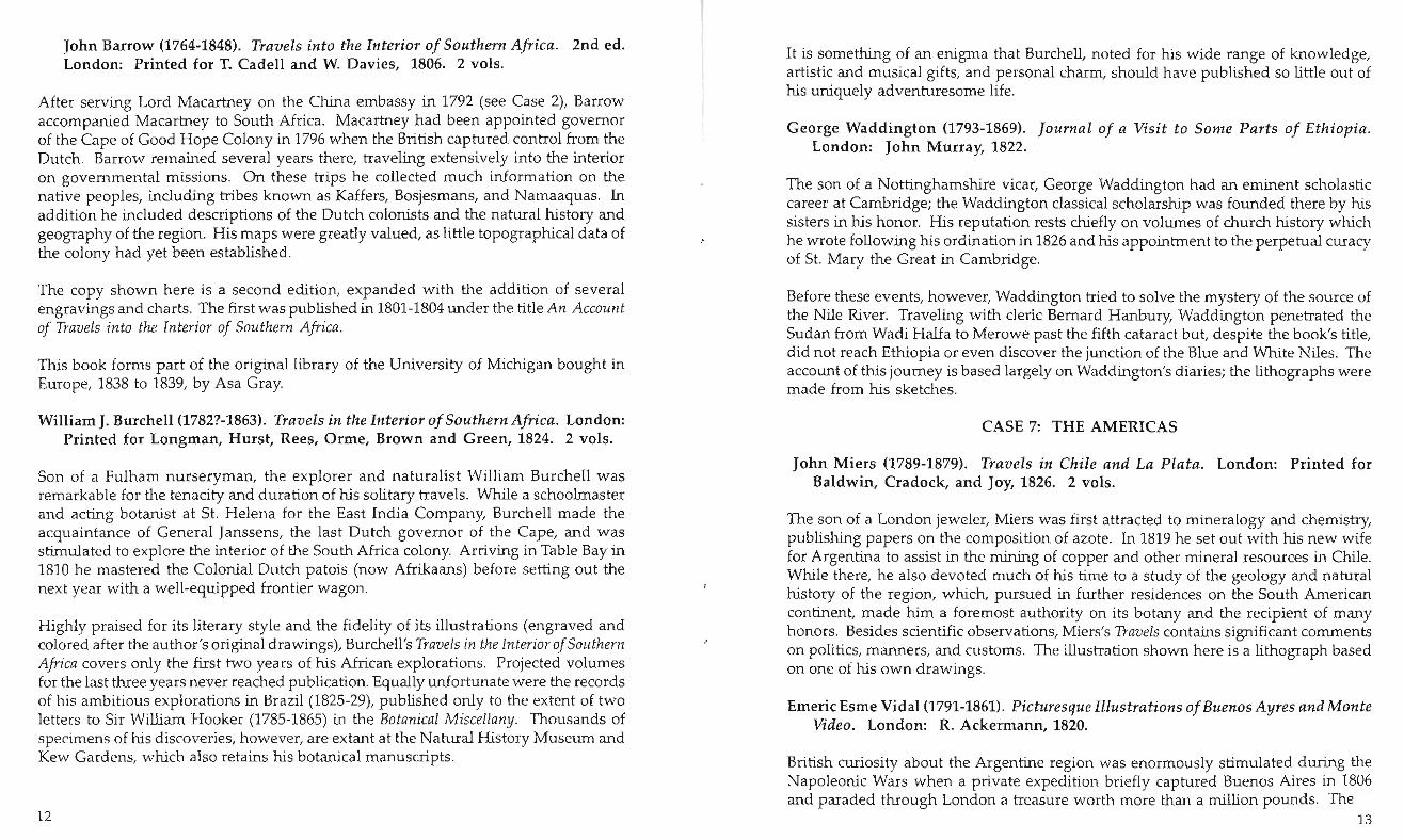
Gaspard Theodore, comte de Mollien (1796-1872). Travels in the Interior of Africa. London: Printed for Henry Colburn & Co., 1820.
The son of Napoleon's famous finance minister, Mollien early indulged his thirst for adventure, his first voyage being on the Meduse, whose shipwreck was unparalleled in the annals of horror. Though suffering extreme privation, Mollien was one of the lucky few to escape the wreck and the raft and reach the coast of Africa. Undaunted by these hardships, he returned in 1818 to carry out a mission for the French government by endeavoring to discover the sources of the Senegal, Gambia, and Niger rivers. Although disparaged by the Quarterly Review, Mollien's findings in the upper Senegal were verified in the course of time. The stipple engraving which serves as frontispiece is a portrait of Mollien's interpreter and companion. Mollien carried out another government-sponsored exploration of Colombia in 1822-23, likewise hailed for its contributions to geography and science. He spent his ensuing decades at tropical posts in the French consular service, undertaking a final expedition to India and China in 1856.
This book forms part of the original library of the University of Michigan bought in Europe, 1838 to 1839, by Asa Gray.
11
John Barrow (1764-1848). Travels into the Interior of Southern Africa. 2nd ed. London: Printed for T. Cadell and W. Davies, 1806. 2 vols.
After serving Lord Macartney on the China embassy in 1792 (see Case 2), Barrow accompanied Macartney to South Africa. Macartney had been appointed governor of the Cape of Good Hope Colony in 1796 when the British captured control from the Dutch. Barrow remained several years there, traveling extensively into the interior on governmental missions. On these trips he collected much information on the native peoples, including tribes known as Kaffers, Bosjesmans, and Namaaquas. In addition he included descriptions of the Dutch colonists and the natural history and geography of the region. His maps were greatly valued, as little topographical data of the colony had yet been established.
The copy shown here is a second edition, expanded with the addition of several engravings and charts. The first was published in 1801-1804 under the title An Account of Travels into the Interior of Southern Africa.
This book forms part of the original library of the University of Michigan bought in Europe, 1838 to 1839, by Asa Gray.
William J. Burchell (1782?-1863). Travels in the Interior of Southern Africa. London: Printed for Longman, Hurst, Rees, Orme, Brown and Green, 1824. 2 vols.
Son of a Fulham nurseryman, the explorer and naturalist William Burchell was remarkable for the tenacity and duration of his solitary travels. While a schoolmaster and acting botanist at SI. Helena for the East India Company, Burchell made the acquaintance of General Janssens, the last Dutch governor of the Cape, and was stimulated to explore the interior of the South Africa colony. Arriving in Table Bay in 1810 he mastered the Colonial Dutch patois (now Afrikaans) before setting out the next year with a well-equipped frontier wagon.
Highly praised for its literary style and the fidelity of its illustrations (engraved and colored after the author's original drawings), Burchell's Travels in the Interior of Southern Africa covers only the first two years of his African explorations. Projected volumes for the last three years never reached publication. Equally unfortunate were the records of his ambitious explorations in Brazil (1825-29), published only to the extent of two letters to Sir William Hooker (1785-1865) in the Botanical Miscellany. Thousands of specimens of his discoveries, however, are extant at the Natural History Museum and Kew Gardens, which also retains his botanical manuscripts.
12
It is something of an enigma that Burchell, noted for his wide range of knowledge, artistic and musical gifts, and personal charm, should have published so little out of his uniquely adventuresome life.
George Waddington (1793-1869). Journal of a Visit to Some Parts of Ethiopia. London: John Murray, 1822.
The son of a Nottinghamshire vicar, George Waddington had an eminent scholastic career at Cambridge; the Waddington classical scholarship was founded there by his sisters in his honor. His reputation rests chiefly on volumes of church history which he wrote following his ordination in 1826 and his appointment to the perpetual curacy of SI. Mary the Great in Cambridge.
Before these events, however, Waddington tried to solve the mystery of the source of the Nile River. Traveling with cleric Bernard Hanbury, Waddington penetrated the Sudan from Wadi Halfa to Merowe past the fifth cataract but, despite the book's title, did not reach Ethiopia or even discover the junction of the Blue and White Niles. The account of this journey is based largely on Waddington's diaries; the lithographs were made from his sketches.
CASE 7: THE AMERICAS
John Miers (1789-1879). Travels in Chile and La Plata. London: Printed for Baldwin, Cradock, and Joy, 1826. 2 vols.
The son of a London jeweler, Miers was first attracted to mineralogy and chemistry, publishing papers on the composition of azote. In 1819 he set out with his new wife for Argentina to assist in the mining of copper and other mineral resources in Chile. While there, he also devoted much of his time to a study of the geology and natural history of the region, which, pursued in further residences on the South American continent, made him a foremost authority on its botany and the recipient of many honors. Besides scientific observations, Miers's Travels contains significant comments on politics, manners, and customs. The illustration shown here is a lithograph based on one of his own drawings.
Emeric Esme Vidal (1791-1861). Picturesque Illustrations of Buenos Ayres and Monte Video. London: R. Ackermann, 1820.
British curiosity about the Argentine region was enormously stimulated during the Napoleonic Wars when a private expedition briefly captured Buenos Aires in 1806 and paraded through London a treasure worth more than a million pounds. The
13
struggles of the Spanish colonies for independence during the ensuing years reinforced this interest, which finally resulted in England's becoming Argentina's principal trading partner for much of her subsequent history.
A friend and employer of French emigres and Spanish exiles, German-born Rudolph Ackermann (1764-1834) (see also Case 2) was a well-known figure in London's literary and artistic circles. He printed and published many Spanish translations and original works, creating outlets in several South American cities. His publication of this title was the only notable colorplate example dealing with this region, and has been reprinted several times. Fifteen of Vidal's unpublished watercolors were thought worthy of a special edition more than a century later. Vidal was a British career naval officer with firsthand knowledge of the Plata region. He made some drawings of St. Helena when stationed there during Napoleon's last years but does not seem to have further expressed his artistic talents.
George Heriot (1766-1844). Travels through the Canadas. London: Printed for Richard Phillips, 1807.
This is probably the most important of the few illustrated books on North America published before 1830. The author was for years Deputy Postmaster General of British North America and knew his subject firsthand. Born in Scotland, he received his artistic training in Edinburgh and at the Royal Military Academy in London, before being posted to Quebec in 1792. By the time he was appointed to the Postal Sen:ice in 1799, he had become acquainted with the work of leadmg Bntish watercolonsts and had begun an enthusiastic study of Canada. The travels necessitated by his official position enhanced his work as a landscape painter, and led directly to the publication of this book.
The first part is largely a topographical description of the towns and settlements he visited, from Newfoundland to Lake Superior. Heriot paid particular attention to picturesque geographical features, especially Niagara Falls. The second half describes the manners and customs of various Indian tribes. The result is a work of significance, one of the earliest to concentrate on the Canadas, and one which preserves a life and landscape long since gone.
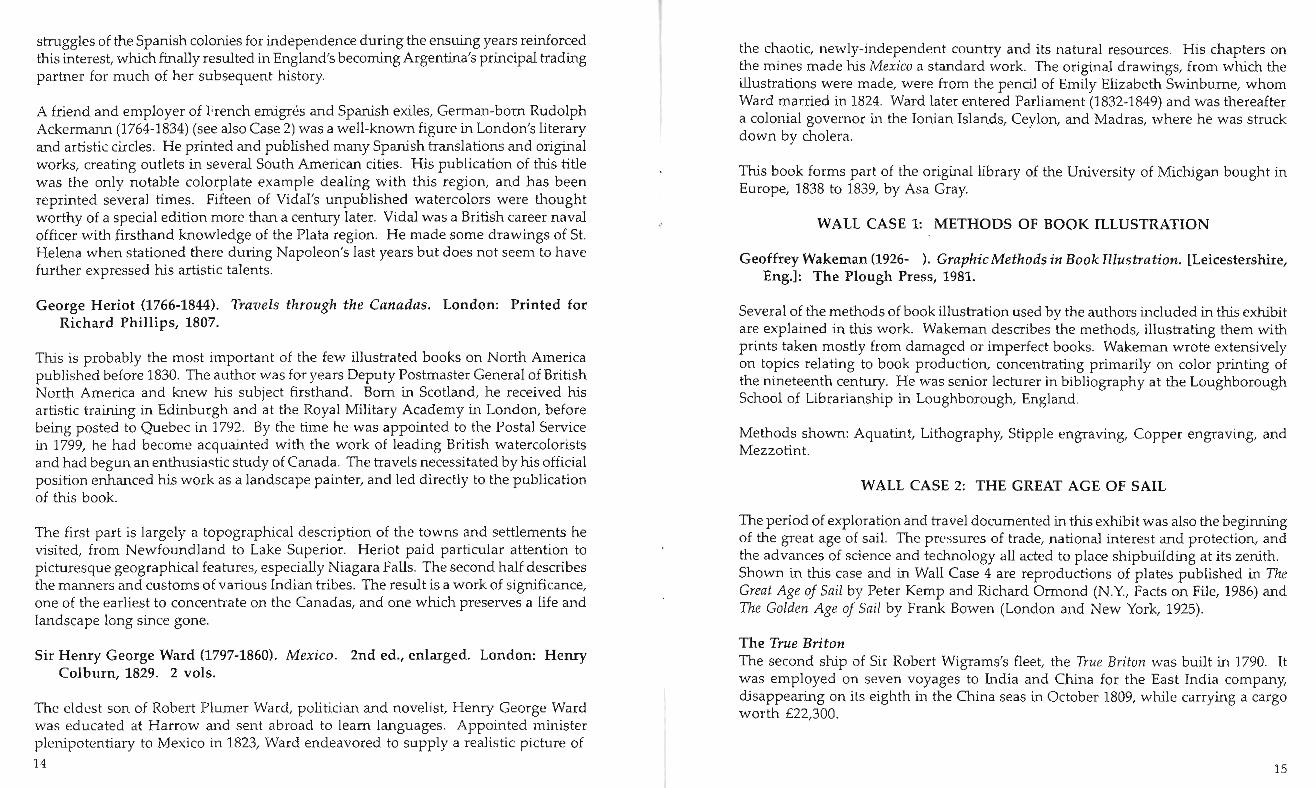
Sir Henry George Ward (1797-1860). Mexico. 2nd ed., enlarged. London: Henry Colburn, 1829. 2 vols.
The eldest son of Robert Plumer Ward, politician and novelist, Henry George Ward was educated at Harrow and sent abroad to learn languages. Appointed minister plenipotentiary to Mexico in 1823, Ward endeavored to supply a realistic picture of
14
the chaotic, newly-independent country and its natural resources. His chapters on the mines made his Mexico a standard work. The original drawings, from which the illustrations were made, were from the pencil of Emily Elizabeth Swinburne, whom Ward married in 1824. Ward later entered Parliament (1832-1849) and was thereafter a colonial governor in the Ionian Islands, Ceylon, and Madras, where he was struck down by cholera.
This book forms part of the original library of the University of Michigan bought in Europe, 1838 to 1839, by Asa Gray.
WALL CASE 1: METHODS OF BOOK ILLUSTRATION
Geoffrey Wakeman (1926- ). Graphic Methods in Book Illustration. [Leicestershire, Eng.]: The Plough Press, 1981.
Several of the methods of book illustration used by the authors included in this exhibit are explained in this work. Wakeman describes the methods, illustrating them with prints taken mostly from damaged or imperfect books. Wakeman wrote extensively on topics relating to book production, concentrating primarily on color printing of the nineteenth century. He was senior lecturer in bibliography at the Loughborough School of Librarianship in Loughborough, England.
Methods shown: Aquatint, Lithography, Stipple engraving, Copper engraving, and Mezzotint.
WALL CASE 2: THE GREAT AGE OF SAIL
The period of exploration and travel documented in this exhibit was also the beginning of the great age of sail. The pressures of trade, national interest and protection, and the advances of science and technology all acted to place shipbuilding at its zenith. Shown in this case and in Wall Case 4 are reproductions of plates published in The Great Age of Sail by Peter Kemp and Richard Ormond (N.Y., Facts on File, 1986) and The Golden Age of Sail by Frank Bowen (London and New York, 1925).
The True Briton The second ship of Sir Robert Wigrams's fleet, the True Briton was built in 1790. It was employed on seven voyages to India and China for the East India company, disappearing on its eighth in the China seas in October 1809, while carrying a cargo worth £22,300.
15

The Euphrates An Indiaman like the True Briton, the Euphrates is shown here off the coast of Cape Town in this 1835 paining by Samuel Walters (1811-1882). East Indiamen were privately owned ships employed by the East India Company, usually for a period of six voyages, during which time their owners could expect to realize a sizable fortune. Walters was known for his exact rendering of rigging and flags.
The Joseph Cunard Pictured here in 1839, the Joseph Cunard was built for Messrs. Smith and Company of Liverpool. A packet ship carrying both cargo and passengers, it was employed at various times during its career on the Liverpool- New Orleans, New York, Australia, Quebec, and India routes. The image is a reproduction of an oil painting by Samuel Walters (1811-1882).
The Ida Ziegler An excellent example of the elegant clipper ships, the Ida Ziegler was launched at Bremerhaven, Germany, in 1854, sailing as a merchant ship primarily between London and Calcutta. Due largely to the speed of the clipper design, the Ida Ziegler became a favorite for passengers between London and New Zealand. In February 1869, it was driven ashore in a heavy gale in Hawke's Bay, New Zealand, becoming a total wreck.
Clipper ships carried the age of sail to a glorious end. Just as the famous and beautiful Cutty Sark was being built in 1869, the commercial sailing ship was being replaced by steamships (see Wall Case 4).
WALL CASE 3
Louis Brion de la Tour (d. 1801?). Mappe-monde celeste terrestre et historique .... Paris, 1786.
Sailors and explorers of the late-eighteenth and early-nineteenth centuries were the beneficiaries of the great age of discoveries as well as a reformation in cartography which had just occurred during the previous several decades. The new cartography was characterized by scientific trends and more accurate detail and based on better instruments: the telescope to aid in astronomical observations, and the chronometer to make the computation of longitude much less laborious. In addition, the development of power-conscious national states in Europe stimulated much topographic activity. France led the way with a national survey, "Carte Geometrique de la France," completed in 1748.
16
Frenchman Louis Brion de la Tour, engineer to the king, drew this complete map of the world in 1786. He augmented the terrestrial map with notations depicting the voyages of the famous British explorer and navigator, Captain James Cook (1728-1779). The map still contains glaring inaccuracies, a problem typical of the maps of this period, and one which many of the travelers whose books are here displayed tried to reconcile through the creation of their own charts.
On loan from the William L. Clements Library.
WALL CASE 4: THE DAWN OF THE AGE OF STEAM
In 1819 the first Atlantic crossing was made using auxiliary steam power by the Savannah - and the era of oceanic steam travel was born. During this largely experimental period, steam was used as an auxiliary means of power, designed to assist in calms and weak winds.
Auxiliary steam ships came to the East India routes some twenty years later, in 1838, when the first Indiaman, the Earl of Hardwicke, was launched with steam engine and paddles. In 1839 both the Owen Glendower and the Vernon were launched fitted with auxiliary steam as well, but the Owen Glendower quickly abandoned the experiment. Though the Earl of Hardwicke was launched first, the Vernon made the pioneer voyage to India. Its return trip took eighty-six days, and the time of forty-two days from the Cape of Africa to England was considered a record. Within a short while the Vernon, too, abandoned steam and spent a thirty-year career as a straight sailing ship, after which it was used as a prison ship in Sydney.
Though many were initially enthusiastic and optimistic about auxiliary steam, it did not last long, as large clipper ships and full steam ships took their place. By the 1860s steam lines crossed the world .
Ships shown: The Savannah The Vernon (reproduction of a color aquatint) The Robert F Stockton (chromolithograph)
17

WALL CASE 5: BRAZIL
Maximilian Wied-Neuwied, Prinz von (1782-1867). Reise Ilach Brasiliell ill den Jahrell 1815 bis 1817. Frankfurt a. M.: Heinrich Ludwig Bronner, 1820. 2 vols. and atlas .
The eighth child of Prince Friedrich Karl, who ruled a small principality near Koblenz, Maximilian Wied was encouraged by his mother's interest in natural history and studied under Johann Friedrich Blumenbach (1752-1840), a founder of scientific anthropology who viewed mankind as a product of nature and the most perfect of domestic animals. Service with Prussia in the Napoleonic Wars delayed his long projected trip to the New World, but in 1815 he made a two-year journey along the coast of Brazil which established his reputation as a naturalist.
Interested in comparing the Indians of North America with those he had studied in Brazil, Wied sailed in 1832 for the United States in the company of the Swiss artist Karl Bodmer. His detailed ethnographic descriptions of the tribes along the Missouri document ways of life that were very soon disrupted or destroyed. The zoological collections of this skilled and dedicated observer were eventually acquired by the American Museum of Natural History.
Shown here is the original account of his Brazilian travels which was published in German and illustrated with copperplate engravings. Also on display is an English translation of the first volume of text, published by Richard Phillips (London, 1825). This slim book presents only the first volume of text, as the rest had not yet appeared in Germany.
WALL CASE 6: UNITED STATES OF AMERICA
Lesueur, Charles Alexandre, 1778-1846. Dessills de Ch. A. Lesueur, executes aux Etats-Ullis de 1816 Ii 1837. Paris, 1933.
Selected plates from a facsimile edition of Lesueur's Dessills, made while he traveled around the United States. Lesueur traveled extensively in New York just after his arrival, before settling for a time in New Harmony, Indiana, as a member of the community founded by Robert Owen. From Indiana, Lesueur made several smaller trips through the Midwest and South.
Plates shown: "Niagara Falls;" "Bethlehem, Pennsylvania;" "Tyawapatia Bottom or Commercetown;" "Indian at Petit Golfe on the Mississippi, April 16, 1830;" "On board the Philanthropist: the Kitchen." 18

Please visit our upcoming exhibit:
Portrait of a People: The Jewish Heritage Collection
Dedicated to Mark and Dave Harris
April 11 - August 19, 2005
SPECIAL COLLECTIONS LmRARY 7TH FLOOR, HARLAN HATCHER GRADUATE LmRARY
UNIVERSITY OF MICHIGAN
ANN ARROR, MI 48109-1205 (734) 764-9377
HTIP:/ /WWW.Lffi .UMICH.EDU/SPEC-COLL