© tafe mecat 2008 chapter 6(b) where & how we take measurements
TRANSCRIPT
© TAFE MECAT 2008
Chapter 6(b)
Where & how we take measurements
© TAFE – MECAT 2008
Where & how we take measurements
While the parameters we have discussed so far can be directly measured there are many others that can be used such as Solar flux,
UV intensity,
rainfall, and
snow depth
Furthermore, we can calculate even more parameters from the few mentioned which provide us with even greater detail of the atmosphere.
© TAFE – MECAT 2008
What meteorologists measure
The BoM use staff and volunteers to gather data from all of Australia and its territories so that it can produce the forecasts that it delivers.
This requires a substantive network of communication gathering, even with today’s modern equipment.
While it is simple enough to obtain data from the surface, it is a bit more difficult to get readings from high up in the atmosphere.

© TAFE – MECAT 2008
Surface measurements
A weather station is a facility with instruments and equipment to make observations of atmospheric conditions in order to provide information to make weather forecasts and to study the weather and climate.
The measurements taken include temperature, barometric pressure, humidity, wind speed, wind direction, and precipitation amounts.
Wind measurements are taken as free of other obstructions as possible, while temperature and humidity measurements are kept free from direct solar radiation, or insolation.
Manual observations are taken at least once daily, while automated observations are taken at least once an hour.
© TAFE – MECAT 2008
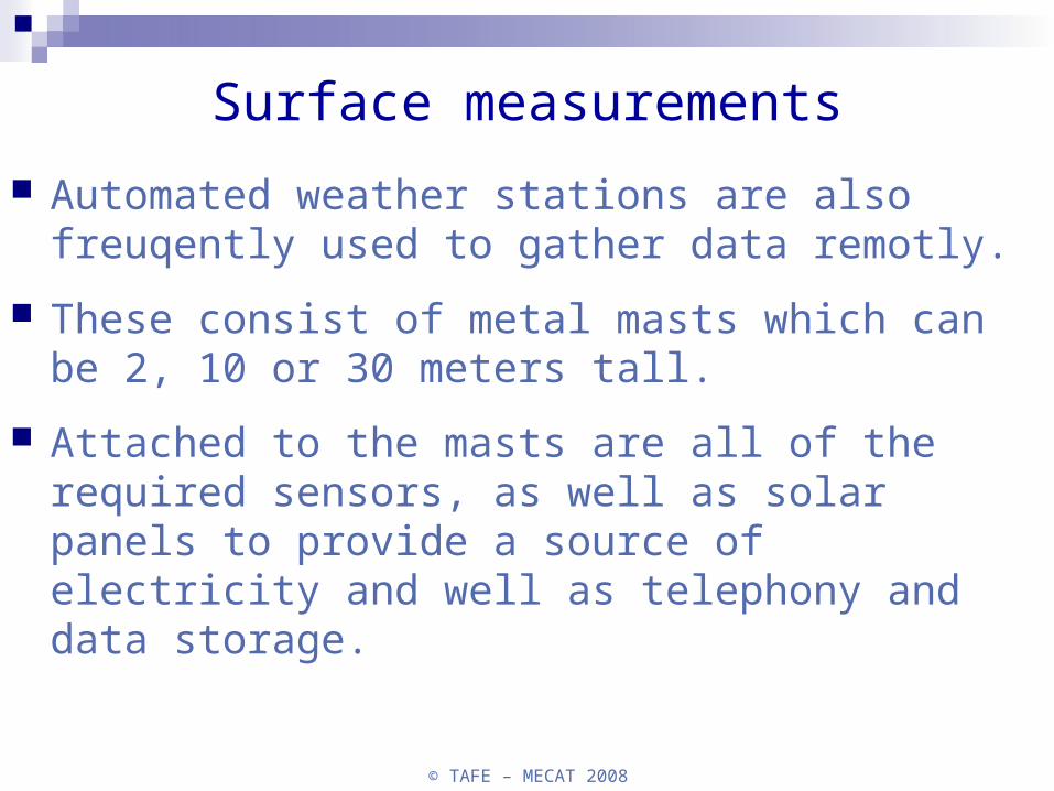
Automated weather stations are also freuqently used to gather data remotly.
These consist of metal masts which can be 2, 10 or 30 meters tall.
Attached to the masts are all of the required sensors, as well as solar panels to provide a source of electricity and well as telephony and data storage.
Surface measurements
© TAFE – MECAT 2008
Higher altitude measurements
Planes and weather balloons are used to make high altitude measurements, however, planes are limited in the heights they can fly.
Commercial planes fly at heights of around 10000 meters, and meteorologists require readings as high up as 30 km, especially if they are looking at ozone levels.

© TAFE – MECAT 2008
A weather balloon is a helium (or hydrogen) filled balloon used to provide vertical profiles of the atmosphere (and make Americans believe in UFO’s).
The balloon is just the vehicle, attached to the balloon is a device called a radiosonde,
which is group of small black magic boxes that act as a mobile weather station and take measurements
Higher altitude measurements

© TAFE – MECAT 2008
Weather Balloons & Radiosondes

© TAFE – MECAT 2008
The BoM uses its own radar system to track the radiosonde's position so that wind speeds and directions can be determined as well as the height of the balloon for each measurement taken.
A computer takes this data and constructs a profile of the atmosphere for each location at which a balloon is released
Higher altitude measurements

© TAFE – MECAT 2008
© TAFE – MECAT 2008
Ground based remote sensing
You would be very familiar with the concept of weather radar images.
Radar, which stands for Radio Detection and Ranging, is the most common of several ground based remote sensing profiling techniques in use today.
Ground based devices are categorized by the wavelength of the electromagnetic signal they emit.
Radars emit a signal in the radio frequency but there are many more ground based devises including;
Sodar (Sound Detection and Ranging) devices, emit signal in the audible spectrum.
Lidar (Light Detection and Ranging) devices emit signals of visible wavelengths.
© TAFE – MECAT 2008
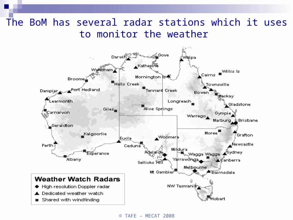
The BoM has several radar stations which it uses to monitor the weather
© TAFE – MECAT 2008
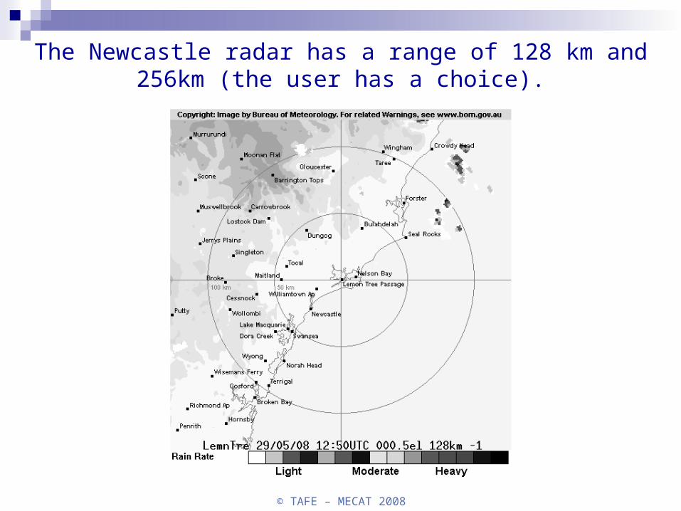
The Newcastle radar has a range of 128 km and 256km (the user has a choice).
© TAFE – MECAT 2008
Satellites
While radar technology can provide us with a view of a localized cross section of the atmosphere, satellites in orbit above the earth can beam down photos of the entire globe.
Satellites have become an invaluable tool for forecasting the weather.
Not only can satellites take photographs, they also function as sensing devices.
Satellites can measure radiation from the earth's surface and atmosphere which can help us make determinations about the earth-atmosphere heat budget.
They can measure water vapour content in the air and even measure winds. Satellites can collect, compile, and transmit data from remote surface stations making data collection and organization an easier task.
© TAFE – MECAT 2008
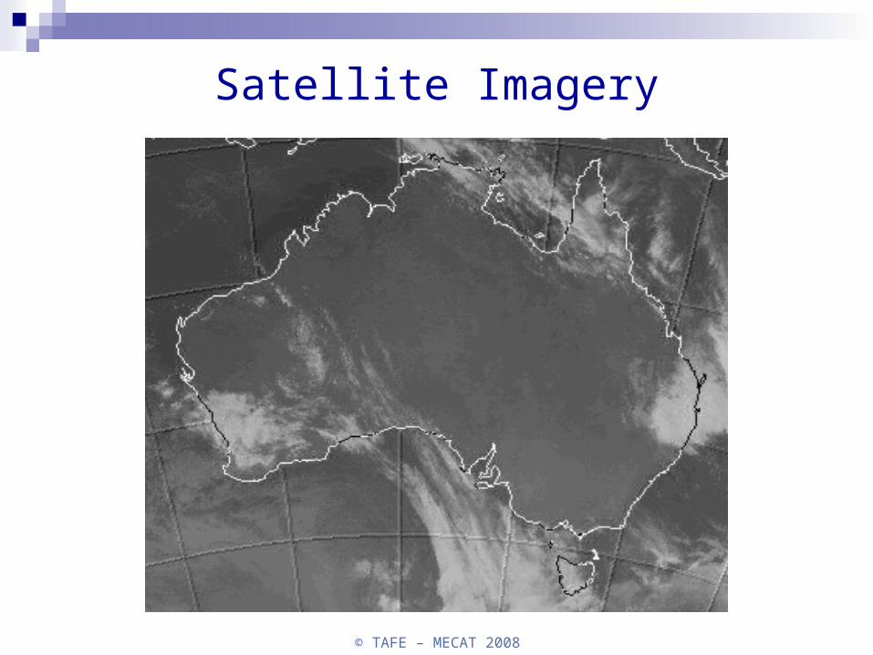
Satellite Imagery

© TAFE – MECAT 2008
What environmental technicians measure
As an environmental technician, you will be expected to perform the following tasks;
Perform a checklist on the portable meteorological unit
Undertake pre-site testing of all equipment
Load and transport the equipment to site
© TAFE – MECAT 2008
Set up equipment as per manufacturers instructions and appropriate standards
Test on-site application of equipment (quality control)
Set equipment to perform required tasks for set timeframe
Perform post-application checks (quality control)
Capture, record or load data from data logger to computer (or setup other technique)
© TAFE – MECAT 2008
Pack up and transport equipment back to source.
Transfer data to appropriate data storage device (data base or other)
Perform simple data manipulations such as summary/descriptive statistics
Provide simple reports based on summarised data.

© TAFE – MECAT 2008
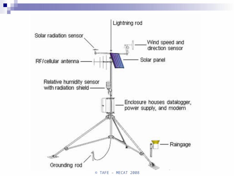
So what does this unit that you will more than likely use look like?
Outlined below is an image that would reflect a great many environmental met stations.
Obviously, each individual application will determine what parameters are measured (air and noise studies may have different sensors to what is used for forecasting).
In the picture below we are using basic weather sensors.
© TAFE – MECAT 2008