© dhi importance of data for urban water projects tomas metelka zdenek svitak ivanka yordanova...
TRANSCRIPT
© DHI
Importance of data for urban water projects
Tomas MetelkaZdenek Svitak
Ivanka Yordanova Prunet
BULAQUA 2015
RDBMS

© DHI
1. Current situation in urban water data
2. Importance of proper data management
3. Case study – Western region Bulgaria project
4. Conclusions
Content

© DHI
1. Project data available at distinct organisations
2. Project data available in distinct formats (CAD, GIS, XLS,…)
3. Some data digital, some other paper harcopies
4. Some data free of charge, some other not
5. Some data easily accessible, some other not
6. Data quantity and quality varies from good to bad
7. Data utilization sometimese usfull, sometimes useless
Current situation in urban water data
Time, resource and budget consuming “repetitive” process to collect the data for current urban water projects
© DHI
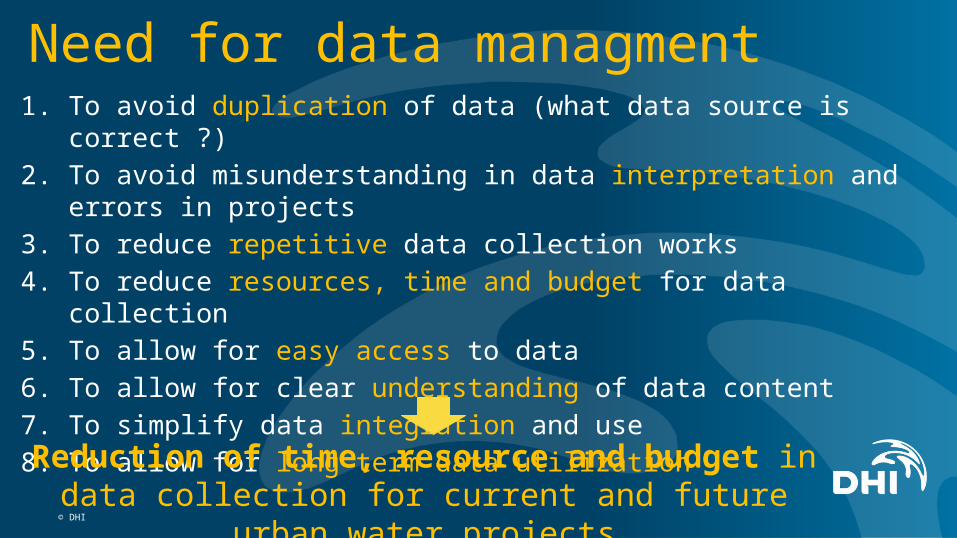
1. To avoid duplication of data (what data source is correct ?)
2. To avoid misunderstanding in data interpretation and errors in projects
3. To reduce repetitive data collection works
4. To reduce resources, time and budget for data collection
5. To allow for easy access to data
6. To allow for clear understanding of data content
7. To simplify data integration and use
8. To allow for long term data utilization
Need for data managment
Reduction of time, resource and budget in data collection for current and future urban water projects
© DHI
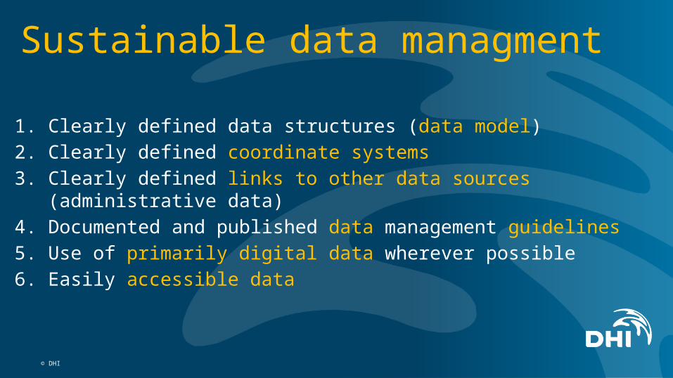
1. Clearly defined data structures (data model)
2. Clearly defined coordinate systems
3. Clearly defined links to other data sources (administrative data)
4. Documented and published data management guidelines
5. Use of primarily digital data wherever possible
6. Easily accessible data
Sustainable data managment

© DHI
Case study – Western region projectPREPARATION OF REGIONAL WATER AND WASTEWATER MASTER PLANS FOR
WESTERN REGION - MIDP-MP-QCBS3 – 2012-2013
• 19 regions (out of 52)
• Settlements above 2000 PE: 118
• Total population: 1 166 000 inhabs.
• Total area size: 40 000 km2
• Client: MRDPW • Beneficients: Municipalities + WU• Duration: 18 months• DHI, NIRAS, RAMBOLL, SCG, AQP• DHI: Full water supply RMP

Data model definition
City
Municipality
District
Region Region 1
District 1.1
Municipality 1.1.1
City 1.1.1.1 Village 1.1.1.2
District 1.2
Municipality 1.2.1
WSS 1.1.1
Water sources
Reservoirs
Pumping stations
Network
Supply zone
Comunities
ViK 1.2.1
Administrative data Water supply system data ViK data

Data structure description
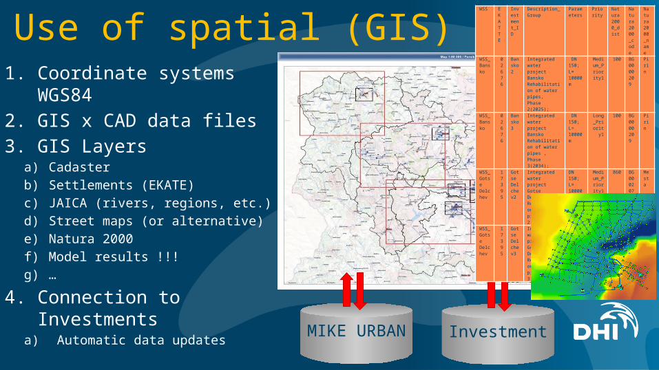
1. Coordinate systems WGS84
2. GIS x CAD data files
3. GIS Layersa) Cadaster
b) Settlements (EKATE)
c) JAICA (rivers, regions, etc.)
d) Street maps (or alternative)
e) Natura 2000
f) Model results !!!
g) …
4. Connection to Investmentsa) Automatic data updates
Use of spatial (GIS) data
MIKE URBAN
Investment
WSS EKATTE
Investment_ID
Description_Group
Parameters
Priority
Natura2000_dist
Natura2000_code
Natura2000_name
WSS_Bansko
0267
6
Bansko2
Integrated water project Bansko Rehabilitation of water pipes, Phase 2(2025);
DN 150; L= 10000 m
Medium_Priority
1
100 BG0000209
Pirin
WSS_Bansko
0267
6
Bansko3
Integrated water project Bansko Rehabilitation of water pipes , Phase 3(2034);
DN 150; L= 10000 m
Long_Priority1
100 BG0000209
Pirin
WSS_Gotse Delchev
1739
5
Gotse Delchev2
Integrated water project Gotse Delchev. Rehabilitation of water pipes, Phase 2 (2025)
DN 150; L= 10000 m
Medium_Priority
1
860 BG0002076
Mesta
WSS_Gotse Delchev
1739
5
Gotse Delchev3
Integrated water project Gotse Delchev. Rehabilitation of water pipes, Phase 3 (2034)
DN 150; L= 10000 m
Long_Priority1
860 BG0002076
Mesta

1. Digital processing of all data from A to Z
2. GIS based data structure
3. Core Water dataa) Asset data
b) Model data
c) Administrative data
d) Investment data
Basic project data structure and storageWSS Asset data
Administrative data(Population and water demand projection)
Model dataAnalysis, Summarization
Maps, Graphs
Investment data Development options
Optimized Investment
MODELgeodatabase
Investment Geodatabase
CADASTER Geodatabase
WSS Asset data
Administrative data(Population and water demand projection)
Model dataAnalysis, Summarization
Maps, Graphs
Investment data Development options
Optimized Investment
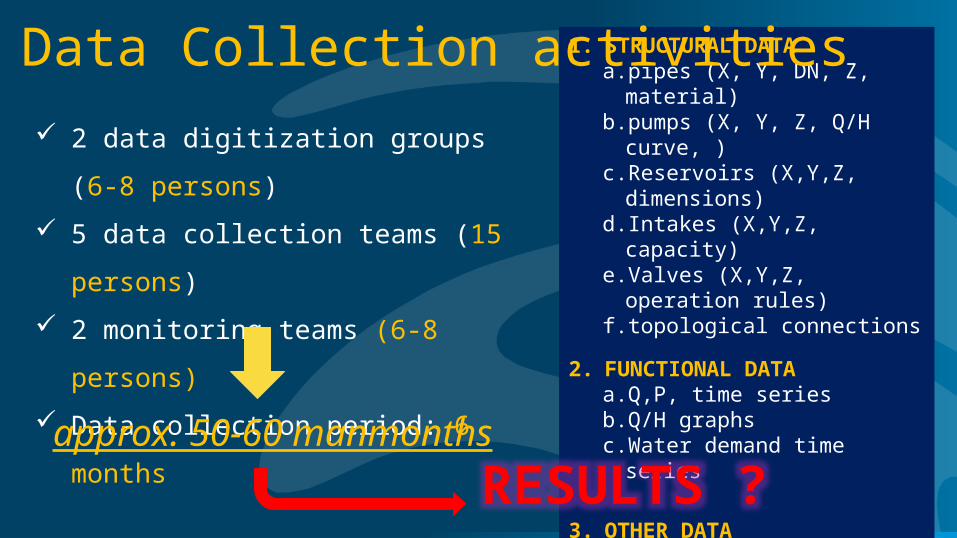
1. STRUCTURAL DATAa. pipes (X, Y, DN, Z, material)b. pumps (X, Y, Z, Q/H curve, )c. Reservoirs (X,Y,Z, dimensions)d. Intakes (X,Y,Z, capacity)e. Valves (X,Y,Z, operation rules)f. topological connections
2. FUNCTIONAL DATAa. Q,P, time seriesb. Q/H graphsc. Water demand time series
3. OTHER DATAa. Cadaster, b. DTM, c. surveys, …
Data Collection activities
2 data digitization groups (6-8 persons)
5 data collection teams (15 persons)
2 monitoring teams (6-8 persons)
Data collection period: 6 months
approx. 50-60 manmonths
RESULTS ?

© DHI
Water supply digital data

© DHI
Water supply digital data – detail 1
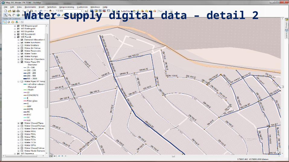
© DHI
Water supply digital data – detail 2

© DHI
Water supply data analysis (material)

© DHI
Water supply data analysis (material)

© DHI
City Water supply data

Municipal Water supply data

Regional Water supply data

Water supply data for Bulgaria

© DHI
1. 1/3 of Bulgaria water supply data was collected – proof of concept
2. Data has monetary value
3. Well structured information helps in a course of project
4. Need for right data structure definition for urban water projects
5. GIS based water asset database at ViK would be appreciated
Conclusions
