yolo county flood control & water conservation district
DESCRIPTION
Annual ReportTRANSCRIPT
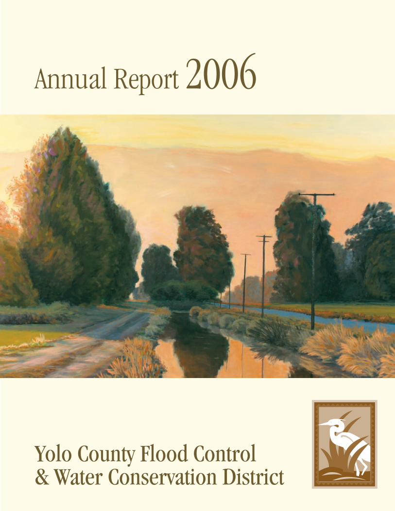
Annual Report 2006
Yolo County Flood Control & Water Conservation District
A N NUA L R E P O RT 2 0 0 6 1
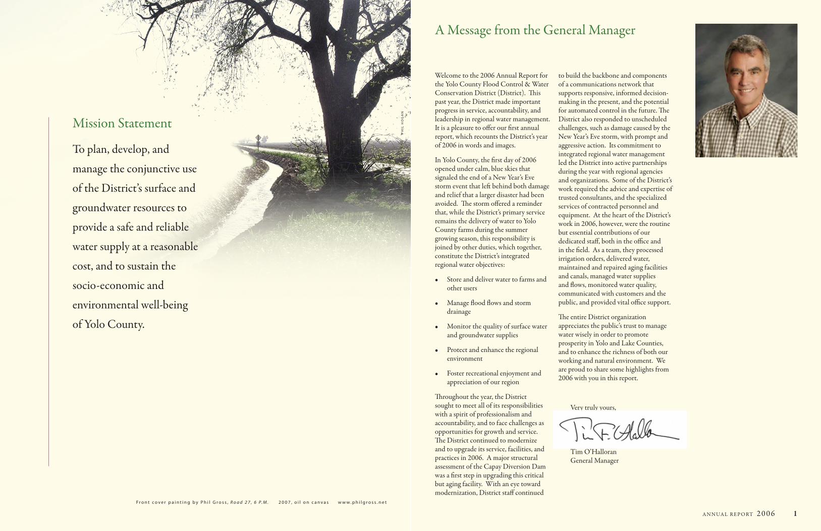
Welcome to the 2006 Annual Report for the Yolo County Flood Control & Water Conservation District (District). This past year, the District made important progress in service, accountability, and leadership in regional water management. It is a pleasure to offer our first annual report, which recounts the District’s year of 2006 in words and images.
In Yolo County, the first day of 2006 opened under calm, blue skies that signaled the end of a New Year’s Eve storm event that left behind both damage and relief that a larger disaster had been avoided. The storm offered a reminder that, while the District’s primary service remains the delivery of water to Yolo County farms during the summer growing season, this responsibility is joined by other duties, which together, constitute the District’s integrated regional water objectives:
Store and deliver water to farms and •other users
Manage flood flows and storm •drainage
Monitor the quality of surface water •and groundwater supplies
Protect and enhance the regional •environment
Foster recreational enjoyment and •appreciation of our region
Throughout the year, the District sought to meet all of its responsibilities with a spirit of professionalism and accountability, and to face challenges as opportunities for growth and service. The District continued to modernize and to upgrade its service, facilities, and practices in 2006. A major structural assessment of the Capay Diversion Dam was a first step in upgrading this critical but aging facility. With an eye toward modernization, District staff continued
to build the backbone and components of a communications network that supports responsive, informed decision-making in the present, and the potential for automated control in the future. The District also responded to unscheduled challenges, such as damage caused by the New Year’s Eve storm, with prompt and aggressive action. Its commitment to integrated regional water management led the District into active partnerships during the year with regional agencies and organizations. Some of the District’s work required the advice and expertise of trusted consultants, and the specialized services of contracted personnel and equipment. At the heart of the District’s work in 2006, however, were the routine but essential contributions of our dedicated staff, both in the office and in the field. As a team, they processed irrigation orders, delivered water, maintained and repaired aging facilities and canals, managed water supplies and flows, monitored water quality, communicated with customers and the public, and provided vital office support.
The entire District organization appreciates the public’s trust to manage water wisely in order to promote prosperity in Yolo and Lake Counties, and to enhance the richness of both our working and natural environment. We are proud to share some highlights from 2006 with you in this report.
Very truly yours,
Tim O’Halloran General Manager
A Message from the General Manager
Mission Statement
To plan, develop, and
manage the conjunctive use
of the District’s surface and
groundwater resources to
provide a safe and reliable
water supply at a reasonable
cost, and to sustain the
socio-economic and
environmental well-being
of Yolo County.
F r o n t c o v e r p a i n t i n g b y P h i l G r o s s , R o a d 2 7 , 6 P. M . 2 0 0 7 , o i l o n c a n v a s w w w . p h i l g r o s s . n e t
Ph
il h
oG
an

2 A N NUA L R E P O RT 2 0 0 6 A N NUA L R E P O RT 2 0 0 6 3
C l e a r l a k e
L a k e B e r r y e s s a
I n d I a n V a l l e y r e s e r V o I r
C a p a y
W o o d l a n d
d a V I s
W I n t e r s
Ca
C h e Cr
e e k
S
ac
ra
me
n t o r i v e r
P U T A H C R E E K
District Area acresTotal 196,000
Drainage Area square milesClear Lake Sub-Watershed 528 50.6%Indian Valley Sub-Watershed 121 11.6%Bear Creek Sub-Watershed 100 9.6%Cache Creek Sub-Watershed 295 28.2%
Total Cache Creek Watershed 1,044 100.0%
Water Rights PrioritiesCache Creek 1855Clear Lake 1912Indian Valley Reservoir 1946, 1954, 1957
Water Storage Capacity acre feetClear Lake (zero to 7.56’ Rumsey Gauge) 314,000 Indian Lake Reservoir 300,600
Total 614,600
Water Released for Sale in 2006 acre feetClear Lake 112,149 58.5%Indian Lake Reservoir 79,641 41.5%
Total Water Released for Sale 191,790 100%
Water Sold in 2006 acre feetAgricultural 150,190 97.5%Non-Agricultural 3,857 2.5%
Total Water Sold 154,047 100%
Major Facilities initial construction yearCache Creek Dam 1914Capay Diversion Dam 1914Indian Valley Dam 1976Chapman Reservoir 1979Moore Siphon (at site of Moore Dam 1856) 1983Indian Valley Dam Hydroelectric Plant 1983Cache Creek Dam Hydroelectric Plant 1986
Water Distribution FacilitiesCanals miles 160Gates/Turnouts total number 655Checks/Backups total number 283Canal Crossings total number 224
Groundwater MonitoringWater Level Wells 160Water Quality Wells 29
District 2006 Profile
The natural waterscape of Cache Creek relies on Coast Range rainfall for its water source. The cycle begins in early autumn as the days shorten and temperatures cool. During the winter months, thick marine clouds gather into storms that bear inland, sweeping upward to pass over the crest of the Coast Range. As the moist air cools, its vapor condenses into raindrops.
This upland precipitation, twice the amount that falls in the Central Valley trough to the east, becomes runoff, not snowpack, in the mild winter climate. Clear Lake, a basin surrounded by peaks and hills in central Lake County, collects much of this storm water, then spills it into its outflow channel, Cache Creek.
Further downstream, Cache Creek is joined by the North Fork of Cache Creek, Bear Creek, and smaller tributaries, which together drain more than 1,000 square miles of Coast Range. After a swift descent from the hills, Cache Creek slows as it moves onto the valley floor, drawn by gravity across broad flatlands that tilt toward the east and the south. These winter flows historically pooled at the base of Sacramento River’s natural levees in marshy settling basins where they percolated downward into immense underground aquifers. Only during major flood events did Cache Creek surface waters join the Sacramento River system.
Before the era of dams, Cache Creek and its tributaries would dwindle and sometimes disappear altogether in the parching days of summer. Trickles from perennial springs, an occasional thunderstorm, and the moist remains of natural pools provided the season’s only moisture until autumn rainfalls once again returned.
Before the mid-1800’s, the seasonality of the region’s climate shaped the lives of the Native people who lived near Cache Creek, determining where and how people lived, and what foods they cultivated and relied upon. James Moore, a local farmer, first saw the potential of managing Cache Creek waters to enhance the productivity of his farm with irrigation. In 1856, he built a
rudimentary willow brush dam across Cache Creek to divert water into a 3.5-mile ditch to irrigate his crops. Over the next 50 years, he and others created ditch systems that relied on gravity to move creek water from natural channels to cultivated fields across Yolo County’s gently sloping valley floor. As surface irrigation systems multiplied in the late 1800’s, area farmers elevated Yolo County agriculture to international renown with increased productivity and profitable specialty crops such as hops, fruit, and sugar beets.
Valley irrigation systems did not remedy the waterless summers, when Cache Creek naturally ran dry. In 1914, the Yolo Water and Power Company built Cache Creek Dam five miles downstream from Clear Lake to store winter rainwater. Dam releases succeeded in enhancing summer flows in Cache Creek, but the prospect of uninterrupted irrigation to Yolo County farms continued to be frustrated by years of drought, when farmers were forced to pump groundwater. To prevent depleting the region’s best protection against drought – its groundwater – the Yolo County Flood Control and Water Conservation District, successor to the private water companies of the area, constructed the Indian Valley Dam and Reservoir in the mid-1970s. This reservoir added more than 300,000 acre feet of water storage in the northeast hills of Cache Creek’s watershed. It has provided containment for winter floodwaters to be released for summer use and for hydroelectric power generation that had been planned 100 years ago. The summer flows created by the managed Cache Creek water system have also contributed to a rich, year-around habitat for plants and wildlife in the natural sloughs of the valley.
The Yolo County Flood Control & Water Conservation District, an Independent Special District created by the California legislature in 1951, supplies water from Clear Lake, Indian Valley Reservoir, and the Cache Creek drainage system to users in Lake and Yolo Counties. In addition to delivering water to its customers, the District also provides a variety of other regional water resource services that help protect and enhance the resources and way of life in the region.
About Our District
Yolo County Flood Control & Water Conservation District manages a gravity-fed water delivery system that provides benefit to both the natural environment and the working rural landscape that we value in the region. Water flows through Cache Creek and into the canals and sloughs of Yolo County, providing invaluable sustenance to our crops and ecosystems. In addition, the storage of winter storm waters behind Cache Creek and Indian Valley Dams provides downstream flood protection during storm events, as well as a supply of water for rafting and groundwater replenishment during the summer months. To understand the work of the District, it is important to understand the story of both the natural watershed and the constructed water delivery system.
The Cache Creek Water System
4 A N NUA L R E P O RT 2 0 0 6 A N NUA L R E P O RT 2 0 0 6 5
AccountabilityThe District takes pride in conducting its business in an accountable and accessible manner. A comprehensive upgrade to the District website in 2006 simplified public access to water flow information, technical reports, and the Board of Directors’ agendas and minutes. The District provided outreach presentations on its role and business practices to both the Yolo and Lake County Grand Juries, as part of their public agency review process. In addition, elected officials and members of the general public participated in tours of District facilities in the upper watershed, and attended numerous other public presentations and excursions offered by the District throughout the year.
Water QualityResponding to an increased regulatory environment, the District expanded its water testing program by adding more sampling sites and increasing the frequency and nature of data collection in its canals, test wells, and at dam sites in 2006. The District continued to build a comprehensive database of water quality attributes such as temperature, sediments, algae, microbes, dissolved chemicals, oxygen and more. As a member of the Sacramento Valley Water Quality Coalition, the District worked closely with the Yolo County Farm Bureau and Agricultural Commissioner.
RecreationIndian Valley Reservoir and Campground enjoyed a banner year. Due to the extended rainy season, the reservoir reached record high storage and provided year-around enjoyment for fishing and recreation enthusiasts. Refurbished bathroom facilities and a renewed emphasis on campground cleanliness made for a safe and wholesome atmosphere. The District communicated and coordinated with rafting companies and kayaking groups to facilitate their operations and activities throughout the extended season.
Environmental Stewardship
Water Supply
Carefully managed Cache Creek waters deliver life to an agriculture-based industry that in 2006 contributed more than $1 billion to Yolo County’s economy. A wet winter and spring provided a full water supply that allowed the District to deliver water without allocations. During the irrigation season of May 3 to Oct 28, 2006, District staff orchestrated a daily sequence of releases and water flows through its extensive delivery system. The District played an important role in Yolo County’s agricultural production, which grew in crop value by 11% during 2006.
The plentiful supply of surface water in 2006 was also a boon to groundwater levels in the immense aquifers underneath Yolo County. Each year,
applied irrigation water and canal seepage make up almost half of all groundwater recharge in Yolo County. These aquifers supply water to rural wells and to Winters, Woodland, Davis, and UC Davis. Furthermore, ample canal deliveries during the 2006 season meant that many Yolo County farmers did not have to tap into groundwater supplies to supplement their surface supply, as is often necessary in low-water years. In an effort to develop a better understanding of the area’s groundwater and to establish sound groundwater management practices, the District completed its Groundwater Management Plan and co-sponsored the development of the Yolo County Integrated Groundwater and Surface Water Model, both of which were published in 2006.
The District occupies an important and challenging position balancing human water needs and environmental stewardship values. Releases of stored water help sustain the fishery above Capay Dam and promote flourishing streamside and aquatic habitats in Cache Creek as well as in the miles of natural sloughs that run through the District’s service area. The creeks, canals, and sloughs of Yolo County are interrelated components of a regional ecosystem that
is home to a healthy diversity of wildlife and plants.
The District honored Betsy Marchand with its 2006 Stewardship and Water Conservation Award for her success in promoting interagency cooperation on regional water issues. Along with the Water Resources Association of Yolo County, the District co-hosted the annual poster contest for Yolo County students during Water Awareness Month.
District Highlights in 2006
PH
IL H
OG
AN
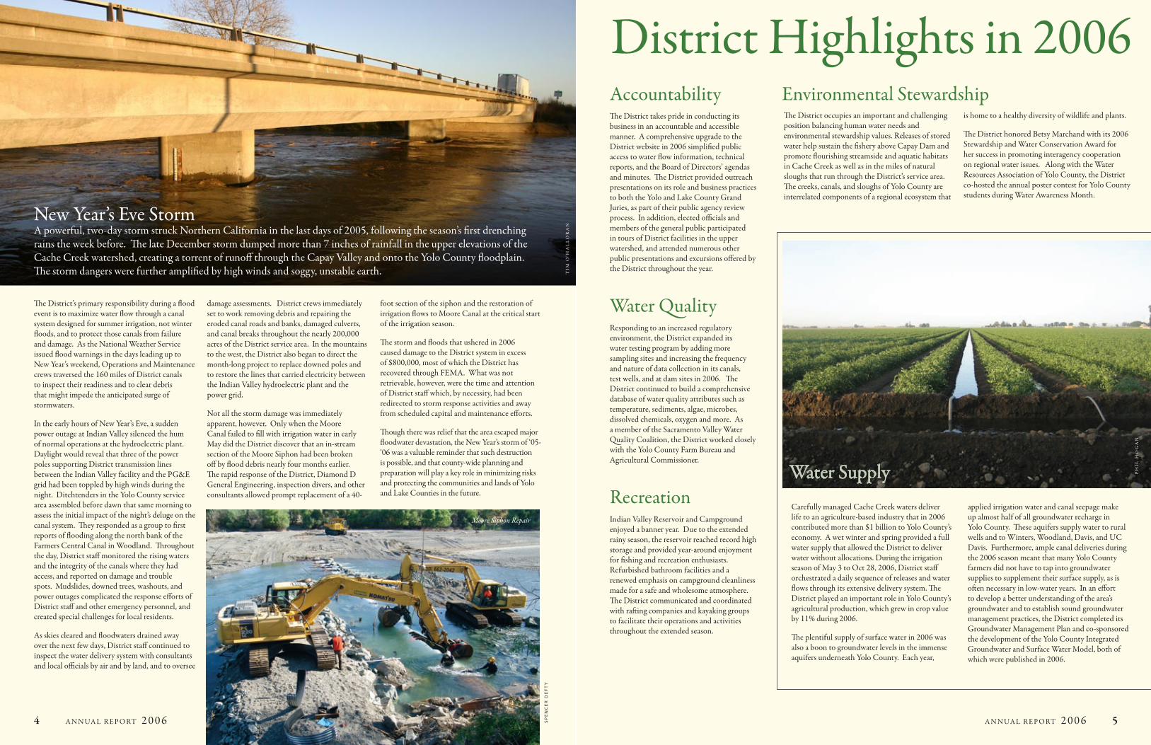
New Year’s Eve StormA powerful, two-day storm struck Northern California in the last days of 2005, following the season’s first drenching rains the week before. The late December storm dumped more than 7 inches of rainfall in the upper elevations of the Cache Creek watershed, creating a torrent of runoff through the Capay Valley and onto the Yolo County floodplain. The storm dangers were further amplified by high winds and soggy, unstable earth.
The District’s primary responsibility during a flood event is to maximize water flow through a canal system designed for summer irrigation, not winter floods, and to protect those canals from failure and damage. As the National Weather Service issued flood warnings in the days leading up to New Year’s weekend, Operations and Maintenance crews traversed the 160 miles of District canals to inspect their readiness and to clear debris that might impede the anticipated surge of stormwaters.
In the early hours of New Year’s Eve, a sudden power outage at Indian Valley silenced the hum of normal operations at the hydroelectric plant. Daylight would reveal that three of the power poles supporting District transmission lines between the Indian Valley facility and the PG&E grid had been toppled by high winds during the night. Ditchtenders in the Yolo County service area assembled before dawn that same morning to assess the initial impact of the night’s deluge on the canal system. They responded as a group to first reports of flooding along the north bank of the Farmers Central Canal in Woodland. Throughout the day, District staff monitored the rising waters and the integrity of the canals where they had access, and reported on damage and trouble spots. Mudslides, downed trees, washouts, and power outages complicated the response efforts of District staff and other emergency personnel, and created special challenges for local residents.
As skies cleared and floodwaters drained away over the next few days, District staff continued to inspect the water delivery system with consultants and local officials by air and by land, and to oversee
damage assessments. District crews immediately set to work removing debris and repairing the eroded canal roads and banks, damaged culverts, and canal breaks throughout the nearly 200,000 acres of the District service area. In the mountains to the west, the District also began to direct the month-long project to replace downed poles and to restore the lines that carried electricity between the Indian Valley hydroelectric plant and the power grid.
Not all the storm damage was immediately apparent, however. Only when the Moore Canal failed to fill with irrigation water in early May did the District discover that an in-stream section of the Moore Siphon had been broken off by flood debris nearly four months earlier. The rapid response of the District, Diamond D General Engineering, inspection divers, and other consultants allowed prompt replacement of a 40-
foot section of the siphon and the restoration of irrigation flows to Moore Canal at the critical start of the irrigation season.
The storm and floods that ushered in 2006 caused damage to the District system in excess of $800,000, most of which the District has recovered through FEMA. What was not retrievable, however, were the time and attention of District staff which, by necessity, had been redirected to storm response activities and away from scheduled capital and maintenance efforts.
Though there was relief that the area escaped major floodwater devastation, the New Year’s storm of ‘05-‘06 was a valuable reminder that such destruction is possible, and that county-wide planning and preparation will play a key role in minimizing risks and protecting the communities and lands of Yolo and Lake Counties in the future.
Moore Siphon Repair
SP
en
ce
r D
eF
tY
TIM
O’H
AL
LO
RA
N
6 A N NUA L R E P O RT 2 0 0 6
0
1000
2000
3000
4000
5000
6000
FY 05-06
$ th
ousa
nd
FY 06-07
0
1000
2000
3000
4000
5000
6000
$ th
ousa
nd
FY 05-06 FY 06-07
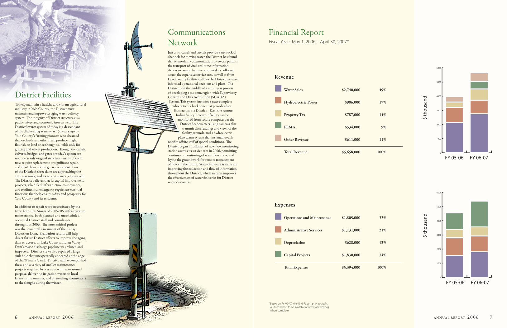
Financial Report Fiscal Year: May 1, 2006 – April 30, 2007*
Revenue
Water Sales $2,740,000 49%
Hydroelectric Power $986,000 17%
Property Tax $787,000 14%
FEMA $534,000 9%
Other Revenue $611,000 11%
Total Revenue $5,658,000 100%
Expenses
Operations and Maintenance $1,805,000 33%
Administrative Services $1,131,000 21%
Depreciation $628,000 12%
Capital Projects $1,830,000 34%
Total Expenses $5,394,000 100%
* Based on FY ’06-’07 Year End Report prior to audit. Audited report to be available at www.ycfcwcd.org when complete.
A N NUA L R E P O RT 2 0 0 6 7
District FacilitiesTo help maintain a healthy and vibrant agricultural industry in Yolo County, the District must maintain and improve its aging water delivery system. The integrity of District structures is a public safety and economic issue as well. The District’s water system of today is a descendant of the ditches dug as many as 150 years ago by Yolo County’s farming pioneers who dreamed that orchards and other fresh produce might flourish on land once thought suitable only for grazing and wheat production. Though the canals, culverts, bridges, and gates of today’s system are not necessarily original structures, many of them now require replacement or significant repair, and all of them need regular assessment. Two of the District’s three dams are approaching the 100-year mark, and its newest is over 30 years old. The District believes that its capital improvement projects, scheduled infrastructure maintenance, and readiness for emergency repairs are essential functions that help ensure safety and prosperity for Yolo County and its residents.
In addition to repair work necessitated by the New Year’s Eve Storm of 2005-‘06, infrastructure maintenance, both planned and unscheduled, occupied District staff and consultants throughout 2006. The most critical project was the structural assessment of the Capay Diversion Dam. Evaluation results will help direct future District efforts to improve the aging dam structure. In Lake County, Indian Valley Dam’s major discharge pipeline was relined and inspected. District crews also repaired a large sink hole that unexpectedly appeared at the edge of the Winters Canal. District staff accomplished these and a variety of smaller maintenance projects required by a system with year-around purpose, delivering irrigation waters to local farms in the summer, and channeling stormwaters to the sloughs during the winter.
Communications NetworkJust as its canals and laterals provide a network of channels for moving water, the District has found that its modern communications network permits the transport of vital, real-time information. Access to comprehensive, current data collected across the expansive service area, as well as from Lake County facilities, allows the District to make informed operational decisions and plans. The District is in the middle of a multi-year process of developing a modern, region-wide Supervisory Control and Data Acquisition (SCADA) System. This system includes a near-complete
radio network backbone that provides data links across the District. Even the remote
Indian Valley Reservoir facility can be monitored from secure computers at the
District headquarters using cameras that transmit data readings and views of the facility grounds, and a hydroelectric
plant alarm system that instantaneously notifies offsite staff of special conditions. The District began installation of new flow monitoring stations across its service area in 2006, permitting continuous monitoring of water flows now, and laying the groundwork for remote management of flows in the future. State-of-the-art systems are improving the collection and flow of information throughout the District, which in turn, improves the effectiveness of water deliveries for District water customers.
8 A N NUA L R E P O RT 2 0 0 6
Looking Forward…
The District has the essential responsibility of managing Cache Creek
water upon which so many farmers and residents in Yolo and Lake
Counties depend. This water is a vital resource for the health of our natural
environment as well. We are proud of the District’s work this past year that
included delivering water to our farms, managing environmental resources,
and responding to a major storm event.
We enter into 2007 with long-term projects well underway. We anticipate
continuing with the modernization of District facilities, particularly the
Capay Diversion Dam. The ongoing development of the communications
network will allow us to progress toward real-time resource monitoring
and management across the District’s service area. In the coming year,
the District will assume a leadership role in a pilot flood management
partnership with the City of Woodland and Yolo County, and will continue
to work closely on regional water management teams. We will continue
to advance strategies and technologies that will allow us to manage our
precious water resources most efficiently and responsibly, and we will
continue to work toward enhancing our regional environment.
We appreciate the opportunity to serve Yolo County and the region.
Sincerely,
Bruce J. Rominger 2006 District Board Chair
David Scheuring 2007 District Board Chair
C r e d i t s :
W r i t e r / e d i t o r : m a r g a r e t K r a l o v e c
G r a p h i c D e s i g n / P r i n t i n g : t h e P r i n t e r w w w . t h e - p r i n t e r . n e t
District Meetings the Yolo county Flood control & Water conservation District’s Board of Directors are all volunteers appointed by the Yolo county Board of Supervisors. the Board meets at 7:00 Pm on the first tuesday of each month at the District office, 34274 State highway16, Woodland, ca. the public is always welcome and encouraged to share its views and concerns. Board meeting agendas and minutes are available at www.ycfcwcd.org
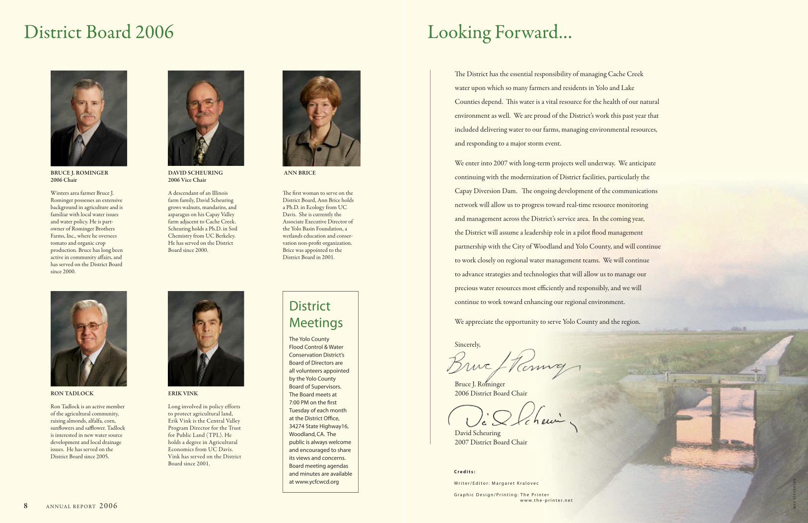
BRUCE J. ROMINGER 2006 Chair
Winters area farmer Bruce J. Rominger possesses an extensive background in agriculture and is familiar with local water issues and water policy. He is part-owner of Rominger Brothers Farms, Inc., where he oversees tomato and organic crop production. Bruce has long been active in community affairs, and has served on the District Board since 2000.
DAVID SCHEURING 2006 Vice Chair
A descendant of an Illinois farm family, David Scheuring grows walnuts, mandarins, and asparagus on his Capay Valley farm adjacent to Cache Creek. Scheuring holds a Ph.D. in Soil Chemistry from UC Berkeley. He has served on the District Board since 2000.
RON TADLOCK
Ron Tadlock is an active member of the agricultural community, raising almonds, alfalfa, corn, sunflowers and safflower. Tadlock is interested in new water source development and local drainage issues. He has served on the District Board since 2005.
ANN BRICE
The first woman to serve on the District Board, Ann Brice holds a Ph.D. in Ecology from UC Davis. She is currently the Associate Executive Director of the Yolo Basin Foundation, a wetlands education and conser-vation non-profit organization. Brice was appointed to the District Board in 2001.
ERIK VINK
Long involved in policy efforts to protect agricultural land, Erik Vink is the Central Valley Program Director for the Trust for Public Land (TPL). He holds a degree in Agricultural Economics from UC Davis. Vink has served on the District Board since 2001.
District Board 2006
ma
x S
te
ve
nS
on
Yolo County Flood Control & Water Conservation District34274StateHighway16•Woodland,CA95695-9371Phone:(530)662-0265•Fax:(530)662-4982Website:www.ycfcwcd.org•Email:[email protected]
TIM
O’H
AL
LO
RA
N
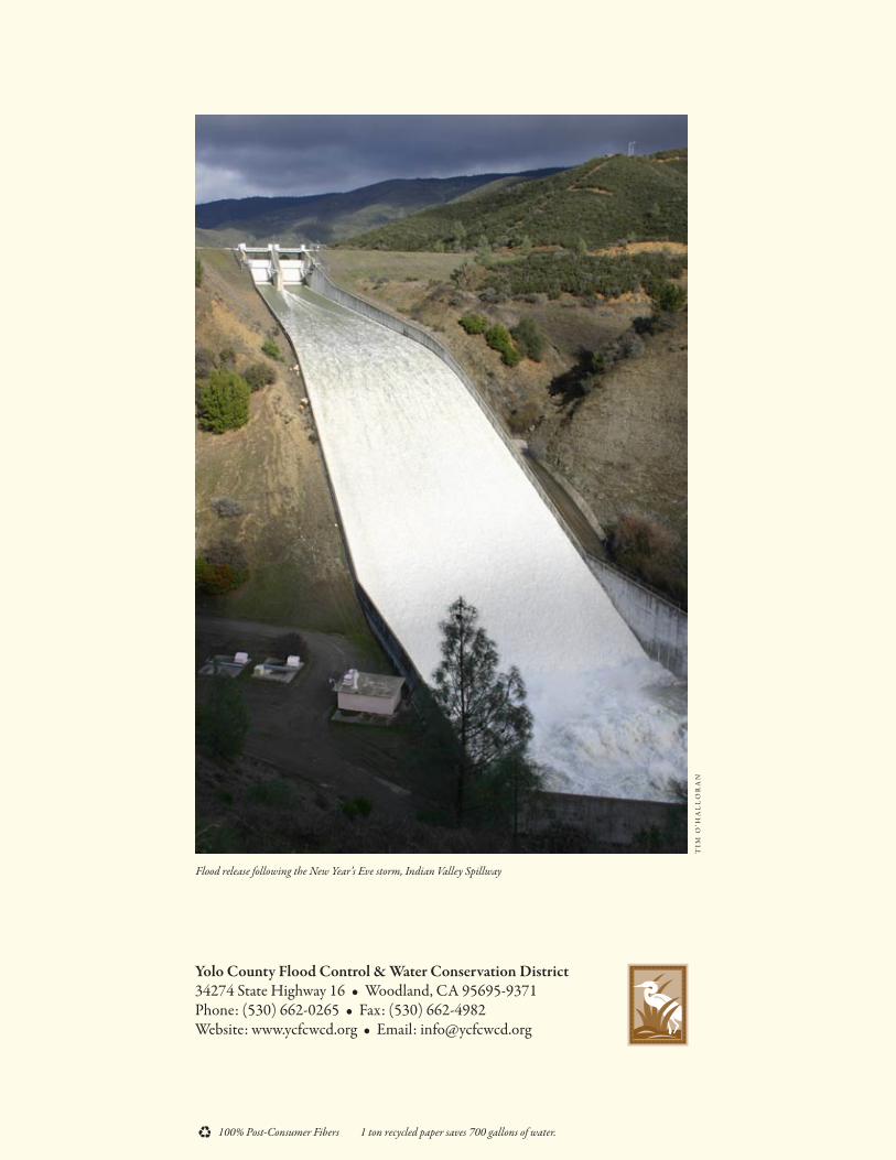
Flood release following the New Year’s Eve storm, Indian Valley Spillway
100% Post-Consumer Fibers 1 ton recycled paper saves 700 gallons of water.