xiang ding presented by aixia dou institute of earthquake science china earthquake administration...
TRANSCRIPT
Xiang DINGXiang DING
Presented by Aixia DOUPresented by Aixia DOU
Institute of Earthquake ScienceInstitute of Earthquake Science
China Earthquake AdministrationChina Earthquake Administration
Friday, July 29,2011Friday, July 29,2011
IGARSS 2011, July 25-29, IGARSS 2011, July 25-29, Vancouver, Vancouver, Canada Canada
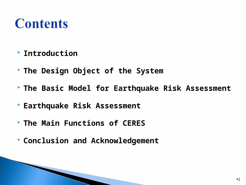
Introduction
The Design Object of the System
The Basic Model for Earthquake Risk Assessment
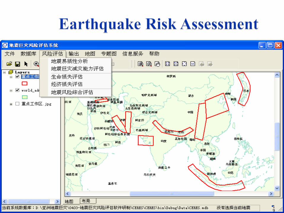
Earthquake Risk Assessment
The Main Functions of CERES
Conclusion and Acknowledgement
2
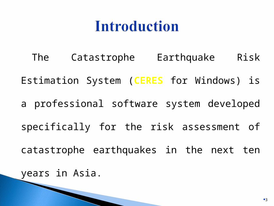
The Catastrophe Earthquake Risk Estimation
System (CERES for Windows) is a professional
software system developed specifically for the
risk assessment of catastrophe earthquakes in
the next ten years in Asia.
3
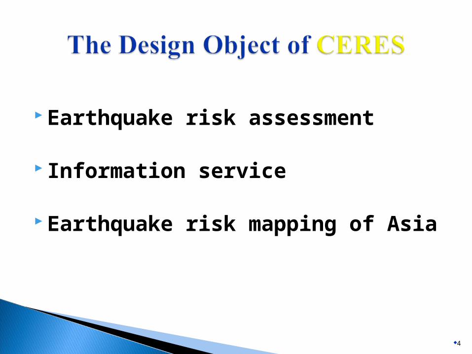
Earthquake risk assessment
Information service
Earthquake risk mapping of Asia
4
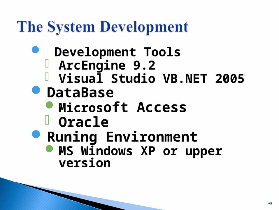
Development Tools ArcEngine 9.2 Visual Studio VB.NET 2005
DataBaseMicrosoft Access Oracle
Runing EnvironmentMS Windows XP or upper version
5
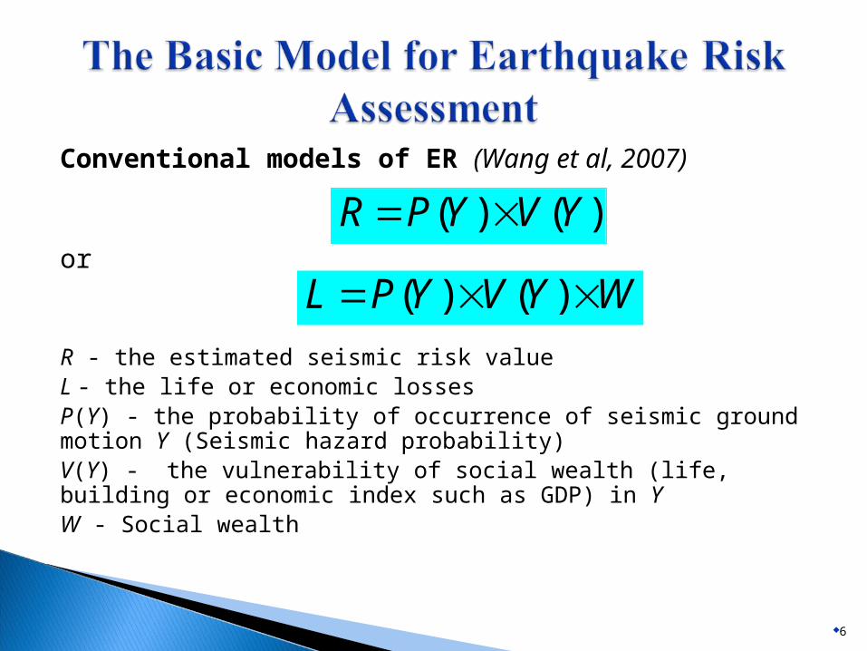
Conventional models of ER (Wang et al, 2007)
or
R - the estimated seismic risk valueL - the life or economic lossesP(Y) - the probability of occurrence of seismic ground motion Y (Seismic hazard probability)V(Y) - the vulnerability of social wealth (life, building or economic index such as GDP) in Y W - Social wealth
6
)()( YVYPR
WYVYPL )()(
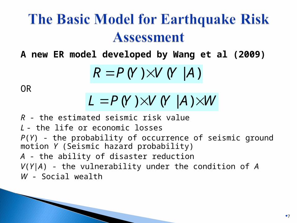
A new ER model developed by Wang et al (2009)
OR
R - the estimated seismic risk valueL - the life or economic lossesP(Y) - the probability of occurrence of seismic ground motion Y (Seismic hazard probability)A - the ability of disaster reductionV(Y|A) - the vulnerability under the condition of A W - Social wealth
7
)|()( AYVYPR
WAYVYPL )|()(
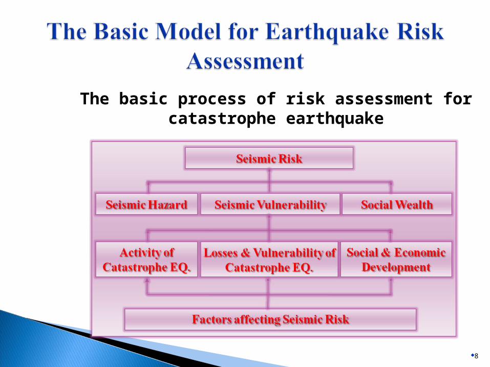
The basic process of risk assessment for catastrophe earthquake
8
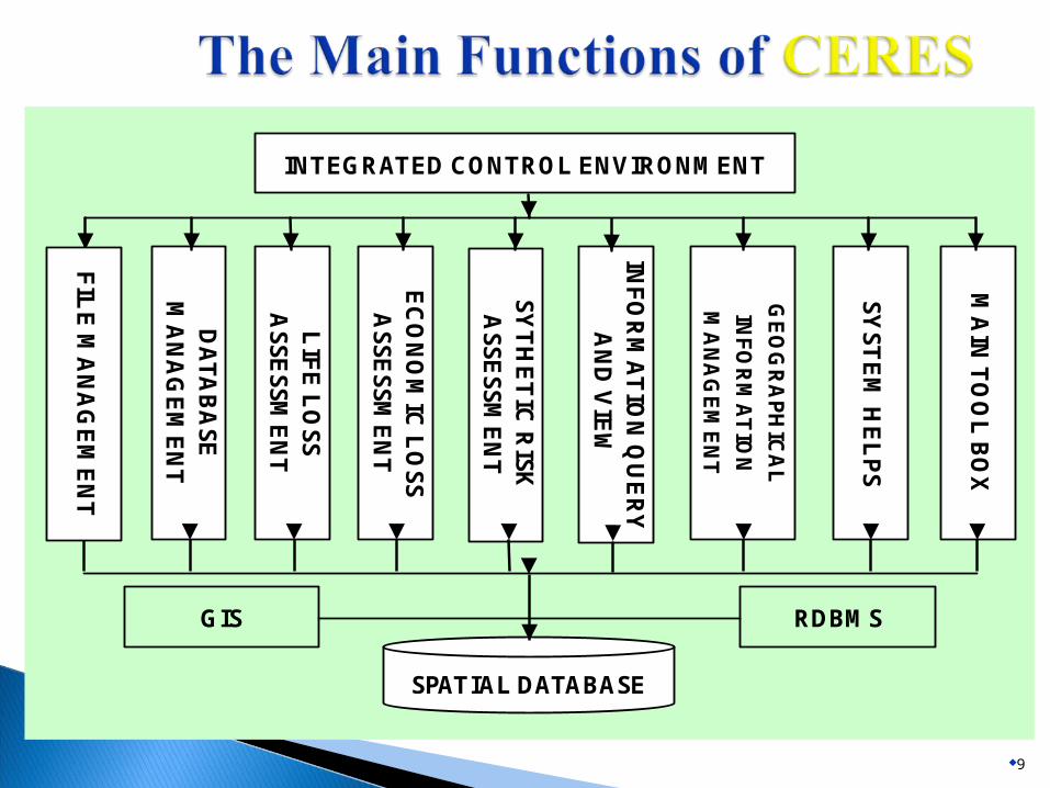
The system function frame chart
9
INTEGRATED CONTROL ENVIRONMENT
DA
TA
BA
SE
M
AN
AG
EM
EN
T
LIF
E L
OS
S
AS
SE
SS
ME
NT
EC
ON
OM
IC L
OS
S
AS
SE
SS
ME
NT
INF
OR
MA
TIO
N Q
UE
RY
A
ND
VIE
W
GE
OG
RA
PH
ICA
L
INF
OR
MA
TIO
N
MA
NA
GE
ME
NT
SY
ST
EM
HE
LP
S
MA
IN T
OO
L B
OX
SY
TH
ET
IC R
ISK
A
SS
ES
SM
EN
T
ES
TIM
AT
E B
EF
OR
E
EA
RT
HQ
UA
KE
SPATIAL DATABASE
GIS RDBMS
FIL
E M
AN
AG
EM
EN
T
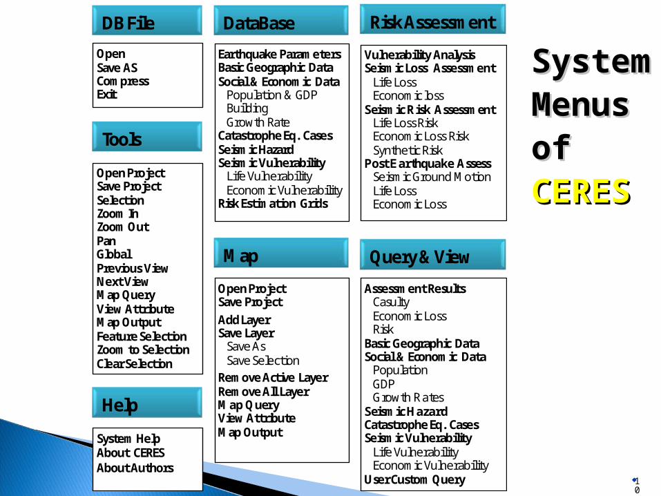
System System Menus Menus of of CERESCERES
10
DB File
OpenSave ASCompressExit
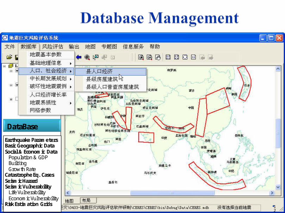
DataBase
Earthquake ParametersBasic Geographic DataSocial & Economic DataPopulation & GDPBuildingGrowth Rate
Catastrophe Eq. CasesSeismic HazardSeismic VulnerabilityLife VulnerabilityEconomic Vulnerability
Risk Estimation Grids
Risk Assessment
Vulnerability AnalysisSeismic Loss AssessmentLife LossEconomic loss
Seismic Risk AssessmentLife Loss RiskEconomic Loss RiskSynthetic Risk
Post Earthquake AssessSeismic Ground MotionLife LossEconomic Loss
Query&View
Assessment ResultsCasultyEconomic LossRisk
Basic Geographic DataSocial & Economic DataPopulationGDPGrowth Rates
Seismic HazardCatastrophe Eq. CasesSeismic VulnerabilityLife VulnerabilityEconomic Vulnerability
User CustomQuery
Map
Help
SystemHelpAbout CERESAbout Authors
Tools
OpenProjectSave ProjectAdd LayerSave LayerSave AsSave Selection
Remove Active LayerRemove All LayerMap QueryViewAttributeMap Output
OpenProjectSave ProjectSelectionZoom InZoomOutPanGlobalPrevious ViewNext ViewMap QueryViewAttributeMap OutputFeature SelectionZoom to SelectionClear Selection
11
12
DB File
OpenSave ASCompressExit
DataBase
Earthquake ParametersBasic Geographic DataSocial & Economic DataPopulation & GDPBuildingGrowth Rate
Catastrophe Eq. CasesSeismic HazardSeismic VulnerabilityLife VulnerabilityEconomic Vulnerability
Risk Estimation Grids
Risk Assessment
Vulnerability AnalysisSeismic Loss AssessmentLife LossEconomic loss
Seismic Risk AssessmentLife Loss RiskEconomic Loss RiskSynthetic Risk
Post Earthquake AssessSeismic Ground MotionLife LossEconomic Loss
Query&View
Assessment ResultsCasultyEconomic LossRisk
Basic Geographic DataSocial & Economic DataPopulationGDPGrowth Rates
Seismic HazardCatastrophe Eq. CasesSeismic VulnerabilityLife VulnerabilityEconomic Vulnerability
User CustomQuery
Map
Help
SystemHelpAbout CERESAbout Authors
Tools
OpenProjectSave ProjectAdd LayerSave LayerSave AsSave Selection
Remove Active LayerRemove All LayerMap QueryViewAttributeMap Output
OpenProjectSave ProjectSelectionZoom InZoomOutPanGlobalPrevious ViewNext ViewMap QueryViewAttributeMap OutputFeature SelectionZoom to SelectionClear Selection

13
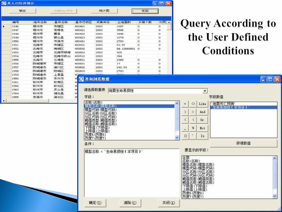
The Input of Earthquake The Input of Earthquake ParametersParameters
Database maintainAdd/Batch AddDelete/Batch DeleteUpdateCancelFindAuxiliary input list
14

15

16

17

18
19

Interface of Control Params for
Risk Assessment
20
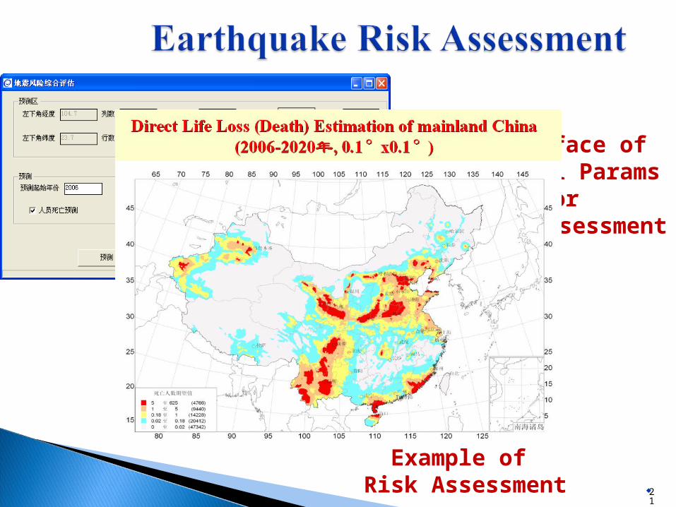
Interface of Control Params for
Risk Assessment
21
Example of Risk Assessment
22
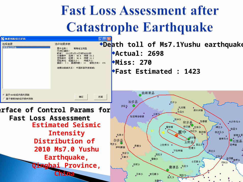
Death toll of Ms7.1Yushu earthquakeActual: 2698Miss: 270Fast Estimated : 1423
Estimated Seismic Intensity Distribution of
2010 Ms7.0 Yushu Earthquake, Qinghai
Province, China
Interface of Control Params for Interface of Control Params for Fast Loss AssessmentFast Loss Assessment
The Catastrophe Earthquake Risk Estimation System (CERES) has been showing the potential ability in practical research of risk assessment in Asia while the results have not been presented here for a limited extent of paper.
The research was supported by Ministry of Science & Technology of China (NO. 2008BAC44B02).
23