wv watershed assessment pilot project - … · wv watershed assessment pilot project expert ......
TRANSCRIPT
WV WATERSHED ASSESSMENT PILOT PROJECT
Expert Workshop #1, Round 2 Bridgeport Conference Center, October 10 & 11, 2012
Gauley River ©Kent Mason
Wetlands Model
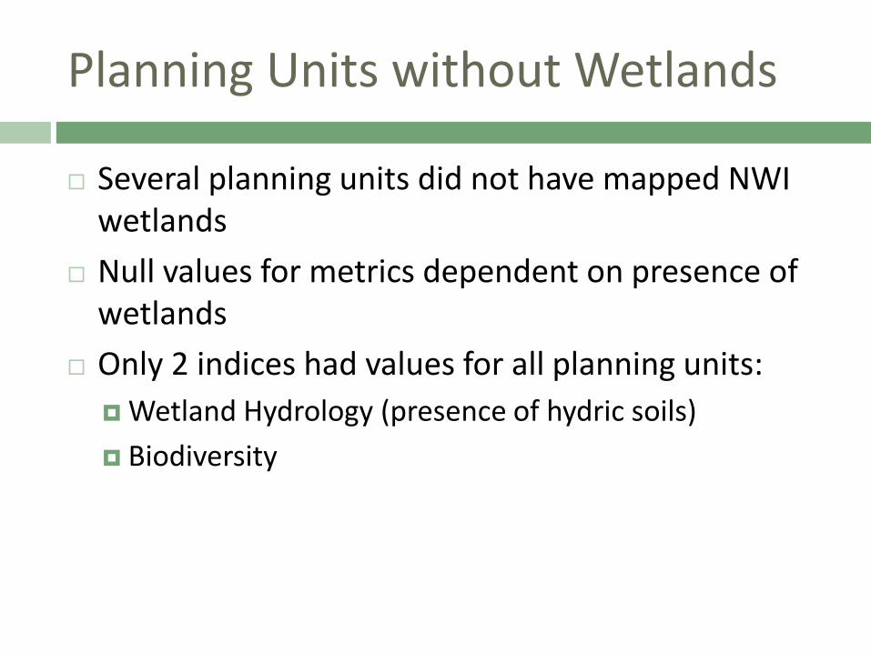
Planning Units without Wetlands
Several planning units did not have mapped NWI wetlands
Null values for metrics dependent on presence of wetlands
Only 2 indices had values for all planning units: Wetland Hydrology (presence of hydric soils) Biodiversity
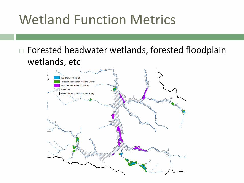
Wetland Function Metrics
Forested headwater wetlands, forested floodplain wetlands, etc
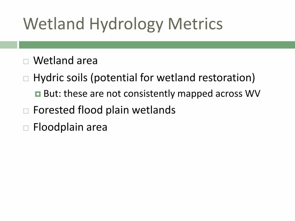
Wetland Hydrology Metrics
Wetland area Hydric soils (potential for wetland restoration)
But: these are not consistently mapped across WV Forested flood plain wetlands Floodplain area
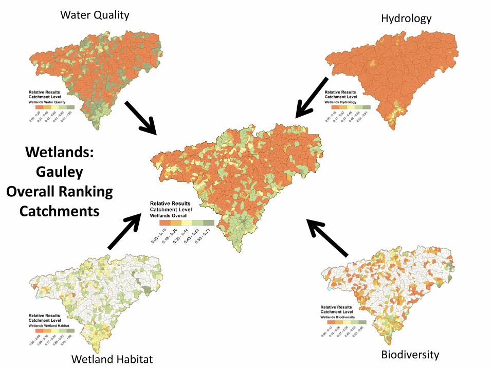
Wetlands: Gauley
Overall Ranking Catchments
Water Quality
Biodiversity
Hydrology
Wetland Habitat
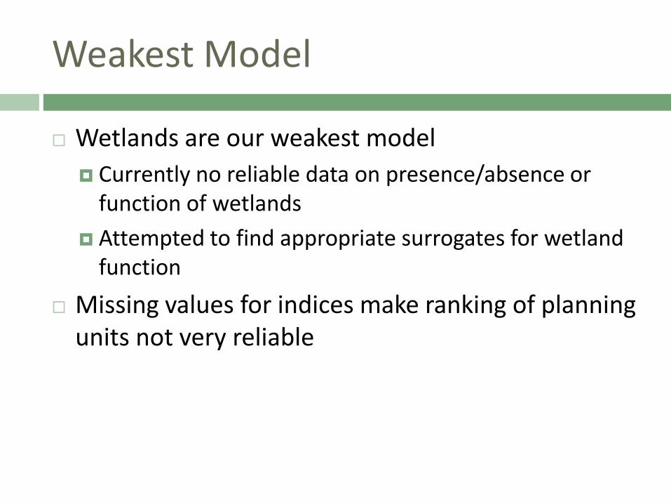
Weakest Model
Wetlands are our weakest model Currently no reliable data on presence/absence or
function of wetlands Attempted to find appropriate surrogates for wetland
function Missing values for indices make ranking of planning
units not very reliable
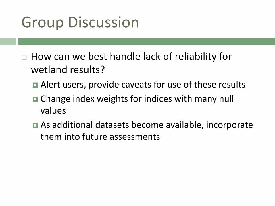
Group Discussion
How can we best handle lack of reliability for wetland results? Alert users, provide caveats for use of these results Change index weights for indices with many null
values As additional datasets become available, incorporate
them into future assessments
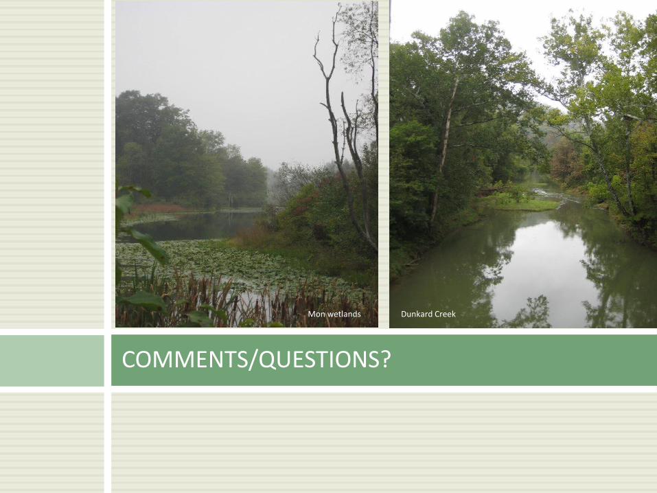
COMMENTS/QUESTIONS?
Dunkard Creek Mon wetlands
Group Discussion After Results Presentations
Are thresholds defined appropriately? Is the Very Good/Good threshold too stringent? Very difficult to
attain Is the Poor/Fair threshold too stringent? Should an alternate definition (i.e., quantiles, other?) be used
where thresholds don’t work? How should metrics with missing thresholds be handled? Keep as presence/absence Assign intermediate very good/good and poor/fair categories
instead of forcing into good and fair only Assign arbitrary/”best guess” thresholds for all thresholds
How should results be presented in interactive web tool? Suggest potential workflow for users
Next Steps
Please let us know any suggestions, especially on: Objective ranking methodology Thresholds Workflow for interactive web tool Wetlands model modifications
Incorporate workshop feedback Second expert workshop will present consolidated
analysis and potential strategies Spring: stakeholder/partner workshop April 2013: final watershed assessments and
interactive webtool completed
Acknowledgments US Environmental Protection Agency WV Department of Environmental Protection Many individuals from several agencies, organizations, watershed associations:
US Geological Survey US Army Corps of Engineers US Office of Surface Mining US Department of Agriculture - NRCS WV Division of Natural Resources WV Geological and Economic Survey Region 3 Intergovernmental Council The Conservation Agency Trout Unlimited West Virginia University Marshall University WV Rivers Coalition WV Land Trust Canaan Valley Institute Potesta & Associates Triad Engineering Morgantown Utility Board Several Watershed Organizations
THANK YOU FOR YOUR HELP!
Elk River at Birch Run, WV ©www.over-land.com Gauley River ©Kent Mason Mon River at Friendship Hill ©photos.igougo.com