wolf rocks trail and spruce flats bog narrative · growing among the maples, yellow birch, and...
TRANSCRIPT

Wolf Rocks Trail
Spruce Flats Bog
W.E. Hamilton D.Y. Sillman Penn State University This work is licensed under a Creative Commons Attribution‐Noncommercial‐No Derivative Works 3.0 license. It may be distributed and shared, with attribution, but not altered or used commercially in any way.
Wolf Rocks Trail and Spruce Flats Bog:
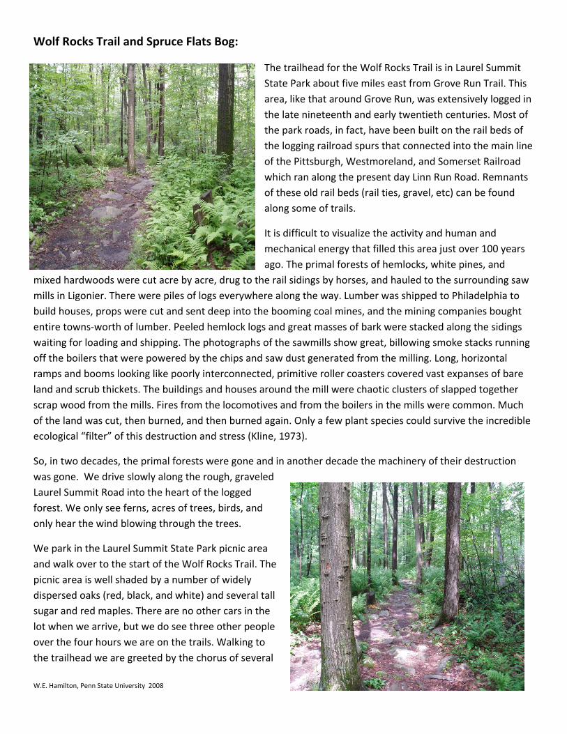
The trailhead for the Wolf Rocks Trail is in Laurel Summit State Park about five miles east from Grove Run Trail. This area, like that around Grove Run, was extensively logged in the late nineteenth and early twentieth centuries. Most of the park roads, in fact, have been built on the rail beds of the logging railroad spurs that connected into the main line of the Pittsburgh, Westmoreland, and Somerset Railroad which ran along the present day Linn Run Road. Remnants of these old rail beds (rail ties, gravel, etc) can be found along some of trails.
It is difficult to visualize the activity and human and mechanical energy that filled this area just over 100 years ago. The primal forests of hemlocks, white pines, and
mixed hardwoods were cut acre by acre, drug to the rail sidings by horses, and hauled to the surrounding saw mills in Ligonier. There were piles of logs everywhere along the way. Lumber was shipped to Philadelphia to build houses, props were cut and sent deep into the booming coal mines, and the mining companies bought entire towns‐worth of lumber. Peeled hemlock logs and great masses of bark were stacked along the sidings waiting for loading and shipping. The photographs of the sawmills show great, billowing smoke stacks running off the boilers that were powered by the chips and saw dust generated from the milling. Long, horizontal ramps and booms looking like poorly interconnected, primitive roller coasters covered vast expanses of bare land and scrub thickets. The buildings and houses around the mill were chaotic clusters of slapped together scrap wood from the mills. Fires from the locomotives and from the boilers in the mills were common. Much of the land was cut, then burned, and then burned again. Only a few plant species could survive the incredible ecological “filter” of this destruction and stress (Kline, 1973).
So, in two decades, the primal forests were gone and in another decade the machinery of their destruction was gone. We drive slowly along the rough, graveled Laurel Summit Road into the heart of the logged forest. We only see ferns, acres of trees, birds, and only hear the wind blowing through the trees.
W.E. Hamilton, Penn State University 2008
We park in the Laurel Summit State Park picnic area and walk over to the start of the Wolf Rocks Trail. The picnic area is well shaded by a number of widely dispersed oaks (red, black, and white) and several tall sugar and red maples. There are no other cars in the lot when we arrive, but we do see three other people over the four hours we are on the trails. Walking to the trailhead we are greeted by the chorus of several
small, furtive birds flying against the bright sky in the upper branches of the trees.
Finally, I focus my binoculars on one of the birds and identify him as a warbling vireo. Along the trail we see and hear a great collection of birds: more vireos, hooded warblers, wood thrushes, northern mockingbirds, scarlet tanagers, towhees, common yellowthroats, myrtle warblers, northern orioles, and pileated woodpeckers along with a more mundane group of chipping sparrows, blue jays, American robins, American crows, northern juncos, and northern cardinals. This trail like Grove Run Trail, is an excellent site for birds!
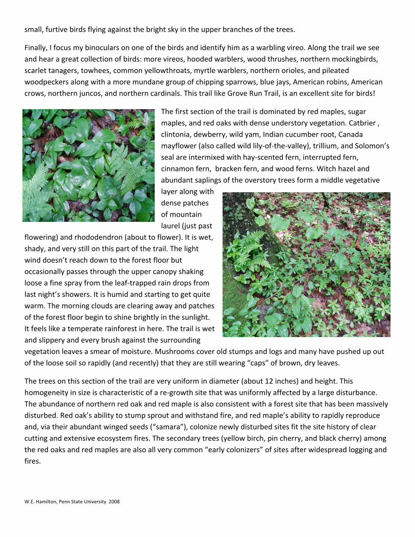
The first section of the trail is dominated by red maples, sugar maples, and red oaks with dense understory vegetation. Catbrier , clintonia, dewberry, wild yam, Indian cucumber root, Canada mayflower (also called wild lily‐of‐the‐valley), trillium, and Solomon’s seal are intermixed with hay‐scented fern, interrupted fern, cinnamon fern, bracken fern, and wood ferns. Witch hazel and abundant saplings of the overstory trees form a middle vegetative layer along with dense patches of mountain laurel (just past
flowering) and rhododendron (about to flower). It is wet, shady, and very still on this part of the trail. The light wind doesn’t reach down to the forest floor but occasionally passes through the upper canopy shaking loose a fine spray from the leaf‐trapped rain drops from last night’s showers. It is humid and starting to get quite warm. The morning clouds are clearing away and patches of the forest floor begin to shine brightly in the sunlight. It feels like a temperate rainforest in here. The trail is wet and slippery and every brush against the surrounding vegetation leaves a smear of moisture. Mushrooms cover old stumps and logs and many have pushed up out of the loose soil so rapidly (and recently) that they are still wearing “caps” of brown, dry leaves.
The trees on this section of the trail are very uniform in diameter (about 12 inches) and height. This homogeneity in size is characteristic of a re‐growth site that was uniformly affected by a large disturbance. The abundance of northern red oak and red maple is also consistent with a forest site that has been massively disturbed. Red oak’s ability to stump sprout and withstand fire, and red maple’s ability to rapidly reproduce and, via their abundant winged seeds (“samara”), colonize newly disturbed sites fit the site history of clear cutting and extensive ecosystem fires. The secondary trees (yellow birch, pin cherry, and black cherry) among the red oaks and red maples are also all very common “early colonizers” of sites after widespread logging and fires.
W.E. Hamilton, Penn State University 2008
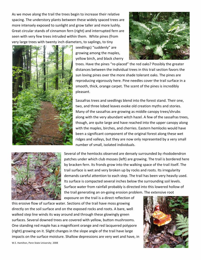
As we move along the trail the trees begin to increase their relative spacing. The understory plants between these widely spaced trees are more intensely exposed to sunlight and grow taller and more lushly. Great circular stands of cinnamon fern (right) and interrupted fern are seen with very few trees intruded within them. White pines (from very large trees with twenty inch diameters, to saplings, to tiny
seedlings) “suddenly” are growing among the maples, yellow birch, and black cherry trees. Have the pines “re‐placed” the red oaks? Possibly the greater distances between the individual trees in this trail section favors the sun loving pines over the more shade tolerant oaks. The pines are reproducing vigorously here. Pine needles cover the trail surface in a smooth, thick, orange carpet. The scent of the pines is incredibly pleasant.
Sassafras trees and seedlings blend into the forest stand. Their one, two, and three lobed leaves evoke old creation myths and stories. Many of the sassafras are growing as middle canopy trees/shrubs along with the very abundant witch hazel. A few of the sassafras trees, though, are quite large and have reached into the upper canopy along with the maples, birches, and cherries. Eastern hemlocks would have been a significant component of the original forest along these wet ridges and valleys, but they are now only represented by a very small number of small, isolated individuals.
W.E. Hamilton, Penn State University 2008
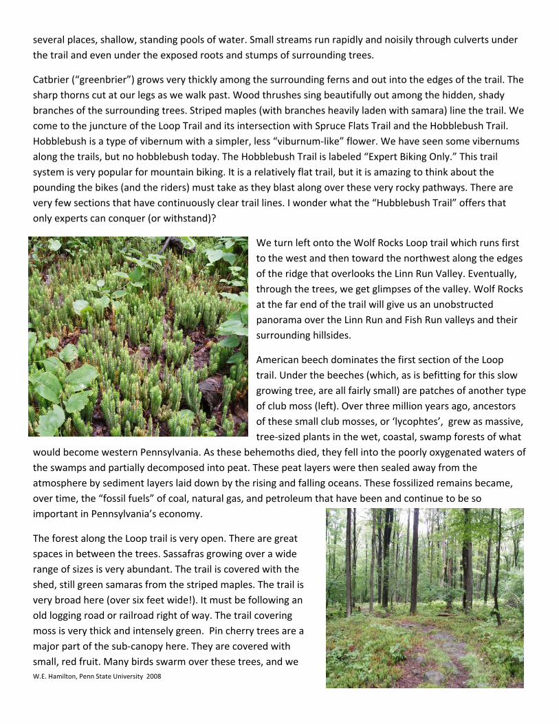
ere Several of the hemlocks observed are densely surrounded by rhododendron patches under which club mosses (left) are growing. The trail is bordered hby bracken fern. Its fronds grow into the walking space of the trail itself. The trail surface is wet and very broken up by rocks and roots. Its irregularity demands careful attention to each step. The trail has been very heavily used. Its surface is compacted several inches below the surrounding soil levels. Surface water from rainfall probably is directed into this lowered hollow of the trail generating an on‐going erosion problem. The extensive root exposure on the trail is a direct reflection of
this erosive flow of surface water. Sections of the trail have moss growing directly on the soil surface and on the exposed rocks and roots. A bare, well walked step line winds its way around and through these glowingly green surfaces. Several downed trees are covered with yellow, button mushrooms. One standing red maple has a magnificent orange and red lacquered polypore (right) growing on it. Slight changes in the slope angle of the trail have large impacts on the surface moisture. Shallow depressions are very wet and have, in
several places, shallow, standing pools of water. Small streams run rapidly and noisily through culverts under the trail and even under the exposed roots and stumps of surrounding trees.
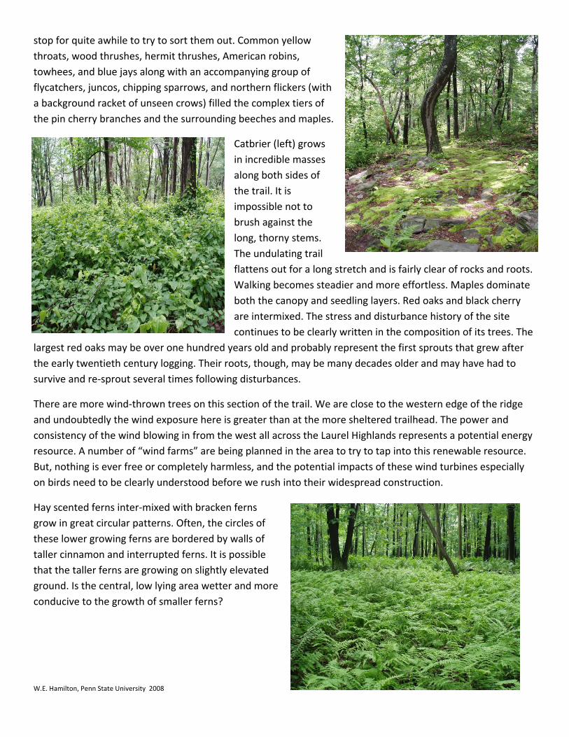
Catbrier (“greenbrier”) grows very thickly among the surrounding ferns and out into the edges of the trail. The sharp thorns cut at our legs as we walk past. Wood thrushes sing beautifully out among the hidden, shady branches of the surrounding trees. Striped maples (with branches heavily laden with samara) line the trail. We come to the juncture of the Loop Trail and its intersection with Spruce Flats Trail and the Hobblebush Trail. Hobblebush is a type of vibernum with a simpler, less “viburnum‐like” flower. We have seen some vibernums along the trails, but no hobblebush today. The Hobblebush Trail is labeled “Expert Biking Only.” This trail system is very popular for mountain biking. It is a relatively flat trail, but it is amazing to think about the pounding the bikes (and the riders) must take as they blast along over these very rocky pathways. There are very few sections that have continuously clear trail lines. I wonder what the “Hubblebush Trail” offers that
W.E. Hamilton, Penn State University 2008
only experts can conquer (or withstand)?
tors
at
ers of
, that have been and continue to be so
The forest along the Loop trail is very open. There are great
a
We turn left onto the Wolf Rocks Loop trail which runs first to the west and then toward the northwest along the edges of the ridge that overlooks the Linn Run Valley. Eventually, through the trees, we get glimpses of the valley. Wolf Rocks at the far end of the trail will give us an unobstructed panorama over the Linn Run and Fish Run valleys and their surrounding hillsides.
American beech dominates the first section of the Loop trail. Under the beeches (which, as is befitting for this slow growing tree, are all fairly small) are patches of another typeof club moss (left). Over three million years ago, ancesof these small club mosses, or ‘lycophtes’, grew as massive,tree‐sized plants in the wet, coastal, swamp forests of wh
would become western Pennsylvania. As these behemoths died, they fell into the poorly oxygenated watthe swamps and partially decomposed into peat. These peat layers were then sealed away from the atmosphere by sediment layers laid down by the rising and falling oceans. These fossilized remains becameover time, the “fossil fuels” of coal, natural gas, and petroleumimportant in Pennsylvania’s economy.
spaces in between the trees. Sassafras growing over a wide range of sizes is very abundant. The trail is covered with the shed, still green samaras from the striped maples. The trail isvery broad here (over six feet wide!). It must be following an old logging road or railroad right of way. The trail covering moss is very thick and intensely green. Pin cherry trees aremajor part of the sub‐canopy here. They are covered with small, red fruit. Many birds swarm over these trees, and we
W.E. Hamilton, Penn State University 2008
(with tiers of
along both sides of
tems. l
inate
The
There are more wind‐thrown trees on this section of the trail. We are close to the western edge of the ridge
y
grow in great circular patterns. Often, the circles of f
e
stop for quite awhile to try to sort them out. Common yellow throats, wood thrushes, hermit thrushes, American robins, towhees, and blue jays along with an accompanying group of flycatchers, juncos, chipping sparrows, and northern flickersa background racket of unseen crows) filled the complexthe pin cherry branches and the surrounding beeches and maples.
Catbrier (left) grows in incredible masses
the trail. It is impossible not to brush against the long, thorny sThe undulating traiflattens out for a long stretch and is fairly clear of rocks and roots. Walking becomes steadier and more effortless. Maples domboth the canopy and seedling layers. Red oaks and black cherry are intermixed. The stress and disturbance history of the site continues to be clearly written in the composition of its trees.
largest red oaks may be over one hundred years old and probably represent the first sprouts that grew after the early twentieth century logging. Their roots, though, may be many decades older and may have had to survive and re‐sprout several times following disturbances.
and undoubtedly the wind exposure here is greater than at the more sheltered trailhead. The power and consistency of the wind blowing in from the west all across the Laurel Highlands represents a potential energresource. A number of “wind farms” are being planned in the area to try to tap into this renewable resource. But, nothing is ever free or completely harmless, and the potential impacts of these wind turbines especially on birds need to be clearly understood before we rush into their widespread construction.
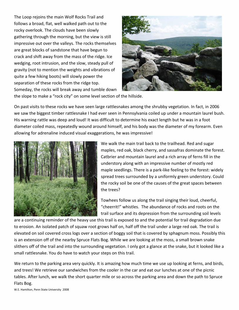
Hay scented ferns inter‐mixed with bracken ferns
these lower growing ferns are bordered by walls otaller cinnamon and interrupted ferns. It is possible that the taller ferns are growing on slightly elevated ground. Is the central, low lying area wetter and morconducive to the growth of smaller ferns?
W.E. Hamilton, Penn State University 2008
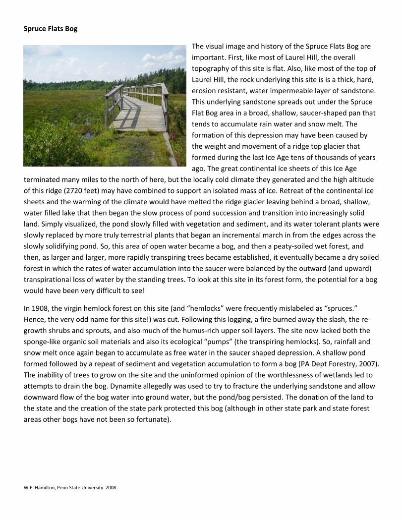
he Loop rejoins the main Wolf Rocks Trail and follows a broad, flat, well walked path out to the
ll mselves
of
down section of the hillside.
to these rocks we have seen large rattlesnakes among the shrubby vegetation. In fact, in 2006 we saw the biggest timber rattlesnake I had ever seen in Pennsylvania coiled up under a mountain laurel bush.
black cherry, and sassafras dominate the forest. Catbrier and mountain laurel and a rich array of ferns fill in the
en
whistles. The abundance of rocks and roots on the trail surface and its depression from the surrounding soil levels
are a continuing reminder of the heavy use th il is
ed like a
rns, and birds, and trees! We retrieve our sandwiches from the cooler in the car and eat our lunches at one of the picnic
T
rocky overlook. The clouds have been slowly gathering through the morning, but the view is stiimpressive out over the valleys. The rocks theare great blocks of sandstone that have begun to crack and shift away from the mass of the ridge. Ice wedging, root intrusion, and the slow, steady pull gravity (not to mention the weights and vibrations ofquite a few hiking boots) will slowly power the separation of these rocks from the ridge top. Someday, the rocks will break away and tumblethe slope to make a “rock city” on some level
On past visits
His warning rattle was deep and loud! It was difficult to determine his exact length but he was in a foot diameter coiled mass, repeatedly wound around himself, and his body was the diameter of my forearm. Even allowing for adrenaline induced visual exaggerations, he was impressive!
We walk the main trail back to the trailhead. Red and sugar maples, red oak,
understory along with an impressive number of mostly red maple seedlings. There is a park‐like feeling to the forest: widely spread trees surrounded by a uniformly green understory. Couldthe rocky soil be one of the causes of the great spaces betwethe trees?
Towhees follow us along the trail singing their loud, cheerful, “cheerrit!”
is trail is exposed to and the potential for trail degradation dueto erosion. An isolated patch of squaw root grows half on, half off the trail under a large red oak. The traelevated on soil covered cross logs over a section of boggy soil that is covered by sphagnum moss. Possibly thisis an extension off of the nearby Spruce Flats Bog. While we are looking at the moss, a small brown snake slithers off of the trail and into the surrounding vegetation. I only got a glance at the snake, but it looksmall rattlesnake. You do have to watch your steps on this trail.
We return to the parking area very quickly. It is amazing how much time we use up looking at fe
tables. After lunch, we walk the short quarter mile or so across the parking area and down the path to Spruce Flats Bog.
Spruce Flats Bog
W.E. Hamilton, Penn State University 2008
The visual image and history of the Spruce Flats Bog are ke most of Laurel Hill, the overall
topography of this site is flat. Also, like most of the top of
tone.
ears
ice w,
were
d )
bog
8, the virgin hemlock forest on this site (and “hemlocks” were frequently mislabeled as “spruces.” Hence, the very odd name for this site!) was cut. Following this logging, a fire burned away the slash, the re‐
). o
important. First, li
Laurel Hill, the rock underlying this site is is a thick, hard, erosion resistant, water impermeable layer of sandsThis underlying sandstone spreads out under the Spruce Flat Bog area in a broad, shallow, saucer‐shaped pan that tends to accumulate rain water and snow melt. The formation of this depression may have been caused by the weight and movement of a ridge top glacier that formed during the last Ice Age tens of thousands of yago. The great continental ice sheets of this Ice Age
terminated many miles to the north of here, but the locally cold climate they generated and the high altitude of this ridge (2720 feet) may have combined to support an isolated mass of ice. Retreat of the continentalsheets and the warming of the climate would have melted the ridge glacier leaving behind a broad, shallowater filled lake that then began the slow process of pond succession and transition into increasingly solid land. Simply visualized, the pond slowly filled with vegetation and sediment, and its water tolerant plantsslowly replaced by more truly terrestrial plants that began an incremental march in from the edges across the slowly solidifying pond. So, this area of open water became a bog, and then a peaty‐soiled wet forest, and then, as larger and larger, more rapidly transpiring trees became established, it eventually became a dry soileforest in which the rates of water accumulation into the saucer were balanced by the outward (and upwardtranspirational loss of water by the standing trees. To look at this site in its forest form, the potential for awould have been very difficult to see!
In 190
growth shrubs and sprouts, and also much of the humus‐rich upper soil layers. The site now lacked both thesponge‐like organic soil materials and also its ecological “pumps” (the transpiring hemlocks). So, rainfall and snow melt once again began to accumulate as free water in the saucer shaped depression. A shallow pond formed followed by a repeat of sediment and vegetation accumulation to form a bog (PA Dept Forestry, 2007The inability of trees to grow on the site and the uninformed opinion of the worthlessness of wetlands led tattempts to drain the bog. Dynamite allegedly was used to try to fracture the underlying sandstone and allow downward flow of the bog water into ground water, but the pond/bog persisted. The donation of the land to the state and the creation of the state park protected this bog (although in other state park and state forest areas other bogs have not been so fortunate).
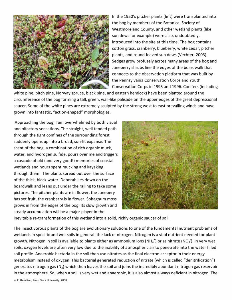
In the 1950’s pitcher plants (left) were transplanted into the bog by members of the Botanical Society of Westmoreland County, and other wetland plants (like sun dews for example) were also, undoubtedly, introduced into the site at this time. The bog contains cotton grass, cranberry, blueberry, white cedar, pitcher plants, and round‐leaved sun dews (Vechter, 2003). Sedges grow profusely across many areas of the bog and Juneberry shrubs line the edges of the boardwalk that connects to the observation platform that was built by the Pennsylvania Conservation Corps and Youth Conservation Corps in 1995 and 1996. Conifers (including
white pine, pitch pine, Norway spruce, black pine, and eastern hemlock) have been planted around the circumference of the bog forming a tall, green, wall‐like palisade on the upper edges of the great depressional saucer. Some of the white pines are extremely sculpted by the strong west to east prevailing winds and have grown into fantastic, “action‐shaped” morphologies.
Approaching the bog, I am overwhelmed by both visual and olfactory sensations. The straight, well tended path through the tight confines of the surrounding forest suddenly opens up into a broad, sun‐lit expanse. The scent of the bog, a combination of rich organic muck, water, and hydrogen sulfide, pours over me and triggers a cascade of old (and very good!) memories of coastal wetlands and hours spent mucking and kayaking through them. The plants spread out over the surface of the thick, black water. Deborah lies down on the boardwalk and leans out under the railing to take some pictures. The pitcher plants are in flower, the Junebery has set fruit, the cranberry is in flower. Sphagnum moss grows in from the edges of the bog. Its slow growth and steady accumulation will be a major player in the inevitable re‐transformation of this wetland into a solid, richly organic saucer of soil.
The insectivorous plants of the bog are evolutionary solutions to one of the fundamental nutrient problems of wetlands in specific and wet soils in general: the lack of nitrogen. Nitrogen is a vital nutrient needed for plant growth. Nitrogen in soil is available to plants either as ammonium ions (NH4
+) or as nitrate (NO3‐). In very wet
soils, oxygen levels are often very low due to the inability of atmospheric air to penetrate into the water filled soil profile. Anaerobic bacteria in the soil then use nitrates as the final electron acceptor in their energy metabolism instead of oxygen. This bacterial generated reduction of nitrate (which is called “denitrification”) generates nitrogen gas (N2) which then leaves the soil and joins the incredibly abundant nitrogen gas reservoir in the atmosphere. So, when a soil is very wet and anaerobic, it is also almost always deficient in nitrogen. The
W.E. Hamilton, Penn State University 2008
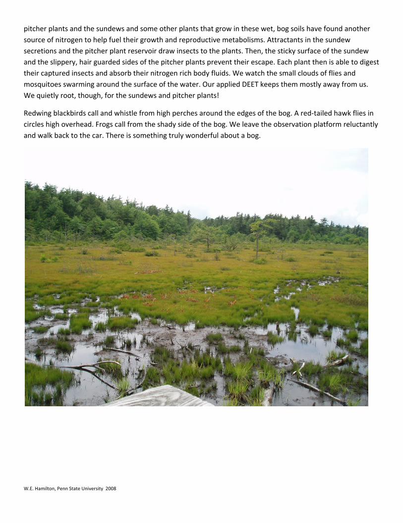
pitcher plants and the sundews and some other plants that grow in these wet, bog soils have found another source of nitrogen to help fuel their growth and reproductive metabolisms. Attractants in the sundew secretions and the pitcher plant reservoir draw insects to the plants. Then, the sticky surface of the sundew and the slippery, hair guarded sides of the pitcher plants prevent their escape. Each plant then is able to digest their captured insects and absorb their nitrogen rich body fluids. We watch the small clouds of flies and mosquitoes swarming around the surface of the water. Our applied DEET keeps them mostly away from us. We quietly root, though, for the sundews and pitcher plants!
Redwing blackbirds call and whistle from high perches around the edges of the bog. A red‐tailed hawk flies in circles high overhead. Frogs call from the shady side of the bog. We leave the observation platform reluctantly and walk back to the car. There is something truly wonderful about a bog.
W.E. Hamilton, Penn State University 2008