whitney oaks trail guide - whitney oaks community association
TRANSCRIPT
Whitney Oaks Whitney Oaks Whitney Oaks Whitney Oaks TrailsTrailsTrailsTrails
Whitney Oaks Community AssociationBoard of Directors
Garth Tanner PresidentChris Eatough Vice PresidentKen McKee TreasurerStan Laderman SecretaryStephen Buccellato Director
Credits
Ken and Bea Morrow, along with Earl Brabb, created this guide because of their interestin protecting and improving the trails for the enjoyment of all residents of Whitney Oaks.
Earl Brabb's geological descriptions provide a peek at the forces of nature that createdthe beautiful area that we all call home.
Acknowledgments
The Rocklin Historical Society originally coined the alliteration “Rock, Rails andRanches” as the theme of the Rocklin History Museum. The help provided by theRocklin History Museum staff is gratefully acknowledged. www.rocklinhistory.org
Articles written by Gary Day for the Rocklin History Museum expand greatly upon thehistory provided herein. He and his wife Jean have spent years researching, gatheringand cataloguing information and writing articles about Rocklin and the Whitney family'shistory. http://www.rocklintoday.com/news/templates/history_news.asp?articleid=2851&zoneid=31
May 28, 2008

Recent History
The Whitney Oaks Community Association (WOCA), aside from being one of the largestresidential neighborhoods in Rocklin, California, is set within a remarkably beautifulnatural setting with a very rich historical connection. That history encompasses the 3R's, Rocklin's Rocks, Rocklin's Railroad and Rocklin's Ranch.
Rocklin's Rocks : Granite was quarried in Rocklin beginning in the late 1850s and bythe mid-1870s, beautiful polished granite could be produced. By 1890, when 30quarries were operating, 2,000 rail car loads were being shipped each year. As manyas 60 quarries existed at one time or another, but by 1928 only 7 remained in operation.Rocklin granite was used for the Bank of Italy and the docks at Fort Mason in SanFrancisco, the Bell Tower at U.C. Berkeley, the Court House in Reno, the SacramentoCounty Jail, Fort Lewis in Washington, the Naval Station at Pearl Harbor and theGolden Gate Bridge among many others.
Rocklin's Railroad : Rocklin was an important railroad town as the railroad terminuswas pushed ever further eastward. When the railroad became transcontinental in 1869,Rocklin served as a "roundhouse" (a semi-circular structure completed in 1868) and asa fuel depot. The roundhouse served a dual purpose, the maintenance of engines andcars, and the place where extra engines were added to eastbound trains (or subtractedfrom westbound trains) for the climb over the Sierras. Rocklin's limited space forexpansion caused the roundhouse to be moved to Roseville in 1908. As a result of thismove, many railway workers moved to Roseville and literally pulled their houses behindthem, causing a severe decline of Rocklin. In the early days, railroads were given 20square miles of land (10 alternate sections on each side) for each mile of track laid toencourage them to extend rail lines into undeveloped areas. The early locomotives hada voracious appetite for wood as fuel. It took 48 cords of wood to power the 3locomotives (16 cords for each) pulling a train over the Sierra Nevada range (an 82 milerun). A cord is a stack of wood measuring 4x4x8 feet and is the amount that could betransported on a horse or ox-drawn wagon. Many ranchers used their teams andwagons for hauling wood for fuel and for railroad ties where oak was preferred.Although it is known that forests in the vicinity of a rail line were often denuded, it isunclear whether the oak trees in Whitney Oaks were harvested. Although many of ouroak trees are quite young, some very majestic trees remain. The fact that the Whitneyfamily began to acquire land in the 1850's and the many streams to be crossed mayhave prevented extensive logging in Whitney Oaks.
Rocklin's Ranch: Joel Parker Whitney arrived in California in 1852 when he was 17years old. The sailing ship on which he traveled took 142 days to get from Boston toSan Francisco by way of Cape Horn in South America. Four of his five brothers hadpreceded him to California. He was anxious to try his hand at gold mining even thoughhis brothers tried to stop him. He apparently hiked from Sacramento to Auburn and, ashe passed through our foothill area, he fell in love with the land. He spent a few months"gold digging" in El Dorado County but quickly gave up the idea of being a miner andreturned to San Francisco. He and his brothers realized that buying and sellingequipment to gold crazed miners was much more profitable than digging for the stuff.

He worked as a game hunter for about a year and saved enough money to start amerchandising business. He periodically raced across the U.S. (8 times), either bystagecoach or by way of ships and the Isthmus of Panama, first obtaining goods inBoston, placing them on ships that went around Cape Horn, meeting them in SanFrancisco and arranging for the sale of the cargo. The risks were enormous, but by theage of 30 (1865) he was extremely wealthy. He sold his Boston businesses and went toDenver to check on his silver mining companies. Money was coming in at such a rate,he couldn’t bring himself to retire as he had planned.
He became a world traveler, met his wife in England (Lucy Ann Chadwick Whitney) andfinally returned to California to buy the land with which he had previously fallen in love.Joel's father and his brothers began acquiring land in the mid 1850s. Joel took activecontrol after his father retired in the early 1870s. He continued to acquire land from thegovernment, the railroads and from the 33 farmers who had homesteaded portions ofland he wanted. He went to each of them and asked them to name their price. A fewasked too much and were made to wait until they were serious about selling, eventhough he could have paid a hundred times more than they asked. Placer Countyrecords show that the Whitney family made at least 140 land purchases over a period of31 years (starting in 1857), acquiring title to all of the properties making up the ranch.
Otis Brown owned the site of the Whitney Oaks Golf Course, and he was the onlyfarmer that refused to sell to Whitney. Brown's Valley consisted of 250 acres of landand contained an 80-acre vineyard and a small orchard of 120 fig trees. Otis Brownwilled his valley to Joel when he died in 1901, possibly because Joel had helped himobtain irrigation water. The Spring Valley Ranch, with the acquisition of Brown's Valley,contained about 18,400 contiguous acres (29 square miles). The site of the original"Spring Valley" is today being preserved as the "Environmental Learning Center," a 150-acre open area that is just north of Pioneer Way and Pioneer Court in the Springfielddevelopment.
It appears that Joel Parker Whitney's early fascination with the beauty of the land wasthe reason for the family's purchases of the land that became the Spring Valley Ranch.The beauty is undeniable, but the land was not suitable for farming due to its rockynature. Curiously, in the 1850's much of California was free range, and it was notunusual for ranchers who had herds of cattle or sheep to graze them on any land thatwas not claimed by others. Joel's father, George, joined his sons in California in 1854and became aware that demand for mutton and wool in California was increasing. Hewas also aware that good quality wool could only be obtained from England or Australia.Joel's brother, George Jr., made a trip to Australia in 1856 to purchase Spanish Merinosheep that produced a superior long-staple wool that was in great demand bymanufacturers of textiles. He purchased approximately 400 sheep and loaded them ona ship bound for California. The voyage was so arduous that only 120 survived andGeorge's own health may have been adversely affected since he died shortly thereafter.
The Whitney family knew of a General William W. Hollister (think Hollister, California)who eventually owned 150,000 acres (235 square miles) on which he grazed about80,000 sheep. His herd included Saxony bucks from Vermont, and some of these wereacquired and crossbred with the Whitney's Australian Merino sheep. This resulted in abreed of sheep with excellent wool and mutton. The ranching operation began in 1856and may have pre-dated the Whitney's first purchase of land in 1857. The number of

sheep on the Spring Valley Ranch eventually grew to about 12,000 and transformedsheep ranching in the Western United States. For many years the ranch shipped asmany as 4,000 of this superior breed of sheep to other farmers throughout the West.The Whitney family made a number of purchases of the Australian Merino sheep untilthe Australian government finally realized that their hold on the wool market was beingeroded in the process and passed a law forbidding the export of their prize sheep. But itwas too late.
The ranch thrived for many years with herds of sheep and cattle and orchards. Naveloranges weighing 2 pounds and having a circumference of 17 inches won a prize in the1893 Paris exposition. Joel's daughter, Beryl, appeared on the January 1906 cover ofSunset Magazine holding these amazing orange specimens. For years, wealthy andinfluential members of California's early history visited the ranch. Joel delighted intaking his guests on evening carriage rides with his prized Clydesdale horses. Heconstructed a superior (for its day) "8 Mile Road" and 12 granite bridges over streamsalong its path (one bridge is located in Clover Valley Park). The ranch employed about200 ranch-hands and, at one time, up to 1000 Chinese laborers were used to constructroads, fences and other facilities.
Joel Parker Whitney died in 1913, and his wife died in 1926. Around the time of herdeath, it became difficult to manage the ranch and to turn a profit. The land wentthrough a succession of owners, one of which decided to raze the Whitney's 22-roommansion because he hated paying the $2,000 tax bill each year. The Whitney mansion,"The Oaks", was constructed in 1885 entirely of redwood (except for the floors). Themansion occupied what is now Knoll Court that is just outside of the Whitney Oaksproperty. Two palm trees that graced the front of the mansion are still there today, aswell as a granite plaque (commissioned by a nearby resident) that bears an etchedengraving of the original mansion.
In 1960, the Sunset International Petroleum Corporation purchased the land with theintent of developing a peaceful planned community, and the rest is our history.
See the bibliography at the end of this guide for additional information about Rocklin'sand Whitney's fascinating history.
American Indian History
No archaeological report we are aware of has been prepared specifically for the areawhich today comprises Whitney Oaks. Beyond any doubt though, it is very similar tothat of Clover Valley, which is immediately to the east. A report prepared by Peak &Associates for the owner of a large undeveloped portion of Clover Valley explains ingreat detail the archaeological background of this area. The following information reliesheavily upon that report. (See Bibliography at the end)
Evidence of human occupation of the Spooner Lake site east of Lake Tahoe dates asfar back as 7,000 years B.P. (Before the Present). Various tribes called the Washoe(4,000 B.P.) and the Miwok (2,000 B.P.) occupied the local foothills and mountainareas. The Kings Beach area of Lake Tahoe was inhabited starting around 1,000 B.P.until the first Euro-American contact in the 1830's. When the first Europeans arrived,
the Native American Indians described themselves as either the Hill or Valley Nisenan(Hill or Valley People). A common language (Penutian) existed within the CentralValley, the San Francisco Bay area and the western Sierra Nevada foothills.
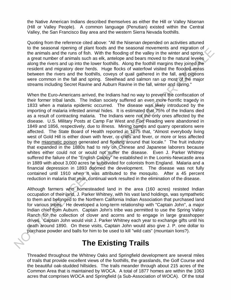
Quoting from the reference cited above: "All the Nisenan depended on activities attunedto the seasonal ripening of plant foods and the seasonal movements and migration ofthe animals and the runs of fish. With the flooding of the valley in the winter and spring,a great number of animals such as elk, antelope and bears moved to the natural leveesalong the rivers and up into the lower foothills. Along the foothill margins they joined theresident and migratory deer herds. Huge flocks of waterfowl visited the flooded areasbetween the rivers and the foothills, coveys of quail gathered in the fall, and pigeonswere common in the fall and spring. Steelhead and salmon ran up most of the majorstreams including Secret Ravine and Auburn Ravine in the fall, winter and spring."
When the Euro-Americans arrived, the Indians had no way to prevent the confiscation oftheir former tribal lands. The Indian society suffered an even more horrific tragedy in1833 when a malaria epidemic occurred. The disease was likely introduced by theimporting of malaria infested animal hides. It is estimated that 75% of the Indians diedas a result of contracting malaria. The Indians were not the only ones affected by thedisease. U.S. Military Posts at Camp Far West and Fort Reading were abandoned in1849 and 1856, respectively, due to illness. Mining camps and quarry operations wereaffected. The State Board of Health reported in 1875 that, "Almost everybody livingwest of Gold Hill is either down with fever, or chills and fever, or more or less affectedby the miasmatic poison generated and floating around that locale." The fruit industrythat expanded in the 1880s had to rely on Chinese and Japanese laborers becausewhites either could not or would not suffer the disease. Even J. Parker Whitneysuffered the failure of the "English Colony" he established in the Loomis-Newcastle areain 1889 with about 3,000 acres he subdivided for colonists from England. Malaria and afinancial depression in 1893 doomed the development. The disease was not fullycontained until 1910 when it was attributed to the mosquito. After a 45 percentreduction in malaria that year, continual work resulted in the elimination of the disease.
Although farmers who homesteaded land in the area (160 acres) resisted Indianoccupation of their land, J. Parker Whitney, with his vast land holdings, was sympatheticto them and belonged to the Northern California Indian Association that purchased landfor various tribes. He developed a long-term relationship with "Captain John", a majorIndian chief from Auburn. Captain John's tribe was permitted to use the Spring ValleyRanch for the collection of clover and acorns and to engage in large grasshopperdrives. Captain John would visit J. Parker Whitney each year to exchange gifts until hisdeath around 1890. On these visits, Captain John would also give J. P. one dollar topurchase powder and balls for him to be used to kill "wild cats" (mountain lions?).
The Existing Trails
Threaded throughout the Whitney Oaks and Springfield development are several milesof trails that provide excellent views of the foothills, the grasslands, the Golf Course andthe beautiful oak-studded hillsides. The trails meander through about 215 acres of theCommon Area that is maintained by WOCA. A total of 1877 homes are within the 1063acres that comprises WOCA and Springfield (a Sub-Association of WOCA). Of the total
homes, 868 are within Springfield. A separately owned Golf Course covers 175 acresof the total.
There are currently about 3-1/4 miles of trails that have a walking surface that is eitherasphalt or decomposed granite. Some sections of the trails are very steep and requirethat those who use the trails be sure-footed and exercise caution on the steep portions.In the future the steep sections might be eliminated and replaced with more moderategrades that will permit a larger number of people to enjoy the experience of hiking thetrails. That improvement, if made, could result in increasing the length of the trails toapproximately 4 miles.
Please Remember
Our trails are for the enjoyment of all residents. No unauthorized motor vehicles arepermitted. Users are required to remain on the trails, and children are not allowedanywhere within the common area to climb trees or construct tree houses. Dog ownersare required to clean up after their pets, which are permitted on the trails only if leashed.Dog owners are advised that rattlesnakes are especially dangerous to them. It isinstinctive for dogs, whether leashed or not, to walk right up to a rattlesnake and sniff it,and suffer a potentially life threatening bite. Treating any victim, whether a dog or aperson, is very expensive. Doctors have reported that 50 percent of snakebite victimsthey treat are young males who have been drinking and, unbelievably, tried to pick up arattlesnake to impress friends!
Trail Names and their locations
N Trail Name Location Length (ft)1 Black Oak Black Oak Dr to Whitney Oaks Dr 3,5742 Sunset Whitney Oaks Dr to Abby Rd 5683 Granite Abby Rd to Black Oak Dr 2,7214 Majestic Oaks Park Dr to paved trail below Black Oak Dr 1,0555 Foothills Whitney Oaks Dr to Black Oak Dr (paved) 7636 Wildlife Clubhouse Dr to Park Dr (paved) 1,6387 Turkey Hill Clubhouse Dr to Cody Ct (paved) 8908 Clarke Dominguez Park Dr to Crest Dr (paved) 5,1089 Sierra Nevada Clarke Dominguez Trail to Scenic Dr (paved) 900
(Note: One mile is 5,260 feet) Total 17,217
General Geology of the Whitney Oaks Area
The rounded boulders beneath most of the homes in the Springfield area derived fromlava that flowed from the Carson City, Nevada area during the Miocene and PlioceneEpochs, roughly 4 to 10 million years ago. Streams eroded this lava, and chunks of itwere transformed into rounded rocks as they moved downhill to this area and depositedin alluvial fans. Some of these stream boulders mixed with more recent lava flows thatextended all the way to Whitney Oaks. The fans have since been eroded into therelatively flat hilltops upon which the Springfield development is built and the interveningbeautiful valley containing the Whitney Oaks development and the golf course.

Geologists labeled the boulders and the lava from which they are derived the MehrtenFormation . In this area, its thickness varies from 10 to 25 feet. The relationship of agiven geologic unit to the others is shown in Figure 1 .
Beneath the Mehrten Formation is a layer of sandstone and interbeds of mudstonecalled the Valley Spring Formation that is 30 to 50 feet thick. These rocks wereprobably deposited as stream channel and lake deposits during the Miocene andOligocene Epochs some 20 to 30 million years ago.
Granite is exposed at the base of the hill and in many areas of the golf course. Thisgranite formed during the Cretaceous or Jurassic Periods between 130 and 150 millionyears ago. Additional information about geologic time and the formation of granite canbe found at the following links.http://www.ucmp.berkeley.edu/exhibits/geologictime.phphttp://geology.csupomona.edu/alert/igneous/granite.htm.
Earthquakes and Landslides
The Rocklin area has had small earthquakes at least since 1975, but none were felt orreported by residents. Three historical earthquakes have been felt - on February 23,1885, April 21, 1892 and May 30, 1908. The 1908 event was felt over an area of10,000 square kilometers and had an estimated magnitude of 4.0 on the Richter scale.The larger earthquakes typically occur along the Foothills Fault System that extendsfrom Oroville to Auburn. Smaller earthquakes are related to isostatic uplift of the granitethat occurs after (sometimes long after) the removal of the overburden by the erosionprocess. http://en.wikipedia.org/wiki/Isostasy
Some small and shallow landslides occur in Whitney Oaks when heavy rains saturatesoil on hillsides. No damage to homes or other structures has occurred as a result ofthese relatively small slope failures. Cattails growing in wet areas on lower parts of thehills provide some evidence that the natural drainage was disturbed at some time in thepast by old landslides.
Geological Features Visible From Trails
Black Oak Trail (#1)
The Black Oak Trail extends from WhitneyOaks Drive to Black Oak Drive. On thenorth side of the entrance near WhitneyOaks Drive and at point 1 , the mudstoneand sandstone of the Valley SpringsFormation form a conspicuous outcropwith nearly horizontal beds shown by thelayering in the rock. The rock ispredominately sandstone above andmudstone below.
At point 2, the light grey color of weathered mudstone is quite evident. Not evident butexposed when the houses to the south were under construction, is Valley Springssandstone resting on granite. The granite forms the base of the hill here and throughoutthe Golf Course and other valleys in Whitney Oaks.
The sandstone of the Valley Springs Formation has mudstone inter-beds at point 3 .The sandstone is probably a stream deposit, and the mudstones might be backwaterdeposits from lagoons or oxbow lakes (http://en.wikipedia.org/wiki/Oxbow_lake) wheredeposition was very slow and quiet.
Granite is exposed at point 4 . The granite is much higher on the slope here than on theGolf Course or connected valleys at a lower elevation. It probably was a knob of moreresistant rock that protruded above the valley floor when the Valley Springs Formationwas deposited.
A contact between the Mehrten Formation at the upper part of the hill and the well-bedded sandstones and mudstones of the Valley Springs Formation underneath theboulders is exposed at point 5 . The contact is exposed here and for a short distancealong the trail. If you place your hand on the contact, about 10 million years of geologictime is missing. No sedimentation may have taken place in this area during that period,or the sediments could have been eroded and removed by the time the MehrtenFormation was deposited. You would have to travel to the San Francisco region to findrocks of that missing time period.
A distinctive light-colored boulder in the Mehrten Formation is rare in the Whitney Oaksarea but is common in most areas where volcanism has taken place. This rock is arhyolite in contrast to the dark-colored andesite and basalt that form nearly all of theboulders.
At point 6 near Black Oak Drive, rounded cobbles of volcanic rocks typical of theMehrten Formation are common on the east side of the trail.
Sunset Trail (#2)
Sunset Trail goes from Whitney Oaks Drive to Abby Road. Granite is exposed at theentrance to the trail and as big boulders and towers of resistant rock on the golf coursebehind the houses on the west side of Whitney Oaks Drive.
About 100 feet up this very steep trail, horizontal beds of the Valley Springs Sandstoneand interbeds of a very light grey weathered mudstone are exposed. The sandstonehere is cross-bedded. At the top of the hill at point 7 , just below a house, the basaltand andesite boulders of the Mehrten Formation are well exposed.
Granite Trail (#3)
At Abby Road, Sunset Trail ends and the beginning of Granite Trail is locatedtopographically lower along Abby Road. Valley Springs sandstone and mudstone areexposed at a few places along the trail to point 8 where a stairway with 45 steps leadsdownward and across a gully to point 9 where granite is exposed. A few tens of feet
above the granite, and to the junction with the Foothills Trail, sandstone and mudstoneof the Valley Springs Formation are exposed.
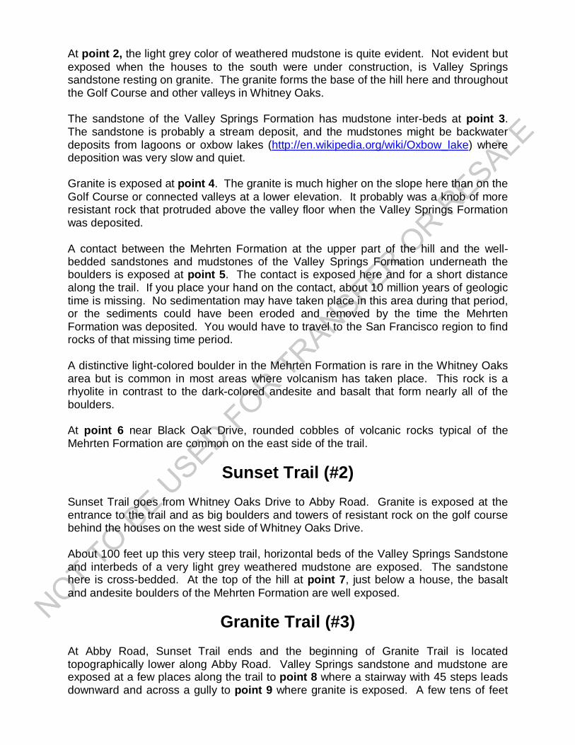
Majestic Oaks Trail (#4)
Majestic Oaks Trail branches eastwardfrom the Foothills Trail to Park Drive. Thereare a few small exposures of the ValleySprings Formation sandstone until about400 feet from Park Drive where granite isexposed. Also near Park Drive is a hugegranite boulder sheltered by a lovely Oaktree. In the Rocklin History Museum, thissame boulder appears in a photo of achicken ranch that once occupied the areaaround Pleasant Valley Creek. At this trail'sjuncture with Park Drive, one can see alovely open area that is north of the homesalong Park. This 150-acre area is named
the "Environmental Learning Center" and possesses a spring. This plot of land is theoriginal site of Joel Parker Whitney's "Spring Valley Ranch."
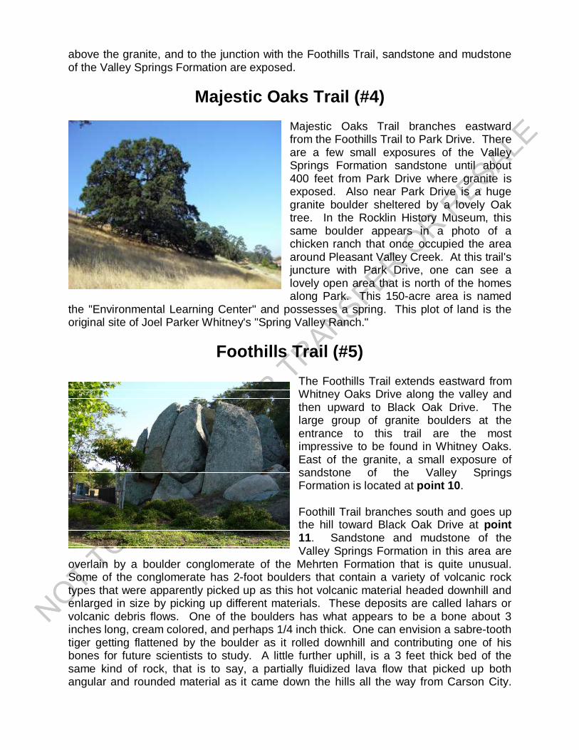
Foothills Trail (#5)
The Foothills Trail extends eastward fromWhitney Oaks Drive along the valley andthen upward to Black Oak Drive. Thelarge group of granite boulders at theentrance to this trail are the mostimpressive to be found in Whitney Oaks.East of the granite, a small exposure ofsandstone of the Valley SpringsFormation is located at point 10 .
Foothill Trail branches south and goes upthe hill toward Black Oak Drive at point11. Sandstone and mudstone of theValley Springs Formation in this area are
overlain by a boulder conglomerate of the Mehrten Formation that is quite unusual.Some of the conglomerate has 2-foot boulders that contain a variety of volcanic rocktypes that were apparently picked up as this hot volcanic material headed downhill andenlarged in size by picking up different materials. These deposits are called lahars orvolcanic debris flows. One of the boulders has what appears to be a bone about 3inches long, cream colored, and perhaps 1/4 inch thick. One can envision a sabre-toothtiger getting flattened by the boulder as it rolled downhill and contributing one of hisbones for future scientists to study. A little further uphill, is a 3 feet thick bed of thesame kind of rock, that is to say, a partially fluidized lava flow that picked up bothangular and rounded material as it came down the hills all the way from Carson City.

So some volcanic rocks are clearly inter-layered with the Mehrten Formation streamcobbles in the Whitney Oaks area.
Wildlife Trail (#6)
This trail begins across from the Gables entrance to Springfield and extends toClubhouse Drive. A short distance from Park Drive, large boulders and outcrops ofgranite are conspicuous on the golf course to the west. At point 12 , where the trail isvery steep, rounded cobbles and boulders of lava from the Mehrten formation crop outon the east side of the trail. At least some and probably most of these boulders aredisplaced downhill by recent gravity movement. The Valley Springs sandstone andmudstone that sit on the granite cannot be seen because the slopes are covered withalluvium.
Turkey Hill Trail (#7)
This trail connects Cody Court with thegolf course clubhouse. About 300 feetfrom the entrance at Cody Court, point13, rounded boulders of lava from theMehrten Formation have rolled down fromthe top of the hill and are strewn along thepath. At point 14 , near the junction withthe Wildlife trail, the Valley SpringsSandstone is well cemented, and forms ahard bed about 10 feet long.
Clarke Dominguez Trail (#8)
This trail is named in honor of Clarke Dominguez (a lifetime educator) who servedRocklin as a Planning Commissioner, as a City Council member and as Mayor for threeterms. During the period of his service the city acquired 180 acres of parkland andopen space and opened 8 new parks.
A few hundred feet downhill from the entrance to this trail at Crest Drive, at point 15 , acontact is exposed showing the Valley Springs sandstone in the bottom of a gulley thatgoes under the trail and the Mehrten Formation cobble conglomerate sitting on top of it.Exposed contacts like this are fairly rare in geologic field investigations because mostare covered with soil and alluvium.
The Valley Spring Formation with interbeds of sandstone and mudstone is exposed atintervals along the Clarke Dominguez trail from points 16 to 21 . Many of thesandstone beds are cross-bedded, meaning that one set of layers is truncated byanother set. Cross-bedding is common in fossil sand dune deposits where the wind has

blown slightly different material ahead and on top of the underlying set. Most cross-bedding formed from dunes, however, is in sets that are several feet high. The fossilsand dunes in Zion National Park are one spectacular example. The beds here,however, are in sets only a few inches high. These are most common in stream or riverdeposits where water moves a sand set forward and on top of the underlying set.Interbeds of mudstone that weather light grey are suggestive of a lagoon, oxbow lake,or slack water area formed when the stream moved laterally from one area to another.
At point 21, looking directly west toward the school on the other side of Park Drive,granite forms a prominent outcrop of hard rock sticking out of the ground. Granite formsthe bottom of this entire valley in the vicinity of the golf course. The Valley Springs andMehrten Formations sit upon the granite like a stack of cards. The valley has beenexcavated by stream erosion and the Valley Springs and Mehrten Formations havebeen removed and dumped into the creeks and streams that feed the American Riverand eventually the ocean.
Sierra Nevada Trail (#9)
This short and paved trail extends from Scenic Drive downhill to where it meets theClarke Dominguez Trail. At the beginning of the trail near Scenic Drive, point 22 on themap, rounded boulders of the Mehrten Formation are on both sides of the trail andespecially beneath the houses on the left (north) side of the trail. Some of the bouldersare huge, and could roll downhill during a strong earthquake. The WOCA Board wasable to persuade Pulte to bury one of the most vulnerable boulders to prevent it frommoving.
Sandstone within the Valley Springs Formation is exposed on the north side of the trailat point 23 . No fossils have yet been found in these rocks, leading to speculation thatthey are non-marine.
Geologic Strata On Whitney Oaks TrailsMehrten FormationMostly rounded boulders and cobbles of volcanic rocks (basalt and andesite)brought by streams from the Carson City area. Includes lava flows and lahars(jumbled volcanic debris flows) and tuff in a few places. Thickness 10 to 25 feet.Age: Pliocene and Miocene Epochs, 4 to 10 million years ago.
Valley Springs FormationCross-bedded sandstone and interbeds of mudstone and tuff that weather lightgray. Non-marine stream and lake deposits and volcanic ash. Thickness 30 to 50feet. Age: Miocene and Oligocene Epochs, 20 to 30 million years ago.
GraniteLight colored quartz diorite intruded into the crust of the earth from 130 to 142million years ago during the Cretaceous or Jurassic Periods. The age is obtainedby measuring the amount of radioactive argon that has formed since the rockcooled.
Figure 1 - Rock Layers in the Whitney Oaks area.
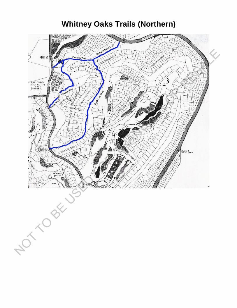
Whitney Oaks Trails (Northern)
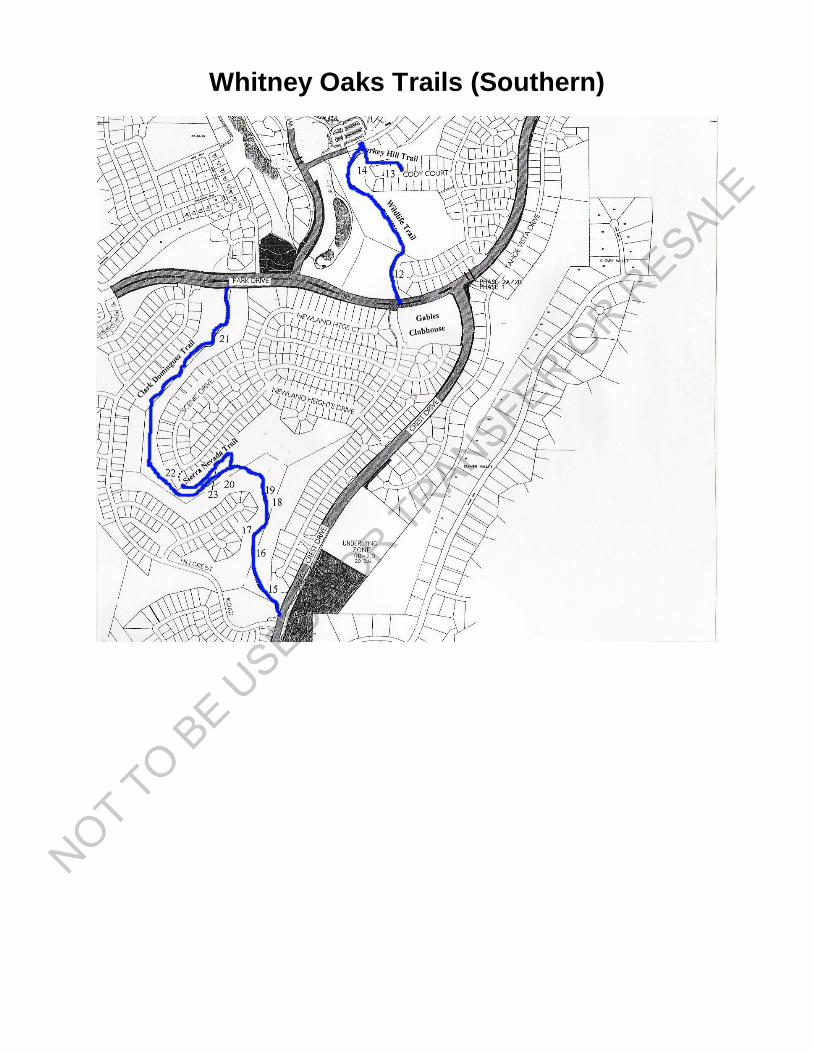
Whitney Oaks Trails (Southern)

Animals in Whitney Oaks
Rattlesnake
Those who walk the trails in Whitney Oaks are required (by the CC&Rs) to remain onthe trail. This is for the protection of both the natural environment and the users of thetrails. West Coast Diamond Back Rattlesnakes are very prevalent in the area. Theirprey consists largely of voles, lizards and small birds. They spend the winter months incommunal dens. They can grow to be 4 feet long. They have large, dark brown,diamond shaped markings on their back and have a wide head that is solid brown ontop. You should be aware that they are active both during the day and at night. Theyare usually shy and will try to avoid humans if possible. However, if it is disturbed, it willhold its ground and will aggressively rattle its tail as a warning. If you hear this rattle,the snake is warning you not to come any closer. If you ignore their warning, you maywind up with a snakebite that is expensive to treat.For more information see www.en.wikipedia.org/wiki/Rattlesnake.
Kingsnake
This reptile is named King for the reason that it is able to kill rattlesnakes and othersnakes by constriction. If you have this snake in your neighborhood (they have beenobserved in WOCA), you should be proud and protective of it. It has a distinctivechocolate brown color with circular bands, every 2 to 3 inches, that are light brown,white, cream or yellow. It has immunity from the venom of other snakes and grows to 6feet in length and has a lifespan of up to 24 years. They are often kept as pets.http://en.wikipedia.org/wiki/Kingsnake
Deer
Black Tail Deer are prevalent in Whitney Oaks. They migrate to higher elevationsduring the summer months and return for the lush vegetation during the fall, winter andspring. Although they normally do not pose any threat to us, you should be aware thatthey are dangerous when they feel threatened. Several accounts appear in the newseach year of people who have been gored by a buck that was caught off guard orbecame cornered in a side yard. You should always check to see that you do notaccidentally surprise a deer in a confined area. They are very fast and strong. Theycan sometimes be seen making a very graceful leap (from a standing position) over a 5-foot tall fence. Coyotes love to dine on newborn fawns.www.dfg.ca.gov/keepmewild/deer.html
Coyote
The howling and yapping of coyotes tends to bring a chill to one’s spine, but it is a signof a healthy ecosystem. If they are present, you can be sure that voles, turkeys, rabbits,squirrels and deer are around also. Flocks of grown turkeys have been observedsuddenly descending from trees and chasing coyotes when they decide they don’tappreciate their hanging around. www.dfg.ca.gov/keepmewild/coyote.html

Vole
You may not believe it, but the vole is probably the single most important animal inWhitney Oaks. It is the prey for hawks, rattlesnakes, coyotes and owls. Although it istempting, considering the damage they do to gardens, to try to eliminate this rodent, itshould be treated as the source of food for many other animals we have in WhitneyOaks. Without them, our observation of other wildlife would be greatly diminished.They live in open, grassy areas, and the neat, concave paths chewed in your lawn areproof of their existence.
Other Scary, Creepy, Crawly & Hopping Animals
We assume that "Captain John" took care of mountain lions a long time ago. Althoughrarely seen today in this area, mountain lions are likely to be present wherever there is apopulation of deer. www.dfg.ca.gov/keepmewild/lion.html Bobcats and foxes are alsoprobably rare in our populated areas. The Grey Squirrel is a joy to behold with theirbushy tails and disconcerting when it chooses to crawl up and down your stucco wallswith exceptional ease because of its articulated ankles. Cotton Tail rabbits andJackrabbits are often seen in open fields. Gopher snakes, Garter snakes and Kingsnakes are harmless and even beneficial in keeping the rodent population in check.Western Fence Lizards and Newts (Salamanders) are prevalent in some areas. Andwho can ignore the frogs (or even sleep with the window open) in the pond areasaround the golf course.
Flying Animals (Birds)
Turkey
Wild turkeys have adapted well to the open areas of Whitney Oaks and appear to behere throughout the year. The largest reported sighting of turkeys is 72 in one flock (asof 2007). You may think that turkeys are slow, plodding and ungainly, but that is not thecase. Turkeys are able to take flight and do so in a formation similar to that of geese.They are extremely graceful when flying. The flights that have been observed may beoccurring between adjacent valleys as the food supply diminishes in the summer. Theyroost in trees at night to protect against Coyotes. Since geese honk when in flight, weleave you with this question “Do turkeys gobble when flying?” We honestly do notknow. www.dfg.ca.gov/keepmewild/turkey.html
Turkey Vulture
Although not the most beautiful to look at up close, these very graceful birds can soarfor hours with only a gentle breeze and are considered by some to be a spectacularsighting. In Whitney Oaks, you see them flying everywhere for hours each day. Theirmere presence is proof that a very vibrant and healthy animal population exists withinour community. They clean up what would otherwise be the smelly messes of deadanimals.
Red Tail Hawk
This beautiful raptor flies only for one reason: to find the next meal. It feeds upon voles,other smaller birds, snakes (including rattlers), rabbits, squirrels and other smallanimals. Its keen eyesight enables it to readily distinguish very small movements withinthe general landscape. The manner of taking another bird, such as a dove, is a lessonin efficiency. Immediately after capture, it will take its prey to the ground and extract anumber of feathers from one wing: if its prey gets loose, it can only fly in circles. Thehawk then places a claw around the prey’s neck and strangles it. Then it lifts off withthe meal in tow. They are sometimes referred to as "chicken hawks" to justify theirelimination
Prairie Falcon
A sighting of this predator is a treat. It is more streamlined than the Red Tail Hawk andfaster in flight. It uses a technique of observing a potential prey that is distinctive. Byuse of its wings and tail it is able to remain in a stationary position that is often directlyabove a potential meal. It is possessed of a very light colored, almost white, breast.
American Kestrel
This very small and colorful falcon is sometimes referred to as the sparrow hawk. Itprefers a good breeze to be able to use the hover technique when searching for prey.
Great Horned Owl
If you hear the “Who, Who, Who” cry in the night, it is most likely the Great Horned Owl.Owls have a unique capability of almost completely inaudible flight. This attributeaccounts for their ease of capture of the vole that is its major prey.
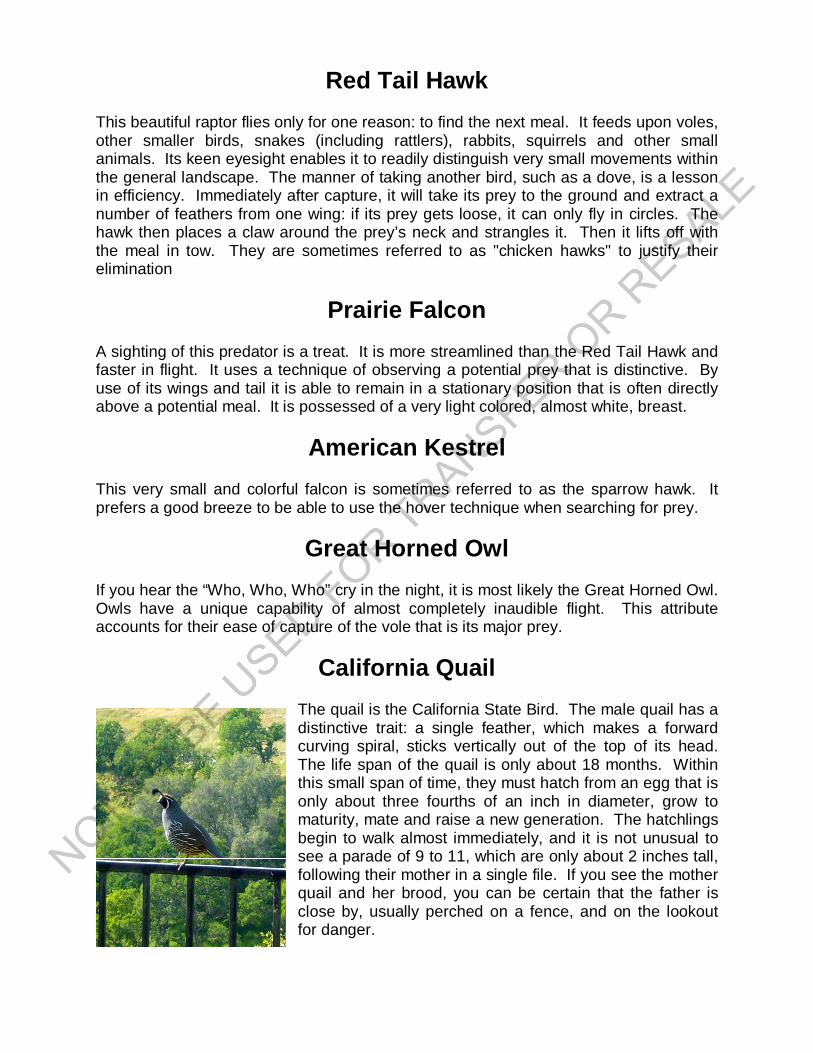
California Quail
The quail is the California State Bird. The male quail has adistinctive trait: a single feather, which makes a forwardcurving spiral, sticks vertically out of the top of its head.The life span of the quail is only about 18 months. Withinthis small span of time, they must hatch from an egg that isonly about three fourths of an inch in diameter, grow tomaturity, mate and raise a new generation. The hatchlingsbegin to walk almost immediately, and it is not unusual tosee a parade of 9 to 11, which are only about 2 inches tall,following their mother in a single file. If you see the motherquail and her brood, you can be certain that the father isclose by, usually perched on a fence, and on the lookoutfor danger.
Acorn Woodpecker
This colorful bird appears to be decked out in a Tuxedo with its black feathers accentedby white patches on its wings and breast. A neat red head patch complements the tux.It often perches in the top of an oak tree and darts 15 to 20 feet outward to nab a flyinginsect before returning. Pecking holes in dead trees to stash acorns is a seasonal parttime job beginning in early October. The acorn is its primary source of food, and itspopulation declines significantly when the supply is limited.
Hummingbird
The predominant hummingbird in this area is the Anna's hummingbird. It is residentalong the Pacific seaboard and is the only one to winter in North America. It is one ofthe first birds to nest, sometimes in late December. Its wings beat at the rate of 80-120times per minute, and it can hover and fly in any direction except upside down. If yousee one making high speed plunges and then rapid vertical ascents, it is a male duringthe mating season. They can live as long as 8 years.
If you put out a feeder, a solution of sugar (1 cup) and water (4 cups) brought to a boiland simmered for 2 minutes will satisfy them immensely and provide you with manydelightful hours observing their activities.
Mourning Dove
The sad cooing of this bird gives it its name. Its diet consists almost entirely of seeds.This member of the pigeon family can nest any time of the year since its young are feda "pigeon's milk" secretion from its throat.
Killdeer
This shorebird sometimes lives inland and can be seen in the Boulder Ridge Parklocated at the highest point along Park Drive. It lays its camouflaged eggs on theground and will perform an incredible act to protect the eggs if discovered andthreatened. It will flop around on the ground pretending to have a badly injured wing, todivert the attention of a predator from finding the eggs, all accompanied by loud shrieks.
California Thrasher
This bird's distinguishing characteristic is the 1-1/2 to 2 inch downward curving beakthat it uses to thrash about in areas containing grubs and other insects. If you see yourbark littering your walkways or patios, it is probable that a Thrasher or a Brown or RufusSided Towhee has visited your garden. The Towhees do their thrashing by jumpingslightly off the ground and scratching with their feet in a very rapid manner.
Migratory Birds
Whitney Oaks and the entire Sacramento valley is on the Pacific Flyway that is themigration route of many birds between their winter grounds in the south and theirnesting grounds in the north. Some come from as far as Alaska and travel as far southas Mexico. It is not uncommon to see Pheasants, Egrets, Herons Flickers, BlackPhoebes, Dark Eyed Juncos, Finches, Western Tanagers, California (Brown) Towhees,Rufous Sided Towhees, Robins, Steller’s Jays and Scrub Jays, Western Bluebirds,Geese, Ducks, Ravens, Crows, Swallows, California Gnatcatchers, White CrownedSparrows, Starlings and many others.
Plants in Whitney Oaks
Trees
If there is one thing that residents should cherish in Whitney Oaks, it is the Oaks. TheBlue Oak is the prevalent species. Identification of a given tree, by looking at the leafshape and characteristics, is sometimes difficult because of the hybridization(crossbreeding) that occurs within groups of trees. It is not completely understood howOak trees (as far away as both sides of the valley) are able to synchronize theirproduction of large quantities of acorns in various years. This characteristic is called"masting". A mature Blue Oak can produce as many as 100,000 acorns in a mast (highyield) year. Year 2007 was a mast year and the trails were literally covered with acornsthat begin to drop in early October. Deer, mice, pigs, jays and woodpeckers eat acorns.Indians did also, but they had to leach the tannic acid from the nut. Some spectacularexamples of grinding mortars where the nuts were cracked and ground prior to theleaching can be found in the Pleasant Valley Creek Park a small distance West of theentrance to the Foothill Trail. If you visit this park, try to locate the deepest mortar andimagine how long it took to create this hole (100, 200, 1000 years?). These native oaksthrive in the natural environment of our Common Area slopes. They do not tolerateartificial watering which results in root rot and the eventual death of the trees. For moreinformation about oaks check out http://www.hastingsreserve.org and see if you candetermine why pigs were mentioned above. Hint: Search for Oak Woodlands andlocate the fascinating article by Walter Koenig and Jean Knops that was published inAmerican Scientist.
Black Oaks
Native Indians preferred the Black Oak for its better quality acorns.
Interior Live Oaks
The Interior Live Oak is one of the few Oaks that are not deciduous. It is very droughttolerant and has stiff leaves with prickly edges. The leaves are generally not lobed.
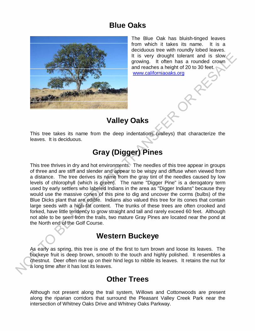
Blue Oaks
The Blue Oak has bluish-tinged leavesfrom which it takes its name. It is adeciduous tree with roundly lobed leaves.It is very drought tolerant and is slowgrowing. It often has a rounded crownand reaches a height of 20 to 30 feet. www.californiaoaks.org
Valley Oaks
This tree takes its name from the deep indentations (valleys) that characterize theleaves. It is deciduous.
Gray (Digger) Pines
This tree thrives in dry and hot environments. The needles of this tree appear in groupsof three and are stiff and slender and appear to be wispy and diffuse when viewed froma distance. The tree derives its name from the gray tint of the needles caused by lowlevels of chlorophyll (which is green). The name "Digger Pine" is a derogatory termused by early settlers who labeled Indians in the area as "Digger Indians" because theywould use the massive cones of this pine to dig and uncover the corms (bulbs) of theBlue Dicks plant that are edible. Indians also valued this tree for its cones that containlarge seeds with a high fat content. The trunks of these trees are often crooked andforked, have little tendency to grow straight and tall and rarely exceed 60 feet. Althoughnot able to be seen from the trails, two mature Gray Pines are located near the pond atthe North end of the Golf Course.
Western Buckeye
As early as spring, this tree is one of the first to turn brown and loose its leaves. Thebuckeye fruit is deep brown, smooth to the touch and highly polished. It resembles achestnut. Deer often rise up on their hind legs to nibble its leaves. It retains the nut fora long time after it has lost its leaves.
Other Trees
Although not present along the trail system, Willows and Cottonwoods are presentalong the riparian corridors that surround the Pleasant Valley Creek Park near theintersection of Whitney Oaks Drive and Whitney Oaks Parkway.
Other Plants
Grasses
Grasses have a number of unique characteristics. About 70 percent of the plant isunder-ground and it grows from the base that permits it to be grazed by animals andmowed by humans. Grasses are drought and fire resistant because much of the foodthat it needs is stored in the root and the seeds have a protective coating. Few of theoriginal native grasses are present here in Whitney Oaks because extensive grazing bysheep and cattle occurred on the property.
Clover
Red Clover is a native plant that was a food source for the American Indians. It ispresent in Whitney Oaks sometimes in clumps as large as 2 feet high. The flowers arereddish and rounded, and it blooms in the period from April to October.
Thistles
The Yellow Star Thistle is a native plant and is abundant. It has very sharp spines andgrows to about 3 feet tall. It appears to be a favorite food source for small Goldfinches.It is very invasive and blooms from May through October.
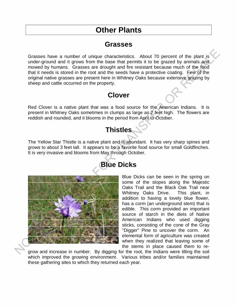
Blue Dicks
Blue Dicks can be seen in the spring onsome of the slopes along the MajesticOaks Trail and the Black Oak Trail nearWhitney Oaks Drive. This plant, inaddition to having a lovely blue flower,has a corm (an underground stem) that isedible. This corm provided an importantsource of starch in the diets of NativeAmerican Indians who used diggingsticks, consisting of the cone of the Gray"Digger" Pine to uncover the corm. Anelemental form of agriculture was createdwhen they realized that leaving some ofthe stems in place caused them to re-
grow and increase in number. By digging for the root, the Indians were tilling the soilwhich improved the growing environment. Various tribes and/or families maintainedthese gathering sites to which they returned each year.

Grasshopper Gathering
Considering the other Indian-related information included in this guide, it would be ashame not to mention another food source used by the Indians. Joel Parker Whitneyallowed Captain John's tribe to use his land each year for the gathering ofGrasshoppers. Before the use of pesticides, grasshoppers were in abundance anddevoured large quantities of grasses. Indians used them as an additional food source,and the gathering process is instructive in that it demonstrates the resourcefulness ofthe Indians.
Prior to the actual gathering, a hole (pit) about 5 feet deep and 5 feet in diameter wouldbe excavated. The pit would be partially filled with water. The entire tribe wouldencircle a large area and, using brush or tree branches, would drive the grasshoppersinto the open pit causing them to drown. A large fire would be built around a pile ofrocks that had been gathered together. The rocks would be heated by the fire and,when hot enough, would be rolled into the pit causing the grasshoppers to be cooked.They would then be gathered in animal skin pouches for later consumption.
Bibliography
Anonymous, ECHO IN SPRING VALLEY, Rocklin Historical Society, Rocklin, California,1994 (Available from the Rocklin History Museum)
Barry-Schweyer, Carmel & Alvarez, Alycia S., IMAGES of America: ROCKLIN, ArcadiaPublishing, Charleston SC, Chicago IL, Portsmouth NH, San Francisco CA, 2005,(Available from the Rocklin History Museum)
Davis, Leonard M., ROCKLIN: PAST, PRESENT, FUTURE, Rocklin Historical Society,Rocklin, California, 2004 (Available from the Rocklin History Museum)
Hinckle, Warren, J. Parker Whitney, Frontier Conservationist & Versatile Man of theWest, Argonaut Press, San Francisco, California, 1993 (Available from the RocklinHistory Museum)
Miller, Richard A., Fortune Built by Gun: The Joel Parker Whitney Story, The MansionPublishing Co., Walnut Grove, California, 1969 (Available in Rocklin's Public Library)
Peak & Associates, Inc., A Determination Of Eligibility and Effect On Cultural ResourcesWithin The Clover Valley Lakes Project Area, El Dorado Hills, CA, 2002 (May beavailable from the City Of Rocklin - Part of the Environmental Impact Report)
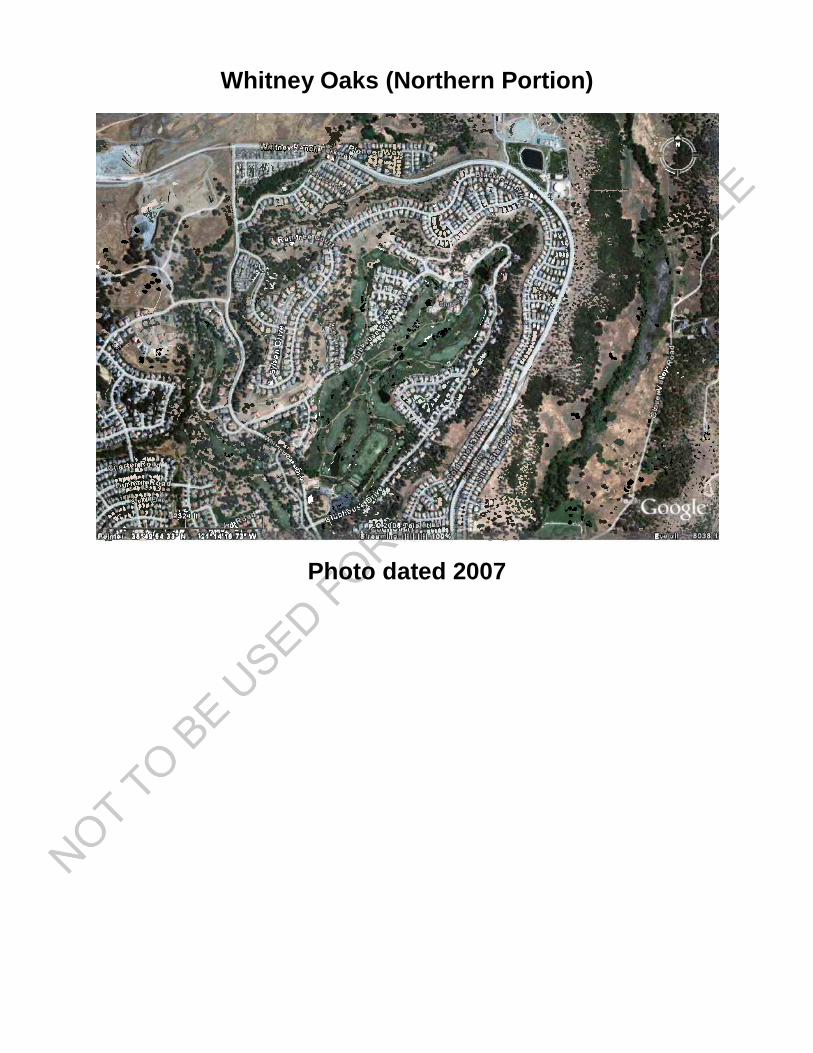
Whitney Oaks (Northern Portion)
Photo dated 2007
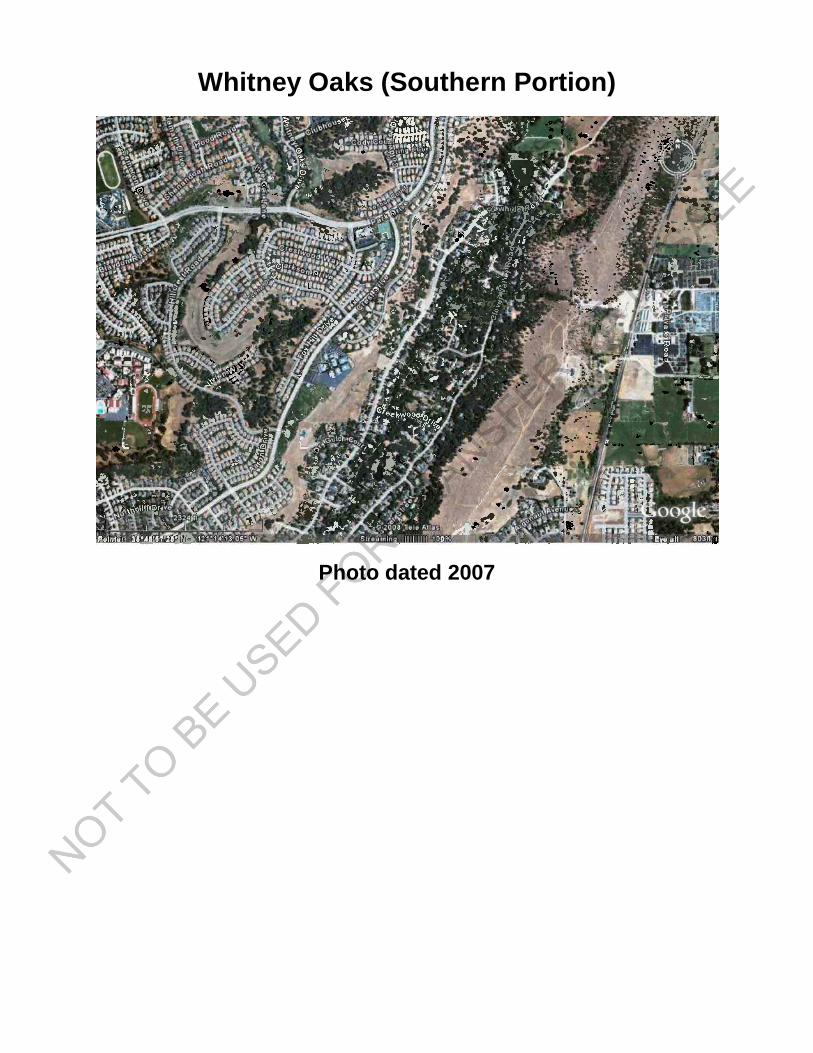
Whitney Oaks (Southern Portion)
Photo dated 2007