what is a topographic map? a topographic map is a map that shows changes and shape in the elevation...
TRANSCRIPT


What is a topographic map?
• A topographic map is a map that shows changes and shape in the elevation of land.

• Use contour lines to depict accurate changes in elevation.

Contour lines• A line on a map representing a
corresponding imaginary line on the ground that has the same elevation along its entire length.
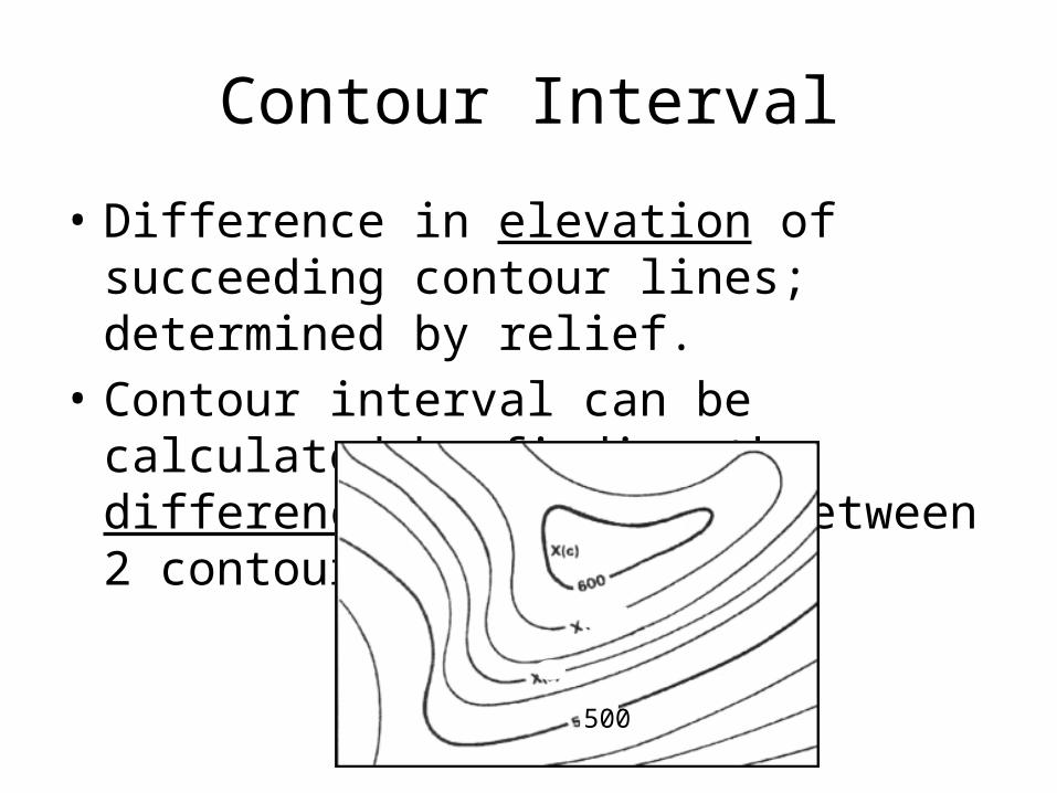
Contour Interval
• Difference in elevation of succeeding contour lines; determined by relief.
• Contour interval can be calculated by finding the difference in elevation between 2 contour lines.
500

Contour Interval• Difference in elevation of succeeding contour lines,
determined by relief—the difference in elevation between any 2 points.
• The contour interval will be given at the bottom of the map.


Rules for Contour Lines
1. Every point on a contour line has the same elevation.

Rules for Contour Lines2. Contour lines bend upstream or cross a valley (points in
direction opposite to the flow of the stream) are called “V”-Shaped. – If the stream flows through the valley the “V” will point
upstream, or within the direction opposite to the flow of the stream.

“V” points
• Contour lines form “V’s” that point upstream whenever they cross streams.

“V” Points• When you walk straight across a stream, you walk downhill
to the stream, and uphill away from the stream.
• In order to cross a stream and stay at the same elevation, you would have to walk upstream to cross over.
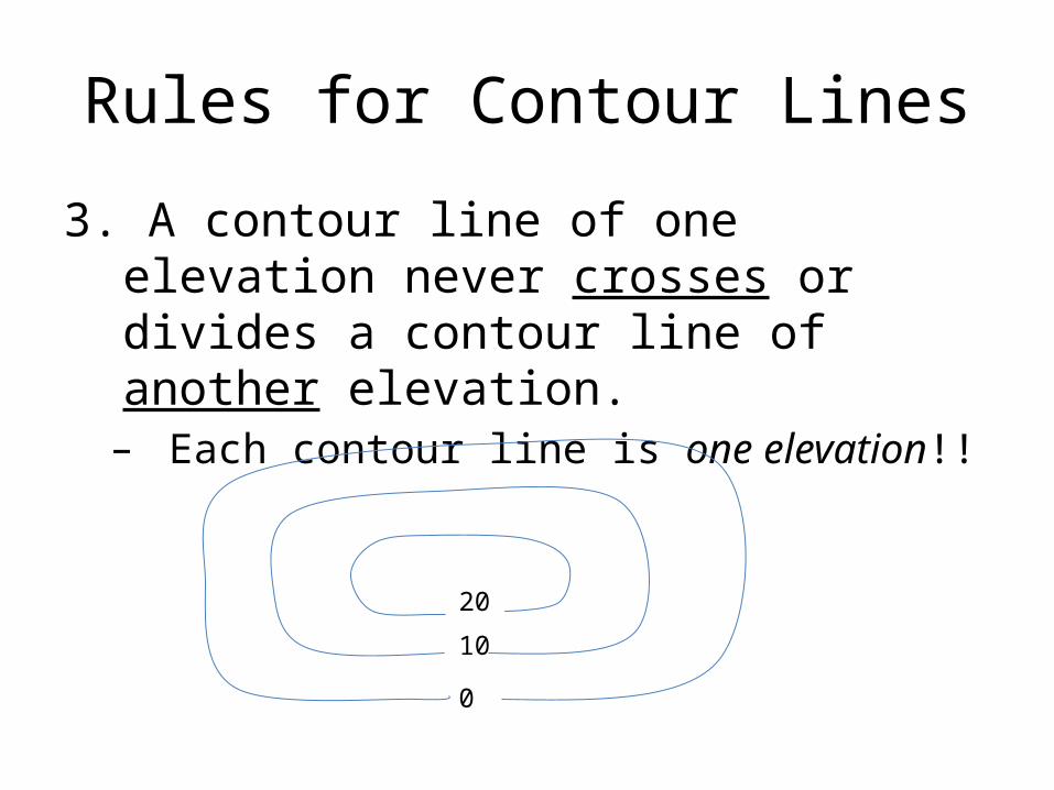
Rules for Contour Lines
3. A contour line of one elevation never crosses or divides a contour line of another elevation.– Each contour line is one elevation!!
20
10
0


Rules for Contour Lines4. Contour lines form closed loops around hilltops.
Depressions are encircled by contour lines with hachure marks. (short lines within the depression that point toward lower elevations.)
400
300
200
100
Hilltops
100
200
200
Depressions


Hill or Depression???
To decide if you are looking at a hill or a depression,a. Read the elevation numbersb. Look for hachures
1. Short lines drawn inside a depression2. They point toward lower elevations

Rules for Contour Lines
5. Contours are widely spaced on gentle slopes and closely spaced on steep slopes. – Lines close together = STEEP SLOPE– Lines far apart = GENTLE SLOPE
300
200
100
Gentle Slope
500
400300
200
100
Steep Slope

Slopes of Contour LinesClose lines together = STEEP slope
Lines farther apart = GENTLE slope

