washington state freight and goods transportation system ... · pdf filetransportation system...
TRANSCRIPT

Washington State Freight and Goods
Transportation System and Truck Freight
Economic Corridors
Seattle Freight Advisory Board Meeting
September 15, 2015
Wenjuan Zhao
Freight Systems Division
Washington State Department of Transportation
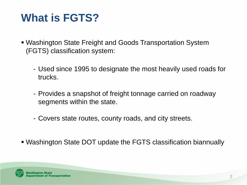
What is FGTS?
Washington State Freight and Goods Transportation System
(FGTS) classification system:
- Used since 1995 to designate the most heavily used roads for
trucks.
- Provides a snapshot of freight tonnage carried on roadway
segments within the state.
- Covers state routes, county roads, and city streets.
Washington State DOT update the FGTS classification biannually
2
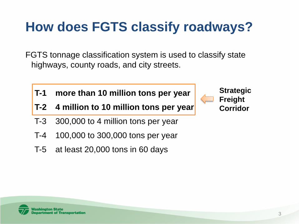
How does FGTS classify roadways?
FGTS tonnage classification system is used to classify state
highways, county roads, and city streets.
T-1 more than 10 million tons per year
T-2 4 million to 10 million tons per year
T-3 300,000 to 4 million tons per year
T-4 100,000 to 300,000 tons per year
T-5 at least 20,000 tons in 60 days
Strategic
Freight
Corridor
3

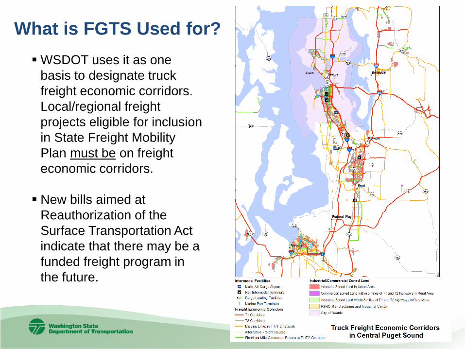
What is FGTS Used for?
Freight Mobility Strategic
Investment Board
approves and adopts the
list of designated strategic
freight corridors every two
years. Projects eligible for
FMSIB funding must be
on a strategic freight
corridor.
4
5
What is FGTS Used for?
WSDOT uses it as one
basis to designate truck
freight economic corridors.
Local/regional freight
projects eligible for inclusion
in State Freight Mobility
Plan must be on freight
economic corridors.
New bills aimed at
Reauthorization of the
Surface Transportation Act
indicate that there may be a
funded freight program in
the future.

6
How is the data collected?
• State Routes – truck
volume data collected
from WSDOT traffic
counters and converted
to tonnage
• County FGTS data
collected through County
Road Administration
Board’s (CRAB) Road’s
Mobility Database
• City FGTS data collected
from all cities and towns

7
June 2015 Started 2015 FGTS update process
August 2015 Completed city data collection
November
2015
Complete update on T-1 and T-2
classifications, and provide it to FMSIB for
strategic freight corridor designation
February 2016 Publish full update through WSDOT website
2015 FGTS Update Timeline

Why WSDOT identify Freight Economic
Corridors in the State Freight Plan?
WSDOT need objectively define the state’s freight corridors to:
• Map and show exactly which first-and-last mile routes
connect to high-volume freight routes to link the state’s
freight-intensive land uses to U.S. and global commerce.
• Determine which freight corridors WSDOT will track and
measure to improve performance of the state’s high-value
supply chains.
• Determine where to focus needs analysis and solution
development.
8
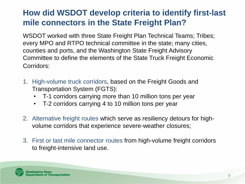
How did WSDOT develop criteria to identify first-last
mile connectors in the State Freight Plan?
WSDOT worked with three State Freight Plan Technical Teams; Tribes;
every MPO and RTPO technical committee in the state; many cities,
counties and ports, and the Washington State Freight Advisory
Committee to define the elements of the State Truck Freight Economic
Corridors:
1. High-volume truck corridors, based on the Freight Goods and
Transportation System (FGTS):
• T-1 corridors carrying more than 10 million tons per year
• T-2 corridors carrying 4 to 10 million tons per year
2. Alternative freight routes which serve as resiliency detours for high-
volume corridors that experience severe-weather closures;
3. First or last mile connector routes from high-volume freight corridors
to freight-intensive land use.
9

What criteria is used to identify first/last mile
connector routes?
Statewide:
• To-and-from T-1 and T-2 truck routes and strategic U.S. defense facilities
• Over-dimensional truck freight routes that connect the state’s significant
intermodal facilities to the T-1 and T-2 highway system
In urban areas:
• To-and-from the Interstate system and the (1) closest major airport with air
freight service, (2) marine terminals, ports, barge loaders and other intermodal
facilities, and (3) warehouse/industrial lands
• From high-volume urban freight intermodal facilities to other urban intermodal
facilities, e.g. from the Port of Seattle to the BNSF rail yard in Seattle
In rural areas:
• To-and-from state freight hubs located within five miles of T-1 and T-2
highways; freight hubs are defined as: (1) agricultural processing centers, (2)
distribution centers, (3) intermodal facilities, and (4) industrial/commercial
zoned land
• Routes that carry one million tons during three months of the year (reflecting
seasonality) of agricultural, timber or other resource industry sector goods
10

Truck Freight Economic Corridors in Washington State
11
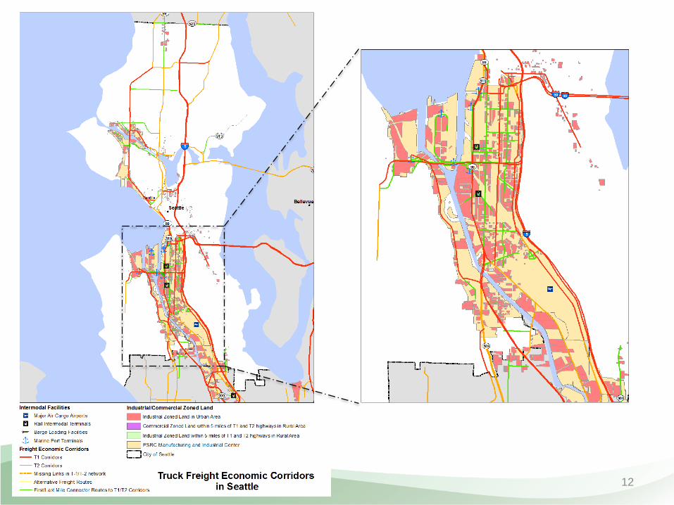
12

How does it relate to SDOT truck network
designation?
13
WSDOT Truck Freight Economic
Corridor
Seattle’s Draft Truck Street
Designation
• High volume truck corridors
• Alterative freight routes
• First/last mile connector routes
• Limited access facility
• Major truck street
• Minor truck street
• First/last mile connectors
• First/last mile connectors in WSDOT designation were reviewed
and verified by SDOT, and revised based on their inputs.
• Seattle’s Truck Street Designation is still under development. Its
first/last mile connectors are developed based on the list
submitted to WSDOT.
• We will continue coordinating with SDOT in the process.

Aerospace Supply Chain: Example Freight Mobility Improvements
14
I-90 Snoqualmie Pass--widen
to Easton
Widening and interchange
improvements.
Phase I -Re-designation of
SR 529 & Improvements
Access improvements from
Port of Everett to I-5 and
intersection improvements to
better accommodate over-
dimensional freight traffic.
I-5 Tacoma to Everett
mobility improvements
Multiple improvements to I-5.
Aerospace products and part are a $52.2 billion
industry in Washington State

Wheat Supply Chain: Example Freight Mobility Improvements
15
Ice Harbor Lock & Dam
Lock and dam maintenance
project.
PCC Freight Rail
Preservation
Multiple preservation and
rehabilitation projects.
West Vancouver Freight
Access
New freight rail entrance to the
Port of Vancouver from the
mainline and internal rail track
storage to accommodate unit
trains.
Wheat is a $1.14 billion industry in Washington State
Please contact:
Wenjuan Zhao
Washington State Department of Transportation
Freight Systems Division
Washington State Freight and Goods Transportation System is
available at :http://www.wsdot.wa.gov/Freight/FGTS/
Washington State Freight Economic Corridor is available at:
http://www.wsdot.wa.gov/Freight/EconCorridors.htm
Questions?
16