walkability and green spaces
DESCRIPTION
In downtown Tucson, AZ. A walkable environment could be provided by adding green networks.TRANSCRIPT

WALKABILITY AND GREEN SPACES Downtown Tucson
Julio Carrillo Baran Farahani Katharine Mitchell LAR622 – December 6, 2011
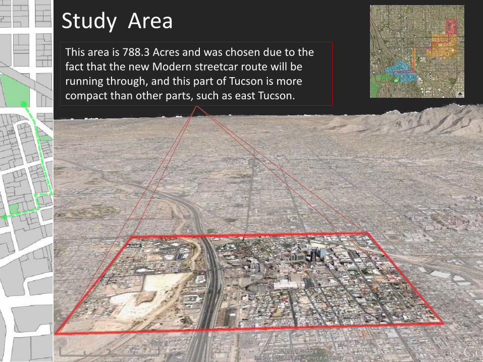
Study Area This area is 788.3 Acres and was chosen due to the fact that the new Modern streetcar route will be running through, and this part of Tucson is more compact than other parts, such as east Tucson.

PROBLEM DOWNTOWN
TUCSON VACANT &PARKING
LOTS
The study area also currently has a large number of vacant lots not currently being used. The negative impacts of these vacant parcels include: - an aesthetic eyesore - encourage crime in the vicinity or on the lot itself - the city is missing out on the potential to attract businesses - create low activity clusters
GOAL
DOWNTOWN TUCSON GREEN SPACE
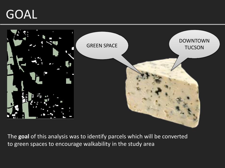
The goal of this analysis was to identify parcels which will be converted to green spaces to encourage walkability in the study area
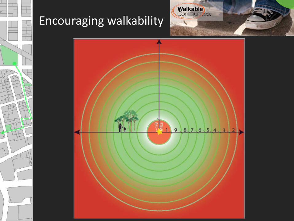
Encouraging walkability
GO
AL OBJECTIVES
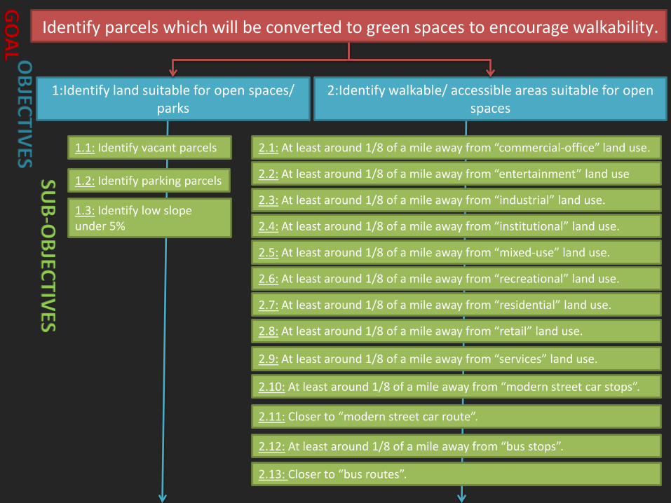
1:Identify land suitable for open spaces/ parks
2:Identify walkable/ accessible areas suitable for open spaces
SUB-O
BJECTIVES
1.2: Identify parking parcels
1.3: Identify low slope under 5%
2.3: At least around 1/8 of a mile away from “industrial” land use.
2.4: At least around 1/8 of a mile away from “institutional” land use.
2.5: At least around 1/8 of a mile away from “mixed-use” land use.
2.6: At least around 1/8 of a mile away from “recreational” land use.
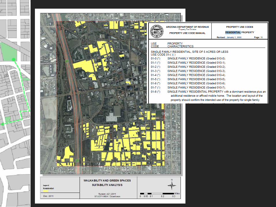
2.7: At least around 1/8 of a mile away from “residential” land use.
2.8: At least around 1/8 of a mile away from “retail” land use.
2.11: Closer to “modern street car route”.
2.9: At least around 1/8 of a mile away from “services” land use.
2.12: At least around 1/8 of a mile away from “bus stops”.
2.13: Closer to “bus routes”.
2.2: At least around 1/8 of a mile away from “entertainment” land use
2.10: At least around 1/8 of a mile away from “modern street car stops”.
Identify parcels which will be converted to green spaces to encourage walkability.
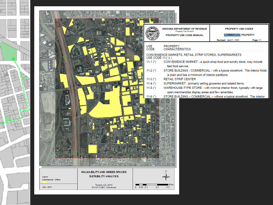
1.1: Identify vacant parcels 2.1: At least around 1/8 of a mile away from “commercial-office” land use.
SUITABILITY ANALYSIS
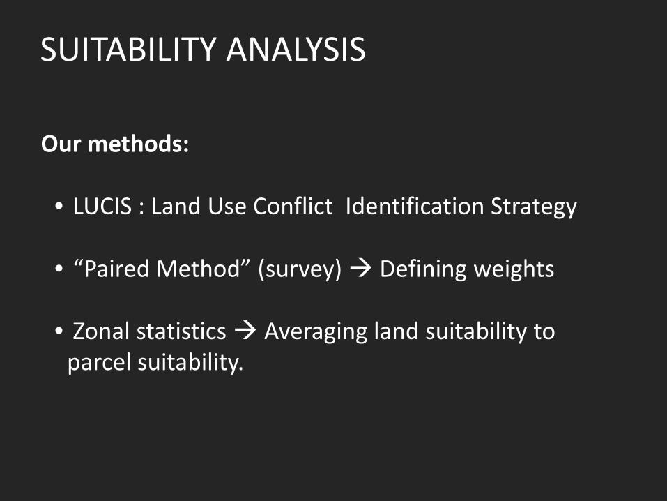
Our methods: • LUCIS : Land Use Conflict Identification Strategy • “Paired Method” (survey) Defining weights • Zonal statistics Averaging land suitability to
parcel suitability.

Objective 1 : Identify land suitable for open spaces /parks
- Sub-objective 1.1 : Identify vacant parcels.
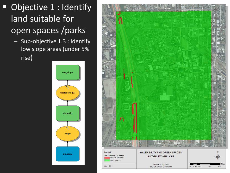
Objective 1 : Identify land suitable for open spaces /parks – Sub-objective 1.3 : Identify
low slope areas (under 5% rise)
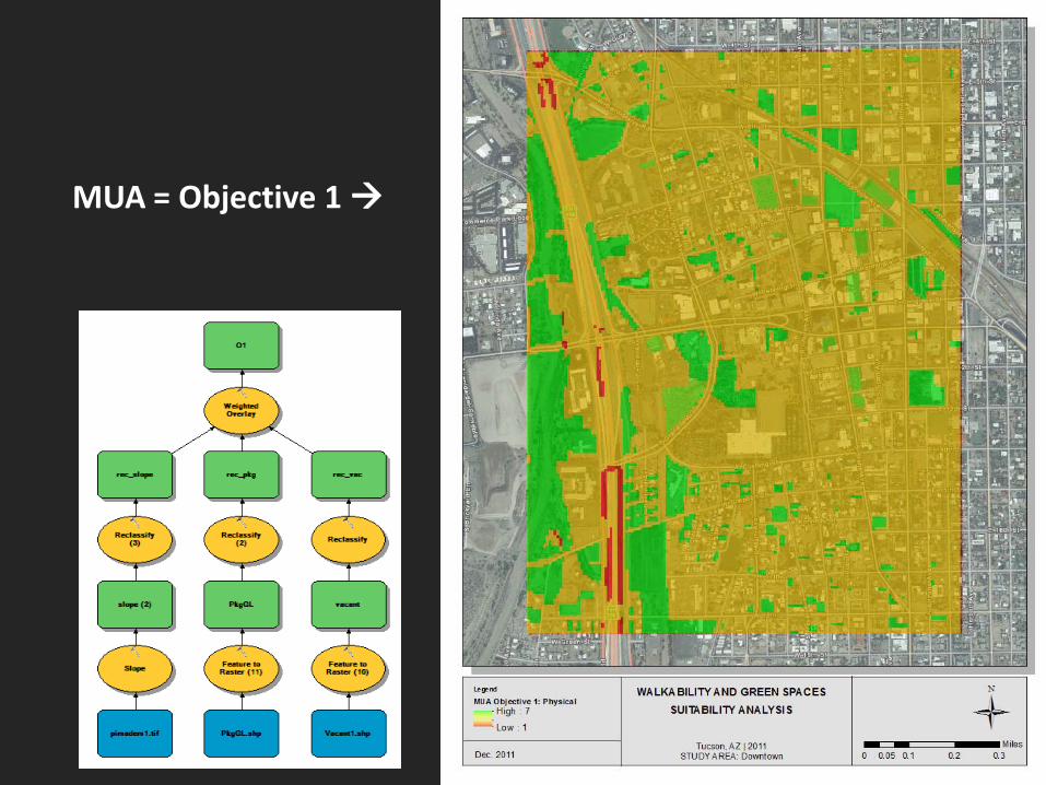
MUA = Objective 1
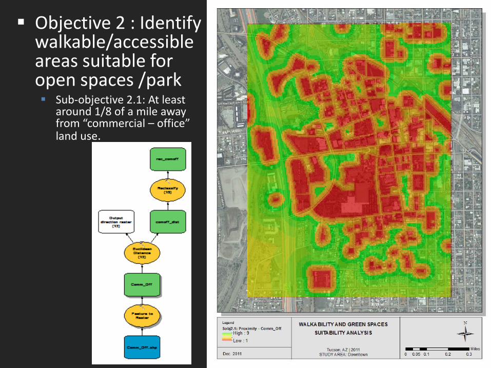
Objective 2 : Identify walkable/accessible areas suitable for open spaces /park Sub-objective 2.1: At least
around 1/8 of a mile away from “commercial – office” land use.

Objective 2 : Identify walkable/accessible areas suitable for open spaces /park Sub-objective 2.11: Closer to
“modern street car route”.

Objective 2 : Identify walkable/accessible areas suitable for open spaces /park Sub-objective 2.12: At least
around 1/8 of a mile away from “MSCar stops”.
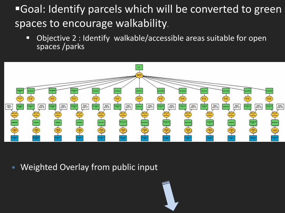
Goal: Identify parcels which will be converted to green spaces to encourage walkability. Objective 2 : Identify walkable/accessible areas suitable for open
spaces /parks
Weighted Overlay from public input
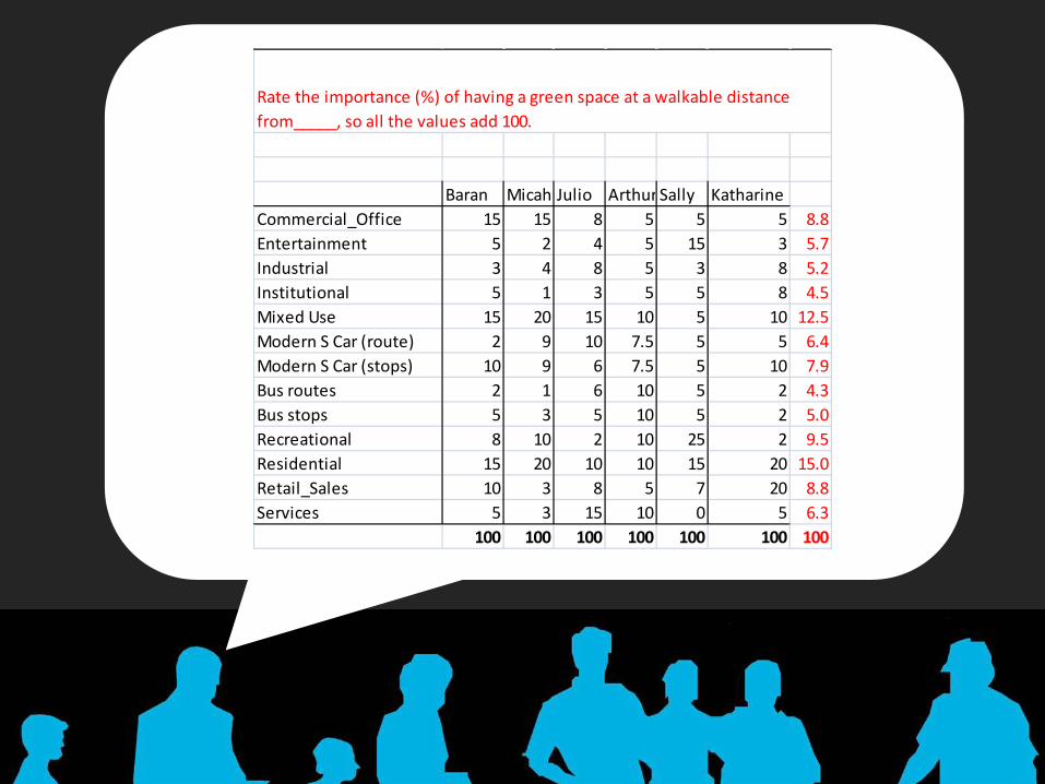
Suitability analysis Baran Micah Julio Arthur Sally Katharine
Commercial_Office 15 15 8 5 5 5 8.8Entertainment 5 2 4 5 15 3 5.7Industrial 3 4 8 5 3 8 5.2Institutional 5 1 3 5 5 8 4.5Mixed Use 15 20 15 10 5 10 12.5Modern S Car (route) 2 9 10 7.5 5 5 6.4Modern S Car (stops) 10 9 6 7.5 5 10 7.9Bus routes 2 1 6 10 5 2 4.3Bus stops 5 3 5 10 5 2 5.0Recreational 8 10 2 10 25 2 9.5Residential 15 20 10 10 15 20 15.0Retail_Sales 10 3 8 5 7 20 8.8Services 5 3 15 10 0 5 6.3
100 100 100 100 100 100 100
Rate the importance (%) of having a green space at a walkable distance from_____, so all the values add 100.

MUA = Objective 2
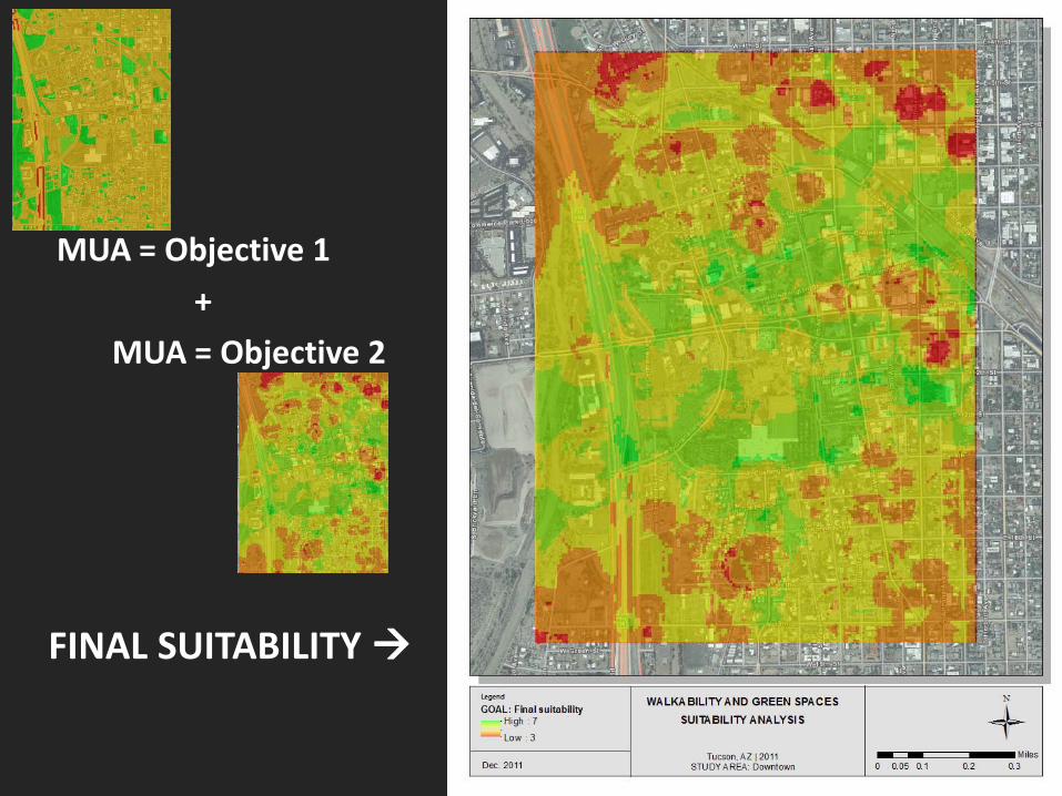
FINAL SUITABILITY
MUA = Objective 1 + MUA = Objective 2
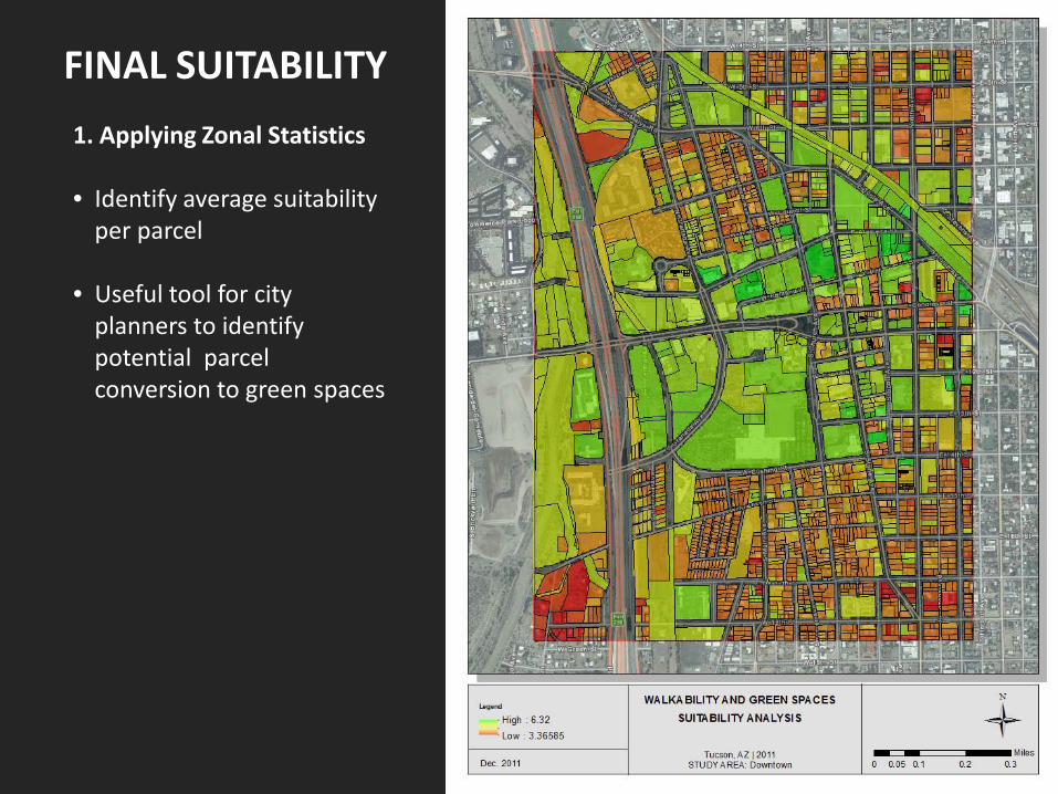
FINAL SUITABILITY 1. Applying Zonal Statistics • Identify average suitability
per parcel • Useful tool for city
planners to identify potential parcel conversion to green spaces
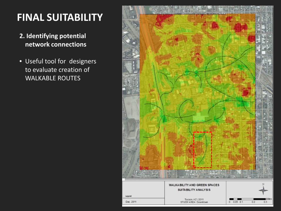
FINAL SUITABILITY 2. Identifying potential
network connections • Useful tool for designers
to evaluate creation of WALKABLE ROUTES
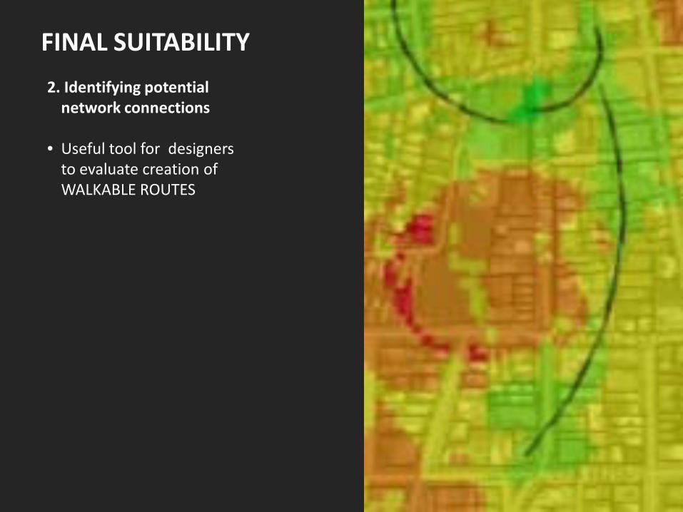
FINAL SUITABILITY 2. Identifying potential
network connections • Useful tool for designers
to evaluate creation of WALKABLE ROUTES
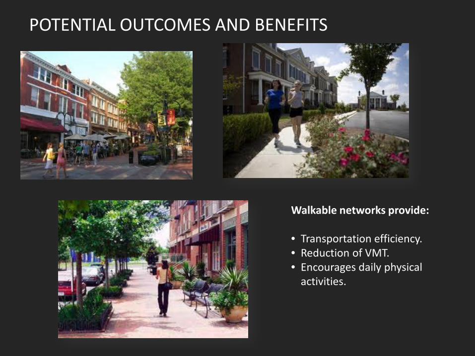
POTENTIAL OUTCOMES AND BENEFITS
Walkable networks provide: • Transportation efficiency. • Reduction of VMT. • Encourages daily physical
activities.
WALKABILITY AND GREEN SPACES Downtown Tucson
Julio Carrillo Baran Farahani Katharine Mitchell LAR622 – December 6, 2011
THANK YOU!…. Questions?