unosat and swcem - · information technology (git) within different application domains: –...
TRANSCRIPT
UNOSAT and SWCEM
Einar Bjorgo, Manager
Workshop on Operational Space-based Weather and
Climate Extremes Monitoring (SWCEM)
Geneva 16 February 2017
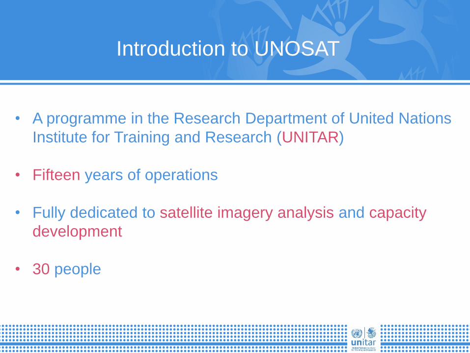
Introduction to UNOSAT
• A programme in the Research Department of United Nations
Institute for Training and Research (UNITAR)
• Fifteen years of operations
• Fully dedicated to satellite imagery analysis and capacity
development
• 30 people

50% 50%
Introduction to UNOSAT

UNOSAT’s offices
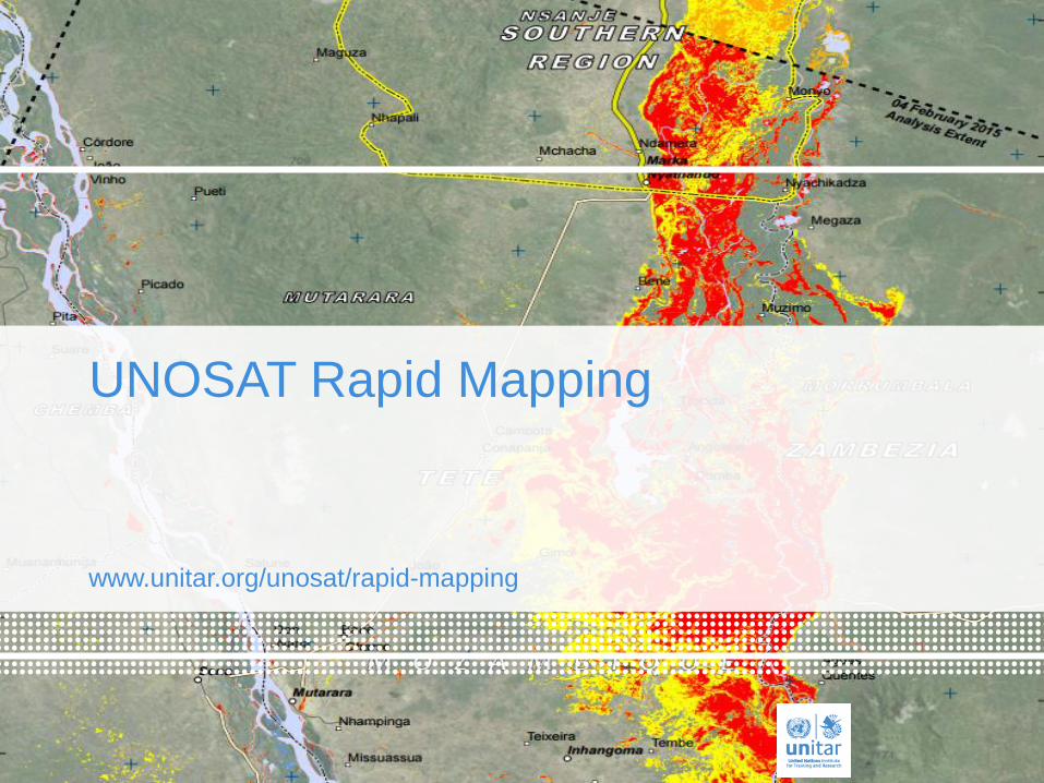
www.unitar.org/unosat/rapid-mapping
UNOSAT Rapid Mapping

The big picture:
CRED and UNISDR: The human cost of weather related disasters
1995 - 2015


Flood Finder
Flood Finder is a flood forecasting system being
developed by UNOSAT to effectively linking
meteorological, hydrological and inundation models to
produce global early warnings and simulated flood
scenarios and to anticipate satellite tasking.
.
Flood Finder is a tool to support flood preparedness
contingency planning, and flood response operations
undertaken by UN agencies, international humanitarian
organizations and national and regional water authorities.
What is it?
Whom is it for?
Credits: UN Photo/Logan Abassi
Partners: CERN, CIMA, USGS

Strengthening Technical Capacities for
Disaster Risk Reduction

• More than a decade of experience in the
development and delivery of training and capacity
development activities on the use of Geospatial
Information Technology (GIT) within different
application domains:
– Disaster Risk Reduction
– Disaster Risk Management
– Water Resource Management
– Territorial Planning
• Face to Face Training
– Hands-on, practical sessions by enhancing
learning experience through past disaster
events and operational case studies
Overview

Project Work Developed by Beneficiaries in Bangladesh


19
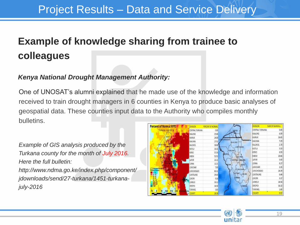
Example of knowledge sharing from trainee to
colleagues
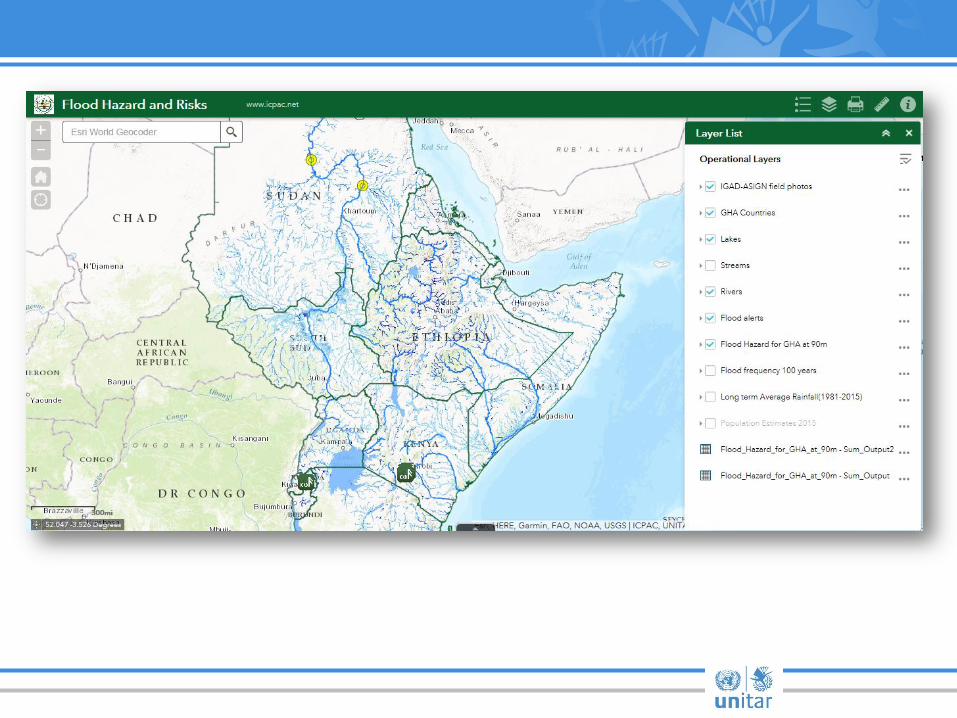
Kenya National Drought Management Authority:
Project Results – Data and Service Delivery
One of UNOSAT’s alumni explained that he made use of the knowledge and information
received to train drought managers in 6 counties in Kenya to produce basic analyses of
geospatial data. These counties input data to the Authority who compiles monthly
bulletins.
Example of GIS analysis produced by the
Turkana county for the month of July 2016.
Here the full bulletin:
http://www.ndma.go.ke/index.php/component/
jdownloads/send/27-turkana/1451-turkana-
july-2016

ResEau Chad: Sustainable water management
UNOSAT and SWCEM
• We can contribute with operational climate services
• Satellite analysis • Modelling • Training and capacity development
• Partnerships fundamental, for example ICPAC, ADPC. MoU with WMO
• Let us know how we can best contribute – we are ready

Palais des Nations
1211 Geneva 10
Switzerland
T +41 22 917 8400
F +41 22 917 8047
www.unitar.org
United Nations Institute for Training and Research
Institut des Nations Unies pour la Formation et la Recherche
Instituto de las Naciones Unidas para Formación Profesional e Investigaciones
Учебньıй и научно-исследовательский институт
Организации Объединенньıх Наций
معهد األمم المتحدة للتدريب والبحث联合国训练研究所
22
UNITAR Operational Satellite Application Programme (UNOSAT) Contact information:
www.unitar.org/unosat
T +41 22 767 4020