transportation alternatives 2020 call for projects for the ......active transportation projects. •...
TRANSCRIPT
Transportation Alternatives2020 Call for Projects
for the North Central Texas Region
Public WorkshopJanuary 21, 2020
Workshop Overview• Mobility 2045• 2020 Transportation Alternatives (TA) Call for Projects –
Program Overview• Guidelines• Evaluation and Scoring
• Application Overview• Environmental Review• Project Implementation
• Project Schedule• Project Budget
• Program Schedule
2
Implementing Mobility 2045
Mobility 2045 Policy BP3-002: Implement pedestrian and bicycle facilities
• Active Transportation Network Implementation• Close Gaps and Improve Connectivity in the Regional Veloweb,
On-Street Bikeway Network, and Pedestrian Network• Linkages to Transit and Major Destinations• Environmental Justice Areas and Transit-Dependent Populations• Regional Pedestrian Network• Safe Routes to School
• Safety Improvements• ADA
4

2020 Transportation AlternativesCall for Projects
Program Overview
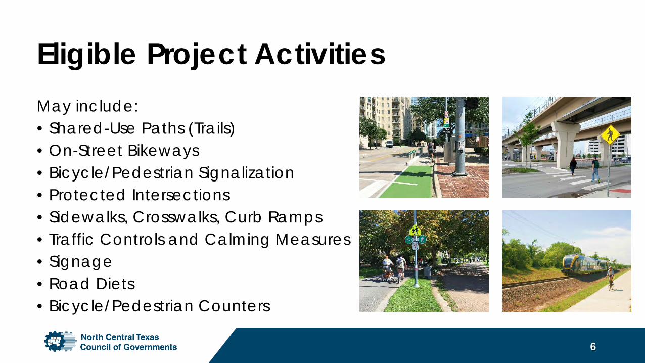
Eligible Project ActivitiesMay include:• Shared-Use Paths (Trails)• On-Street Bikeways• Bicycle/Pedestrian Signalization• Protected Intersections• Sidewalks, Crosswalks, Curb Ramps• Traffic Controls and Calming Measures• Signage• Road Diets• Bicycle/Pedestrian Counters
6
Ineligible Project ActivitiesIncludes, but not limited to:• Planning for Safe Routes to School, corridor studies, trail or on-
street bicycle plans, etc.• Promotional activities and/or Safe Routes to School non-
infrastructure activities related to education, encouragement, and enforcement
• Bike share equipment or operations.• General recreation and park facilities (e.g., playground
equipment, sports fields, etc.)• Roadway construction/reconstruction focused projects• Routine maintenance and operations
7
Eligible Project Sponsors• Local Governments• Regional Transportation Authorities• Transit Agencies• School Districts, Local Education Agencies, or Schools• Tribal Governments• Other local or regional governmental entity with
responsibility for oversight of transportation or recreational trails
8
Funding Overview
9
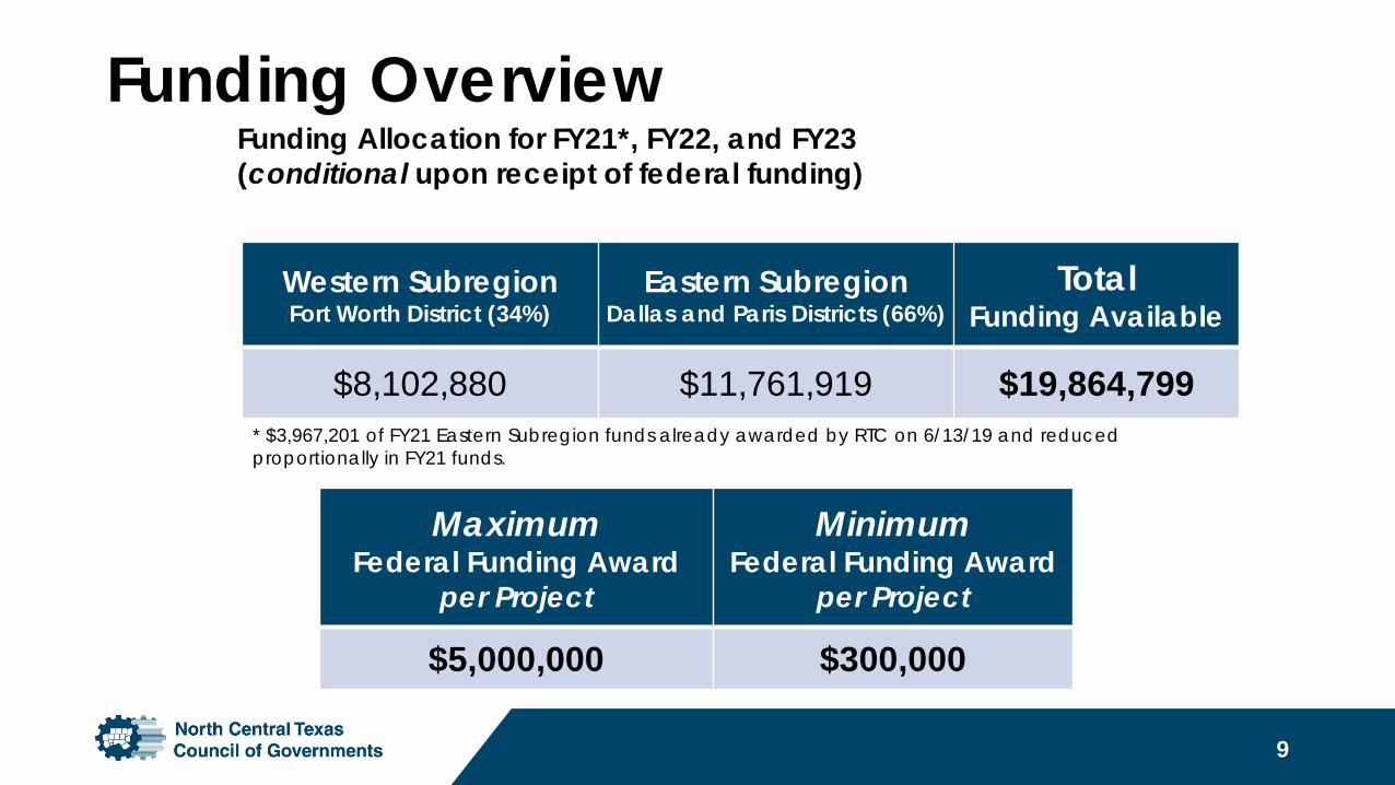
Western SubregionFort Worth District (34%)
Eastern SubregionDallas and Paris Districts (66%)
Total Funding Available
$8,102,880 $11,761,919 $19,864,799
MaximumFederal Funding Award
per Project
MinimumFederal Funding Award
per Project
$5,000,000 $300,000
* $3,967,201 of FY21 Eastern Subregion funds already awarded by RTC on 6/13/19 and reduced proportionally in FY21 funds.
Funding Allocation for FY21*, FY22, and FY23 (conditional upon receipt of federal funding)
Funding Overview• TA federal funding is not a grant. The funds provided are on a cost
reimbursement basis.• Construction-implementation focus. Engineering/design and environmental
must be 100 % locally funded.• Minimum 20% local match is required for construction.• Local match must be cash or TDCs – no in-kind contributions allowed.• Agencies eligible to request TDCs in lieu of a local match if qualified through
the MTP Policy Bundle process.• A resolution by the project sponsor’s governing body confirming the
availability of the local match contribution is required with each application.
10
Program Rules• Project Agreement: Applicants must commit to executing an
Advanced Funding Agreement (AFA) with TxDOT within one year of project selection (by end of FY2021).
• Funding Obligation: Applicants must commit to obligate funds within three years of selection (by end of FY2023) or risk the loss of funding.
• Cost Overruns: Are solely the responsibility of the nominating entity.
11
Eligible Project Categories
Active Transportation• Bicycle and pedestrian
infrastructure projects.• Projects that complete the
regional Veloweb trail network, or connect to transit or major destinations are encouraged.
Safe Routes to School• Bicycle and Pedestrian
infrastructure projects.• Projects intended to improve
the safety and comfort of students walking and bicycling to school and encourage more students to walk or bicycle.
12
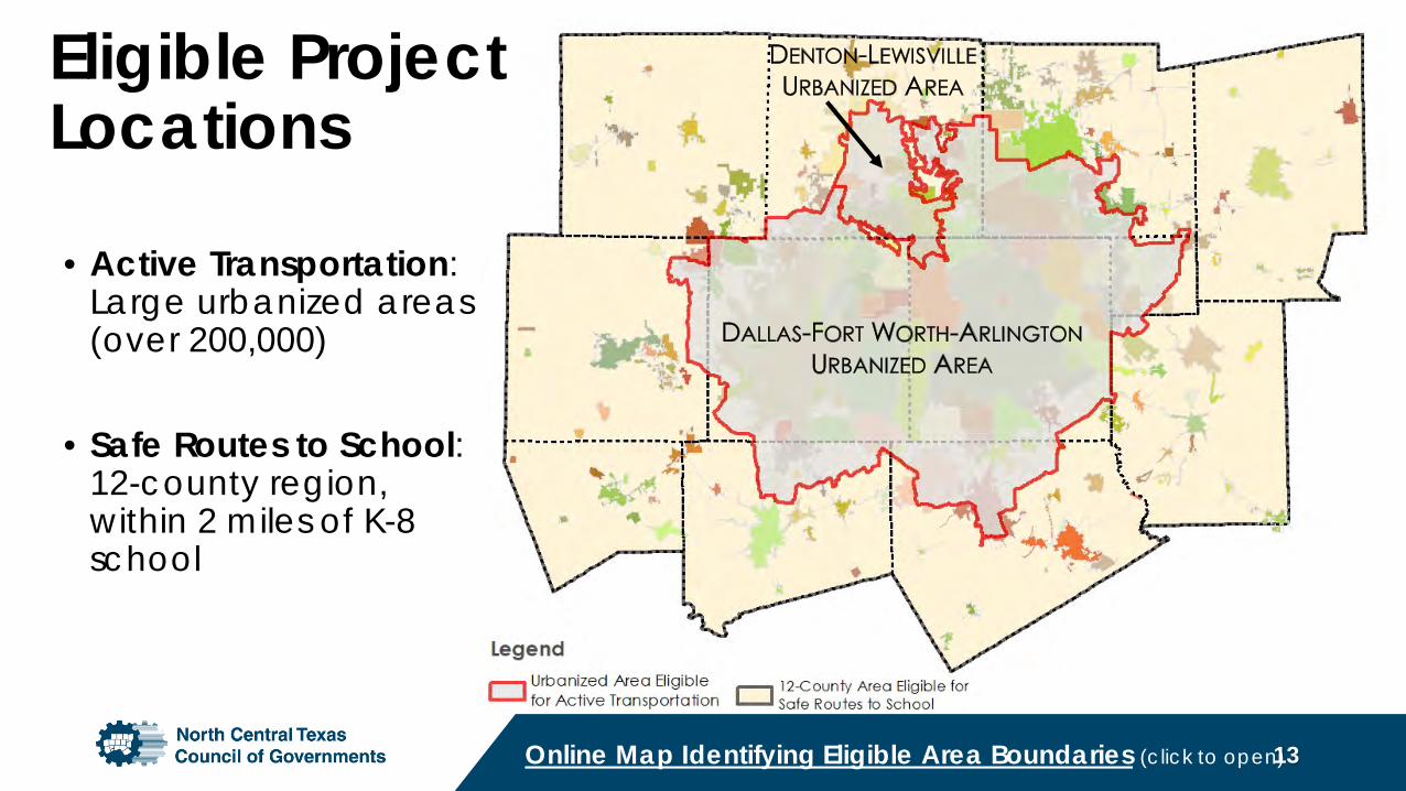
Eligible Project Locations
13
• Active Transportation: Large urbanized areas (over 200,000)
• Safe Routes to School: 12-county region, within 2 miles of K-8 school
Online Map Identifying Eligible Area Boundaries (click to open)
Evaluation and Scoring
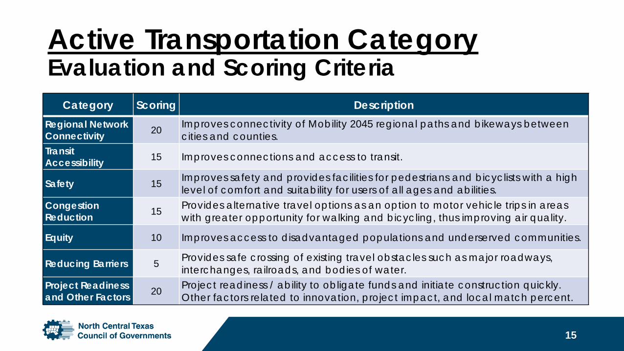
Category Scoring DescriptionRegional Network Connectivity 20 Improves connectivity of Mobility 2045 regional paths and bikeways between
cities and counties.Transit Accessibility 15 Improves connections and access to transit.
Safety 15 Improves safety and provides facilities for pedestrians and bicyclists with a high level of comfort and suitability for users of all ages and abilities.
Congestion Reduction 15 Provides alternative travel options as an option to motor vehicle trips in areas
with greater opportunity for walking and bicycling, thus improving air quality.
Equity 10 Improves access to disadvantaged populations and underserved communities.
Reducing Barriers 5 Provides safe crossing of existing travel obstacles such as major roadways, interchanges, railroads, and bodies of water.
Project Readiness and Other Factors 20 Project readiness / ability to obligate funds and initiate construction quickly.
Other factors related to innovation, project impact, and local match percent.
Active Transportation CategoryEvaluation and Scoring Criteria
15
Active Transportation CategoryEvaluation and Scoring Criteria
16
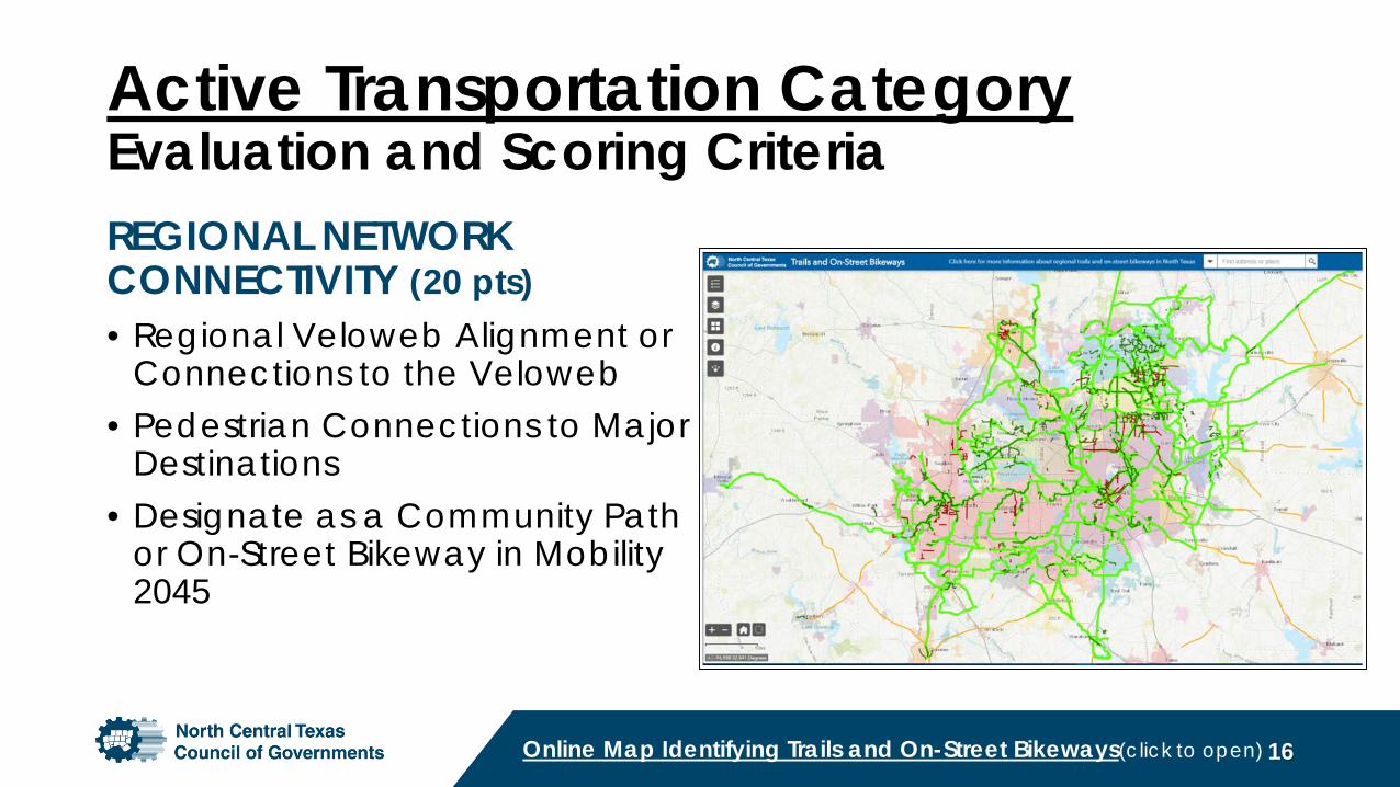
REGIONAL NETWORK CONNECTIVITY (20 pts)• Regional Veloweb Alignment or
Connections to the Veloweb• Pedestrian Connections to Major
Destinations• Designate as a Community Path
or On-Street Bikeway in Mobility 2045
Online Map Identifying Trails and On-Street Bikeways(click to open)
Active Transportation CategoryEvaluation and Scoring Criteria
17
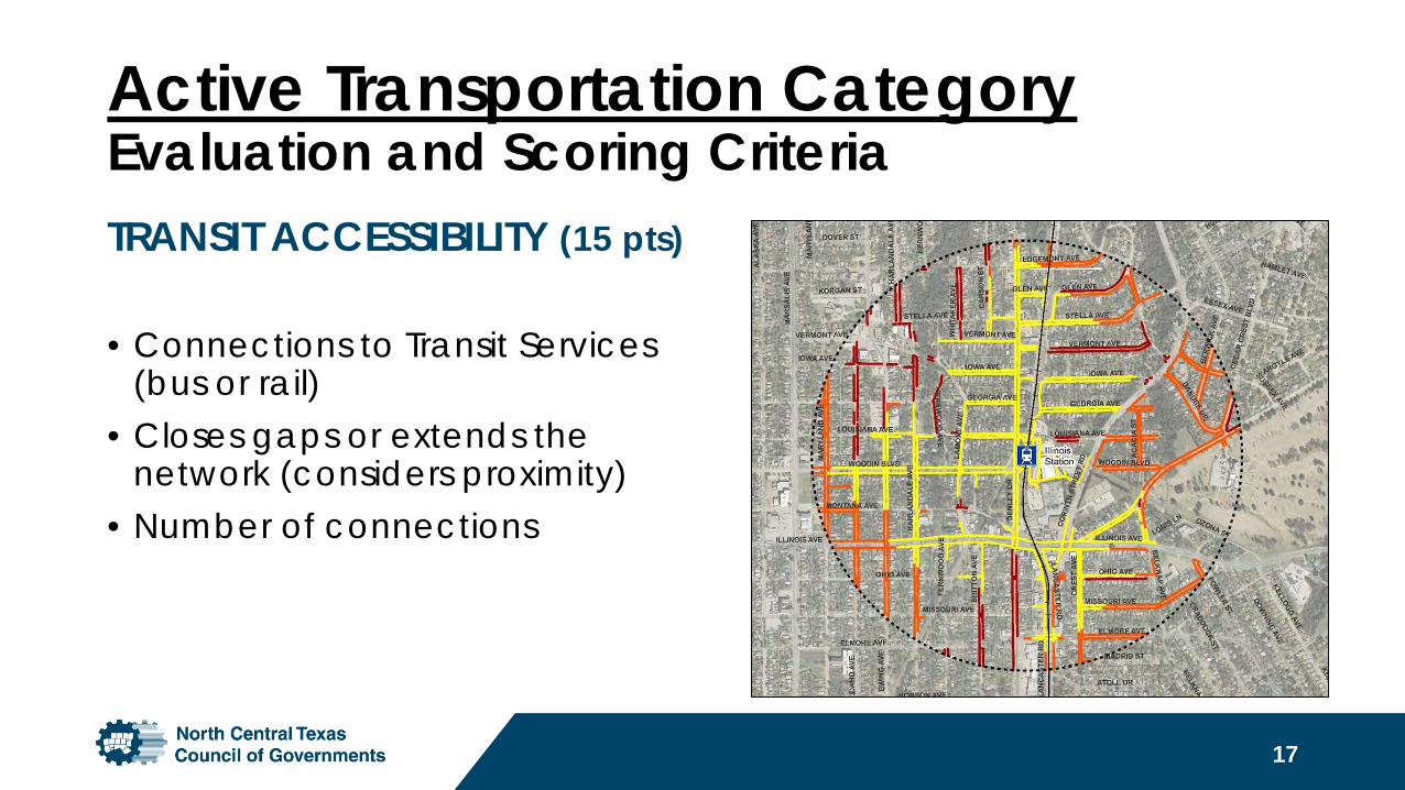
TRANSIT ACCESSIBILITY (15 pts)
• Connections to Transit Services (bus or rail)
• Closes gaps or extends the network (considers proximity)
• Number of connections
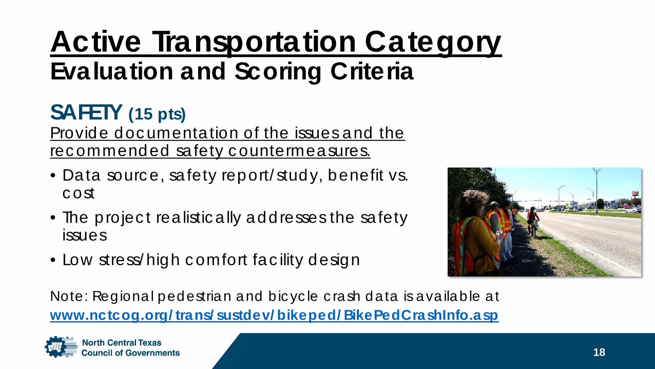
Active Transportation CategoryEvaluation and Scoring CriteriaSAFETY (15 pts) Provide documentation of the issues and the recommended safety countermeasures.• Data source, safety report/study, benefit vs.
cost• The project realistically addresses the safety
issues• Low stress/high comfort facility design
18
Note: Regional pedestrian and bicycle crash data is available at www.nctcog.org/trans/sustdev/bikeped/BikePedCrashInfo.asp
Active Transportation CategoryEvaluation and Scoring Criteria
19
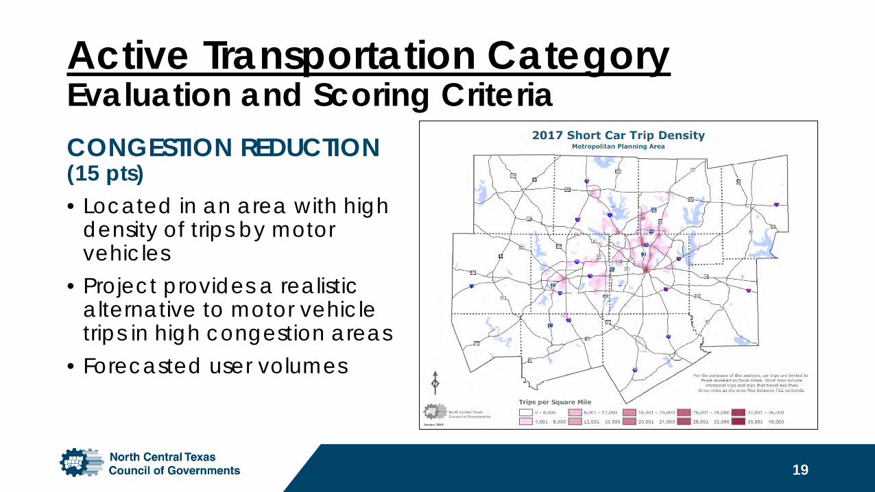
CONGESTION REDUCTION (15 pts)• Located in an area with high
density of trips by motor vehicles
• Project provides a realistic alternative to motor vehicle trips in high congestion areas
• Forecasted user volumes
Active Transportation CategoryEvaluation and Scoring Criteria
20
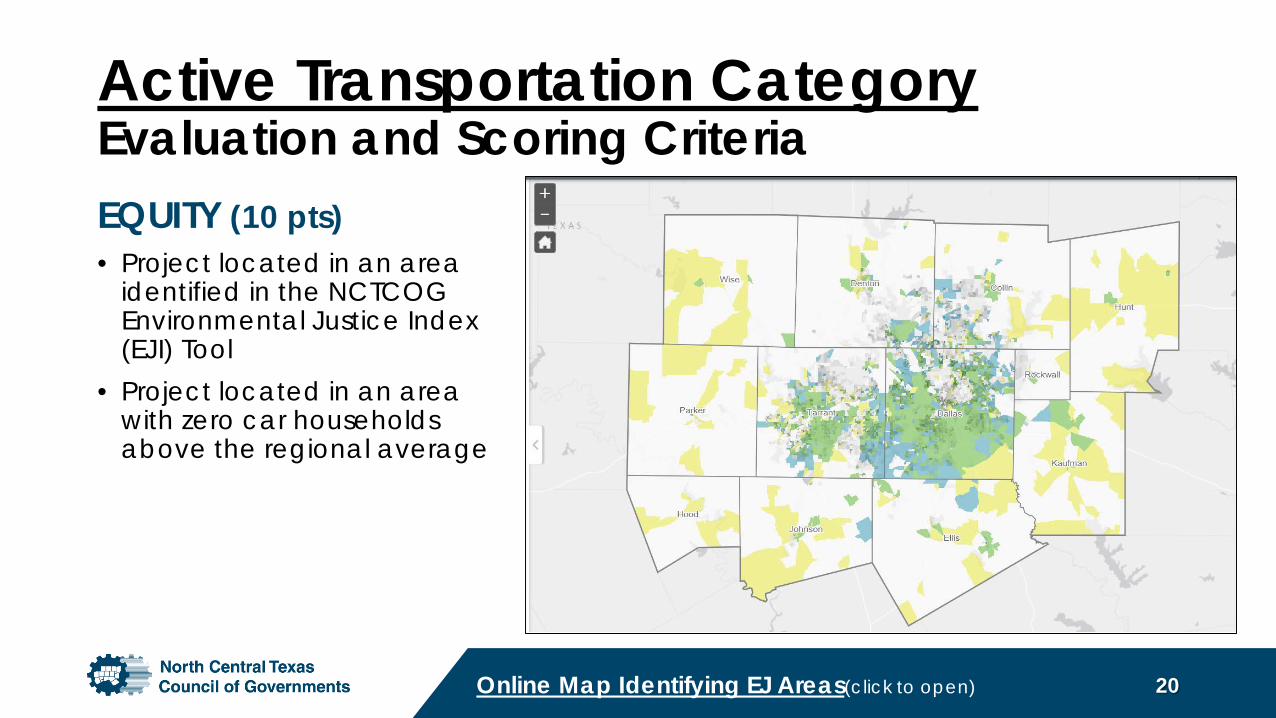
EQUITY (10 pts)• Project located in an area
identified in the NCTCOG Environmental Justice Index (EJI) Tool
• Project located in an area with zero car households above the regional average
Online Map Identifying EJ Areas(click to open)
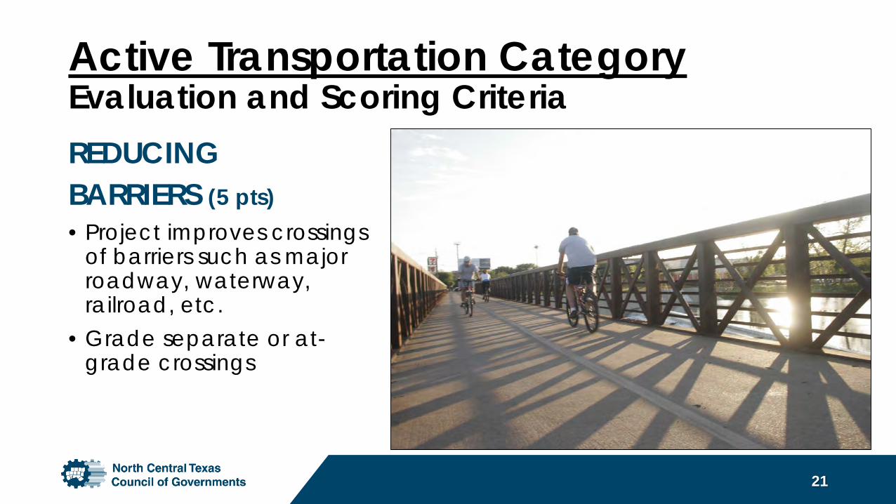
Active Transportation CategoryEvaluation and Scoring CriteriaREDUCING BARRIERS (5 pts)• Project improves crossings
of barriers such as major roadway, waterway, railroad, etc.
• Grade separate or at-grade crossings
21
Active Transportation CategoryEvaluation and Scoring Criteria
22
PROJECT READINESS & OTHER FACTORS (20 pts)• Engineering/design – percent complete• Local funding overmatch • Innovative technology and treatments• Preliminary utility assessment• Geographic distribution• Benefit vs. cost• Level of stakeholder/community support
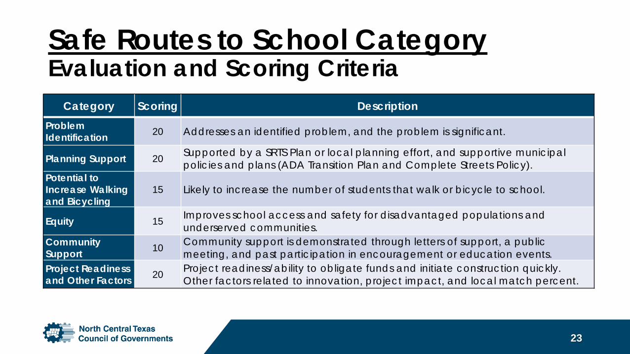
Category Scoring DescriptionProblem Identification 20 Addresses an identified problem, and the problem is significant.
Planning Support 20 Supported by a SRTS Plan or local planning effort, and supportive municipal policies and plans (ADA Transition Plan and Complete Streets Policy).
Potential to Increase Walking and Bicycling
15 Likely to increase the number of students that walk or bicycle to school.
Equity 15 Improves school access and safety for disadvantaged populations and underserved communities.
Community Support 10 Community support is demonstrated through letters of support, a public
meeting, and past participation in encouragement or education events.Project Readiness and Other Factors 20 Project readiness/ability to obligate funds and initiate construction quickly.
Other factors related to innovation, project impact, and local match percent.
Safe Routes to School CategoryEvaluation and Scoring Criteria
23
Safe Routes to School CategoryEvaluation and Scoring Criteria
24
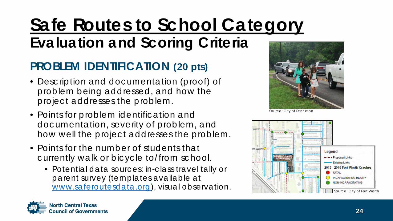
PROBLEM IDENTIFICATION (20 pts)• Description and documentation (proof) of
problem being addressed, and how the project addresses the problem.
• Points for problem identification and documentation, severity of problem, and how well the project addresses the problem.
• Points for the number of students that currently walk or bicycle to/from school.
• Potential data sources: in-class travel tally or parent survey (templates available at www.saferoutesdata.org), visual observation.
Source: City of Princeton
Source: City of Fort Worth
Safe Routes to School CategoryEvaluation and Scoring Criteria
25
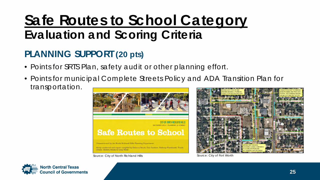
PLANNING SUPPORT (20 pts)• Points for SRTS Plan, safety audit or other planning effort.• Points for municipal Complete Streets Policy and ADA Transition Plan for
transportation.
Source: City of North Richland Hills Source: City of Fort Worth
Safe Routes to School CategoryEvaluation and Scoring Criteria
26
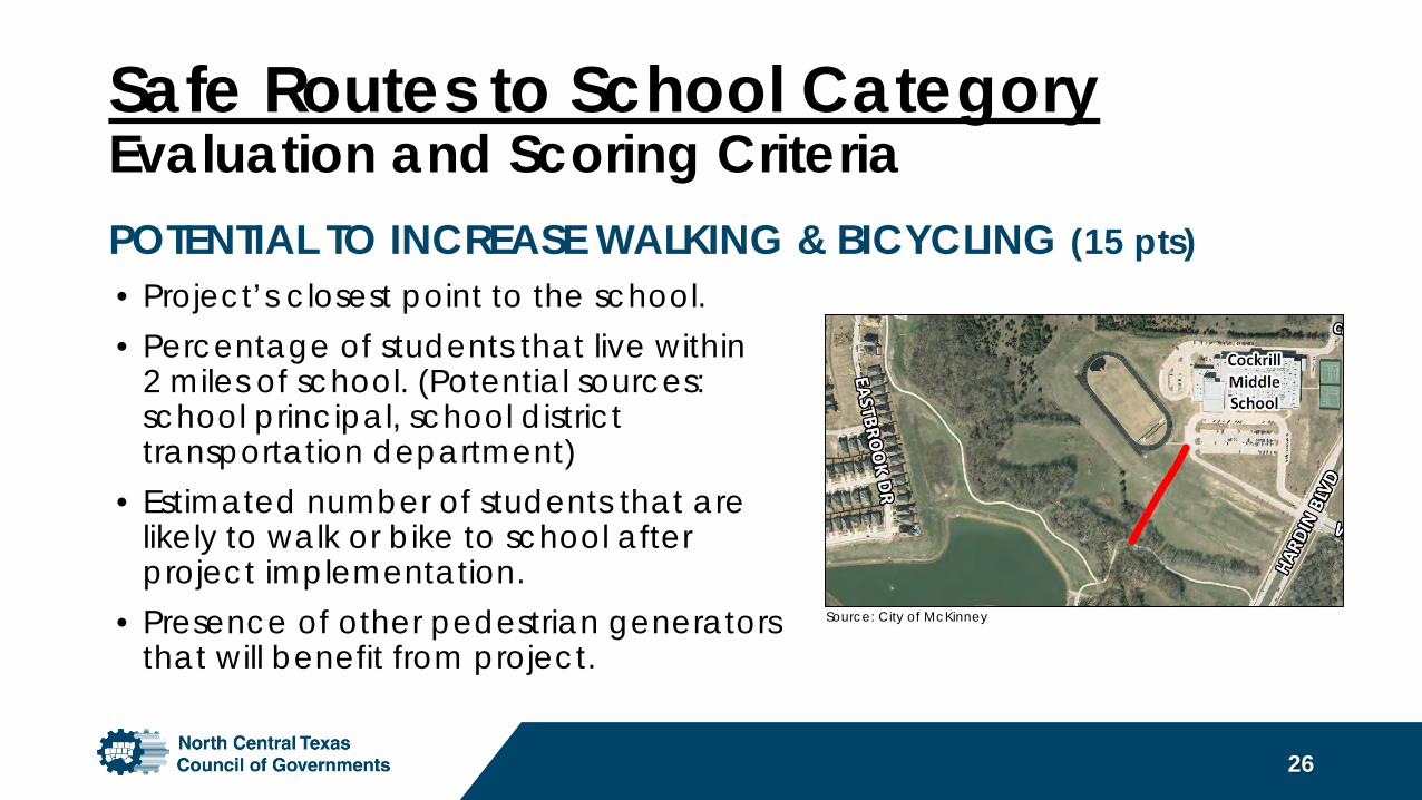
POTENTIAL TO INCREASE WALKING & BICYCLING (15 pts)
Source: City of McKinney
• Project’s closest point to the school.• Percentage of students that live within
2 miles of school. (Potential sources: school principal, school district transportation department)
• Estimated number of students that are likely to walk or bike to school after project implementation.
• Presence of other pedestrian generators that will benefit from project.
Safe Routes to School CategoryEvaluation and Scoring Criteria
27
EQUITY (15 pts)• Percent of students that are economically disadvantaged.
• (Source: Texas Education Agency School Report Cards)
COMMUNITY SUPPORT (10 pts)• Letter of support from school district superintendent (Required).• Letter of support from school principal.• Additional letters of support (up to five).• School and/or city’s past participation in education or
encouragement events for walking/bicycling to school.• Whether a public meeting has been held.
Safe Routes to School CategoryEvaluation and Scoring Criteria
28
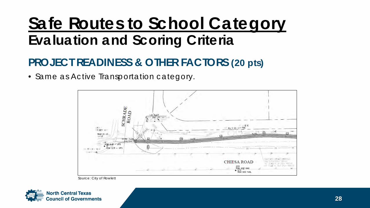
PROJECT READINESS & OTHER FACTORS (20 pts)• Same as Active Transportation category.
Source: City of Rowlett
Safe Routes to School Category• Applications for SRTS projects will not compete for funding with
Active Transportation projects.
• A separate application should be submitted for each school campus or grouping of schools.
• Note: Projects that perform best are grounded in a planning effort, site observations during arrival/dismissal, and/or input from the school community. Projects that are purely based on a city’s sidewalk gap inventory will not perform well.
29
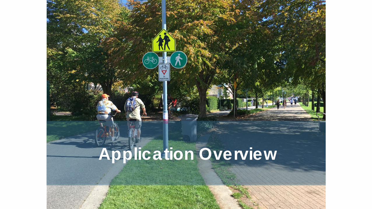
Application Overview
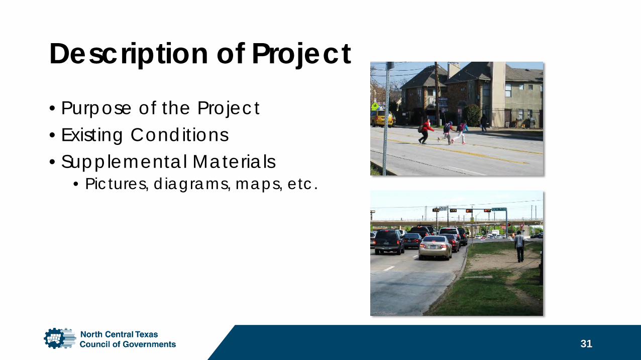
Description of Project• Purpose of the Project• Existing Conditions• Supplemental Materials
• Pictures, diagrams, maps, etc.
31
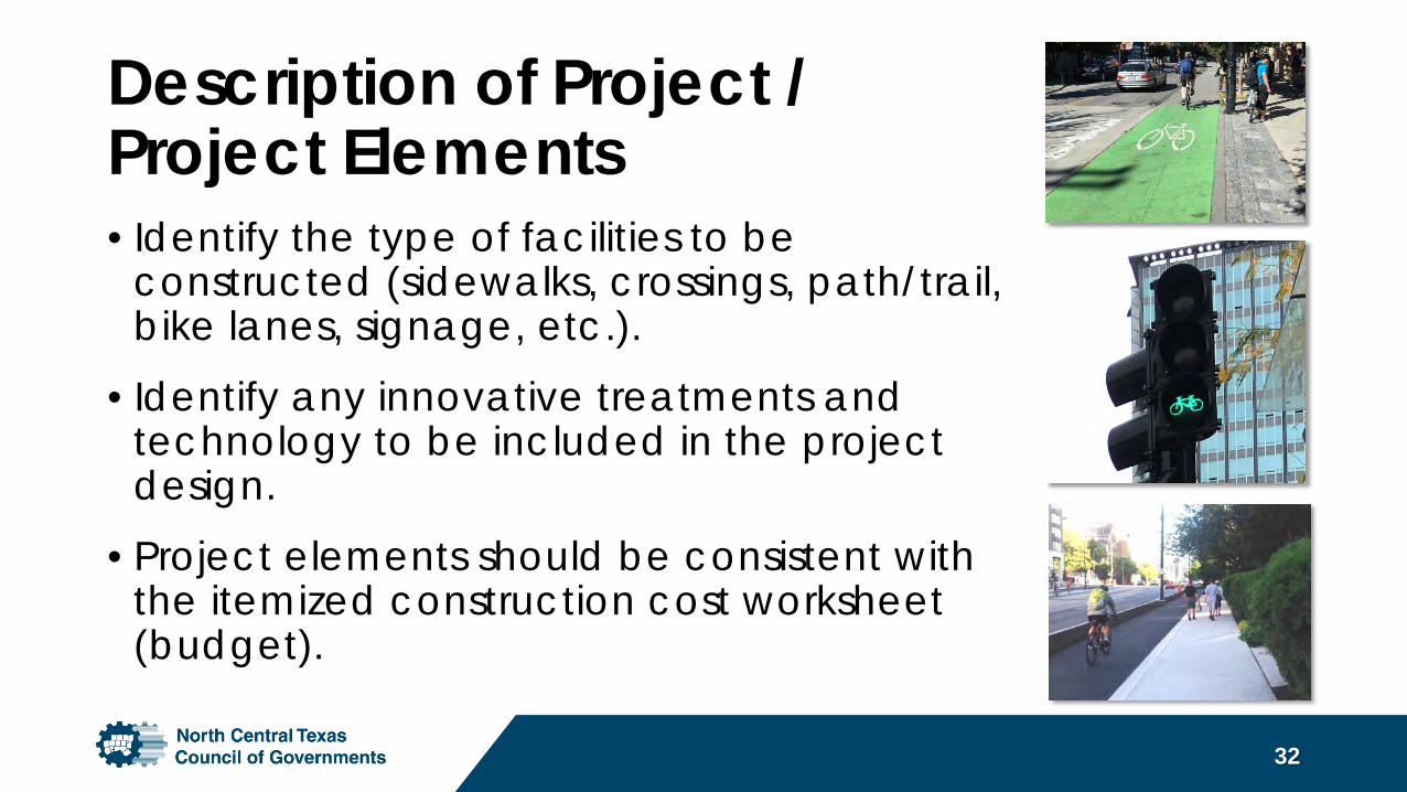
Description of Project / Project Elements• Identify the type of facilities to be
constructed (sidewalks, crossings, path/trail, bike lanes, signage, etc.).
• Identify any innovative treatments and technology to be included in the project design.
• Project elements should be consistent with the itemized construction cost worksheet (budget).
32
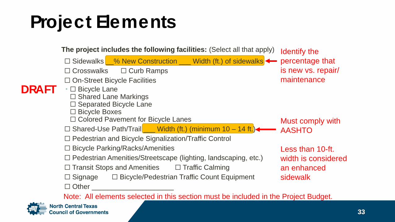
Project Elements
3333
Identify the percentage that is new vs. repair/ maintenance
Must comply with AASHTO
Less than 10-ft. width is considered an enhanced sidewalk
Note: All elements selected in this section must be included in the Project Budget.
The project includes the following facilities: (Select all that apply)☐ Sidewalks __% New Construction ___ Width (ft.) of sidewalks☐ Crosswalks ☐ Curb Ramps☐ On-Street Bicycle Facilities ☐ Bicycle Lane☐ Shared Lane Markings☐ Separated Bicycle Lane☐ Bicycle Boxes☐ Colored Pavement for Bicycle Lanes
☐ Shared-Use Path/Trail ___ Width (ft.) (minimum 10 – 14 ft.) ☐ Pedestrian and Bicycle Signalization/Traffic Control☐ Bicycle Parking/Racks/Amenities☐ Pedestrian Amenities/Streetscape (lighting, landscaping, etc.)☐ Transit Stops and Amenities ☐ Traffic Calming ☐ Signage ☐ Bicycle/Pedestrian Traffic Count Equipment☐ Other _____________________
DRAFT
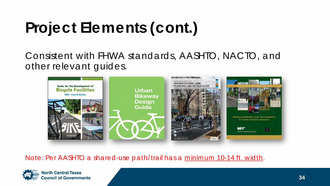
Project Elements (cont.)Consistent with FHWA standards, AASHTO, NACTO, and other relevant guides.
34
Note: Per AASHTO a shared-use path/trail has a minimum 10-14 ft. width.
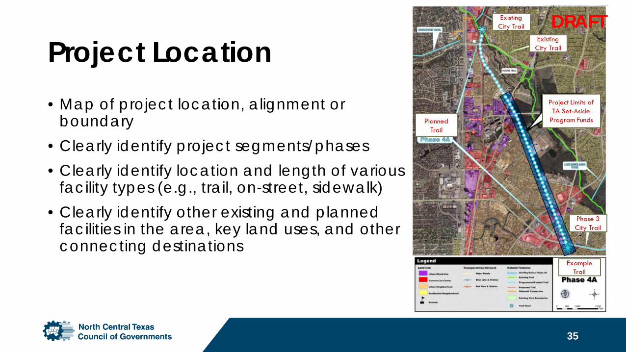
Project Location• Map of project location, alignment or
boundary• Clearly identify project segments/phases• Clearly identify location and length of various
facility types (e.g., trail, on-street, sidewalk)• Clearly identify other existing and planned
facilities in the area, key land uses, and other connecting destinations
35
DRAFT
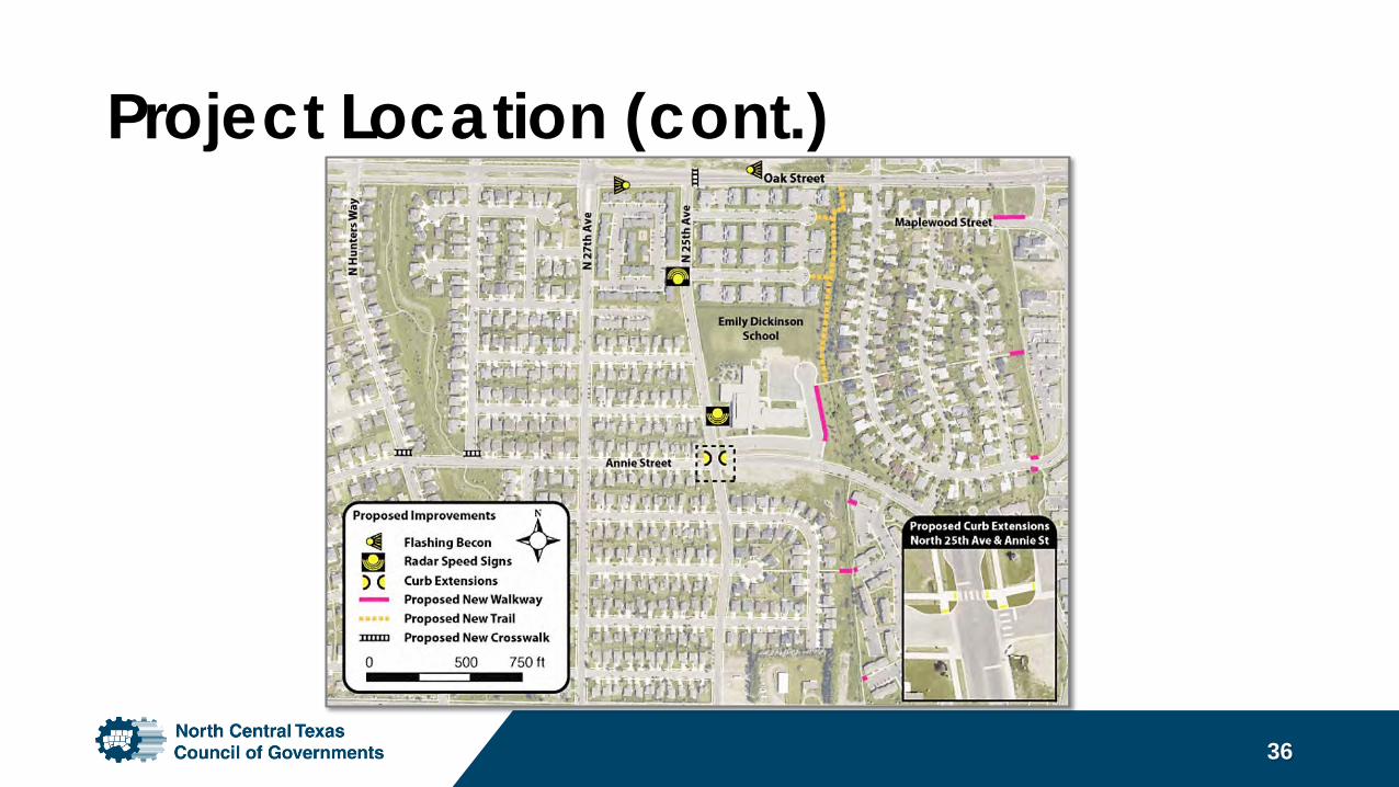
Project Location (cont.)
36
Application Requirements• Funding Resolution by Project
Sponsor Governing Body: Confirm the availability of the local match contribution.
• Environmental Checklist• Right-of-Way/Easement: Property
must be under public ownership. If easement cannot be obtained by deadline, a consent letter from property owner is required.
• Project Schedule Worksheet• Project Budget Worksheet
• GIS Files of Project Elements• Letter of Support from School District
Superintendent (SRTS Projects Only)• Railroad Right of Entry
Letter/Agreement (if project is in railroad right-of-way)
• TxDOT District Engineer Letter of Consent (if project is in TxDOT right-of-way)
• Documentation of Support from Supporting Entity (if project crosses jurisdictions)
37
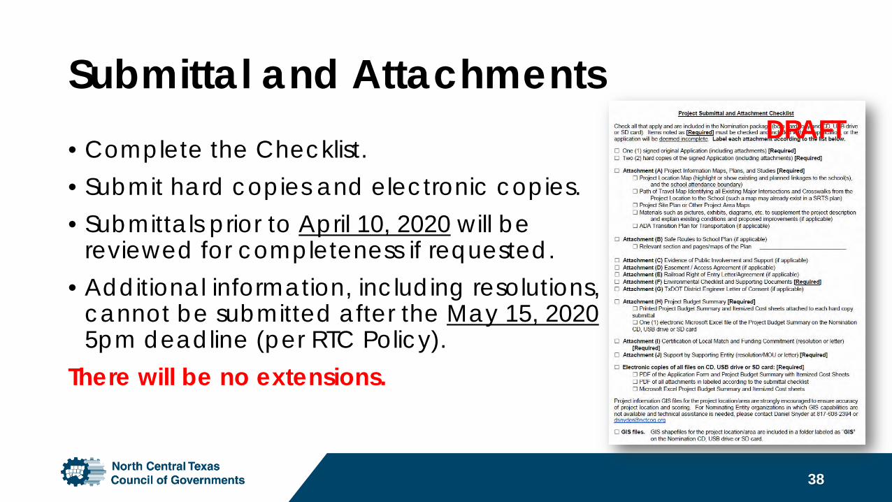
Submittal and Attachments• Complete the Checklist.• Submit hard copies and electronic copies. • Submittals prior to April 10, 2020 will be
reviewed for completeness if requested.• Additional information, including resolutions,
cannot be submitted after the May 15, 2020 5pm deadline (per RTC Policy).
There will be no extensions.
38
DRAFT
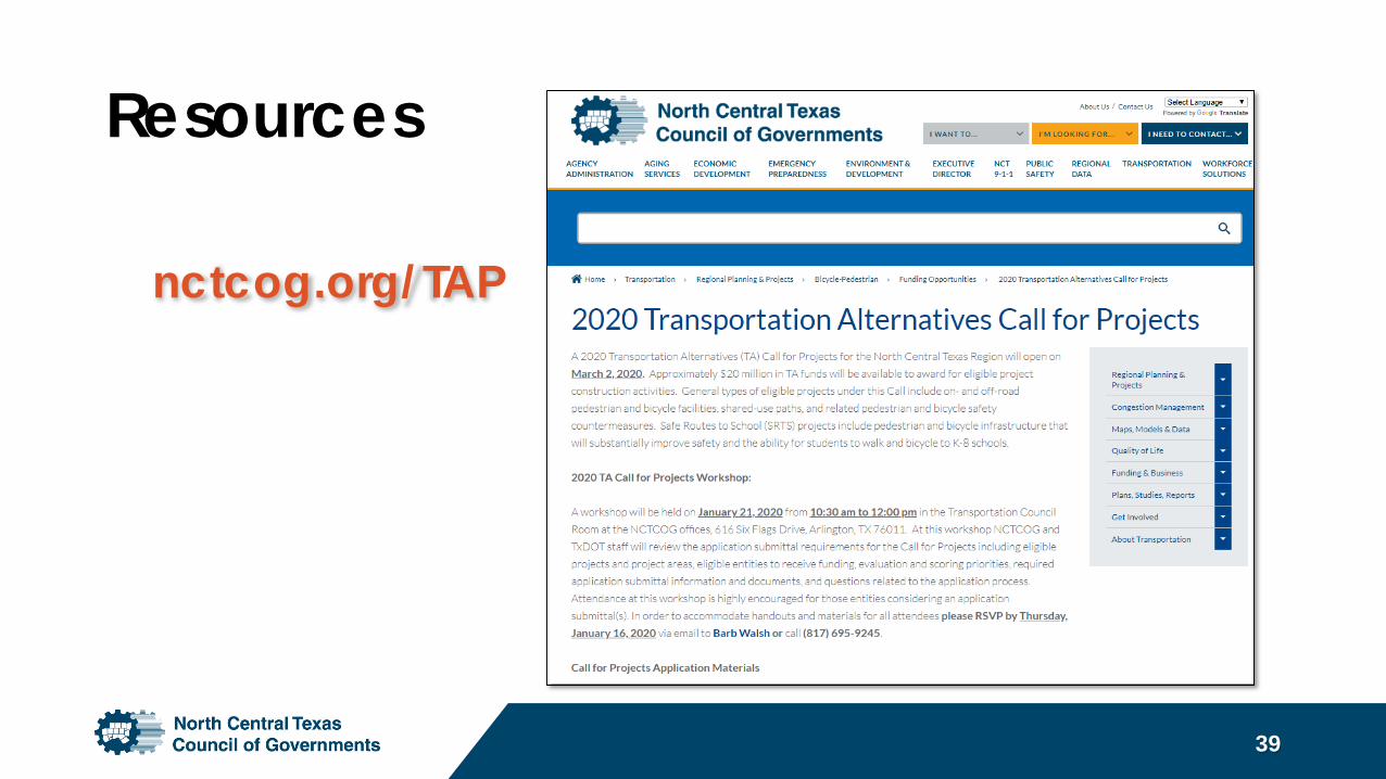
Resources
39
nctcog.org/TAP
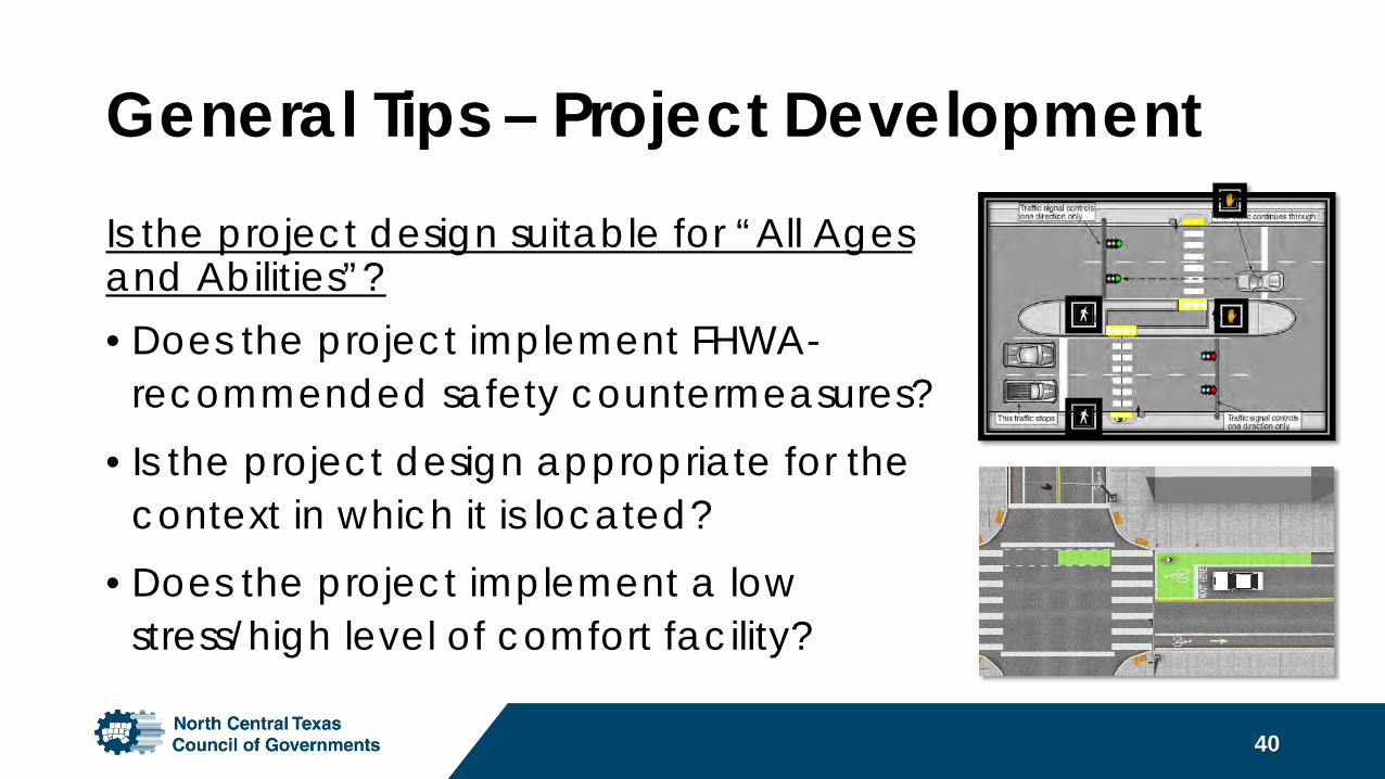
General Tips – Project DevelopmentIs the project design suitable for “All Ages and Abilities”?• Does the project implement FHWA-
recommended safety countermeasures? • Is the project design appropriate for the
context in which it is located?• Does the project implement a low
stress/high level of comfort facility?
40
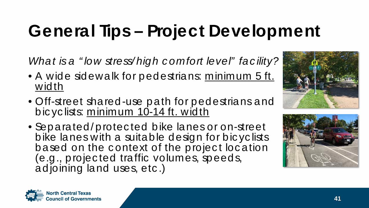
General Tips – Project DevelopmentWhat is a “low stress/high comfort level” facility?• A wide sidewalk for pedestrians: minimum 5 ft.
width• Off-street shared-use path for pedestrians and
bicyclists: minimum 10-14 ft. width• Separated/protected bike lanes or on-street
bike lanes with a suitable design for bicyclists based on the context of the project location (e.g., projected traffic volumes, speeds, adjoining land uses, etc.)
41
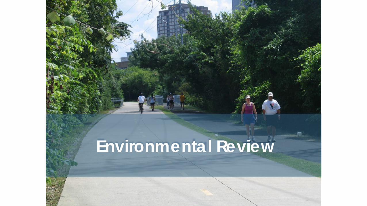
Environmental Review
Environmental Review• Purpose of the TA Program checklist is to identify any
major issues that could delay environmental approval of the proposed project.
• All projects will be required to follow the federal/state environmental process (NEPA).
• The checklist is not a NEPA document. A separate environmental analysis is required for all projects.
43
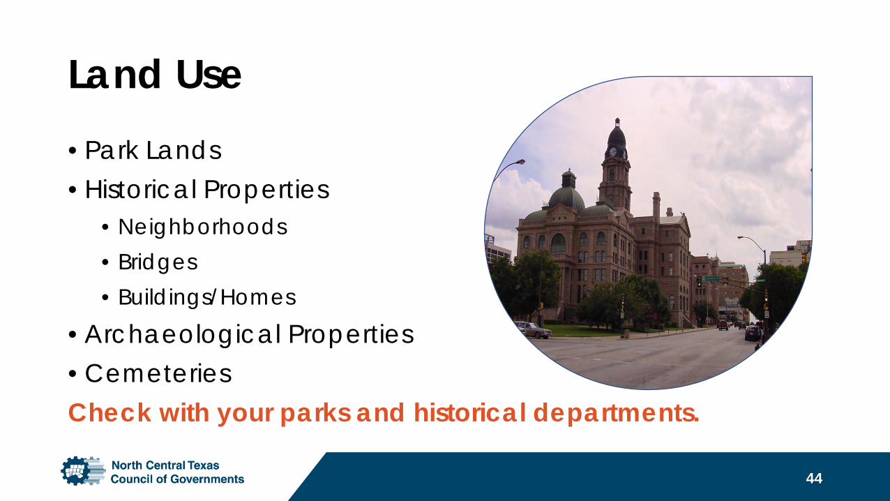
Land Use• Park Lands• Historical Properties
• Neighborhoods• Bridges• Buildings/Homes
• Archaeological Properties• CemeteriesCheck with your parks and historical departments.
44
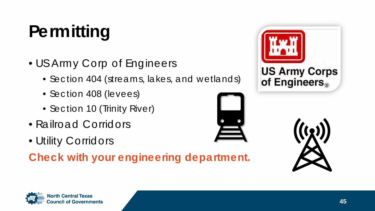
Permitting• US Army Corp of Engineers
• Section 404 (streams, lakes, and wetlands)• Section 408 (levees)• Section 10 (Trinity River)
• Railroad Corridors• Utility CorridorsCheck with your engineering department.
45
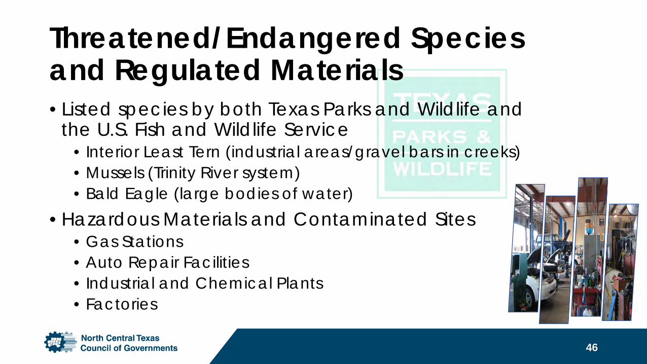
Threatened/Endangered Speciesand Regulated Materials• Listed species by both Texas Parks and Wildlife and
the U.S. Fish and Wildlife Service• Interior Least Tern (industrial areas/gravel bars in creeks)• Mussels (Trinity River system)• Bald Eagle (large bodies of water)
• Hazardous Materials and Contaminated Sites• Gas Stations• Auto Repair Facilities• Industrial and Chemical Plants• Factories
46
Project Implementation
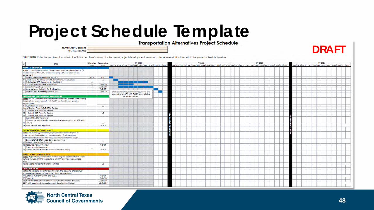
Project Schedule Template
48
DRAFT
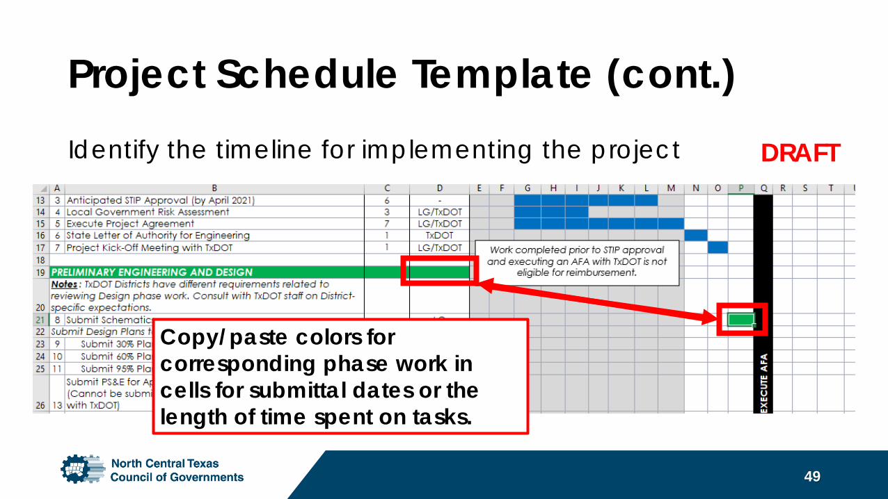
Project Schedule Template (cont.)Identify the timeline for implementing the project
49
Copy/paste colors for corresponding phase work in cells for submittal dates or the length of time spent on tasks.
DRAFT
Implementation of Projects• Consistent with other Federal-aid highway programs, TA funds
are administered by the Texas Department of Transportation.• Regardless of whether the projects are located within the right-
of-way of a Federal-aid highway, the treatment of projects will require:
• Project Agreements• Authorization to Proceed Prior to Incurring Costs• Approval of environmental documents• Designing to federal standards• Prevailing Wage Rates (Davis-Bacon)• Buy America• Competitive Bidding
50
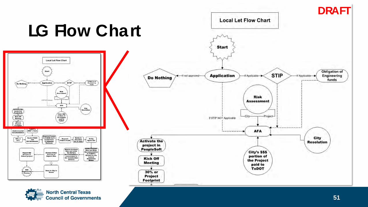
LG Flow Chart
51
DRAFT
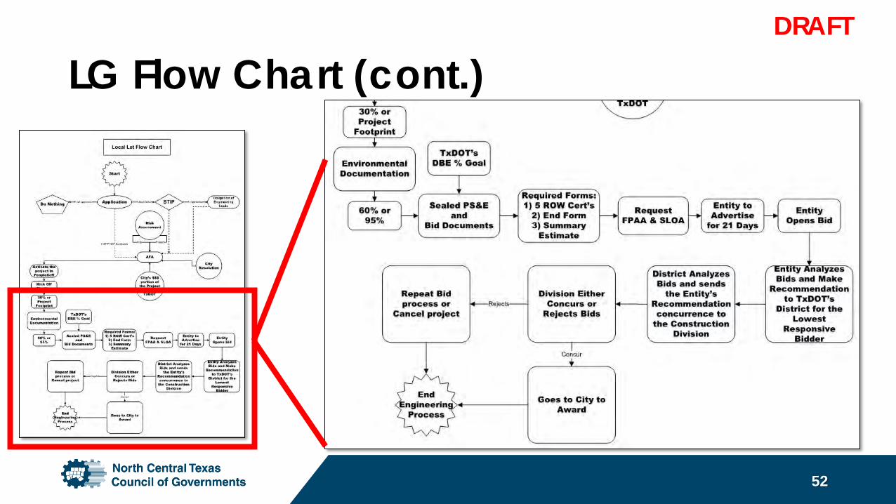
LG Flow Chart (cont.)
52
DRAFT
Project Schedule and Phasing• Anticipated approval of STIP and availability of TA funds is
March/April 2021.• Project sponsor must be prepared to execute an agreement
(LPAFA) with TxDOT quickly after approval of the STIP (by Sept. 2021).• TxDOT administrative fee must be paid prior to advertising.
(Half of fee paid at time the AFA is signed by the project sponsor.)• All TA funded projects must advance to construction within three
years (or less) of project selection (by 2023), per program rules.• Projects unable to be completed within the required timeframe are
at risk of losing TA funding due to federal regulations.
53

Project Budget
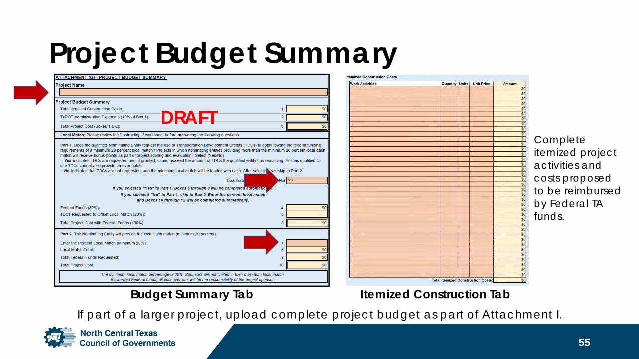
Project Budget Summary
55
Budget Summary Tab Itemized Construction Tab
Complete itemized project activities and costs proposed to be reimbursed by Federal TA funds.
If part of a larger project, upload complete project budget as part of Attachment I.
DRAFT
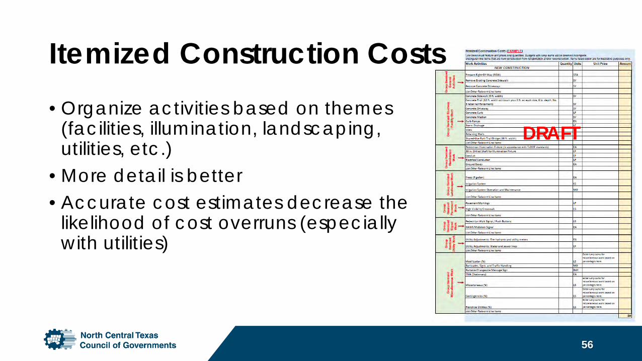
Itemized Construction Costs• Organize activities based on themes
(facilities, illumination, landscaping, utilities, etc.)
• More detail is better• Accurate cost estimates decrease the
likelihood of cost overruns (especially with utilities)
56
DRAFT
Cost Estimates and Budget Issues• Cost estimates based on sound
professional judgement. Be sure to address utility needs.
• Project’s scope of work will not change after application is submitted.
• Projects cannot substantially change after the funding award.
57
The applicant is responsible for any and all cost overruns.
Contact Information:TxDOT District Staff
Fort Worth TxDOT DistrictPhillip Hays
[email protected](817) 370-6673
58nctcog.org/TAP
Paris TxDOT DistrictSydney Newman
[email protected](903) 737-9285
Dallas TxDOT DistrictMaher Ghanayem
[email protected](214) 320-6691
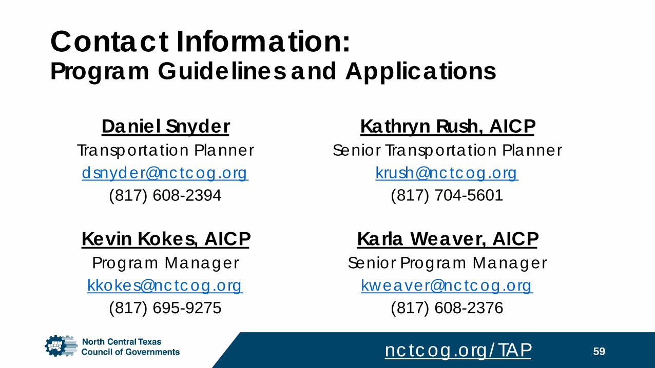
Contact Information:Program Guidelines and Applications
Kathryn Rush, AICPSenior Transportation Planner
[email protected](817) 704-5601
Karla Weaver, AICP Senior Program Manager
[email protected](817) 608-2376
59
Daniel SnyderTransportation [email protected]
(817) 608-2394
Kevin Kokes, AICPProgram Manager
[email protected](817) 695-9275
nctcog.org/TAP
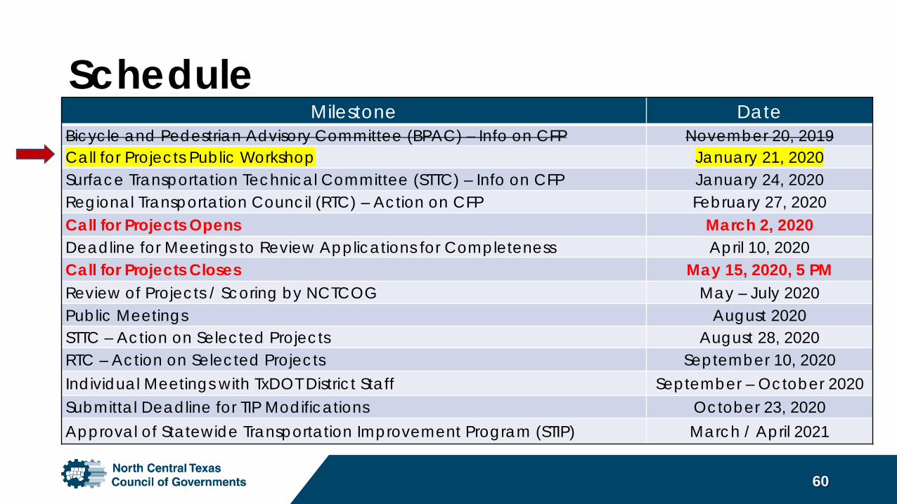
Milestone DateBicycle and Pedestrian Advisory Committee (BPAC) – Info on CFP November 20, 2019 Call for Projects Public Workshop January 21, 2020Surface Transportation Technical Committee (STTC) – Info on CFP January 24, 2020Regional Transportation Council (RTC) – Action on CFP February 27, 2020Call for Projects Opens March 2, 2020 Deadline for Meetings to Review Applications for Completeness April 10, 2020Call for Projects Closes May 15, 2020, 5 PM Review of Projects / Scoring by NCTCOG May – July 2020 Public Meetings August 2020 STTC – Action on Selected Projects August 28, 2020RTC – Action on Selected Projects September 10, 2020Individual Meetings with TxDOT District Staff September – October 2020Submittal Deadline for TIP Modifications October 23, 2020Approval of Statewide Transportation Improvement Program (STIP) March / April 2021
Schedule
60

Questions?