township of sables-spanish rivers official...
TRANSCRIPT
TOWNSHIP OF SABLES-SPANISH RIVERS
OFFICIAL PLAN
As Approved with Modifications September 16, 2010
Tunnock Consulting Ltd. 427 Hearst Street NORTH BAY ON P1B 8Z2 Tel. (705) 475-0040 Fax (705) 475-0030 e-mail: [email protected] File P-945/P-1835 September 16, 2010
Township of Sables-Spanish Rivers Official Plan
TABLE OF CONTENTS
PAGE
i
1.0 INTRODUCTION ......................................................................................... 1
1.1 Introduction and Utilization .....................................................................................1
1.2 Authority ..................................................................................................................1
1.3 Title and Components ..............................................................................................1
1.4 Interpretation ............................................................................................................2
1.5 Agency Names and Responsibilities ........................................................................3
1.6 Planning Period, Review and Amendments.............................................................3
1.7 The Planning Process ...............................................................................................4
1.8 How to Use This Plan ..............................................................................................4
2.0 BASIS OF THE OFFICIAL PLAN ............................................................. 6
2.1 General .....................................................................................................................6
2.2 Provincial Planning System ....................................................................................6
2.3 Municipal Restructuring and Planning Documents .................................................6
2.4 Population Growth ...................................................................................................7
2.5 Settlement Pattern ....................................................................................................7
2.6 Economic Growth ....................................................................................................8
2.7 Public Health and Safety ..........................................................................................9
2.8 Natural Heritage Features ........................................................................................9
2.9 Public Service Facilities and Infrastructure .............................................................9
2.10 Cultural Heritage and Archaeological Resources ....................................................9
2.11 Resource Management .............................................................................................9
2.12 Energy ....................................................................................................................10
3.0 GENERAL DEVELOPMENT POLICIES ................................................ 11 3.1 General Statement ................................................................................................... 11
3.2 Provision of Municipal and Public Services ........................................................... 11
3.3 Infilling and Intensification..................................................................................... 11
3.4 Existing and Non-Conforming Uses ...................................................................... 11
3.5 Lots of Record......................................................................................................... 12
3.6 Future Rural Development ...................................................................................... 13
3.7 Plans of Subdivision, Consents and Part-Lot Control ............................................ 13
3.7.1 Plans of Subdivision ................................................................................. 13
3.7.2 Subdivision and Consent Review Criteria .................................................. 14
3.7.3 Part-Lot Control .......................................................................................... 21
3.8 Lots Fronting on Both Water and Road .................................................................. 21
3.9 Shoreline Structures ................................................................................................ 21
3.10 Transportation, Transportation and Infrastructure Corridors .................................. 22
Township of Sables-Spanish Rivers Official Plan
TABLE OF CONTENTS
PAGE
ii
3.10.1 Provincial Highways .................................................................................... 22
3.10.2 Township Roads........................................................................................... 23
3.10.3 Private Roads ............................................................................................... 25
3.10.4 Resource Access Roads ............................................................................... 26
3.10.5 Transportation Corridors .............................................................................. 26
3.10.6 Infrastructure Corridors ............................................................................... 27
3.11 Communications, Utilities and Services, Energy and Air Quality ......................... 27
3.11.1 Communications, Utilities and Services ..................................................... 27
3.11.2 Energy ......................................................................................................... 28
3.11.3 Air Quality .................................................................................................. 28
3.12 Water Supply and Sewage Disposal ....................................................................... 28
3.12.1 Policy Overview.......................................................................................... 28
3.12.2 Municipal Water and Sewer Systems ......................................................... 29
3.12.3 Individual On-Site Sewage and Water Systems ......................................... 31
3.12.4 Private Communal Water and Sewage Systems and Responsibility
Agreements ................................................................................................. 32
3.13 Storm Water Management and Drainage ................................................................ 33
3.14 Waste Disposal Facilities ........................................................................................ 35
3.14.1 Policies ........................................................................................................ 35
3.15 Cultural Heritage and Archaeological Resources ................................................... 36
3.15.1 Policies ........................................................................................................ 37
3.16 Environmental Protection Area - Flood Plains ....................................................... 38
3.16.1 Definitions................................................................................................... 38
3.16.2 Policies - Flood Plains and Natural Hazards ............................................... 40
3.17 Organic Soils and Other Hazardous Sites ............................................................... 43
3.17.1 Policies ........................................................................................................ 43
3.18 Contaminated Sites ................................................................................................. 43
3.18.1 Policies - Site Decommissioning and Clean-up .......................................... 43
3.19 Noise and Vibration ................................................................................................ 45
3.19.1 Policies ........................................................................................................ 45
3.20 Mine Hazards ............................................................................................. 45
3.20.1 Mine Hazards .............................................................................................. 45
3.21 Community Improvement ....................................................................................... 46
3.21.1 Description .................................................................................................. 46
3.21.2 Goal ......................................................................................................... 46
3.21.3 Characteristics of a Community Improvement Area .................................. 46
3.21.4 Objectives for Community Improvement ................................................... 47
3.21.5 Phasing Community Improvement ............................................................. 48
Township of Sables-Spanish Rivers Official Plan
TABLE OF CONTENTS
PAGE
iii
3.21.6 Implementation of Community Improvement ............................................ 48
3.22 Natural Heritage Features ....................................................................................... 49
3.22.1 Natural Heritage Features ........................................................................... 49
3.22.2 Definitions................................................................................................... 49
3.22.3 Natural Heritage Features Policies.............................................................. 52
4.0 COMMUNITY DEVELOPMENT - LAND USE POLICIES .................. 57
4.1 General .................................................................................................................... 57
4.2 Land Use Designations ........................................................................................... 57
4.3 Urban Residential District....................................................................................... 58
4.4 Hamlet Residential District ..................................................................................... 62
4.5 Mobile Home Residential District .......................................................................... 64
4.5.1 Planning Principles ..................................................................................... 64
4.5.2 Zoning ......................................................................................................... 66
4.6 Commercial District ................................................................................................ 67
4.7 Industrial District .................................................................................................... 69
4.8 Rural District ........................................................................................................... 73
4.8.1 Development Concept ................................................................................. 73
4.9 Rural District - Residential Uses............................................................................. 74
4.10 Resource Recreation District .................................................................................. 78
4.11 Rural District - Commercial Uses ........................................................................... 85
4.12 Rural District - Salvage Yard Use .......................................................................... 87
4.13 Rural District - Waste Disposal Facility Designation ............................................. 89
4.14 Rural District - Resource Uses ................................................................................ 90
4.15 Crown Land ............................................................................................................ 91
4.16 Conservation Uses .................................................................................................. 92
4.17 Remote Development ............................................................................................. 93
4.18 Recreational Vehicles ............................................................................................. 94
4.19 Kennels ................................................................................................................... 97
5.0 RESOURCE MANAGEMENT ................................................................... 98 5.1 Agricultural Resource Lands .................................................................................. 98
5.1.1 Definitions................................................................................................... 98
5.1.2 Policies ........................................................................................................ 98
5.2 Mineral Aggregate Resources ................................................................................. 99
5.2.1 Definitions................................................................................................... 99
5.2.2 Policies ........................................................................................................ 99
Township of Sables-Spanish Rivers Official Plan
TABLE OF CONTENTS
PAGE
iv
5.2.3 Permitted Uses ............................................................................................ 99
5.2.4 Influence Area ........................................................................................... 100
5.2.5 Site Development of Pits and Quarries ..................................................... 101
5.2.6 Review of Applications............................................................................. 101
5.2.7 Wayside Pits and Quarries ........................................................................ 101
5.2.8 Portable Asphalt/Concrete Plants ............................................................. 101
5.2.9 Resource Identification or Depletion and Rehabilitation........................... 102
5.3 Mineral Resources ................................................................................................ 103
5.3.1 Definitions................................................................................................. 103
5.3.2 Policies ...................................................................................................... 104
5.3.3 Mineral Resources as a Constraint ............................................................ 104
5.3.4 New Mines ................................................................................................ 104
5.3.5 Rehabilitation ............................................................................................ 104
5.3.6 Influence Area ........................................................................................... 105
5.3.7 Resource Depletion ................................................................................... 105
5.3.8 Implementation .......................................................................................... 105
5.4 Forestry ................................................................................................................. 106
6.0 THE TOOLS OF IMPLEMENTATION ................................................. 107
6.1 Introduction ........................................................................................................... 107
6.2 Building Code ....................................................................................................... 107
6.2.1 Property Standards .................................................................................... 107
6.3 Condominium Act ................................................................................................. 107
6.4 Environmental Assessment Act ............................................................................ 108
6.5 Environmental Protection Act ............................................................................... 108
6.6 Gasoline Handling Act and Code ......................................................................... 108
6.7 Municipal Act ....................................................................................................... 108
6.8 Ontario Heritage Act ............................................................................................. 108
6.8.1 Requirement for Archaeological Assessment ........................................... 108
6.9 Planning Act.......................................................................................................... 108
6.9.1 Amendments and Complete Applications ................................................ 108
6.9.2 Public Works - Section 24 ........................................................................ 110
6.9.3 Acquisition of Land - Section 25 .............................................................. 110
6.9.4 Meeting to Consider Revisions to the Plan - Section 26 .......................... 110
6.9.5 Community Improvement - Section 28..................................................... 110
6.9.6 Zoning By-Laws - Section 34 ................................................................... 110
6.9.7 Holding Zone - Section 36 ........................................................................ 111
6.9.8 Interim Control By-Laws - Section 38...................................................... 112

Township of Sables-Spanish Rivers Official Plan
TABLE OF CONTENTS
PAGE
v
6.9.9 Temporary Use By-Laws - Section 39 ...................................................... 112
6.9.10 Site Plan Control – Section 41 ................................................................... 113
6.9.11 Parkland Dedication or Cash-in-Lieu – Section 42 ................................... 115
6.9.12 Committee of Adjustment – Sections 44 and 45 ....................................... 116
6.9.13 Subdivisions, Consents and Part-Lot Control – Sections 50-53 ................ 117
6.9.14 Tariff of Fees - Section 69 ......................................................................... 117
Appendix 1 - Procedures and Supplementary Information
Appendix 2 - Waterfront Planning
LAND USE SCHEDULES
Sables-Spanish Rivers Official Plan 1
P-1835
TOWNSHIP OF SABLES-SPANISH RIVERS
OFFICIAL PLAN
1.0 INTRODUCTION 1.1 Introduction and Utilization
1. The Official Plan of the Sables-Spanish Rivers Planning Area is a legal document
containing the objectives and policies established primarily to provide guidance
for the physical development of the Township of Sables-Spanish Rivers while
having regard to relevant social, economic and environmental matters.
2. Regard shall be had to all provisions and policies of this Plan and consistency
with the Provincial Policy Statement in reviewing all types of planning
applications (e.g. Official Plan amendments, zoning by-law amendments,
subdivisions, consents, minor variances). Sections of the Plan are cross referenced
where they are to be used in conjunction with each other or for the convenience
and understanding of the reader.
1.2 Authority
The Official Plan of the Sables-Spanish Rivers Planning Area was prepared under the
authority of Section 16 of the Planning Act which states that:
"An Official Plan shall contain goals, objectives and policies established primarily to
manage and direct physical change and the effects on the social, economic and natural
environment of the municipality" and "may contain a description of the measures and
procedures proposed to attain the objectives of the Plan and procedures for informing and
obtaining the views of the public in respect of a proposed amendment to the Official Plan
or proposed revision of the Plan or in respect of a proposed zoning by-law". Also, "the
Council of a municipality may elect to follow the prescribed processes and develop
materials prescribed for the preparation of an Official Plan".
1.3 Title and Components
1. This policy document shall be known as the "Official Plan for the Township of
Sables-Spanish Rivers" and is hereinafter referenced to as the Official Plan or the
Plan.
2. The Official Plan consists of the following text and Schedules ‘A1, A2 and A3'
which make up the Land Use Plan.
Sables-Spanish Rivers Official Plan 2
P-1835
3. Background statements, illustrations and appendices included in this document
are provided for information purposes only and do not constitute a formal part of
the Official Plan.
1.4 Interpretation
1. It is intended that the boundaries of the land use designations shown on
‘Schedules A1, A2 and A3', be considered as approximate. Boundaries are to be
considered absolute only where clearly bounded by roads, railways, rivers or
streams or other geographical barriers. Amendments to the Official Plan will not
be required in order to make minor adjustments to the boundaries of land use
designations or features or other symbols nor to the location of roads, provided
that in all cases, the general intent of the Plan is preserved. Such minor deviations
may not be reflected on the Land Use Plan.
2. It is intended that all figures and numerical quantities herein shall be considered
as approximate unless otherwise stated. Amendments to the Official Plan will not
be required for any reasonable variance from any of the proposed figures.
3. For the purposes of this Plan, it is interpreted that an existing use as of the date of
approval of this Plan refers to the land presently or actually in use and not
necessarily the total land area or land holding of the property owner.
4. It is intended that buildings, structures, uses etc., that are normally incidental,
accessory or essential to a permitted use will also be allowed even though not
specifically stated in the land use policies. (Example: a home based business
which is accessory to a residential dwelling, or an administrative office which is
accessory to a campground or retail business.)
5. Where examples of permitted uses are provided for in the land use policies of this
Plan, it is intended to indicate the possible range of uses considered appropriate
and not to be interpreted as all-encompassing unless otherwise stated as such.
However, all uses shall be in conformity with the general intent and policies of
the general land use designations of this Plan.
6. Where an Act or portion of an Act is referred to in this Plan, such references will
be interpreted to include any subsequent legislation that may supersede the Act so
named.
7. This Plan utilizes words or terms defined in the Provincial Policy Statement of
March 2005. These definitions shall apply in the interpretation of the policies of
this Plan and their application to development proposals and planning
applications.
Sables-Spanish Rivers Official Plan 3
P-1835
8. Where reference is made in this Plan to an original document which provides
more accurate information in the interpretation of this Plan, reference shall be
made to the original document, where necessary, in implementing the policies of
this Plan.
9. The indication of any proposed roads, infrastructure, and municipal services in the
policy text or on the Land Use Plan Schedules will not be interpreted as a
commitment by the Township to provide the features within a specified time
frame. Minor adjustments to the location of these features do not require an
amendment to the plan if the intent of the plan is maintained.
1.5 Agency Names and Responsibilities
From time to time, the names of various government or other agencies may change. In
addition, responsibilities may shift from agency to agency. The names of the various
agencies responsible for the many programs, regulations and approvals are given in this
Plan as of the adoption date of this Plan. It is not intended that the Plan be amended each
time a change in a name or responsibility occurs. Rather, this Plan shall be interpreted so
as to refer to those agencies named, or to their successors, as conditions dictate.
1.6 Planning Period, Review and Amendments
1. The Planning Period for this Official Plan is intended to be approximately 20
years (2001-2021). The Plan will be subject to a review from time-to-time to
ensure that the goals and objectives are being achieved and the policies are
practical. It is the intent of Council that a special meeting of Council, open to the
public be held not less frequently than once every five years pursuant to Section
26 of the Planning Act to discuss the revisions that may be required. Revisions to
the Official Plan will be made to ensure that it conforms with provincial plans or
does not conflict with them, as the case may be; has regard to the matters of
provincial interest listed in section 2 of the Planning Act, and is consistent with
policy statements issued under subsection 3 (1) of the Planning Act.
2. The review shall not be deemed to prevent any person or applicant from making
an application under Section 22 of the Planning Act to amend the Plan.
Applications for amendments to this Plan by the public or amendments initiated
by Council will be considered in accordance with the requirements of the
Planning Act. Applications submitted by the public must be complete and where
required by this Plan, be supported by studies, information or reports to determine
conformity with the Plan and consistency with the Provincial Policy Statement.
3. Where the policies of this Plan require consultation, or where consultation is
required under the Planning Act, the Township and/or the applicant shall consult
Sables-Spanish Rivers Official Plan 4
P-1835
with the Ministry of Municipal Affairs and Housing where the Ministry is the
approval authority and shall consult with the prescribed public bodies.
4. Where studies or assessments are required under this Plan, it is Council‟s
responsibility is to ensure that decisions made based on the outcomes and
recommendations of these studies or assessments are consistent with the
Provincial Policy Statement.
5. Council will convene public meetings to consider an amendment to the Official
Plan prior to adopting an amendment, but may decline to have a meeting if they
refuse to adopt the amendment or the application is not deemed to be complete.
6. Amendments will be required for a change in a land use designation shown on the
Schedules ‘A1, A2 and A3', Land Use Plan or for changes in the policy or text
of the Plan. An amendment will not be required for typographic changes,
numbering or formatting of the Plan.
1.7 The Planning Process
The Planning process started in the summer of 2008 with the collection of data and
consultation with provincial ministries and other agencies. A Community Profile was
prepared and released and was followed by the preparation of a draft Plan. A public
meeting on the draft Plan was held April 8, 2009.
1.8 How to Use This Plan
Applicants should consider the following steps in using this Plan:
1. Locate the property proposed for development on the appropriate Schedules ‘A1,
A2 or A3' to the Land Use Plan. Use the legend to determine which land use
designation the property is located in.
2. Use the Table of Contents to locate the policies that apply to the specific land use
designation. Review the policies to determine which land uses are permitted and
the planning principles that apply in undertaking any development. Review also,
the General Development Polices of Section 3.0 since they generally apply to all
land uses.
3. If application is being made for a plan of subdivision, the policies of Section 3.7 -
Subdivisions, Consents & Part-Lot Control should be examined.
4. If the property is located close to a water body or a natural heritage feature or area
on the Land Use Schedule, reference should be made to Section 3.22 - Natural
Heritage Features. Similarly, if the property is located in or close to an area
Sables-Spanish Rivers Official Plan 5
P-1835
designated for agriculture, mineral potential or mineral aggregates, the policies in
Sections 5.1, 5.2 or 5.3 of the Plan should be considered.
5. Other key Sections of the Plan which should be considered include:
● Section 3.12 - Water Supply and Sewage Disposal which sets out the
requirements for water supply and sewage disposal;
● Section 3.10 - Transportation which sets out the requirements for access onto
a provincial highway, township road or private road;
● Sections 3.15 - Cultural Heritage and Archaeological Resources, 6.9 and
Appendix 1 which sets out the requirements for undertaking an archaeological
assessment.
For the convenience of the reader, all federal and provincial statutes referred to in this
Plan are shown in italics. Cross references are shown in bold script.
Sables-Spanish Rivers Official Plan 6
P-1835
2.0 BASIS OF THE OFFICIAL PLAN
2.1 General
The Official Plan is based on merits of good land use planning principles as well as
various factors, trends, circumstances that were identified in the Community Profile. The
Community Profile (December 2008) may be considered as a reference document and as
the background for the preparation of the basis, intent and policies of this Plan.
2.2 Provincial Planning System
The Planning Act sets out the ground rules for land use planning in Ontario. The Act
provides the basis for the Provincial Policy Statement which sets out land use matters that
are of provincial interest. The Provincial Policy Statement, which is intended to be read
in its entirety, promotes a policy-led system intended to:
1. Manage change and promote efficient, cost effective development and land use
patterns which stimulate economic growth and protect the environment and public
health.
2. Protect resources for their economic use and/or environmental benefits; and
3. Reduce the potential for public cost or risk to Ontario's residents by directing
development away from areas where there is a risk to public health or safety, or of
property damage.
This policy statement is the basis for provincial interests reflected in the policies of this
Plan as well as the procedures for the review of planning applications set out in the
Planning Act and various Ontario Regulations enacted under the authority of the Act.
In addition, this Plan recognizes the responsibilities and opportunities the Province has or
may provide for the Township of Sables-Spanish Rivers in decision-making on land use
planning matters. These include but are not limited to land severance, exempting official
plan amendment approvals, regulating and controlling land uses through zoning, site plan
control and other planning tools and municipal plan review.
2.3 Municipal Restructuring and Planning Documents
The Township of Sables-Spanish Rivers is a restructured municipality. The Township of
The Spanish River, the Towns of Massey and Webbwood and the previously
unincorporated geographic townships of Tennyson, Gough, Shakespeare and McKinnon
were restructured as the Township of Sables-Spanish Rivers on July 1, 1998.
Sables-Spanish Rivers Official Plan 7
P-1835
An initiative of the first Council of the new municipality was to prepare an Official Plan
and comprehensive zoning by-law to replace and/or update Planning documents currently
in place. The following is the status of current Official Plan and zoning by-law coverage
in the Sables-Spanish Rivers Planning Area.
The Sables Spanish Rivers Official Plan was adopted on November 28, 2001.
The Official Plan was finally approved by the Minister of Municipal Affairs and Housing
on February 3, 2003. The Township adopted a comprehensive zoning by-law to
implement the Official Plan.
2.4 Population Growth
The population has remained relatively stable over the last twenty-five years within the
Sables-Spanish Rivers Planning Area (e.g., 3,350 (1981) to 3,237 (2006) (excluding the
unincorporated townships). The Plan provides for a potential population of 3,400 - 3,600
over the Planning Period recognizing that growth will be largely driven by in-migration
associated with retirement and/or economic development initiatives. This is exclusive of
a seasonal residential population of approximately 750 residents.
2.5 Settlement Pattern
Future growth in the municipality will occur through significant opportunities for
settlement in the three designated urban areas (Massey, Webbwood, Walford), through
the attraction of waterfront residential development and through limited development in
the rural area. The settlement pattern, while permitting these opportunities, will not
compromise the conservation of the natural resource base, the protection of the natural
environment nor the ability of the municipality to deliver and maintain cost-effective
infrastructure and public services. Of the total vacant lot supply of 717 lots (December
2007) in the Township, 46 are located on or adjacent to some 12 key lakes in the
municipality (does not include complete inventory of lakes). The vacant land supply
includes a further 87 residential building lots in Massey, 49 in Webbwood and 8 in
Walford. Since the 2000 inventory was completed, 78 lots previously listed have been
built on and removed from the list and an additional 81 lots have been added providing a
net increase of 3 vacant lots (not including lots in draft approved plans of subdivision).
Within this predominantly rural setting there are three urban communities. Of these,
Massey is the largest and offers the most extensive scope and mix of land uses and public
services. Webbwood offers a smaller but diverse mix of land uses while Walford is
predominantly residential. The role of the two larger urban communities will be to
provide a basic level of commercial and public service uses which caters to local
residents and the tourist industry. The land supply for development within the three urban
settlement areas is considered to be adequate for the planning period. Expansion of the
settlement area boundaries is not intended within the planning period.
Sables-Spanish Rivers Official Plan 8
P-1835
The Plan provides for an adequate land supply within the Planning Area for residential
development. The housing demand is projected to be between 82 and 163 permanent
residential dwellings to 2019 depending on the rate of growth and 60-75 seasonal
dwellings units over the same period.
An appropriate range of housing types and densities to meet projected requirements shall
be provided, including the provision of affordable housing. One quarter of all new
dwellings built in the Township should be affordable to the 50th
household income
percentile.
The land use pattern will be rounded out with provision for resource related uses
(agriculture, forestry, mineral aggregate extraction and mining), and related land use
activities. The Plan also makes provision for other rural-based land uses (e.g., outdoor
recreation, waste management sites, utilities etc.).
2.6 Economic Growth
Major employment sectors (2006) included business, finance and administration (15.8%),
health, social and educational services (14.1%), primary industries (11.0%),
manufacturing (12.1%), wholesale and retail trades (20.0%) which together employed
73% of the population. The total labour force 15 years and over was 1,500 (1996) and
1,445 in 2006.
While there is no formal structure for economic development in the Planning Area, the
municipality is a participant in the La Cloche Manitoulin Business Association
Corporation (LAMBAC).
LAMBAC is a community-based non-profit corporation whose objectives are to facilitate
job creation and business expansion, entrepreneurship and community development, and
to offer small business loans ($1.2 million in 2006 to some 31 small businesses which
facilitated 135 new jobs and 11 business start-ups).
The future prospects for economic development will be dependent on the ability and
initiatives of residents and decision makers alike to harness and manage its human,
financial and natural resource base in creating or sustaining employment. The Plan
provides a positive framework by conserving the natural resource base for its economic
value and by supporting or providing land use activities which create new employment in
tourism, service commercial uses, home based businesses etc. Catering to the evolving
market of pre and post retirees is also a significant target.
1 Reference should be made to Section 4 of the Community Profile, 2009 for further
details on the land supply for residential development.
Sables-Spanish Rivers Official Plan 9
P-1835
Water is an important resource as well from the standpoint of recreational activities and
waterfront-oriented development.
2.7 Public Health and Safety
Physical constraints to development and issues of public safety will influence where and
why development can take place, e.g. flood plains (Section 3.16), organic soils and steep
or unstable slopes (Section 3.17), mine hazards (Section 3.20), bedrock, contaminated
sites (Section 3.18). Policies to ensure safe development are essential ingredients to the
Plan.
2.8 Natural Heritage Features
Part of the heritage of the area is a deep respect for the environment
and the amenities of natural habitat areas. The Plan sets out policies to
ensure that there are no adverse impacts to the conservation of the
environment and the ecological functions associated with fish and
wildlife habitats and wetlands (see Section 3.22).
2.9 Public Service Facilities and Infrastructure
Public service facilities and infrastructure are generally adequate and have residual
capacity to support further growth and development. Development within Massey and
Webbwood is dependent on the provision of piped services. Maintenance of the network
of roads is key to the growth and settlement policies of the Plan. However, private roads
are strictly controlled to avoid long term public expenditures for their potential
assumption.
2.10 Cultural Heritage and Archaeological Resources
Recognition, conservation and management of the historical legacy of rural pioneer
settlements and water based development are addressed through a policy on cultural
heritage resources (see Sections 3.15 and 6.9).
2.11 Resource Management
The Planning Area is endowed with renewable and non-renewable resources important to
the economic base of the community. The Plan permits and supports agricultural land use
activities, designates mineral aggregate resources including active pits and quarries and
reserves, identifies lands having mineral potential for future mineral extraction and
identifies and encourages forestry as a land use activity (see Sections 5.1 - 5.4).
Sables-Spanish Rivers Official Plan 10
P-1835
2.12 Energy
The Plan encourages the initiation of alternative and renewable energy systems (see
Section 3.11.2).
Sables-Spanish Rivers Official Plan 11
P-1835
3.0 General Development Policies
The following general development policies shall apply throughout the Sables-Spanish
Rivers Planning Area.
3.1 General Statement
It shall be a policy of Council to ensure that all development shall take place in
accordance with the land use designations and policy statements of this Plan. The zoning
by-law and any amendments thereto shall be enacted only in conformity with the policies
of this Plan.
3.2 Provision of Municipal and Public Services
It shall be a policy of Council to ensure that municipal and other public services are
adequate to service the residents of the Planning Area and that the capacity of these
services will be monitored on an ongoing basis in order to determine whether new
development can be accommodated within the present servicing capacity. Such services
shall include municipal water and/or sanitary sewers and storm water management
facilities, transportation, waste disposal, recreation and park facilities, schools and fire
and police services. Council will consult with and circulate applications for development
to agencies which deliver public services not provided by the municipality.
3.3 Infilling and Intensification
It shall be a policy of Council to encourage infilling on vacant lots and to encourage the
intensification of residential and non-residential buildings within the settlement areas of
Massey and Webbwood. Opportunities for intensification and redevelopment shall be
promoted where it can be accommodated through existing building stock, infill and
existing vacant lots, including brownfield sites. Consideration for such initiatives shall
recognize the availability of existing infrastructure. Council‟s target for intensification
is to encourage development on lots/land identified in the vacant land supply while
recognizing local servicing limitations of partial services such that provision will be
made for development in the form of infilling and rounding out of existing development
on partial services where it is within the reserve system capacity of those services and
where site conditions are suitable for the long-term provision of such services.
3.4 Existing and Non-Conforming Uses
Nothing in this Plan shall affect the continuance of uses legally established under the
provisions of any zoning by-law in force on the date of approval of this the Plan or other
legally established land uses including uses that do not conform with the land use
designations as shown on Schedules ‘A1, A2 and A3', Land Use Plan. Nothing in this

Sables-Spanish Rivers Official Plan 12
P-1835
Plan shall prevent the reconstruction of legal non-conforming uses which are
inadvertently destroyed by a natural cause e.g. fire, flood, earthquake, subsidence, nor
prevent the maintenance, repair or strengthening of any building to a safe condition. This
shall not prevent Council from encouraging residents to rebuild where they are not
susceptible to a natural or human made hazards e.g. outside of a flood plain.
It is the intention of this Plan that non-conforming uses, where they exist, should
eventually cease to exist. It may be desirable, however, to permit the extension,
enlargement or change of a non-conforming use to a similar or more compatible use
subject to the following planning principles:
1. The extension or enlargement does not aggravate the non-conforming situation or
the enjoyment of neighbouring uses. The use of buffering or screening techniques
may be used to mitigate the impacts of development.
2. The extension or enlargement is in reasonable proportion to the existing use and
to the land on which it is to be located.
3. The proposed extension or enlargement will not create undue noise, vibration,
fumes, smoke, dust, odours, glare from lights, environmental hazards or other
public health or safety concerns.
4. Traffic and parking conditions in the vicinity will not be adversely affected and
traffic impacts will be kept to a minimum by the appropriate design of ingress and
egress points to and from the site and by improvement of site conditions
especially in proximity to intersections.
5. Adequate provisions have been or will be made for off-street parking and loading
facilities where they apply.
6. Infrastructure and public services such as roads, waste disposal, school bussing,
fire protection etc. are adequate or can be made adequate.
3.5 Lots of Record
1. Lots of record are legally created parcels or tracts of land that can legally be
conveyed and, for the purposes of this Plan, are deemed to include lots in a
registered plan of subdivision, parcels created by consent, in accordance with the
Planning Act and/or any other distinct and separate holding, the deed to which is
registered in the Land Titles Office.
2. Lots of record, which are vacant and which existed on the date of adoption of this
Plan, may be used for building purposes provided that prior to a building permit
being issued the Township is satisfied that:
Sables-Spanish Rivers Official Plan 13
P-1835
A. The lot complies with the policies of this Plan for access to lots i.e. frontage
on a public or private road, water access etc. (see Section 3.10 -
Transportation);
B. Sewage disposal facilities and potable water can be provided on the lot to
the satisfaction of the public body having jurisdiction (see Section 3.12 -
Water Supply and Sewage Disposal);
C. The use complies with the provisions of the Community Development
policies of this Plan (see Section 4.0);
D. The lot meets the relevant planning principles of this Plan for specific land
use designations and the zoning standards of the implementing zoning by-
law; and
E. An absolute minimum lot size may be established in the zoning by-law for
development on a lot of record.
3.6 Future Rural Development
It shall be a policy of Council to allow for development in the rural district which is in
conformity with the growth and settlement policies of this Plan. In general, Council will
discourage fringe development around the fringe of settlement areas where it is more
appropriately located within those settlement areas (i.e. Massey, Webbwood or Walford).
Council intends to provide for the preservation of the rural atmosphere and rural living
environment of the Planning Area.
3.7 Plans of Subdivision, Consents and Part-Lot Control
3.7.1 Plans of Subdivision
Land development shall generally take place by plan of subdivision in the urban
settlement areas (Massey, Webbwood, and Walford) and for waterfront residential
development where more than four lots are proposed. Development by plan of
subdivision may be used for large lot residential development in the Rural district.
Consents shall otherwise be the method of land division.
An application for a plan of subdivision shall be in accordance with the requirements of
the Planning Act. Additional information may be required in assessing the
appropriateness and the location of the subdivision (see also Sections 6.9.1 and 6.9.13).
It shall be the policy of Council to consider for approval, only those plans of subdivision
which comply with the policies of this Plan and which, to the satisfaction of the Council,
Sables-Spanish Rivers Official Plan 14
P-1835
can be supplied with adequate and cost effective public service facilities (see also
Appendix 1).
3.7.2 Subdivision and Consent Review Criteria
Provisions relating to the granting of consents and the approval of subdivisions are set out
in Sections 51 and 53 of the Planning Act. Council shall be consistent with the Provincial
Policy Statement in addition to the following subdivision and consent review criteria
checklist which is intended to be used by Council in the review of consent applications or
in the review of plans of subdivision applications (see also Sections 4.9.2 (F) and 4.10
(9) for subdivisions in the Rural District and Resource Recreation District
respectively.
1. The application shall be complete and shall include a
sketch and the prescribed application fee and shall comply
with the requirements of the Planning Act and associated
Ontario Regulation for the filing, review, notice and
decision procedures;
2. The sketch shall show the lands to be severed and the lands
to be retained, existing and proposed lot dimensions, lot
areas and buildings, natural physical features (water bodies,
slopes, tree cover) and sufficient information to be able to
easily locate the land. The draft plan of subdivision shall
illustrate all the requirements of Section 51 (17 of the
Planning Act;
3. The proposed use of the lands to be subdivided shall be a
use permitted in the underlying land use designation e.g.
refer to the Official Plan Land Uses Plan Schedules to
determine designation and then refer to corresponding list
of permitted uses for that designation in the text of this
Plan;
Sables-Spanish Rivers Official Plan 15
P-1835
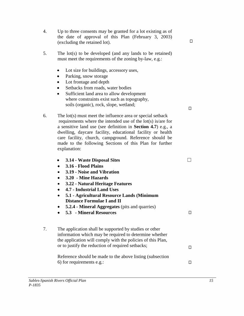
4. Up to three consents may be granted for a lot existing as of
the date of approval of this Plan (February 3, 2003)
(excluding the retained lot).
5. The lot(s) to be developed (and any lands to be retained)
must meet the requirements of the zoning by-law, e.g.:
Lot size for buildings, accessory uses,
Parking, snow storage
Lot frontage and depth
Setbacks from roads, water bodies
Sufficient land area to allow development
where constraints exist such as topography,
soils (organic), rock, slope, wetland;
6. The lot(s) must meet the influence area or special setback
requirements where the intended use of the lot(s) is/are for
a sensitive land use (see definition in Section 4.7) e.g., a
dwelling, daycare facility, educational facility or health
care facility, church, campground. Reference should be
made to the following Sections of this Plan for further
explanation:
3.14 - Waste Disposal Sites ☐ 3.16 - Flood Plains
3.19 - Noise and Vibration
3.20 - Mine Hazards
3.22 - Natural Heritage Features
4.7 - Industrial Land Uses 5.1 - Agricultural Resource Lands (Minimum
Distance Formulae I and II
5.2.4 - Mineral Aggregates (pits and quarries)
5.3 - Mineral Resources
7. The application shall be supported by studies or other
information which may be required to determine whether
the application will comply with the policies of this Plan,
or to justify the reduction of required setbacks;
Reference should be made to the above listing (subsection
6) for requirements e.g.:
Sables-Spanish Rivers Official Plan 16
P-1835
Mitigation of industrial impacts
Mitigation of waste disposal impacts
Mitigation of negative impacts to cultural heritage
resources
Verification of non-impact for below ground
Water aggregate operation
Plan/measures for rehabilitation of mine hazards
Assessment of mineral potential
Impact Assessment/mitigation measures for natural
heritage features and areas
Flood proofing measures
Noise or acoustical study
Record of Site Condition (contaminated sites) (see
Section 3.18, Contaminated Sites)
In the absence of appropriate mitigation, the application
will be refused. The intent of the Plan is to ensure
satisfactory compatibility between the proposed land use
and existing land uses;
8. The application should be supported with information or a
certificate of approval or evidence to verify suitability
of the lot(s) for sewage disposal. This may include
approval for a connection to municipal water services or
municipal sewer services, where available, an individual
on-site sewage or water service or a private communal
sewage or water service, or a hydrogeological study. In
approving consents, the Township shall confirm that there
is sufficient availability of off-site reserve sewage system
capacity for (hauled sewage) for any individual on-site
sewage service in the municipal septage disposal facility.
(See Section 3.12, Water Supply and Sewage Disposal);
9. The application should be supported with information to
verify suitability of the water supply (quantity and
quality);
10. The lot(s) shall have frontage on and direct access to a year
round maintained public road unless otherwise exempted as
follows:
New lot creation on private roads will only be
contemplated on Beach Road Right, Beach Road Left,
Sables-Spanish Rivers Official Plan 17
P-1835
Sugar Lake Road, and Buck Miller Road. Over a
period of five years beginning on the date this Official
Plan comes into effect, a cumulative total of six (6) lots
will be permitted to be created on these four roads. A
full planning justification shall be provided prior to any
decision on lot creation, including justification of the
need and confirmation that no suitable lots are
available on publicly owned and maintained roads.
Development is encouraged on an infill basis, with a
preference for seasonal residential development.
Conversions on private roads will be discouraged.
Written confirmation of support for the creation of the
new lot on the private road is required from local
emergency services providers;
New lot creation on private roads will only be
permitted where provisions are made as a condition of
development approval for the progressive upgrading,
reconstruction or improvement, and ongoing
maintenance of the private road. Council will use the
enabling authority of the Planning Act and the
Municipal Act to require agreements with one or more
landowners designed to achieve improvements and
maintenance of private road infrastructure;
A lot for any seasonal residential use may be created
having access to a publicly maintained seasonal road;
Development with water access only may be granted
for seasonal residential dwellings provided there is
adequate docking and parking facilities on the
mainland of the same water body; and
Lots for non-habitable buildings or structures
associated with forestry, mining, mineral aggregate
operations and telecommunications may be accessed by
private roads.
11. Where the lot(s) proposed front/fronts on a provincial
highway, prior approval must be obtained for access from
the Ministry of Transportation. Also, where the Ministry
has identified the need for a road widening, the necessary
land shall be dedicated as a condition of approval (see also
Section 3.10.1). The applicant must receive approval from
the municipality for the location and installation
requirements for an entrance and/or culvert for access onto
any public road;
Sables-Spanish Rivers Official Plan 18
P-1835
12. The access or entrance to any lot should not create a traffic
hazard e.g. on a curve or a hill where a driver's sight line is
blocked or impaired. To improve the safety of roads in the
area, sight distances should be maintained on corner lots.
To achieve this for a corner lot, no lot should be created
where any structure, berm, fence, tree, hedge or shrub with
a height exceeding 1 m [3.2 ft] above the finished grade of
the road is within the triangular space measured: (a) along
the street lines for a distance of 10 m [32.8 ft] from their
point of intersection, and (b) along the street line and
railway right-of-way for a distance of 30 m [98.4 ft] from
their point of intersection;
13. Where the potential for archaeological resources site has
been identified or development or site alteration is
proposed on adjacent lands to a protected heritage
property, an archaeological or heritage impact assessment
shall be required. The applicant shall consult with the
municipality, and where archaeology is concerned, the
Ministry of Culture (see Section 3.15, Cultural Heritage
and Archaeological Resources);
14. Development will not be permitted which has the effect of
limiting access to back lands for future development or
which have the effect of creating land locked parcels for
either the severed or retained lot;
15. Development will not be approved in areas where the
undue extension of municipal services would be required
(e.g., extension of a public road or school bus route);
16. Development will not be granted for the creation of a new
lot(s) on a water body where the lake has reached its
development capacity and no residual capacity exists for
that water body except in accordance with Section
4.10(2.A);
17. Development may not be approved which would interfere
with a future public facility such as a park, road, source of
water or similar facility:
Sables-Spanish Rivers Official Plan 19
P-1835
18. Ensure that non-residential uses (industrial, commercial,
institutional uses) comply with other relevant policies of
this Plan. Non-residential uses more appropriate to a rural
setting should be directed to a location outside of urban
areas;
19. Ensure that lots in the built-up areas are proportioned to
appropriately fit within the lotting pattern and serve to
enhance the viability of the urban areas. (See also policies
for infilling and intensification - Section 3.3);
20. Ensure that the design of rural non-farm residential
development is appropriate for the site and surrounding
area and creates a minimal impact on the natural
environment;
21. Ensure that lots on which a mobile home is proposed shall
be judged on the same criteria as those for conventional
dwellings;
22. Despite the provisions of this Plan, no lot shall be created
with more than one dwelling or mobile home erected
thereon;
23. Lots should not be created which have the effect of
generating scattered or strip development, thereby
increasing the cost of providing municipal services;
24. Despite the criteria outlined in „1' to „23' above, consents may be granted for the
following purposes:
To correct lot boundaries;
To convey additional land to an adjacent lot provided the conveyance does
not lead to the creation of an undersized or irregularly shaped lot for the
purpose for which it is being or will be used;
To clarify title to the land;
Where the effect of the severance does not create an additional building lot;
To permit an easement;
To permit a severance for municipal or other government purposes; or
To permit the discharge of a mortgage which does not have the effect of
creating a new lot.
Sables-Spanish Rivers Official Plan 20
P-1835
25. Conditions may be imposed by Council in the granting of consents which may
include but not be limited to the following:
A zoning amendment under the zoning by-law or a minor variance under
Section 45 of the Planning Act;
Site plan control;
The dedication of land or cash-in-lieu of parkland;
The conveyance of land or conveyance for easements for utilities, access
control or drainage;
The construction or upgrading of roads, road widening or the installation of
drainage or storm water facilities and culverts;
The establishment of buffer strips and landscaping;
The installation of water supply or sewage disposal systems;
The entering into of an agreement including provisions for financial
guarantees;
Demolition of buildings or structures and/or measures to remediate the
property due to hazardous or contaminated conditions;
Implementation of mitigation measures to ensure compatibility amongst land
uses;
Provisions for adequate drainage or storm water management; and
Requiring the submission of a survey or reference plan of survey.
26. Procedures for processing consent applications may include but not be limited to:
Applicant files a complete application with the Clerk;
Notice of the application will be circulated in accordance with the Planning
Act;
Undertaking a site inspection;
Council may also seek technical input from other selected agencies;
The application will be reviewed for compliance to the policies of this Plan
and the regulations of the implementing zoning by-law. Council may seek a
Planning Report from a qualified Planner;
Council may have a public meeting to consider the application;
Council will issue a decision and may impose conditions of approval
(provisional consent);
Decision is advertised (circulated) as required by the Planning Act;
Applicant shall enter into a consent agreement where required as a means to
implement the conditions;
Applicant has up to one year to fulfill provisions of conditional consent;
Consent is granted upon fulfillment of conditions and submission of deed or
instrument for stamping (certificate); and
The conveyance must occur within two years from the date the certificate is
given or consent will lapse.
Sables-Spanish Rivers Official Plan 21
P-1835
(Note: where decision or non-decision of Council is appealed, the matter is
referred to the Ontario Municipal Board for consideration and the Board’s
decision is final.)
3.7.3 Part-Lot Control
Part-lot control may be used for existing plans of subdivision where it is necessary to
realign lot boundaries, to clarify or grant title, to exact specific servicing requirements as
a condition of consent such as a road widening or to further control internal development
on a lot.
3.8 Lots Fronting on Both Water and Road
Where a lot fronts on both a water body and a street, the lot line abutting the water body
and the lot line abutting the road must meet both the minimum lot frontage requirements.
3.9 Shoreline Structures
The policies of this section shall apply to shoreline structures abutting any lake or water
body:
1. With the exception of docks and (wet) boat houses, all shoreline structures shall
be constructed within the confines of the property boundaries of a lot;
2. Shoreline structures including single storey boat houses, boat ports and float plane
hangars shall be limited to a maximum width, height and length as set out in the
zoning by-law;
3. Construction of a second storey addition for any shoreline structure shall not be
permitted;
4. Interior finishing or occupancy of any portion of a boat house or boat port for use
or occupancy as a dwelling shall not be permitted;
5. Saunas or steam baths shall not be serviced by a pressurized water system;
6. Floating structures, cribs and docks (of less than 15 m2 [161.5 ft
2]) in floor area
shall be subject to municipal review while structures exceeding this area shall
require permits from the appropriate regulatory authority;
7. The type of docks shall generally be limited to floating, cantilevered or post dock
construction. Other types of docks may be permitted where it is demonstrated that
they will not have a negative impact on fish habitat. Docks shall be built of non-
toxic building materials. The size of docks may be regulated by the zoning by-law
Sables-Spanish Rivers Official Plan 22
P-1835
and in no case shall limit or restrict safe navigation. The shoreline below the high
water mark shall not be permanently altered through the construction of shoreline
structures except to accommodate the placement or use of docks as approved by
the authority having jurisdiction;
8. No shoreline structure which will destroy fish habitat shall be permitted [see
Section 3.22(3)];
9. Other shoreline structures may include a gazebo, utility or storage shed, deck or
viewing area subject to the standards set out above (with the exception of size);
and
10. Shoreline structures shall be permitted in a front yard on lots having water
frontage provided that such uses meet appropriate zoning standards. Shoreline
structures may require additional approvals from the Ministry of Natural
Resources and the Federal Department of Fisheries and Oceans.
3.10 Transportation, Transportation and Infrastructure Corridors
Transportation infrastructure is made up of provincial highways, township roads, private
roads, resource access roads and snowmobile trails while transportation and infrastructure
corridors consist of the CPR Rail Line and hydro electric power transmission lines.
3.10.1 Provincial Highways
Highway 17, as shown on the Land Use Plan Schedules, is classified as a staged
freeway (Class II) designed to carry high volumes of through traffic.
In addition to all the applicable municipal requirements, all proposed development
located in the vicinity of Highways 17 and 553 will be subject to the Ministry of
Transportation (MTO) approval under the Public Transportation and Highway
Improvement Act. Any new areas in the municipality identified for future development
that are located adjacent or in the vicinity of Highways 17 and 553 and/or intersection
within MTO‟s permit control area under the Public Transportation and Highway
Improvement Act will be subject to MTO‟s access management policies, standards and
requirements. Direct access will be discouraged and often prohibited. Access to
provincial highways is restricted and development shall only be permitted where the
applicable approvals/permits have been obtained. This may include a traffic study. Any
new roads proposed to be connected to a provincial highway are subject to provincial
approval including spacing requirements between intersections. Noise and vibration
studies may be required prior to considering whether development should be approved
adjacent to Highways 17 and 553.
Sables-Spanish Rivers Official Plan 23
P-1835
Highway 553 is a (Class V) minor provincial highway (outside of Massey) and is also
subject to the requirements and permits of the Ministry of Transportation.
3.10.2 Township Roads
1. Classification of Roads
For the purposes of this Plan, the classification of Township roads shall include
the following:
A. Township Roads which are maintained year round
B. Township Roads which are seasonally maintained
C. Township Roads which are unmaintained
The classification system for Township roads as set out above is illustrated on the
Land Use Plan Schedules to this Plan.
2. Year Round and Seasonally Maintained Township Roads
The primary function of Township roads will be to provide access to abutting
properties. Standards for new road construction will include a minimum of 20 m
[66 ft] right-of-way engineered design and layout, appropriate drainage and
construction. Roads on lands under plan of subdivision may be assumed by the
township provided the standards for road construction have been satisfactorily
met.
Council may post seasonally maintained roads with signs to indicate that
maintenance is limited. Where such roads are classified and posted with a sign,
Council will not be obliged to provide winter control services.
There is no obligation by Council to convert a seasonally maintained road to a
year-round maintained road. Council may, however, undertake or request a cost-
benefit analysis (e.g. assessment of the operational costs of maintaining roads and
extending infrastructure or services such as ambulance, fire, police, utilities,
school bussing) to determine the impact of such a conversion. Where Council is
satisfied that potential development is justifiable, the status of the road may be
changed to year-round. As a condition of the change of status, Council may
require one or more applicants to share the cost of improving the road to an
acceptable standard. The status of the road may be changed without an
amendment to this Plan. In making a decision on the change of status Council
may also consult with school boards to determine whether any additional costs to
school busing are reasonable.
Sables-Spanish Rivers Official Plan 24
P-1835
3. Unmaintained Roads
Council recognizes that there are municipal roads which are abandoned and are no
longer maintained by the municipality. Where such roads have been abandoned, it
is not the intent of Council to maintain these roads or to permit development on
such roads. Council may give consideration to new development (i.e., creation of
a new lot, change in land uses, construction of a building) provided that the road
is upgraded and maintained to a municipal standard and provided Council is
satisfied that the operational costs of maintaining the road or extending
infrastructure or services such as ambulance, fire, police, utilities, school bussing,
will be reasonably offset by property tax revenues.
4. Unassumed and Unopened Road Allowances
Council recognizes that the public may use unassumed or unopened road
allowances for access by vehicles or for use as snowmobile or recreational
vehicles even though they are not maintained by the township. Council is under
no obligation to maintain such roads, but may require an agreement for their use
or maintenance. Council may open a road allowance or assume a road where the
road is developed to municipal standards in accordance with Section 3.10.2 (2)
above and provided Council is satisfied that the operational costs of maintaining
the road will be reasonably offset by property tax revenues.
5. Road Maintenance and Improvements
Construction or maintenance of existing Township roads and bridges or crossing
structures will continue to be based on a regular program of capital expenditures
as set out from time-to-time by Council. The number of kilometers of hard
surfaced roads may be increased with priority being given to roads with higher
traffic volumes and/or the need for improvements to meet contemporary design
and safety standards. Road improvements may be undertaken to improve the
efficiency, function and safety of roads.
Road maintenance and improvements of municipal roads including the addition of
roads to the municipal road system shall be deemed to be in conformity with
section 24 of the Planning Act. This shall not limit the authority of the Township
to designate truck routes, fire routes and the installation of parking lanes as may
be required.
Council may undertake or require the installation of sidewalks to an acceptable
standard. In general, however, sidewalks will be limited to urban settlement areas.
Council may require a traffic impact study to be undertaken by the proponent of
development where it is anticipated that additional traffic will have an impact on
the safety and efficiency of a road. Where the transportation system is not
Sables-Spanish Rivers Official Plan 25
P-1835
adequate to accommodate a proposed development, Council may require as a
condition of approval:
A. Reasonable improvements to the system by the proponent of the
development;
B. Financial contributions towards undertaking the necessary improvements;
or
C. The dedication of a right-of-way for a future road or a road widening of an
existing road.
6. Culverts and Entrance Permits
A properly installed culvert and/or entrance permit will be required, where
applicable, for any new access to a Township road. The installation or
replacement of culverts will be to acceptable standards for drainage to the
satisfaction of the municipality.
7. Utility Location
Council shall ensure, wherever possible, that all future utilities are located within
a municipal road allowance.
3.10.3 Private Roads
1. A private road is defined as a road under private ownership which serves two or
more legally conveyable lots and may include a right-of-way registered on title.
(A driveway, by contrast, provides access to only one property or legally
conveyable lot, despite the length of the driveway.);
2. Private roads are intended to provide access to abutting properties including
existing lots of record;
3. As a first priority, development shall be focused on municipally owned and
maintained roads. No new private roads will be permitted, except where the
private road is internal to a plan of condominium. No extensions to existing
private roads will be permitted. While new development on existing private roads
is discouraged, it may be permitted in exceptional circumstances, in accordance
with OP Policy 3.7.2(10);
4. Council may assume a private road where the standards meet the design and
construction requirements for township roads or are constructed to an alternative
standard acceptable to Council, and where the road allowance is dedicated
(transfer of title) to the municipality and is surveyed. If it is physically impossible
Sables-Spanish Rivers Official Plan 26
P-1835
to widen an existing substandard private road or reduce any existing grade to 8%,
Council may, as part of its risk assessment, accept a lesser width or greater grade.
Prior to deciding on the assumption of a private road, Council may require a cost-
benefit analysis to determine if the operational costs of assuming and maintaining
the road will be offset by property tax revenues. The costs for upgrading a private
road to a township standard will typically be borne by the adjacent property
owners e.g. survey, legal and construction costs;
5. An existing lot may be used or developed for a use permitted which does not have
frontage on a public road provided that the lot has a legal access (e.g. right-of-
way) registered on title; and
6. Council assumes no responsibility for providing access, snow removal or the
maintenance of private roads nor is any responsibility acknowledged for the
provision of school busing. Where Council provides for emergency services,
private roads will be required to meet a minimum standard of construction and
maintenance. Council may at its sole discretion, register notice on title or require
that an owner enter into an agreement acknowledging that the municipality will
not be responsible for the repair or maintenance of private roads and that the
municipality is under no obligation to provide fire protection, police, ambulance
or other emergency services.
3.10.4 Resource Access Roads
1. For the purposes of this Plan, resource access roads as shown on the Land Use
Schedules are intended to provide access to resource-based land uses such as
forestry, mineral or mineral aggregate extraction and are generally not intended to
provide access to residential or commercial land uses. Except for the West Branch
Road which provides access to the north side of Birch Lake, new lot creation for
seasonal residential or commercial uses on Resource Access Roads will not be
permitted; and
2. Resource access roads are expected to be maintained by private enterprise under
lease or other arrangements with the Crown.
3.10.5 Transportation Corridors
1. It is the intent of this Plan that existing transportation corridors for road and rail
be protected from land use activities which may interfere with the function and
safe operation of these corridors including Highway 17 and the CPR Rail Line
(see also Section 3.19 – Noise and Vibration); and
2. It is the intent of this plan that the network of the Trans Ontario Provincial Trails
(TOPS) snowmobile system be protected. It is recognized that the TOPS routing

Sables-Spanish Rivers Official Plan 27
P-1835
as shown on the land use plan may change from time-to-time. However, an
amendment to this Plan is not required for changes to this routing so long as the
intent of this policy is upheld. Any trail crossings of provincial highways will,
however, require the prior approval of the Ministry of Transportation.
3.10.6 Infrastructure Corridors
1. It is the intent of this Plan that existing infrastructure corridors for utilities be
protected from land use activities which may interfere with the function and safe
operation of these corridors(see also Section 3.19 – Noise and Vibration).
3.11 Communications, Utilities and Services, Energy and Air Quality
3.11.1Communications, Utilities and Services
It is the policy of Council to provide for the development of electric power facilities, gas,
oil and communications facilities in all land use designations without an amendment to
this Plan. Council intends to work with the responsible private and public related
agencies in order to provide for the installation of such facilities for any proposed
development while minimizing the disruption to existing development or to the
environment. Agencies will have regard for the relevant policies of this Plan in installing
energy and communications utilities. For example, utility corridors and communications
towers should be set back from existing or proposed development as a measure of public
safety. The installation of any facilities shall be installed in compliance with the
applicable environmental standards and may be subject to the Environmental Assessment
Act. Administration or service buildings associated with utility installations shall respect
the appropriate zoning standards of the zone in which they are located. Communication
towers, sub-stations, dams, administration buildings and similar utility installations are
subject to site plan control (see Section 6.9.10 - Site Plan Control).
It is the policy of Council to encourage the joint use of public rights-of-way or utility
corridors in order to ensure the orderly development of major electric power lines, oil and
gas pipelines and communications lines.
Council will encourage, where economically feasible, that utility and transmission lines
be installed underground in residential areas so as to minimize their adverse visual impact
on the environment.
Sables-Spanish Rivers Official Plan 28
P-1835
3.11.2Energy
1. A renewable energy generation facility, a renewable energy project, a renewable
energy testing facility or a renewable energy testing project, as defined in sub-
section 1(1) of the Planning Act is exempt from the provisions of the Planning
Act except as set out in subsection 62.0.2 of the Act;
2. Council, in conserving energy, may encourage energy audits and implementation
measures to retrofit the existing stock i.e. upgrading of windows, fixtures, energy
efficient furnaces, etc.;
3 Council may take advantage of Provincial or Federal Government funding to
achieve a more energy efficient community;
4. It is a policy of Council to encourage non-vehicular movement (pedestrian) within
the community;
17. It is the intent of Council to encourage the installation of: energy efficient solid
fuel burning appliances; proper, energy efficient insulation; water conserving
fixtures, etc. This may be achieved through a program of public education; and
18. Council will encourage sustainability measures in land use planning through
promoting energy-efficient land use development, alternative energy systems,
reuse, reduction and recycling, adaptive reuse of buildings, healthy lifestyles that
emphasize cycling and pedestrian travel and the use of locally produced consumer
and food products.
3.11.3Air Quality
Council will support measures to sustain or improve air quality by encouraging the use of
non-fossil fuel energy sources, by encouraging pedestrian and cycling travel and by
ensuring that fugitive (dust, odour, particulate) emissions from industries and other
sources are adequately treated and meet provincial protocols.
3.12 Water Supply and Sewage Disposal
3.12.1 Policy Overview
The Provincial Policy Statement identifies a servicing hierarchy of which full municipal
sewage and water services are the preferred form of servicing for urban areas and rural
settlement areas. Communal services are identified by the Provincial Policy Statement as
being the preferred means of servicing multiple lots/units in areas where full municipal
sewage and water services are not or cannot be provided and site conditions are suitable
for the long-term provision of such services. Individual on-site systems are to be used
Sables-Spanish Rivers Official Plan 29
P-1835
where the use of communal systems is not feasible and where site conditions are suitable
over the long term. Partial services (where there is a connection to a one communal
service or full municipal service where the other connection is to an individual on-site
system) shall only be permitted where they area necessary to address failed individual
on-site sewage services and individual on-site water services in existing development
and within settlement areas to allow for infilling and rounding out of existing
development on partial services provided that the development is within the reserve
sewage system capacity and reserve water system capacity and site conditions are
suitable for the long-term provision of such services.
It is the intent of Council, in being consistent with the Provincial Policy Statement, to
balance the servicing needs of the area with the character of development. In Massey and
Webbwood, infill development will be permitted on existing partial services. (See
Section 3.3 - Infilling and Intensification). In the hamlet of Walford, where the density of
development is lower, servicing will be on the basis of individual on-site sewage services
and individual on-site water services. This reflects the character of the area as well as
the intent to avoid densities which may necessitate the installation of piped services. This
may not preclude the need for communal systems for larger scale development.
Where applicable, Council will have regard for Ontario‟s Safe Drinking Water Act and
associated regulations where applicable, which is intended to ensure that Ontarians have
access to a safe drinking water supply. This legislation applies both to municipally owned
and operated water supply systems as well as private communal systems.
3.12.2 Municipal Water and Sewer Services
1. It is the policy of Council to ensure that development within Massey and
Webbwood respectively, is serviced with municipal piped water or sewer services
(e.g. partial services) within the limits of the service area. This shall occur on the
basis of infill (see Section 3.3 - Infilling and Intensification). In the review of
planning applications, it is Council‟s intent to ensure that there is sufficient
reserve capacity for future development. Council may allocate uncommitted
reserve capacity where appropriate as a means to control the location and phasing
of development. Development elsewhere within any designated settlement area
shall be subject to a servicing options report to assess the most appropriate
method for providing water supply and sewage disposal.
2. Wellhead Protection
Wellhead protection shall be required for a municipal water supply or a
communal supply. This shall include the definition of a geographic area or zone
surrounding a well (wells) that coincides with a time-of-travel (TOT) or the time
taken for contaminants to travel through the soil to reach the aquifer. A two year
TOT will be required in setting the limits of the protection zone. Alternatively, a
minimum distance separation distance or setback may be established in
Sables-Spanish Rivers Official Plan 30
P-1835
consultation with the Ministry of the Environment. „Sentry‟ wells may be required
as an early warning monitoring system for water quality. Contaminants which will
be restricted or prohibited within the protection zone include bulk fuel, bulk
chemical/organic fertilizer, or manure storage. The provisions listed under
subsection 3 [i] - [vi] below (aquifer protection) shall apply where applicable.
3. Aquifer Protection
In areas identified as having aquifer vulnerability, land uses may be restricted
which have the potential to contaminate the aquifer. Proponents of development
shall be required to clearly demonstrate to Council‟s satisfaction that protection
measures will be implemented. Such measures may include one or more of the
following measures:
A Installation of professionally designed retention basins (examples,
concrete holding tank, clay liner) for the storage of toxic and other
substances including fuels, fertilizers, salt, manure, landfills, putrescible
waste disposal septage etc.;
B Undertaking a development impact assessment to determine any „adverse
effects‟ (as defined in the Environmental Protection Act) on the aquifer for
such uses as auto wrecking and salvage yards, septage and waste
stabilization lagoons, warehousing of industrial chemicals, metal finishing
operations, gasoline service stations, snow disposal sites, dry cleaning
establishments, manufacturing or storage of pesticides and herbicides,
manufacturing of batteries, engines or electrical equipment, fiberglass,
plastics, synthetic resins, paints and varnishes, adhesives and
pharmaceuticals, incineration operations/facilities;
C Establishing a spills emergency plan and/or emergency measures plan;
D Establishing an aquifer protection trust fund to mitigate any adverse effect
or a spill affecting or which has the potential to affect an aquifer;
E Capping of any abandoned well as a prerequisite to new development;
F Production of a „Record of Site Condition‟ report as a prerequisite to the
redevelopment of any contaminated site (see also Section 3.18 -
Contaminated Sites of this Plan).
G Entering into a site plan agreement which sets out the details, amongst
other matters prescribed by Section 41 of the Planning Act, for drainage
and storm water management, waste and materials storage, the location of
buildings and structures relative to any wells or aquifer recharge or
discharge areas and the long term maintenance of any buildings or
Sables-Spanish Rivers Official Plan 31
P-1835
structures containing materials or products which may have the potential
to contaminate an aquifer.”
4. Webbwood Sewage Lagoon
The minimum separation distance for development between the Webbwood
Sewage Lagoon and any sensitive land uses surrounding this facility shall be 100
m [328 ft]. The distance separation shall be measured from the nearest edge of
any active waste stabilization pond (lagoon) to the nearest property boundary of
any sensitive land use. Where the proposed separation distance is less than
prescribed by this Plan or the zoning by-law, a justification report shall be
provided using the Ministry of the Environment‟s Guideline D-2, Compatibility
between Sewage Treatment and Sensitive Land Use.
3.12.3 Individual On-Site Sewage and Water Services
1. Lands throughout the Planning Area may be serviced by individual on-site
sewage services. Planning applications for new development shall be supported
with information satisfactory to meeting the approval requirements under the
Building Code Act or the Ontario Water Resources Act: e.g.
A. Where the total effluent discharged by a sewage system or systems is
10,000 liters/day (2,200 gallons/day) or less, and the system will be
entirely within the bounds of the lot, the approvals will be governed by the
Building Code Act;
B. Where the total effluent discharged by a sewage system or systems is
greater than 10,000 liters/day (2,200 gallons/day), the approval authority
will be the Ministry of the Environment. The associated hydro-geological
study shall demonstrate soil suitability, sufficient area for effluent
treatment and site suitability for the disposal system;
C. A water supply assessment report may be required for proposals using a
groundwater source to demonstrate that there is an adequate supply
(quantity and quality) and that there will be no interference from sewage
disposal or draw down of the water table. (Reference should be made in
this regard to the Ministry of the Environment’s “Water Management -
Goals, Policies, Objectives and Implementation Procedures” know as the
Provincial Water Quality Objectives”.) Consideration shall be given to the
cumulative impact of development on the available water supply. A water
budget for users may be required in this regard;
D. Where a hydrogeological and/or water supply assessment study is required
to assess the potential risk to groundwater or requirement for services,
reference shall be made to Ministry of the Environment, Guideline D-5-4,
Technical Guideline for Individual On-Site Sewage Systems: Water

Sables-Spanish Rivers Official Plan 32
P-1835
Quality Impact Risk Assessment, in undertaking the appropriate
assessment. Approval of new lots developed on individual on-site sewage
services shall include sufficient off-site reserve sewage system capacity
for hauled sewage.
2. For plans of subdivision on privately owned and operated individual or communal
septic systems, where five or more lots or units are proposed, a servicing options
report and a hydrogeological report in accordance with Ministry of the
Environment Guidelines will be required. Both of the above types of reports will
also be required for subdivisions with less than five lots or units, where more than
4,500 liters of effluent per day would be produced;
3. Well construction standards will be required to meet Ontario Regulation 903 for
lands serviced with an individual on-site water services (i.e. well); and 4. Industrial and commercial development is encouraged by this municipality.
Where such development is proposed that uses water in the manufacturing
process, the proponent should consult the Ministry of the Environment.
3.12.4 Private Communal Water and Sewage Systems and Responsibility
Agreements
Council may consider new private communal services (water and/or sewage) for multiple
lot/unit development (six or more lots/units).
Prior to considering the need for a new private communal system, Council shall be
satisfied that the following criteria are considered:
1. That the proposed density of development is essential to the viability of the
project and that other development or servicing options have been thoroughly
considered i.e. different location, method of servicing, acquisition of a larger land
holding etc., and that as a result, the only reasonable or economical alternative is a
communal system;
2. That the potential for remedial measures has been adequately investigated with
respect to health related matters i.e. well contamination, nutrient management,
and that no reasonable or economical alternative exits for resolving such health
concerns than to install a communal system;
3. That the Ministry of the Environment has issued an order under the
Environmental Protection Act requiring the installation of a communal system
and/or the proposed communal system qualifies for Certificate of Approval from
the Ministry;
4. That the proposed owner/operator has prepared an appropriate business plan to
establish an appropriate cost structure for the installation and operation of the
communal system(s); and
Sables-Spanish Rivers Official Plan 33
P-1835
5. That a financial security can be established i.e. trust fund, to offset potential
capital or operational costs arising from the default of the operator.
Where such a system is deemed to be necessary based on the above criteria and is
approved, Council will assume responsibility or ownership after the issuance of a
Certificate of Approval. (Note: this may include a Permit to Take Water under the
Ontario Water Resources Act.) Council may choose to operate the system or may
consider entering into a legal agreement for the operation and maintenance of the system
on a private basis subject to the approval of the Ministry of the Environment. The legal
agreement shall contain financial assurance provisions which will ensure funds for
operation and routine maintenance as well as a secured fund for capital improvements
should repair or replacement of the facility become necessary. In addition, the legal
agreement shall set out the following: 1. Operating and Maintenance Standards.
2. A definition of Default.
3. An outline of remedial action.
4. Registration on title of the subject property.
5. Easements, where required.
Council will assume responsibility for the communal system should the system fail or
should the operator fail to operate or maintain the system according to the agreement and
will utilize the financial security as needs be in the operation/repair of the communal
system.
3.13 Storm Water Management and Drainage
It is Council‟s policy that storm water management shall be integrated as a component of
the development approval process particularly for subdivisions, multiple lot/unit
residential development, commercial, industrial and institutional and in the design and
implementation of stormwater infrastructure for urban settlement areas as a preventative
approach (rather than relying solely on end-of-pipe quality control) to protecting water
resources (quality and quantity).
The principles which Council intends to utilize in its approach to storm water
management are enumerated as follows:
1. That natural hydrological characteristics are maintained, and where possible,
enhanced as the means to protecting the base flow of watercourses;
2. That the natural infiltration of water on lands which are developed is maximized;
Sables-Spanish Rivers Official Plan 34
P-1835
3. That proposed development will not result in increased downstream flooding or
erosion or cause adverse effects on receiving waters during construction and post-
construction;
4. To ensure that alterations to natural drainage systems are prohibited or at least
minimized by maximizing the retention of natural vegetation and by leaving
stream channels in their natural form;
5. That fish and wildlife habitat is protected, enhanced or restored including habitat
linkages where affected by the discharge or outlet of drainage facilities;
6. That a sustainable environmental approach is utilized in protecting water
resources;
7. That water quality will be monitored on an ongoing basis as the means to
evaluating the effectiveness of storm water management practices;
8. That a construction mitigation plan is instituted to prevent stream borne
sediments, changes in flow or other adverse characteristics from affecting the
ecological functions or other impacts on receiving waters during construction; and
9. That the post construction phase shall include rehabilitation continued
maintenance of infrastructure and preferably, a monitoring program.
It is the intent of Council to incorporate storm water management controls into the
development review and approval process. Proponents of development will be required to
plan for and undertake storm water management which complies with the above
principles as well as any master drainage plan. This may require a sub-watershed
management plan for large tracts of land or a storm water site management plan and
construction mitigation plan. Proponents shall utilize best management practices where
they are consistent with and will achieve the Township‟s water quality and quantity
targets. Depending on the size and scope of a particular development, Council may
require the preparation of a master drainage plan
In the interim (prior to the development of a master drainage plan), proponents will be
expected to assess the impact of the development on the receiving stream and to utilize a
mix of site level, conveyance and end-of-pipe best management practices for the
development.
Improvements to storm sewer mains e.g. replacement, or extensions are anticipated as
part of the regular program of maintenance by the Township and are deemed to comply
with this Plan.
Storm water management plans for development adjacent to a provincial highway shall
be submitted to the Ministry of Transportation for their review and approval.
Sables-Spanish Rivers Official Plan 35
P-1835
Reference documents for storm water management include: Storm Water Management
Planning & Design Manual, Ministry of the Environment; Guidelines on Erosion and
Sediment Control for Urban Construction Sites, Ministry of the Environment.
3.14 Waste Disposal Facilities
3.14.1 Policies
1. Existing or New Sites
Existing active or inactive or new sites (public or private) within the Planning
Area may only be operated, expanded or closed in accordance with current
provincial environmental standards and approvals. Waste disposal activities may
include facilities for recycling, composting, hazardous waste control and ancillary
activities in accordance with the Certificate of Approval. New sites, including
sites for septage disposal, will require an amendment to this Plan and will require
approval under the Environmental Protection Act and/or Environmental
Assessment Act. Prohibited wastes shall include nuclear wastes, hazardous or
pathological wastes. Sites may include transfer sites used for the temporary
storage of waste materials.
2. Closed Sites
Closed sites may be used for other purposes subject to meeting requirements of
the Environmental Protection Act (Section 46 Order). In general, no buildings or
other uses shall be made of land or land covered by water which has been used as
a waste management facility within a period of 25 years from the year in which
the site was closed without the prior approval of the Minister of the Environment.
Closure plans should provide for the progressive rehabilitation of a site.
3. Influence Area
Council recognizes that waste management facilities may have an impact on
adjacent land uses. An influence area surrounding the waste management facility
will be set out in the implementing zoning by-law to recognize the potential for
adverse effects between the existing waste management facility and other land
uses. No development shall be permitted on or within 30 m [98.4 ft] of the
licensed fill area of an active waste disposal facility or area. Unless a specific
setback distance is otherwise established by the Certificate of Approval,
development proposed beyond the 30 m [98.4 ft] but within an influence area of
500 m [1,640 ft] of the licensed fill area of an active waste disposal facility or
area shall be accompanied by an environmental impact statement that
demonstrates that the proposed development will not be negatively impacted by
the waste disposal facility (e.g. leachate, methane gas, rodents, vermin, odours,
fire etc.) Where recommended by the impact statement, measures to mitigate any
Sables-Spanish Rivers Official Plan 36
P-1835
adverse impacts will be required as a condition of development. (See reference
document for Guideline D-4 below.)
4. Designation on Land Use Plan
Waste Disposal sites are identified on, Schedules ‘A1 - A3', Land Use Plan as a
land use designation.
5. Development to Have Adequate Capacity
Council, in the review of planning applications, will ensure that there is sufficient
capacity to accommodate the waste disposal needs of the proposed development.
Council will continue to monitor the capacity of the existing sites and will
undertake improvements as required e.g. expand sites or implement operational
plans, to maintain adequate capacity for future development.
Council will monitor the environmental impacts of sites to ensure that there is no
off-site migration of leachate.
6. 3 R’s
Council supports a program to reduce, reuse and recycle waste products.
(Reference document: Guideline D-4, Land Use on or Near Landfills and Dumps, Ministry of the
Environment.)
3.15 Cultural Heritage and Archaeological Resources
The intent of this Plan is to conserve "built heritage resources, cultural heritage
landscapes and archaeological resources". Built heritage resources means one or more
significant buildings, structures, monuments, installations, or remains associated with
architectural, cultural, social, political, economic, or military history, and identified as
being important to a community. These resources may be identified through designation
or heritage conservation easement under the Ontario Heritage Act, or listed by local,
provincial or federal jurisdictions. A cultural heritage landscape means a defined
geographical area of heritage significance which has been modified by human activities
and is valued by a community. It involves a grouping(s) of individual heritage features
such as structures, spaces, archaeological sites and natural elements, which together form
a significant type of heritage form, distinctive from that of its constituent elements or
parts. Examples may include, but are not limited to heritage conservation districts
designated under the Ontario Heritage Act; and villages, parks, gardens, battlefields,
main streets, and neighborhoods, cemeteries, trail ways and industrial complexes of
cultural heritage value. Archaeological potential "means areas with the likelihood to
contain archaeological resources. Criteria for determining archaeological potential are
established by the province, but municipal approaches which achieve the same objectives
may also be used. Archaeological potential is confirmed through archaeological
fieldwork undertaken in accordance with the Ontario Heritage Act.
Sables-Spanish Rivers Official Plan 37
P-1835
3.15.1 Cultural Heritage and Archaeological Resources, Policies
It is a policy of Council to consider cultural heritage resource conservation in all land use
planning decisions. Cultural heritage resources include, but are not restricted to,
archaeological sites, buildings and structural remains of cultural heritage value or
interest, and human-made rural, urban or cultural heritage landscapes of historic and
scenic interest. To implement this policy, Council shall:
1. Provide for the identification, restoration, protection, maintenance, management,
and enhancement of cultural heritage resources of local, provincial or federal
significance. (Examples: Water Wheel (Denvic Lake), Birch Lake Dam.) This may
be achieved through a co-operative and co-ordinated approach with senior level
governments;
2. Consider ways and means in which Council may co-operate in the conservation
and/or preservation of cultural heritage resources, including utilization of the
Ontario Heritage Act in the following ways:
A. Council may establish a Municipal Heritage Committee with the goals and
objectives of such a committee to identify and consider cultural heritage
resources throughout the Planning Area; and
B. Council may designate properties, districts and areas having cultural
heritage value or interest in the Planning Area under Parts IV and V of the
Ontario Heritage Act;
3. Council may develop or facilitate the preparation of an inventory of cultural
heritage resources in the Planning Area;
4. Council well require that in any proposed plan of subdivision and prior to the
undertaking of any public work, private development, consent or zoning by-law
amendment, consideration be given to the possible effects and impacts of such
works or development on cultural heritage resources and that such impacts, where
identified or assessed through a heritage impact assessment, are appropriately
mitigated;
5. Council will require that an archaeological impact assessment be carried out by an
archaeologist licensed under the Ontario Heritage Act, when any public work,
private development, consent or zoning by-law amendment will affect a property
containing a known archaeological site or cemetery or an area considered to have
archaeological potential or is within 250 m [820 ft] of a provincially registered or
known archaeological site or is considered to have archaeological potential (see
Section 6.9).
Archaeological potential areas within the Township can include properties along
shorelines of primary lakes and rivers (e.g. Spanish River), along favorable
physiographical and cultural characteristics such as pockets of sandy soils, raised
Sables-Spanish Rivers Official Plan 38
P-1835
topography, or unusual land forms such as mounds or caves, and any locally
known significant heritage areas such as portage routes or places of past
settlements;
6. Council may consider, where appropriate, the passing of archaeological zoning
by-laws under Section 34 of the Planning Act, to be adopted for the purpose of
preserving identified significant archaeological resources on site;
7. Development and site alteration will not be permitted on adjacent lands to a
protected heritage property without a heritage impact assessment that
demonstrates that the proposed development will not negatively impact the
purpose or character of the heritage resource;
8. Marked and Unmarked Burial Sites: Where, through development, a site is
identified to contain an unmarked burial site or new archaeological features, the
municipality shall contact the Ministry of Culture, the Ontario Provincial Police
and First Nations. The Ministry of Consumer Services shall also be contacted
with respect to the discovery of burial sites and unmarked cemeteries and matters
related to the Cemeteries Act; and
9. Heritage Conservation Incentives: Where feasible and desirable, incentives may
be provided to land developers in exchange for the preservation of significant
cultural heritage resources. This can be accomplished by permitting increased
densities, density transfers, tax incentives, assistance through a trust fund, heritage
conservation easements and/or other means considered appropriate for heritage
resource conservation.
3.16 Environmental Protection Area - Flood Plains and Lands with
Development Constraints
3.16.1 Definitions
Floodproofing Standard means the combination of measures incorporated into the basic
design and/or construction of buildings, structures, or properties to reduce or eliminate
flooding hazards, wave uprush and other water-related hazards along the shorelines of
the Great Lakes-St-Lawrence River System and large inland lakes and flooding along
river stream and small inland lake stream systems.
Protection Works Standards means the combination of non-structural or structural works
and allowances for slope stability and flooding/erosion to reduce damages caused by
flooding hazards/erosion hazards and other water related hazards and to allow access
for their maintenance and repair.
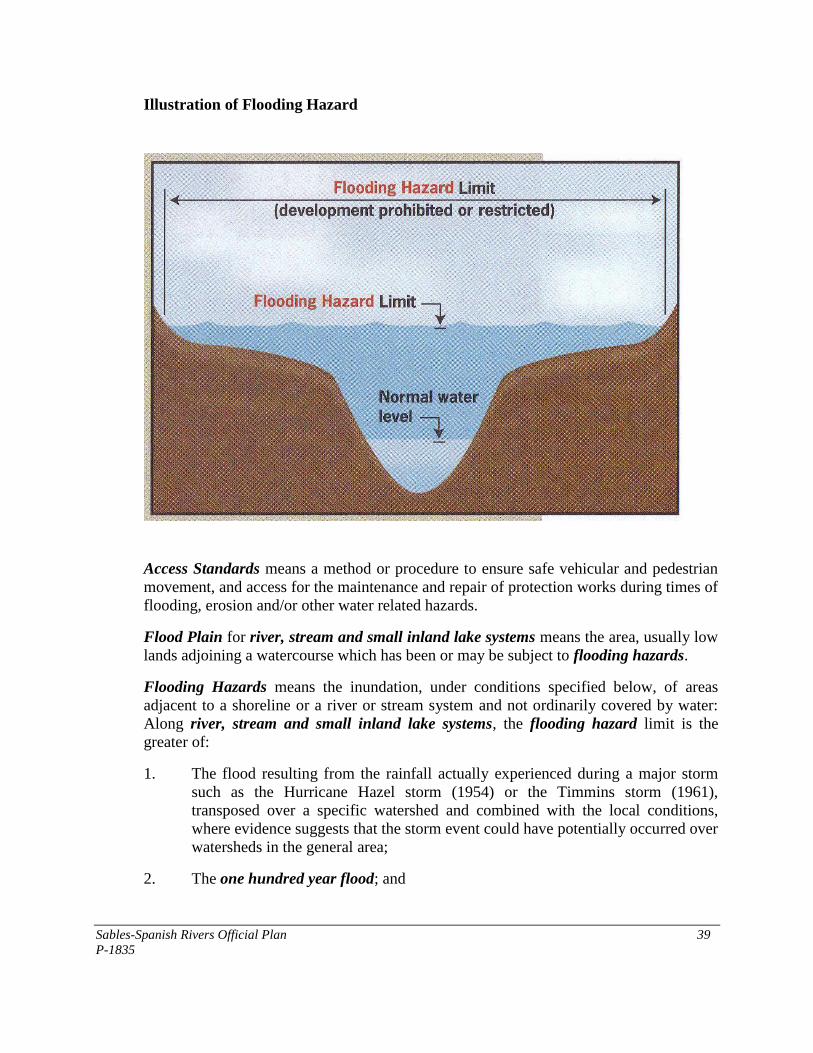
Sables-Spanish Rivers Official Plan 39
P-1835
Illustration of Flooding Hazard
Access Standards means a method or procedure to ensure safe vehicular and pedestrian
movement, and access for the maintenance and repair of protection works during times of
flooding, erosion and/or other water related hazards.
Flood Plain for river, stream and small inland lake systems means the area, usually low
lands adjoining a watercourse which has been or may be subject to flooding hazards.
Flooding Hazards means the inundation, under conditions specified below, of areas
adjacent to a shoreline or a river or stream system and not ordinarily covered by water:
Along river, stream and small inland lake systems, the flooding hazard limit is the
greater of:
1. The flood resulting from the rainfall actually experienced during a major storm
such as the Hurricane Hazel storm (1954) or the Timmins storm (1961),
transposed over a specific watershed and combined with the local conditions,
where evidence suggests that the storm event could have potentially occurred over
watersheds in the general area;
2. The one hundred year flood; and
Sables-Spanish Rivers Official Plan 40
P-1835
3. A flood which is greater than 1. or 2. which was actually experienced in a
particular watershed or portion thereof as a result of ice jams and which has been
approved as the standard for that specific area by the Ministry of Natural
Resources;
except where the use of the one hundred year flood or the actually experienced event has
been approved by the minister of Natural Resources as the standard for the specific
watershed (where the past history of flooding supports the lowering of the standard).
Floodway, for river, stream and small inland lake systems means the portion of the
flood plain where development and site alteration would cause a danger to public health
and safety or property damage. Where the one zone concept is applied, the floodway is
the entire contiguous flood plain.
One Hundred Year Flood for large inland lakes, lake levels and wind setups have a 1 %
chance of being equaled or exceeded in any given year, except that, where sufficient
water level records do not exist, the one hundred year flood level is based on the highest
known water level and wind setups..
River, Stream and Small Inland Lake Systems means all watercourses, rivers, streams
and small inland lakes or water bodies that have a measurable or predictable response to a
single runoff event.
3.16.2 Policies - Flood Plains and Natural Hazards
1. The following are recognized as representing the flooding hazard in the Planning
Area where flood plain elevations have been established:
Agnew Lake: flood plain elevation (regulatory flood) is 262.98 m
Spanish River: flood plain elevation (regulatory flood) is 177.3 m
(See illustration for flooding hazard)
Lands at or below the flood plain elevation as shown on the Land Use Plan as an
Environmental Protection Area designation are considered to be in the flood
plain and are subject to flooding or flooding hazard.
2. No new buildings are permitted to be constructed within the flood plain except
flood control structures, wharf or dock, boat slip, boat house, or a marine
structure. Other public and private activities including the construction of roads,
or new structures necessary for the conservation, agriculture, public recreation
(recreational trails), water supply, waste water management, will be permitted in
the flood plain subject to the approval of Council and where deemed necessary,
shall meet a flood proofing and access standard.
No use, building or structure which involves the disposal, manufacture, treatment
or storage of hazardous substances (e.g. toxic, ignitable, corrosive, reactive,
Sables-Spanish Rivers Official Plan 41
P-1835
radioactive or pathological materials and sewage facilities), nor any institutional
use or an essential emergency service (e.g. fire, police, ambulance stations and
electrical substations) shall be permitted to be constructed, enlarged or expanded
in a flood plain.
2. Extensions or enlargements to existing habitable or other buildings located in the
flood plain (other than an institutional use) may be permitted where it is clearly
demonstrated to Council through engineering or other studies, that the flooding
hazard can be overcome and it has been demonstrated that the site has safe access
for the nature of the development and that the effects and risk to public safety are
minor so as to be managed or mitigated in accordance with provincial standards
with respect to flood proofing, protection works standards, and access standards,
that vehicles and people have a way of safely entering and exiting the area during
times of flooding, erosion and other emergencies, that new hazards are not created
and existing hazards are not aggravated and that no adverse environmental
impacts will result. As an additional measure, any building openings shall be
located above the flood elevation.
3. In areas of the Planning Area where the flood plain has not been determined, the
setback of habitable buildings and non-residential buildings and sewage disposal
systems from the shoreline or high water mark shall be 30 m [98.4 ft] and the
provisions of Section 3.16.2 (2) shall apply. The setback provisions may be
reduced or be waived without amendment to this Plan where the river bank or
adjacent lands constitute an escarpment, bluff or other topographic feature that
distinctively separates the river valley from the surrounding lands and Council is
satisfied that a hazard will not be created or can be safely addressed (e.g. through
engineering or other studies, that the hazard can be overcome).
4. Measuring Setbacks:
A. The required 30 m [98.4 ft] setback on Agnew Lake and the Spanish River
shall be measured from the limit of the flood elevation set out in Section
3.16.2.1. The flood elevation contour should be established on a property
by a qualified Ontario Land Surveyor.
B. For a shoreline property on a water body which does not have an
established flood plain elevation, the 30 m [98.4 ft] setback should be
measured from the normal high water mark and may be distinguished or
identified by changes in vegetation patterns or water stains/marks on rock
outcrops.
5. Other natural hazards may include lands which if developed, may create a risk to
property damage, loss of life and social disruption (e.g. steep slopes, lands subject
to slumping or subsidence). Hazard lands may be unstable, poorly drained or have
any other physical condition or impairment which can lead to the deterioration of
man-made structures thereon. Development on or adjacent to such lands may be
Sables-Spanish Rivers Official Plan 42
P-1835
considered where it is clearly demonstrated to Council through engineering or
other studies, that the hazard can be overcome.
6. Where land which is designated as an Environmental Protection Area is under
private ownership, this Plan does not indicate that this land will necessarily
remain as such indefinitely, nor shall it be construed as implying that such areas
are free and open to the general public or will be purchased by the municipality or
other public agency. An application for the redesignation of lands designated
Environmental Protection Area for other purposes may be given due
consideration by Council after taking into account:
A. The existing environmental and/or physical hazards.
B. The potential impacts of these hazards.
C. The proposed methods by which these impacts may be overcome in a
manner consistent with accepted engineering hazards.
There is no public obligation, however, either to redesignate by amendment to this
Plan, or purchase any land if there is an existing or potential hazard that would be
difficult or costly to overcome
7. Where new development is proposed on a site, part of which has physical or
environmental constraints, such land shall not necessarily be acceptable for
parkland dedication under Section 43 of the Planning Act. All lands conveyed to
the municipality shall be in a physical condition satisfactory to Council.
8. Minor changes to the boundary of the Environmental Protection Area may be
permitted without an amendment to this Plan where consideration has been given
to:
A. The existing environmental hazards.
B. The potential impact of these hazards.
C. The proposed methods by which such impacts may be overcome in a
manner consistent with accepted engineering practices; and
D. The costs and benefits in monetary terms of any engineering works and/or
resource management practices required to overcome these impacts.
There is no public obligation, however, either to change the delineation of an
Environmental Protection Area if the environmental hazard would be costly or
difficult to overcome.
9. In the implementing zoning by-law, existing uses as of the date of the approval of
this Plan (February 3, 2003) in the flood plain shall be recognized as conforming
uses despite their designation as Environmental Protection Area. Council shall
Sables-Spanish Rivers Official Plan 43
P-1835
discourage the expansion or enlargement of any existing use beyond the limits
recognized by the zoning by-law except where it may be qualified under Section
3.16.2 (3) above.
The Schedules to the zoning by-law shall illustrate the areas affected by flooding
and the flood elevations, where they have been determined.
On lands or a property which is subject to a flooding hazard, the Municipality
will not be obliged to rezone or issue a building permit where there is an
insufficient (residual) area on the lot to provide for a reasonable building envelope
for construction.
10. Council may use Site Plan Control for any land use in the Environmental
Protection Area designation (see Section 6.9.10 - Site Plan Control).
3.17 Organic Soils and Other Hazardous Sites
3.17.1 Policies
1. For the purposes of this Plan, organic soils are described as those soils normally
formed in a water saturated environment (e.g. wetland) where the soil is not
exposed to the air for a sufficient enough time to permit the break down of
vegetative material. As a result, these soils may not contain sufficient strength to
support a building or structure.
2. Organic soils, as shown on the land use plan, shall be considered as a constraint to
development and no development shall be permitted including the installation of
sewage disposal systems in organic soils unless the hazard can be overcome using
acceptable engineering techniques, safe access and egress is assured during
emergencies and no new hazards or adverse environmental impacts will occur and
where applicable, the standards set out in the Building Code can be met.
3. Institutional uses and hazardous substances or essential emergency services are
not permitted on organic soils.
4. Development will generally be directed away from hazardous sites such as lands
with steep slopes, rocky conditions or low lying or marshy lands.
3.18 Contaminated Sites
3.18.1 Policies - Site Decommissioning and Clean-up
1. Potentially contaminated sites include lands where contaminants may be present
due to previous industrial, transportation, utility or similar uses. Sources of site
contamination can include disposal of waste materials, raw material storage,
residues left in containers, maintenance activities and spills. Some commercial
Sables-Spanish Rivers Official Plan 44
P-1835
uses such as gasoline stations and automotive repair garages have a similar
potential. Potentially contaminated sites are shown on the Land Use Plan
Schedules with a symbol.
It is a policy to ensure the proper decommissioning and clean-up of contaminated
sites prior to their redevelopment or reuse. Measures to be taken by Council
and/or the approval authority and the proponent include the following:
A. The identification and inventory of sites by the municipality of where
existing and past uses may have contributed to the presence of
contaminants.
B. Applications for the development or redevelopment of sites that are
identified as being contaminated or potentially contaminated shall be
accompanied by a Ministry of the Environment acknowledged Record of
Site Condition and if necessary, a site remediation plan prepared in
accordance with the “Guidelines for Use at Contaminated Sites in
Ontario”. Mandatory filing of a Record of Site Condition in the Registry
is required for the change of use of a property from industrial or
commercial to residential or parkland. Phase I Environmental Site
Assessments (ESA) should be carried out at sites which may be
contaminated and Phase 2 ESAs should be completed if required. Clean-
up of contaminated sites shall be done in accordance with the record of
Site Condition Regulation (O. Reg. 153/04 and Ministry of the
Environment Guideline “Records of Site Condition - A Guide on Site
Assessment, the Clean-Up of Brownfield Sites and the filing of records of
Site Condition” (October 2004) or associated guidelines.”
C. Site plan control may be used as a measure to enhance site
decommissioning and remediation. (See Section 6.9.10 - Site Plan
Control).
D. Contaminated sites may be placed in a holding zone in the municipality's
zoning by-law. However, the feasibility of remediation to the proposed
new use should be determined prior to establishing the holding zone.
Where a holding zone is used, the "H" may be removed when the site has
been acceptably decommissioned or cleaned up to the satisfaction of the
municipality and in accordance with a site remediation plan and subject
further, to the submission to the municipality of a Ministry of the
Environment acknowledged Record of Site Condition.
Sables-Spanish Rivers Official Plan 45
P-1835
3.19 Noise and Vibration
3.19.1 Policies
1. All applications for development of a sensitive land use (e.g. residential use,
daycare, education or health care facility) within 50 m [164 ft] of Highway 17
and/or the main CPR Rail Line or within 1,000 m [3,280 ft] of a stationary noise
source not associated with an industry (i.e., hydro transformer or gas compressor
station) should be accompanied by a noise feasibility study prepared by a
qualified consultant and to the satisfaction of the municipality. The study shall
demonstrate whether noise and vibrations levels can be reduced to meet
provincial standards in accordance with the Ministry of the Environment
Publication LU-131, Noise Assessment in Land Use Planning: Requirements,
Procedures and Implementation.
2. All applications for development of a sensitive land use (e.g. residential use,
daycare, education or health care facility) within 50 m [164 ft] and 300 m [984 ft]
of Highway 17 and/or the main CPR Rail Line or within 1,000 m (3,280 ft) of a
stationary noise source not associated with an industry (i.e., hydro transformer or
gas compressor station) should be accompanied by an acoustical study prepared
by a qualified consultant and to the satisfaction of the municipality. The study
shall demonstrate how noise and vibrations levels can be reduced to meet
provincial standards in accordance with the Ministry of the Environment
Publication LU-131, Noise Assessment in Land Use Planning: Requirements,
Procedures and Implementation. The conclusions and recommendations of this
study shall be implemented through conditions of the development approval.
3. These policies do not apply to infill on Lots of Record.
3.20 Mine Hazards
3.20.1 Mine Hazards
Lands shown by a symbol on the Land Use Plan Schedules have been identified as a
mine hazard.
Any proposed development within one (1) km (0.6 miles) of a mine hazard feature will
require review to determine the need for a detailed geo-technical evaluation. A technical
review carried out by a duly qualified individual, typically a qualified professional
engineer (although some risks may not be covered by an engineering discipline i.e.
chemical contamination) may be required to determine the risk to public health and safety
posed by each location and also the degree to which recent or historic rehabilitation
activity impacts upon that risk. The Township will consult with the Ministry of Northern
Development and Mines to determine when a technical study related to a mine hazard is
required prior to approving any development, the requirements and scope for undertaking
Sables-Spanish Rivers Official Plan 46
P-1835
the study and the required qualifications of any professional required to undertake a
study. The recommendations of any technical study or report required above may be in
addition to other requirements that may need to be addressed before development can
proceed. The Township will require that the procedures for site rehabilitation and
mitigation of public health and safety hazards be underway or completed prior to
approval of the development application. Through studies and in consultation with the
Ministry of Northern Development and Mines and mining companies, the Township may
refine the boundaries of sites. Proponents of development may be exempted from
technical studies where prior studies have served to define the limits, rehabilitation,
remedial and/or mitigation characteristics or requirements for a particular area or
location. Studies may be required for a single development or for a major development
such as a plan of subdivision. Despite the above, a circumferential distance of one (1) km
will apply to all known or future mine hazards for the purpose of determining the
potential impact on development and any associated rehabilitation, remedial or mitigation
requirements.
3.21 Community Improvement Policies
3.21.1 Description
Community improvement may be generally defined as encompassing all those activities,
both public and private, which maintain, rehabilitate and redevelop the existing physical
environment to accommodate the social and economic priorities within the community.
The undertaking of Community Improvement Programs is a major priority of Council.
The built-up part of Massey, Webbwood and Walford are hereby designated as a priority
Community Improvement Area as set out on the Land Use Plan Schedules. Council also
intends that the balance of the Township be considered a Community Improvement Area.
3.21.2 Goal
The goal of Council is to encourage community improvement by developing a strong
planning framework to guide community improvement activities in order to maintain the
community as a desirable place in which to live.
3.21.3 Characteristics of a Community Improvement Area
Community Improvement Areas are identified where one or more of the following
characteristics are exhibited:
1. A deterioration or deficiency of such municipal services such as a lack of piped
water supply and sewage disposal facilities, substandard or obsolete pipes,
pumping or treatment equipment due to age, substandard roads and sidewalks,
inadequate and insufficient street lighting;
Sables-Spanish Rivers Official Plan 47
P-1835
2. A deterioration or deficiency in public services and recreational facilities such as
a lack of facilities including parks, a ball diamond and tennis courts, substandard
community centre and library facilities;
3. Poor housing or building conditions due to age, appearance and the inability to
meet current energy, structural or other property standards;
4. Poor drainage conditions such as ponding in low lying and flat areas and
inadequate drainage or ditching;
5. Land use conflicts such as incompatible land uses and poor access; and
6. To redevelop brownfield sites.
The Community Improvement Areas shown on the Land Use Plan Schedules for
Massey, Webbwood and Walford delineate areas which exhibit one or more of the above
characteristics and where Council intends to direct its major community improvement
efforts.
The boundaries of these Community Improvement Areas shall be considered flexible and
minor adjustments deemed necessary for the desirable development of the Community
Improvement Area may be permitted in the specific by-laws designating Community
Improvement Project Areas under Section 28 (2) of the Planning Act without an
amendment to this Plan, provided the general intent of the Plan is maintained.
Other areas of the Township exhibiting similar characteristics will be considered as
candidate areas for community improvement.
3.21.4 Objectives for Community Improvement
In undertaking Community Improvement, the objectives of Council are:
1. To maintain or improve social services, public utilities and social and recreational
facilities;
2. To improve conditions in older, predominantly residential neighbourhoods
occupied by low and moderate income households;
3. To improve the property and business tax base by encouraging economic
expansion and new development by both the private and public sectors;
4. To encourage investment and improvement in the maintenance and rehabilitation
of existing buildings and structures in commercial and residential areas including
heritage buildings; and
5. To redevelop brownfield sites as a means optimize the use of existing
infrastructure provide an incentive for economic development and improve the
image of the community. This may include the repair, restoration or
Sables-Spanish Rivers Official Plan 48
P-1835
redevelopment of brownfield sites, environmental site assessment, environmental
remediation, development and redevelopment, construction and reconstruction of
lands and buildings for rehabilitation purposes or for improving energy efficiency,
buildings, structures, works, improvements and facilities.
3.21.5 Phasing Community Improvement
In the phasing of Community Improvement, it is a policy of Council:
1. To undertake improvements in Community Improvement Project Areas
designated under Section 28 (2) of the Planning Act;
2. To integrate Community Improvement Projects into other municipal improvement
programs;
3. To determine specific Community Improvement Project priorities and the budget
allocation as part of the annual budgeting process; and
4. To undertake improvements in the Community Improvement Project Areas based
on; the number and severity of the deficiencies; the benefits of the improvement
to the project area and the municipality; the degree of municipal Council
commitment and public support for the project; and the financial resources
available.
3.21.6 Implementation of Community Improvement
The following is the program for implementation:
1. To designate Community Improvement Project Areas under Section 28 (2)
of the Planning Act;
2. To prepare and adopt Community Improvement Plans under Section 28 (4)
of the Planning Act for the areas designated as Community Improvement Project
Areas;
3. In the preparation of a community improvement plan, Council shall consult with
the appropriate approval authority;
4. To use public funds acquired through appropriate municipal, provincial and
federal programs to assist in implementing the Community Improvement policies
of this Plan;
5. To enforce the Property Standards By-law in accordance with the Planning Act;
To provide support for heritage conservation by enacting, if required, a By-law to
designate properties of cultural heritage value or interest in accordance with the
Ontario Heritage Act;
Sables-Spanish Rivers Official Plan 49
P-1835
6. To acquire, clear, grade or otherwise prepare land for the purpose of
undertaking community improvements;
7. To encourage the rehabilitation of private buildings and the improvement of
private property by advising owners of rehabilitation programs and by
providing advice and guidance on energy conservation, the conservation and
maintenance and the rehabilitation of buildings and structures;
8. To encourage public participation in the preparation of a Community
Improvement Project Plan by holding a public meeting and encouraging any
person or agency to make written or verbal representation to any proposed Plan or
amendment thereto; and
9. Subject to the Planning Act, Council may make grants or loans towards the
cost of rehabilitation of lands and buildings in conformity with the community
improvement plan and may use financial incentives as provided for under the
Municipal Act.
3.22 Natural Heritage Features
3.22.1 Natural Heritage Features
Natural heritage features and areas are those areas which are important for their
environmental and social values as a legacy of the natural landscapes of the area.
Collectively, the individual natural heritage features and areas within a given Planning
Area form a natural heritage system. It is intended that the particular features identified in
Sables-Spanish Rivers will be conserved for their natural heritage value. Known Natural
Heritage Features are shown on Schedules ‘A1 - A3’, Land Use Plan. Additional
features or areas may be added to the inventory where the basis of the information is
adequate to determine the nature and importance of the feature (e.g. assessment of the
significance of an unclassified wetland using the provincial Wetland Evaluation Manual).
Such information may be incorporated as part of a regular update of this Plan or by a
specific amendment. Where a known natural heritage feature and area is not identified
on the Land Use Schedules to this Plan, this shall not preclude the requirement for an
Impact Assessment in the review of any planning application.
3.22.2 Definitions
For the purposes of this Plan, the following definitions, as excerpted from the Provincial
Policy Statement shall be utilized in the application of the Natural Heritage Features
and Areas policies:
Adjacent Lands means for the purposes of this Plan, those lands contiguous to a specific
natural heritage feature or area where it is likely that development or site alteration would
have a negative impact on the feature or area. The extent of the adjacent lands may be
Sables-Spanish Rivers Official Plan 50
P-1835
recommended by the Province or based on municipal approaches which achieve the same
objectives
Areas of Natural and Scientific Interest (ANSI) means areas of land and water
containing natural landscapes or features that have been identified as having life science
or earth science values related to protection, scientific study or education.
Development means the creation of a new lot, a change in land use, or the construction of
buildings and structures, requiring approval under the Planning Act, but does not include
activities that create or maintain infrastructure authorized under an environmental
assessment process, works subject to the Drainage Act; or for the purposes of significant
wetlands, underground or surface mining of minerals or advanced exploration on mining
lands in significant areas of mineral potential in Ecoregion 5E, where advanced
exploration has the same meaning as under the Mining Act. Instead, those matters shall
be subject to policy 2.1.4(e) of the 2005 Provincial Policy Statement.
Ecological Functions means the natural processes, products or services that living and
non-living environments provide or perform within or between species, ecosystems and
landscapes. These may include biological, physical and socio-economic interactions.
Fish Habitat means the spawning grounds and nursery, rearing, food supply, and
migration areas on which fish depend directly or indirectly in order to carry out their life
processes.
Natural Heritage Features and Areas means features and areas, including significant
wetlands, significant coastal wetlands, fish habitat, significant woodlands south and
east of the Canadian Shield, significant valley lands south and east of the Canadian
Shield, significant habitat of endangered species and threatened species, significant
wildlife habitat, and significant areas of natural and scientific interest which are
important for their environmental and social values as a legacy of the natural landscapes
of an area.
Negative Impacts: means
1. In regard to water, degradation to the quality and quantity of water, sensitive
surface water features and sensitive ground water features, and their related
hydrologic functions, due to single, multiple or successive development or site
alteration activities;
2. In regard to fish habitat, the harmful alteration, disruption or destruction of fish
habitat, except where, in conjunction with the appropriate authorities, it has been
authorized under the Fisheries Act, using the guiding principle of no net loss of
productive capacity; and
3. In regard to other natural heritage features and areas, degradation that threatens
the health and integrity of the natural features or ecological functions for which an
Sables-Spanish Rivers Official Plan 51
P-1835
area is identified due to single, multiple or successive development or site
alteration activities.
Significant means:
1. In regard to wetlands, coastal wetlands and areas of natural and
scientific interest, an area identified as provincially significant by the
Ministry of Natural Resources using evaluation procedures established by
the province, as amended from time to time;
2. In regard to the habitat of endangered species and threatened species,
means the habitat, as approved by the Ontario Ministry of Natural
Resources, that is necessary for the maintenance, survival, and/or the
recovery of naturally occurring or reintroduced populations of endangered
species or threatened species, and where those areas of occurrence are
occupied or habitually occupied by the species during all or any part(s) of
its life cycle; and
3. in regard to other features and areas, ecologically important in terms of
features, functions, representation or amount and contributing to the
quality and diversity of an identifiable geographic area or natural heritage
system. Criteria for determining significance for the resources are
recommended by the Province but municipal approaches that achieve the
same objective may also be used.
Site Alteration means activities, such as grading, excavation and the placement of fill that
would change the land form and natural vegetative characteristics of a site. For the
purposes of significant wetlands in Ecoregions 5E, 6E and 7E, site alteration does not
include underground or surface mining of minerals or advanced exploration on mining
lands in significant areas of mineral potential in Ecoregion 5E, where advanced
exploration has the same meaning as in the Mining Act and. Instead, those matters shall
be subject to policy 2.1.4(e) of the 2005 Provincial Policy Statement.
Wetlands means lands that are seasonally or permanently covered by shallow water, as
well as lands where the water table is close to or at the surface. In either case, the
presence of abundant water has caused the formation of hydric soils and has favored the
dominance of either hydrophytic plants or water tolerant plants. The four major types of
wetlands are swamps, marshes, bogs and fens. Periodically soaked or wetlands being
used for agricultural purposes which no longer exhibit wetland characteristics are not
considered to be wetlands for the purposes of this definition.
Wildlife Habitat means areas where plants, animals and other organisms live, and find
adequate amounts of food, water, shelter and space needed to sustain their populations.
Specific wildlife habitats of concern may include areas where species concentrate at a
vulnerable point in their annual or life cycle; and areas which are important to migratory
or non-migratory species.

Sables-Spanish Rivers Official Plan 52
P-1835
3.22.3 Natural Heritage Features Policies
1. Natural Heritage Features
Natural Heritage Features and Areas which have been designated in Sables-
Spanish Rivers include, but are not limited to:
A. Spawning areas for pike, muskie and perch on the North Channel.
B. Salmon spawning in Salter.
C. Sensitive nesting sites (heron rookeries) in Victoria, Salter, Harrow,
Shakespeare, May, McKinnon, and nesting sites for osprey, red
shouldered hawk, and goshawk).
D. Moose aquatic feeding areas (Victoria, Gough, Tennyson, Shakespeare,
McKinnon, Harrow), and later winter moose habitat (Tennyson, Gough,
Shakespeare, McKinnon).
E. Cold and warm water fisheries (Victoria, Tennyson, Gough, Salter,
Harrow, May, McKinnon, Shakespeare).
F. Walleye spawning areas (Victoria, Gough, McKinnon, Harrow,
Shakespeare).
G. Bass spawning (Gough).
H. Spanish River (warm water stream).
I. Deer Yard Stratum 1 and 2 (Victoria, Salter, May, Harrow, Hallam,
McKinnon).
J. Significant fauna and flora (Victoria, Tennyson, Harrow).
K. Significant wetland (portion of Spanish River Delta Marsh, Victoria
Township, Section 42)
The Blanding‟s Turtle, lake sturgeon, chimney swift and whip-poor-will have
been identified as a threatened species in the Planning Area.
Such natural features and areas, parks and conservation areas are illustrated the
Land Use Plan Schedules with an appropriate symbol to identify particular
features. Although occurrences of species at risk and habitats are not includes on
the Land Use Plan Schedules, due to data sensitivity, the Township will consider
species at risk when screening planning applications and prior to application
approval. There is potential that suitable/significant habitat persists in the
Township and the list of species at risk is subject to change as new information is
gathered. The Township will contact the Ministry of Natural Resources
periodically to update known occurrences of species at risk in the Township in
order to assist with accurate and effective screening of development applications
Sables-Spanish Rivers Official Plan 53
P-1835
2. Wetlands and Wildlife Habitat
It is a policy of Council to protect and manage the identified wetlands as
ecosystems which are important as habitat for a variety of plant and animal
species, for water quality, flood control and water storage and recharge areas and
for their value for passive recreation.
Development and site alteration shall not be permitted in the
wetlands listed above or in significant coastal wetlands or
significant wildlife habitat but may be permitted on their
adjacent lands, only if it has been demonstrated through the
preparation of an Impact Assessment as required in Section
3.22.3 (5) - Impact Assessment of this Plan, that there will be
no negative impacts on the natural features or on the ecological
functions for which the area is identified or as determined by
reference to the Significant Wildlife Habitat Technical Guide
(MNR, October 2000).
For the purposes of this policy, adjacent lands to wetlands include an area of 120
m [394 ft], or 50 m [164 ft] in the case of wildlife habitat. In addition to satisfying
Section 3.22.3 (5) - Impact Assessment, any new development or site alteration
proposed on adjacent lands shall also satisfy the land use policies of the
underlying land use designation as shown on Schedules ‘A1 - A3’, Land Use
Plan.
Blanding‟s Turtles, a threatened species known to occur in Sables-Spanish Rivers
Township, prefer wetland habitats. MNR should be consulted regarding any
development applications affecting wetlands (as well as prior to any road
maintenance, including grading, as the turtles may also be adversely affected by
such activities).
3. Fish Habitat
It is a policy of Council to protect designated cold and warm
water bodies and fish spawning areas for their fish habitat
values. Development and site alteration may be permitted adjacent to fish habitat
on water bodies (adjacent lands) and their associated tributaries for uses in the
underlying or adjacent land use designation provided it has been demonstrated
through the preparation of an Impact Assessment as required in Section 3.21.3 (5)
- Impact Assessment of this Plan, that there will be no negative impacts on the
fish habitat or on the ecological functions for which the area is identified.
Development and site alteration shall not be permitted in fish habitat except in
accordance with provincial and federal requirements.
Sables-Spanish Rivers Official Plan 54
P-1835
It is a policy to provide for a net gain of productive capacity wherever possible.
More specifically, development and site alteration in and adjacent to fish habitat
shall not result in:
A. A net loss of fish habitat.
B. The harmful alteration, disruption, degradation or destruction of fish
habitat.
C. The restriction of fish passage.
For the purposes of this policy, adjacent lands to fish habitat include a distance of
30 m [98.2 ft] from the shoreline abutting the affected water bodies. Council
recognizes that fish habitat areas are not limited to the above noted lakes and
Council may require an impact assessment for development abutting the shoreline
of other water bodies in the Planning Area.
Prior to permitting any development or site alteration, as defined, the proponent,
(or a governmental authority where the governmental agency is the proponent),
shall undertake an Impact Assessment as described in Section 3.22.3 (5) below.
4. Endangered and Threatened Species
Development and site alteration shall not be permitted in significant habitat of
endangered species and threatened species but may be permitted on the adjacent
lands of endangered species or threatened species for uses in the adjacent land
use designation, only if it has been demonstrated through the preparation of an
impact assessment as required in Section 3.22.3 (5) - Impact Assessment of this
Plan, that there will be no negative impacts on the natural features or on the
ecological functions for which the area is identified.
For the purposes of this policy, adjacent lands to endangered or threatened
species include an area of 50 m [164 ft] or as determined by reference to the
Significant Wildlife Habitat Technical Guide (MNR, October 2000). In addition
to satisfying Section 3.22.3 (5) - Impact Assessment, any new development or
site alteration proposed on adjacent lands shall also satisfy the land use policies
of the underlying land use designation as shown on Schedule ‘A1 - A4’, Land
Use Plan.
5. Impact Assessment
Council will require an impact assessment for development and site alteration
proposed in designated Natural Heritage Features and adjacent lands. An Impact
Assessment (IA) will be prepared by a qualified professional to support planning
applications such as Official Plan amendments, zoning by-law amendments, plans
of subdivision, consent etc., prior to the approval of the proposed development or
Sables-Spanish Rivers Official Plan 55
P-1835
site alteration. Where the impact of the development and/or site alteration cannot
be mitigated, it will not be permitted.
An Impact Assessment (IA) is intended to provide for an assessment of the
potential impact of a proposed development or site alteration on a particular
natural heritage feature and shall be used to determine whether the proposed
development, redevelopment or site alteration should or should not be permitted.
The IA will be undertaken by the proponent of development and/or site
alteration.
The components of the IA shall be tailored to the scale of development and may
range from a simplified assessment (scoped assessment) to a full site assessment.
(For example, a single detached dwelling may only require a scoped assessment
while a subdivision, multiple unit residential complex, major commercial or
industrial development, golf course etc. will require a full site assessment).
Council may consult with the Ministry of Natural Resources in determining
information requirements and the type and content of an IA. The following is
intended to provide a guideline on the potential scope of an IA:
A. A description of the study area and landscape context;
B. Description of the development proposal;
C. Identification of those features and functions likely to be affected by the
development proposal;
D. Assessment of the potential impacts of the proposed development on key
features and functions;
E. Identification of mitigation requirements and monitoring requirements;
F. Quantification of residual impacts (those that cannot be mitigated) if any;
and
G. Review and decision.
(Note: Reference may be made to the Natural Heritage Reference Manual,
Addressing Impacts of Development on Natural Heritage Features and Areas,
MNR, for further guidance on the scope of an Impact Assessment.
Council may consult with a public authority to assist with the technical review
and findings of an IA. Council may also engage such professionals as are required
for the purpose of reviewing the Impact Assessment report. Costs will normally
be recovered from the applicant.
6. Implementation Measures
Council may use zoning, site plan control and the provisions of the Municipal Act
(site alteration controls) as measures to implement recommendations or results of
an Impact Assessment or to govern the spatial relationship of buildings and
structures to natural heritage features.
Sables-Spanish Rivers Official Plan 56
P-1835
7. Provincial Resource Lands
Council recognizes the importance of conserving natural features of ecological,
recreational or other values on Crown Land to the residents of Ontario for the
following features:
A. River aux Sables (waterway) Provincial Park.
B. Gough Outwash Forest Conservation Reserve.
C. Shakespeare Forest Reserve.
D. La Cloche Ridge Conservation Reserve.
E. Spanish River.
F. Chutes Provincial Park
These natural features and provincial parks are shown on the Land Use Plan
Schedules to this Plan. It is the intent of Council to work with provincial agencies
to ensure the mutual compatibility of land uses and activities between Provincial
Resource Lands and abutting properties.
Sables-Spanish Rivers Official Plan 57
P-1835
4.0 Community Development - Land Use Policies
4.1 General
The following section sets out the land use policies for the Planning Area and should be
read together with the Land Use Plan Schedules which form part of this Plan. The Plan
sets out policies for future development as well as redevelopment while giving due
consideration to the management of renewable and non-renewable resources within the
Planning Area such as agricultural lands, mineral resources, mineral aggregate resources,
forestry and recreational resources.
4.2 Land Use Designations
Within the Planning Area, the following Land Use Designations including their
respective land uses shall apply:
1. Urban Residential District (see Section 4.3)
2. Hamlet Residential District (see Section 4.4)
3. Mobile Home Residential District (see Section 4.5)
4. Commercial District (see Section 4.6)
5. Industrial District (see Section 4.7)
6. Rural District (see Section 4.8)
7. Resource Recreation District (see Section 4.10)
8. Mineral Aggregate Resources (see Section 5.2)
Other Land uses permitted in the Planning Area include:
1. Mineral Resource Constraint Overlay (see Section 5.3)
2. Lands identified as having Natural Heritage Features (see Section 3.22) including
lands designated or proposed for Ontario‟s Living Legacy and Provincial Parks
3. Crown Land (see Section 4.15)
4. Waste Disposal Facilities (see Section 3.14)
5. Environmental Protection Area (see Section 3.16)
The following sections of this Plan set out the policies for each of the land use districts.
Sables-Spanish Rivers Official Plan 58
P-1835
4.3 Urban Residential District
1. Permitted Uses
Permitted uses in the Urban Residential District designation as shown on the
Land Use Plan Schedules shall include:
A. Residential uses: single detached and two unit dwellings, group homes
and garden suites. Two unit dwellings shall include semi-detached
dwellings, duplexes and converted dwellings (maximum of three units).
Multiple housing types such as small block apartment buildings
(maximum of three storeys), town housing and seniors‟ housing may be
permitted by infill (see Section 3.3 -Infilling and Intensification) subject
to the lot size being adequate to support such development on partial
services (water supply and sewage disposal), that safe access can be
achieved and that this type of housing is compatible with surrounding
uses;
B. Local Commercial uses such as a convenience store which serve the day-
to-day needs of residents or uses which cater to the tourist industry
(examples include an antique store, craft shop, restaurant, bed and
breakfast). The intent of the Plan is to also recognize other existing
commercial uses;
C. Home Based Businesses provided they do not create a public nuisance
(e.g. noise, electrical interference, excessive traffic, odour etc.). For the
purposes of this Plan, a home based business is defined as a privately
operated legal business located within a residential dwelling or an
accessory building by the occupant or owner thereof and which is
compatible with the character of a residential setting and which is an
accessory use or clearly secondary to the principal residential use.
Home based businesses shall be encouraged as a means of providing local
services, to providing an incubator for new businesses and as a means to
providing more specialized services to a broader clientele;
D. Garden suites which are defined as a one-unit detached (portable)
residential structure containing bathroom and kitchen facilities that is
ancillary (accessory) to an existing residential structure and that is
designed to be portable. Garden suites are intended for people who are
largely capable of living independently but who, by virtue of their age or
because of a disability require some support to live on their own. Council
may provide opportunities for garden suites on a site specific basis
Sables-Spanish Rivers Official Plan 59
P-1835
provided the lot is of a sufficient size and the unit can be properly serviced
with partial services (water supply and sewage disposal); and
E. Public Service uses such as schools, parks and open space, places of
worship and government services.
2. Development Densities
Residential development shall be permitted in compliance with the following
densities:
A. Single detached dwellings of up to 15 units per hectare [6.07 units/ac];
B. Converted dwellings and two-unit dwellings of up to 25 units per hectare
[10.12 units per ac];
C. Small block apartments of up to 35 units per hectare [14.17 units per ac];
and
D. Up to 27 units per hectare [10.93 units per ac] for town housing and up to
50 units per hectare [20.14 units per ac] for seniors‟ housing or special
housing projects.
3. Conversions and Intensification
The conversion (intensification) of residences shall be permitted to occur up to a
maximum of three units per dwelling. Any proposed conversions exceeding this
number may be permitted by means of an amendment to the zoning by-law. In
considering an amendment, Council shall ensure the adequacy of off-site parking
facilities, safe access, adequate water supply and sewage disposal (see Section
3.12 - Water Supply and Sewage Disposal) as well as the potential impact of a
conversion on the roads system and other related facilities.
Conversion of non-residential buildings to a residential use may also be permitted
where the lot size is deemed adequate for off-street parking, where the project can
be adequately serviced with partial services (water supply and sewage disposal)
(see Section 3.12) and where the use is compatible with surrounding residential
uses.
4. Site development and Zoning Standards
The following site development and zoning standards shall apply to residential
and non-residential uses in the Urban Residential District:
Sables-Spanish Rivers Official Plan 60
P-1835
A. The lot size shall be sufficient to allow for open space on the lot for a
driveway, accessory buildings, light, air and access to the rear of the lot.
B. The lot can be adequately service with water supply and sewage disposal
(see Section 3.12 - Water Supply and Sewage Disposal).
C. The development of the lot will be in keeping with the street profile and
other characteristics of the neighbourhood. Home based businesses with
provincial highway access will be subject to Ministry of Transportation
approval.
D. Provisions shall be made in the implementing zoning by-law to classify
individual types of land use and to set out the zone requirements for
development (e.g. lot size, frontage, setbacks, height, parking, signs,
landscaping, etc.). Where commercial uses are located adjacent to
residential uses, provisions may be made for increased setbacks, buffering
or screening to avoid land use conflicts with adjacent or nearby residential
uses. Garden Suites shall be subject to a Temporary Use by-law adopted
under the Planning Act to permit a garden suite for a period of up to ten
(10) years (renewable) and may require a homeowner proposing a garden
suite to enter into an agreement with the municipality under the Municipal
Act to govern the appearance and maintenance and stipulate the removal
of the garden suite when the occupant (named in the agreement) moves
out, is deceased or the temporary use by-law expires (see Section 6.9.9 -
Temporary Use By-laws).
E. Public open space should be provided within 300 m [984 ft] of any
residential development.
F. Council will encourage development to occur on existing approved lots
before considering new development.
G. New development should be contiguous to existing development and
development should be planned to be compact to permit cost-effective
servicing.
H. Lots shall have frontage on and direct access onto a public road.
I. New development should proceed by Plan of Subdivision except for infill
on vacant lots of record or through the re-subdivision of existing lots or
blocks in accordance with the consent policies of this Plan (see Section
3.7.2 - Subdivision and Consent Review Criteria). Council may control
development through phasing and the allocation of servicing capacity
within the limitations of the policies for infill on partial services.
Sables-Spanish Rivers Official Plan 61
P-1835
J. To ensure compatibility with the character of the Residential District,
public service and local commercial uses will normally be located on
larger lots with direct access onto a major street. Site plan control may be
used to address the details of development such as the location of parking
and loading areas, landscaping, drainage, fire routes, on-site waste storage,
services and lighting.
5. Site Plan Control
Multiple residential developments of 6 units or more, commercial uses and public
service uses may be subject to site plan control (see Section 6.9.10 - Site Plan
Control).
Sables-Spanish Rivers Official Plan 62
P-1835
4.4 Hamlet Residential District
The Hamlet of Walford shown as a designation on Land Use Schedule ‘A1' is a
predominantly residential community whose development is dependent on servicing with
on-site (water and sewer) services.
1. Permitted Uses
Permitted uses shall include:
Residential uses including single detached and two-unit dwellings.
Public Service uses such as schools, parks and open space, places of worship and
government services.
Commercial uses which are compatible with surrounding residential uses and
serve the day-to-day needs of area residents (e.g. convenience store, bait dealer,
craft store, etc.).
Home Based Businesses provided they do not create a public nuisance (e.g.
noise, electrical interference, excessive traffic, odour etc.). For the purposes of
this Plan, a home based business is defined as a privately operated legal business
located within a residential dwelling or an accessory building by the occupant or
owner thereof and which is compatible with the character of a residential setting
and which is an accessory use or clearly secondary to the principal residential use.
Home based businesses shall be encouraged as a means of providing local
services, to providing an incubator for new businesses and as a means to
providing more specialized services to a broader clientele.
All existing uses as of the date of the approval of this Plan (February 3, 2003)
shall be permitted to continue.
2. Planning Principles
Land use planning principles to be considered in providing for all development
within the Hamlet District include:
A. The lot size shall be sufficient to allow for open space on the lot for a
driveway, accessory buildings, light, air and access to the rear of the lot;
B. The lot can be adequately service with water supply and sewage disposal
(see Section 3.12 - Water Supply and Sewage Disposal);
Sables-Spanish Rivers Official Plan 63
P-1835
C. The development of the lot will be in keeping with the street profile and
other characteristics of the neighbourhood;
D. Provisions shall be made in the implementing zoning by-law to classify
individual types of land use and to set out the zone requirements for
development (e.g. lot size, frontage, setbacks, height, parking, signs,
landscaping, etc.). Where commercial uses are located adjacent to
residential uses, provisions may be made for increased setbacks, buffering
or screening to avoid land use conflicts with adjacent or nearby residential
uses;
E. Council will encourage development to occur on existing approved lots of
record and on newly created lots which have frontage on and direct access
to a public road; and
F. To ensure compatibility with the character of the Residential District,
public service uses will normally be located on larger lots with direct
access onto a major street. Site plan control may be used to address the
details of development such as the location of parking and loading areas,
landscaping, drainage, fire routes, on-site waste storage, services and
lighting (see Section 6.9.10 - Site Plan Control).
Sables-Spanish Rivers Official Plan 64
P-1835
4.5 Mobile Home Residential District
The Mobile Home Residential District designation as shown on the Land Use Plan
shall mean that the predominant use of the land shall be for mobile homes and other land
uses that are compatible with mobile home residential development.
1. Permitted Uses
The Mobile Home Residential District designation shall mean that the
predominant use of land in the areas so designated shall be for Mobile Home
Parks for permanent year round occupancy. For the purposes of this Plan, mobile
homes are considered to be transportable factory built single detached dwelling
units suitable for occupancy, designed to be transported on their own wheels and
chassis and arriving at the site ready for occupancy apart from incidental
operations such as location on foundation supports, which meet the requirements
of The Building Code, and connection to service utilities. In addition, accessory
uses such as parks and playgrounds shall be permitted. Park Model Units may
also be permitted as defined in The Building Code.
The intent of this Plan is to recognize existing mobile home parks and to permit
new parks in accordance with the following planning principles.
4.5.1 Planning Principles
Mobile Home Parks shall be properly laid out and in considering applications for mobile
home parks, Council shall be satisfied with respect to the following principles:
1. Consideration shall only be given to Mobile Home Park developments that
represent a high standard of quality, have adequate resources to provide their own
planning controls and amenities, that are sufficient in size and are designed with
due regard to all planning aspects;
2. Mobile Home Park developments should adapt to individual site conditions, type
of market to be served, reflect advance site planning techniques and be adaptable
to the trends in the design of the mobile home itself. Site planning which
integrates the mobile home park and individual mobile home units to the terrain,
existing vegetation, other natural site features and rock formations is preferred.
Favourable views or vistas should be conserved;
3. The site should be separated from commercial and industrial uses and the
proposed Mobile Home Park should not conflict with the density and character of
adjacent development;
Sables-Spanish Rivers Official Plan 65
P-1835
4. Mobile homes proposed in locations such as scenic areas, should be planned to
minimize their impact on the quality of the environment and surroundings;
5. Provision shall be made for adequate off-street parking, landscaping and
buffering, the standards of which shall be established in the implementing zoning
by-law and through the use of site plan control (see Section 6.9.10 - Site Plan
Control);
6. All streets shall be constructed to an acceptable municipal standard;
7. Mobile homes should be arranged in planned groups or clusters and not more than
one mobile home shall be located on a designated mobile home site on-a lot;
8. A wide variety of mobile home sites and shapes should be provided to
accommodate mobile homes and park model units of differing sizes including
expandable and double wide units and park model units. The placement of
individual units should also be varied to avoid monotony;
9. Servicing shall be in accordance with Section 3.12 - Water Supply and Sewage
Disposal and may include individual (on-site) or communal services;
10. Not less than 10 % of the gross site area shall be devoted to recreational facilities,
generally provided in a central and accessible location. In large developments
(more than 100 units), recreation facilities may be decentralized with at least one
area large enough for activities such as a small sports field soft. Recreation areas
may include space for community buildings, as well as community recreational
facilities. Recreation areas should be bordered by a fence or hedge or definable
separation where it is desirable to control access to the area or separate the area
from traffic or nearby mobile home sites. Recreation areas should be
appropriately landscaped to give a pleasing appearance;
11. Vacant mobile home sites lots in parks, shall not be allowed to become weed
covered and overgrown and shall comply with the Municipality‟s Property
Standards By-law;
12. To ensure adequate control, each new development shall require an amendment to
this Plan and to the implementing zoning by-law and shall be subject to a site plan
control agreement. In addition, Council shall require that the applicant submit the
following information so that Council can assess the full impact of such proposed
development: (See Section 6.9.10 - Site Plan Control)
A. The area and dimension of the land to be developed;
B. An overall fully dimensioned plan showing the location and size of all
mobile home sites, service buildings, communal facilities, roads, walks
Sables-Spanish Rivers Official Plan 66
P-1835
and parking areas and the details of water supply and sewage disposal
facilities per the requirements of Section 3.12 - Water Supply and
Sewage Disposal;
C. Details of the individual mobile home sites showing the location and size
of the mobile home stand, service connections, patio areas, storage
buildings, fences and landscaping;
D. Details with respect to storm water management and drainage;
E. Full details of site development and landscaping with special attention to
grading and overall surface drainage patterns;
F. Details of surrounding developments with special attention to existing and
proposed zoning and land use patterns; and
G. An indication of the proposed Mobile Home type, size and design of units.
13. Despite the above, on separate lots of record outside of a designated mobile home
park, only one (1) mobile home per lot shall be permitted as set out in Section 46
(2) of the Planning Act; and
14. The Property Standards By-law shall be used to ensure that mobile home
developments are kept in a state of good repair.
4.5.2 Zoning
Mobile Home Parks shall be permitted by amendment to this Plan and shall be included
in a separate zoning category in the implementing zoning by-law. Zoning is intended to
reflect the development criteria set out above as well as to establish standards appropriate
to the scale of rural development (e.g. lot size, setbacks, lot coverage, parking,
landscaping or buffering etc.).
Sables-Spanish Rivers Official Plan 67
P-1835
4.6 Commercial District
The Commercial District designation as shown on Schedules ‘A2' and ‘A3', Land Use
Plan is intended to provide opportunities for commercial development within Massey
and Webbwood. While the predominant land use will be commercial, a mixed land use
approach is intended to allow for residential development to occur in the Commercial
District as well. This will support the well being of these downtowns as „people places‟.
1. Permitted Uses
Within the Commercial District land use designation as illustrated on Schedules
‘A1 and ‘A2’, Land Use Plan, permitted uses shall include retail stores, personal
service uses (examples: hair care, pet care, repair shops, computer services),
business offices, financial services, uses which are dependent on the traveling
public or substantial traffic flows or which are important to tourism. Examples
include automotive uses (auto and recreational vehicle sales and services),
accommodation, eateries, convenience and small scale retail stores, gift shops,
antique stores and tourist commercial uses. Residential uses include existing
dwelling and dwelling units and new residential units in accordance with the
policies of Section 4.3 (4) of this Plan. Development may also consist of mixed
use buildings where the commercial component is typically at street level.
2. Planning Principles
Land use planning principles to be considered in providing for all development in
the Commercial District include:
A. Ensuring that the lot size is adequate for the proposed use e.g. parking and
loading, private services, storage, signage, landscaping and buffering;
B. Ensuring that the lot/use of land can be serviced with partial services (see
Section 3.12 - Water Supply and Sewage Disposal);
C. That provisions are made in the implementing zoning by-law to classify
individual types of land use and to set out the zone requirements for
development (e.g. lot size, frontage, setbacks, height, parking etc.). Where
commercial uses are located adjacent to residential uses, provisions may
be made for increased setbacks, buffering or screening to avoid land use
conflicts with adjacent or nearby residential uses;
D. Providing for frontage on and direct access to a public road. Access onto
Highway 17 is restricted and governed by the Ministry of Transportation
(see Section 3.10.1 - Provincial Highways);
Sables-Spanish Rivers Official Plan 68
P-1835
E. Automotive uses and larger scale commercial uses (building supply,
public storage) shall generally be directed to the Highway 17 corridor
(rather than secondary roads within the urban settlement areas);
F. All commercial uses shall be subject to site plan control (see Section
6.9.10 - Site Plan Control); and
G. While the Plan envisions a mixed use approach, preference will be given
to the build-up or clustering of commercial uses.
Sables-Spanish Rivers Official Plan 69
P-1835
4.7 Industrial District
1. Permitted Uses
On Schedules ‘A1- A3’, Land Use Plan, lands designated as Industrial District
may be used for the following scope of permitted uses:
Class I Industry - Light Industrial
Means a place of business for a small scale, self contained plant or building which
produces, manufactures, assembles or stores a product which is contained in a
package and has a low probability of fugitive emissions e.g. noise, odour, dust
and vibration. Such industries operate in the daytime only with infrequent
movement of products and /or heavy trucks and no outside storage. Examples
include: electronics manufacturing and repair, high technology industries,
furniture repair and refinishing, beverage bottling, package and crafting services,
small scale assembly, auto parts supply.
Class II Industry - Medium Industrial
Means a place of business for medium scale process and manufacturing with
outdoor storage of wastes or materials (e.g. it has an open process) and where
there are periodic or occasional outputs of fugitive emissions e.g. noise, odours,
dust and/or vibration. Shift operations occur and there is frequent movement of
products and /or heavy trucks during daytime hours. Examples include dry
cleaning services, printing establishments, paint spray booths, welding shops,
courier and transport services, heavy vehicle repairs, bulk fuel storage, raw
product storage (aggregates, logs/lumber), warehousing, contractor‟s yard.
Class III Industry - Heavy Industrial
Means a place of business for uses characterized as having emissions such as
noise, smoke, odour, fumes or vibrations or extensive outside storage as part of
their normal operations. Such uses include sawmills, pulp and paper mills,
refineries, smelting operations and similar uses which are intended to be secluded
from residential or other sensitive land uses in order to limit and potential adverse
effects on the environment or the surrounding areas and public health.
A. New industrial development shall proceed by amendment to this Plan and
shall have regard to the planning principles listed below for industrial
development. Existing uses as of the date of the approval of this Plan
(February 3, 2003) may be expanded where there are compatible to
adjacent land uses and adverse effects can be mitigated;
Sables-Spanish Rivers Official Plan 70
P-1835
B. Ancillary uses excluding residential uses. Such uses may include the
incidental retailing or wholesaling of goods and services produced,
manufactured or offered and which have been produced on the premises.
The scale of ancillary commercial uses should be a relatively minor
component of the primary industrial use; and
C. Uses will not be permitted which are considered to represent a significant
health or safety risk to the residents of Sables-Spanish Rivers or the
environment by reason of noise pollution, or pollution of the environment
or by virtue of any other adverse environmental impact.
2. Planning Principles
A. Industrial development shall be directed away from the residential district.
Preference will be given to locations along the Highway 17 corridor.
Access onto Highway 17 is, however, restricted and governed by the
Ministry of Transportation (see Section 3.10.1 - Provincial
Highways).Class III Industrial uses are restricted to the Rural district;
B. An Influence Area as set out by the Ministry of the Environment for Class
I, II and Class III industrial uses shall apply between industrial uses and
sensitive uses (reciprocally) and shall be incorporated into the
implementing zoning by-law. Sensitive land uses [see definition in
Section 4.7 (4)] shall not be permitted within the influence area unless it is
clearly demonstrated through technical studies that any adverse effects
[see definition in Section 4.7(4)] are clearly and fully mitigated to the
satisfaction of Council and, where applicable, environmental approvals
have been obtained from the Ministry of the Environment. The influence
area shall be measured from the nearest point of the property line of an
industrial use and the nearest point of the property boundary of the
sensitive land use. The influence area for a Class I Industry shall be 70 m
[230 ft], for a Class II Industry 300 m [984 ft] and for a Class III Industry
1,000 m [3,280 ft]. The minimum separation distance between a Class I
industry and a sensitive use shall be 20 m [65.6 ft], for a Class II industry
70 m [230 ft] And for a Class III industry 300 m [984 ft];
C. Open storage shall be appropriately screened from adjacent properties and
any public street and provincial highways;
D. The lot area shall be sufficiently large to accommodate the intended use
including parking, on-site maneuvering of vehicles, loading, storage of
materials and wastes, access by emergency vehicles and landscaping;
Sables-Spanish Rivers Official Plan 71
P-1835
E. Building coverage and height control standards will be set out in the
implementing zoning by-law. Building height shall not exceed the
equivalent of four storeys;
F. Site plan control shall apply in governing the massing and layout of
buildings and storage areas, waste disposal areas, access, parking and
loading, lighting, drainage, utilities and services, landscaping for any new
industry or for extensions to existing industries (see Section 6.9.10 - Site
Plan Control);
G. Services shall be evaluated to determine if they are adequate to meet the
requirements for industrial development e.g. on-site water and sewer (see
Section 3.12 - Water Supply and Sewage Disposal), waste management,
fire protection and roads;
H. Industrial traffic shall be directed to and from industrial areas by
designated roads and provincial highways;
I. Environmental Approvals shall be obtained where required from the
public authority having jurisdiction (see Appendix 1); and
J. The zoning by-law may be utilized to set out appropriate separation
distances or provide for influence areas between industrial uses and
sensitive land uses depending on the industrial classification and in
accordance with the policies of this Plan. These distances may be reduced
or development may be permitted in an influence area where any adverse
effects (as defined in the Environmental Protection Act) are satisfactorily
mitigated.
3. Adverse Effects
Adverse effects, for the purposes of this Plan, shall be as defined in the
Environmental Protection Act, and in the Provincial Policy Statement as follows:
Means one or more of:
A. Impairment of the quality of the natural environment for any use that can
be made of it;
B. Injury or damage to property or plant and animal life;
C. Harm or material discomfort to any person;
D. An adverse affect on the health of any person;
Sables-Spanish Rivers Official Plan 72
P-1835
E. Impairment of the safety of any person;
F. Rendering any property or plant or animal life unfit for use by humans;
G. Loss of enjoyment of normal use of property; and
H. Interference with normal conduct of business.
4. Sensitive Land Uses
Sensitive Land Uses, for the purposes of this plan, shall be as defined in the
Provincial Policy Statement as:
Means buildings, amenity areas, or outdoor spaces where routine or normal
activities occurring at reasonably expected times would experience one or more
adverse affects from contaminant discharges generated by a nearby major facility.
Sensitive land uses may be a part of the natural or built environment. Examples
include: residences, day care centres and educational and health facilities.
5. Exceptions
Within Massey, a mixed commercial-industrial use shall be recognized on the
west side of Carl Albert Street. Expansion of this use shall require an amendment
to this Plan.
Sables-Spanish Rivers Official Plan 73
P-1835
4.8 Rural District
4.8.1 Development Concept
Within the Rural District, the Plan provides for a supply of land for rural residential and
recreational oriented land uses. Rural residential includes both permanent and seasonal
land uses. The predominant focus will be on waterfront development on the many lakes
and water bodies within the Township. The Plan also provides for development in other
parts of the rural district. It is anticipated that all development will be serviced with on-
site water and sewage disposal and that initiatives will be undertaken to upgrade older
systems as a means to improving water quality.
Recreational activities will include recreational commercial establishments
(campgrounds, lodges, golf courses, marinas and outdoor recreational uses) normally
located in a rural setting as well as commercial uses which cater to the traveling public.
The Plan also makes provision for other rural uses typically found in a rural area.
The intent of the Plan is to provide opportunities for industrial development through the
establishment of criteria for industrial uses (see Section 4.7 - Industrial District)
The Plan makes provision for waste management facilities as an essential municipal
service.
The Plan recognizes the economic value of renewable and non-renewable resources
within the Rural District e.g. agriculture, mineral aggregates, minerals and forestry, and
the need for stewardship of these resources. The Plan provides for resource development
and measures for avoiding or minimizing the land use conflicts which may arise from
such development. Although these land use activities form part of the Rural District, it is
the Resource Uses Policies of this Plan which are used to govern such uses.
Planning principles will apply to all development to ensure that it is environmentally
sustainable and is complementary to the physical and scenic attributes of the natural
environment.
Sables-Spanish Rivers Official Plan 74
P-1835
4.9 Rural District - Residential Uses
1. Permitted Uses
In areas designated Rural District on Schedule 'A1', limited rural residential
development shall be permitted and shall include single detached housing whose
occupancy may be seasonal or permanent. Housing types may include mobile
homes and park model units on individual lots. Recreational vehicles are not
considered to be a form of housing, but rather for short term recreational-oriented
accommodation.
Accessory uses may include a home based business or a bed and breakfast
establishment.
(Note: Rural residential uses do not include residential uses adjacent to i.e. within
300 m [984.2 ft] of a water body. Such development is governed by policies in
Section 4.10 - Resource Recreation District designation.)
2. Planning Principles
A. To maintain the rural character of the area, the minimum lot size for
residential development shall be 1 ha [2.47 ac] with a minimum frontage
of 80 m [262.4 ft] and which can be adequately serviced with on-site water
and sewage disposal services. Council may require a servicing options
report as a means to determine the most appropriate option for servicing
(on-site services or communal services) (see Section 3.12- Water Supply
and Sewage Disposal). Only one dwelling per lot shall be permitted
(except for a garden suite as per Section 4.3 (D) and Section 6.9.9 of this
Plan);
B. Development will generally be directed to the existing network of year
round maintained township (public) roads provided the area is serviced
with hydro and school bussing;
C. The Minimum Distance Formulae I and II of the Ministry of Agriculture
and Food in effect at the time, shall apply to proposed development in the
vicinity of any active or inactive livestock facility (livestock barn where
animals or poultry are housed or could be housed), a manure storage
facility and to the proposed development of a livestock facility within the
vicinity of existing development as a means to maintaining an adequate
separation distance between residential uses and farming operations.
Generally, rural residential development will be discouraged near active
farming operations in the Rural District;
Sables-Spanish Rivers Official Plan 75
P-1835
D. All residential development shall respect the influence area or separation
distance requirements in this Plan for mineral aggregates, waste disposal
facilities or industrial uses;
E. Provision shall be made for safe access to a lot by avoiding entrances on
curves, grades or where there are limited sight lines;
F. Large scale development by plan of subdivision will be discouraged in the
Rural District. Consideration may be given to estate-like residential
subdivisions of 10-15 lots which provide an alternate residential living
environment in a natural setting. Proposed development of this type shall
meet the following development criteria:
Developers will be expected to design the subdivision with a view to
complementing and enhancing natural landscapes, emphasize scenic
vistas, conserve ecological attributes, natural vegetation and the
wilderness setting;
(i) That the minimum lot size shall be 1 ha [2.47 ac];
(ii) That convenient access is provided, for the subdivision from a public
road maintained year round by the municipality;
(iii) That access to individual lots shall be, wherever possible, from
publicly owned and maintained internal secondary roads (except in the
case of a vacant land condominium, where internal roads may be
private) and not from existing or proposed Township Roads, or a
Provincial Highway. However, certain exceptions may be considered
where topographic constraints are encountered;
(iv) That the lots are well proportioned and of regular shape and
dimension. Long narrow lots shall not be permitted;
(v) That the dwellings to be erected are of sufficient size and value such
that a financial burden will not be placed upon the Township;
(vi) That servicing can be provided in accordance with Section 3.12 -
Water Supply and Sewage Disposal. In particular, the quality and
quantity of groundwater, where this is the source of supply, shall be
verified. Where communal services are proposed, proponents of
development are expected to present a costing package to the
Municipality which details the capital and long term operational costs
of developing and maintaining services and the associated tax revenue
requirements (see Section 3.12.4 - Communal Services);
Sables-Spanish Rivers Official Plan 76
P-1835
(vii) That dwellings shall be set back sufficiently from the edge or
embankment of a water body in order to ensure adequate structural
stability and to avoid adversely affecting the visual amenity of the
landscape;
(viii) That all lots have frontage on and direct access to a publicly owned
and maintained road (except in the case of a vacant land
condominium, where internal roads may be private) developed to
municipal standards;
(ix) That no buildings are erected on any part of any lot subject to the
danger of flooding, subsidence or erosion or other natural hazards;
(x) That the future development of other lands in the immediate vicinity is
not prejudiced by the proposed development, especially by the
proposed road patterns;
(xi) That in cases where the existing topography and/or vegetation
provides no protection adjacent to main peripheral roads, tree
screening and earth berms shall be provided in order to protect
dwellings from passing traffic and to create as much privacy and
enclosure as is possible;
(xii) That existing trees and vegetative cover shall be preserved. A
landscape plan shall be submitted to illustrate measures for the
conservation or re-vegetation of the subdivision; and
(xiii) That subdivisions in the Rural District of this type will not be located
within the fringe of the urban settlement areas where they may
potentially require the extension of piped services.
Lands in the Rural District which are adjacent (i.e. within 300 m [984.2 ft]) to an
inland lake and the Spanish River (outside of the Massey urban settlement area)
are not intended to be intensively developed (e.g. consents or a plan of
subdivision or a major commercial use) without an amendment to this Plan in
accordance with the provisions of Section 4.10 - Resource Recreation District.
This is not intended to prevent the issuance of a building permit on an existing lot
of record in accordance with the provisions of Section 3.5 - Lots of Record of
this Plan. Council may limit the type of development adjacent to water bodies
through zoning controls.
3. Exceptions
Despite the provisions of this Plan, a subdivision having a maximum of 19 lots
may be created on Plan 53M1157 on part of Lot 2, Concession 4, Township of
Sables-Spanish Rivers Official Plan 77
P-1835
Hallam provided that the requirements set out in a site-specific zoning by-law
amendment are complied with.
Sables-Spanish Rivers Official Plan 78
P-1835
4.10 Resource Recreation District
1. Introduction
Council recognizes that inland lakes and other water bodies, such as the Spanish
River within the Township of Sables-Spanish Rivers are valuable recreational and
environmental resources and as such should be protected from development that
might cause further deterioration of their water quality. This Plan further
recognizes that the Township of Sables-Spanish Rivers also has an obligation to
adjacent municipalities who share the water bodies with them as well as the
existing residents and tourist camp operators located on these water bodies, to
protect the water bodies by advocating a sensible land use policy for the use of the
waterfront and surrounding environment.
Council also recognizes that many residents depend on these water bodies as the
sole source of drinking water, that the shoreline of these water bodies has a
special aesthetic appeal for the development of seasonal and permanent residential
uses; and that the general population wishes to see that special care is taken
through strict lake/river and watershed development controls to maintain or
improve the existing level of water quality, aesthetics and fishery quality.
Further, Council recognizes that the ecology of lakes and rivers is an intricate
system of living and non-living components which represents a highly valued
community resource.
Phosphorus is recognized as the basic nutrient that controls eutrophication.
Eutrophication is the main threat to deteriorating resource quality. Eutrophication
is at least partially controllable through planning policy.
It is the intent of Council that this Plan strictly control or limit the nature and
extent of development along the shoreline of water bodies, including second tier
or back lot development, development on islands in, development along
watercourses flowing into lakes/rivers and development in their respective
watersheds in general. It is the objective of these controls to maintain or improve
the existing level of water quality, aesthetic and recreational quality to improve
the fisheries, particularly, cold water fisheries or lake trout lakes. While
maintaining this commitment to protecting the water quality, limited waterfront
residential development or the commercial equivalent will be permitted based on
the exercise of appropriate controls on the siting of buildings and structures,
including tile beds, and the use of the best available technology for phosphorus
removal.
It is also the intent of Council to provide for the development of lake management
plans over the longer term as a means to establishing the capacity for future
development, if any. The objective of the lake management plans will be to
Sables-Spanish Rivers Official Plan 79
P-1835
determine a water quality level for phosphorus and a water quality level for
dissolved oxygen to protect water quality and maintain the habitat necessary for
the survival of lake trout in sensitive lakes or the fishery in other lakes. These
Lake Management Plans will also set out standards for development for both
existing lots and future lots.
In the interim period, a lake‟s capacity for development will be assessed using the
Lakeshore Capacity Model as outlined in the Ministry of the Environment‟s
Lakeshore Capacity Assessment Handbook. There are no Ministry of the
Environment concerns regarding additional capacity for Agnew Lake.
The Resource Recreation District land use designation is shown on Land Use
Schedule ‘A1'.
1. Permitted Uses
Permitted uses within the Resource Recreation District designation include
seasonal and permanent residential and recreational commercial uses such as
campgrounds, recreational vehicle parks, marinas, tourist lodges, golf courses and
restaurants. Accessory uses may include a sleep cabin as a detached building or as
a loft over a garage provided the cabin is not equipped with sanitary or cooking
facilities. Where a lot is occupied by both a dwelling and sleeping cabin, a garden
suite shall not be permitted.
2. Lake Development
The Ministry of the Environment‟s Lakeshore Capacity Assessment Handbook
shall be used to determine the capacity of any lake in any of the five watersheds to
accommodate further development. This shall include proposed development on
lands designated as Resource Recreation District and all other lands within 300 m
[984.2 ft] of the shoreline of the lake and associated tributaries.
The intent of the Plan is to direct shoreline development into those areas
designated as Resource Recreation District. Where the lands designated
Resource Recreation District approach full build-out, new areas may be
designated by amendment to this Plan where it is determined that there is
remaining development capacity in accordance with the following criteria.
A. Lakes Deemed to be at Capacity
Development will be prohibited on lands adjacent to a lake where the lake
has reached its development capacity except where one or more of the
following conditions exists:
Sables-Spanish Rivers Official Plan 80
P-1835
The tile fields on each new lot are set back at least 300 m [984 ft] from
the shoreline of the lake such that the drainage from the tile fields
would flow at least 300 m [984 ft] before reaching the lake.
The tile fields on each new lot are located such that it would drain into
the drainage basin of another water body which is not at capacity.
To separate existing, habitable buildings each having a separate
sewage disposal system, provided that the land use would not change;
Where a site-specific soils investigation prepared by qualified
professional demonstrates that phosphorous can be retained in soils
on-site, as outlined in the Ministry of the Environment‟s Lakeshore
Capacity Assessment Handbook.
The proposed new use complies with the relevant policies of this Plan.
These development restrictions are not applicable, however, to existing
registered vacant lots as of July 1, 2001.
B. Lakes Deemed to have Additional Capacity
On lakes identified as having additional capacity, development may be
permitted on existing registered lots of record as well as lots created by
plan of subdivision or by consent. This may also include a change of use
i.e. conversion of a seasonal residence to a permanent residence or other
approval under the Planning Act e.g. rezoning for a recreational
commercial use. The Municipality shall maintain a detailed inventory of
existing development and vacant registered lots on each lake. This
information is absolutely necessary to manage and allocate the remaining
development capacity.
This inventory shall include the monitoring of conversions of seasonal to
permanent residences and the consequential changes to the development
capacity from any development that may impact on water quality.
C. Lake Management Plans
It is the intent of this Plan that Lake Management Plans be developed
with priority being given to those lakes that are the most accessible for
development and/or already exhibit significant development. The scope of
the Lake Management Plan should include a defined development limit,
an assessment of the physiography of the shoreline for development, the
measures for conservation of the natural heritage features in and around
the water body and a management strategy for the maintenance or
improvement of the water quality e.g. water quality targets, septic tank
inspections/retrofit, storm drainage etc.
Sables-Spanish Rivers Official Plan 81
P-1835
4. Lot Size, Frontage and Physiography
The minimum lot size for new lot creation shall be 1 ha [2.47 ac] and the
minimum lot frontage shall be 80 m [262.4 ft]. Lots shall be properly
proportioned e.g. have sufficient depths, to accommodate the safe installation of a
water supply and sewage disposal system. The topography and slope of lots
should be conducive to development. Preference will be given in new lot creation
on lands with a slope of 6% or less and with a soil mantle exceeding 0.5 m [1.64
ft] or more. Development on lands which are substantially bare bedrock, swampy
or low lying will be discouraged or prohibited.
Existing lots of record which are less than 1,950 m2 [20,990 ft
2] will be
considered unsuitable for development. Council, however, encourages undersized
lots to be consolidated with adjacent lots to create larger lots, which may then
have the potential for development.
5. Setbacks for Sewage Disposal Systems
The minimum setback for on-site subsurface sewage disposal beds from the
shoreline of a lake or the bank of a watercourse flowing into a lake shall be 30 m
[98.4 ft]. Minor variances to the minimum setback for on-site subsurface sewage
disposal beds may be considered provided such applications are accompanied by
a report prepared by a competent professional engaged in the science and design
of subsurface sewage disposal systems that clearly indicates that a minor variance
is justified.
6. Zoning
Applications to amend the zoning by-law in order to permit the conversion of
seasonal dwellings to permanent dwellings may be approved in accordance with
all of the applicable policies for the Resource Recreation District designation of
this Plan.
Provisions shall be made in the implementing zoning by-law to classify individual
types of land use and to set out the zone requirements for development (e.g. lot
size, frontage, setbacks, height, parking etc.). Where recreational commercial uses
are located adjacent to residential uses in the Resource Recreation District
designation, provisions may be made for increased setbacks, buffering or
screening to avoid land use conflicts with adjacent or nearby residential uses;
7. Recreational Commercial Uses and Non-Residential Uses
Non-residential lots may be created provided the impact on the water quality
objectives is not greater than the equivalent number of residential lots. Where
non-residential lots are created, this equivalent number shall be deducted from
Sables-Spanish Rivers Official Plan 82
P-1835
whatever residual number of lots remains on the date the application is accepted
by the municipality.
8. Phosphorus Removal Technology
All new development within 300 m [984.3 ft] of a lake or major tributary shall
utilize a sewage disposal system which incorporates the best available technology
for phosphorus removal as approved by the province. Phosphorous removal
technology cannot be used to justify development on lakes that are defined as
being at capacity based on the Lakeshore Capacity Assessment Model.
9. Consents
Consents for lots shall be reviewed in accordance with the policies contained in
Section 3.7.2 -Subdivision and Consent Review Criteria of this Plan.
10. Plans of Subdivision
Applications for plans of subdivision or condominium developments shall be
accompanied by an impact report which shows the impact of the proposed use on
water quality. New lot or dwelling unit creation by plan of subdivision or
condominium shall only be considered where there is no net increase in potential
phosphorus export from the existing land use and where there is no adverse effect
on water quality (See also Section 3.7.1 - Plans of Subdivision.)
11. Vegetation Buffer
It is the intent of Council to require the establishment and/or retention of a natural
vegetation buffer on lands within 15 m [49.2 ft] of the shoreline of a lake or a
tributary. In situations where the natural vegetation buffer will be reduced to
accommodate the expansion of an existing building, the replanting of an area
equivalent or greater than the area required for the expansion, will be required
(see illustration in Appendix 2). See requirements for Site Plan Control in
Section 4.10 (14).
12. Access
Access may be a water access (for seasonal residential development only),
provided the lake has a public access point and there is sufficient land to provide
for parking on the mainland. Access by road (for all permitted uses in the
Resource Recreation District designation) shall be subject to the policies of
Sections 3.10.2, 3.10.3 and 3.10.4 of this Plan.
Sables-Spanish Rivers Official Plan 83
P-1835
13. Conversions
Conversions from seasonal to permanent residential uses may be permitted in
accordance with the following criteria:
A. The minimum lot size shall be 1 ha [2.47 ac];
B. Year round services such as school busing, fire and police protection and
snow plowing are already being provided;
C. The sewage disposal system shall meet the prescribed sewage disposal
system standards set out in the Building Code and the system must be set
back a minimum of 30 m [98.4 ft] from the high water mark;
D. The lands must be appropriately zoned;
E. The lot must have frontage on and direct access to a year-round
maintained public road; and
F. The conversion will not result in the lake reaching its development
capacity.
14. Site Plan Control
Site Plan Control may be applied to the following items as required:
A. The siting of sewage disposal components;
B. The siting of water supply system components, particularly drilled or dug
wells;
C. Proposed site drainage;
D. House and/or building siting;
E. Requirements for the protection, conservation and/or revegetation of the
shoreline riparian zone e.g. vegetation buffer;
F. Siltation and erosion controls; and
G. Site grading and replacement of fill.
Sables-Spanish Rivers Official Plan 84
P-1835
15. Exceptions
A. Despite the provisions of Section 4.10 (3), to the contrary, the frontage
requirement shall be 40 m [131.2 ft] on that part of lot 12, Concession 4,
Township of Harrow.
B. Despite the provisions of Section 4.10 (3), to the contrary, the minimum
lot area shall be 0.14 ha [0.36 ac] and the minimum lot frontage shall be
28 m [91.8 ft] for lands on Part of Broken Lot 12, Concession 1, Township
of Shakespeare being Plan SR-82, parcel 19455, Sudbury West Section.
C. Despite the provisions of Section 4.10 (3), to the contrary, the minimum
lot area shall be 0.16 ha [0.40 ac] and the minimum lot frontage shall be
31 m [101.8 ft] for lands on Part of Broken Lot 12, Concession 1,
Township of Shakespeare being Plan SR-82, parcel 22349, Sudbury West
Section.
D. Despite the provisions of Section 4.10 (3), to the contrary, the minimum
lot areas shall be deemed to be adequate for Lots 1 - 13, Plan 53M-1153
being Part of Parcel 17-3 SWS in the southwest quarter of Section 17,
township of Victoria.
Sables-Spanish Rivers Official Plan 85
P-1835
4.11 Rural District - Commercial Uses
Commercial uses may be permitted on a limited basis within the Rural District subject
to the following development criteria:
1. Permitted Uses
Permitted uses shall include commercial uses which are dependent on the
traveling public or substantial traffic flows or which are important to tourism.
Examples include automotive uses (auto and recreational vehicle sales and
services), accommodation, eateries, convenience and small scale retail stores, gift
shops, antique stores and tourist commercial uses. Residential uses may be
permitted as accessory uses.
2. Planning Principles
Land use planning principles to be considered in providing for all commercial
uses in the Rural District include:
A. Ensuring that the lot size is adequate for the proposed use e.g. parking and
loading, private services, storage, signage, landscaping and buffering;
B. Ensuring that the lot/use of land can be serviced (see Section 3.12 - Water
Supply and Sewage Disposal). Development in areas within Massey and
Webbwood which are designated Rural District shall be subject to the
servicing policies for infill and intensification (see Section 3.3);
C. That provisions are made in the implementing zoning by-law to classify
individual types of land use and to set out the zone requirements for
development (e.g., lot size, frontage, setbacks, height, parking etc.). Where
commercial uses are located adjacent to residential uses, provisions may
be made for increased setbacks, buffering or screening to avoid land use
conflicts with adjacent or nearby residential uses;
D. The location of commercial uses should be justified with a business or
marketing plan. Isolated locations will generally be discouraged;
E. Providing for frontage on and direct access to a public road. Access onto
Highway 17 is restricted and governed by the Ministry of Transportation.
(See Section 3.10.1 - Provincial Highways);
F. Automotive uses and larger scale commercial uses (building supply,
public storage) shall generally be directed to the Highway 17 corridor
(rather than secondary roads within the urban settlement areas). Access
Sables-Spanish Rivers Official Plan 86
P-1835
onto Highway 17 is restricted and governed by the Ministry of
Transportation. (See Section 3.10.1 - Provincial Highways); and
G. All commercial uses shall be subject to site plan control (see Section
6.9.10 - Site Plan Control).
Sables-Spanish Rivers Official Plan 87
P-1835
4.12 Rural District - Salvage Yard Use
Because of the potential land use conflicts associated with this type of land use, the intent
of the Plan is to direct these uses to locations which minimize the impact on surrounding
or adjacent land uses through an amendment to this Plan.
1. Permitted Uses
On lands designated for a salvage yard, the uses shall include the storage, crushing,
dismantling, recycling, sorting or transfer of vehicles, building materials, non-
hazardous wastes, junk and other materials and shall include the incidental retail,
shipping and receiving of such materials. Accessory uses may include storage
buildings, crushing or processing equipment, waste storage facilities and
administration facilities.
2. Amendment
New scrap, junk, salvage or wrecking yards shall be located on lands designated
for these purposes by an amendment to this Plan. Existing sites may also be
recognized which comply with the intent of the following planning principles.
3. Planning Principles
In considering applications for amendments to this Plan to designate an area for
scrap, junk, salvage or wrecking operations or an extension to an existing area,
Council shall amongst other matters give consideration to the following planning
principles:
A. The general need and desirability of the type of operation proposed;
B. The location of the proposed site relative to the land use and development
policies in this Plan;
C. The suitability of the topography and soils relative to the proposed uses;
D. That insofar as is practical, scrap, junk, salvage and wrecking operations
will generally be restricted to areas not exposed to public view;
E. The adequacy of existing or proposed roads to provide access to the site
and capacity to support truck traffic;
F. That provisions have or will be made to obtain approvals under the
Environmental Protection Act, if required, to assure the minimization of
pollution to air soil and water and the adequate control of noise, dust,
fumes, vibration or other emissions;
Sables-Spanish Rivers Official Plan 88
P-1835
G. That adequate provision is made for fencing, buffering or berming the
operation; and
H. The entering into of a Site Plan Control Agreement under the Planning Act
(see Section 6.9.10 - Site Plan Control).
4. Zoning
Provisions shall be made in the implementing zoning by-law to regulate salvage
yards. As new salvage yards require an amendment to this plan, they will also
require an amendment to the implementing zoning by-law.
Sables-Spanish Rivers Official Plan 89
P-1835
4.13 Rural District - Waste Disposal Facilities Designation
Waste disposal facilities as shown on the Land Use Plan, are permitted as a separate land
use designation in accordance with the policies of Section 3.14 - Waste Disposal
Facilities of this Plan.
Sables-Spanish Rivers Official Plan 90
P-1835
4.14. Rural District - Resource Uses
Any uses set out in Section 5.0 Resource Management of this Plan are permitted in the
Rural District.
Sables-Spanish Rivers Official Plan 91
P-1835
4.15 Crown Land
It is recognized that Council does not have the jurisdiction to enforce the provisions of this
Plan as it relates to Crown land since Crown lands are recognized as falling under the
purview and responsibility of the Provincial government. This includes lands that are part
of Ontario‟s Living Legacy. However, it is expected that Council and Provincial
Ministries will work cooperatively in achieving the objectives and spirit of this Plan
particularly with respect to the review of development applications. It is expected that
Crown lands proposed to be released for private development not be released by the
Crown without prior consultation with the Council and the redesignation of such lands be
in conformity with the Official Plan, where required by this Plan. Generally, the release of
Crown land for non-resource related development is not encouraged except where there
are no alternative private lands available for such development or where the lands are
required to achieve the economic development objectives of this Plan (see Section 2.6 -
Economic Growth). It is also the intent of Council to minimize or avoid land use
conflicts or conflicts in resource development since inter-agency cooperation is essential
to maximizing the potential of natural resources within the Planning Area.
Council is cognizant of the many resource attributes on Crown Land within the Planning
Area and wishes to ensure a balanced approach to resource management to ensure that
resource development is optimized for the economic health of the area while taking into
consideration the ecological functions of wildlife and fish habitat.
Council recognizes the interest of First Nations in traditional and other land uses on
Crown Land and will support and ensure that they are appropriately consulted in land use
planning decisions.
Sables-Spanish Rivers Official Plan 92
P-1835
4.16 Conservation Uses
It is a policy to permit conservation uses which may include any activity which is
designed to enhance or improve ecosystems within the Planning Area. Programs for
wildlife management are encouraged as well as activities related to wildlife and
conservation interpretation.
Sables-Spanish Rivers Official Plan 93
P-1835
4.17 Remote Development
It is a policy to recognize certain specific land uses which are part of the rural landscape.
These uses are characterized as self-sustaining and are not dependent on services provided
by public authorities. It is a policy to permit such uses in undeveloped, remote or generally
inaccessible areas within the Planning Area on a limited basis. Such uses include a
trappers' cabin associated with a registered trap line or a fishing and hunt camp. A fishing
and hunt camp may be permitted under a leasehold arrangement with the Crown or as a
single use on patented land.
Sables-Spanish Rivers Official Plan 94
P-1835
4.18 Recreational Vehicles
1. Development Concept
The intent of the Plan is to allow for the development of Recreational Vehicle
Parks and Campgrounds and to allow recreational vehicles on a limited basis on
individual lots as a means to accommodating this type of land use. It is expected
that recreational vehicle parks would be operated on a seasonal basis e.g. May -
October and closed during the winter months. The purpose of a Recreational
Vehicle is to provide temporary living accommodation on a seasonal basis that is
recreationally oriented. Recreational vehicles are not intended to be a substitute for
a permanent dwelling. The Plan allows for the overwintering or storage of
recreational vehicles in these parks. Recreational vehicles will not be permitted on
lots bordering the Spanish River within the urban settlement area of Massey.
2. Recreational Vehicle - Definition
Recreational Vehicles, which are also known as travel trailers, campers and trailers
are for the purposes of this Plan, defined as follows: means any vehicle so
constructed that it is suitable for being attached to a motor vehicle for the purpose
of being drawn or is propelled by the motor vehicle (i.e. self-propelled) and is
capable of being used for the living, sleeping or eating accommodation of persons
on a temporary, transient or short term basis, even if the vehicle is jacked up or its
running gear is removed. Recreational vehicles may include a bus which has been
converted for accommodation but does not include a mobile home nor shall it
apply to limit the storage of boats, personal water craft, snowmobiles or other
recreational equipment.
3. Recreational Vehicle Parks and Campgrounds
Recreational vehicles, as defined above, shall be permitted within a Recreational
Vehicle Park or campground on land zoned for this purpose in the implementing
Zoning By-Law. Recreational Vehicle Parks shall be a permitted use in the Rural
District and may include campgrounds for tents and day use activities.
4. Recreational Vehicles as a Seasonal Use
Recreational Vehicles may be used only for temporary accommodation on a
seasonal basis (e.g. over the summer months). Occupancy is intended to be for
recreational purposes and not for long term or permanent accommodation. Such
vehicles may be stored in a designated park over winter provided they are not
occupied.
Sables-Spanish Rivers Official Plan 95
P-1835
5. Recreational Vehicles on Individual Lots
One Recreational vehicle may be stored as an accessory use on any property zoned
for a seasonal or permanent dwelling and may be used for recreation purposes
while located on such a property provided the accommodation is temporary or
seasonal only. The municipality may limit the period of occupancy (e.g. so many
days within a calendar month).
Recreational vehicles may be permitted on an individual lot zoned for that purpose,
provided the lot is of an adequate size for the use, for on-site servicing (see
Section 3.12 - Water Supply and Sewage Disposal) and will not create a land use
conflict with a neighbouring residential or other use.
6. Licensing
Recreational Vehicles may be licensed by the Municipality under the authority of
the Municipal Act.
7. Planning Principles for Recreational Vehicle Parks and Campgrounds
In considering applications for amendments to the Zoning By-law to zone an area
for a Recreational Vehicle Park and/or campground, the Council shall, amongst
other matters, give consideration to the following planning principles:
A. The type of facility proposed and what uses or facilities in addition to
recreational vehicle sites are proposed (e.g., camping, picnicking,
swimming);
B. The number of recreational vehicles and camp sites and the duration of
occupancy;
C. The location of the proposed site relative to the land use and other
development policies in this Plan;
D. The appropriateness of the topography, soils and vegetative cover of the
site relative to the proposed uses;
E. The compatibility of the proposed use with existing and anticipated
surrounding uses. The setting for these parks should include recreation
oriented amenities (e.g. lake frontage, mature tree cover, proximity to
wildlife, access to or proximity to recreational trails etc.);
F. The adequacy of existing or proposed roads to provide access for traffic
and recreational vehicles to the site;
Sables-Spanish Rivers Official Plan 96
P-1835
G. The proposed water supply and sewage disposal systems proposed shall
comply with Section 3.12 - Water Supply and Sewage Disposal. A
communal system may be considered as an option for servicing. Water
usage and sewage disposal shall take into consideration provisions for
shower, rest room and laundry facilities;
H. The adequacy of additional services to be provided such as hydro, gas etc.;
I. Any additional facilities or uses proposed to be included such as eating
facilities, retail commercial facilities, other commercial uses, recreational
facilities e.g. sports fields, community pavilions etc. Generally, such uses
shall be planned and developed as accessory uses to the park;
J. The adequacy of open space, parking facilities, buffering, storage etc.
K. The development plan prepared by the applicant shall illustrate the details
of the layout of the proposed development including phasing and the
ultimate plan; and
L. A maximum of 12 campsites per 0.4 ha [0.98 ac] shall be permitted for
campgrounds and a beach or other recreational area of 10 m2 [107.6 ft
2] per
campsite, shall be provided.
8. Site Plan Control
Recreational Vehicles shall be subject to a Site Plan Control Agreement under the
Planning Act (see Section 6.9.10 - Site Plan Control).
9. Zoning
Provisions shall be made in the implementing zoning by-law to regulate
Recreational Vehicles in parks or campgrounds utilized for recreational vehicles or
on individual lots.
Sables-Spanish Rivers Official Plan 97
P-1835
4.19 Kennels
As this use has the potential to create land use conflicts with adjacent land uses, it is the
policy of Council to require an amendment to the zoning by-law to control the location of
kennels. The zoning by-law may establish a minimum distance separation distance
between a kennel and any adjacent land use which may be sensitive. A kennel may be
associated with a veterinarian establishment or may be operated commercially (i.e.
boarding facility).
Sables-Spanish Rivers Official Plan 98
P-1835
5.0 RESOURCE MANAGEMENT
5.1 Agricultural Resource Lands
The intent of the Plan is to recognize the importance of the
contribution of the agricultural industry to the local economy by
protecting existing agricultural activities and providing for their
expansion.
5.1.1 Definitions
Agricultural uses means the growing of crops, including nursery and horticultural crops;
raising of livestock; raising of other animals for food, fur or fiber, including poultry and
fish; aquaculture; apiaries; agro-forestry; maple syrup production; and associated on-farm
buildings and structures, including accommodation for full-time farm labour when the size
and nature of the operation requires additional employment.
Agricultural-related uses means those farm-related commercial and farm-related
industrial uses that are small scale and directly related to the farm operation and are
required in close proximity to the farm operation.
5.1.2 Policies
On lands designated Rural District, as show on the Land Use Plan, the following
policies shall apply:
1. Agriculture uses and agricultural-related uses as defined shall be permitted;
2. The Minimum Distance Separation Formulae I and II of the Ministry of
Agriculture and Food, in effect at the time, will apply to all farm and non-farm
development;
3. Farm operations will be encouraged to expand their operations and to not seek
consents which may interfere with agricultural productivity;
4. Agricultural uses and normal farm practices in the Rural District will be
promoted and protected;
5. Non-farm development and unrelated agricultural activities will be discouraged in
the vicinity of viable farming operations unless it is demonstrated that they are
compatible and will not interfere with normal farming practices;
Sables-Spanish Rivers Official Plan 99
P-1835
6. Energy and communications facilities and agricultural related uses will be directed
to poorer quality agricultural lands wherever possible (see specific policies for
Energy in Section 3.11.2);
7. Agriculturally related commercial and industrial uses are subject to site plan
control (see Section 6.9.10 - Site Plan Control); and
8. It is the intent of Council to provide for the preservation of top soil preservation
within the municipality. This may be achieved through the enactment of a by-law
under the Top Soil Preservation Act.
5.2 Mineral Aggregate Resources
5.2.1 Definitions
Mineral Aggregate Resources: means gravel, sand, clay, earth, shale, stone, limestone,
dolostone, sandstone, marble, granite, rock or other material prescribed under the
Aggregate Resources Act suitable for construction, industrial, manufacturing and
maintenance purposes, but does not include metallic ores, asbestos, graphite, kyanite,
mica, nepheline syenite, salt, talc, wollastonite, mine tailings or other materials prescribed
under the Mining Act.
5.2.2 Policies
1. It is a policy that mineral aggregate resources will be protected for their resource
value through the designation of active pits and quarries and mineral aggregate
reserves as a Mineral Aggregate Resources area (see Land Use Schedule ‘A1').
This (designation) area includes Areas of Primary Significance, Licensed
Resources, Unlicenced Resources and Mineral Aggregates (Nipissing Diabase).
This shall also include wayside pits and quarries although they are not required to
be specifically designated.
2. For the purposes of this Plan, the Township is designated under the Aggregate
Resources Act.
5.2.3 Permitted Uses
It is a policy that the permitted uses within areas designated as part of the Mineral
Aggregate Resource include the following:
1. Pits and quarries;
2. Wayside pits and quarries;
Sables-Spanish Rivers Official Plan 100
P-1835
3. An agricultural use excluding any permanent buildings;
4. Forestry excluding any permanent buildings;
5. Uses associated with pit and quarry operations such as crushing facilities, stock
piles, screening operations, asphalt plants and aggregate transfer or recycling
operations provided they do not prevent the opening of a pit, quarry, wayside pit or
quarry; and
Crushers, screeners, asphalt plants and recycling operations are permitted where
they have a Certificate of Approval from the Ministry of the Environment;
6. Passive recreation uses; and
7. Existing mineral mining operations.
5.2.4 Influence Area
It is a policy to recognize an influence area as a means of protecting against incompatible
land uses in the vicinity of proposed pits and quarries and to protect existing pits and
quarries from encroachment from other incompatible land uses. It is a policy of Council
to discourage incompatible land uses in areas surrounding lands designated Mineral
Aggregate Resources on the Land use Plan Schedules Areas. For the purposes of this
plan, the influence area shall be considered to be:
1. 500 m [1,640 ft] for quarries with a recommended separation distance of 300 m
[984.2 ft]; and
2. 300 m [984.2 ft] for pits with a recommended separation distance of 70 m [229.6
ft];
Measurement of the distances shall be from the boundary of the Mineral Aggregate
Resources land use designation shown on the Land Use Schedule ‘A1'. The
extent of the influence area may be modified in consultation with the public body
having jurisdiction without amendment to this plan.
Within the influence area, and outside of the recommended separation distance (of
300 m or 70 m respectively), development including sensitive land uses may be
permitted where it is clearly demonstrated (through a Resource Management
Report), that impacts such as noise, dust, vibration can be mitigated by the
operator and the quality and quantity of ground water on adjacent properties will
not be compromised. There shall be no excavating activities below the water
table; and
Sables-Spanish Rivers Official Plan 101
P-1835
3. The recommended separation distances shall apply on a reciprocal basis in
establishing a new pit or quarry in the vicinity of an existing sensitive land use (as
defined in Section 4.7 (4) of this Plan.
5.2.5 Site Development of Pits and Quarries
Mineral aggregate operations shall be subject to the requirements and approvals provided
for under the Aggregate Resources Act and any related provincial or federal approvals.
Applicants will be required to comply with the Aggregate Resources on Ontario
Provincial Standards, Version 1.0, 1997 in the submission and preparation of aggregate
applications under the Aggregate Resources Act including any required separation
distance between a mineral aggregate operation and a sensitive land use or sensitive
receptor.
5.2.6 Review of Applications
Council will review applications under the Aggregate Resources Act for compliance with
the relevant policies of this Plan to ensure that the resource is protected and that adequate
measures are undertaken to mitigate impacts of pit and quarry operations on sensitive land
uses and to address the impacts of operations on the municipal road infrastructure.
5.2.7 Wayside Pits and Quarries
It is a policy to permit wayside pits and quarries.
A wayside pit or wayside quarry means a temporary pit or a quarry opened and used by a
public road authority or their agent, solely for the purpose of a particular project or
contract of road construction or maintenance and not located on a road right-of-way.
Wayside pits and quarries are permitted throughout the Planning Area without an
amendment to this Plan or to the zoning by-law except in areas designated as a designated
settlement area (Massey, Webbwood, and Walford) or on environmentally sensitive lands
which have been determined to be incompatible with extraction and associated activities.
5.2.8 Portable Asphalt/Concrete Plants
It is a policy to recognize portable asphalt/concrete plants as an important part of
aggregate operations.
Portable asphalt/concrete plants, used by a public road authority or their agents, shall be
permitted throughout the Planning Area without an amendment to this plan or to the
zoning by-law. Portable asphalt/concrete plants are not permitted in areas designated as a
designated settlement area (Massey, Webbwood, and Walford) or on lands designated
Environmental Protection.
Sables-Spanish Rivers Official Plan 102
P-1835
If asphalt or concrete for a public road project cannot be obtained from an exiting
asphalt/concrete plant, attempts should be made to locate the portable plant in a wayside
pit, vacant industrial site, the highway right-of-way, or on inactive or less productive
agricultural lands.
Portable asphalt plants are subject to the following provisions:
1. Portable asphalt/concrete plants will be removed from the site upon completion of
the project.
2. All portable asphalt/concrete plants shall also require a location approval by the
district manager of the Ministry of the Environment.
3. Sites used for portable asphalt/concrete plants within the agricultural area shall be
rehabilitated to their former agricultural capability.
"Portable asphalt plant" means a facility with equipment designed to heat and dry
aggregate and to mix aggregate with bituminous asphalt to produce asphalt paving
material, and includes stockpiling and storage of bulk materials used in the process; and
which is not of permanent construction, but which is to be dismantled at the completion of
the construction project.
"Portable concrete plant” means a building or structure with equipment designed
to mix cementing materials, aggregate, water and admixtures to produce concrete,
and includes stockpiling and storage of bulk materials used in the process; and
which is not of permanent construction, but which is designed to be dismantled at
the completion of the construction project.
5.2.9 Resource Identification or Depletion and Rehabilitation
It is a policy that an amendment is required to this Plan to designate mineral aggregate
resource lands not currently identified or conversely to redesignate existing lands wherein
the resource has been depleted. In any redesignation, consideration shall be given to the
following criteria.
1. Evidence, provided by the applicant, indicating that the aggregate extraction is
unfeasible due to quality, quantity, other development constraints or that the
resource has been depleted;
2. The necessity of the land use change in comparison to the necessity of conserving
the aggregate resource e.g. development of the land will not sterilize the use of
resources on adjacent lands, the lands are not natural heritage features (wetlands,
habitat areas);
Sables-Spanish Rivers Official Plan 103
P-1835
3. The reason for the choice of location and the consideration given to alternate
locations on non-aggregate land;
4. The consideration given to the option of sequential land use, in which the
aggregate is removed prior to the development of the land for the proposed use;
and
5. Progressive and final rehabilitation shall be required to accommodate subsequent
land uses, to promote land use compatibility, and to recognize the interim nature of
extraction. Final rehabilitation shall take surrounding land use and approved land
use designations into consideration.
Reference may be made to the Non-Renewable Resources Training Manual, MNR for Mineral
Aggregates in seeking further guidance on the application of the criteria for evaluating mineral
aggregate resource lands and/or their potential redesignation.
5.3 Mineral Resources
5.3.1 Definitions
Mineral Deposits: means areas of identified minerals that have sufficient quantity and
quality based on specific geological evidence to warrant present or future extraction.
Mineral Mining Operation: means mining operations and associated facilities, or, past
producing mines with remaining development potential that have not been permanently
rehabilitated to another use.
Minerals: means metallic minerals and non-metallic minerals as herein defined, but do
not include mineral aggregate resources or petroleum resources.
Metallic minerals: means those minerals from which metals (e.g. copper, nickel, gold)
are derived.
Non-metallic minerals: means those minerals that are of value for intrinsic properties of
the minerals themselves and not as a source of metal. They are generally synonymous
with industrial minerals (e.g. asbestos, graphite, kyanite, mica, nepheline syenite, salt,
talc and wollastonite.
Mine hazards: means any feature of a mine as defined under the Mining Act or any
related disturbance of the ground that has not been rehabilitated.
Sables-Spanish Rivers Official Plan 104
P-1835
5.3.2 Policies
It is a policy to recognize mineral resource lands as those lands shown on Land Use
Schedule ‘A1' which exhibit a mineral potential rating. The mineral potential rating is
intended to be a guideline in interpreting policies set out in Section 5.3.3 - Mineral
Resources as a Constraint as well as other policies applying to rural development within
the Planning Area.
5.3.3 Mineral Resources as a Constraint
It is a policy that mineral resource lands be recognized as a development constraint
overlay. This shall mean that mineral resource-related uses such as exploration,
development and mineral mining operations and ancillary uses shall be permitted where
they meet the development criteria set out in this Plan and the requirements of applicable
law (i.e. Environmental Assessment Act, Mining Act etc.).
Lands shown as a “Mining Operation on Crown Lands” overlay on Land Use Schedule
„A1‟ are recognized as such to ensure that land use compatibility is addressed for the
proposed development of any sensitive land uses in the vicinity of these lands. The
provisions of Sections 4.7 – Industrial District and 5.3.6 – Influence Area shall apply to
any such proposed development.
5.3.4 New Mines
It is a policy that the establishment of new mines shall be subject to the approval of the
Ministry of Northern Development and Mines under the Mining Act and the
Environmental Protection Act and/or Environmental Assessment Act and will require an
amendment to the Official Plan and an amendment to the zoning by-law. Permitted uses
within any potential Mine Designation shall include mineral mining operations and
ancillary uses.
New mines shall be considered as a Class III Industry and the provisions of Section 4.7 -
Industrial District shall apply to the development of a mine.
5.3.5 Rehabilitation
It shall be a policy that active mining operations shall be subject to the provisions of the
Mining Act with respect to rehabilitation and/or closure, such that subsequent land uses
can be accommodated after extraction and other related activities have ceased. This shall
include progressive rehabilitation, wherever feasible.
Sables-Spanish Rivers Official Plan 105
P-1835
5.3.6 Influence Area
It is a policy to recognize an influence area as a means of protecting against incompatible
land uses in the vicinity of active mining operations and to protect mining operations from
encroachment from other incompatible land uses. It is a policy of the Council to
discourage or prohibit incompatible land uses adjacent to a mineral mining operation.
Development may be permitted in the influence area where it is clearly demonstrated
through technical studies that the impacts of mining operations can be properly mitigated.
For the purposes of this Plan, the influence area shall be generally 1,000 m [3,280 ft]. The
establishment or modification of the influence area should be carried out in consultation
with the Ministry of Northern Development and Mines and the Ministry of the
Environment and may be done without amendment to this Plan.
5.3.7 Resource Depletion
Where the mineral resource has been depleted and the mine or lands associated with the
mining operation have been rehabilitated or closed in accordance with plans approved by
the Ministry of Northern Development and Mines, these lands may revert to an alternative
resource use where there is an overlapping designation with the mining resource lands
designation or alternatively where such is not the case, the lands may be redesignated by
amendment to this Plan provided that such redesignation does not prejudice mining
operations or mineral resource operations or other resource lands on adjacent properties
(see also Section 5.3.8.2).
5.3.8 Implementation
Measures to achieve policies of the Council respecting mineral resources are as follows:
1. In the review of planning applications i.e. plan of subdivision, zoning or official
plan amendment, Council shall consult or circulate to the Ministry of Northern
Development and Mines where the proposed development is located within lands
identified as having medium to high mineral potential. [Reference may also be
made to mapping provided by the Ministry of Northern Development and Mines
(geological map based on MNDM Dataset MRD 126 - revised 1:250,000 scale
bedrock geology of Ontario, OGS, 2006 and related geology mapping accessible
at www.ontario.ca/geology) which identifies sites in the Mineral Deposit Inventory
(MDI)].
2. The proponent of development may be required to provide appropriate information
to Council to demonstrate that the proposed development:
A. Will not preclude or hinder the establishment of new mining operations;
B. That the resource use would not be feasible; or
Sables-Spanish Rivers Official Plan 106
P-1835
C. That the proposed land uses or development serves a greater long term
public interest; and
D. That issues of public health and safety and environmental impacts are
addressed.
5.4 Forestry
It is the policy of the Council to recognize the importance of forests as a renewable and
sustainable resource within the Planning Area. This includes recognition of timber
harvesting and silviculture activities of commercial timber operators licensed by the
Ministry of Natural Resources and private property owners operating under public-private
forest management agreements.
On land falling under The Crown Forest Sustainability Act agreements, forestry
management and wood production activities shall be permitted and encouraged. Council
recognizes that other land uses may co-exist with timber operations and such uses
including outdoor recreation, eco-tourism, trapping, traditional native land use activities,
shall be permitted as complementary activities.
In recognizing the importance of the forest resource within the Planning Area, it is a
policy to both support and help co-ordinate the application of forest resource management
techniques to ensure compatibility with harvesting, renewal and maintenance operations
with other resource attributes, particularly wildlife and fish habitat.
Sables-Spanish Rivers Official Plan 107
P-1835
6.0 THE TOOLS OF IMPLEMENTATION
6.1 Introduction
There are many „tools‟ at the disposal of a planning authority in implementing an Official
Plan. This Section of the Plan lists those tools required to implement this Plan. Reference
is made to a number of different provincial statutes and/or Ontario Regulations. The list
does not include all of the enabling authority of all legislation, particularly, those Acts and
Regulations which are administered by the federal or provincial government but the list is
intended to be reasonably comprehensive.
Over time, amendments are made to legislation which may change the numbering of
sections of various Acts or Regulations. These changes should not affect the integrity of
the following list nor limit the authority of the municipality to exercise certain controls,
unless the legislation is repealed. The Acts etc are listed alphabetically for convenience.
Procedures associated with the Tools of Implementation are included in Appendix 1 for
the information and assistance to the reader and do not form part of this Plan. These
sections are cross referenced to assist the reader.
6.2 Building Code Act (See also Appendix 1)
6.2.1 Property Standards
It is a policy of Council to enforce the Property Standards By-law as provided for under
the Act with the objective of maintaining buildings, structures and properties in the
municipality in a good state of repair.
The by-law may be reviewed from time-to-time with respect to the standards for
maintenance of buildings and without limiting the foregoing, shall include consideration
for:
● The maintenance of yards and accessory buildings
● The maintenance of residential and non-residential buildings and structures
● Occupancy standards
● Notices and orders
● Administration and enforcement measures
6.3 Condominium Act (See Appendix 1)
(See also Section 3.7.1 - Subdivisions)
Sables-Spanish Rivers Official Plan 108
P-1835
6.4 Environmental Assessment Act (See Appendix 1)
6.5 Environmental Protection Act (See Appendix 1)
6.6 Gasoline Handling Act and Code (See Appendix 1)
6.7 Municipal Act (See Appendix 1)
6.8 Ontario Heritage Act (See also Appendix 1)
6.8.1 Requirement for Archaeological Assessment
To implement the requirements of Section 3.15 - Cultural Heritage and Archaeological
Resources of this Plan, the review of a planning application (e.g. zoning amendment,
subdivision or consent) may require a review of the archaeological potential of a site.
Where Council determines the need for an archaeological assessment, it is Council‟s
policy that the following condition would apply:
“The proponent shall carry out an archaeological assessment of the subject property and
mitigate, through preservation or resource removal and documentation, adverse impacts to
any significant archaeological resources found. No grading or other soil disturbances shall
take place on the property prior to the approval authority and the Ministry of Culture
confirming that all archaeological resources have met licensing and resource conservation
requirements. The assessment shall be carried out by a licensed archeologist under the
Ontario Heritage Act.”
6.9 Planning Act (See also Appendix 1)
The procedures for applications and other matters are dealt with in sequence by section.
6.9.1 Amendments and Complete Applications
This Plan provides a long range development framework to guide the future growth of
Sables-Spanish Rivers. It is the policy of Council that amendments to the Plan shall only
be required where major changes to the broad land use pattern and development policies
become necessary as a result of changing circumstances. In determining whether or not an
amendment to the Plan is required, special regard shall be had to the general development
policies of Section 3, and the definitions and policies of each land use category set out in
this Plan. While it is not the intent of Council to limit the rights of any person under the
Planning Act to apply for an amendment, any proponent of development is encouraged to
discuss the need for an amendment with the Municipality prior to making an application.
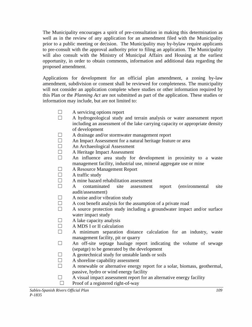
Sables-Spanish Rivers Official Plan 109
P-1835
The Municipality encourages a spirit of pre-consultation in making this determination as
well as in the review of any application for an amendment filed with the Municipality
prior to a public meeting or decision. The Municipality may by-bylaw require applicants
to pre-consult with the approval authority prior to filing an application. The Municipality
will also consult with the Ministry of Municipal Affairs and Housing at the earliest
opportunity, in order to obtain comments, information and additional data regarding the
proposed amendment.
Applications for development for an official plan amendment, a zoning by-law
amendment, subdivision or consent shall be reviewed for completeness. The municipality
will not consider an application complete where studies or other information required by
this Plan or the Planning Act are not submitted as part of the application. These studies or
information may include, but are not limited to:
☐ A servicing options report
☐ A hydrogeological study and terrain analysis or water assessment report
including an assessment of the lake carrying capacity or appropriate density
of development
☐ A drainage and/or stormwater management report
☐ An Impact Assessment for a natural heritage feature or area
☐ An Archaeological Assessment
☐ A Heritage Impact Assessment
☐ An influence area study for development in proximity to a waste
management facility, industrial use, mineral aggregate use or mine
☐ A Resource Management Report
☐ A traffic study
☐ A mine hazard rehabilitation assessment
☐ A contaminated site assessment report (environmental site
audit/assessment)
☐ A noise and/or vibration study
☐ A cost benefit analysis for the assumption of a private road
☐ A source protection study including a groundwater impact and/or surface
water impact study
☐ A lake capacity analysis
☐ A MDS I or II calculation
☐ A minimum separation distance calculation for an industry, waste
management facility, pit or quarry
☐ An off-site septage haulage report indicating the volume of sewage
(sepatge) to be generated by the development
☐ A geotechnical study for unstable lands or soils
☐ A shoreline capability assessment
☐ A renewable or alternative energy report for a solar, biomass, geothermal,
passive, hydro or wind energy facility
☐ A visual impact assessment report for an alternative energy facility
☐ Proof of a registered right-of-way
Sables-Spanish Rivers Official Plan 110
P-1835
These studies may be in addition to other requirements set out in Ontario Regulations
543/06, 544/06, 545/06 or 547/06, as may be amended.
Applications for site plan control shall be accompanied by the information prescribed in
Section 41(4) of the Planning Act.
6.9.2 Public Works - Section 24
Council shall not undertake any public work and no by-law shall be passed that does not
conform to the Official Plan. Council may pass a by-law which does not conform with the
Official Plan where they have adopted an amendment to this Plan and where the public
work will comply with the amendment, once the amendment is approved.
6.9.3 Acquisition of Land - Section 25
Council may acquire land for any purpose set out in this Plan and may lease or otherwise
dispose of such lands where no longer required.
6.9.4 Meeting to Discuss Revisions to the Plan - Section 26
The Plan will be subject to a review from time-to-time to ensure that the goals and
objectives are being achieved and the policies are practical. It is the intent of Council that
a special meeting of Council, open to the public be held not less frequently than once
every five years pursuant to Section 26 of the Planning Act to discuss the revisions that
may be required. Revisions to the Official Plan will be made to ensure that it conforms
with provincial plans or does not conflict with them, as the case may be; has regard to the
matters of provincial interest listed in section 2 of the Planning Act, and is consistent with
policy statements issued under subsection 3 (1) of the Planning Act.
6.9.5 Community Improvement - Section 28
Council may, subject to an amendment to this Plan, consider the use of this section of the
Planning Act to carry out physical improvements within the community.
6.9.6 Zoning By-Laws - Section 34
The zoning by-law for Sables-Spanish Rivers shall reflect the principles, policies and land
use descriptions in this Plan. The by-law shall zone land and establish regulations to
control the use of land and the character, location and use of buildings and structures in
accordance with this Plan.
Council may use the powers provided by Section 34 to regulate the use of all land,
buildings and structures within the Township of Sables-Spanish Rivers as well as to
Sables-Spanish Rivers Official Plan 111
P-1835
govern other matters such as to prohibit land uses and development in sites containing a
variety of natural heritage features, as well as sites containing an identified significant
archaeological feature. Council may establish any number of zones to classify and control
land uses to implement this Plan.
6.9.7 Holding Zone - Section 36
In order to show a future zoning designation while retaining control of the timing of
development, a “holding” designation may be used, in the form of a symbol “H” as a
suffix to the zone designation. As long as the “H" is retained, the use of the land shall be
limited to the existing uses as of the date of the approval of this Plan (February 3, 2003).
Rationale for the Use of Holding By-Laws
Holding by-laws may be used where the principle of development has been established
through scrutiny under the Planning Act. A Holding By-law may be used under the
following circumstances:
1. To hold land from development until water and sewage services are provided, or,
studies have been undertaken to prove that servicing is possible on the site and the
servicing has been included in the Municipal budget or provided for through a
Subdivision Agreement or other acceptable means with a developer;
2. To hold land that is designated in the Official Plan, but, as yet is undeveloped
until a proposal is submitted to develop the land for the use/uses intended in the
Official Plan;
3. To hold land from development until other environmental or physical
improvements to the site are made. For example, road improvements or infill on a
site may be required prior to development of the site;
4. To prevent or limit the use of land in order to achieve orderly phased
development;
5. To ensure that all conditions of development including financial requirements and
agreements in accordance with the provisions of this Plan and/or the Planning
Act, have been complied with;
6. Contaminated sites may be placed in a Holding Zone in the municipality‟s zoning
by-law. However, the feasibility of remediation to the proposed new use should
be determined prior to establishing the holding zone. Where a holding zone is
used, the “H” symbol may be removed when the site has been acceptably
decommissioned or cleaned up to the satisfaction of the municipality and in
accordance with a site remediation plan and subject further, to the submission of a
Ministry of the Environment acknowledged Record of Site Condition to Council.
Sables-Spanish Rivers Official Plan 112
P-1835
Conditions to be Met for Removal of the Holding Symbol
The Holding "h” may be removed by an application to Council to amend the by-law when
the above circumstances have been satisfied and the following conditions met:
1. Approval of servicing the site /area is given or servicing of adequate standards is
provided on the site;
2. A proposal is submitted for a site that conforms to the policies of the Official Plan;
3. A phasing plan is submitted;
4. Architectural or design drawings and studies, where applicable, are submitted
showing the required features;
5. Financial securities have been submitted e.g., bond or letter of credit;
6. With respect to contaminated sites, the “H” may be removed upon the receipt of a
report approved by Council that the appropriate level of remediation, demonstrated
by a Ministry of Environment acknowledged Record of Site Condition has been
achieved.
6.9.8 Interim Control By-laws - Section 38
In utilizing this authority, it is Council‟s policy that an interim control by-law shall be
preceded by a By-law or resolution, directing that a study be undertaken of planning
policies in the affected area and setting out the terms of reference for the study.
When an Interim Control By-law expires, the prior zoning shall automatically apply,
unless a new zoning by-law is passed.
6.9.9 Temporary Use By-laws - Section 39
In certain circumstances, it may be desirable to pass a Temporary Use By-law to
implement the policies of this Plan or to implement measures for economic growth and
prosperity (e.g. it may be desirable to locate certain uses in vacant commercial or
institutional buildings or on lands zoned for institutional uses on a temporary basis despite
the fact the uses are not permitted under the provisions of the Official Plan). It may also be
beneficial to temporarily zone lands for industrial or commercial uses as an incubator or
temporary location for a use which does not conform to the Plan.
A Temporary Use By-law may also be passed to permit a garden suite.
Sables-Spanish Rivers Official Plan 113
P-1835
Council may, therefore, in a by-law passed under Section 39 of the Planning Act,
authorize a temporary use of existing structures for any purpose set out therein. The period
of time for a temporary use may be for a period of up to ten years for a garden suite and up
to three years in all other cases, both of which are renewable. Notice of a Temporary Use
By-law shall be given in the same manner as that of a zoning by-law under Section 34 of
the Planning Act.
As a condition of the passing of a Temporary Use By-law for a garden suite, Council may
require the owner of the suite or any other persons to enter into an agreement with the
Municipality under the Municipal Act.
Any use introduced under such a Temporary Use By-law does not acquire the status of a
legal non-conforming use at the expiration of the by-law(s) and at that time must therefore
cease.
It is not the intent of the Official Plan that Temporary Use By-laws be used to permit a
new use while an amendment to the Official Plan and/or zoning by-law is being processed
to permit the use on a permanent basis. However, once a temporary use is established and
it becomes apparent to Council that the use should be permitted on a permanent basis, the
use may continue under a Temporary Use By-law while any required amendments are
passed.
6.9.10 Site Plan Control - Section 41
1. Policies
A. Under the authority of Section 41 of the Planning Act, Council may by by-
law designate specific areas or land uses within the municipality which shall
be known as site plan control areas. For the purposes of this Plan, the
following land use designations and land uses shall be subject to Site Plan
Control:
(i) Any industrial, commercial or public service use.
(ii) Any multiple residential use consisting of six (6) or more dwelling
units.
(iii) Any lands abutting a lake, water body or natural heritage feature or
area.
(iv) All land uses within the Environmental Protection Area.
(v) All conversions and redevelopment within any of the above
categories.
(vi) Communication towers and facilities as per Section 3.11.
(vii) Alternative energy systems and renewable energy systems per
Section 3.11.2 The specific applications of Site Plan Control are set out in the various land
use designations in this Plan and should be used as the primary reference.
Sables-Spanish Rivers Official Plan 114
P-1835
Council may by by-law designate one or more areas as Site Plan Control
Areas. Council may require the submission of plans and drawings for all
development proposals within the Site Plan Control area.
Council may, as a condition of site plan approval, require the dedication of
land for the widening of any street to the width set out in Section 3.10.2
policies of this Plan for roads as specified by the classification. The
conveyance to the municipality shall not exceed more than one-half of the
deficiency of the width or 5 m [16.4 ft] whichever is the lesser. The
conveyance shall apply to the full frontage of the property wherever the
deficiency exists.
Council shall require each applicant submitting such a development
proposal to enter into an agreement with the Municipality as a condition to
the approval of the development proposal. Where a development proposal is
of a minor nature, some or all of the points listed below may be waived in
the agreement. The agreement may include conditions on the following
facilities and matters.
B. The construction or reconstruction of the access or egress onto all major
roads or highways and any upgrading of the roads, that will be necessary as
a result of the increased traffic caused by the development;
C. The number and location of all off-street loading areas and parking areas to
be provided within each development, and the surfacing of such areas and
driveways;
D. The number, location and construction of all walkways and walkway ramps
and pedestrian access points to be provided in the development and how
these will eventually be connected to adjacent areas;
E. The location, number and power of any facilities for lighting, including
floodlighting of the site or any buildings or structures (such as signs)
thereon;
F. All grading required to be done on the property and how storm, surface and
waste waters will be disposed of in order to prevent erosion including the
period during construction of the project. Plans will show the location and
connections for all services to municipal services including elevations and
inverts;
G. The techniques that are to be used on the site for landscaping of the property
for the protection of adjoining lands, water bodies or natural heritage
features, including the type of vegetation and techniques to be used, the
Sables-Spanish Rivers Official Plan 115
P-1835
existing (native) vegetation which is to be preserved, and any structures
such as walls, fences or barriers that are to be used;
H. The location, height, number and size of all residential units to be erected on
the site and the method by which the development will be staged;
I. The location, height, and type of all other buildings located in the proposal;
J. Illustration of the contours and final elevations of the site on a contour
interval of 1 m [3.3 ft] or less;
K. The location and type of any facilities and enclosures for the storage of
garbage and other waste materials;
L. The location and extent of any easements or other covenants on the land to
be conveyed to the municipality or a local board for public utilities;
M. The installation or application of sustainable design elements such as
vegetation materials, street furniture, waste and recycling and bicycle
parking; and
N. Facilities designed to have regard for access for persons with disabilities.
In the review of Site Plan Applications, Council may circulate to municipal
departments and outside agencies that are considered to have a vested interest for
their comments prior to the approval of any site plan or site plan agreement.
Agreements entered into under the authority of Section 41 of the Planning Act
may be for the provision of any or all of the facilities, works or matters as
provided for in the Act and the maintenance thereof and for the registration of
such agreements against title to the land to which they apply.
6.9.11 Parkland Dedication or Cash-in-Lieu - Section 42
It is Council‟s policy to require the conveyance of parkland or the cash-in-lieu equivalent
for residential and non-residential development as a means to implementing the policies
for parks and open space areas of this Plan. The land or cash to be conveyed shall not
exceed two per cent (2 %) of the value of the land to be developed for commercial or
industrial uses or five per cent (5 %) for residential uses. Where Council requests cash-in-
lieu, the value of the land shall be determined on the day before the day the building
permit is issued.
Sables-Spanish Rivers Official Plan 116
P-1835
6.9.12 Committee of Adjustment - Sections 44 and 45
1. Status of Legal Non-conforming Uses
It is the intention of this Plan that non-conforming uses should eventually cease to
exist.
The owner/applicant in submitting an application for an expansion, enlargement or
change of a non-conforming use shall demonstrate that all three of the following
conditions are met in qualifying a use as a non-conforming use:
A. That the use was legally established prior to the passing of any of the zoning
by-laws as set out in Section 3.4 of this Plan;
B. That the use has continued without interruption from the date of its
establishment of the use, or in the case of an interruption, that there has been a
reasonable attempt to continue the use during the period of discontinuance;
and
C. That the use is deemed to have existed and continued only if there was in fact,
an actual user directly involved with the use.
2. Enlargement of Expansion or Change to a Non-Conforming Use
It may be desirable, however, to permit the extension, enlargement or change of a
nonconforming use to a similar or more compatible use subject to the following
criteria:
A. The extension or enlargement does not aggravate the non-conforming
situation for neighboring uses;
B. The extension or enlargement is in reasonable proportion to the existing use
and to the land on which it is to be located;
C. The proposed extension or enlargement will not create undue noise, vibration,
fumes, smoke, dust, odors, glare from lights nor environmental hazards;
D. Traffic and parking conditions in the vicinity will not be adversely affected
and traffic impacts will be kept to a minimum by the appropriate design of
ingress and egress points to and from the site and by improvement of site
conditions especially in proximity to intersections;
E. Adequate provisions have been or will be made for off-street parking and
loading facilities where they apply; and
Sables-Spanish Rivers Official Plan 117
P-1835
F. Infrastructure and public services such as water and sewer, storm drainage,
roads, school bussing etc. are adequate or can be made adequate.
6.9.13 Subdivisions, Consents and Part-Lot Control - Sections 50-53
1. Plans of Subdivision
Land development shall generally take place by plan of subdivision for urban
areas, waterfront residential development and/or where five or more lots are
proposed. Development by plan of subdivision may be used for large lot
residential development in the Rural District. Consents shall otherwise be the
method of land division (see Section 3.7.2)
It shall be the policy of Council to consider for approval, only those plans of
subdivision which comply with the policies of this Plan and which, to the
satisfaction of the Council, can be supplied with adequate and cost effective
public service facilities.
2. Consent Policies and Procedures
Provisions relating to the granting of consents are set out in Sections 51 and 53 of
The Planning Act. Council shall be consistent with the Provincial Policy
Statement in addition to the consent policy checklist set out in Section 3.7.2 of
this Plan.
3. Part-Lot Control
Part-lot control may be used for existing plans of subdivision where it is necessary
to re-align lot boundaries to clarify or grant title, exact specific servicing
requirements as a condition of consent such as a road widening or to further
control internal development on a lot.
6.9.14 Tariff of Fees - Section 69 (see Appendix)
APPENDIX 1
PROCEDURES AND
SUPPLEMENTARY INFORMATION
Sables-Spanish Rivers Official Plan 119
P-1835
APPENDIX 1 - PROCEDURES AND SUPPLEMENTARY
INFORMATION
1. Building Code Act
1.1 General
The Building Code Act provides the enabling authority for Councils to issue building
permits through the appointment of a building official and the adoption of a building by-
law. The Act also provides for the administration of property standards (transferred from
the Planning Act). A building permit cannot be issued unless the proposed structure
complies with „applicable law such as a zoning by-law. The associated Ontario Building
Code sets out the standards for design and construction of buildings. Building permits are
generally required for:
A. Construction of a new building or structure (garage or accessory building
exceeding 10 m2) including a mobile home or manufactured dwelling;
B. The repair, reconstruction or retrofitting of a building or other construction which
is a part of the structural support of a building;
C. Adding an extension;
D. Excavating or constructing a foundation;
E. Installing heating, plumbing, air conditioning or a fire place (solid fuel appliance);
F. Building or placing a temporary building;
G. The demolition of a building;
H. The change of use of a building may require a permit since different code
standards may apply to the new use;
Important sections of the Building Code Act include:
Section 3 (2) - The Council shall appoint a chief building official and such inspectors as
are necessary for the enforcement of the Building Code Act.
Section 7 - Enables Council to adopt a building by-law specifying the classes of permits,
application fees, requirements for applications etc.
Sables-Spanish Rivers Official Plan 120
P-1835
Section 8 (1) - Provides that no person shall construct or demolish a building unless a
permit has been issued.
Section 15.1 - 15.8 - Sets out the enabling authority for property standards including the
appointment of a property standards officer, appointment of a property standards
committee, issuing of orders to remedy buildings or conditions which do not meet the
requirements set out in a property standards by-law.
2. Condominium Act
2.1 General
Condominiums are a form of property ownership in which title to a unit, such as an
individual apartment in an apartment building or a single detached dwelling in a private
subdivision, is held by an individual together with a share of the rest of the property,
which is common to all owners.
Condominiums can involve a brand new development, or an existing rental project which
is converted to condominium ownership. They can apply to any type of residential
building as well as commercial and industrial areas. Vacant land condominiums are also
permitted.
Section 50 (2) - A condominium plan is like any plan of subdivision in that it is a way of
dividing property and must be approved by the approval authority.
Section 50 (3) may be utilized to exempt approval for buildings which have already been
constructed and which satisfy all of the applicable municipal policies and requirements.
2.2 Applications
Applications shall be made to Council utilizing the form prescribed and shall set out a
description suitable for registration on title unless otherwise exempted by Council.
Council may enter into an agreement with the applicant for the provision of services or
such other matters as are governed by Section 51 of the Planning Act.
3. Development Charges Act, 1997
3.1 General
Subject to undertaking a study (Section 10), Council may adopt a Development Charges
By-law (Section 6) for the purposes of imposing a development charge against specified
land uses to pay for increased capital costs required because of the increased need for
services arising from new development of the area to which the by-law applies.
Sables-Spanish Rivers Official Plan 121
P-1835
Section 2 (2) - Development which may precipitate a development charge includes:
1. The passing of a zoning by-law or an amendment to a by-law under Section 34 of the
Planning Act;
2. The approval of a minor variance under Section 45 of the Planning Act;
3. A conveyance of land to which a by-law passed under Section 50 (7) of the Planning
Act applies;
4. The approval of a plan of subdivision under Section 51 of the Planning Act;
5. A consent under Section 53 of the Planning Act;
6. The approval of a description under Section 50 of the Condominium Act; or
7. The issuing of a building permit under the Building Code Act in relation to a building
or structure.
4. Environmental Assessment Act
Prior to the construction of public works or undertakings, such as roads, sewage works,
waste disposal facilities, water filtration plants, a municipality is obliged to follow
procedures under the Environmental Assessment Act. Some types of undertakings may fall
into a class environmental assessment which is a more streamlined process in reviewing
the environmental impacts of the proposed work. Generally, the intent of this Plan is to
ensure that the following procedures (generalized description) are followed prior to the
construction of a project (undertaking):
1. Consult with affected parties:
A. Involve affected parties early in the process and continuously throughout;
B. Encourage the identification and resolution of issues before an EA is
formally submitted;
C. Promote mutually acceptable, environmentally sound solutions through
consultation;
D. Consider reasonable alternatives: planning must consider alternatives to the
undertaking which fulfill the purpose of the undertaking in functionally
different ways and alternative methods of implementing a particular type of
alternative. The „do-nothing alternative must also be considered;
E. Consider all aspects of the environment: the planning process must
consider the effects on the natural or biophysical environment as well as
Sables-Spanish Rivers Official Plan 122
P-1835
effects on the social, economic and cultural conditions that influence the
lives of humans of a community;
F. Systematically evaluate net environmental effects: evaluate alternatives in
light of their advantages and disadvantages and the effects remaining after
mitigation or enhancement measures have been addressed; and
G. Provide clear, complete documentation: the EA should strive to represent
accurately the process that was followed in a clear and understandable way
and to communicate the results of that process.
5. Environmental Protection Act
The Environmental Protection Act provides control mechanisms for the protection of the
environment that has application to the general public as well as to the Council of a
municipality.
Section 46 - land used for a waste disposal site may not be used for another purpose within
a period of twenty-five years from the date the land ceased to be used, without the
approval of the Minister.
6. Gasoline Handling Act and Code
This legislation prescribes the requirements for the handling of gasoline and associated
products and amongst other matters sets out in the associated Gasoline Handling Code,
the prescribed setbacks of gasoline storage facilities and pump islands from streets and
adjacent properties. The intent of this Plan is to ensure that the amending zoning by-law
reflects these standards as a measure of public safety and compatibility with adjacent land
uses.
7. Municipal Act
This Act provides the enabling authority for a variety of types of by-laws which serve to
implement features of this Plan or to authorize other actions of Council as follows:
Section 31 - Establishing a highway
Section 34 - Closing a highway
Sections 37/38 - Closing a private road
Sections 47/48 - Naming a road
Section 99 - Regulating Signs
Section 123 - Regulating dangerous places e.g. cliffs, deep water
Section 124 - Regulating pits and quarries
Section 127 - Regulating refuse and debris (clean yards)
Section 129 - Regulating noise, odour, dust, vibration, outdoor illumination
Sables-Spanish Rivers Official Plan 123
P-1835
Section 131 - Regulating wrecking yards
Section 135 - Regulating tree cutting or injury to trees
Section 142 - Site alteration control (e.g. dumping, filling, topsoil removal, grade
alteration)
Section 151 - Licensing adult entertainment establishments
Section 166 - Designation and registration of group homes
Section 168/169 - Licensing trailers and trailer camps
Section 170 - Licensing motor vehicle racing
Section 204 - Establishing a Business Improvement Area
8. Ontario Heritage Act
The Ontario Heritage Act is intended to assist municipalities with the designation and
conservation of buildings, structures, districts, landscapes, ruins that may be considered to
be cultural heritage or archaeological resources. The municipality may use Part IV of the
Act to designate individual buildings, structures or sites/landscapes or use Part V to
designate a Heritage Conservation District.
Section 27.1 - Clerk shall keep a registry of properties of cultural heritage value or interest
and to include designated properties in registry
Part IV - Authority to designate properties of cultural heritage value or interest
Section 28 - Authorizes Council to establish a Municipal Heritage Committee of 5 or more
people to advise Council on all matters related to Part IV of the Act.
Section 29 (2) - Authorizes a by-law to designate commencing with a Notice of Intention
to Designate a property.
Section 31(2) - Authorizes a by-law to repeal a designating by-law.
Section 32 (2) - Owners application to repeal designating by-law
Section 33 (4) - Owners application for permission to alter a designated property.
Section 34 (2) - Owners application for permission to demolish or remove building or
structure which forms part of a designated property.
Section 34.5(1) - Minister may designate any property as having heritage value or interest
Section 35.3(1) - Municipality may prescribe standards in its property standards by-law for
heritage properties
Section 36(1) - Municipality may acquire, purchase or lease a designated heritage property
Sables-Spanish Rivers Official Plan 124
P-1835
Section 37(1) - Municipality may enter into conservation easement
Part V -Authority to establish a Heritage Conservation District
Section 40(1) – Authorizes Council to undertake a study of an area for the purpose of
designating a heritage conservation district
Section 41.1(1) – requires the adoption of a heritage conservation district plan for each
district that is designated. The plan must contain those items listed in s. 41.1(5).
9. The Planning Act
9.1 Amendments to the Official Plan - Sections 17 and 22
The following procedures shall be used in evaluating Official Plan applications.
1. Procedures:
A. Conduct Preliminary Review of Proposed Amendment:
A complete application shall be filed with the clerk of the municipality
using an application form prescribed by the municipality and shall include
a map or survey to identify the location of the property(s) affected, existing
land uses on the subject and surrounding lands, proposed land uses and
servicing of the subject property;
The application will be reviewed to determine if the proposal will
involve amendments to the text, schedule or both;
The policy sections or land use designations affected will be
identified; and
The applicant s reasoning or justification for the proposal will be
reviewed so that it is clearly understood. The initial step may require a mandatory consultation with the proponent. Where the application is deemed to be complete (incomplete) notice will be sent to the proponent (within 30 days of submission).
B. Assess Compatibility of Proposed Amendment with Intent of the Official
Plan:
The application will be assessed to determine if the proposal meets
the general intent of the overall purpose, goals, objectives and
general policies of the Plan.
C. Assess Need for Proposed Amendment:

Sables-Spanish Rivers Official Plan 125
P-1835
Assess if the change is necessary to achieve the purpose, goals,
objectives and policies of the Plan; and
Determine if conditions have changed to warrant the proposed
amendment (e.g. consult local studies, statistics etc., which may
point to changes in economic conditions or other circumstances);
D. Assess Long Term Implications of Proposing the Amendment:
Assess if it is likely that the amendment will have positive or
negative effects for the future (e.g. could approval set the precedent
for similar requests);
Refer to local studies to understand conditions and circumstances
affecting the Township; and
Consult with other municipalities on how they have dealt with
similar proposals.
E. Appropriateness/Compatibility of Proposed Amendment
Assess appropriateness of location within the context of the
municipality;
Assess compatibility of proposed use with surrounding land uses;
Determine scale of the proposal in relation to need and compatibility
with surrounding land uses;
Calculate/assess servicing in terms of capacity and adequacy of
sewer, water, waste and utilities;
Assess site suitability in terms of any physical constraints, on-site
parking and loading availability etc.; and
Certain studies or other information shall be submitted where
required by this Plan such as:
(i) traffic study or traffic engineering
(ii) environmental review on contaminated site
(iii) calculation of uncommitted residual capacity of sewer or
water services
(iv) storm water management and drainage studies
(v) archaeological review and/or heritage impact assessment
(vi) marketing study
(vii) natural heritage feature - impact assessment
(viii) lake capacity
(ix) hydrogeological investigation/water supply assessment and
servicing options
(x) land use compatibility assessment
(xi) noise/vibration study
(xii) MDS calculation
Sables-Spanish Rivers Official Plan 126
P-1835
Reference should be made to Section 6.9.1 for other studies or
information that may be required.
F. Provincial Interests:
Pre-consultation will involve discussions with affected agencies and
the Ministry of Municipal Affairs and Housing in being consistent
with the Provincial Policy Statement and having regard for matters
of Provincial interest;
G. Public Consultation:
Notice of a public meeting shall be advertised within 45 days of the
submission of a complete application pursuant to the requirements
for notice;
Following a public meeting Council may adopt the amendment as
proposed or with modifications, or may refuse the application.
Council shall consider any relevant public concerns with the
proposed amendment and whether changes or refinements may be
necessary in the public interest e.g. can the amendment be altered or
improved to make it acceptable. Should Council refuse to adopt, or
not adopt the amendment within 90 days of the application, the
applicant may appeal to the Ontario Municipal Board;
Where the amendment is adopted, notice of adoption shall be given
within15 days and the amendment together with the record of
submission shall be submitted to the approval authority;
The approval authority has 180 days to render a decision on the
amendment following which there is a 20 day period for appeal to
the Ontario Municipal Board. Where there is no appeal, the decision
is final;
The notice procedures as prescribed in Section 17 of the Planning
Act, and Ontario Regulations thereto, shall be adhered to; and
However, Council may forego public notification and public
meeting(s), in connection with Official Plan changes, if the changes
relate to the following:
(i) A consolidation of the Official Plan which does not affect
the policies and intent of the Plan;
(ii) Altering the numbers and arrangement of provisions;
Correcting grammar or typographical errors, changing the
format, punctuation or language slightly to obtain a uniform
format and mode of expression in the Plan.
Sables-Spanish Rivers Official Plan 127
P-1835
9.2 Zoning By-Laws - Section 34
1. General
When Council receives an application for a development project which it
considers at the time is desirable, not premature, capable of being adequately
serviced, and in conformity with the policies and designations of this Plan,
Council may pass an implementing amending by-law to the Zoning By-Law.
Council may, as a condition of development or redevelopment, require the owner
of the land to enter into one or more agreements or requirements with the
Municipality dealing with the provision, maintenance and use of certain facilities
as set forth in the Planning Act. These agreements or requirements may pertain to
one or more Sections of the Planning Act, such as:
● Holding Provisions - 36 (2);
● Temporary Use Agreement - 39 (1.2);
● Site Plan Control Agreement- 41(7,8);
● Subdivision Control Agreement - 51(26);
● Consent Agreement - 53 (12);
2. The Zoning Amendment Process
Applications for an amendment to the Zoning By-Law shall generally comply
with the following process:
Step 1 - Filing an Application and Notification of Complete Application
Obtain an application for a Zoning By-Law Amendment;
Complete the application in full. Applications which are not complete may
lead to a delay in processing;
Ensure that additional information required by the municipality is submitted.
This may include: (i) An Impact Assessment if the proposed development is located close
to:
- A Natural Heritage Feature (wetland, fish or wildlife habitat area)
- An archaeological feature
- A cultural heritage resource
- An existing or former waste management site
Reference should be made to Section 6.9.1 for other studies or information
that may be required; and
The application will be reviewed for completeness and subject to the
assessment, a notice of complete application will be distributed to prescribed
agencies.
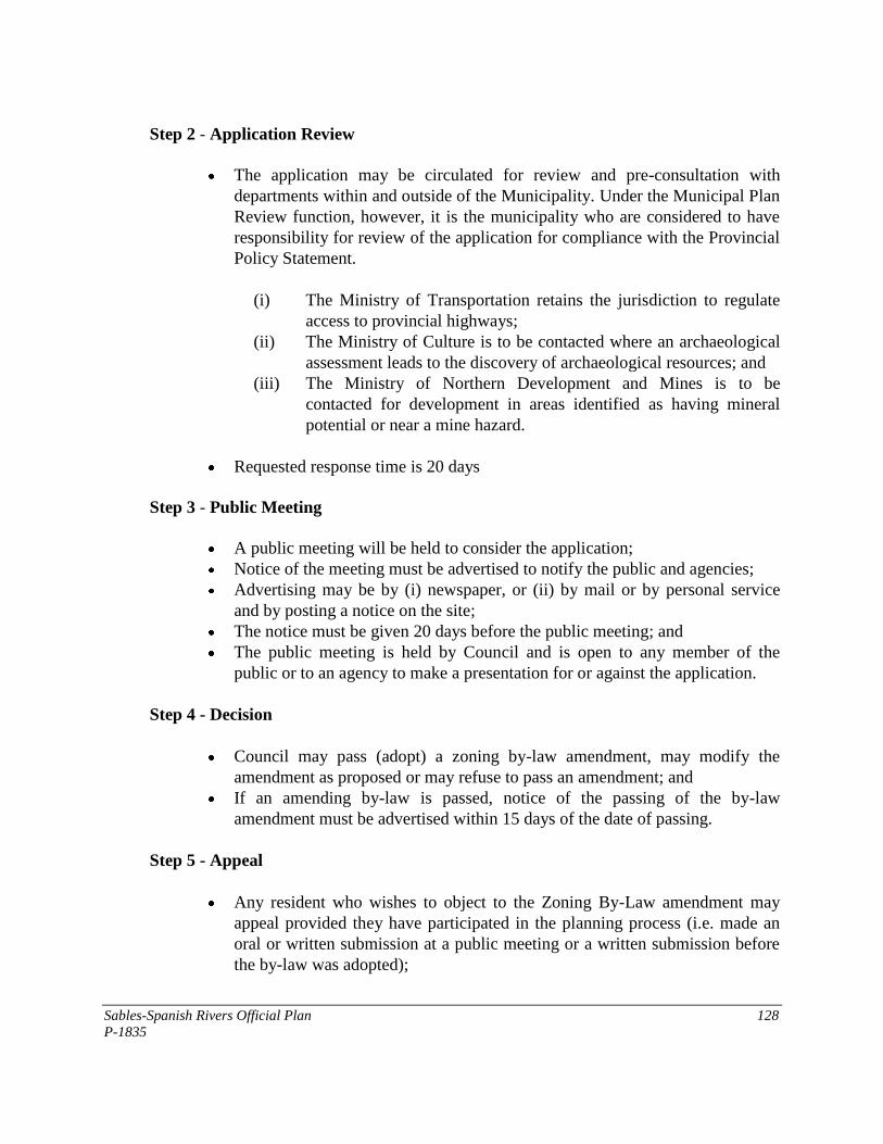
Sables-Spanish Rivers Official Plan 128
P-1835
Step 2 - Application Review
The application may be circulated for review and pre-consultation with
departments within and outside of the Municipality. Under the Municipal Plan
Review function, however, it is the municipality who are considered to have
responsibility for review of the application for compliance with the Provincial
Policy Statement.
(i) The Ministry of Transportation retains the jurisdiction to regulate
access to provincial highways;
(ii) The Ministry of Culture is to be contacted where an archaeological
assessment leads to the discovery of archaeological resources; and
(iii) The Ministry of Northern Development and Mines is to be
contacted for development in areas identified as having mineral
potential or near a mine hazard.
Requested response time is 20 days
Step 3 - Public Meeting
A public meeting will be held to consider the application;
Notice of the meeting must be advertised to notify the public and agencies;
Advertising may be by (i) newspaper, or (ii) by mail or by personal service
and by posting a notice on the site;
The notice must be given 20 days before the public meeting; and
The public meeting is held by Council and is open to any member of the
public or to an agency to make a presentation for or against the application.
Step 4 - Decision
Council may pass (adopt) a zoning by-law amendment, may modify the
amendment as proposed or may refuse to pass an amendment; and
If an amending by-law is passed, notice of the passing of the by-law
amendment must be advertised within 15 days of the date of passing.
Step 5 - Appeal
Any resident who wishes to object to the Zoning By-Law amendment may
appeal provided they have participated in the planning process (i.e. made an
oral or written submission at a public meeting or a written submission before
the by-law was adopted);
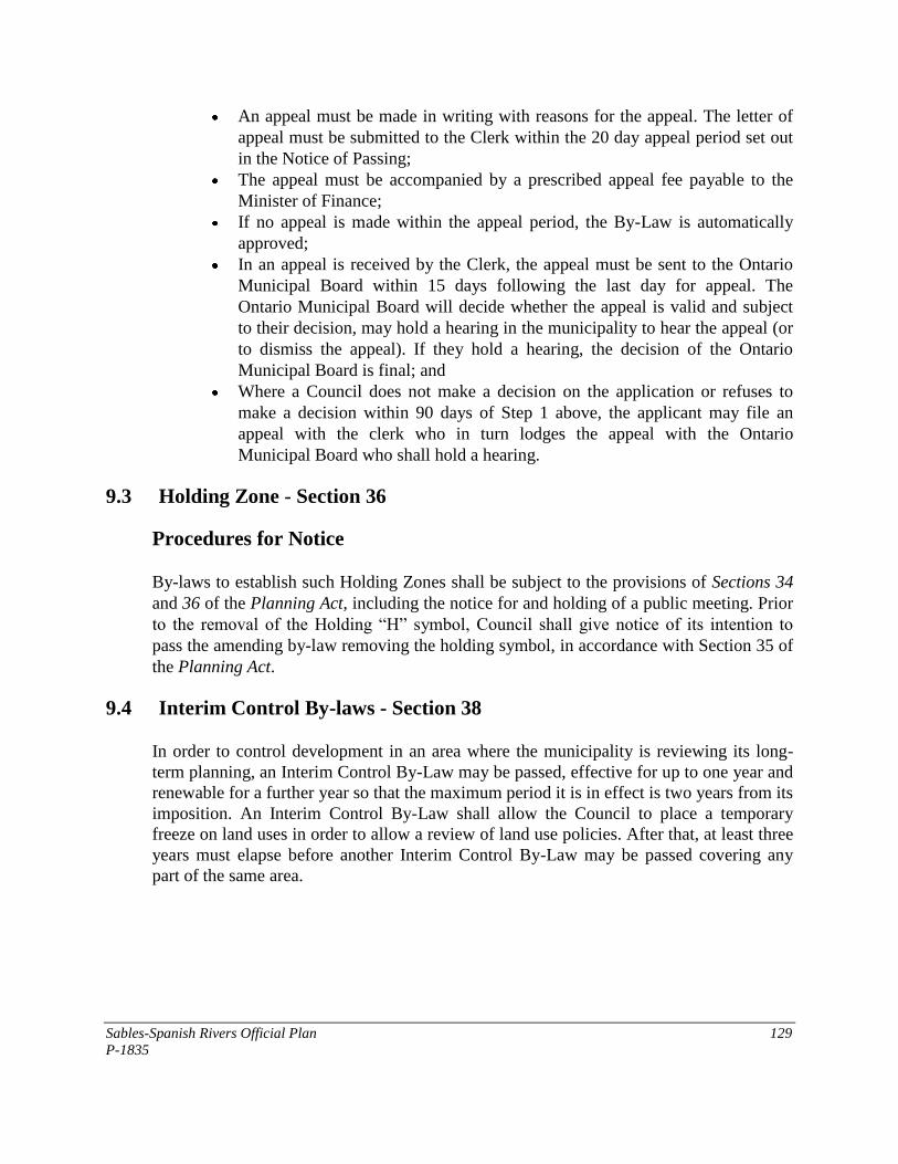
Sables-Spanish Rivers Official Plan 129
P-1835
An appeal must be made in writing with reasons for the appeal. The letter of
appeal must be submitted to the Clerk within the 20 day appeal period set out
in the Notice of Passing;
The appeal must be accompanied by a prescribed appeal fee payable to the
Minister of Finance;
If no appeal is made within the appeal period, the By-Law is automatically
approved;
In an appeal is received by the Clerk, the appeal must be sent to the Ontario
Municipal Board within 15 days following the last day for appeal. The
Ontario Municipal Board will decide whether the appeal is valid and subject
to their decision, may hold a hearing in the municipality to hear the appeal (or
to dismiss the appeal). If they hold a hearing, the decision of the Ontario
Municipal Board is final; and
Where a Council does not make a decision on the application or refuses to
make a decision within 90 days of Step 1 above, the applicant may file an
appeal with the clerk who in turn lodges the appeal with the Ontario
Municipal Board who shall hold a hearing.
9.3 Holding Zone - Section 36
Procedures for Notice
By-laws to establish such Holding Zones shall be subject to the provisions of Sections 34
and 36 of the Planning Act, including the notice for and holding of a public meeting. Prior
to the removal of the Holding “H” symbol, Council shall give notice of its intention to
pass the amending by-law removing the holding symbol, in accordance with Section 35 of
the Planning Act.
9.4 Interim Control By-laws - Section 38
In order to control development in an area where the municipality is reviewing its long-
term planning, an Interim Control By-Law may be passed, effective for up to one year and
renewable for a further year so that the maximum period it is in effect is two years from its
imposition. An Interim Control By-Law shall allow the Council to place a temporary
freeze on land uses in order to allow a review of land use policies. After that, at least three
years must elapse before another Interim Control By-Law may be passed covering any
part of the same area.
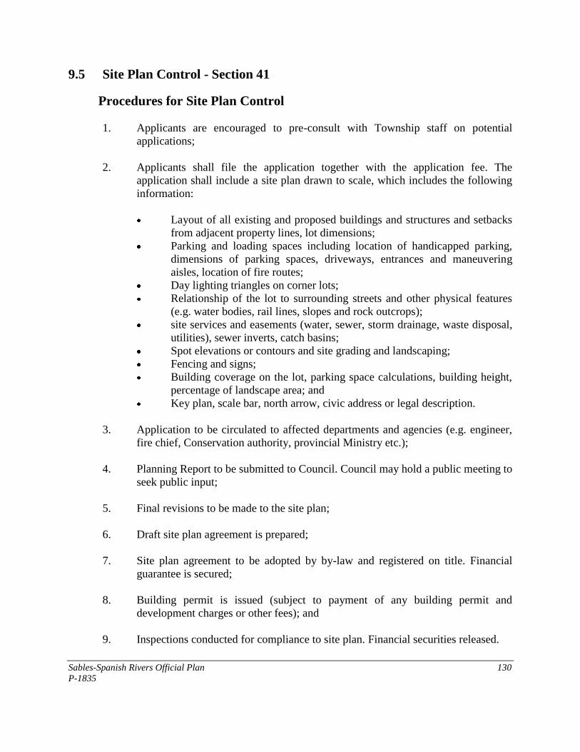
Sables-Spanish Rivers Official Plan 130
P-1835
9.5 Site Plan Control - Section 41
Procedures for Site Plan Control
1. Applicants are encouraged to pre-consult with Township staff on potential
applications;
2. Applicants shall file the application together with the application fee. The
application shall include a site plan drawn to scale, which includes the following
information:
Layout of all existing and proposed buildings and structures and setbacks
from adjacent property lines, lot dimensions;
Parking and loading spaces including location of handicapped parking,
dimensions of parking spaces, driveways, entrances and maneuvering
aisles, location of fire routes;
Day lighting triangles on corner lots;
Relationship of the lot to surrounding streets and other physical features
(e.g. water bodies, rail lines, slopes and rock outcrops);
site services and easements (water, sewer, storm drainage, waste disposal,
utilities), sewer inverts, catch basins;
Spot elevations or contours and site grading and landscaping;
Fencing and signs;
Building coverage on the lot, parking space calculations, building height,
percentage of landscape area; and
Key plan, scale bar, north arrow, civic address or legal description.
3. Application to be circulated to affected departments and agencies (e.g. engineer,
fire chief, Conservation authority, provincial Ministry etc.);
4. Planning Report to be submitted to Council. Council may hold a public meeting to
seek public input;
5. Final revisions to be made to the site plan;
6. Draft site plan agreement is prepared;
7. Site plan agreement to be adopted by by-law and registered on title. Financial
guarantee is secured;
8. Building permit is issued (subject to payment of any building permit and
development charges or other fees); and
9. Inspections conducted for compliance to site plan. Financial securities released.
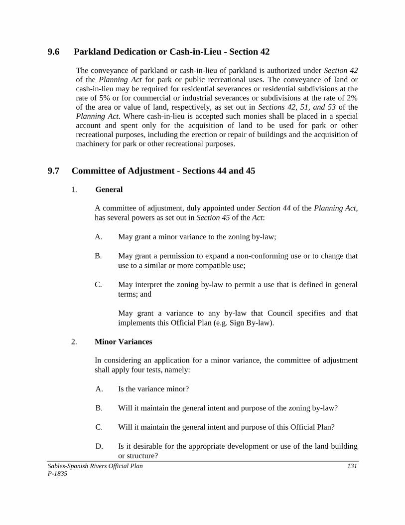
Sables-Spanish Rivers Official Plan 131
P-1835
9.6 Parkland Dedication or Cash-in-Lieu - Section 42
The conveyance of parkland or cash-in-lieu of parkland is authorized under Section 42
of the Planning Act for park or public recreational uses. The conveyance of land or
cash-in-lieu may be required for residential severances or residential subdivisions at the
rate of 5% or for commercial or industrial severances or subdivisions at the rate of 2%
of the area or value of land, respectively, as set out in Sections 42, 51, and 53 of the
Planning Act. Where cash-in-lieu is accepted such monies shall be placed in a special
account and spent only for the acquisition of land to be used for park or other
recreational purposes, including the erection or repair of buildings and the acquisition of
machinery for park or other recreational purposes.
9.7 Committee of Adjustment - Sections 44 and 45
1. General
A committee of adjustment, duly appointed under Section 44 of the Planning Act,
has several powers as set out in Section 45 of the Act:
A. May grant a minor variance to the zoning by-law;
B. May grant a permission to expand a non-conforming use or to change that
use to a similar or more compatible use;
C. May interpret the zoning by-law to permit a use that is defined in general
terms; and
May grant a variance to any by-law that Council specifies and that
implements this Official Plan (e.g. Sign By-law).
2. Minor Variances
In considering an application for a minor variance, the committee of adjustment
shall apply four tests, namely:
A. Is the variance minor?
B. Will it maintain the general intent and purpose of the zoning by-law?
C. Will it maintain the general intent and purpose of this Official Plan?
D. Is it desirable for the appropriate development or use of the land building
or structure?
Sables-Spanish Rivers Official Plan 132
P-1835
3. Procedures for Applications
A. Applicants are encouraged to consult with Township staff prior to
submitting an application;
B. Applicant to file complete application with the secretary-treasurer of the
committee of adjustment together with the required fee. The application,
where required, shall be accompanied by a sketch or plan showing the
specific dimensions of buildings or structures which affect or may be
affected by the application (including buildings or structures on adjacent
properties);
C. Committee shall hold a public meeting duly advertised at least 10 days
prior and within 30 days after the application is date stamped as a complete
application. A preview of the application (planning report) along with a
site visit is recommended;
D. Committee may make a decision or reserve a decision and impose
conditions on a decision. Decision to be mailed within 10 days; and
E. Applicant or other person has 20 days from the date of the decision to file
an appeal with the secretary-treasurer together with an appeal fee upon
which the appeal is forwarded to the Ontario Municipal Board. The OMB
may dismiss the appeal or hold a hearing and render a decision.
9.8 Subdivisions, Consents and Part-Lot Control - Sections 50-53
1. Procedures for Processing a Plan of Subdivision
The processing of a Plan of Subdivision shall generally consist of the following
steps:
A. Satisfactory completion of an application together with the submission of
the required fee to the approval authority (see Section 6.9.1 for studies and
information that may be required in support of an application);
B. Submission of required supplementary studies or information, where
required;
C. The approval authority will be responsible for evaluating the application in
compliance with the relevant policies of this Plan, and the Provincial
Policy Statement. This will also include, where required, the circulation of
the application to the Ministry of Transportation with respect to an
Sables-Spanish Rivers Official Plan 133
P-1835
entrance permit onto Highway 7; and the Ministry of Culture with respect
to an archaeological assessment;
D. Holding of a duly advertised public meeting (in accordance with the notice
provisions set out in the Planning Act) to consider the proposed
subdivision;
E. Decision may be made to approve or to not approve the draft plan.
Approval may be subject to conditions as required by the approval
authority, Council, Ministries or other agencies. If no decision is made, or
if the decision is made to not approve the draft plan, an appeal to the
Ontario Municipal Board may be filed with the approval authority;
F. Preparation of a subdivision agreement to address the conditions of draft
approval;
G. Execution of the subdivision agreement by Council and registration of the
agreement against the lands to which it applies;
H. Clearance of concerns or requirements by agencies;
I. Final approval of the Plan of Subdivision and registration;
J. Development of lands per the requirements of the subdivision agreement
and approvals or clearances by the Municipality and other agencies upon
satisfactory completion of the requirements;
K. Conveyance of land or covenants for easements for utilities, access control
or drainage;
L. Sale of lots and issuance of building permits;
M. Assumption of municipal water, sewer, roads, street lights etc., by the
Municipality (subject to meeting warranty and other construction standards
set out in the subdivision agreement).
2. Consents
Procedures for processing consent applications may include but not be limited to:
A. Applicant files a complete application with the Clerk;
Sables-Spanish Rivers Official Plan 134
P-1835
B. Council may also seek technical input from other selected agencies and
municipal staff;
C. The application will be reviewed for compliance to the policies of this Plan
and the regulations of the implementing zoning by-law (Planning Report);
D. Council may have a public meeting to consider the application;
E. Council may issue a decision to approve or not approve the application. If
the decision is made by Council to approve, Council may impose
conditions of approval (provisional consent). If no decision is made or if
the decision is made to not approve, the applicant may appeal to the
Ontario Municipal board by filing an appeal with the municipality within
the same frame specified in the Planning Act, if any;
F. Decision is advertised (circulated) as required by the Planning Act;
G. Applicant shall enter into a consent agreement where required as a means
to implement the conditions;
H. Applicant has up to one year to fulfill provisions of conditional consent;
I. Consent is granted upon fulfillment of conditions and submission of deed
or instrument for stamping (certificate); and
J. Applicant must register consent within two years from the date the
certificate is given or consent will lapse.
3. Part-Lot Control
Part-lot control may be used for existing plans of subdivision where it is necessary to re-
align lot boundaries to clarify or grant title, exact specific servicing requirements as a
condition of consent such as a road widening or to further control internal development
on a lot.
9.9 Tariff of Fees - Section 69
Council may by by-law, adopt a tariff of fees by-law for the purpose of levying fees for
the costs associated with the processing of planning applications including:
● An amendment to the Official Plan;
● An amendment to the Zoning By-law;
● A Minor Variance or permission related to a non-conforming use;
Sables-Spanish Rivers Official Plan 135
P-1835
● Site Plan Control application and agreement;
● A Plan of Subdivision or Condominium application and agreement;
● A Consent application and Consent Agreement;
● A Change of use.
APPENDIX 2
WATERFRONT PLAN
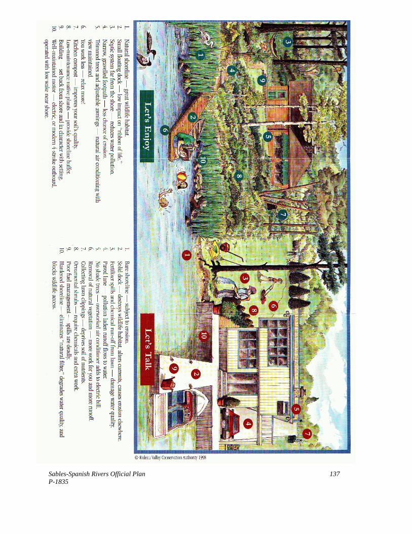
Sables-Spanish Rivers Official Plan 137
P-1835
LAND USE SCHEDULES