topographic maps created by: belinda schmahl. table of contents 1.topographic maps defined...
TRANSCRIPT
Topographic Maps
Created By:Belinda Schmahl
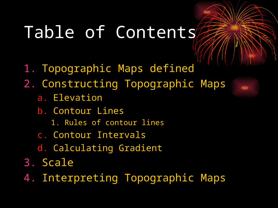
Table of Contents
1. Topographic Maps defined2. Constructing Topographic Maps
a. Elevationb. Contour Lines
1. Rules of contour lines
c. Contour Intervalsd. Calculating Gradient
3. Scale4. Interpreting Topographic Maps
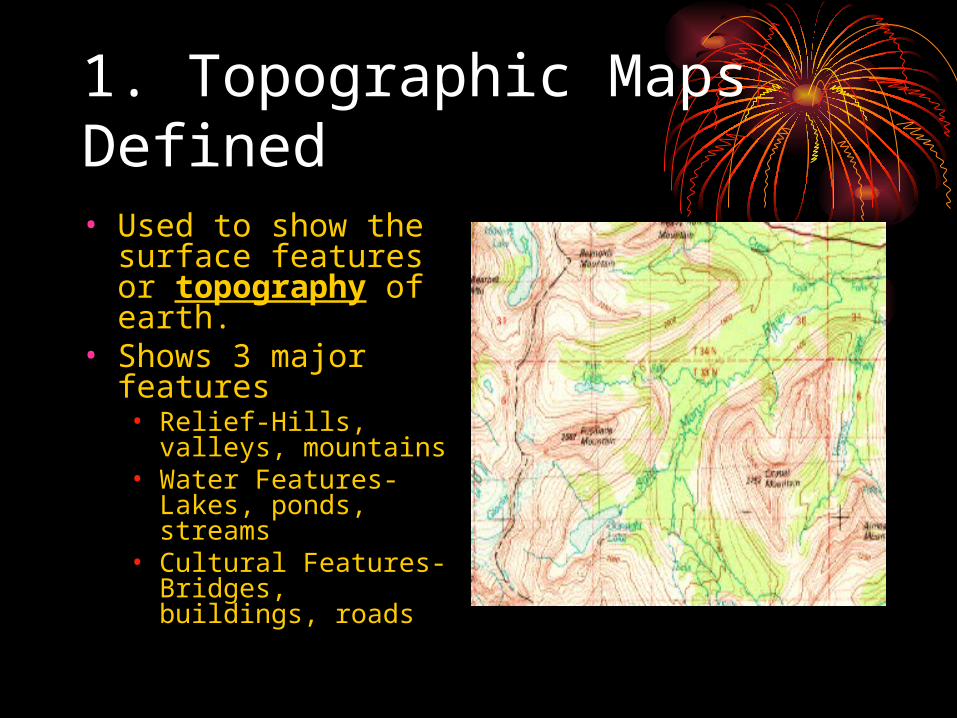
1. Topographic Maps Defined• Used to show the
surface features or topography of earth.
• Shows 3 major features• Relief-Hills, valleys,
mountains• Water Features-Lakes,
ponds, streams• Cultural Features-
Bridges, buildings, roads
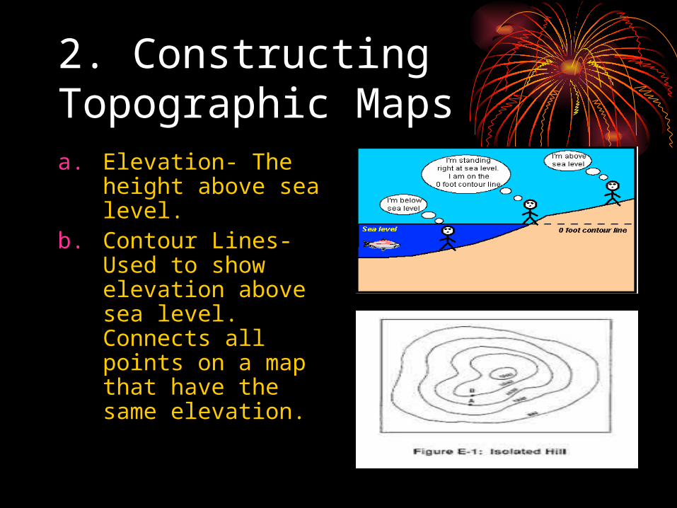
2. Constructing Topographic Mapsa. Elevation- The
height above sea level.
b. Contour Lines- Used to show elevation above sea level. Connects all points on a map that have the same elevation.
2b1. Rules of Contour Lines• Where a contour line crosses a stream or
valley it bends to form a V that points upstream or valley.
• The top of the hill is higher than the highest closed contour.
• Depressions are shown by closed hatched contours
• Widely spaced contours-gentle slope• Closely spaced contours-steep slope• Contours don’t cross each other EVER….
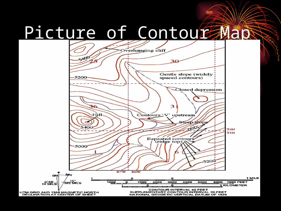
Picture of Contour Map
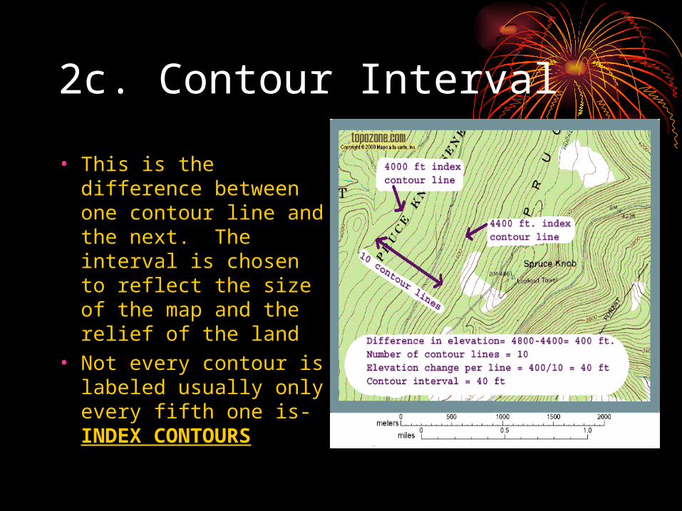
2c. Contour Interval
• This is the difference between one contour line and the next. The interval is chosen to reflect the size of the map and the relief of the land
• Not every contour is labeled usually only every fifth one is- INDEX CONTOURS
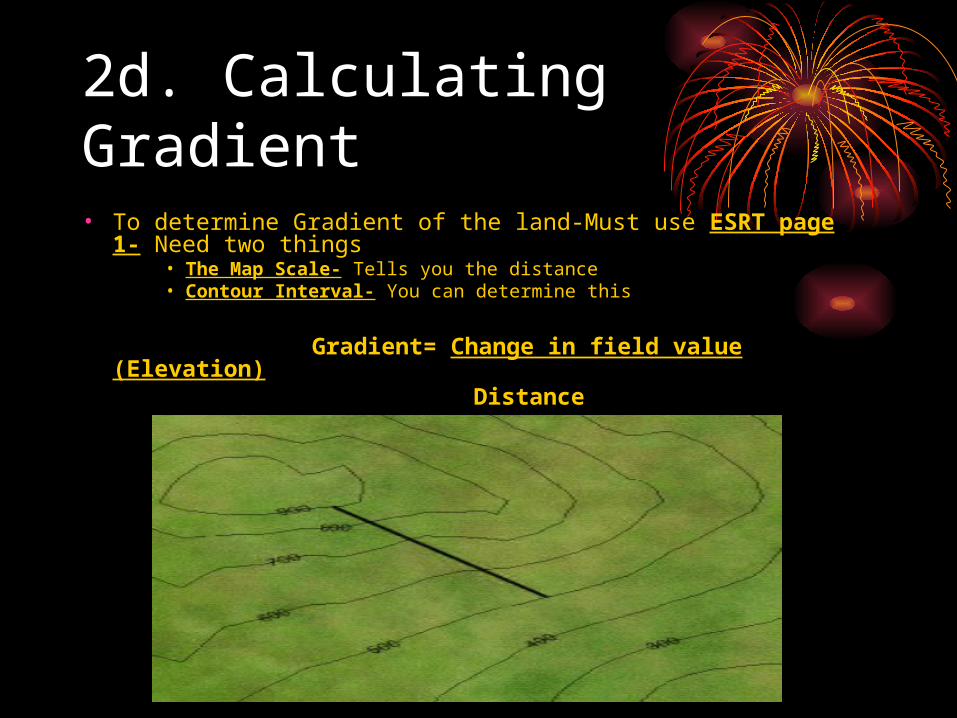
2d. Calculating Gradient
• To determine Gradient of the land-Must use ESRT page 1- Need two things
• The Map Scale- Tells you the distance• Contour Interval- You can determine this
Gradient= Change in field value (Elevation) Distance
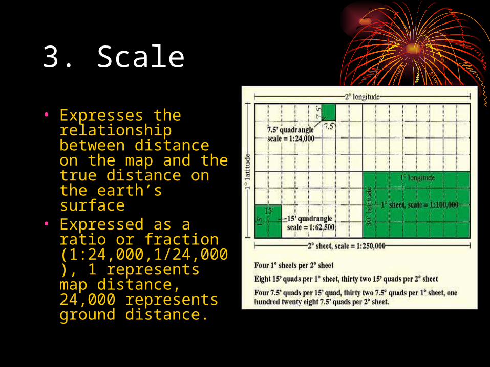
3. Scale
• Expresses the relationship between distance on the map and the true distance on the earth’s surface
• Expressed as a ratio or fraction (1:24,000,1/24,000), 1 represents map distance, 24,000 represents ground distance.
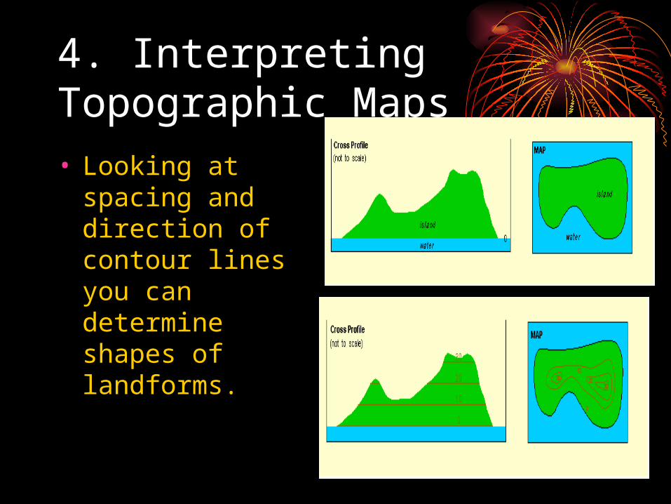
4. Interpreting Topographic Maps• Looking at
spacing and direction of contour lines you can determine shapes of landforms.