topographic and geological survey - dcnr homepage · by alan r. geyer pennsylvania geological...
TRANSCRIPT

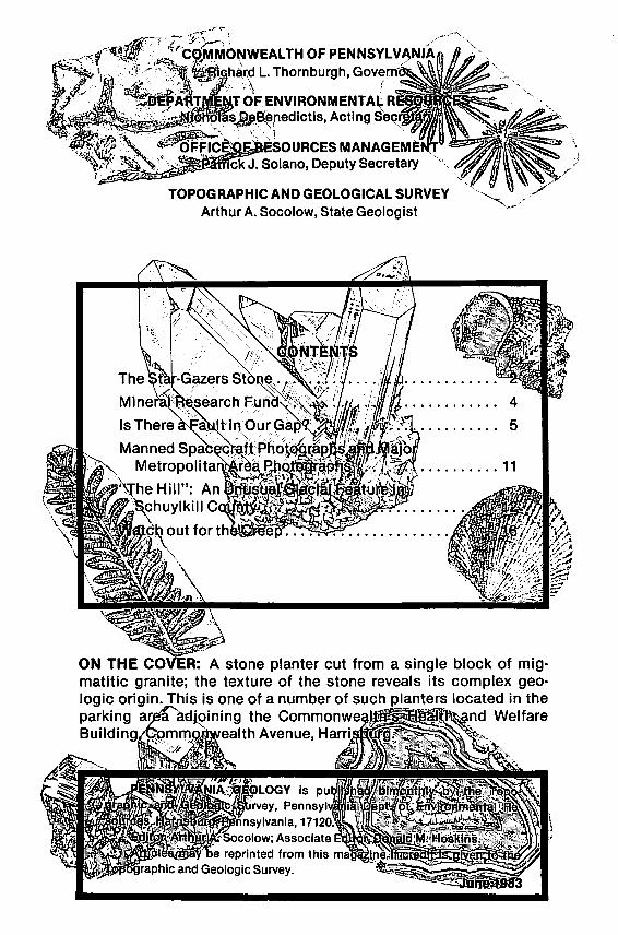
TOPOGRAPHIC AND GEOLOGICAL SURVEY Arthur A. Socolow, State Geologist
MannedSpiab~~~~tt·Ph~~tq~~~D~ Metropo1i•~,.~~lrEtalt'J'JQ_t16J~ctPn~ .......... 11
Hill": An llfifj~~i~iW~~ltYl~lU~
'\lwmc~hnuylkill C~~~~~~~~:-
: A stone planter cut from a single block of migmatitic granite; the texture of the stone reveals its complex geologic origin. This is one of a number of such lanters located in the parking oining the Comma d Welfare Build in lth Avenue, H

FROM THE DESK
OF THE
STATE GEOLOG IST ...
GEOLOGISTS FACING THE ANGRY PUBLIC
I
Years ago geological work entailed basic mapping of the rock formations and mineral deposits with accompanying research to unravel the processes and conditions by which these earth resources were formed. Such endeavors const ituted the stim ulating, scientific activities in the wonderful world of geology.
Geologists today, particularly those in government service, have a broader scope of work responsibilities. Now we have to deal with the interrelationship of geology to societal activities and we are involved with issues such as suitable sites for hazardous waste disposal , evaluating the geologic safety of nuclear power plant locations, locating groundwater resources of sufficient quantity and quality su itable for public water supp lies, assessing the geologic and hydrologic safety of proposed radioactive waste disposal sites, and determining whether certain potentially hazardous mineral const ituents are present in our building materials (e.g. certain forms of asbestos) or our fuel s (e.g. mercury or selenium).
Since these issues with which geologists are now involved deal with health and safety, there is a heavy responsibility upon the involved geologists to be particularly accurate and carefu l in their investigations. And because from the public standpoint these issues are matters of great concern, discussions over them become heated and highly emotional. Many geologists, therefore, long accustomed to dealing with rocks that don't talk back, are faced with the challenge of having their geologic finding s face up to public scrutiny, including public doubts and hostility. This is an application of geology wh ich is generally not taught in the colleges, yet it is extremely important, for it represents our geologic science at the interface with society's needs and concerns. It's not easy to face an angry, doubting aud ience of non-scientists and make a convincing presentation. But that 's the challenge that many geologists must now be prepared to face.

by Alan R. Geyer Pennsylvania Geological Survey
In granting charters for America's colonies, the King of England often paid little attention to exact boundaries. One of the most famous boundary disputes arose between William Penn (Pennsylvania) and Lord Baltimore II (Maryland). They died still bickering over this dividing line. Their heirs resolved the problem by hiring a young astronomer named Charles and a surveyor/astronomer named Jeremiah.
In 1764, these two gentlemen had to use the stars to locate the southern tip of Philadelphia; the PA-MD boundary was then 15 miles due south. However, that would have been New Jersey, so they had to travel west to clear the Great Arc that formed the north boundary of Delaware. Their mission was to find a reference point due west of the southern tip of Philadelphia and 15 miles north of the PA-MD " boundary. "
2

3

By March of 1764, with the use of their sensitive instruments, they found the spot. They marked this location with a large layer of vitreous quartzite, henceforth known as the Star-Gazers Stone. To the best of our knowledge this quartz layer came from a nearby exposure of the Setters Quartzite.
From the Star-Gazers Stone they cut a straight line 15 miles south to the exact point from which Charles Mason and Jeremiah Dixon surveyed Pennsylvania's southern boundary, the Maxon-Dixon Line.
The Star-Gazers Stone may be seen today along Star Gazers Road in Chester County near the village of Embreeville. From this stone, Mason and Dixon surveyed their way into American history.
Mineral Research Fund _ . ':; ~ . - . - .
In keeping with its primary goal of advancing the scientific understanding of mineralogy, the Pennsylvania Chapter of Friends of Mineralogy has created a Memorial Fund, monies from which will go to support research on the minerals of Pennsylvania. The Chapter wil l award grants ranging from $50 to $250 to eligible students from this fund as a tribute to past members and colleagues.
Full-time graduate and advanced undergraduate students in accredited colleges and universities throughout the United States and Canada may apply. Projects including both field and laboratory studies which characterize a mineral 's composition, optical properties, density, crystallography, habit and paragenesis are encouraged. Problems in geochemistry, petrology, ore, microscopy, fluidinclusion studies, and field mapping will also be considered if closely related to Pennsylvania mineralogy. Research within surrounding states will be considered if similar occurrences are likely within the Commonwealth. Support may be utilized for field expenses, field and laboratory equipment for the department, research supplies, thin sections, instrument fees, analyses or references purchased for an institutional library.
Grants will be awarded semi-annually on October 15 and February 15. Completed applications must be post-marked no later than one month before the award date. Further details and applications are available from Mr. Donald Schmerling, 1780 Prescott Road, York , PA 17403. It is the hope of the members of the Pennsylvania Chapter that in honoring its past members and friends in this manner, the Memorial Fund will ensure continuing research in Pennsylvania mineralogy to the benefit of all.
4

Is There a Fault in Our Gap? by
Joseph P. Theisen The grandeur and natural beauty of Susquehanna Gap, north of
Harrisburg, Pennsy lvania, has long attracted the attention of al l w ho travelled northward from the Great Valley. The Gap is also of interest for the wealth of geologic information it provides. It is one of the few localities where the rocks of Blue Mountain may be seen in c ross-section.
A new roadcut a long U.S. Route 22-322 on the eas t side of the gap at Rockville provides a unique opportun ity to compare the strati graphy and structure on opposite sides of Susquehanna Gap and sheds l ight upon a possible structural cont rol of the location o f the gap. The rocks on the east side show more de formation and contain different rock types than the sect ion on the oppos ite s ide o f the gap. A prefolding, strike-slip fau lt under the river in the Gap may explain these features.
STRATIGRAPHY The five formations in the Gap are, from bottom to top: Martins
burg (shale), Juniata (sandstone and conglomerate), Tuscarora (sandstone), Rose Hil l (sandstone and shale), and Bloomsburg (sandstone and shale). Dyson (1967) identified distinctive subdivisions in the Tuscarora and Rose Hill Formations on the wes t side. The Tuscarora here cons ists of a lower unit of thickly bedded q uartz sandstones with little shale, and an upper unit characterized by thinner beds and a greater amount of shale. Five subdivisions in the Rose Hill include two sixty-foot-thick shale zones which occur between resistant quartzitic and hemat it ic sandstones.
The Tuscarora is corre lated across the Gap by the basal quartzite which can be found on both sides (Figure 1). With the exception of the basal quartzitic member of the Tuscarora, no other individual rock units persist across the Gap.
STRUCTURE The rocks of the Susquehanna Gap are subvert ical and those on
the east side of the gap are more deformed than those on the opposite side. The western outcrop contains minor extension fau lts and abundant jo ints. Extensional faulting is also presen t in nearby exposures to the north in the Mahantango Formation exposu res in Litt le Mountain (Cioos and Broedel , 1943).
5

WEST
6
FtG. 1
CoMPARISON OF
SrPATIG~APHY
ON 0PPO.S/T£ SlOES
oF SusQUEHANNA GAP
1---Ros£ HILL
Tu SCAR OR A --.,..----1
JuNIATA -----1
MARTIHSBIJRG'
EAST

Compressional features found in the highly strained rocks of the east side include wedge faults and kink bands (Figure 2). lntrabed wedge faults are very common, both singly and in conjugate sets; they occur at small angles to bedding and in places follow pre-exist· ing planes such as cross-bedding surfaces (470' in Fig. 2). Thrust faults cutting through several beds and measuring up to 30 feet in displacement are less numerous (790 ' in Fig. 2). Trends of slicken· sides on these compressional faults are perpendicular to fault-bed· ding intersections, and when beds are rotated to horizontal, indi· cate a greatest principle stress in the plane of bedding. These low· ang le reverse faults are therefore one of the earliest structures present.
Kink bands, which also occur singly and as conjugate sets, form conjugate, or "box" folds at their intersections (300' and 320' in Fig. 2). These conjugate kink structures are not symmetric to bed· ding implying that smal l-scale folding began after the start of major folding.
The most common extensional features are conjugate sets of faults which are oriented at 60° to go o to bedding. One fault set, the dominant one, dips approximately 30°N, whereas the other is generally horizontal. Displacements on faults range upwards to 150 feet (660' in Fig. 2). Extension also occurs in the form of incipient boudi· nage {pinch and swell) (365 ' in Fig. 2). Both incipient boudinage and extensional faulting are extremely common in the outcrop. Since extension faults offset all other structures, they occurred late in the deformational sequence, post dating both the compressional reverse faults and the kink folding .
The Lower Tuscarora rocks at the southern end of the new out· crop are more highly strained than the rest of the exposure. This in· creased strain appears to result from a thrust fault which has moved the Martinsburg over the Juniata and brought it into contact with the basal quartzitic member of the Tuscarora (0 ' ·50 ' in Fig. 2). The orientation and sense of movement of the thrust fault imply that it occurred late in the deformational sequence during the last stages of folding . The thrust fault is not offset by extensional faults, also indicating that it is a late feature.
POSSIBLE ORIGIN OF SUSQUEHANNA GAP Major water gaps generally imply zones of weakness in the rocks
through which drainage developed. Studies of Cumberland Gap (Rich, 1933) in western Virginia and of the Delaware Water Gap (Ep· stein , 1966) in eastern Pennsylvania describe offset of ridges caused by differing bedding dips on opposite sides of the gaps and
7

Ft6. 2
8
G£OLOGIC DIAGRAM
OF Tfl£ £AS T SID£ OF StiSQUEH'A;fi#A GAP
m H£/'fATITIC s .. NOSTONE
D ~,4L£
(~~) GR,.ss Alt'D v".us ~ _ ~ .. lil,r S,o_.,.,. $1(;*'' /C"'"r
__...---c""' Dlt't. ,.UI>'fLNT 01' 81COIW~
~- ~~::~C~=: ~~~~~INN~
Index Map
West Exposure
-·
Harr iS burg
~------------------------------------------------------------------------I?OSG fftLL ~ORMATION---------------------------------------------------------------------
, ... I ' , .. I .. . I ... ~-+------------------------------------------ i'usCARORA FoRMArto~ ~rt-------------------------------------~
I ...
,,' ,
'I' ,,,.
... ,,
,,, •'
•t' il,r
""' MARTINSBURG_~
-+- J'uAit<rA Fo"""'r'oN -- FORMATION~
9

suggest that post· or synfolding, transverse or strike faults are re· sponsible for the locat ion of the gaps.
At Susquehanna Gap, however, bedding dips are identical on op· posite sides and therefore it is unlikely that a large-displacement, late-stage fault is respons ible for Susquehanna Gap. The structure which controlled the location of the Gap is possib ly a prefolding w rench fault. Such a fau lt , caused by shear between independently advancing thrust blocks, would correspond to the prefolding, small· scale wrench faults described by Nickelsen (1979) in the sequence of deformation at the Bear Valley Strip Mine.
The presence of a prefolding wrench fault in Susquehanna Gap could account for the various features found in and adjacent to the Gap. The unusually high degree of deformation seen only in the new outcrop could result from a narrow wrench zone cutting ob liquely through the wide gap, c loser to the east side than the west. Air photos show the riffle in the Susquehanna River (Figure 1, index map) caused by the resistant basal Tuscarora quartzite apparently undeformed . The riffle ends abruptly as it approaches the east bank where the river flows on alluvi um. The area between the east end of the riffle and the gap outcrop could contain a wrench (tear) fault.
In summary, the interpretation that a prefolding, large-scale wrench fault caused the structural weakness that controlled Susquehanna Gap is based on the following: (1) no offset of ridges is seen across the gap, hence the structure causing the gap cannot be a postfolding w rench fault ; (2) while late extensional structures are found at all nearby exposures, prefolding compressive deformation (wedges, thrusts, and kink folds) occurs on ly in the rocks on the east side of Susquehanna Gap, suggesting that a major prefolding w rench fault passes c lose to this outcrop; (3) poor stratigraphic cor· relation between oppos ite s ides may be exp lained by the strike-slip movement of a wrench fault having juxtaposed facies possessing dissimilar small-scale bedding characteristics.
REFERENCES Cloos, E., and Broedel, C.H., 1943, Reverse Faulting North of Harrisburg,
Pennsylvania: Bull. of the Geol. Soc. of Am. , Vol. 54, p. 1375·1397. Dyson, J.L., 1967, Geology and Mineral Resources of the Southern Half of
the New Bloomf ield Quadrangle, Pennsylvania: Commonwealth of Pennsylvania, Dept. of Internal Affairs, Topographic and Geologic Sur· vey, Atlas 137cd.
Epstein, J.B., 1966, Structural Geology at Wind and Water Gaps and Stream Capture in the Stroudsburg Area, Pennsylvania and New Jersey: U.S. Geol. Survey Prof. Paper 550B, p. B80·B86.
10

Nickelsen, R.P., 1979, Sequence of Struc tu ral Stages of the Allegheny Orogeny, at the Bear Valley Strip Mine, Shamokin, Pennsylvania: Am. Journal of Sc i., Vol. 279, p. 225-271 .
Rich, J.L., 1933, Physiography of Cumberland Gap, Va.: Bull . of the Geol. Soc. of Am., Vol. 44, p. 1219.
MANNED SPACECRAFT PHOTOGRAPHS AND
MAJOR METROPOLITAN AREA PHOTOGRAPHS
Views of the earth obtained from spacecraft provide large amounts of information about our planet, its resources and its inhabitants. Spacecraft aerial data are being used in: land-use planning, agriculture, forestry, geography, geology, hydrology and range management. Sophisticated techniques are used to obtain high altitude photography. High-flying aircraft operated by NASA flies specific areas while Landsat satellite circles the earth in a changing orbit.
SATELLITE IMAGES AND PHOTOGRAPHS
Satellite images available are the result of the NASA program established in 1972. A limited number of space photographs come from the Gemini and Apollo programs (1965 to 1970) and from the Skylab program (1973 to 1974). The photographic coverage of the Gemini and Apollo programs was limited by the flight paths of the aircraft. These pictures generally cover the southwest, the Gulf Coast and Florida. The Skylab program was designed to obtain photographic coverage of the Earth between latitudes 50 ° North and South. During the three Skylab flights more than 35,000 frames of photography were acquired. Coverage included most of the conterminous United States, a large part of South America, and parts of Africa, Europe, and the Middle East. The largest group of photographs available is from the Landsat Program. Landsat circles the Earth 14 times daily. From an orbital altitude of 570 miles it provides repetitive coverage every 18 days.
11

AVAILABLE PRODUCTS
MANNED SPACECRAFT PHOTOGRAPHY-The photographs acquired during the Gemini, Apollo and Skylab series of spacecraft programs are useful in planning, agriculture, geographic and other studies and for general viewing. The spacecraft photography can be ordered by contacting the Eastern NCIC office, and requesting two forms: Manned Spacecraft Photograph Order Form and Geographic Search Inquiry Form.
METROPOLITAN AREA PHOTOGRAPHS-Prints of color and color-infrared photographs of more than 100 cities in the United States are available. They were chosen from NASA aircraft, Skylab spacecraft and Landsat satellite coverage. The photographs and images are useful for reg ional planning and general viewing. NASA aircraft photographs provide the most terrain detail. Skylab photographs offer the next greatest level, and Landsat imagery the least amount of detail. Print sizes range from a 4.5-inch square Skylab print to a 36-inch square NASA aerial photographs. These prints may be ordered by contacting: Eastern Mapping Center-NCIC, U.S. Geological Survey, 536 National Center, Reston, VA 22092. Telephone: 703-860-6336.
liThe Hill": An Unusual Glacial Feature In Schuylkill County
by Duane D. Braun and Keith Springman Geography and Earth Science Department Bloomsburg State College
" The Hil l" is a till -capped sand deposit located 1.7 mi northwest of Ringtown (west of Mahanoy City) on the north side of legis lative route 53064 (northeast portion of Ashland ?1/2' quadrangle) (Fig. 1). The deposit forms a knob that projects from the fl ank of Little Mountain into the va lley of Trex ler Run and I ies 1.6 m i northeast of a low col that marks the drainage divide with Roaring Creek. Trexler Run, which makes a broad loop around " The Hill " has been dis-
12

placed southward by the deposit where it has cut a relati vely narrow, steep walled channel 40 feet into bedrock. The sand is mined by the owner, Dan iel Grow of Ringtown.
o'C:::========::525 Mi.
Figure 1. Map showing extent and age of glacial deposits in east central Pennsy lvania. Woodfordian, Altonian , and Illinoian areas taken from 1980 Geologic Map of Pennsy lvania. Pre-Illinoian area is from Leverett {1934).
The deposit comprises 3 to 6ft of bouldery diamicton (til l) overlying 33 to 36 ft of sand (F ig. 2). The diamicton is a moderately cohesive and unsorted mixture of c lay to boulder-s ized material. The matrix between clasts tends to be silty or sandy and is reddish brown in co lor, ref lecting its derivation from the underlying red shale and sandstone of the Mauch Chunk Format ion. Pebble-s ized and larger c lasts are angular to well round ed, commonly striated, and relatively unweathered to moderately weathered with weathering rinds a few millimeters thick. The larger c lasts are dom inant ly sandstone and conglomerate derived from the Mauch Chunk, Pocono, and Pottsv ille Formations.
The sands are medium to very fine grained, ye llowish brown and well stratifi ed with prominent ripp les, climbing ripp les, and cross bedding. Anthracite grains form dark lam inae and are also present as scattered pebble-s ized and larger fragments. The upper 3 to 6 ft
13

Figure 2. Till overlying kame delta sands; Little Mountain forms skyline.
of sand have been oxidized to a reddish yellow to black color. A few small-scale normal faults and reverse faults of a few millimeters to centimeter displacement are present. The fine-grained sands immediately under the diamicton are deformed into a series of folds or convolutions by unequal loading (load casting) of the diamicton upon the sands. Clast-rich portions of the diamicton tend to protrude downward into the underlying fine to very fine grained sands, in places producing vertical isoclinal folds in the sands.
"The Hill " is interpreted to be part of a kame delta that was deposited in a prog laciallake that formed when advancing ice blocked Trexler Run's eastward flow (Fig. 3). The lake spilled westward, as suggested by the attitude of the cross bedding, across a low col at an elevation of about 1200 ft into the Roaring Creek drainage (Fig. 3). The lack of coarse sand and larger grain sizes, the horizontality of the bedding, the presence of c limbing ripples, and the fact that the top of the sand is 50 ft below the spillway elevation, indicate that the sands are probably the bottomsets at the distal edge of an originally much larger kame delta. A few rounded masses of diamicton as much as 1.5 ft in diameter occur within the upper 6 ft of the sands. The deformation of bedding beneath these masses suggests that they were dropped from ice rafts f loating on the lake surface.
14

X "The Hill "
........ ~ I ce Margin
O'C:::::========::::::::il Mi.
~ Extent of Preglac ial L a ke
::~: Buried Valley
Figure 3. Map show ing the position of the ice margin and the proglac ial lake at the time the kame delta was being deposited.
The diamicton overlying the sands may have been depos ited (1) directly from g lacier ice that overrode the delta, (2) as a subaq ueous debris flow from the nearby edge of the glac ier, or (3) from basal melting of overridin g but float ing glacier ice. There is no conc lus ive evidence to prove or disprove any of these alternatives, but deposition di rect ly f rom the glac ier seems most probable.
This depos it lies beyond the limi ts of glac iat ion shown on the 1980 Geolog ic Map of Pennsylvania, but was inc luded in an area of pre-Illinoian drift by Leverett (1934) (Fig. 1). The degree of weathering and so il deve lopment in the diamicton is similar to that of t he Glen Brook till (lnners, 1981) which is considered early Wisconsinan (A itonian) in age. In contrast, the amount of erosion of the deposit, the deep inc ision of trans located Trex ler Run, and the lack of other glac ial depos its for several miles around the s ite are fac ts more consistant with an Illinoian age. More study is requi red before an age ass ignment can be made with confidence.
15

REFERENCES lnners, J.D. (1981), Geology and mineral resources of the Bloomsburg and
Mifflinville quadrangles and part of the Catawissa quandrangle, Columbia County, Pennsy lvania: Pennsylvania Geological Survey, 4th ser., At las 164 cd , 152p.
Leverett, F. (1934), Glacial deposits outside the Wisconsin terminal moraine in Pennsylvania: Pennsylvania Geological Survey, 4th ser., General Geology Report 7, 123p.
Watch out for the Creep Zone of weathered gneiss showing effects of slow, down-slope
movement due to gravity, a phenomenon known as creep. Where movement of weathered zone di rectly above the bedrock is minimal, the banding is vertical ; where movement has been pronounced, the banding is nearly horizontal. The topographic slope is 4:1 or less than 15 o . Such differential movement suggests the need for caution in planning foundations and in terpreting geochemical so il surveys. The shovel in the photo is about 3 feet in length.
16

..
PENNSYLVANIA GEOLOGICAL SURVEY STAFF Arthur A. Socolow, State Geologist
Donald M. Hoskins, Assistant State Geologist
TECHNICAL SERVICES Shirley J. Barner, Stenographer Mary A. 1\1 i llef,Stenographer Sandra Blust, Librarian Geary L. Sarno, Draftsman James H. Dolimpio, Draftsman Marjorie Steel, S
1tenographer
John G. Kuchinski, Draftsman Janet !l. Wotring, Typist a Christine Mf odge, Geologist Supervise - 7
l,. ENVIRONMENTAL GEOLO~Y DIVISION iii. \ Alan R. Geyer, Division Chief / . •
Mari G. Barnhart, Clerk o eJise W. Rcfyer, Hydrogeologist Helen L. Delano, Geologist (Pittsburgh Donna M. Snyder, Stenographer
Office) Larry E. Taylor, Hydrogeologist Thomas A. McElroy, Hydrogeologist John P. Wilshusen , Geologist
GEOLOGIC MAPPING DIVISION1 1 Thomas M. Berg, Division p trief
Clifford H. Dodge, Geologist Linda Polk, Clerk RodgerT. Faill , Geologist ~~"' William D. Sevo~ . Geologist Albert D. Glover, Geologist ~ ~ James R. Shaulis, Geologist Jon D.lnners, Geologist ,{ Viktoras W. Skema, Geologist David B. Maclachlan, Geologist John H. Way, Jr. , Geologist .,
MINERAL RESOURCES DIVISION ~~ Robert C. Smith,.Division Chief ::\
1 . ' ;;:;
John H. Barnes, Geologist Leslie T. Chubb, Laboratory Technician . :8 SamueiW. Berkheiser,Jr., Geologist · -4 ,. ~ .. <0 .. ;'
OIL AND GAS GEOLOGY DIVISION - -~ 1201 Kossman Bldg.
100 Forbes Ave., Pittsburgh , Pa. 15222 John A. Harper, Division Chief
Kathleen D. Abel , Geologist Robert Fenton, Laboratory Technician Lajos Balogh, Draftsman Christopher D. Laughrey, Geologist Cheryl Cozart , Statistical Asst. John Petro, Draftsman
TOPOGRAPHIC DIVISION In Cooperation with The U.S. Geological Survey
GROUND WATER DIVIS10N In Cooperation with The U.S. Geological Survey

GROUND WATER LEVELS
FOR
May 1983
Bureau of Topographic and Geologic Survey Dept . of Environmenta l Resources P.O. Box 2357 Harrisburg, Pa. 17120
Address Corrections Requested
X
0 Above l •• t r••r
Bulk Rate U . S. Postage
PAID Harrisburg. Pa. Permit No. 601