the value of coding for gis david howes, ph.d. aksmc-howes-the value of coding for gis.pdf · the...
TRANSCRIPT

The Value of Coding for GISDavid Howes, Ph.D.
David Howes, LLC
dhowes.com49th Annual Alaska Surveying & Mapping Conference
February 19th, 2015


Contributors
• Bill Dollins - Zekiah Technologies, Inc.
• Jeff Berry - Erlandsen, Inc.
• Jason Pardy - NewfoundGEO Consulting
• Aaron Paul - First American Title
• Matt Stevenson - CORE GIS
• Eldan Goldenberg – DRiVEdecisions
• Karsten Vennemann - Terra GIS
• Mike McGuire - Ascent GIS, Inc.
• Igor Talpalatski - Azimetry

Python Scripting


.NET - Beyond Data-Driven Pages

What is “Coding”?
• See How Coding Works, codeconquest.com
http://www.codeconquest.com/what-is-coding/how-does-coding-work/
• Simple - instructions that tell a computer what to do
• Complex - binary sequences of 1s and 0s that turn transistors on and off
• Language types:• Low level languages - operate close to binary code (e.g., C++)
• High level languages - operate far away from binary code (e.g., Python)
• In between - e.g., C#, Visual Basic

Why Code?
“Coding is the hottest skill on the job market, the modern-day language of creativity, and a powerful force in the economy”
“coding is … an innovative and artistic process”
Madeline McSherry, New America Foundation - Why Everyone Should Learn to Code: An Event Recap
http://www.slate.com/blogs/future_tense/2013/03/29/codecademy_hacker_school_why_everyone_should_learn_to_code.html

Why Should Coding Be Important?
• Personal development perspective
Why should coding be important to you?
• Professional growth
• Expanded toolbox
• Streamline workflows • Policy perspective
Why should coding be important to your employer?
• Return on investment
• Standard operating procedures
• Leveraging/freeing up resources

Do You Need to Code?
• Not necessarily, but it can really help
• It depends on your job
• Very valuable for analysts
• Helpful for managers (increasing need to understand role of coding)

Levels of Coding
• Scripting and tool development
• GIS analyst
• E.g., data manipulation, map-making, glue code
• Application development
• GIS developer
• E.g., add-in, plugin
• Software engineering• Computer scientists/IT professionals
• E.g., Microsoft Office

Industry Needs
See Yes, You Need to Code - Bill Dollins, geoMusings.com
“I am very publicly on the record that I think some form of coding skill is essential for any GIS analyst entering the workforce today”
http://blog.geomusings.com/2013/01/30/yes-you-need-to-code/

Technology Trend
• Coding has always been valuable for GIS
• Increasing emphasis on coding
• Example: MapTime Seattle (Meetup group)
• Making a web page and a web map (HTML5, CSS, JavaScript, Leaflet.js)
• Git & GeoJSON
• Mapping with D3.js

Being able to take advantage of extensibility options can really set you apart as a GIS professional
“software tools expose less than 10% of their full capability through their default interfaces”
Bill Dollins, geoMusings -Yes, You Need to Code

Coding Types
• Configuration
Setting values to adjust base functionality
• Customization
• Either
• Hybrid
• Programming
• Creating an executable formulation of a computing problem
(http://en.wikipedia.org/wiki/Computer_programming)
• Scripts, programs, add-ins/plugins

Importance of Coding
“If you choose to get by with just using the GUI tools, you are doing yourself two disservices:
1. You are placing yourself at the mercy of others who can code to get around to building the customizations you need.
2. You are allowing your skills to erode by not using a significant amount of capability.”
Bill Dollins, geoMusings - Yes, You Need to Code
“If you don’t code you risk settling for what you’re given, which may not be the best solution for the task at hand”
Ralph Straumann, in response to Yes, You Need to Code

Benefits of Coding
1. Satisfaction
2. Efficiency
3. Repeatability & validation
4. Freedom
5. Enablement
6. Creativity
7. Clarity & logic
8. Documentation & organization
9. Integration & interoperability
10. Employability

Benefits of Coding - Efficiency
• Tasks can be quantified
• Level of effort
• Cost
• Value
• Justifies creation of streamlining tools and processes

Copy Map Point Tool (Python Add-In)


Extending ArcGIS for Desktop Using Python and .NET Add-Ins, 2014 Washington GIS Conference
http://gispd.com/training
ArcMap Field Update & Feature Navigation Tools (.NET Add-Ins)

Benefits of Coding - Repeatability & Validation
• Allow for re-running processes and custom validation procedures
• Increases confidence in methods and results
• Crash-resistant processing
E.g., Species Protection Area tools

Species Protection Area Tools
.NET add-in & external code

Setup file
Setup file location fileLog file
Species Protection Area Tools - Operation

Benefits of Coding - Freedom
• Work with command line
• Build sequences of instructions using libraries of functions, e.g., GDAL
• Build your own…

Benefits of Coding - Enablement
• Learning to code• Opens new doors
• Advance your professional capabilities
• Increases your standing
• Access (more) open source options
• Open source experience makes you a better proprietary software user
See• Opening the Door to Open Source GIS• Explorations into Open Source GIS• Treading Into Open Source GIS
http://dhowes.com/presentations, http://gispd.com/events

Benefits of Coding - Creativity
• Required functionality may not exist
• Develop new processes, & procedures
E.g., extended flow accumulation computation
See The Value of Automation: Geoprocessing with .NET and ArcObjects, 2008 Washington GIS Conference
http://dhowes.com/presentations

Benefits of Coding - Clarity & Logic
• Coding helps you think clearly and logically about problems
• Understand what’s really happening under the hood
E.g., Whitebox
http://www.uoguelph.ca/~hydrogeo/Whitebox/index.html
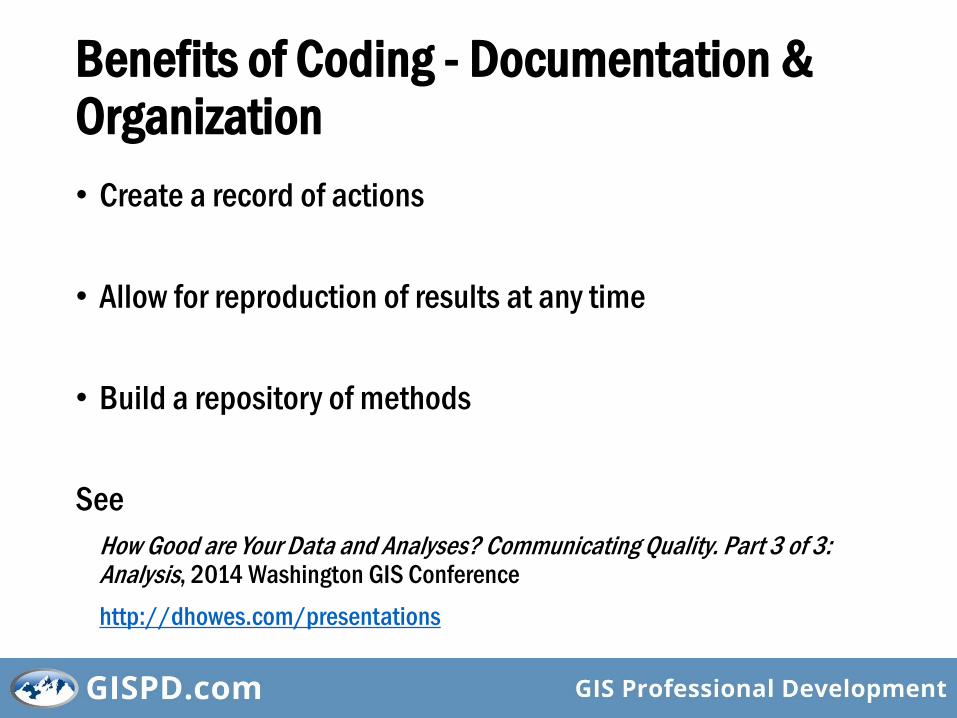
Benefits of Coding - Documentation & Organization
• Create a record of actions
• Allow for reproduction of results at any time
• Build a repository of methods
See
How Good are Your Data and Analyses? Communicating Quality. Part 3 of 3: Analysis, 2014 Washington GIS Conference
http://dhowes.com/presentations

Benefits of Coding - Integration & Interoperability
• Don’t come to a halt if a few core programs won’t do everything you need them to do
• Bring together the best of all worlds
E.g., using data from R in ArcMap

Benefits of Coding - Employability
• Look at most GIS analyst job openings?
• Ability to code demonstrates interest in
• Your career
• Advancing yourself
• Investing in your capabilities
• Demonstrates appreciation for GIS investment

Coding Recommendations - 1
• Start small
• Be realistic & don’t overdo it
• Resist the temptation to start coding too soon
Help others and learn from them

Coding Recommendations - 2
• Be persistent
• Keep plenty of backups
• Use code storage systems (repositories)
E.g., Subversion, GitHub

Coding Recommendations - 3
• Consider re-use and readability
• By yourself
• By others
• Keep code neat, simple, clean
• Use plenty of comments//This comment will save me a lot of grief later

Coding Recommendations - 4
Follow style standards
• Python PEP 8 Style Guide
https://www.python.org/dev/peps/pep-0008/
• C# Coding Conventions
https://msdn.microsoft.com/en-us/library/ff926074.aspx
• Conventions for your language of choice

Coding Recommendations - 5
Think in terms of objects
Object-oriented code
• Professional
• Re-usable
• Clean

Coding Recommendations - 6
• Adopt a cookbook approach - create code “recipes”
• Get each piece working in turn
• Think of all the ways something can fail and cover for them as required

Coding Recommendations - 7
• Think about how your tools could be misused
• Handle errors cleanly
• Develop strong testing methodologies
E.g., unit tests

Path for Growth - ArcGIS for Desktop
• Python command line in ArcMap
• Standalone Python scripts
• Create a geoprocessing tool
• Create a Python toolbox
• Create a Python add-in
• Create a .NET Windows form application
• Create a .NET ArcGIS for Desktop add-in

Path for Growth - Open Source GIS
• Write a spatial SQL query
http://postgis.net/
• Write a Python script that uses the GDAL libraryhttp://www.gdal.org/
• Create a Leaflet.js (JavaScript) webmaphttp://leafletjs.com/
• In QGIS• Write a Python script• Create a Python plugin• http://plugins.qgis.org/• http://www.qgisworkshop.org/html/workshop/plugins_tutorial.html

Resources
• Interactive Development Environments (IDEs)• PyScripter
• Microsoft Visual Studio 2012 Express
• Eclipse
• Esri ArcGIS Resource Centers
• Open source GIS help pages
• Blogs (e.g., geoMusings, GISPD.com)
• FOSS4G
• GISPD.com
• MapTime Seattle (Meetup group)
• CUGOS.org

Education
• University of Alaska Anchorage - Geomaticshttp://www.uaa.alaska.edu/geomatics/
• King County GIS Center
http://www.kingcounty.gov/operations/GIS.aspx
• Coursera
https://www.coursera.org/
• edX
https://www.edx.org/
• Penn State
http://open.ems.psu.edu/courseware
• GEOG485 GIS Programming and Automation
• GEOG585 Open Web Mapping
• GISPD.comhttp://gispd.com
• Extending ArcGIS for Desktop Using Python and .NET Add-Ins
• Extending ArcGIS for Desktop with Python and .NET: Geoprocessing Tools and Add-Ins


Thanks for Coming
Please Stay for
The (not so) Secret (but very necessary) Skills of GIS Professionals
Slides available at http://gispd.com/events

Image Credits
• https://watergis.files.wordpress.com/2012/03/python.jpg
• https://darcymullin.files.wordpress.com/2011/08/growth1.jpg
• http://www.blairkaplan.ca/wp-content/uploads/2012/06/policy.jpg
• http://www.udel.edu/johnmack/frec480/arcmap_intro2.png
• https://me4bruno.files.wordpress.com/2012/02/qgis-osm-admin4-border.png
• http://blogs.yis.ac.jp/18heminke/files/2013/01/freedom-jumping_00376259-1s2s8xq.jpg
• http://www.uoguelph.ca/~hydrogeo/Whitebox/img/FSP.png
• http://www.derekyu.com/tigs/forums/tutorials/gmtut/gmtut-008.png
• http://resources.arcgis.com/en/communities/python/GUID-8326AF89-5095-47EC-A9A8-FAFD06B8867E-web.jpg
• http://resources.arcgis.com/en/communities/analysis/GUID-BDAFEA8B-3BE9-425F-99C8-DBA1E02EB5E2-web.png
• http://img.scoop.it/PCbXE8EdKoLX-urHpRfsrjl72eJkfbmt4t8yenImKBVvK0kTmF0xjctABnaLJIm9
• http://1.bp.blogspot.com/_R3IQEFF9yoE/TLn9MIEsiII/AAAAAAAAA3s/01K9nCWfphE/s1600/WindowsFormsApplication.jpg
• http://upload.wikimedia.org/wikipedia/commons/7/7b/Logo_square_postgis.png
• http://en.wikipedia.org/wiki/GDAL
• http://wiki.openstreetmap.org/wiki/Leaflet
• http://upload.wikimedia.org/wikipedia/commons/7/71/QGis_Logo.png