the inca's triumph over geography - burnet middle...
TRANSCRIPT

___________________ Date ____ Class ____ _
Latin America
Geography and History Activity
The Inca's Triumph Over Geography In 1438 the Inca ruler Pachacuti began
building a powerful empire in what is today Peru. By the end of the 1400s, the Incas controlled the largest empire ever established in the Americas. It encompassed nearly 12 million people in Peru, southern Colombia, Ecuador, northern Chile, western Bolivia, and part of northern Argentina.
Three Distinct Regions Three physical regions-deserts, moun
tains, and rain forests-made up the Inca Empire. Deserts run along the Pacific coast. The Atacama Desert in northern Chile is one of the driest places on Earth. Fertile areas can be found, however, where small rivers and streams run from the Andes highlands to the sea.
East of the coastal deserts, the Andes ranges run 4,500 miles (7,242 km) from north to south. Dominating Inca society, the mountain peaks were worshiped as gods. Cities were built of stone cut from the mountainsides. One city, Machu Picchu, was built 7,710 feet (2,350 m) high in the Andes.
The eastern foothills of the Andes eventually slope toward the Amazon Basin. The Inca never established settlements there, but they did use many valuable rain forest resources, such as wood, fruit, and natural medicines.
Road Network One of the most remarkable Inca
accomplishments was the empire's vast network of roads, which still exists in many areas of western South America today. The Inca built their roads through
the scorching coastal deserts, over mountains more than 20,000 feet high, through tangled masses of tropical rain forest, and across raging torrents of rivers hundreds of feet wide. Totaling nearly 15,525 miles (25,000 km), the roads were used to tie the vast empire's people together, and to allow quicker movement of soldiers and goods. Llamas carried loads of agricultural products or textiles along its length. Storehouses and barracks were placed at regular intervals. The Inca living nearby maintained each length of road.
The highway system also served as a communication network for the government and military. Relay runners constantly carried messages long distancesoften up to 250 miles (403 km) per day. That same distance took the Spanish colonial post nearly two weeks to cover.
The Inca's road network consisted of two north-south roads-one that ran 2,236 miles (3,600 km) along the Pacific coast, and the other along the Andean highlands farther inland. These main roads were periodically interconnected by smaller east-west roads.
To cross the many steep ravines, gorges, and rivers found in the Andes, the' Inca built vine-supported suspension bridges. If enemies tried to cross into the empire's territory, Inca soldiers set fire to the bridges.
Fall from Power For all its power and accomplishments,
the Inca Empire lasted only about 100 years. Spanish conquistadors under the leadership of Francisco Pizarro took over the empire in 1532.
II
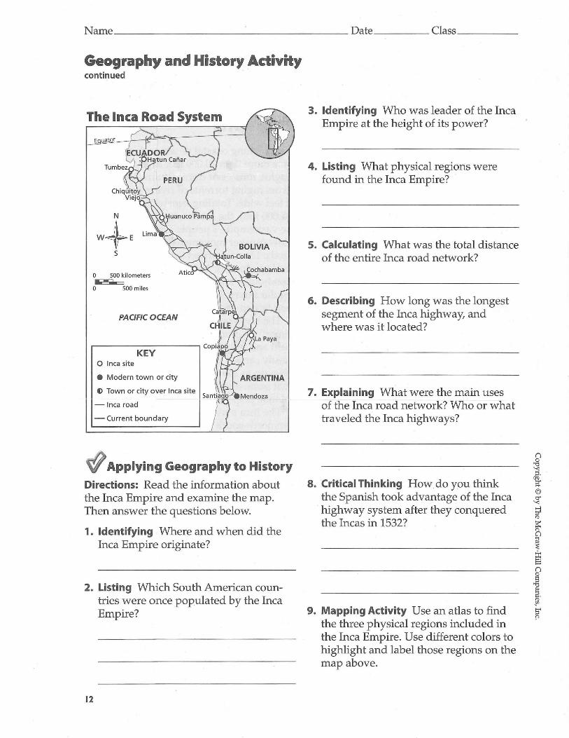
Name _____________ ______ Date _____ Class ____ _
Geography and History Activity continued
The Inca Road System
o 500 k ilomet ers ...... o 500 miles
PACIFIC OCEAN
KEY o Inca sit e
• Modern t own or cit y
() Town or city over Inca site
-Inca road
- Current boundary
'+II Applying Geography to History Directions: Read the information about the Inca Empire and examine the map. Then answer the questions below.
1. Identifying Where and when did the Inca Empire originate?
2. Listing Which South American countries were once populated by the Inca Empire?
12
3. Identifying Who was leader of the Inca Empire at the height of its power?
4. Listing What physical regions were found in the Inca Empire?
5. Calculating What was the total distance of the entire Inca road network?
6. Describing How long was the longest segment of the Inca highway, and where was it located?
7. Explaining What were the main uses of the Inca road network? Who or what traveled the Inca highways?
8. Critical Thinking How. do you think the Spanish took advantage of the Inca highway system after they conquered the Incas in 1532?
9. Mapping Activity Use an atlas to find the three physical regions included in the Inca Empire. Use different colors to highlight and label those regions on the map above.