the evaluation of soil fertility on forest conservation …jds/dl/151219/11.pdfenvironmental issues...
TRANSCRIPT
The Evaluation of Soil Fertility on Forest Conservation in Myanmar
Tin Maung Oo201426042
University of TsukubaJDS International Seminar
2015/12/15

Outline
Introduction
Methodology
Results & Discussion
Conclusion
References
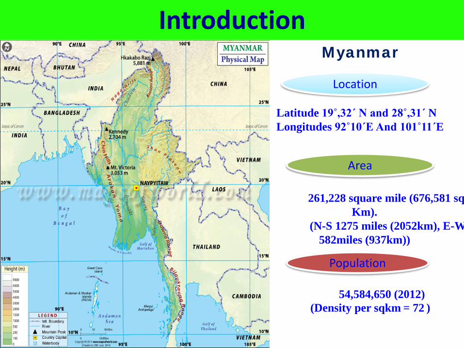
IntroductionMyanmar
Latitude 19˚,32΄ N and 28˚,31΄ NLongitudes 92˚10΄E And 101˚11΄E
261,228 square mile (676,581 sq Km).
(N-S 1275 miles (2052km), E-W 582miles (937km))
54,584,650 (2012)(Density per sqkm = 72 )
Area
Population
Location
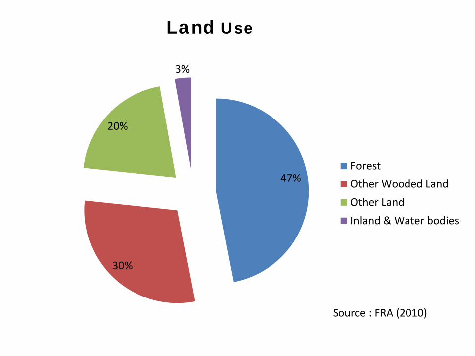
Land Use
Source : FRA (2010)
47%
30%
20%
3%
ForestOther Wooded LandOther LandInland & Water bodies
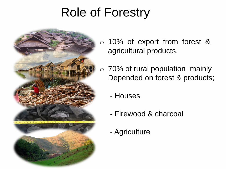
Role of Forestry
o 10% of export from forest & agricultural products.
o 70% of rural population mainly Depended on forest & products;
- Houses
- Firewood & charcoal
- Agriculture
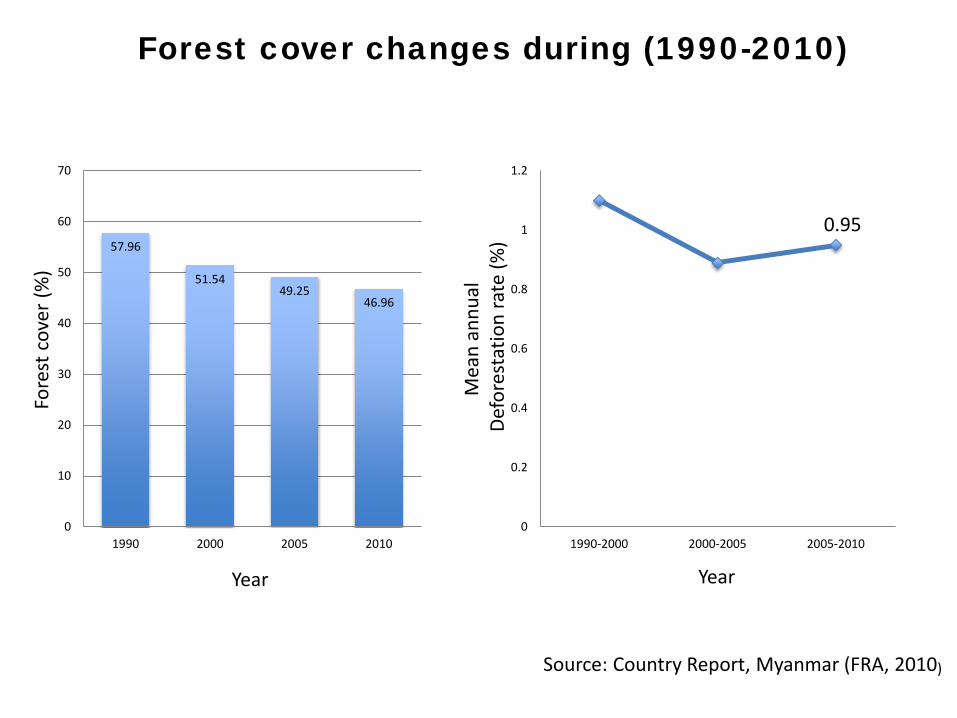
57.96
51.5449.25
46.96
0
10
20
30
40
50
60
70
1990 2000 2005 20100
0.2
0.4
0.6
0.8
1
1.2
1990-2000 2000-2005 2005-2010
Fore
st c
over
(%)
Year
Mea
n an
nual
De
fore
stat
ion
rate
(%)
Year
Forest cover changes during (1990-2010)
Source: Country Report, Myanmar (FRA, 2010)
0.95
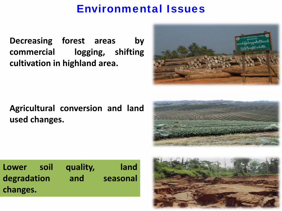
Environmental Issues
Decreasing forest areas bycommercial logging, shiftingcultivation in highland area.
Agricultural conversion and landused changes.
Lower soil quality, landdegradation and seasonalchanges.
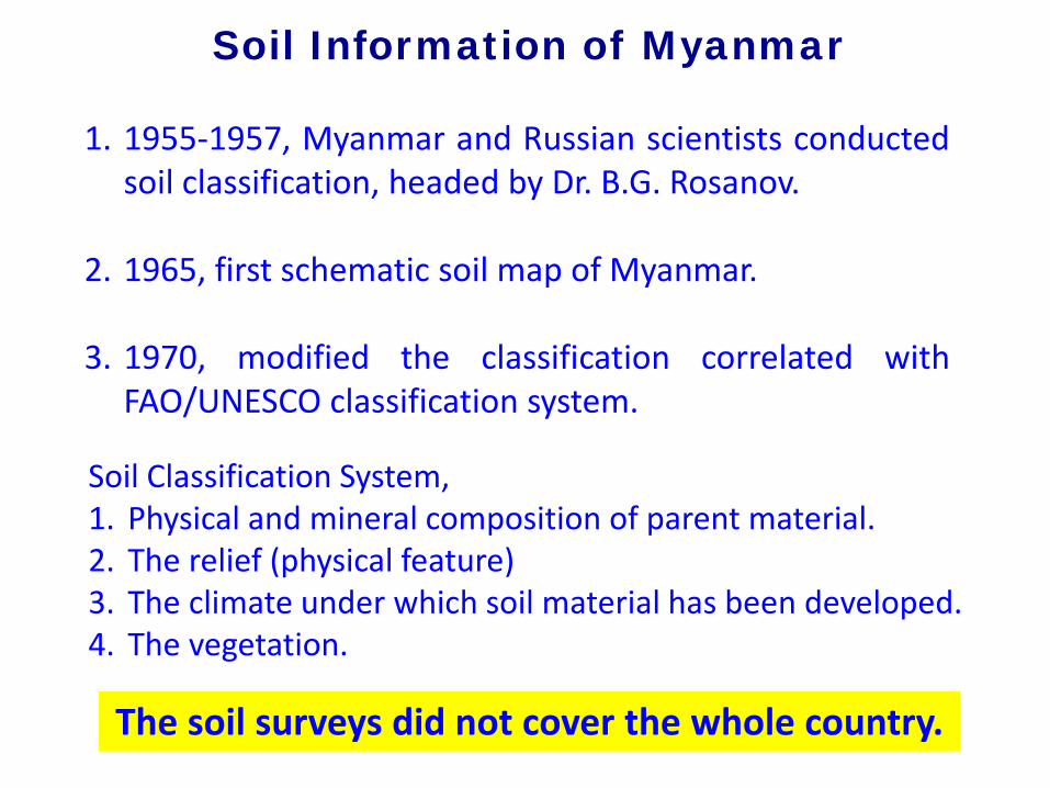
Soil Information of Myanmar
1. 1955-1957, Myanmar and Russian scientists conductedsoil classification, headed by Dr. B.G. Rosanov.
2. 1965, first schematic soil map of Myanmar.
3. 1970, modified the classification correlated withFAO/UNESCO classification system.
Soil Classification System,1. Physical and mineral composition of parent material.2. The relief (physical feature)3. The climate under which soil material has been developed.4. The vegetation.
The soil surveys did not cover the whole country.
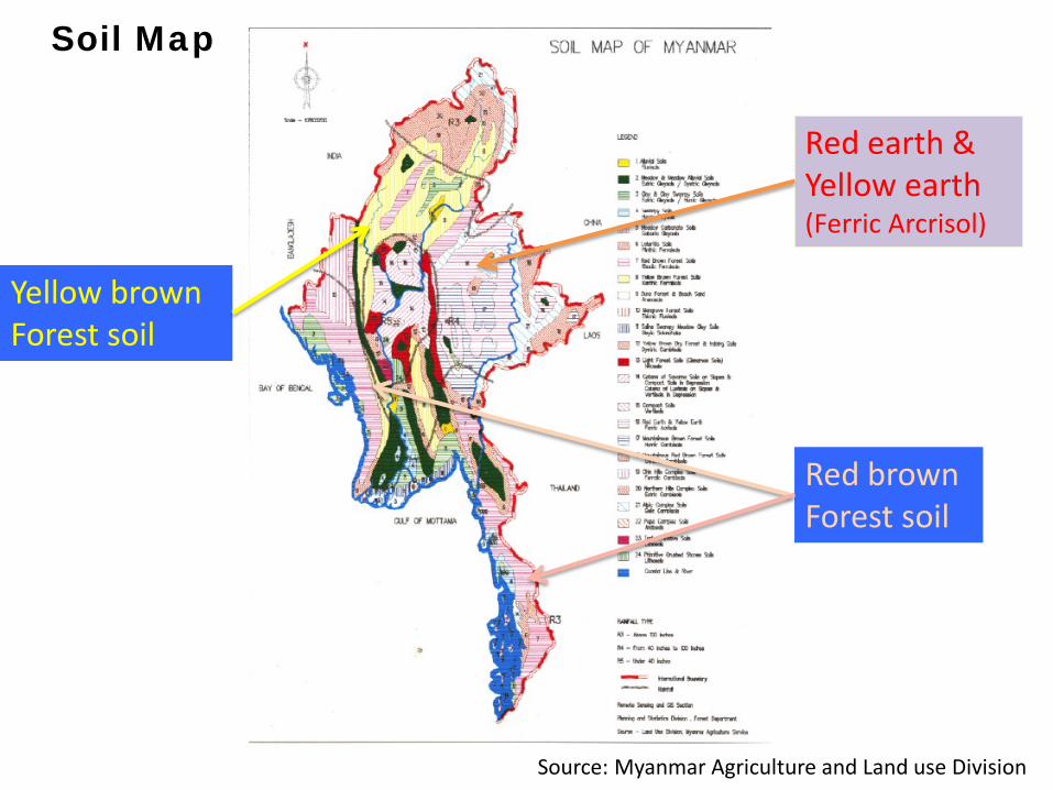
Red earth & Yellow earth(Ferric Arcrisol)
Red brownForest soil
Yellow brownForest soil
Source: Myanmar Agriculture and Land use Division
Soil Map
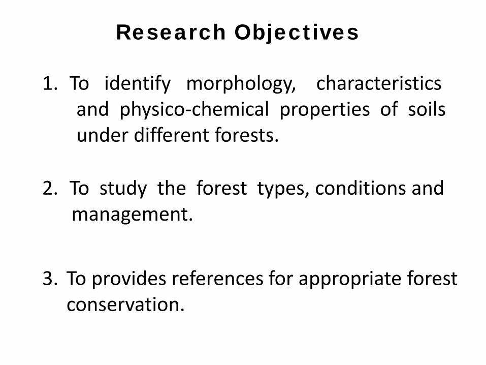
Research Objectives
1. To identify morphology, characteristicsand physico-chemical properties of soilsunder different forests.
2. To study the forest types, conditions andmanagement.
3. To provides references for appropriate forest conservation.
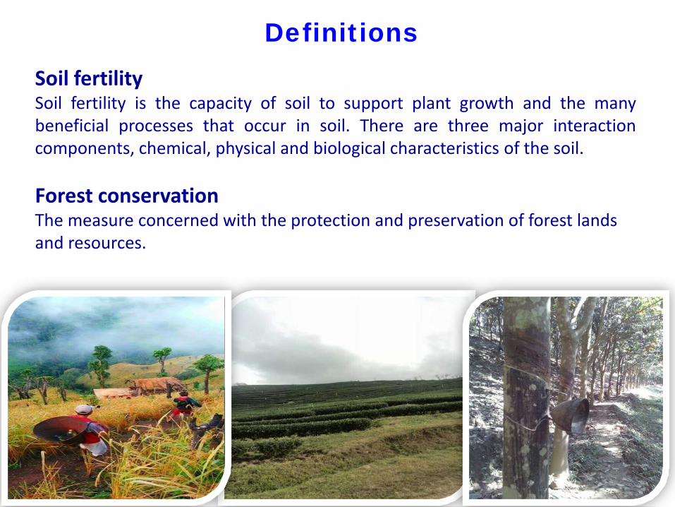
DefinitionsSoil fertilitySoil fertility is the capacity of soil to support plant growth and the manybeneficial processes that occur in soil. There are three major interactioncomponents, chemical, physical and biological characteristics of the soil.
Forest conservationThe measure concerned with the protection and preservation of forest lands and resources.
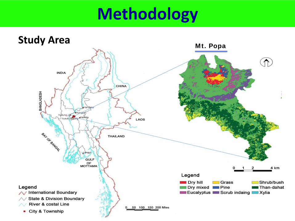
MethodologyStudy Area
Mt. Popa
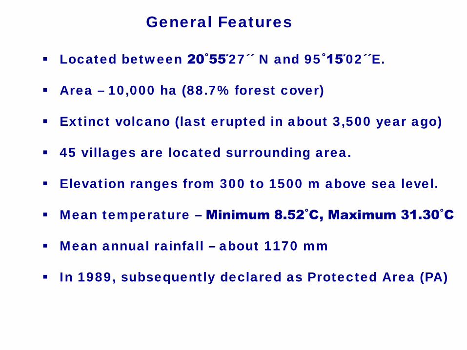
General Features
Located between 20˚55΄27´´ N and 95˚15΄02´´E.
Area – 10,000 ha (88.7% forest cover)
Extinct volcano (last erupted in about 3,500 year ago)
45 villages are located surrounding area.
Elevation ranges from 300 to 1500 m above sea level.
Mean temperature – Minimum 8.52˚C, Maximum 31.30˚C
Mean annual rainfall – about 1170 mm
In 1989, subsequently declared as Protected Area (PA)
Road
Other forest
Road Source: Popa forest Department
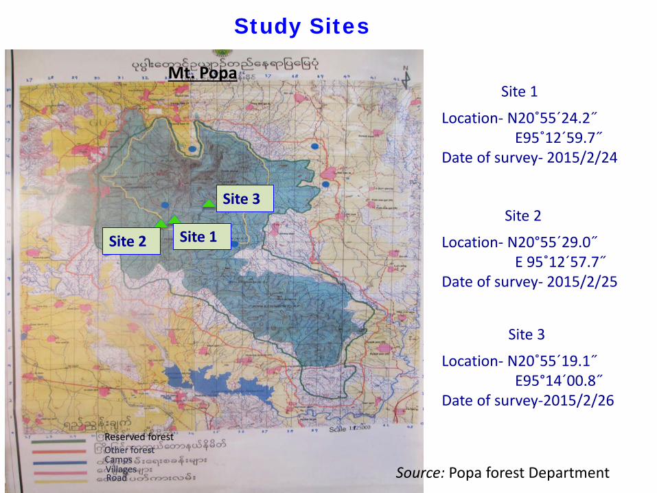
Site 1
Site 3
Site 2
Reserved forest
CampsVillages
Study Sites
Site 1
Location- N20˚55´24.2˝E95˚12´59.7˝
Date of survey- 2015/2/24
Site 2
Location- N20°55´29.0˝E 95˚12´57.7˝
Date of survey- 2015/2/25
Site 3
Location- N20˚55´19.1˝E95°14´00.8˝
Date of survey-2015/2/26
Mt. Popa
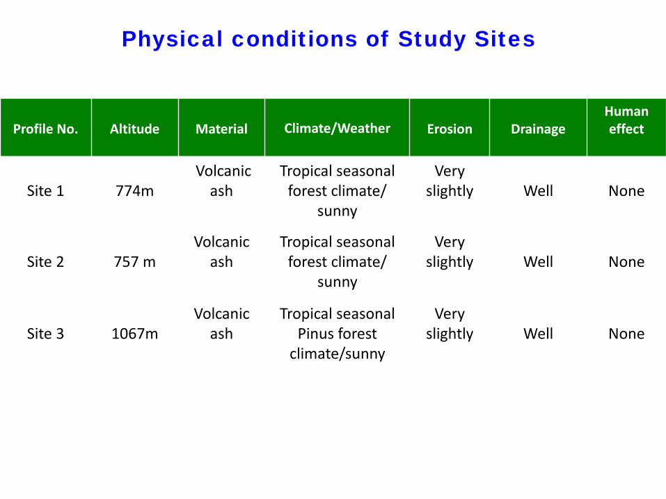
Profile No. Altitude Material Climate/Weather Erosion DrainageHuman effect
Site 1 774m Volcanic
ash Tropical seasonal
forest climate/ sunny
Very slightly Well None
Site 2 757 mVolcanic
ashTropical seasonal
forest climate/ sunny
Very slightly Well None
Site 3 1067mVolcanic
ashTropical seasonal
Pinus forest climate/sunny
Very slightly Well None
Physical conditions of Study Sites
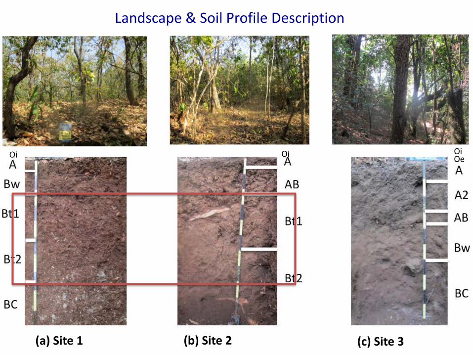
Landscape & Soil Profile Description
(a) Site 1 (b) Site 2 (c) Site 3
Oi Oi OiOe

Soil Profile Morphology
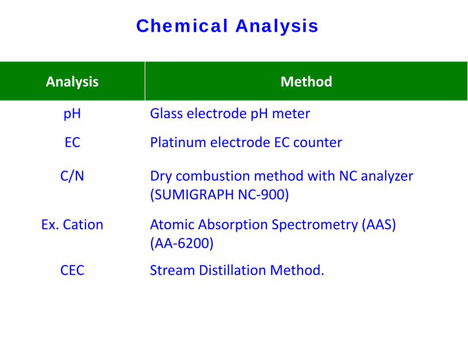
Chemical Analysis
Analysis Method
pH Glass electrode pH meter
EC Platinum electrode EC counter
C/N Dry combustion method with NC analyzer(SUMIGRAPH NC-900)
Ex. Cation Atomic Absorption Spectrometry (AAS)(AA-6200)
CEC Stream Distillation Method.
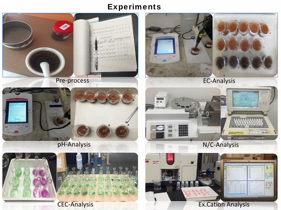
Experiments
Pre-process EC-Analysis
pH-Analysis N/C-Analysis
CEC-Analysis Ex.Cation Analysis
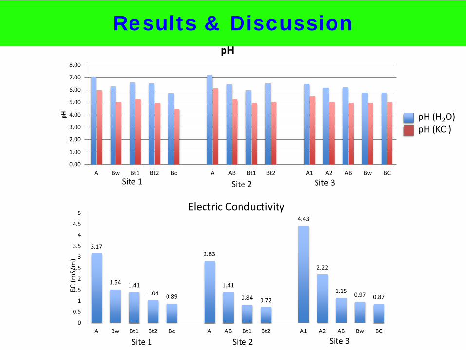
Results & Discussion
0.00
1.00
2.00
3.00
4.00
5.00
6.00
7.00
8.00
A Bw Bt1 Bt2 Bc A AB Bt1 Bt2 A1 A2 AB Bw BC
pH
Site 2
pH
EC (m
S/m
)
Site 1 Site 3
Site 1 Site 2 Site 3
3.17
1.54 1.411.04 0.89
2.83
1.41
0.84 0.72
4.43
2.22
1.15 0.97 0.87
0
0.5
1
1.5
2
2.5
3
3.5
4
4.5
5
A Bw Bt1 Bt2 Bc A AB Bt1 Bt2 A1 A2 AB Bw BC
Electric Conductivity
pH (H2O)pH (KCl)
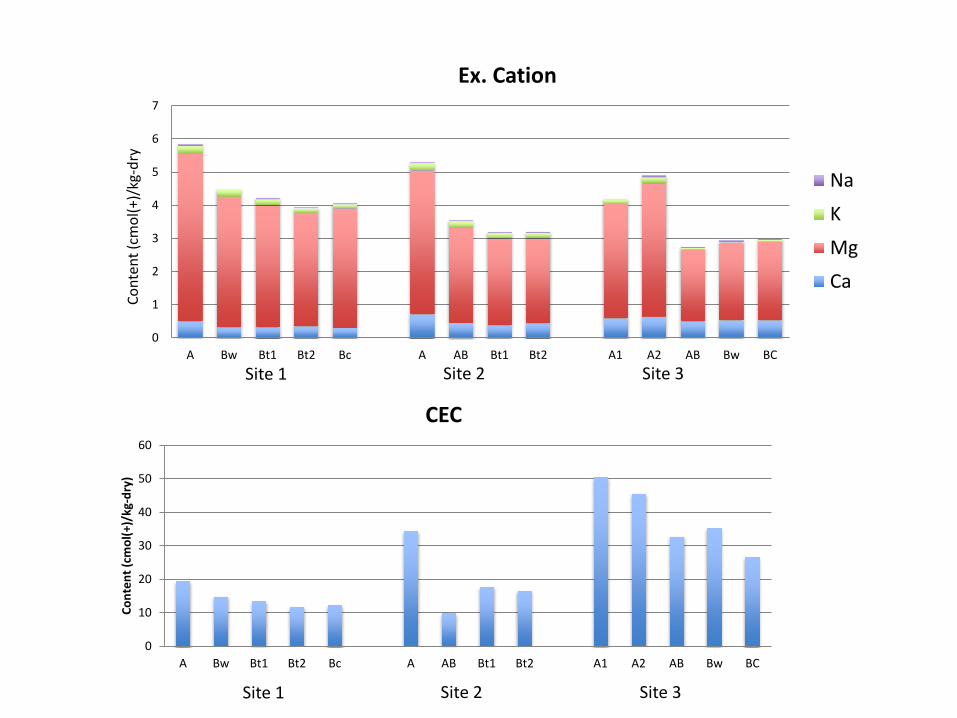
0
1
2
3
4
5
6
7
A Bw Bt1 Bt2 Bc A AB Bt1 Bt2 A1 A2 AB Bw BC
Ex. Cation
Na
K
Mg
Ca
Cont
ent (
cmol
(+)/
kg-d
ry
0
10
20
30
40
50
60
A Bw Bt1 Bt2 Bc A AB Bt1 Bt2 A1 A2 AB Bw BC
Cont
ent (
cmol
(+)/
kg-d
ry)
CEC
Site 1 Site 2 Site 3
Site 1 Site 2 Site 3
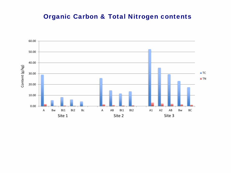
0.00
10.00
20.00
30.00
40.00
50.00
60.00
A Bw Bt1 Bt2 Bc A AB Bt1 Bt2 A1 A2 AB Bw BC
TC
TN
Site 1 Site 2 Site 3
Cont
ent (
g/kg
)Organic Carbon & Total Nitrogen contents
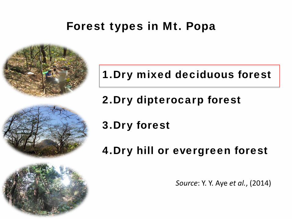
Forest types in Mt. Popa
1.Dry mixed deciduous forest
2.Dry dipterocarp forest
3.Dry forest
4.Dry hill or evergreen forest
Source: Y. Y. Aye et al., (2014)
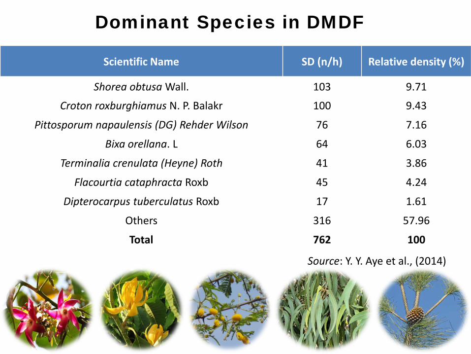
Dominant Species in DMDF
Scientific Name SD (n/h) Relative density (%)
Shorea obtusa Wall. 103 9.71
Croton roxburghiamus N. P. Balakr 100 9.43
Pittosporum napaulensis (DG) Rehder Wilson 76 7.16
Bixa orellana. L 64 6.03
Terminalia crenulata (Heyne) Roth 41 3.86
Flacourtia cataphracta Roxb 45 4.24
Dipterocarpus tuberculatus Roxb 17 1.61
Others 316 57.96
Total 762 100
Source: Y. Y. Aye et al., (2014)
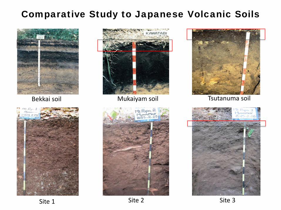
Comparative Study to Japanese Volcanic Soils
Bekkai soil Mukaiyam soil Tsutanuma soil
Site 1 Site 2 Site 3
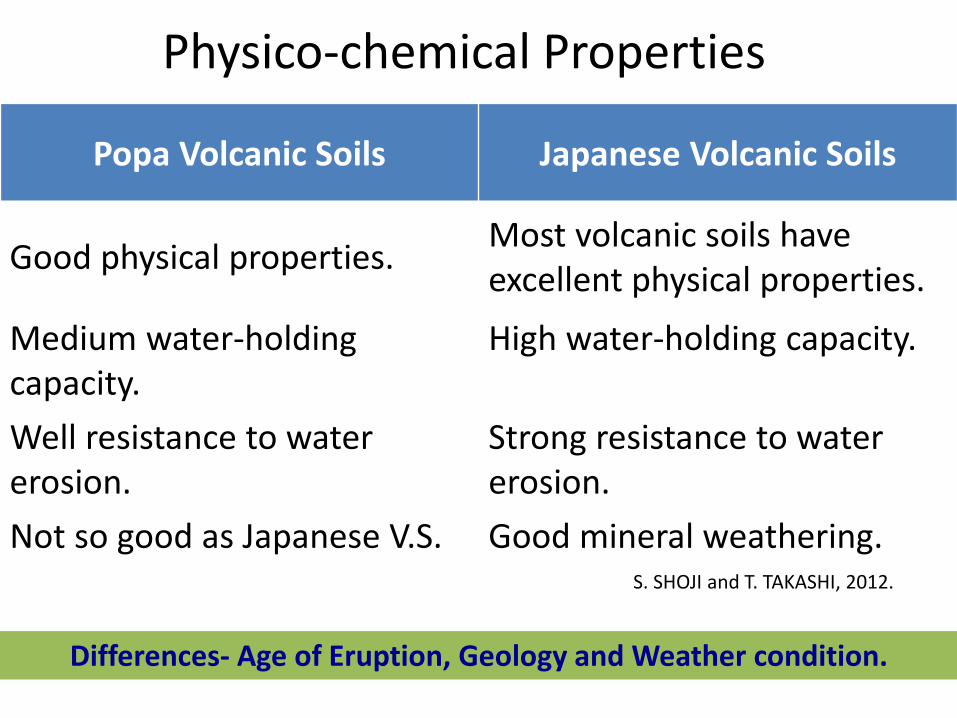
Physico-chemical Properties
Popa Volcanic Soils Japanese Volcanic Soils
Good physical properties. Most volcanic soils have excellent physical properties.
Medium water-holding capacity.
High water-holding capacity.
Well resistance to water erosion.
Strong resistance to water erosion.
Not so good as Japanese V.S. Good mineral weathering.S. SHOJI and T. TAKASHI, 2012.
Differences- Age of Eruption, Geology and Weather condition.
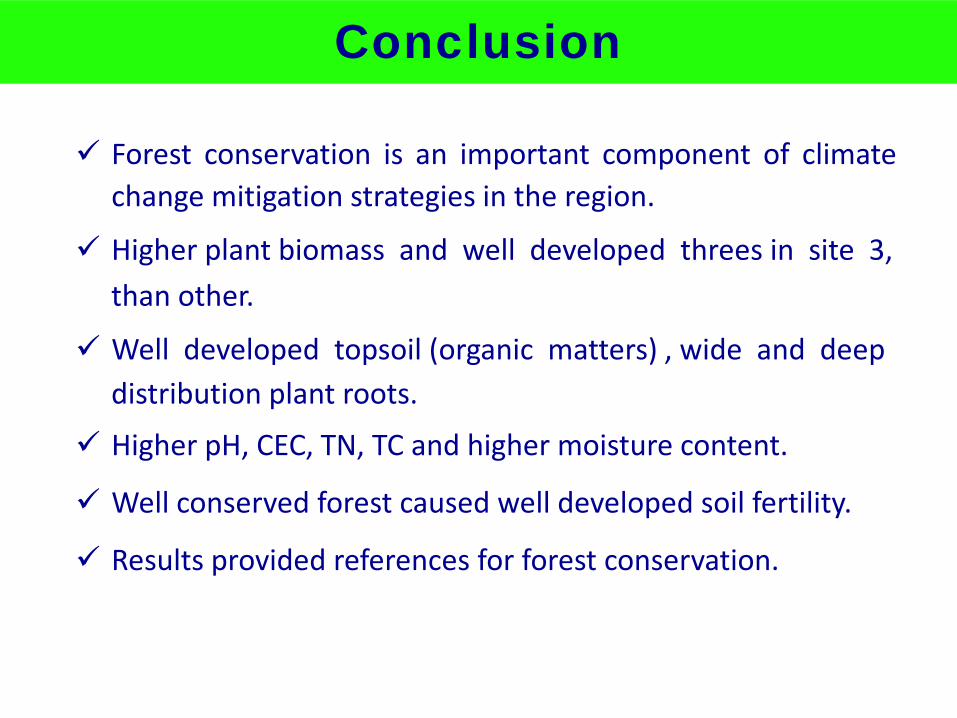
Conclusion
Forest conservation is an important component of climatechange mitigation strategies in the region.
Higher plant biomass and well developed threes in site 3,than other.
Well developed topsoil (organic matters) , wide and deepdistribution plant roots.
Higher pH, CEC, TN, TC and higher moisture content.
Well conserved forest caused well developed soil fertility.
Results provided references for forest conservation.
Future Plan
1. To analyze soil types by Acidic Oxalate Dissolution,Pyrophosphate Dissolve and Dithionite-citrateReduction Dissolution methods.
2. To analyze mineral composition sand fraction andparticle size distribution.
References1. Y.Y. Aye, et al, (2014), Floristic Composition, Diversity and Stand Structure
of Tropical Forests in Popa Mountain Park. Journal of EnvironmentalProtection, 5.1588-1602.
2. H. T. Aung, (2003), Myanmar; the study of processes and patterns, formerRector and former Professor of geography, University of Mawhlamyine.
3. T. T. Myint, (2012), A Study on the sustainable management of natural teakforests in Myanmar, Graduate School of Agricultural and Life Sciences,
The University of Tokyo.
4. S. Shoji and T. Takahashi, (2012), Environmental and agricultural significant ofvolcanic ash soil, Graduate school of agriculture sciences, Tohoku university.
Thank You for Your Attention
Tin Maung Oo201426042
2015/11/02