the dowd’s creek restoration proposal a research proposal to the sea...
TRANSCRIPT
The Dowd’s Creek Restoration Proposal June 1987
A Research Proposal to the Sea Grant Program
Response of Macro Organisms to Restoration of
Degraded Tidal Marsh Habitats
Oyster Shell Habitat Associations
Submitted May 18, 1987 Dr John S. Barclay, Dr Robert B. Whitlatch, Timothy C. Visel,
University of Connecticut
Rekeyed by the Sound School Adult Education Program April 2009
The Sound School, New Haven, CT Summary/Abstract:
In 1986, a site in Hammonassett State Park was selected for an experimental attempt to establish certain habitat indexes for coastal restoration. Important to the effort was habitat associations, preferences regarding estuarine shellfish populations. Included in the proposal was an example project design, site of study, fisheries history project organization, literature search, pre and post restoration plans, examples of support letters, equipment lists and volunteer monitoring outlines. Although this proposal was written more than 2 decades ago, and not funded, shellfish environmental services has recently emerged as a critical environmental area in many coastal estuaries. This study is made available to groups wishing to learn more about project/proposal organization and development regarding coastal resource restoration. Key Words: Shellfish Environmental Services, Specific Habitat Associations with soft shell, hardshell clam and oysters, coastal resource restoration, habitat diversity indexes including shell/sand mud/shell, pebbles, rocks and aquatic vegetation.
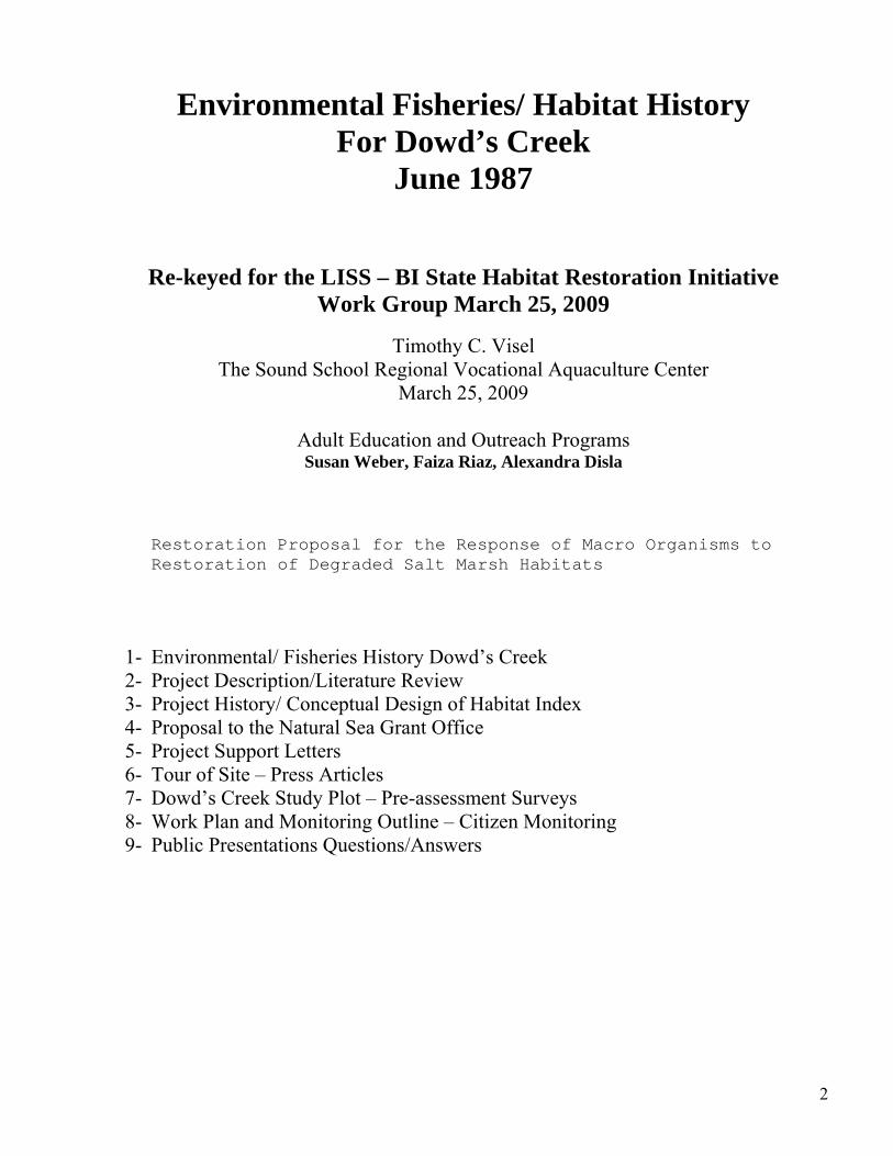
Environmental Fisheries/ Habitat History For Dowd’s Creek
June 1987
Re-keyed for the LISS – BI State Habitat Restoration Initiative Work Group March 25, 2009
Timothy C. Visel
The Sound School Regional Vocational Aquaculture Center March 25, 2009
Adult Education and Outreach Programs Susan Weber, Faiza Riaz, Alexandra Disla
Restoration Proposal for the Response of Macro Organisms to Restoration of Degraded Salt Marsh Habitats
1- Environmental/ Fisheries History Dowd’s Creek 2- Project Description/Literature Review 3- Project History/ Conceptual Design of Habitat Index 4- Proposal to the Natural Sea Grant Office 5- Project Support Letters 6- Tour of Site – Press Articles 7- Dowd’s Creek Study Plot – Pre-assessment Surveys 8- Work Plan and Monitoring Outline – Citizen Monitoring 9- Public Presentations Questions/Answers
2
Environmental Fisheries/Habitat History For Dowd’s Creek
June 1987
3
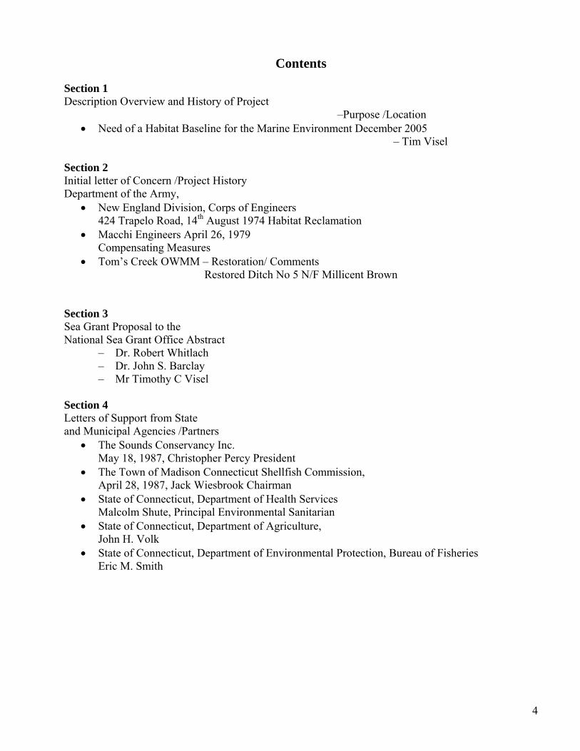
Contents
Section 1 Description Overview and History of Project
–Purpose /Location • Need of a Habitat Baseline for the Marine Environment December 2005
– Tim Visel
Section 2 Initial letter of Concern /Project History Department of the Army,
• New England Division, Corps of Engineers 424 Trapelo Road, 14th August 1974 Habitat Reclamation
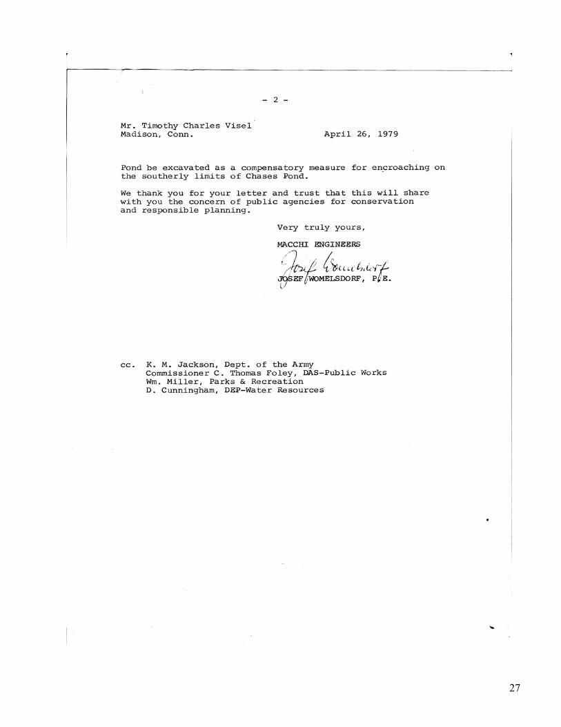
• Macchi Engineers April 26, 1979 Compensating Measures
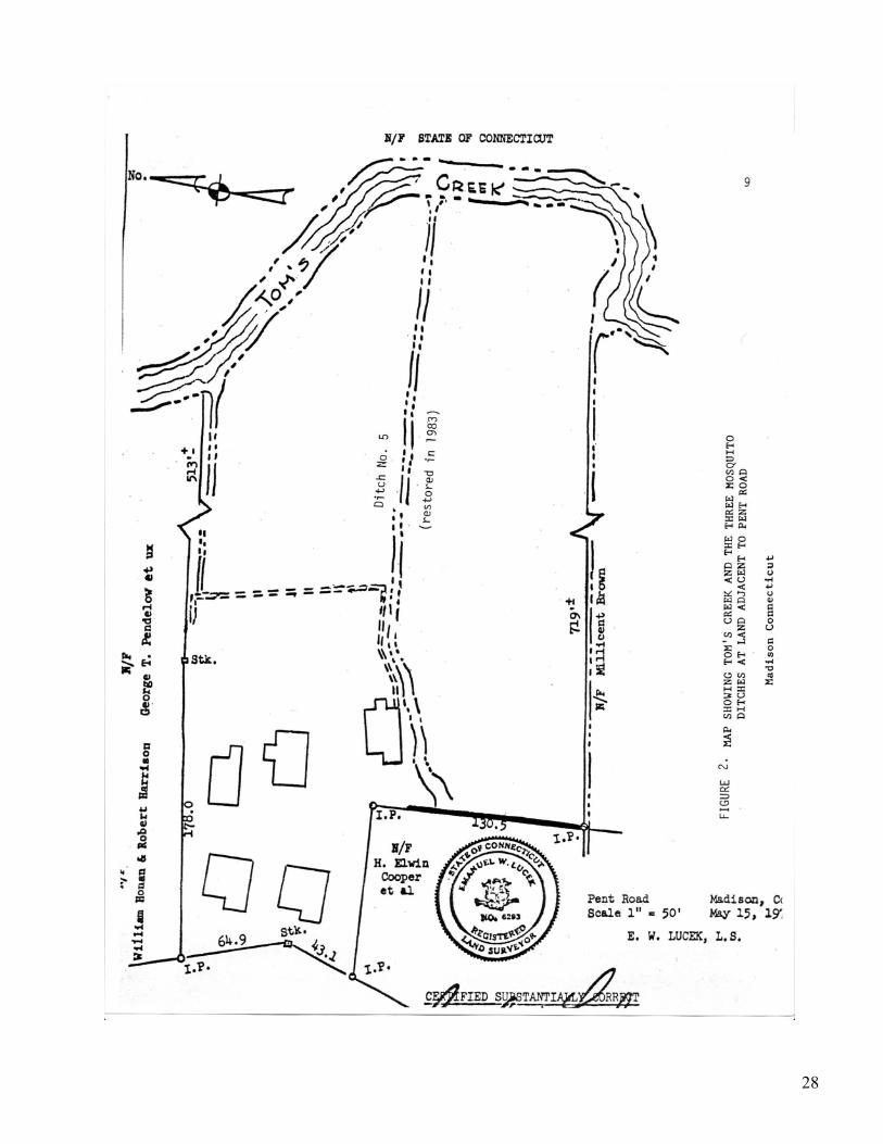
• Tom’s Creek OWMM – Restoration/ Comments Restored Ditch No 5 N/F Millicent Brown
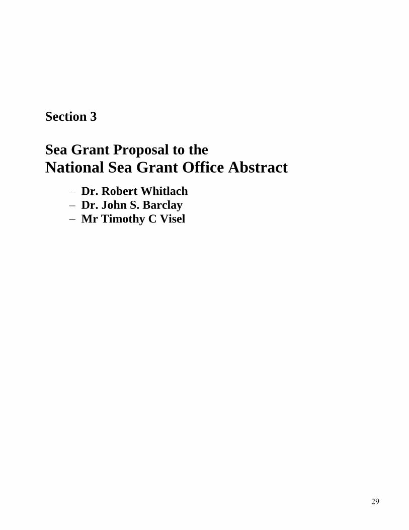
Section 3 Sea Grant Proposal to the National Sea Grant Office Abstract
– Dr. Robert Whitlach – Dr. John S. Barclay – Mr Timothy C Visel
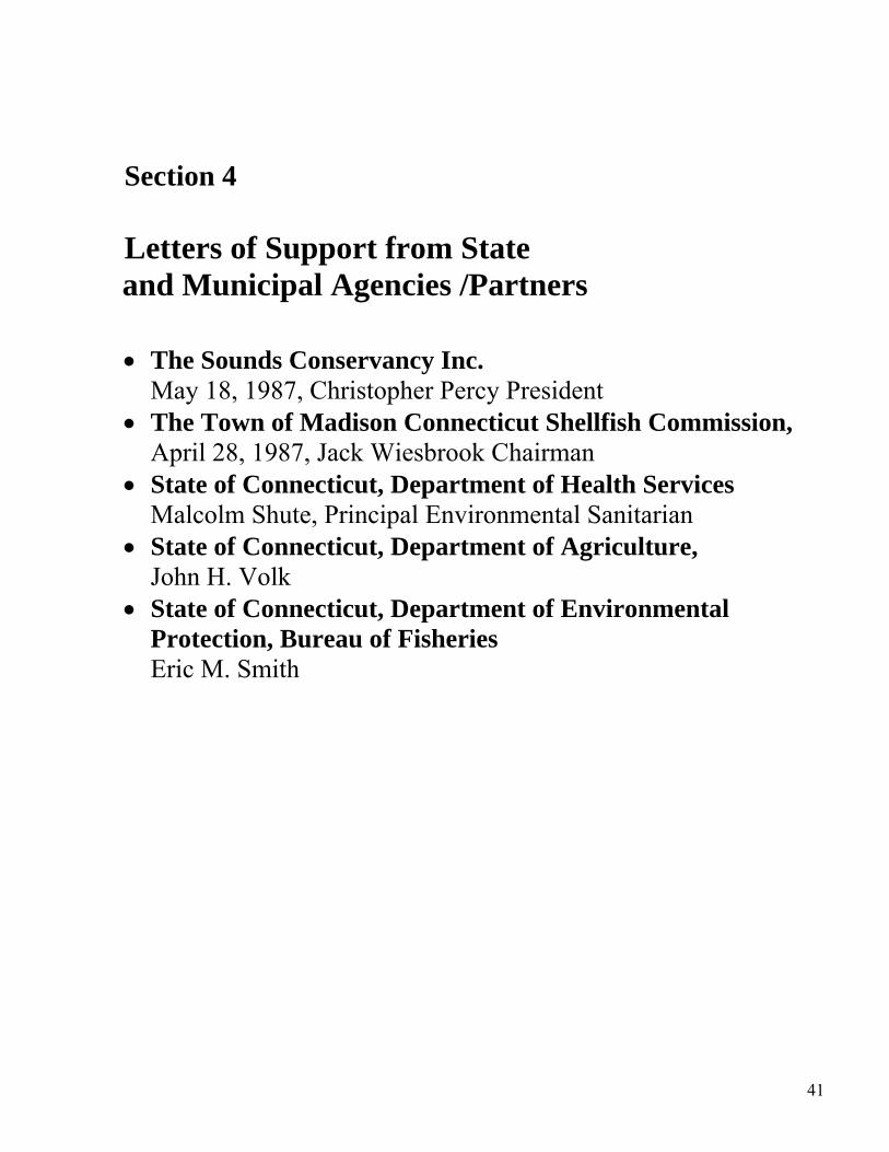
Section 4 Letters of Support from State and Municipal Agencies /Partners
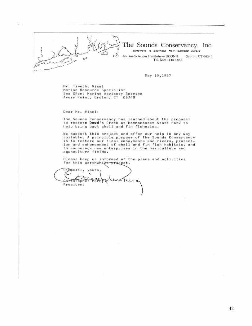
• The Sounds Conservancy Inc. May 18, 1987, Christopher Percy President
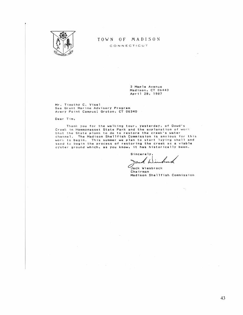
• The Town of Madison Connecticut Shellfish Commission, April 28, 1987, Jack Wiesbrook Chairman
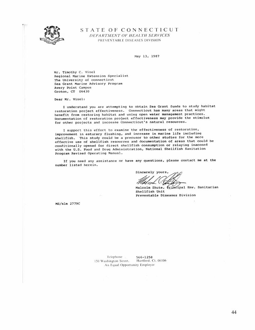
• State of Connecticut, Department of Health Services Malcolm Shute, Principal Environmental Sanitarian
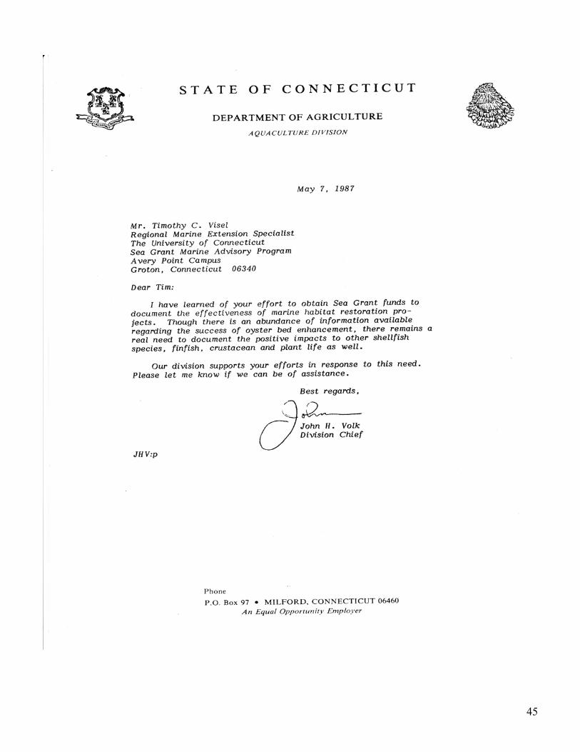
• State of Connecticut, Department of Agriculture, John H. Volk
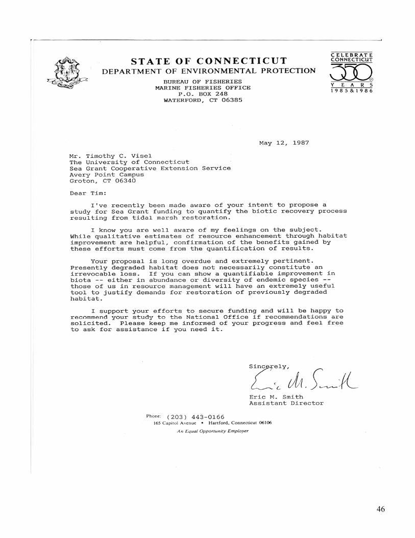
• State of Connecticut, Department of Environmental Protection, Bureau of Fisheries Eric M. Smith
4
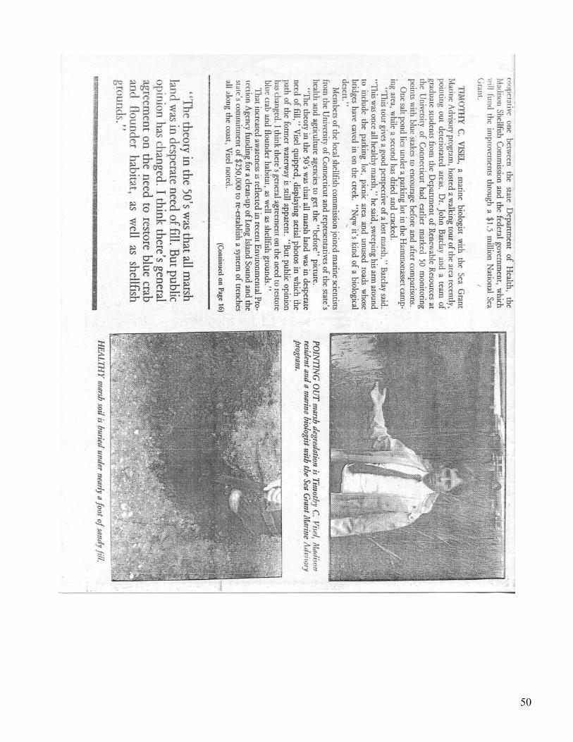
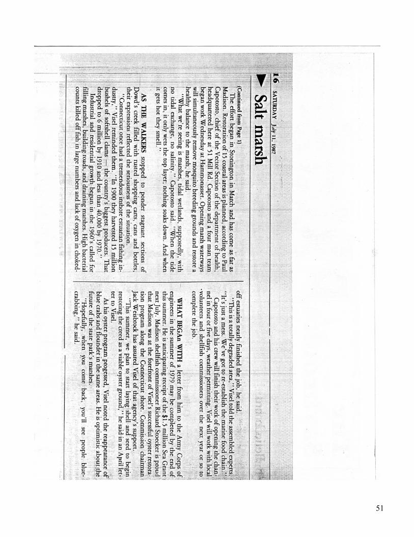
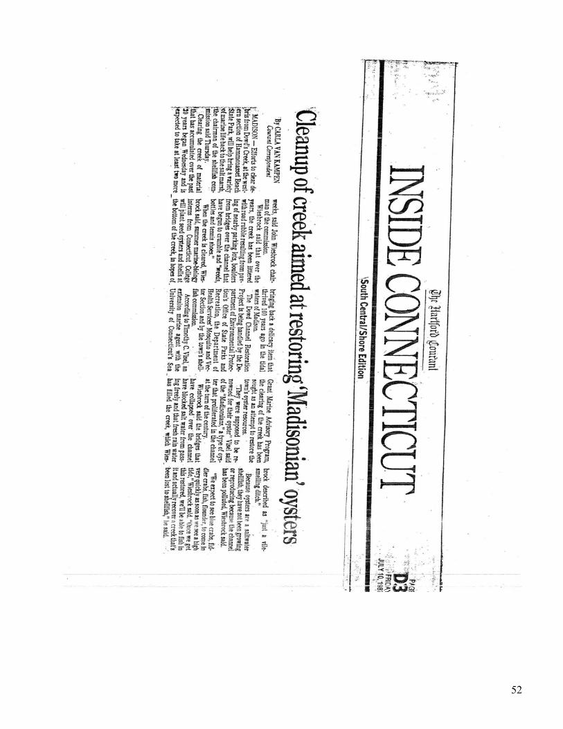
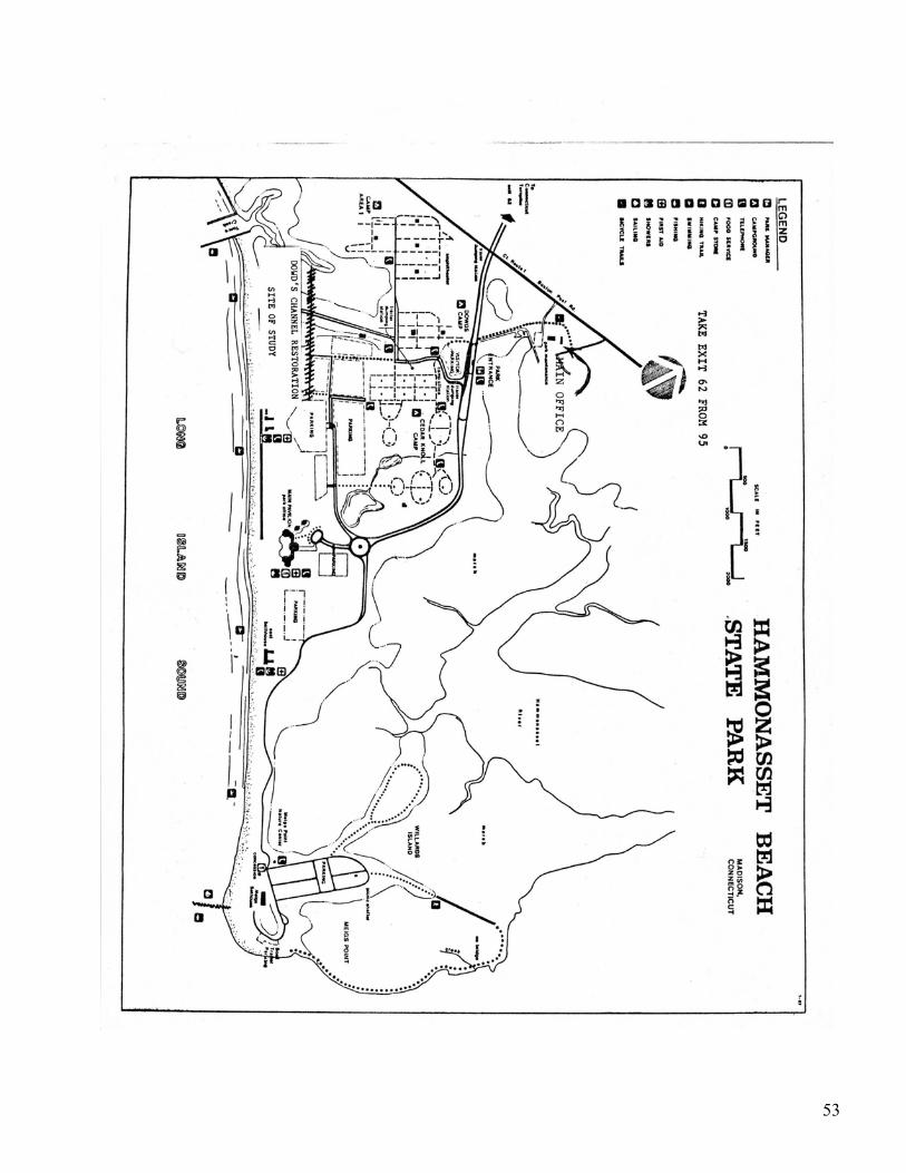
Section 5 Press Articles –Tour of Site Background Details - June 17, 1987
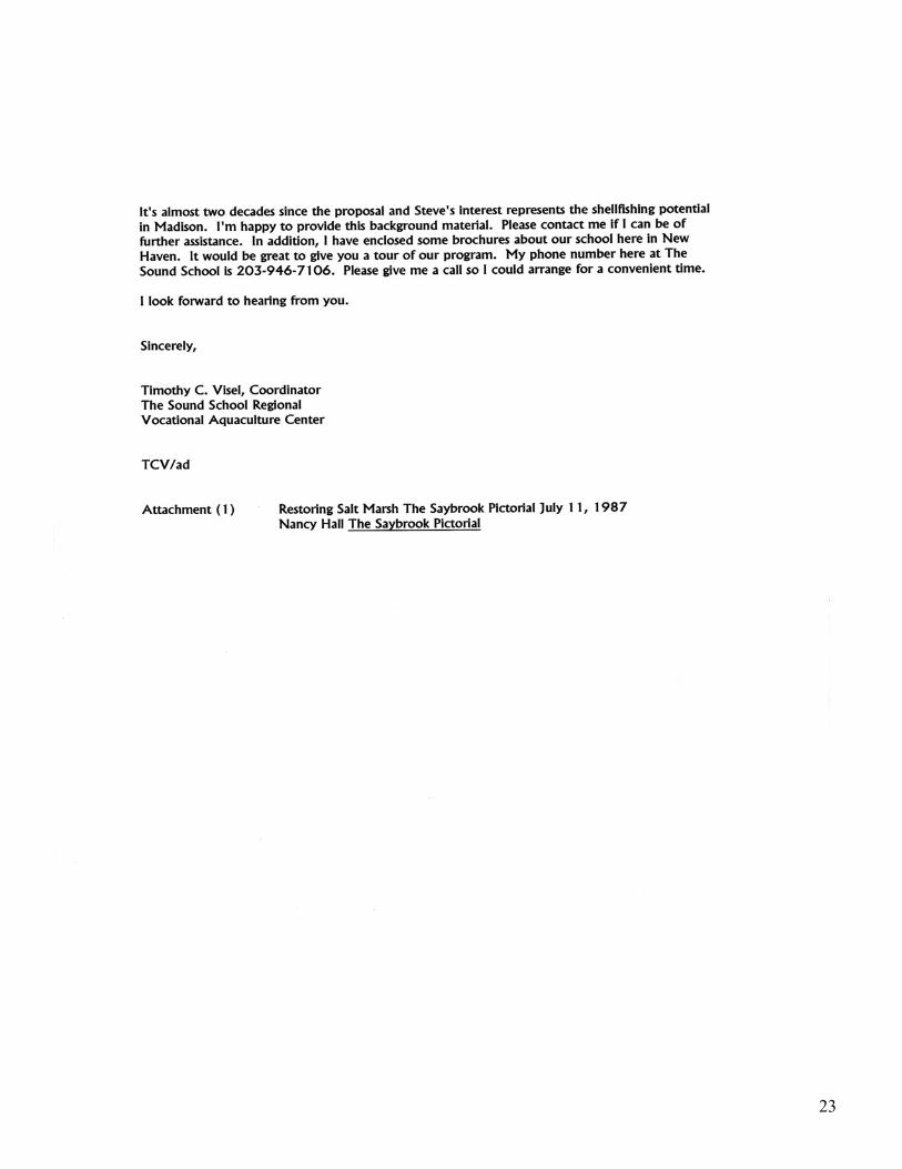
Walking Tour and Presentation to the Madison Shellfish Commission and Madison Land Conservation Trust - July 11, 1987 “Restoring Salt Marsh” The Saybrook Pictorial - July 10, 1987 “Clean-up of creek aimed at restoring ‘Madisonian’ oysters – the Hartford Courant - Site map, Hammonassett Beach State Park
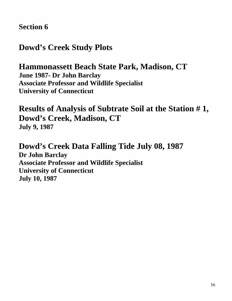
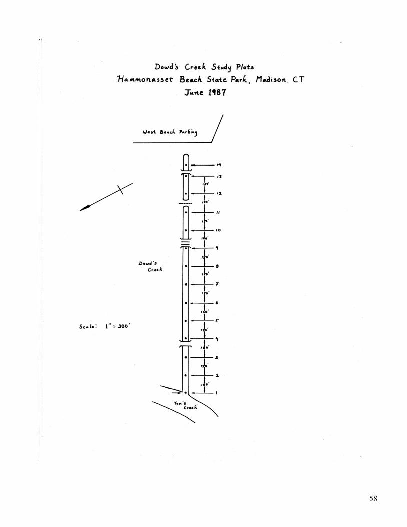
Section 6
Dowd’s Creek Study Plots Hammonassett Beach State Park, Madison, CT June 1987- Dr John Barclay Associate Professor and Wildlife Specialist University of Connecticut Results of Analysis of Subtrate Soil at the Station # 1, Dowd’s Creek, Madison, CT July 9, 1987 Dowd’s Creek Data Falling Tide July 08, 1987 Dr John Barclay Associate Professor and Wildlife Specialist University of Connecticut July 10, 1987
Section 7
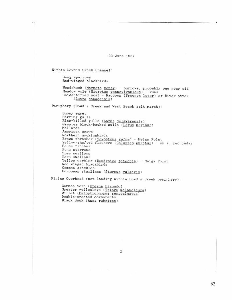
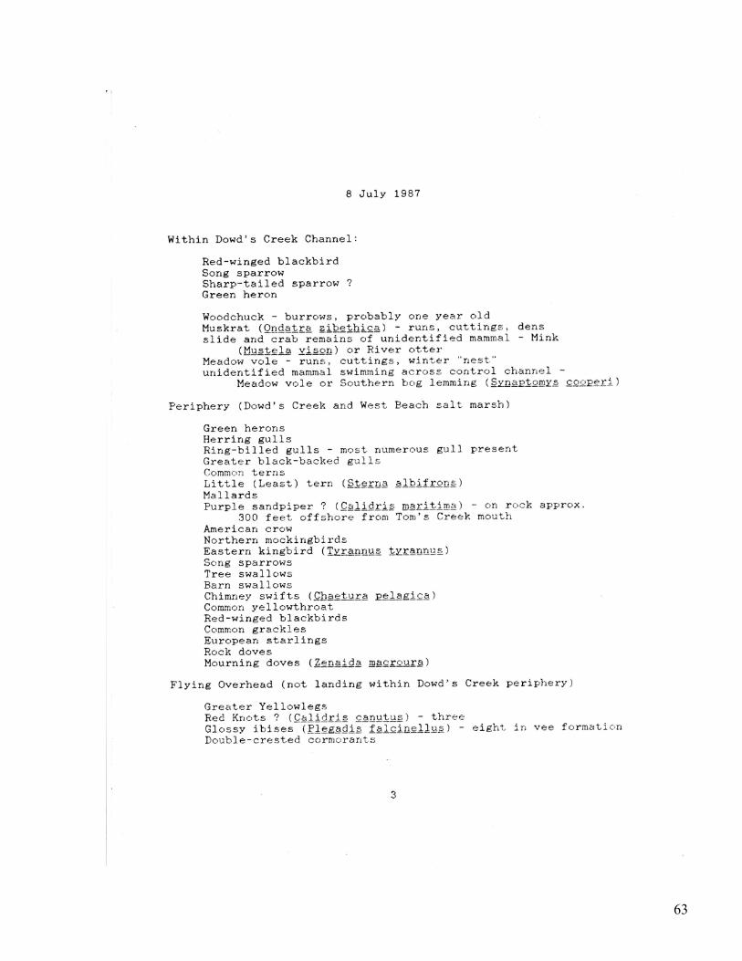
Listing of Mammals and Shore and Inland Birds Prior to Re-channeling Dowd’s Creek Study June 18, 1987 Dr John Barclay Associate Professor and Wildlife Specialist University of Connecticut
• June 23, 1987 • July 08, 1987
Section 8
Madison Land Trust/ Madison Shellfish Commission Study Establishing a Habitat Index for Shellfish and Finfish Species Work Plan and Monitoring Outline Tim Visel
5
Section 9 Questions/Responses for the Micro Habitat types – Walking Tour and Meeting June 17, 1987
Hammonassett State Park Office.
Section 10 Permits and Regulatory Procedures
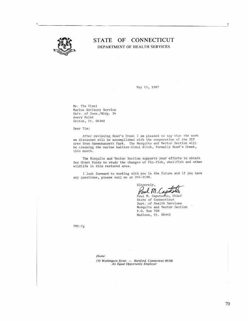
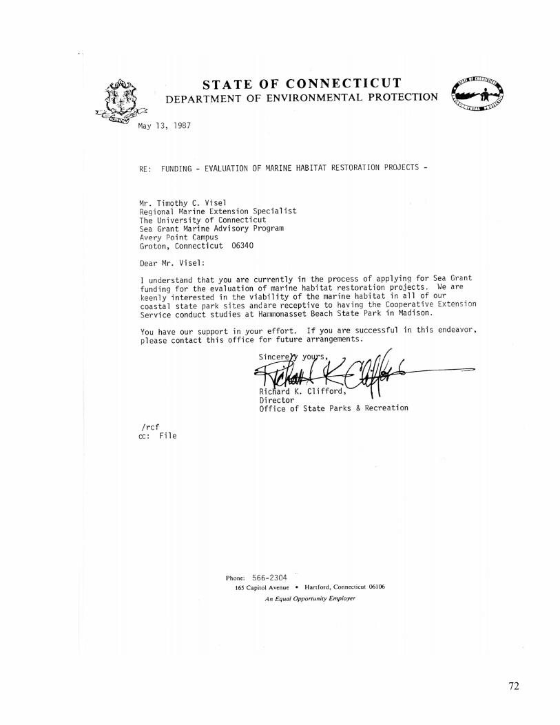
Paul M. Capotosto • May 13, 1987 – Correspondence Paul M. Capotosto Chief State of CT, Dept of Health Services • Hammonasset Park – Madison Site # 1 • May 13, 1987 – Correspondence Richard K. Clifford Director Office of State Parks and
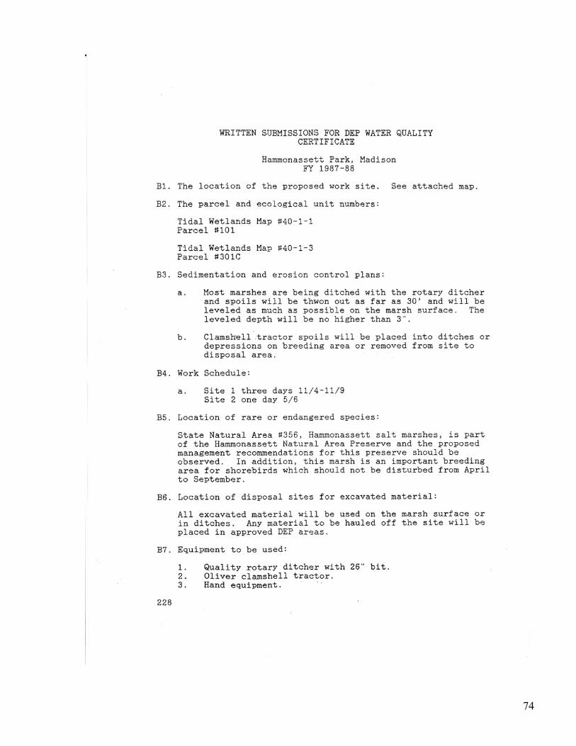
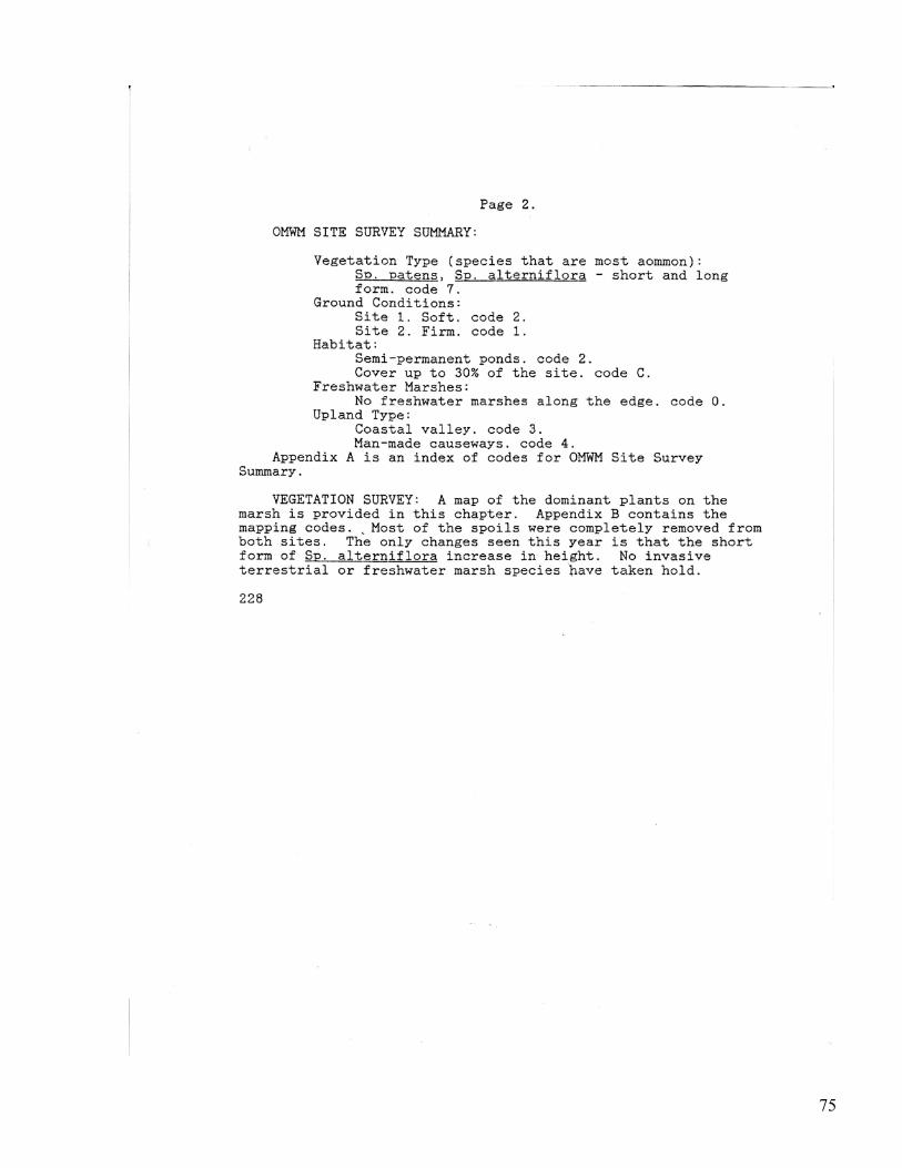
Recreation • Written Submissions for DEP Water Quality Certificate – Work Site Descriptions #228
Section 11
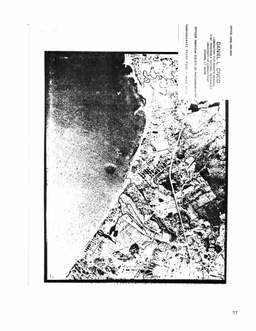
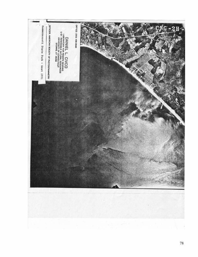
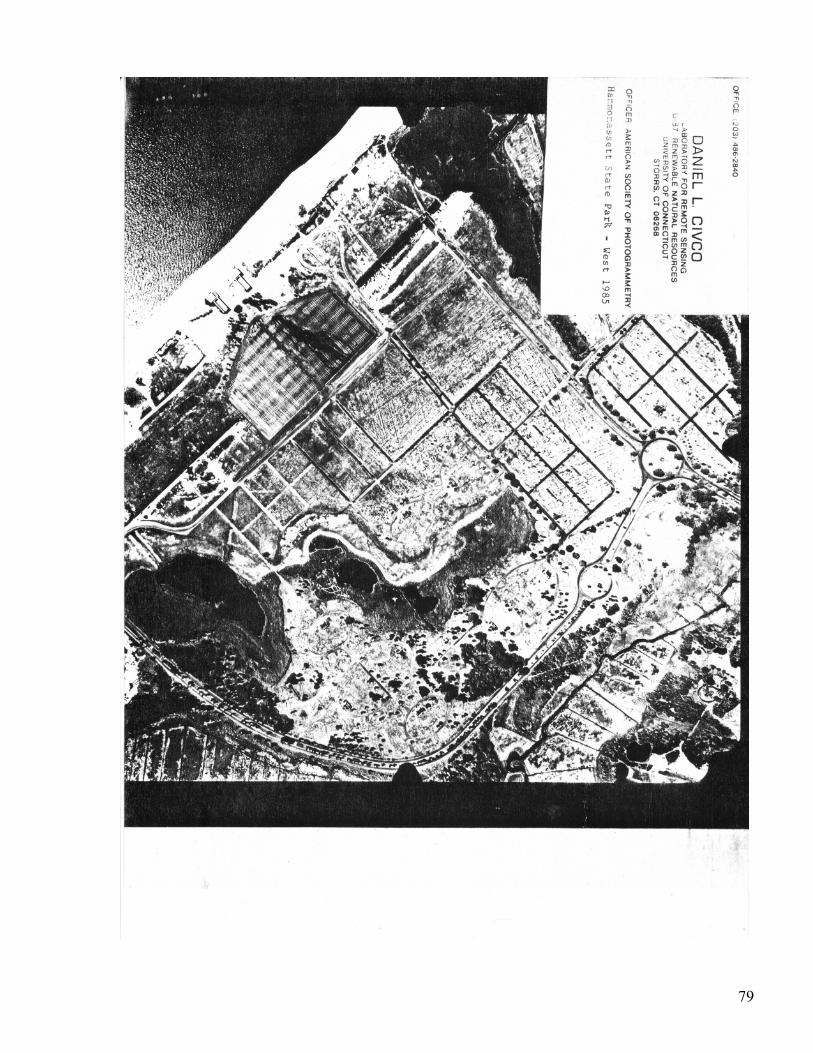
Overflight Photos Dowd’s Creek Daniel Civco University of Connecticut Lab For Remote Sensing 1934 – Saltmarsh Watershed Dawd’s Creek 1951 - Filled Creek Channel to Tom’s Creek 1985 - New Parking Lot Filled Creek + Salt Marsh
6
Environmental Fisheries/Habitat History
For Dowd’s Creek June 1987
Re-keyed for the LISS – BI State Habitat Restoration Initiative
Work Group March 25, 2009 Hammonassett State Park has a long history of coastal resource loss and alteration. Estuarine habitat loss has continued to occur despite the fact that Hammonassett Beach is clearly recognized as a glacial feature and thus, fits the basic description of a coastal barrier1 below, “A depositional geologic feature such as a bay barrier tombolo, barrier spit or barrier island that –
1. Consists of unconsolidated sedimentary materials 2. Is subject to wave, tidal, and wind energies 3. Protects landward aquatic habitats from direct wave attack 4. All associated aquatic habitats including the adjacent wetlands,
marshes, estuaries inlets and near shore waters” It has a history of sustaining development actions that have diminished the ecological and habitat roles of such coastal barriers. The shape of and its axis Hammonassett Beach to curve southwest and southeast blows direct tidal and wave energy to what typically can be considered the weakest sections.2
This has been the case for the area of Hammonassett State Park – the central sections west of the new 1964 concrete pavilion. Unfortunately, much of the previous ecology has been lost from dredge and fill operations conducted at the park. One area that has been filled is a classic feature, the so-called Barrier Beach inlet. This is the history that Mr. Emil Miller, a former state park employee, described, a seasonal or storm related event that cut or breached the beach front reopening the inlet to a salt pond/salt marsh system adjacent to a large drainage system he called Dowd’s Creek. Mr. Stephen Leatherman of the National Park Service – Cooperative Research Unit – UMASS Amherst in a 1980 Barrier Island forum and workshop described this process at a May 1980 meeting in Provincetown, Massachusetts.
1 97th Congress 2nd Session – House of Representative Report 97-928 Coastal Barrier Resources Act October 1, 1982 – pg 2. 2 Mr. Emil Miller, whose family owned part of the State Park prier to 1918, described much of the ecology and habitat history for the Dowd’s Creek area.
7
“Inlets are usually formed during a storm, primarily hurricanes because the storm surge is much higher on the average than during winter northeast storms. It is clear that as sea level rises, islands must move; landward littoral drift basically creates the barrier feature in the Northeast with the aid of activity and over wash processes. Over wash in the last ten years has really captured our imagination; it is a phenomenon that we can go out and study since it is common occurrence on some barriers. By comparison inlets have a frequency of occurring only one in fifty to seventy five years along some shorelines, whereas over wash is much more prevalent, happening during most major storms.”3
What Mr. Miller described, as some of the early State Park history, was two “weak” or thin sections of beach, with adjacent marshes, one at the site of Dowd’s Creek/Salt Pond and a second area just west of the 1964, so-called “New Pavilion.” In 1971-73, a series of storms over washed these areas, and a new creek threatened to become tidal until bulldozers operated by the State Park quickly closed it. Remnants of this barrier cut can still be observed today southwest of the traffic rotary circle. The over wash at Dowd’s Creek wasn’t as severe but it did destroy what remained of the 1945-49 elevated fixed board work in front of the famous food concession pavilion. A second section, an elevated boardwalk from the pavilion to the Dowd’s Campground beach, 60 feet landward was not impacted by these storms. The entire 3/8-mile section has been subjected to similar erosion type episodes. According to Mr. Miller, the salt pond and creek was filled as trolley tracks/roadway were constructed and tides redirected to Tom’s Creek through an unnatural man-made ditch 1,400 feet west to the most easterly branch of Tom’s Creek. As late as the 1970’s, old trolley rail lines were seen to the side of and onto a ramp in back of the “Clam Shed” pavilion. The erosion events, according to Mr. Miller, were constant and becoming more severe.
• 1920’s - Boardwalk was fronted by some 100 to 150 feet of beach – but by 1938 only enough beach remained to support the 30 foot graduated ramps from the boardwalk. At high tide, the ramps were often near the water. The 1983 Hurricane destroyed much of the first boardwalk and tides/waves were underneath both the beach pavilion and food pavilions but because they were elevated, most of the damage escaped them.
• The post World War II boardwalk was moved back about 50 feet
closer the beach pavilion and clam shed that was so popular
3 Page 142 Barrier Island forum and workshop May 1980, Published by the National Park Service, North Atlantic Region, Barbara S. Mayo and Lester B. Smith J. editors.
8
during the war years. He mentioned that on weekends a line would form sometimes in the hundreds to wait for a plate of raw cherrystones clams (late 1940’s).
• By the 1960’s, the water had come so close that those boardwalk
entrance ramps were now near water, so it was decided to replace the boardwalk again, moving it closer to the clam shed (the original pavilion had already come down some years earlier) so that ramps entered directly upon the boardwalk.
• By the 1970’s, both the first boardwalk and second removed
piling stumps could be seen below the high tide line – some 150 feet of beach had been lost as the beach front retreated towards what had been Dowd’s Creek/salt pond.
• The Clam Shed was torn down during Ella Grasso’s administration.
It was controversial, and many newspaper accounts had people detailing stories and experiences at the clam shed – emotions of the 1940’s, the shore and seafood eating experiences. What people didn’t realize was during storms, the clam shed (it was a food concession building) and inside covered 30-foot long wood bench type picnic tables had regular storm surges pass underneath its support pilings. It was only a matter of time before the sea claimed it. So to try to rebuild it was foolhardy, but people did not realize the past, just snap shots of past experiences.
• In 1985, Hurricane Gloria destroyed much of platform type
boardwalk that was set over the foundation pilings of the clam shed and lifeguard station park office – which had also been torn down by this time. Some 250 feet of landward of the first boardwalk. This storm had over wash even spread into the new paved parking lot – once site of a salt pond and possible Native American fishing camp. Some 350 feet from the regular high tide line.
Maps from the 1860’s seem to support some of the oral history from Mr. Miller. It appears that Dowd’s Creek and what is today called Tom’s Creek, were once two separate creeks, each with its own salt marsh and drainage areas. By the 1890’s, only one creek remains shown, Tom’s, but a substantial salt marsh system to the east apparently without tidal access is still shown on geodesic maps (a series of 1934 aerial photographs provided by Dan Civco of the
9
University of Connecticut details the 1934, 1951 and 1985 changes at the park). Tim Visel Account – The 1970’s saw several park improvements and disappointments. When construction started on a modern parking lot capable of holding several hundred cars, it was first thought to be a project for restoring Dowd’s Creek and salt pond! A dredging operation dug out thousands of yards of marsh mud, shells and wood debris. It was immediately east of the Dowd’s Creek drainage ditch, and you could clearly see mollusk shells, scallop, clam and oyster shells, and at times, beach sand (T. Visel personal observation). Mr. Emil Miller had mentioned the possibility of an old bridge as poles, wood of all types, and hundreds of old pilings were uncovered about 4 to 5 inches in diameter, but they were trucked off-site. Remnants of parking lot construction material were used to fill more salt marsh west of the lot, which prompted a letter to the Army Corps of Engineers in August of 1979. (Response obtained August 14, 1979).
Increased Tidal Flow – Improved Salt Water Habitats
According to recent studies done at Connecticut College, any increase of tidal action could be deemed positive in terms of the Park’s original ecology. So much of the Dowd’s creek drainage, the salt pond and creek had been lost due to extensive channelization and causeway construction.4 A large salt marsh/freshwater system had been filled behind and to the west of the Meigs Point double road – now replaced by a higher single lane road. I watched the dredge operations myself, filing in the salt marsh, watching as sea gulls would swoop down and pick up live surf clams spisula appearing at the discharge. Today if you walk this filled section, you can find old spisula (species) surf clam shells, quahogs and conch. The fill is fine grained gray and filled with shell hatch not typical to the coarser grain “yellow sand” found on the beachfront. On winter days, these fine grain dredge sediments are easily blown across the park road. Although coastal barriers beaches, inlets and spits have been well recognized in the scientific literature, a connection to fisheries and fisheries habitat loss has been poorly understood by the public. Norbert Psuty, President of the Coastal Society, in a public forum, wrapped up to the 1980 Barrier Island forum and workshop with a 4 Source-Tidal Wetlands of Connecticut by William A. Niering, R. Scott Warren, forward by E. Zell Steever. Connecticut Arboretum Bulletin #19, Connecticut College, New London, CT, 1974.
10
challenged the scientific community to help bridge this gap of understanding to fisheries and fish habitats and barrier ecology.
“I can look to the literature that I deal with and I can see that quite a while ago, in fact around the turn of the century, there is in the literature, a lot of information from observations by scientists at the time that recognize the concept of Barrier Island recognizing the fact that they migrate, that they are dynamic. So we have on the order of eighty or ninety years worth of information of scientists pointing out some of the potential for change along the Shoreline. The scientists on the order hand, were apparently interested in talking to themselves, the “ivory tower” type of scientists, so this information didn’t really get into the hands of management. The scientists weren’t interested in making management decisions and developing management plans.”
One of the organizations trying to breach this “ivory tower” concept here is Connecticut is the Connecticut Arboretum. Dr. William Niering, one of its founders feels it is important that the public learn more about the marine environments and strongly supports the concept of demonstration projects that citizens can observe “off the shelf and into the field.” As such, the Connecticut Arboretum at Connecticut College “spearheaded the movement to highlight the roles of tidal marshes in marine productivity through a series of bulletins originating as early as 1961.”5 Dr. Niering acknowledged that the productivity of renewable shellfish and finfish resources was not well understood as most efforts were directed toward protection and conservation and not the fisheries aspect. Dr. Galtsoff, a noted shellfish biologist, in his meeting with state officials on May 14, 1958, urged members of the State Board of Fisheries and Game, who were interested in the fisheries aspect, to conduct such studies focusing upon the value of marshes as nursery grounds for fish populations that sustain public fisheries. During the conference, he urged state officials to conduct a study for winter flounder. Dr. Galtsoff stated with the “data obtained by this study, you probably can make a very good estimate of how much fish is dependent on marsh and determine the value of marsh area with reference to one particular species.” At that time, Mr. Lyle M. Thorpe, then Director of the Connecticut State Board of Fisheries and Game, found himself having to document the importance of salt marsh habitats to fisheries and is quoted at the May 14, 1958 conference as stating: We have been plagued with the destruction of shore marshes, and we have made every effort to try to save the remnants of them by purchase and by moral persuasion of other State and Federal agencies whose case for saving a marsh, as
5 Forward William A Niering, Director, Page 2. Tidal Marsh Invertebrates of Connecticut.
11
such, as compared to turning it into dry land, the usual balancing of value seems to be the creation of some valuable piece of property as compared to a couple of ducks.6 During this period, the burden of proof, the value of the habitat seemed to rest squarely with the State in this case, the State Board of Fisheries and Game. Some two decades later in a major policy shift for the state, the Coastal Area Management Act defined habitat values by regulation and state statute. The value of the habitat is now defined by the state and federal agencies and any disturbance/alteration is the responsibility of the applicant to conduct now regulated activities. Shellfish/Finfish Habitat Associations Such a habitat preference study would research an area of concern raised by the shellfish industry and John Baker of the State Department of Agriculture – Aquaculture Division (personal communications 1979). Division Chief Baker felt that shellfish populations and habitats were important to other estuarine organisms as well particularly fish species such as back black flounder, soft shell clams, eels and blue crabs. To him, these habitat associations needed to be researched and documented. He urged state officials to conduct such shellfish and finfish habitat studies between 1978 and 1979. Recreational Shellfishing Opportunities After all of Madison’s creeks and rivers were closed to direct shellfish harvesting (due to bacterial contamination of the water), much of Madison’s recreational shellfishing areas were lost. In an effort to restore commercial fishing and to increase production from local shellfish beds, the Madison Shellfish Commission approved relaying in 1978. A comprehensive program (shellfish management plan) was adopted and relay sites designated. The recreational relay sites were West Wharf, Middle Beach and East Wharf. It became immediately evident, that Middle Beach was subject to storm movement of sand and could bury large amounts of relayed oysters and was finally abandoned as a relay area (depuration site). However, continued losses of shellfish at East and West Wharfs due to burial, storms and winter freezes initiated an effort to locate a
6 Ibid.
12
safer more accessible relay site. This site would only have to be a conditional one requiring water quality levels permissible for harvesting in the winter. The idea of restoring Dowd’s Creek was suggested by the Intern Director as a possibility. Dowd’s Creek is in a relatively undeveloped section of Hammonassett State Park, contains no home or sewer outfall contaminant potential, and has good public access and plenty of parking. In addition to eliminating to above problems associated with present relay operations at East and West Wharfs, a creek environment would provide an opportunity for shellfish growth, spawning, recruitment, and protection from salt-water predators. At the end of Dowd’s Creek, a small salt pond would be created, removing fill dumped along its edge. Before conducting exhaustive water quality tests of the area, it was determined that restoration work was necessary to again sustain shellfish populations. In fact, much of the original portion of Dowd’s Creek has been filled and only two original bends remained. The other sections were partially and in one case, totally filled with debris, glass bottles and trash, and in two places, broken bridge abutments blocked tidal flow. Dowd’s Creek historically was an important shellfish producing area (E. Miller personal communication). Meetings with Dick Clifford, Director of Connecticut Parks and Recreation Department and Paul Capotosto, Division Chief of the Mosquito and Vector Section Connecticut Department of Health Services endorsed the project both as a habitat restoration/enhancement and elimination of mosquito breeding areas. A letter of support for this project was obtained from Chairman Wiesbrock soon after those meetings. A meeting was held at the Office of Hammonassett Park Manager (Gary Thomas) for the Madison Shellfish Commission (represented by Richard Stoecher), the Department of Health Services (Malcolm Shute), and the Madison Land Conservation Trust (represented by Fred Korsmeyer) as well as other interested public officials in order to explain the goals of the project before work commenced. Water Quality Studies Most conditional areas are dependant upon water quality tests after rainfalls. A report must be completed and submitted to the Connecticut Department of Health Services (and one that will be forwarded to the F.D.A.) detailing bacterial levels during different seasons, dry and wet periods (especially after 1 inch of rain). Since a winter or late fall opening would be ideal for the Madison Shellfish Commission, I suggested that sampling be concentrated during those periods. Dowd’s Creek in is an isolated area of Hammonassett State Park and is subject to few point source discharges of bacteria (such as poorly designated or inadequate septic systems for example); water quality should be good and better during cold
13
months with potentially less wildlife in the area. In addition, new criteria for water testing may differentiate human pollution from livestock or poultry. The hundreds of wooden outhouses that once dominated the landscape had been replaced by modern shower/toilet facilities. In any case, the designation of Dowd’s Creek also would require a close working relationship with the Town Sanitation officer (John Bowers) and the Madison Director of Health. The Madison Shellfish Commission could fund the water tests through John Bowers’ department; if necessary, and have samples delivered to Hartford for evaluations. (I understand that John Bowers already sends samples to Harford on a weekly basis, and it may be possible to “double up on these trips to Hartford.”) The Madison Shellfish Commission should identify someone (or a laboratory) to collect the samples of a regular basis and have them delivered to John Bowers or to Hartford. A phone call to the State Health Department (Malcolm Shute’s office) at 566-1258 should provide information on who can collect the samples, under what supervision and what laboratories are state licensed to do the work if the Commission cannot arrange for transportation to Hartford. Unfortunately, Malcolm Shutes’ office cannot conduct the necessary studies such as this one regarding a conditional area because of a critical shortage of staff. Equipment Required It is hoped that the project will stimulate interest in the community and surrounding towns as a component of the study after year two. In order to accomplish the long-term study, volunteers would need to be utilized in periodic sampling. This is a very small project but could provide some interesting results. To ease monitoring studies, equipment should be easily set/hauled by hand and require little maintenance. Aquatic Plants: establish a 40 long X 20 wide patch – Spartina Alterniflora (species) from the bank edge. Some sections have natural dense strands of Alterniflora; they would be used for the habitat association/matrix. Small Pebbles/Sand: establish a 40 long x 20 foot wide patch of small aggregate – pebbles sand/ the state park staff has some gravel mix; we need to remove some of the 1979 fill and replace it with this sandy gravel matrix re-deposition to the depth of 4 inches. Rake smooth as possible. Firm Mud/Shell: A section of creek bottom 40 X 20 will be selected that is firm enough to support a thin covering of oyster shell; oyster shell will be moved from Tom’s Creek or a pile of oyster shell at Lang’s Dock in Clinton.
14

Rocks/Small Cobbles: The park staff identified small cobblestones at Meigs Point they would be placed in a 40 X 20 patch. Much evidence exists that structure creates a habitat for many organisms deemed or termed the “riffle effect” according to Dr. John Barclay. This is the habitat mix that should show to a small extent what type of organisms inhabit which and could shed some light on habitat associations and larger scale restoration projects in the future.
15
Section I
Description Overview and History of Project
–Purpose /Location
• Need of a Habitat Baseline for the Marine Environment December 2005
– Tim Visel
16
The Dowd’s Creek Proposal
“The Need of a Habitat Baseline for the Marine Environment” S. G. M. A. P. Abbreviated Case History 1983-1989
Timothy C. Visel Re-keyed for the EPA LISS Habitat Restoration Committee – December 2005
In 1985, I planned a Connecticut citizen monitoring effort similar to the “Pond Watchers” that Dr. Virginia Lee started with Rhode Island Sea Grant. When I was employed at URI at the time (1978-81), I was amazed at how controversial something as simple as citizen monitoring could be. In 1986, I participated in a two-day water quality workshop for the Pond Watchers at the University of Rhode Island. At UCONN Sea Grant, I started to organize a similar group, which were called the “Cove Watchers” and would soon learn how sensitive this issue was first-hand. Most of the “Cove Watchers” program dealt with classifying winter flounder population assemblages to a “habitat index.” The index is the measure of how “healthy” the habitat is. It is the “yardstick upon which to measure,” according to Dr. Art Gaines at Woods Hole, who I worked with in the early 1980’s as a UMASS Marine Extension Agent. In Connecticut, we also needed the critical habitat yardstick – without it, observations were just that, a presence/absence study, but no measure. Observations did have value, but to draw conclusions about reference habitat relationships could not be validated. Without the habitat index, it was a point in time with no historical reference or notation of a norm or expectation. Massachusetts had selected a salt pond on Martha’s Vineyard to be the “control” habitat baseline, and Dr. Virginia Lee had done the same in Southern Rhode Island with two relatively undisturbed salt ponds.1 Connecticut had no pristine “control” or baseline coastal pond for determining heritage species as with Massachusetts or Rhode Island. Holly Pond, for example, was so degraded, it barely supported vegetation.2 The coves in our area 1 University of Rhode Island Marine Technical Report #73 (1980). An Elusive Compromise and the rest is all cut off on the bottom of the page. 2 Environmental Review Team Report – Holly Pond, Stamford and Darien, Ct. King’s Mark Resource Conservation and development Area, May, 1985.
17
were also in advanced atrophic decline by the 1980’s, thus, early attempts to build or “create” a new salt pond (1979 US Army Corps) at Hammonasset State Park with a purpose of trying to restore some flounder and shellfish habitat. After exposure to Dr. Gaines biodiversity habitat index of 25% shell/sand, 25% mud, 25% pebbles/rocks and 25% vegetation, on the Cape I proposed building a small salt pond at the end of Dowd’s Creek at Hammonasset State Beach in 1985. We would replace the habitats with the same index mixture from Massachusetts, 25% of each habitat type, and UCONN graduate students would assess the populations. We thought that Madison’s waters were relatively “clean,” and road runoff could be corrected/mitigated. Everyone thought that it was a great effort, and National Sea Grant Office lined up $1.5 million for additional test sites in New York, Massachusetts, New Hampshire, Maine and New Jersey. If ours were successful, we would be the beginning of a possible “Fisheries Restoration Service.” Similar projects were planned on Long Island and New Jersey (shellfish restoration/habitat enhancement) and New York State had proposed a shell/cultivation program with its hard shell fishermen (Kassner). The project had two phases – clean a partially filled section of creek, and restore a tidal function/pond at the extreme east end. A small section would be shelled with oyster cultch and seeded with both hard clams and soft shell clams. The Madison Shellfish Commission had offered to provide any seed shellfish to support the initiative. Both the Madison Land Trust and Shellfish Commission had pledged membership or volunteer support with long-term monitoring. Hammonasset State Park has a long history of filling in tidal areas with fill and dredged material. In 1965 an offshore hydraulic dredge filled in much of the salt pond complex between the “water tower” (now absent) and the beach east of it. In December of 1978 a proposal was made to recover a more recently filled salt pond labeled A-L at West Beach. A response from the Army Corps in early 1979 stated that it is not the agency that organized salt-water habitat reclamation. According to Mr. Emil Miller, a former park resident off Dudley Lane in Madison, the salt pond marsh and tidal creek now known as Dowd’s Creek, originally was not the easterly branch of Tom’s Creek also named from the Dowd Family that lived at the entrance of Webster Point in Madison. Mr. Miller stated that when the trolley track line was established to the grand beach pavilion, a pre-existing salt pond marsh and creek inlet was filled. In the process, early 1930’s (this pavilion was taken down early 1970’s) Dowd’s Creek was substantially filled and straightened and connected to Tom’s Creek. By 1986, the creek was
18
little more than a lateral drainage ditch, but still had the opportunity of tidal flow with a direct connection to Tom’s Creek to the west at the edge of Hammonasset State Park. Habitat Questions What is the normal or heritage species diversity/assemblage was the primary goal. Secondary was restoration of sub tidal shellfish habitats in the Town of Madison. If some stream morphology could be restored and the failing bridges fixed, is it possible to restore some of this habitat that had long ceased to function as its previous ecology? According to Mr. Emil Miller, Hammonasset Beach was once a barrier beach system – a small tidal creek occasionally communicated or breached during storms. Thus, the beach was originally two beaches – with a small marsh salt pond complex separating the two larger sections. What was proposed was very limited removal of fill that had washed/eroded into the creek – several hundred yards – the project proposed to utilize periodic cleaning by the State of CT Health Dept – Mosquito and Vector Section. “The Mosquito and Vector section supports your efforts to obtain Sea Grant funds to study the changes of finfish, shellfish and other wildlife in this restored area.” Paul Capotosto, then Chief of Dept. of Health Services Mosquito and Vector Section wrote in May 13th 1987. Information from Daniel Civio at the University of Connecticut, who provided copies of 1934 over-flight of Hammonasset Beach which indicated the presence of two district watershed areas. When the Dowd’s Creek project was halted over permit questions on August 7th 1987 by the DEP Office of Long Island Sound Programs an effort to partially establish habitat indexes again was attempted by way of environmental history fisheries reviews. Similar to what Dr. Virginia Lee had done in parts of Rhode Island – attempt as best as possible to create a fisheries history coast wide on each cove,river, creek, etc.1. The overall goal was to try compiling an estuarine habitat index by using historical information. The Coastal Cove and Embayment Board, which was created by the Coastal Area Management Act, which in 1982 had asked DEP to consider and support this statewide historical fisheries review. For some time, especially for finfish and shellfish restoration this discussion was caught in habitat value discussions. The Sound’s Conservancy - a non-profit organization then out of Essex, CT continued these habitat quality discussions into formal proposals. A January 19, a 1988 Coastal Embayment Advisory Board member asked these questions squarely – the significance of any parameter depends upon how much that “value departs from the normal or expected value for a particular type of embayment” during the same board meeting
1 “A Comprehensive Survey and Action program for Connecticut’s Coastal Embayments and Rivers – August 5, 1987 The Sound’s Conservancy.
19
“several board members noted the importance of documenting current shellfish information for historical reference” and asked “how the relative importance of species should be determined in evaluating habitat quality.”2 Cove and Embayment Board members were to vote on this key habitat indexing issue, which many of the Board members were convinced was critical to future finfish and shellfish restoration efforts. In the 1980’s, several organizations in the state had expressed interest in enhancing coastal resources. Memories of the Niantic Bay Scallop Fishery or local flounder fishing, for example, shared large “user group” participation. To address these groups an effort to provide guidance in this are a lead to a collaborative effort between regulatory agencies, researchers, scientists and municipal leaders. In 1987, A Guide To Restoring Coastal Resources was printed by University of Connecticut Sea Grant Program in 1972. The foreword of this publication was written by William Niering and in it, he states, “Within the Long Island Sound estuary, restoration of finfish and shellfish populations must be another one of our top priorities.” However, specific technical guidelines of recommendations for restoring finfish and shellfish resources have been slow to materialize. Although prominently mentioned as part of the new Coastal Area Management goals of restoring coastal resources in 1978 included: 3 (pg 20)Planning Report #24
1. Restoration and enhancement of Connecticut’s shellfish industry 2. Restoration, preservation and enhancement of the states recreational and commercial fishers had raised again by the Coastal Cove and Embayment Board in 1988 they remain unfinished. Although shellfish and finfish restoration opportunities then generated the bulk of the public questions, specific restoration guidelines and recommendations are yet to be developed (some two decades later). That is why we still need the HRI habitat chapters (guidelines) completed.
Today, The Sound School is now working with the environmental organizations and cooperating researchers to establish protocols and standard operations for several marine environmental monitoring efforts. It’s quite an undertaking! However, we still seek to have the critical baseline habitat index, a look at the “original forest” so to speak and not the stumps of one as one retired Guilford CT shell fisherman mentioned. Comparing “stumps to stumps” without the index is disappointing. If we cannot build or reconstruct the original “forest,” or heritage species index, then the effort to establish the historical one, as proposed 2 Distribution of Minutes, Arthur J. Rocque Jr. February 22, 1988. 3 Report to the legislature’s committee on coastal management. The Connecticut Coastal Area Management Program, Planning Report, No 27, September 1, 1978.
20

by the disbanded Coastal Embayment Board, should be renewed. The entire concept of the Citizen’s Embayment Board of resource use/management needs to be brought back. Many people were very concerned with its sudden dismissal over policy issue differences. I thought at the time it played a critical role of citizen input from resource user groups in our State. I still do.
21
22
23
Section 2 Initial letter of Concern /Project History
Department of the Army, • New England Division, Corps of Engineers
424 Trapelo Road, 14th August 1974 Habitat Reclamation
• Macchi Engineers April 26, 1979 Compensating Measures
• Tom’s Creek OWMM – Restoration/ Comments
Restored Ditch No 5 N/F Millicent Brown
24

25

26
27
28
Section 3 Sea Grant Proposal to the National Sea Grant Office Abstract
– Dr. Robert Whitlach – Dr. John S. Barclay – Mr Timothy C Visel
29
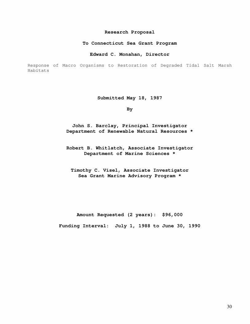
Research Proposal
To Connecticut Sea Grant Program
Edward C. Monahan, Director
Response of Macro Organisms to Restoration of Degraded Tidal Salt Marsh Habitats
Submitted May 18, 1987
By
John S. Barclay, Principal Investigator Department of Renewable Natural Resources *
Robert B. Whitlatch, Associate Investigator Department of Marine Sciences *
Timothy C. Visel, Associate Investigator Sea Grant Marine Advisory Program *
Amount Requested (2 years): $96,000
Funding Interval: July 1, 1988 to June 30, 1990
30
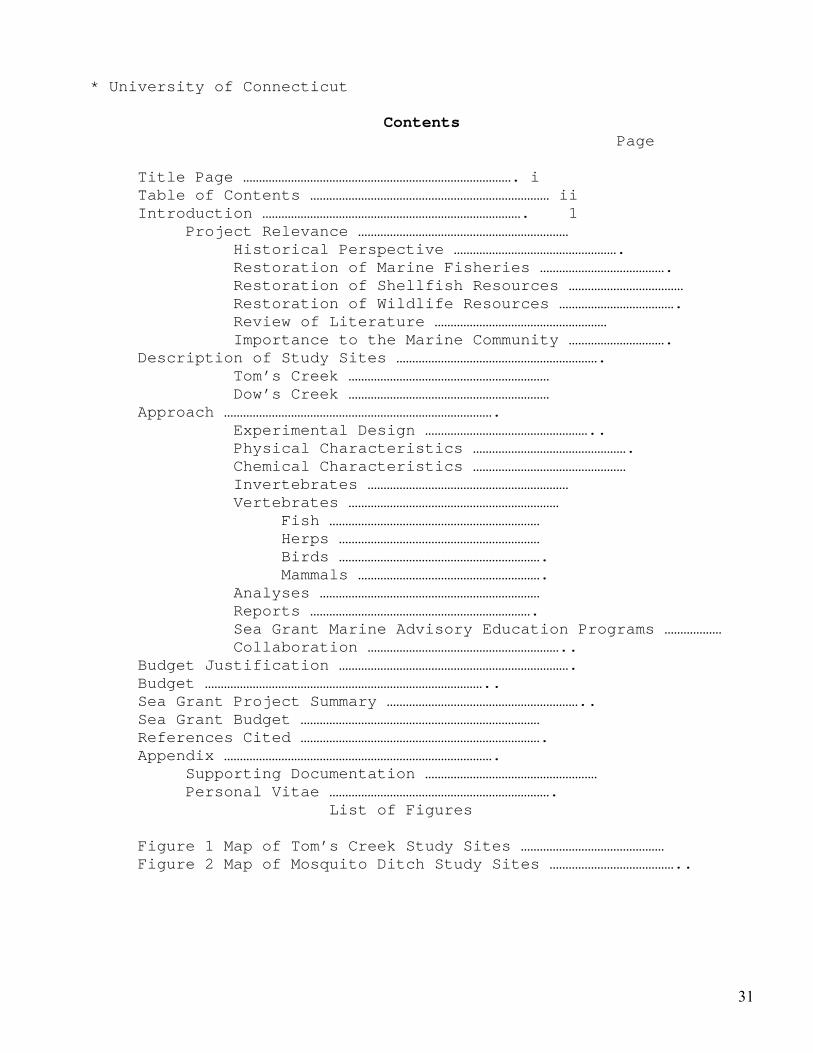
* University of Connecticut
Contents Page
Title Page …………………………………………………………………………. i Table of Contents ………………………………………………………………… ii Introduction ………………………………………………………………………. 1 Project Relevance ………………………………………………………… Historical Perspective ……………………………………………. Restoration of Marine Fisheries …………………………………. Restoration of Shellfish Resources ……………………………… Restoration of Wildlife Resources ………………………………. Review of Literature ……………………………………………… Importance to the Marine Community …………………………. Description of Study Sites ………………………………………………………. Tom’s Creek ……………………………………………………… Dow’s Creek ……………………………………………………… Approach …………………………………………………………………………. Experimental Design …………………………………………….. Physical Characteristics …………………………………………. Chemical Characteristics ………………………………………… Invertebrates ……………………………………………………… Vertebrates ………………………………………………………… Fish ………………………………………………………… Herps ……………………………………………………… Birds ………………………………………………………. Mammals …………………………………………………. Analyses …………………………………………………………… Reports ……………………………………………………………. Sea Grant Marine Advisory Education Programs ……………… Collaboration …………………………………………………….. Budget Justification ………………………………………………………………. Budget …………………………………………………………………………….. Sea Grant Project Summary …………………………………………………….. Sea Grant Budget ………………………………………………………………… References Cited …………………………………………………………………. Appendix …………………………………………………………………………. Supporting Documentation ……………………………………………… Personal Vitae …………………………………………………………….
List of Figures Figure 1 Map of Tom’s Creek Study Sites ……………………………………… Figure 2 Map of Mosquito Ditch Study Sites …………………………………..
31
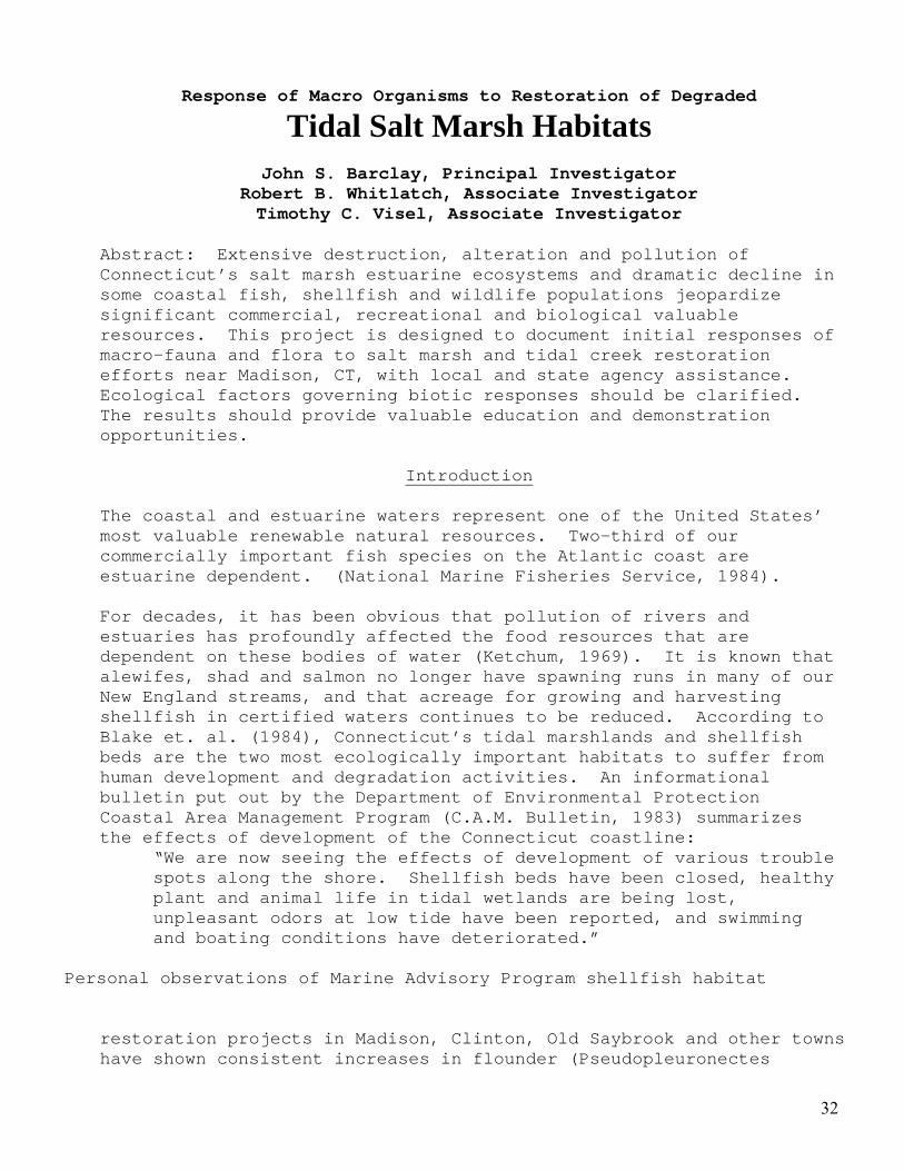
Response of Macro Organisms to Restoration of Degraded
Tidal Salt Marsh Habitats
John S. Barclay, Principal Investigator Robert B. Whitlatch, Associate Investigator Timothy C. Visel, Associate Investigator
Abstract: Extensive destruction, alteration and pollution of Connecticut’s salt marsh estuarine ecosystems and dramatic decline in some coastal fish, shellfish and wildlife populations jeopardize significant commercial, recreational and biological valuable resources. This project is designed to document initial responses of macro-fauna and flora to salt marsh and tidal creek restoration efforts near Madison, CT, with local and state agency assistance. Ecological factors governing biotic responses should be clarified. The results should provide valuable education and demonstration opportunities.
Introduction The coastal and estuarine waters represent one of the United States’ most valuable renewable natural resources. Two-third of our commercially important fish species on the Atlantic coast are estuarine dependent. (National Marine Fisheries Service, 1984). For decades, it has been obvious that pollution of rivers and estuaries has profoundly affected the food resources that are dependent on these bodies of water (Ketchum, 1969). It is known that alewifes, shad and salmon no longer have spawning runs in many of our New England streams, and that acreage for growing and harvesting shellfish in certified waters continues to be reduced. According to Blake et. al. (1984), Connecticut’s tidal marshlands and shellfish beds are the two most ecologically important habitats to suffer from human development and degradation activities. An informational bulletin put out by the Department of Environmental Protection Coastal Area Management Program (C.A.M. Bulletin, 1983) summarizes the effects of development of the Connecticut coastline:
“We are now seeing the effects of development of various trouble spots along the shore. Shellfish beds have been closed, healthy plant and animal life in tidal wetlands are being lost, unpleasant odors at low tide have been reported, and swimming and boating conditions have deteriorated.”
Personal observations of Marine Advisory Program shellfish habitat
restoration projects in Madison, Clinton, Old Saybrook and other towns have shown consistent increases in flounder (Pseudopleuronectes
32
americanus), blue crabs (Callinectes sapidus), and other wildlife (see appendix).These shellfish enhancement programs
were conducted with municipal shellfish commissions and volunteer shellfishermen. Of particular interest to Connecticut’s shellfisheries is research directed toward revitalizing historically productive setting areas and the “research should be redirected toward improving the knowledge of the ecology of species inhabiting Long Island Sound (Blake et. al., 1984). Unfortunately the ecology of tidal and subtidal habitats has been destroyed or degraded along many western sections of Connecticut’s coastline (Schubel, 1987). The authors are convinced that ample opportunities exist to enhance marine organism and wildlife diversity and productivity in restoration projects given suitable verification. Therefore, we propose to:
1) document the effects of physical alteration of tidal circulation and flow patterns of maintained mosquito ditches in a salt marsh on plants and animals;
2) document the response of macroorganisms to the restoration of an oyster bed in a degraded tidal channel;
3) determine ecological factors influencing responses of the biota to habitat restoration efforts; 4) demonstrate the feasibility of restoring degraded tidal salt marsh habitats. Project Relevance Historical Perspective
Connecticut’s creeks, rivers and coastal bays once supported substantial inshore fisheries (Goode, 1887). These unique environments were extremely productive, providing critical habitats for both reproduction and growth of estuarine dependent species. Connecticut’s early fisheries were mostly carried on for commerce. The Stonington and New London areas once sustained large fish reduction (menhaden) fisheries (Benoit, 1968). According to Goode (1887), New London was the principal food fish producing port south of Cape Cod. Goode details the 1880 catch of the New London fleet as comprising “1,230,000 pounds of cod, 490,000 pounds of halibut, 467,500 pounds of bluefish, 73,500 pounds of swordfish, 159,800 pounds of striped
33
bass, 4,223 barrels of mackeral and 170,000 pounds of lobsters. The shore fisheries yielded about 150,000 pounds of flounders, eels, tautog (blackfish), smelts and other species and 30,000 pounds of lobsters.”
Connecticut’s fisheries have suffered major declines. For instance, landings of blackback flounders declined from a 1930 high of 11 million pounds to as little as 0.5 million pounds annually in recent years. Landings of other estuarine species such as the softshell clam, (Mya arenaria) have also shown sharp declines. Commercial landings of softshell clams ceased in 1950 (Blake, et. al. 1984) in contrast to a previous estimated 300,000 bushels annually (Goode, 1887). These landings statistics can be used only as a rough indication of variations in abundance (Blake, et. al., 1984) but serve to illustrate the situation.
Connecticut’s early shell fishing history is also rich one. The state’s rivers, creeks and bays provided ideal habitats and low salinities that shellfish species such as the oyster (Ostrea sp.) prefer. Native Americans and later European settlers availed themselves of the vast populations of clams, oysters, mussels (Mytilus sp.) and scallops (Pecten opercula is) during winter times when terrestrial food supplies were scarce. Shellfish were gathered with rakes, tongs and hand dredges from shellfish beds along most of Connecticut’s 200 miles of coastline (Kochiss, 1974).
The commercial oyster industry peaked in Connecticut at 2 million bushels in 1910 but fell to only 40,000 bushels in 1967 (Matthiessen, 1974). Improvement in water quality in some areas has helped the industry recently (from about 1970) and many beds again produce oysters. Today, oyster culture has become the largest private aquacultural effort in the state (Volk, 1986).
Restoration of Marine fisheries
In many coastal towns, shoreline development has damaged or eliminated marine resources in salt ponds, bays and salt marshes. By 1964, shoreline alterations had destroyed or damaged more than 50% of the tidal marsh that existed in 1914 (Niering and Bowers, 1966). For example, in the town of Fairfield one salt marsh acreage has been reduced from over 600 acres in 1914 to about 17 acres in 1979 (Steinke, 1987). Embayment tidal flushing have been restricted by causeways and insufficient culverts. However two state programs currently underway have the potential for restoring the productivity of Connecticut’s near shore environments for fisheries.
34
In 1983, special act # 83-13 was passed by the Connecticut General Assembly authorizing a study of approximately 135 coves and embayments along the state’s 280 mile coastline. Under the auspices of the department of Environmental Protection Coastal Area Management Program, a Coastal Coves and embayment Advisory Board has been created to study coastal water bodies and make recommendations for possible restoration efforts.
In 1986, the Connecticut Department of Health Services - Vector Section implemented open Marsh Water Management techniques in coastal salt marshes. This approach replaces an earlier program initiated in 1900 which was established to control mosquito populations after an outbreak of malaria hit coastal regions of the state. Open Marsh Water Management (OMWM) reduces mosquito populations while creating ponds for fish and wildlife, rejuvenating coastal salt marshes to be a productive part of the marine food chain again (Capotosto, 1985).
Restoration of Shellfish Resources
In 1979, efforts were made by the Sea Grant Marine Advisory Program to initiate the development of management plans in coastal town which were addressing shellfish restoration (Visel, 1985). Nearly all of these programs were in areas closed by the State Department of Health Services to direct shellfish harvesting because of pollution. Careful cleaning and shelling of formerly productive seed oysters has resulted in dramatic increases of spatfalls (Visel, 1986). To date, over $1,000,000 worth of seed oysters has been produced from these restoration efforts and the value is increasing rapidly (Sea Grant Informational Bulletin, 1987).
Town shellfish beds still produce significant quantities of mussels, soft shell clams, hard shell clams (Crassostrea virginica), oysters and scallops although production today is just a fraction of past harvests. Many thousands of acres within municipal jurisdiction remain closed to recreational harvests due to sewage outfalls or bacterial contaminations (Shute, 1982). Renewed interest in improving water quality and reducing pollution hopefully may lead to reopening these closed areas. Several town shellfish commissions have taken an active role in rebuilding formerly productive shellfish beds in closed areas with Marine Advisory Program recultivation or habitat enhancement programs. On the state natural beds, the Connecticut Department of Agriculture, Aquaculture Division, has commenced a seed oyster restoration program for historical productive offshore areas.
Restoration of Wildlife Resources
“Restoration” implies that the resources to be restored area at a suboptimal level due to conditions adverse to their presence.
35
Ecologists (MacNamara, 1952; Gossellink, 1980; Teal, 1986) agree that many forms of “wildlife”, i.e., free-ranging warm-blooded vertebrates (birds and mammals) benefit from or depend upon the productivity of tidal mashes and estuaries. However, quantification of these roles, particularly in marshes damaged by ditching and pollution, does not appear to have been as well documented. Many of the earlier efforts emphasized waterfowl and other game or furbearing species (MacNamara, 1962; Shaw and Fredine, 1956) and confirmed coastal salt marsh values to waterfowl, rails, mink (Mustela Vison), muskrat (Ondatra zibethticus) and raccoon (Procyon lotor). An exception is the detailed report by Bourn and Cottam (1950) on the biological effects of ditching tidewater marshes.
Given the substantial loss and alteration of coastal wetland habitats in Connecticut and elsewhere (Gosselink, 1980; Frayer et.al., 1983), once can assume that the associated losses to indigenous, migratory and wintering wildlife have at least been equal or greater. Lowered water tables, reduced salinities and changes in flora and fauna are cited by Bourn and Cottam (1950:12) as major factors contributing to the destruction of vital coastal wildlife habitat.
Recent observations by Visel (pers. commu.) of enhanced wildlife use of restored tidal creeks and mosquito drainage ditches appears to be related to the effects of renewed tidal ebb and flow, removal of organic deposits, and establishment of a firm calcareous (oyster shell) substrate in creeks and ditches. Unlike the 1950 study by Bourn and Cottam, which monitored extensive areas of marsh surface, this project will include analyses of ditch and channel characteristics as well. We expect to gain important documentation as to the stability, ecological processes and consequence of substrate restoration for the overall marsh/estuary complex. These results are essential and needed soon if enlightened management decisions are to be made in response to public pressure (see Reed, 1975, and others) for fish, shellfish and wildlife production in the remaining altered tidal marsh habitats.
Review of Literature
The areas of study we propose have been researched by others in response to a special problem (mitigation for example) or were mainly concerned with a single species (Bousfield, 1969). Studies have been conducted on the oyster community by Korringa (1951) and also Hedgpeth (1953) both of whom give a comprehensive description of oyster associations. In a 1957 paper Hedgpeth asserts that oyster reefs (beds) are the most significant aggregations in estuaries since they are a major factor governing patterns of sedimentation and, at the same time, provide habitats for a variety of smaller organisms.
36
In a study of the oyster community in Delaware Maurer et. al. (1973) provided strong evidence to support the premise that any increase in abundance is associated with a gradual increase in clean, hard shell substrate. Mackenzie (1983) reported that seed oyster beds occupy from 1 to 10 percent of the bottom area of estuaries and that these beds harbor much more algae and many more invertebrates and fish than the remaining bottom. Thus MacKenzie concludes “rehabilitation of seed oyster beds produces an increase in the abundance of oysters and associated species.” In the late 1790’s malaria was common during warm weather in Southern New England (Simpson, 1983). Mosquito control in Connecticut salt marshes was started in 1900 when an outbreak of malaria hit the coastal sections of the State (Capotosto, 1986). During the depression a W.P.A. program “grid ditched” nearly all of Connecticut’s salt marshes in an attempt to control Aedes sollicitans, a salt marsh mosquito, along the coastal regions of the State. Since payment was based “by the foot,” marshes were ditched at close regular intervals. In many cases marshes were over ditched, lowering the marsh water table and disrupting normal marsh ecology. Dr. Paul Galtsoff, at a 1958 meeting at the Connecticut Board of Fisheries & Game Office in Hartford (now within the Department of Environmental Protection) is quoted in response to the following:
“Questions: Do you think that tidal marsh that has been ditched for mosquito control is badly damaged or does it provide a good deal of nutrients?
Dr. Galtsoff: We saw many places where the marsh was very badly damaged because the level of ground water was so lowered that it affected farm land nearby. In other places, where it was more carefully ditched, there was no such lowering of the water level…. It will be very desirable to organize a study of the swamp (marsh) nursing grounds for winter flounders.”
Techniques for open marsh water management (OMWM) procedures developed by Ferrigno (1968 at the New Jersey Agriculture Experiment Station are now being applied on New England salt marshes (Hruby, 1985). The major objective of open OMWM is to eliminate mosquito breeding while improving salt marshes for fish and wildlife (Ferrigno and Jobbins, 1975). OMWM utilizes pond creation, pond radials and radial ditches instead of the previous grid pools and to increase marine diversity (Meredith et. al., 1985), OMWM procedures were accepted and instituted in Connecticut‘s Deparment of Health Services Mosquito and Vector Division in 1986. Unfortunately, large sections of salt marsh habitats have been filled for development purposes. Connecticut’s coastal ponds and coves have been altered, diked or so seriously degraded that marine diversity
37
and abundance of organisms have suffered. Therefore the grid ditches have in effect supplemented this lost intertidal habitat and may provide considerable opportunities for maintaining marine and coastal wildlife diversity. Importance to the Marine Community Previous Marine Advisory program shellfish restoration in five coastal towns has produced thousands of bushels of seed oysters (Fish & Wildlife Transactions, 1986) for relay programs (Visel, 1986). All restoration projects have also been associated with dramatic increases of marine life such as flounder and blue crabs. The authors believe that shellfish (oysters) restoration projects will not only increase recreational and commercial shellfisheries but also enhance other fisheries and wildlife as well. By restoration oyster habitat and monitoring species changes or trends, documentation of habitat restoration efforts can be accomplished. Ultimately, where feasible, appropriate and not in conflict with legitimate uses of linear ditching, restoration of the original meandering marsh creeks may prove most productive and ecologically appropriate. This study constitutes a necessary first step in documenting the factors involved in marsh estuary restoration, the potential results, and optimum ecological conditions. This study has the potential to improve recreational and commercial marine fisheries by documenting the successful reintroduction of them to restored habitats. Publications and fact sheets obtained from research findings can be used by marine resource and wildlife managers to illustrate the benefits of such projects. Field tours and slide lecture presentations will provide public officials the opportunity to learn about the effectiveness of marine habitat restoration of degraded tidal areas and salt marsh, and confirm the consequences of neglect and abuse. In a 1979 report to the Legislature’s Committee on Coastal Management, a general fisheries policy was delineated as a coastal management goal and policy. Section L (Fisheries) is quoted below.
General Policy: To manage the State’s fisheries in order to promote the long term benefits of commercial and recreational fishing.
Specific Policy: To manage the State’s fisheries in order to promote the economic benefits of commercial and recreational fishing, enhance recreational fishing opportunities, optimize
38
the yield of all species, prevent the depletion of indigenous species, maintain and enhance the productivity of natural estuarine resources and preserve healthy fisheries resources for future generations.
Implementation of habitat restoration program and documenting positive responses to living marine resources could have a profound impact upon marine fisheries management. Distribution of published journal articles, abstracts and M.A.P. educational fact sheets would educate public officials and recreational and commercial fishing groups to potential opportunities to rebuild Connecticut’s once prosperous inshore fisheries. The economic significance and importance of these inshore fisheries to Connecticut is documented in many of the references cited in this proposal.
39
40
Section 4
Letters of Support from State and Municipal Agencies /Partners
• The Sounds Conservancy Inc. May 18, 1987, Christopher Percy President
• The Town of Madison Connecticut Shellfish Commission, April 28, 1987, Jack Wiesbrook Chairman
• State of Connecticut, Department of Health Services Malcolm Shute, Principal Environmental Sanitarian
• State of Connecticut, Department of Agriculture, John H. Volk
• State of Connecticut, Department of Environmental Protection, Bureau of Fisheries Eric M. Smith
41
42
43
44
45
46
Section 5 Press Articles Tour of Site Background Details
- June 17, 1987
Walking Tour and Presentation to the Madison Shellfish Commission and Madison Land Conservation Trust
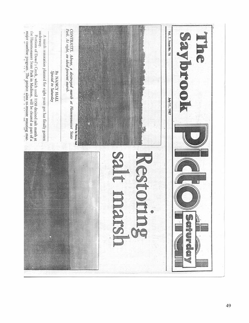
- July 11, 1987 “Restoring Salt Marsh” The Saybrook Pictorial
- July 10, 1987 “Clean-up of creek aimed at restoring ‘Madisonian’ oysters – the Hartford Courant
- Site map, Hammonassett Beach State Park
47

48
49
50
51
52
53
54
55
Section 6 Dowd’s Creek Study Plots Hammonassett Beach State Park, Madison, CT June 1987- Dr John Barclay Associate Professor and Wildlife Specialist University of Connecticut Results of Analysis of Subtrate Soil at the Station # 1, Dowd’s Creek, Madison, CT July 9, 1987
Dowd’s Creek Data Falling Tide July 08, 1987 Dr John Barclay Associate Professor and Wildlife Specialist University of Connecticut July 10, 1987
56
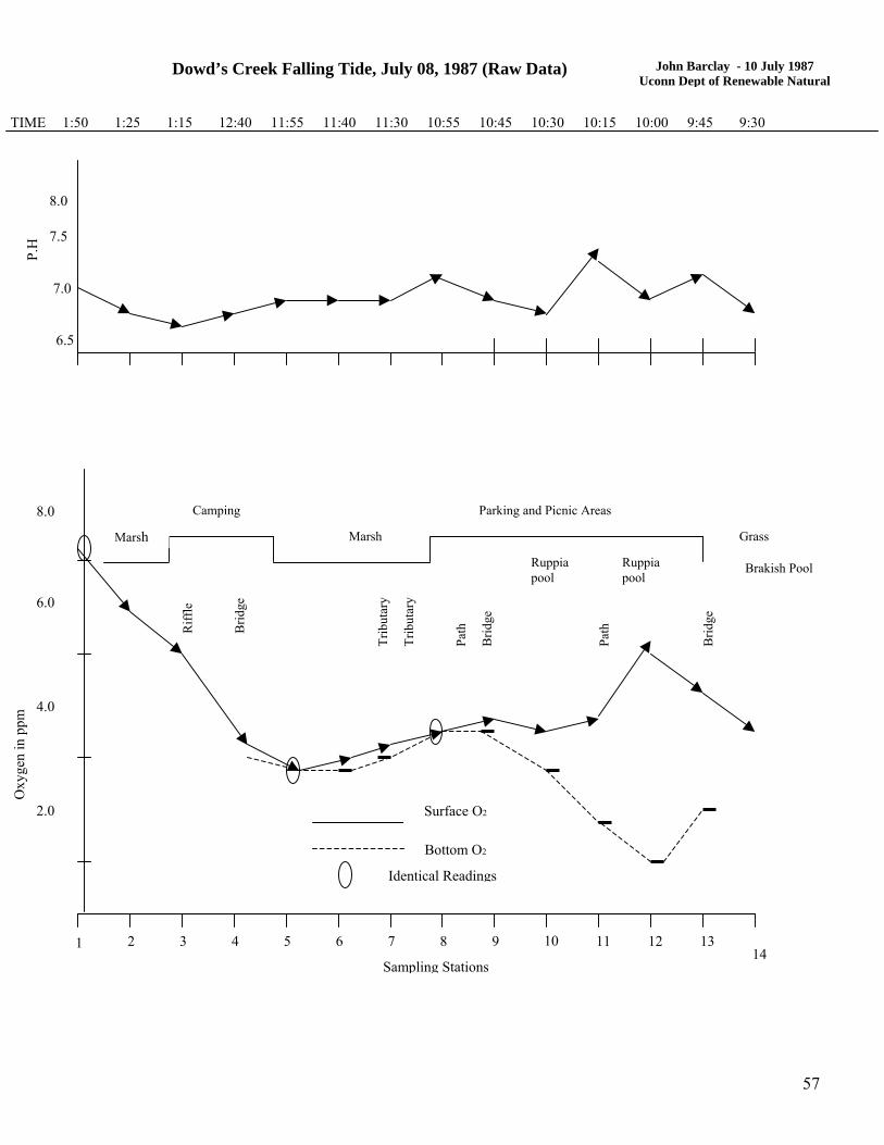
Dowd’s Creek Falling Tide, July 08, 1987 (Raw Data) John Barclay - 10 July 1987
Uconn Dept of Renewable Natural
7.0
6.5
7.5
8.0
P.H
TIME 1:50 1:25 1:15 12:40 11:55 11:40 11:30 10:55 10:45 10:30 10:15 10:00 9:45 9:30
Camping 8.0 Parking and Picnic Areas
Grass
Brakish Pool
14
Oxy
gen
in p
pm
131
2.0
2 3 4 5 6 7 8 9
4.0
6.0
10 11 12
Marsh Marsh
Ruppia pool
Path
Ruppia pool
Sampling Stations
Surface O2
Bottom O2
Identical Readings
Riff
le
Brid
ge
Trib
utar
y
Trib
utar
y
Path
Brid
ge
Brid
ge
57
58
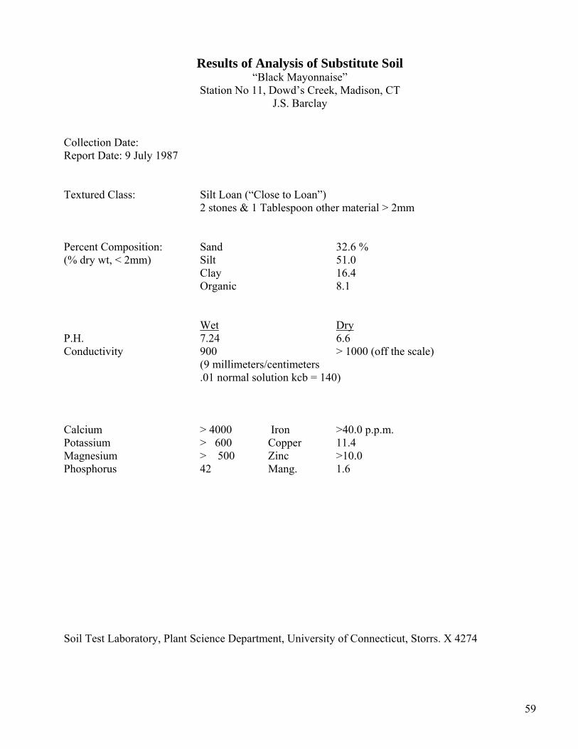
Results of Analysis of Substitute Soil “Black Mayonnaise”
Station No 11, Dowd’s Creek, Madison, CT J.S. Barclay
Collection Date: Report Date: 9 July 1987 Textured Class: Silt Loan (“Close to Loan”) 2 stones & 1 Tablespoon other material > 2mm Percent Composition: Sand 32.6 % (% dry wt, < 2mm) Silt 51.0 Clay 16.4 Organic 8.1 Wet Dry P.H. 7.24 6.6 Conductivity 900 > 1000 (off the scale) (9 millimeters/centimeters .01 normal solution kcb = 140) Calcium > 4000 Iron >40.0 p.p.m. Potassium > 600 Copper 11.4 Magnesium > 500 Zinc >10.0 Phosphorus 42 Mang. 1.6
Soil Test Laboratory, Plant Science Department, University of Connecticut, Storrs. X 4274
59
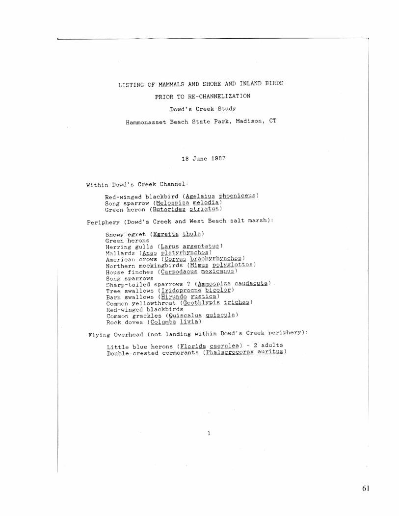
Section 7
Listing of Mammals and Shore and Inland Birds Prior to Re-channeling Dowd’s Creek Study June 18, 1987 Dr John Barclay Associate Professor and Wildlife Specialist University of Connecticut
• June 23, 1987 • July 08, 1987
60
61
62
63
Section 8 Madison Land Trust/ Madison Shellfish Commission Study Establishing a Habitat Index for Shellfish and Finfish Species Work Plan and Monitoring Outline Tim Visel
64
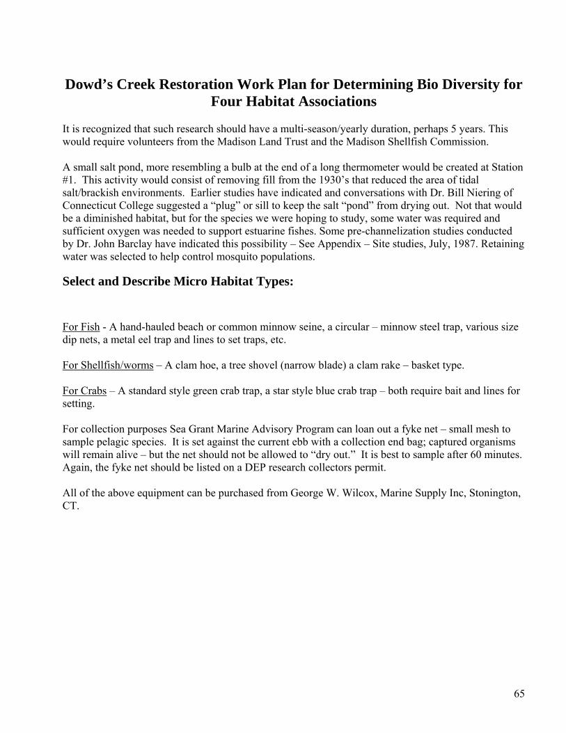
Dowd’s Creek Restoration Work Plan for Determining Bio Diversity for
Four Habitat Associations It is recognized that such research should have a multi-season/yearly duration, perhaps 5 years. This would require volunteers from the Madison Land Trust and the Madison Shellfish Commission. A small salt pond, more resembling a bulb at the end of a long thermometer would be created at Station #1. This activity would consist of removing fill from the 1930’s that reduced the area of tidal salt/brackish environments. Earlier studies have indicated and conversations with Dr. Bill Niering of Connecticut College suggested a “plug” or sill to keep the salt “pond” from drying out. Not that would be a diminished habitat, but for the species we were hoping to study, some water was required and sufficient oxygen was needed to support estuarine fishes. Some pre-channelization studies conducted by Dr. John Barclay have indicated this possibility – See Appendix – Site studies, July, 1987. Retaining water was selected to help control mosquito populations. Select and Describe Micro Habitat Types:
For Fish - A hand-hauled beach or common minnow seine, a circular – minnow steel trap, various size dip nets, a metal eel trap and lines to set traps, etc. For Shellfish/worms – A clam hoe, a tree shovel (narrow blade) a clam rake – basket type. For Crabs – A standard style green crab trap, a star style blue crab trap – both require bait and lines for setting. For collection purposes Sea Grant Marine Advisory Program can loan out a fyke net – small mesh to sample pelagic species. It is set against the current ebb with a collection end bag; captured organisms will remain alive – but the net should not be allowed to “dry out.” It is best to sample after 60 minutes. Again, the fyke net should be listed on a DEP research collectors permit. All of the above equipment can be purchased from George W. Wilcox, Marine Supply Inc, Stonington, CT.
65
Section 9 Questions/Responses for the Micro Habitat types – Walking Tour and Meeting June 17, 1987 Hammonassett State Park Office.
66
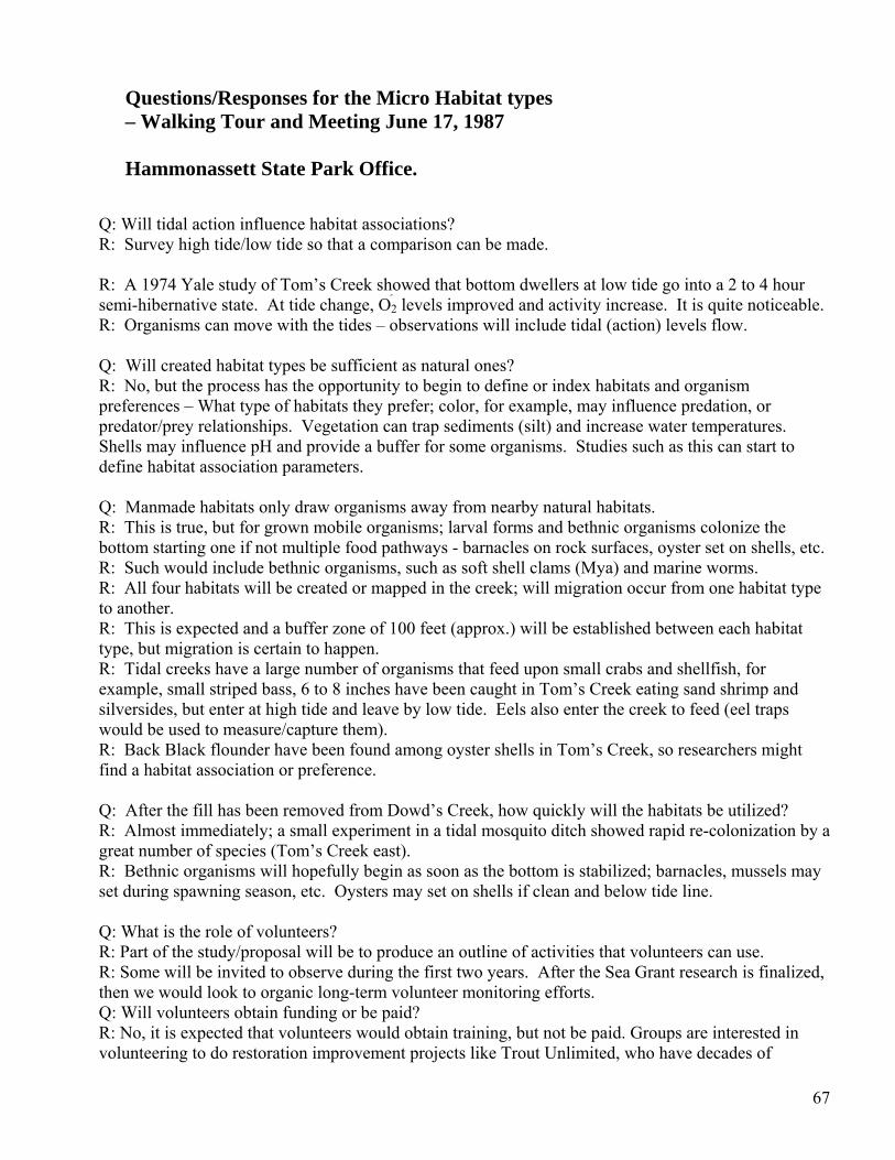
Questions/Responses for the Micro Habitat types – Walking Tour and Meeting June 17, 1987 Hammonassett State Park Office.
Q: Will tidal action influence habitat associations? R: Survey high tide/low tide so that a comparison can be made. R: A 1974 Yale study of Tom’s Creek showed that bottom dwellers at low tide go into a 2 to 4 hour semi-hibernative state. At tide change, O2 levels improved and activity increase. It is quite noticeable. R: Organisms can move with the tides – observations will include tidal (action) levels flow. Q: Will created habitat types be sufficient as natural ones? R: No, but the process has the opportunity to begin to define or index habitats and organism preferences – What type of habitats they prefer; color, for example, may influence predation, or predator/prey relationships. Vegetation can trap sediments (silt) and increase water temperatures. Shells may influence pH and provide a buffer for some organisms. Studies such as this can start to define habitat association parameters. Q: Manmade habitats only draw organisms away from nearby natural habitats. R: This is true, but for grown mobile organisms; larval forms and bethnic organisms colonize the bottom starting one if not multiple food pathways - barnacles on rock surfaces, oyster set on shells, etc. R: Such would include bethnic organisms, such as soft shell clams (Mya) and marine worms. R: All four habitats will be created or mapped in the creek; will migration occur from one habitat type to another. R: This is expected and a buffer zone of 100 feet (approx.) will be established between each habitat type, but migration is certain to happen. R: Tidal creeks have a large number of organisms that feed upon small crabs and shellfish, for example, small striped bass, 6 to 8 inches have been caught in Tom’s Creek eating sand shrimp and silversides, but enter at high tide and leave by low tide. Eels also enter the creek to feed (eel traps would be used to measure/capture them). R: Back Black flounder have been found among oyster shells in Tom’s Creek, so researchers might find a habitat association or preference. Q: After the fill has been removed from Dowd’s Creek, how quickly will the habitats be utilized? R: Almost immediately; a small experiment in a tidal mosquito ditch showed rapid re-colonization by a great number of species (Tom’s Creek east). R: Bethnic organisms will hopefully begin as soon as the bottom is stabilized; barnacles, mussels may set during spawning season, etc. Oysters may set on shells if clean and below tide line. Q: What is the role of volunteers? R: Part of the study/proposal will be to produce an outline of activities that volunteers can use. R: Some will be invited to observe during the first two years. After the Sea Grant research is finalized, then we would look to organic long-term volunteer monitoring efforts. Q: Will volunteers obtain funding or be paid? R: No, it is expected that volunteers would obtain training, but not be paid. Groups are interested in volunteering to do restoration improvement projects like Trout Unlimited, who have decades of
67
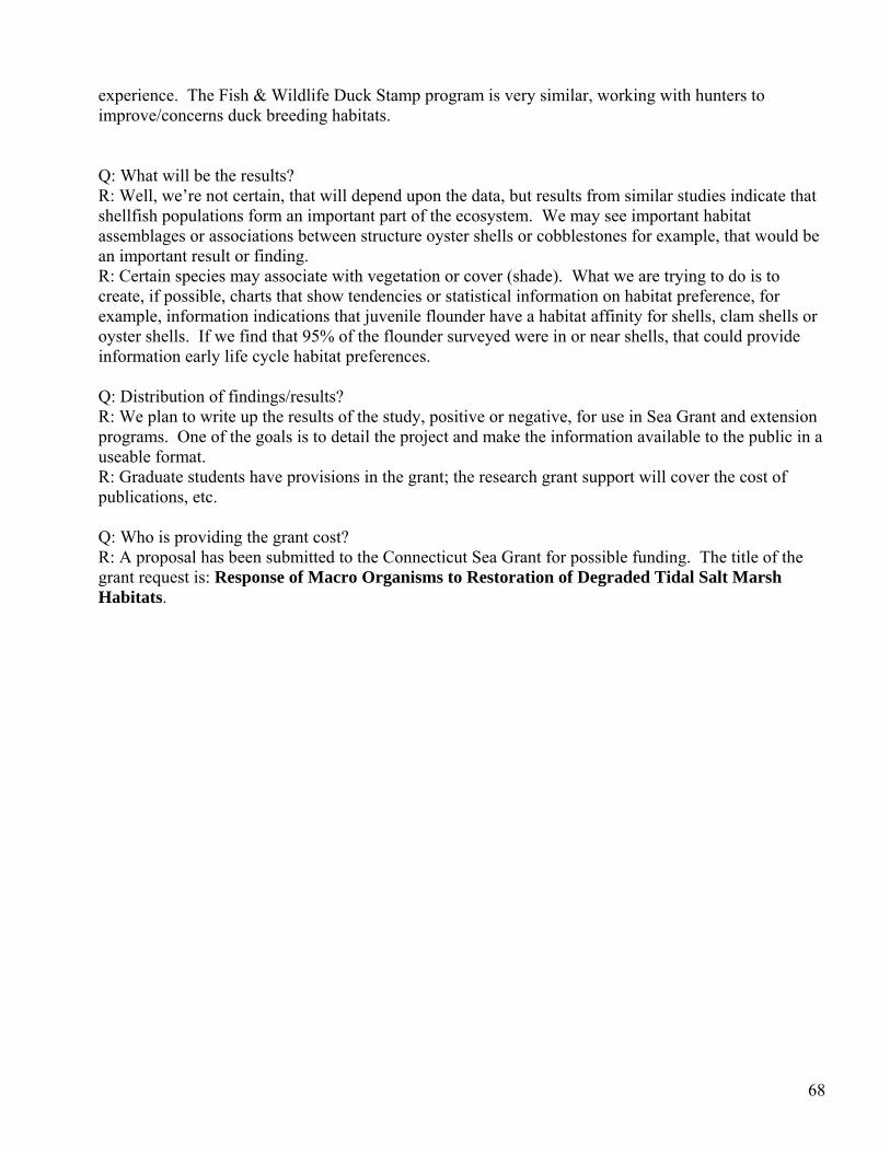
experience. The Fish & Wildlife Duck Stamp program is very similar, working with hunters to improve/concerns duck breeding habitats. Q: What will be the results? R: Well, we’re not certain, that will depend upon the data, but results from similar studies indicate that shellfish populations form an important part of the ecosystem. We may see important habitat assemblages or associations between structure oyster shells or cobblestones for example, that would be an important result or finding. R: Certain species may associate with vegetation or cover (shade). What we are trying to do is to create, if possible, charts that show tendencies or statistical information on habitat preference, for example, information indications that juvenile flounder have a habitat affinity for shells, clam shells or oyster shells. If we find that 95% of the flounder surveyed were in or near shells, that could provide information early life cycle habitat preferences. Q: Distribution of findings/results? R: We plan to write up the results of the study, positive or negative, for use in Sea Grant and extension programs. One of the goals is to detail the project and make the information available to the public in a useable format. R: Graduate students have provisions in the grant; the research grant support will cover the cost of publications, etc. Q: Who is providing the grant cost? R: A proposal has been submitted to the Connecticut Sea Grant for possible funding. The title of the grant request is: Response of Macro Organisms to Restoration of Degraded Tidal Salt Marsh Habitats.
68
Section 10
Permits and Regulatory Procedures Paul M. Capotosto
• May 13, 1987 – Correspondence Paul M. Capotosto Chief State of CT, Dept of Health Services
• Hammonasset Park – Madison Site # 1
• May 13, 1987 – Correspondence Richard K. Clifford
Director Office of State Parks and Recreation
• Written Submissions for DEP Water Quality Certificate – Work Site Descriptions #228
69
70
71
72
73
74
75
Section 11
Overflight Photos Dowd’s Creek Daniel Civco University of Connecticut Lab For Remote Sensing 1934 – Saltmarsh Watershed Dawd’s Creek 1951 - Filled Creek Channel to Tom’s Creek 1985 - New Parking Lot Filled Creek + Salt Marsh
76
77
78
79

80