system to evaluate prime farmland reclamation success based on spatial soil properties
DESCRIPTION
System to Evaluate Prime Farmland Reclamation Success Based on Spatial Soil Properties. Applied Science Project United States Department of the Interior Office of Surface Mining Reclamation and Enforcement Cooperating and Supporting Agencies: Black Beauty Coal Company Inc. Peabody Energy Inc. - PowerPoint PPT PresentationTRANSCRIPT

System to Evaluate Prime Farmland Reclamation Success Based on
Spatial Soil PropertiesApplied Science Project
United States Department of the Interior
Office of Surface Mining Reclamation and Enforcement
Cooperating and Supporting Agencies:Black Beauty Coal Company Inc.
Peabody Energy Inc.Solar Sources Inc.
Illinois Clean Coal InstituteNatural Resources Conservation ServiceIllinois Department of Natural ResourcesIndiana Department of Natural Resources
Illinois Clean Coal InstituteIllinois Coal Association
Indiana Coal Council

SMCRA
• Requires operator to restore mined land to pre-mine land use and level of productivity
• Created standards for soil replacement
• Authorized states "primacy" to regulate - state program no less stringent than federal rules
• Requires coal operator to show proof of productivity
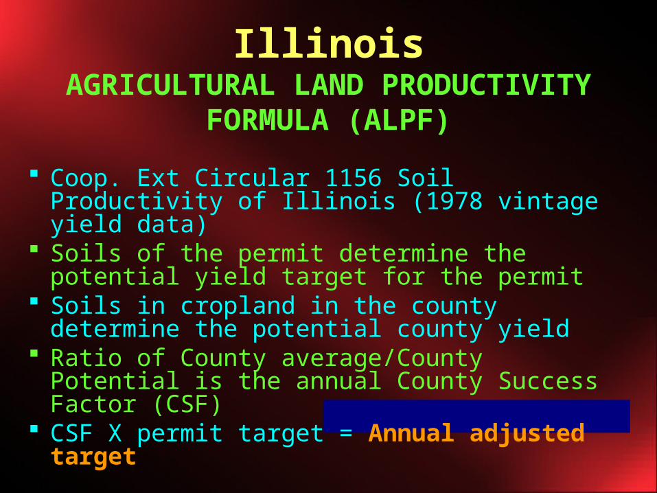
IllinoisAGRICULTURAL LAND
PRODUCTIVITY FORMULA (ALPF)
Coop. Ext Circular 1156 Soil Productivity of Illinois (1978 vintage yield data)
Soils of the permit determine the potential yield target for the permit
Soils in cropland in the county determine the potential county yield
Ratio of County average/County Potential is the annual County Success Factor (CSF)
CSF X permit target = Annual adjusted target
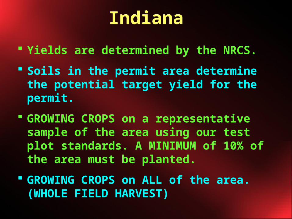
Indiana
Yields are determined by the NRCS.
Soils in the permit area determine the potential target yield for the permit.
GROWING CROPS on a representative sample of the area using our test plot standards. A MINIMUM of 10% of the area must be planted.
GROWING CROPS on ALL of the area. (WHOLE FIELD HARVEST)
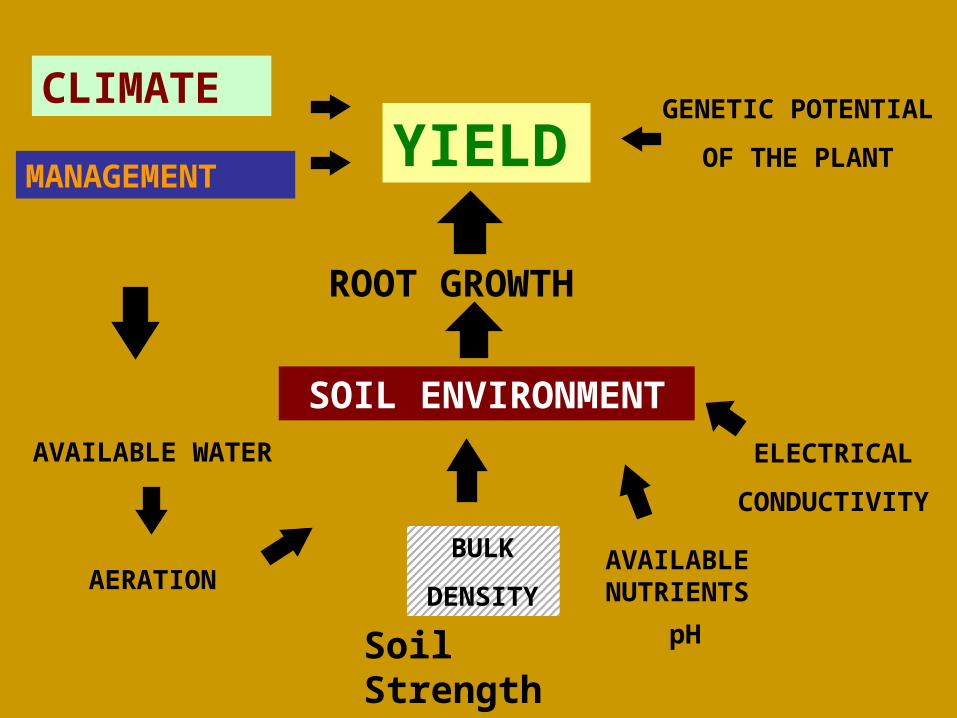
YIELD
ROOT GROWTH
SOIL ENVIRONMENT
CLIMATE
MANAGEMENT
AVAILABLE WATER
AERATIONBULK
DENSITY
ELECTRICAL
CONDUCTIVITY
GENETIC POTENTIAL
OF THE PLANT
pHSoil Strength
AVAILABLENUTRIENTS

1977-1993
Funded by OSM, USDA and the Coal Industry
2000-2005
Funded by Indiana Coal Council
Prime Farmland Reclamation Research Program
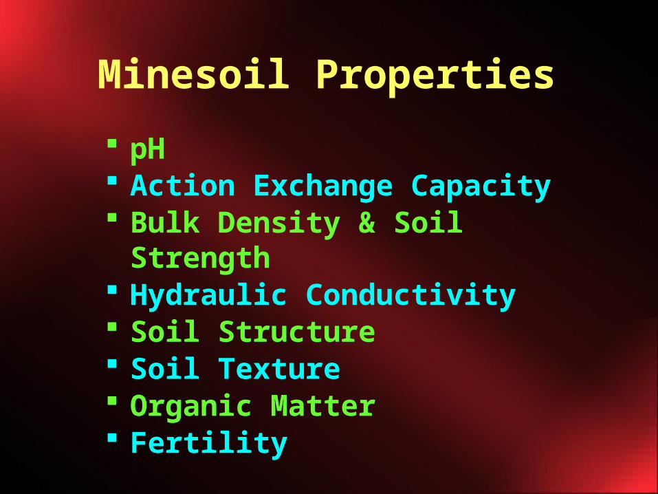
pH Action Exchange Capacity Bulk Density & Soil Strength Hydraulic Conductivity Soil Structure Soil Texture Organic Matter Fertility
Minesoil Properties
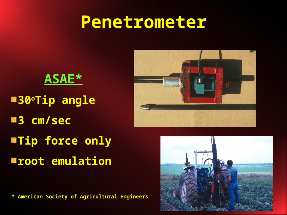
Penetrometer
* * American Society of Agricultural Engineers
ASAE*
30oTip angle
3 cm/sec
Tip force only
root emulation
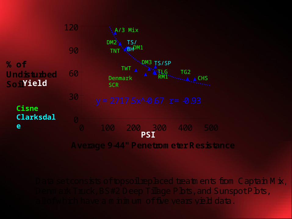
y = 2717.5x^-0.67 r = -0.93
0
30
60
90
120
0 100 200 300 400 500
% ofUndisturbedSoil
Average 9-44" Penetrometer Resistance
Data set consists of topsoil replaced treatments from Captain Mix,Denmark Truck, BS#2 Deep Tillage Plots, and Sunspot Plots, all of which have a minimum of five years yield data.
A/3 Mix
TNT
DM2 TS/BHDM1
Yield
Cisne Clarksdale
PSI
TS/SPDM3TWT
TLGRM1Denmark
SCR
TG2CHS
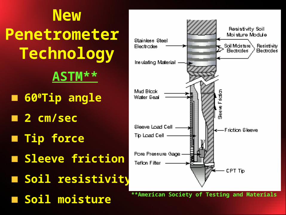
NewPenetrometer
Technology
**American Society of Testing and Materials
ASTM**
600Tip angle
2 cm/sec
Tip force
Sleeve friction
Soil resistivity
Soil moisture
Project Objectives• The objective of this work is to develop
a soil based approach which could be used in lieu of the current yield based approach for bond release.
• The soil based approach will use measurable soil spatial characteristics to determine if a given reclaimed field meets the requirements of restoration of field productivity as outlined in existing federal and state regulations.
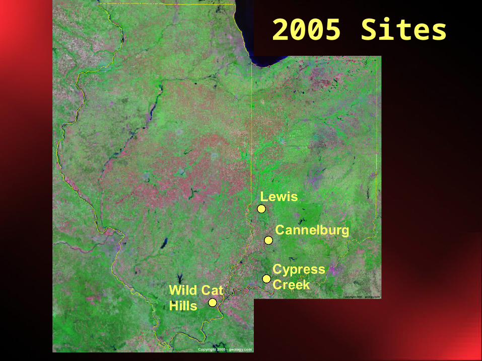
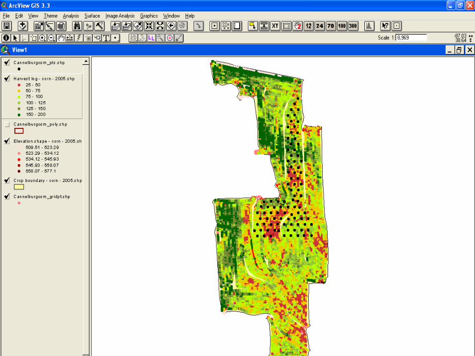
2005 Sites
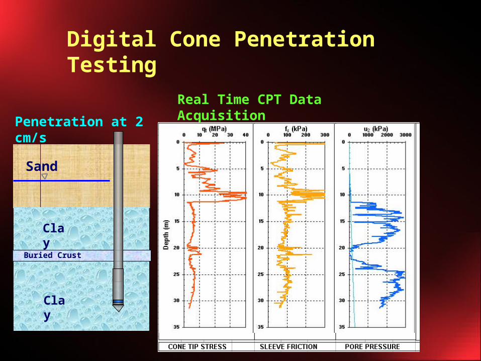
Digital Cone Penetration Testing
Real Time CPT Data Acquisition
Penetration at 2 cm/s
Sand
Clay
Buried Crust
Clay

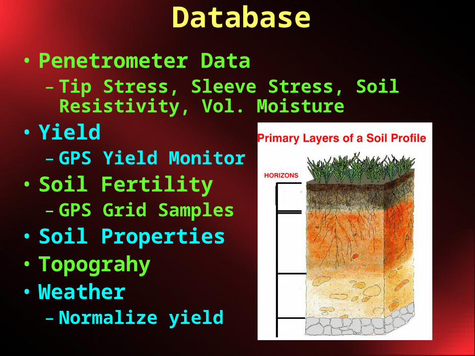
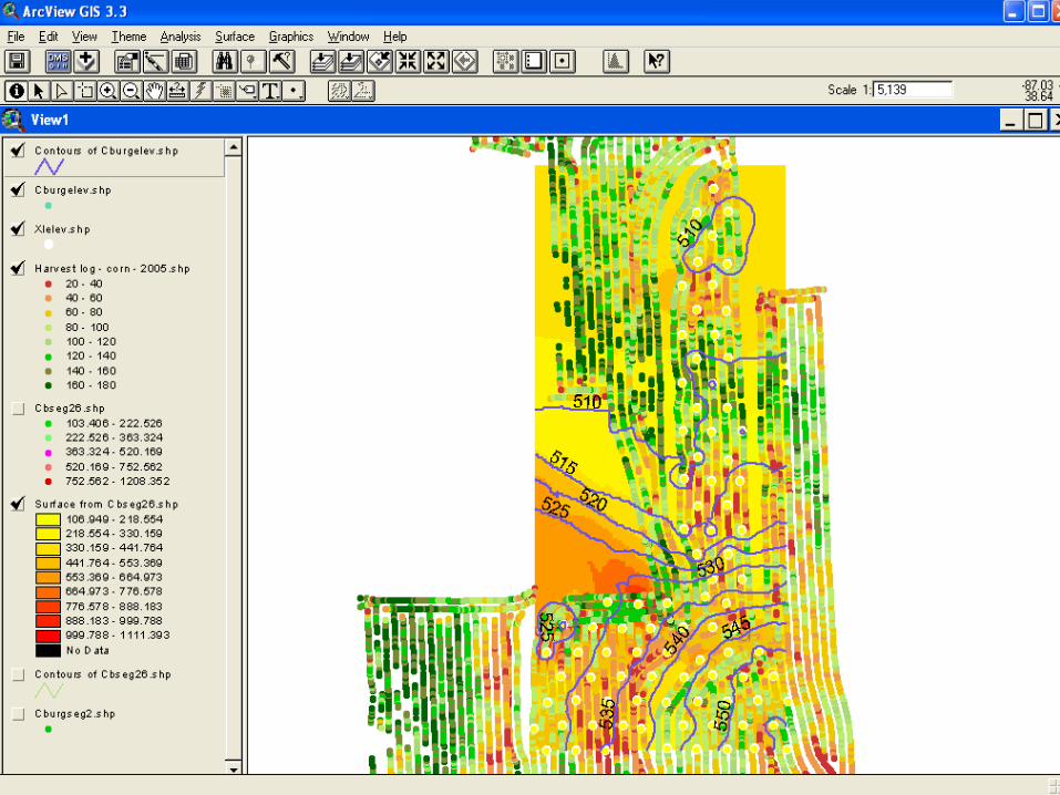
Database• Penetrometer Data
– Tip Stress, Sleeve Stress, Soil Resistivity, Vol. Moisture
• Yield– GPS Yield Monitor
• Soil Fertility– GPS Grid Samples
• Soil Properties • Topograhy• Weather
– Normalize yield
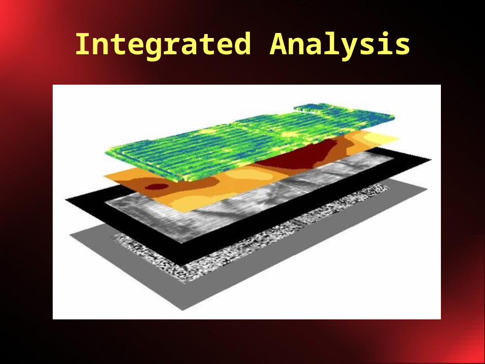
Integrated Analysis
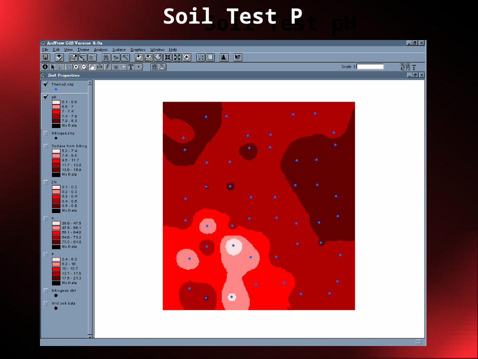
Soil Test pHSoil Test P
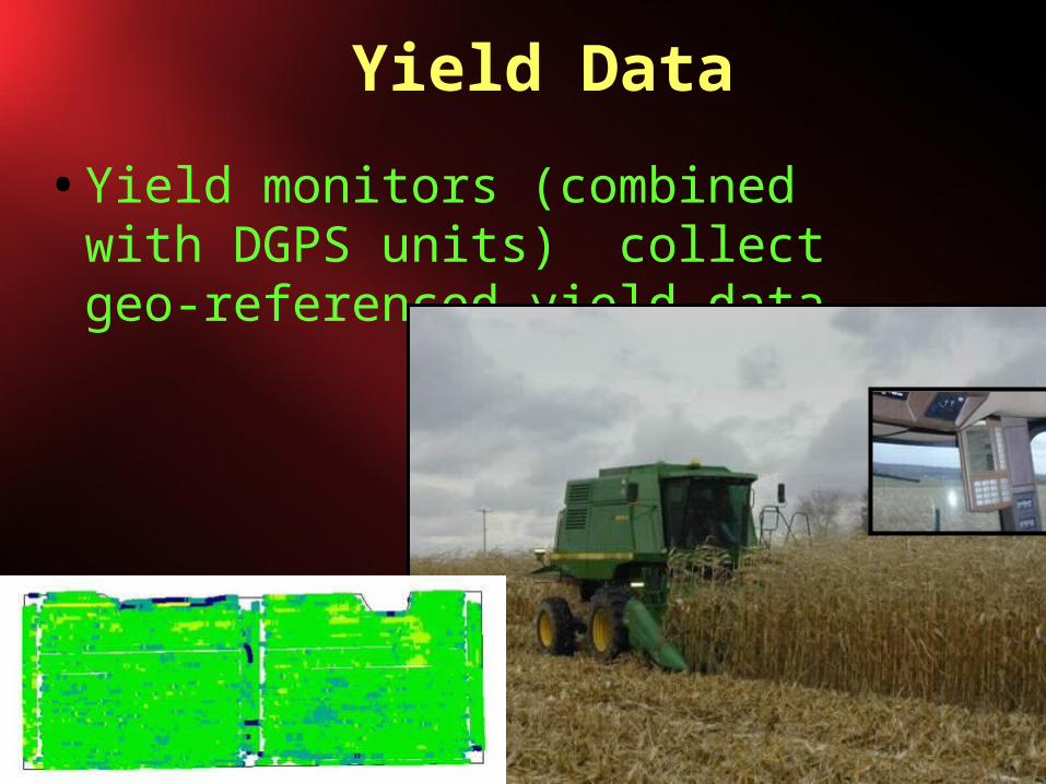
Yield Data
• Yield monitors (combined with DGPS units) collect geo-referenced yield data.
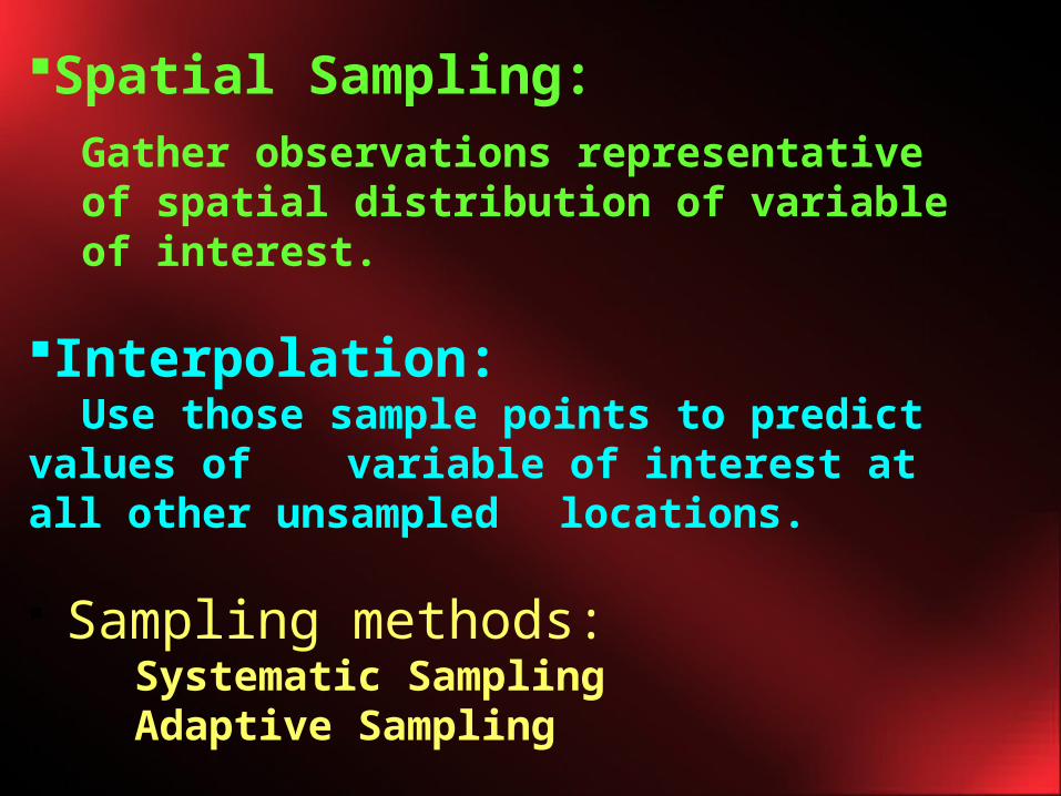
Spatial Sampling:Gather observations representative of spatial distribution of variable of interest.
Interpolation:Use those sample points to predict values of variable of interest at all other unsampled locations.
Sampling methods:Systematic SamplingAdaptive Sampling
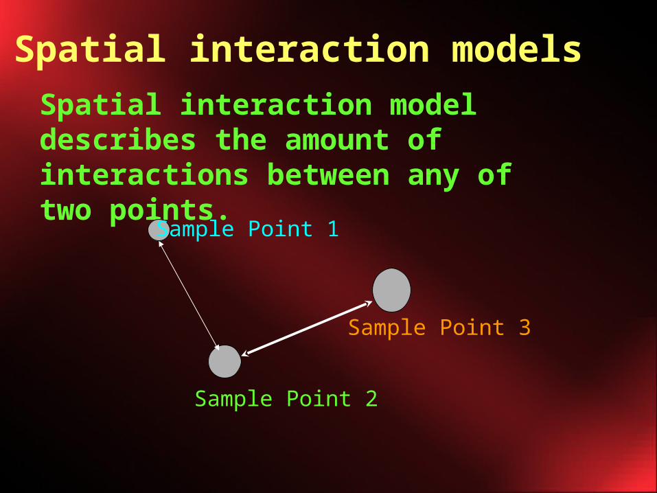
Spatial interaction model describes the amount of interactions between any of two points.
Sample Point 1
Sample Point 2
Sample Point 3
Spatial interaction models
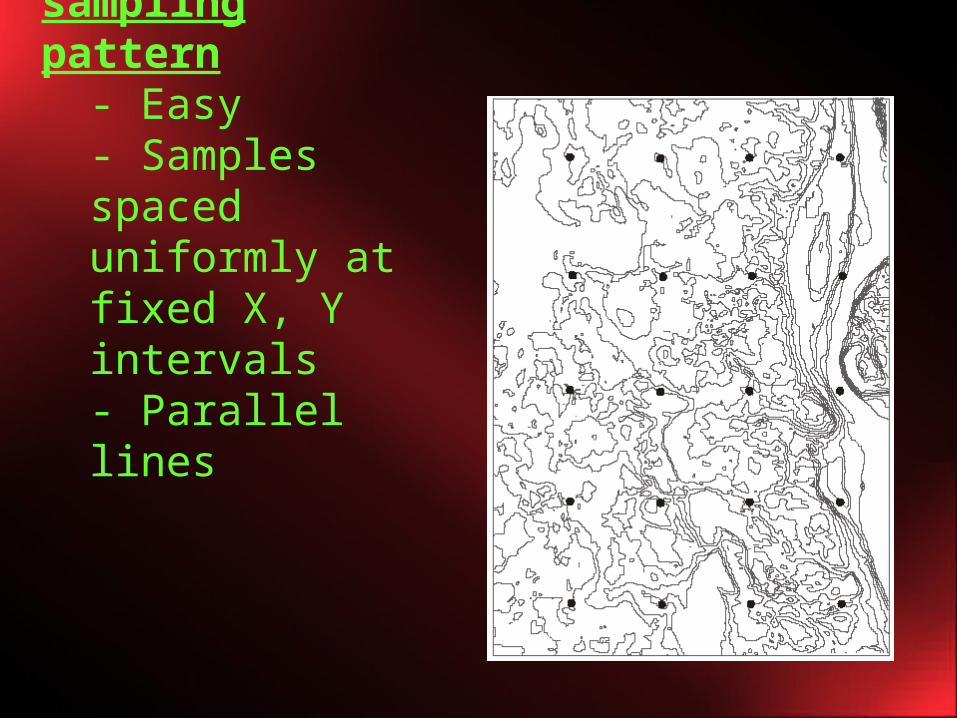
Systematic sampling pattern
- Easy- Samples spaced uniformly at fixed X, Y intervals- Parallel lines
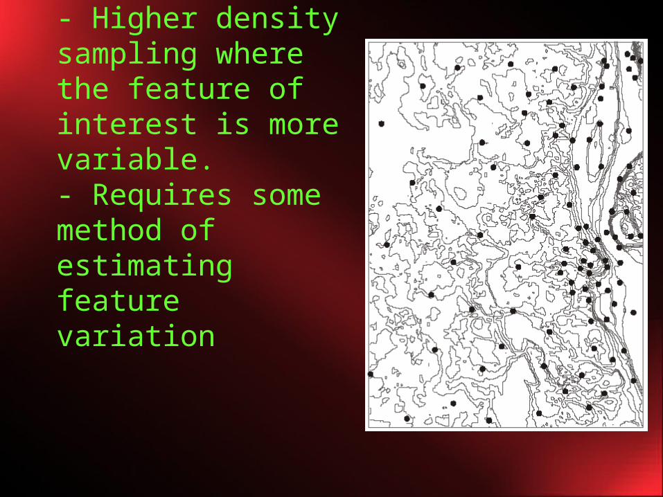
Adaptive sampling- Higher density sampling where the feature of interest is more variable. - Requires some method of estimating feature variation
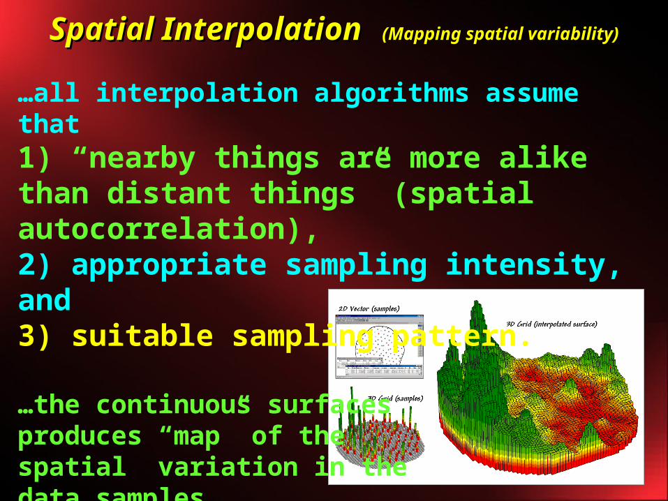
Spatial InterpolationSpatial Interpolation (Mapping spatial variability)(Mapping spatial variability)
…all interpolation algorithms assume that 1) “nearby things are more alike than distant things” (spatial autocorrelation), 2) appropriate sampling intensity, and 3) suitable sampling pattern.
…the continuous surfaces produces “map” of the spatial variation in the data samples.

Not the first attempt…..
• Earlier attempts had difficulty in accounting for spatial structure.
• With the advent of new technology, new statistical techniques and software, and improved computer accessibility, we now have the opportunity to produce and utilize probabilistic models.