surveying & prospection for archaeology & environmental science introduction phil buckland...
TRANSCRIPT
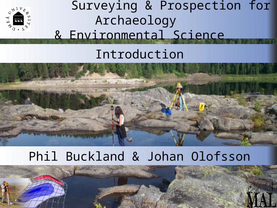
Surveying & Prospection for Archaeology & Environmental Science
Introduction
Phil Buckland & Johan Olofsson
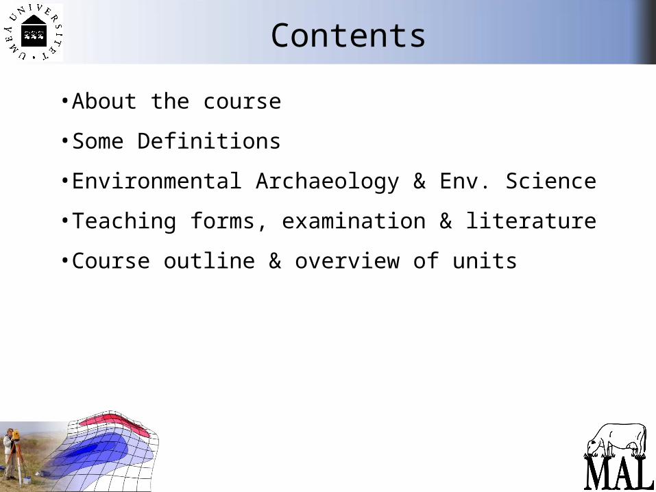
Contents
• About the course
• Some Definitions
• Environmental Archaeology & Env. Science
• Teaching forms, examination & literature
• Course outline & overview of units
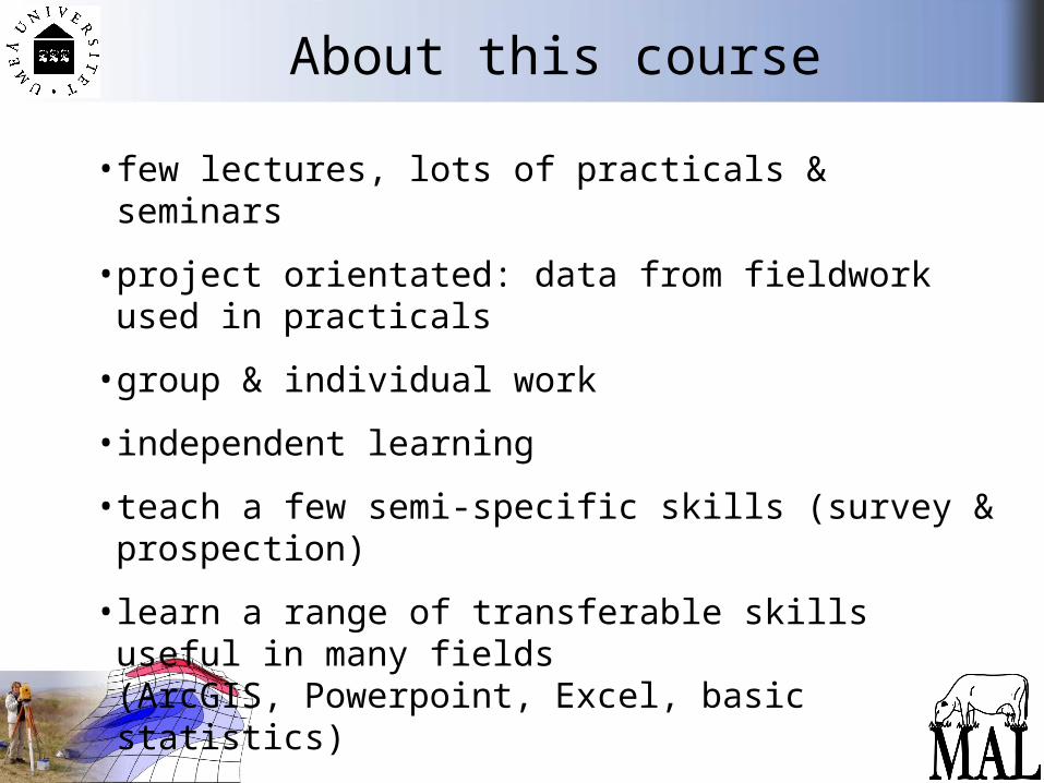
About this course
• few lectures, lots of practicals & seminars
• project orientated: data from fieldwork used in practicals
• group & individual work
• independent learning
• teach a few semi-specific skills (survey & prospection)
• learn a range of transferable skills useful in many fields(ArcGIS, Powerpoint, Excel, basic statistics)
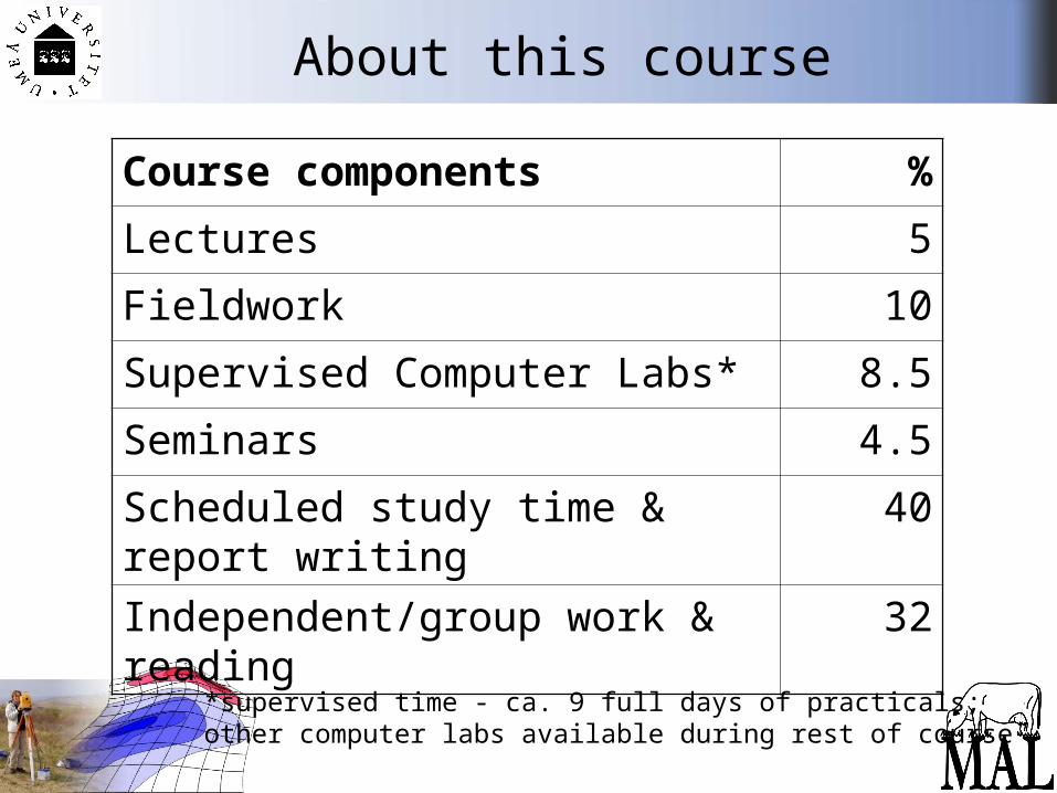
About this course
Course components %
Lectures 5
Fieldwork 10
Supervised Computer Labs* 8.5
Seminars 4.5
Scheduled study time & report writing
40
Independent/group work & reading 32
*supervised time - ca. 9 full days of practicals; other computer labs available during rest of course
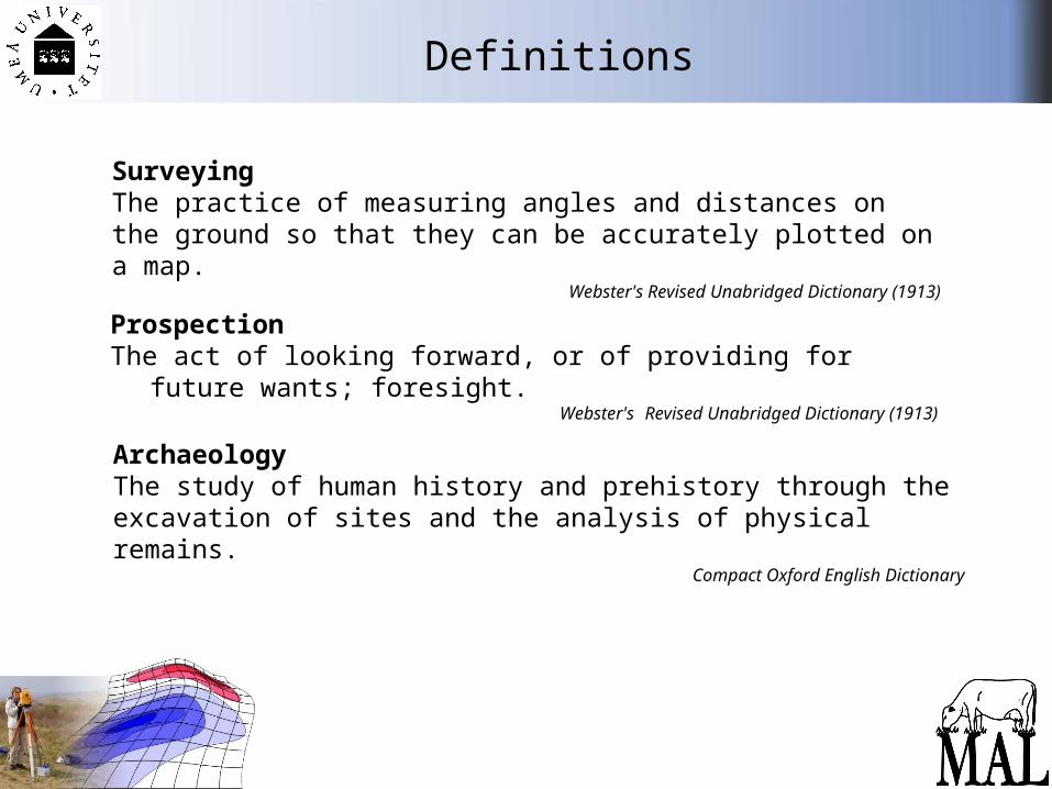
Definitions
ProspectionThe act of looking forward, or of providing for future wants; foresight.
Webster's Revised Unabridged Dictionary (1913)
SurveyingThe practice of measuring angles and distances on the ground so that they can be accurately plotted on a map.
Webster's Revised Unabridged Dictionary (1913)
ArchaeologyThe study of human history and prehistory through the excavation of sites and the analysis of physical remains.
Compact Oxford English Dictionary
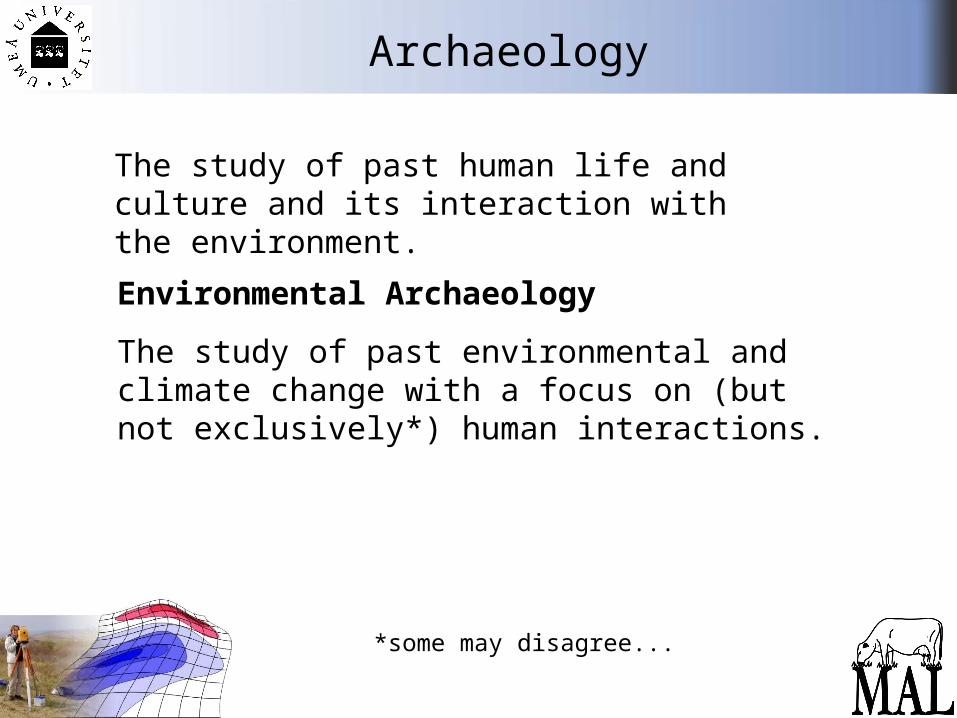
Archaeology
The study of past human life and culture and its interaction with the environment.
Environmental Archaeology
The study of past environmental and climate change with a focus on (but not exclusively*) human interactions.
*some may disagree...
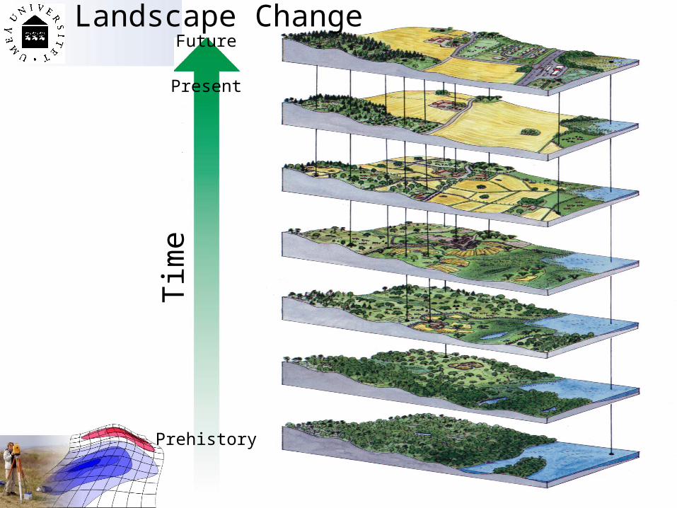
Landscape Change
Tim
e
Prehistory
Present
Future
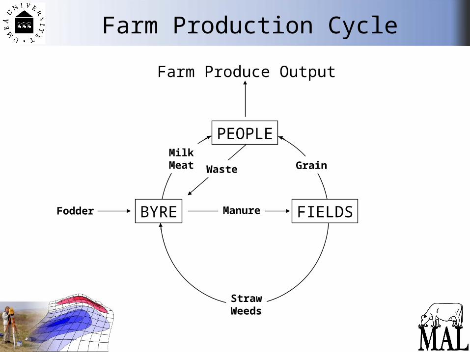
Farm Production Cycle
Farm Produce Output
PEOPLE
FIELDSFodder
MilkMeat
StrawWeeds
Manure
GrainWaste
BYRE
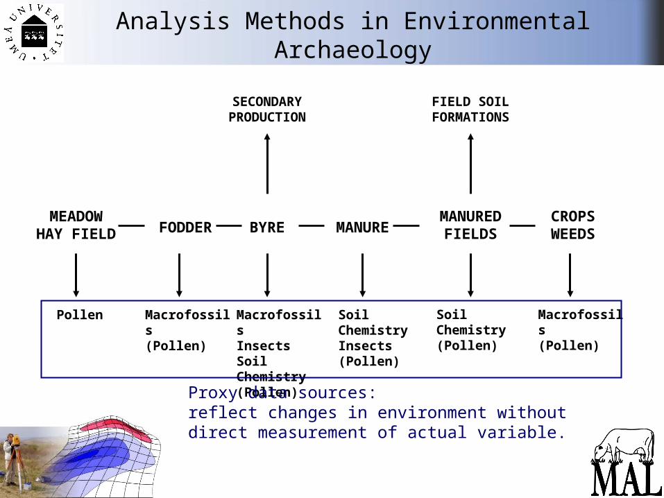
Analysis Methods in Environmental Archaeology
MEADOWHAY FIELD FODDER
Pollen
CROPSWEEDS
MANURED FIELDSMANUREBYRE
Macrofossils(Pollen)
MacrofossilsInsectsSoil Chemistry(Pollen)
Macrofossils(Pollen)
Soil Chemistry(Pollen)
Soil ChemistryInsects(Pollen)
SECONDARYPRODUCTION
FIELD SOIL FORMATIONS
Proxy data sources:reflect changes in environment without direct measurement of actual variable.
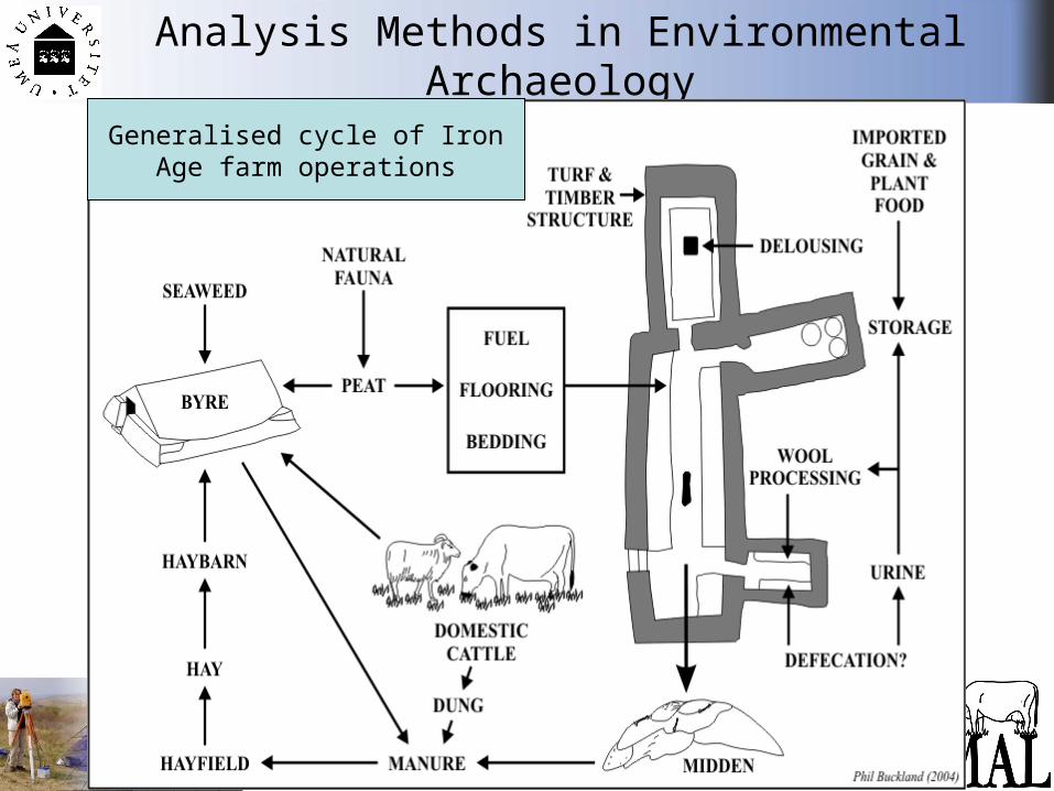
Analysis Methods in Environmental Archaeology
Generalised cycle of Iron Age farm operations
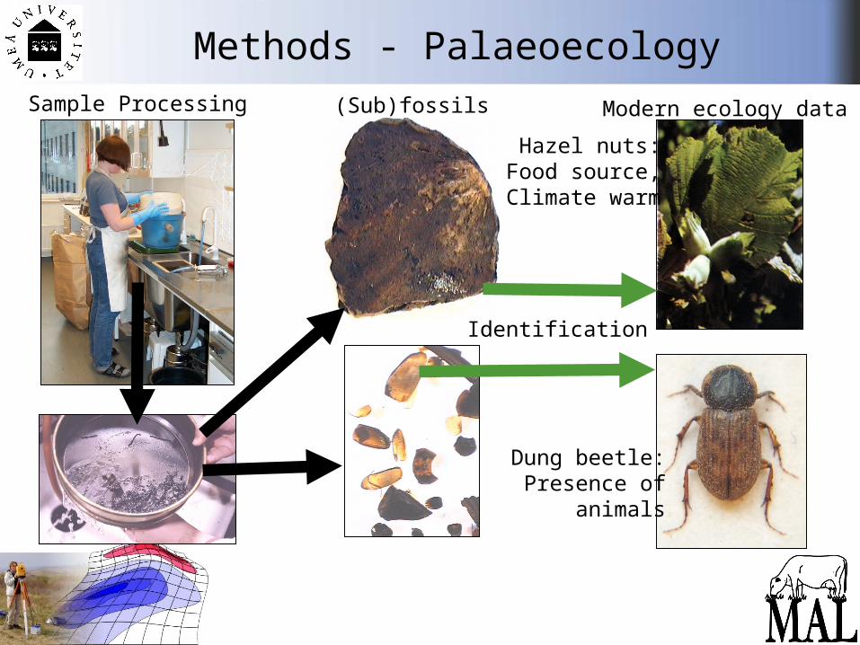
Methods - PalaeoecologySample Processing (Sub)fossils
Identification
Modern ecology data
Dung beetle:Presence of
animals
Hazel nuts:Food source,Climate warm
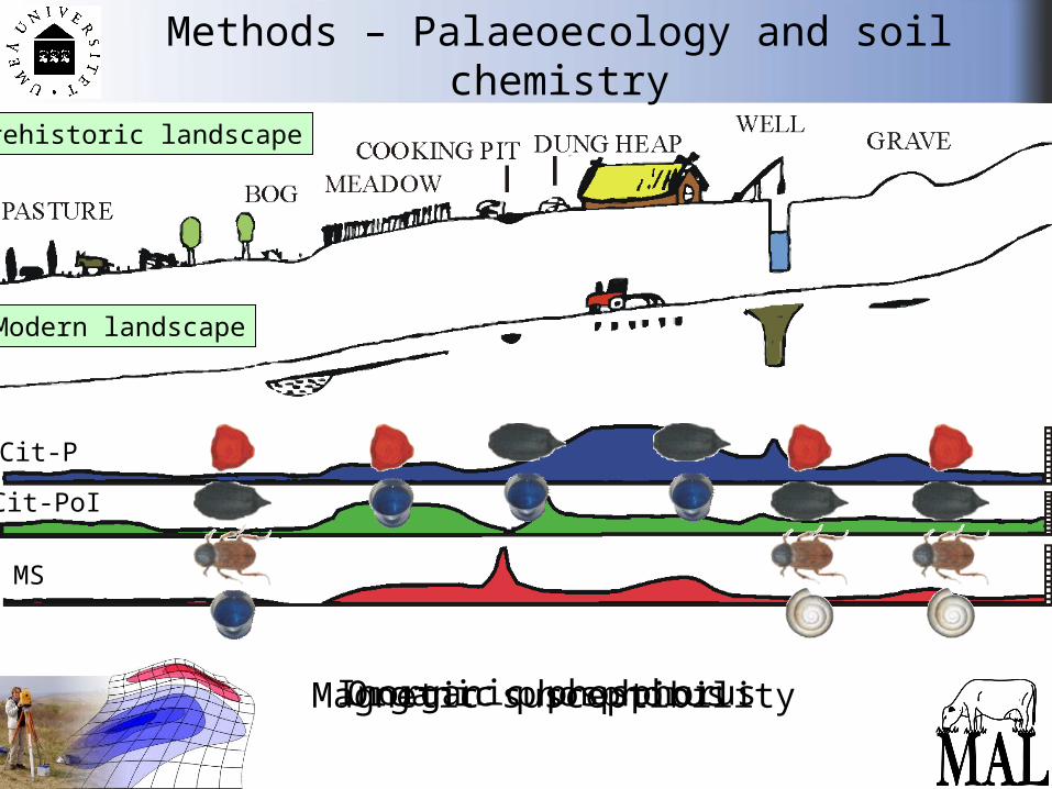
Methods – Palaeoecology and soil chemistry
Modern landscape
Prehistoric landscape
Cit-P
Cit-PoI
MS
Inorganic phosphorusOrganic phosphorusMagnetic susceptibility
5 2 1 3 5 0 5 2 1 4 0 0 5 2 1 4 5 0 5 2 1 5 0 0 5 2 1 5 5 0
2 7 6 7 0 0
2 7 6 7 5 0
2 7 6 8 0 0
2 7 6 8 5 0
2 7 6 9 0 0
2 7 6 9 5 0
2 7 7 0 0 0
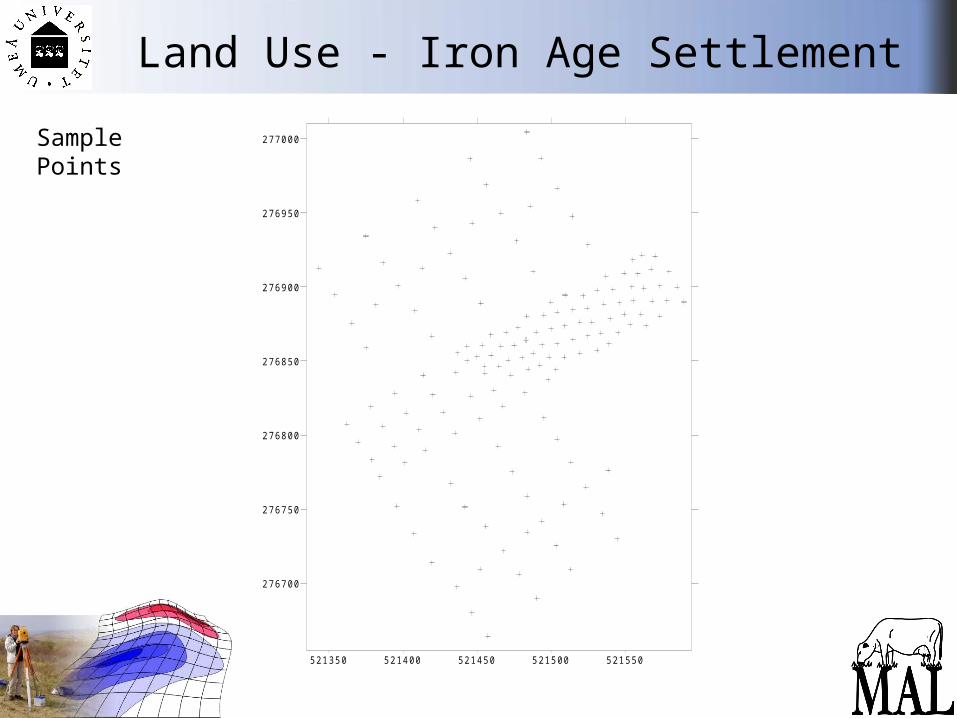
Land Use - Iron Age Settlement
SamplePoints
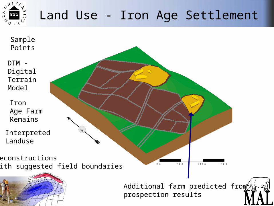
Land Use - Iron Age Settlement
DTM -DigitalTerrainModel
SamplePoints
IronAge FarmRemains
InterpretedLanduse
Reconstructionswith suggested field boundaries 0 m 5 0 m 1 0 0 m 1 5 0 m
N
Additional farm predicted from prospection results
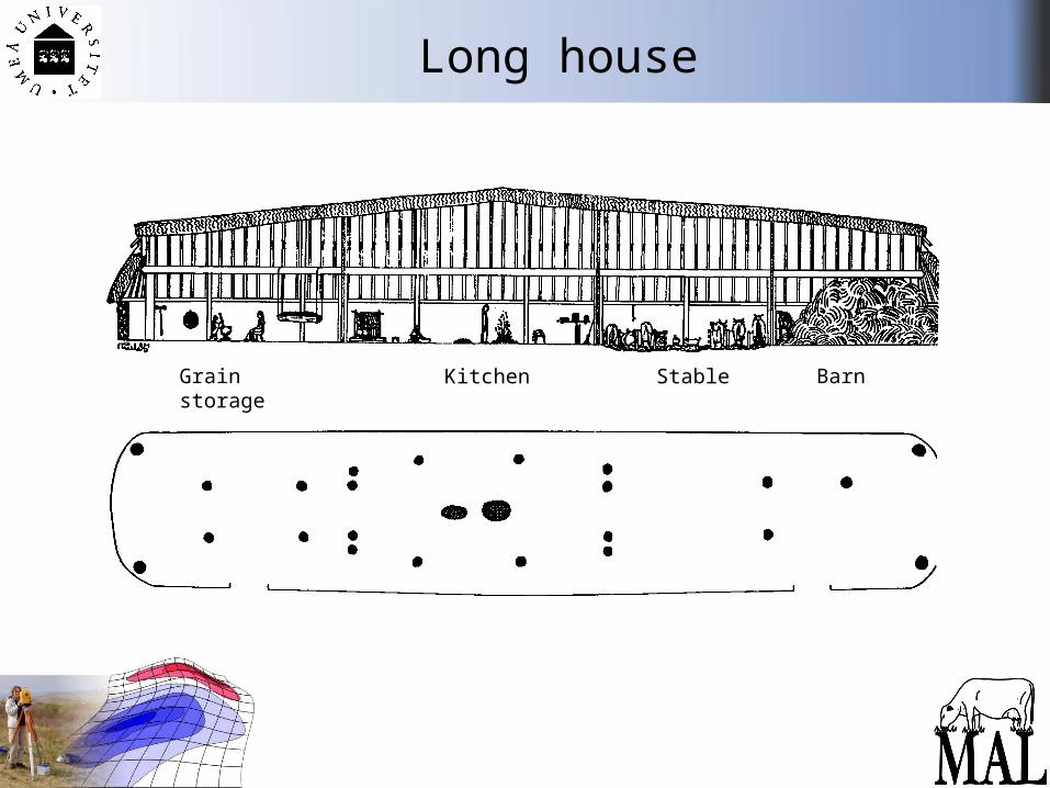
Long house
Grain storage Kitchen Stable Barn
Environmental Science
Very broadly...“the study of the interactions among the physical, chemical and biological components of the environment...”
http://en.wikipedia.org/wiki/Environmental_science
“...with a focus on pollution and degradation of the environment related due to human
activities; and the impact on biodiversity and sustainability from local and global
development.”
Environmental Science
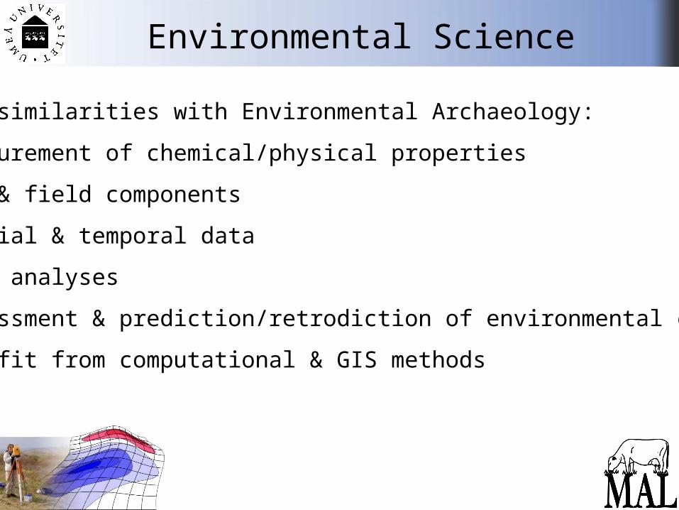
Some similarities with Environmental Archaeology:
• Measurement of chemical/physical properties
• Lab & field components
• Spatial & temporal data
• Data analyses
• Assessment & prediction/retrodiction of environmental change
• Benefit from computational & GIS methods
Teaching forms and learning
Fieldwork, computer labs, lectures, group work and presentations. Problem based learning.
Emphasis on the practical application of surveying and sampling methodologies.
Students will work in small interactive and rotated groups, supported by individual based learning, which will then be combined for a cohesive analysis of the problem at hand.
Teaching will be coordinated using the Ping-Pong online teaching administration system.
ExaminationShort papers, practicals (seminar interaction and group based presentation), and individual written report.
All parts of the course must be completed for examination. The available grades in Swedish system are: failed (U), passed (G), passed with merit (VG).
Course components are weighted as follows: Short papers on theory & methods 20% Practical performance: 30% Final report: 50%
A minimum grade of G (40%) in all examined components must be obtained in order to pass the course. To pass with merit (VG) students must achieve an average of 70% for the entire course.
ExaminationCourse components are weighted as follows:
Short papers on theory & methods 20% - home exam, given out towards end of Unit 1 - handed in on 31st July
Practical performance: 30% - fieldwork & group presentations
Final report: 50% - combination of individual & group work- guided writing (structure and directions will be given)- handed in on 11th August- individual presentations on 14th August

Literature
Course LiteratureGetting to Know Arcgis Desktop, 2nd ed.The Basics of ArcView, Arceditor, and Arcinfo Updated for Arcgis 9(Incl. software, 180 days trial version)ISBN: 158948083X (Check internet shops for best price. Should cost about 400 Skr.)
Articles (pdf) and websitesA ”compendium” will be available i Ping Pong
Recommended Literature Geographical Information System in ArchaeologyJames Conolly and Mark LakeCambridge University PressISBN: 0521797446
Ask us for more tips & use the library
An Introduction to Geographical Information Systems Sarah Cornelius, Steve Carver, Ian HeywoodPrentice Hall ISBN: 0131293176

Other information sources
The Internet - use it!www.wikipedia.orgwww.google.com etc.www.umu.se/envarchlab/mal/... more links to come in Ping-Pong
Search for keywords, but beware:definitions can vary between disciplines and countries!
The internet can also be wrong...
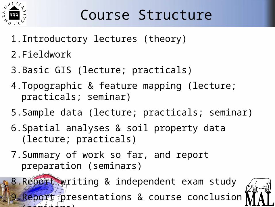
Course Structure
1. Introductory lectures (theory)
2. Fieldwork
3. Basic GIS (lecture; practicals)
4. Topographic & feature mapping (lecture; practicals; seminar)
5. Sample data (lecture; practicals; seminar)
6. Spatial analyses & soil property data (lecture; practicals)
7. Summary of work so far, and report preparation (seminars)
8. Report writing & independent exam study
9. Report presentations & course conclusion (seminars)
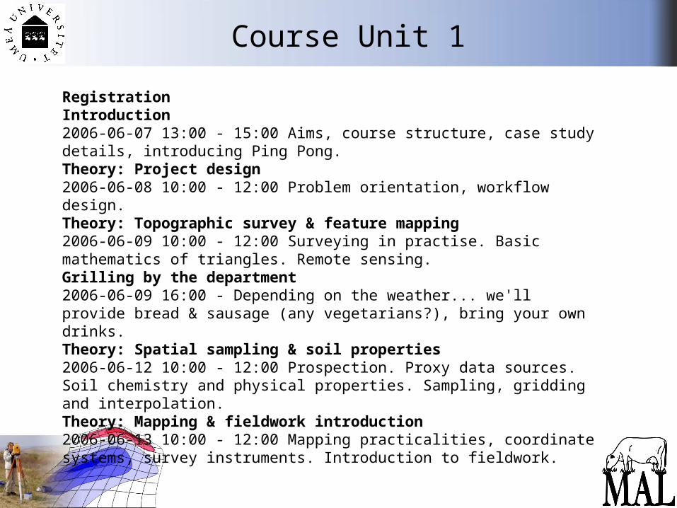
Course Unit 1
RegistrationIntroduction2006-06-07 13:00 - 15:00 Aims, course structure, case study details, introducing Ping Pong.Theory: Project design 2006-06-08 10:00 - 12:00 Problem orientation, workflow design.Theory: Topographic survey & feature mapping 2006-06-09 10:00 - 12:00 Surveying in practise. Basic mathematics of triangles. Remote sensing.Grilling by the department 2006-06-09 16:00 - Depending on the weather... we'll provide bread & sausage (any vegetarians?), bring your own drinks.Theory: Spatial sampling & soil properties 2006-06-12 10:00 - 12:00 Prospection. Proxy data sources. Soil chemistry and physical properties. Sampling, gridding and interpolation.Theory: Mapping & fieldwork introduction 2006-06-13 10:00 - 12:00 Mapping practicalities, coordinate systems, survey instruments. Introduction to fieldwork.
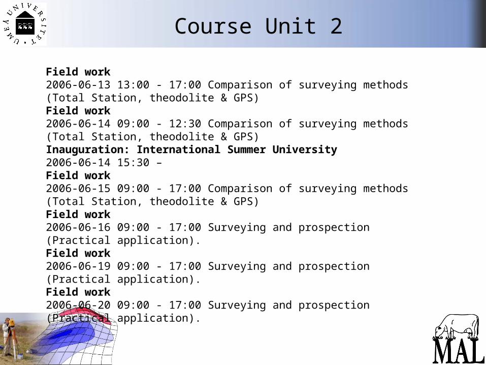
Course Unit 2
Field work 2006-06-13 13:00 - 17:00 Comparison of surveying methods (Total Station, theodolite & GPS)Field work 2006-06-14 09:00 - 12:30 Comparison of surveying methods (Total Station, theodolite & GPS)Inauguration: International Summer University 2006-06-14 15:30 –Field work 2006-06-15 09:00 - 17:00 Comparison of surveying methods (Total Station, theodolite & GPS)Field work 2006-06-16 09:00 - 17:00 Surveying and prospection (Practical application).Field work 2006-06-19 09:00 - 17:00 Surveying and prospection (Practical application).Field work 2006-06-20 09:00 - 17:00 Surveying and prospection (Practical application).
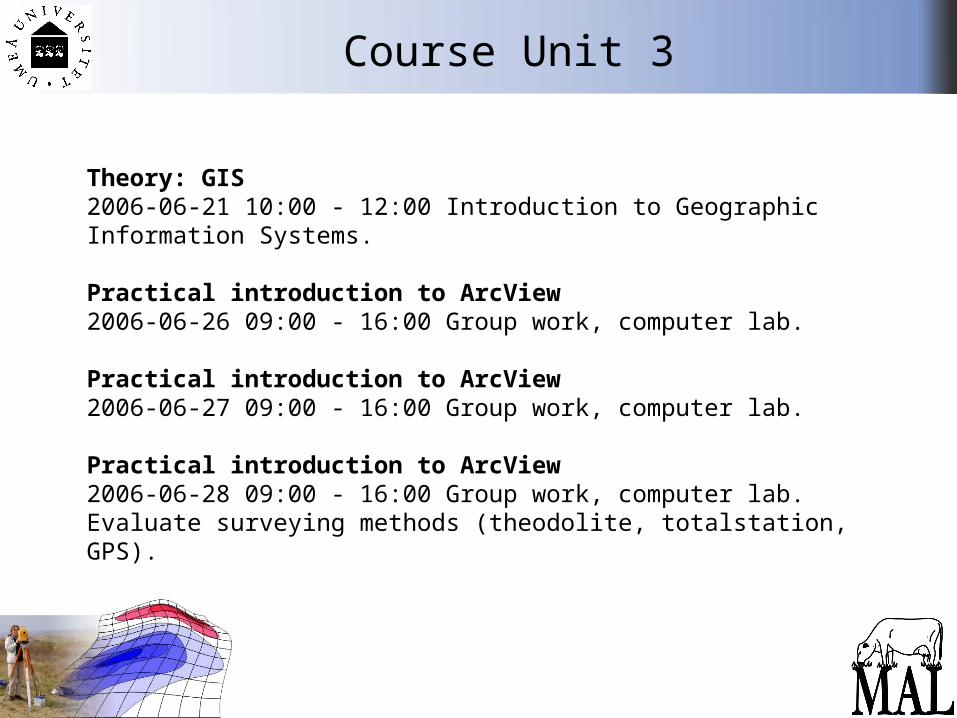
Course Unit 3
Theory: GIS 2006-06-21 10:00 - 12:00 Introduction to Geographic Information Systems.
Practical introduction to ArcView 2006-06-26 09:00 - 16:00 Group work, computer lab.
Practical introduction to ArcView 2006-06-27 09:00 - 16:00 Group work, computer lab.
Practical introduction to ArcView 2006-06-28 09:00 - 16:00 Group work, computer lab.Evaluate surveying methods (theodolite, totalstation, GPS).

Course Unit 4
Theory: Topographic & feature mapping 2006-06-29 10:00 - 12:00 Rectifying and registration of maps. Map design. Creating contours and adding features
Practical: Topographic & feature mapping 2006-06-29 13:00 - 16:00 Group work, computer lab.
Practical: Topographic & feature mapping 2006-06-30 09:00 - 16:00 Group work, computer lab.
Practical: Topographic & feature mapping 2006-07-03 09:00 - 16:00 Group work, computer lab.
Group Presentations: Topographic & feature data 2006-07-04 10:00 - 15:00 Short presentations & discussion of results
Course Unit 5
Theory: Sample data2006-07-05 10:00 - 12:00 Basic statistics for summarising data. Graphing and charting. Reporting and PowerPoint presentation.
Practical: MS Excel & data analysis2006-07-05 13:00 - 16:00 Basic statistics. Using Excel to summarise, analyse and graph data.
Practical: Sample data 2006-07-06 09:00 - 16:00 Group work, computer lab.
Practical: Sample data 2006-07-07 09:00 - 12:00 Group work, computer lab.
Group Presentations: Sample data 2006-07-07 13:00 - 17:00 Short presentations & discussion
Course Unit 6
Theory: Spatial analyses2006-07-10 10:00 - 12:00 Analysing and interpreting spatial data.
Practical: Soil property data2006-07-11 09:00 - 16:00 Group work, computer lab.
Practical: Soil property data2006-07-12 09:00 - 16:00 Group work, computer lab.
Practical: Soil property data2006-07-13 09:00 - 12:00 Group work, computer lab.
Course Unit 7
Theory: Report writing2006-07-13 13:00 - 15:00 Report structure and expected contents
Discussion of results & report preparation 2006-07-14 10:00 - 15:00Summary of work so far and preparation for final report.
Course Unit 8
Report Writing 2006-07-17 -2006-07-28 Independant group work
Deadline for written exam2006-07-31 10:00 - 17:00 Hand in to teachers
Report Writing2006-08-01 -2006-08-11 Group work, teachers available 1 hour per day.
Course Unit 9
Final Report Presentation and Appraisal2006-08-14 10:00 - 15:00 Short presentations and discussion
Course Conclusion2006-08-15 10:00 - 12:00 Summary and evaluation
Fieldwork areas
•University Campus - outside department•Agnäs, 50 km West of Umeå
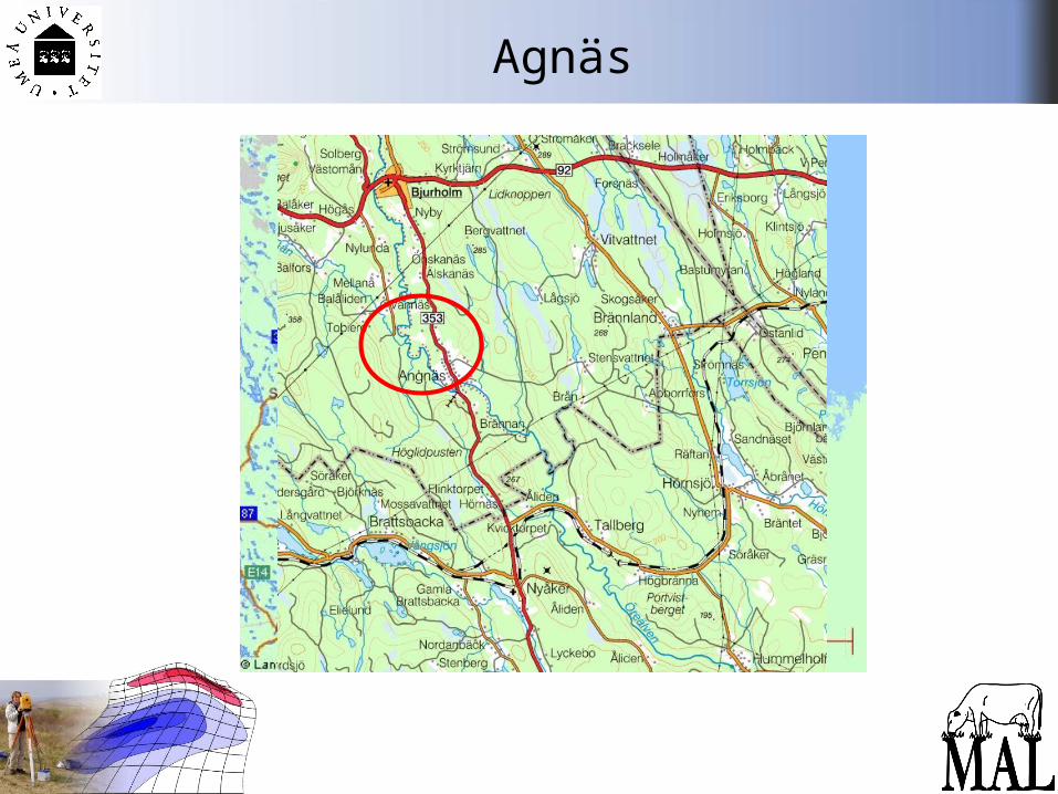
Agnäs
Check list
Register at the Dept. Archaeology and Sami Studies.Get a student email address from Umdac:
You need to visit Umdac. Bring an ID.Get a pass card for access to KBC building, GIS-lab & HUMlab.
(We’ll sort this out)Log on to Ping Pong (after the 12th June)
Add personal info.Apply for a HUMlab account.
http://www.humlab.umu.se/You need a pass card number before doing this.
Activate your Active Directory to get access to PC’s in GIS-lab.You need a student email address to do this.
https://www.verktyg.umdac.umu.se/
Party 1
Grilling - up the hill from the department, towards IKSU
Start 16:00
We’ll provide hotdogs etc. Bring your own drinks
Please tell us on Thursday whether you will be coming(& if you are a vegetarian)
Party 2Inauguration of the International Summer University will be held 14 June at the Building for Teacher education.
TimeWednesday 14 June 2006 at 3:30 pmPlaceLjusgården, Teacher Education Building on CampusProgramme• Mingle with snacks and refreshments• Piano performance by jazz legend Birgit Lindberg• Umeå University’s All-Star Band with P A Sundbaum and others• Grace Mc Clean from Belfast, recording artist and Umeå alumnus• Entertainment by students from our Singing Songwriting and Creative Music courses• Show tunes from the musical “Only the Lonely” by the Umeå Show Choir• Master of Ceremonies for the musical programme is Lorentz Edberg
Link on course website