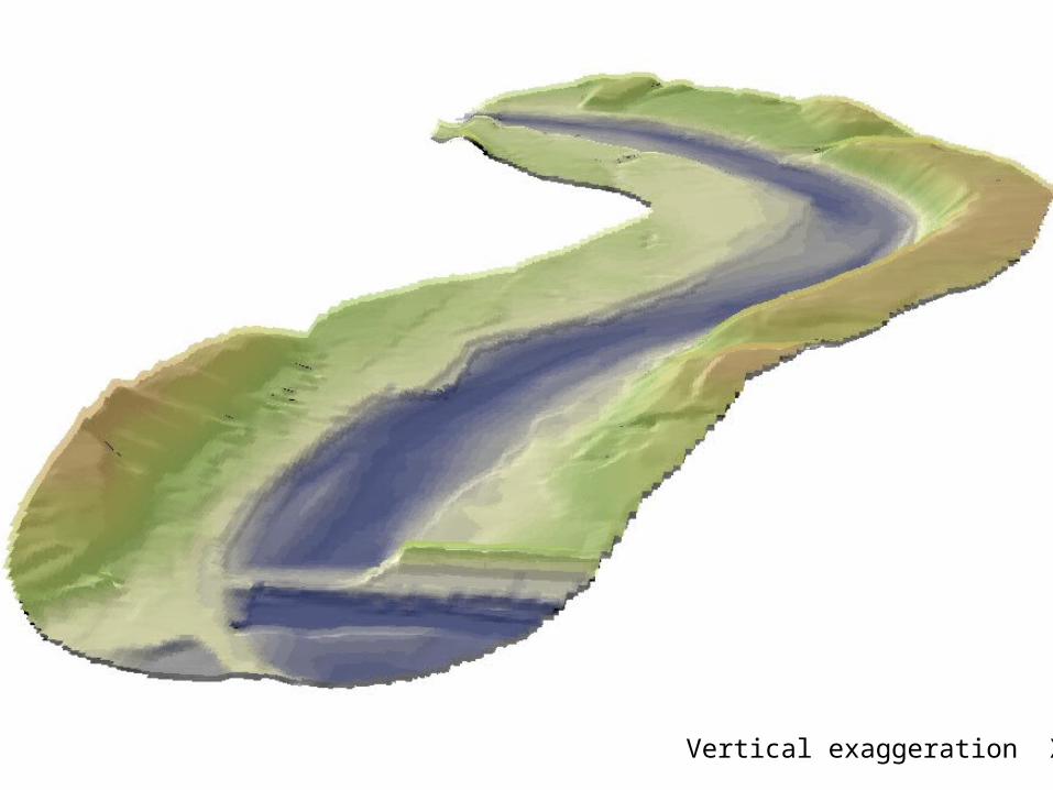
surface model. vertical exaggeration x2
Post on 21-Dec-2015
234 views
TRANSCRIPT

Surface Model

Vertical exaggeration X2

Vertical exaggeration X2

Vertical exaggeration X2

Vertical exaggeration X2

Vertical exaggeration X2

PROCESS of OPERATION
Step 1: Prepare the stream bank elevation point
Step 2: Prepare the bottom elevation point
Step 3: Interpolate the surface model

Step 1: Prepare the stream bank elevation point

1 foot contour TIN (smooth line)Convert contour to TIN
TIN GridConvert TIN to Grid (10ft grid)
Grid (integer values)Convert grid value to integer after multiply 10

Grid (integer values) Elevation point data (EP)Convert Grid (integer values) to point shape

Step 2: Prepare the bottom elevation point

River elevation grid (REG)Raster calculation (TIN Grid – Depth Grid)
REG (integer values)Convert grid value to integer after multiply 10
River elevation point (REP)Convert REG (integer values) to point shape
Depth grid from Bar Report and TIN grid from 1 foot contour
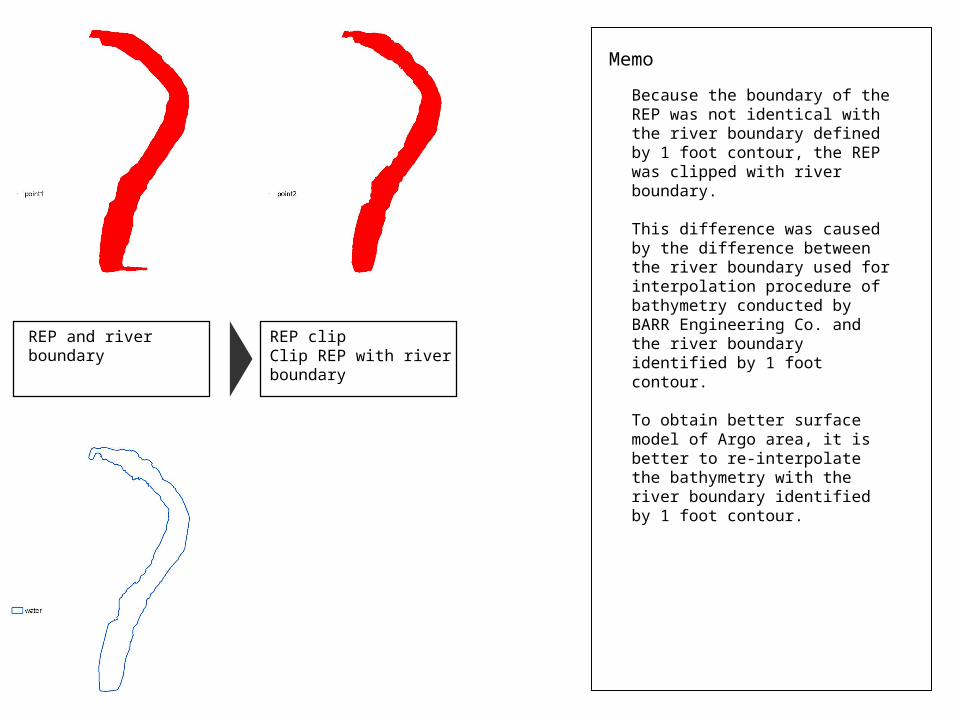
REP and river boundary REP clipClip REP with river boundary
Because the boundary of the REP was not identical with the river boundary defined by 1 foot contour, the REP was clipped with river boundary.
This difference was caused by the difference between the river boundary used for interpolation procedure of bathymetry conducted by BARR Engineering Co. and the river boundary identified by 1 foot contour.
To obtain better surface model of Argo area, it is better to re-interpolate the bathymetry with the river boundary identified by 1 foot contour.
Memo

Step 3: Interpolate the surface model

EP and REP clip Argo Elevation Point (AEP)Merge EP and REP
Final DEMInterpolate surface with IDW followed by raster calculation (int(grid value/10))

FOR BETTER MODEL
1: Re-interpolate the bathymetry data with additional cross-section and the river boundary identified by 1 foot contour2: Make smaller TIN Grid of the river bank model3: Make bathymetry data with multiple points of water depth (use sonar and GPS)