strait of canso transmission line ... - nova scotia · strait of canso transmission line...
TRANSCRIPT
KKELMANHERITAGECONSULTING
STRAIT OF CANSO TRANSMISSION LINEARCHAEOLOGICAL ASSESSMENT
INVERNESS COUNTY, NOVA SCOTIA
Submitted to: Nova Scotia Special Places Program & Nova Scotia Power Incorporated
Consulting Archaeologist: Darryl KelmanReport Preparation: Darryl Kelman
Heritage Research Permit #: A2015NS061
July 2015
6052 North StreetHalifax, Nova Scotia
B3K 1N8www.kelmanheritage.ca
2015 SHOVEL TESTING REPORT
Strait of Canso Transmission Line NSPI
Archaeological Assessment
KKELMAN
HERITAGE
CONSULTING
EXECUTIVE SUMMARY
Nova Scotia Power Incorporated (NSPI) in proposing to construct a new transmission
line crossing at the Strait of Canso. To reliably deliver the energy provided by the
Maritime Link Project, the transmission lines across the Strait of Canso need to be
reconfigured. The reconfiguration calls for the separation of the 345kV line and the
230kV line that currently share the existing double circuit tower at the Auld's Cove -
Newtown crossing. The most feasible solution is to build a second crossing, directly
adjacent to the existing tower crossing, to physically separate the two transmission lines.
The project triggered a Class 1 Environmental Assessment, including an archaeological
assessment. In May 2015, NSPI retained Kelman Heritage Consulting to conduct an
archaeological screening and reconnaissance of the proposed transmission line. The
screening and reconnaissance identified several small areas that exhibited high
archaeological potential. Based on the final design for tower placement, Tower 4A
located on the Cape Breton side, close to the shore of Long Pond, is positioned close to
areas identified as exhibiting high archaeological potential. NSPI retained Kelman
Heritage Consulting to conduct an archaeological assessment of the Tower 4A location.
The archaeological assessment consisted of a shovel testing program. A total of 66 shovel
tests were excavated across the study area with none registering as positive for artifact
recovery. The shovel testing program did not identify any significant archaeological
features or deposits. Based on the results of the shovel testing, it is recommended that the
proposed impact area as described in this report be cleared as there are no further
archaeological concerns.
Strait of Canso Transmission Line NSPI
Archaeological Assessment
KKELMAN
HERITAGE
CONSULTING i
TABLE OF CONTENTS
1.0 INTRODUCTION ................................................................................................1
2.0 STUDY AREA .....................................................................................................2
3.0 METHODOLOGY ...............................................................................................6
4.0 RESULTS .......... ..................................................................................................7
5.0 CONCLUSIONS AND RECOMMENDATIONS .............................................10
6.0 REFERENCES CITED .......................................................................................12
LIST OF FIGURES Figure 1: Study Area Overview ....................................................................................... 3
Figure 2: High Potential Area Detail & Study Area ........................................................ 4
Figure 3: Detailed Tower Plan ......................................................................................... 5
Figure 4: Shovel Testing .................................................................................................. 8
LIST OF PLATES Plate 1: Shovel testing Tower 4A location ................................................................................... 9
Plate 2: Shovel testing Tower 4A location ................................................................................... 9
Strait of Canso Transmission Line NSPI
Archaeological Assessment
KKELMAN
HERITAGE
CONSULTING 1
1.0 INTRODUCTION
Nova Scotia Power Incorporated (NSPI) in proposing to construct a new transmission
line crossing at the Strait of Canso. To reliably deliver the energy provided by the
Maritime Link Project, the transmission lines across the Strait of Canso need to be
reconfigured. The reconfiguration calls for the separation of the 345kV line and the
230kV line that currently share the existing double circuit tower at the Auld's Cove -
Newtown crossing. The most feasible solution is to build a second crossing, directly
adjacent to the existing tower crossing, to physically separate the two transmission lines.
The project triggered a Class 1 Environmental Assessment, including an archaeological
assessment. In May 2015, NSPI retained Kelman Heritage Consulting to conduct an
archaeological screening and reconnaissance of the proposed transmission line. The
screening and reconnaissance identified several small areas that exhibited high
archaeological potential (Kelman 2015). Based on the final design for tower placement,
Tower 4A located on the Cape Breton side, close to the shore of Long Pond, is
positioned close to areas identified as exhibiting high archaeological potential. NSPI
retained Kelman Heritage Consulting to conduct an archaeological assessment of the
Tower 4A location. No other areas identified as exhibiting high archaeological potential
are to be impacted.
The archaeological program was directed by Darryl Kelman, Principal Archaeologist
with Kelman Heritage Consulting. The archaeological assessment was conducted
according to the terms of Heritage Research Permit A2015NS061 (Category ‘C’), issued
to Kelman by the Special Places Program. Field assistance was provided by
archaeological field technicians Allison Fraser and John MacDougall. This report
describes the archaeological assessment, presents its results, and offers resource
management recommendations.
Strait of Canso Transmission Line NSPI
Archaeological Assessment
KKELMAN
HERITAGE
CONSULTING 2
2.0 STUDY AREA
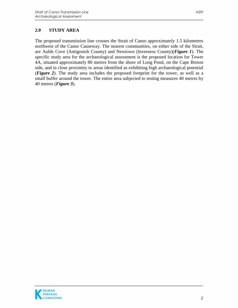
The proposed transmission line crosses the Strait of Canso approximately 1.5 kilometres
northwest of the Canso Causeway. The nearest communities, on either side of the Strait,
are Aulds Cove (Antigonish County) and Newtown (Inverness County)(Figure 1). The
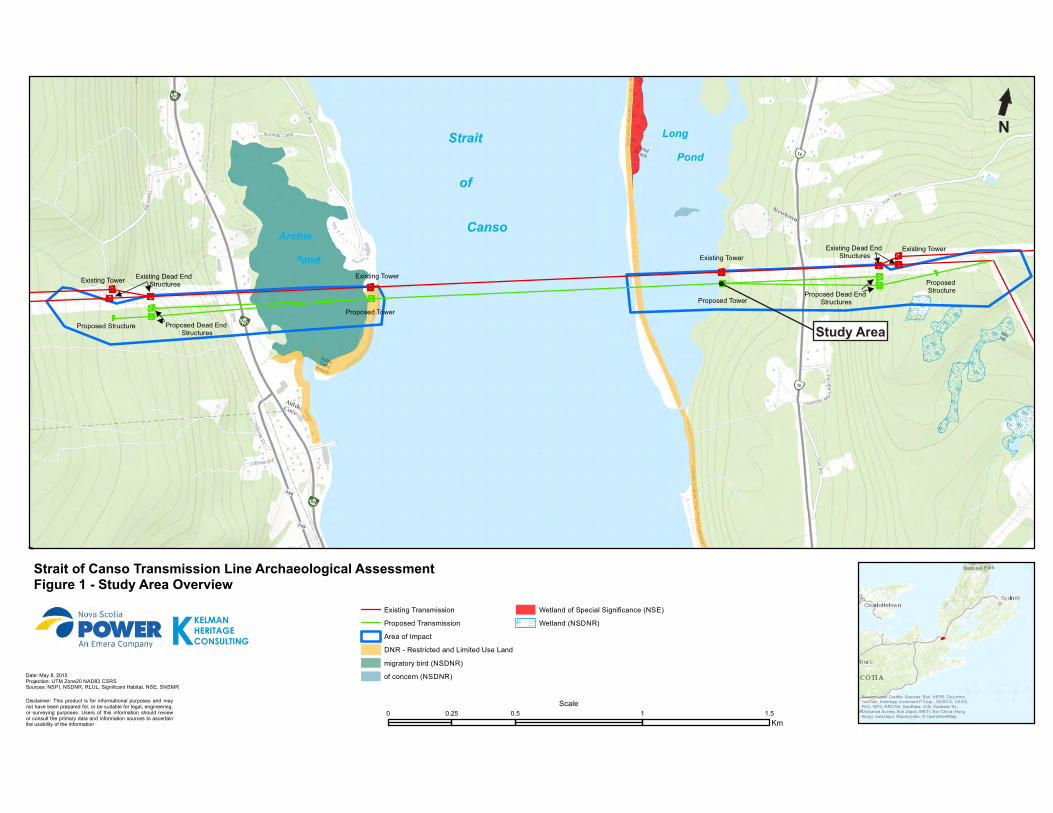
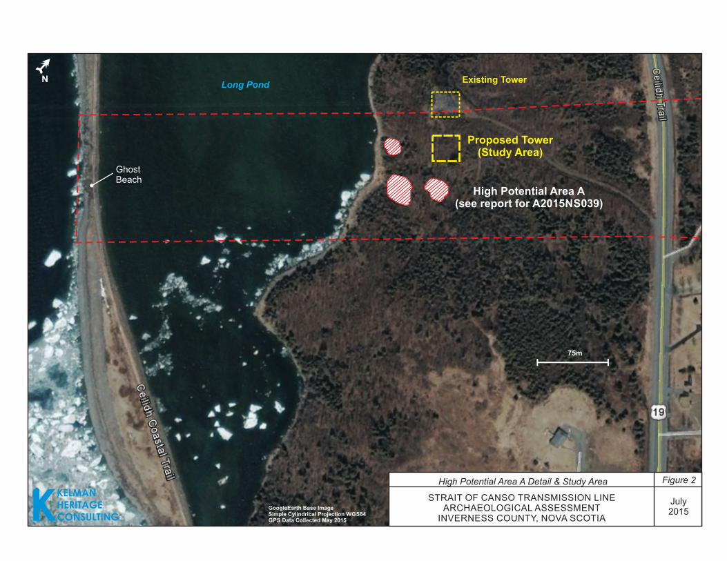
specific study area for the archaeological assessment is the proposed location for Tower
4A, situated approximately 80 metres from the shore of Long Pond, on the Cape Breton
side, and in close proximity to areas identified as exhibiting high archaeological potential
(Figure 2). The study area includes the proposed footprint for the tower, as well as a
small buffer around the tower. The entire area subjected to testing measures 40 metres by
40 metres (Figure 3).
KKELMANHERITAGECONSULTING
0 0.5 1 1.50.25
Km
Existing Transmission
Proposed Transmission
Area of Impact
DNR - Restricted and Limited Use Land
migratory bird (NSDNR)
of concern (NSDNR)
Wetland of Special Significance (NSE)
Wetland (NSDNR)
Date: May 8, 2015Projection: UTM Zone20 NAD83 CSRSSources: NSPI, NSDNR, RLUL, Significant Habitat, NSE, SNSMR
Disclaimer: This product is for informational purposes and maynot have been prepared for, or be suitable for legal, engineering,or surveying purposes. Users of this information should reviewor consult the primary data and information sources to ascertainthe usability of the information
ScaleService Layer Credits: Sources: Esri, HERE, DeLorme,TomTom, Intermap, increment P Corp., GEBCO, USGS,FAO, NPS, NRCAN, GeoBase, IGN, Kadaster NL,Ordnance Survey, Esri Japan, METI, Esri China (HongKong), swisstopo, MapmyIndia, © OpenStreetMap
Strait of Canso Transmission Line Archaeological AssessmentFigure 1 - Study Area Overview
Existing TowerExisting Dead End
Structures
Proposed Dead End Structures
Proposed Structure
Existing Tower
Proposed Tower
Existing Tower
Proposed Tower
Existing Dead End Structures
Existing Tower
Proposed Dead End Structures
Proposed Structure
NStrait
of
Canso
Long
Pond
Archie
Pond
Study Area
Long Pond
GhostBeach
High Potential Area A(see report for A2015NS039)
STRAIT OF CANSO TRANSMISSION LINEARCHAEOLOGICAL ASSESSMENT
INVERNESS COUNTY, NOVA SCOTIA
GoogleEarth Base ImageSimple Cylindrical Projection WGS84GPS Data Collected May 2015K
KELMANHERITAGECONSULTING
N
High Potential Area A Detail & Study Area Figure 2
July2015
75m
Existing Tower
Proposed Tower(Study Area)
Figure 3 Detailed Tower Plan
STRAIT OF CANSO TRANSMISSION LINEARCHAEOLOGICAL ASSESSMENT
INVERNESS COUNTY, NOVA SCOTIA
KKELMANHERITAGECONSULTING
N
Strait of Canso Transmission Line NSPI
Archaeological Assessment
KKELMAN
HERITAGE
CONSULTING 6
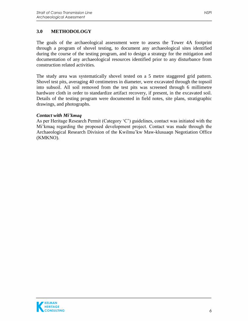
3.0 METHODOLOGY
The goals of the archaeological assessment were to assess the Tower 4A footprint
through a program of shovel testing, to document any archaeological sites identified
during the course of the testing program, and to design a strategy for the mitigation and
documentation of any archaeological resources identified prior to any disturbance from
construction related activities.
The study area was systematically shovel tested on a 5 metre staggered grid pattern.
Shovel test pits, averaging 40 centimetres in diameter, were excavated through the topsoil
into subsoil. All soil removed from the test pits was screened through 6 millimetre
hardware cloth in order to standardize artifact recovery, if present, in the excavated soil.
Details of the testing program were documented in field notes, site plans, stratigraphic
drawings, and photographs.
Contact with Mi’kmaq
As per Heritage Research Permit (Category ‘C’) guidelines, contact was initiated with the
Mi’kmaq regarding the proposed development project. Contact was made through the
Archaeological Research Division of the Kwilmu’kw Maw-klusuaqn Negotiation Office
(KMKNO).
Strait of Canso Transmission Line NSPI
Archaeological Assessment
KKELMAN
HERITAGE
CONSULTING 7
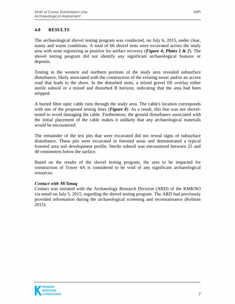
4.0 RESULTS
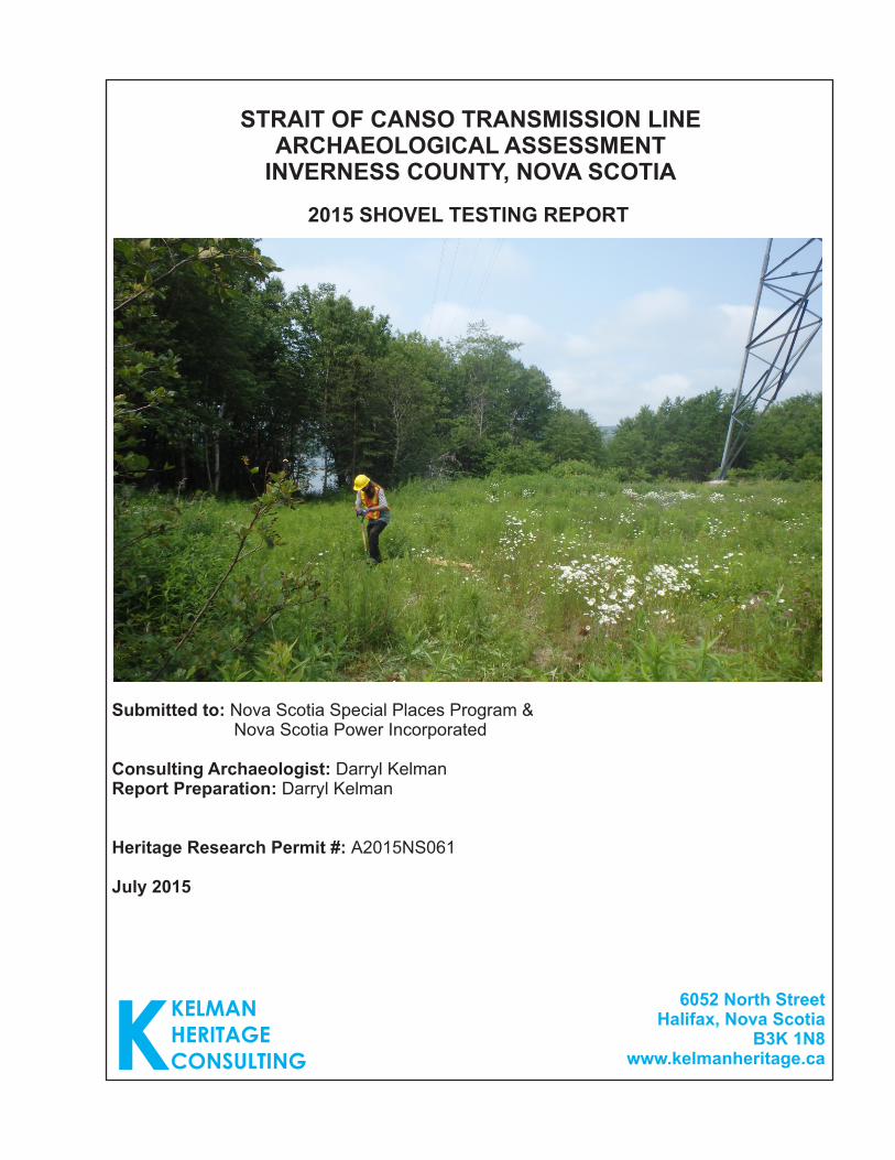
The archaeological shovel testing program was conducted, on July 6, 2015, under clear,
sunny and warm conditions. A total of 66 shovel tests were excavated across the study
area with none registering as positive for artifact recovery (Figure 4; Plates 1 & 2). The
shovel testing program did not identify any significant archaeological features or
deposits.
Testing in the western and northern portions of the study area revealed subsurface
disturbance, likely associated with the construction of the existing tower and/or an access
road that leads to the shore. In the disturbed units, a mixed gravel fill overlay either
sterile subsoil or a mixed and disturbed B horizon, indicating that the area had been
stripped.
A buried fibre optic cable runs through the study area. The cable's location corresponds
with one of the proposed testing lines (Figure 4). As a result, this line was not shovel-
tested to avoid damaging the cable. Furthermore, the ground disturbance associated with
the initial placement of the cable makes it unlikely that any archaeological materials
would be encountered.
The remainder of the test pits that were excavated did not reveal signs of subsurface
disturbance. These pits were excavated in forested areas and demonstrated a typical
forested area soil development profile. Sterile subsoil was encountered between 25 and
40 centimetres below the surface.
Based on the results of the shovel testing program, the area to be impacted for
construction of Tower 4A is considered to be void of any significant archaeological
resources.
Contact with Mi’kmaq
Contact was initiated with the Archaeology Research Division (ARD) of the KMKNO
via email on July 5, 2015, regarding the shovel testing program. The ARD had previously
provided information during the archaeological screening and reconnaissance (Kelman
2015).
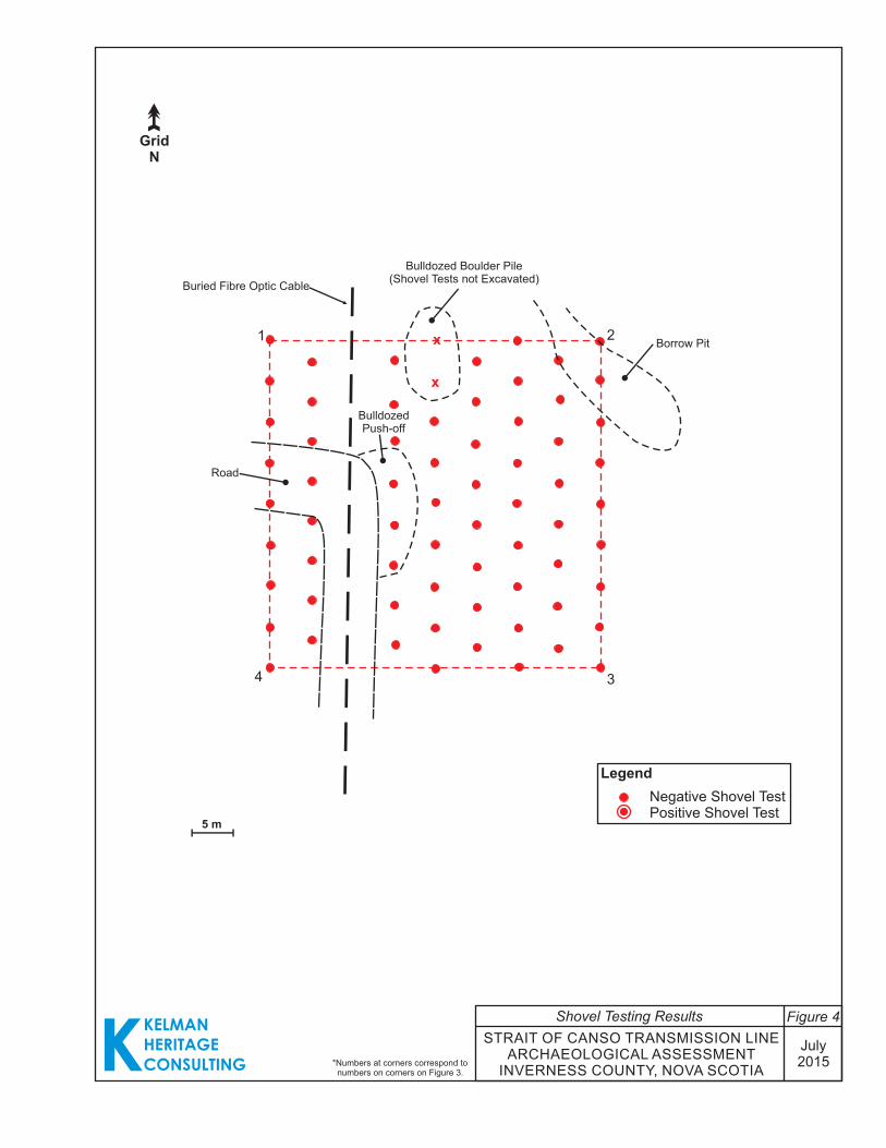
Legend
Negative Shovel TestPositive Shovel Test
5 m
x
x
KKELMANHERITAGECONSULTING
GridN
Borrow Pit
Bulldozed Boulder Pile(Shovel Tests not Excavated)
Buried Fibre Optic Cable
Road
BulldozedPush-off
1 2
34
STRAIT OF CANSO TRANSMISSION LINEARCHAEOLOGICAL ASSESSMENT
INVERNESS COUNTY, NOVA SCOTIA
July2015
Shovel Testing Results Figure 4
*Numbers at corners correspond to numbers on corners on Figure 3.
Strait of Canso Transmission Line NSPI
Archaeological Assessment
KKELMAN
HERITAGE
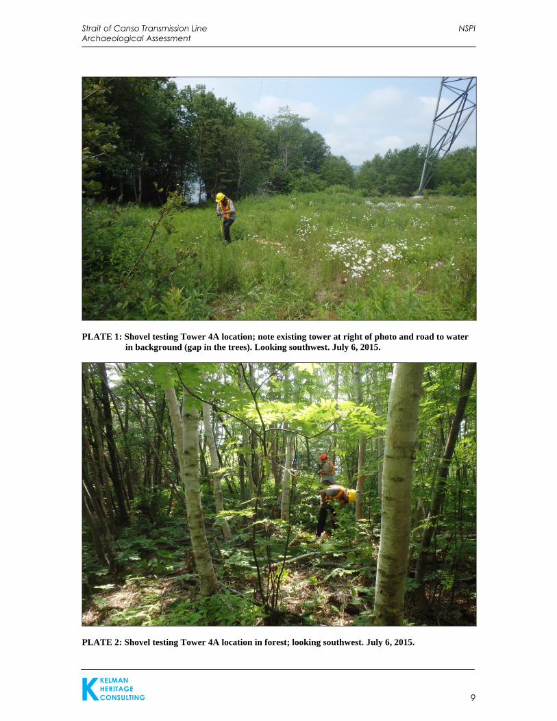
CONSULTING 9
PLATE 1: Shovel testing Tower 4A location; note existing tower at right of photo and road to water
in background (gap in the trees). Looking southwest. July 6, 2015.
PLATE 2: Shovel testing Tower 4A location in forest; looking southwest. July 6, 2015.
Strait of Canso Transmission Line NSPI
Archaeological Assessment
KKELMAN
HERITAGE
CONSULTING 10
5.0 CONCLUSIONS AND RECOMMENDATIONS
The 2015 archaeological assessment of the Strait of Canso Transmission Line,
specifically the proposed location of Tower 4A in Inverness County, Nova Scotia,
consisted of a program of archaeological shovel testing. No significant archaeological
resources were identified.
Based on these results, Kelman Heritage offers the following management
recommendations for the overall project:
1. It is recommended that the proposed impact area subjected to shovel testing as
described in this report be cleared as there are no further archaeological concerns.
2. In the unlikely event that significant archaeological resources or human remains are
encountered during any construction activities, all work in the associated area(s)
should be halted and immediate contact should be made with the Coordinator of
Special Places (Sean Weseloh McKeane: 902-424-6475).
Strait of Canso Transmission Line NSPI
Archaeological Assessment
KKELMAN
HERITAGE
CONSULTING 11
6.0 REFERENCES CITED
Kelman, Darryl
2015 Strait of Canso Transmission Line Archaeological Screening &
Reconnaissance. Unpublished report for Heritage Research Permit
A2015NS039 on file with the Special Places Program.